Totale Sonnenfinsternis vom 09.11.-1793
| Wochentag: | Samstag |
| Maximale Dauer der Verfinsterung: | 03m54s |
| Maximale Breite des Finsternispfades: | 153 km |
| Saroszyklus: | 14 |
| Bedeckungsgrad: | 100% |
| Magnitude: | 1.0461 |
| Gamma: | 0.0296 |
Wo kann man die Sonnenfinsternis vom 09.11.-1793 sehen?
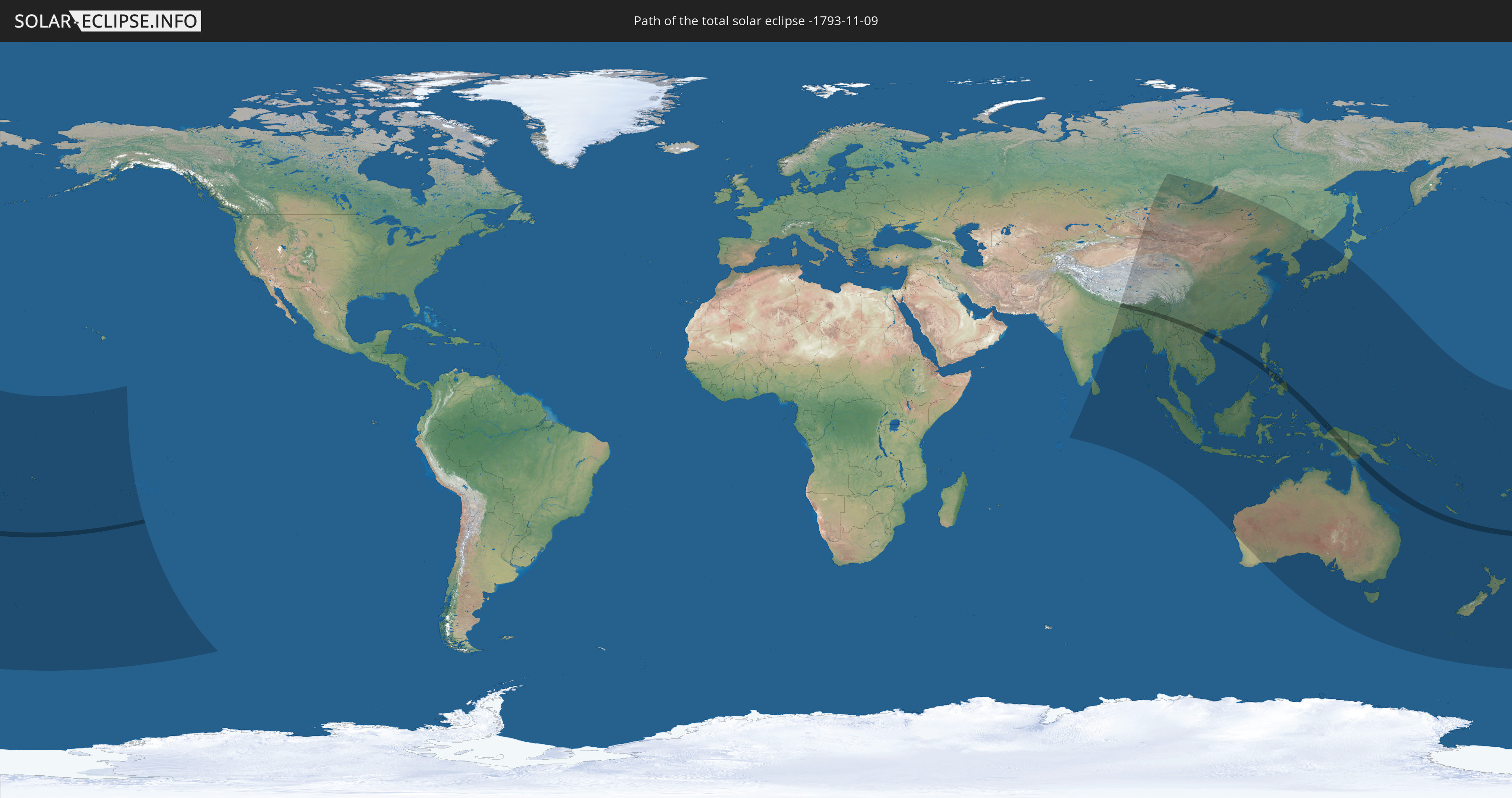
Die Sonnenfinsternis am 09.11.-1793 kann man in 52 Ländern als partielle Sonnenfinsternis beobachten.
Der Finsternispfad verläuft durch 13 Länder. Nur in diesen Ländern ist sie als totale Sonnenfinsternis zu sehen.
In den folgenden Ländern ist die Sonnenfinsternis total zu sehen
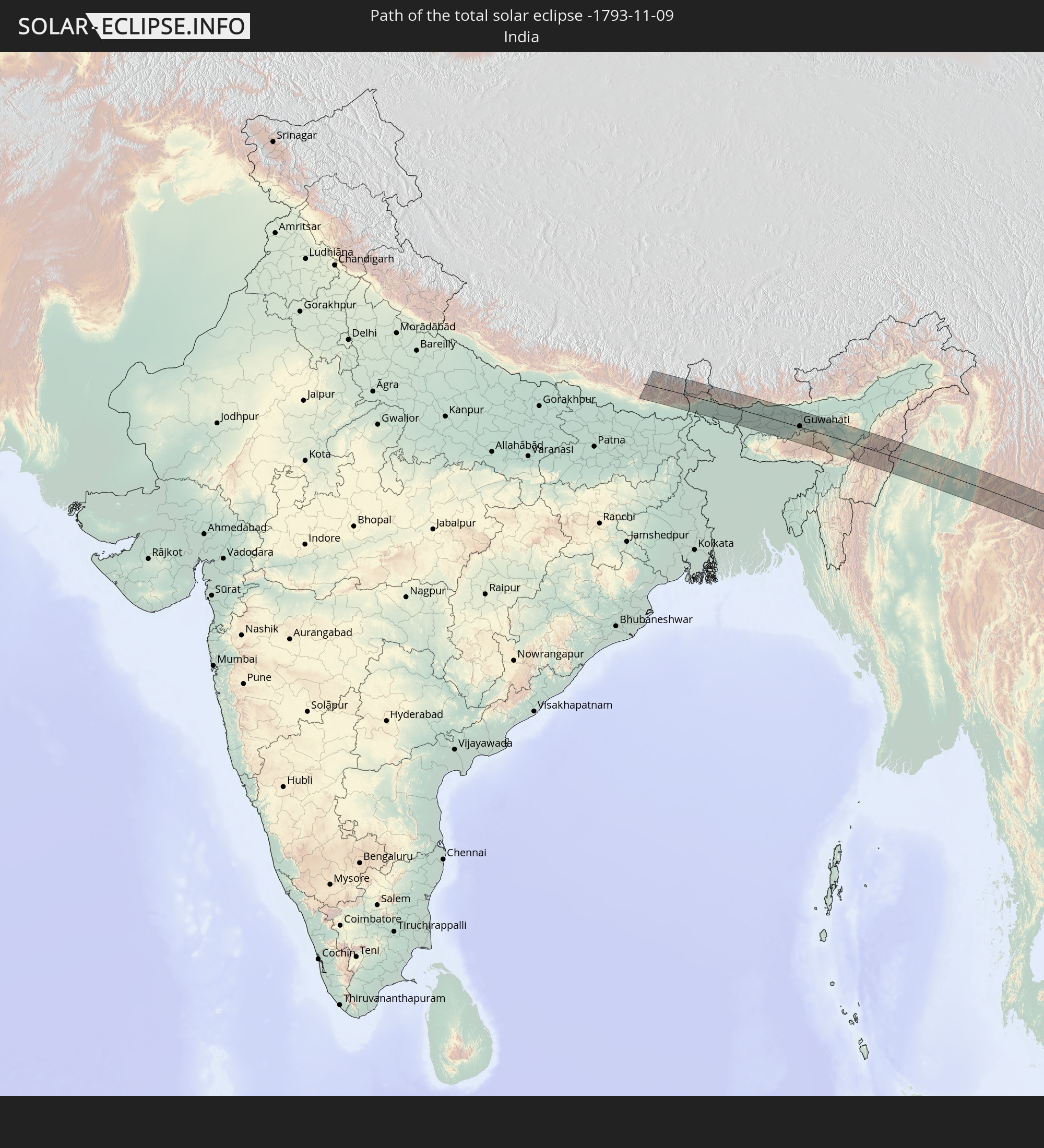 Indien
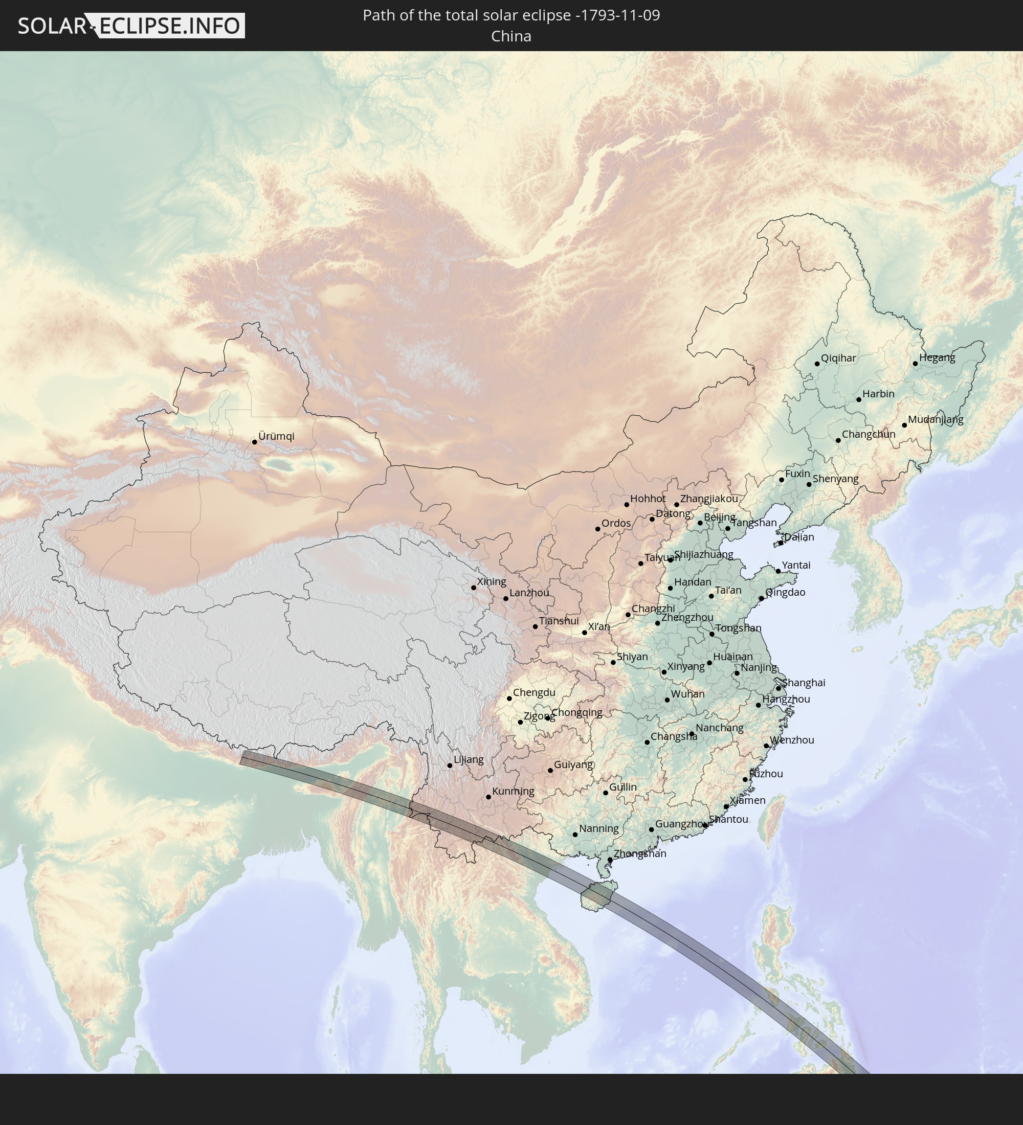 Volksrepublik China
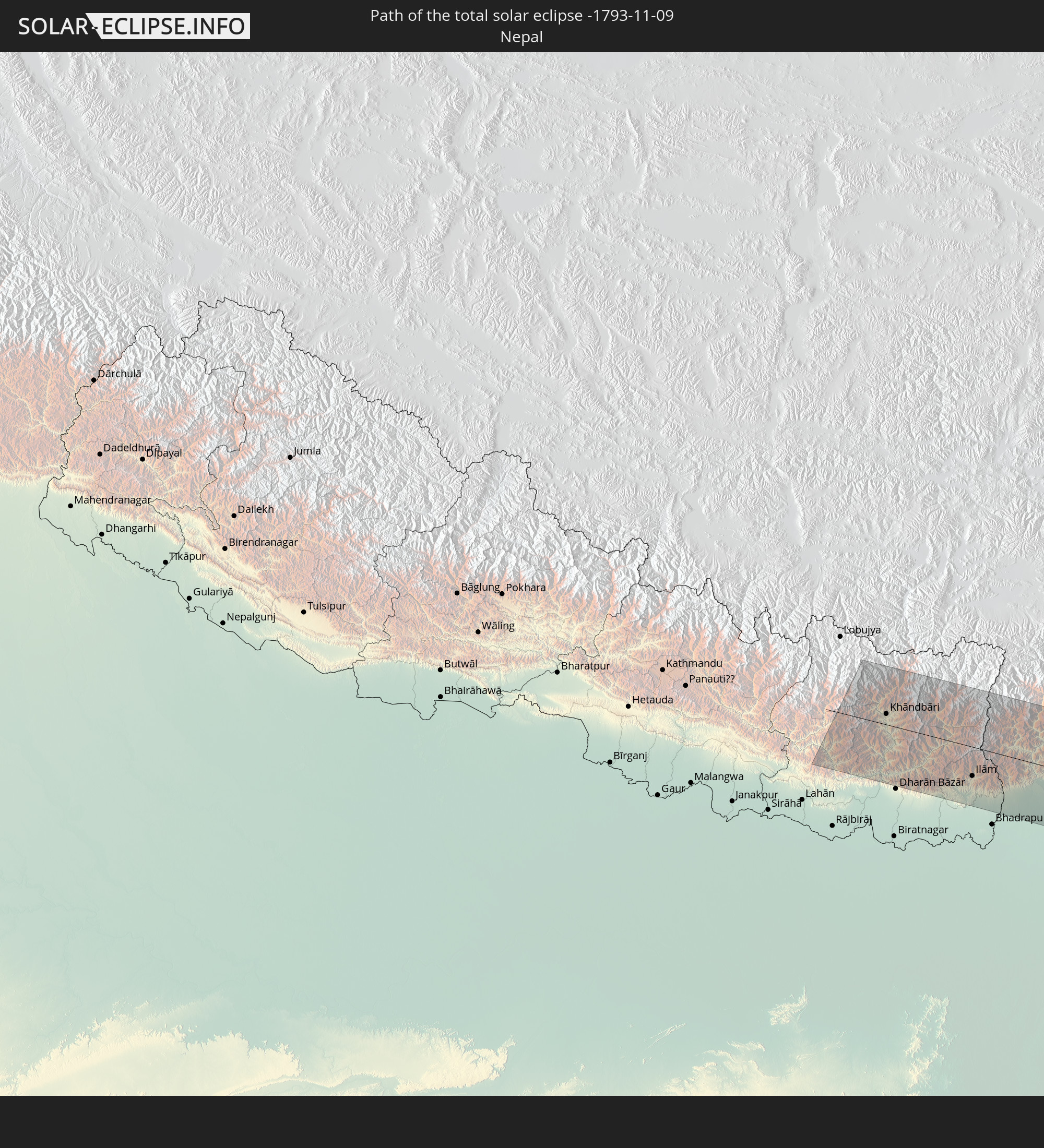 Nepal
Nepal
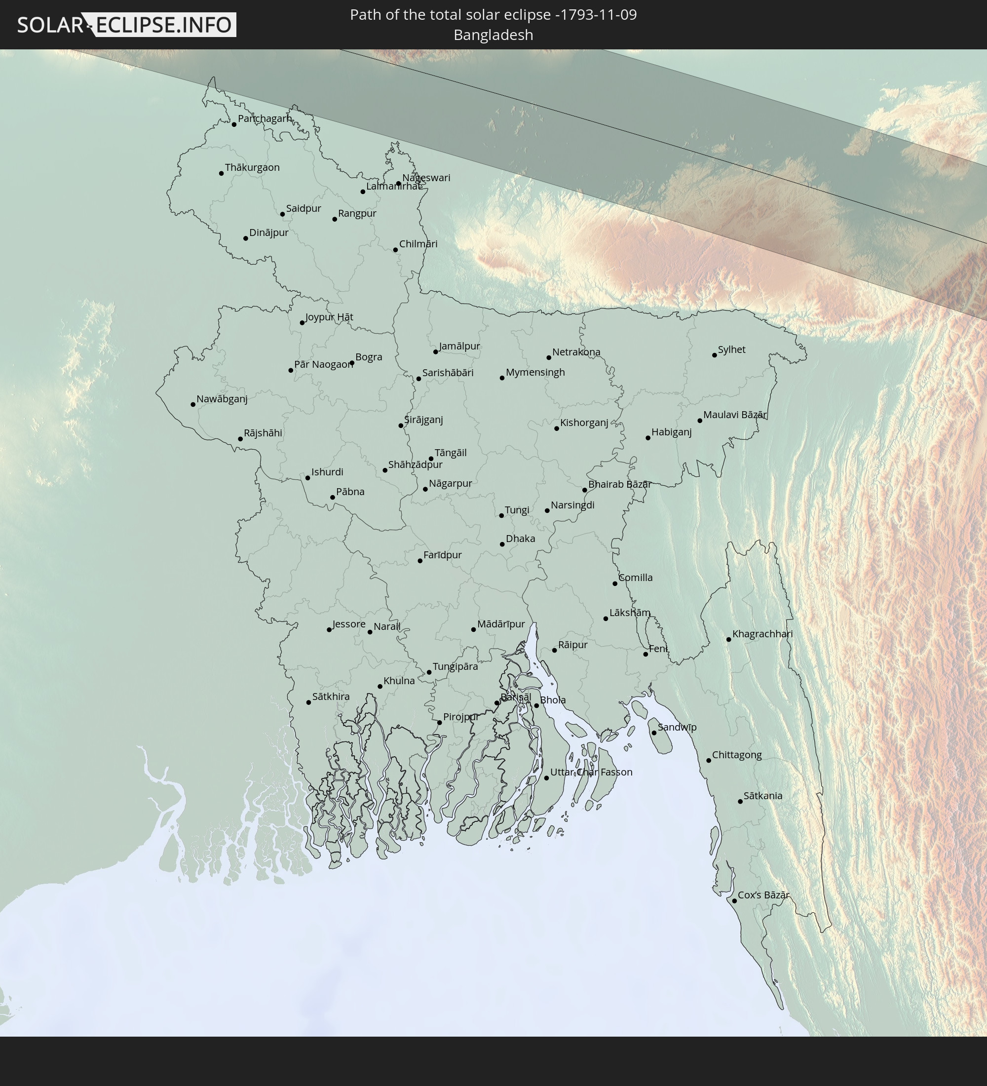 Bangladesch
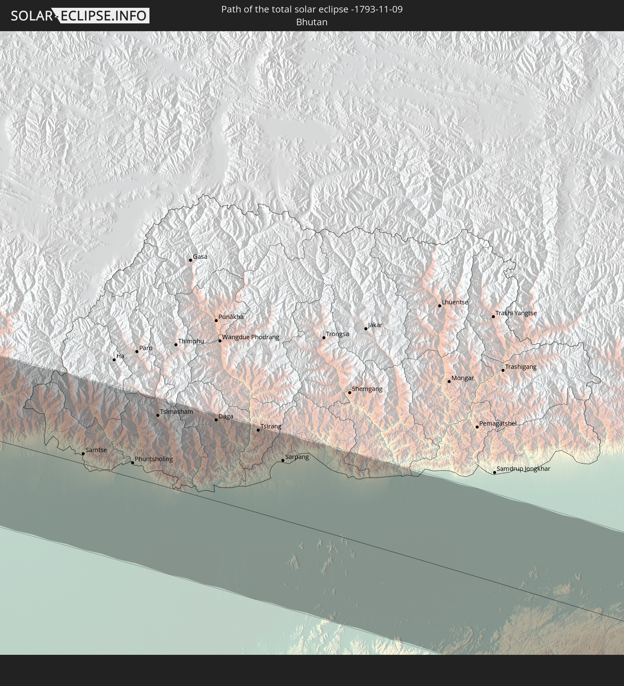 Bhutan
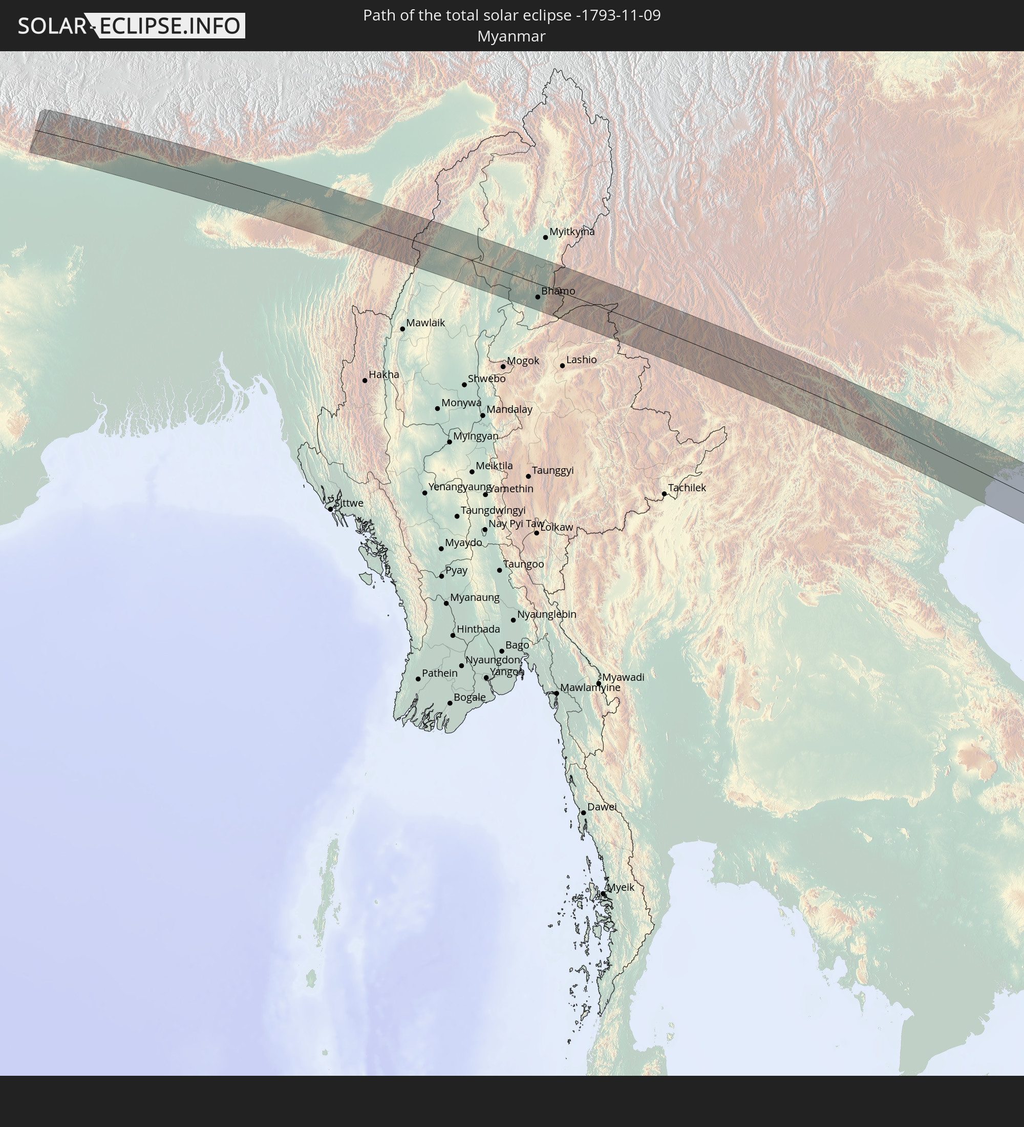 Myanmar
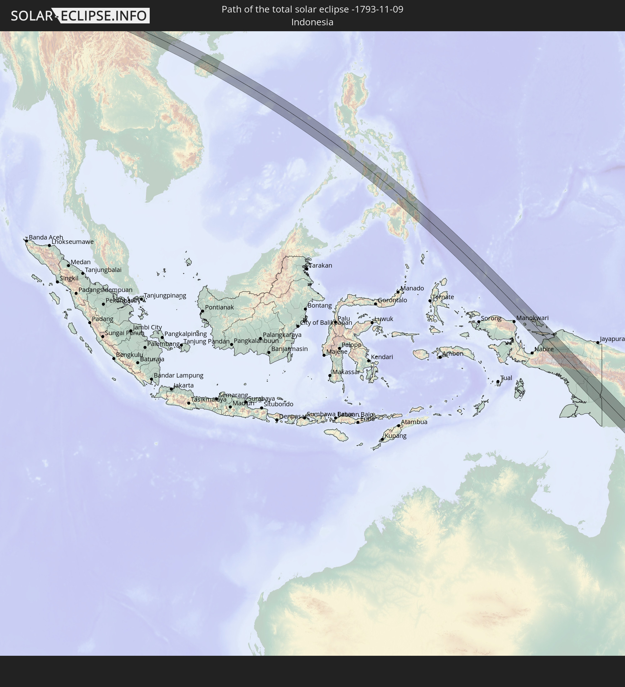 Indonesien
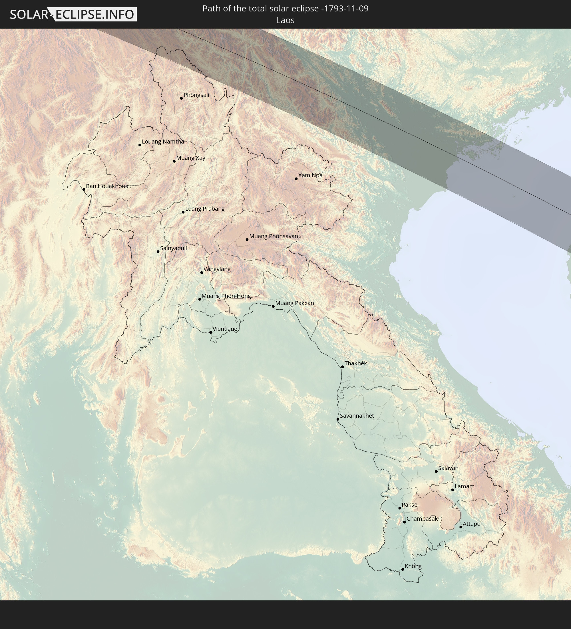 Laos
Laos
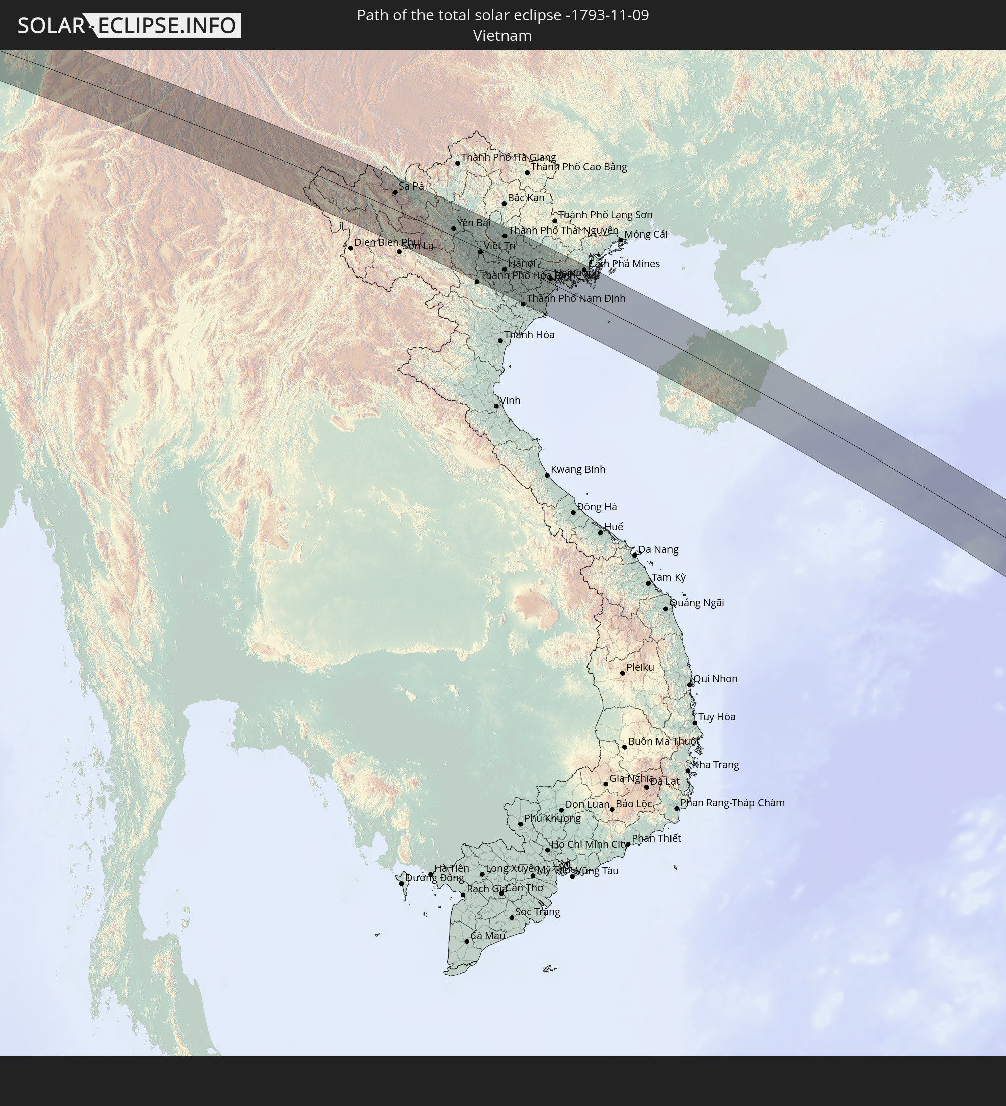 Vietnam
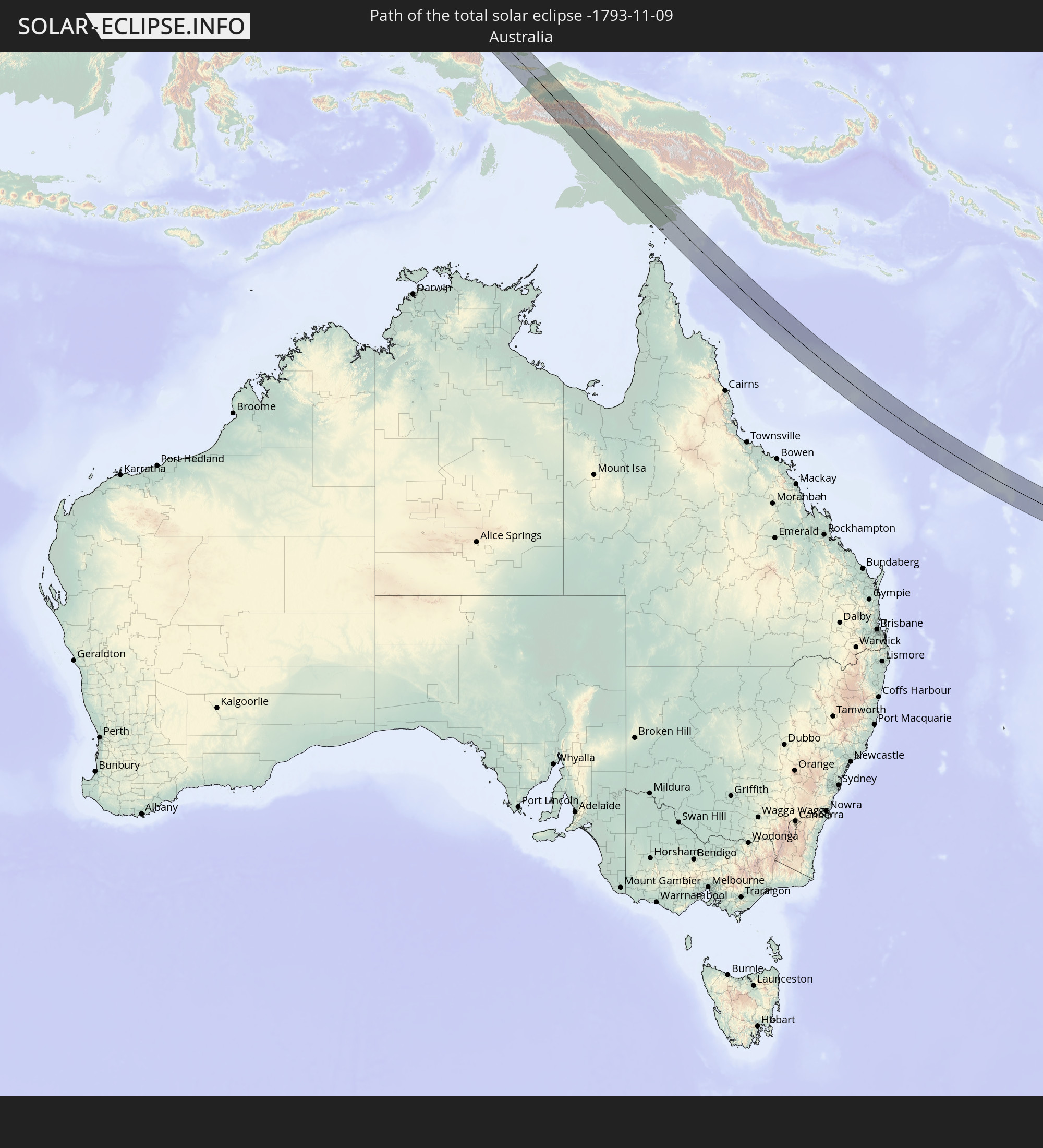 Australien
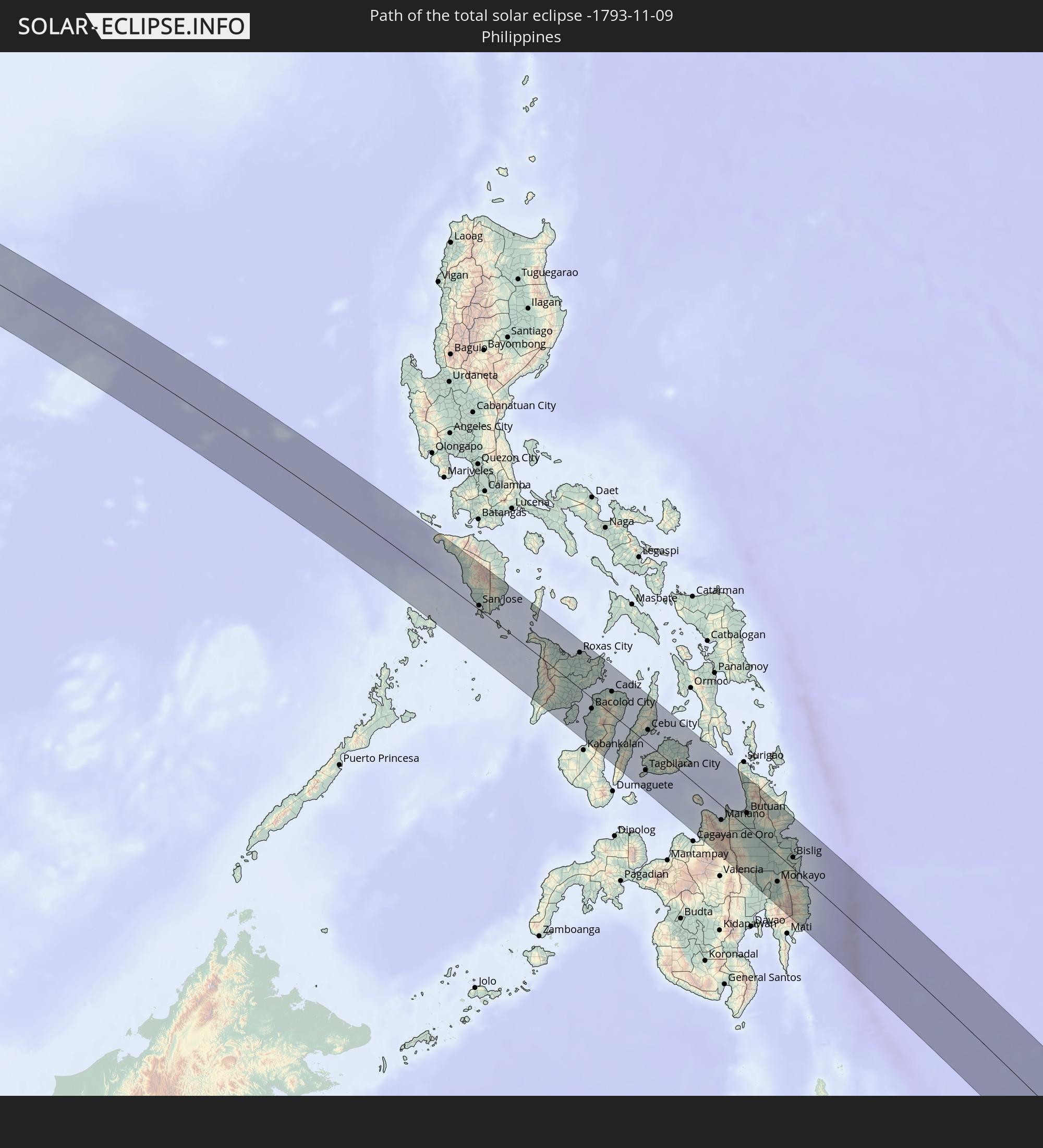 Philippinen
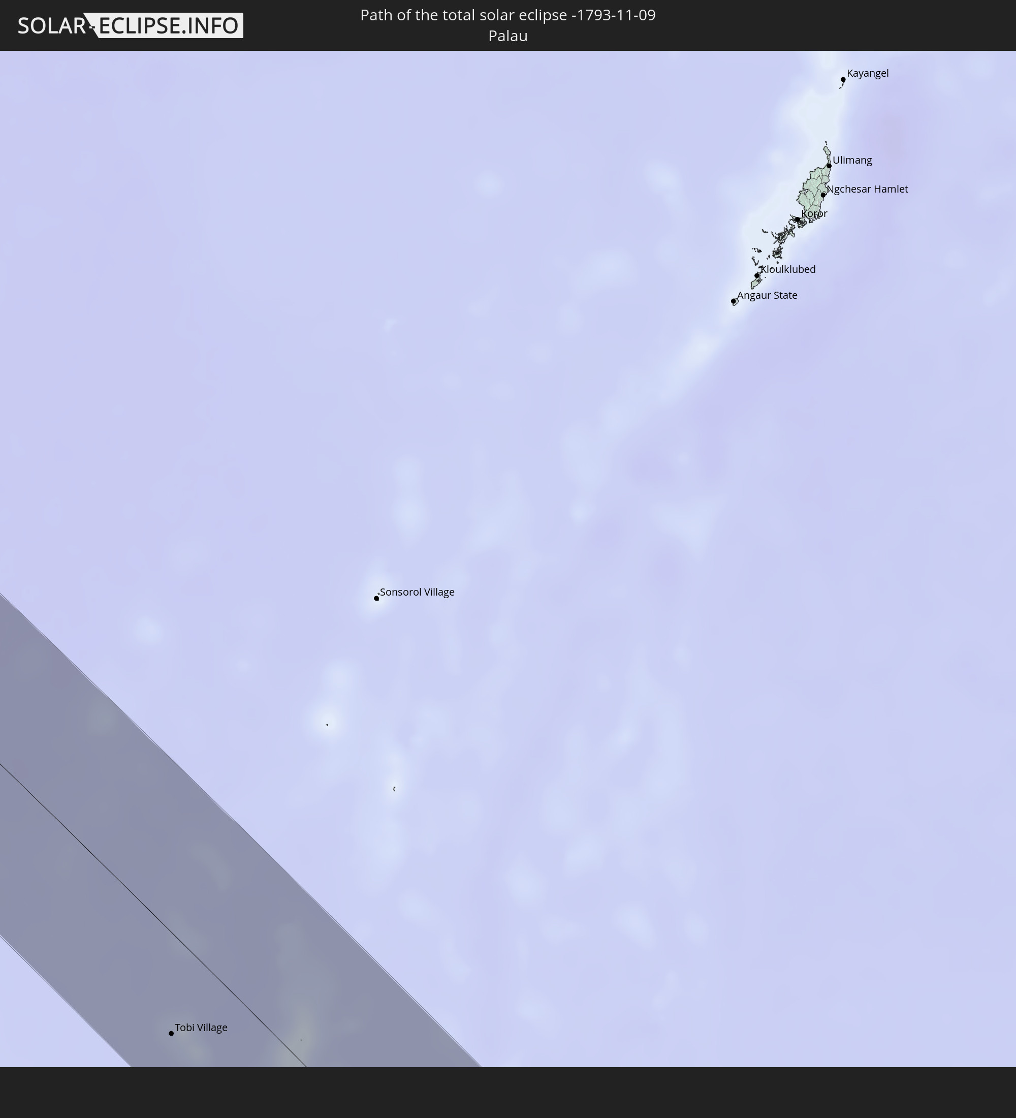 Palau
Palau
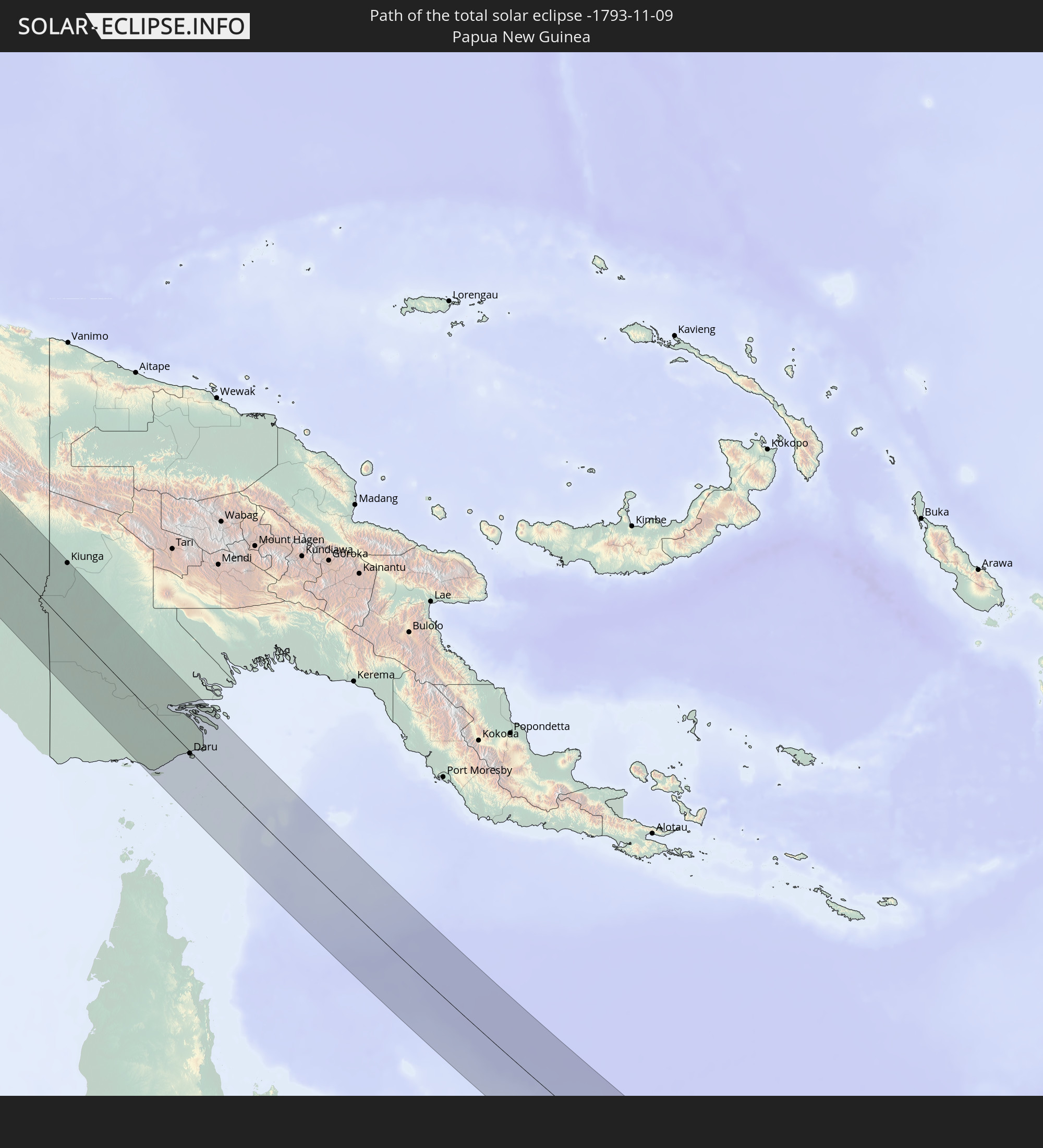 Papua-Neuguinea
In den folgenden Ländern ist die Sonnenfinsternis partiell zu sehen
 Russland
 Fidschi
 Neuseeland
 United States Minor Outlying Islands
 Wallis und Futuna
 Tonga
Tonga
 Kiribati
 Samoa
Samoa
 Tokelau
 Amerikanisch-Samoa
 Niue
Niue
 Cookinseln
 Französisch-Polynesien
 Indien
 Volksrepublik China
 Sri Lanka
 Nepal
Nepal
 Mongolei
 Bangladesch
 Bhutan
 Myanmar
 Indonesien
 Kokosinseln
 Thailand
 Malaysia
 Laos
Laos
 Vietnam
 Kambodscha
 Singapur
 Weihnachtsinsel
 Australien
 Macau
Macau
 Hongkong
 Brunei
 Taiwan
 Philippinen
 Japan
Japan
 Osttimor
 Nordkorea
 Südkorea
 Palau
Palau
 Föderierte Staaten von Mikronesien
 Papua-Neuguinea
 Guam
Guam
 Nördliche Marianen
 Salomonen
 Neukaledonien
 Marshallinseln
 Vanuatu
 Nauru
Nauru
 Norfolkinsel
 Tuvalu
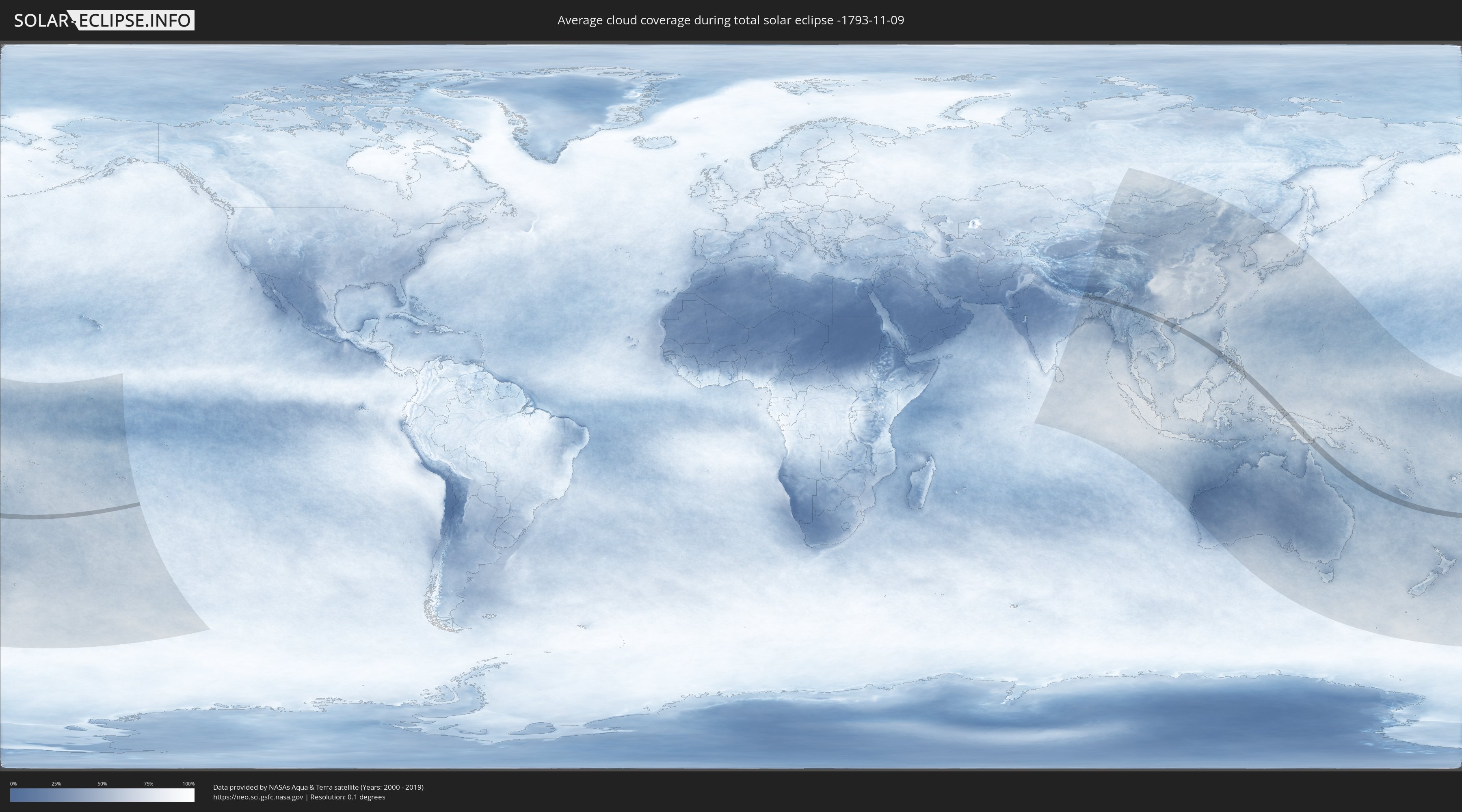
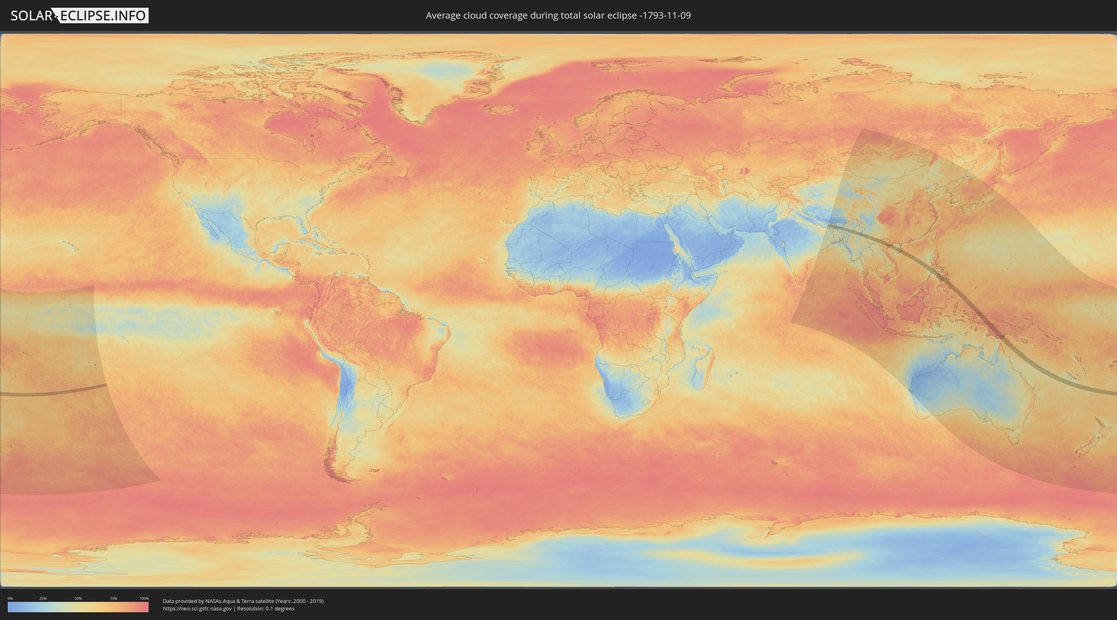
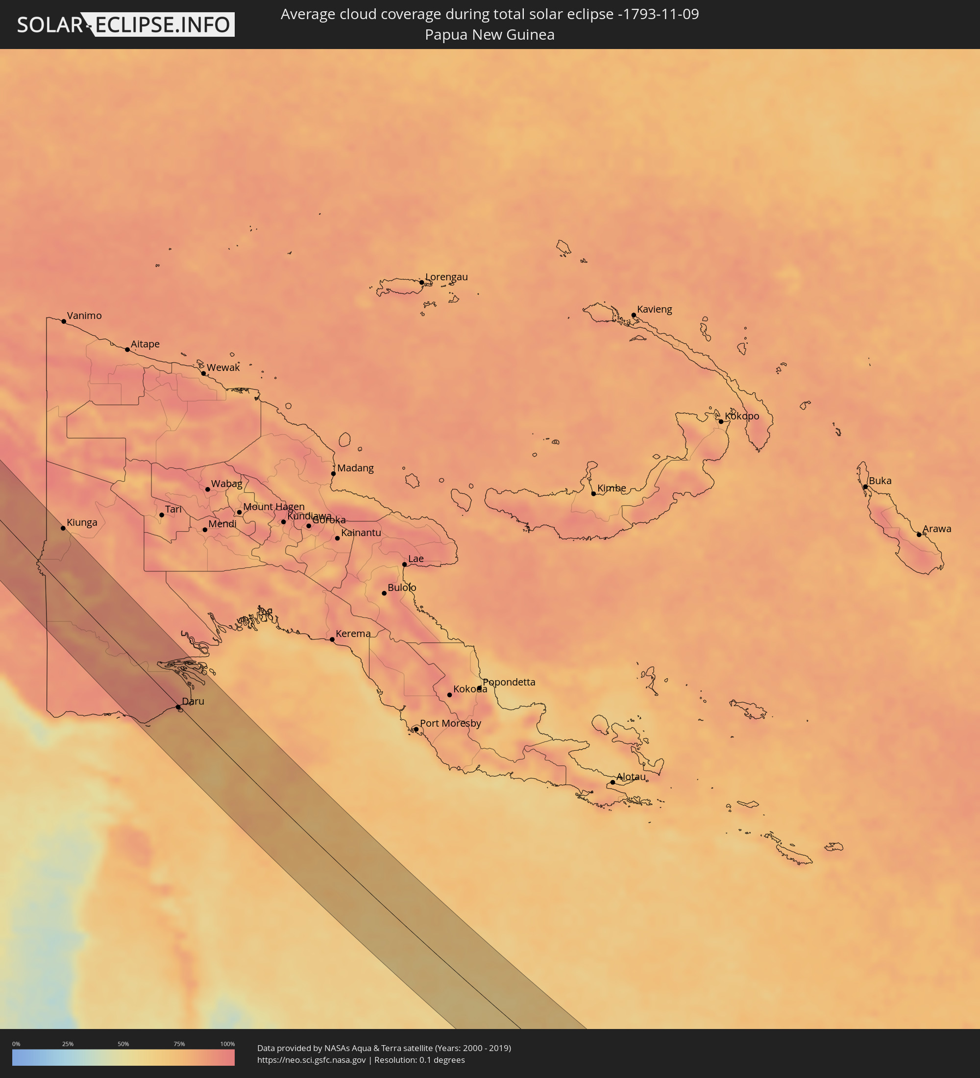
Wie wird das Wetter während der totalen Sonnenfinsternis am 09.11.-1793?
Wo ist der beste Ort, um die totale Sonnenfinsternis vom 09.11.-1793 zu beobachten?
Die folgenden Karten zeigen die durchschnittliche Bewölkung für den Tag, an dem die totale Sonnenfinsternis
stattfindet. Mit Hilfe der Karten lässt sich der Ort entlang des Finsternispfades eingrenzen,
der die besten Aussichen auf einen klaren wolkenfreien Himmel bietet.
Trotzdem muss man immer lokale Gegenenheiten beachten und sollte sich genau über das Wetter an seinem
gewählten Beobachtungsort informieren.
Die Daten stammen von den beiden NASA-Satelliten
AQUA und TERRA
und wurden über einen Zeitraum von 19 Jahren (2000 - 2019) gemittelt.
Detaillierte Länderkarten
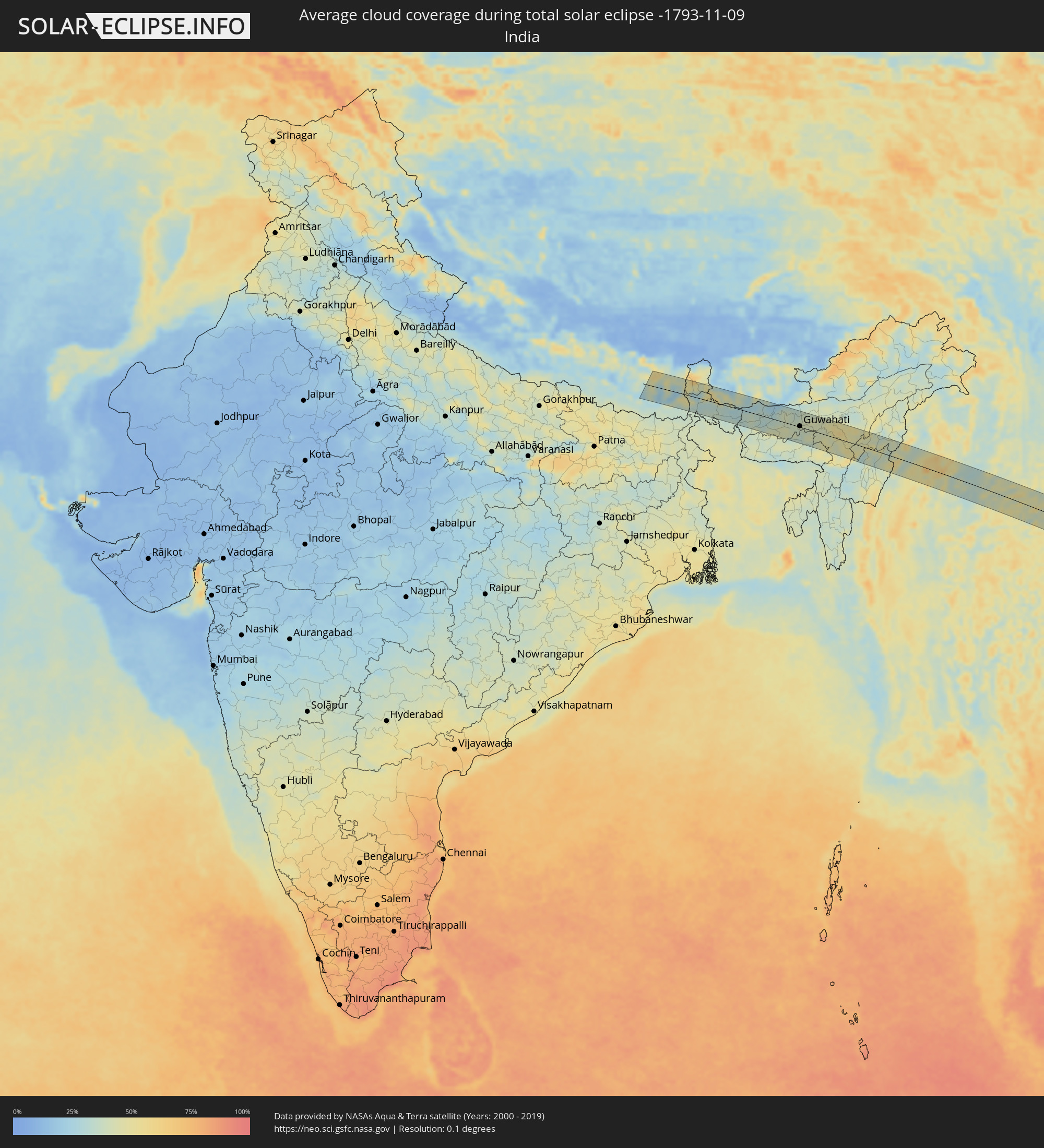 Indien
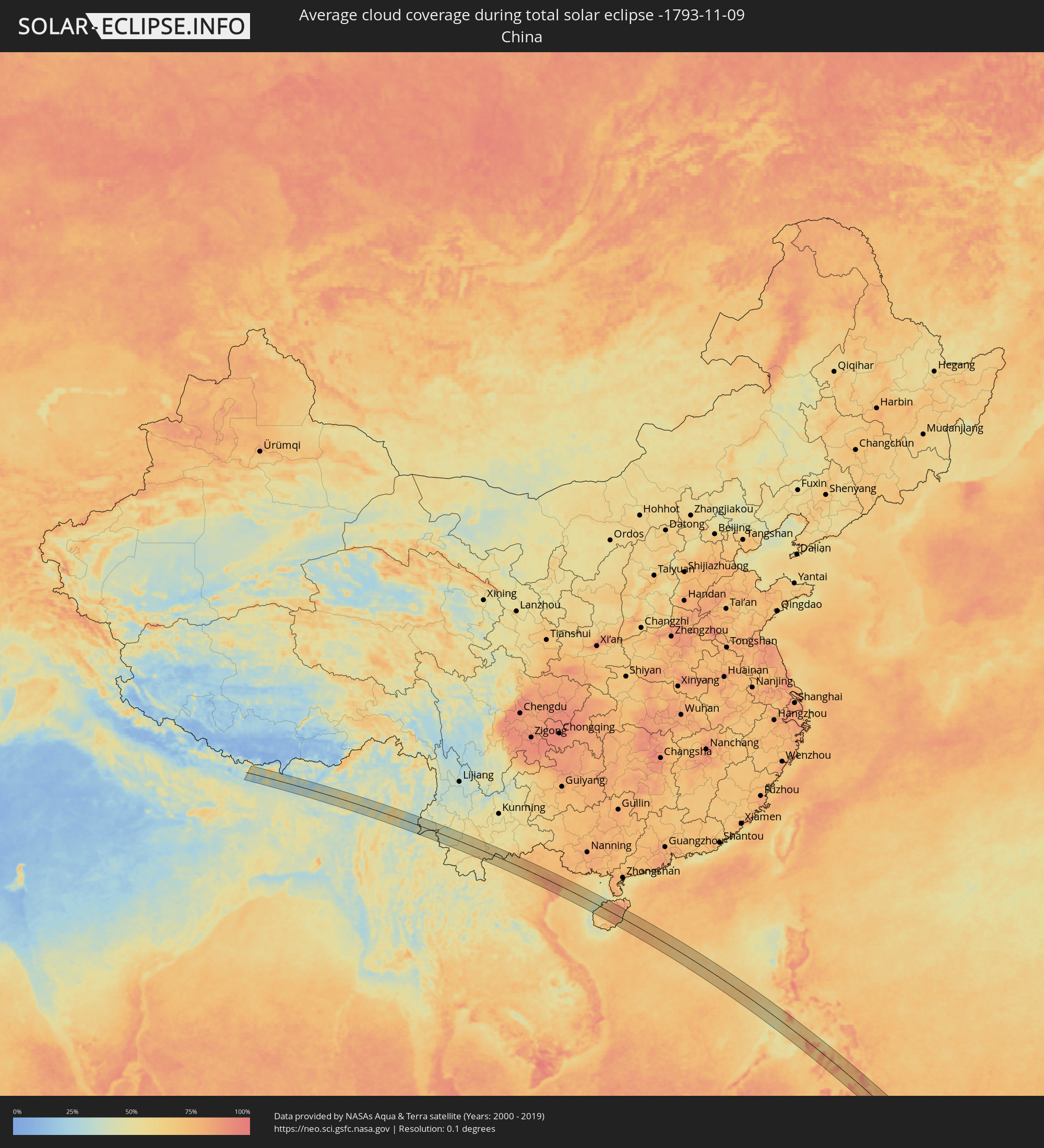 Volksrepublik China
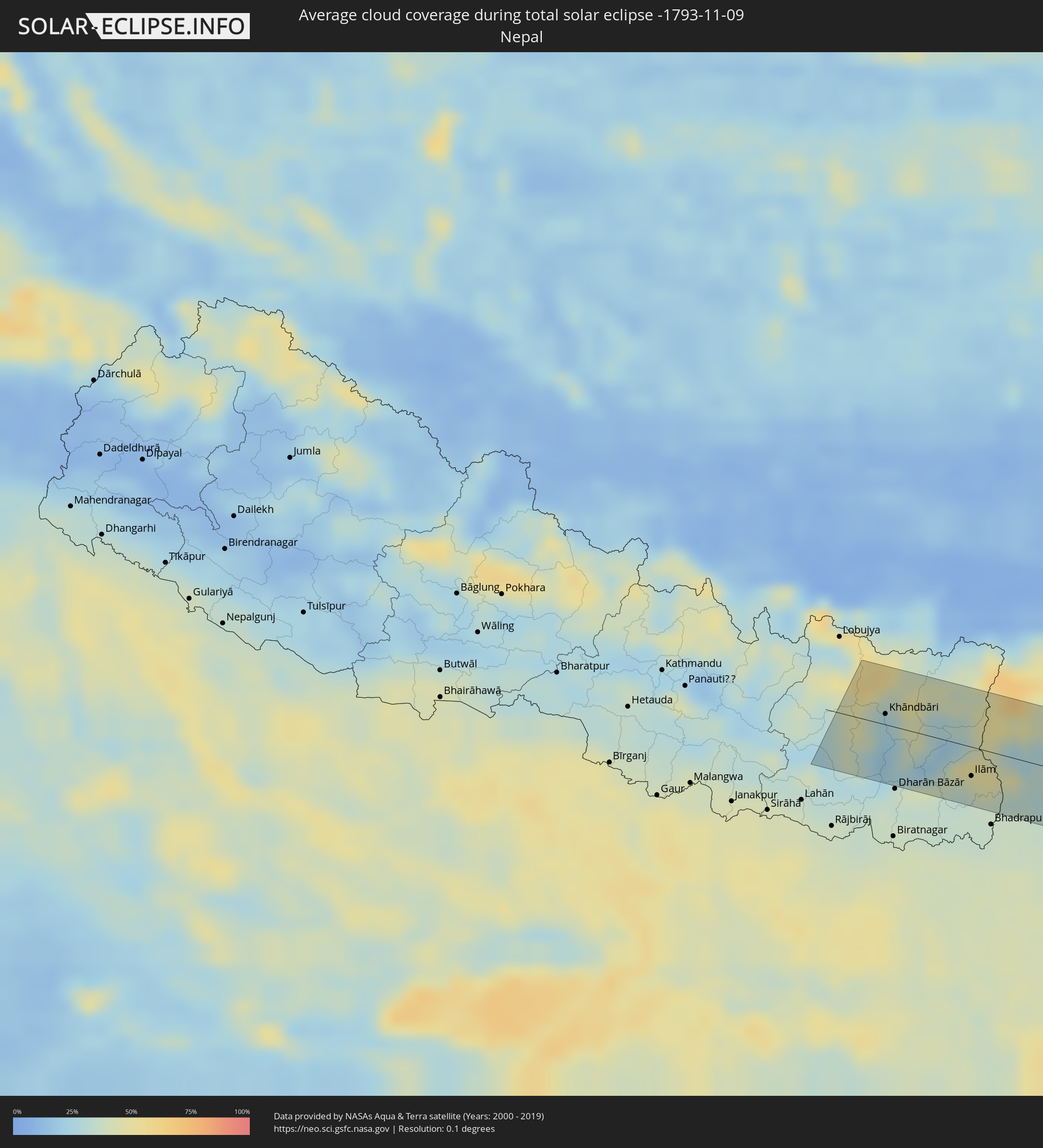 Nepal
Nepal
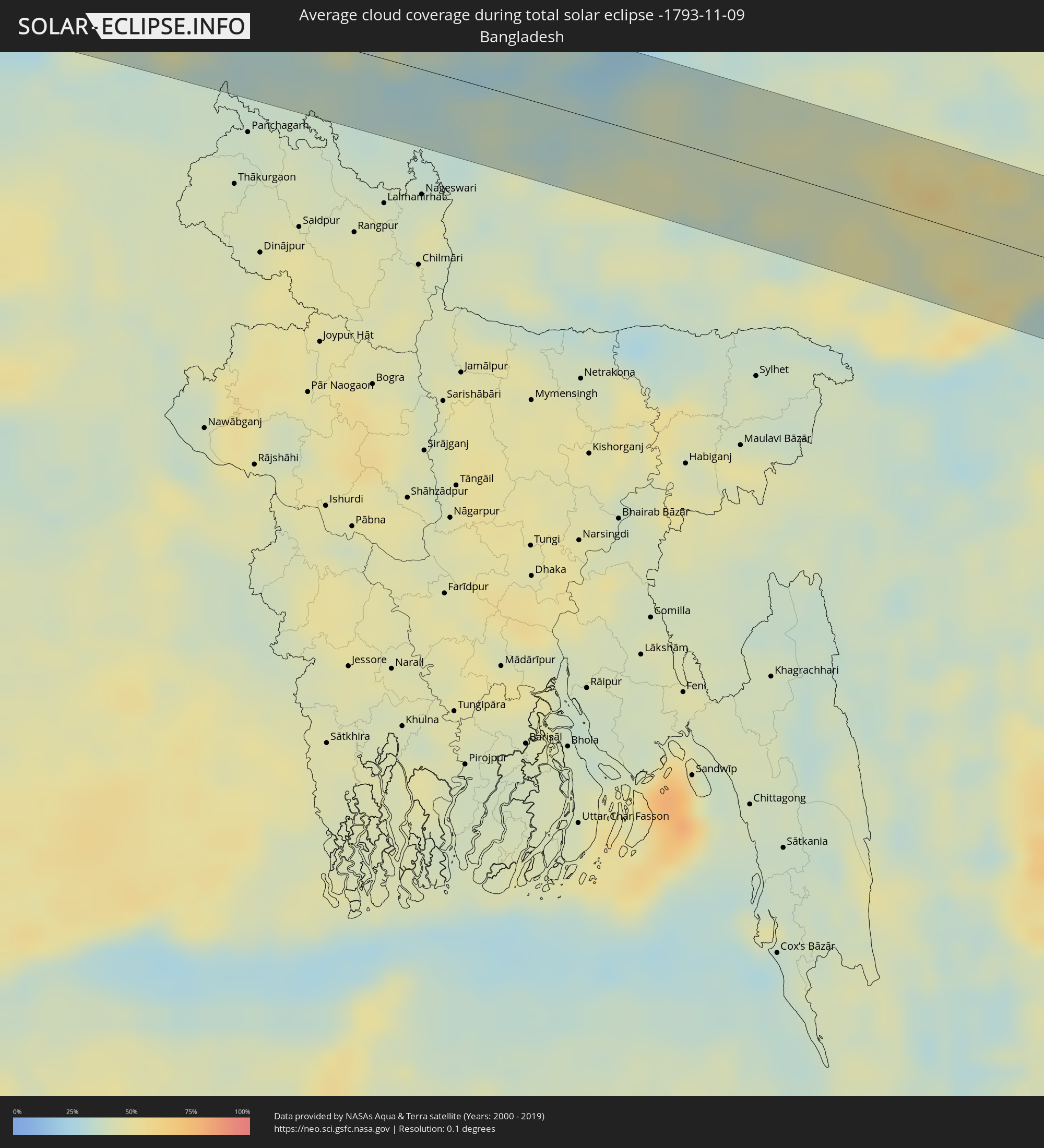 Bangladesch
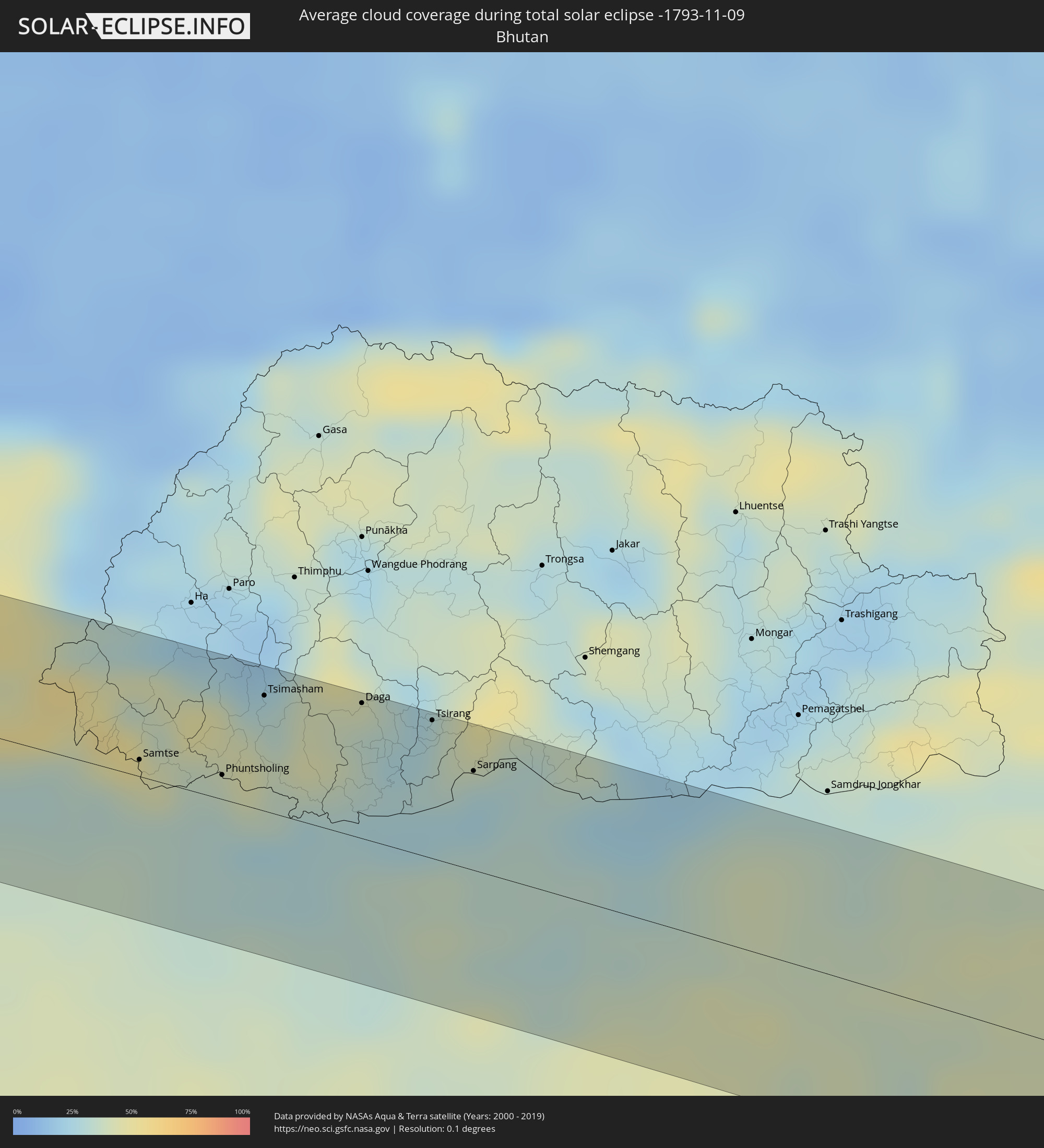 Bhutan
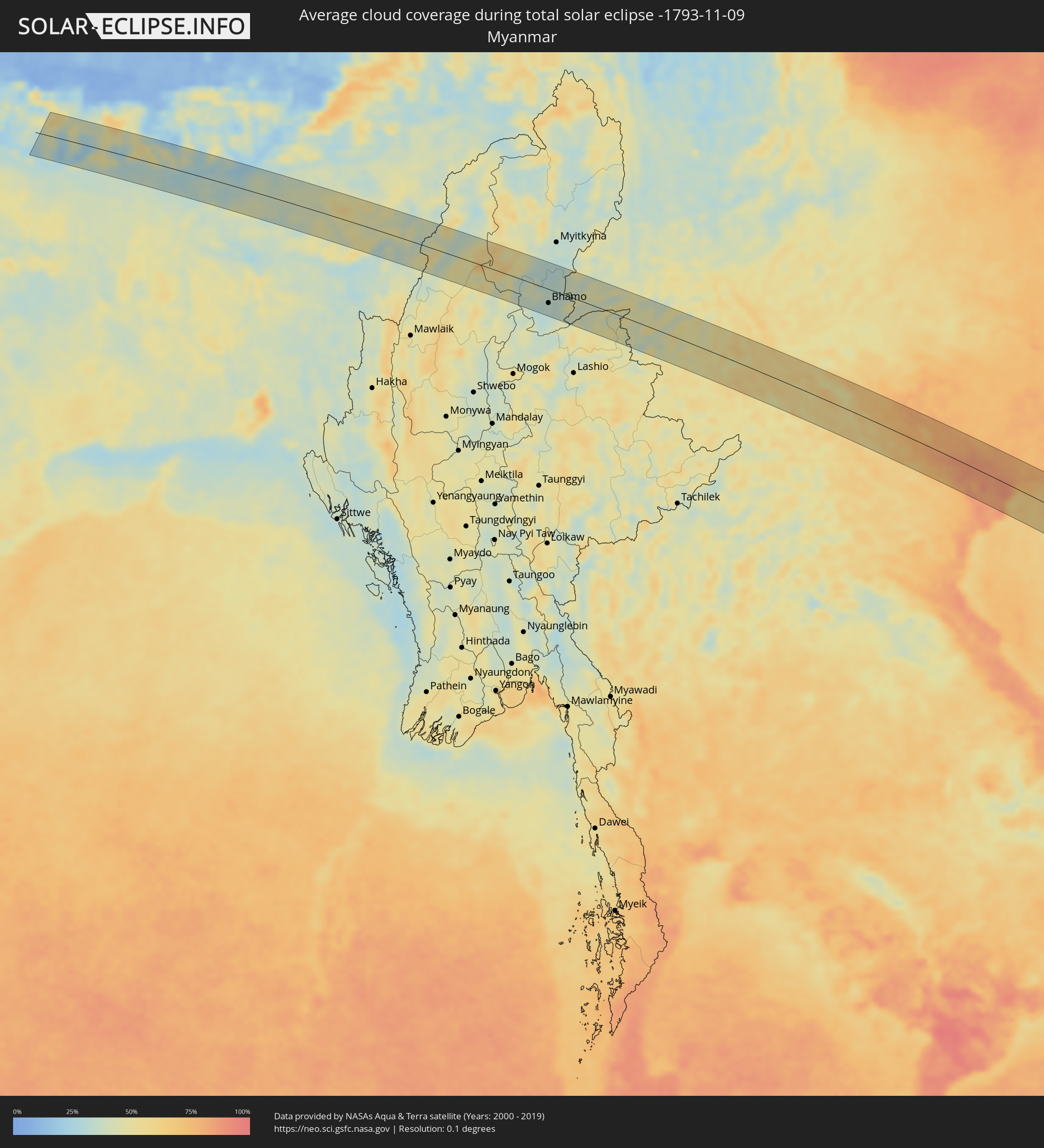 Myanmar
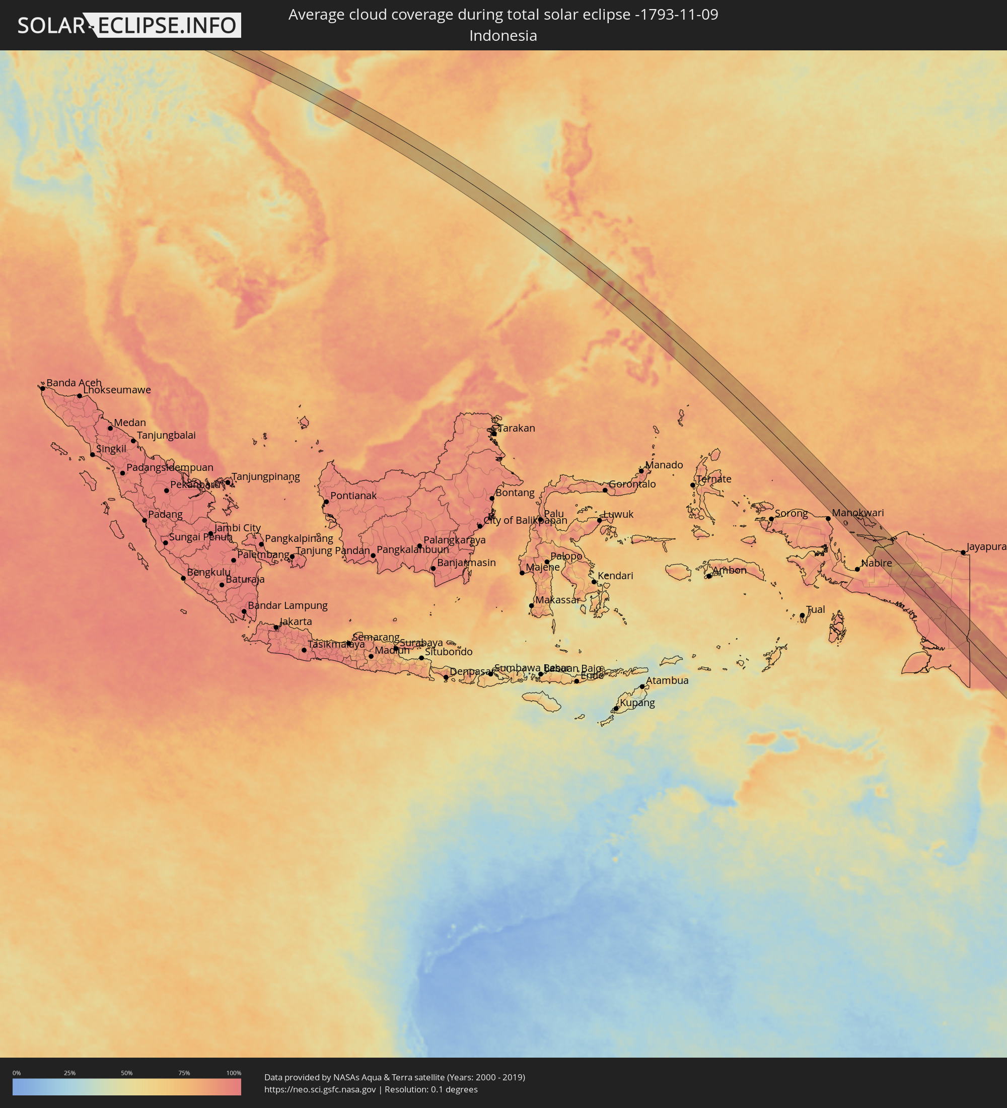 Indonesien
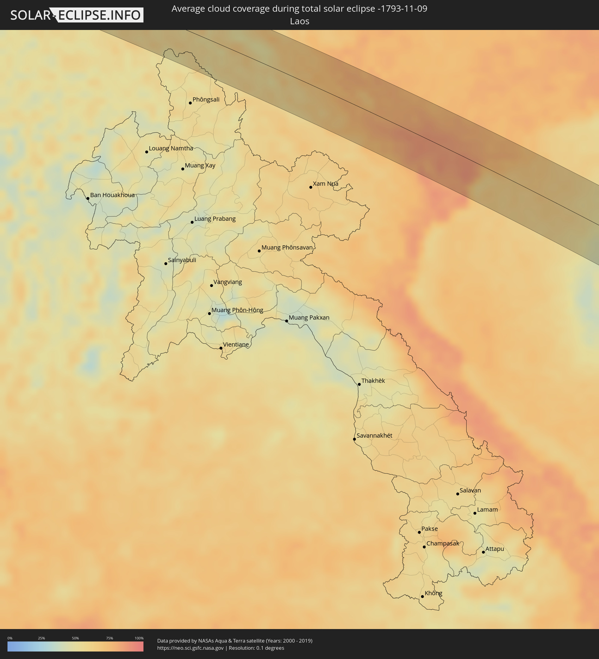 Laos
Laos
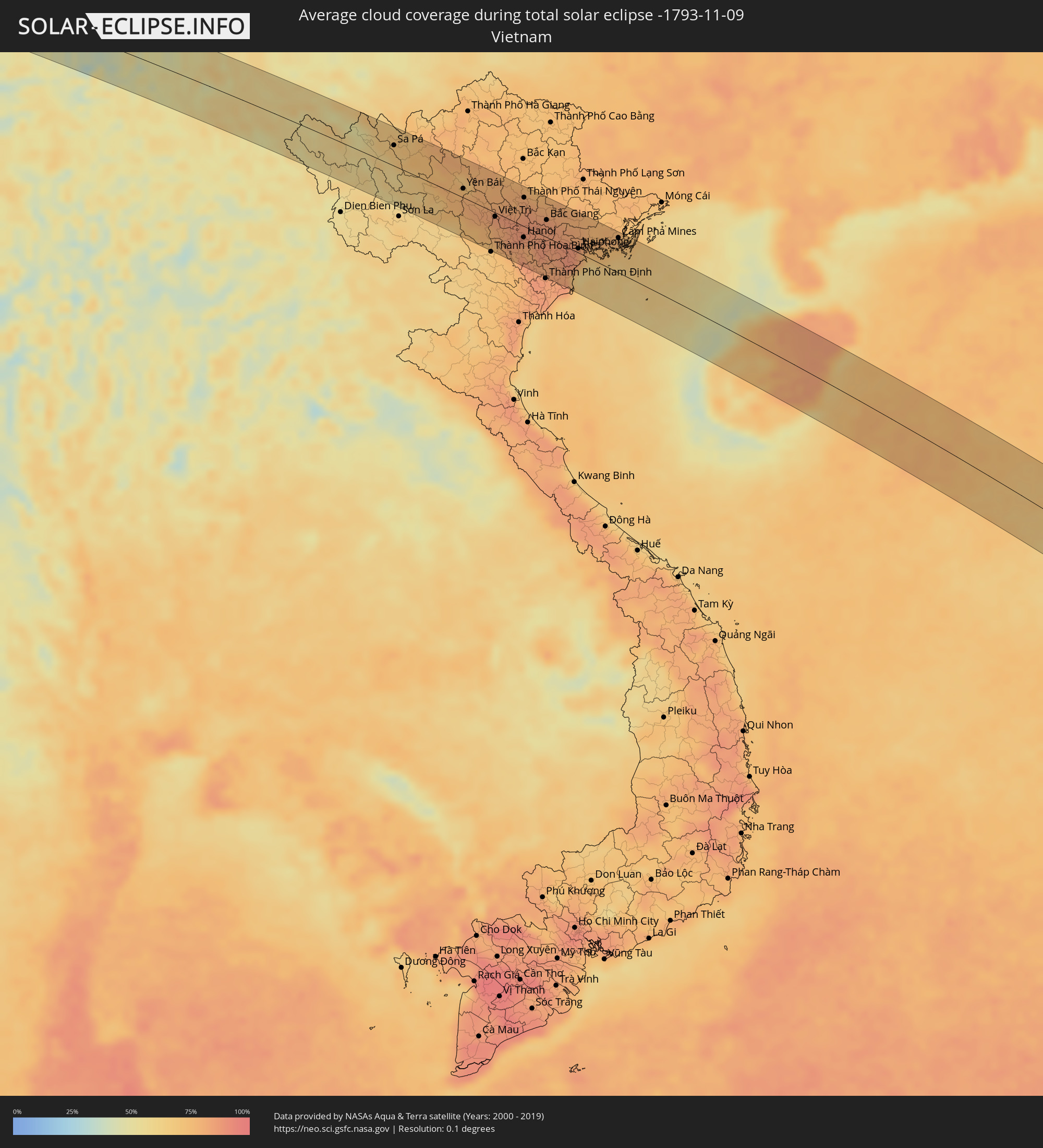 Vietnam
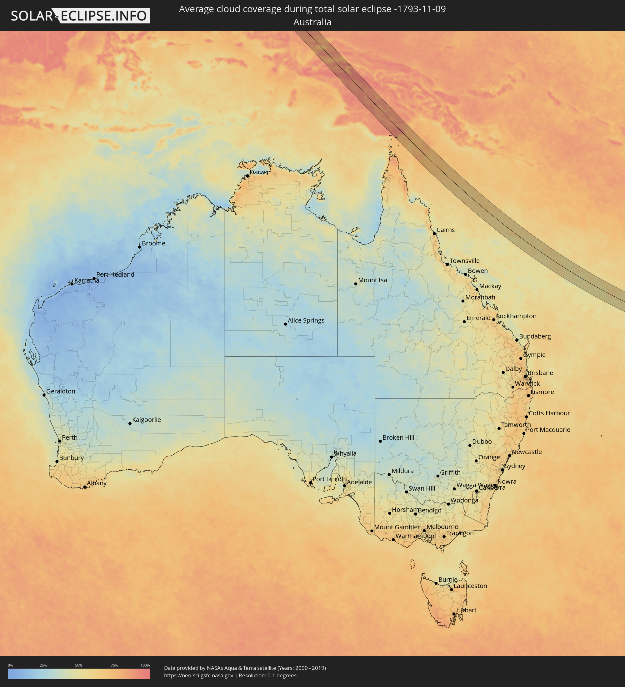 Australien
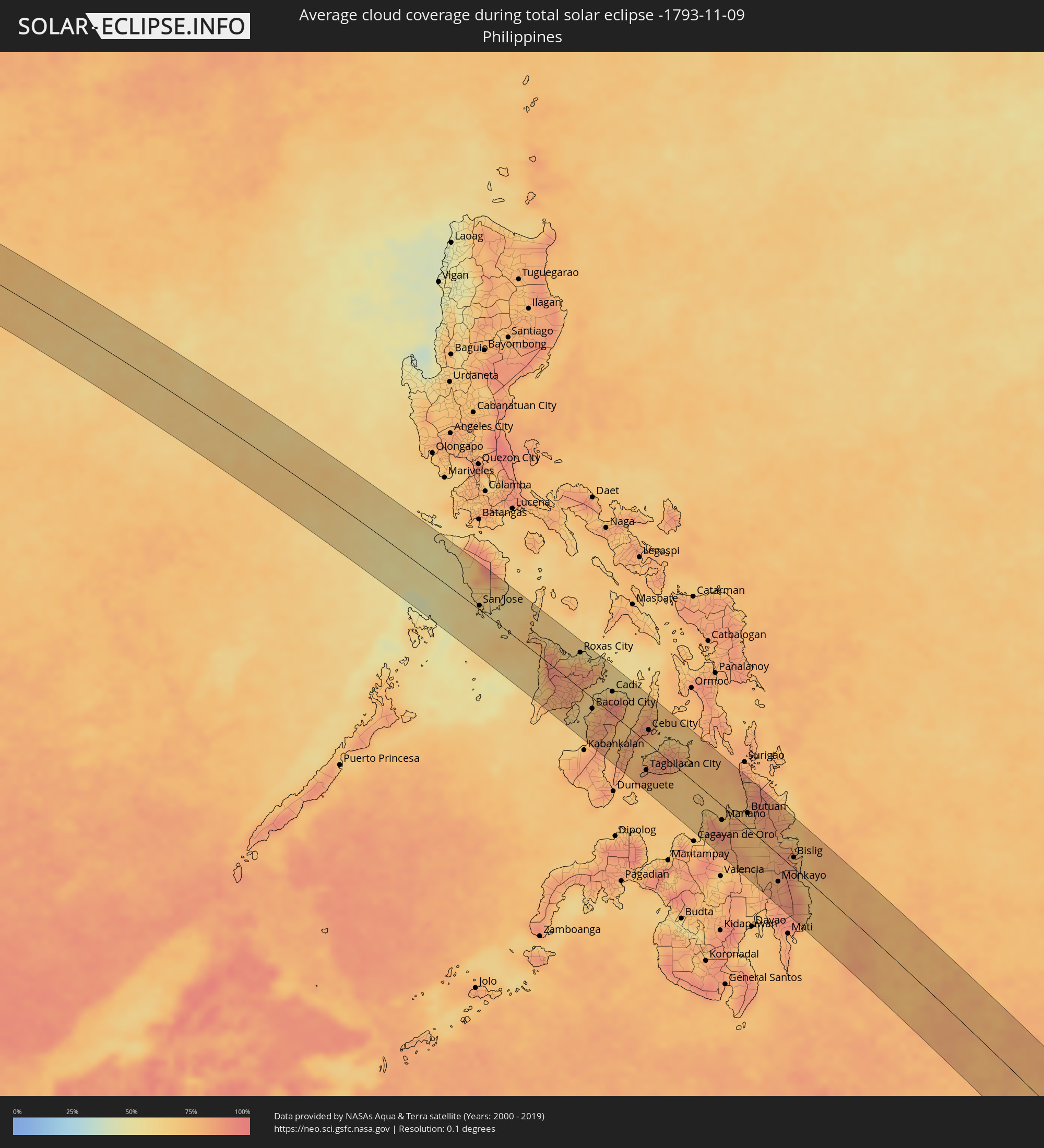 Philippinen
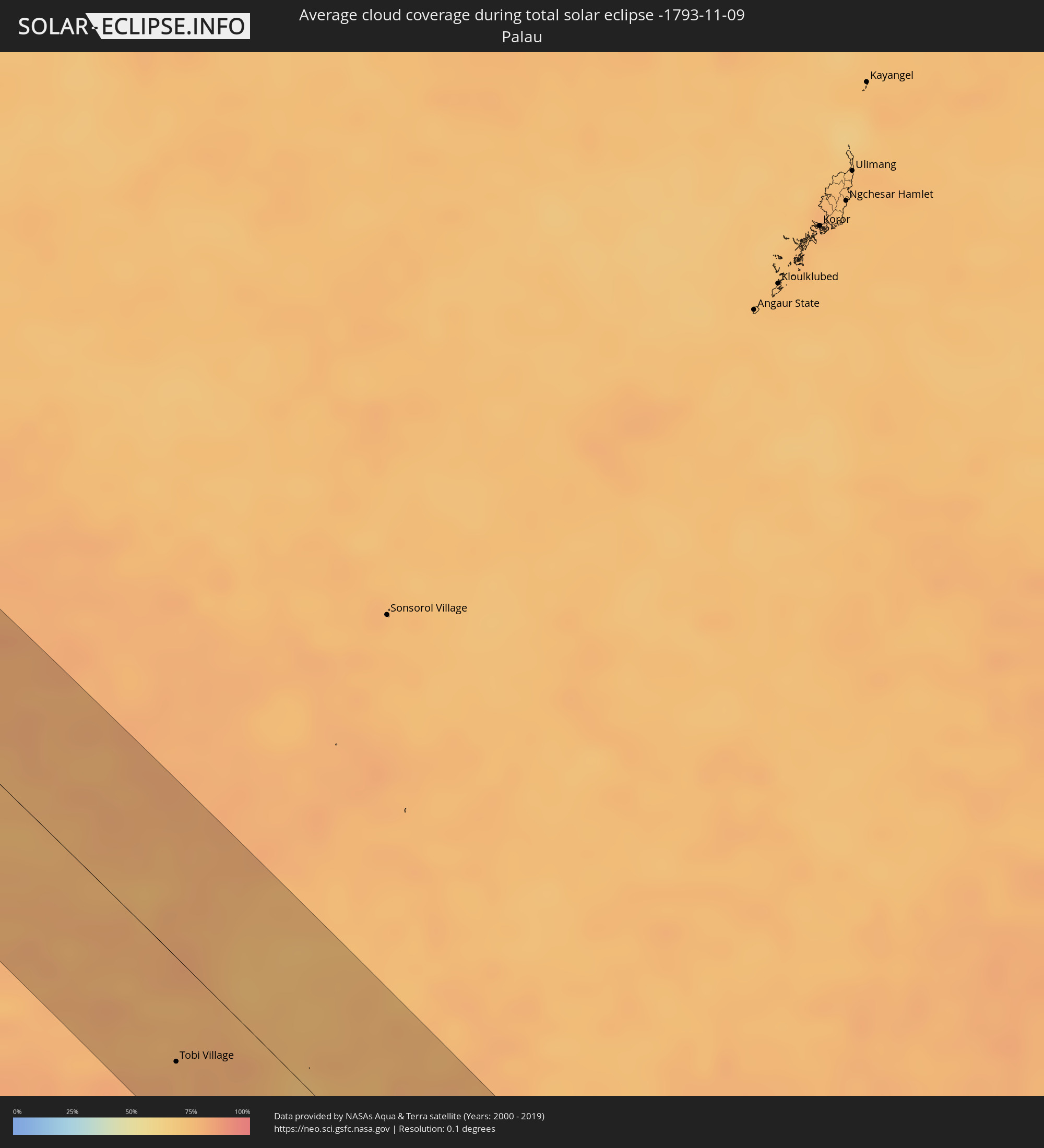 Palau
Palau
 Papua-Neuguinea
Orte im Finsternispfad
Die nachfolgene Tabelle zeigt Städte und Orte mit mehr als 5.000 Einwohnern, die sich im Finsternispfad befinden. Städte mit mehr als 100.000 Einwohnern sind dick gekennzeichnet. Mit einem Klick auf den Ort öffnet sich eine Detailkarte die die Lage des jeweiligen Ortes zusammen mit dem Verlauf der zentralen Finsternis präsentiert.
| Ort | Typ | Dauer der Verfinsterung | Ortszeit bei maximaler Verfinsterung | Entfernung zur Zentrallinie | Ø Bewölkung |
|
Khāndbāri, Eastern Region
|
total | - | 06:12:07 UTC+05:41 | 9 km | 27% |
|
Dhankutā, Eastern Region
|
total | - | 06:12:10 UTC+05:41 | 30 km | 26% |
|
Ilām, Eastern Region
|
total | - | 06:12:10 UTC+05:41 | 24 km | 36% |
|
Naksalbāri, West Bengal
|
total | - | 05:52:06 UTC+05:21 | 40 km | 35% |
|
Dārjiling, West Bengal
|
total | - | 05:52:03 UTC+05:21 | 2 km | 45% |
|
Kārsiyāng, West Bengal
|
total | - | 05:52:05 UTC+05:21 | 18 km | 38% |
|
Shiliguri, West Bengal
|
total | - | 05:52:06 UTC+05:21 | 32 km | 34% |
|
Kālimpong, West Bengal
|
total | - | 05:52:03 UTC+05:21 | 8 km | 31% |
|
Gangtok, Sikkim
|
total | - | 05:52:01 UTC+05:21 | 39 km | 36% |
|
Jalpāiguri, West Bengal
|
total | - | 05:52:08 UTC+05:21 | 45 km | 40% |
|
Goyerkāta, West Bengal
|
total | - | 05:52:07 UTC+05:21 | 18 km | 34% |
|
Samtse, Samchi
|
total | - | 06:29:31 UTC+05:58 | 6 km | 40% |
|
Jaigaon, West Bengal
|
total | - | 05:52:06 UTC+05:21 | 7 km | 31% |
|
Phuntsholing, Chukha District
|
total | - | 05:52:06 UTC+05:21 | 8 km | 36% |
|
Koch Bihār, West Bengal
|
total | - | 05:52:12 UTC+05:21 | 47 km | 36% |
|
Tsimasham, Chukha District
|
total | - | 06:29:31 UTC+05:58 | 39 km | 40% |
|
Daga, Dagana District
|
total | - | 06:29:32 UTC+05:58 | 45 km | 34% |
|
Tsirang, Chirang
|
total | - | 06:29:33 UTC+05:58 | 46 km | 29% |
|
Bilāsipāra, Assam
|
total | - | 05:52:15 UTC+05:21 | 35 km | 40% |
|
Sarpang, Geylegphug
|
total | - | 06:29:35 UTC+05:58 | 33 km | 29% |
|
Kokrajhar, Assam
|
total | - | 05:52:13 UTC+05:21 | 16 km | 33% |
|
Bongaigaon, Assam
|
total | - | 05:52:14 UTC+05:21 | 0 km | 30% |
|
Goālpāra, Assam
|
total | - | 05:52:17 UTC+05:21 | 30 km | 35% |
|
Barpeta Road, Assam
|
total | - | 05:52:15 UTC+05:21 | 14 km | 34% |
|
Barpeta, Assam
|
total | - | 05:52:17 UTC+05:21 | 4 km | 40% |
|
Rangia, Assam
|
total | - | 05:52:19 UTC+05:21 | 27 km | 37% |
|
Guwahati, Assam
|
total | - | 05:52:22 UTC+05:21 | 2 km | 38% |
|
Hojāi, Assam
|
total | - | 05:52:31 UTC+05:21 | 16 km | 52% |
|
Lumding Railway Colony, Assam
|
total | - | 05:52:37 UTC+05:21 | 2 km | 50% |
|
Diphu, Assam
|
total | - | 05:52:38 UTC+05:21 | 16 km | 44% |
|
Dimāpur, Nagaland
|
total | - | 05:52:39 UTC+05:21 | 32 km | 47% |
|
Kohima, Nagaland
|
total | - | 05:52:46 UTC+05:21 | 19 km | 48% |
|
Bhamo, Kachin
|
total | - | 06:57:22 UTC+06:24 | 27 km | 34% |
|
Lai Châu, Lai Châu
|
total | - | 07:41:57 UTC+07:06 | 19 km | 60% |
|
Sa Pá, Lào Cai
|
total | - | 07:42:08 UTC+07:06 | 30 km | 67% |
|
Lào Cai, Lào Cai
|
total | - | 07:42:07 UTC+07:06 | 50 km | 68% |
|
Yên Bái, Yên Bái
|
total | - | 07:42:54 UTC+07:06 | 13 km | 78% |
|
Thành Phố Tuyên Quang, Tuyên Quang
|
total | - | 07:42:59 UTC+07:06 | 36 km | 78% |
|
Việt Trì, Phú Thọ
|
total | - | 07:43:20 UTC+07:06 | 6 km | 83% |
|
Sơn Tây, Ha Nội
|
total | - | 07:43:29 UTC+07:06 | 19 km | 79% |
|
Vĩnh Yên, Vĩnh Phúc
|
total | - | 07:43:26 UTC+07:06 | 2 km | 87% |
|
Hà Đông, Ha Nội
|
total | - | 07:43:42 UTC+07:06 | 24 km | 82% |
|
Hanoi, Ha Nội
|
total | - | 07:43:42 UTC+07:06 | 16 km | 82% |
|
Thành Phố Thái Nguyên, Thái Nguyên
|
total | - | 07:43:24 UTC+07:06 | 41 km | 81% |
|
Hưng Yên, Hưng Yên
|
total | - | 07:44:01 UTC+07:06 | 45 km | 84% |
|
Bắc Ninh, Bắc Ninh
|
total | - | 07:43:44 UTC+07:06 | 11 km | 85% |
|
Bắc Giang, Bắc Giang
|
total | - | 07:43:44 UTC+07:06 | 25 km | 85% |
|
Thành Phố Hải Dương, Hải Dương
|
total | - | 07:43:59 UTC+07:06 | 2 km | 84% |
|
Thành Phố Thái Bình, Thái Bình
|
total | - | 07:44:16 UTC+07:06 | 51 km | 83% |
|
Haiphong, Hải Phòng
|
total | - | 07:44:13 UTC+07:06 | 6 km | 81% |
|
Thành Phố Uông Bí, Quảng Ninh
|
total | - | 07:44:10 UTC+07:06 | 27 km | 79% |
|
Cát Bà, Hải Phòng
|
total | - | 07:44:29 UTC+07:06 | 9 km | 62% |
|
Thành Phố Hạ Long, Quảng Ninh
|
total | - | 07:44:22 UTC+07:06 | 33 km | 74% |
|
Cẩm Phả Mines, Quảng Ninh
|
total | - | 07:44:27 UTC+07:06 | 50 km | 74% |
|
Lincheng, Hainan
|
total | - | 08:39:47 UTC+08:00 | 55 km | 77% |
|
Jinjiang, Hainan
|
total | - | 08:40:06 UTC+08:00 | 53 km | 82% |
|
Wanning, Hainan
|
total | - | 08:40:58 UTC+08:00 | 18 km | 74% |
|
San Jose, Mimaropa
|
total | - | 08:55:53 UTC+08:00 | 6 km | 61% |
|
Kalibo (poblacion), Western Visayas
|
total | - | 08:58:02 UTC+08:00 | 35 km | 68% |
|
Iloilo, Western Visayas
|
total | - | 08:59:30 UTC+08:00 | 39 km | 66% |
|
Passi, Western Visayas
|
total | - | 08:59:04 UTC+08:00 | 2 km | 85% |
|
Roxas City, Western Visayas
|
total | - | 08:58:36 UTC+08:00 | 51 km | 65% |
|
Bago City, Western Visayas
|
total | - | 09:00:01 UTC+08:00 | 35 km | 65% |
|
La Carlota, Western Visayas
|
total | - | 09:00:15 UTC+08:00 | 38 km | 79% |
|
Bacolod City, Western Visayas
|
total | - | 08:59:58 UTC+08:00 | 15 km | 78% |
|
Victorias, Western Visayas
|
total | - | 08:59:48 UTC+08:00 | 13 km | 78% |
|
Canlaon, Central Visayas
|
total | - | 09:00:38 UTC+08:00 | 21 km | 82% |
|
Cadiz, Western Visayas
|
total | - | 09:00:00 UTC+08:00 | 32 km | 90% |
|
Ualog, Western Visayas
|
total | - | 09:00:35 UTC+08:00 | 7 km | 79% |
|
Toledo, Central Visayas
|
total | - | 09:01:07 UTC+08:00 | 7 km | 75% |
|
Carcar, Central Visayas
|
total | - | 09:01:29 UTC+08:00 | 16 km | 79% |
|
Tagbilaran City, Central Visayas
|
total | - | 09:02:19 UTC+08:00 | 40 km | 83% |
|
Cebu City, Central Visayas
|
total | - | 09:01:29 UTC+08:00 | 20 km | 78% |
|
Danao, Central Visayas
|
total | - | 09:01:23 UTC+08:00 | 47 km | 70% |
|
Mariano, Northern Mindanao
|
total | - | 09:04:56 UTC+08:00 | 20 km | 79% |
|
Butuan, Caraga
|
total | - | 09:05:18 UTC+08:00 | 21 km | 76% |
|
Bayugan, Caraga
|
total | - | 09:05:50 UTC+08:00 | 20 km | 87% |
|
Monkayo, Davao
|
total | - | 09:07:32 UTC+08:00 | 38 km | 84% |
|
Compostela, Davao
|
total | - | 09:07:47 UTC+08:00 | 47 km | 83% |
|
Bislig, Caraga
|
total | - | 09:07:18 UTC+08:00 | 15 km | 78% |
|
Tobi Village, Hatohobei
|
total | - | 10:22:05 UTC+09:00 | 43 km | 79% |
|
Kiunga, Western Province
|
total | - | 11:56:27 UTC+10:00 | 74 km | 81% |
|
Daru, Western Province
|
total | - | 12:06:00 UTC+10:00 | 3 km | 77% |