Total solar eclipse of 11/09/-1793
| Day of week: | Saturday |
| Maximum duration of eclipse: | 03m54s |
| Maximum width of eclipse path: | 153 km |
| Saros cycle: | 14 |
| Coverage: | 100% |
| Magnitude: | 1.0461 |
| Gamma: | 0.0296 |
Wo kann man die Sonnenfinsternis vom 11/09/-1793 sehen?
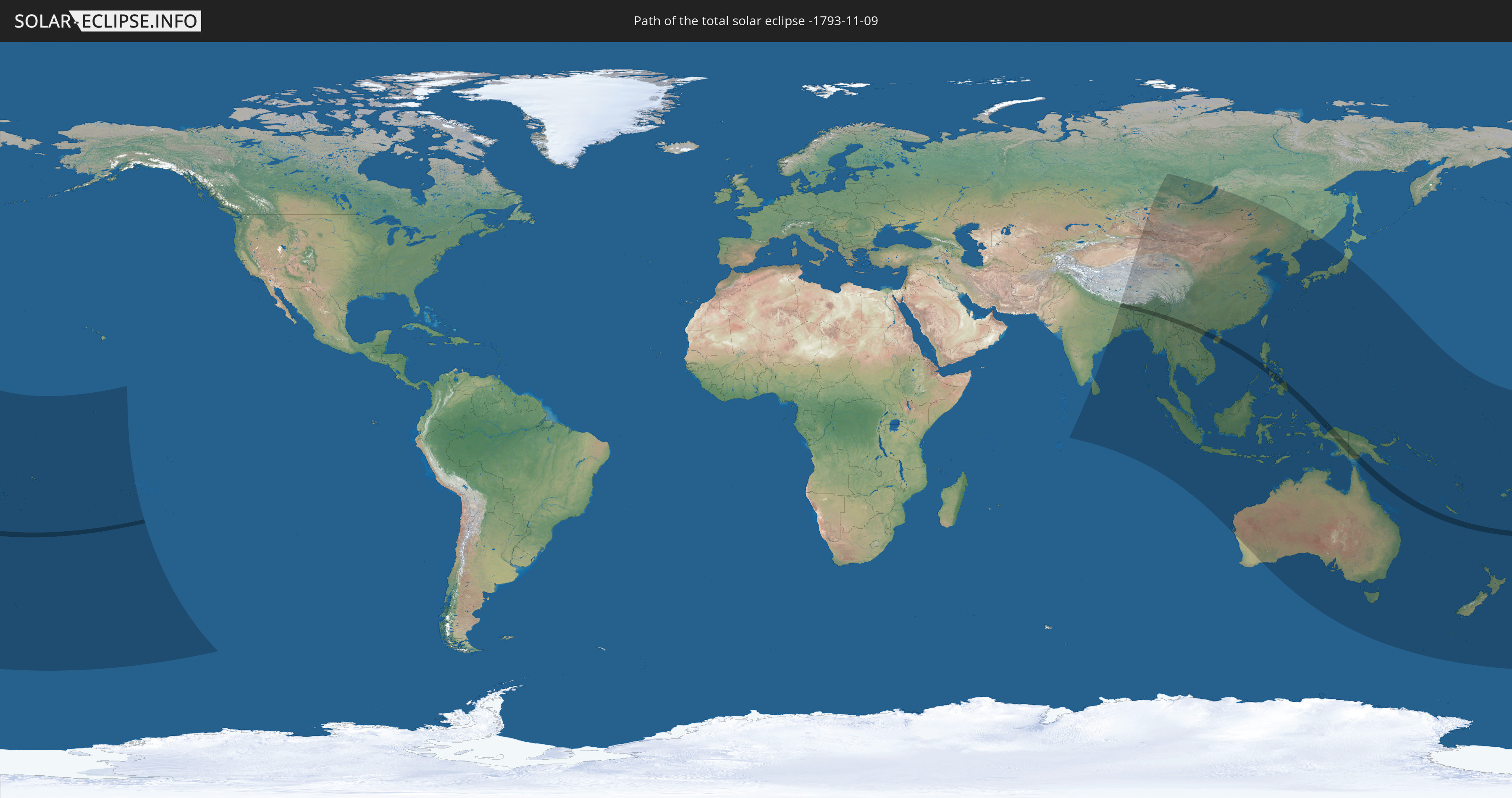
Die Sonnenfinsternis am 11/09/-1793 kann man in 52 Ländern als partielle Sonnenfinsternis beobachten.
Der Finsternispfad verläuft durch 13 Länder. Nur in diesen Ländern ist sie als total Sonnenfinsternis zu sehen.
In den folgenden Ländern ist die Sonnenfinsternis total zu sehen
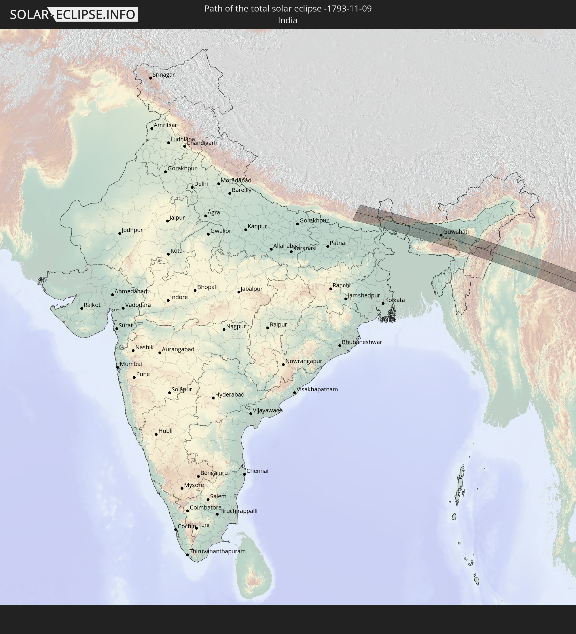 India
India
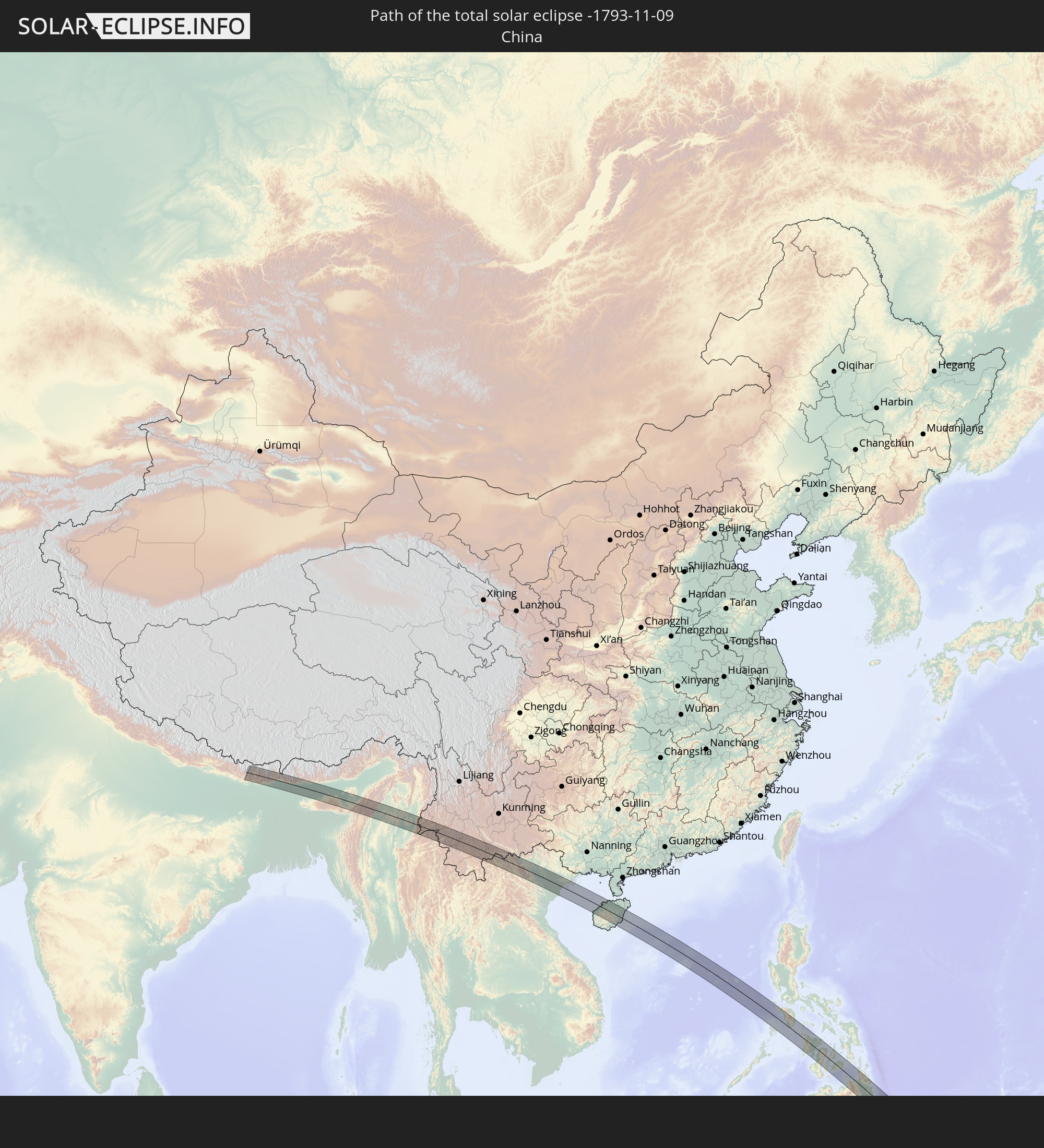 China
China
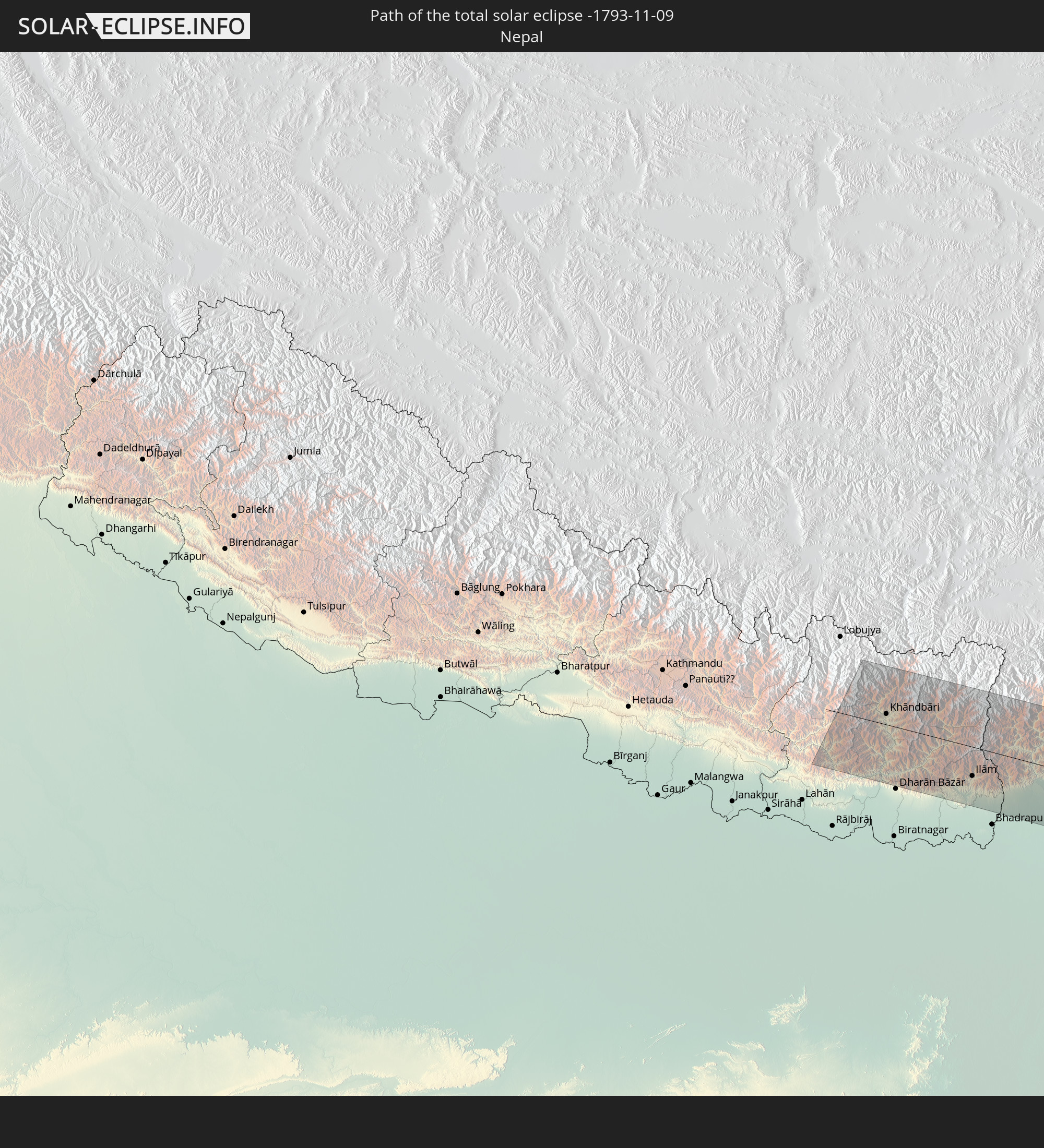 Nepal
Nepal
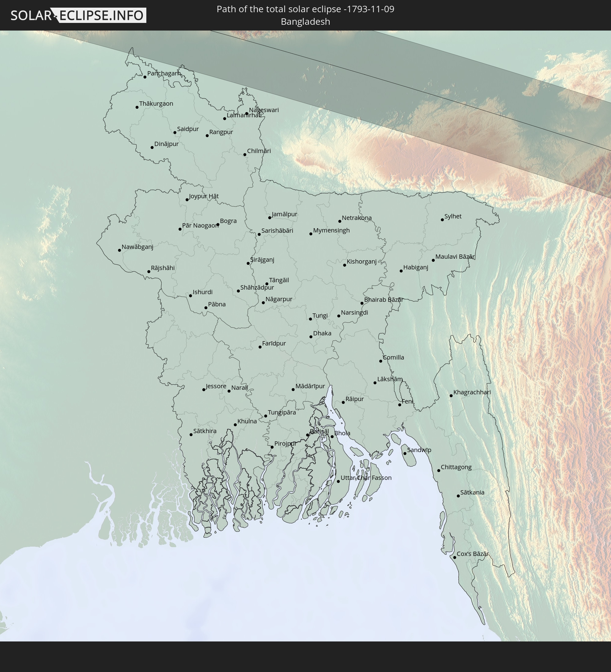 Bangladesh
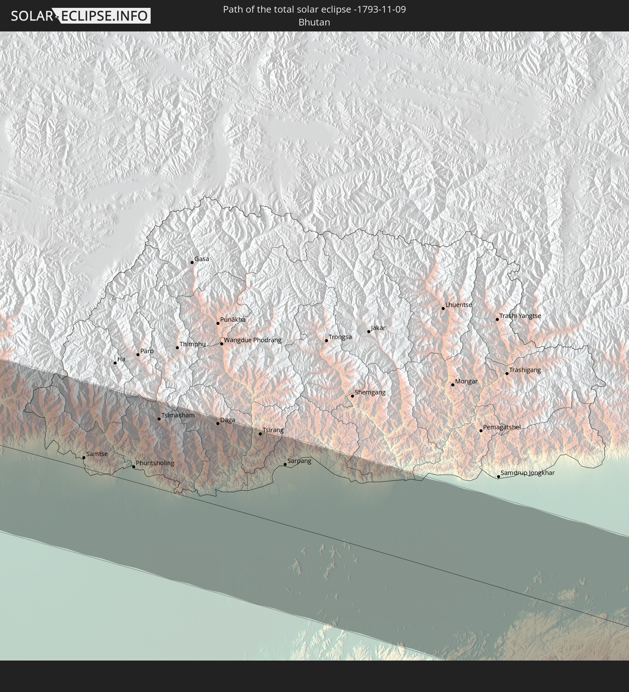 Bhutan
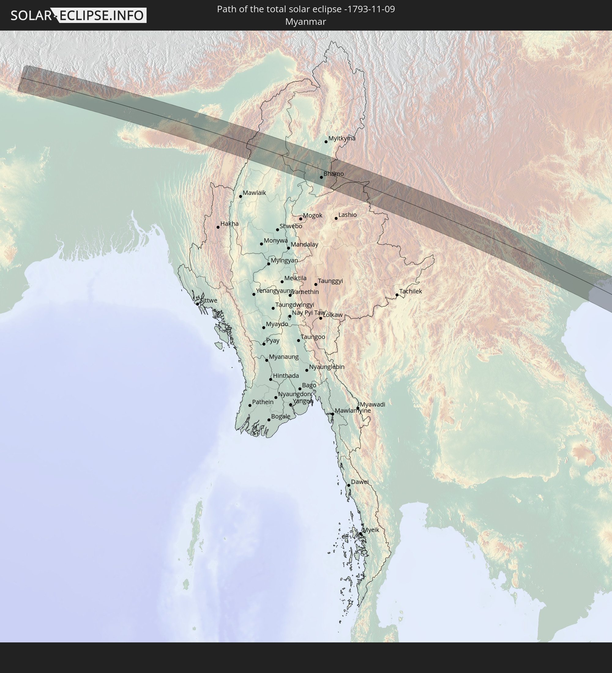 Myanmar
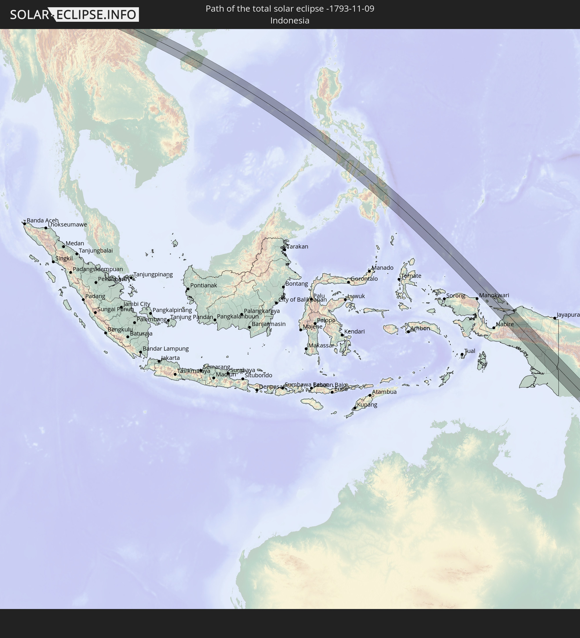 Indonesia
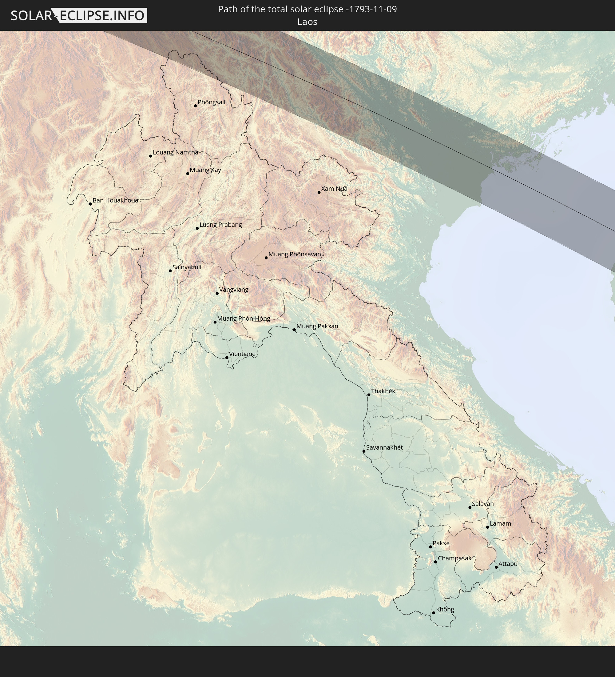 Laos
Laos
 Vietnam
 Australia
 Philippines
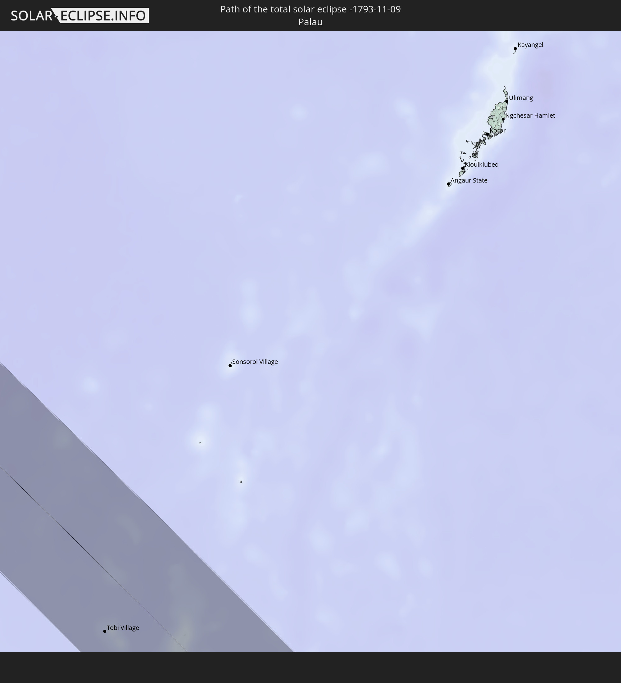 Palau
Palau
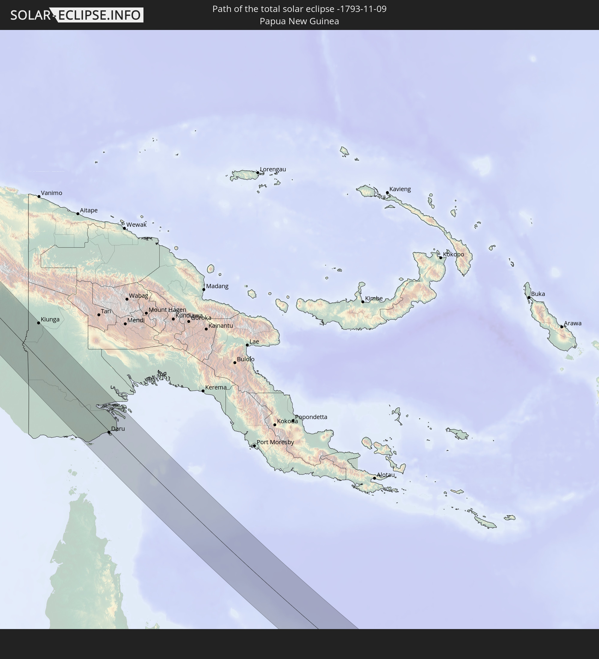 Papua New Guinea
In den folgenden Ländern ist die Sonnenfinsternis partiell zu sehen
 Russia
 Fiji
Fiji
 New Zealand
 United States Minor Outlying Islands
 Wallis and Futuna
 Tonga
Tonga
 Kiribati
 Samoa
Samoa
 Tokelau
 American Samoa
 Niue
Niue
 Cook Islands
 French Polynesia
 India
India
 China
China
 Sri Lanka
 Nepal
Nepal
 Mongolia
 Bangladesh
 Bhutan
 Myanmar
 Indonesia
 Cocos Islands
 Thailand
 Malaysia
 Laos
Laos
 Vietnam
 Cambodia
 Singapore
 Christmas Island
 Australia
 Macau
Macau
 Hong Kong
 Brunei
 Taiwan
 Philippines
 Japan
Japan
 East Timor
 North Korea
 South Korea
 Palau
Palau
 Federated States of Micronesia
 Papua New Guinea
 Guam
Guam
 Northern Mariana Islands
 Solomon Islands
 New Caledonia
 Marshall Islands
 Vanuatu
 Nauru
Nauru
 Norfolk Island
 Tuvalu
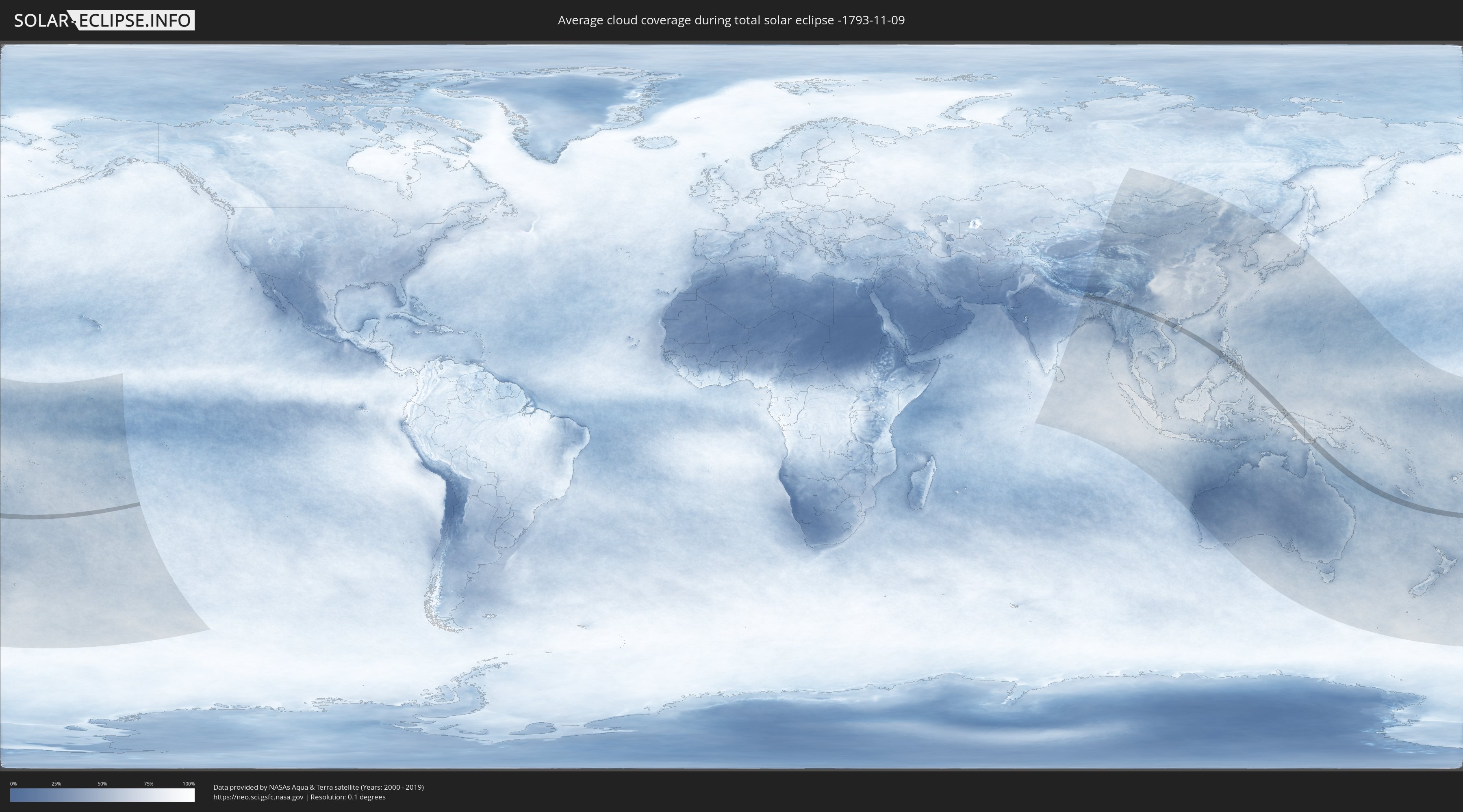
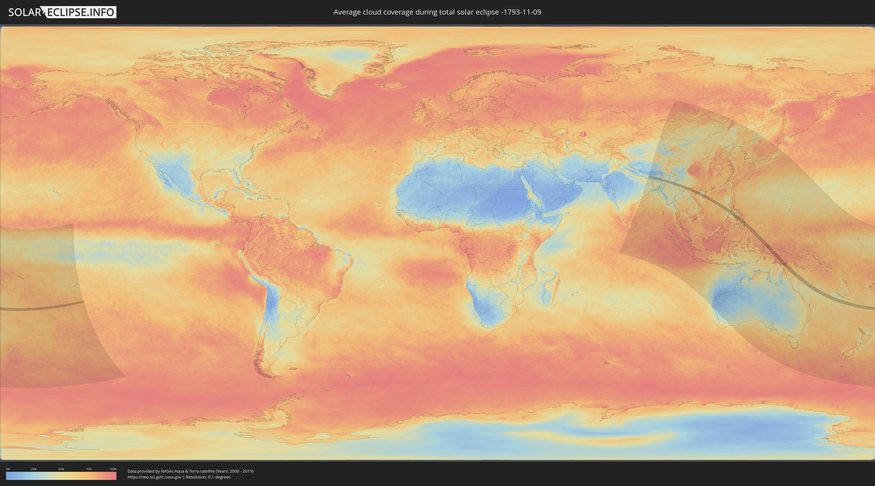
How will be the weather during the total solar eclipse on 11/09/-1793?
Where is the best place to see the total solar eclipse of 11/09/-1793?
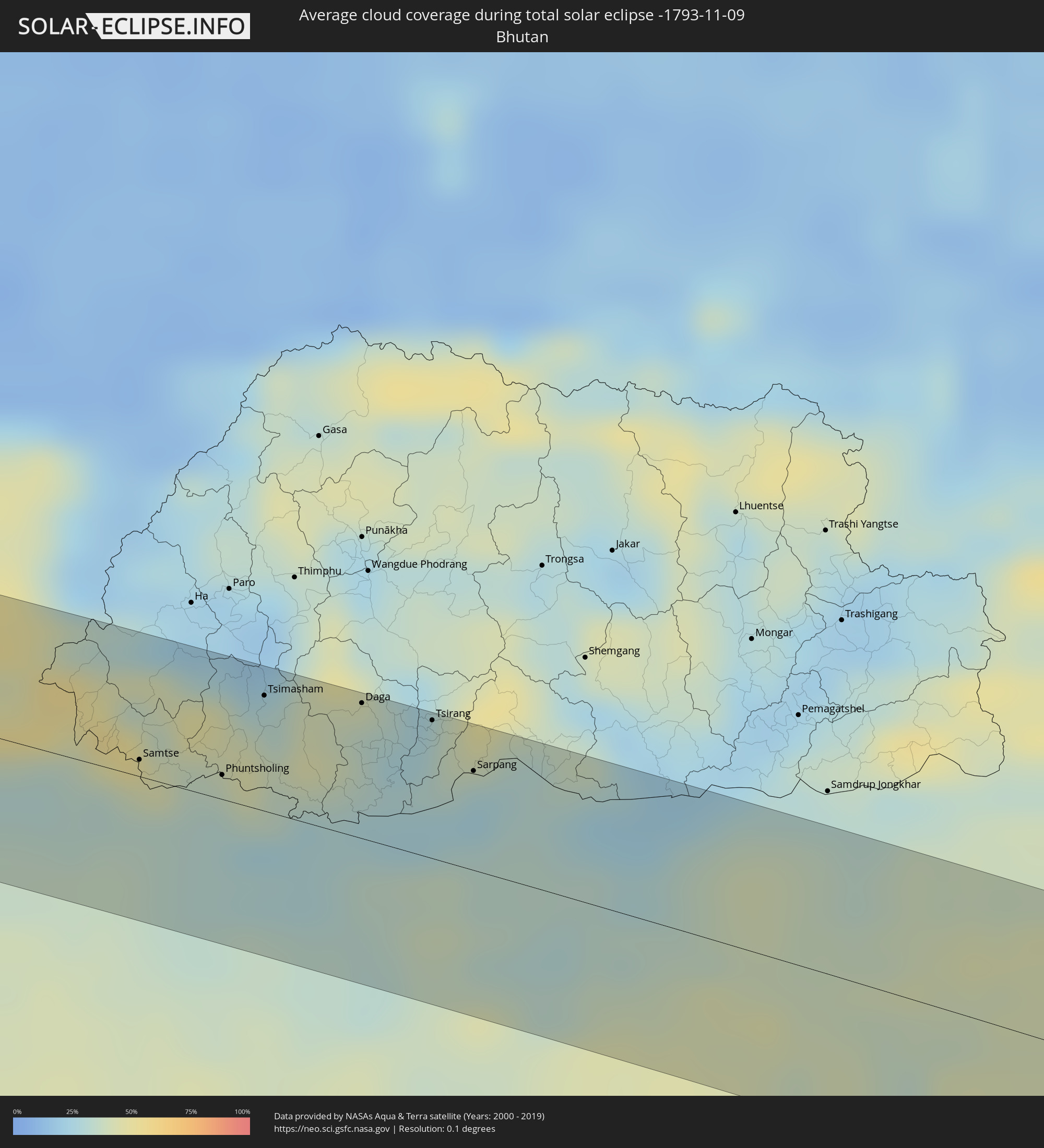
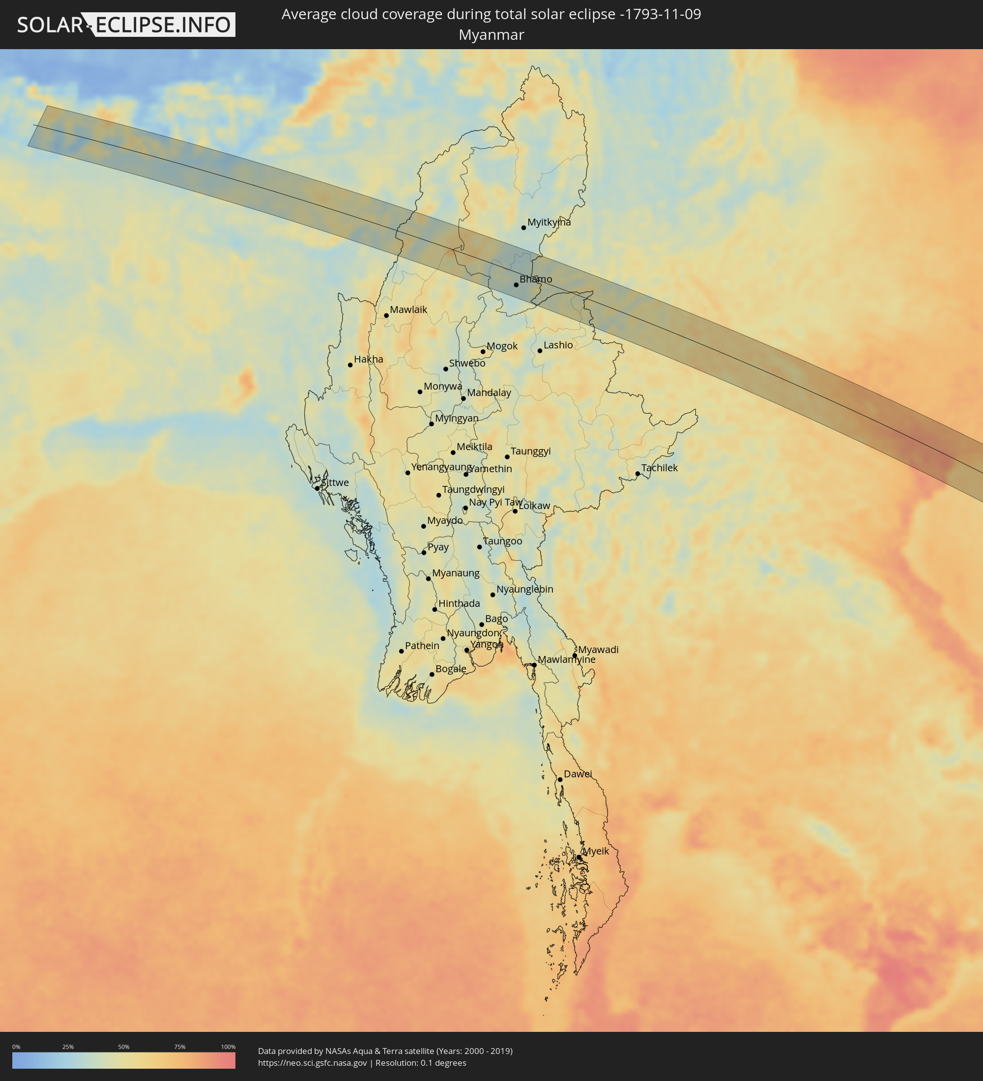
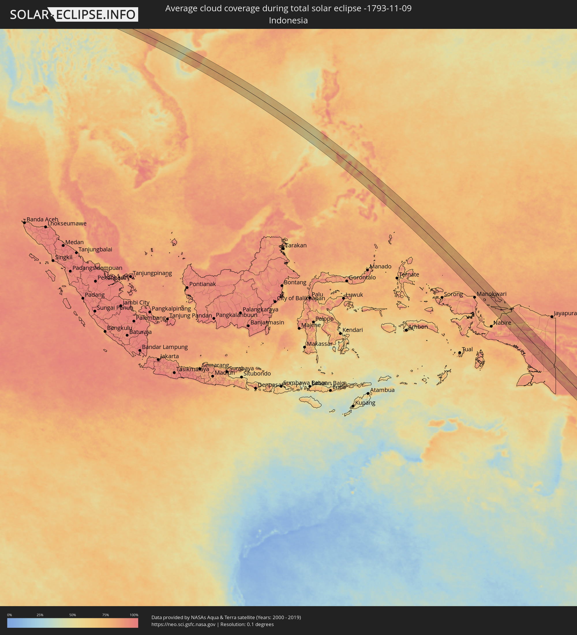
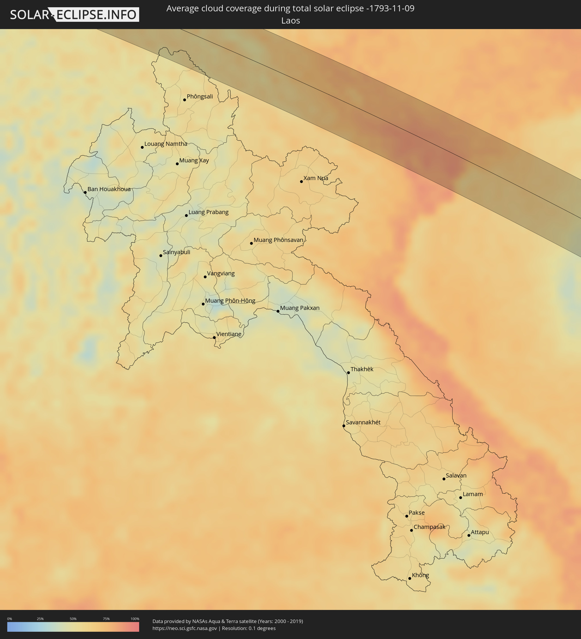
The following maps show the average cloud coverage for the day of the total solar eclipse.
With the help of these maps, it is possible to find the place along the eclipse path, which has the best
chance of a cloudless sky.
Nevertheless, you should consider local circumstances and inform about the weather of your chosen
observation site.
The data is provided by NASAs satellites
AQUA and TERRA.
The cloud maps are averaged over a period of 19 years (2000 - 2019).
Detailed country maps
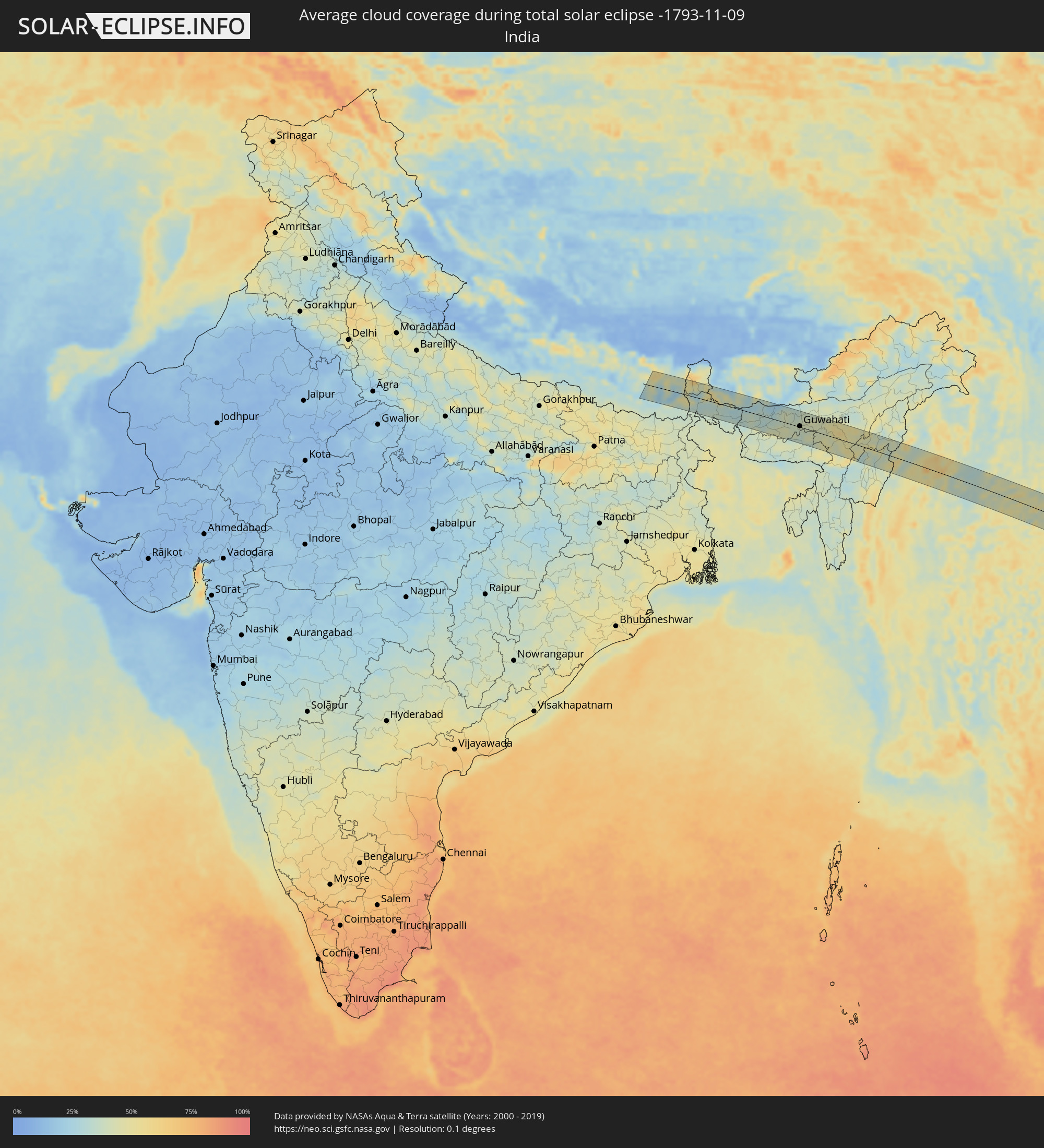 India
India
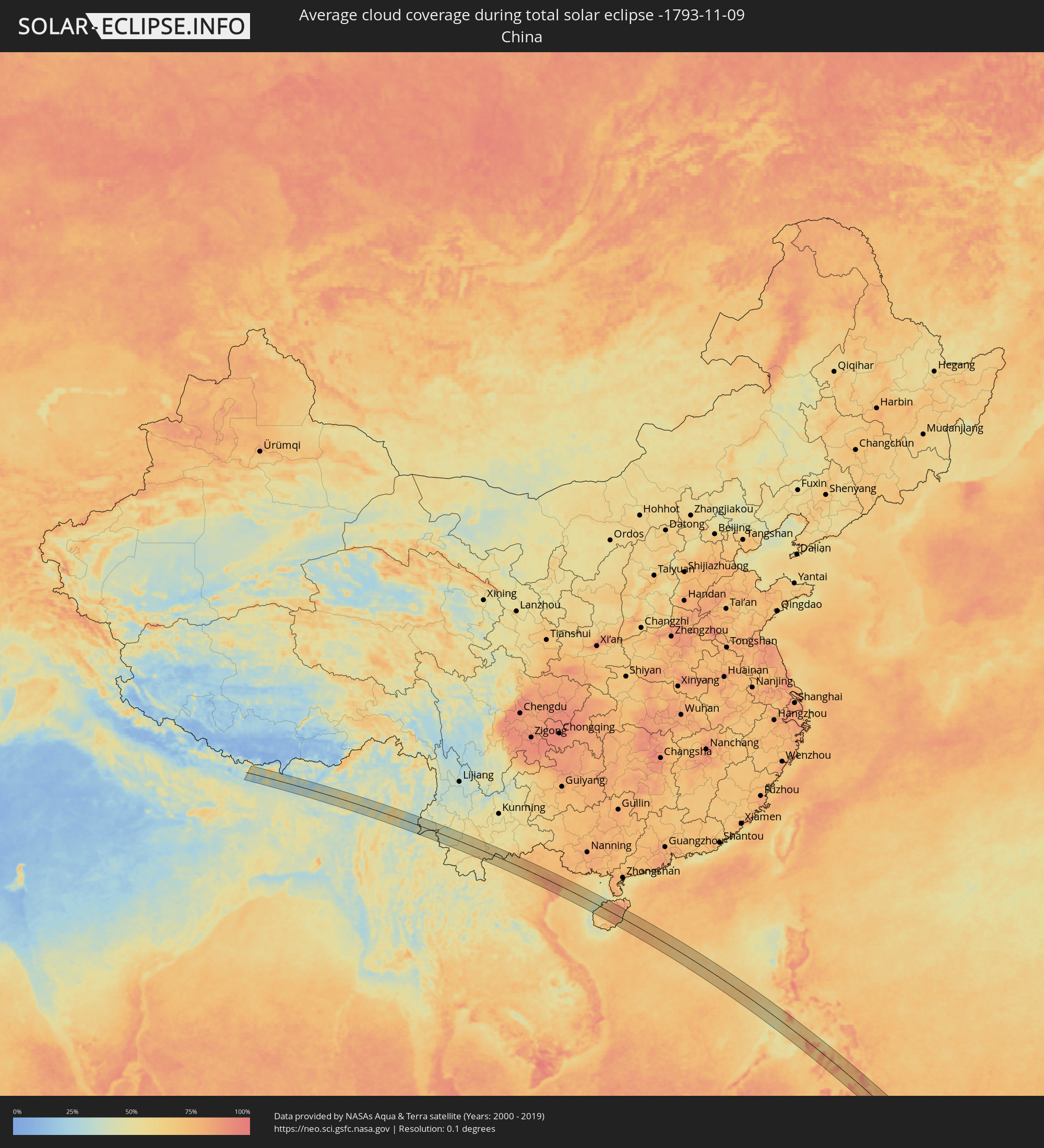 China
China
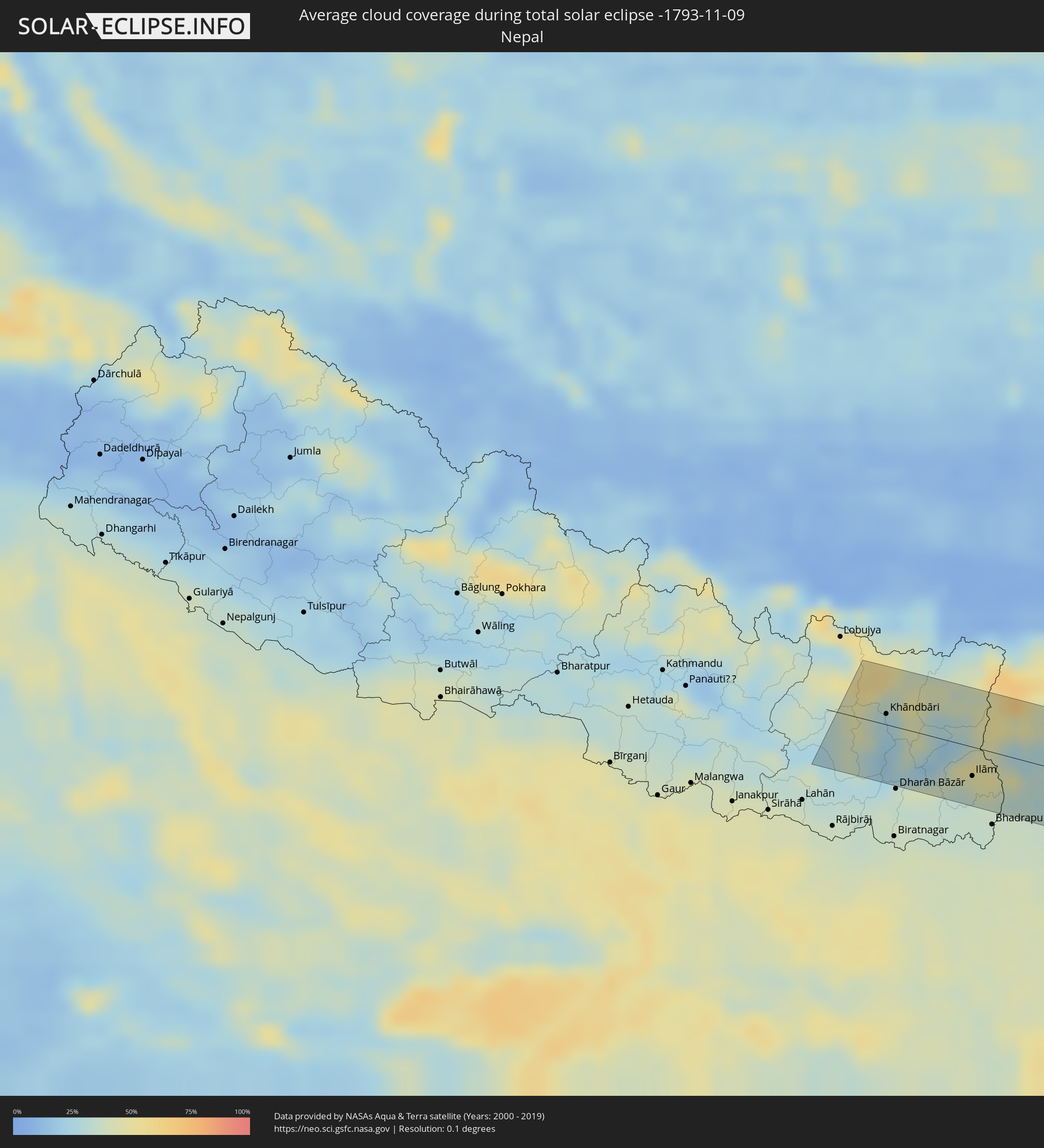 Nepal
Nepal
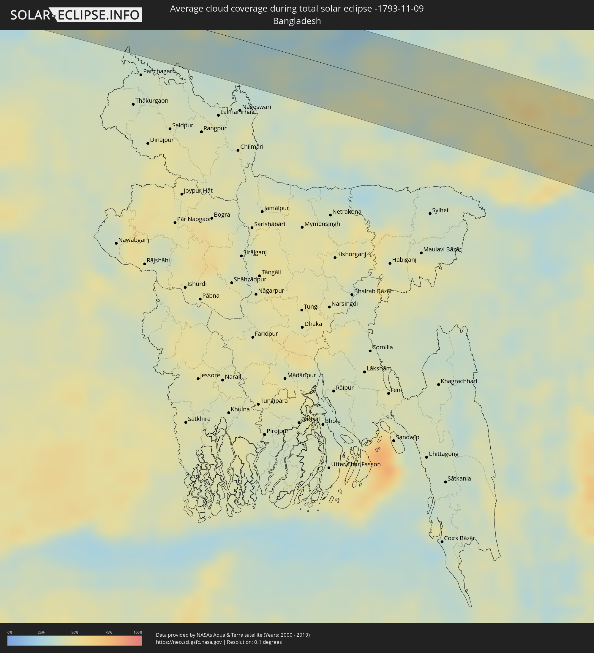 Bangladesh
 Bhutan
 Myanmar
 Indonesia
 Laos
Laos
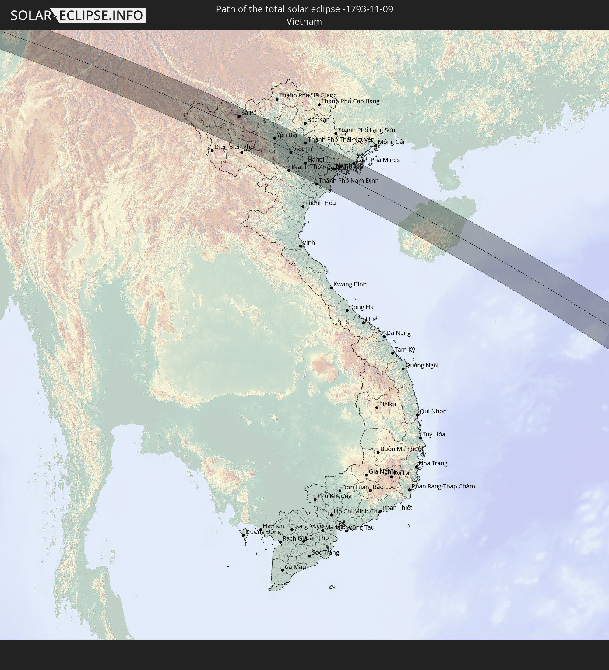
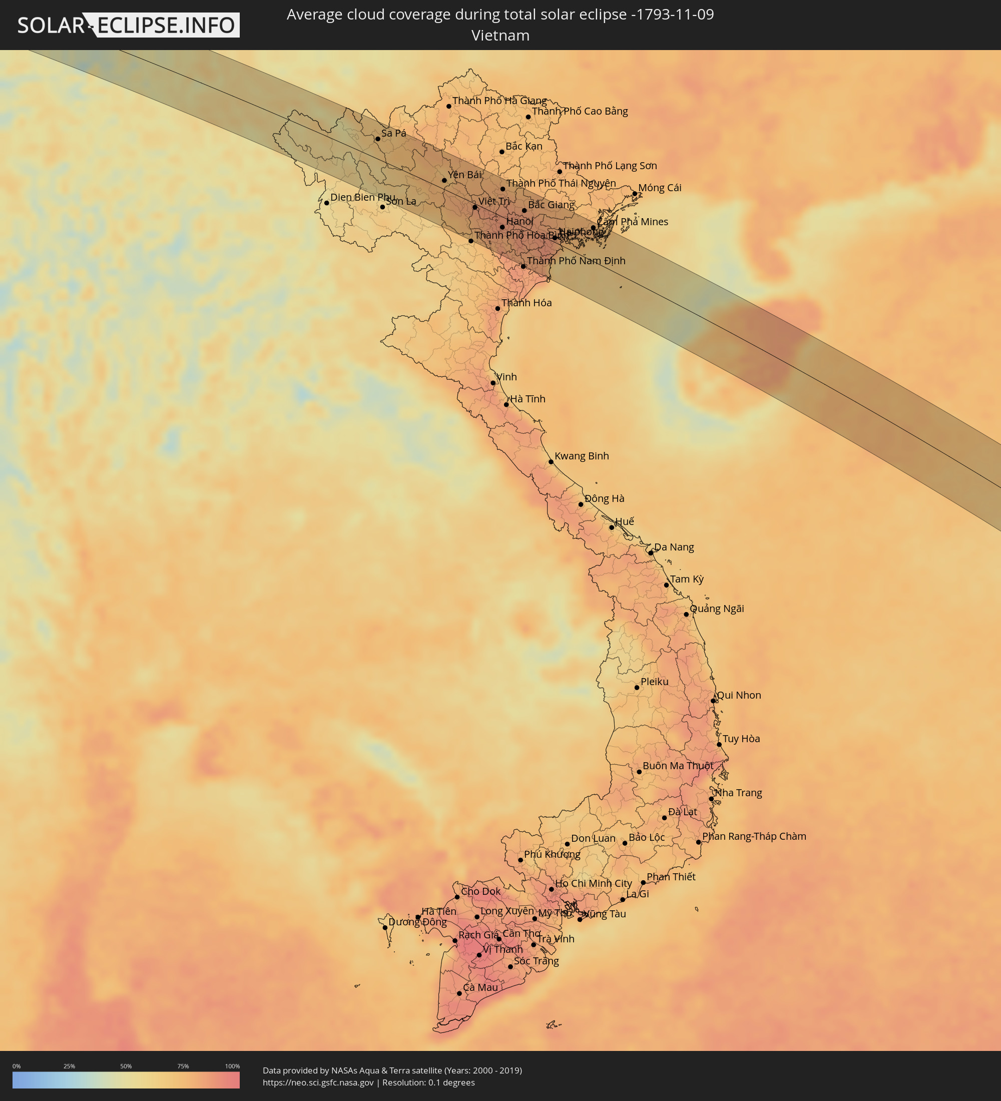 Vietnam
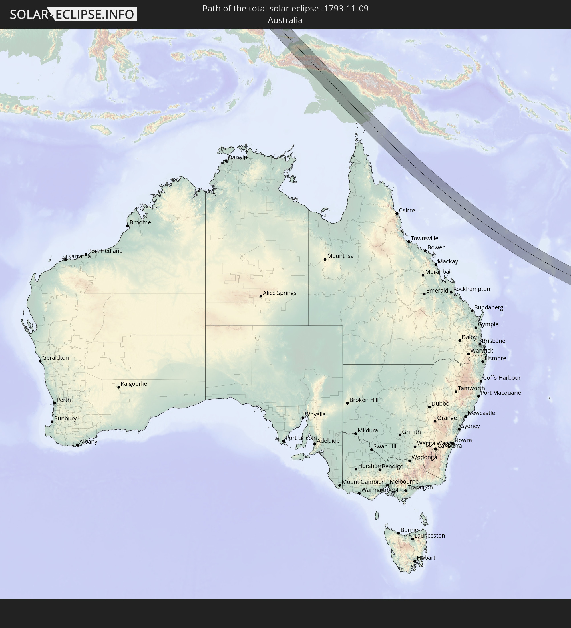
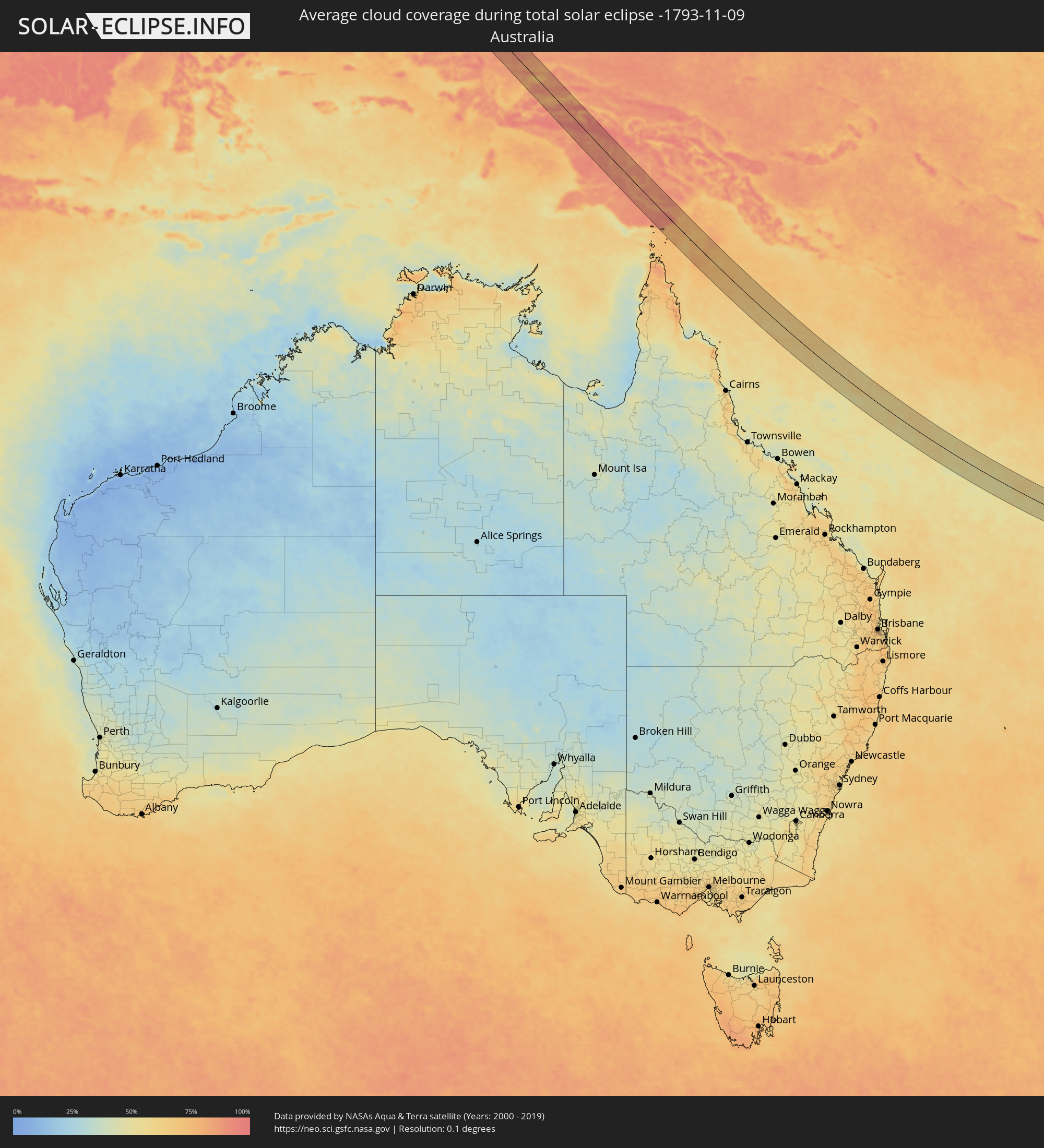 Australia
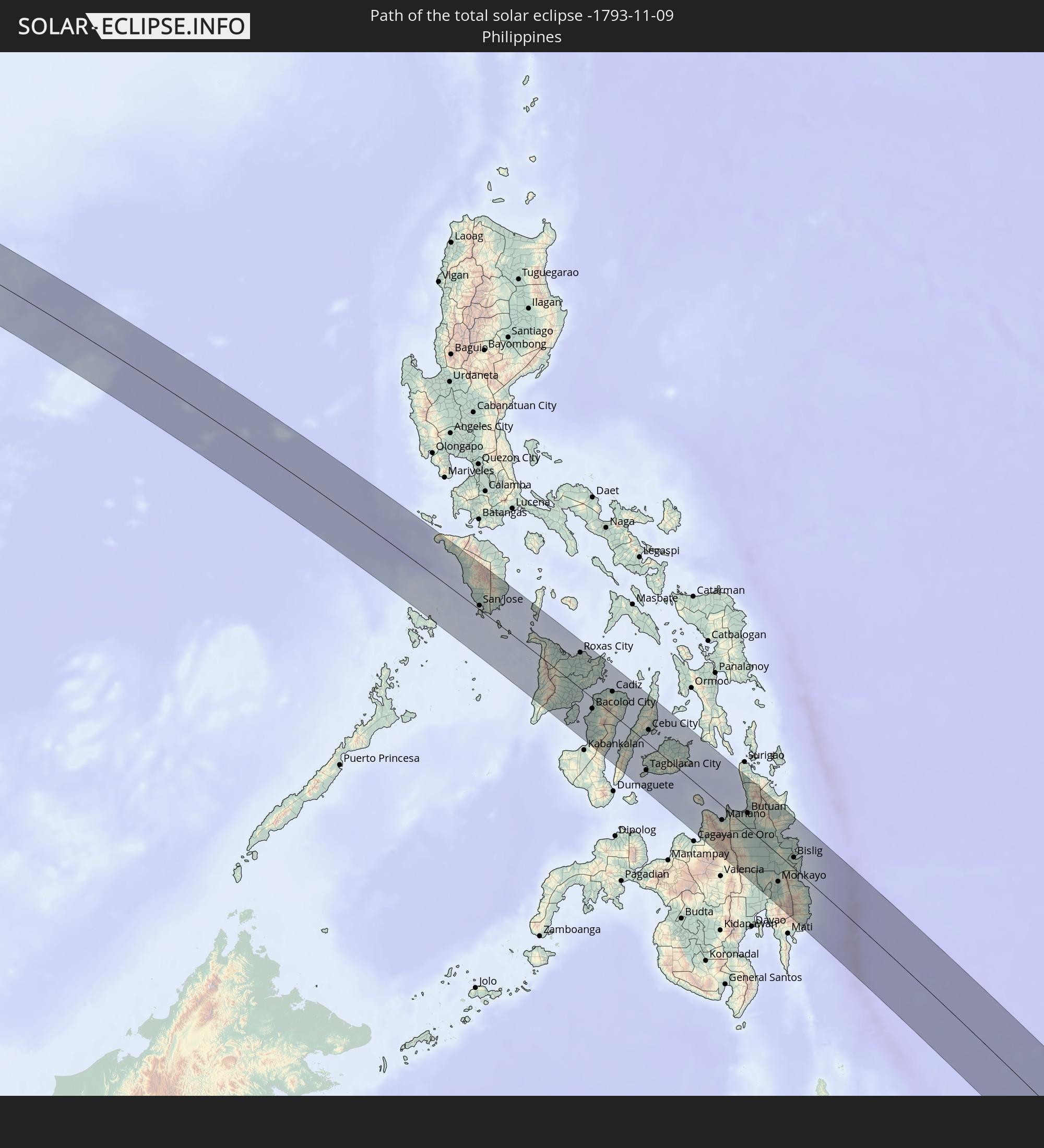
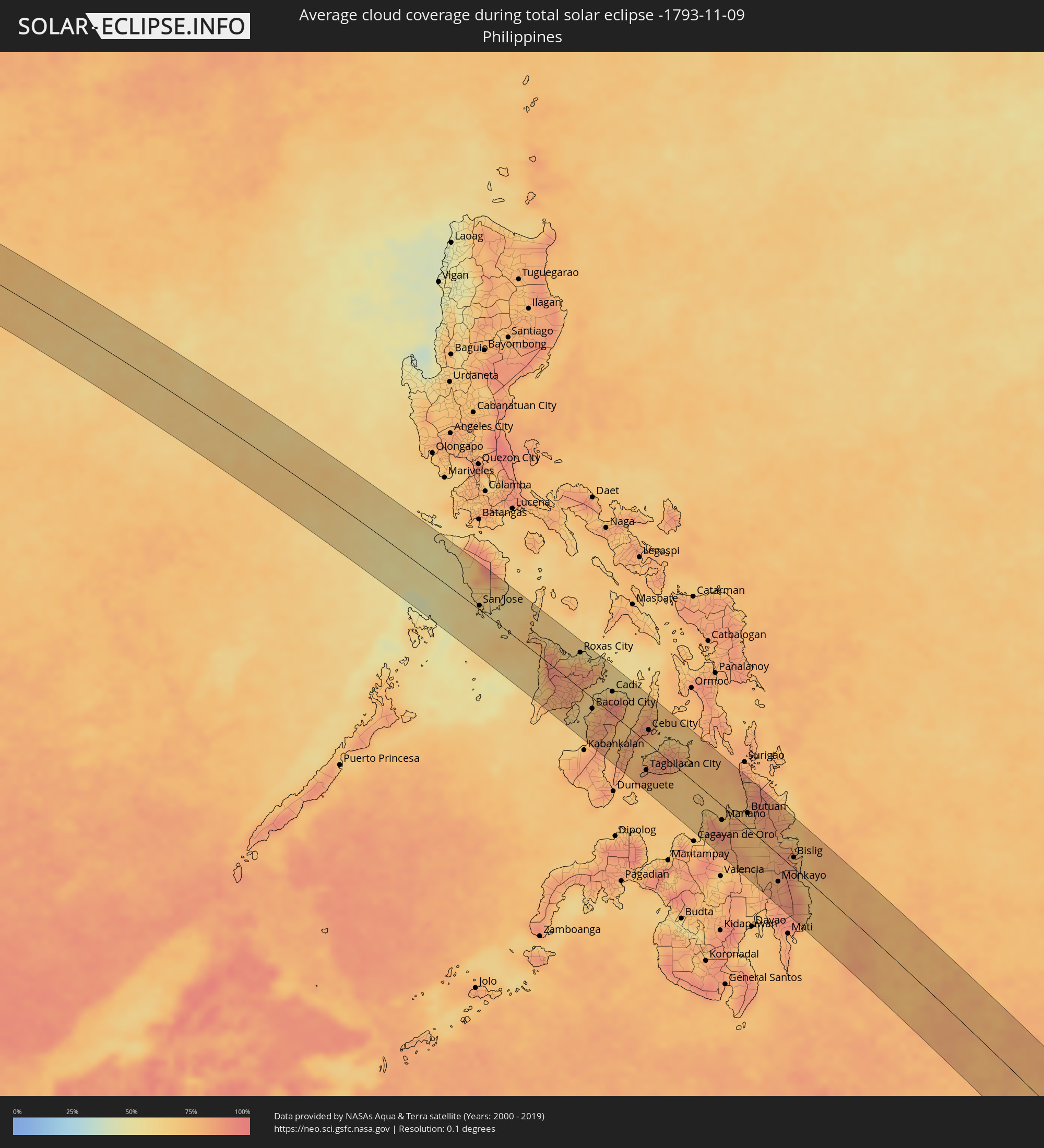 Philippines
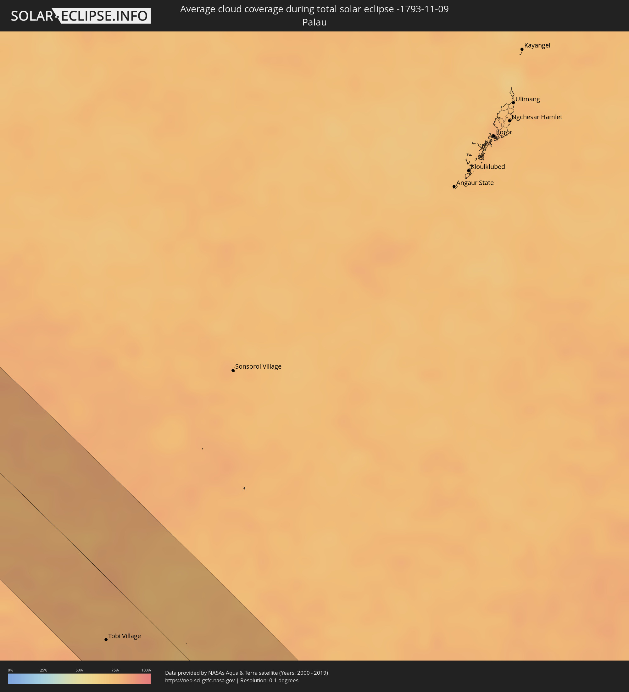 Palau
Palau
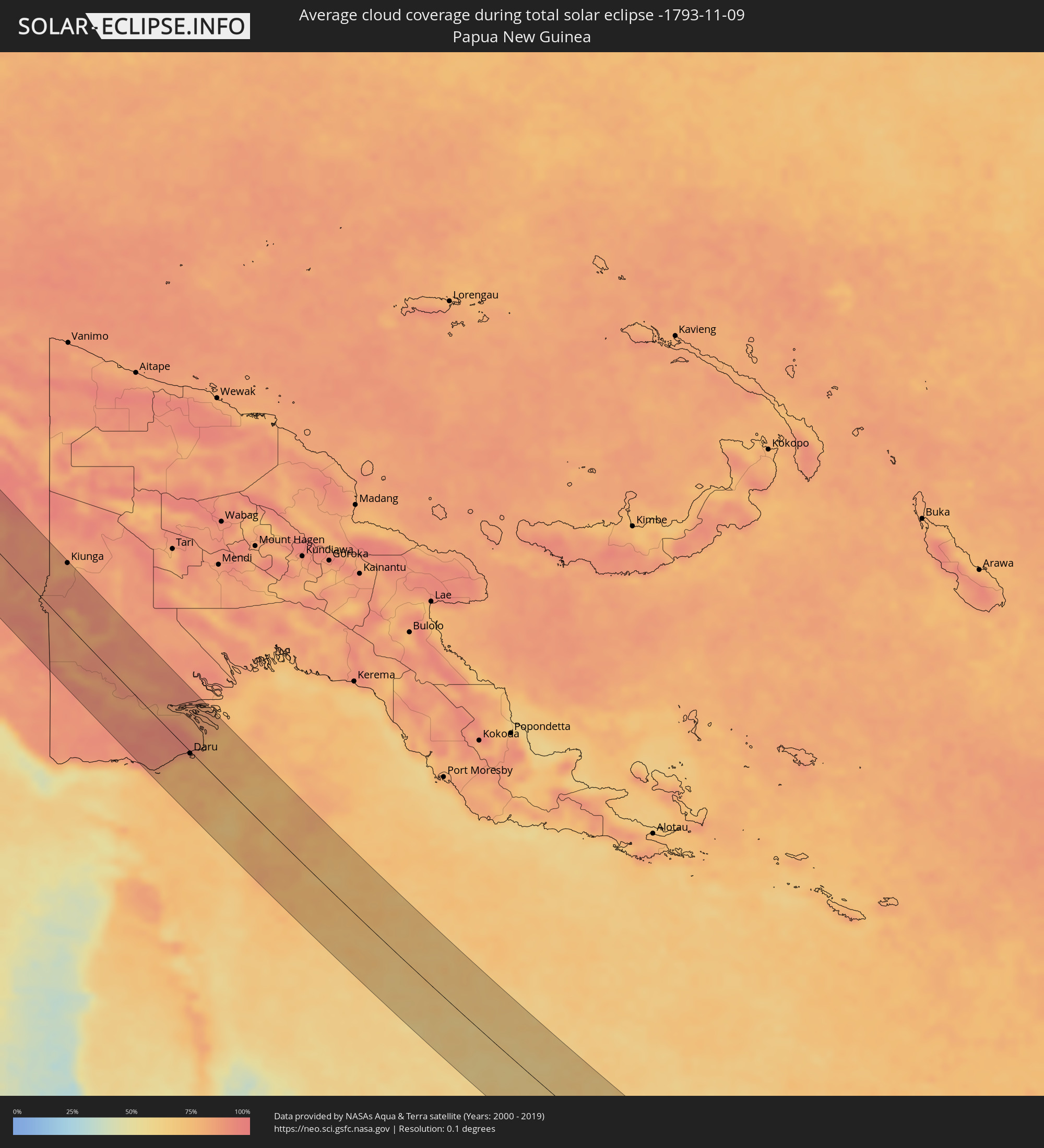 Papua New Guinea
Cities inside the path of the eclipse
The following table shows all locations with a population of more than 5,000 inside the eclipse path. Cities which have more than 100,000 inhabitants are marked bold. A click at the locations opens a detailed map.
| City | Type | Eclipse duration | Local time of max. eclipse | Distance to central line | Ø Cloud coverage |
|
Khāndbāri, Eastern Region
|
total | - | 06:12:07 UTC+05:41 | 9 km | 27% |
|
Dhankutā, Eastern Region
|
total | - | 06:12:10 UTC+05:41 | 30 km | 26% |
|
Ilām, Eastern Region
|
total | - | 06:12:10 UTC+05:41 | 24 km | 36% |
|
Naksalbāri, West Bengal
|
total | - | 05:52:06 UTC+05:21 | 40 km | 35% |
|
Dārjiling, West Bengal
|
total | - | 05:52:03 UTC+05:21 | 2 km | 45% |
|
Kārsiyāng, West Bengal
|
total | - | 05:52:05 UTC+05:21 | 18 km | 38% |
|
Shiliguri, West Bengal
|
total | - | 05:52:06 UTC+05:21 | 32 km | 34% |
|
Kālimpong, West Bengal
|
total | - | 05:52:03 UTC+05:21 | 8 km | 31% |
|
Gangtok, Sikkim
|
total | - | 05:52:01 UTC+05:21 | 39 km | 36% |
|
Jalpāiguri, West Bengal
|
total | - | 05:52:08 UTC+05:21 | 45 km | 40% |
|
Goyerkāta, West Bengal
|
total | - | 05:52:07 UTC+05:21 | 18 km | 34% |
|
Samtse, Samchi
|
total | - | 06:29:31 UTC+05:58 | 6 km | 40% |
|
Jaigaon, West Bengal
|
total | - | 05:52:06 UTC+05:21 | 7 km | 31% |
|
Phuntsholing, Chukha District
|
total | - | 05:52:06 UTC+05:21 | 8 km | 36% |
|
Koch Bihār, West Bengal
|
total | - | 05:52:12 UTC+05:21 | 47 km | 36% |
|
Tsimasham, Chukha District
|
total | - | 06:29:31 UTC+05:58 | 39 km | 40% |
|
Daga, Dagana District
|
total | - | 06:29:32 UTC+05:58 | 45 km | 34% |
|
Tsirang, Chirang
|
total | - | 06:29:33 UTC+05:58 | 46 km | 29% |
|
Bilāsipāra, Assam
|
total | - | 05:52:15 UTC+05:21 | 35 km | 40% |
|
Sarpang, Geylegphug
|
total | - | 06:29:35 UTC+05:58 | 33 km | 29% |
|
Kokrajhar, Assam
|
total | - | 05:52:13 UTC+05:21 | 16 km | 33% |
|
Bongaigaon, Assam
|
total | - | 05:52:14 UTC+05:21 | 0 km | 30% |
|
Goālpāra, Assam
|
total | - | 05:52:17 UTC+05:21 | 30 km | 35% |
|
Barpeta Road, Assam
|
total | - | 05:52:15 UTC+05:21 | 14 km | 34% |
|
Barpeta, Assam
|
total | - | 05:52:17 UTC+05:21 | 4 km | 40% |
|
Rangia, Assam
|
total | - | 05:52:19 UTC+05:21 | 27 km | 37% |
|
Guwahati, Assam
|
total | - | 05:52:22 UTC+05:21 | 2 km | 38% |
|
Hojāi, Assam
|
total | - | 05:52:31 UTC+05:21 | 16 km | 52% |
|
Lumding Railway Colony, Assam
|
total | - | 05:52:37 UTC+05:21 | 2 km | 50% |
|
Diphu, Assam
|
total | - | 05:52:38 UTC+05:21 | 16 km | 44% |
|
Dimāpur, Nagaland
|
total | - | 05:52:39 UTC+05:21 | 32 km | 47% |
|
Kohima, Nagaland
|
total | - | 05:52:46 UTC+05:21 | 19 km | 48% |
|
Bhamo, Kachin
|
total | - | 06:57:22 UTC+06:24 | 27 km | 34% |
|
Lai Châu, Lai Châu
|
total | - | 07:41:57 UTC+07:06 | 19 km | 60% |
|
Sa Pá, Lào Cai
|
total | - | 07:42:08 UTC+07:06 | 30 km | 67% |
|
Lào Cai, Lào Cai
|
total | - | 07:42:07 UTC+07:06 | 50 km | 68% |
|
Yên Bái, Yên Bái
|
total | - | 07:42:54 UTC+07:06 | 13 km | 78% |
|
Thành Phố Tuyên Quang, Tuyên Quang
|
total | - | 07:42:59 UTC+07:06 | 36 km | 78% |
|
Việt Trì, Phú Thọ
|
total | - | 07:43:20 UTC+07:06 | 6 km | 83% |
|
Sơn Tây, Ha Nội
|
total | - | 07:43:29 UTC+07:06 | 19 km | 79% |
|
Vĩnh Yên, Vĩnh Phúc
|
total | - | 07:43:26 UTC+07:06 | 2 km | 87% |
|
Hà Đông, Ha Nội
|
total | - | 07:43:42 UTC+07:06 | 24 km | 82% |
|
Hanoi, Ha Nội
|
total | - | 07:43:42 UTC+07:06 | 16 km | 82% |
|
Thành Phố Thái Nguyên, Thái Nguyên
|
total | - | 07:43:24 UTC+07:06 | 41 km | 81% |
|
Hưng Yên, Hưng Yên
|
total | - | 07:44:01 UTC+07:06 | 45 km | 84% |
|
Bắc Ninh, Bắc Ninh
|
total | - | 07:43:44 UTC+07:06 | 11 km | 85% |
|
Bắc Giang, Bắc Giang
|
total | - | 07:43:44 UTC+07:06 | 25 km | 85% |
|
Thành Phố Hải Dương, Hải Dương
|
total | - | 07:43:59 UTC+07:06 | 2 km | 84% |
|
Thành Phố Thái Bình, Thái Bình
|
total | - | 07:44:16 UTC+07:06 | 51 km | 83% |
|
Haiphong, Hải Phòng
|
total | - | 07:44:13 UTC+07:06 | 6 km | 81% |
|
Thành Phố Uông Bí, Quảng Ninh
|
total | - | 07:44:10 UTC+07:06 | 27 km | 79% |
|
Cát Bà, Hải Phòng
|
total | - | 07:44:29 UTC+07:06 | 9 km | 62% |
|
Thành Phố Hạ Long, Quảng Ninh
|
total | - | 07:44:22 UTC+07:06 | 33 km | 74% |
|
Cẩm Phả Mines, Quảng Ninh
|
total | - | 07:44:27 UTC+07:06 | 50 km | 74% |
|
Lincheng, Hainan
|
total | - | 08:39:47 UTC+08:00 | 55 km | 77% |
|
Jinjiang, Hainan
|
total | - | 08:40:06 UTC+08:00 | 53 km | 82% |
|
Wanning, Hainan
|
total | - | 08:40:58 UTC+08:00 | 18 km | 74% |
|
San Jose, Mimaropa
|
total | - | 08:55:53 UTC+08:00 | 6 km | 61% |
|
Kalibo (poblacion), Western Visayas
|
total | - | 08:58:02 UTC+08:00 | 35 km | 68% |
|
Iloilo, Western Visayas
|
total | - | 08:59:30 UTC+08:00 | 39 km | 66% |
|
Passi, Western Visayas
|
total | - | 08:59:04 UTC+08:00 | 2 km | 85% |
|
Roxas City, Western Visayas
|
total | - | 08:58:36 UTC+08:00 | 51 km | 65% |
|
Bago City, Western Visayas
|
total | - | 09:00:01 UTC+08:00 | 35 km | 65% |
|
La Carlota, Western Visayas
|
total | - | 09:00:15 UTC+08:00 | 38 km | 79% |
|
Bacolod City, Western Visayas
|
total | - | 08:59:58 UTC+08:00 | 15 km | 78% |
|
Victorias, Western Visayas
|
total | - | 08:59:48 UTC+08:00 | 13 km | 78% |
|
Canlaon, Central Visayas
|
total | - | 09:00:38 UTC+08:00 | 21 km | 82% |
|
Cadiz, Western Visayas
|
total | - | 09:00:00 UTC+08:00 | 32 km | 90% |
|
Ualog, Western Visayas
|
total | - | 09:00:35 UTC+08:00 | 7 km | 79% |
|
Toledo, Central Visayas
|
total | - | 09:01:07 UTC+08:00 | 7 km | 75% |
|
Carcar, Central Visayas
|
total | - | 09:01:29 UTC+08:00 | 16 km | 79% |
|
Tagbilaran City, Central Visayas
|
total | - | 09:02:19 UTC+08:00 | 40 km | 83% |
|
Cebu City, Central Visayas
|
total | - | 09:01:29 UTC+08:00 | 20 km | 78% |
|
Danao, Central Visayas
|
total | - | 09:01:23 UTC+08:00 | 47 km | 70% |
|
Mariano, Northern Mindanao
|
total | - | 09:04:56 UTC+08:00 | 20 km | 79% |
|
Butuan, Caraga
|
total | - | 09:05:18 UTC+08:00 | 21 km | 76% |
|
Bayugan, Caraga
|
total | - | 09:05:50 UTC+08:00 | 20 km | 87% |
|
Monkayo, Davao
|
total | - | 09:07:32 UTC+08:00 | 38 km | 84% |
|
Compostela, Davao
|
total | - | 09:07:47 UTC+08:00 | 47 km | 83% |
|
Bislig, Caraga
|
total | - | 09:07:18 UTC+08:00 | 15 km | 78% |
|
Tobi Village, Hatohobei
|
total | - | 10:22:05 UTC+09:00 | 43 km | 79% |
|
Kiunga, Western Province
|
total | - | 11:56:27 UTC+10:00 | 74 km | 81% |
|
Daru, Western Province
|
total | - | 12:06:00 UTC+10:00 | 3 km | 77% |