Totale Sonnenfinsternis vom 12.07.-1991
| Wochentag: | Freitag |
| Maximale Dauer der Verfinsterung: | 05m50s |
| Maximale Breite des Finsternispfades: | 205 km |
| Saroszyklus: | 14 |
| Bedeckungsgrad: | 100% |
| Magnitude: | 1.0606 |
| Gamma: | -0.2421 |
Wo kann man die Sonnenfinsternis vom 12.07.-1991 sehen?
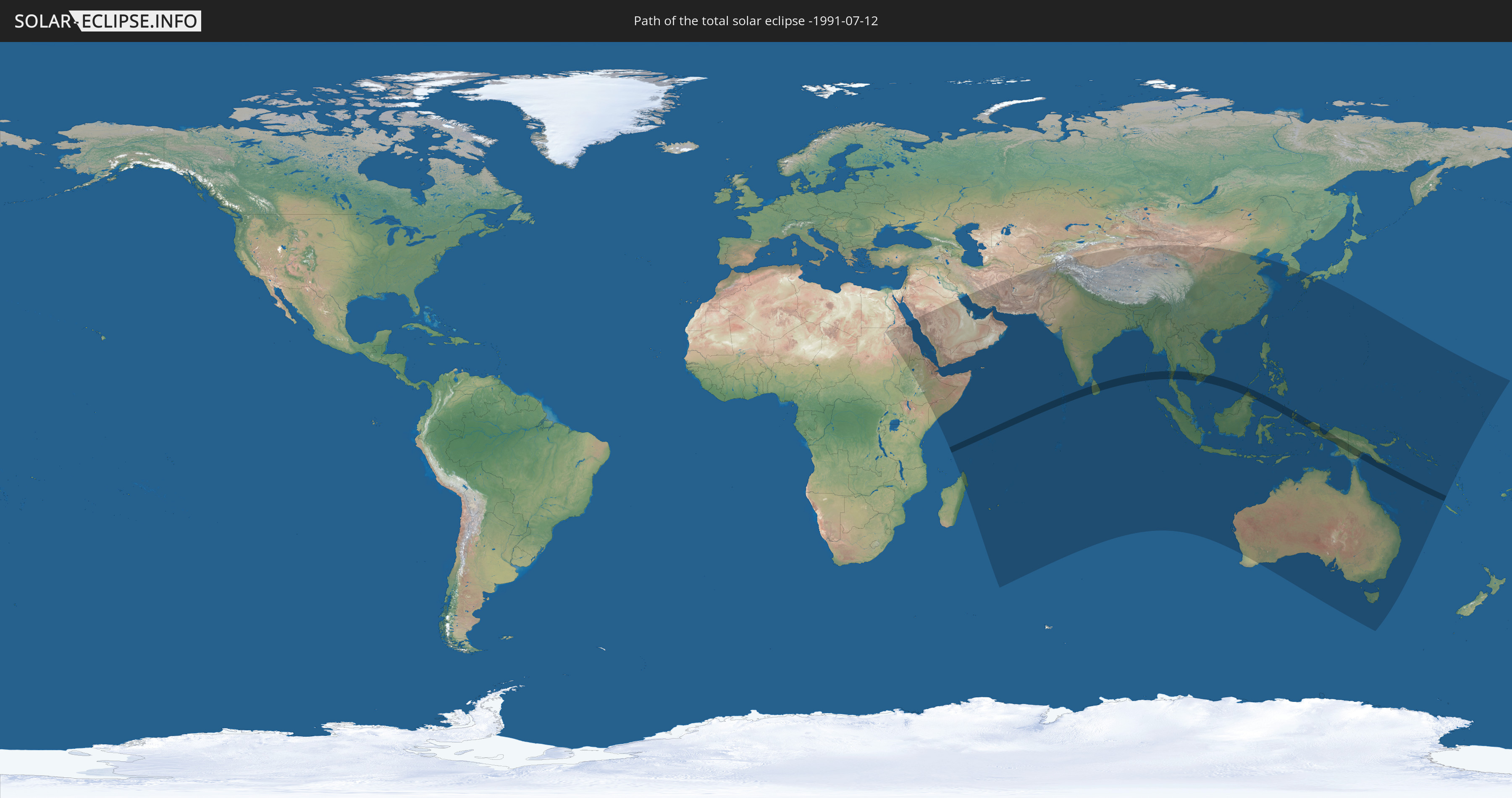
Die Sonnenfinsternis am 12.07.-1991 kann man in 61 Ländern als partielle Sonnenfinsternis beobachten.
Der Finsternispfad verläuft durch 13 Länder. Nur in diesen Ländern ist sie als totale Sonnenfinsternis zu sehen.
In den folgenden Ländern ist die Sonnenfinsternis total zu sehen
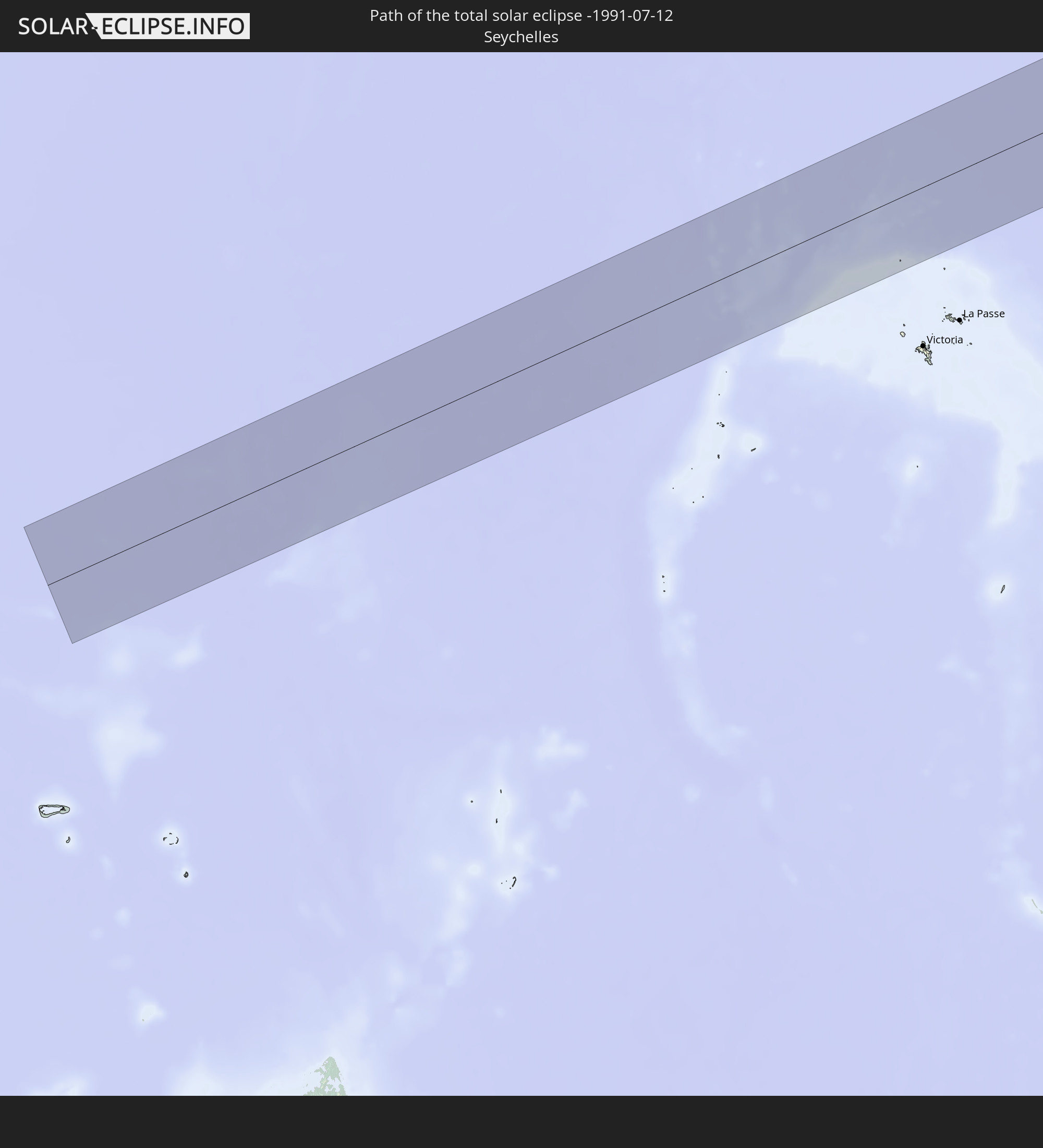 Seychellen
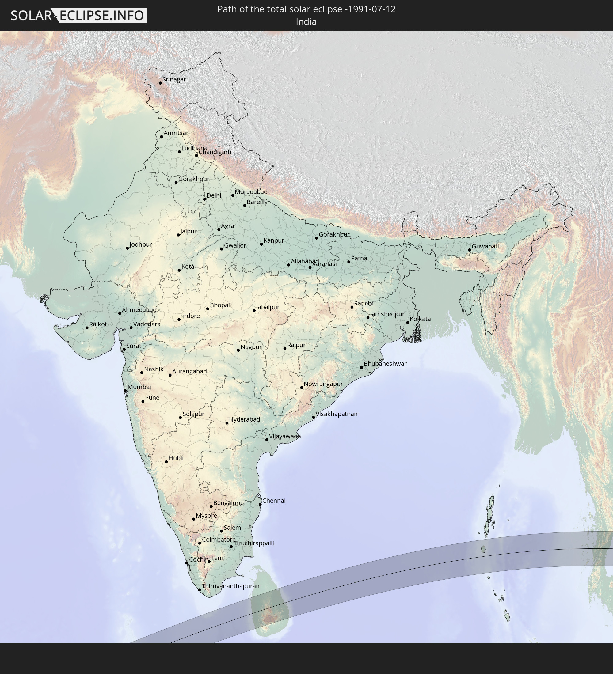 Indien
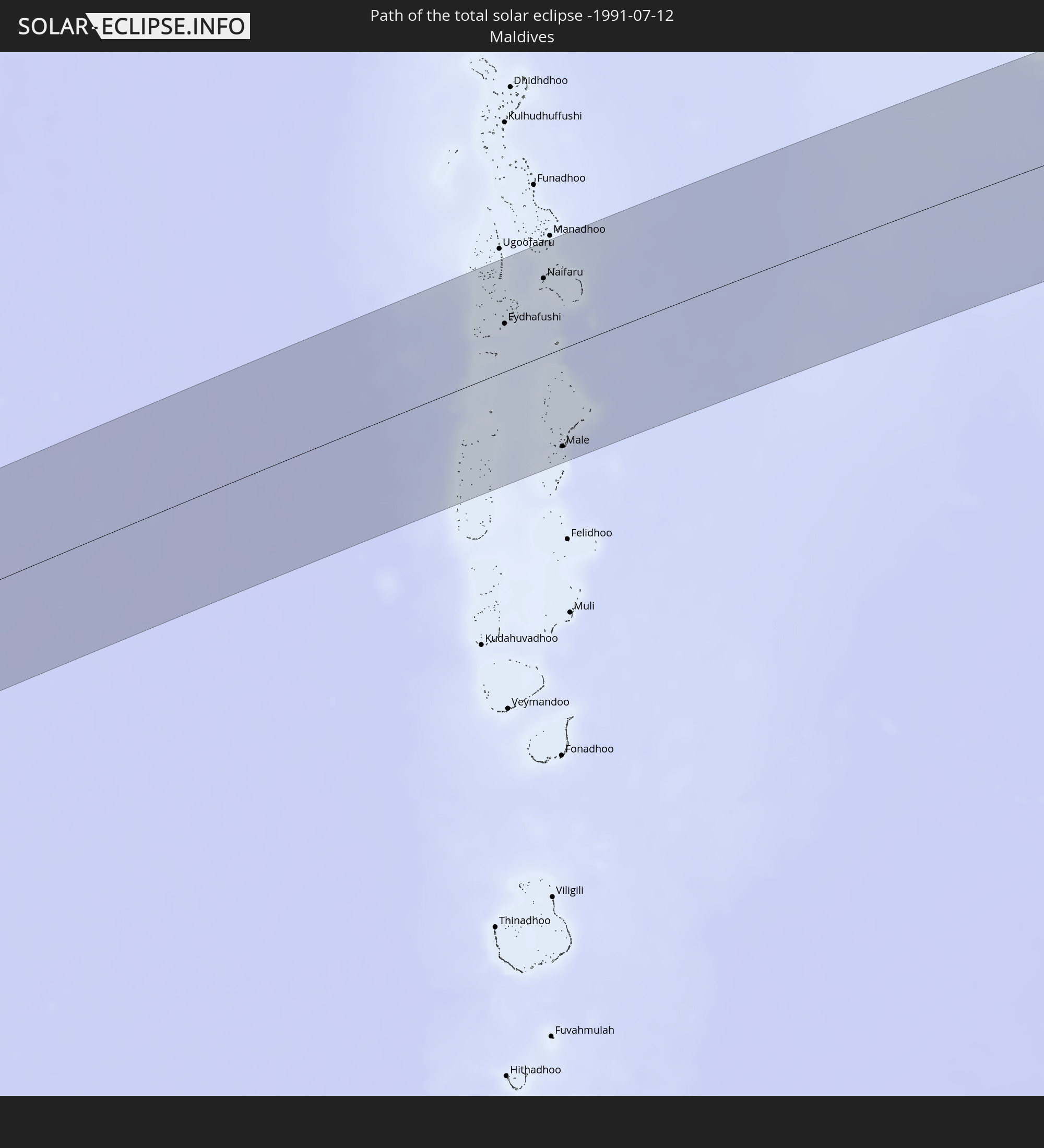 Malediven
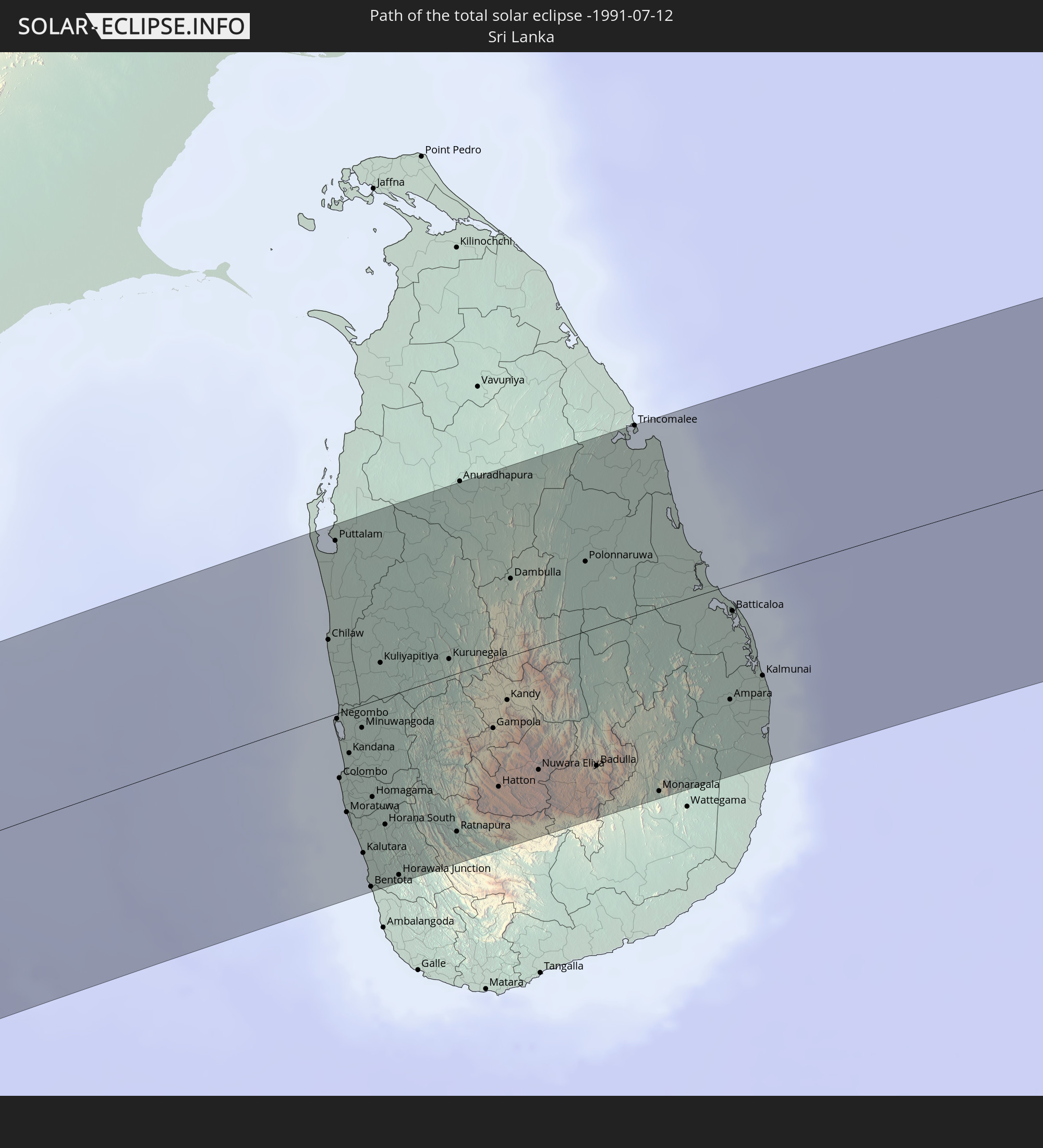 Sri Lanka
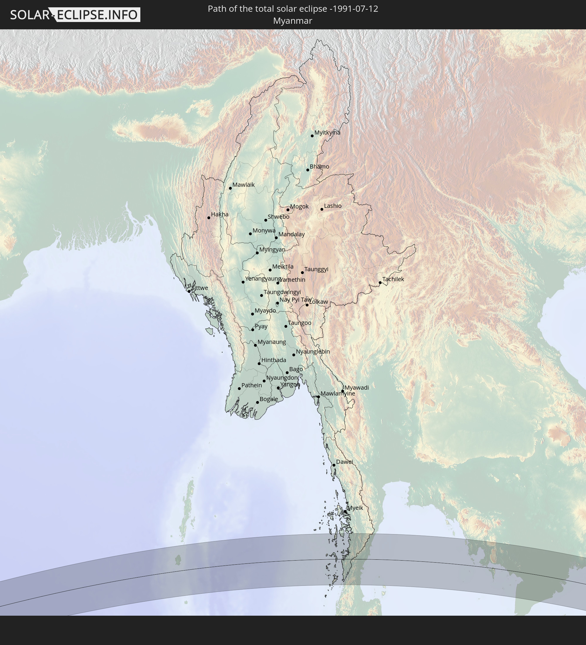 Myanmar
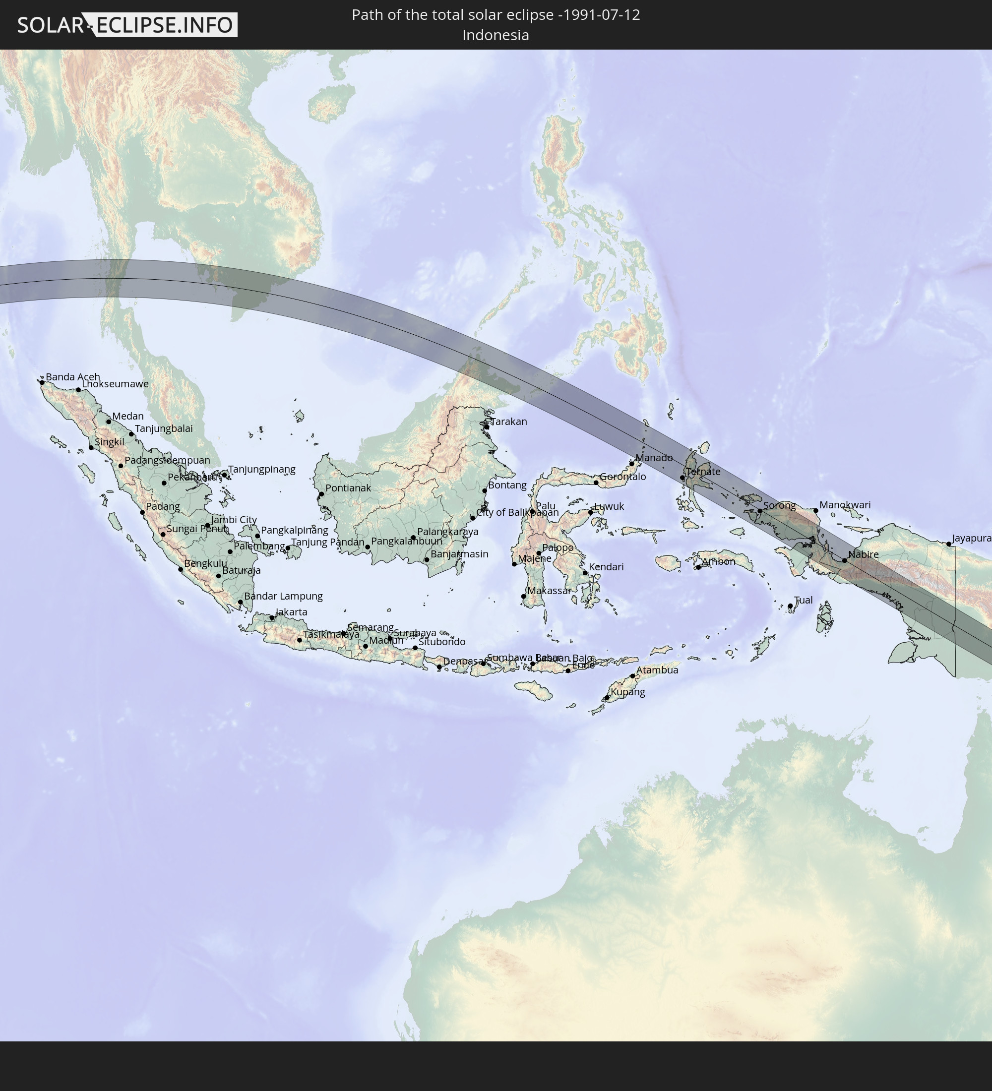 Indonesien
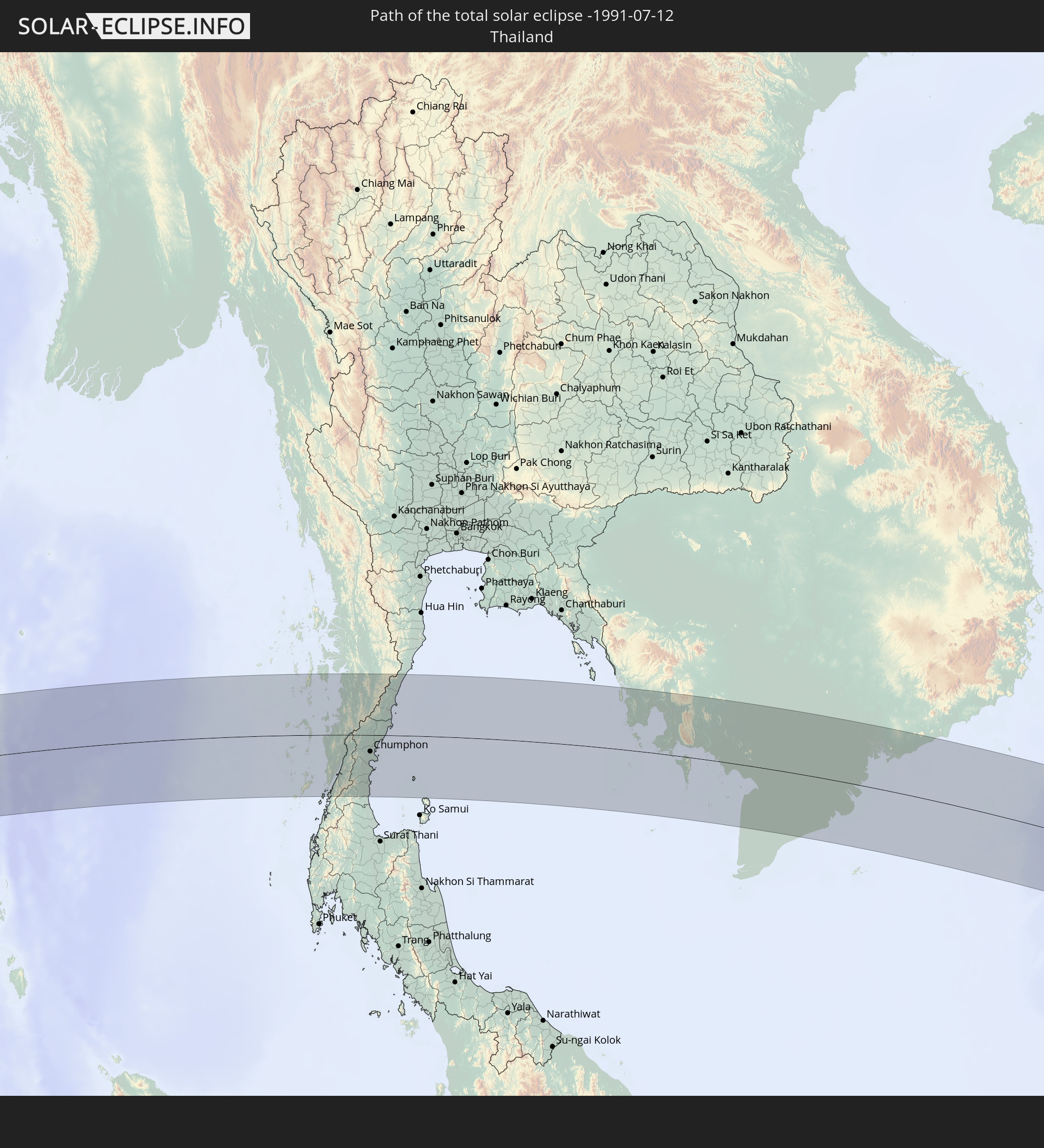 Thailand
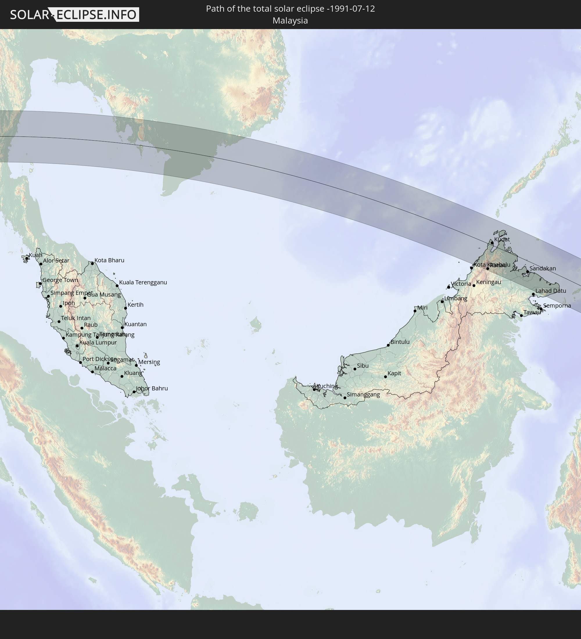 Malaysia
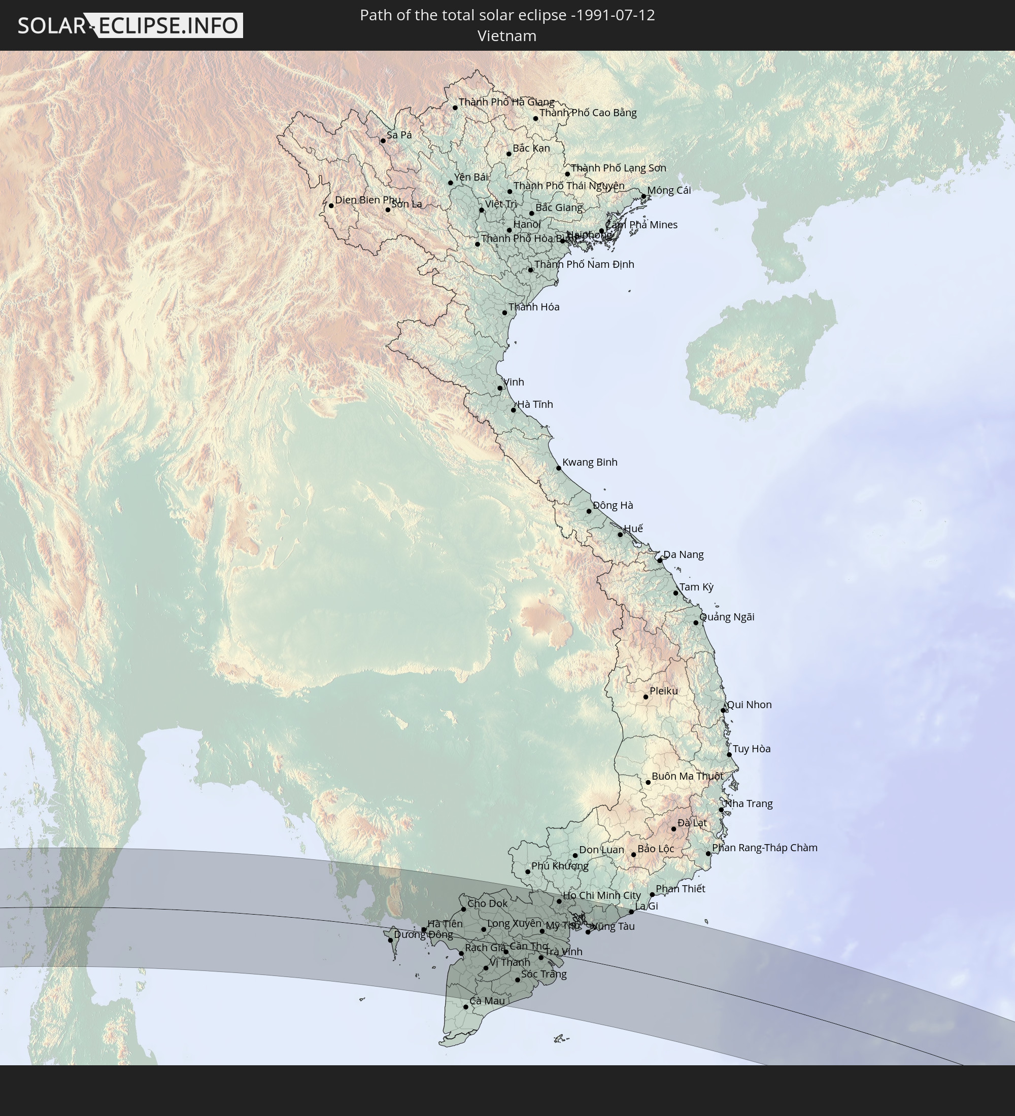 Vietnam
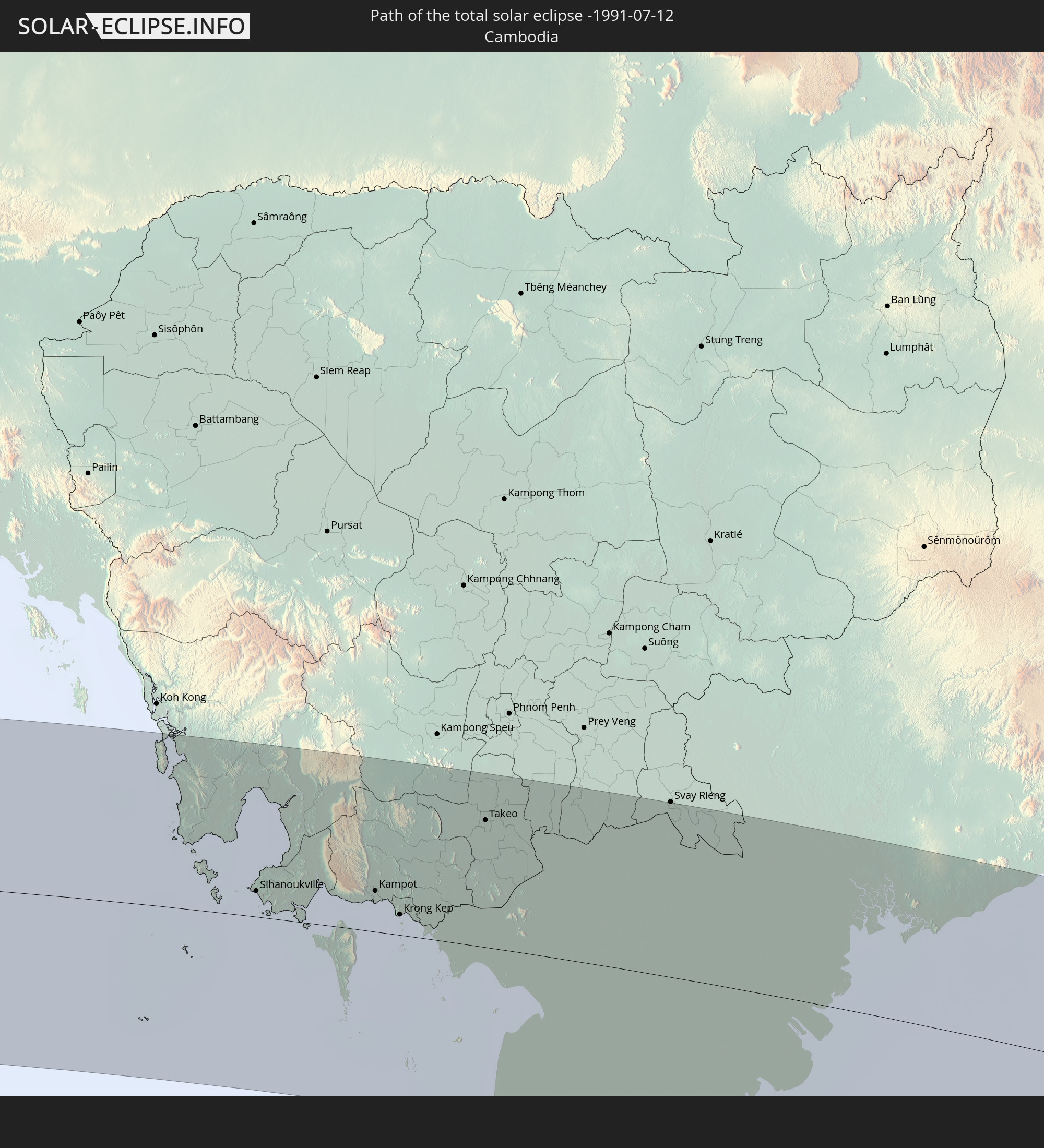 Kambodscha
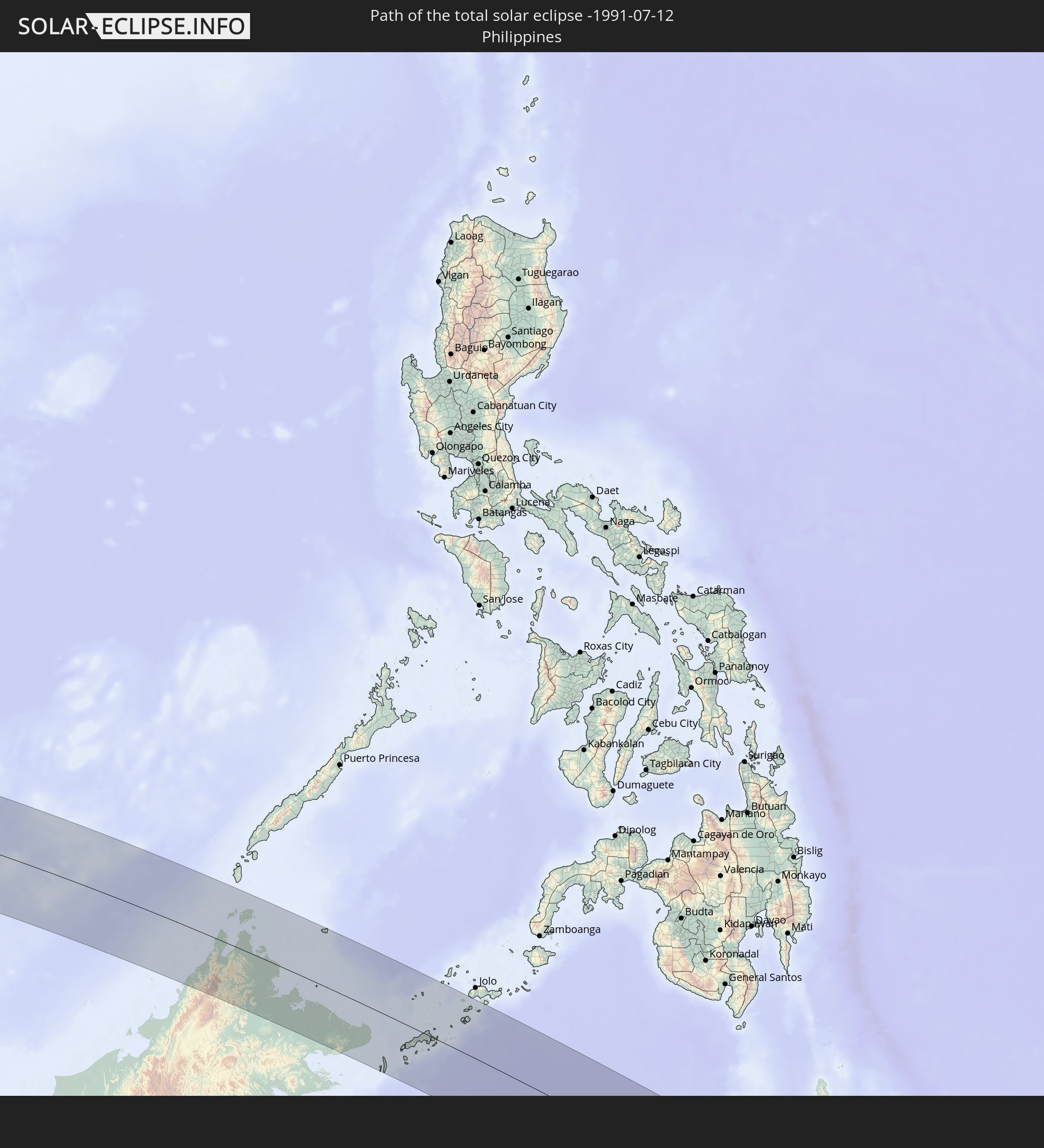 Philippinen
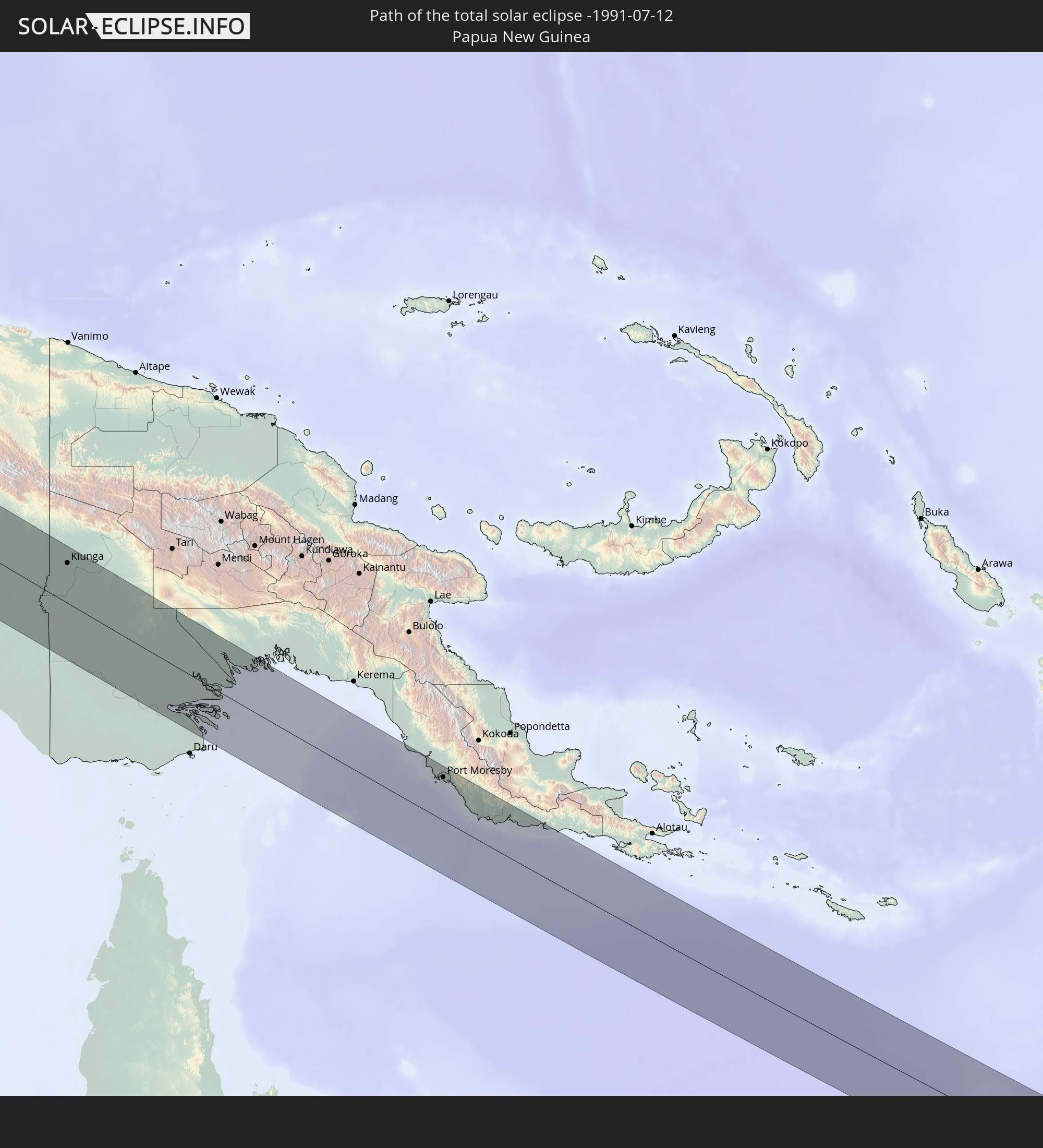 Papua-Neuguinea
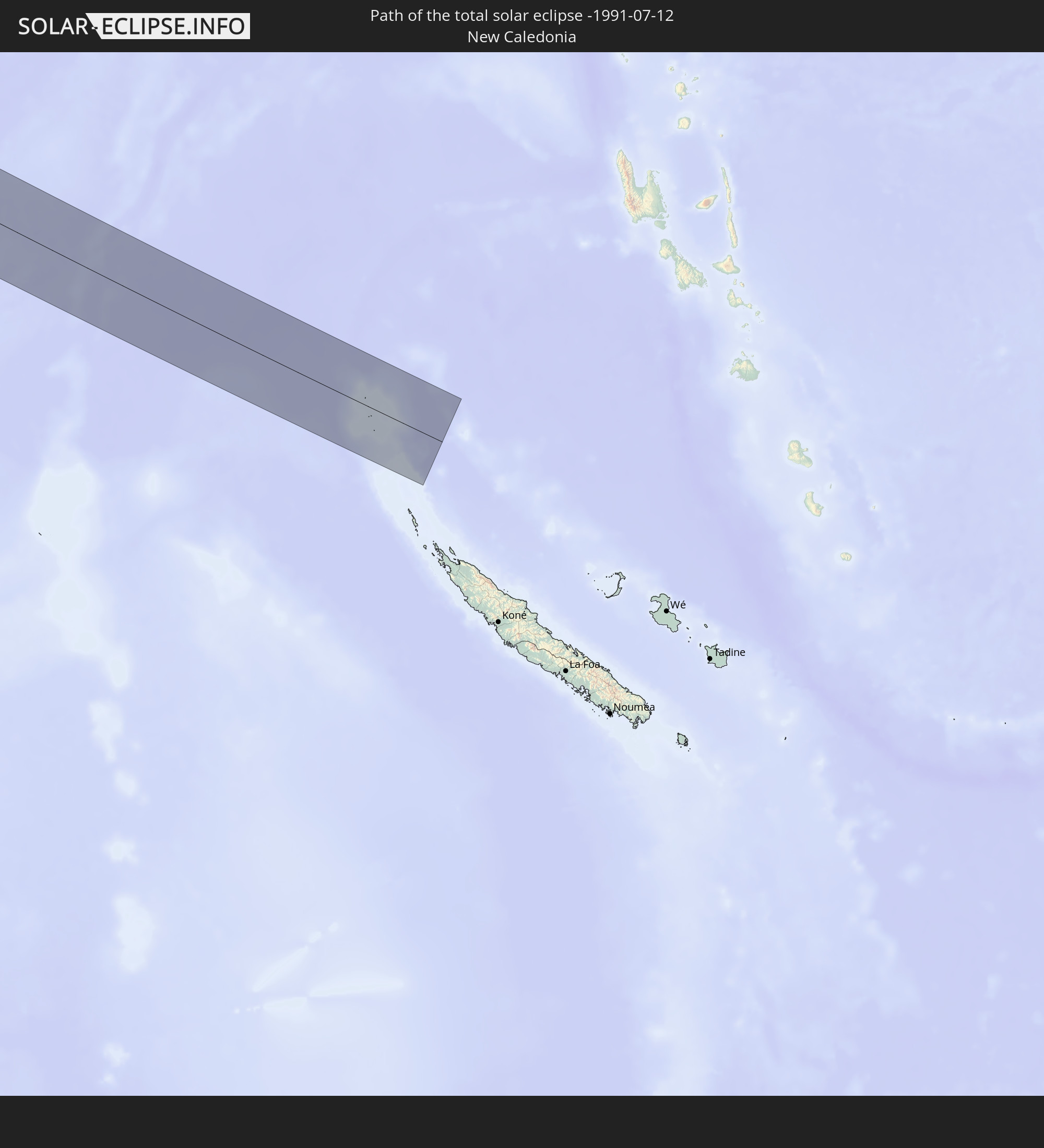 Neukaledonien
In den folgenden Ländern ist die Sonnenfinsternis partiell zu sehen
 Kiribati
 Sudan
Sudan
 Ägypten
 Äthiopien
 Kenia
Kenia
 Saudi-Arabien
 Eritrea
 Französische Süd- und Antarktisgebiete
 Somalia
 Dschibuti
 Jemen
Jemen
 Madagaskar
 Iran
Iran
 Seychellen
 Kuwait
 Bahrain
 Katar
Katar
 Vereinigte Arabische Emirate
 Oman
Oman
 Réunion
 Mauritius
 Afghanistan
 Pakistan
 Tadschikistan
 Indien
 Britisches Territorium im Indischen Ozean
 Malediven
 Volksrepublik China
 Sri Lanka
 Nepal
Nepal
 Bangladesch
 Bhutan
 Myanmar
 Indonesien
 Kokosinseln
 Thailand
 Malaysia
 Laos
Laos
 Vietnam
 Kambodscha
 Singapur
 Weihnachtsinsel
 Australien
 Macau
Macau
 Hongkong
 Brunei
 Taiwan
 Philippinen
 Japan
Japan
 Osttimor
 Südkorea
 Palau
Palau
 Föderierte Staaten von Mikronesien
 Papua-Neuguinea
 Guam
Guam
 Nördliche Marianen
 Salomonen
 Neukaledonien
 Marshallinseln
 Vanuatu
 Nauru
Nauru
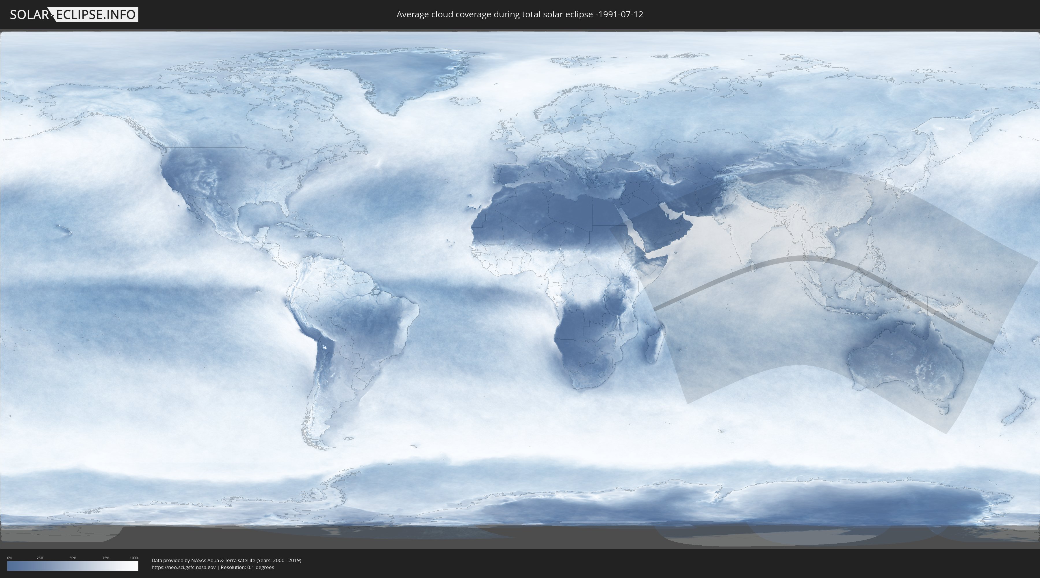
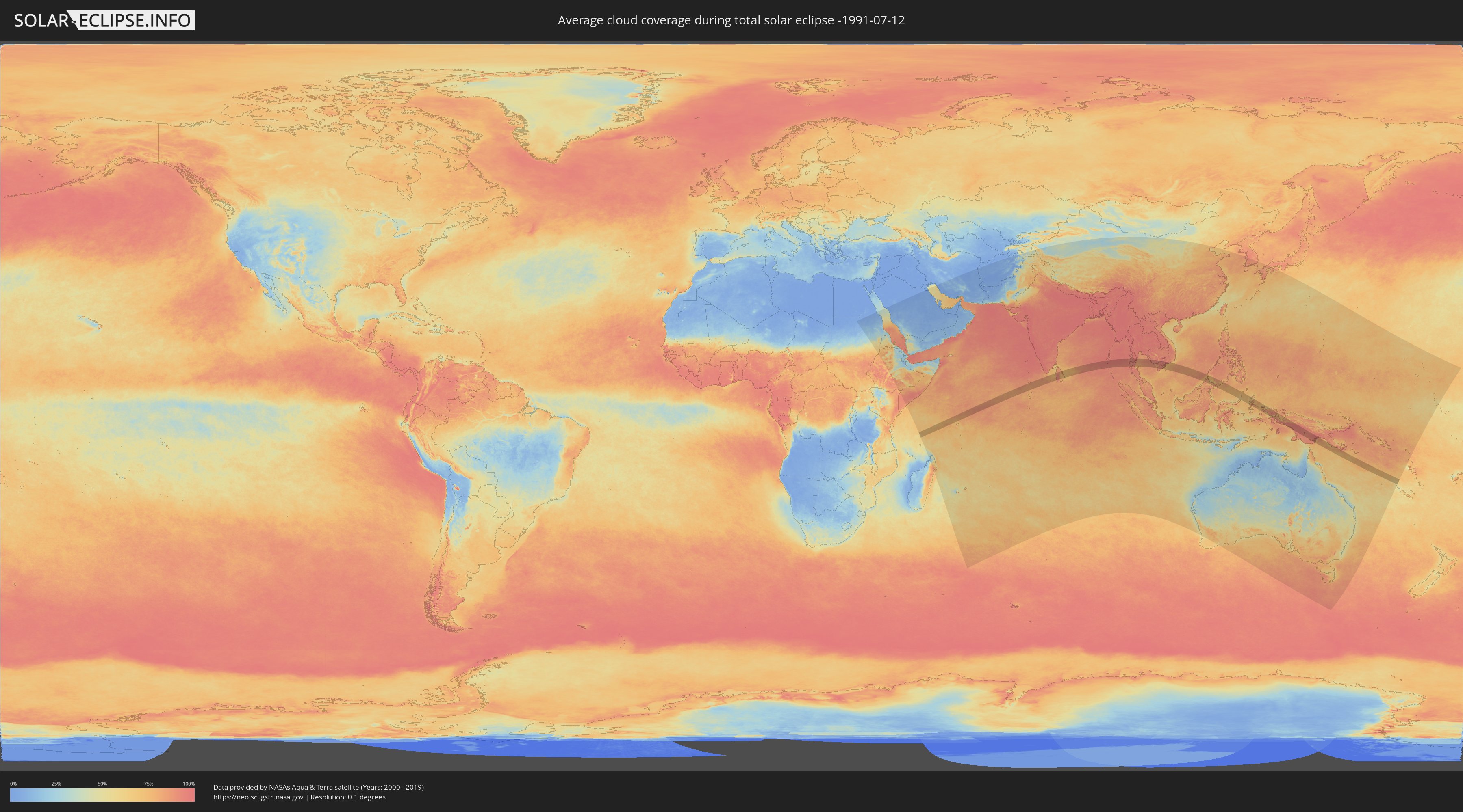
Wie wird das Wetter während der totalen Sonnenfinsternis am 12.07.-1991?
Wo ist der beste Ort, um die totale Sonnenfinsternis vom 12.07.-1991 zu beobachten?
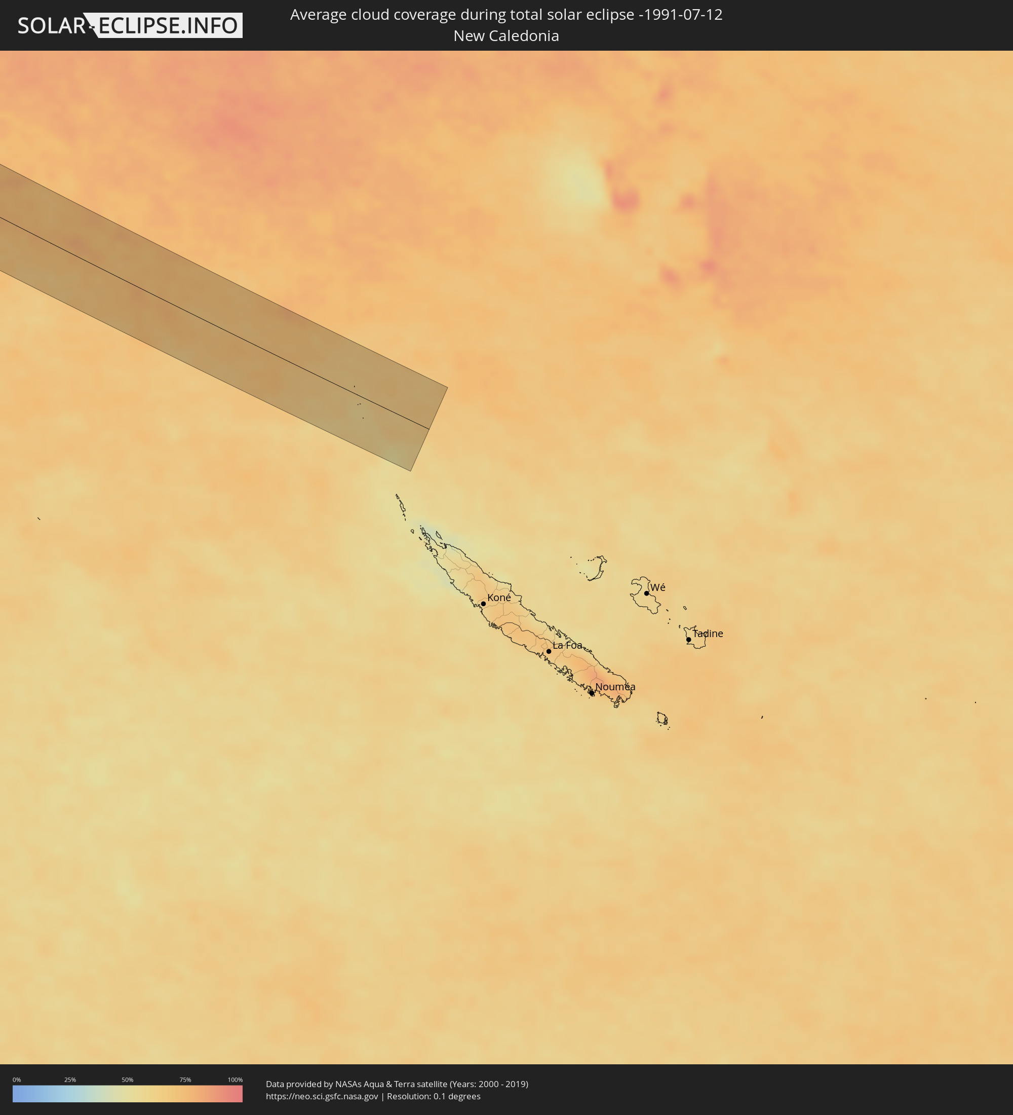
Die folgenden Karten zeigen die durchschnittliche Bewölkung für den Tag, an dem die totale Sonnenfinsternis
stattfindet. Mit Hilfe der Karten lässt sich der Ort entlang des Finsternispfades eingrenzen,
der die besten Aussichen auf einen klaren wolkenfreien Himmel bietet.
Trotzdem muss man immer lokale Gegenenheiten beachten und sollte sich genau über das Wetter an seinem
gewählten Beobachtungsort informieren.
Die Daten stammen von den beiden NASA-Satelliten
AQUA und TERRA
und wurden über einen Zeitraum von 19 Jahren (2000 - 2019) gemittelt.
Detaillierte Länderkarten
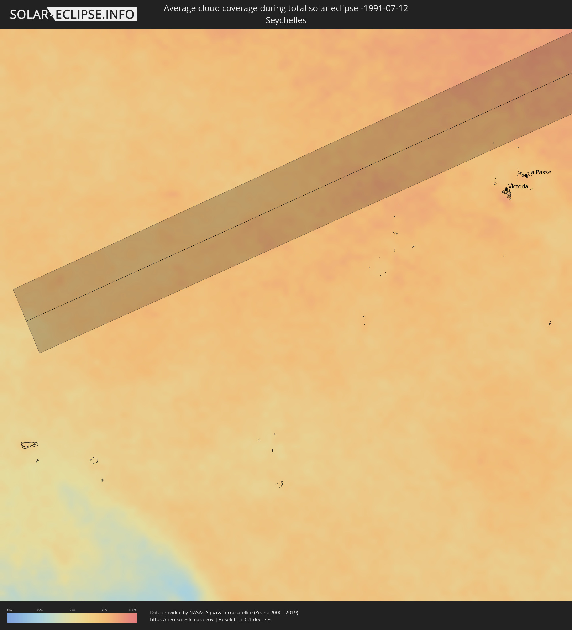 Seychellen
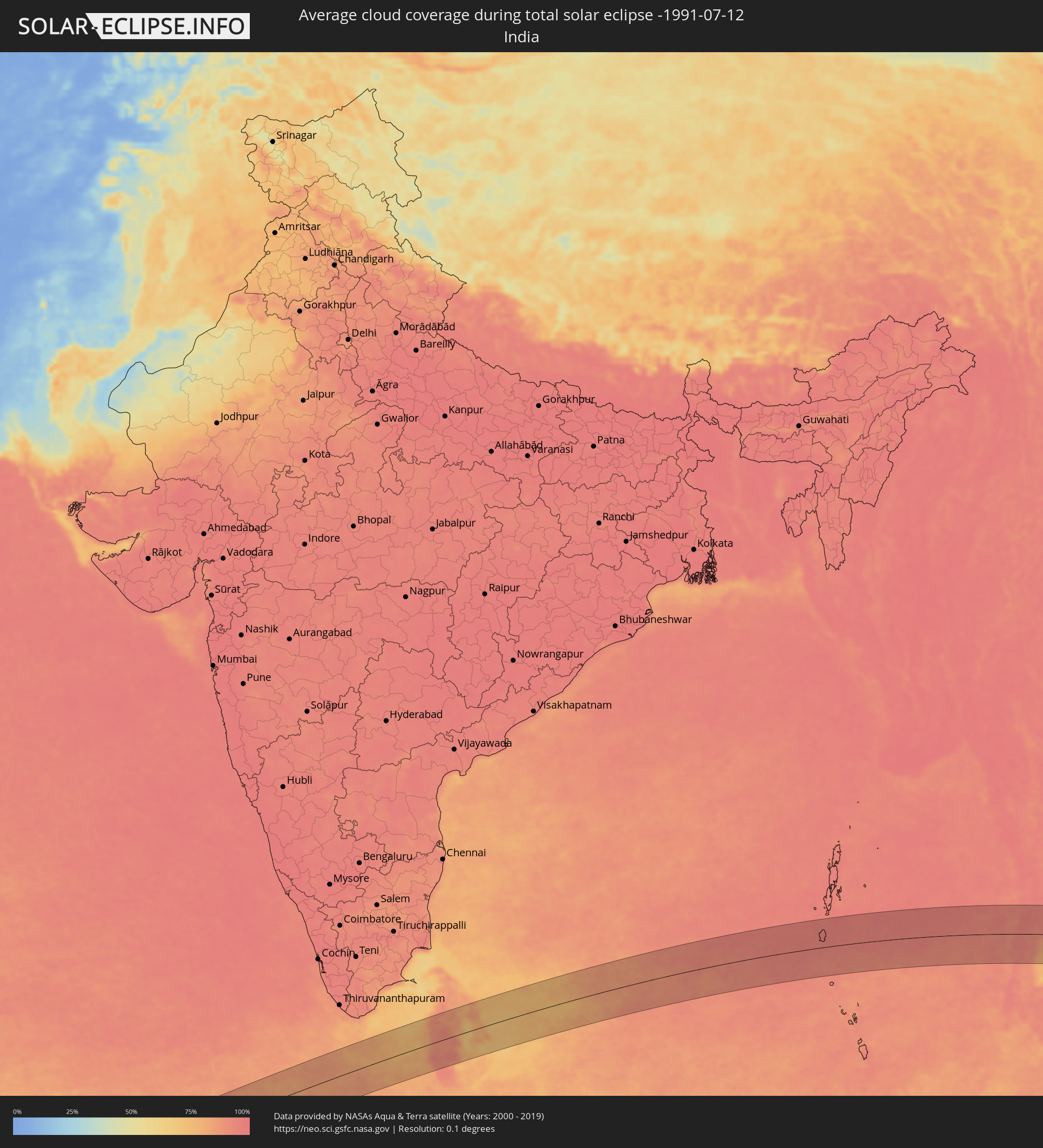 Indien
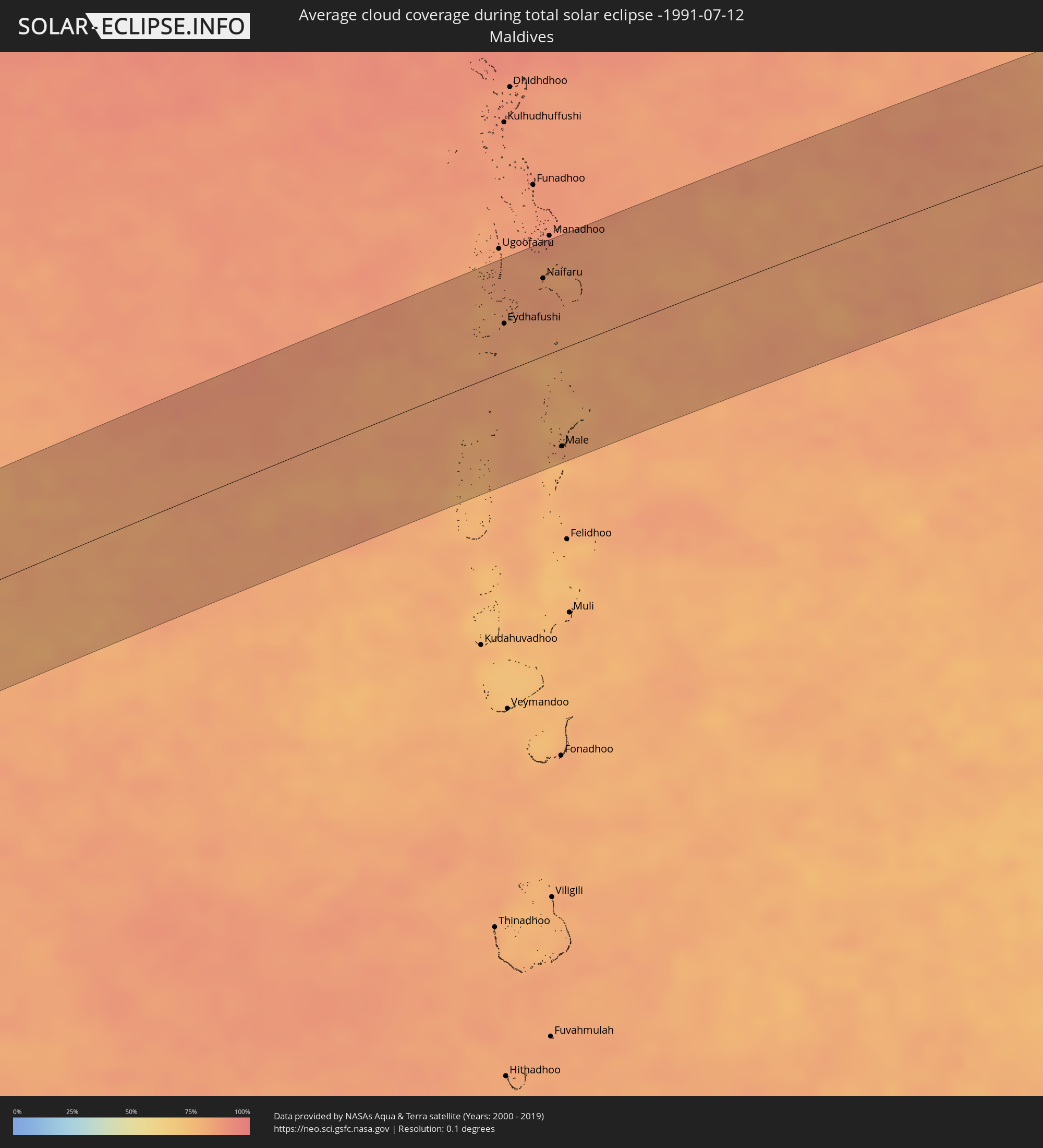 Malediven
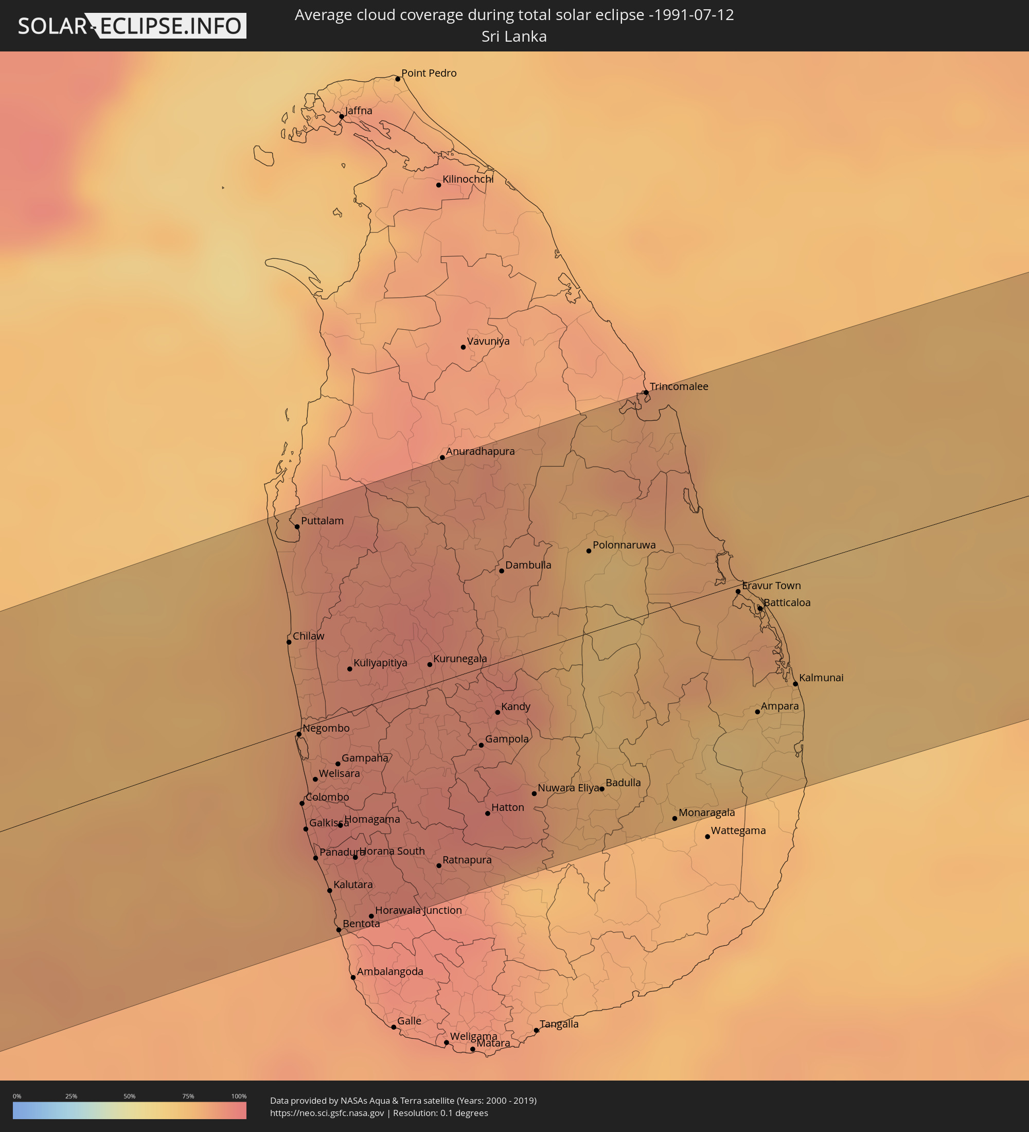 Sri Lanka
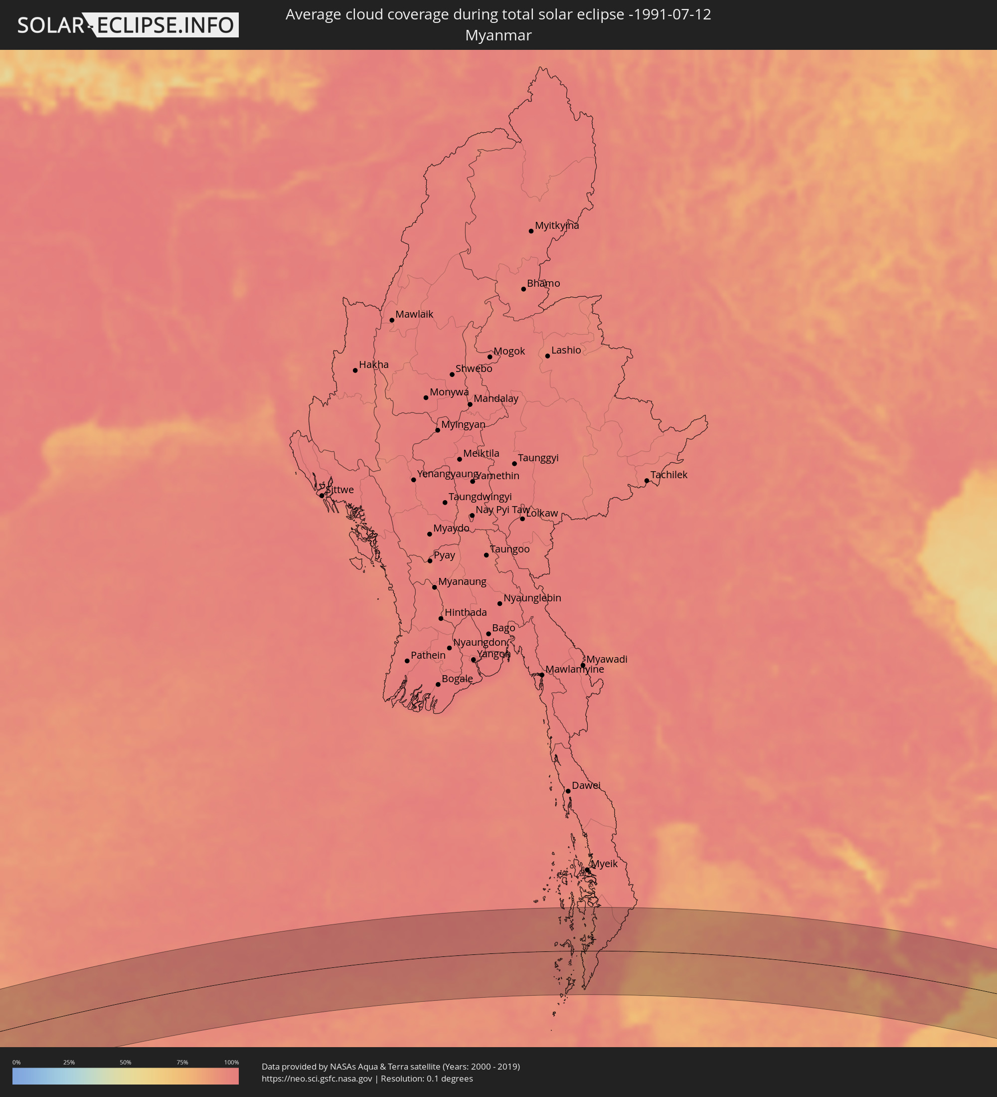 Myanmar
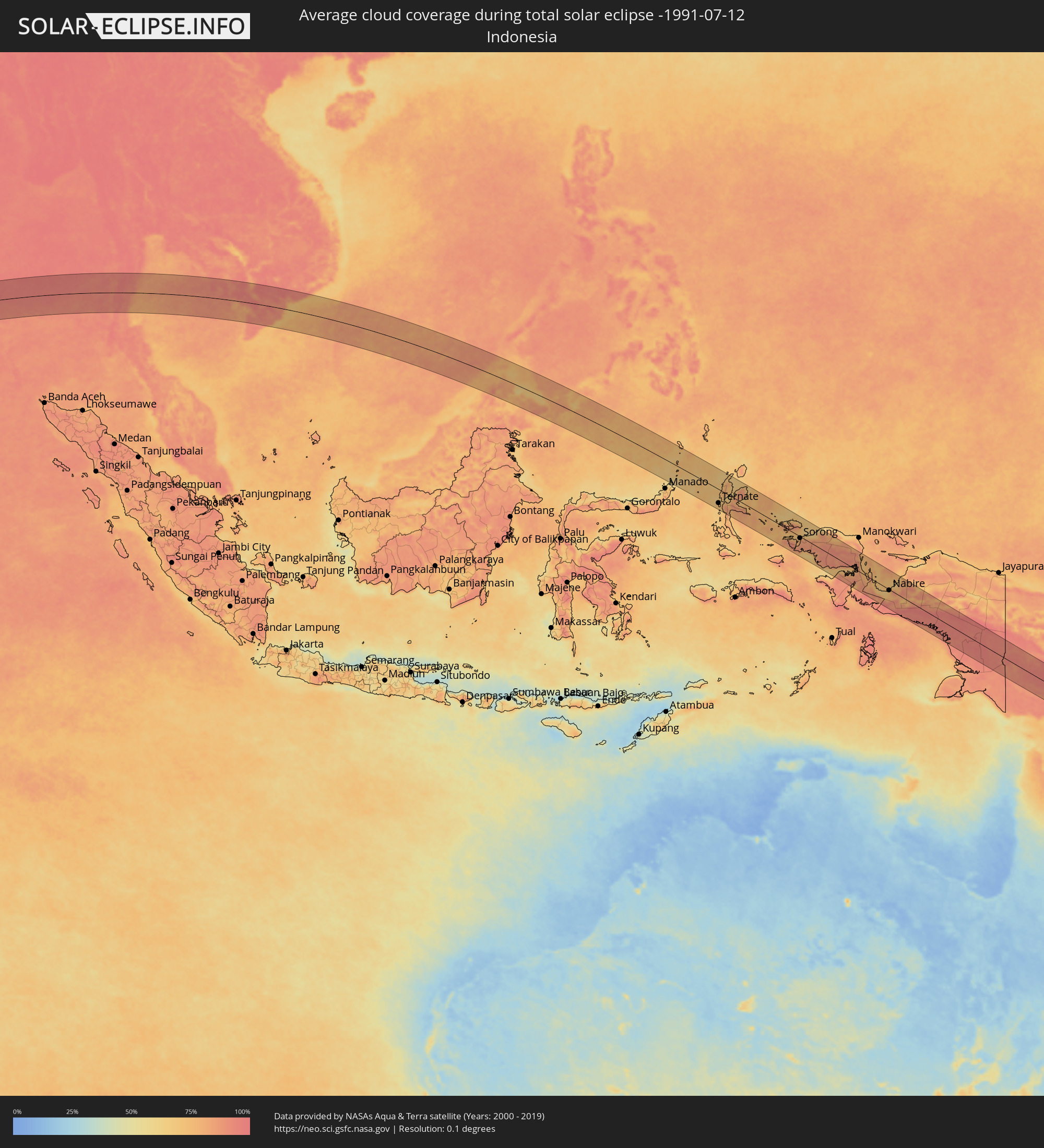 Indonesien
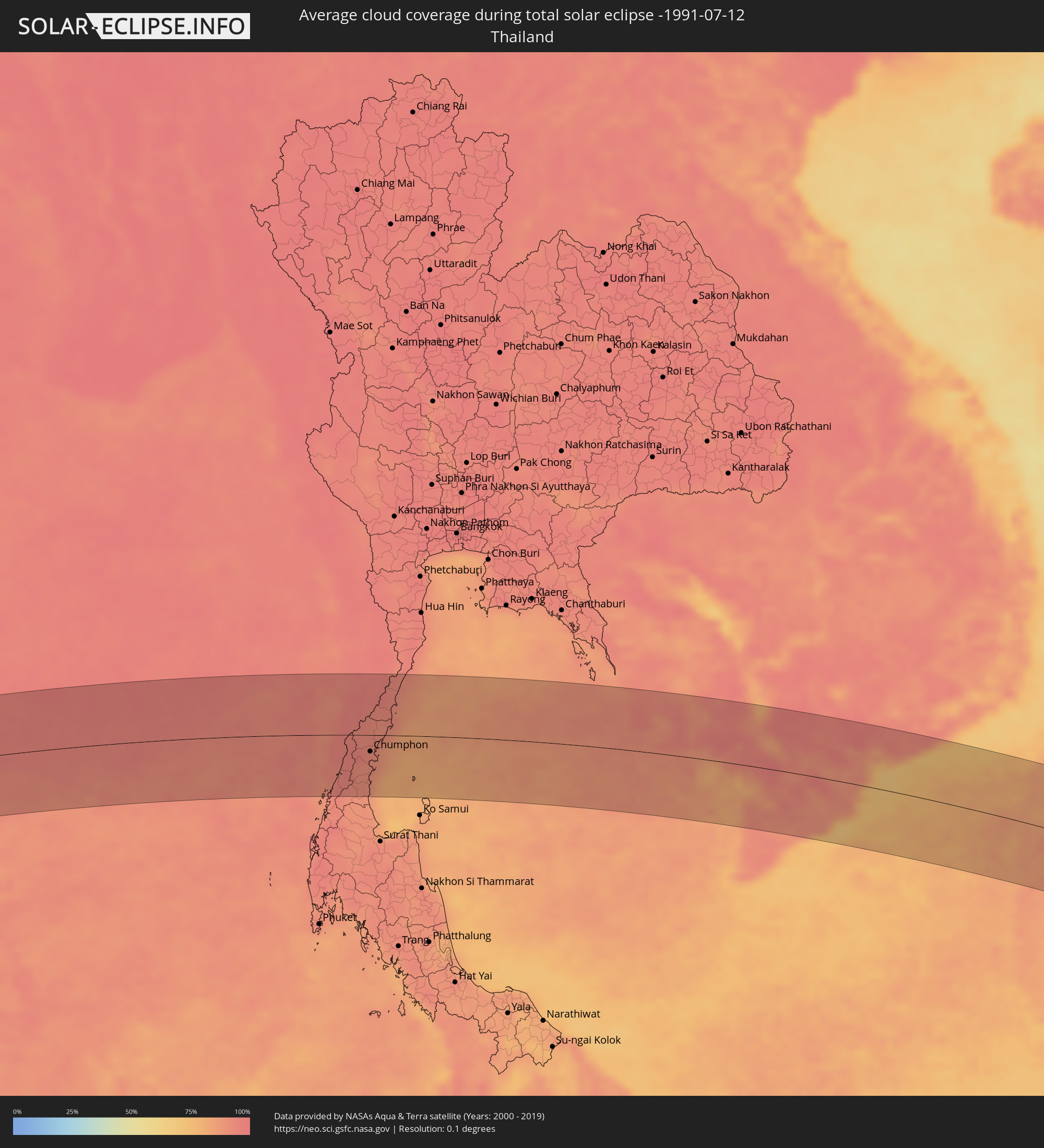 Thailand
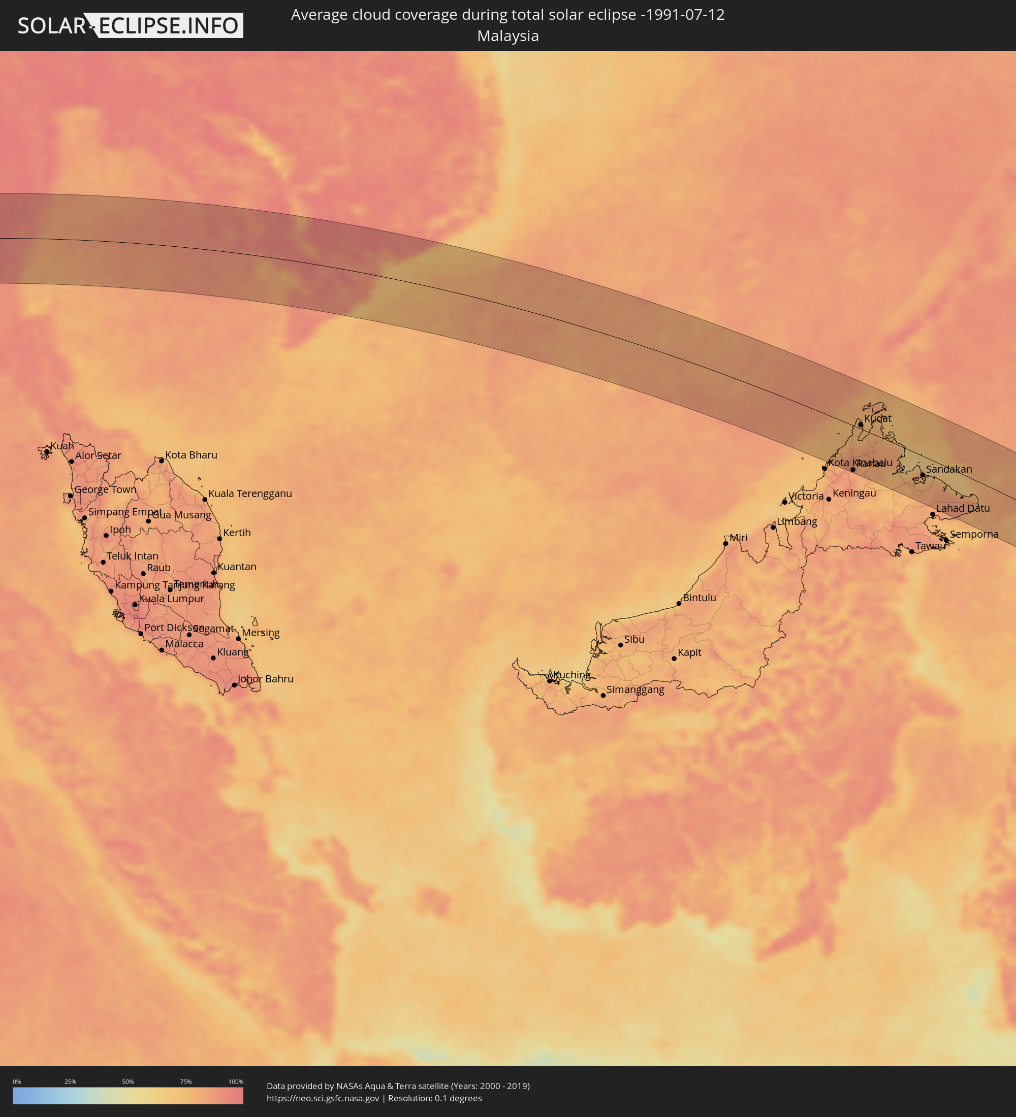 Malaysia
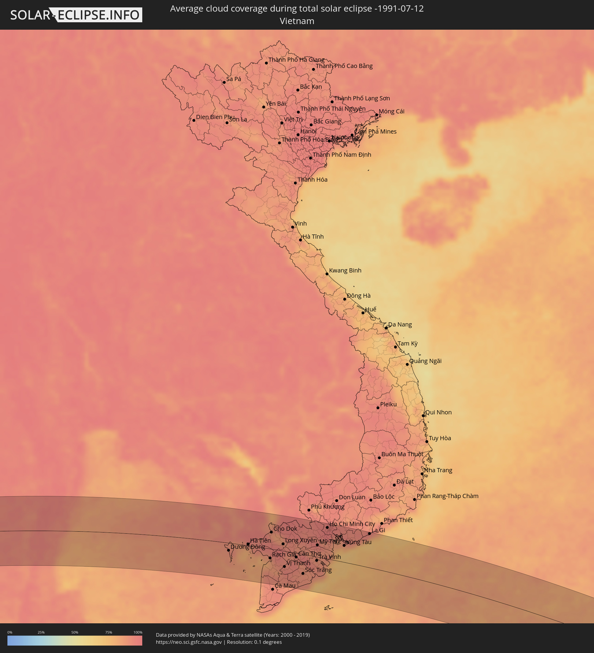 Vietnam
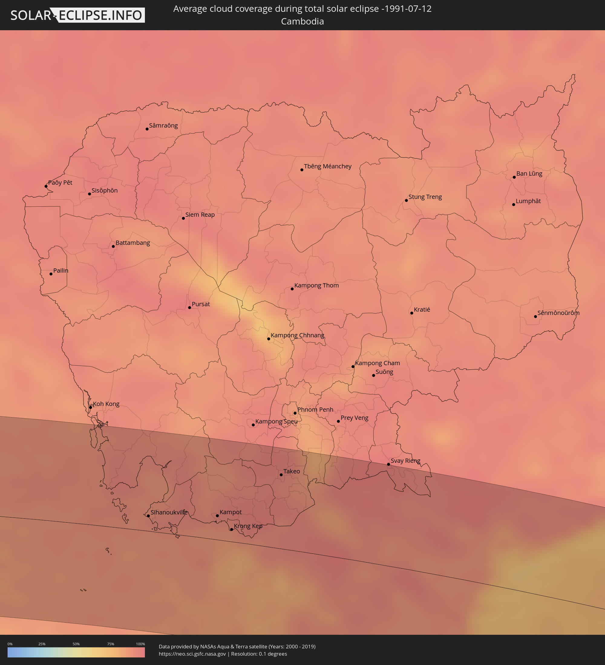 Kambodscha
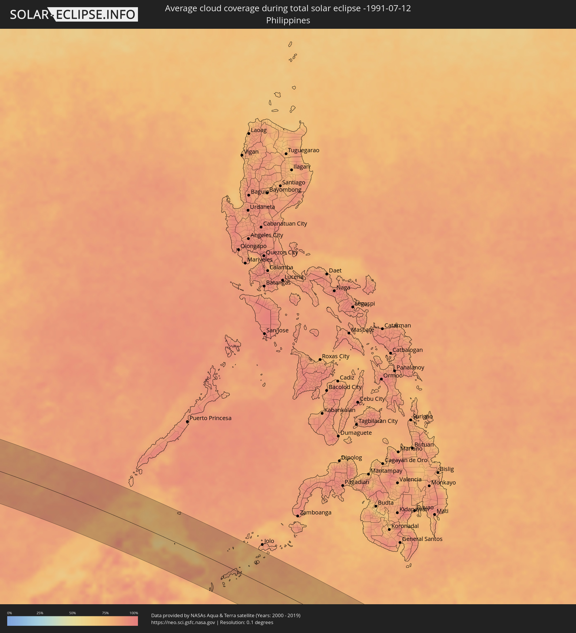 Philippinen
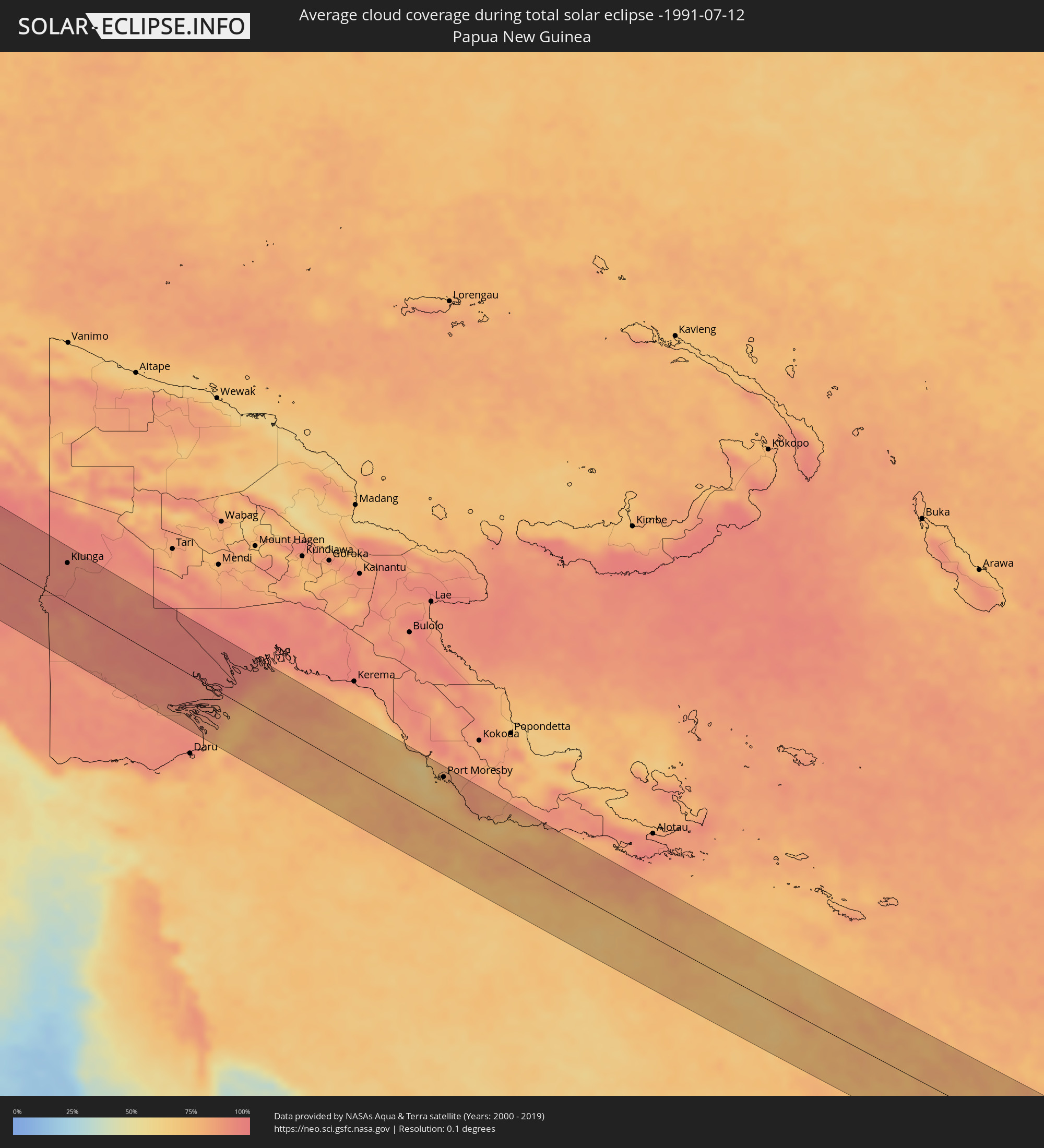 Papua-Neuguinea
 Neukaledonien
Orte im Finsternispfad
Die nachfolgene Tabelle zeigt Städte und Orte mit mehr als 5.000 Einwohnern, die sich im Finsternispfad befinden. Städte mit mehr als 100.000 Einwohnern sind dick gekennzeichnet. Mit einem Klick auf den Ort öffnet sich eine Detailkarte die die Lage des jeweiligen Ortes zusammen mit dem Verlauf der zentralen Finsternis präsentiert.
| Ort | Typ | Dauer der Verfinsterung | Ortszeit bei maximaler Verfinsterung | Entfernung zur Zentrallinie | Ø Bewölkung |
|
Eydhafushi, Baa Atholhu
|
total | - | 08:14:13 UTC+04:54 | 37 km | 83% |
|
Naifaru, Lhaviyani Atholhu
|
total | - | 08:14:43 UTC+04:54 | 61 km | 85% |
|
Male, Kaafu Atoll
|
total | - | 08:14:32 UTC+04:54 | 77 km | 83% |
|
Puttalam, North Western
|
total | - | 08:51:16 UTC+05:19 | 85 km | 84% |
|
Negombo, Western
|
total | - | 08:51:00 UTC+05:19 | 3 km | 82% |
|
Colombo, Western
|
total | - | 08:50:56 UTC+05:19 | 32 km | 86% |
|
Moratuwa, Western
|
total | - | 08:50:57 UTC+05:19 | 50 km | 87% |
|
Peliyagoda, Western
|
total | - | 08:51:01 UTC+05:19 | 30 km | 91% |
|
Wattala, Western
|
total | - | 08:51:02 UTC+05:19 | 29 km | 91% |
|
Ja Ela, Western
|
total | - | 08:51:04 UTC+05:19 | 19 km | 89% |
|
Kandana, Western
|
total | - | 08:51:03 UTC+05:19 | 22 km | 91% |
|
Kelaniya, Western
|
total | - | 08:51:05 UTC+05:19 | 32 km | 91% |
|
Mulleriyawa, Western
|
total | - | 08:51:05 UTC+05:19 | 35 km | 92% |
|
Kalutara, Western
|
total | - | 08:51:02 UTC+05:19 | 73 km | 86% |
|
Bentota, Southern
|
total | - | 08:51:03 UTC+05:19 | 91 km | 82% |
|
Homagama, Western
|
total | - | 08:51:11 UTC+05:19 | 47 km | 92% |
|
Kurunegala, North Western
|
total | - | 08:52:03 UTC+05:19 | 8 km | 89% |
|
Ratnapura, Sabaragamuwa
|
total | - | 08:51:52 UTC+05:19 | 78 km | 91% |
|
Gampola, Central
|
total | - | 08:52:20 UTC+05:19 | 33 km | 91% |
|
Kandy, Central
|
total | - | 08:52:30 UTC+05:19 | 21 km | 89% |
|
Dambulla, Central
|
total | - | 08:52:43 UTC+05:19 | 38 km | 86% |
|
Nuwara Eliya, Central
|
total | - | 08:52:41 UTC+05:19 | 61 km | 85% |
|
Badulla, Uva
|
total | - | 08:53:12 UTC+05:19 | 68 km | 77% |
|
Trincomalee, Eastern Province
|
total | - | 08:54:03 UTC+05:19 | 94 km | 82% |
|
Batticaloa, Eastern Province
|
total | - | 08:54:39 UTC+05:19 | 13 km | 82% |
|
Kalmunai, Eastern Province
|
total | - | 08:54:50 UTC+05:19 | 50 km | 70% |
|
Ranong, Ranong
|
total | - | 11:01:12 UTC+06:42 | 87 km | 93% |
|
Ban Nam Yuen, Chumphon
|
total | - | 11:01:56 UTC+06:42 | 97 km | 90% |
|
Lang Suan, Chumphon
|
total | - | 11:02:34 UTC+06:42 | 89 km | 90% |
|
Chumphon, Chumphon
|
total | - | 11:02:46 UTC+06:42 | 27 km | 93% |
|
Bang Saphan, Prachuap Khiri Khan
|
total | - | 11:03:38 UTC+06:42 | 53 km | 92% |
|
Sihanoukville, Preah Sihanouk
|
total | - | 11:16:22 UTC+06:42 | 15 km | 89% |
|
Dương Đông, Kiến Giang
|
total | - | 11:42:30 UTC+07:06 | 22 km | 87% |
|
Kampot, Kampot
|
total | - | 11:18:26 UTC+06:42 | 24 km | 89% |
|
Krong Kep, Kep
|
total | - | 11:18:55 UTC+06:42 | 12 km | 85% |
|
Hà Tiên, Kiến Giang
|
total | - | 11:44:06 UTC+07:06 | 4 km | 84% |
|
Phumĭ Véal Srê, Takeo
|
total | - | 11:20:08 UTC+06:42 | 74 km | 93% |
|
Takeo, Takeo
|
total | - | 11:20:09 UTC+06:42 | 75 km | 93% |
|
Rạch Giá, Kiến Giang
|
total | - | 11:46:10 UTC+07:06 | 27 km | 85% |
|
Cho Dok, An Giang
|
total | - | 11:45:56 UTC+07:06 | 49 km | 91% |
|
Long Xuyên, An Giang
|
total | - | 11:47:06 UTC+07:06 | 20 km | 96% |
|
Vị Thanh, Hau Giang
|
total | - | 11:47:32 UTC+07:06 | 46 km | 95% |
|
Cao Lãnh, Đồng Tháp
|
total | - | 11:47:41 UTC+07:06 | 31 km | 92% |
|
Thành phố Bạc Liêu, Bạc Liêu
|
total | - | 11:48:38 UTC+07:06 | 95 km | 89% |
|
Sadek, Đồng Tháp
|
total | - | 11:48:10 UTC+07:06 | 15 km | 92% |
|
Cần Thơ, Cần Thơ
|
total | - | 11:48:24 UTC+07:06 | 12 km | 93% |
|
Sóc Trăng, Sóc Trăng
|
total | - | 11:49:14 UTC+07:06 | 57 km | 90% |
|
Vĩnh Long, Vĩnh Long
|
total | - | 11:48:52 UTC+07:06 | 15 km | 92% |
|
Ấp Tân Ngãi, Bến Tre
|
total | - | 11:49:52 UTC+07:06 | 19 km | 90% |
|
Trà Vinh, Trà Vinh
|
total | - | 11:50:13 UTC+07:06 | 11 km | 91% |
|
Mỹ Tho, Tiền Giang
|
total | - | 11:50:02 UTC+07:06 | 34 km | 92% |
|
Bến Tre, Bến Tre
|
total | - | 11:50:09 UTC+07:06 | 22 km | 88% |
|
Tân An, Long An
|
total | - | 11:50:06 UTC+07:06 | 55 km | 95% |
|
Ho Chi Minh City, Ho Chi Minh City
|
total | - | 11:50:36 UTC+07:06 | 90 km | 97% |
|
Cần Giuộc, Long An
|
total | - | 11:50:52 UTC+07:06 | 68 km | 91% |
|
Cần Giờ, Ho Chi Minh City
|
total | - | 11:51:52 UTC+07:06 | 52 km | 76% |
|
Vũng Tàu, Bà Rịa-Vũng Tàu
|
total | - | 11:52:19 UTC+07:06 | 48 km | 69% |
|
Thành Phố Bà Rịa, Bà Rịa-Vũng Tàu
|
total | - | 11:52:29 UTC+07:06 | 66 km | 87% |
|
La Gi, Bình Thuận
|
total | - | 11:54:15 UTC+07:06 | 98 km | 82% |
|
Kota Belud, Sabah
|
total | - | 12:38:04 UTC+07:21 | 64 km | 80% |
|
Ranau, Sabah
|
total | - | 12:39:04 UTC+07:21 | 94 km | 82% |
|
Kudat, Sabah
|
total | - | 12:38:38 UTC+07:21 | 8 km | 77% |
|
Taman Rajawali, Sabah
|
total | - | 12:42:50 UTC+07:21 | 39 km | 79% |
|
Sandakan, Sabah
|
total | - | 12:43:04 UTC+07:21 | 41 km | 74% |
|
Bongao, Autonomous Region in Muslim Mindanao
|
total | - | 13:26:45 UTC+08:00 | 45 km | 77% |
|
Sanga-Sanga, Autonomous Region in Muslim Mindanao
|
total | - | 13:26:44 UTC+08:00 | 40 km | 77% |
|
Tampakan, Autonomous Region in Muslim Mindanao
|
total | - | 13:26:54 UTC+08:00 | 54 km | 77% |
|
New Batu Batu, Autonomous Region in Muslim Mindanao
|
total | - | 13:26:59 UTC+08:00 | 36 km | 75% |
|
Balimbing, Autonomous Region in Muslim Mindanao
|
total | - | 13:27:10 UTC+08:00 | 30 km | 73% |
|
Languyan, Autonomous Region in Muslim Mindanao
|
total | - | 13:27:17 UTC+08:00 | 7 km | 83% |
|
Tongouson, Autonomous Region in Muslim Mindanao
|
total | - | 13:27:39 UTC+08:00 | 28 km | 75% |
|
Siasi, Autonomous Region in Muslim Mindanao
|
total | - | 13:28:49 UTC+08:00 | 58 km | 80% |
|
Lugus, Autonomous Region in Muslim Mindanao
|
total | - | 13:28:40 UTC+08:00 | 74 km | 77% |
|
Laminusa, Autonomous Region in Muslim Mindanao
|
total | - | 13:29:02 UTC+08:00 | 63 km | 81% |
|
Ternate, North Maluku
|
total | - | 15:10:10 UTC+09:22 | 64 km | 70% |
|
Sofifi, North Maluku
|
total | - | 15:10:33 UTC+09:22 | 59 km | 80% |
|
Tobelo, North Maluku
|
total | - | 15:10:33 UTC+09:22 | 61 km | 66% |
|
Sorong, West Papua
|
total | - | 15:18:21 UTC+09:22 | 8 km | 84% |
|
Nabire, Papua
|
total | - | 15:26:20 UTC+09:22 | 4 km | 74% |
|
Kiunga, Western Province
|
total | - | 16:11:44 UTC+10:00 | 60 km | 91% |
|
Port Moresby, National Capital
|
total | - | 16:17:54 UTC+10:00 | 65 km | 76% |