Totale Sonnenfinsternis vom 28.03.0024
| Wochentag: | Donnerstag |
| Maximale Dauer der Verfinsterung: | 04m24s |
| Maximale Breite des Finsternispfades: | 219 km |
| Saroszyklus: | 78 |
| Bedeckungsgrad: | 100% |
| Magnitude: | 1.0531 |
| Gamma: | -0.6039 |
Wo kann man die Sonnenfinsternis vom 28.03.0024 sehen?
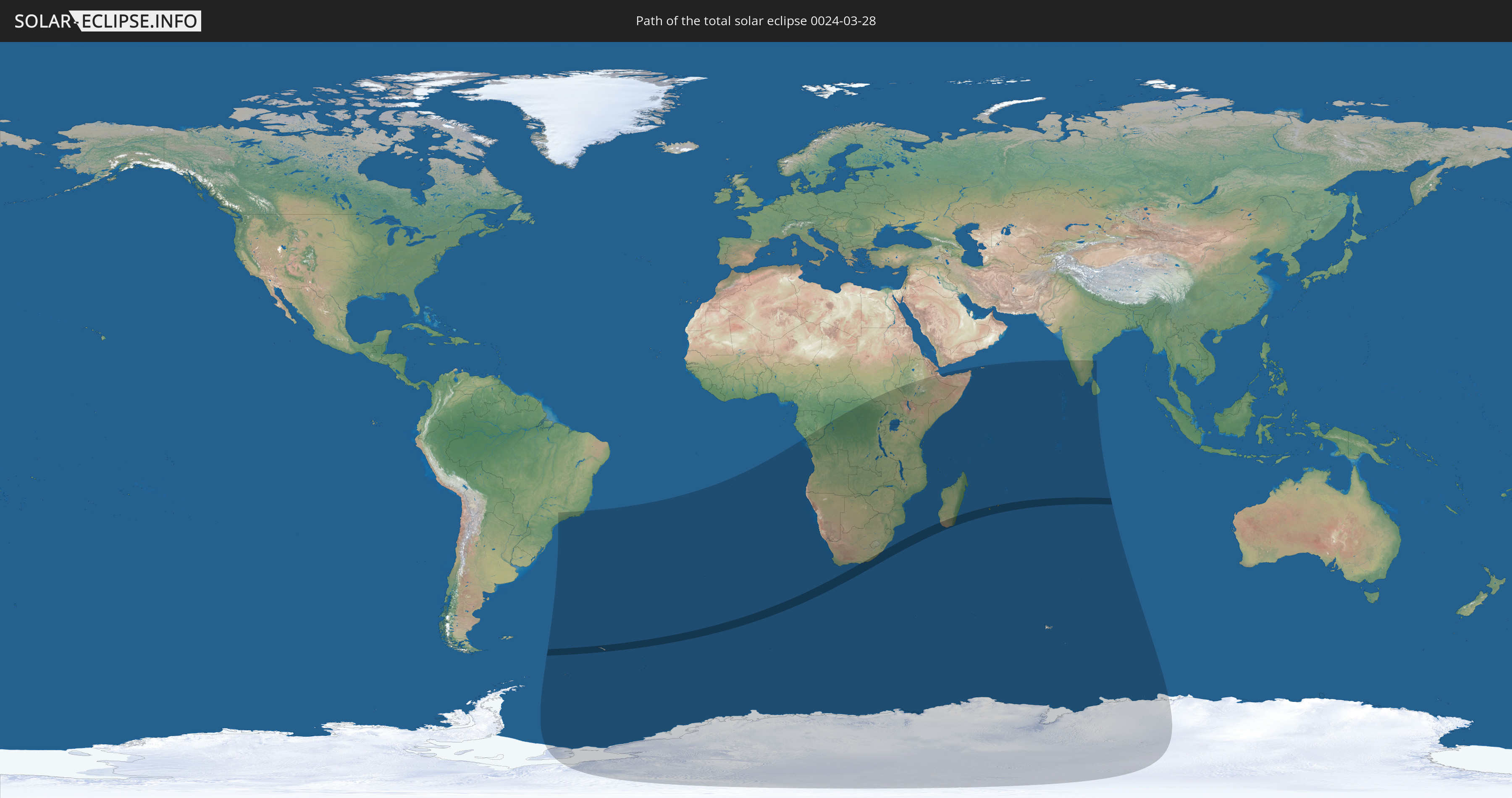
Die Sonnenfinsternis am 28.03.0024 kann man in 37 Ländern als partielle Sonnenfinsternis beobachten.
Der Finsternispfad verläuft durch 5 Länder. Nur in diesen Ländern ist sie als totale Sonnenfinsternis zu sehen.
In den folgenden Ländern ist die Sonnenfinsternis total zu sehen
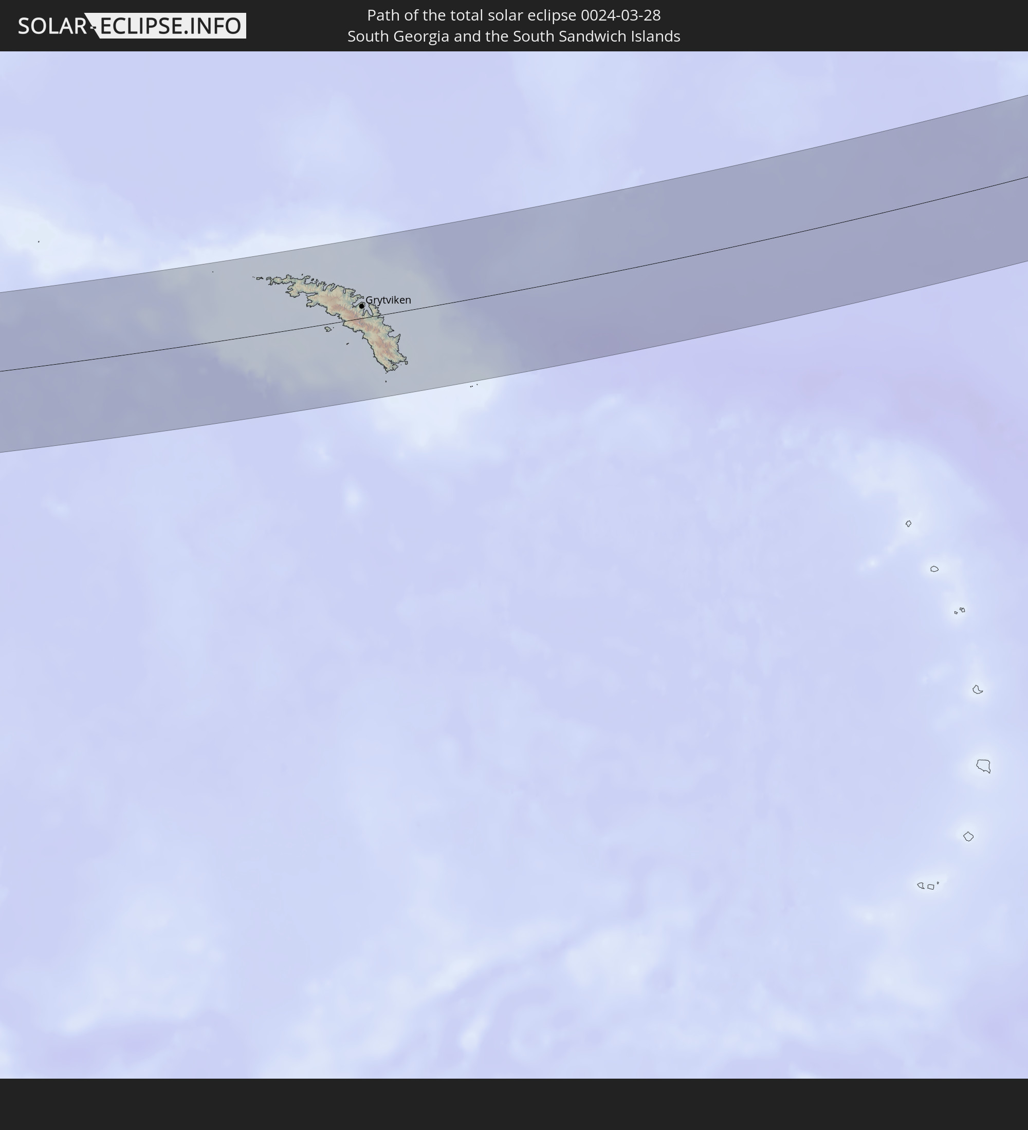 Südgeorgien und die Südlichen Sandwichinseln
 Südafrika
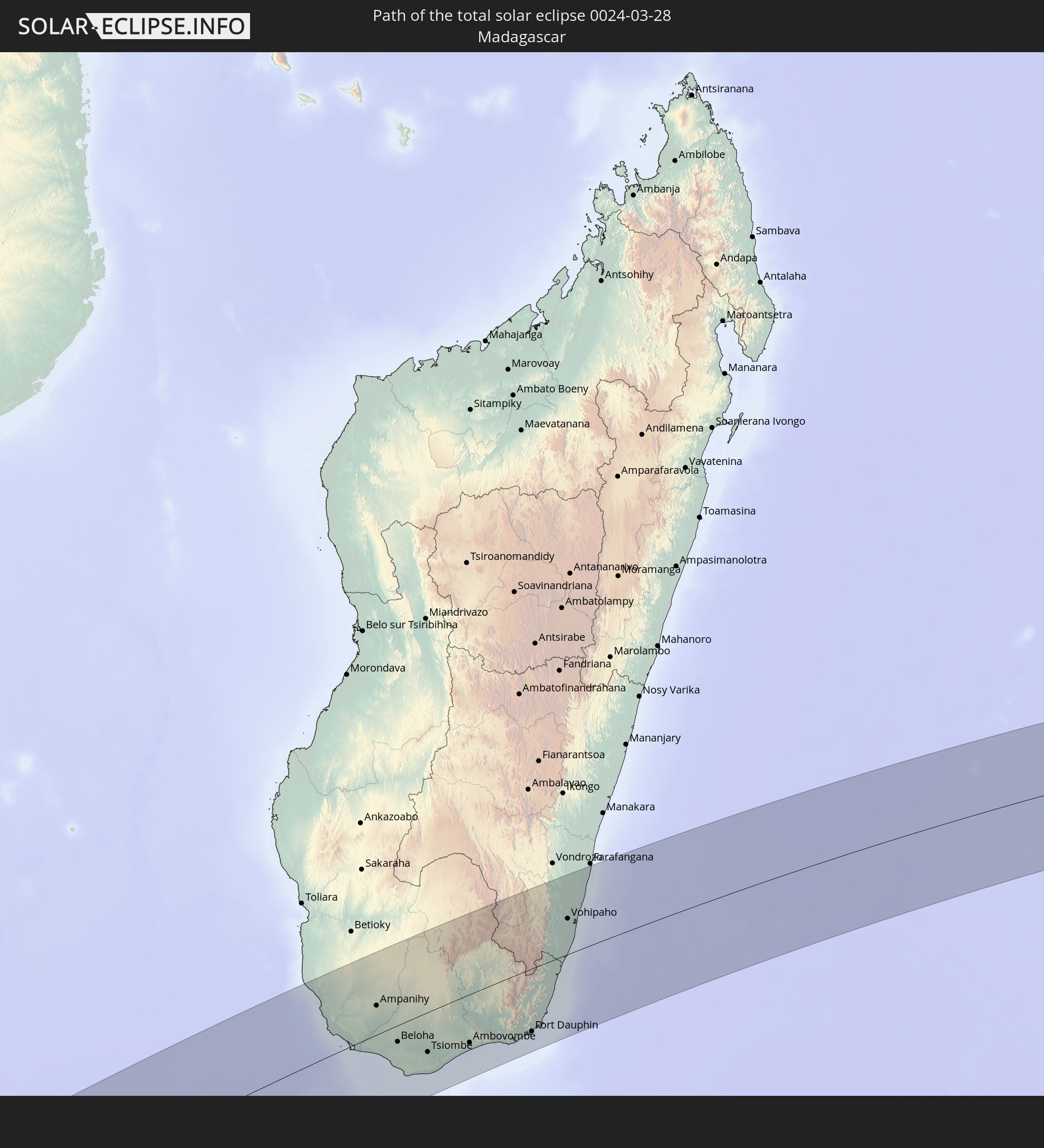 Madagaskar
 Réunion
 Mauritius
In den folgenden Ländern ist die Sonnenfinsternis partiell zu sehen
 Antarktika
 Brasilien
 Südgeorgien und die Südlichen Sandwichinseln
 St. Helena
 Bouvetinsel
 Republik Kongo
 Angola
 Namibia
 Demokratische Republik Kongo
 Südafrika
 Botswana
 Sambia
 Simbabwe
 Lesotho
 Ruanda
 Burundi
 Tansania
 Uganda
 Mosambik
 Swasiland
 Malawi
 Äthiopien
 Kenia
Kenia
 Französische Süd- und Antarktisgebiete
 Somalia
 Jemen
Jemen
 Madagaskar
 Komoren
 Mayotte
 Seychellen
 Réunion
 Mauritius
 Indien
 Britisches Territorium im Indischen Ozean
 Heard und McDonaldinseln
 Malediven
 Sri Lanka
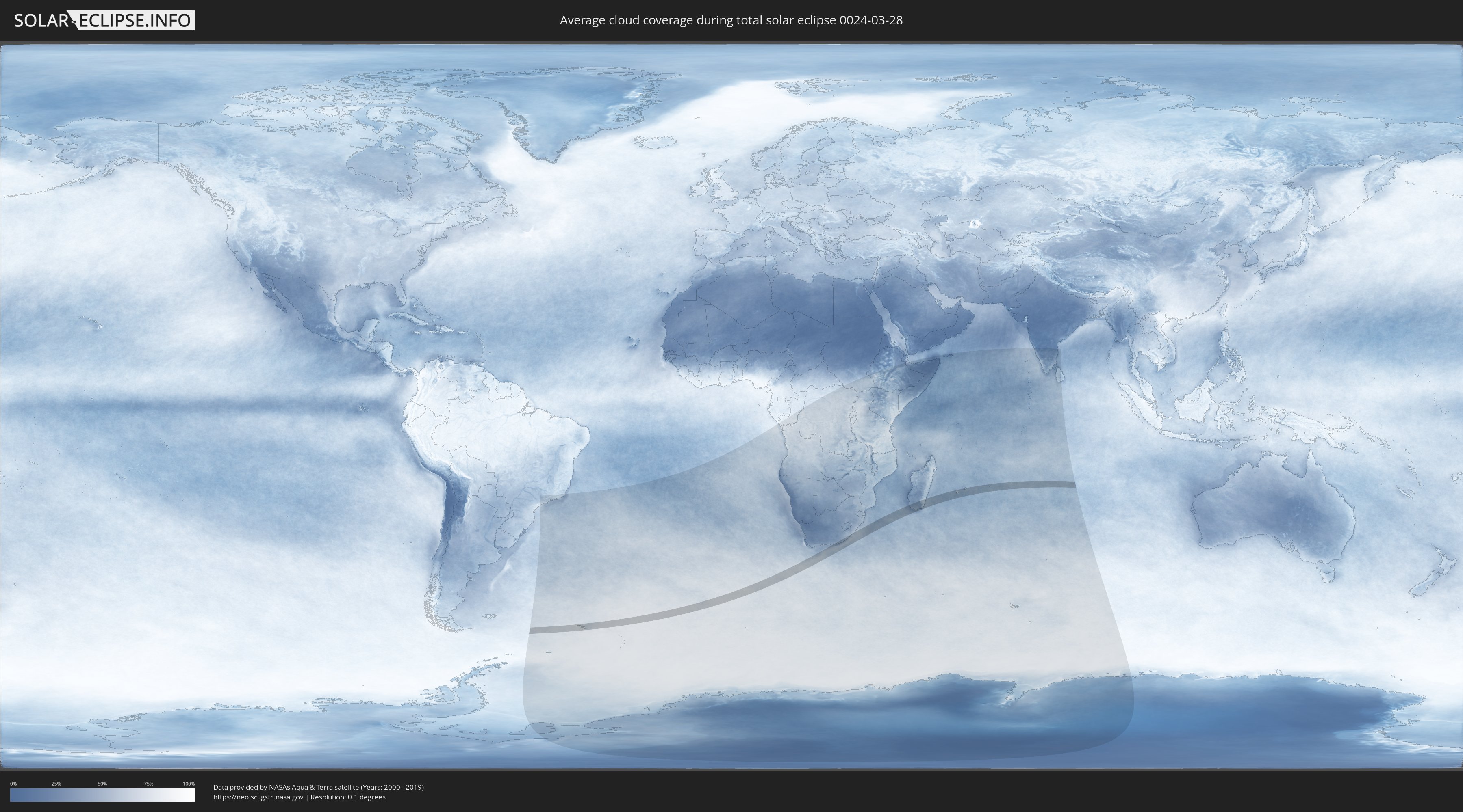
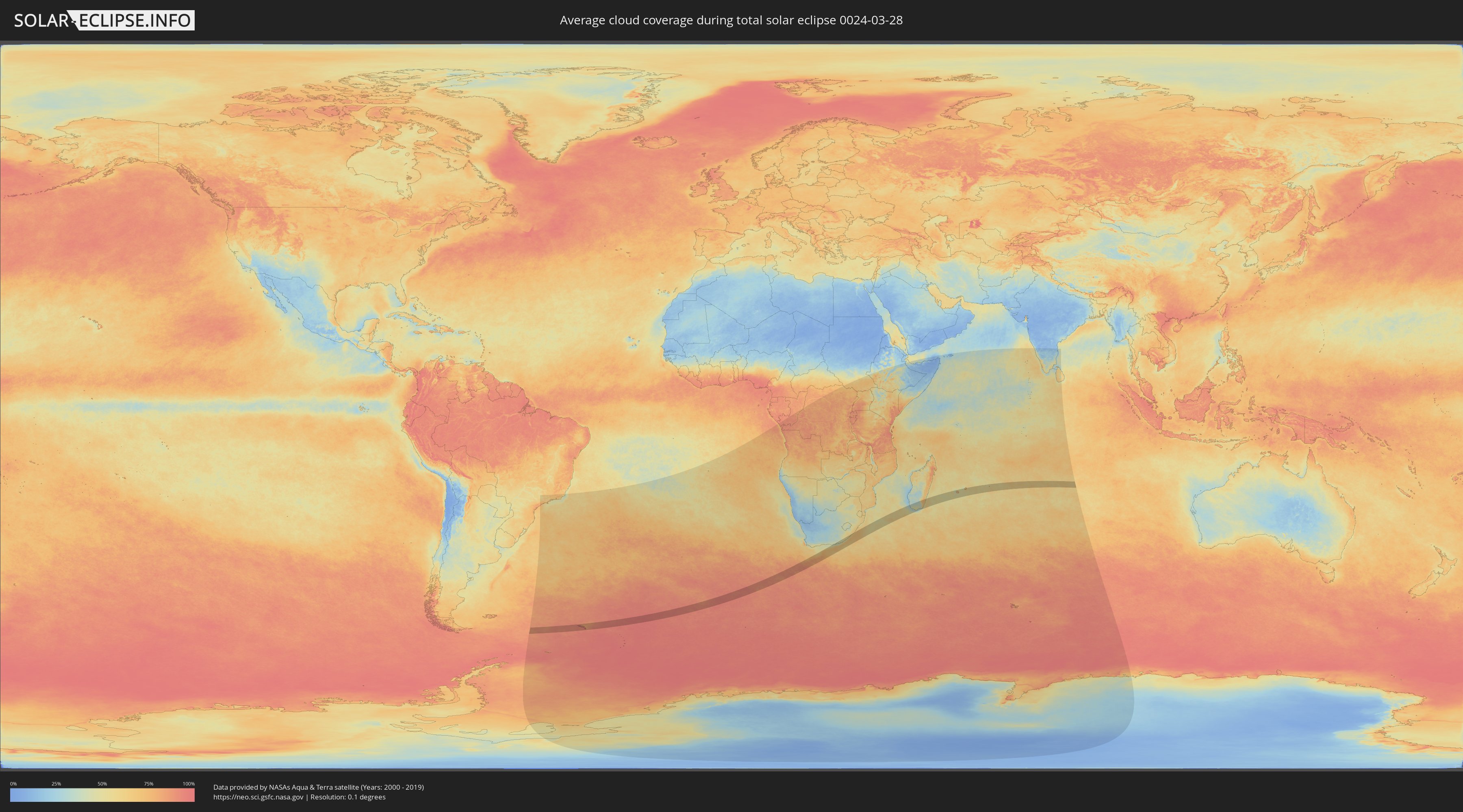
Wie wird das Wetter während der totalen Sonnenfinsternis am 28.03.0024?
Wo ist der beste Ort, um die totale Sonnenfinsternis vom 28.03.0024 zu beobachten?
Die folgenden Karten zeigen die durchschnittliche Bewölkung für den Tag, an dem die totale Sonnenfinsternis
stattfindet. Mit Hilfe der Karten lässt sich der Ort entlang des Finsternispfades eingrenzen,
der die besten Aussichen auf einen klaren wolkenfreien Himmel bietet.
Trotzdem muss man immer lokale Gegenenheiten beachten und sollte sich genau über das Wetter an seinem
gewählten Beobachtungsort informieren.
Die Daten stammen von den beiden NASA-Satelliten
AQUA und TERRA
und wurden über einen Zeitraum von 19 Jahren (2000 - 2019) gemittelt.
Detaillierte Länderkarten
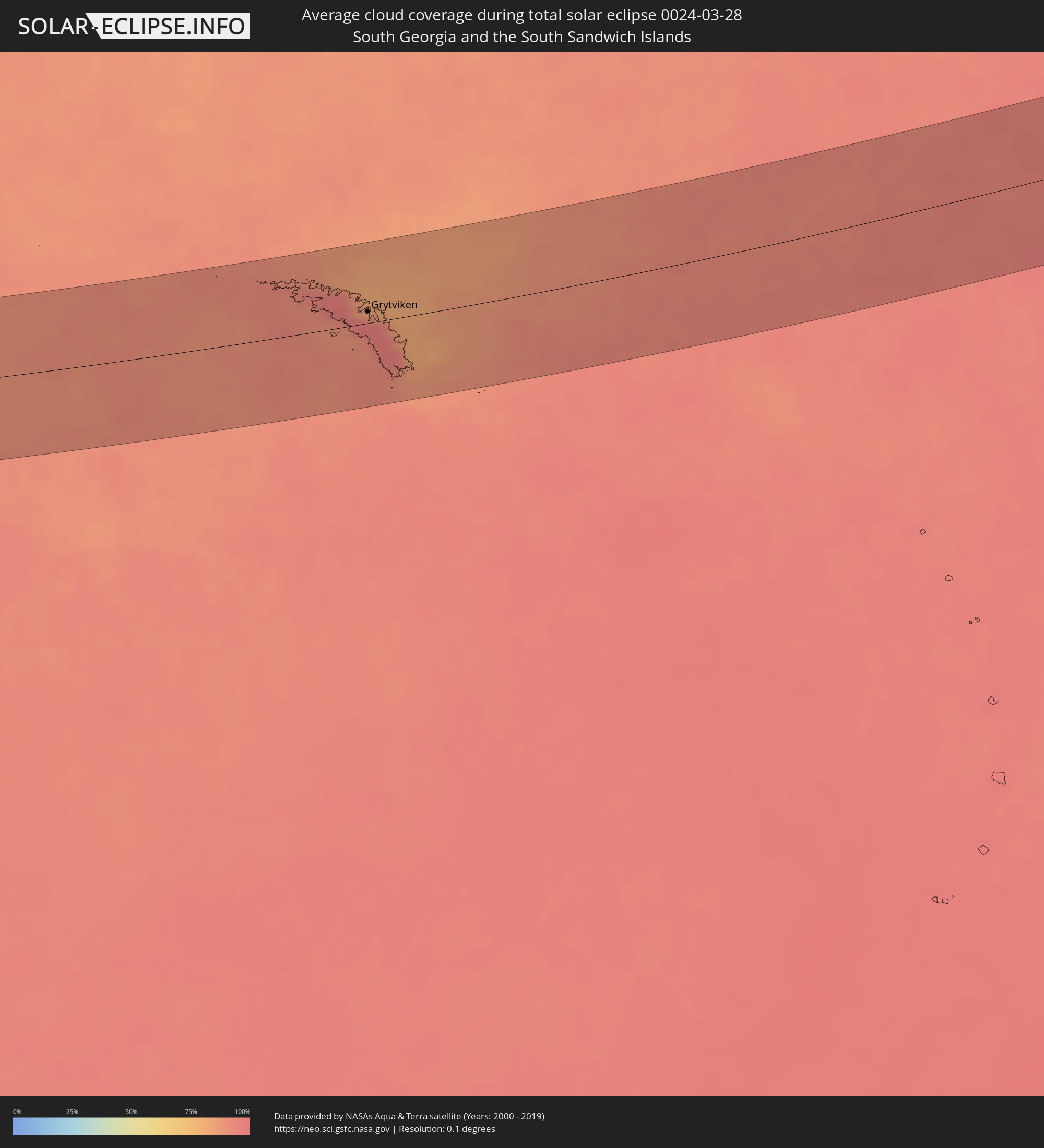 Südgeorgien und die Südlichen Sandwichinseln
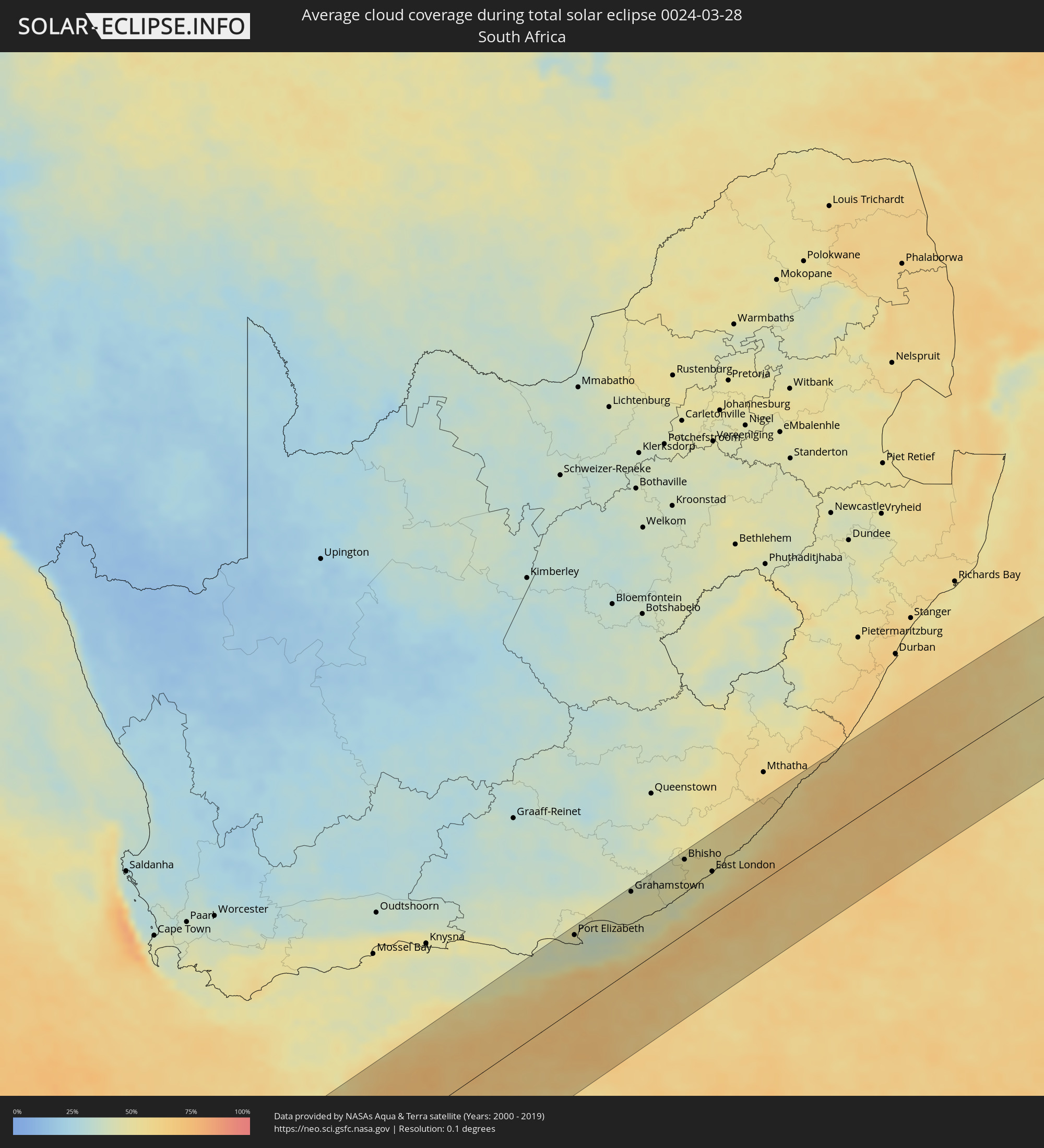 Südafrika
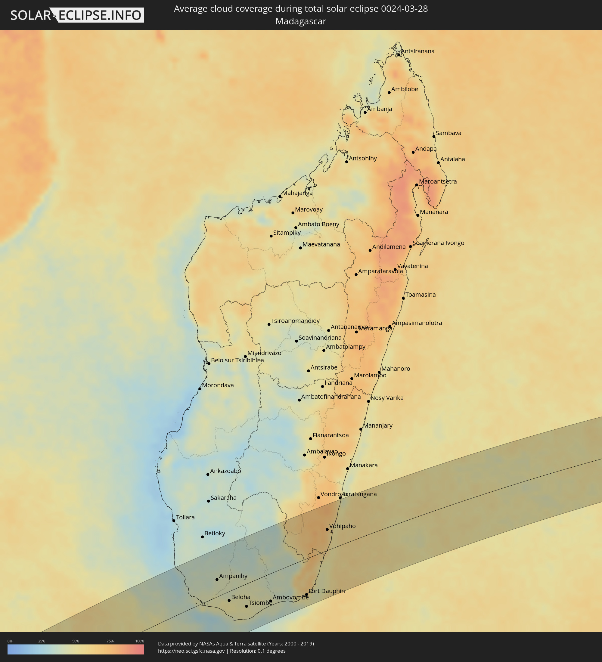 Madagaskar
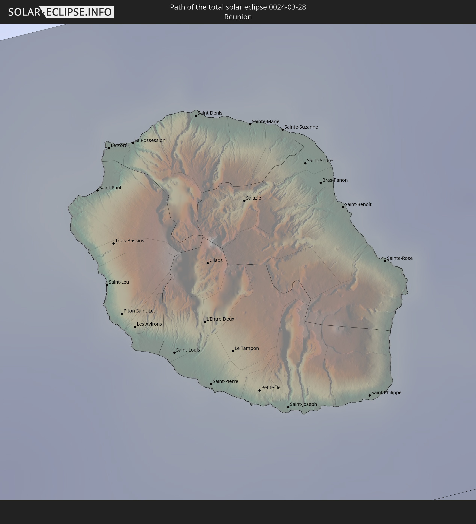
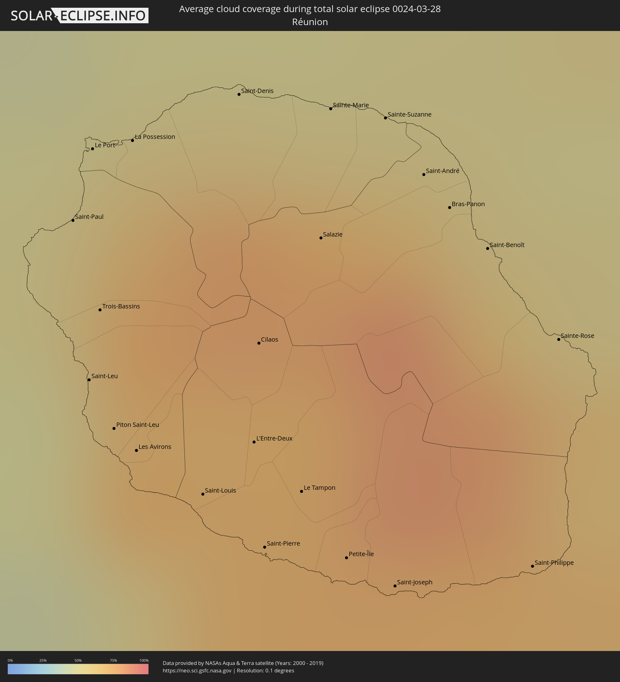 Réunion
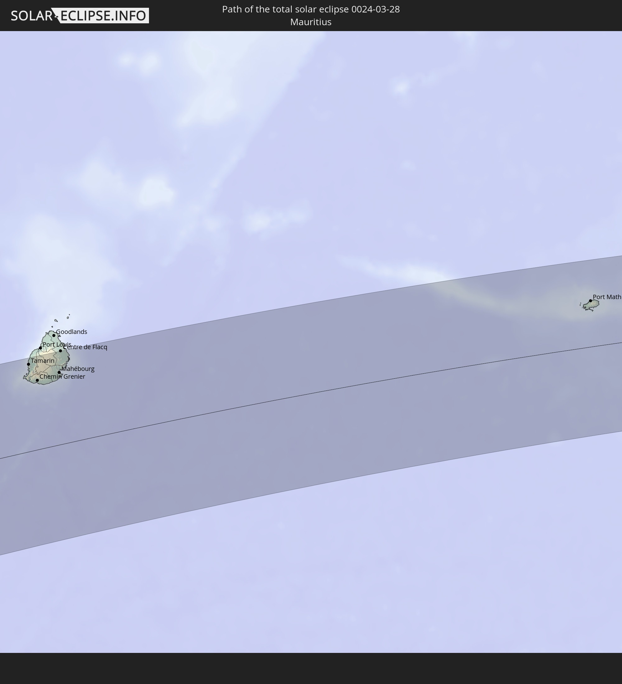
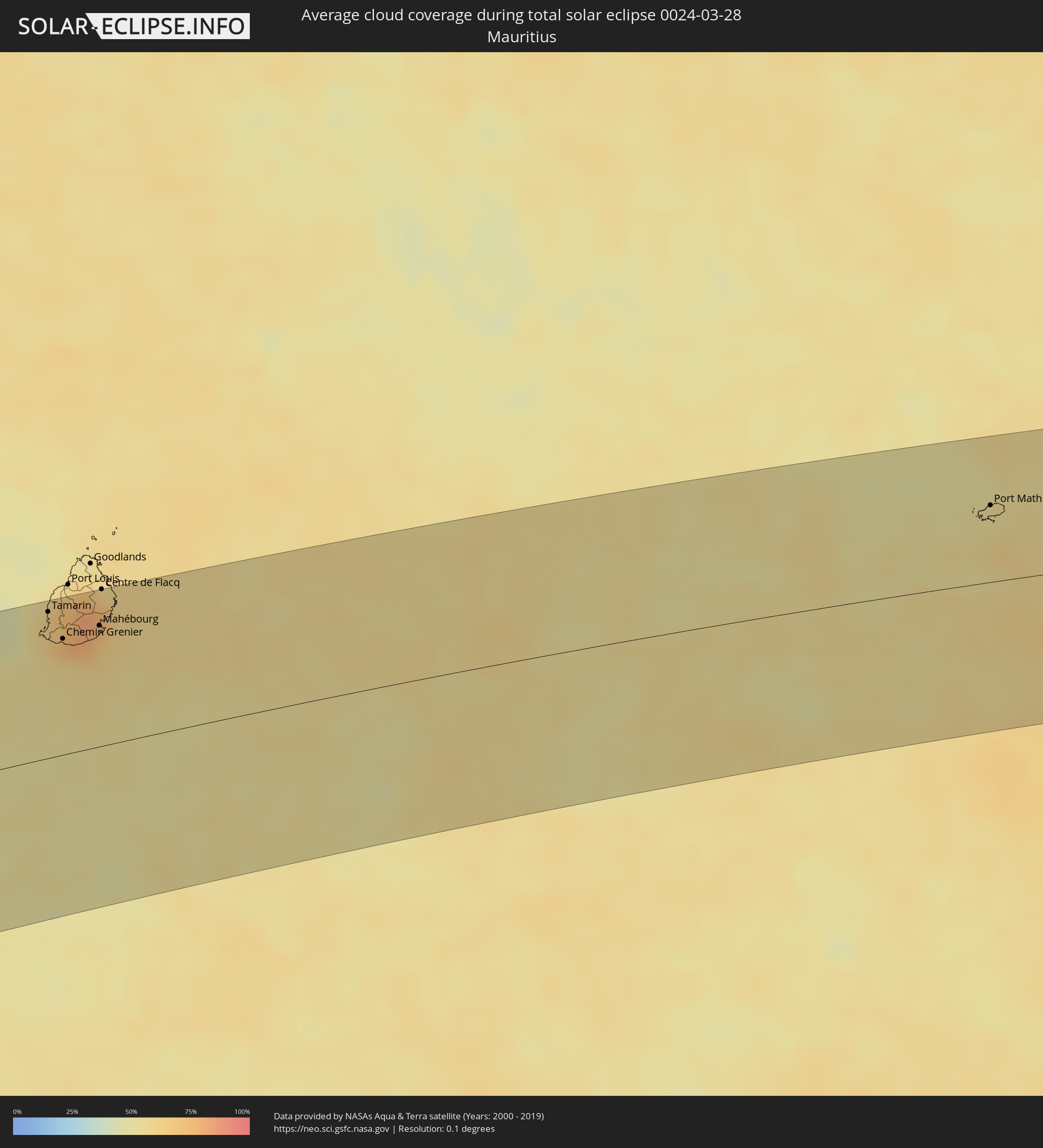 Mauritius
Orte im Finsternispfad
Die nachfolgene Tabelle zeigt Städte und Orte mit mehr als 5.000 Einwohnern, die sich im Finsternispfad befinden. Städte mit mehr als 100.000 Einwohnern sind dick gekennzeichnet. Mit einem Klick auf den Ort öffnet sich eine Detailkarte die die Lage des jeweiligen Ortes zusammen mit dem Verlauf der zentralen Finsternis präsentiert.
| Ort | Typ | Dauer der Verfinsterung | Ortszeit bei maximaler Verfinsterung | Entfernung zur Zentrallinie | Ø Bewölkung |
|
Grytviken
|
total | - | 07:39:03 UTC-02:00 | 12 km | 92% |
|
Port Elizabeth, Eastern Cape
|
total | - | 12:22:38 UTC+01:30 | 95 km | 44% |
|
Grahamstown, Eastern Cape
|
total | - | 12:25:22 UTC+01:30 | 102 km | 46% |
|
Port Alfred, Eastern Cape
|
total | - | 12:25:43 UTC+01:30 | 58 km | 46% |
|
Bhisho, Eastern Cape
|
total | - | 12:27:49 UTC+01:30 | 97 km | 49% |
|
East London, Eastern Cape
|
total | - | 12:28:33 UTC+01:30 | 57 km | 48% |
|
Butterworth, Eastern Cape
|
total | - | 12:29:57 UTC+01:30 | 108 km | 54% |
|
Port Saint John’s, Eastern Cape
|
total | - | 12:33:47 UTC+01:30 | 101 km | 59% |
|
Ampanihy, Atsimo-Andrefana
|
total | - | 14:10:58 UTC+02:27 | 39 km | 41% |
|
Tranovaho, Androy
|
total | - | 14:10:22 UTC+02:27 | 32 km | 46% |
|
Beloha, Androy
|
total | - | 14:10:43 UTC+02:27 | 22 km | 50% |
|
Beteza, Androy
|
total | - | 14:11:59 UTC+02:27 | 49 km | 43% |
|
Kopoky, Androy
|
total | - | 14:10:55 UTC+02:27 | 31 km | 49% |
|
Tsiombe, Androy
|
total | - | 14:11:13 UTC+02:27 | 53 km | 47% |
|
Ambovombe, Androy
|
total | - | 14:12:25 UTC+02:27 | 65 km | 43% |
|
Amboasary, Anosy
|
total | - | 14:13:07 UTC+02:27 | 62 km | 39% |
|
Fort Dauphin, Anosy
|
total | - | 14:14:05 UTC+02:27 | 85 km | 48% |
|
Vohipaho, Atsimo-Atsinanana
|
total | - | 14:17:17 UTC+02:27 | 49 km | 67% |
|
Vangaindrano, Atsimo-Atsinanana
|
total | - | 14:17:45 UTC+02:27 | 66 km | 61% |
|
Saint-Paul, Réunion
|
total | - | 15:46:33 UTC+03:41 | 72 km | 75% |
|
Saint-Leu, Réunion
|
total | - | 15:46:20 UTC+03:41 | 55 km | 55% |
|
Le Port, Réunion
|
total | - | 15:46:41 UTC+03:41 | 80 km | 67% |
|
Trois-Bassins, Réunion
|
total | - | 15:46:27 UTC+03:41 | 62 km | 70% |
|
Piton Saint-Leu, Réunion
|
total | - | 15:46:17 UTC+03:41 | 49 km | 55% |
|
La Possession, Réunion
|
total | - | 15:46:44 UTC+03:41 | 79 km | 67% |
|
Les Avirons, Réunion
|
total | - | 15:46:17 UTC+03:41 | 46 km | 55% |
|
Saint-Louis, Réunion
|
total | - | 15:46:18 UTC+03:41 | 39 km | 44% |
|
Saint-Denis, Réunion
|
total | - | 15:46:57 UTC+03:41 | 82 km | 74% |
|
L'Entre-Deux, Réunion
|
total | - | 15:46:27 UTC+03:41 | 43 km | 74% |
|
Cilaos, Réunion
|
total | - | 15:46:36 UTC+03:41 | 54 km | 74% |
|
Saint-Pierre, Réunion
|
total | - | 15:46:18 UTC+03:41 | 31 km | 54% |
|
Le Tampon, Réunion
|
total | - | 15:46:26 UTC+03:41 | 37 km | 54% |
|
Salazie, Réunion
|
total | - | 15:46:50 UTC+03:41 | 64 km | 79% |
|
Sainte-Marie, Réunion
|
total | - | 15:47:03 UTC+03:41 | 77 km | 74% |
|
Petite-Île, Réunion
|
total | - | 15:46:24 UTC+03:41 | 28 km | 49% |
|
Sainte-Suzanne, Réunion
|
total | - | 15:47:06 UTC+03:41 | 75 km | 69% |
|
Saint-Joseph, Réunion
|
total | - | 15:46:25 UTC+03:41 | 24 km | 49% |
|
Saint-André, Réunion
|
total | - | 15:47:04 UTC+03:41 | 68 km | 67% |
|
Bras-Panon, Réunion
|
total | - | 15:47:03 UTC+03:41 | 63 km | 67% |
|
Saint-Benoît, Réunion
|
total | - | 15:47:02 UTC+03:41 | 58 km | 67% |
|
Saint-Philippe, Réunion
|
total | - | 15:46:37 UTC+03:41 | 22 km | 55% |
|
Sainte-Rose, Réunion
|
total | - | 15:46:59 UTC+03:41 | 46 km | 66% |
|
Tamarin, Black River
|
total | - | 15:58:05 UTC+03:50 | 95 km | 65% |
|
Chemin Grenier, Savanne
|
total | - | 15:57:57 UTC+03:50 | 75 km | 59% |
|
Vacoas, Plaines Wilhems
|
total | - | 15:58:14 UTC+03:50 | 96 km | 75% |
|
Quatre Bornes, Plaines Wilhems
|
total | - | 15:58:17 UTC+03:50 | 99 km | 75% |
|
Surinam, Savanne
|
total | - | 15:57:58 UTC+03:50 | 72 km | 59% |
|
Souillac, Savanne
|
total | - | 15:57:58 UTC+03:50 | 71 km | 59% |
|
Curepipe, Plaines Wilhems
|
total | - | 15:58:16 UTC+03:50 | 93 km | 75% |
|
Grand Bois, Savanne
|
total | - | 15:58:08 UTC+03:50 | 81 km | 77% |
|
Rivière des Anguilles, Savanne
|
total | - | 15:58:03 UTC+03:50 | 74 km | 63% |
|
Nouvelle France, Grand Port
|
total | - | 15:58:14 UTC+03:50 | 86 km | 76% |
|
Dagotière, Moka
|
total | - | 15:58:24 UTC+03:50 | 100 km | 81% |
|
Camp Diable, Savanne
|
total | - | 15:58:07 UTC+03:50 | 76 km | 63% |
|
Rose Belle, Grand Port
|
total | - | 15:58:13 UTC+03:50 | 82 km | 76% |
|
Quartier Militaire, Moka
|
total | - | 15:58:26 UTC+03:50 | 99 km | 81% |
|
New Grove, Grand Port
|
total | - | 15:58:14 UTC+03:50 | 81 km | 76% |
|
Montagne Blanche
|
total | - | 15:58:27 UTC+03:50 | 93 km | 72% |
|
Plaine Magnien, Grand Port
|
total | - | 15:58:16 UTC+03:50 | 77 km | 64% |
|
Sebastopol, Flacq
|
total | - | 15:58:29 UTC+03:50 | 92 km | 72% |
|
Beau Vallon, Grand Port
|
total | - | 15:58:18 UTC+03:50 | 78 km | 64% |
|
Mahébourg, Grand Port
|
total | - | 15:58:19 UTC+03:50 | 79 km | 64% |
|
Centre de Flacq, Flacq
|
total | - | 15:58:39 UTC+03:50 | 102 km | 77% |
|
Ecroignard, Flacq
|
total | - | 15:58:37 UTC+03:50 | 98 km | 77% |
|
Bel Air Rivière Sèche, Flacq
|
total | - | 15:58:36 UTC+03:50 | 94 km | 72% |
|
Quatre Cocos, Flacq
|
total | - | 15:58:41 UTC+03:50 | 99 km | 61% |
|
Port Mathurin, Rodrigues
|
total | - | 16:04:46 UTC+03:50 | 51 km | 56% |