Totale Sonnenfinsternis vom 19.03.0052
| Wochentag: | Dienstag |
| Maximale Dauer der Verfinsterung: | 05m02s |
| Maximale Breite des Finsternispfades: | 200 km |
| Saroszyklus: | 69 |
| Bedeckungsgrad: | 100% |
| Magnitude: | 1.0609 |
| Gamma: | -0.0509 |
Wo kann man die Sonnenfinsternis vom 19.03.0052 sehen?
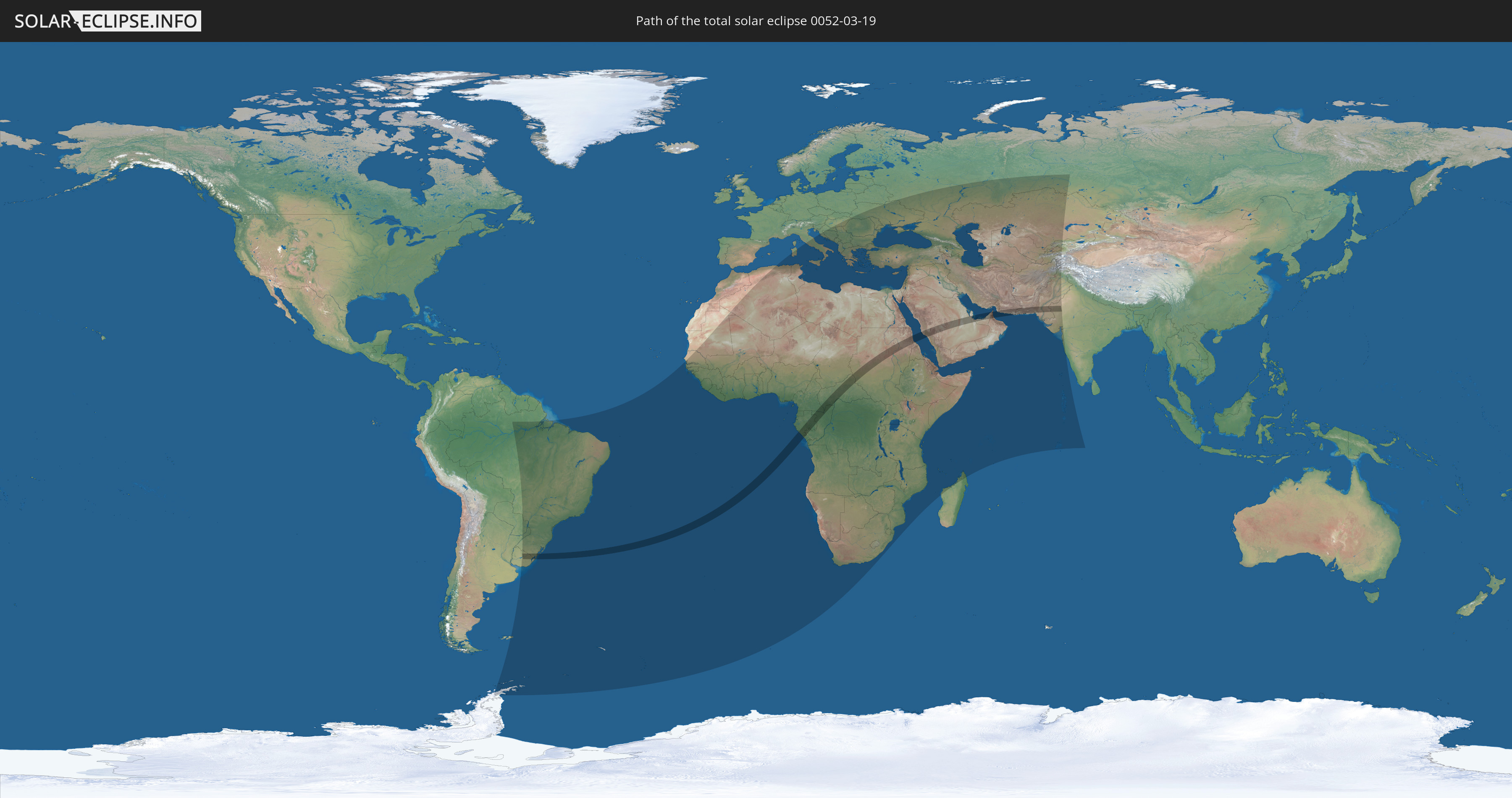
Die Sonnenfinsternis am 19.03.0052 kann man in 107 Ländern als partielle Sonnenfinsternis beobachten.
Der Finsternispfad verläuft durch 15 Länder. Nur in diesen Ländern ist sie als totale Sonnenfinsternis zu sehen.
In den folgenden Ländern ist die Sonnenfinsternis total zu sehen
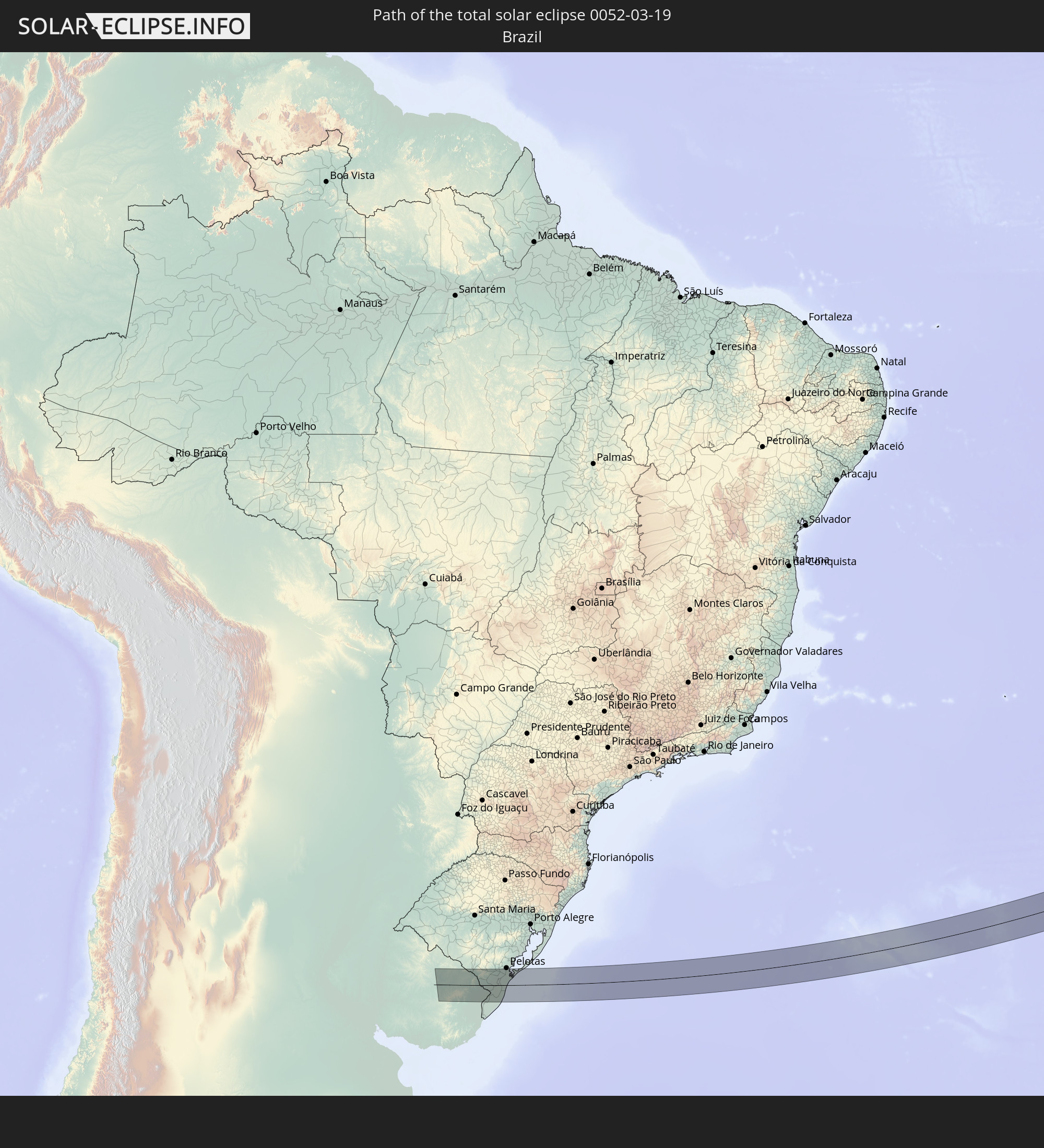 Brasilien
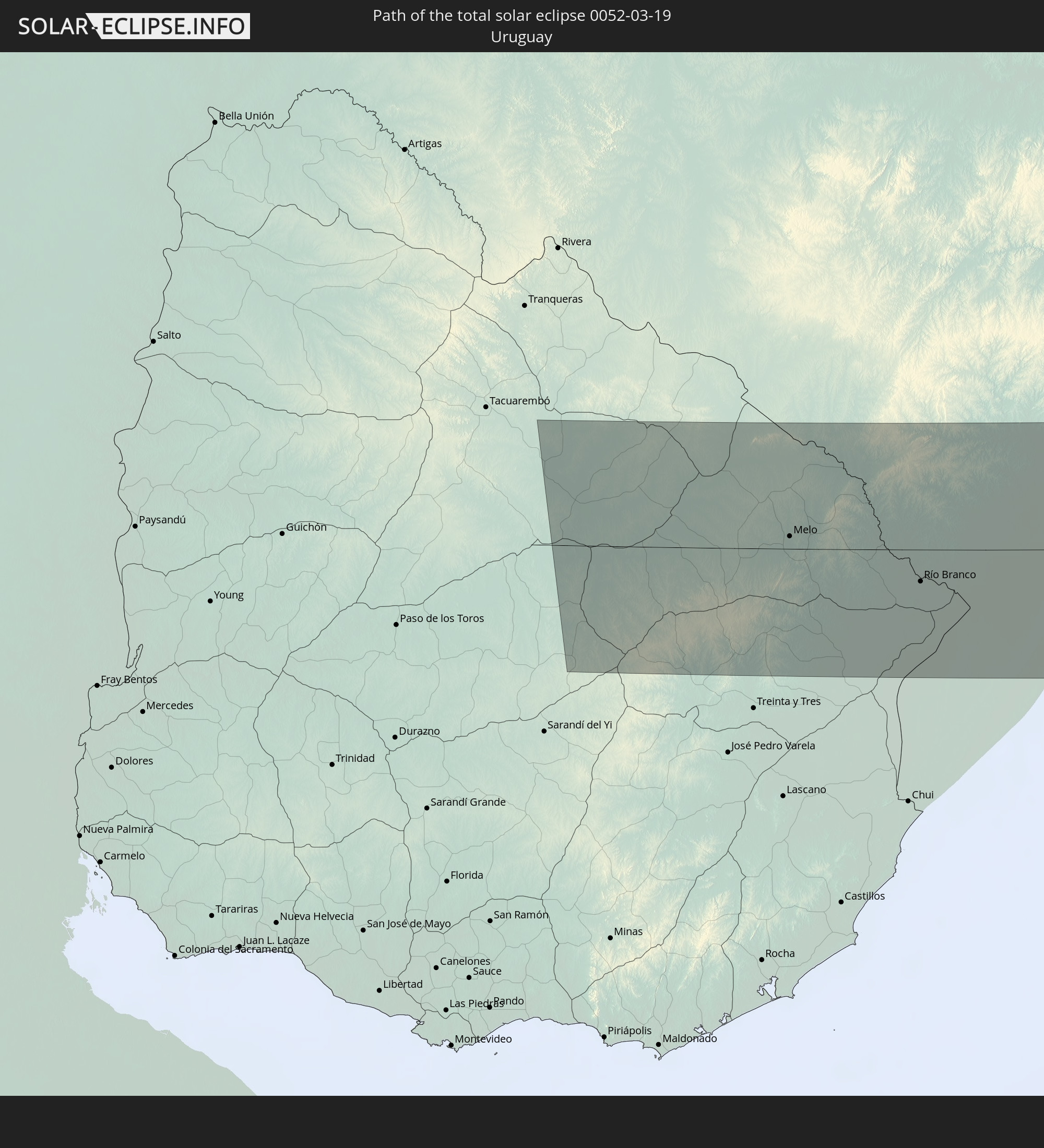 Uruguay
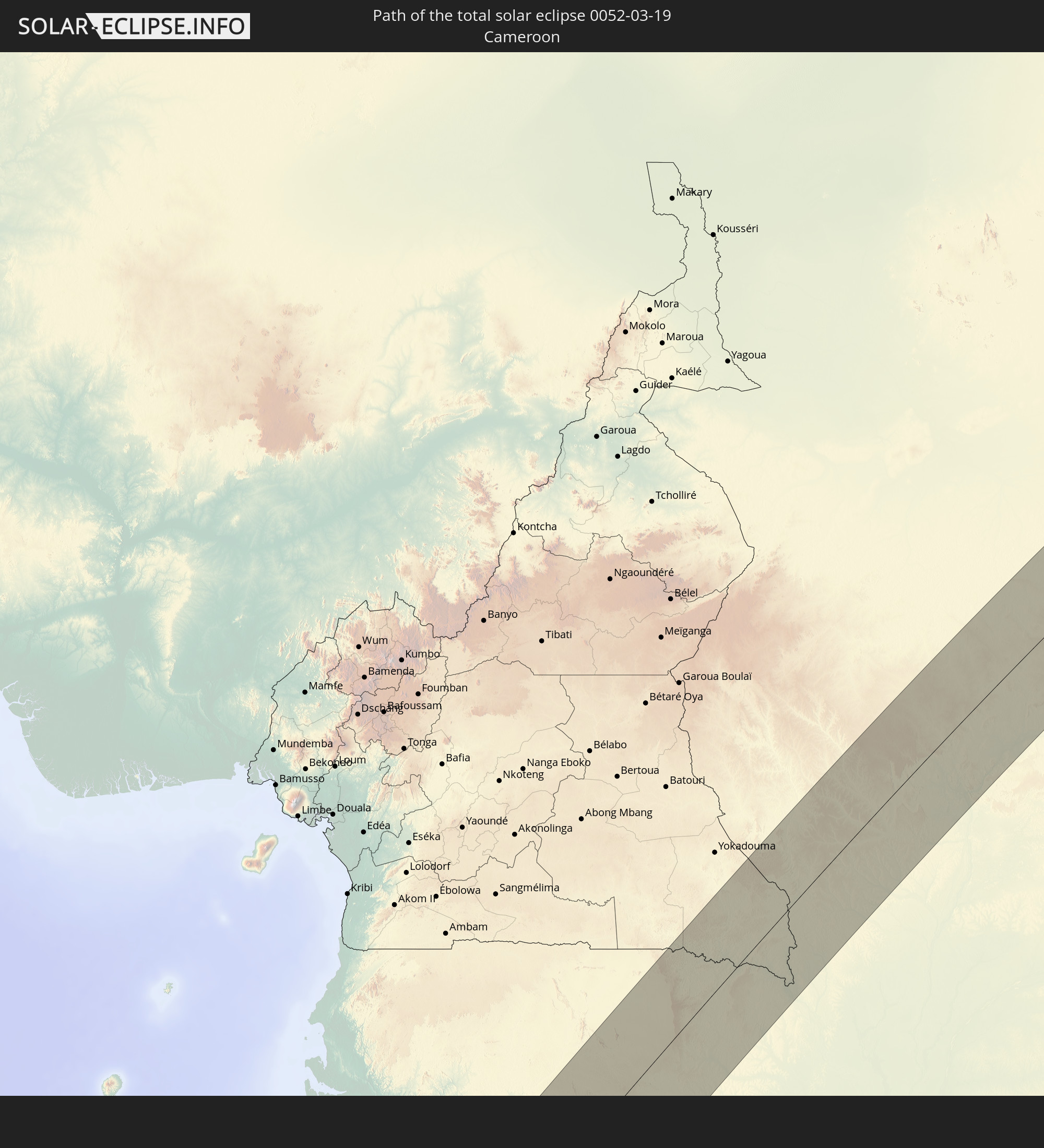 Kamerun
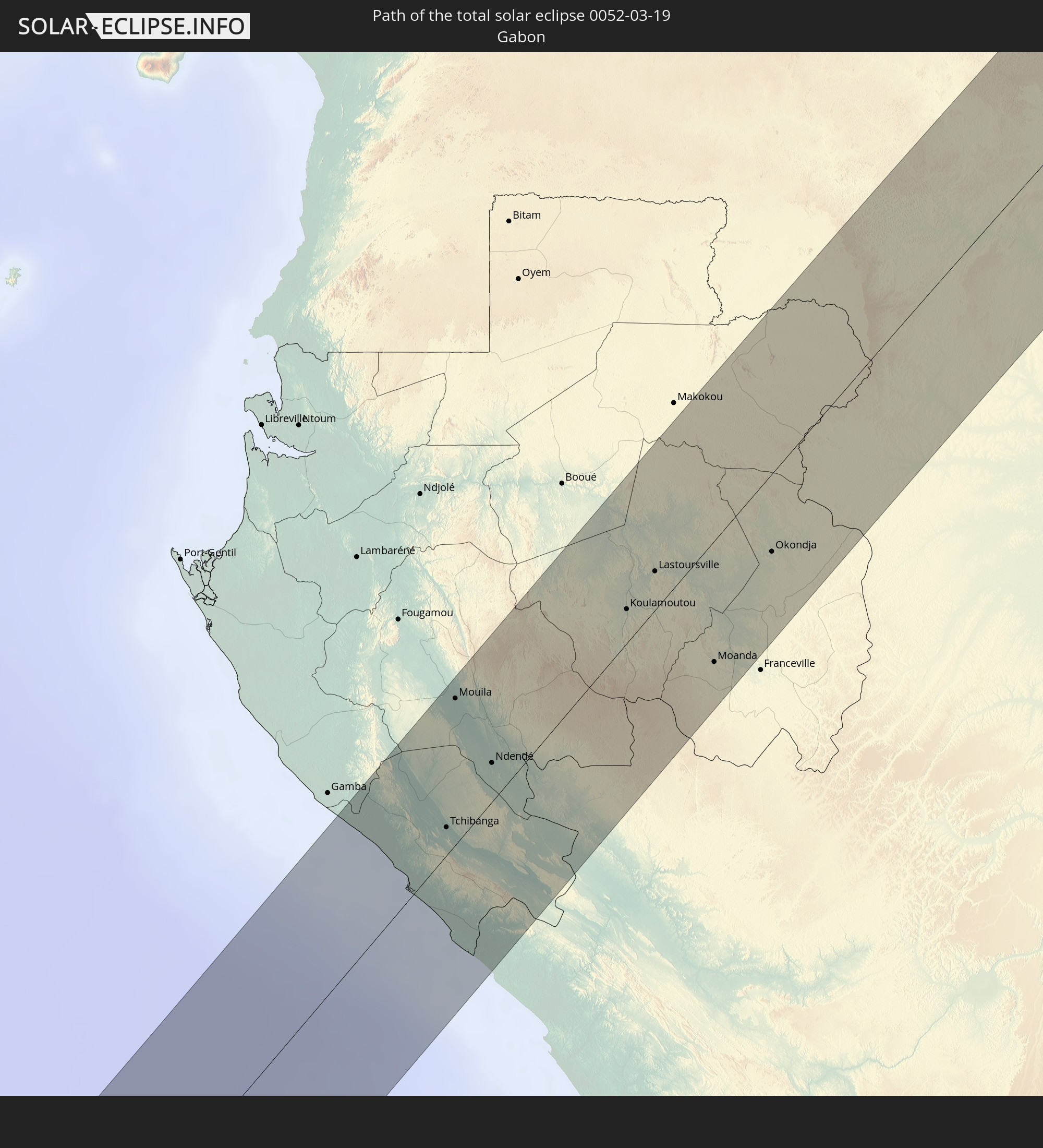 Gabun
Gabun
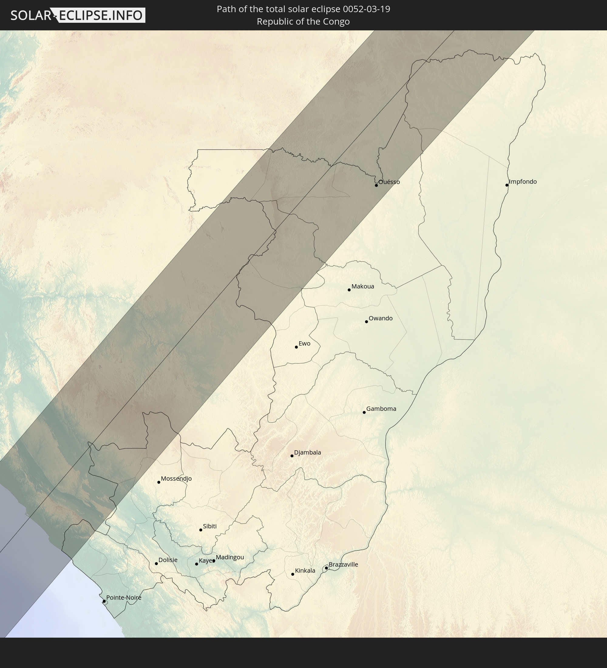 Republik Kongo
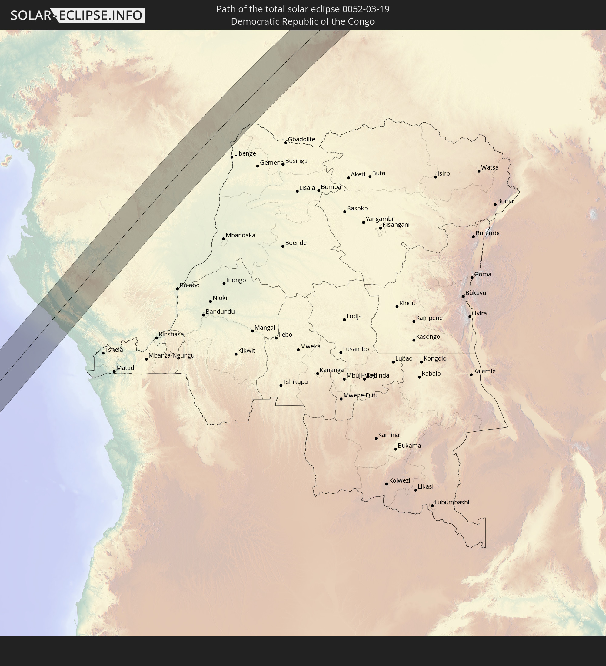 Demokratische Republik Kongo
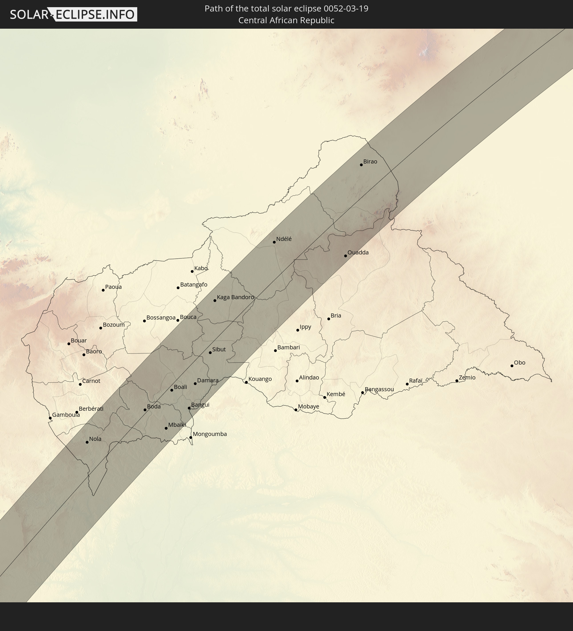 Zentralafrikanische Republik
 Sudan
Sudan
 Saudi-Arabien
 Iran
Iran
 Katar
Katar
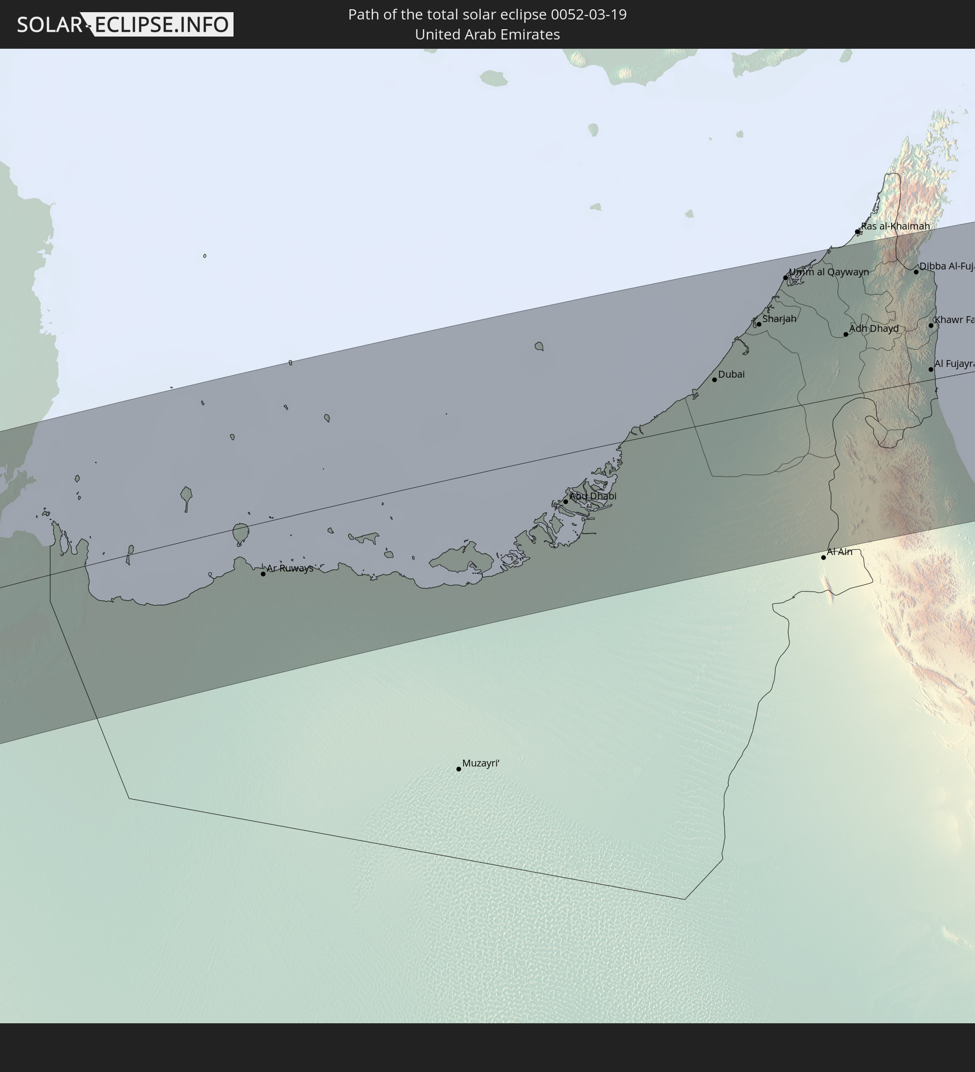 Vereinigte Arabische Emirate
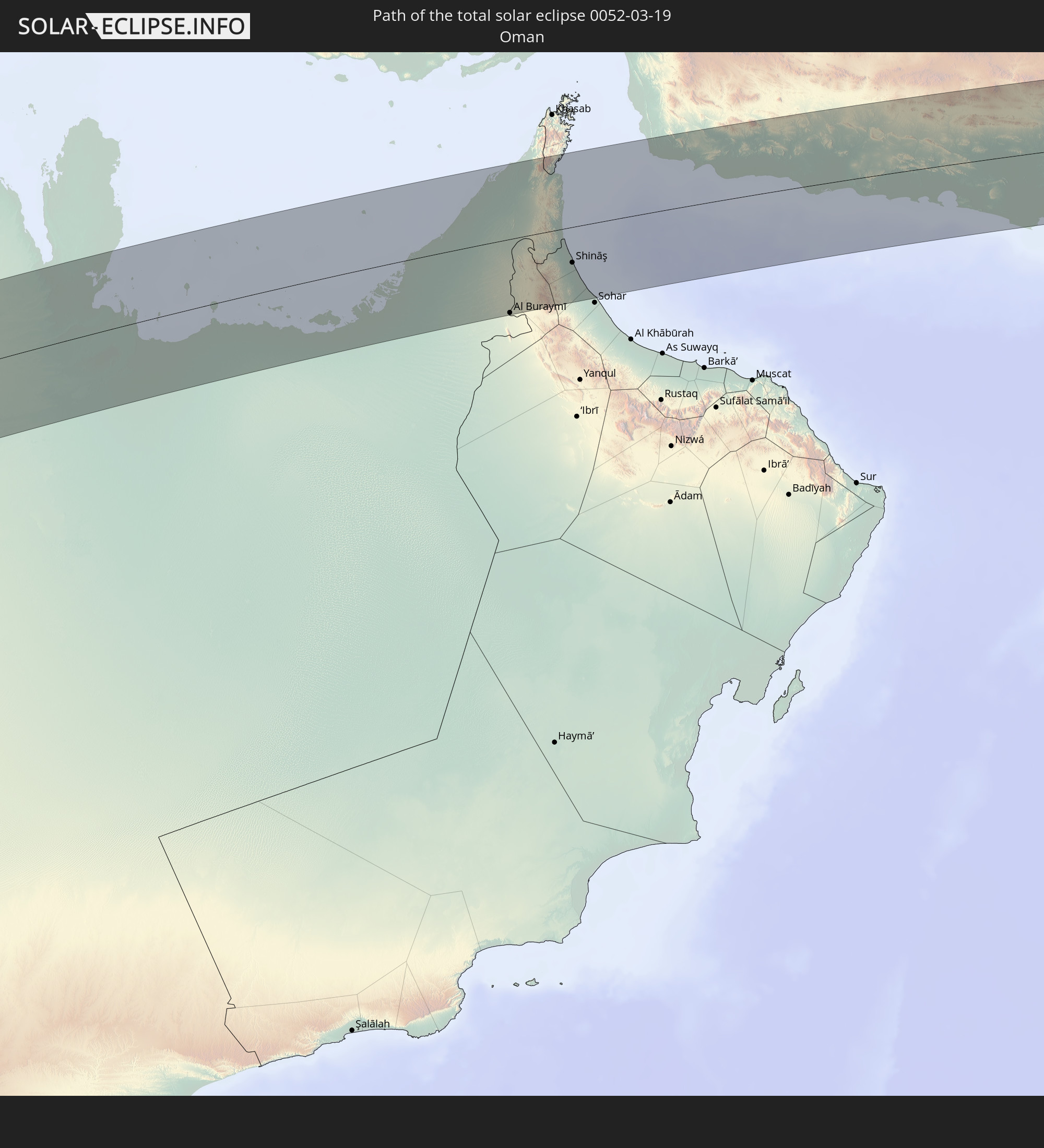 Oman
Oman
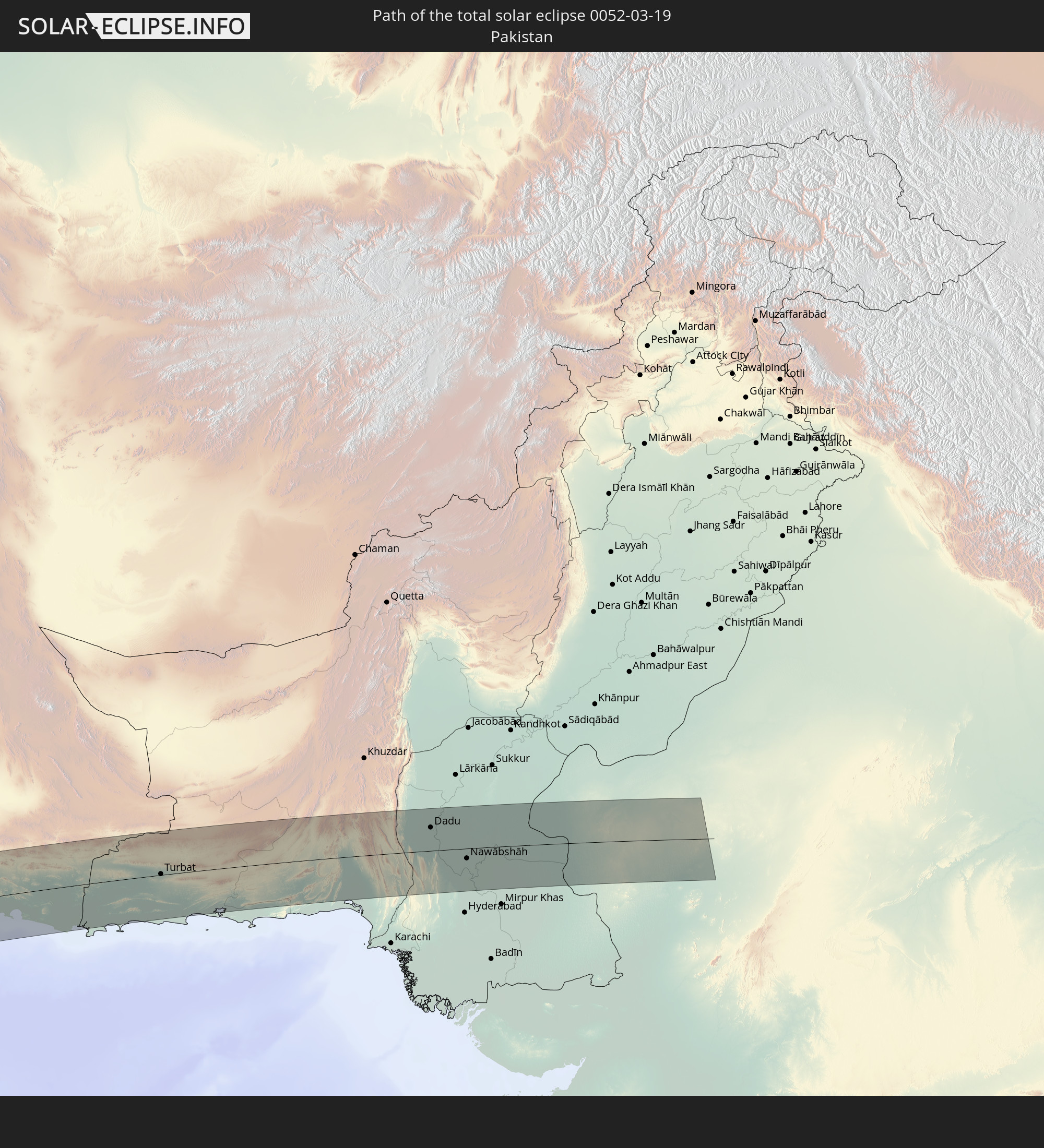 Pakistan
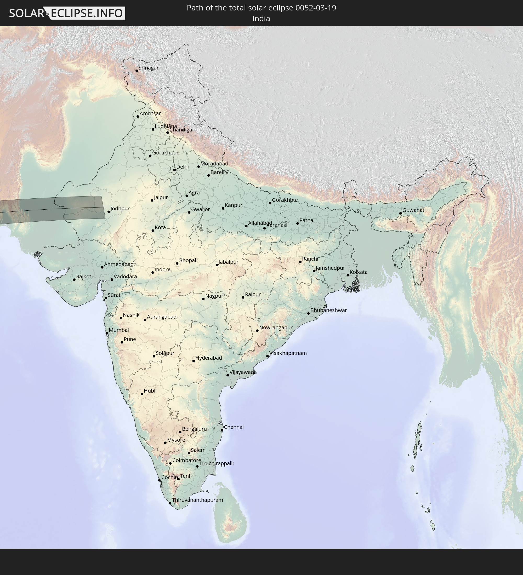 Indien
In den folgenden Ländern ist die Sonnenfinsternis partiell zu sehen
 Russland
 Antarktika
 Brasilien
 Argentinien
 Paraguay
 Falklandinseln
 Uruguay
 Südgeorgien und die Südlichen Sandwichinseln
 Senegal
 Mauretanien
 Gambia
 Guinea-Bissau
 Guinea
 St. Helena
 Sierra Leone
 Mali
Mali
 Liberia
 Algerien
 Elfenbeinküste
 Burkina Faso
 Ghana
Ghana
 Togo
Togo
 Niger
Niger
 Benin
Benin
 Nigeria
 Äquatorialguinea
 São Tomé und Príncipe
 Italien
 Tunesien
 Kamerun
 Gabun
Gabun
 Libyen
 Republik Kongo
 Angola
 Namibia
 Demokratische Republik Kongo
 Vatikanstadt
 Tschad
 Kroatien
 Malta
Malta
 Zentralafrikanische Republik
 Bosnien und Herzegowina
 Ungarn
 Südafrika
 Montenegro
 Serbien
 Albanien
 Griechenland
 Botswana
 Rumänien
 Mazedonien
 Sudan
Sudan
 Sambia
 Ukraine
 Bulgarien
 Weißrussland
 Ägypten
 Simbabwe
 Türkei
 Moldawien
 Lesotho
 Ruanda
 Burundi
 Tansania
 Uganda
 Mosambik
 Swasiland
 Republik Zypern
 Malawi
 Äthiopien
 Kenia
Kenia
 Staat Palästina
 Israel
 Saudi-Arabien
 Jordanien
 Libanon
 Syrien
 Eritrea
 Irak
Irak
 Georgien
 Französische Süd- und Antarktisgebiete
 Somalia
 Dschibuti
 Jemen
Jemen
 Madagaskar
 Komoren
 Armenien
 Iran
Iran
 Aserbaidschan
 Mayotte
 Seychellen
 Kasachstan
 Kuwait
 Bahrain
 Katar
Katar
 Vereinigte Arabische Emirate
 Oman
Oman
 Turkmenistan
 Usbekistan
 Mauritius
 Afghanistan
 Pakistan
 Tadschikistan
 Indien
 Kirgisistan
 Britisches Territorium im Indischen Ozean
 Malediven
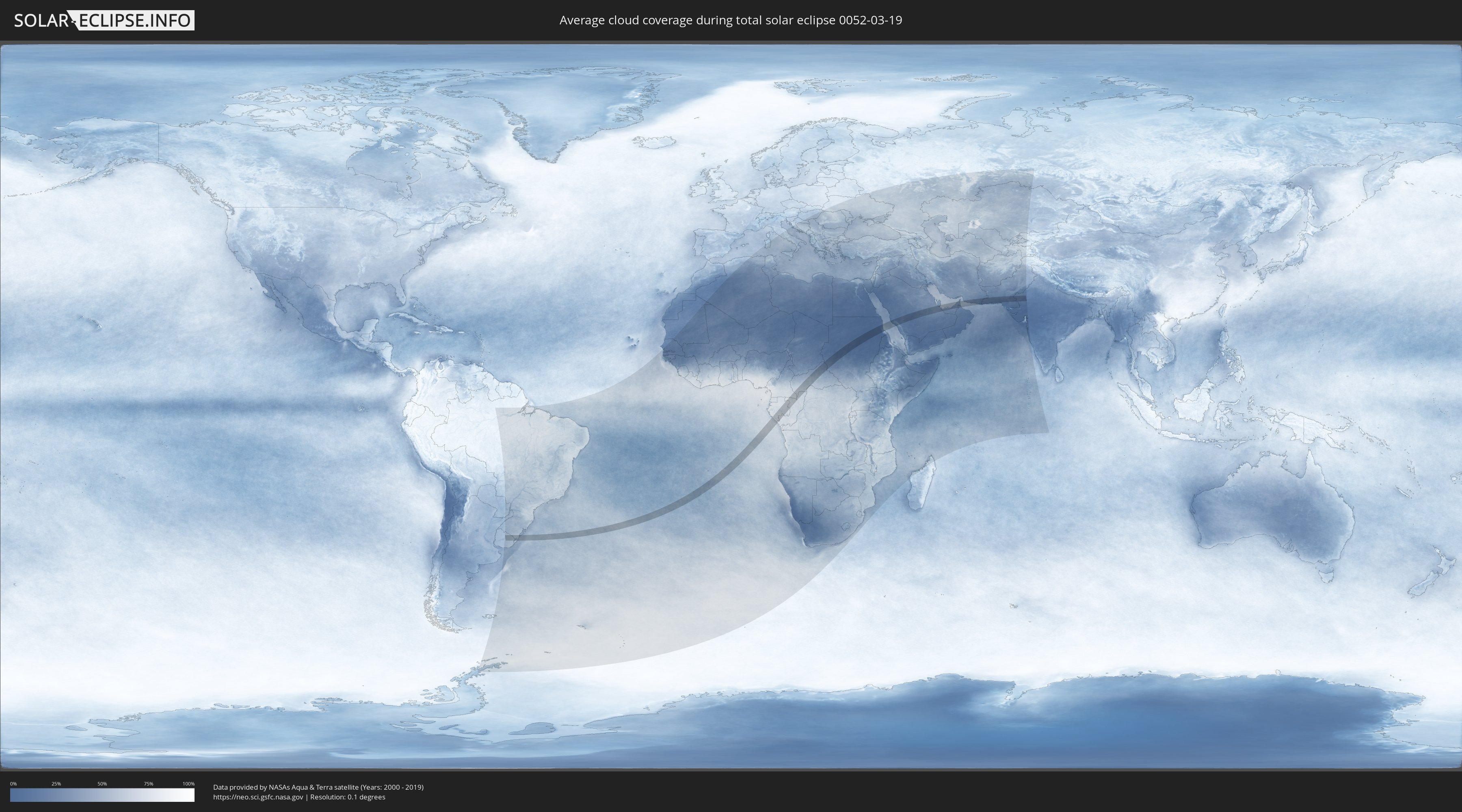
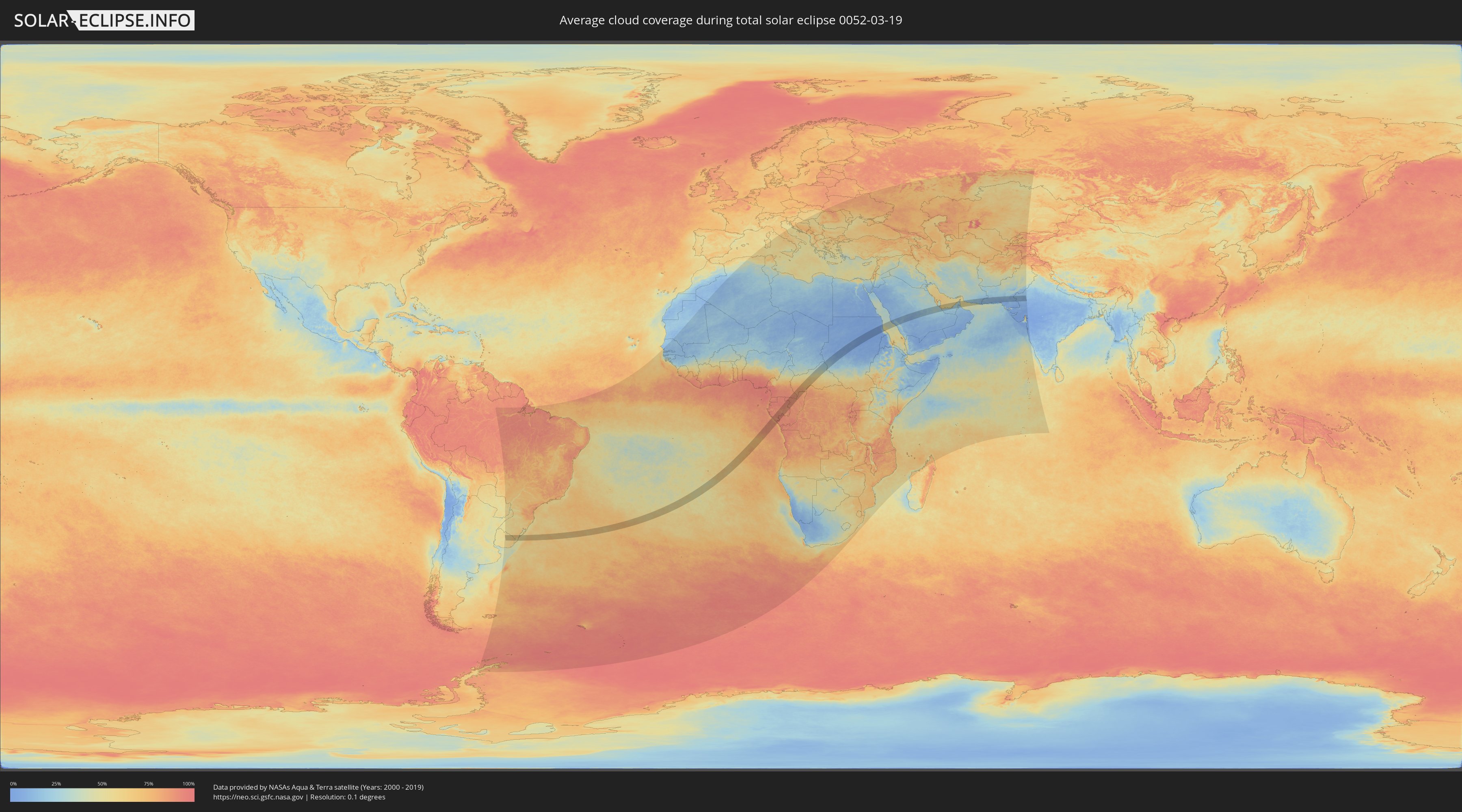
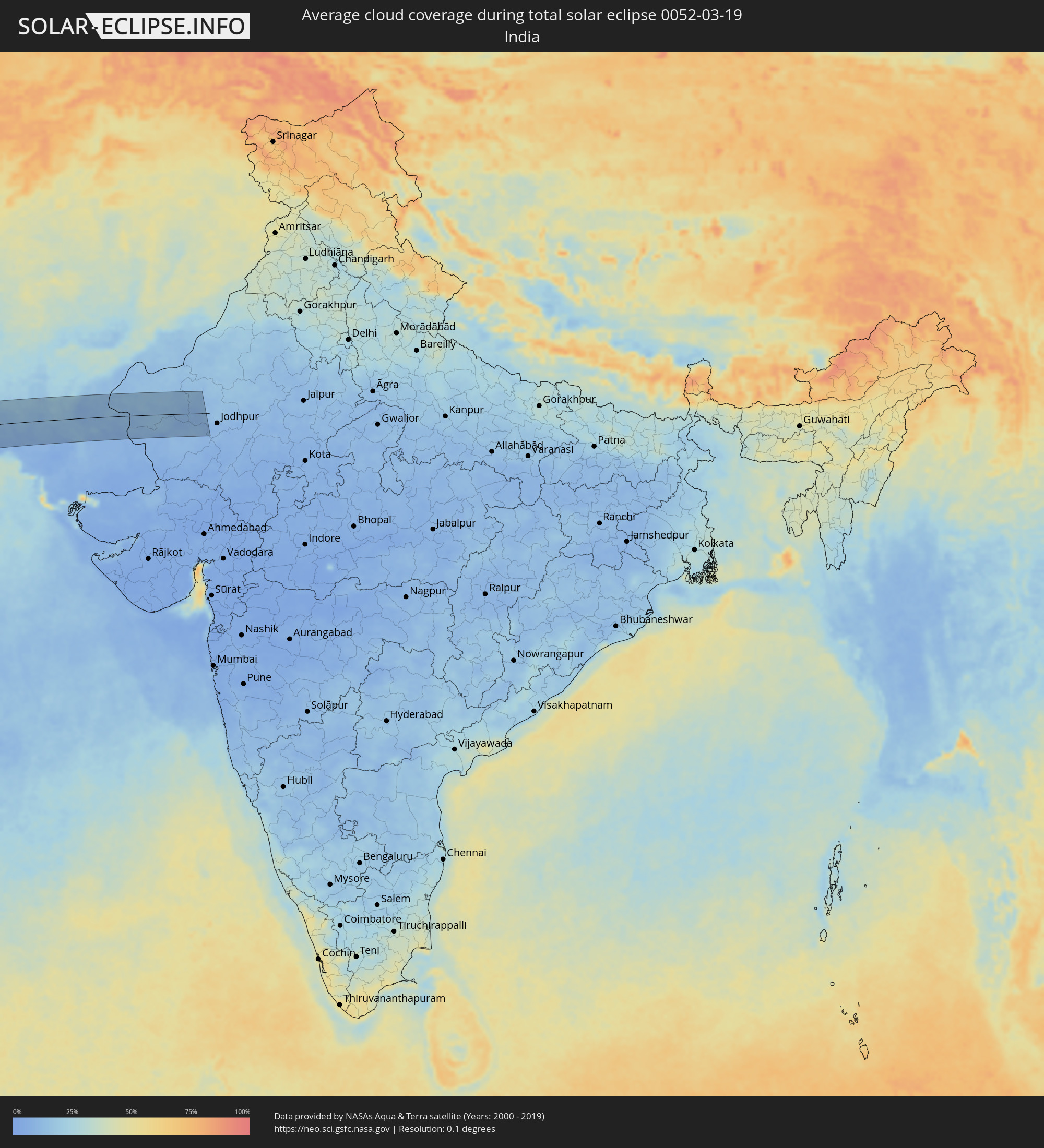
Wie wird das Wetter während der totalen Sonnenfinsternis am 19.03.0052?
Wo ist der beste Ort, um die totale Sonnenfinsternis vom 19.03.0052 zu beobachten?
Die folgenden Karten zeigen die durchschnittliche Bewölkung für den Tag, an dem die totale Sonnenfinsternis
stattfindet. Mit Hilfe der Karten lässt sich der Ort entlang des Finsternispfades eingrenzen,
der die besten Aussichen auf einen klaren wolkenfreien Himmel bietet.
Trotzdem muss man immer lokale Gegenenheiten beachten und sollte sich genau über das Wetter an seinem
gewählten Beobachtungsort informieren.
Die Daten stammen von den beiden NASA-Satelliten
AQUA und TERRA
und wurden über einen Zeitraum von 19 Jahren (2000 - 2019) gemittelt.
Detaillierte Länderkarten
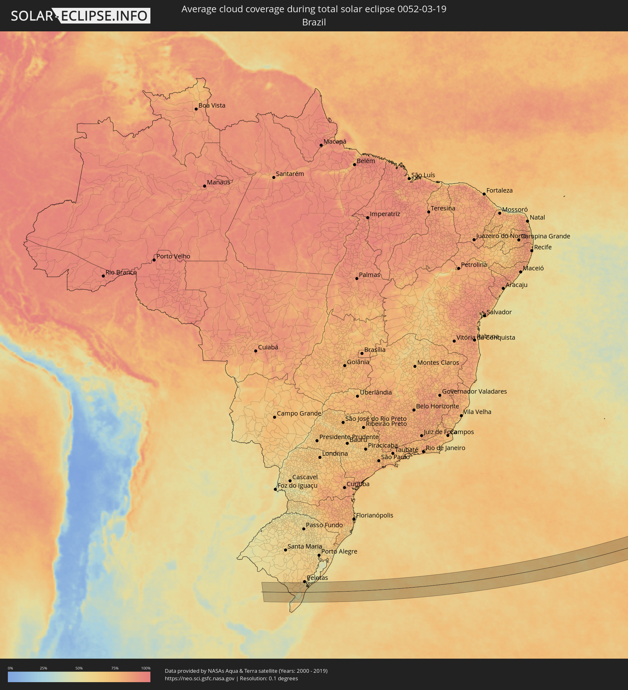 Brasilien
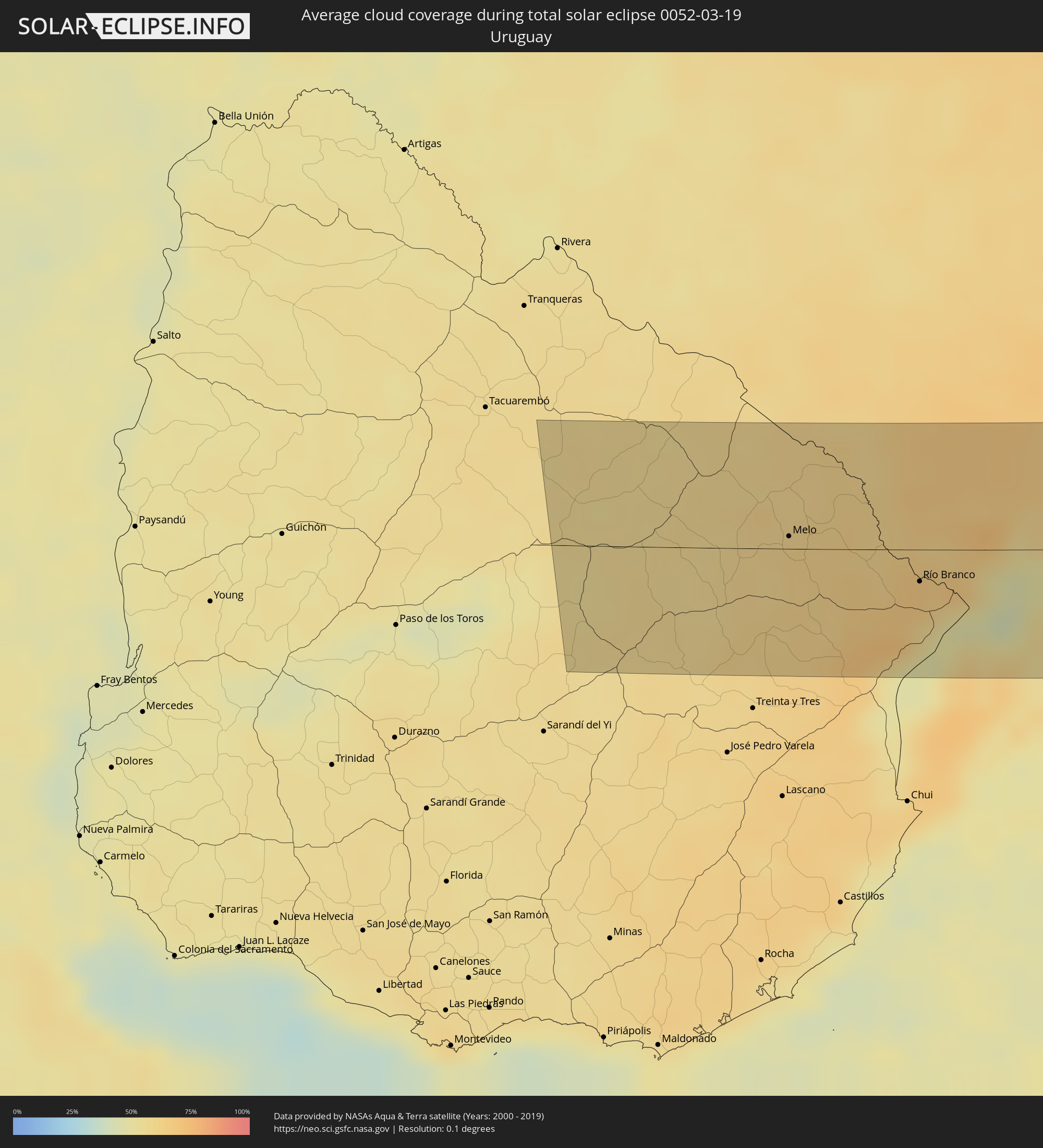 Uruguay
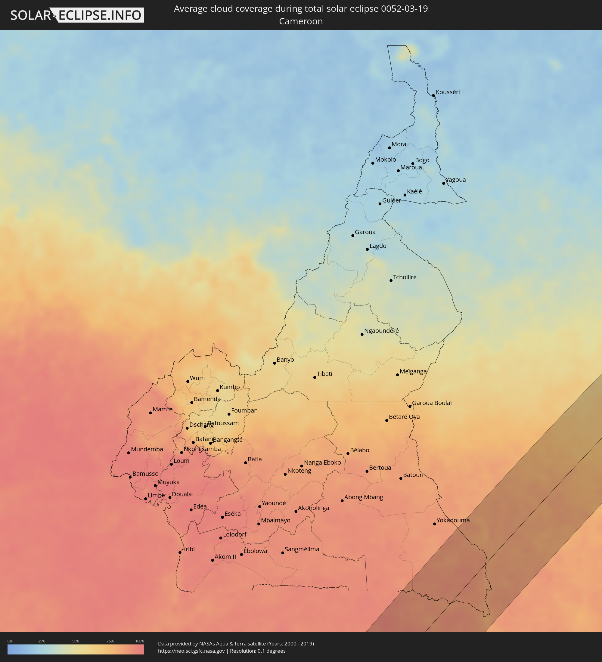 Kamerun
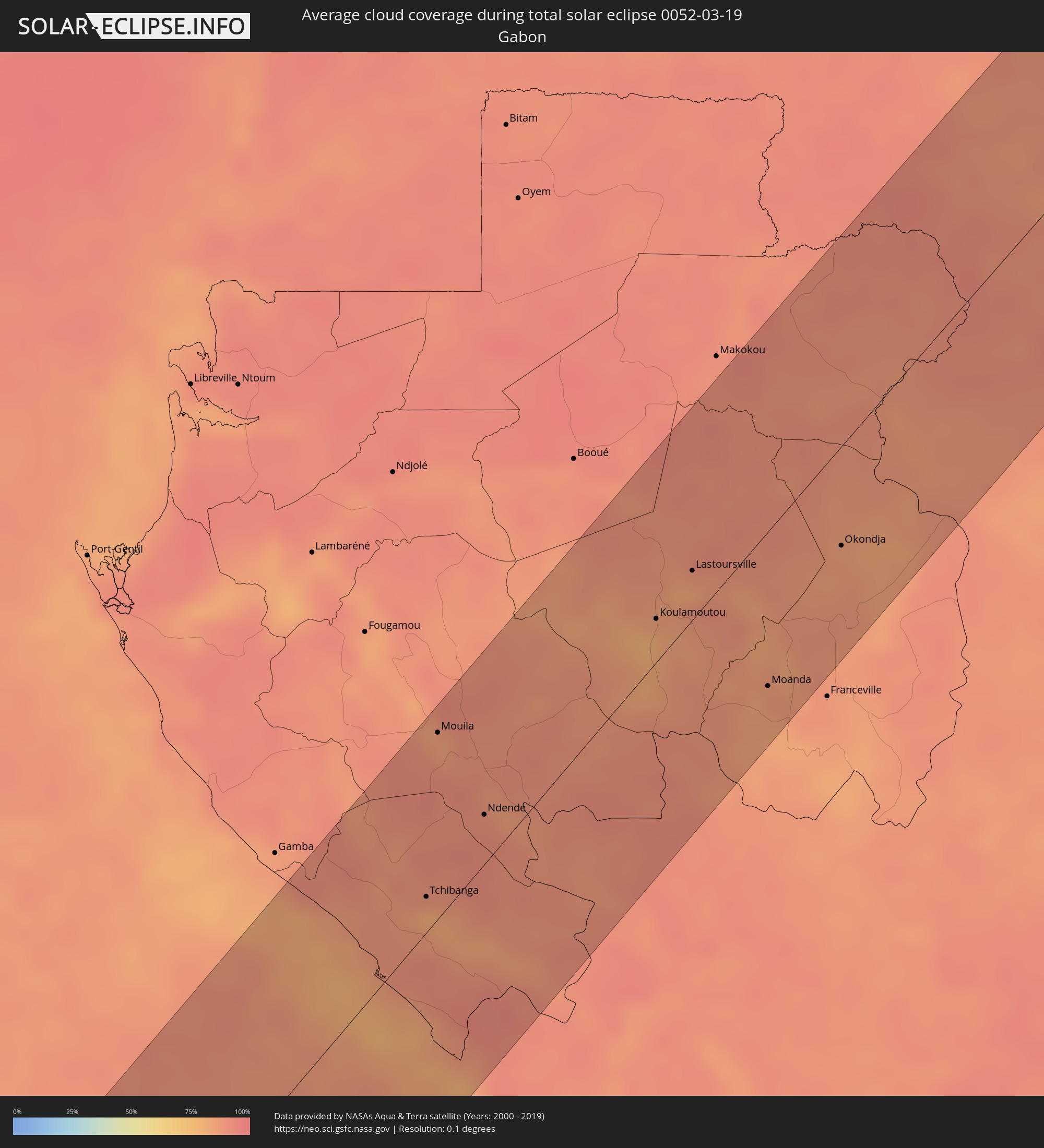 Gabun
Gabun
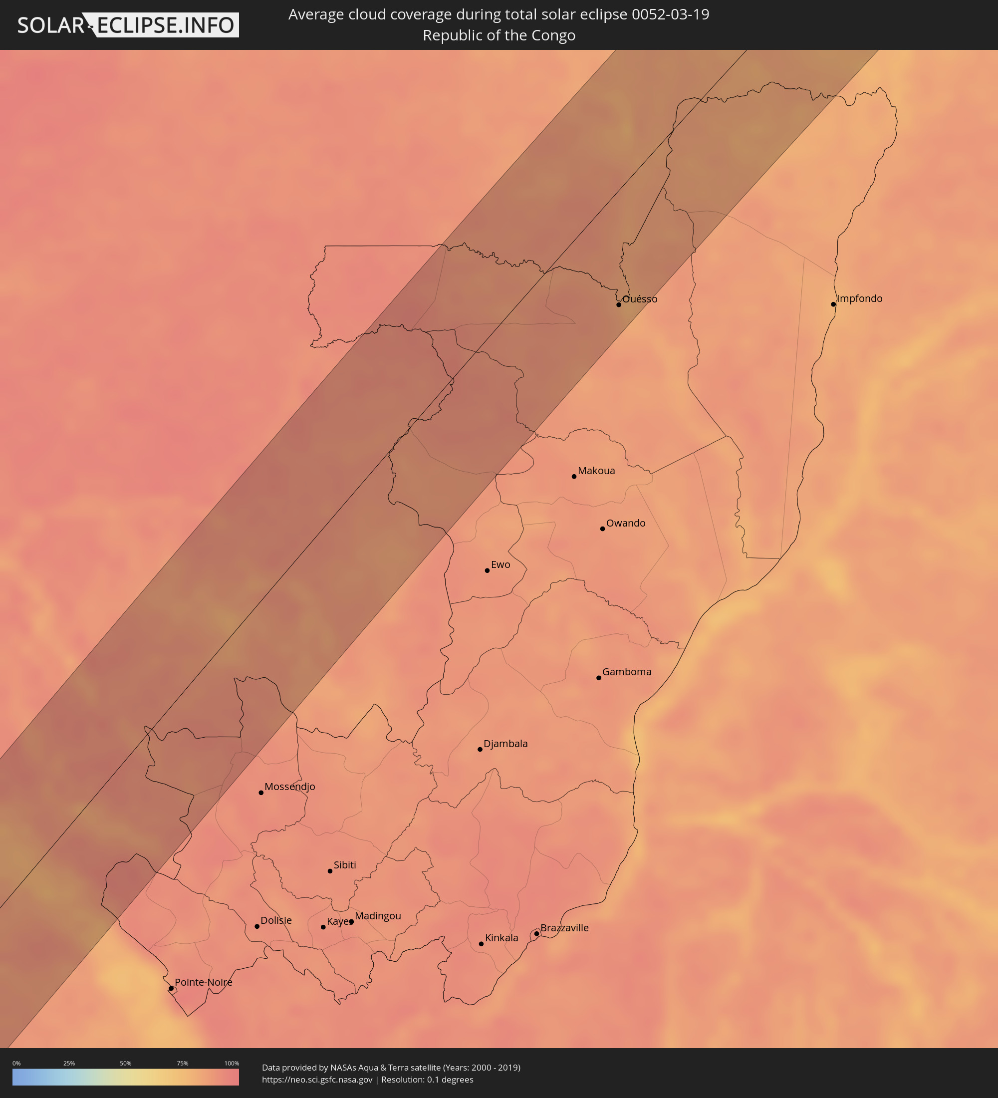 Republik Kongo
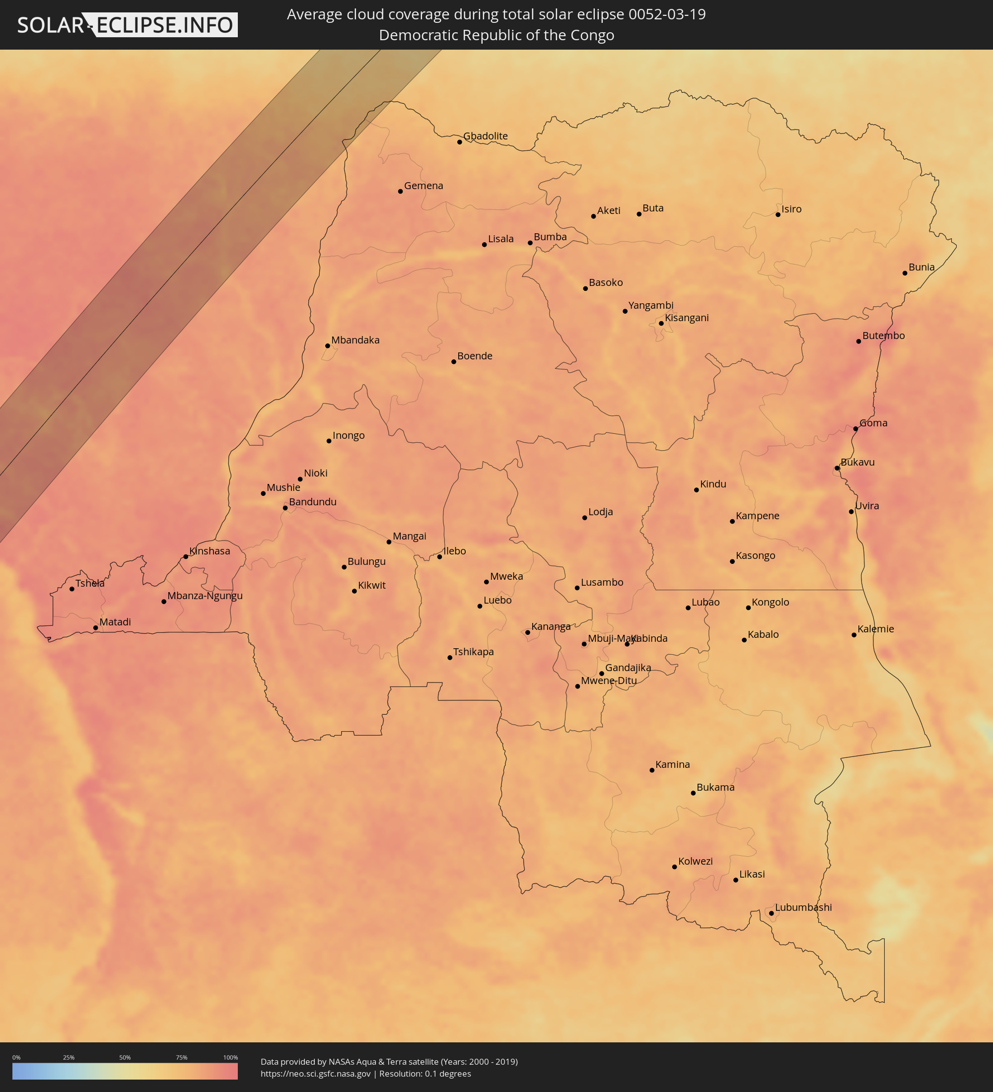 Demokratische Republik Kongo
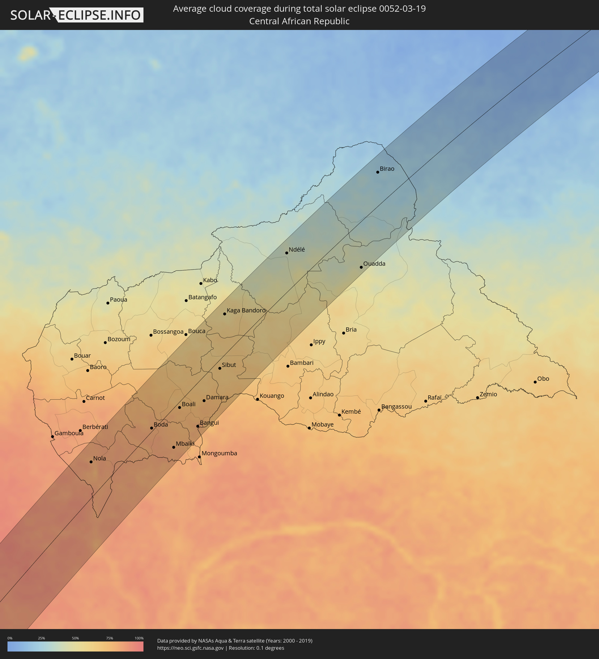 Zentralafrikanische Republik
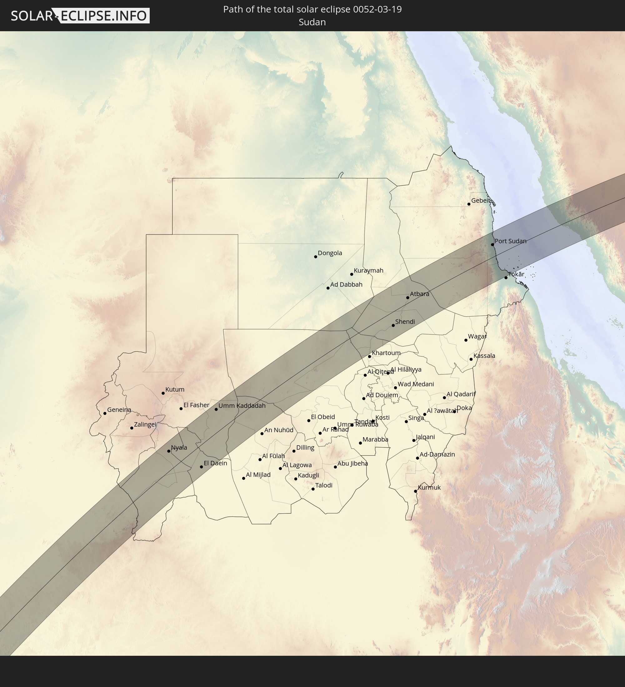
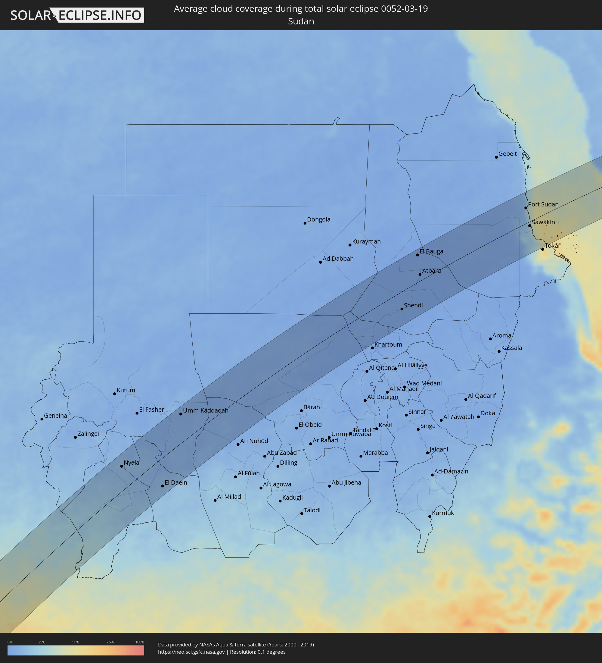 Sudan
Sudan
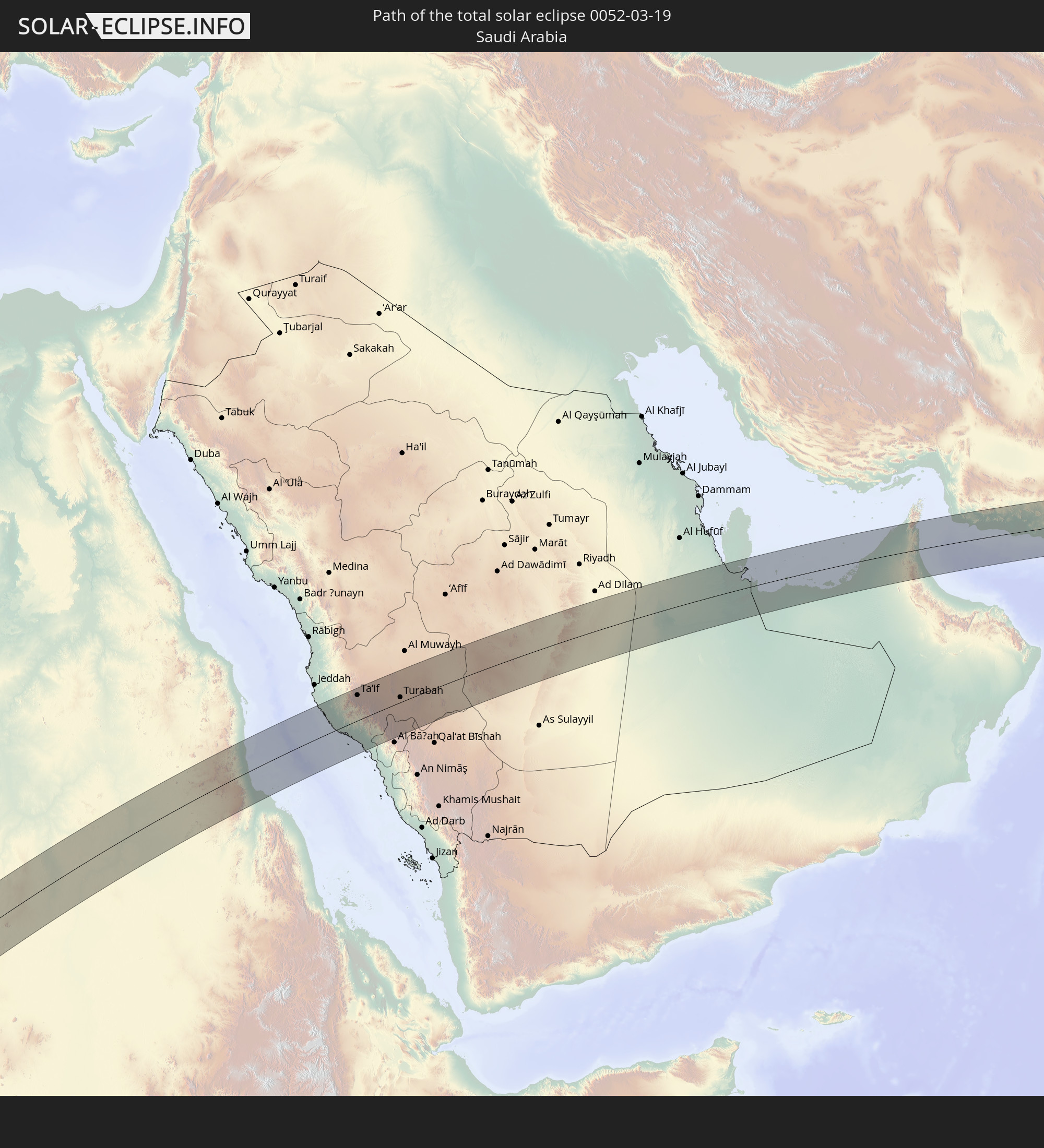
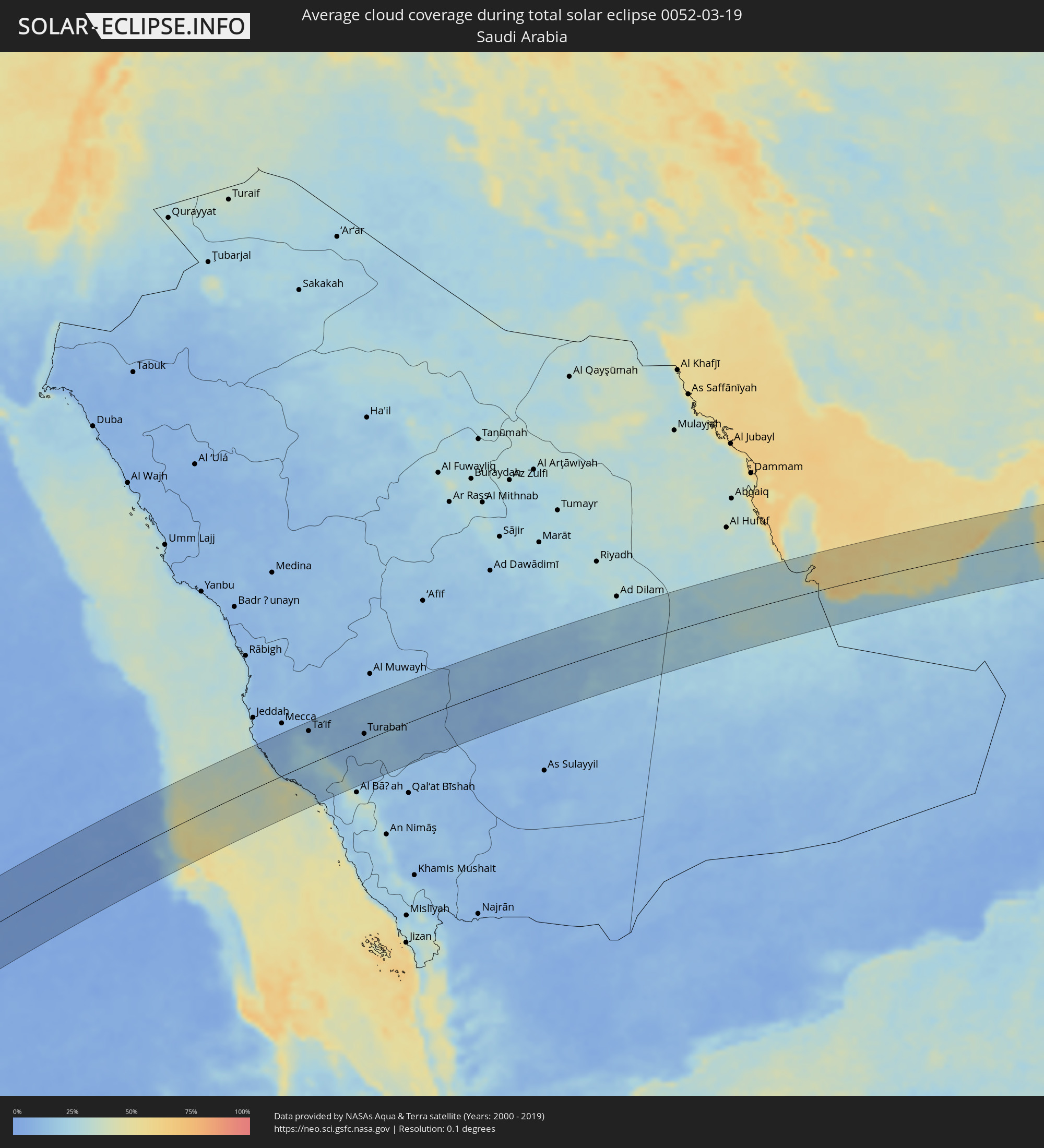 Saudi-Arabien
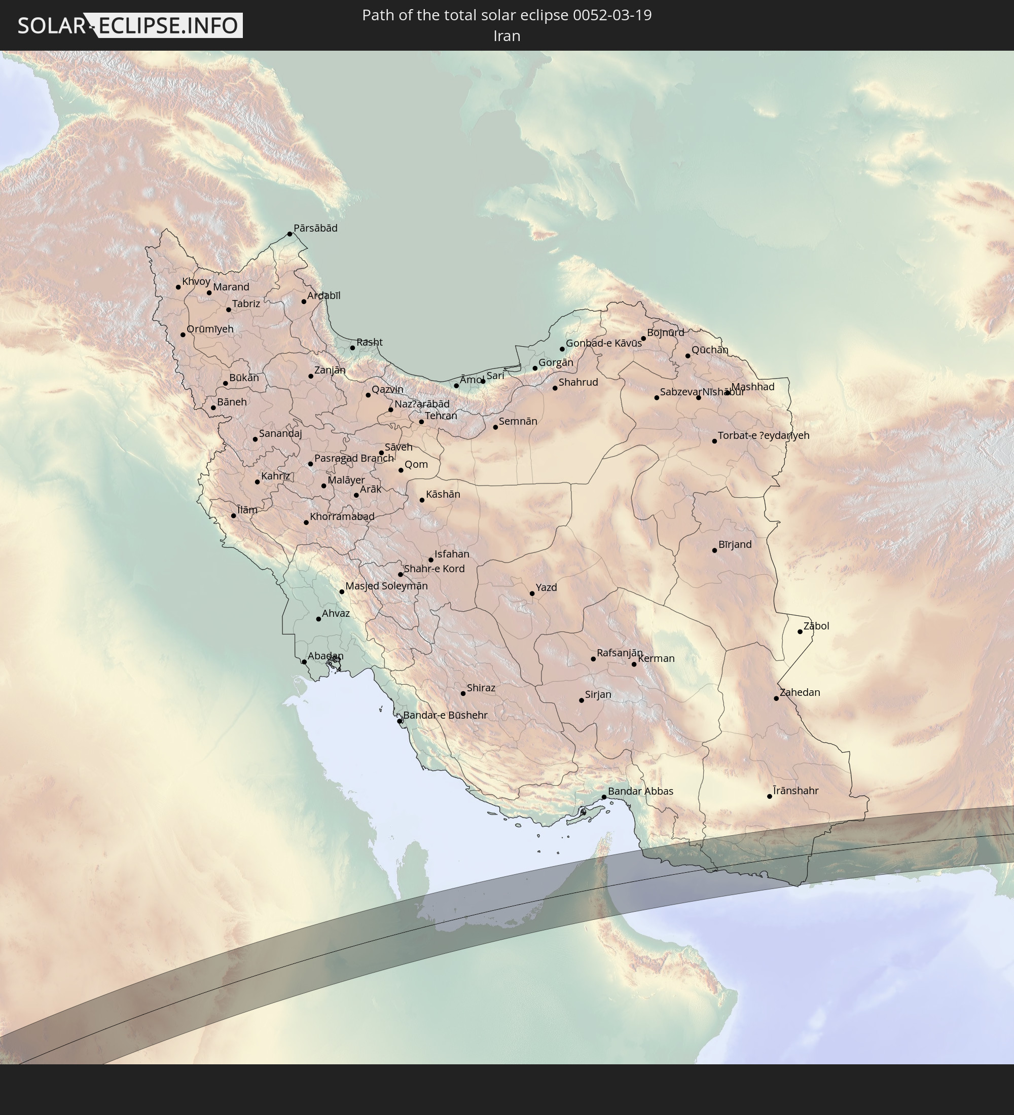
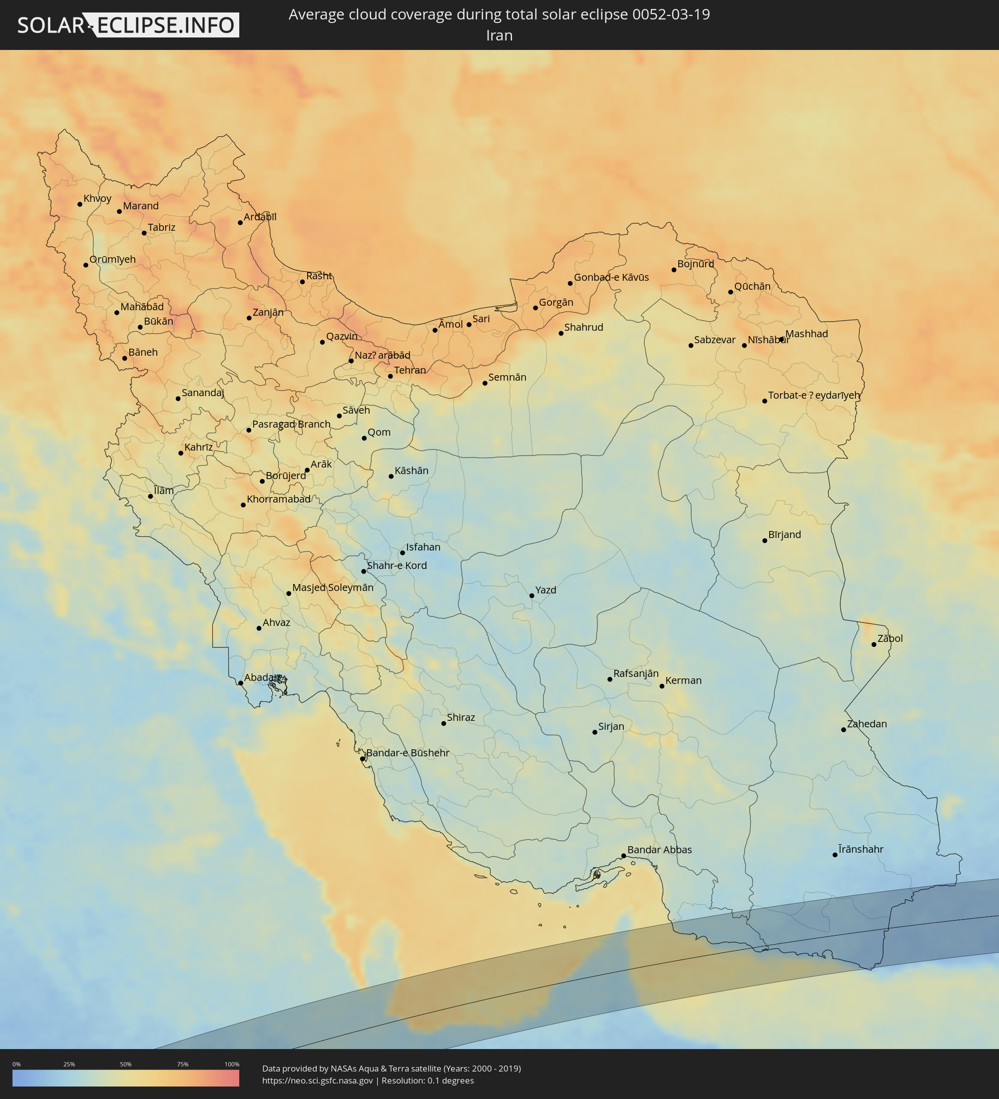 Iran
Iran
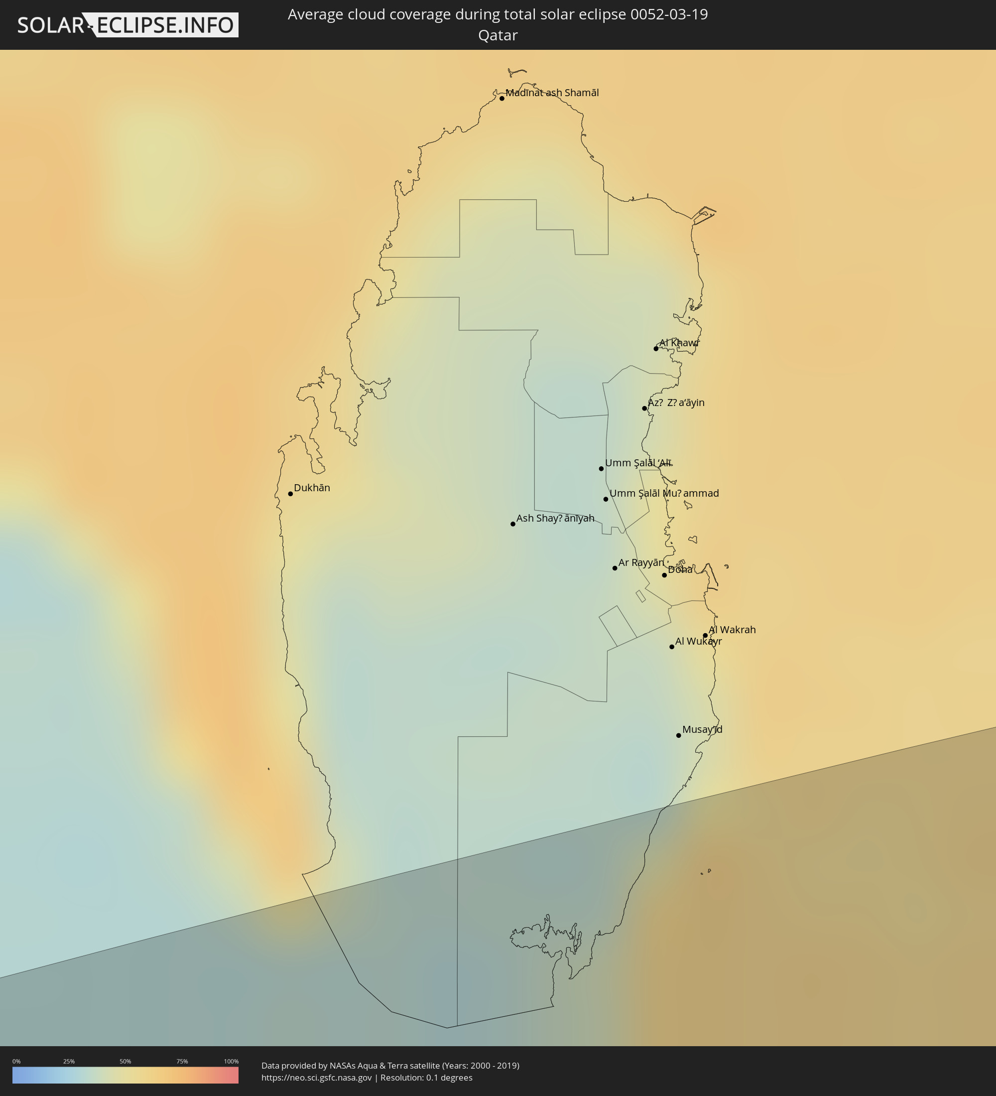 Katar
Katar
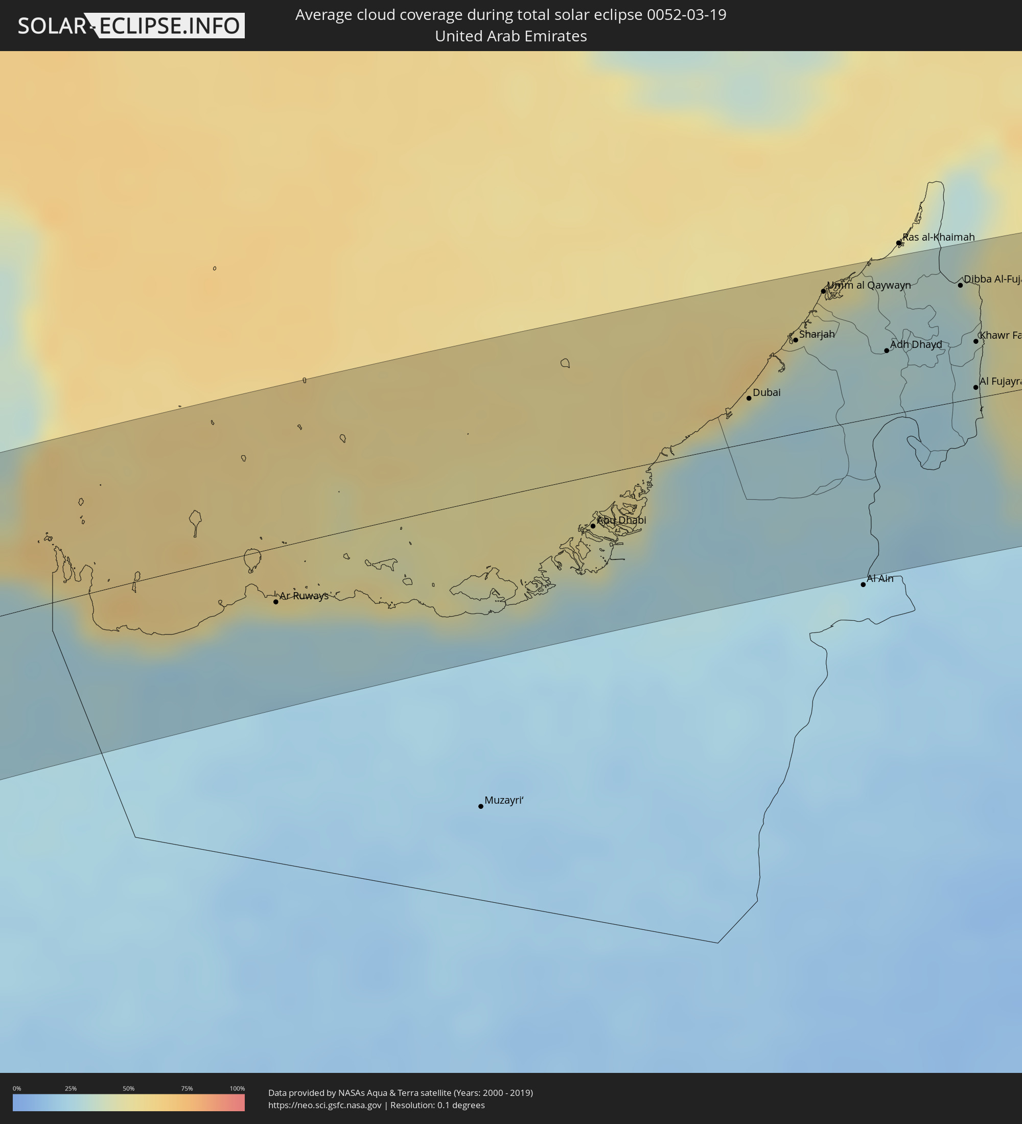 Vereinigte Arabische Emirate
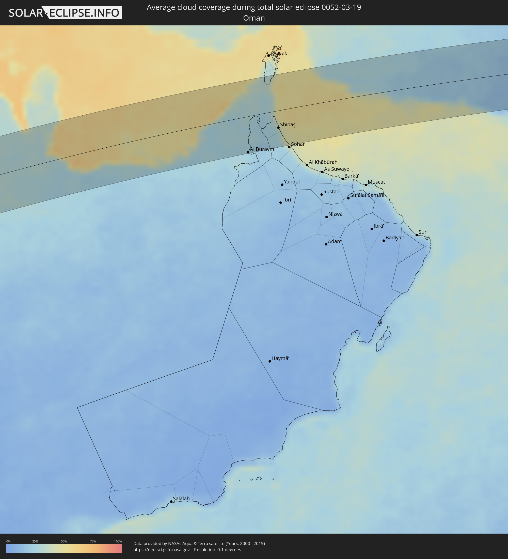 Oman
Oman
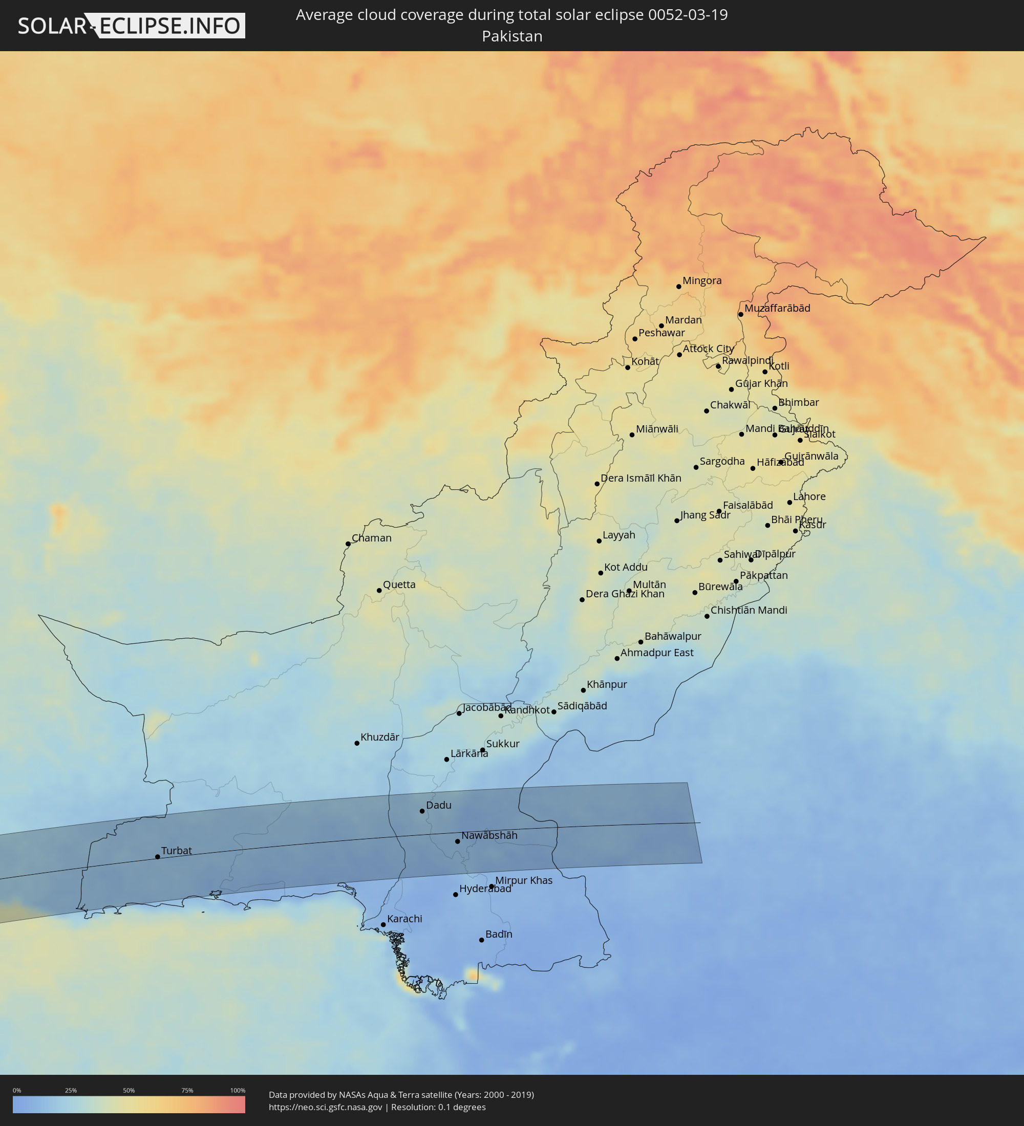 Pakistan
 Indien
Orte im Finsternispfad
Die nachfolgene Tabelle zeigt Städte und Orte mit mehr als 5.000 Einwohnern, die sich im Finsternispfad befinden. Städte mit mehr als 100.000 Einwohnern sind dick gekennzeichnet. Mit einem Klick auf den Ort öffnet sich eine Detailkarte die die Lage des jeweiligen Ortes zusammen mit dem Verlauf der zentralen Finsternis präsentiert.
| Ort | Typ | Dauer der Verfinsterung | Ortszeit bei maximaler Verfinsterung | Entfernung zur Zentrallinie | Ø Bewölkung |
|
Melo, Cerro Largo
|
total | - | 06:04:09 UTC-03:44 | 7 km | 61% |
|
Herval, Rio Grande do Sul
|
total | - | 06:42:32 UTC-03:06 | 46 km | 67% |
|
Río Branco, Cerro Largo
|
total | - | 06:04:12 UTC-03:44 | 18 km | 66% |
|
Jaguarão, Rio Grande do Sul
|
total | - | 06:42:35 UTC-03:06 | 14 km | 66% |
|
Arroio Grande, Rio Grande do Sul
|
total | - | 06:42:34 UTC-03:06 | 22 km | 68% |
|
Rio Grande, Rio Grande do Sul
|
total | - | 06:42:38 UTC-03:06 | 44 km | 61% |
|
Tchibanga, Nyanga
|
total | - | 11:48:16 UTC+00:13 | 17 km | 80% |
|
Mouila, Ngouni
|
total | - | 11:50:39 UTC+00:13 | 87 km | 87% |
|
Ndendé, Ngouni
|
total | - | 11:50:04 UTC+00:13 | 23 km | 91% |
|
Koulamoutou, Ogooué-Lolo
|
total | - | 11:54:46 UTC+00:13 | 20 km | 82% |
|
Lastoursville, Ogooué-Lolo
|
total | - | 11:55:51 UTC+00:13 | 23 km | 83% |
|
Mounana, Haut-Ogooué
|
total | - | 11:55:25 UTC+00:13 | 58 km | 86% |
|
Moanda, Haut-Ogooué
|
total | - | 11:55:10 UTC+00:13 | 73 km | 84% |
|
Okondja, Haut-Ogooué
|
total | - | 11:57:57 UTC+00:13 | 47 km | 85% |
|
Nola, Sangha-Mbaéré
|
total | - | 12:10:49 UTC+00:13 | 62 km | 82% |
|
Ouésso, Sangha
|
total | - | 12:06:55 UTC+00:13 | 80 km | 80% |
|
Boda, Lobaye
|
total | - | 12:14:54 UTC+00:13 | 5 km | 81% |
|
Mbaïki, Lobaye
|
total | - | 12:14:55 UTC+00:13 | 71 km | 81% |
|
Boali, Ombella-M'Poko
|
total | - | 12:17:00 UTC+00:13 | 11 km | 77% |
|
Bimbo, Ombella-M'Poko
|
total | - | 12:16:26 UTC+00:13 | 76 km | 81% |
|
Bangui, Bangui
|
total | - | 12:16:53 UTC+00:13 | 79 km | 78% |
|
Damara, Ombella-M'Poko
|
total | - | 12:18:19 UTC+00:13 | 45 km | 76% |
|
Sibut, Kémo
|
total | - | 12:20:26 UTC+00:13 | 17 km | 66% |
|
Kaga Bandoro, Nana-Grébizi
|
total | - | 12:23:04 UTC+00:13 | 73 km | 54% |
|
Ndélé, Bamingui-Bangoran
|
total | - | 12:28:09 UTC+00:13 | 72 km | 39% |
|
Ouadda, Haute-Kotto
|
total | - | 12:30:26 UTC+00:13 | 88 km | 45% |
|
Birao, Vakaga
|
total | - | 12:34:58 UTC+00:13 | 64 km | 25% |
|
Nyala, Southern Darfur
|
total | - | 14:37:44 UTC+02:10 | 63 km | 12% |
|
El Daein, Eastern Darfur
|
total | - | 14:38:41 UTC+02:10 | 74 km | 11% |
|
Umm Kaddadah, Northern Darfur
|
total | - | 14:42:51 UTC+02:10 | 75 km | 4% |
|
El Matama, River Nile
|
total | - | 14:56:11 UTC+02:10 | 44 km | 1% |
|
Shendi, River Nile
|
total | - | 14:56:16 UTC+02:10 | 50 km | 1% |
|
El Bauga, River Nile
|
total | - | 14:58:39 UTC+02:10 | 76 km | 2% |
|
Ed Damer, River Nile
|
total | - | 14:57:59 UTC+02:10 | 8 km | 1% |
|
Berber, River Nile
|
total | - | 14:58:29 UTC+02:10 | 48 km | 1% |
|
Atbara, River Nile
|
total | - | 14:58:07 UTC+02:10 | 17 km | 1% |
|
Port Sudan, Red Sea
|
total | - | 15:03:53 UTC+02:10 | 44 km | 14% |
|
Sawākin, Red Sea
|
total | - | 15:03:30 UTC+02:10 | 13 km | 19% |
|
Al Hadā, Makkah
|
total | - | 16:05:20 UTC+03:06 | 84 km | 14% |
|
Ash Shafā, Makkah
|
total | - | 16:05:07 UTC+03:06 | 53 km | 25% |
|
Ta’if, Makkah
|
total | - | 16:05:23 UTC+03:06 | 69 km | 13% |
|
Al Mindak, Al Bahah
|
total | - | 16:05:19 UTC+03:06 | 81 km | 32% |
|
Turabah, Makkah
|
total | - | 16:06:31 UTC+03:06 | 14 km | 12% |
|
Ar Ruways, Abu Dhabi
|
total | - | 16:50:58 UTC+03:41 | 28 km | 29% |
|
Abu Dhabi, Abu Dhabi
|
total | - | 16:52:00 UTC+03:41 | 26 km | 44% |
|
Dubai, Dubai
|
total | - | 16:52:37 UTC+03:41 | 23 km | 33% |
|
Sharjah, Ash Shāriqah
|
total | - | 16:52:49 UTC+03:41 | 47 km | 34% |
|
Ajman, Ajman
|
total | - | 16:52:52 UTC+03:41 | 55 km | 41% |
|
Umm al Qaywayn, Umm al Qaywayn
|
total | - | 16:52:58 UTC+03:41 | 69 km | 42% |
|
Al Buraymī, Al Buraimi
|
total | - | 16:52:37 UTC+03:41 | 79 km | 24% |
|
Adh Dhayd, Ash Shāriqah
|
total | - | 16:53:02 UTC+03:41 | 33 km | 30% |
|
Dibba Al-Fujairah, Al Fujayrah
|
total | - | 16:53:18 UTC+03:41 | 59 km | 34% |
|
Dibba Al-Hisn, Al Fujayrah
|
total | - | 16:53:19 UTC+03:41 | 61 km | 34% |
|
Al Fujayrah, Al Fujayrah
|
total | - | 16:53:11 UTC+03:41 | 5 km | 31% |
|
Khawr Fakkān, Ash Shāriqah
|
total | - | 16:53:15 UTC+03:41 | 29 km | 31% |
|
Shināş, Al Batinah North Governorate
|
total | - | 16:53:06 UTC+03:41 | 38 km | 34% |
|
Al Liwā’, Al Batinah North Governorate
|
total | - | 16:53:05 UTC+03:41 | 63 km | 27% |
|
Chabahar, Sistan and Baluchestan
|
total | - | 16:39:26 UTC+03:25 | 46 km | 43% |
|
Qaşr-e Qand, Sistan and Baluchestan
|
total | - | 16:39:42 UTC+03:25 | 58 km | 21% |
|
Turbat, Balochistān
|
total | - | 17:42:45 UTC+04:28 | 2 km | 15% |
|
Bela, Balochistān
|
total | - | 17:43:28 UTC+04:28 | 5 km | 11% |
|
Bhān, Sindh
|
total | - | 17:43:44 UTC+04:28 | 22 km | 15% |
|
Dadu, Sindh
|
total | - | 17:43:45 UTC+04:28 | 41 km | 19% |
|
Sīta Road, Sindh
|
total | - | 17:43:48 UTC+04:28 | 73 km | 19% |
|
Sehwān, Sindh
|
total | - | 17:43:43 UTC+04:28 | 6 km | 12% |
|
Moro, Sindh
|
total | - | 17:43:47 UTC+04:28 | 32 km | 17% |
|
Thāru Shāh, Sindh
|
total | - | 17:43:49 UTC+04:28 | 62 km | 17% |
|
Sakrand, Sindh
|
total | - | 17:43:44 UTC+04:28 | 29 km | 12% |
|
Pad Īdan, Sindh
|
total | - | 17:43:49 UTC+04:28 | 42 km | 16% |
|
Daur, Sindh
|
total | - | 17:43:47 UTC+04:28 | 7 km | 13% |
|
Nawābshāh, Sindh
|
total | - | 17:43:46 UTC+04:28 | 17 km | 14% |
|
Hāla, Sindh
|
total | - | 17:43:42 UTC+04:28 | 66 km | 9% |
|
Shāhdādpur, Sindh
|
total | - | 17:43:44 UTC+04:28 | 55 km | 14% |
|
Shāhpur Chākar, Sindh
|
total | - | 17:43:46 UTC+04:28 | 29 km | 13% |
|
Tando Ādam, Sindh
|
total | - | 17:43:43 UTC+04:28 | 73 km | 13% |
|
Sānghar, Sindh
|
total | - | 17:43:47 UTC+04:28 | 43 km | 10% |
|
Jaisalmer, Rajasthan
|
total | - | 18:37:00 UTC+05:21 | 45 km | 12% |
|
Pokaran, Rajasthan
|
total | - | 18:37:02 UTC+05:21 | 42 km | 11% |
|
Phalodi, Rajasthan
|
total | - | 18:37:03 UTC+05:21 | 65 km | 11% |