Totale Sonnenfinsternis vom 04.09.0145
| Wochentag: | Samstag |
| Maximale Dauer der Verfinsterung: | 00m52s |
| Maximale Breite des Finsternispfades: | 88 km |
| Saroszyklus: | 66 |
| Bedeckungsgrad: | 100% |
| Magnitude: | 1.0128 |
| Gamma: | 0.8709 |
Wo kann man die Sonnenfinsternis vom 04.09.0145 sehen?
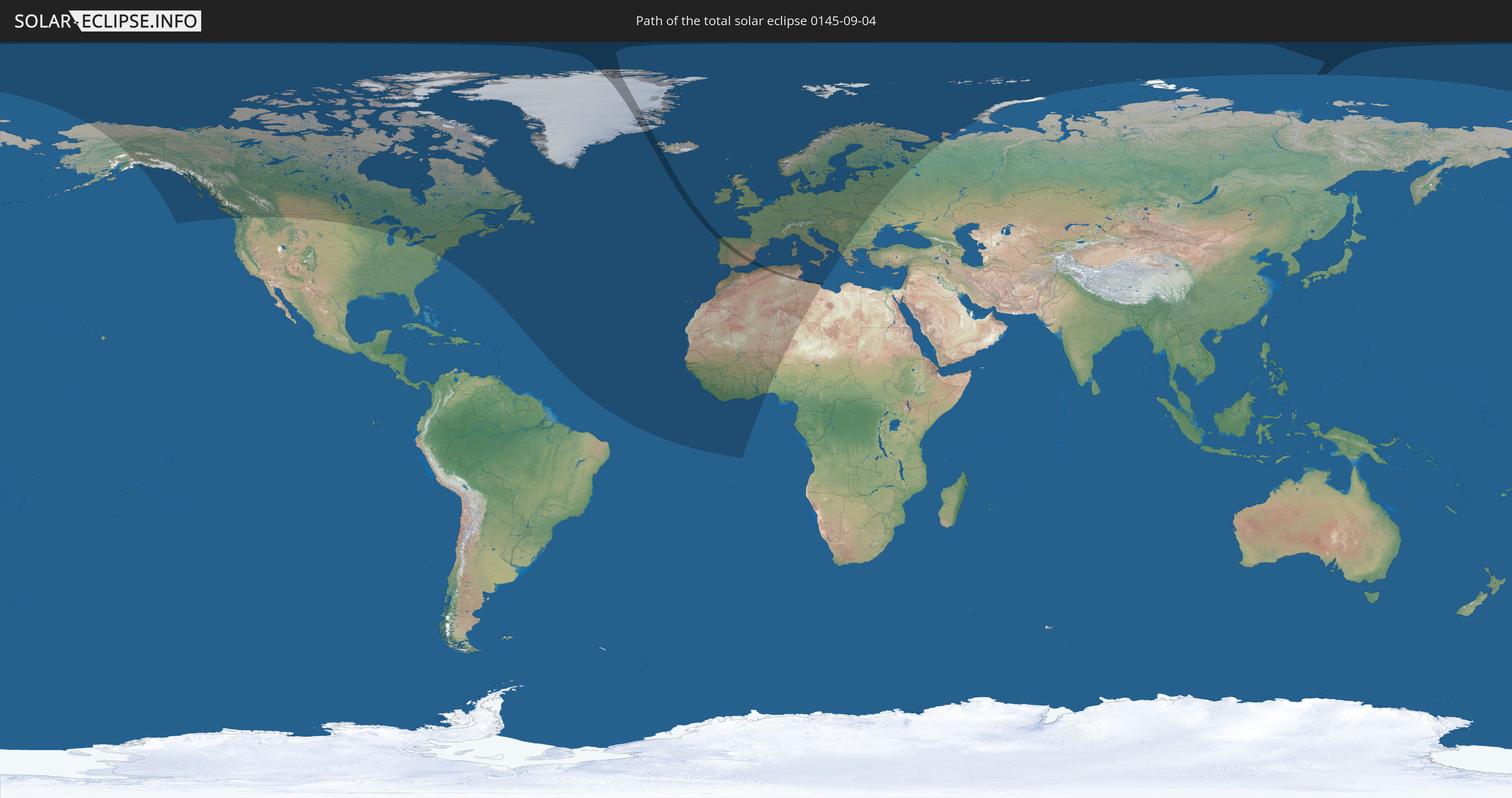
Die Sonnenfinsternis am 04.09.0145 kann man in 76 Ländern als partielle Sonnenfinsternis beobachten.
Der Finsternispfad verläuft durch 7 Länder. Nur in diesen Ländern ist sie als totale Sonnenfinsternis zu sehen.
In den folgenden Ländern ist die Sonnenfinsternis total zu sehen
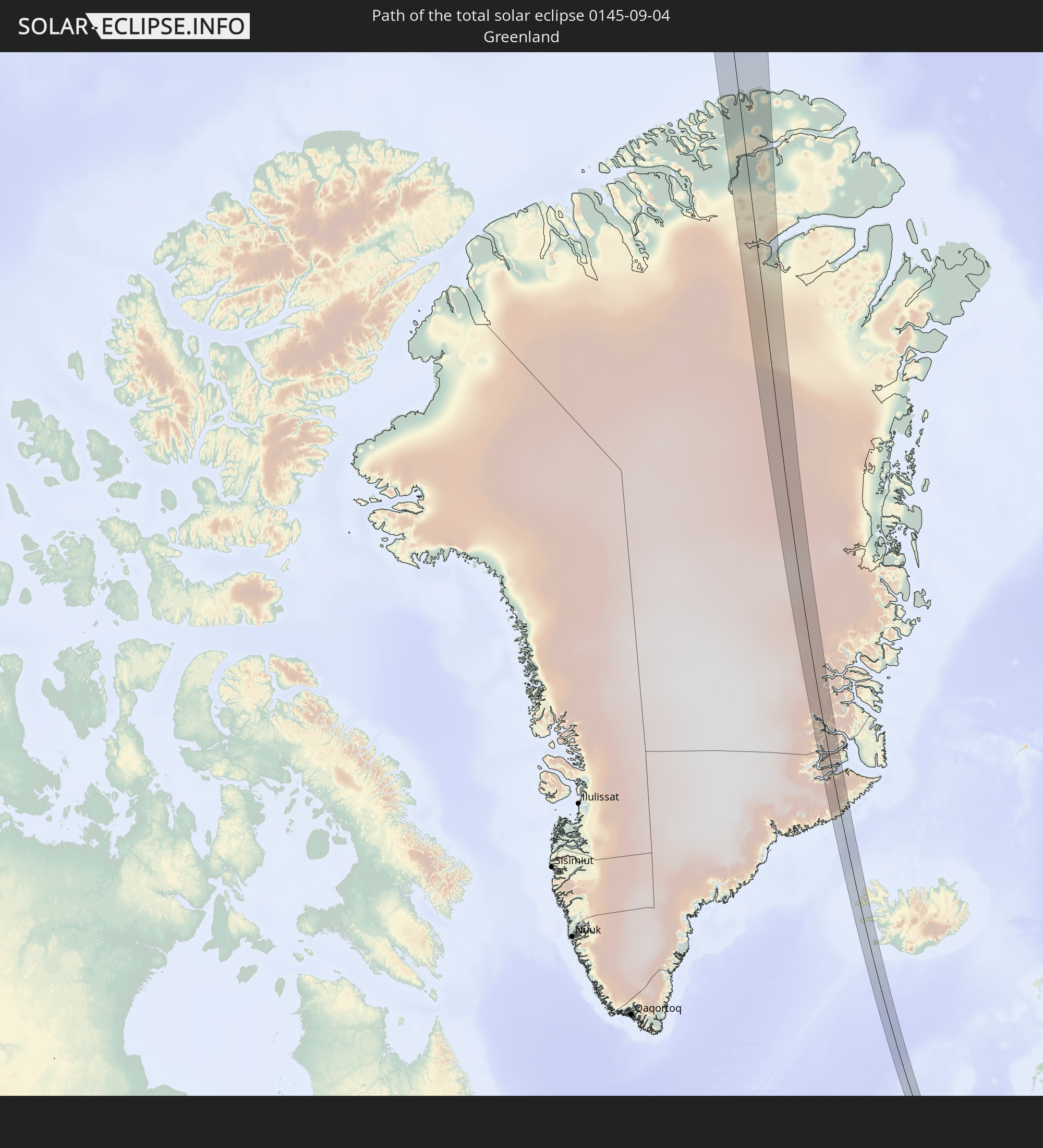 Grönland
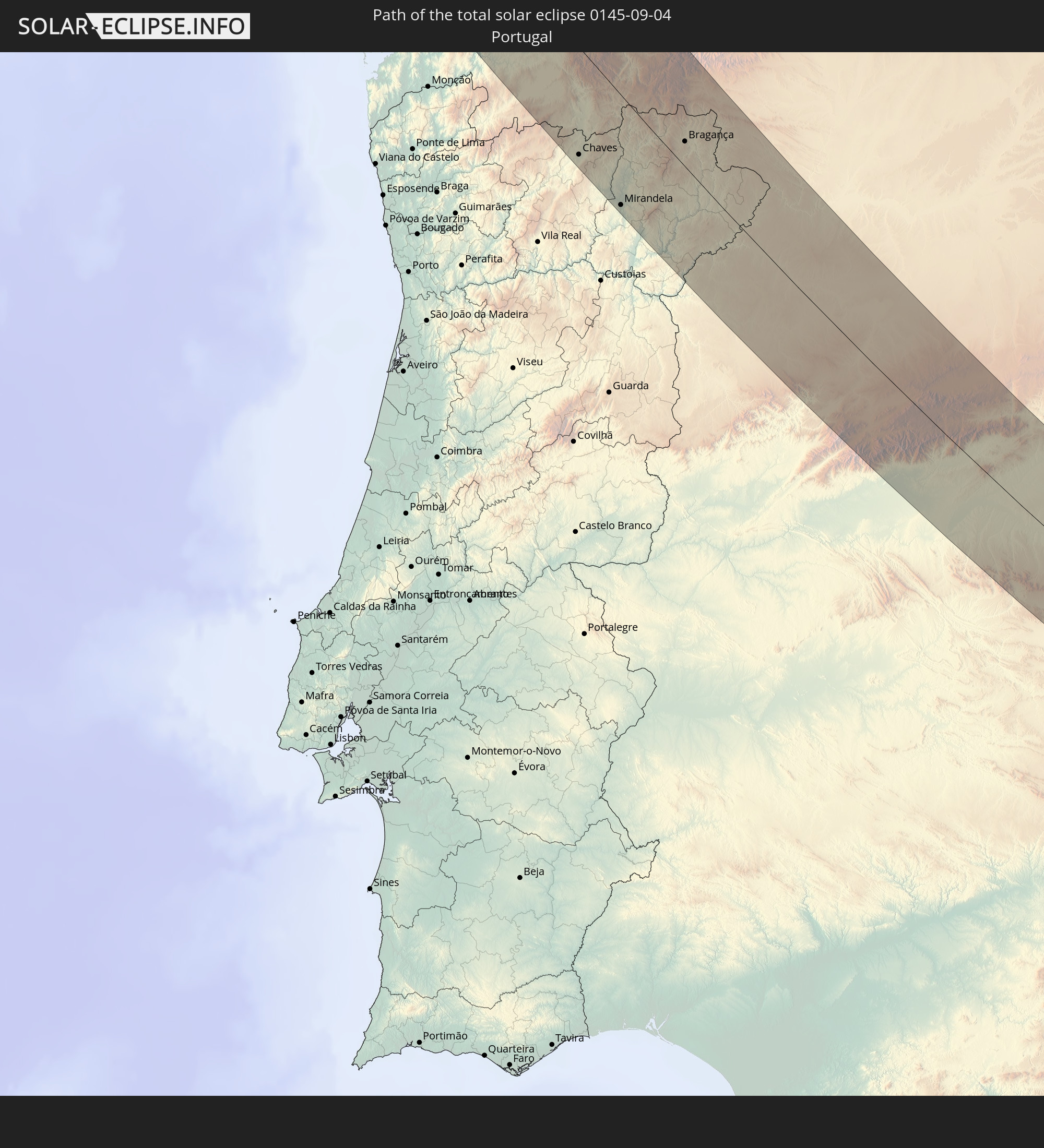 Portugal
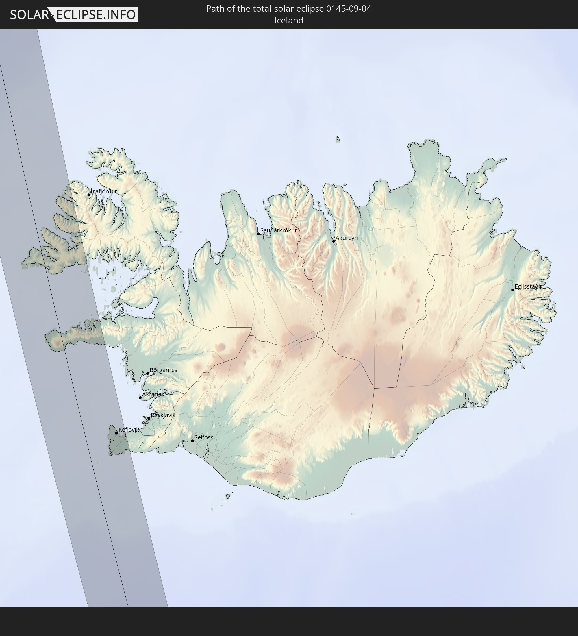 Island
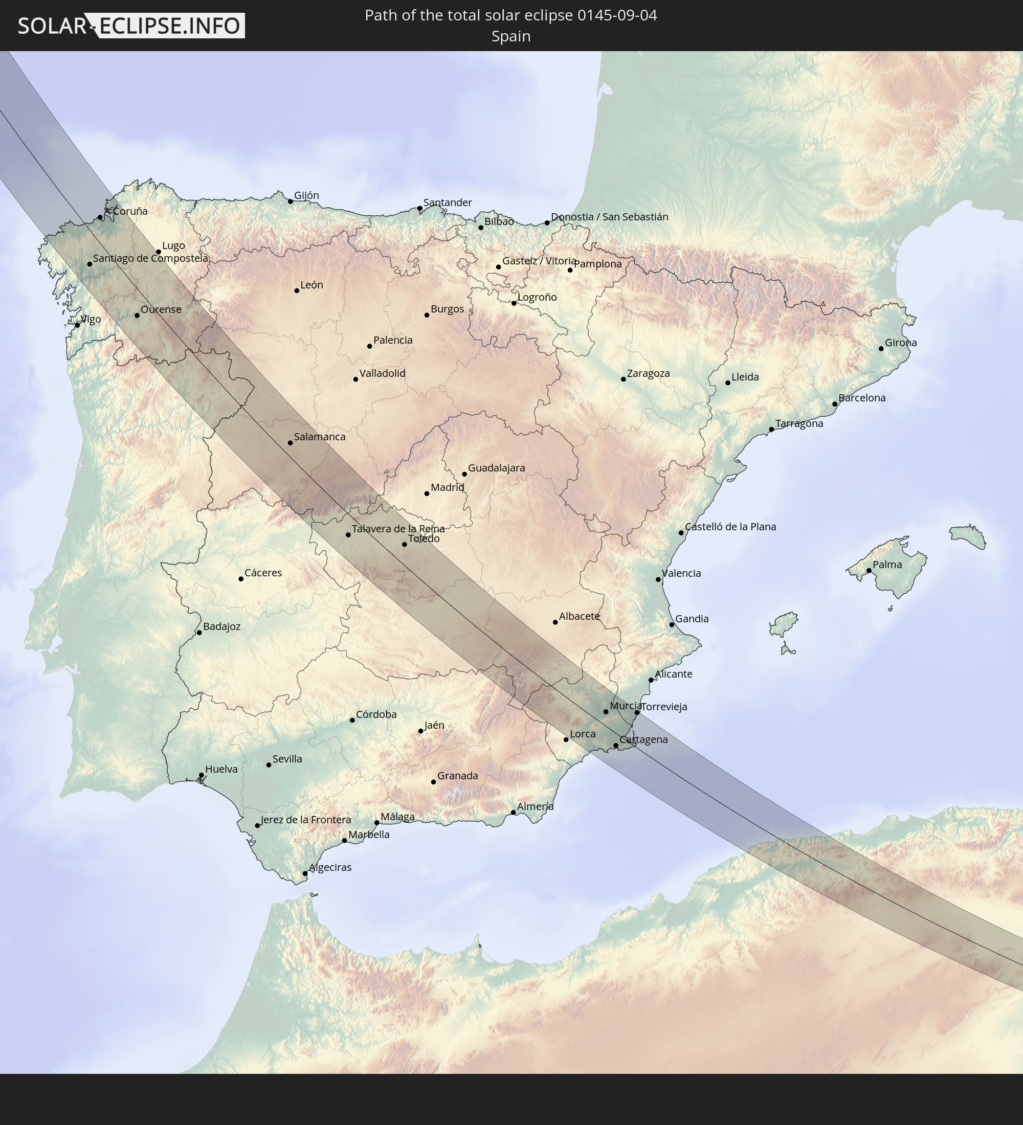 Spanien
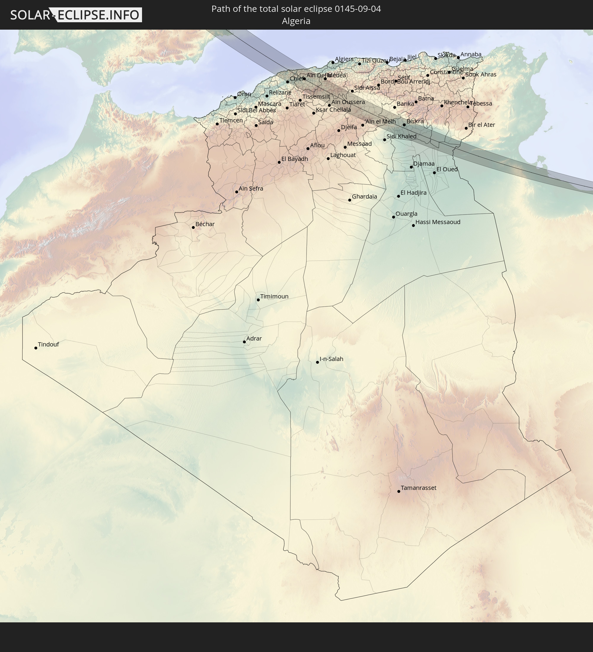 Algerien
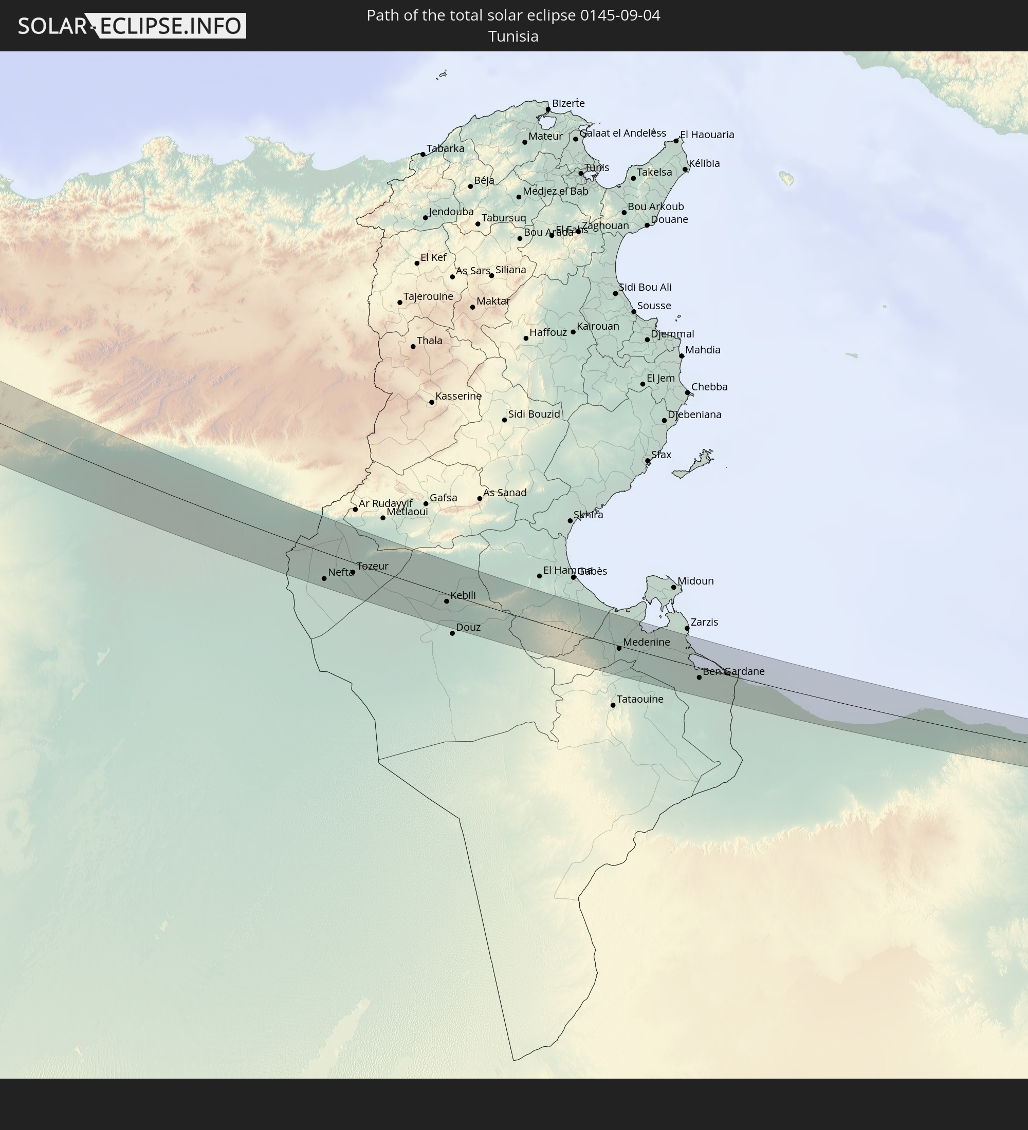 Tunesien
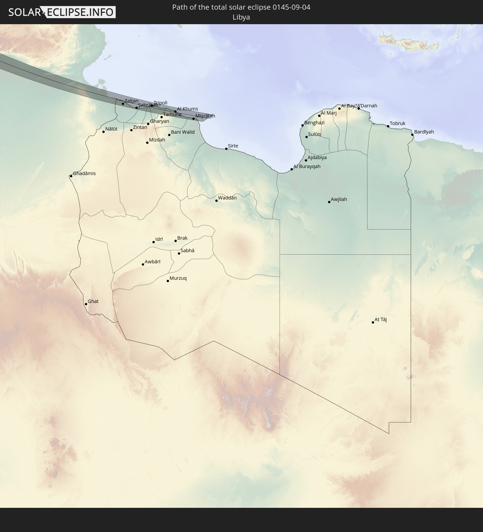 Libyen
In den folgenden Ländern ist die Sonnenfinsternis partiell zu sehen
 Russland
 Vereinigte Staaten
 Kanada
 Grönland
 Bermuda
 Saint-Pierre und Miquelon
 Portugal
 Kap Verde
 Island
 Spanien
 Senegal
 Mauretanien
 Gambia
 Guinea-Bissau
 Guinea
 Sierra Leone
 Marokko
 Mali
Mali
 Liberia
 Irland
 Spitzbergen
 Algerien
 Vereinigtes Königreich
 Elfenbeinküste
 Färöer
 Burkina Faso
 Gibraltar
 Frankreich
 Isle of Man
 Ghana
Ghana
 Guernsey
 Jersey
 Togo
Togo
 Niger
Niger
 Benin
Benin
 Andorra
 Belgien
 Nigeria
 Niederlande
 Norwegen
 Luxemburg
 Deutschland
 Schweiz
 Italien
 Monaco
 Tunesien
 Dänemark
 Libyen
 Liechtenstein
 Österreich
 Schweden
 Tschechien
 San Marino
 Vatikanstadt
 Slowenien
 Kroatien
 Polen
Polen
 Malta
Malta
 Bosnien und Herzegowina
 Ungarn
 Slowakei
 Montenegro
 Serbien
 Albanien
 Åland Islands
 Griechenland
 Rumänien
 Mazedonien
 Finnland
 Litauen
 Lettland
 Estland
 Ukraine
 Bulgarien
 Weißrussland
 Moldawien
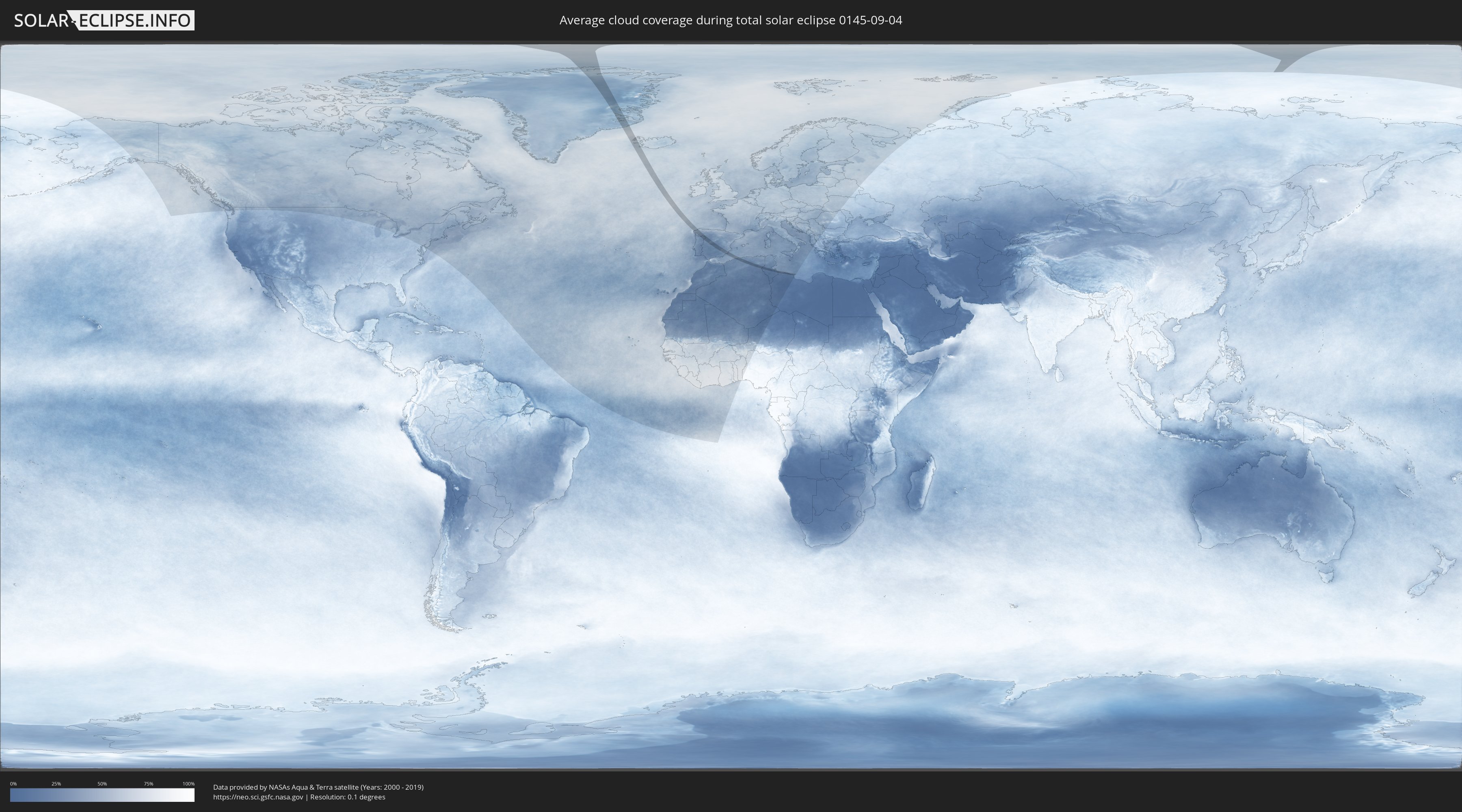
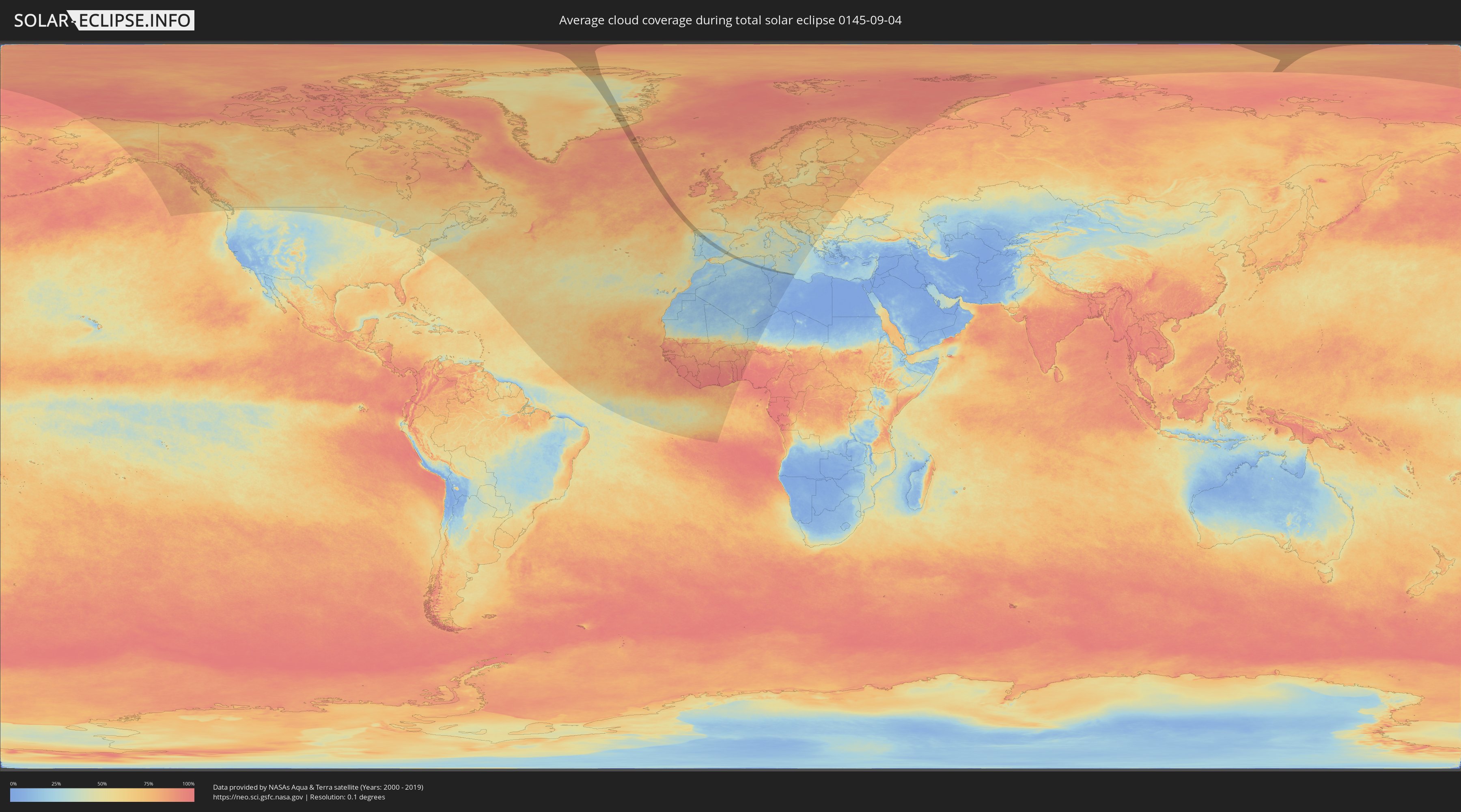
Wie wird das Wetter während der totalen Sonnenfinsternis am 04.09.0145?
Wo ist der beste Ort, um die totale Sonnenfinsternis vom 04.09.0145 zu beobachten?
Die folgenden Karten zeigen die durchschnittliche Bewölkung für den Tag, an dem die totale Sonnenfinsternis
stattfindet. Mit Hilfe der Karten lässt sich der Ort entlang des Finsternispfades eingrenzen,
der die besten Aussichen auf einen klaren wolkenfreien Himmel bietet.
Trotzdem muss man immer lokale Gegenenheiten beachten und sollte sich genau über das Wetter an seinem
gewählten Beobachtungsort informieren.
Die Daten stammen von den beiden NASA-Satelliten
AQUA und TERRA
und wurden über einen Zeitraum von 19 Jahren (2000 - 2019) gemittelt.
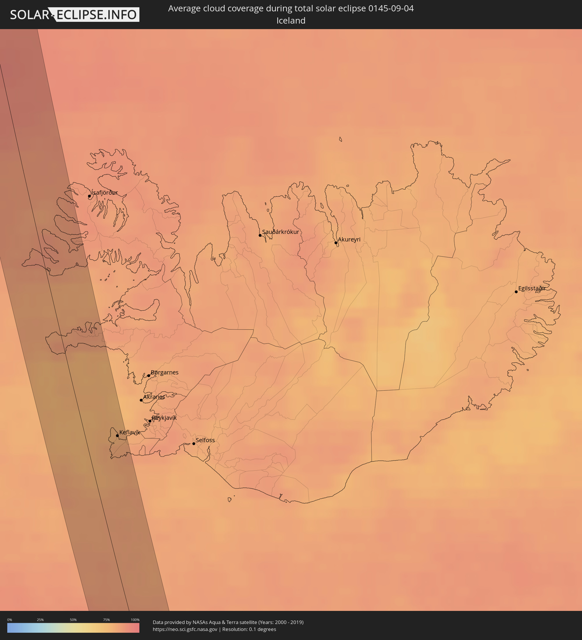
Detaillierte Länderkarten
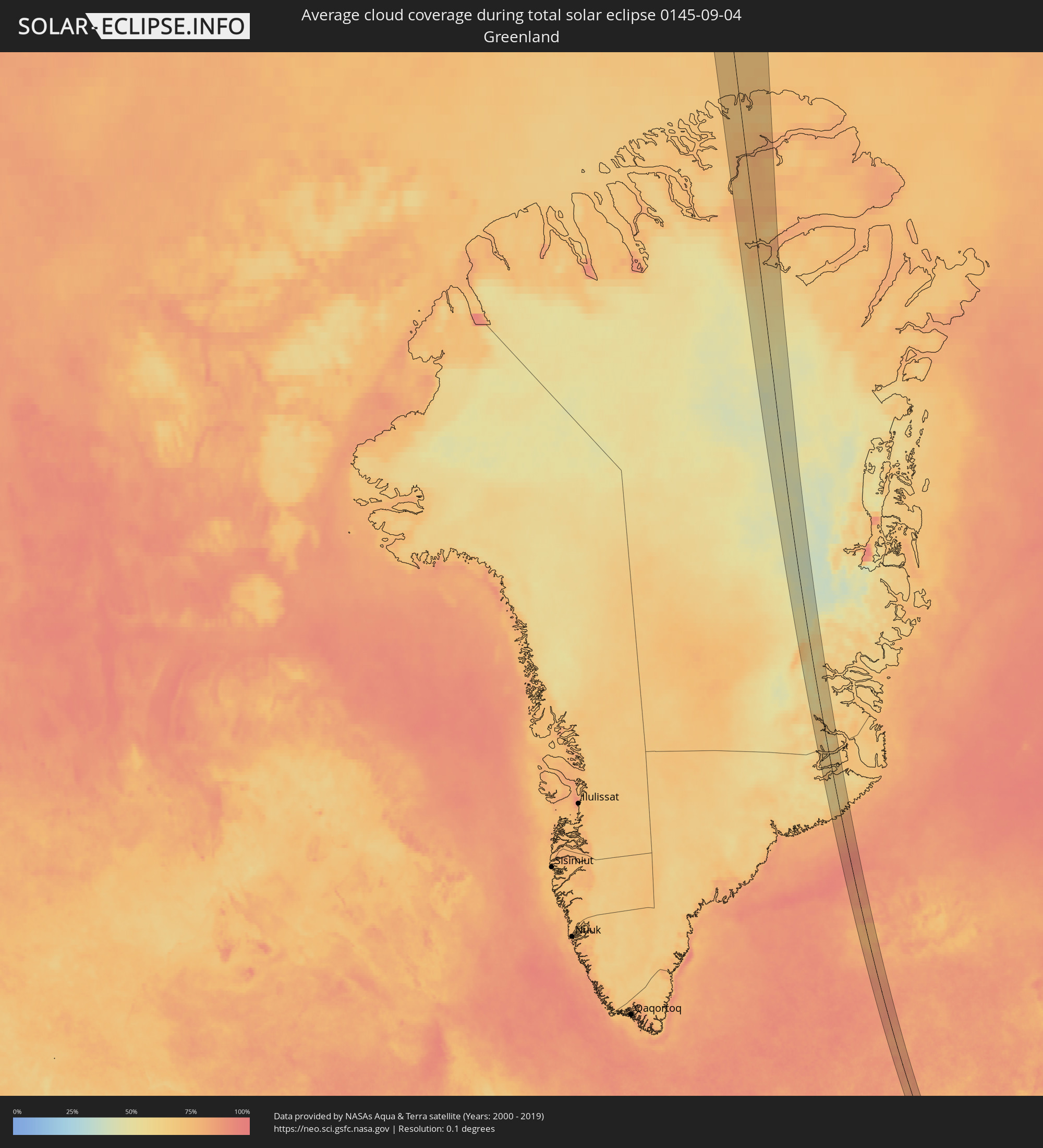 Grönland
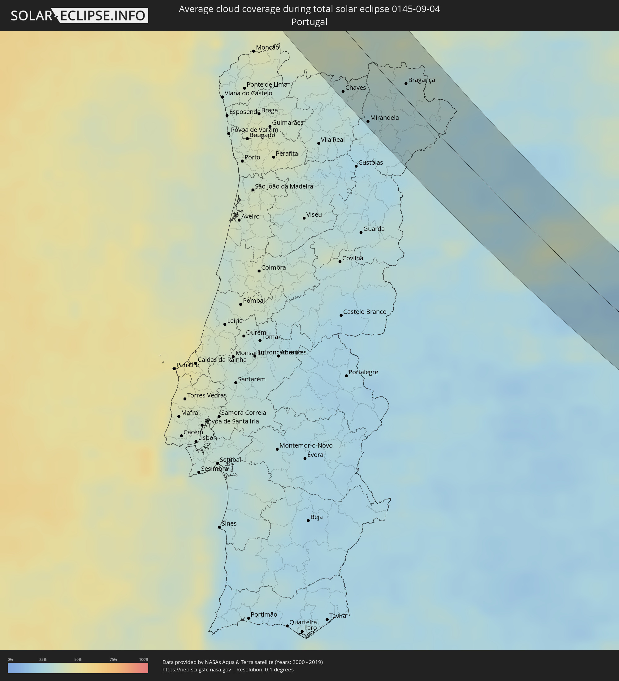 Portugal
 Island
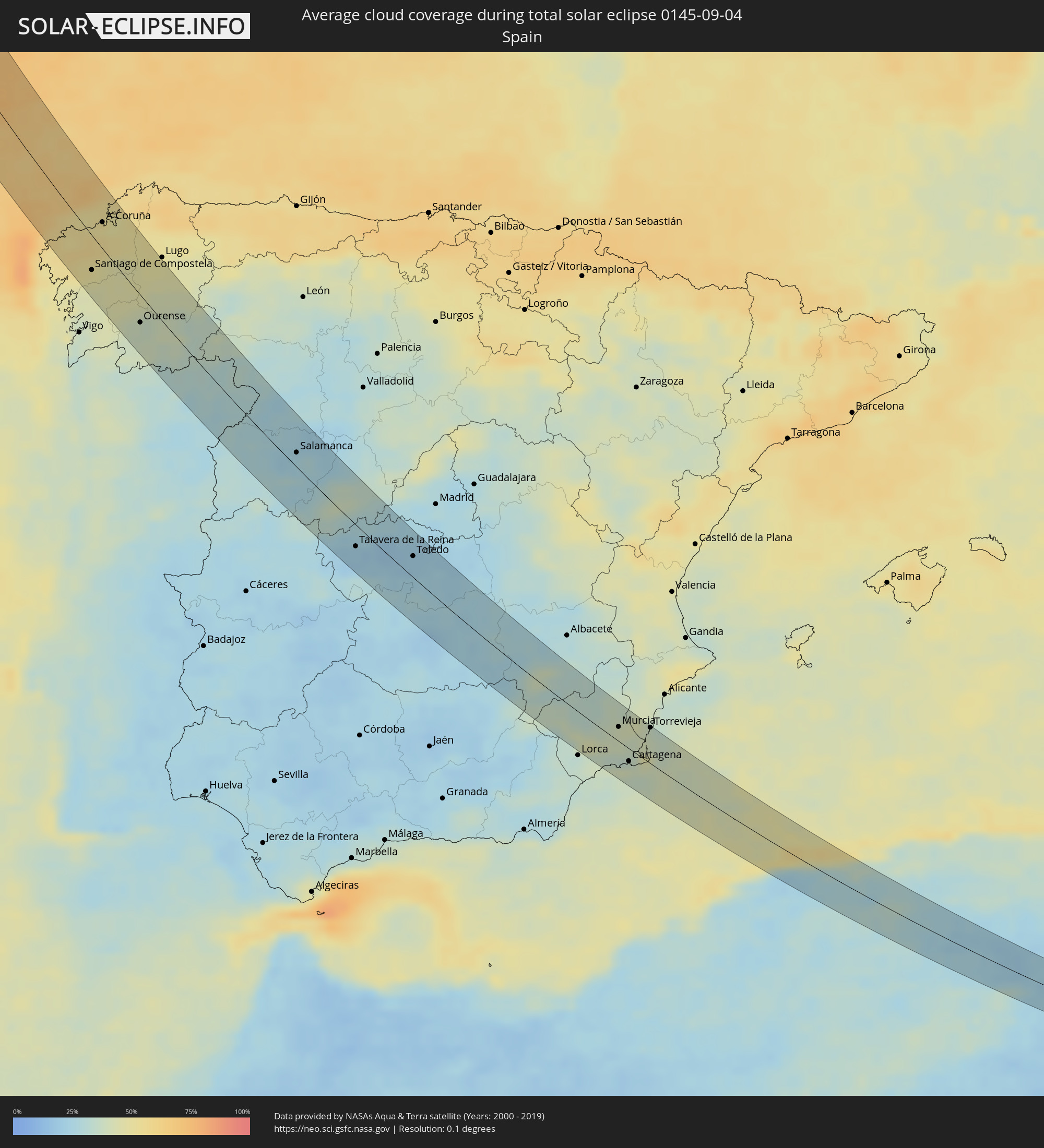 Spanien
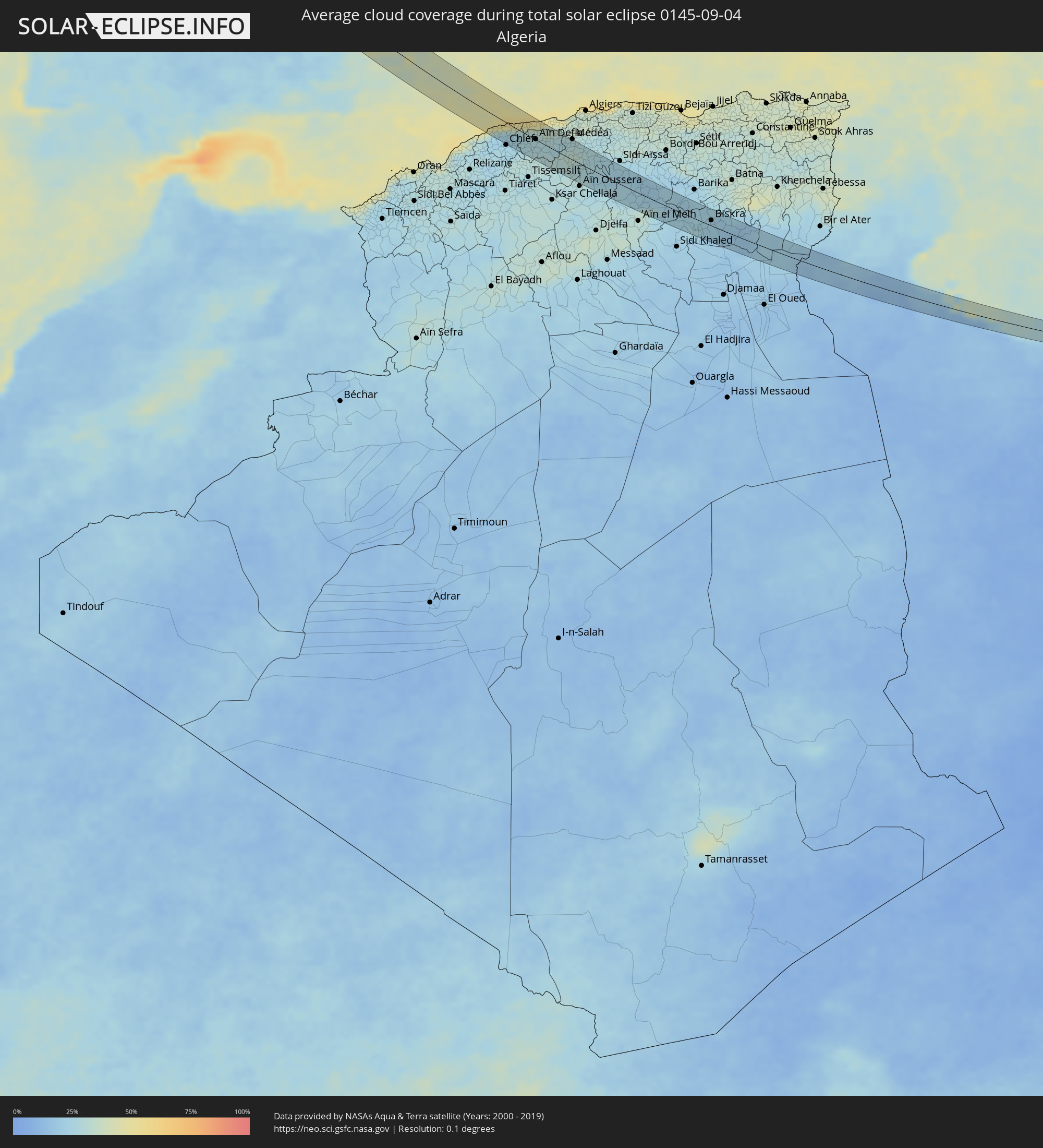 Algerien
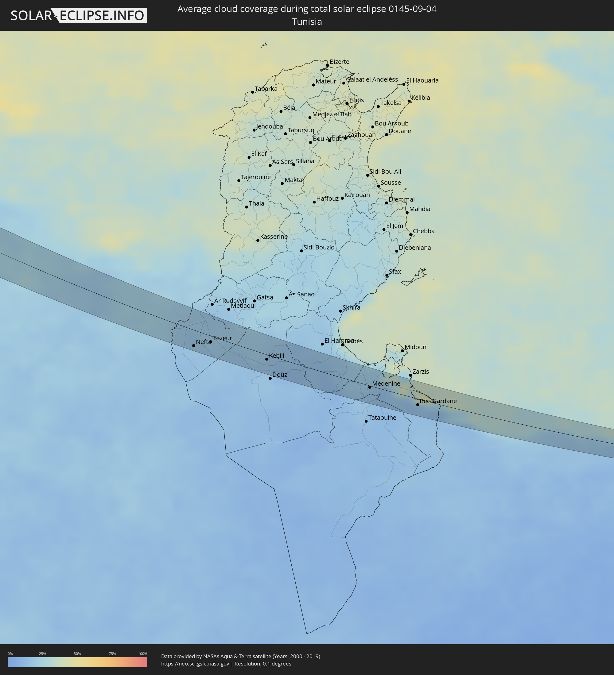 Tunesien
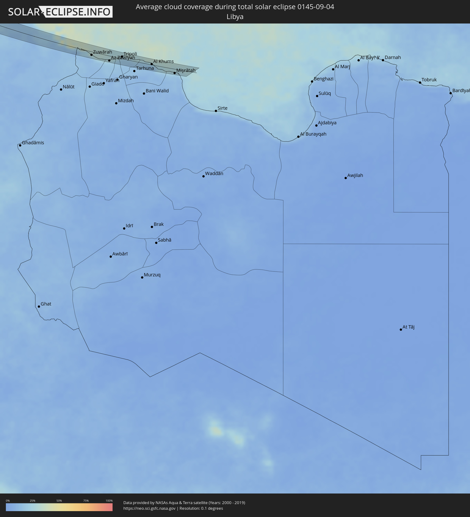 Libyen
Orte im Finsternispfad
Die nachfolgene Tabelle zeigt Städte und Orte mit mehr als 5.000 Einwohnern, die sich im Finsternispfad befinden. Städte mit mehr als 100.000 Einwohnern sind dick gekennzeichnet. Mit einem Klick auf den Ort öffnet sich eine Detailkarte die die Lage des jeweiligen Ortes zusammen mit dem Verlauf der zentralen Finsternis präsentiert.
| Ort | Typ | Dauer der Verfinsterung | Ortszeit bei maximaler Verfinsterung | Entfernung zur Zentrallinie | Ø Bewölkung |
|
Keflavík, Southern Peninsula
|
total | - | 14:37:35 UTC-01:28 | 51 km | 81% |
|
Carballo, Galicia
|
total | - | 16:52:23 UTC+00:00 | 16 km | 57% |
|
Santiago de Compostela, Galicia
|
total | - | 16:53:06 UTC+00:00 | 35 km | 48% |
|
Ribeira, Galicia
|
total | - | 16:53:24 UTC+00:00 | 36 km | 45% |
|
A Coruña, Galicia
|
total | - | 16:52:12 UTC+00:00 | 22 km | 51% |
|
Ferrol, Galicia
|
total | - | 16:52:03 UTC+00:00 | 39 km | 49% |
|
Lalín, Galicia
|
total | - | 16:53:43 UTC+00:00 | 13 km | 46% |
|
O Carballiño, Galicia
|
total | - | 16:54:10 UTC+00:00 | 35 km | 40% |
|
Ourense, Galicia
|
total | - | 16:54:27 UTC+00:00 | 30 km | 37% |
|
Monforte de Lemos, Galicia
|
total | - | 16:54:14 UTC+00:00 | 24 km | 39% |
|
Chaves, Vila Real
|
total | - | 16:19:01 UTC-00:36 | 42 km | 31% |
|
Verín, Galicia
|
total | - | 16:55:23 UTC+00:00 | 37 km | 32% |
|
Mirandela, Bragança
|
total | - | 16:19:37 UTC-00:36 | 46 km | 28% |
|
O Barco de Valdeorras, Galicia
|
total | - | 16:54:38 UTC+00:00 | 44 km | 35% |
|
Macedo de Cavaleiros, Bragança
|
total | - | 16:19:37 UTC-00:36 | 38 km | 28% |
|
Bragança, Bragança
|
total | - | 16:19:10 UTC-00:36 | 22 km | 31% |
|
Béjar, Castille and León
|
total | - | 16:59:01 UTC+00:00 | 40 km | 31% |
|
Salamanca, Castille and León
|
total | - | 16:57:56 UTC+00:00 | 30 km | 25% |
|
Talavera de la Reina, Castille-La Mancha
|
total | - | 17:00:09 UTC+00:00 | 28 km | 21% |
|
Toledo, Castille-La Mancha
|
total | - | 17:00:36 UTC+00:00 | 28 km | 21% |
|
Daimiel, Castille-La Mancha
|
total | - | 17:02:13 UTC+00:00 | 25 km | 22% |
|
Valdepeñas, Castille-La Mancha
|
total | - | 17:02:51 UTC+00:00 | 39 km | 24% |
|
Manzanares, Castille-La Mancha
|
total | - | 17:02:25 UTC+00:00 | 32 km | 24% |
|
Alcázar de San Juan, Castille-La Mancha
|
total | - | 17:01:43 UTC+00:00 | 28 km | 25% |
|
Tomelloso, Castille-La Mancha
|
total | - | 17:02:13 UTC+00:00 | 23 km | 26% |
|
Caravaca, Murcia
|
total | - | 17:04:29 UTC+00:00 | 28 km | 39% |
|
Hellín, Castille-La Mancha
|
total | - | 17:03:46 UTC+00:00 | 33 km | 33% |
|
Totana, Murcia
|
total | - | 17:05:11 UTC+00:00 | 30 km | 36% |
|
Mula, Murcia
|
total | - | 17:04:41 UTC+00:00 | 1 km | 38% |
|
Cieza, Murcia
|
total | - | 17:04:20 UTC+00:00 | 24 km | 36% |
|
Mazarrón, Murcia
|
total | - | 17:05:33 UTC+00:00 | 33 km | 39% |
|
Archena, Murcia
|
total | - | 17:04:35 UTC+00:00 | 20 km | 38% |
|
Murcia, Murcia
|
total | - | 17:04:52 UTC+00:00 | 28 km | 41% |
|
Cartagena, Murcia
|
total | - | 17:05:36 UTC+00:00 | 17 km | 40% |
|
Torre-Pacheco, Murcia
|
total | - | 17:05:21 UTC+00:00 | 4 km | 35% |
|
Orihuela, Valencia
|
total | - | 17:04:43 UTC+00:00 | 37 km | 43% |
|
Atamaría, Murcia
|
total | - | 17:05:39 UTC+00:00 | 24 km | 40% |
|
San Pedro del Pinatar, Murcia
|
total | - | 17:05:13 UTC+00:00 | 21 km | 46% |
|
Torrevieja, Valencia
|
total | - | 17:04:58 UTC+00:00 | 38 km | 38% |
|
Abou el Hassan, Chlef
|
total | - | 17:17:31 UTC+00:09 | 28 km | 22% |
|
Sidi Akkacha, Chlef
|
total | - | 17:17:27 UTC+00:09 | 18 km | 28% |
|
Oued Fodda, Chlef
|
total | - | 17:17:59 UTC+00:09 | 32 km | 25% |
|
El Attaf, Aïn Defla
|
total | - | 17:17:56 UTC+00:09 | 30 km | 26% |
|
El Abadia, Aïn Defla
|
total | - | 17:17:51 UTC+00:09 | 28 km | 27% |
|
Aïn Defla, Aïn Defla
|
total | - | 17:17:54 UTC+00:09 | 4 km | 28% |
|
Khemis Miliana, Aïn Defla
|
total | - | 17:17:56 UTC+00:09 | 20 km | 28% |
|
Ksar el Boukhari, Medea
|
total | - | 17:18:40 UTC+00:09 | 25 km | 31% |
|
Berrouaghia, Medea
|
total | - | 17:18:14 UTC+00:09 | 38 km | 32% |
|
’Aïn Boucif, Medea
|
total | - | 17:18:42 UTC+00:09 | 17 km | 27% |
|
Birine, Djelfa
|
total | - | 17:19:10 UTC+00:09 | 25 km | 24% |
|
‘Aïn el Hadjel, M'Sila
|
total | - | 17:19:09 UTC+00:09 | 33 km | 22% |
|
Tolga, Biskra
|
total | - | 17:20:54 UTC+00:09 | 17 km | 25% |
|
Oumache, Biskra
|
total | - | 17:20:58 UTC+00:09 | 23 km | 21% |
|
Biskra, Biskra
|
total | - | 17:20:41 UTC+00:09 | 21 km | 22% |
|
Sidi Okba, Biskra
|
total | - | 17:20:53 UTC+00:09 | 13 km | 20% |
|
Zeribet el Oued, Biskra
|
total | - | 17:21:00 UTC+00:09 | 21 km | 19% |
|
Nefta, Tawzar
|
total | - | 17:22:22 UTC+00:09 | 21 km | 16% |
|
Tozeur, Tawzar
|
total | - | 17:22:16 UTC+00:09 | 18 km | 16% |
|
Degache, Tawzar
|
total | - | 17:22:11 UTC+00:09 | 20 km | 19% |
|
Kebili, Qibilī
|
total | - | 17:22:36 UTC+00:09 | 6 km | 15% |
|
Jemna, Qibilī
|
total | - | 17:22:48 UTC+00:09 | 20 km | 15% |
|
Medenine, Madanīn
|
total | - | 17:23:04 UTC+00:09 | 3 km | 16% |
|
Ben Gardane, Madanīn
|
total | - | 17:23:21 UTC+00:09 | 25 km | 13% |
|
Zalţan, An Nuqāţ al Khams
|
total | - | 18:06:58 UTC+00:52 | 17 km | 11% |
|
Zuwārah, An Nuqāţ al Khams
|
total | - | 18:06:58 UTC+00:52 | 15 km | 13% |
|
Şabrātah, Az Zāwiyah
|
total | - | 18:07:08 UTC+00:52 | 17 km | 19% |
|
Şurmān, Az Zāwiyah
|
total | - | 18:07:11 UTC+00:52 | 22 km | 20% |
|
Az Zāwīyah, Az Zāwiyah
|
total | - | 18:07:10 UTC+00:52 | 28 km | 20% |
|
Zawiya, Az Zāwiyah
|
total | - | 18:07:10 UTC+00:52 | 28 km | 20% |
|
Tripoli, Tripoli
|
total | - | 18:06:54 UTC+00:52 | 18 km | 17% |
|
Tagiura, Tripoli
|
total | - | 18:06:52 UTC+00:52 | 19 km | 19% |
|
Masallātah, Al Marqab
|
total | - | 18:07:11 UTC+00:52 | 7 km | 14% |
|
Al Khums, Al Marqab
|
total | - | 18:07:05 UTC+00:52 | 23 km | 14% |
|
Zliten, Mişrātah
|
total | - | 18:07:19 UTC+00:52 | 15 km | 16% |
|
Mişrātah, Mişrātah
|
total | - | 18:07:22 UTC+00:52 | 18 km | 16% |