Total solar eclipse of 09/04/0145
| Day of week: | Saturday |
| Maximum duration of eclipse: | 00m52s |
| Maximum width of eclipse path: | 88 km |
| Saros cycle: | 66 |
| Coverage: | 100% |
| Magnitude: | 1.0128 |
| Gamma: | 0.8709 |
Wo kann man die Sonnenfinsternis vom 09/04/0145 sehen?
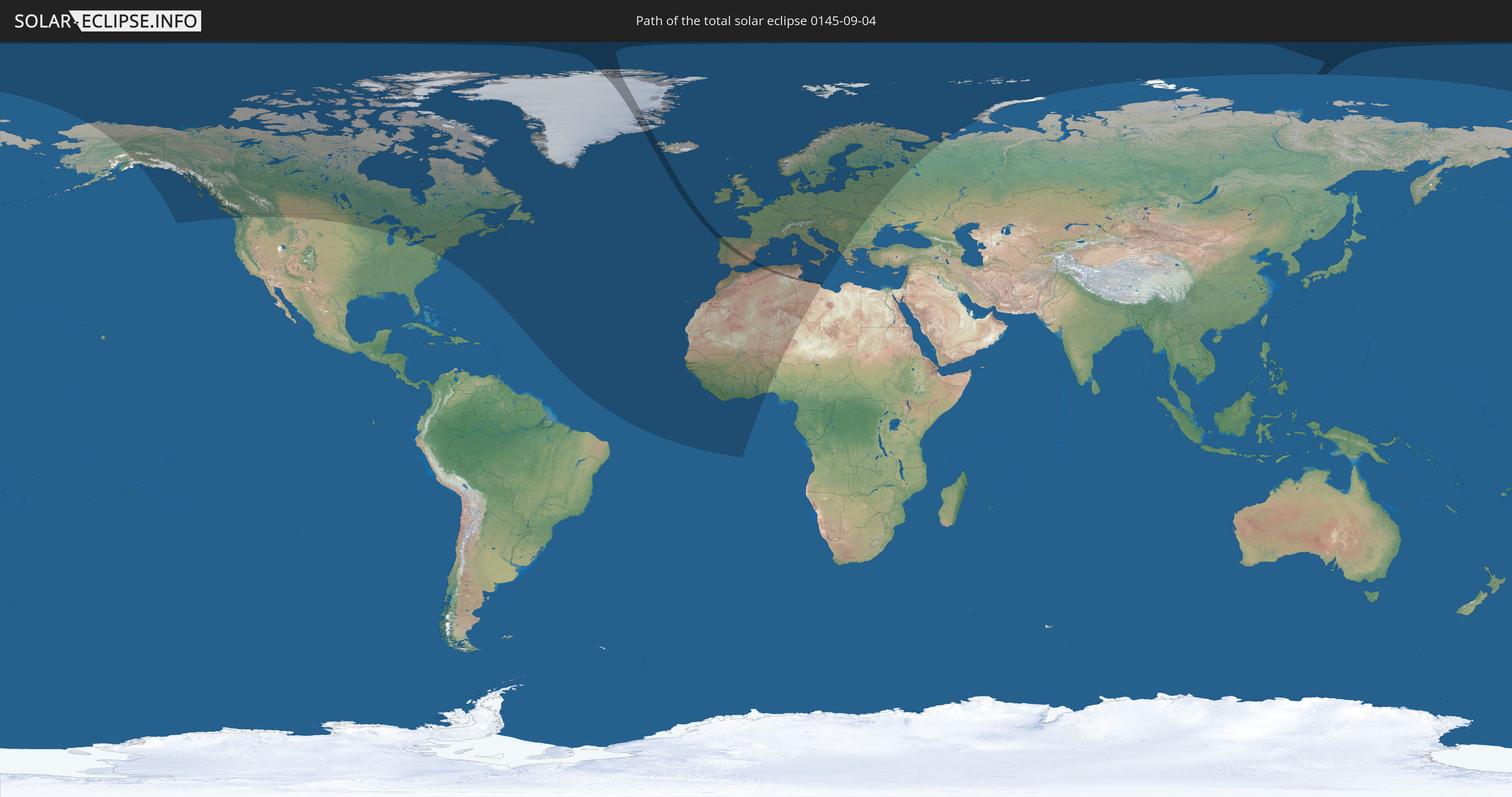
Die Sonnenfinsternis am 09/04/0145 kann man in 76 Ländern als partielle Sonnenfinsternis beobachten.
Der Finsternispfad verläuft durch 7 Länder. Nur in diesen Ländern ist sie als total Sonnenfinsternis zu sehen.
In den folgenden Ländern ist die Sonnenfinsternis total zu sehen
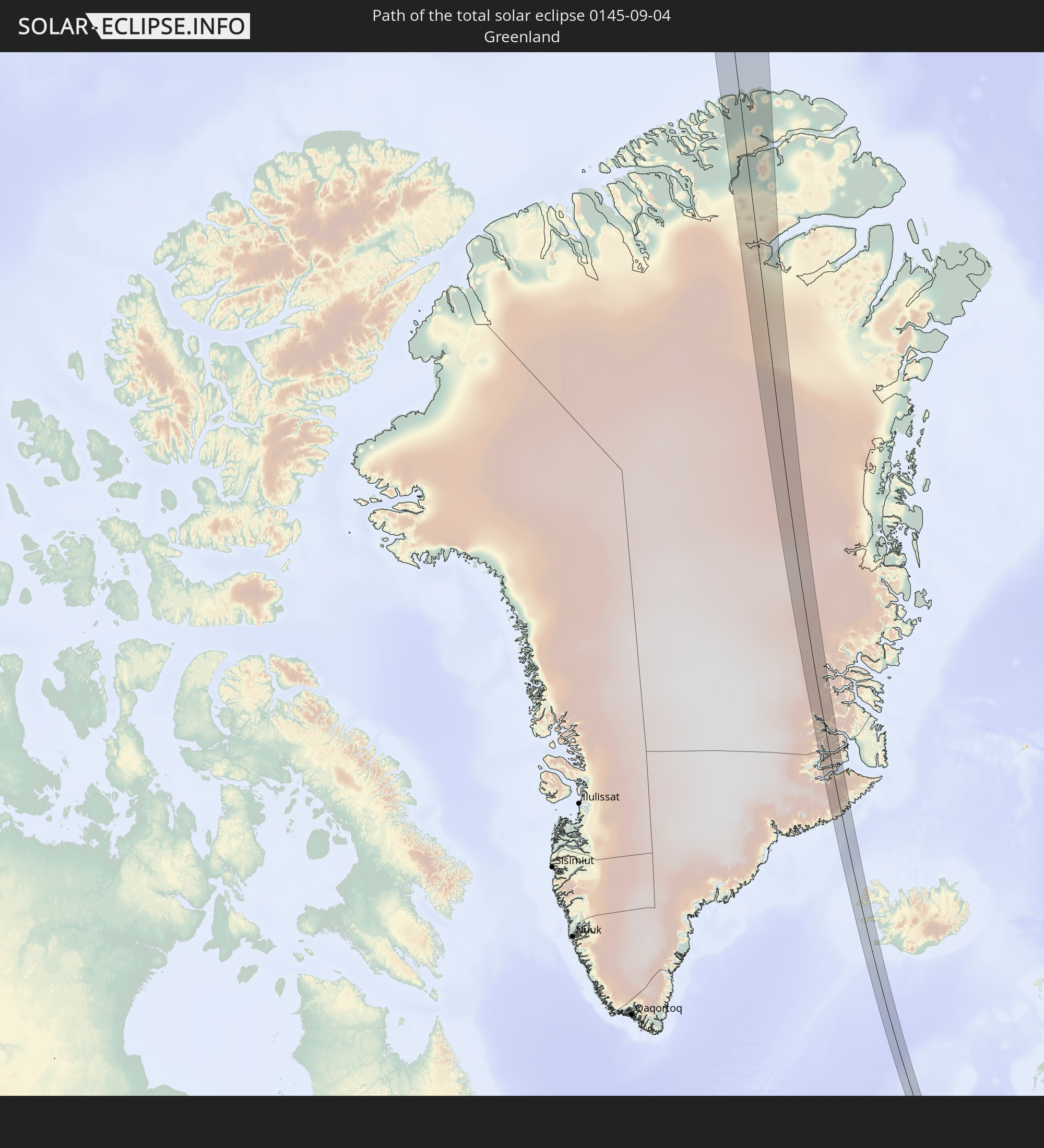 Greenland
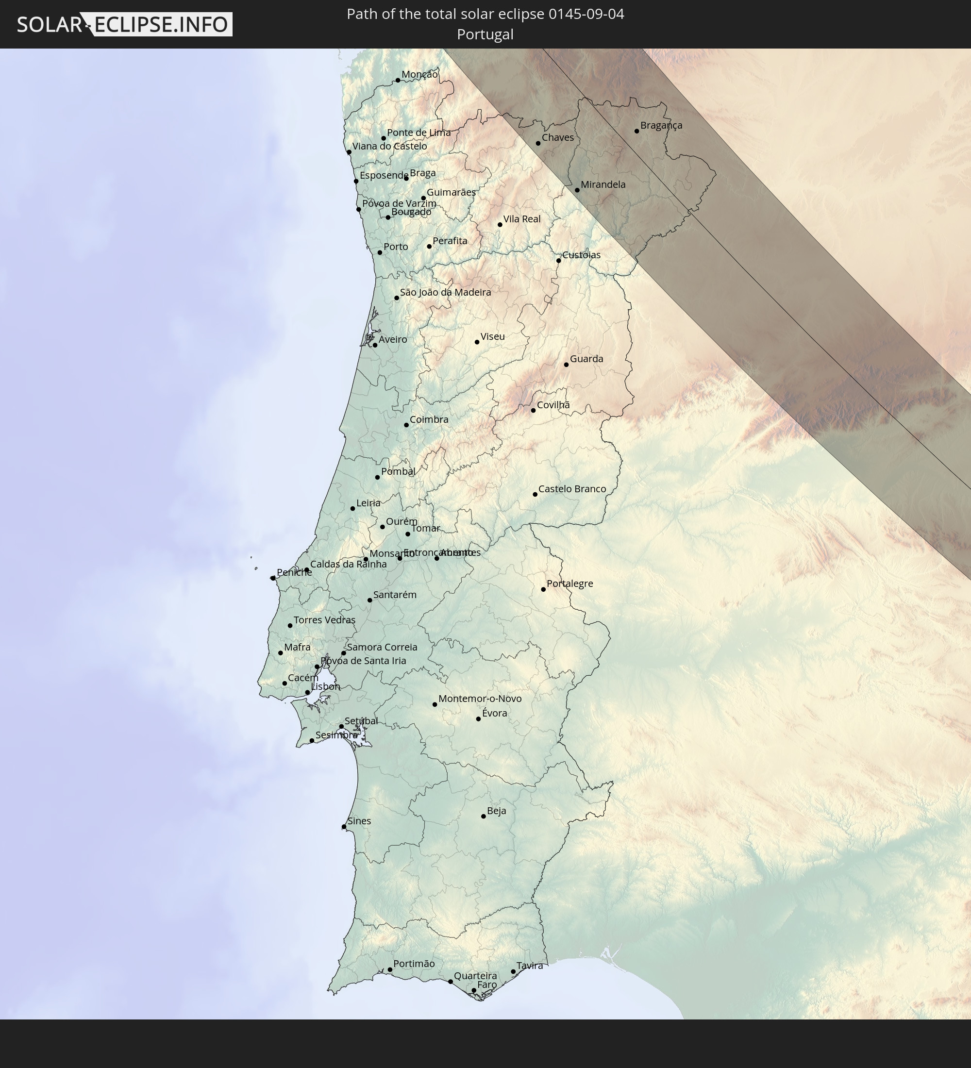 Portugal
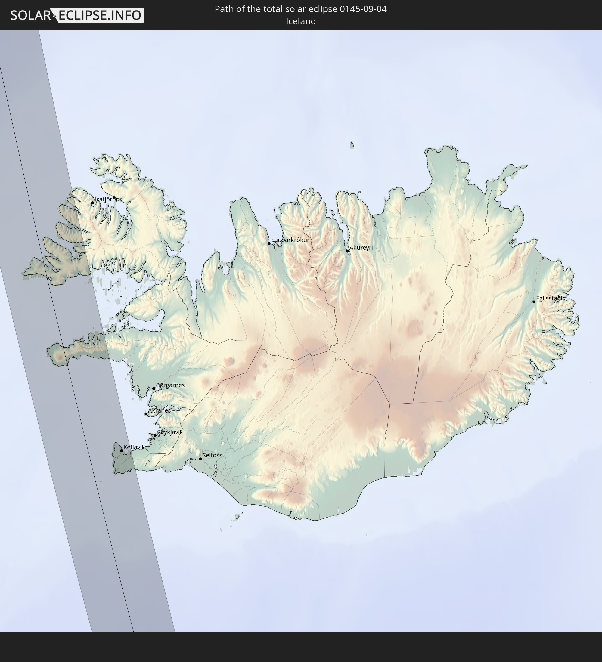 Iceland
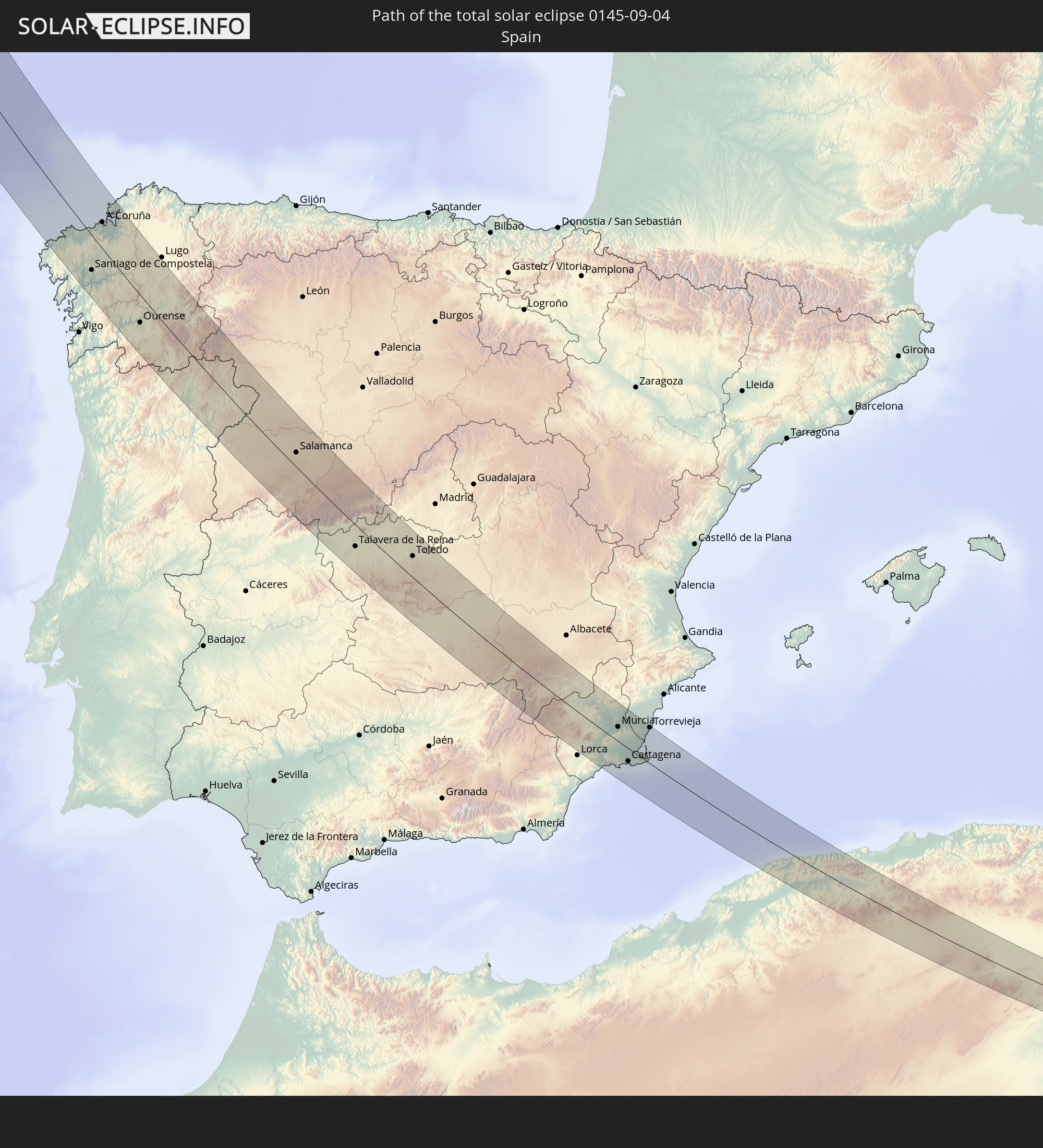 Spain
Spain
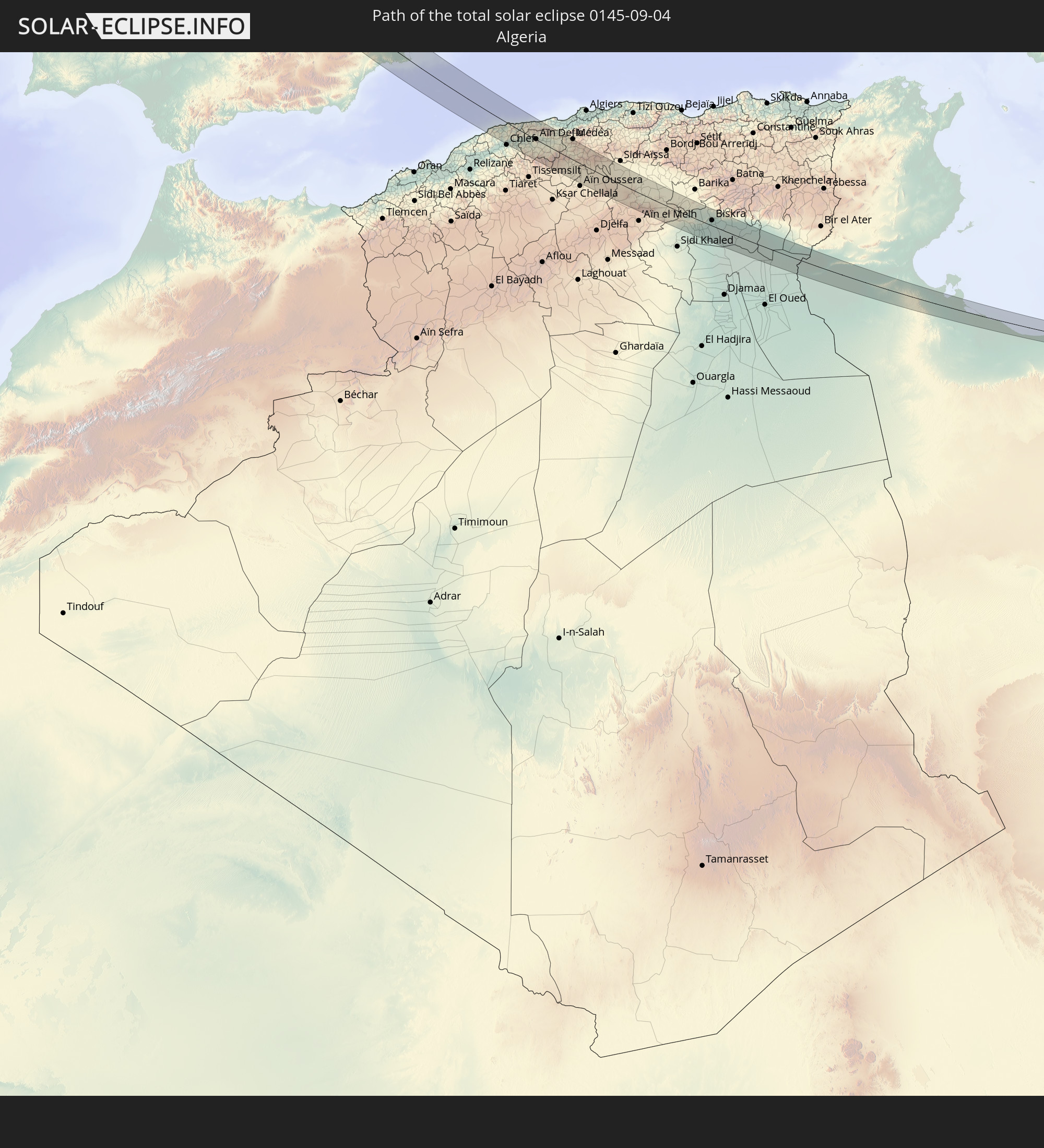 Algeria
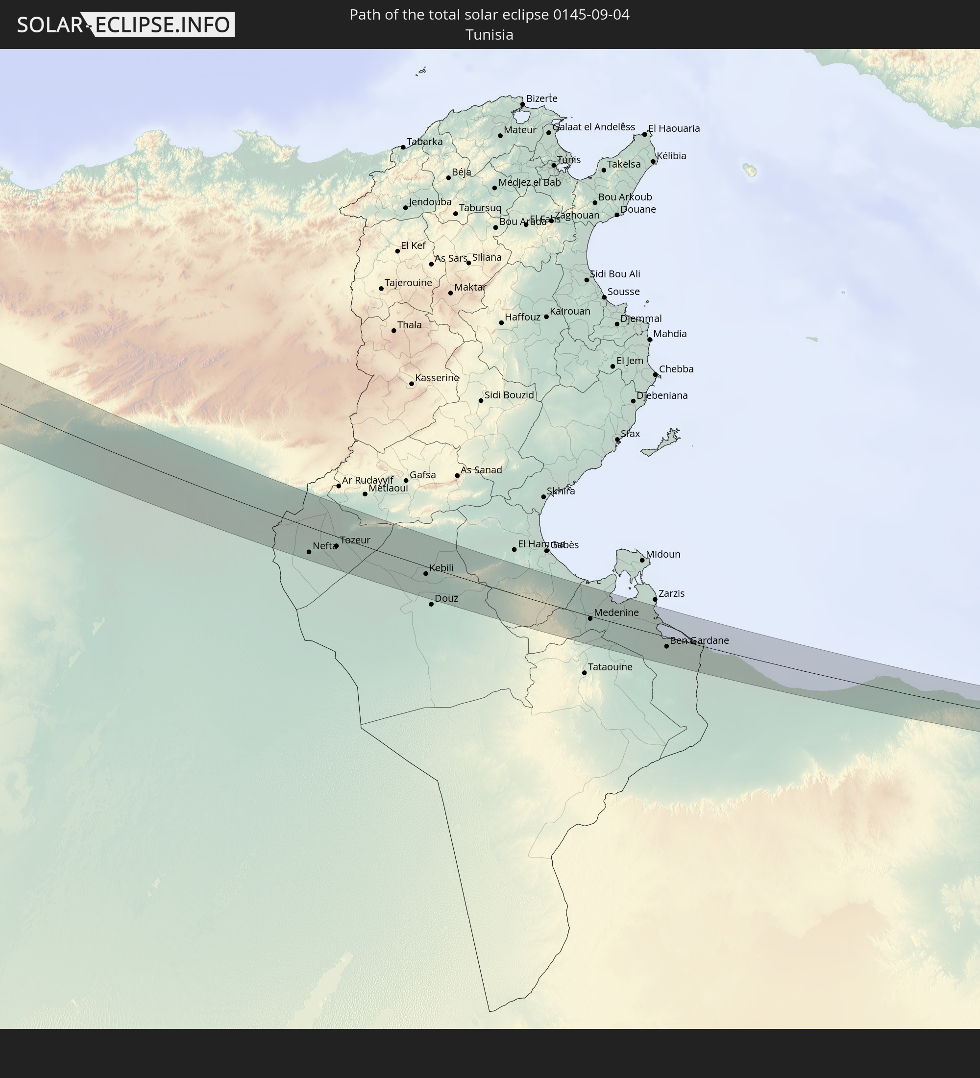 Tunisia
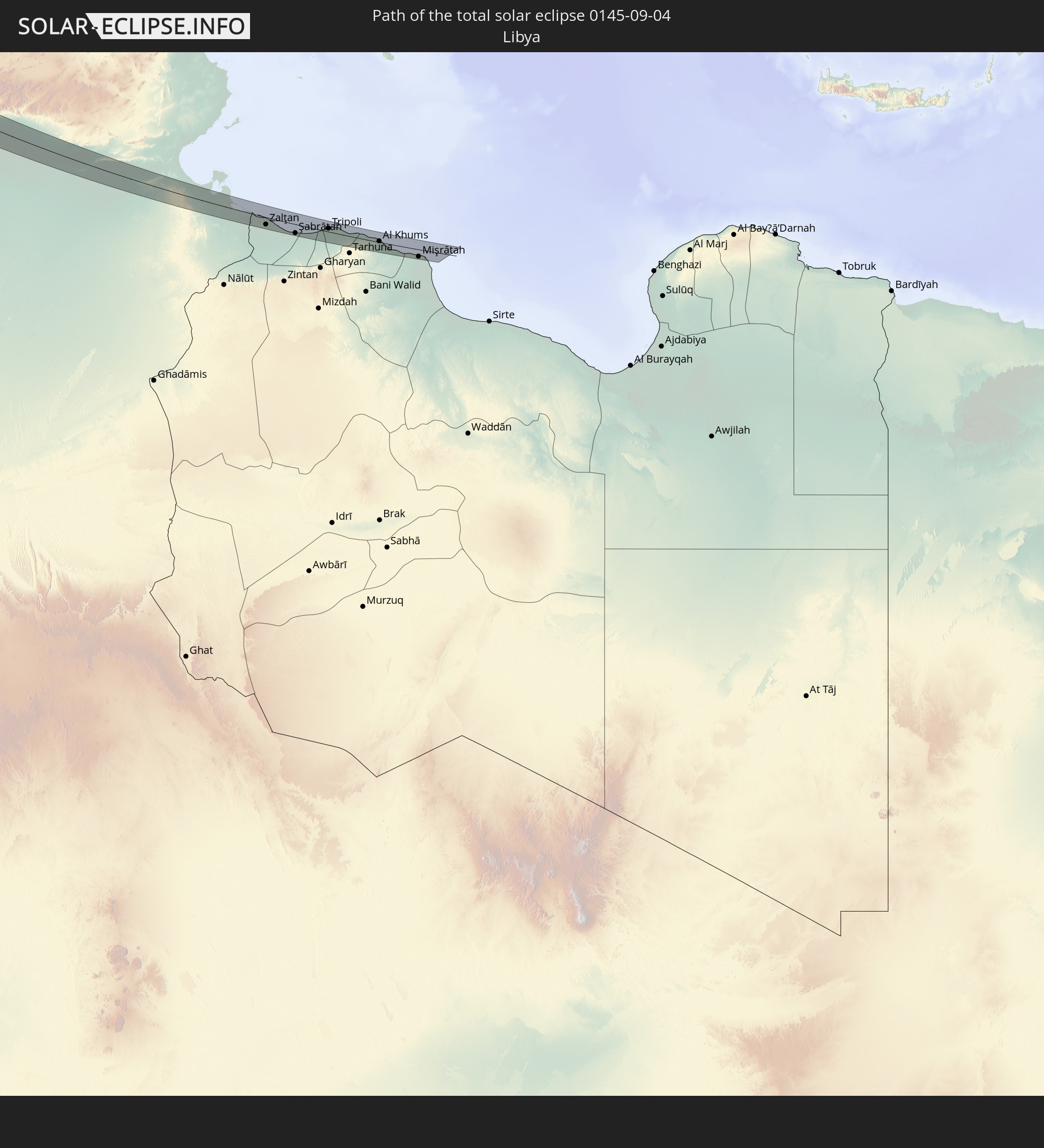 Libya
Libya
In den folgenden Ländern ist die Sonnenfinsternis partiell zu sehen
 Russia
 United States
 Canada
 Greenland
 Bermuda
 Saint Pierre and Miquelon
 Portugal
 Cabo Verde
 Iceland
 Spain
Spain
 Senegal
 Mauritania
 The Gambia
 Guinea-Bissau
 Guinea
 Sierra Leone
 Morocco
 Mali
Mali
 Liberia
 Republic of Ireland
 Svalbard and Jan Mayen
 Algeria
 United Kingdom
 Ivory Coast
 Faroe Islands
 Burkina Faso
 Gibraltar
 France
 Isle of Man
 Ghana
Ghana
 Guernsey
 Jersey
 Togo
Togo
 Niger
Niger
 Benin
Benin
 Andorra
 Belgium
 Nigeria
 Netherlands
 Norway
 Luxembourg
 Germany
 Switzerland
 Italy
Italy
 Monaco
 Tunisia
 Denmark
 Libya
Libya
 Liechtenstein
 Austria
 Sweden
 Czechia
 San Marino
 Vatican City
 Slovenia
 Croatia
 Poland
 Malta
Malta
 Bosnia and Herzegovina
 Hungary
 Slovakia
 Montenegro
 Serbia
 Albania
 Åland Islands
 Greece
 Romania
 Republic of Macedonia
 Finland
 Lithuania
 Latvia
 Estonia
 Ukraine
 Bulgaria
 Belarus
 Moldova
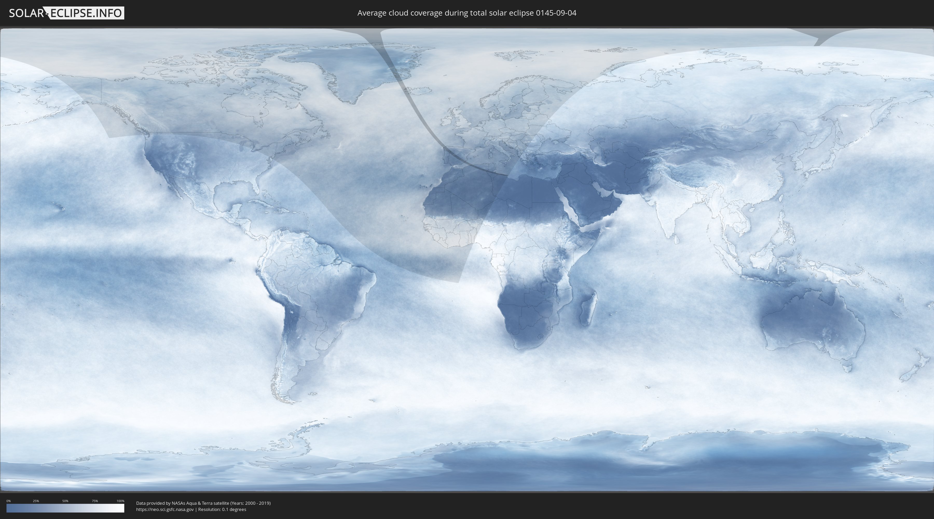
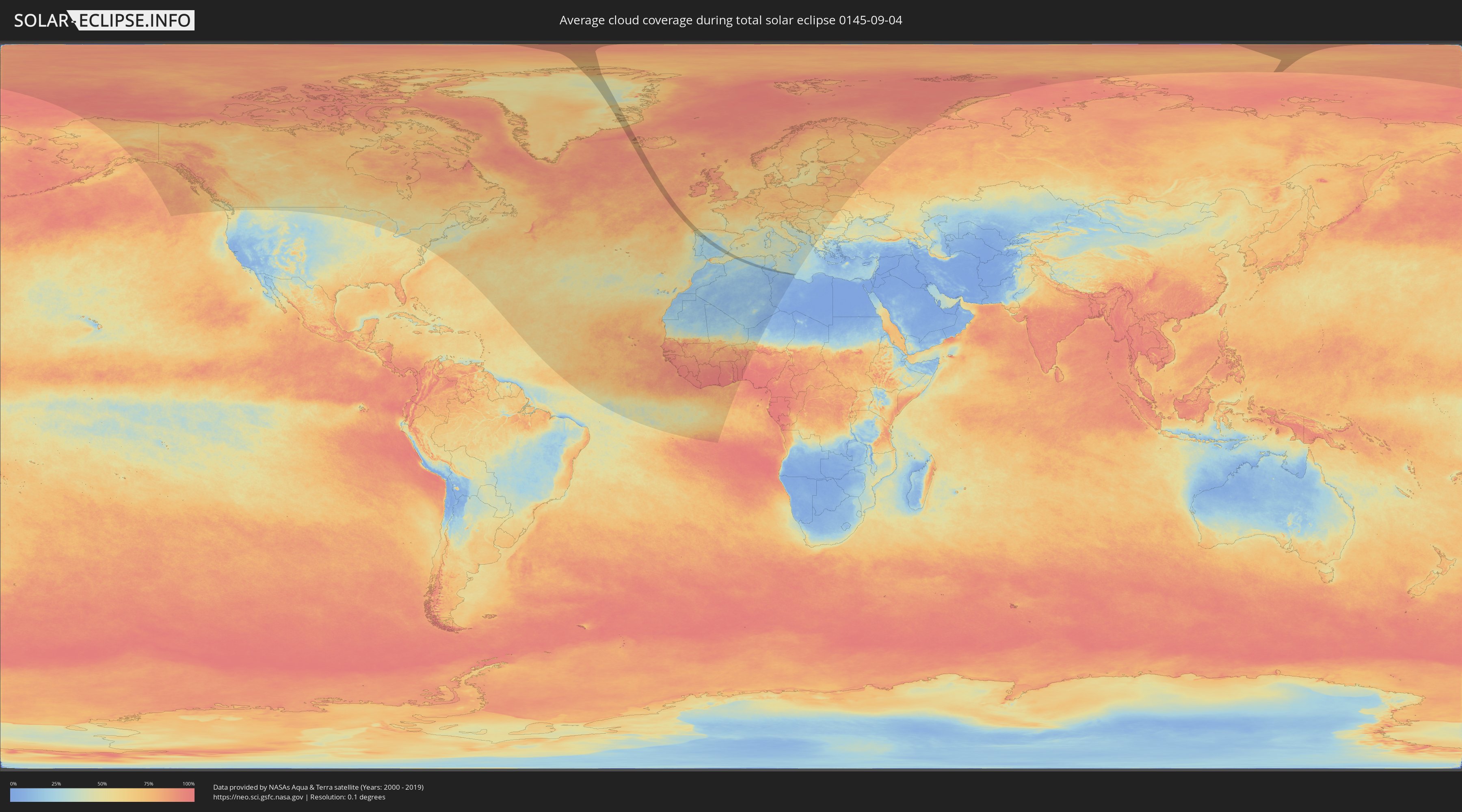
How will be the weather during the total solar eclipse on 09/04/0145?
Where is the best place to see the total solar eclipse of 09/04/0145?
The following maps show the average cloud coverage for the day of the total solar eclipse.
With the help of these maps, it is possible to find the place along the eclipse path, which has the best
chance of a cloudless sky.
Nevertheless, you should consider local circumstances and inform about the weather of your chosen
observation site.
The data is provided by NASAs satellites
AQUA and TERRA.
The cloud maps are averaged over a period of 19 years (2000 - 2019).
Detailed country maps
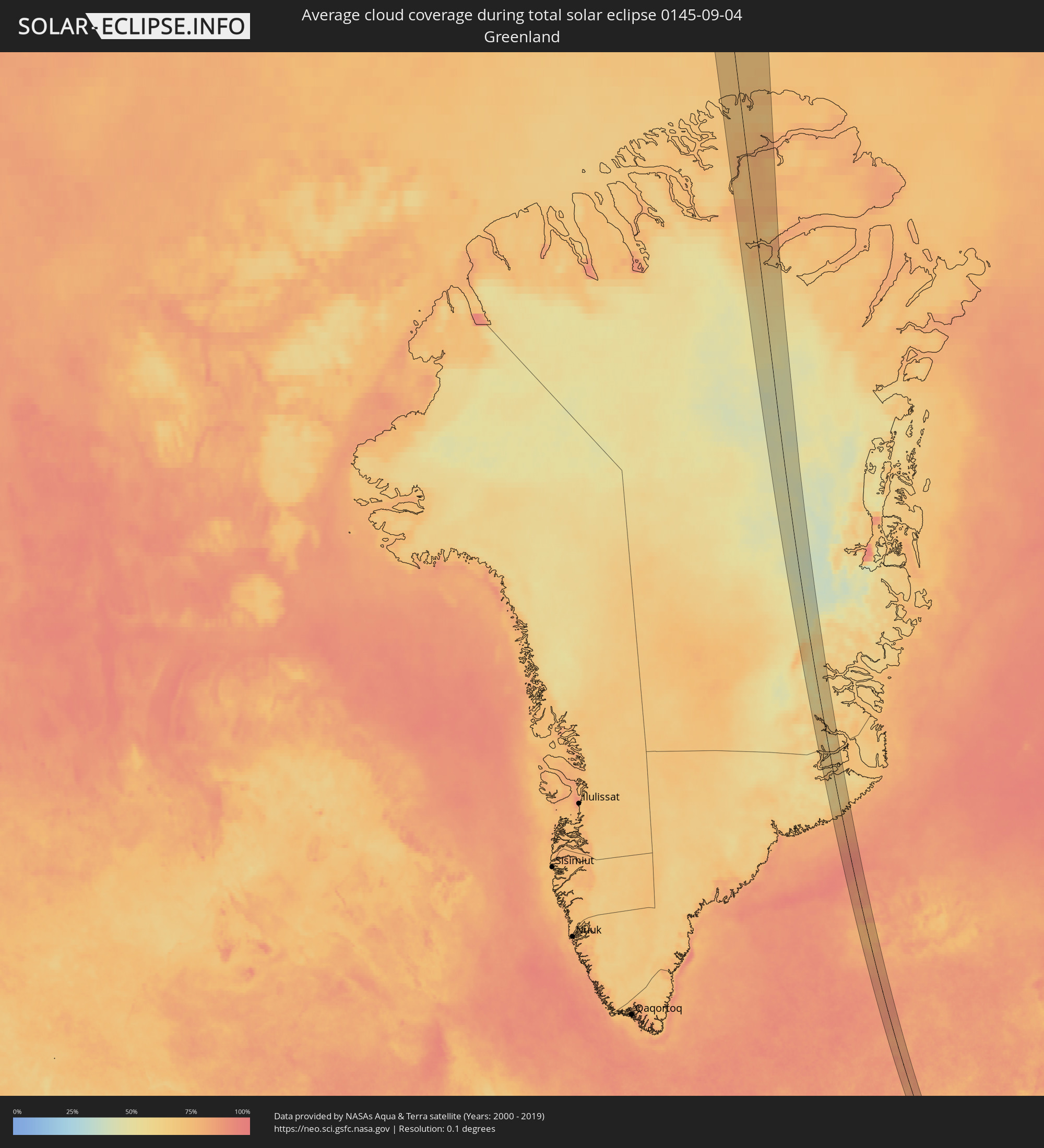 Greenland
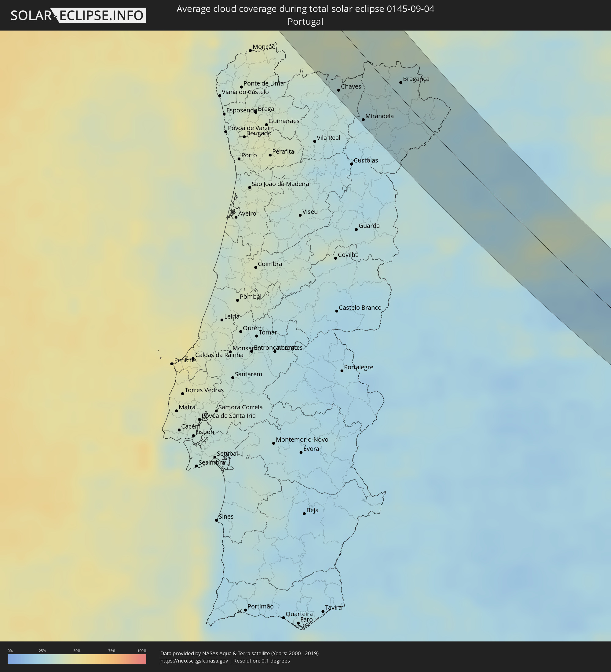 Portugal
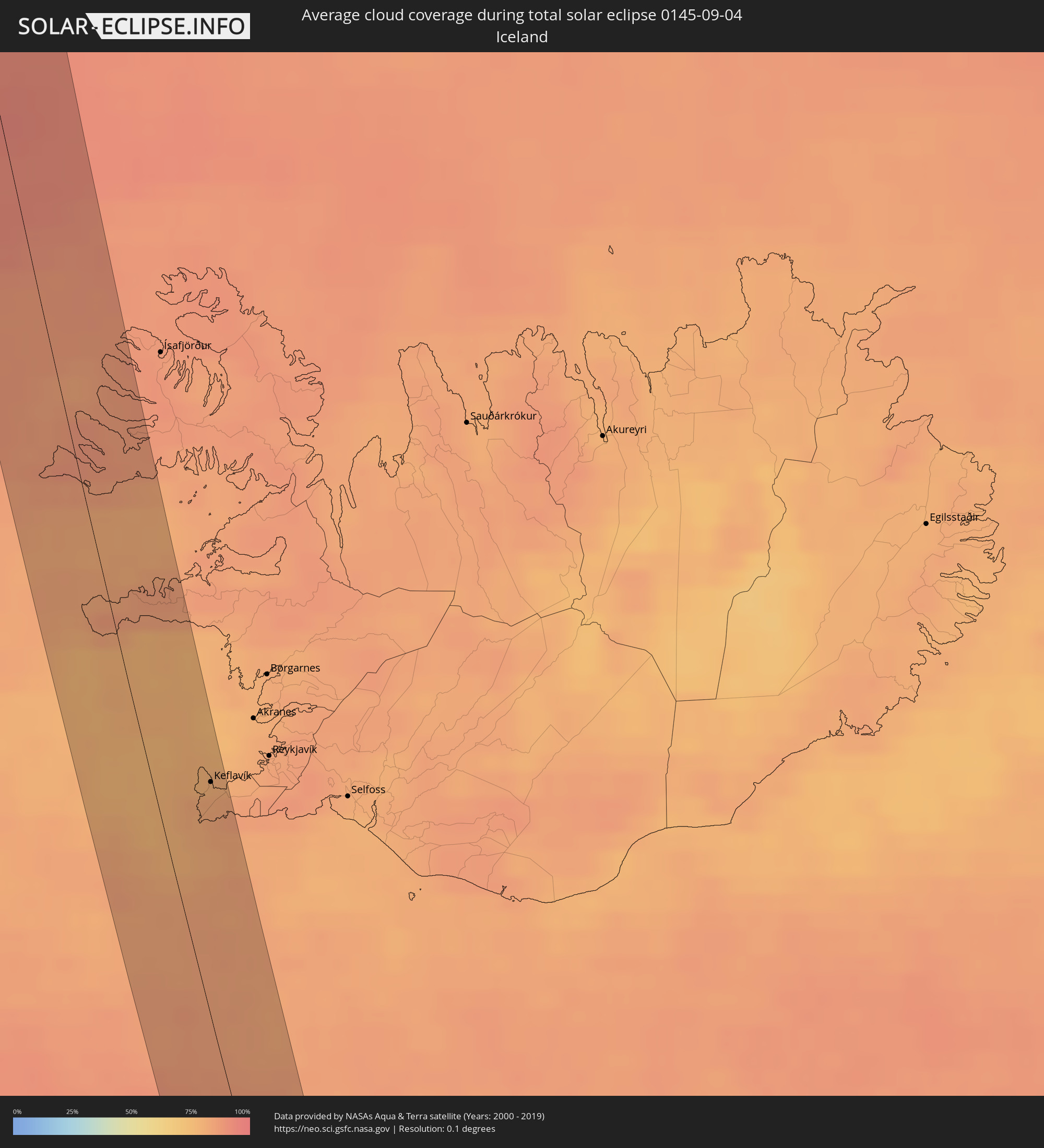 Iceland
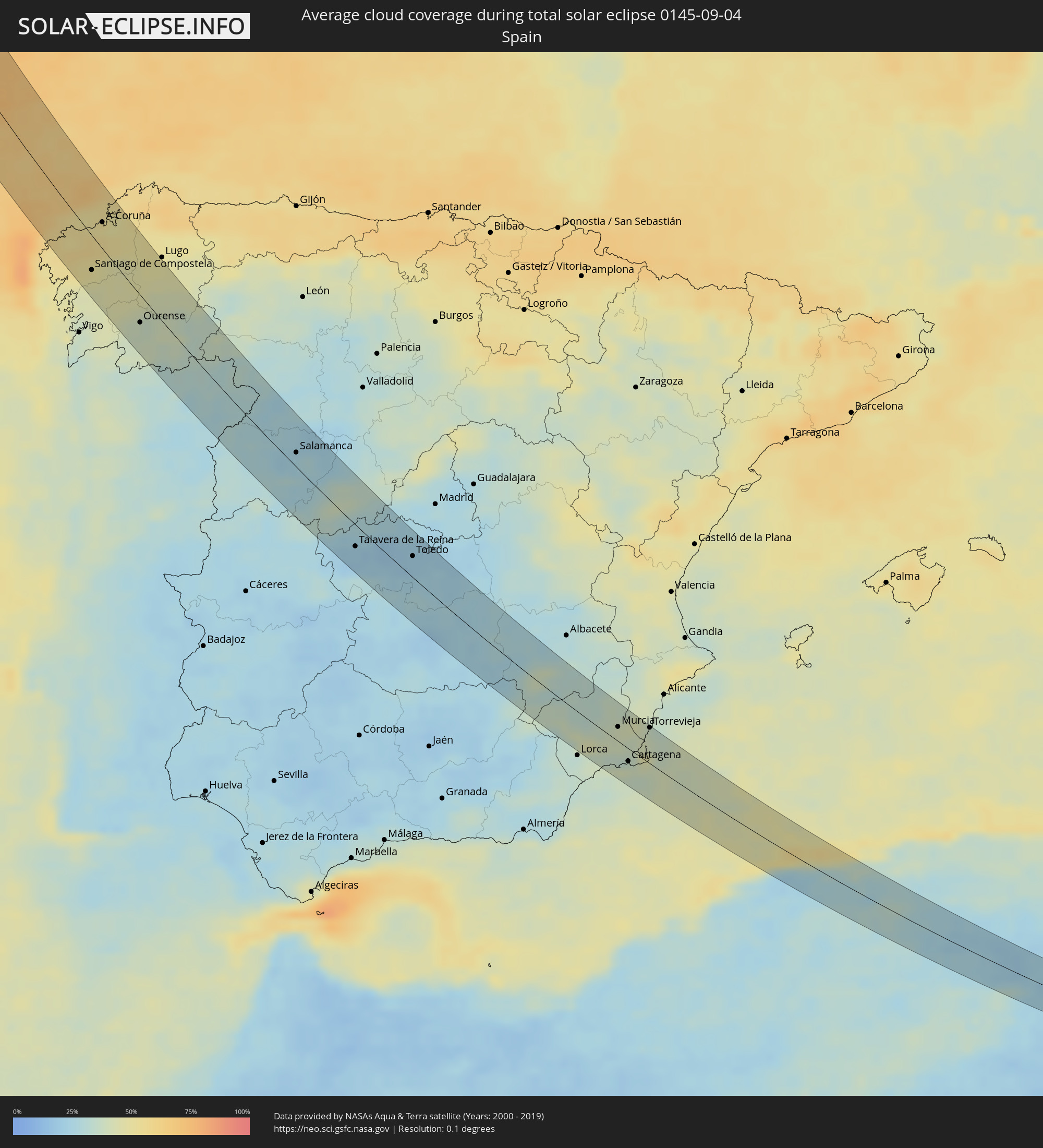 Spain
Spain
 Algeria
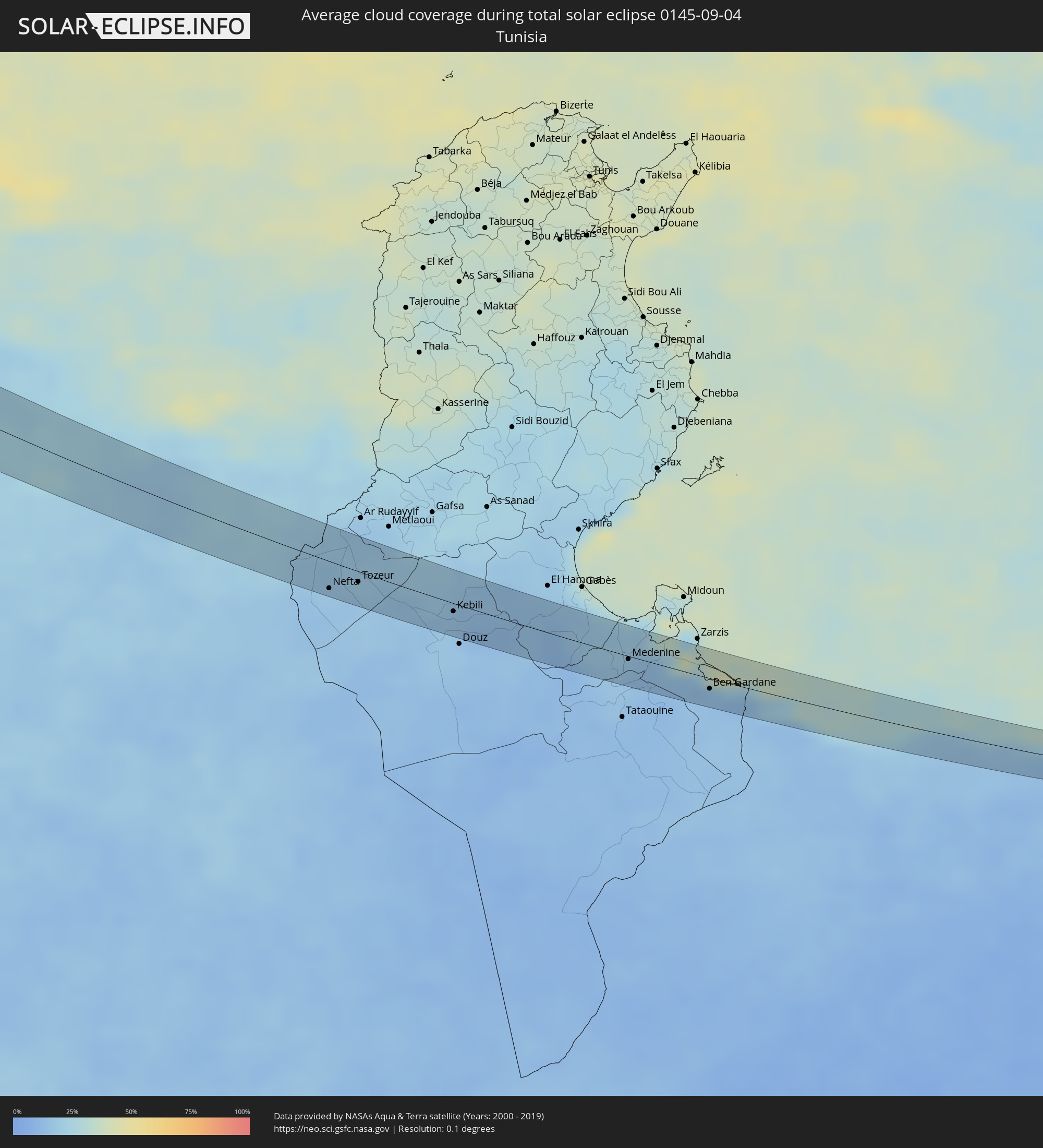 Tunisia
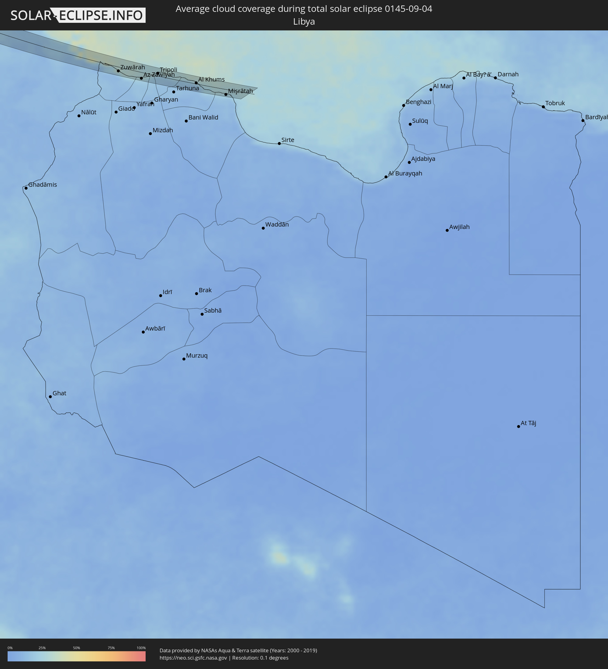 Libya
Libya
Cities inside the path of the eclipse
The following table shows all locations with a population of more than 5,000 inside the eclipse path. Cities which have more than 100,000 inhabitants are marked bold. A click at the locations opens a detailed map.
| City | Type | Eclipse duration | Local time of max. eclipse | Distance to central line | Ø Cloud coverage |
|
Keflavík, Southern Peninsula
|
total | - | 14:37:35 UTC-01:28 | 51 km | 81% |
|
Carballo, Galicia
|
total | - | 16:52:23 UTC+00:00 | 16 km | 57% |
|
Santiago de Compostela, Galicia
|
total | - | 16:53:06 UTC+00:00 | 35 km | 48% |
|
Ribeira, Galicia
|
total | - | 16:53:24 UTC+00:00 | 36 km | 45% |
|
A Coruña, Galicia
|
total | - | 16:52:12 UTC+00:00 | 22 km | 51% |
|
Ferrol, Galicia
|
total | - | 16:52:03 UTC+00:00 | 39 km | 49% |
|
Lalín, Galicia
|
total | - | 16:53:43 UTC+00:00 | 13 km | 46% |
|
O Carballiño, Galicia
|
total | - | 16:54:10 UTC+00:00 | 35 km | 40% |
|
Ourense, Galicia
|
total | - | 16:54:27 UTC+00:00 | 30 km | 37% |
|
Monforte de Lemos, Galicia
|
total | - | 16:54:14 UTC+00:00 | 24 km | 39% |
|
Chaves, Vila Real
|
total | - | 16:19:01 UTC-00:36 | 42 km | 31% |
|
Verín, Galicia
|
total | - | 16:55:23 UTC+00:00 | 37 km | 32% |
|
Mirandela, Bragança
|
total | - | 16:19:37 UTC-00:36 | 46 km | 28% |
|
O Barco de Valdeorras, Galicia
|
total | - | 16:54:38 UTC+00:00 | 44 km | 35% |
|
Macedo de Cavaleiros, Bragança
|
total | - | 16:19:37 UTC-00:36 | 38 km | 28% |
|
Bragança, Bragança
|
total | - | 16:19:10 UTC-00:36 | 22 km | 31% |
|
Béjar, Castille and León
|
total | - | 16:59:01 UTC+00:00 | 40 km | 31% |
|
Salamanca, Castille and León
|
total | - | 16:57:56 UTC+00:00 | 30 km | 25% |
|
Talavera de la Reina, Castille-La Mancha
|
total | - | 17:00:09 UTC+00:00 | 28 km | 21% |
|
Toledo, Castille-La Mancha
|
total | - | 17:00:36 UTC+00:00 | 28 km | 21% |
|
Daimiel, Castille-La Mancha
|
total | - | 17:02:13 UTC+00:00 | 25 km | 22% |
|
Valdepeñas, Castille-La Mancha
|
total | - | 17:02:51 UTC+00:00 | 39 km | 24% |
|
Manzanares, Castille-La Mancha
|
total | - | 17:02:25 UTC+00:00 | 32 km | 24% |
|
Alcázar de San Juan, Castille-La Mancha
|
total | - | 17:01:43 UTC+00:00 | 28 km | 25% |
|
Tomelloso, Castille-La Mancha
|
total | - | 17:02:13 UTC+00:00 | 23 km | 26% |
|
Caravaca, Murcia
|
total | - | 17:04:29 UTC+00:00 | 28 km | 39% |
|
Hellín, Castille-La Mancha
|
total | - | 17:03:46 UTC+00:00 | 33 km | 33% |
|
Totana, Murcia
|
total | - | 17:05:11 UTC+00:00 | 30 km | 36% |
|
Mula, Murcia
|
total | - | 17:04:41 UTC+00:00 | 1 km | 38% |
|
Cieza, Murcia
|
total | - | 17:04:20 UTC+00:00 | 24 km | 36% |
|
Mazarrón, Murcia
|
total | - | 17:05:33 UTC+00:00 | 33 km | 39% |
|
Archena, Murcia
|
total | - | 17:04:35 UTC+00:00 | 20 km | 38% |
|
Murcia, Murcia
|
total | - | 17:04:52 UTC+00:00 | 28 km | 41% |
|
Cartagena, Murcia
|
total | - | 17:05:36 UTC+00:00 | 17 km | 40% |
|
Torre-Pacheco, Murcia
|
total | - | 17:05:21 UTC+00:00 | 4 km | 35% |
|
Orihuela, Valencia
|
total | - | 17:04:43 UTC+00:00 | 37 km | 43% |
|
Atamaría, Murcia
|
total | - | 17:05:39 UTC+00:00 | 24 km | 40% |
|
San Pedro del Pinatar, Murcia
|
total | - | 17:05:13 UTC+00:00 | 21 km | 46% |
|
Torrevieja, Valencia
|
total | - | 17:04:58 UTC+00:00 | 38 km | 38% |
|
Abou el Hassan, Chlef
|
total | - | 17:17:31 UTC+00:09 | 28 km | 22% |
|
Sidi Akkacha, Chlef
|
total | - | 17:17:27 UTC+00:09 | 18 km | 28% |
|
Oued Fodda, Chlef
|
total | - | 17:17:59 UTC+00:09 | 32 km | 25% |
|
El Attaf, Aïn Defla
|
total | - | 17:17:56 UTC+00:09 | 30 km | 26% |
|
El Abadia, Aïn Defla
|
total | - | 17:17:51 UTC+00:09 | 28 km | 27% |
|
Aïn Defla, Aïn Defla
|
total | - | 17:17:54 UTC+00:09 | 4 km | 28% |
|
Khemis Miliana, Aïn Defla
|
total | - | 17:17:56 UTC+00:09 | 20 km | 28% |
|
Ksar el Boukhari, Medea
|
total | - | 17:18:40 UTC+00:09 | 25 km | 31% |
|
Berrouaghia, Medea
|
total | - | 17:18:14 UTC+00:09 | 38 km | 32% |
|
’Aïn Boucif, Medea
|
total | - | 17:18:42 UTC+00:09 | 17 km | 27% |
|
Birine, Djelfa
|
total | - | 17:19:10 UTC+00:09 | 25 km | 24% |
|
‘Aïn el Hadjel, M'Sila
|
total | - | 17:19:09 UTC+00:09 | 33 km | 22% |
|
Tolga, Biskra
|
total | - | 17:20:54 UTC+00:09 | 17 km | 25% |
|
Oumache, Biskra
|
total | - | 17:20:58 UTC+00:09 | 23 km | 21% |
|
Biskra, Biskra
|
total | - | 17:20:41 UTC+00:09 | 21 km | 22% |
|
Sidi Okba, Biskra
|
total | - | 17:20:53 UTC+00:09 | 13 km | 20% |
|
Zeribet el Oued, Biskra
|
total | - | 17:21:00 UTC+00:09 | 21 km | 19% |
|
Nefta, Tawzar
|
total | - | 17:22:22 UTC+00:09 | 21 km | 16% |
|
Tozeur, Tawzar
|
total | - | 17:22:16 UTC+00:09 | 18 km | 16% |
|
Degache, Tawzar
|
total | - | 17:22:11 UTC+00:09 | 20 km | 19% |
|
Kebili, Qibilī
|
total | - | 17:22:36 UTC+00:09 | 6 km | 15% |
|
Jemna, Qibilī
|
total | - | 17:22:48 UTC+00:09 | 20 km | 15% |
|
Medenine, Madanīn
|
total | - | 17:23:04 UTC+00:09 | 3 km | 16% |
|
Ben Gardane, Madanīn
|
total | - | 17:23:21 UTC+00:09 | 25 km | 13% |
|
Zalţan, An Nuqāţ al Khams
|
total | - | 18:06:58 UTC+00:52 | 17 km | 11% |
|
Zuwārah, An Nuqāţ al Khams
|
total | - | 18:06:58 UTC+00:52 | 15 km | 13% |
|
Şabrātah, Az Zāwiyah
|
total | - | 18:07:08 UTC+00:52 | 17 km | 19% |
|
Şurmān, Az Zāwiyah
|
total | - | 18:07:11 UTC+00:52 | 22 km | 20% |
|
Az Zāwīyah, Az Zāwiyah
|
total | - | 18:07:10 UTC+00:52 | 28 km | 20% |
|
Zawiya, Az Zāwiyah
|
total | - | 18:07:10 UTC+00:52 | 28 km | 20% |
|
Tripoli, Tripoli
|
total | - | 18:06:54 UTC+00:52 | 18 km | 17% |
|
Tagiura, Tripoli
|
total | - | 18:06:52 UTC+00:52 | 19 km | 19% |
|
Masallātah, Al Marqab
|
total | - | 18:07:11 UTC+00:52 | 7 km | 14% |
|
Al Khums, Al Marqab
|
total | - | 18:07:05 UTC+00:52 | 23 km | 14% |
|
Zliten, Mişrātah
|
total | - | 18:07:19 UTC+00:52 | 15 km | 16% |
|
Mişrātah, Mişrātah
|
total | - | 18:07:22 UTC+00:52 | 18 km | 16% |