Totale Sonnenfinsternis vom 01.03.0192
| Wochentag: | Donnerstag |
| Maximale Dauer der Verfinsterung: | 03m44s |
| Maximale Breite des Finsternispfades: | 318 km |
| Saroszyklus: | 62 |
| Bedeckungsgrad: | 100% |
| Magnitude: | 1.0507 |
| Gamma: | 0.8505 |
Wo kann man die Sonnenfinsternis vom 01.03.0192 sehen?
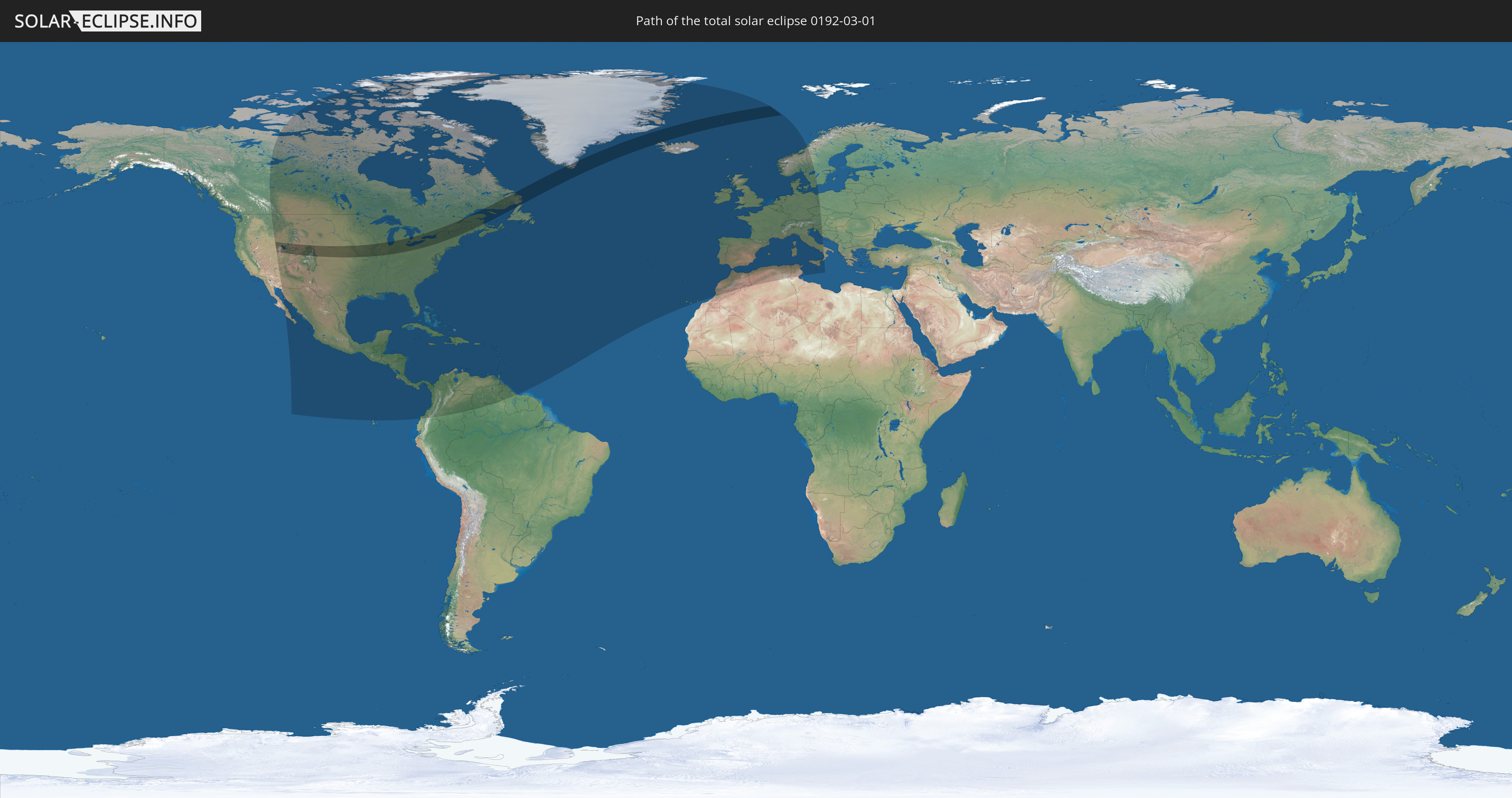
Die Sonnenfinsternis am 01.03.0192 kann man in 79 Ländern als partielle Sonnenfinsternis beobachten.
Der Finsternispfad verläuft durch 5 Länder. Nur in diesen Ländern ist sie als totale Sonnenfinsternis zu sehen.
In den folgenden Ländern ist die Sonnenfinsternis total zu sehen
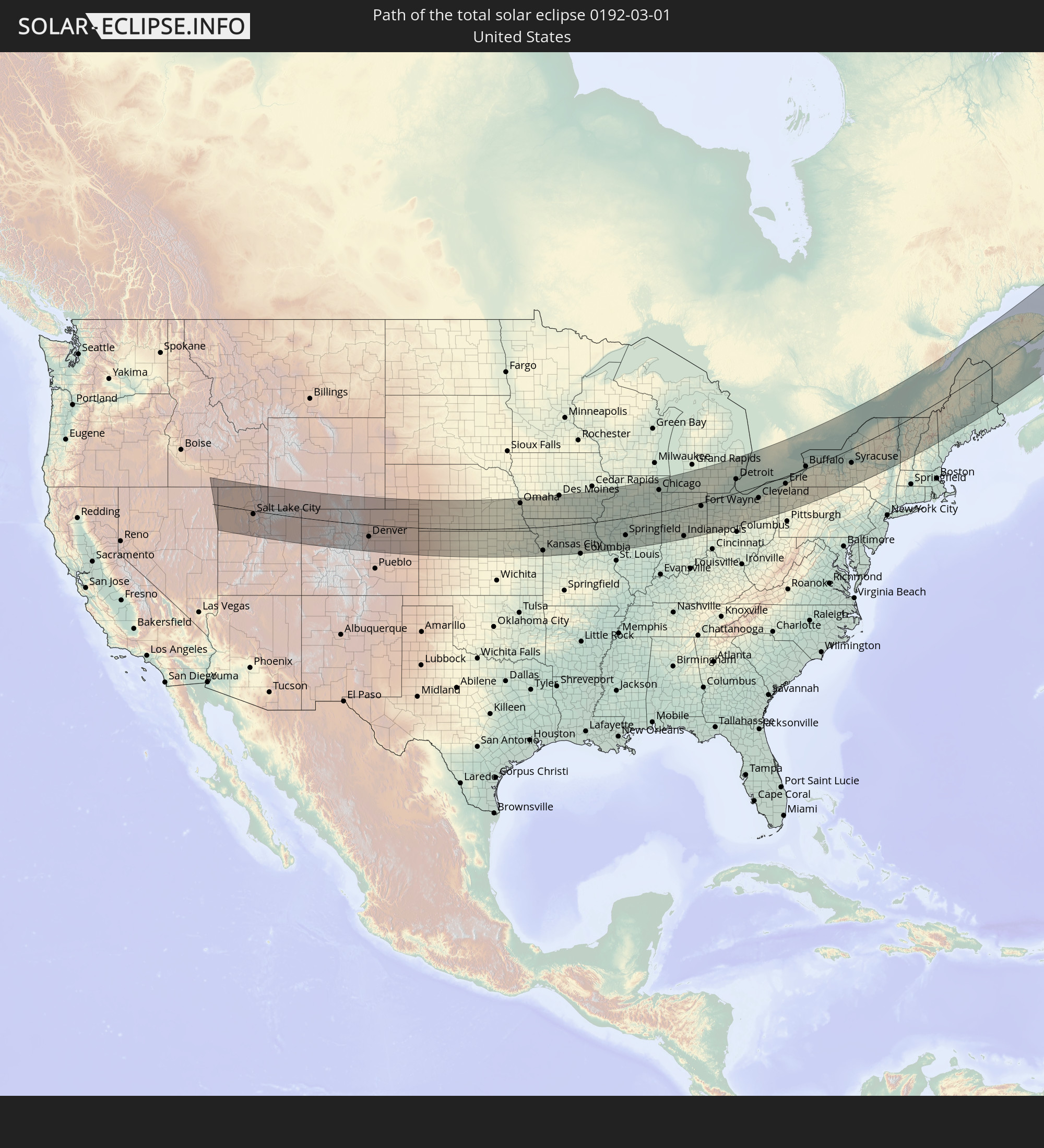 Vereinigte Staaten
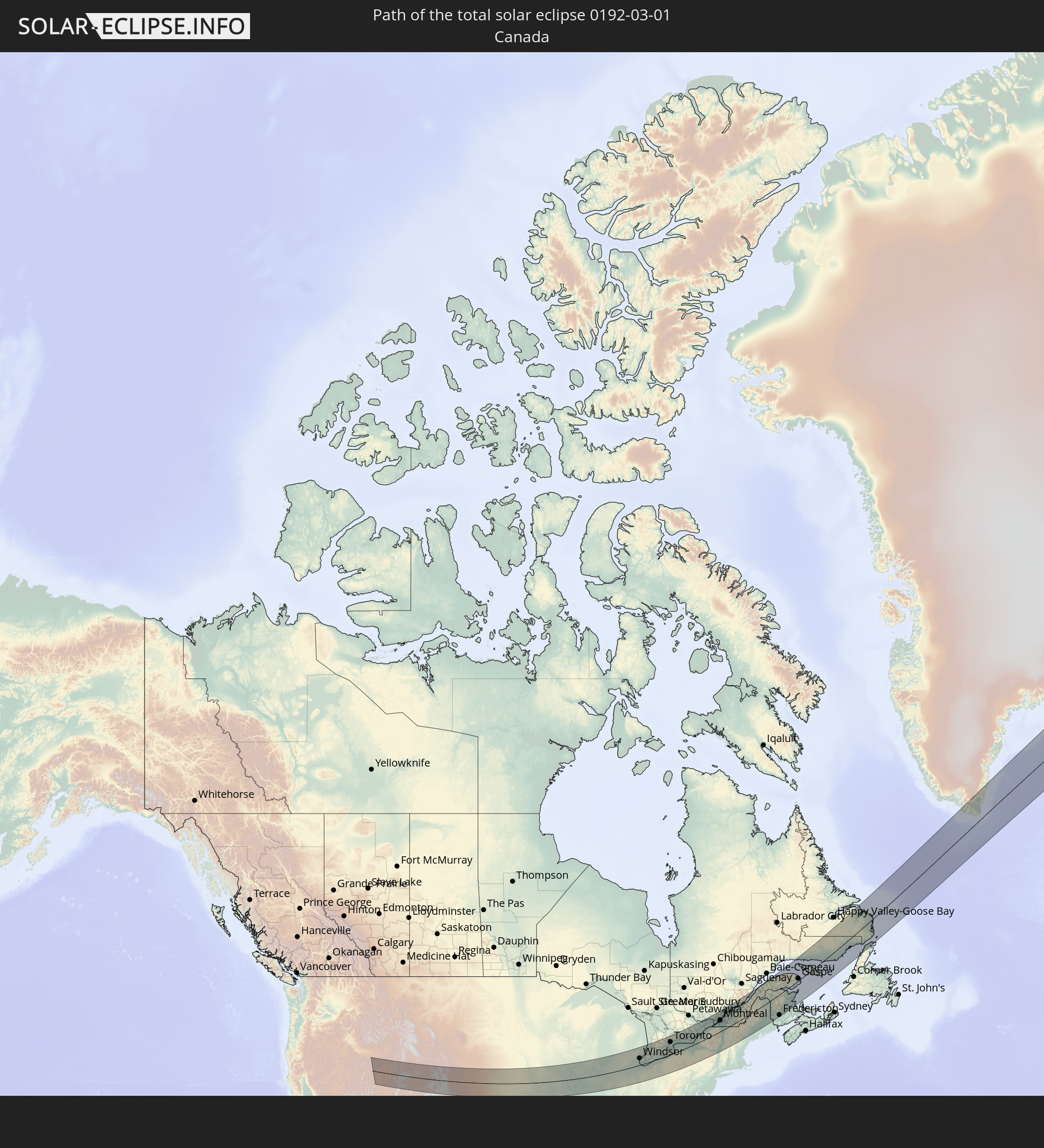 Kanada
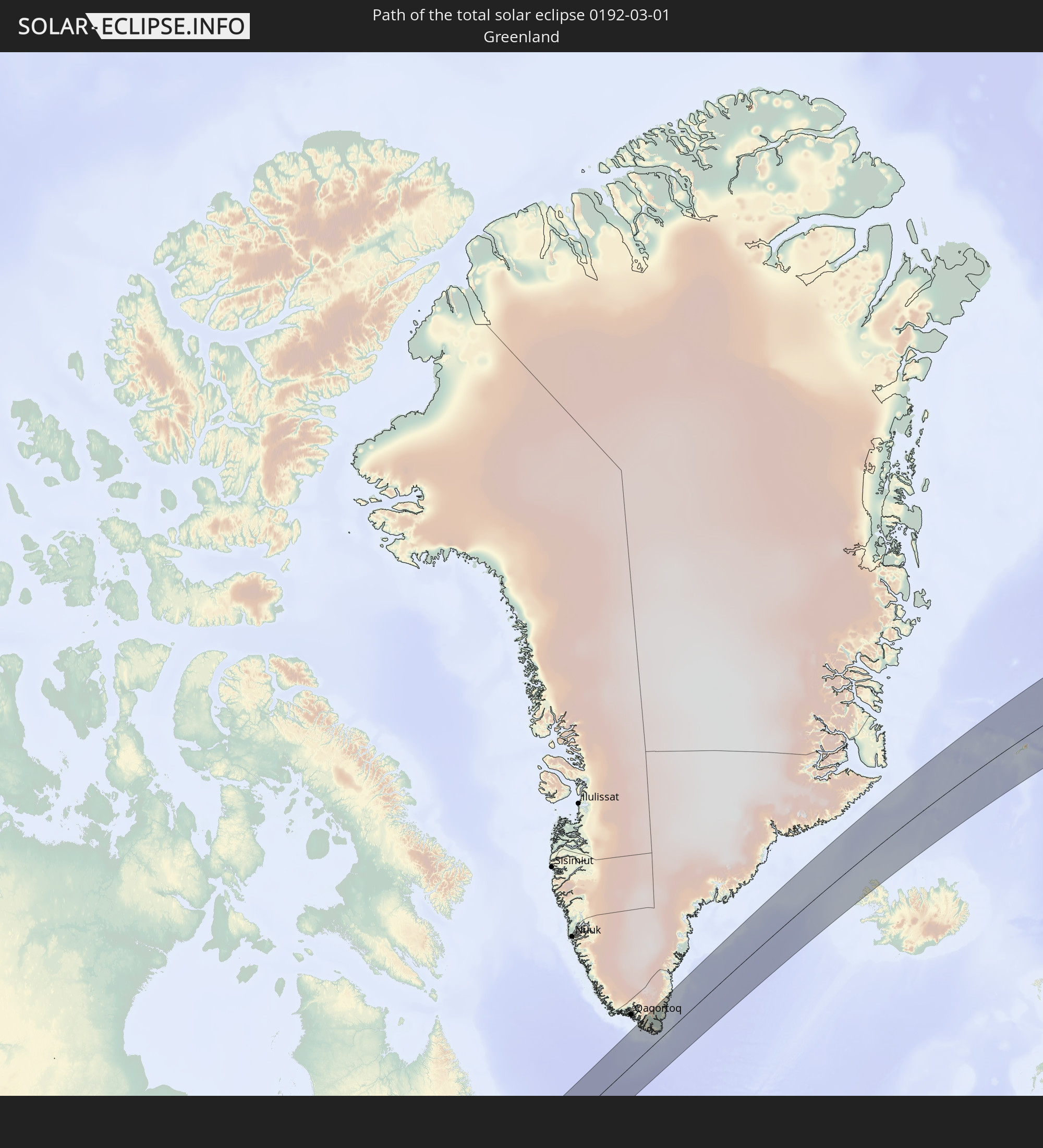 Grönland
 Island
 Spitzbergen
In den folgenden Ländern ist die Sonnenfinsternis partiell zu sehen
 Vereinigte Staaten
 United States Minor Outlying Islands
 Kanada
 Mexiko
 Grönland
 Guatemala
 Ecuador
 El Salvador
 Honduras
 Belize
 Nicaragua
 Costa Rica
 Kuba
Kuba
 Panama
 Kolumbien
 Kaimaninseln
 Bahamas
 Jamaika
 Haiti
Haiti
 Brasilien
 Venezuela
 Turks- und Caicosinseln
 Dominikanische Republik
 Aruba
Aruba
 Puerto Rico
 Amerikanische Jungferninseln
 Bermuda
 Britische Jungferninseln
 Anguilla
 Saint-Martin
 Saint-Barthélemy
 St. Kitts und Nevis
 Antigua und Barbuda
 Montserrat
 Trinidad und Tobago
 Guadeloupe
 Grenada
 Dominica
 St. Vincent und die Grenadinen
 Guyana
 Martinique
 St. Lucia
 Barbados
 Saint-Pierre und Miquelon
 Portugal
 Island
 Spanien
 Marokko
 Irland
 Spitzbergen
 Algerien
 Vereinigtes Königreich
 Färöer
 Gibraltar
 Frankreich
 Isle of Man
 Guernsey
 Jersey
 Andorra
 Belgien
 Niederlande
 Norwegen
 Luxemburg
 Deutschland
 Schweiz
 Italien
 Monaco
 Tunesien
 Dänemark
 Liechtenstein
 Österreich
 Schweden
 Tschechien
 San Marino
 Vatikanstadt
 Slowenien
 Kroatien
 Polen
Polen
 Malta
Malta
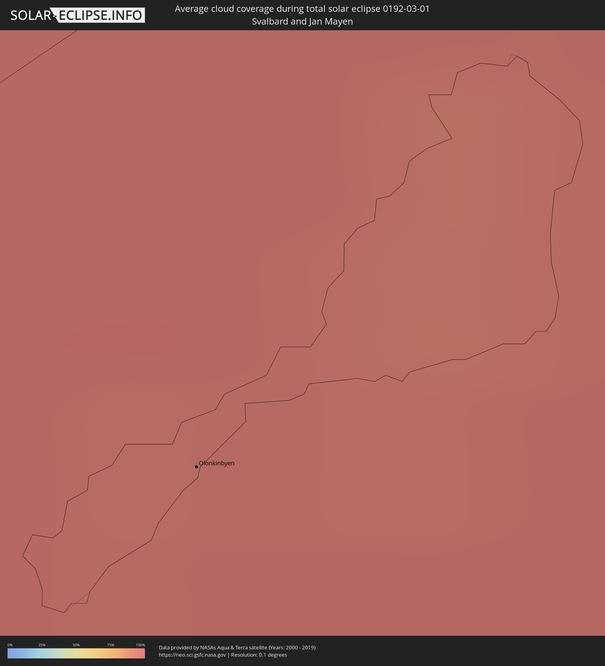
Wie wird das Wetter während der totalen Sonnenfinsternis am 01.03.0192?
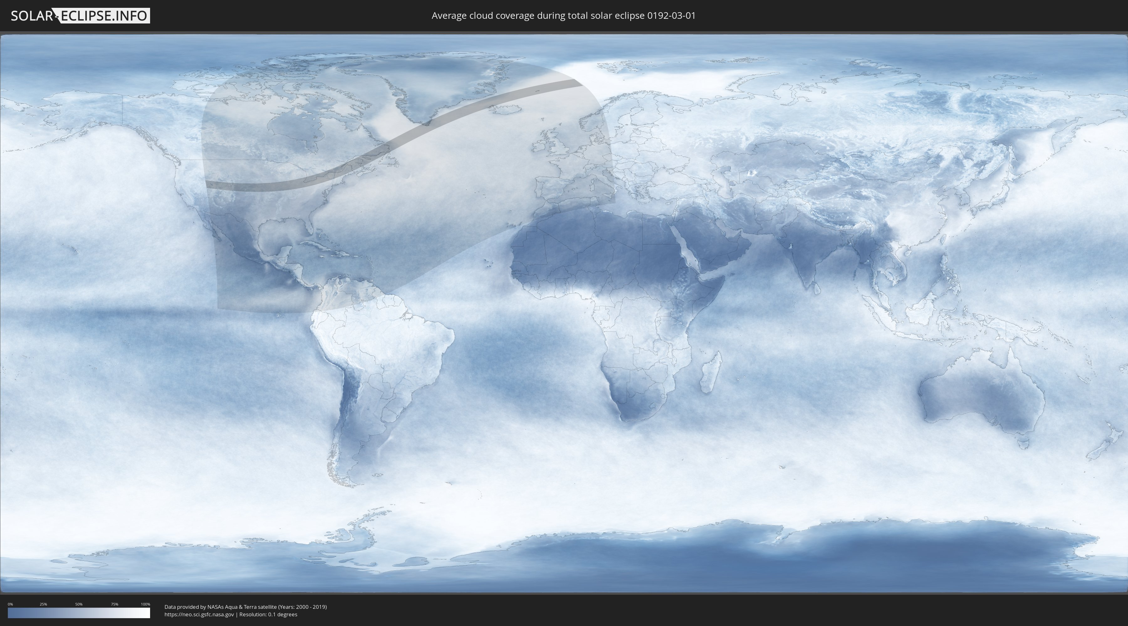
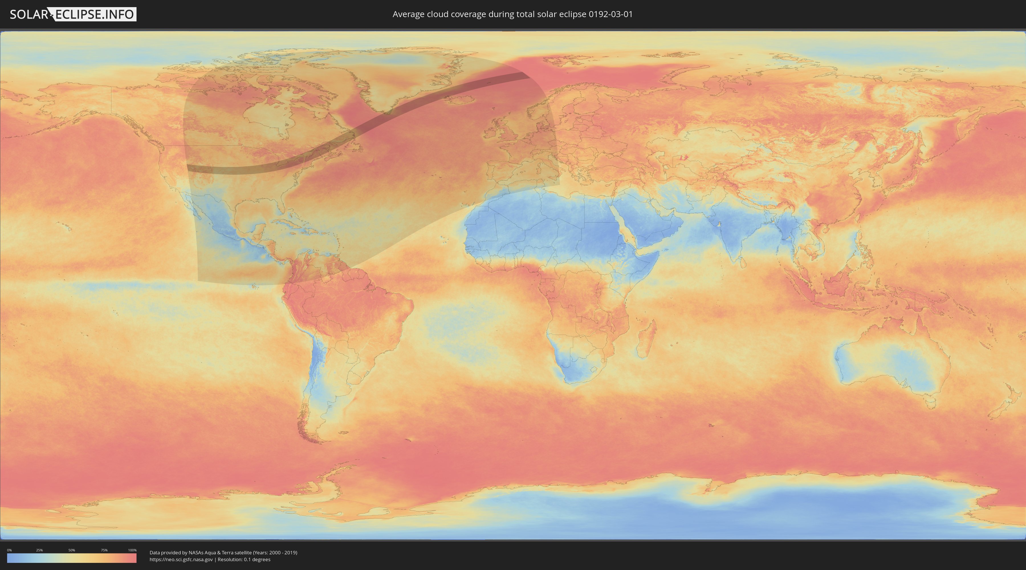
Wo ist der beste Ort, um die totale Sonnenfinsternis vom 01.03.0192 zu beobachten?
Die folgenden Karten zeigen die durchschnittliche Bewölkung für den Tag, an dem die totale Sonnenfinsternis
stattfindet. Mit Hilfe der Karten lässt sich der Ort entlang des Finsternispfades eingrenzen,
der die besten Aussichen auf einen klaren wolkenfreien Himmel bietet.
Trotzdem muss man immer lokale Gegenenheiten beachten und sollte sich genau über das Wetter an seinem
gewählten Beobachtungsort informieren.
Die Daten stammen von den beiden NASA-Satelliten
AQUA und TERRA
und wurden über einen Zeitraum von 19 Jahren (2000 - 2019) gemittelt.
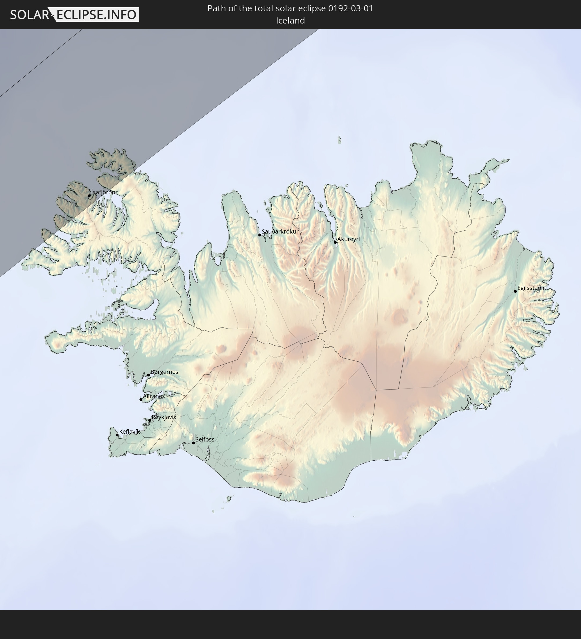
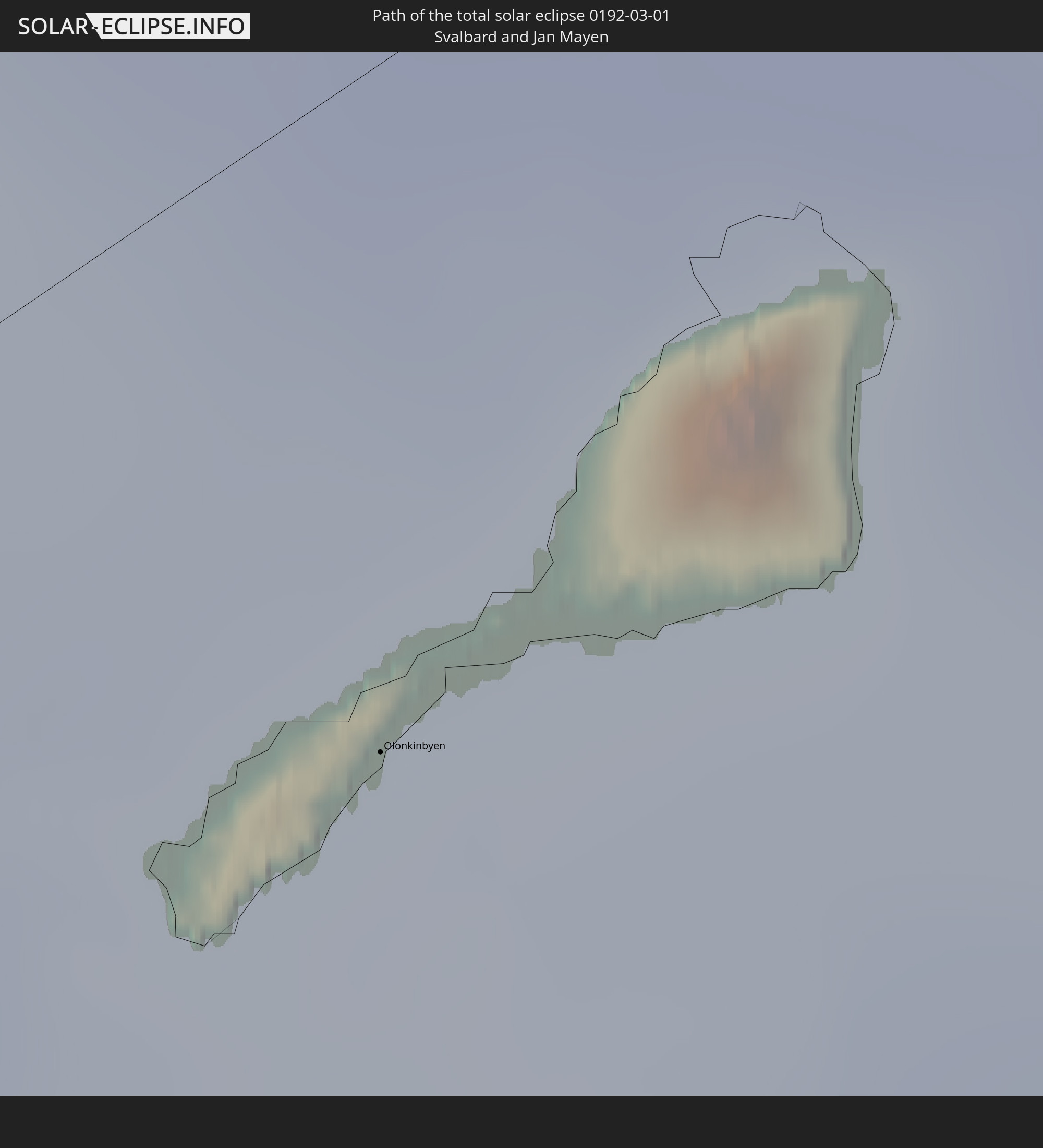
Detaillierte Länderkarten
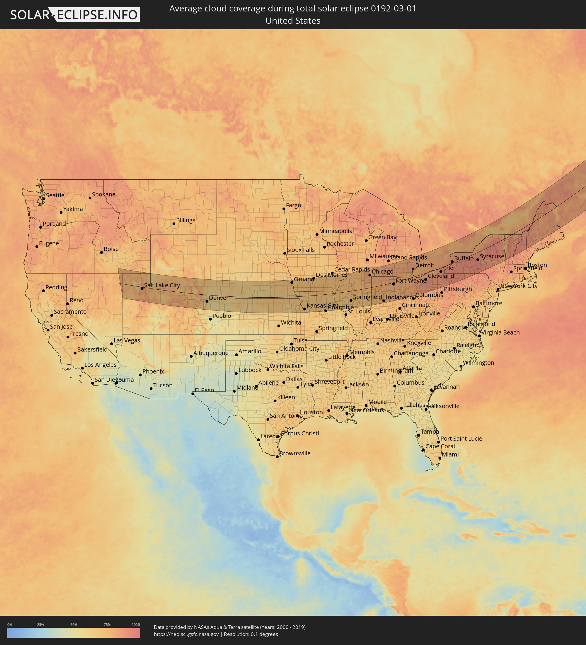 Vereinigte Staaten
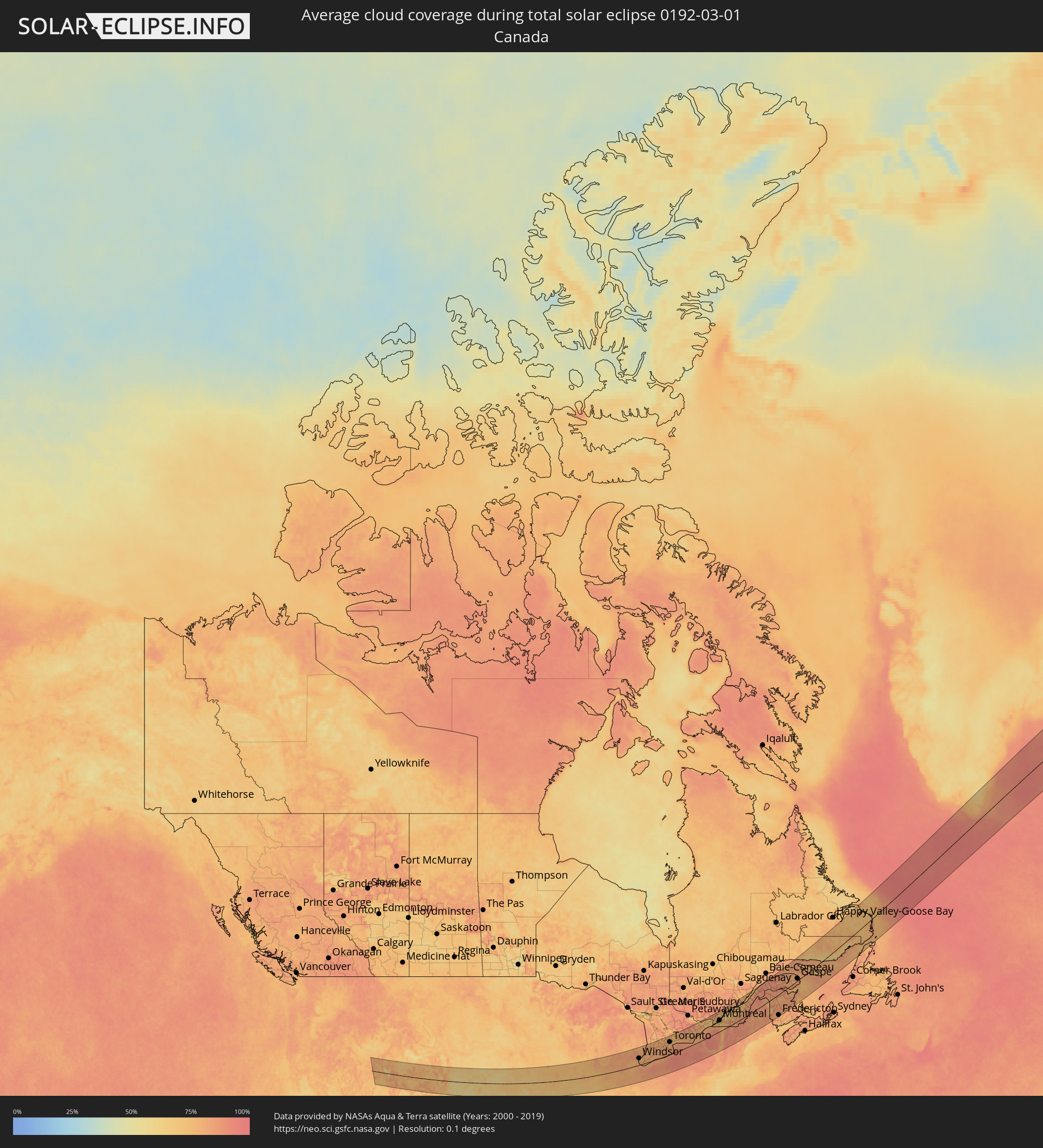 Kanada
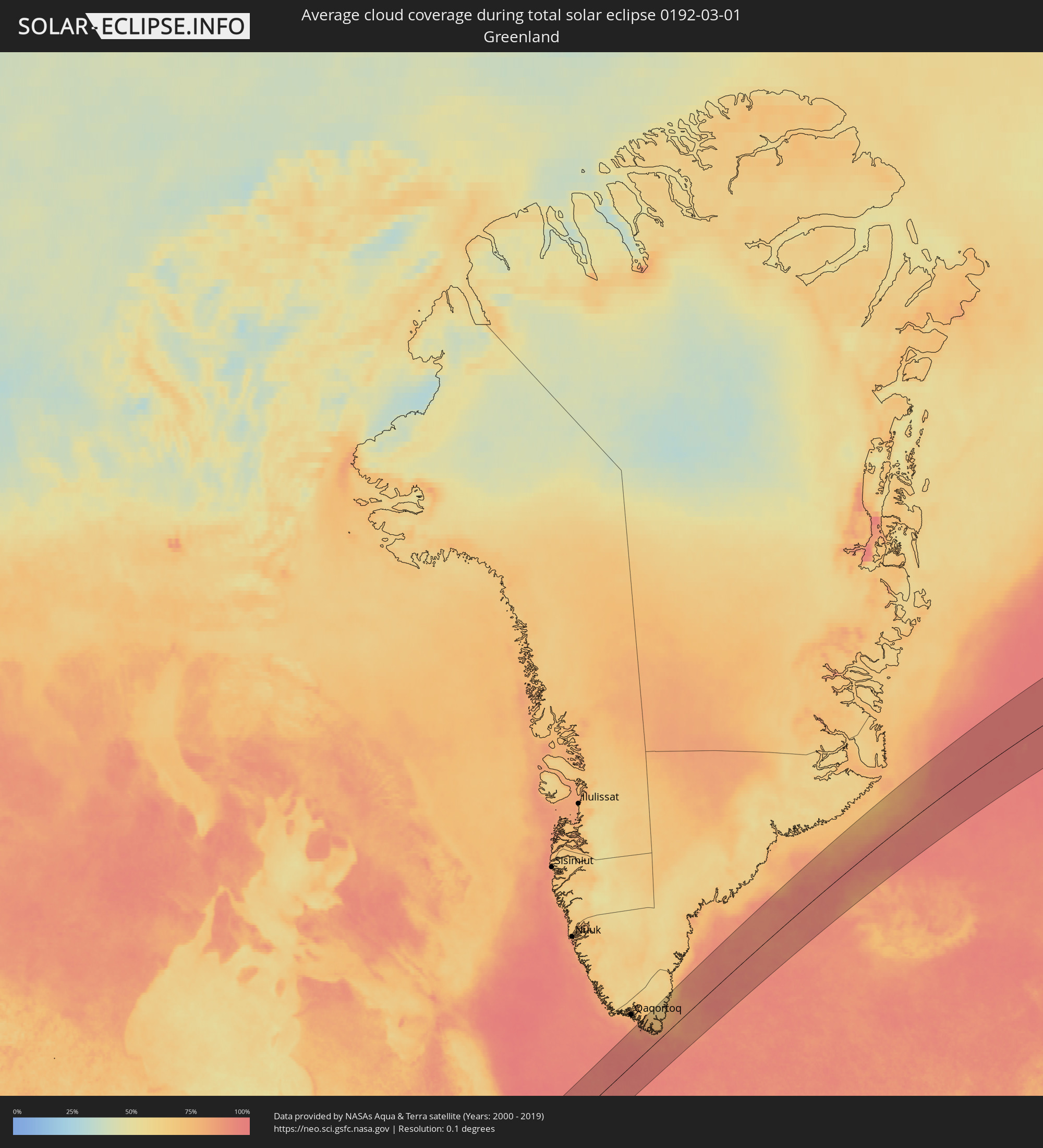 Grönland
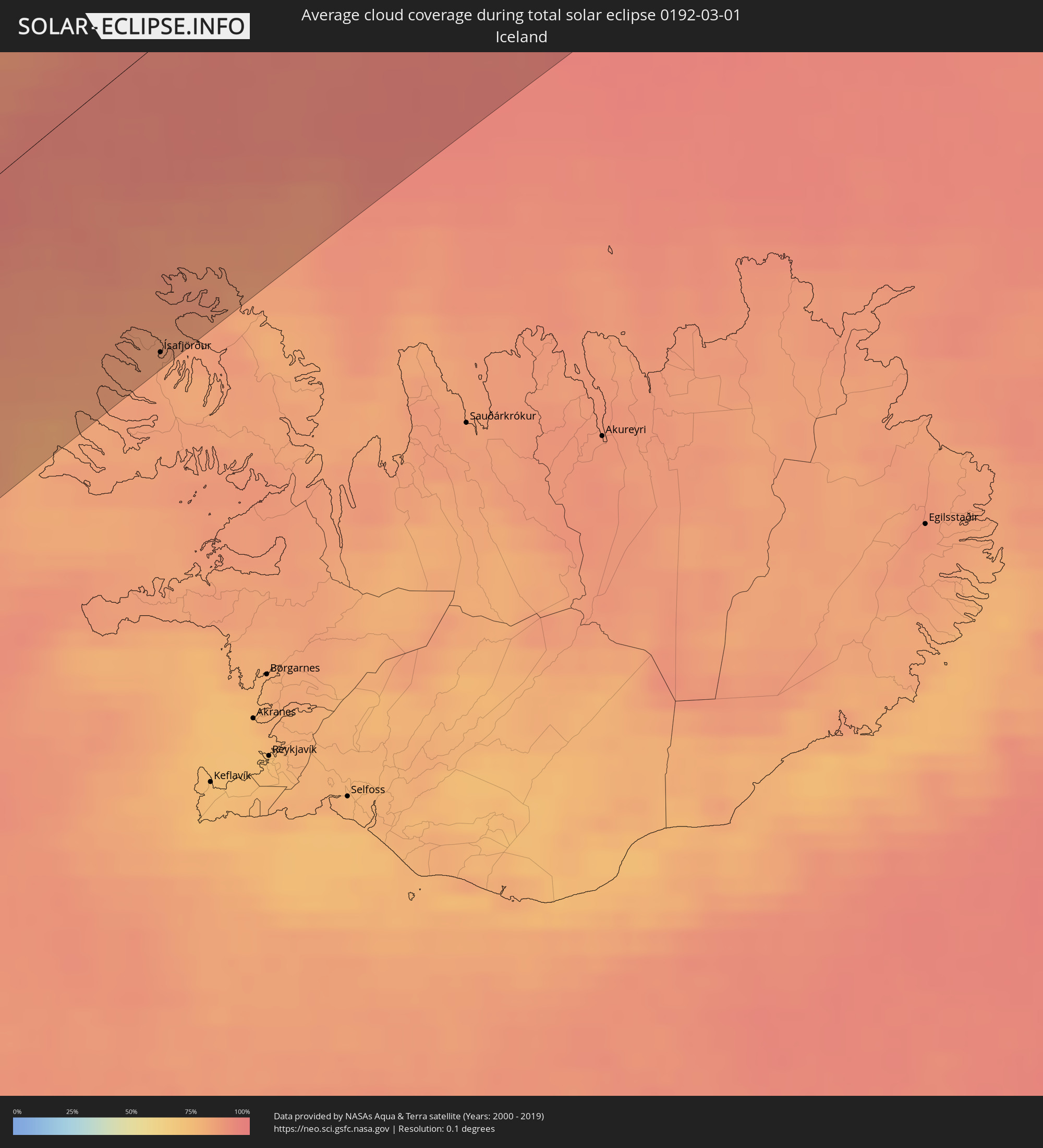 Island
 Spitzbergen
Orte im Finsternispfad
Die nachfolgene Tabelle zeigt Städte und Orte mit mehr als 5.000 Einwohnern, die sich im Finsternispfad befinden. Städte mit mehr als 100.000 Einwohnern sind dick gekennzeichnet. Mit einem Klick auf den Ort öffnet sich eine Detailkarte die die Lage des jeweiligen Ortes zusammen mit dem Verlauf der zentralen Finsternis präsentiert.
| Ort | Typ | Dauer der Verfinsterung | Ortszeit bei maximaler Verfinsterung | Entfernung zur Zentrallinie | Ø Bewölkung |
|
Ogden, Utah
|
total | - | 07:19:06 UTC-07:00 | 33 km | 83% |
|
West Jordan, Utah
|
total | - | 07:18:09 UTC-07:00 | 34 km | 81% |
|
Salt Lake City, Utah
|
total | - | 07:18:24 UTC-07:00 | 17 km | 81% |
|
Provo, Utah
|
total | - | 07:17:38 UTC-07:00 | 72 km | 74% |
|
Boulder, Colorado
|
total | - | 07:19:38 UTC-07:00 | 32 km | 67% |
|
Longmont, Colorado
|
total | - | 07:19:58 UTC-07:00 | 14 km | 62% |
|
Fort Collins, Colorado
|
total | - | 07:20:38 UTC-07:00 | 33 km | 68% |
|
Denver, Colorado
|
total | - | 07:19:20 UTC-07:00 | 60 km | 61% |
|
Centennial, Colorado
|
total | - | 07:19:08 UTC-07:00 | 77 km | 61% |
|
Greeley, Colorado
|
total | - | 07:20:34 UTC-07:00 | 17 km | 59% |
|
Lincoln, Nebraska
|
total | - | 08:26:06 UTC-06:00 | 77 km | 73% |
|
Omaha, Nebraska
|
total | - | 08:27:24 UTC-06:00 | 125 km | 75% |
|
Topeka, Kansas
|
total | - | 08:23:59 UTC-06:00 | 122 km | 68% |
|
Lawrence, Kansas
|
total | - | 08:24:12 UTC-06:00 | 132 km | 66% |
|
Saint Joseph, Missouri
|
total | - | 08:25:49 UTC-06:00 | 45 km | 72% |
|
Olathe, Kansas
|
total | - | 08:24:24 UTC-06:00 | 144 km | 69% |
|
Overland Park, Kansas
|
total | - | 08:24:41 UTC-06:00 | 134 km | 67% |
|
Kansas City, Missouri
|
total | - | 08:24:56 UTC-06:00 | 121 km | 65% |
|
Lee's Summit, Missouri
|
total | - | 08:24:48 UTC-06:00 | 143 km | 65% |
|
East Independence, Missouri
|
total | - | 08:25:07 UTC-06:00 | 123 km | 65% |
|
Des Moines, Iowa
|
total | - | 08:29:51 UTC-06:00 | 151 km | 78% |
|
Davenport, Iowa
|
total | - | 08:32:26 UTC-06:00 | 113 km | 79% |
|
Springfield, Illinois
|
total | - | 08:30:31 UTC-06:00 | 88 km | 72% |
|
Peoria, Illinois
|
total | - | 08:32:01 UTC-06:00 | 9 km | 78% |
|
Bloomington, Illinois
|
total | - | 08:32:16 UTC-06:00 | 22 km | 77% |
|
Aurora, Illinois
|
total | - | 08:35:02 UTC-06:00 | 108 km | 82% |
|
Elgin, Illinois
|
total | - | 08:35:32 UTC-06:00 | 138 km | 81% |
|
Champaign, Illinois
|
total | - | 08:32:26 UTC-06:00 | 73 km | 72% |
|
Joliet, Illinois
|
total | - | 08:34:54 UTC-06:00 | 79 km | 78% |
|
Chicago, Illinois
|
total | - | 08:35:53 UTC-06:00 | 107 km | 84% |
|
Hammond, Indiana
|
total | - | 08:35:36 UTC-06:00 | 76 km | 80% |
|
South Bend, Indiana
|
total | - | 09:37:06 UTC-05:00 | 64 km | 84% |
|
Indianapolis, Indiana
|
total | - | 09:34:06 UTC-05:00 | 145 km | 76% |
|
Carmel, Indiana
|
total | - | 09:34:29 UTC-05:00 | 123 km | 77% |
|
Fort Wayne, Indiana
|
total | - | 09:37:27 UTC-05:00 | 17 km | 82% |
|
Lansing, Michigan
|
total | - | 09:40:41 UTC-05:00 | 143 km | 83% |
|
Ann Arbor, Michigan
|
total | - | 09:40:53 UTC-05:00 | 76 km | 85% |
|
Flint, Michigan
|
total | - | 09:42:07 UTC-05:00 | 153 km | 85% |
|
Toledo, Ohio
|
total | - | 09:40:07 UTC-05:00 | 6 km | 82% |
|
Livonia, Michigan
|
total | - | 09:41:29 UTC-05:00 | 77 km | 86% |
|
Troy, Michigan
|
total | - | 09:42:06 UTC-05:00 | 97 km | 86% |
|
Detroit, Michigan
|
total | - | 09:41:47 UTC-05:00 | 65 km | 80% |
|
Warren, Michigan
|
total | - | 09:42:02 UTC-05:00 | 80 km | 86% |
|
Windsor, Ontario
|
total | - | 09:41:46 UTC-05:00 | 61 km | 80% |
|
Clinton, Michigan
|
total | - | 09:42:21 UTC-05:00 | 89 km | 85% |
|
Sarnia, Ontario
|
total | - | 09:43:35 UTC-05:00 | 118 km | 84% |
|
Cleveland, Ohio
|
total | - | 09:42:06 UTC-05:00 | 57 km | 87% |
|
Akron, Ohio
|
total | - | 09:41:40 UTC-05:00 | 105 km | 87% |
|
London, Ontario
|
total | - | 09:45:01 UTC-05:00 | 88 km | 84% |
|
St. Thomas, Ontario
|
total | - | 09:44:45 UTC-05:00 | 64 km | 81% |
|
Woodstock, Ontario
|
total | - | 09:45:51 UTC-05:00 | 90 km | 78% |
|
Kitchener, Ontario
|
total | - | 09:46:36 UTC-05:00 | 114 km | 80% |
|
Norfolk County, Ontario
|
total | - | 09:45:50 UTC-05:00 | 48 km | 80% |
|
Cambridge, Ontario
|
total | - | 09:46:45 UTC-05:00 | 101 km | 83% |
|
Brantford, Ontario
|
total | - | 09:46:27 UTC-05:00 | 76 km | 80% |
|
Guelph, Ontario
|
total | - | 09:47:07 UTC-05:00 | 119 km | 81% |
|
Orangeville, Ontario
|
total | - | 09:47:53 UTC-05:00 | 153 km | 78% |
|
Erie, Pennsylvania
|
total | - | 09:45:07 UTC-05:00 | 34 km | 87% |
|
Milton, Ontario
|
total | - | 09:47:32 UTC-05:00 | 105 km | 82% |
|
Hamilton, Ontario
|
total | - | 09:47:10 UTC-05:00 | 76 km | 82% |
|
Burlington, Ontario
|
total | - | 09:47:23 UTC-05:00 | 90 km | 82% |
|
Mississauga, Ontario
|
total | - | 09:47:55 UTC-05:00 | 105 km | 82% |
|
Vaughan, Ontario
|
total | - | 09:48:31 UTC-05:00 | 126 km | 88% |
|
Newmarket, Ontario
|
total | - | 09:48:53 UTC-05:00 | 147 km | 82% |
|
Toronto, Ontario
|
total | - | 09:48:25 UTC-05:00 | 110 km | 85% |
|
Scarborough, Ontario
|
total | - | 09:48:44 UTC-05:00 | 112 km | 87% |
|
Welland, Ontario
|
total | - | 09:47:31 UTC-05:00 | 31 km | 86% |
|
St. Catharines, Ontario
|
total | - | 09:47:49 UTC-05:00 | 50 km | 85% |
|
Niagara Falls, Ontario
|
total | - | 09:47:56 UTC-05:00 | 37 km | 88% |
|
Ajax, Ontario
|
total | - | 09:49:08 UTC-05:00 | 113 km | 82% |
|
Buffalo, New York
|
total | - | 09:47:51 UTC-05:00 | 9 km | 87% |
|
Oshawa, Ontario
|
total | - | 09:49:27 UTC-05:00 | 113 km | 78% |
|
Peterborough, Ontario
|
total | - | 09:50:45 UTC-05:00 | 137 km | 77% |
|
Rochester, New York
|
total | - | 09:49:56 UTC-05:00 | 3 km | 90% |
|
Belleville, Ontario
|
total | - | 09:51:46 UTC-05:00 | 93 km | 82% |
|
Kingston, Ontario
|
total | - | 09:53:04 UTC-05:00 | 69 km | 79% |
|
Syracuse, New York
|
total | - | 09:51:46 UTC-05:00 | 62 km | 91% |
|
Ottawa, Ontario
|
total | - | 09:55:51 UTC-05:00 | 159 km | 83% |
|
Cornwall, Ontario
|
total | - | 09:56:36 UTC-05:00 | 84 km | 81% |
|
Salaberry-de-Valleyfield, Quebec
|
total | - | 09:57:46 UTC-05:00 | 85 km | 70% |
|
Mirabel, Quebec
|
total | - | 09:58:24 UTC-05:00 | 122 km | 71% |
|
Saint-Jérôme, Quebec
|
total | - | 09:58:41 UTC-05:00 | 132 km | 77% |
|
Blainville, Quebec
|
total | - | 09:58:42 UTC-05:00 | 116 km | 76% |
|
Dollard-Des Ormeaux, Quebec
|
total | - | 09:58:32 UTC-05:00 | 97 km | 81% |
|
Terrebonne, Quebec
|
total | - | 09:59:04 UTC-05:00 | 110 km | 81% |
|
Montréal, Quebec
|
total | - | 09:58:53 UTC-05:00 | 90 km | 85% |
|
Repentigny, Quebec
|
total | - | 09:59:24 UTC-05:00 | 107 km | 78% |
|
Joliette, Quebec
|
total | - | 09:59:49 UTC-05:00 | 132 km | 69% |
|
Saint-Jean-sur-Richelieu, Quebec
|
total | - | 09:59:03 UTC-05:00 | 58 km | 72% |
|
Sorel-Tracy, Quebec
|
total | - | 10:00:16 UTC-05:00 | 122 km | 67% |
|
Saint-Hyacinthe, Quebec
|
total | - | 09:59:56 UTC-05:00 | 77 km | 72% |
|
Shawinigan, Quebec
|
total | - | 10:01:31 UTC-05:00 | 159 km | 74% |
|
Granby, Quebec
|
total | - | 09:59:56 UTC-05:00 | 46 km | 77% |
|
Trois-Rivières, Quebec
|
total | - | 10:01:29 UTC-05:00 | 130 km | 66% |
|
Drummondville, Quebec
|
total | - | 10:00:57 UTC-05:00 | 83 km | 74% |
|
Victoriaville, Quebec
|
total | - | 10:01:54 UTC-05:00 | 78 km | 70% |
|
Sherbrooke, Quebec
|
total | - | 10:01:07 UTC-05:00 | 13 km | 80% |
|
Québec, Quebec
|
total | - | 10:03:59 UTC-05:00 | 120 km | 72% |
|
Rimouski, Quebec
|
total | - | 10:09:52 UTC-05:00 | 158 km | 85% |
|
Fredericton, New Brunswick
|
total | - | 10:55:07 UTC-04:14 | 151 km | 82% |
|
Ísafjörður, Westfjords
|
total | - | 14:35:28 UTC-01:28 | 122 km | 84% |
|
Olonkinbyen, Jan Mayen
|
total | - | 17:05:55 UTC+01:00 | 32 km | 96% |