Totale Sonnenfinsternis vom 24.04.0255
| Wochentag: | Dienstag |
| Maximale Dauer der Verfinsterung: | 05m39s |
| Maximale Breite des Finsternispfades: | 241 km |
| Saroszyklus: | 81 |
| Bedeckungsgrad: | 100% |
| Magnitude: | 1.0718 |
| Gamma: | 0.2494 |
Wo kann man die Sonnenfinsternis vom 24.04.0255 sehen?
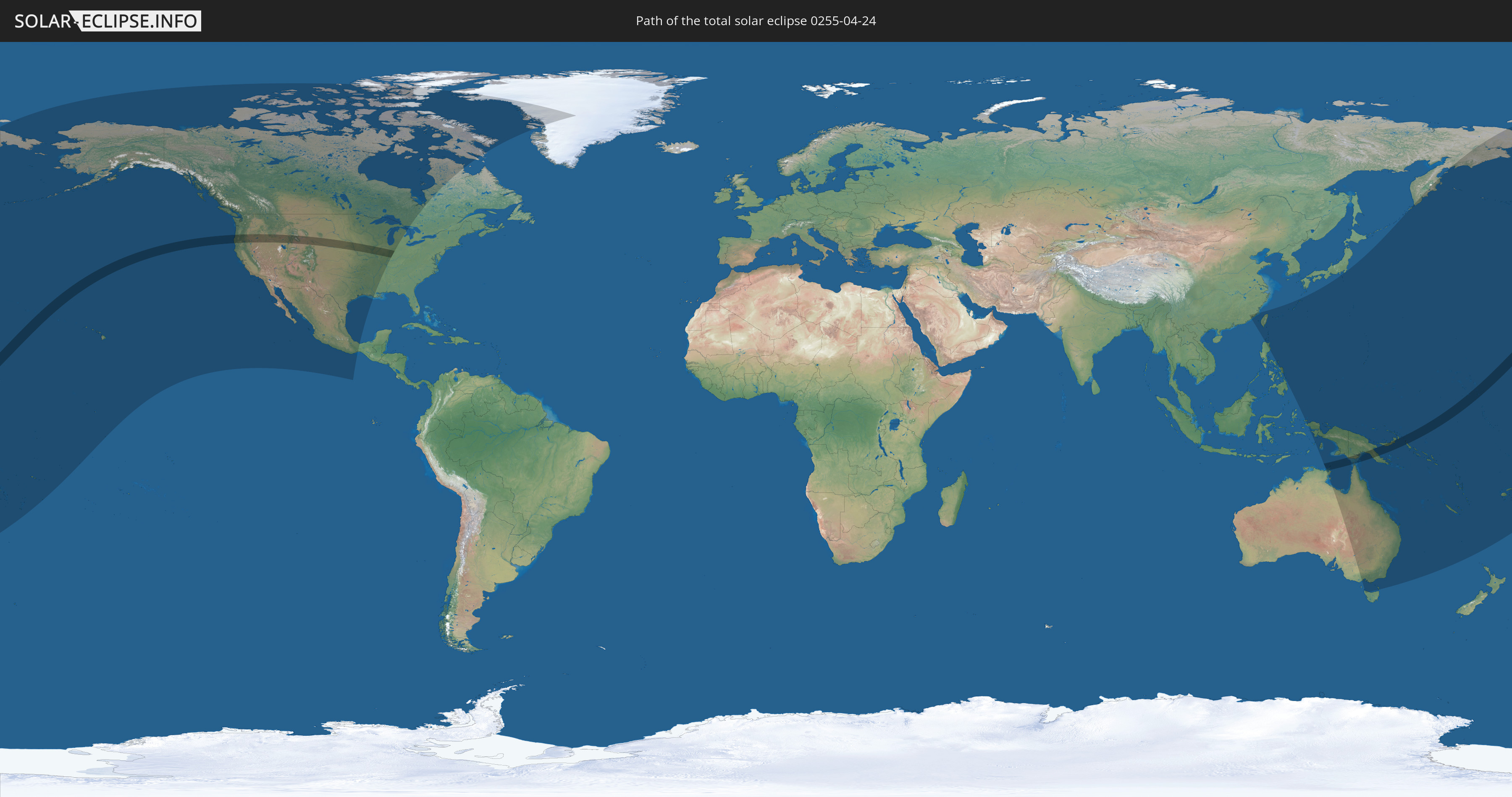
Die Sonnenfinsternis am 24.04.0255 kann man in 33 Ländern als partielle Sonnenfinsternis beobachten.
Der Finsternispfad verläuft durch 5 Länder. Nur in diesen Ländern ist sie als totale Sonnenfinsternis zu sehen.
In den folgenden Ländern ist die Sonnenfinsternis total zu sehen
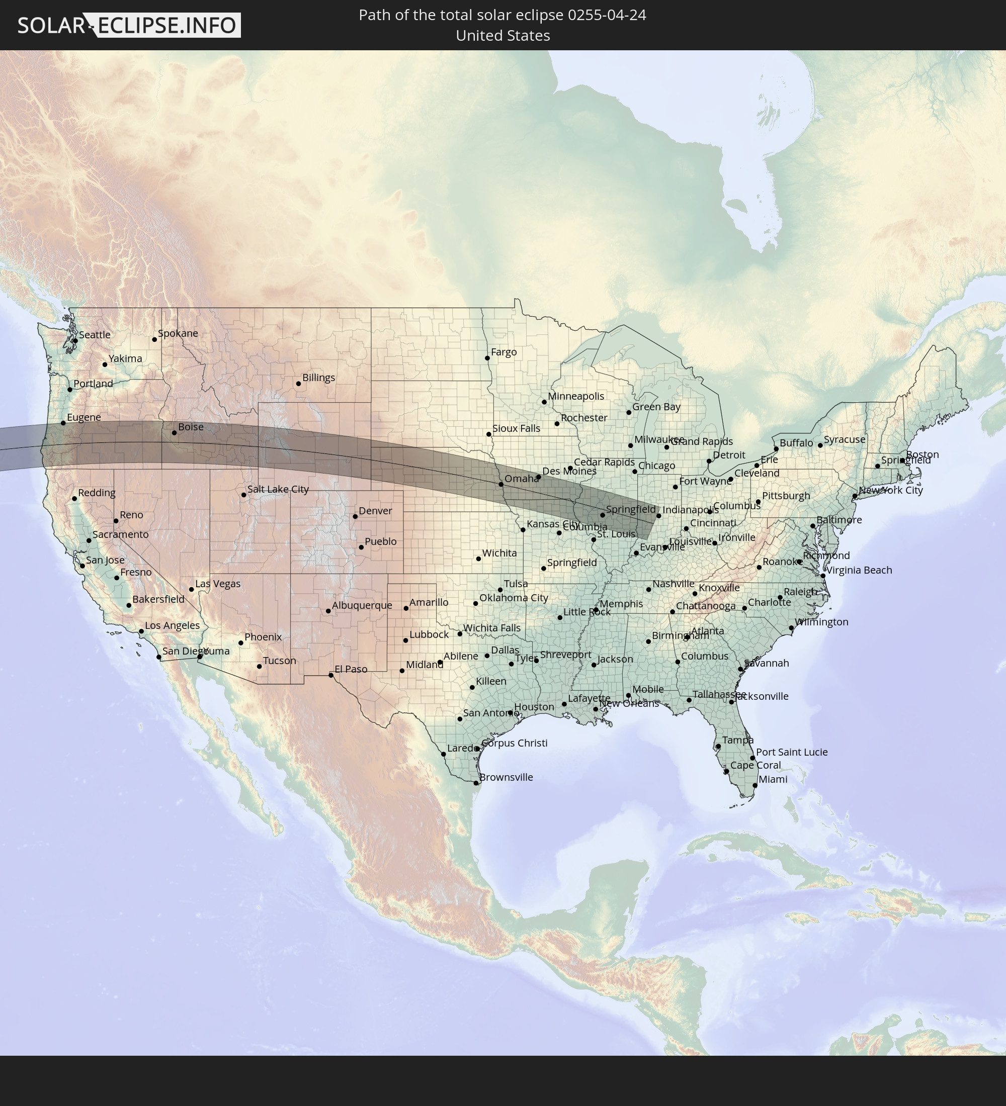 Vereinigte Staaten
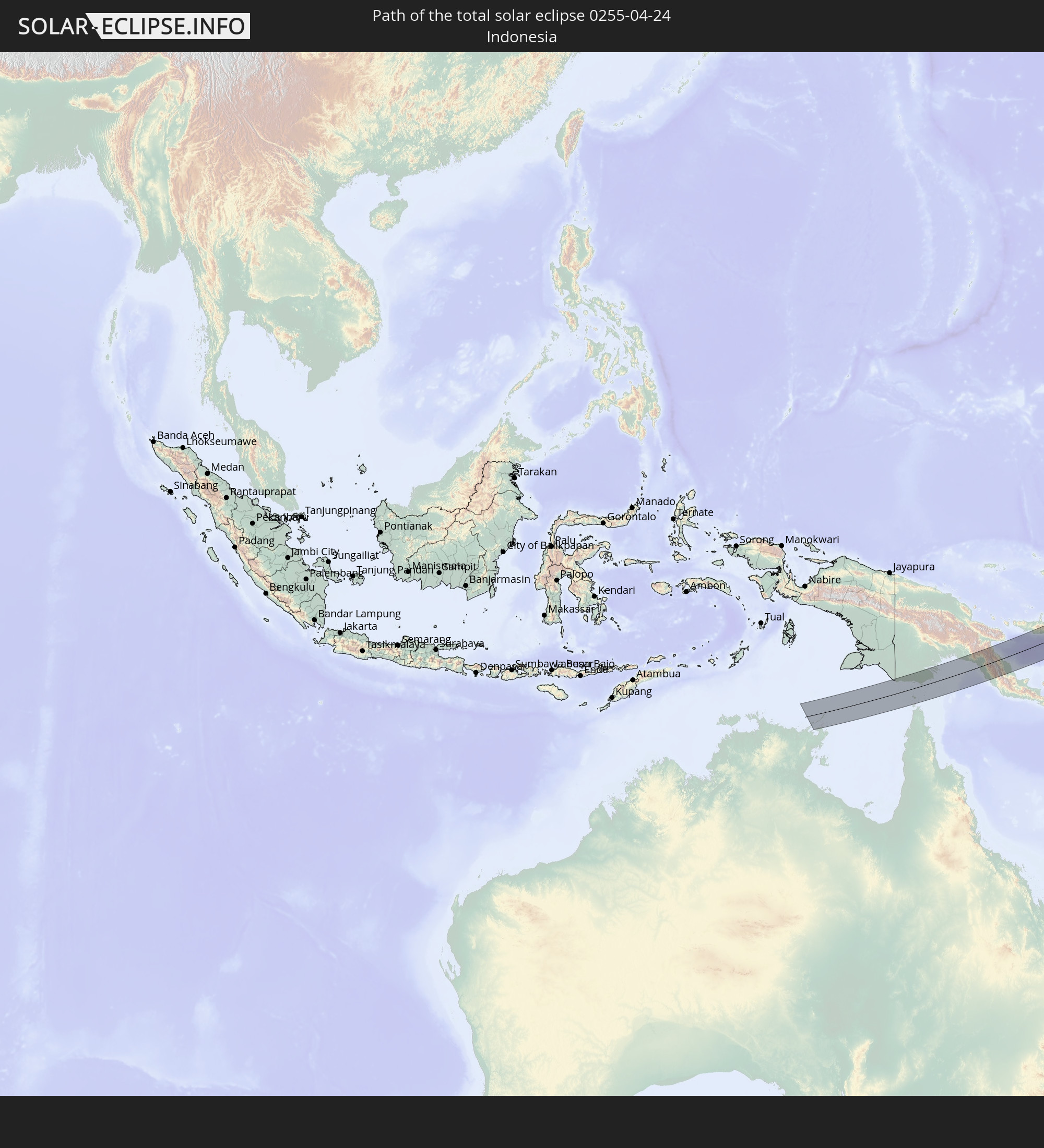 Indonesien
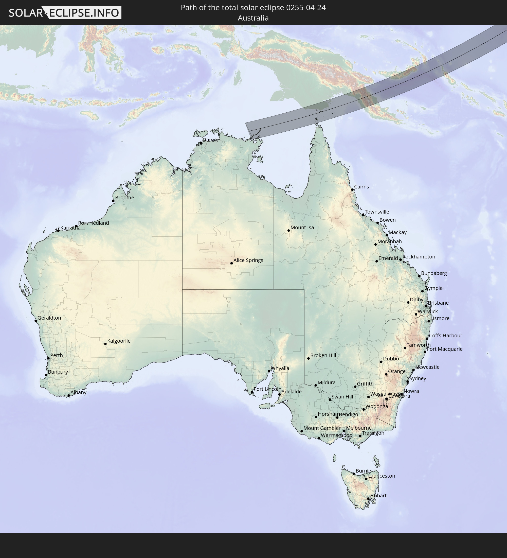 Australien
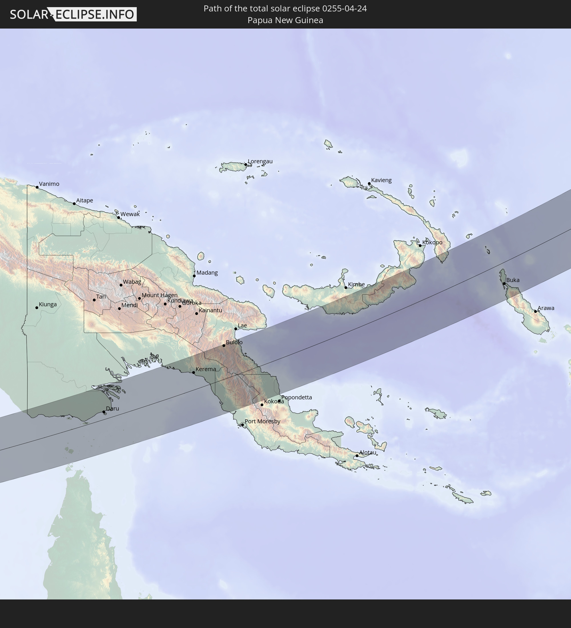 Papua-Neuguinea
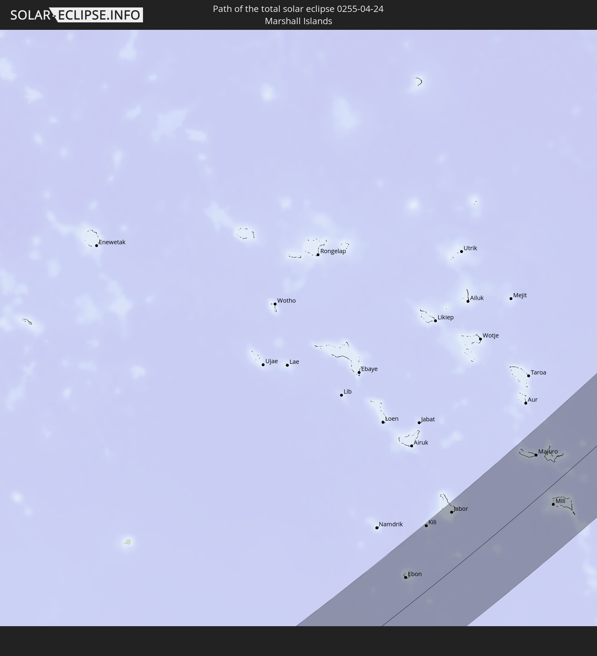 Marshallinseln
In den folgenden Ländern ist die Sonnenfinsternis partiell zu sehen
 Fidschi
 Russland
 Vereinigte Staaten
 United States Minor Outlying Islands
 Wallis und Futuna
 Tonga
Tonga
 Kiribati
 Samoa
Samoa
 Tokelau
 Amerikanisch-Samoa
 Niue
Niue
 Cookinseln
 Kanada
 Mexiko
 Grönland
 Volksrepublik China
 Indonesien
 Australien
 Taiwan
 Philippinen
 Japan
Japan
 Palau
Palau
 Föderierte Staaten von Mikronesien
 Papua-Neuguinea
 Guam
Guam
 Nördliche Marianen
 Salomonen
 Neukaledonien
 Marshallinseln
 Vanuatu
 Nauru
Nauru
 Norfolkinsel
 Tuvalu
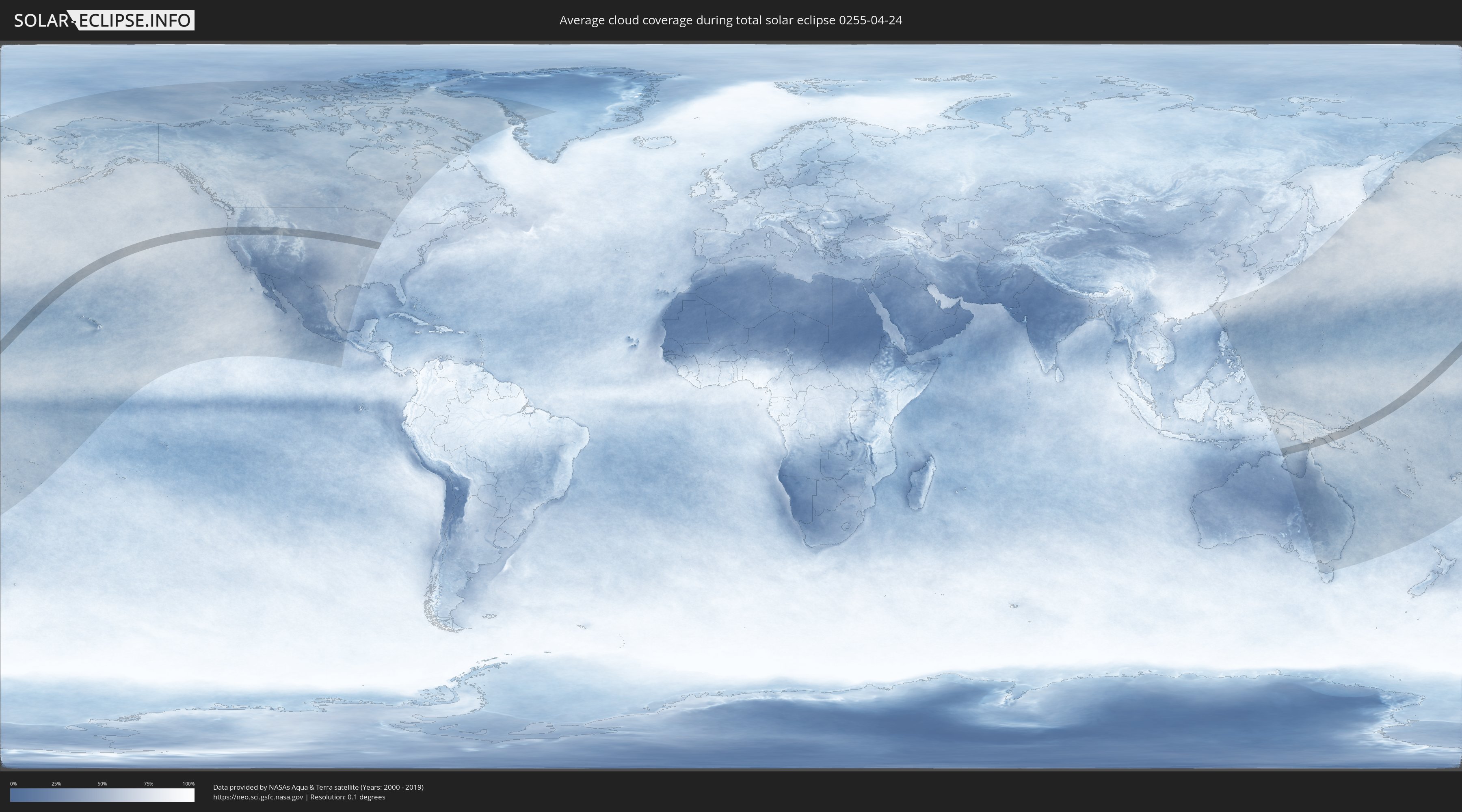
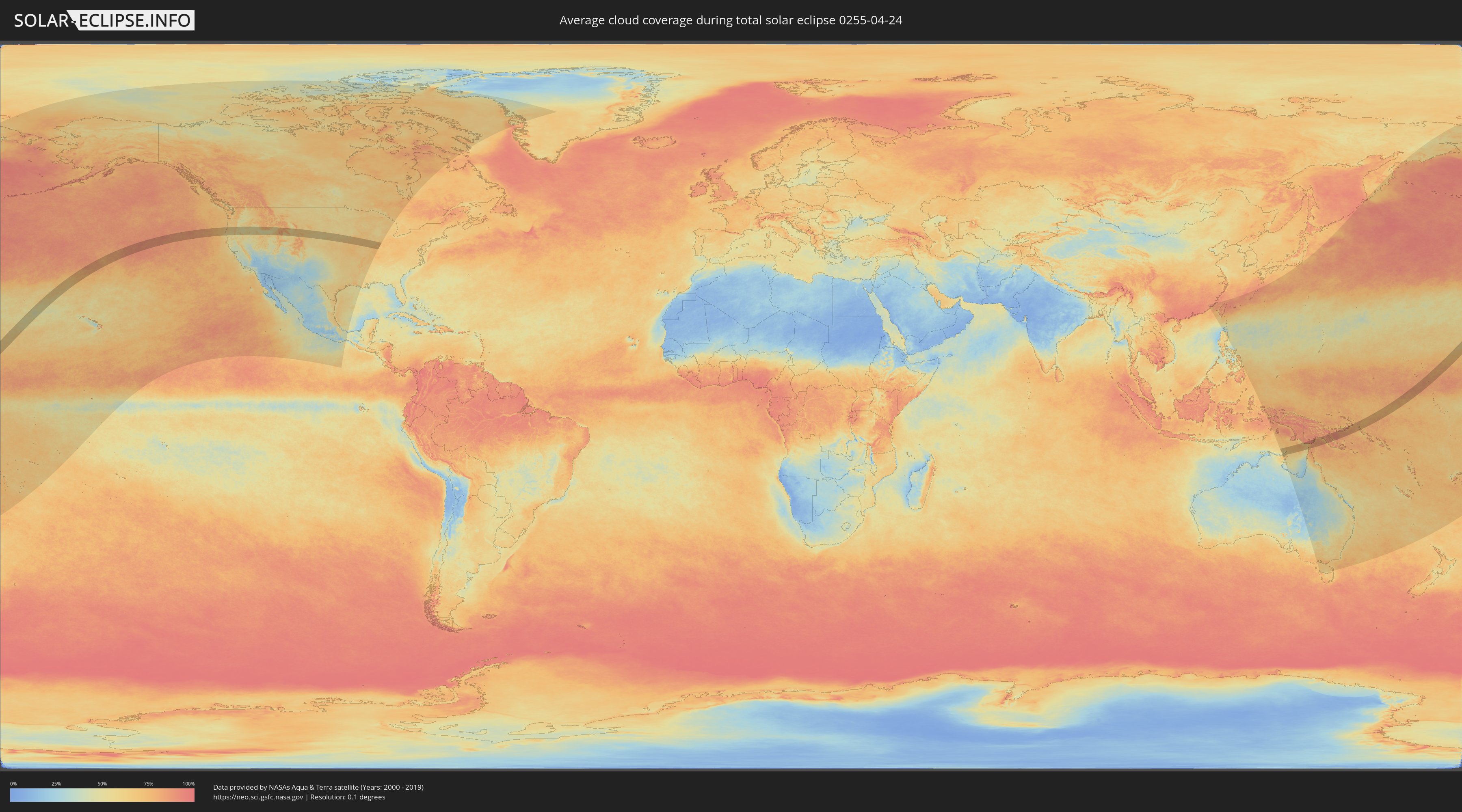
Wie wird das Wetter während der totalen Sonnenfinsternis am 24.04.0255?
Wo ist der beste Ort, um die totale Sonnenfinsternis vom 24.04.0255 zu beobachten?
Die folgenden Karten zeigen die durchschnittliche Bewölkung für den Tag, an dem die totale Sonnenfinsternis
stattfindet. Mit Hilfe der Karten lässt sich der Ort entlang des Finsternispfades eingrenzen,
der die besten Aussichen auf einen klaren wolkenfreien Himmel bietet.
Trotzdem muss man immer lokale Gegenenheiten beachten und sollte sich genau über das Wetter an seinem
gewählten Beobachtungsort informieren.
Die Daten stammen von den beiden NASA-Satelliten
AQUA und TERRA
und wurden über einen Zeitraum von 19 Jahren (2000 - 2019) gemittelt.
Detaillierte Länderkarten
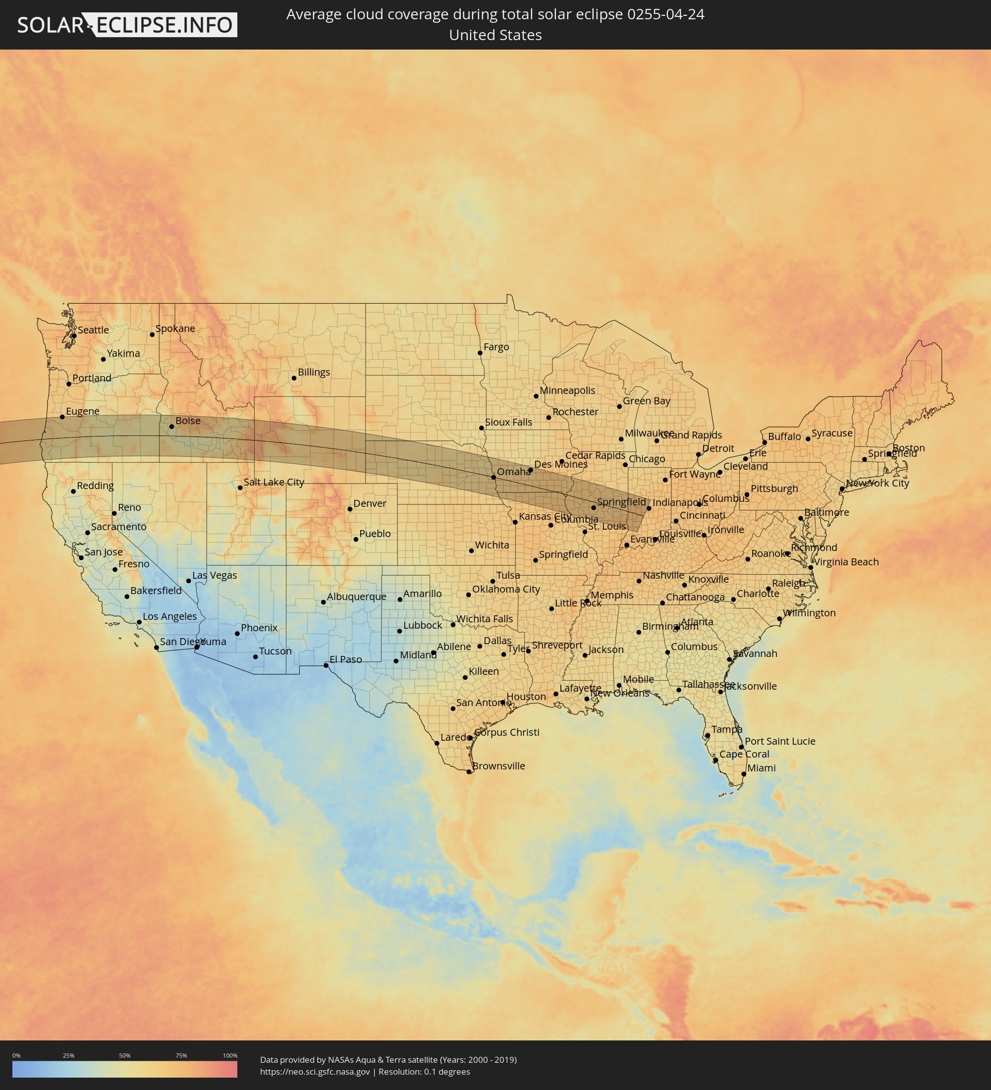 Vereinigte Staaten
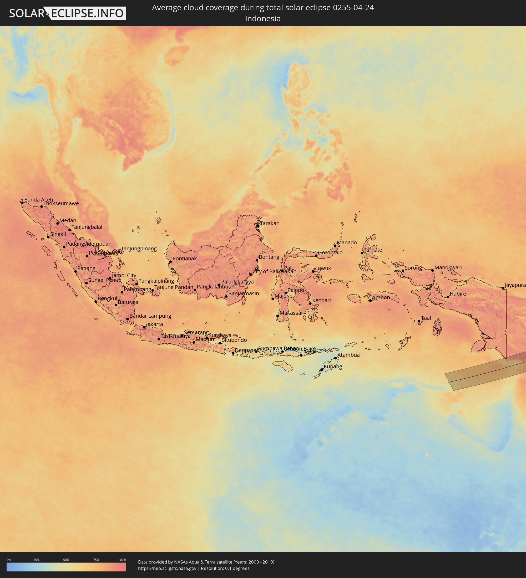 Indonesien
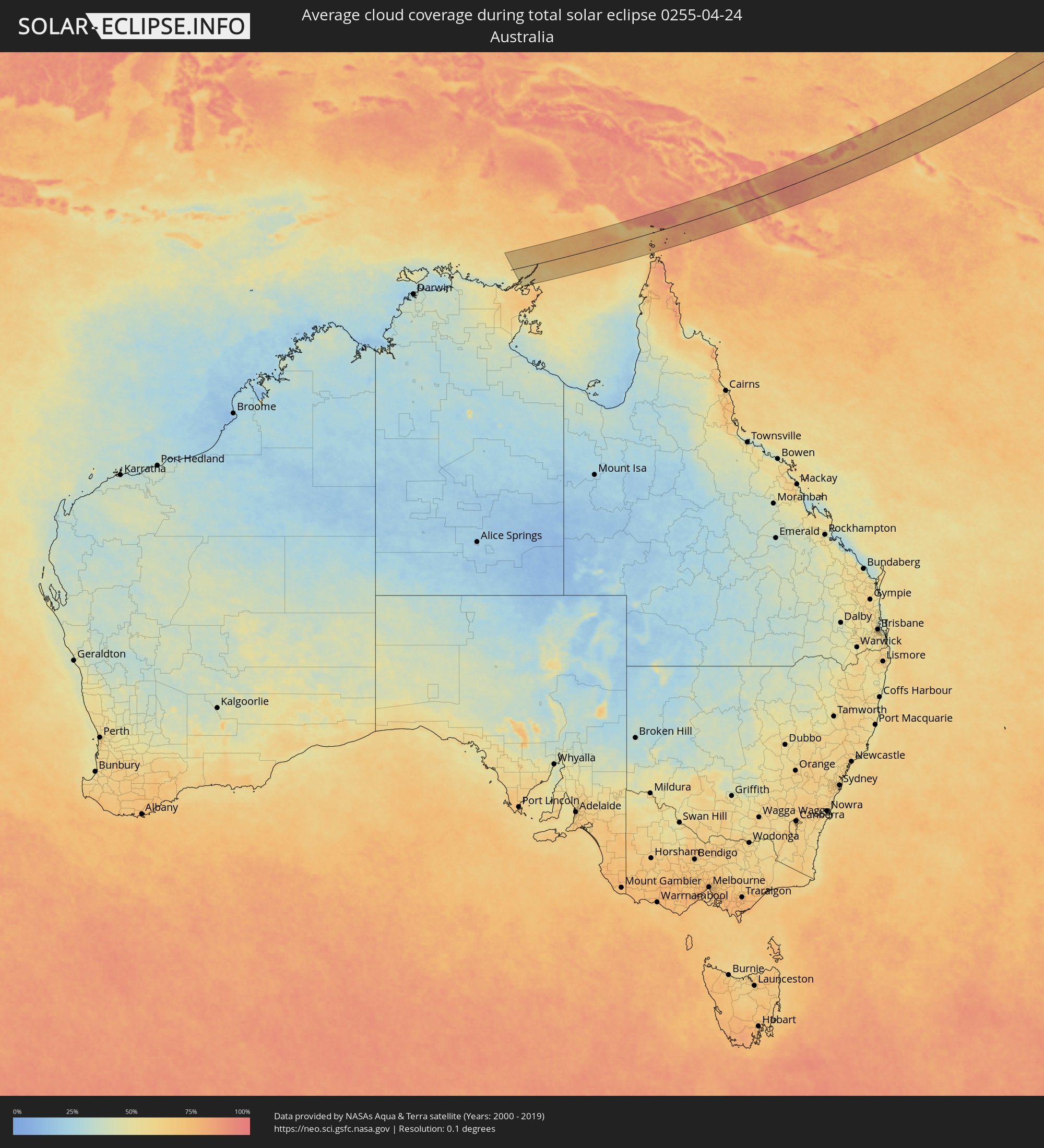 Australien
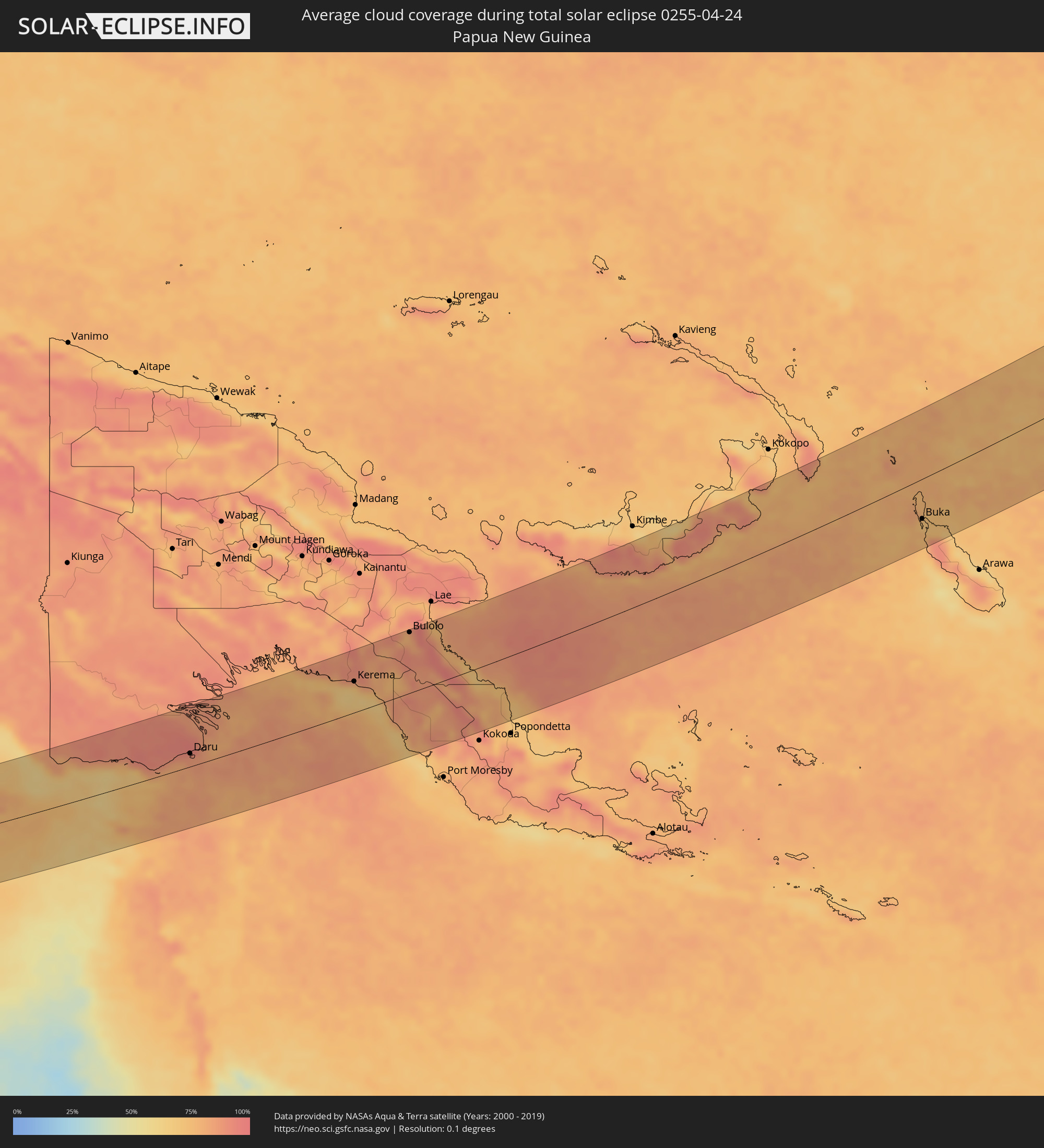 Papua-Neuguinea
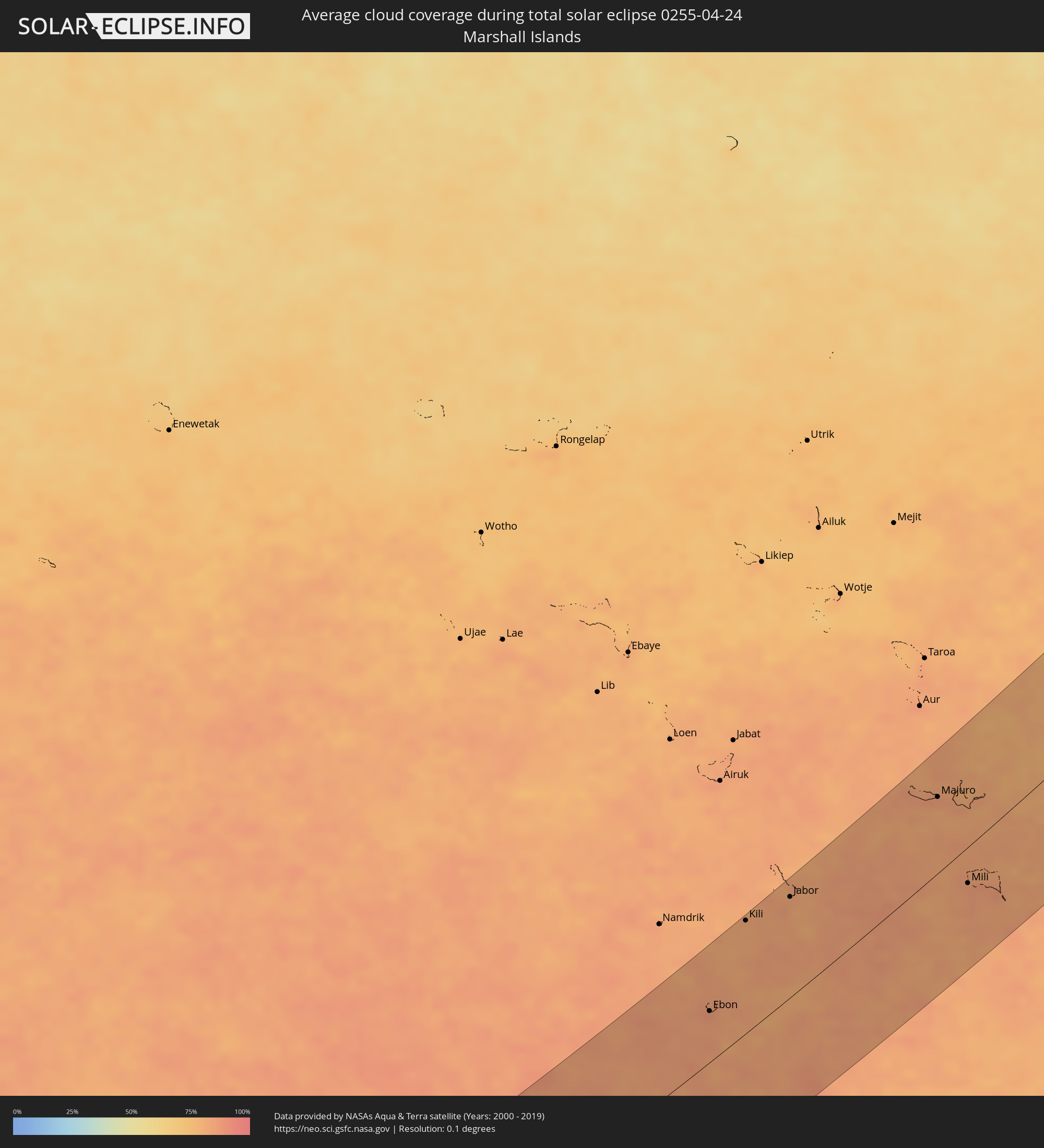 Marshallinseln
Orte im Finsternispfad
Die nachfolgene Tabelle zeigt Städte und Orte mit mehr als 5.000 Einwohnern, die sich im Finsternispfad befinden. Städte mit mehr als 100.000 Einwohnern sind dick gekennzeichnet. Mit einem Klick auf den Ort öffnet sich eine Detailkarte die die Lage des jeweiligen Ortes zusammen mit dem Verlauf der zentralen Finsternis präsentiert.
| Ort | Typ | Dauer der Verfinsterung | Ortszeit bei maximaler Verfinsterung | Entfernung zur Zentrallinie | Ø Bewölkung |
|
Coos Bay, Oregon
|
total | - | 16:09:06 UTC-08:00 | 32 km | 63% |
|
Roseburg, Oregon
|
total | - | 16:09:54 UTC-08:00 | 11 km | 58% |
|
Grants Pass, Oregon
|
total | - | 16:10:11 UTC-08:00 | 76 km | 49% |
|
Eugene, Oregon
|
total | - | 16:09:48 UTC-08:00 | 102 km | 61% |
|
Medford, Oregon
|
total | - | 16:10:37 UTC-08:00 | 91 km | 53% |
|
Bend, Oregon
|
total | - | 16:11:12 UTC-08:00 | 96 km | 51% |
|
Ontario, Oregon
|
total | - | 17:14:17 UTC-07:00 | 88 km | 53% |
|
Caldwell, Idaho
|
total | - | 17:14:39 UTC-07:00 | 48 km | 55% |
|
Nampa, Idaho
|
total | - | 17:14:48 UTC-07:00 | 35 km | 54% |
|
Meridian, Idaho
|
total | - | 17:14:52 UTC-07:00 | 43 km | 53% |
|
Boise, Idaho
|
total | - | 17:14:59 UTC-07:00 | 44 km | 52% |
|
Mountain Home, Idaho
|
total | - | 17:15:33 UTC-07:00 | 9 km | 50% |
|
Jerome, Idaho
|
total | - | 17:16:29 UTC-07:00 | 51 km | 52% |
|
Twin Falls, Idaho
|
total | - | 17:16:36 UTC-07:00 | 68 km | 56% |
|
Burley, Idaho
|
total | - | 17:17:00 UTC-07:00 | 69 km | 55% |
|
Pocatello, Idaho
|
total | - | 17:17:34 UTC-07:00 | 25 km | 62% |
|
Blackfoot, Idaho
|
total | - | 17:17:27 UTC-07:00 | 11 km | 55% |
|
Idaho Falls, Idaho
|
total | - | 17:17:27 UTC-07:00 | 43 km | 58% |
|
Rexburg, Idaho
|
total | - | 17:17:22 UTC-07:00 | 85 km | 57% |
|
Riverton, Wyoming
|
total | - | 17:19:25 UTC-07:00 | 21 km | 56% |
|
Casper, Wyoming
|
total | - | 17:20:19 UTC-07:00 | 23 km | 63% |
|
Scottsbluff, Nebraska
|
total | - | 17:21:47 UTC-07:00 | 56 km | 61% |
|
North Platte, Nebraska
|
total | - | 18:22:59 UTC-06:00 | 98 km | 58% |
|
Grand Island, Nebraska
|
total | - | 18:23:34 UTC-06:00 | 81 km | 59% |
|
Norfolk, Nebraska
|
total | - | 18:23:00 UTC-06:00 | 55 km | 58% |
|
Columbus, Nebraska
|
total | - | 18:23:23 UTC-06:00 | 10 km | 58% |
|
Lincoln, Nebraska
|
total | - | 18:23:52 UTC-06:00 | 66 km | 63% |
|
Fremont, Nebraska
|
total | - | 18:23:29 UTC-06:00 | 6 km | 59% |
|
Chalco, Nebraska
|
total | - | 18:23:41 UTC-06:00 | 15 km | 65% |
|
Omaha, Nebraska
|
total | - | 18:23:39 UTC-06:00 | 3 km | 64% |
|
Maryville, Missouri
|
total | - | 18:24:18 UTC-06:00 | 82 km | 66% |
|
Waukee, Iowa
|
total | - | 18:23:34 UTC-06:00 | 74 km | 62% |
|
Des Moines, Iowa
|
total | - | 18:23:35 UTC-06:00 | 78 km | 65% |
|
Indianola, Iowa
|
total | - | 18:23:45 UTC-06:00 | 53 km | 65% |
|
Pella, Iowa
|
total | - | 18:23:44 UTC-06:00 | 71 km | 68% |
|
Oskaloosa, Iowa
|
total | - | 18:23:48 UTC-06:00 | 64 km | 69% |
|
Kirksville, Missouri
|
total | - | 18:24:29 UTC-06:00 | 53 km | 68% |
|
Ottumwa, Iowa
|
total | - | 18:23:59 UTC-06:00 | 39 km | 69% |
|
Quincy, Illinois
|
total | - | 18:24:38 UTC-06:00 | 57 km | 67% |
|
Keokuk, Iowa
|
total | - | 18:24:21 UTC-06:00 | 7 km | 66% |
|
Hannibal, Missouri
|
total | - | 18:24:46 UTC-06:00 | 80 km | 67% |
|
Fort Madison, Iowa
|
total | - | 18:24:13 UTC-06:00 | 20 km | 67% |
|
Burlington, Iowa
|
total | - | 18:24:06 UTC-06:00 | 43 km | 67% |
|
Macomb, Illinois
|
total | - | 18:24:18 UTC-06:00 | 15 km | 69% |
|
Galesburg, Illinois
|
total | - | 18:23:59 UTC-06:00 | 74 km | 68% |
|
Jacksonville, Illinois
|
total | - | 18:24:43 UTC-06:00 | 53 km | 68% |
|
Canton, Illinois
|
total | - | 18:24:13 UTC-06:00 | 40 km | 68% |
|
Springfield, Illinois
|
total | - | 18:24:39 UTC-06:00 | 33 km | 66% |
|
Peoria, Illinois
|
total | - | 18:24:06 UTC-06:00 | 64 km | 68% |
|
Washington, Illinois
|
total | - | 18:24:05 UTC-06:00 | 69 km | 67% |
|
Lincoln, Illinois
|
total | - | 18:24:25 UTC-06:00 | 11 km | 67% |
|
Taylorville, Illinois
|
total | - | 18:24:46 UTC-06:00 | 52 km | 68% |
|
Bloomington, Illinois
|
total | - | 18:24:12 UTC-06:00 | 55 km | 69% |
|
Decatur, Illinois
|
total | - | 18:24:35 UTC-06:00 | 13 km | 65% |
|
Effingham, Illinois
|
total | - | 18:24:57 UTC-06:00 | 81 km | 71% |
|
Mattoon, Illinois
|
total | - | 18:24:44 UTC-06:00 | 38 km | 67% |
|
Champaign, Illinois
|
total | - | 18:24:21 UTC-06:00 | 33 km | 68% |
|
Charleston, Illinois
|
total | - | 18:24:43 UTC-06:00 | 32 km | 69% |
|
Rantoul, Illinois
|
total | - | 18:24:14 UTC-06:00 | 55 km | 67% |
|
Danville, Illinois
|
total | - | 18:24:17 UTC-06:00 | 48 km | 67% |
|
Terre Haute, Indiana
|
total | - | 19:24:39 UTC-05:00 | 18 km | 70% |
|
Crawfordsville, Indiana
|
total | - | 19:24:15 UTC-05:00 | 57 km | 76% |
|
Frankfort, Indiana
|
total | - | 19:24:04 UTC-05:00 | 91 km | 68% |
|
Lebanon, Indiana
|
total | - | 19:24:12 UTC-05:00 | 67 km | 71% |
|
Plainfield, Indiana
|
total | - | 19:24:24 UTC-05:00 | 32 km | 71% |
|
Brownsburg, Indiana
|
total | - | 19:24:19 UTC-05:00 | 47 km | 71% |
|
Zionsville, Indiana
|
total | - | 19:24:14 UTC-05:00 | 62 km | 70% |
|
Daru, Western Province
|
total | - | 07:06:00 UTC+10:00 | 22 km | 86% |
|
Kerema, Gulf
|
total | - | 07:07:08 UTC+10:00 | 51 km | 66% |
|
Bulolo, Morobe
|
total | - | 07:07:53 UTC+10:00 | 99 km | 80% |
|
Wau, Morobe
|
total | - | 07:07:47 UTC+10:00 | 82 km | 82% |
|
Buka, Bougainville
|
total | - | 07:11:50 UTC+10:00 | 62 km | 69% |
|
Ebon, Ebon Atoll
|
total | - | 08:34:17 UTC+11:00 | 52 km | 87% |
|
Kili, Kili Island
|
total | - | 08:36:24 UTC+11:00 | 114 km | 80% |
|
Jabor, Jaluit Atoll
|
total | - | 08:37:22 UTC+11:00 | 101 km | 83% |
|
Majuro, Majuro Atoll
|
total | - | 08:41:07 UTC+11:00 | 75 km | 84% |
|
RMI Capitol, Majuro Atoll
|
total | - | 08:41:07 UTC+11:00 | 75 km | 84% |
|
Arno, Arno Atoll
|
total | - | 08:41:16 UTC+11:00 | 60 km | 83% |
|
Mili, Mili Atoll
|
total | - | 08:39:49 UTC+11:00 | 35 km | 85% |