Totale Sonnenfinsternis vom 06.06.0327
| Wochentag: | Montag |
| Maximale Dauer der Verfinsterung: | 07m03s |
| Maximale Breite des Finsternispfades: | 261 km |
| Saroszyklus: | 81 |
| Bedeckungsgrad: | 100% |
| Magnitude: | 1.081 |
| Gamma: | -0.0413 |
Wo kann man die Sonnenfinsternis vom 06.06.0327 sehen?
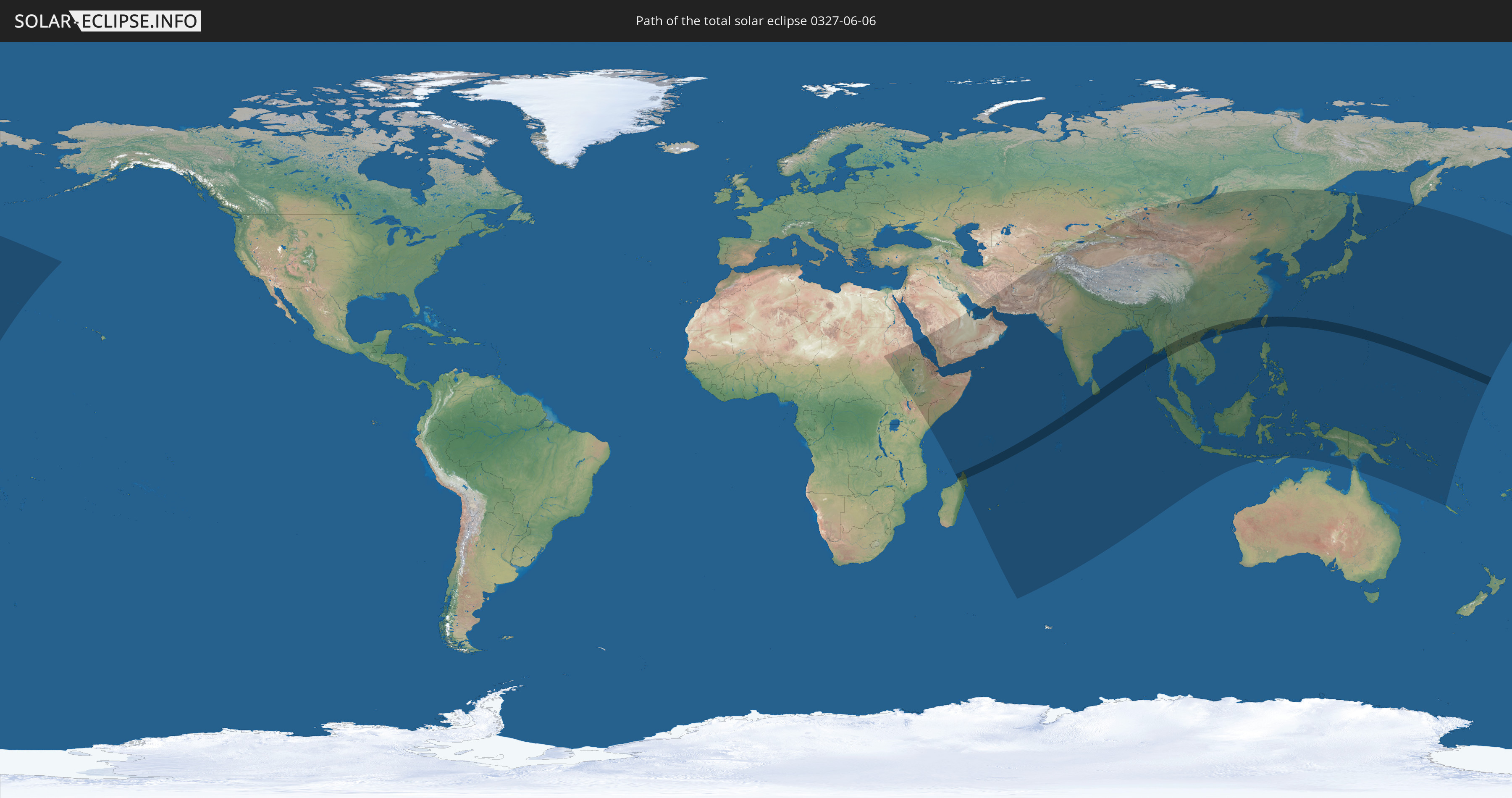
Die Sonnenfinsternis am 06.06.0327 kann man in 65 Ländern als partielle Sonnenfinsternis beobachten.
Der Finsternispfad verläuft durch 16 Länder. Nur in diesen Ländern ist sie als totale Sonnenfinsternis zu sehen.
In den folgenden Ländern ist die Sonnenfinsternis total zu sehen
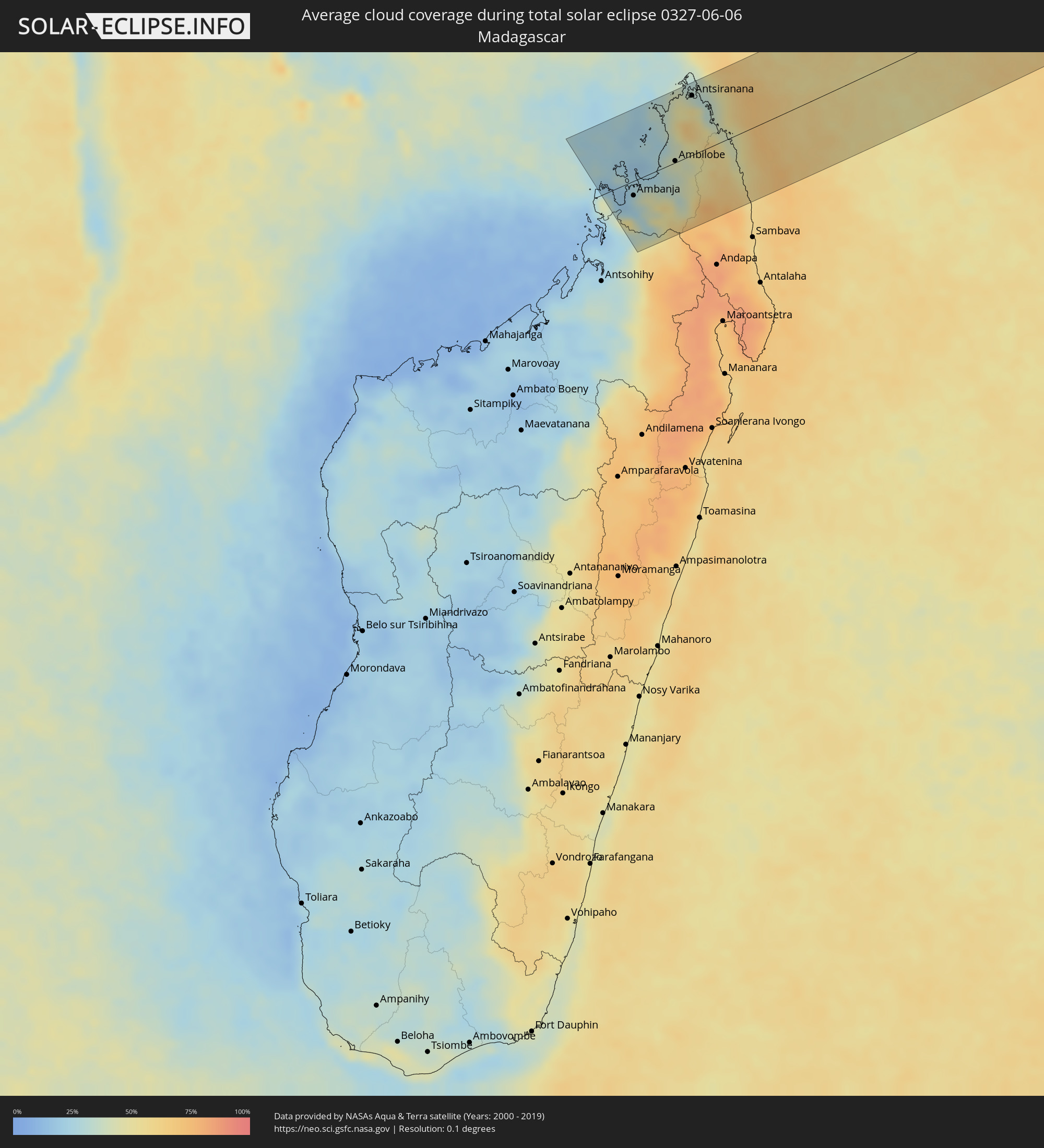
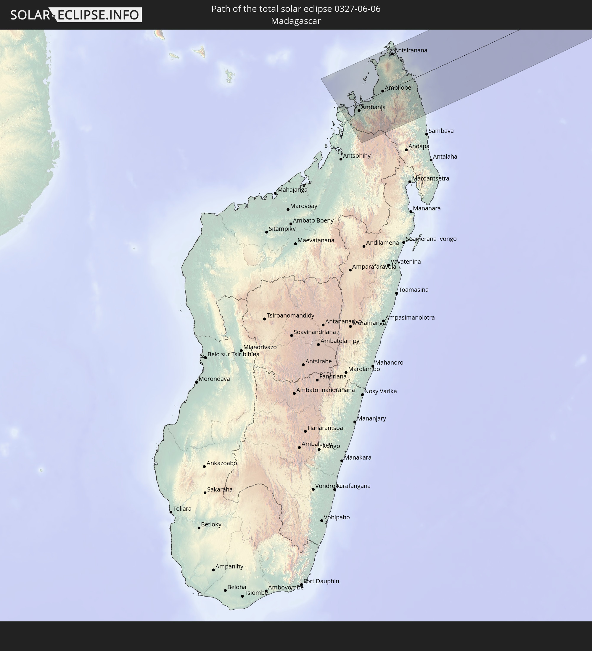 Madagaskar
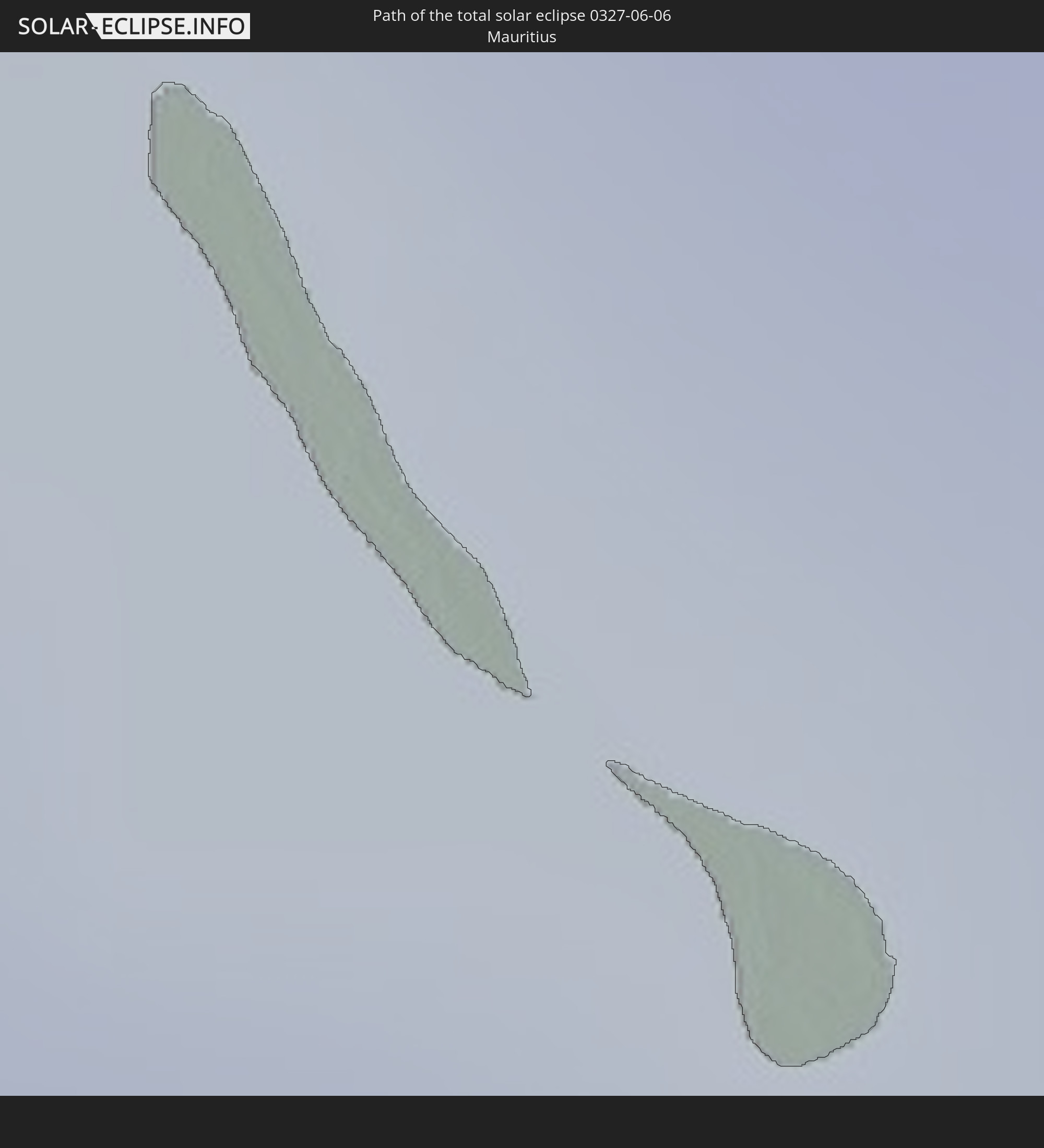 Mauritius
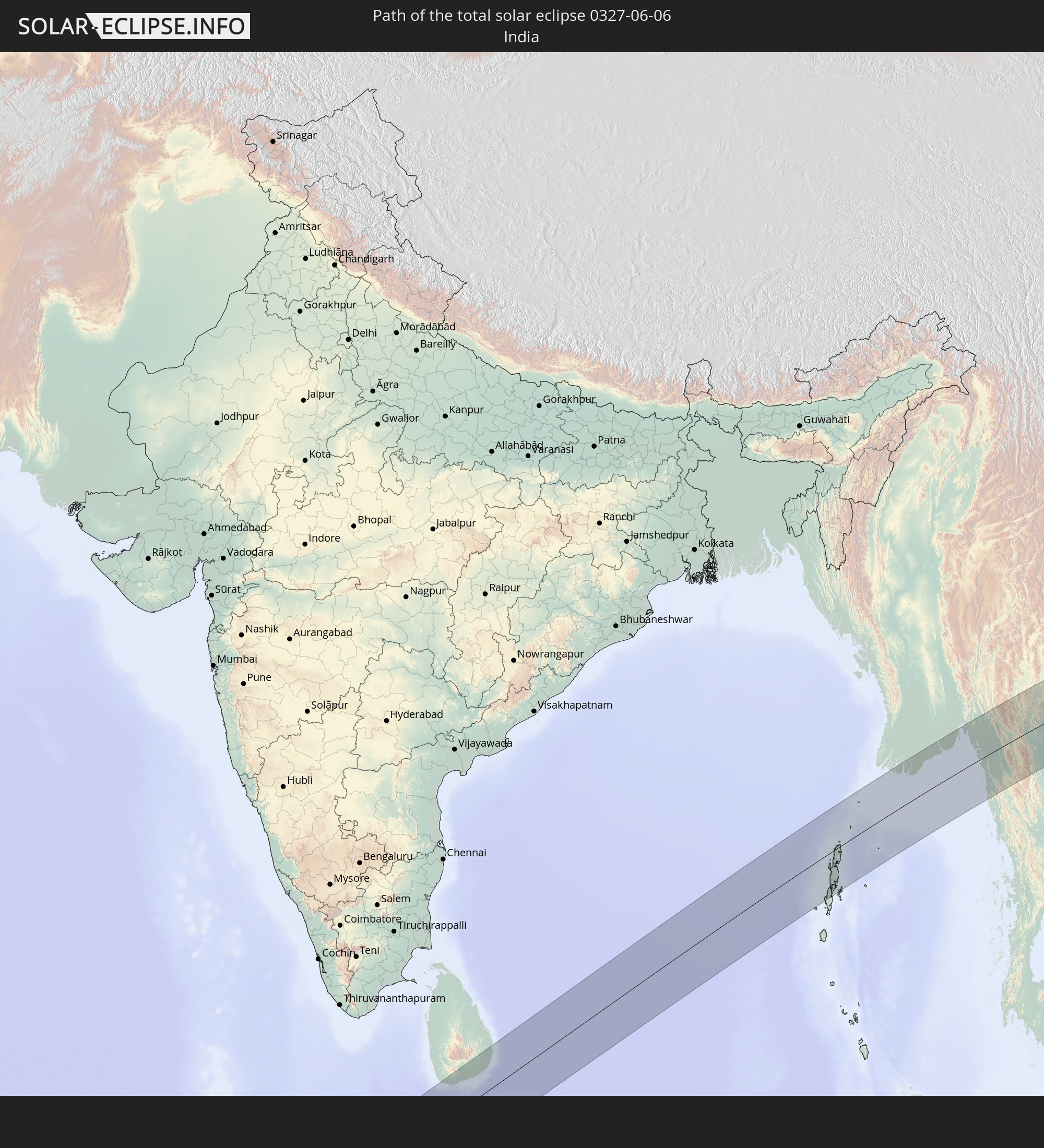 Indien
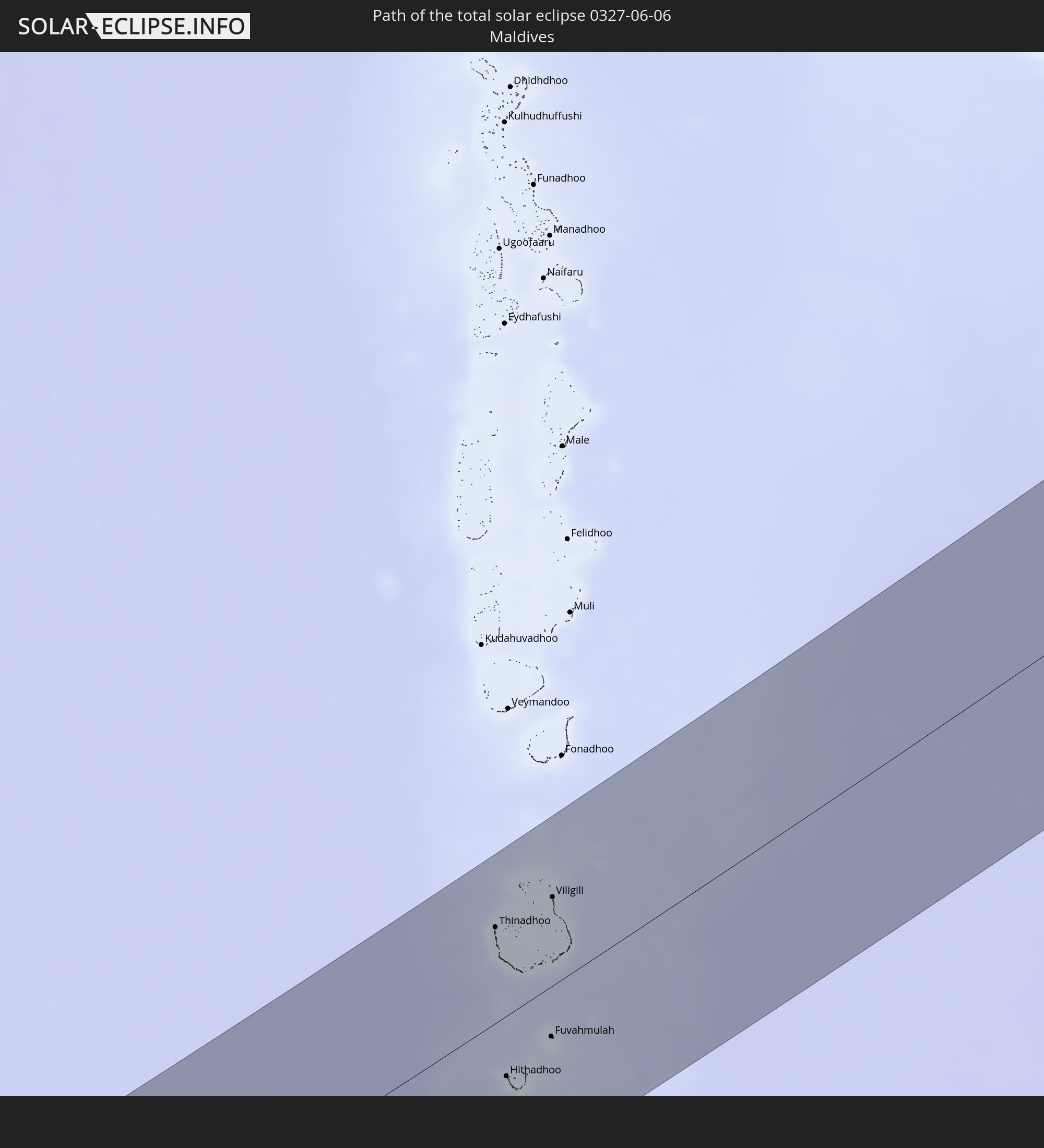 Malediven
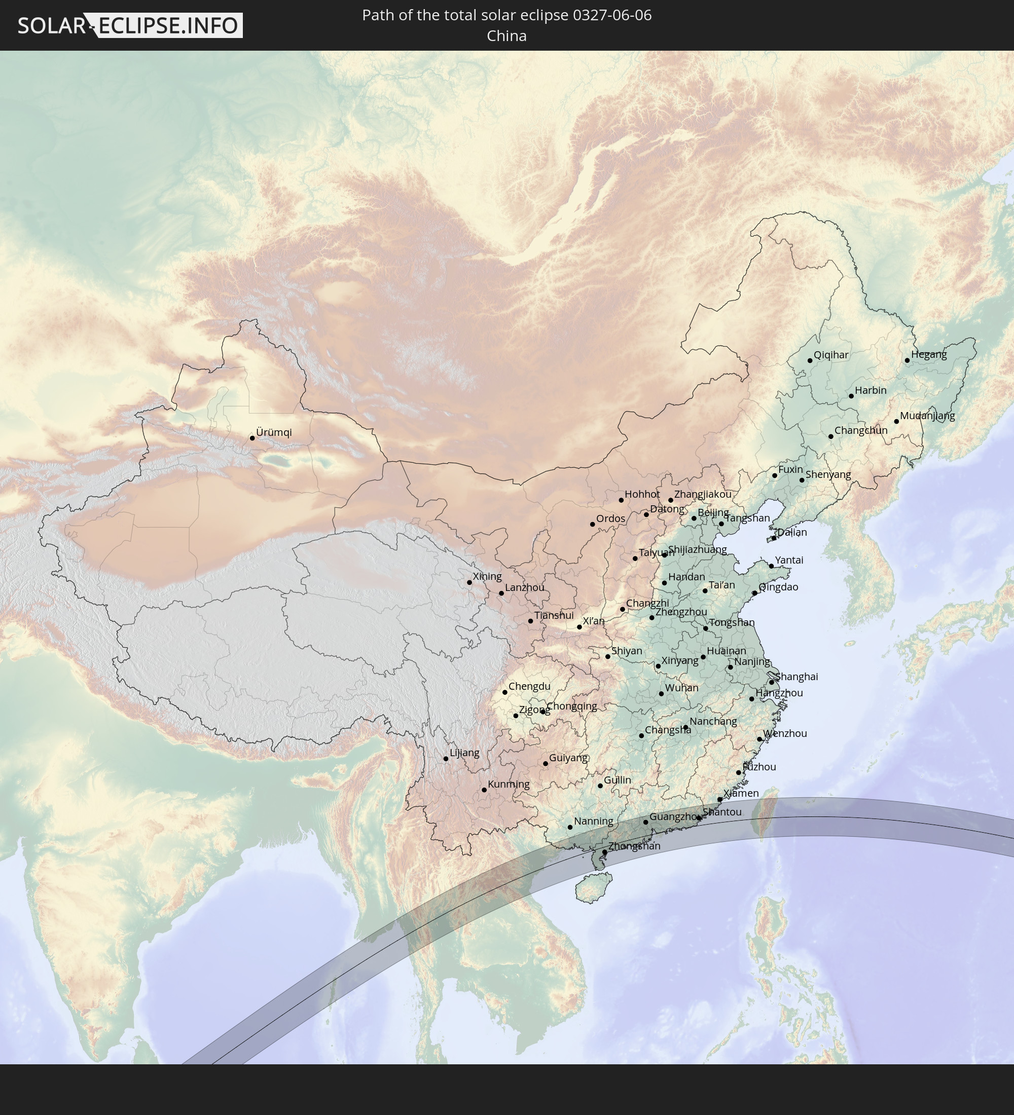 Volksrepublik China
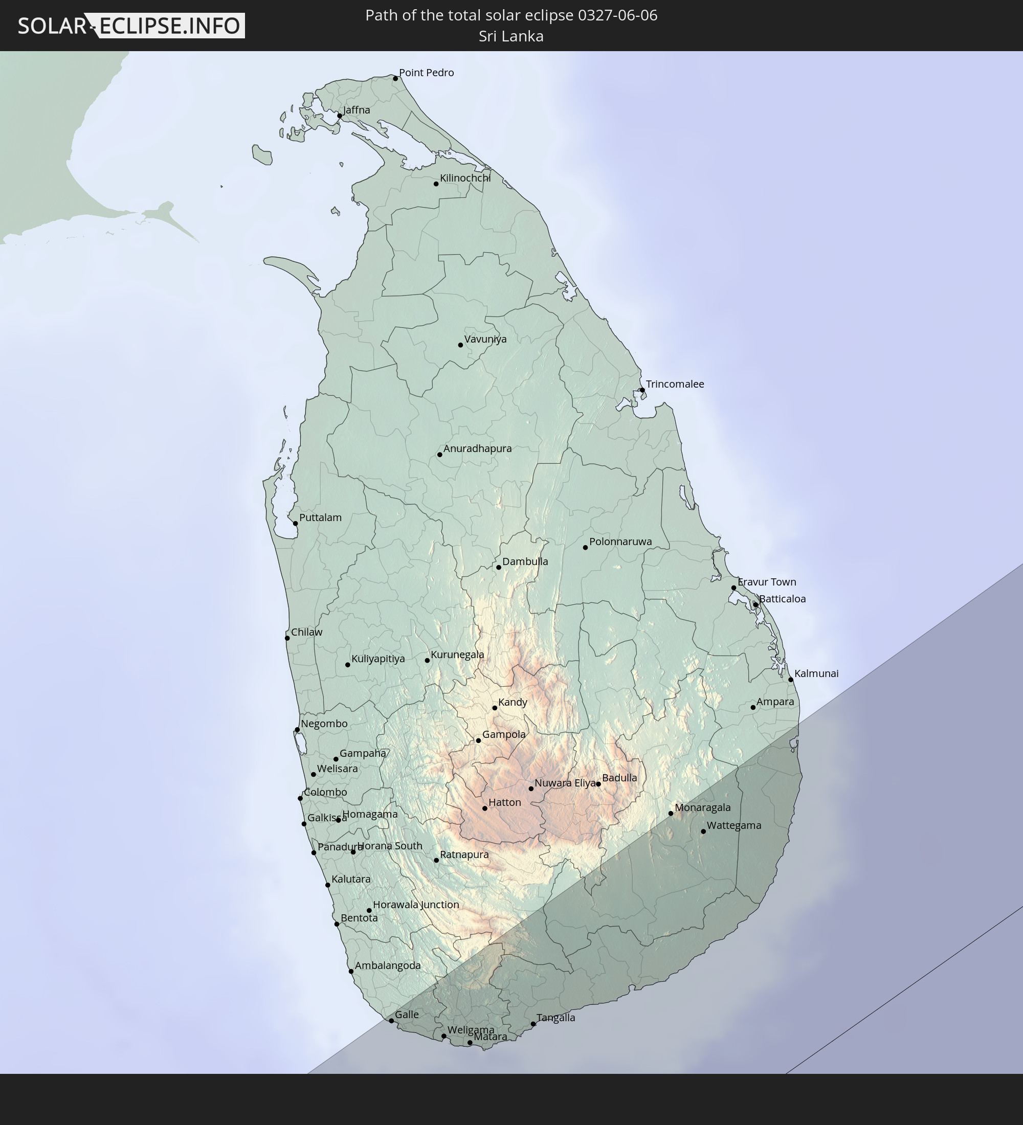 Sri Lanka
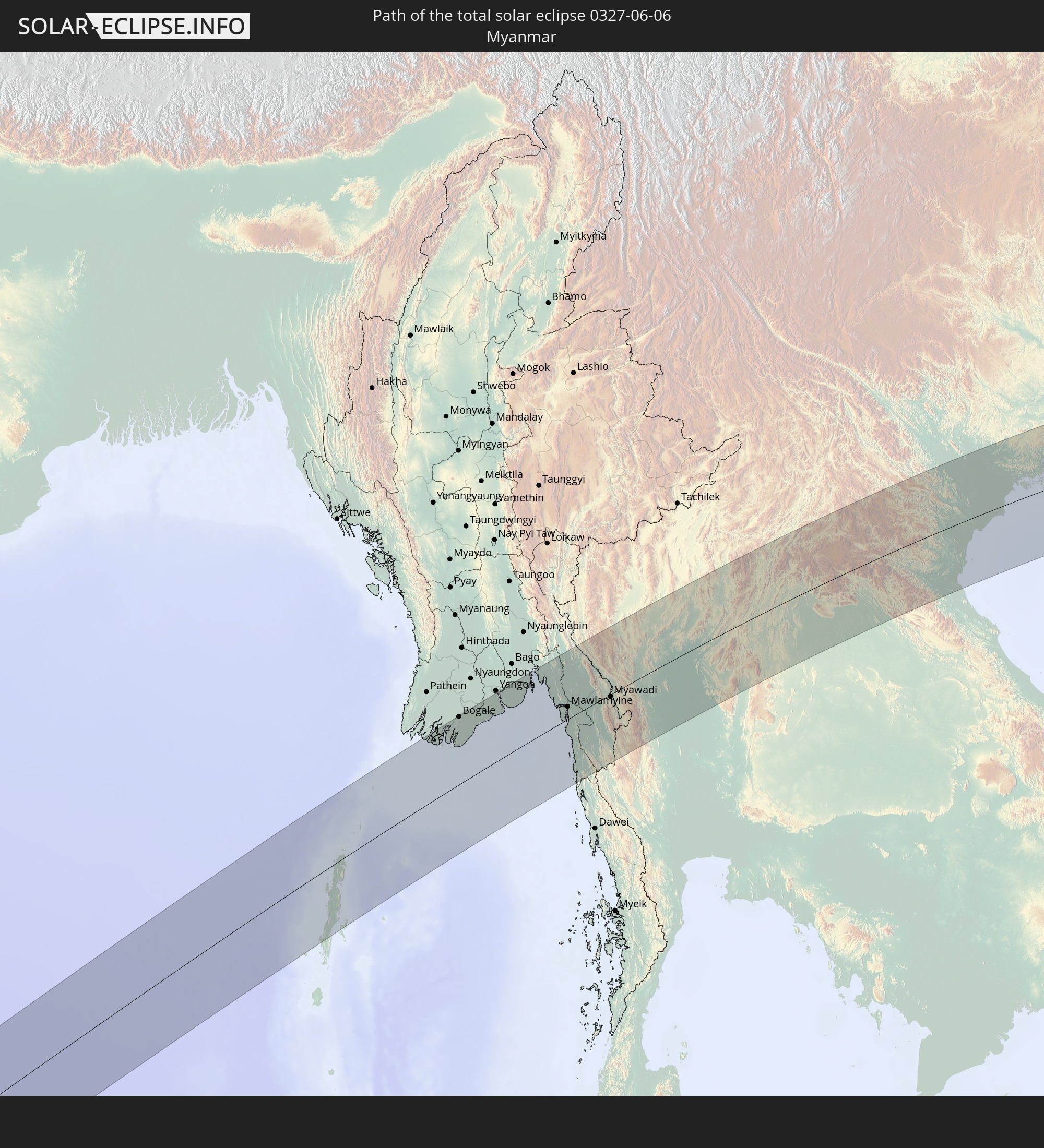 Myanmar
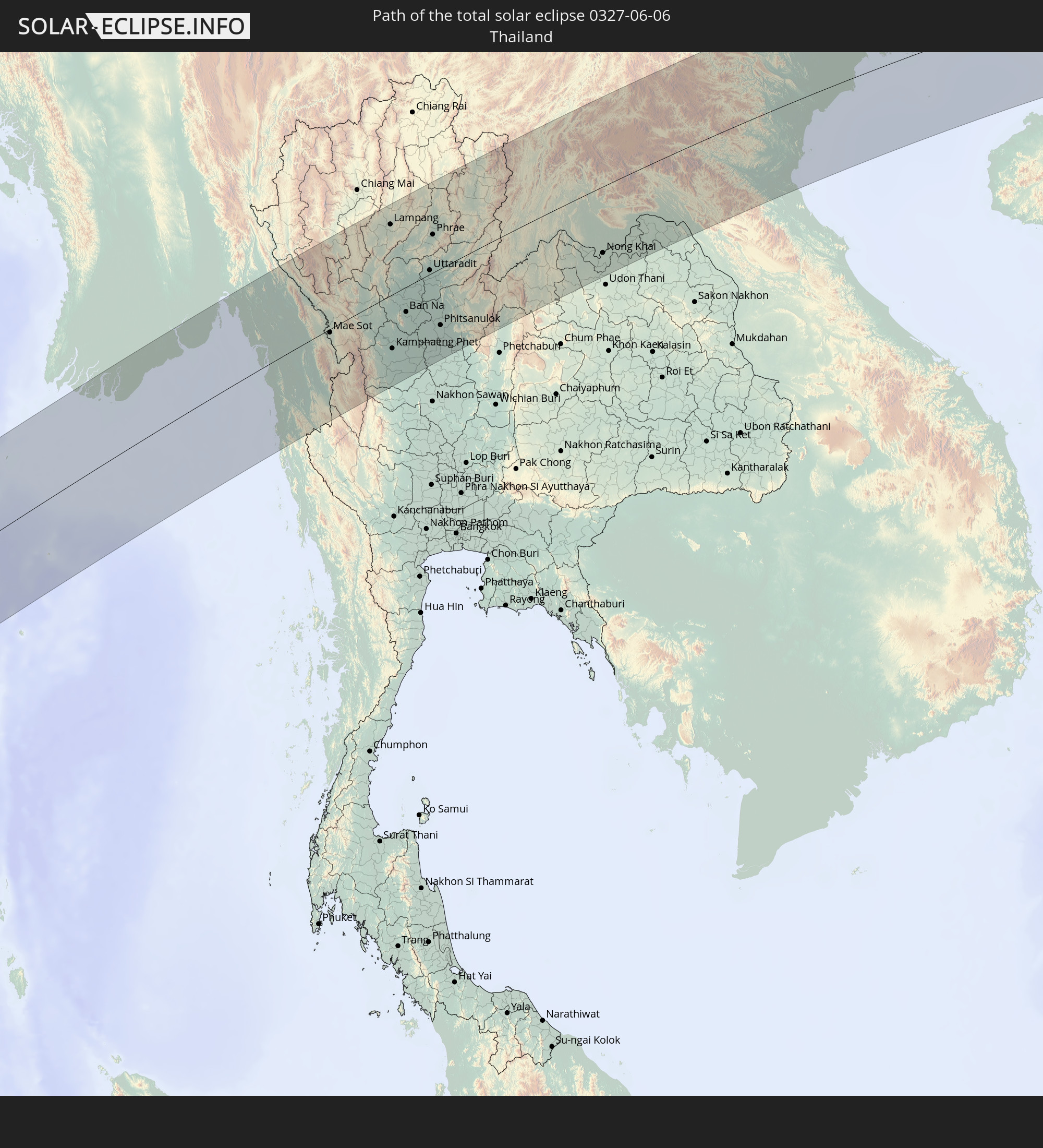 Thailand
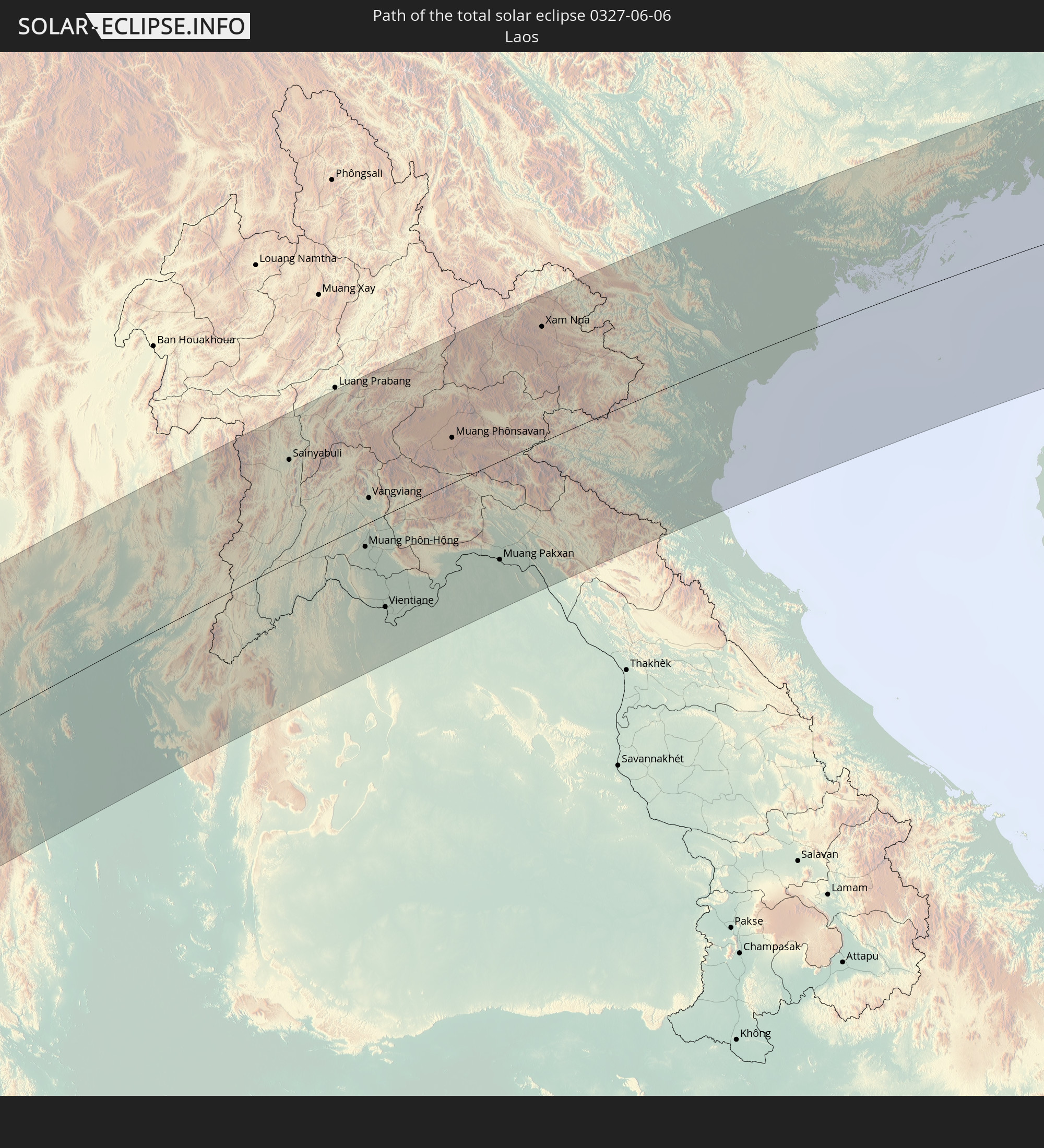 Laos
Laos
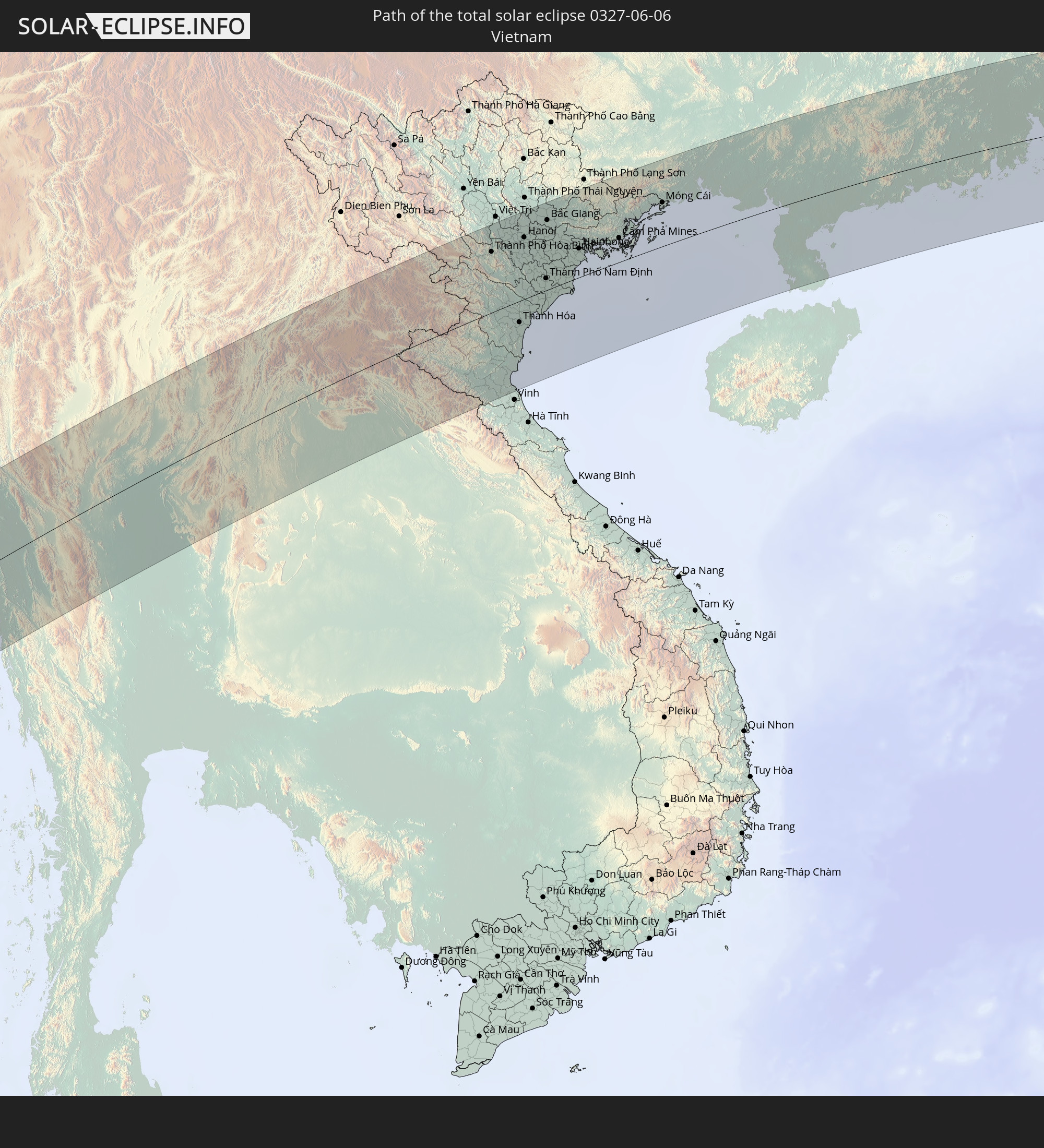 Vietnam
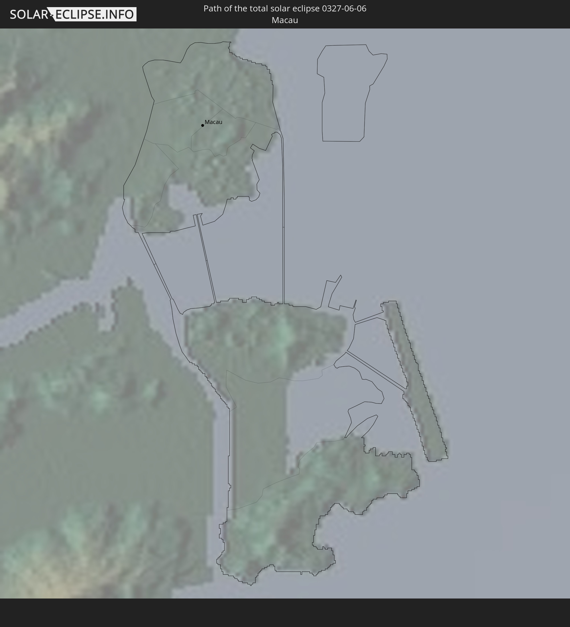 Macau
Macau
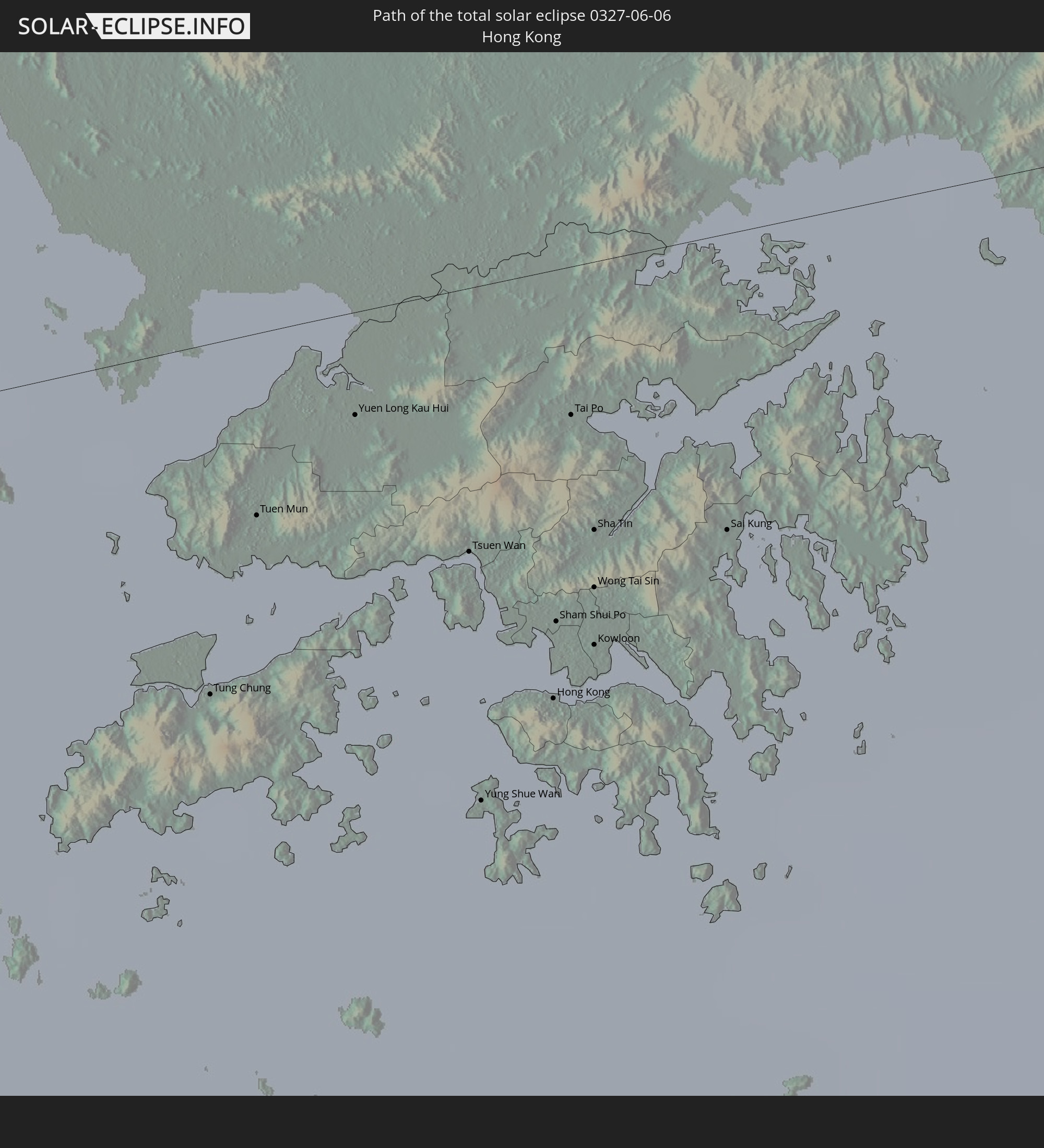 Hongkong
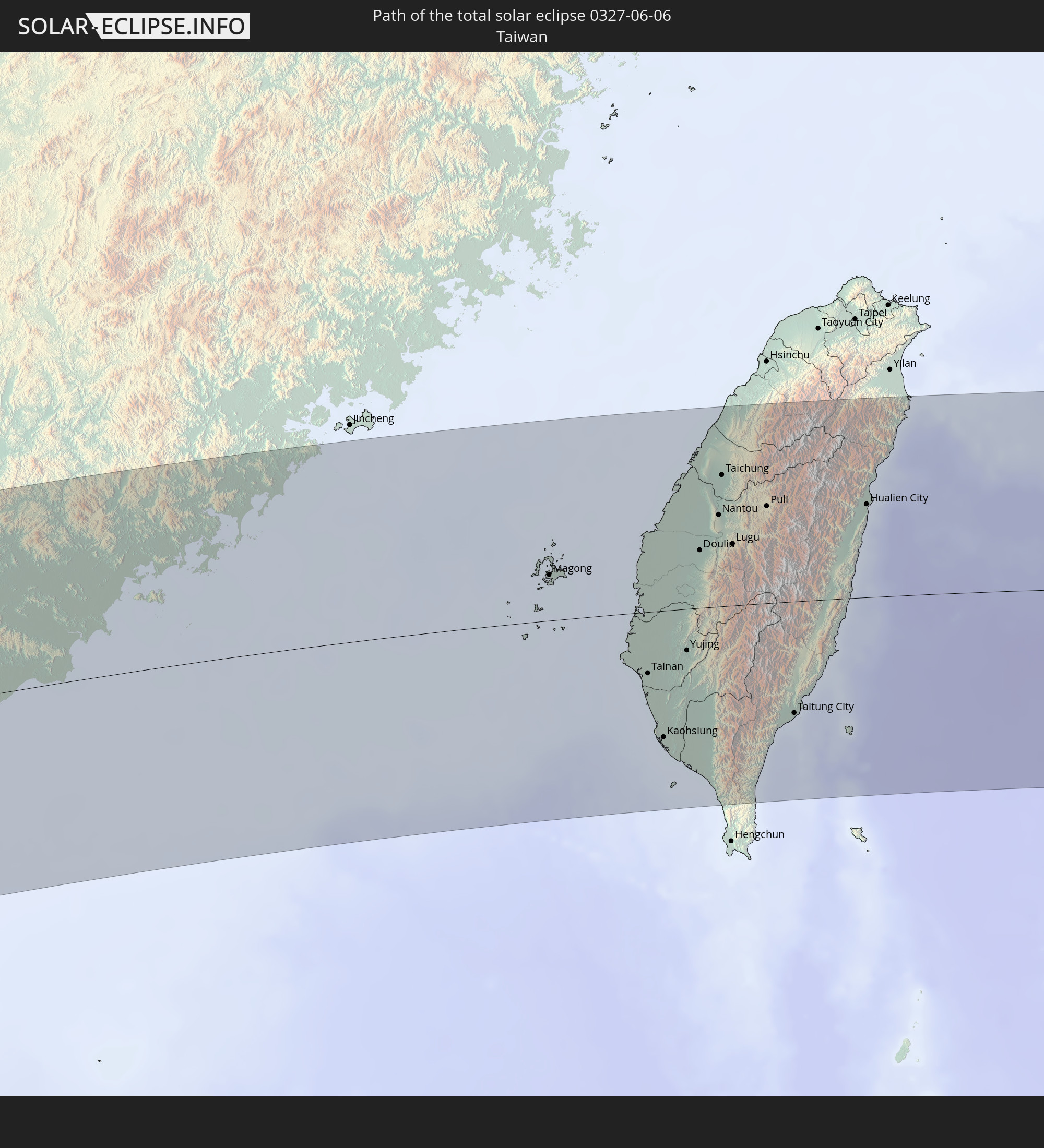 Taiwan
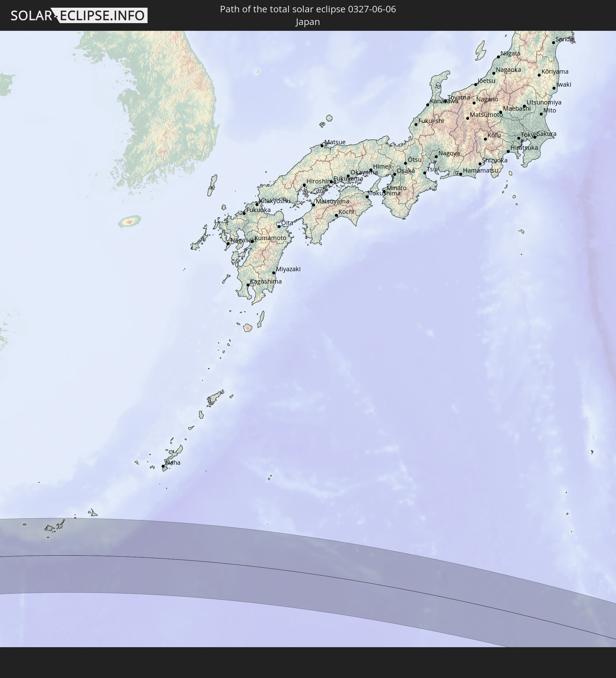 Japan
Japan
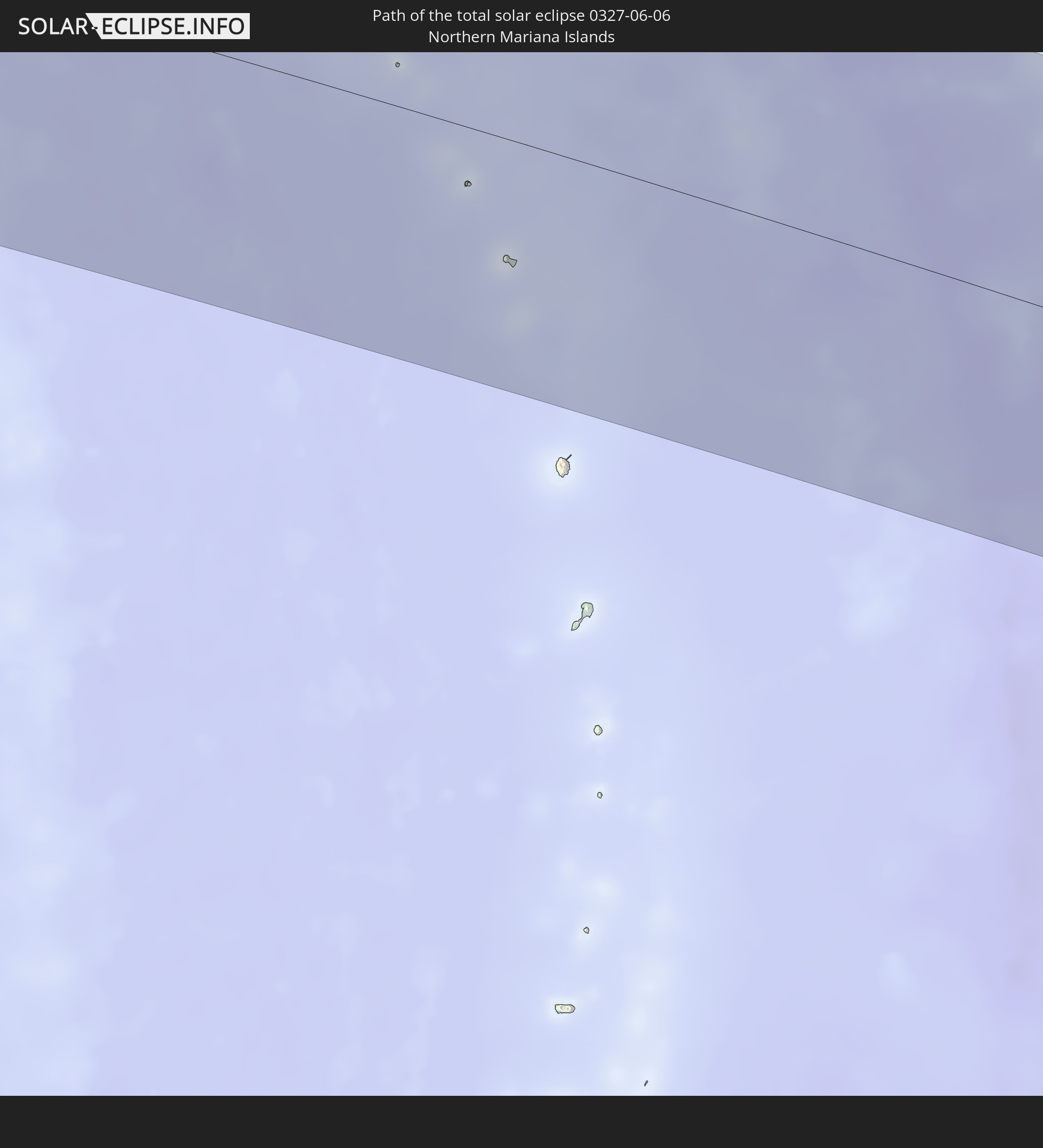 Nördliche Marianen
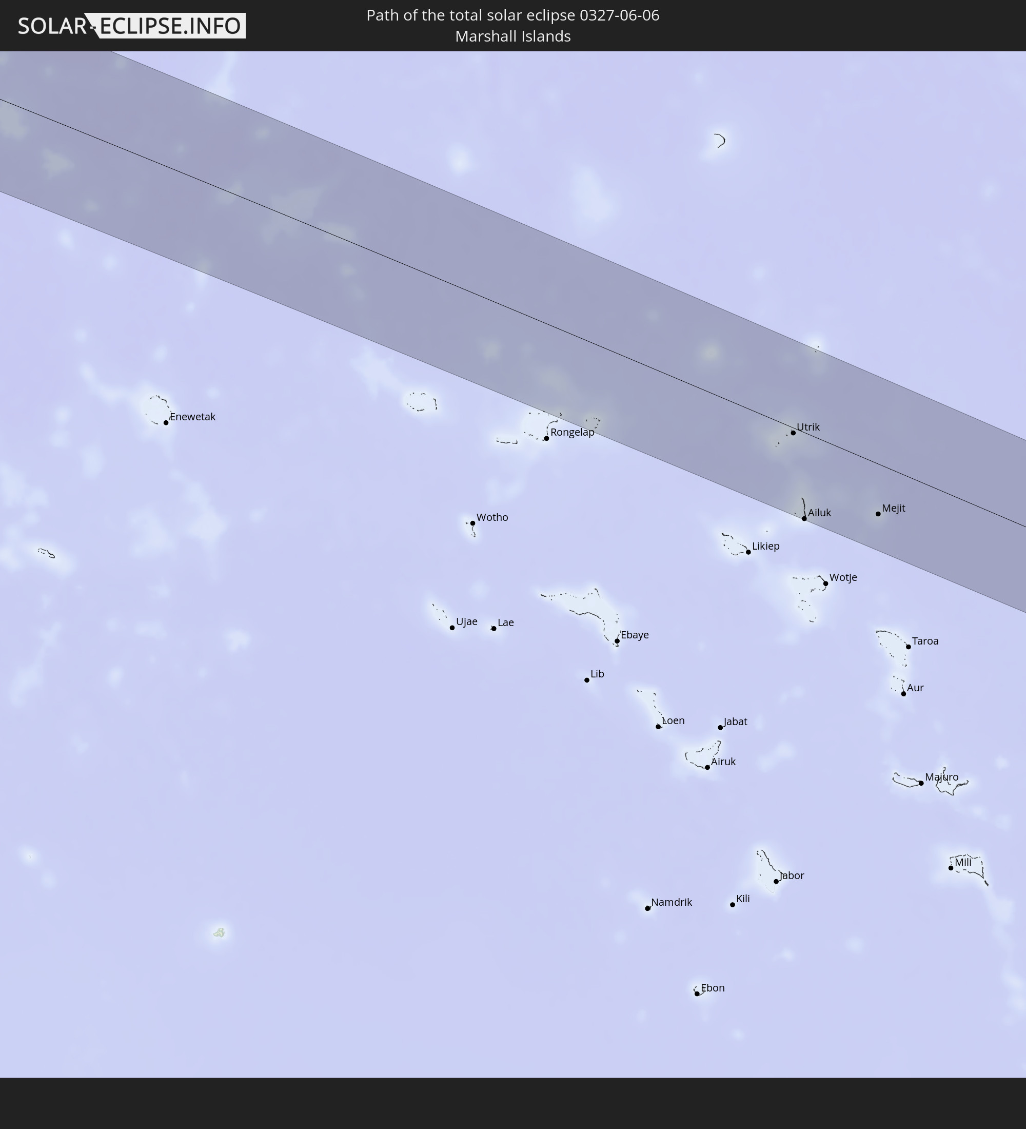 Marshallinseln
In den folgenden Ländern ist die Sonnenfinsternis partiell zu sehen
 Russland
 United States Minor Outlying Islands
 Kiribati
 Sudan
Sudan
 Äthiopien
 Kenia
Kenia
 Saudi-Arabien
 Eritrea
 Französische Süd- und Antarktisgebiete
 Somalia
 Dschibuti
 Jemen
Jemen
 Madagaskar
 Iran
Iran
 Seychellen
 Kasachstan
 Bahrain
 Katar
Katar
 Vereinigte Arabische Emirate
 Oman
Oman
 Réunion
 Usbekistan
 Mauritius
 Afghanistan
 Pakistan
 Tadschikistan
 Indien
 Kirgisistan
 Britisches Territorium im Indischen Ozean
 Malediven
 Volksrepublik China
 Sri Lanka
 Nepal
Nepal
 Mongolei
 Bangladesch
 Bhutan
 Myanmar
 Indonesien
 Kokosinseln
 Thailand
 Malaysia
 Laos
Laos
 Vietnam
 Kambodscha
 Singapur
 Weihnachtsinsel
 Australien
 Macau
Macau
 Hongkong
 Brunei
 Taiwan
 Philippinen
 Japan
Japan
 Osttimor
 Nordkorea
 Südkorea
 Palau
Palau
 Föderierte Staaten von Mikronesien
 Papua-Neuguinea
 Guam
Guam
 Nördliche Marianen
 Salomonen
 Neukaledonien
 Marshallinseln
 Nauru
Nauru
Wie wird das Wetter während der totalen Sonnenfinsternis am 06.06.0327?
Wo ist der beste Ort, um die totale Sonnenfinsternis vom 06.06.0327 zu beobachten?
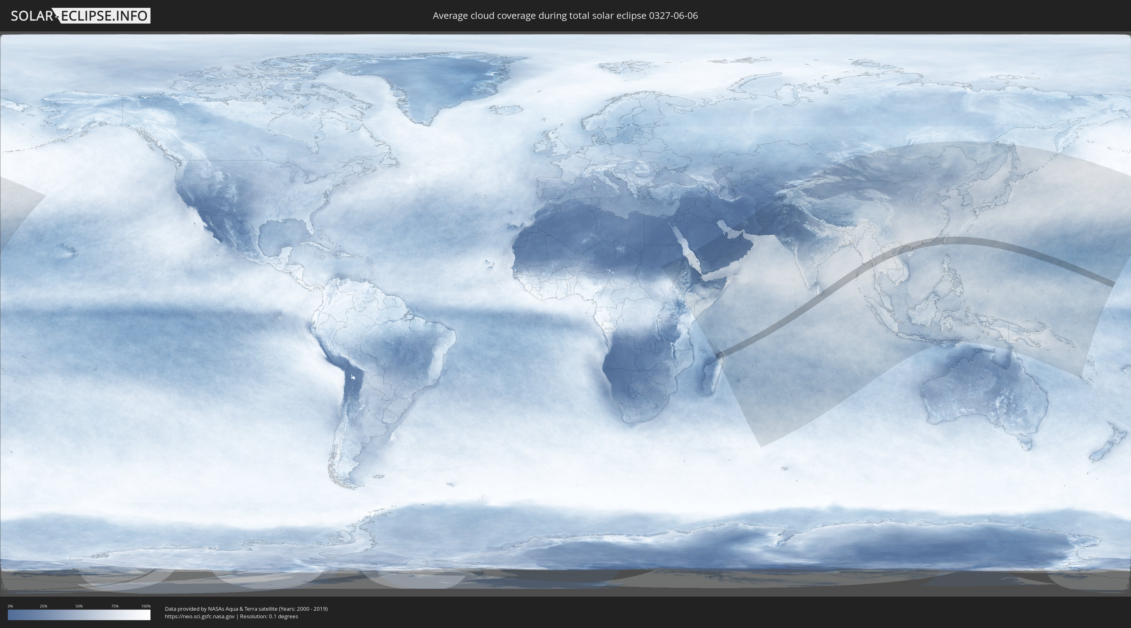
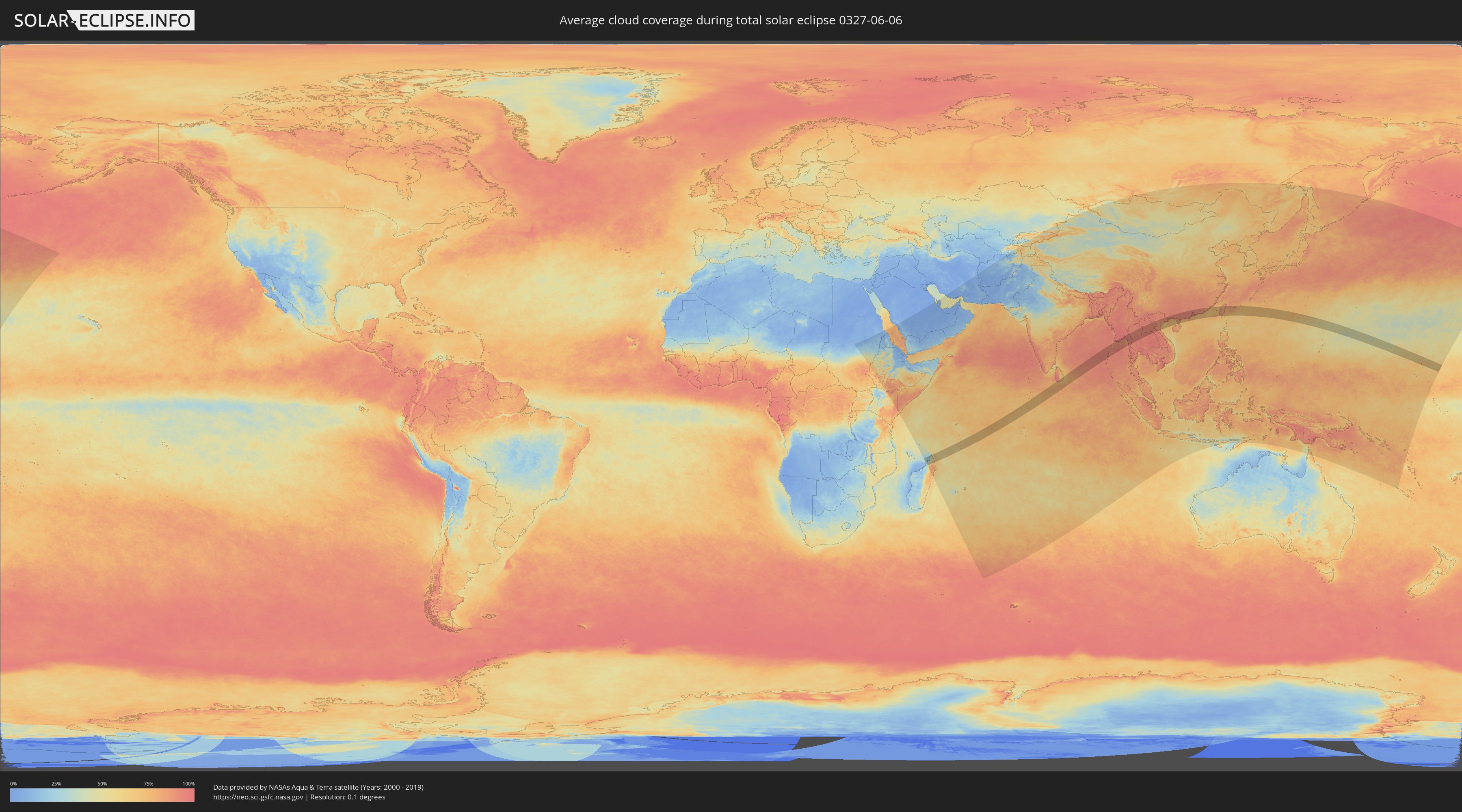
Die folgenden Karten zeigen die durchschnittliche Bewölkung für den Tag, an dem die totale Sonnenfinsternis
stattfindet. Mit Hilfe der Karten lässt sich der Ort entlang des Finsternispfades eingrenzen,
der die besten Aussichen auf einen klaren wolkenfreien Himmel bietet.
Trotzdem muss man immer lokale Gegenenheiten beachten und sollte sich genau über das Wetter an seinem
gewählten Beobachtungsort informieren.
Die Daten stammen von den beiden NASA-Satelliten
AQUA und TERRA
und wurden über einen Zeitraum von 19 Jahren (2000 - 2019) gemittelt.
Detaillierte Länderkarten
 Madagaskar
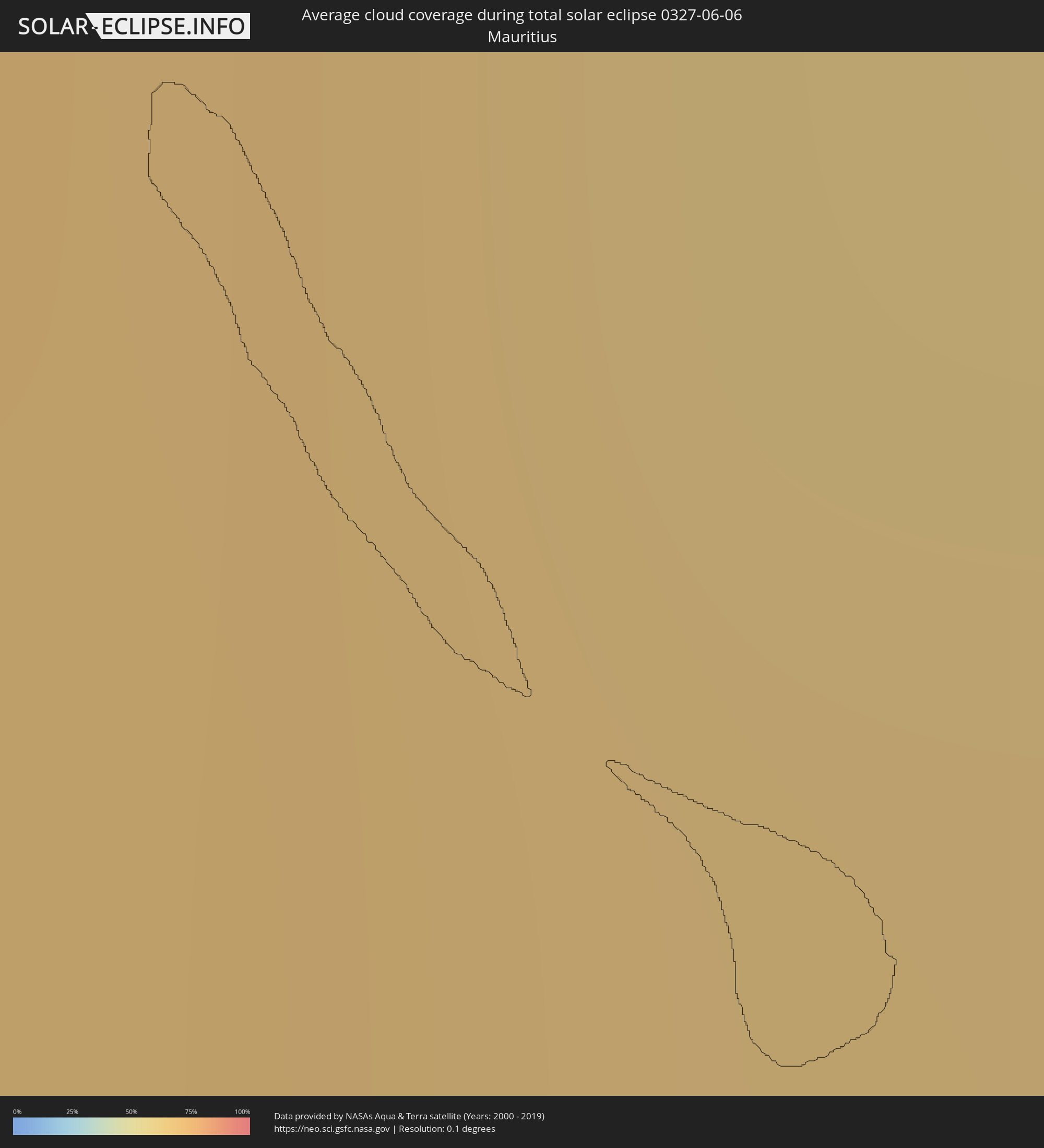 Mauritius
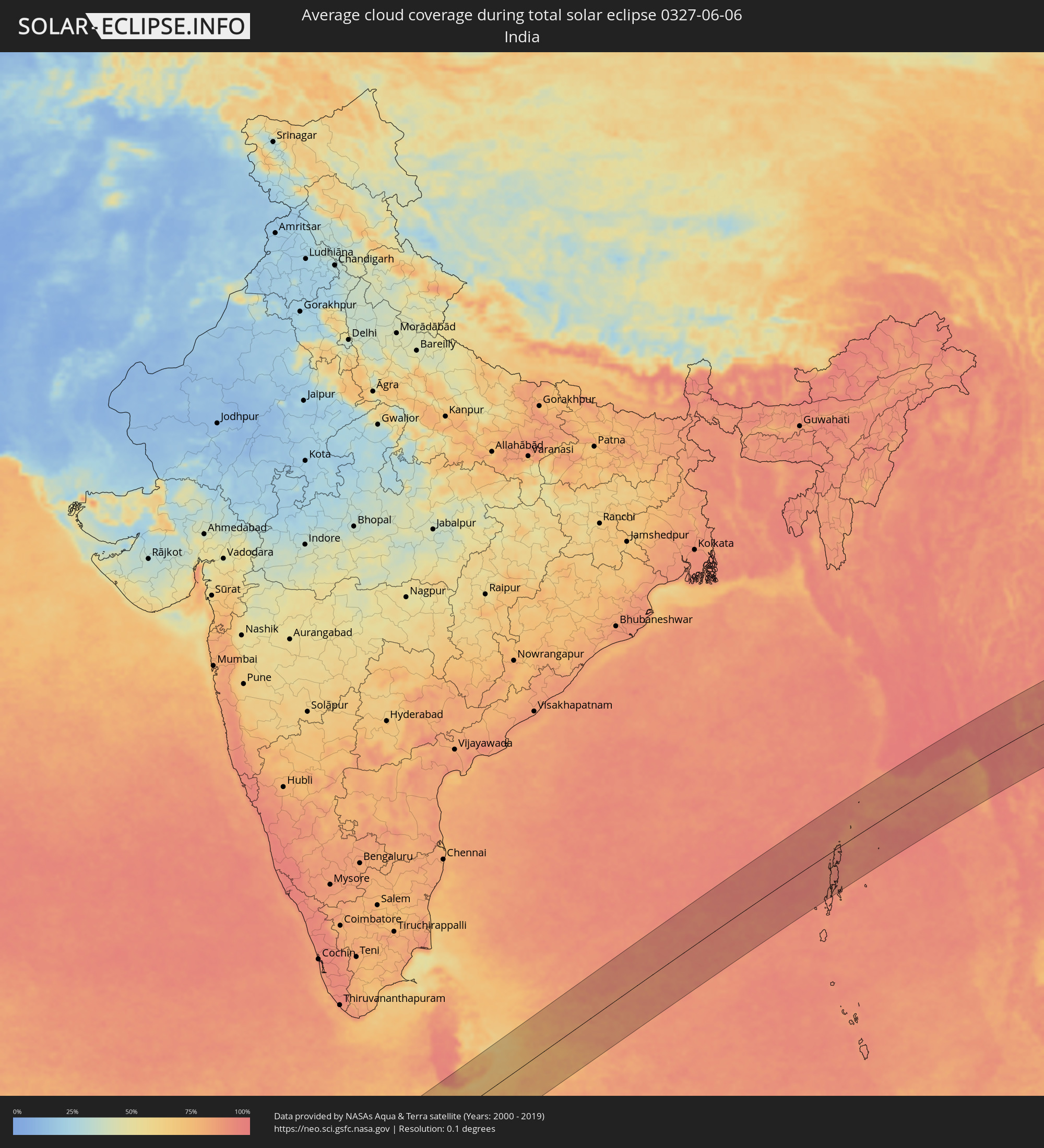 Indien
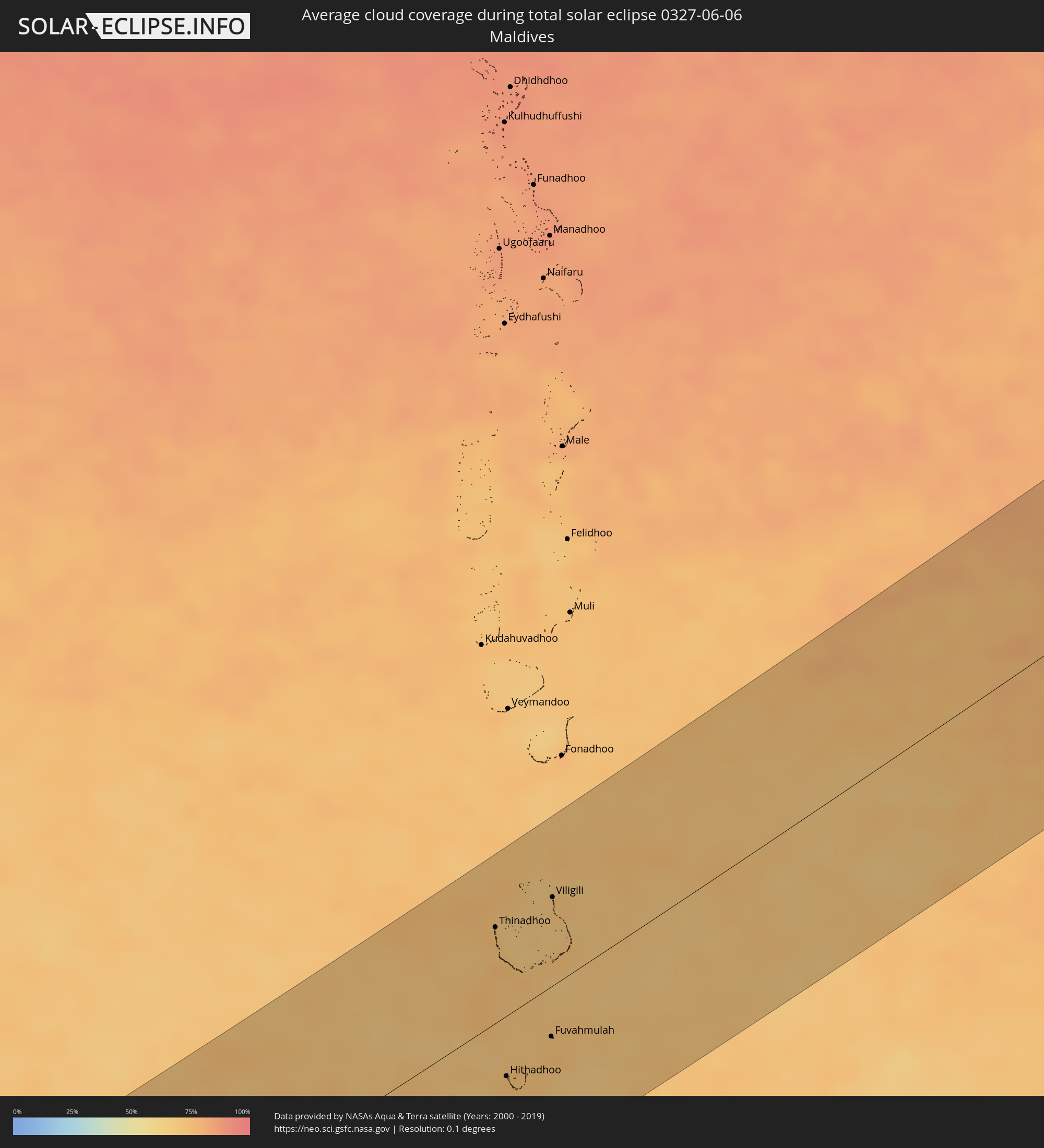 Malediven
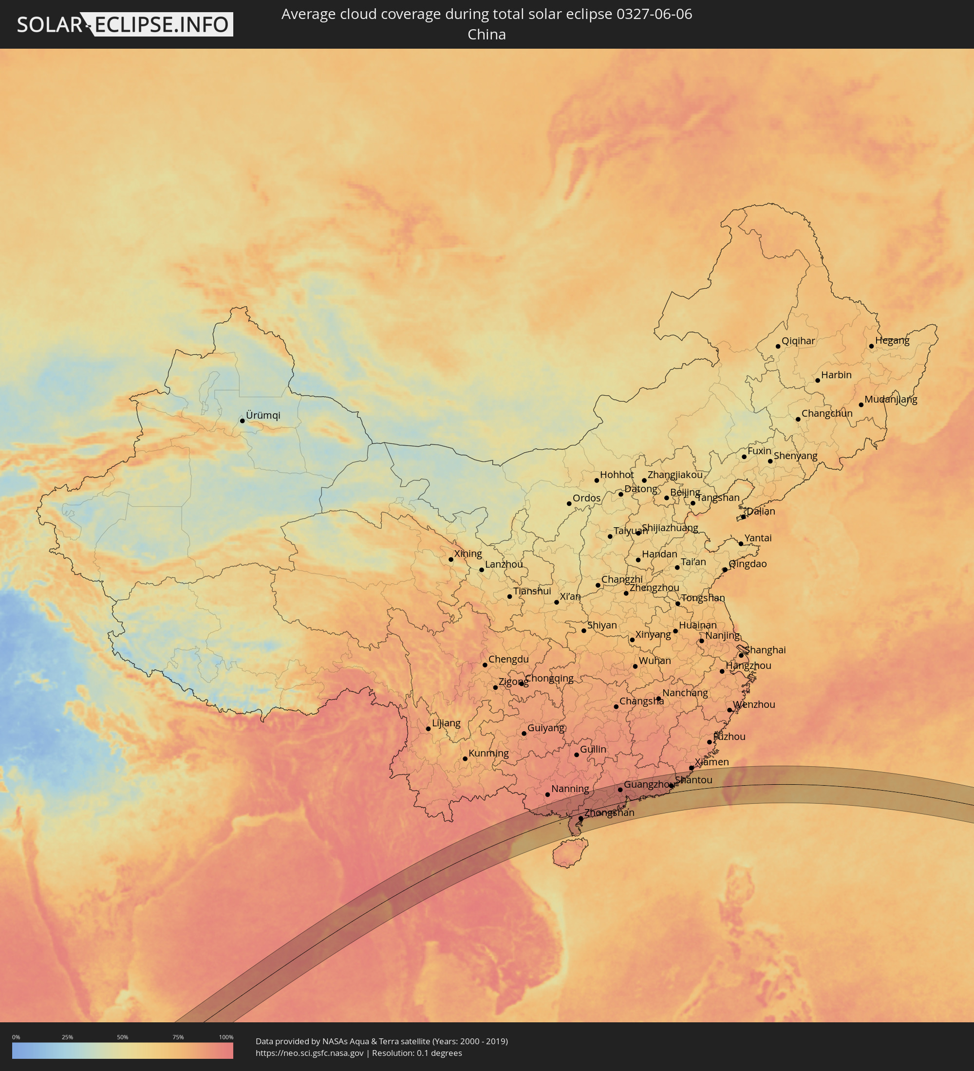 Volksrepublik China
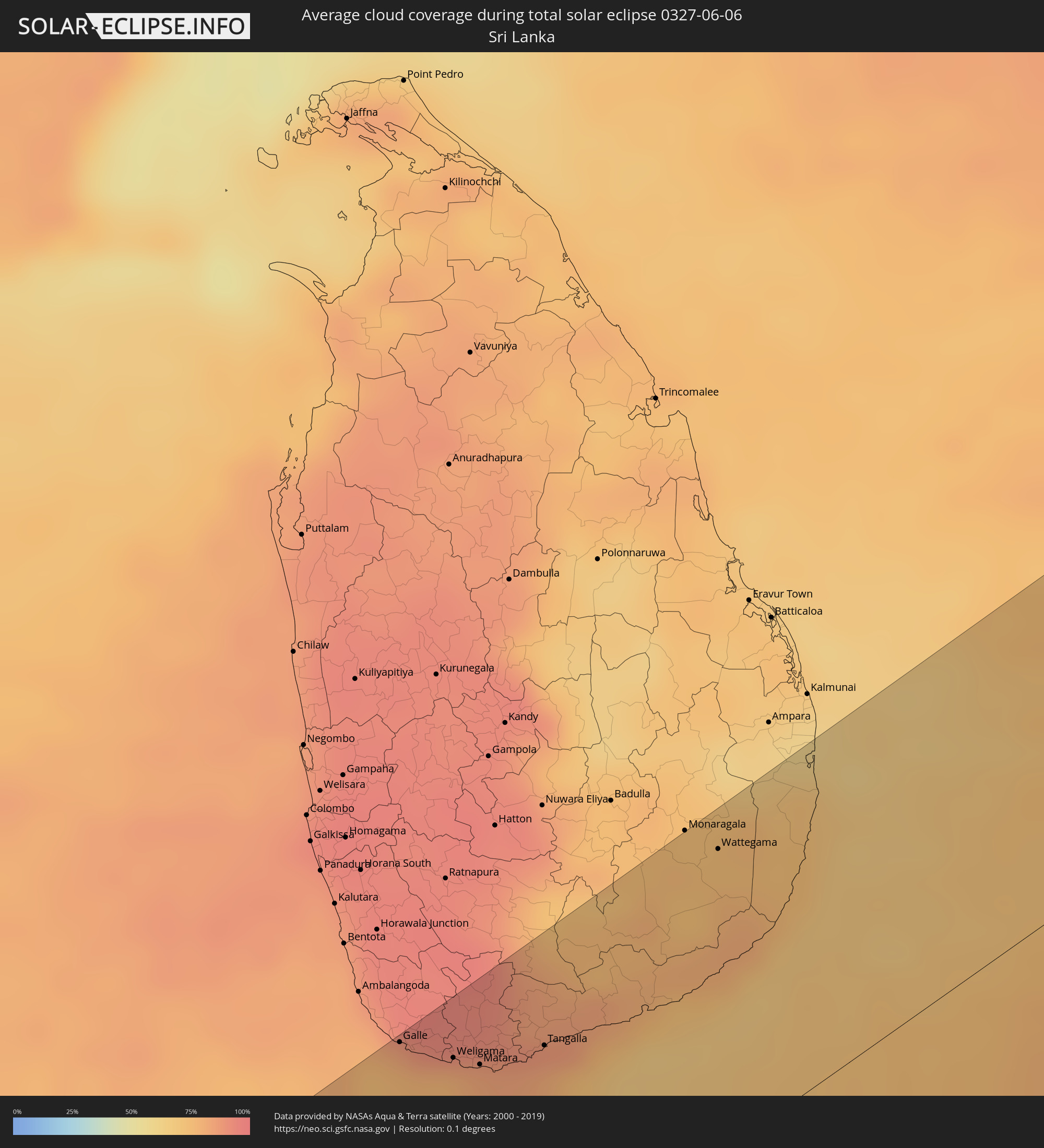 Sri Lanka
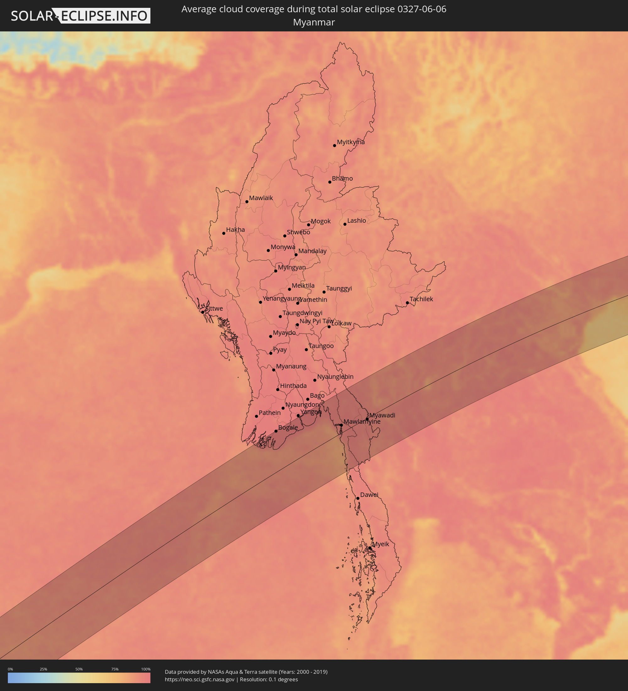 Myanmar
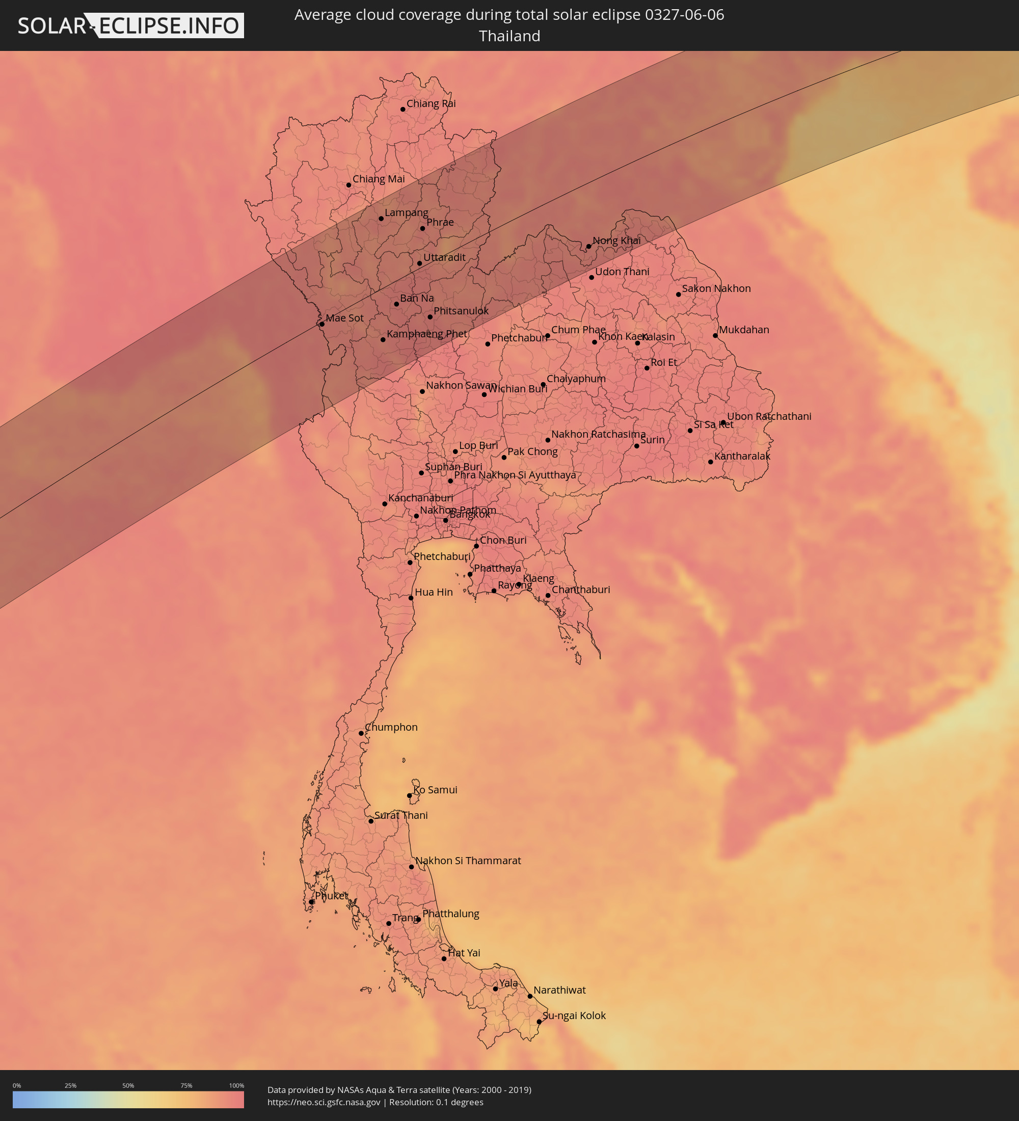 Thailand
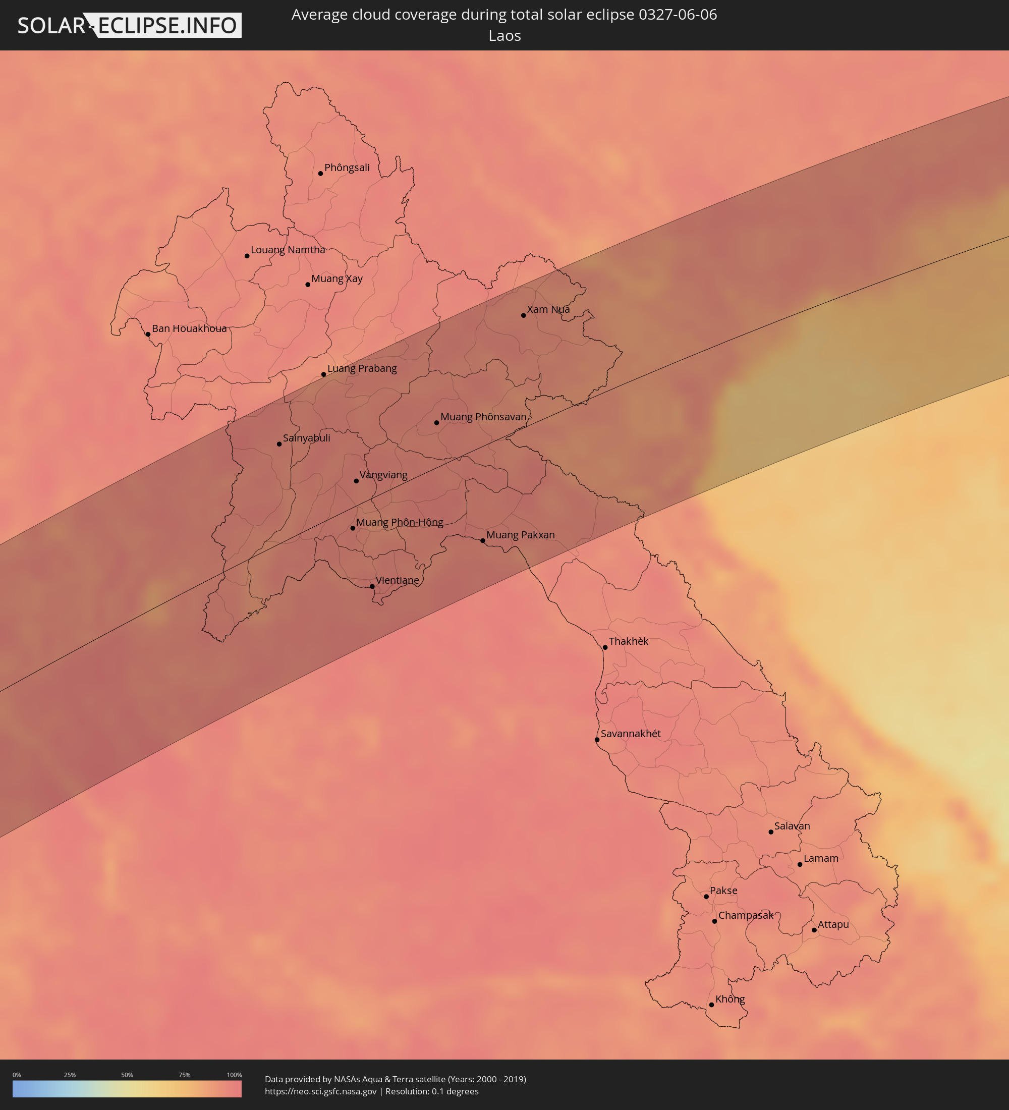 Laos
Laos
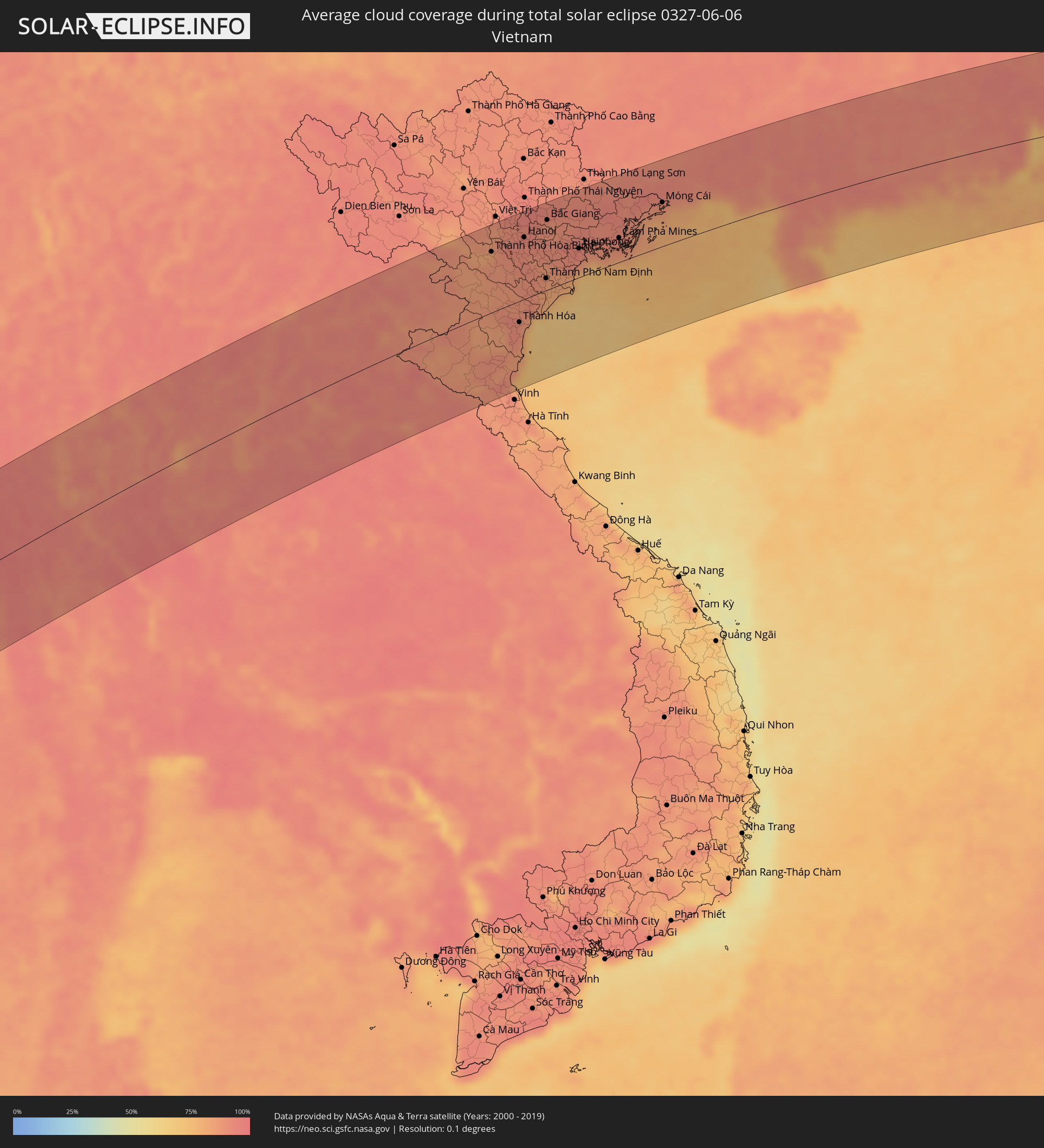 Vietnam
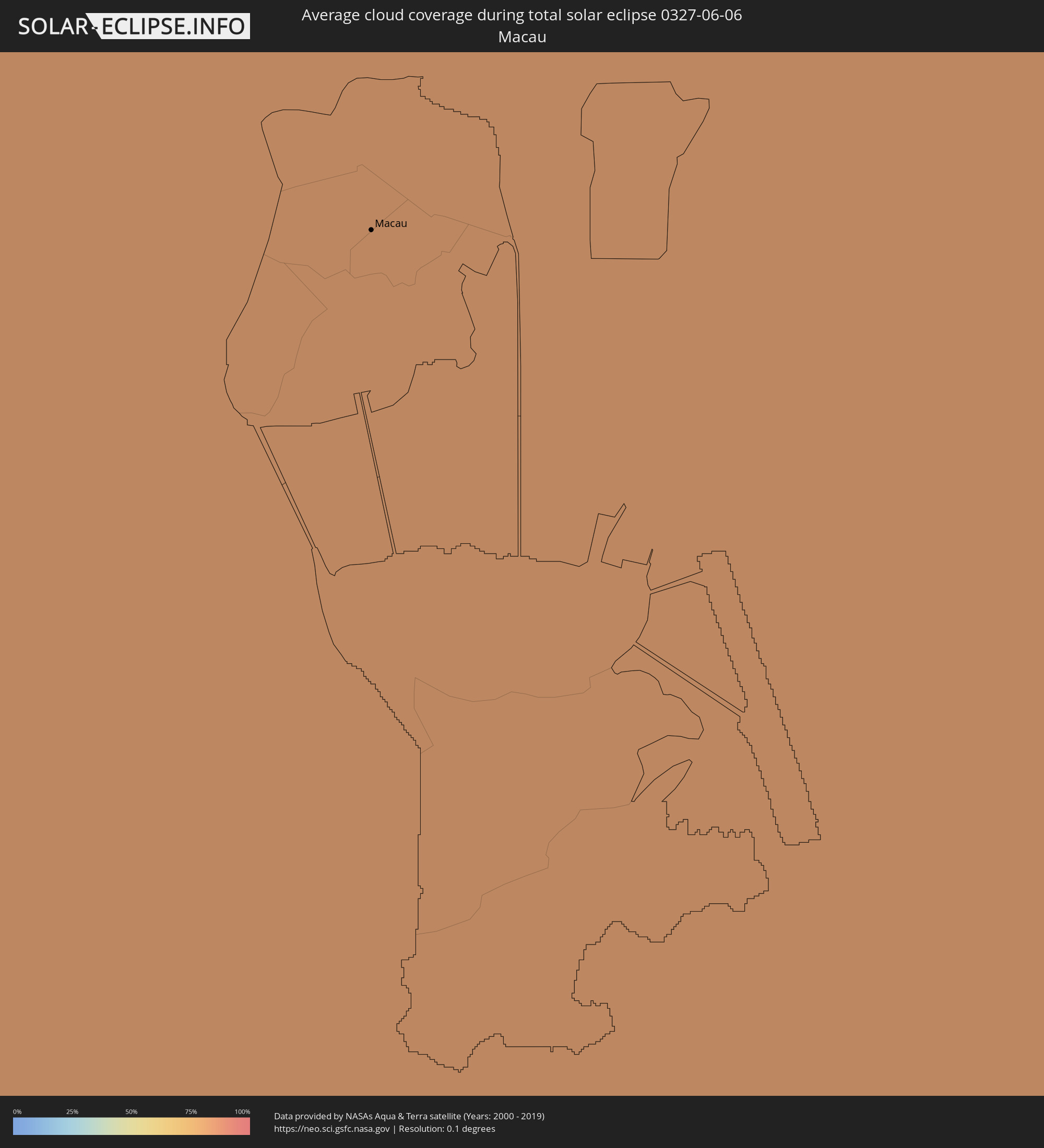 Macau
Macau
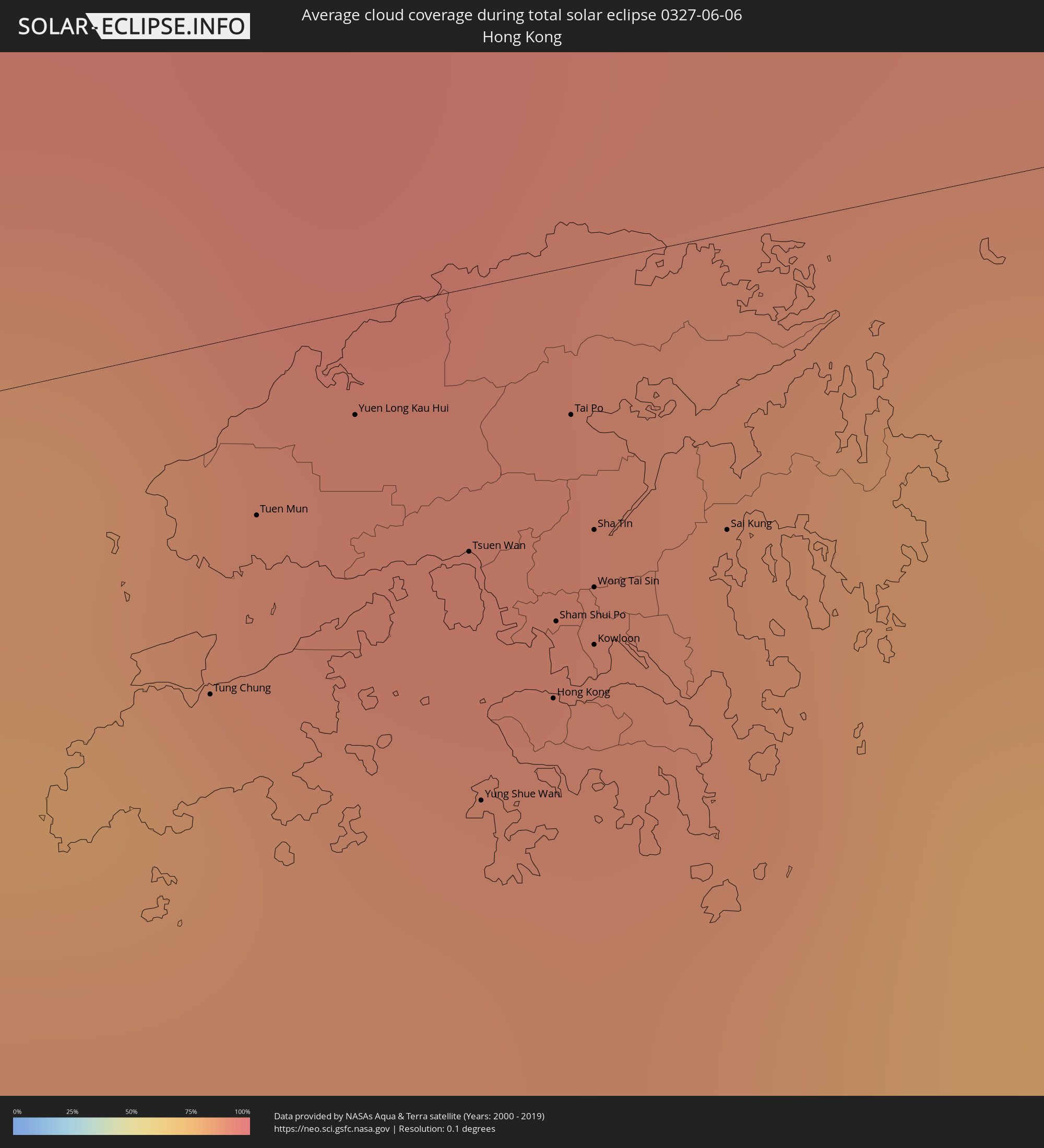 Hongkong
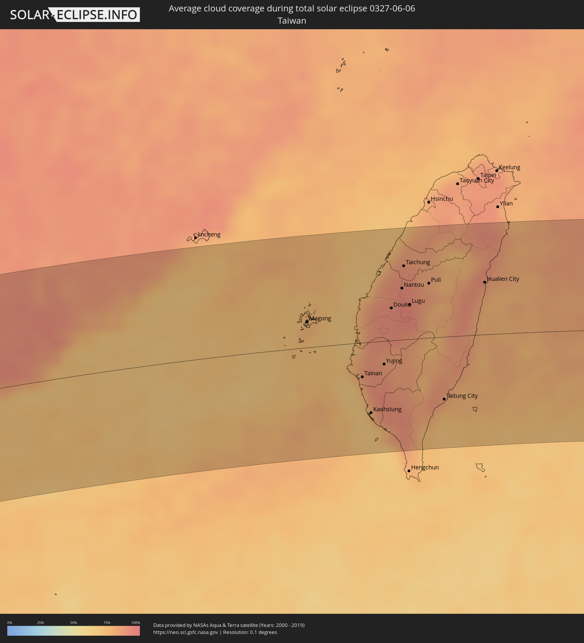 Taiwan
 Japan
Japan
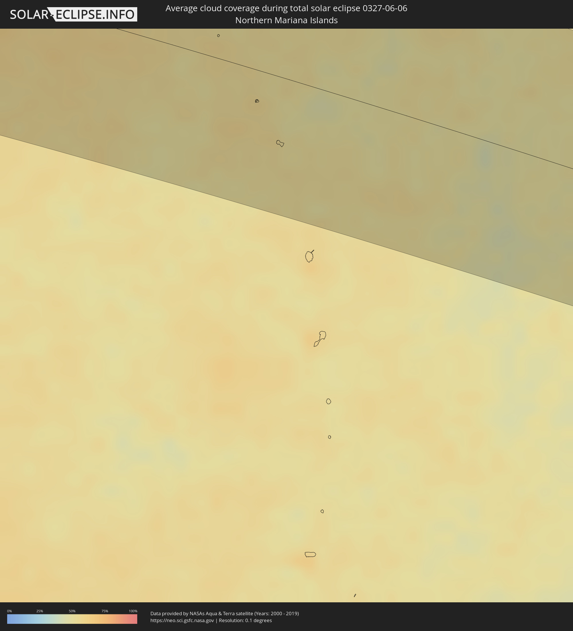 Nördliche Marianen
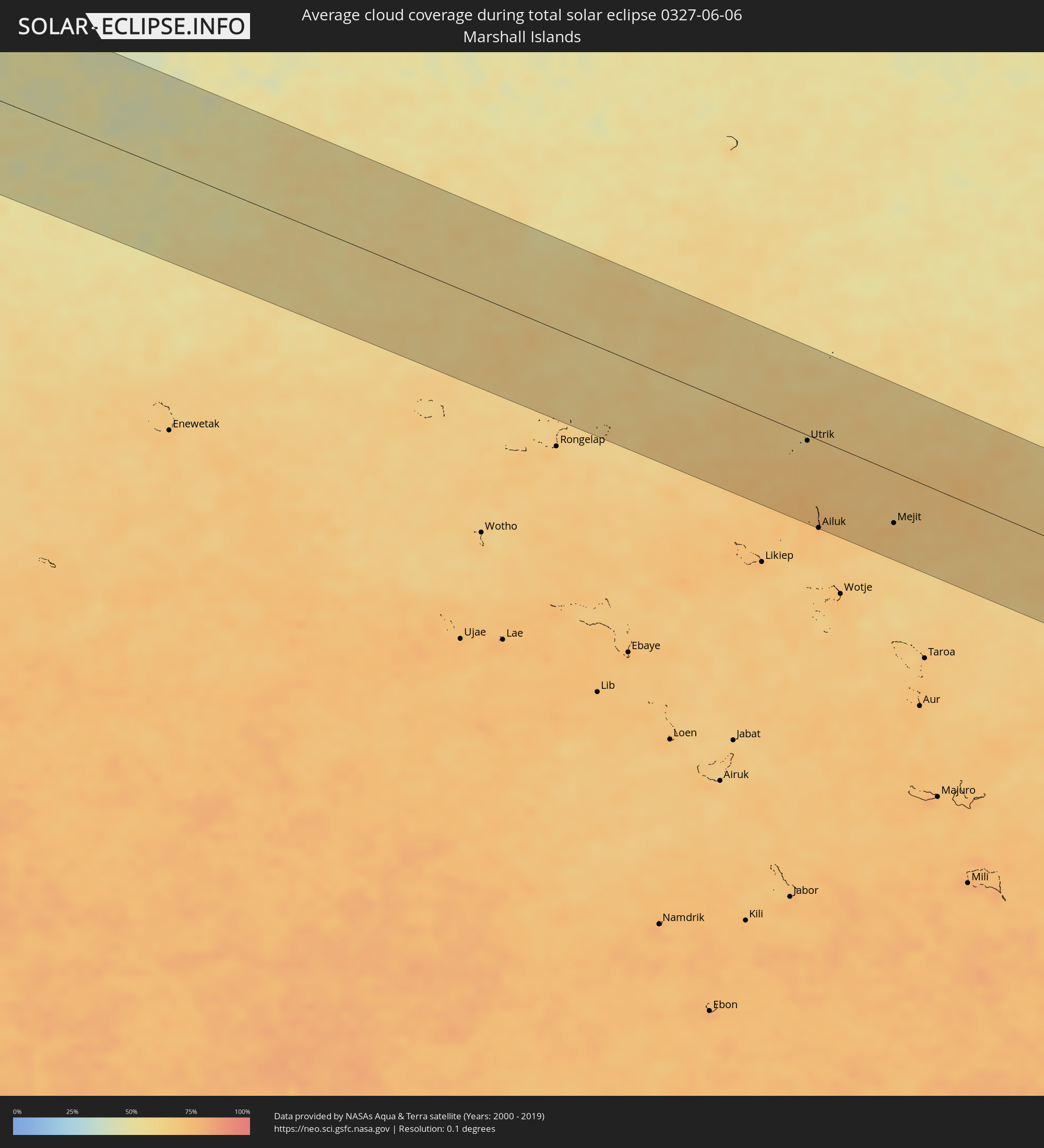 Marshallinseln
Orte im Finsternispfad
Die nachfolgene Tabelle zeigt Städte und Orte mit mehr als 5.000 Einwohnern, die sich im Finsternispfad befinden. Städte mit mehr als 100.000 Einwohnern sind dick gekennzeichnet. Mit einem Klick auf den Ort öffnet sich eine Detailkarte die die Lage des jeweiligen Ortes zusammen mit dem Verlauf der zentralen Finsternis präsentiert.
| Ort | Typ | Dauer der Verfinsterung | Ortszeit bei maximaler Verfinsterung | Entfernung zur Zentrallinie | Ø Bewölkung |
|
Hell-Ville, Diana
|
total | - | 05:33:59 UTC+02:27 | 16 km | 23% |
|
Ambanja, Diana
|
total | - | 05:33:55 UTC+02:27 | 21 km | 28% |
|
Antsohimbondrona, Diana
|
total | - | 05:34:01 UTC+02:27 | 23 km | 36% |
|
Ambarakaraka, Diana
|
total | - | 05:33:55 UTC+02:27 | 20 km | 36% |
|
Ambilobe, Diana
|
total | - | 05:33:59 UTC+02:27 | 2 km | 39% |
|
Antsiranana, Diana
|
total | - | 05:34:12 UTC+02:27 | 85 km | 39% |
|
Sadjoavato, Diana
|
total | - | 05:34:06 UTC+02:27 | 48 km | 56% |
|
Thinadhoo, Gaafu Dhaalu Atholhu
|
total | - | 08:16:39 UTC+04:54 | 68 km | 73% |
|
Hithadhoo
|
total | - | 08:15:42 UTC+04:54 | 43 km | 77% |
|
Fuvahmulah, Gnyaviyani Atoll
|
total | - | 08:16:15 UTC+04:54 | 35 km | 74% |
|
Viligili, Gaafu Alifu Atholhu
|
total | - | 08:17:14 UTC+04:54 | 62 km | 70% |
|
Galle, Southern
|
total | - | 08:55:29 UTC+05:19 | 121 km | 76% |
|
Weligama, Southern
|
total | - | 08:55:41 UTC+05:19 | 102 km | 78% |
|
Matara, Southern
|
total | - | 08:55:47 UTC+05:19 | 93 km | 76% |
|
Tangalla, Southern
|
total | - | 08:56:12 UTC+05:19 | 83 km | 80% |
|
Wattegama, Uva
|
total | - | 08:58:02 UTC+05:19 | 110 km | 74% |
|
Bogale, Ayeyarwady
|
total | - | 10:40:37 UTC+06:24 | 127 km | 98% |
|
Pyapon, Ayeyarwady
|
total | - | 10:41:13 UTC+06:24 | 110 km | 97% |
|
Kyaiklat, Ayeyarwady
|
total | - | 10:41:33 UTC+06:24 | 123 km | 97% |
|
Syriam, Yangon
|
total | - | 10:43:09 UTC+06:24 | 125 km | 98% |
|
Thongwa, Yangon
|
total | - | 10:43:46 UTC+06:24 | 109 km | 98% |
|
Kayan, Yangon
|
total | - | 10:44:03 UTC+06:24 | 121 km | 98% |
|
Thaton, Mon
|
total | - | 10:45:53 UTC+06:24 | 78 km | 96% |
|
Kyaikkami, Mon
|
total | - | 10:45:09 UTC+06:24 | 13 km | 90% |
|
Martaban, Mon
|
total | - | 10:45:54 UTC+06:24 | 28 km | 95% |
|
Mawlamyine, Mon
|
total | - | 10:45:53 UTC+06:24 | 23 km | 95% |
|
Hpa-an, Kayin
|
total | - | 10:46:27 UTC+06:24 | 61 km | 96% |
|
Mudon, Mon
|
total | - | 10:45:46 UTC+06:24 | 5 km | 95% |
|
Myawadi, Kayin
|
total | - | 10:48:12 UTC+06:24 | 4 km | 95% |
|
Mae Sot, Tak
|
total | - | 11:05:39 UTC+06:42 | 5 km | 94% |
|
Tak, Tak
|
total | - | 11:07:12 UTC+06:42 | 19 km | 89% |
|
Lampang, Lampang
|
total | - | 11:10:00 UTC+06:42 | 101 km | 94% |
|
Kamphaeng Phet, Kamphaeng Phet
|
total | - | 11:07:37 UTC+06:42 | 77 km | 92% |
|
Ban Na, Sukhothai
|
total | - | 11:08:51 UTC+06:42 | 36 km | 95% |
|
Si Satchanalai, Sukhothai
|
total | - | 11:09:35 UTC+06:42 | 12 km | 95% |
|
Sawankhalok, Sukhothai
|
total | - | 11:09:29 UTC+06:42 | 11 km | 96% |
|
Uttaradit, Uttaradit
|
total | - | 11:10:32 UTC+06:42 | 6 km | 96% |
|
Phrae, Phrae
|
total | - | 11:11:21 UTC+06:42 | 55 km | 94% |
|
Phitsanulok, Phitsanulok
|
total | - | 11:09:52 UTC+06:42 | 81 km | 96% |
|
Phichit, Phichit
|
total | - | 11:09:34 UTC+06:42 | 123 km | 96% |
|
Nan, Nan
|
total | - | 11:13:44 UTC+06:42 | 86 km | 93% |
|
Sainyabuli, Xiagnabouli
|
total | - | 11:16:38 UTC+06:42 | 89 km | 92% |
|
Loei, Loei
|
total | - | 11:14:23 UTC+06:42 | 88 km | 94% |
|
Na Klang, Changwat Nong Bua Lamphu
|
total | - | 11:15:19 UTC+06:42 | 128 km | 95% |
|
Muang Phôn-Hông, Vientiane Province
|
total | - | 11:17:25 UTC+06:42 | 20 km | 94% |
|
Vangviang, Vientiane Province
|
total | - | 11:18:02 UTC+06:42 | 22 km | 93% |
|
Tha Bo, Nong Khai
|
total | - | 11:17:01 UTC+06:42 | 92 km | 93% |
|
Vientiane, Vientiane
|
total | - | 11:17:13 UTC+06:42 | 81 km | 95% |
|
Nong Khai, Nong Khai
|
total | - | 11:17:28 UTC+06:42 | 97 km | 93% |
|
Muang Phônsavan, Xiangkhoang
|
total | - | 11:20:38 UTC+06:42 | 40 km | 91% |
|
Muang Pakxan, Bolikhamsai Province
|
total | - | 11:20:27 UTC+06:42 | 87 km | 91% |
|
Xam Nua, Houaphan
|
total | - | 11:23:54 UTC+06:42 | 102 km | 93% |
|
Thành Phố Hòa Bình, Hòa Bình
|
total | - | 11:52:15 UTC+07:06 | 90 km | 85% |
|
Sơn Tây, Ha Nội
|
total | - | 11:53:03 UTC+07:06 | 117 km | 90% |
|
Thanh Hóa, Thanh Hóa
|
total | - | 11:52:13 UTC+07:06 | 32 km | 88% |
|
Hà Đông, Ha Nội
|
total | - | 11:53:33 UTC+07:06 | 89 km | 91% |
|
Hanoi, Ha Nội
|
total | - | 11:53:46 UTC+07:06 | 92 km | 91% |
|
Bỉm Sơn, Thanh Hóa
|
total | - | 11:52:47 UTC+07:06 | 7 km | 90% |
|
Bắc Ninh, Bắc Ninh
|
total | - | 11:54:33 UTC+07:06 | 99 km | 90% |
|
Thành Phố Nam Định, Nam Định
|
total | - | 11:54:00 UTC+07:06 | 18 km | 83% |
|
Bắc Giang, Bắc Giang
|
total | - | 11:54:57 UTC+07:06 | 104 km | 90% |
|
Thành Phố Hải Dương, Hải Dương
|
total | - | 11:54:57 UTC+07:06 | 64 km | 91% |
|
Thành Phố Thái Bình, Thái Bình
|
total | - | 11:54:27 UTC+07:06 | 13 km | 85% |
|
Haiphong, Hải Phòng
|
total | - | 11:55:47 UTC+07:06 | 43 km | 91% |
|
Thành Phố Uông Bí, Quảng Ninh
|
total | - | 11:56:12 UTC+07:06 | 58 km | 90% |
|
Thành Phố Hạ Long, Quảng Ninh
|
total | - | 11:56:54 UTC+07:06 | 38 km | 89% |
|
Cẩm Phả Mines, Quảng Ninh
|
total | - | 11:57:34 UTC+07:06 | 36 km | 90% |
|
Móng Cái, Quảng Ninh
|
total | - | 11:59:49 UTC+07:06 | 66 km | 86% |
|
Beihai, Guangxi Zhuang Autonomous Region
|
total | - | 12:56:06 UTC+08:00 | 24 km | 81% |
|
Zhanjiang, Guangdong
|
total | - | 12:59:14 UTC+08:00 | 37 km | 92% |
|
Zhongshan, Guangdong
|
total | - | 12:59:53 UTC+08:00 | 39 km | 85% |
|
Yangjiang, Guangdong
|
total | - | 13:04:03 UTC+08:00 | 21 km | 87% |
|
Yunfu, Guangdong
|
total | - | 13:05:05 UTC+08:00 | 93 km | 92% |
|
Zhaoqing, Guangdong
|
total | - | 13:06:16 UTC+08:00 | 95 km | 92% |
|
Jiangmen, Guangdong
|
total | - | 13:07:34 UTC+08:00 | 30 km | 93% |
|
Foshan, Guangdong
|
total | - | 13:08:00 UTC+08:00 | 77 km | 92% |
|
Guangzhou, Guangdong
|
total | - | 13:08:22 UTC+08:00 | 84 km | 94% |
|
Shiqi, Guangdong
|
total | - | 13:08:19 UTC+08:00 | 15 km | 94% |
|
Macau, Macau
|
total | - | 12:42:42 UTC+07:34 | 23 km | 89% |
|
Zhuhai, Guangdong
|
total | - | 13:08:39 UTC+08:00 | 15 km | 81% |
|
Dongguan, Guangdong
|
total | - | 13:09:37 UTC+08:00 | 62 km | 93% |
|
Tung Chung, Islands
|
total | - | 12:46:21 UTC+07:36 | 22 km | 84% |
|
Tuen Mun, Tuen Mun
|
total | - | 12:46:29 UTC+07:36 | 11 km | 84% |
|
Yuen Long Kau Hui, Yuen Long
|
total | - | 12:46:41 UTC+07:36 | 6 km | 88% |
|
Shenzhen, Guangdong
|
total | - | 13:10:09 UTC+08:00 | 3 km | 91% |
|
Tsuen Wan, Tsuen Wan
|
total | - | 12:46:50 UTC+07:36 | 17 km | 88% |
|
Yung Shue Wan
|
total | - | 12:46:45 UTC+07:36 | 33 km | 75% |
|
Hong Kong, Central and Western
|
total | - | 12:46:55 UTC+07:36 | 27 km | 86% |
|
Central, Central and Western
|
total | - | 12:46:55 UTC+07:36 | 27 km | 86% |
|
Sham Shui Po, Sham Shui Po
|
total | - | 12:46:57 UTC+07:36 | 22 km | 86% |
|
Tai Po, Tai Po
|
total | - | 12:47:03 UTC+07:36 | 9 km | 89% |
|
Wan Chai, Wanchai
|
total | - | 12:46:57 UTC+07:36 | 28 km | 86% |
|
Wong Tai Sin, Wong Tai Sin
|
total | - | 12:47:01 UTC+07:36 | 21 km | 88% |
|
Sha Tin, Sha Tin
|
total | - | 12:47:03 UTC+07:36 | 17 km | 88% |
|
Kowloon, Kowloon City
|
total | - | 12:47:00 UTC+07:36 | 24 km | 86% |
|
Sai Kung, Sai Kung
|
total | - | 12:47:16 UTC+07:36 | 19 km | 86% |
|
Jieyang, Guangdong
|
total | - | 13:16:41 UTC+08:00 | 69 km | 91% |
|
Chaozhou, Guangdong
|
total | - | 13:17:24 UTC+08:00 | 77 km | 92% |
|
Shantou, Guangdong
|
total | - | 13:17:30 UTC+08:00 | 44 km | 86% |
|
Magong, Taiwan
|
total | - | 13:24:50 UTC+08:00 | 30 km | 76% |
|
Tainan, Taiwan
|
total | - | 13:26:14 UTC+08:00 | 40 km | 78% |
|
Kaohsiung, Takao
|
total | - | 13:26:23 UTC+08:00 | 82 km | 73% |
|
Yujing, Taiwan
|
total | - | 13:26:53 UTC+08:00 | 27 km | 87% |
|
Douliu, Taiwan
|
total | - | 13:27:14 UTC+08:00 | 37 km | 90% |
|
Nantou, Taiwan
|
total | - | 13:27:35 UTC+08:00 | 59 km | 91% |
|
Taichung, Taiwan
|
total | - | 13:27:41 UTC+08:00 | 85 km | 90% |
|
Zhongxing New Village, Taiwan
|
total | - | 13:27:39 UTC+08:00 | 64 km | 91% |
|
Lugu, Taiwan
|
total | - | 13:27:45 UTC+08:00 | 40 km | 91% |
|
Puli, Taiwan
|
total | - | 13:28:20 UTC+08:00 | 63 km | 82% |
|
Taitung City, Taiwan
|
total | - | 13:28:30 UTC+08:00 | 72 km | 85% |
|
Hualien City, Taiwan
|
total | - | 13:29:52 UTC+08:00 | 60 km | 86% |
|
Ishigaki, Okinawa
|
total | - | 14:35:52 UTC+09:00 | 94 km | 82% |
|
Utrik, Utrik Atoll
|
total | - | 17:31:37 UTC+11:00 | 7 km | 68% |
|
Ailuk, Ailuk Atoll
|
total | - | 17:31:54 UTC+11:00 | 104 km | 73% |
|
Mejit, Mejit Island
|
total | - | 17:31:55 UTC+11:00 | 61 km | 72% |