Totale Sonnenfinsternis vom 24.01.0483
| Wochentag: | Sonntag |
| Maximale Dauer der Verfinsterung: | 04m03s |
| Maximale Breite des Finsternispfades: | 151 km |
| Saroszyklus: | 87 |
| Bedeckungsgrad: | 100% |
| Magnitude: | 1.0446 |
| Gamma: | 0.1763 |
Wo kann man die Sonnenfinsternis vom 24.01.0483 sehen?
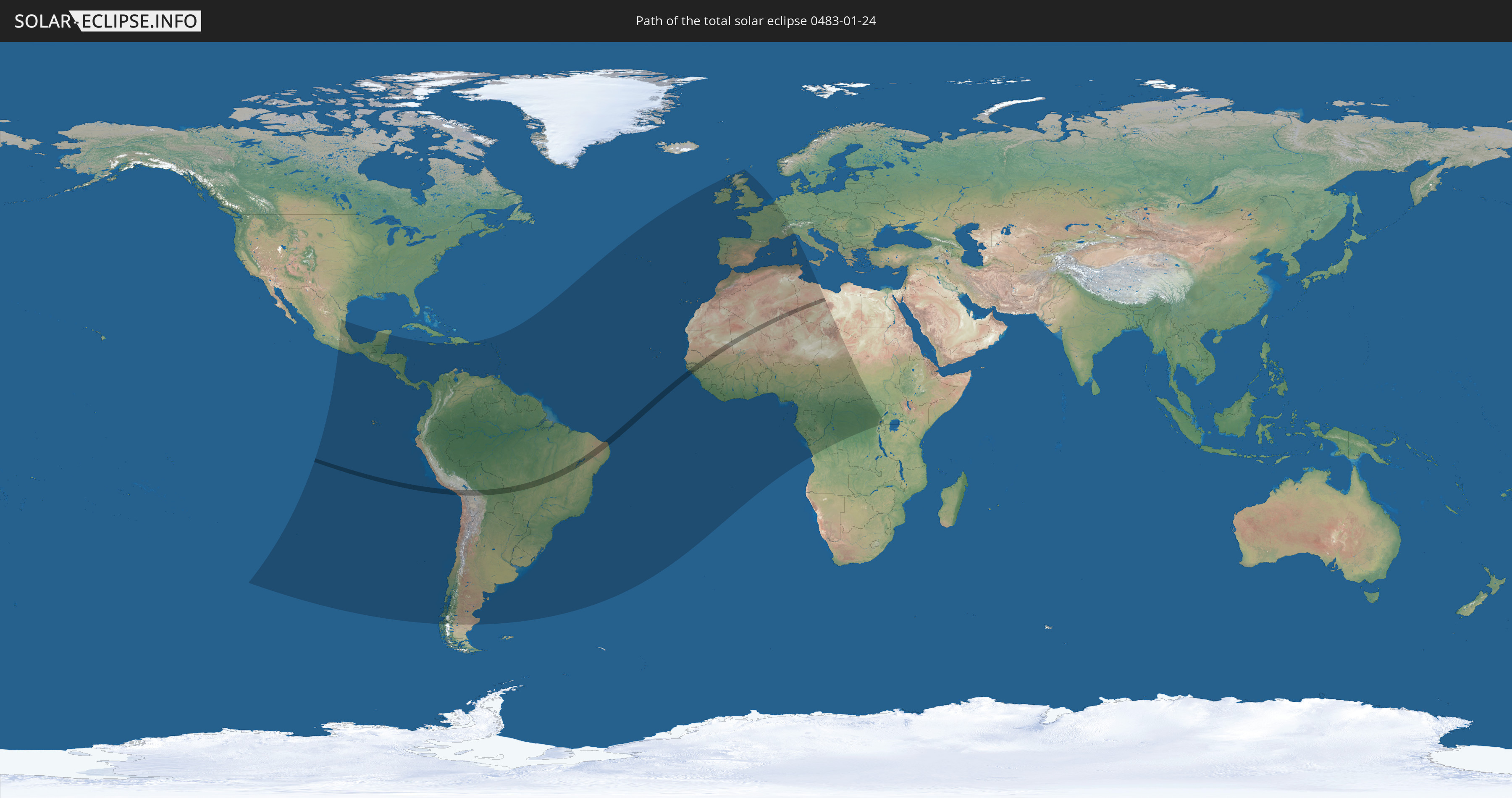
Die Sonnenfinsternis am 24.01.0483 kann man in 90 Ländern als partielle Sonnenfinsternis beobachten.
Der Finsternispfad verläuft durch 12 Länder. Nur in diesen Ländern ist sie als totale Sonnenfinsternis zu sehen.
In den folgenden Ländern ist die Sonnenfinsternis total zu sehen
 Chile
Chile
 Peru
Peru
 Brasilien
 Bolivien
 Senegal
 Mauretanien
 Gambia
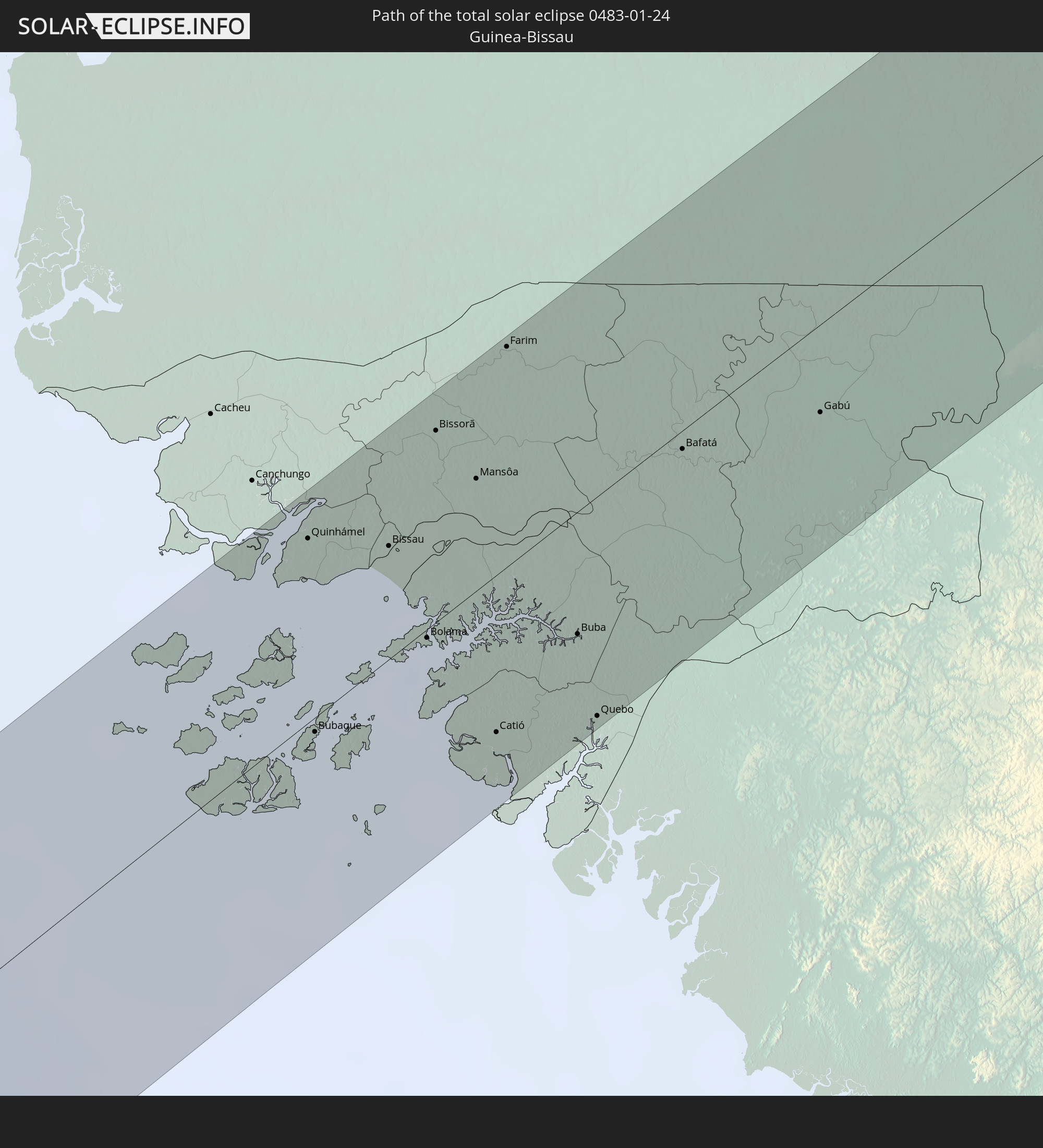 Guinea-Bissau
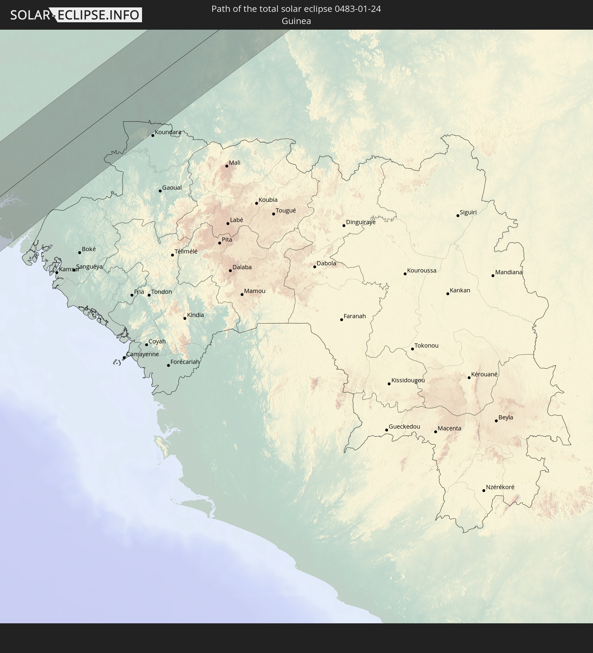 Guinea
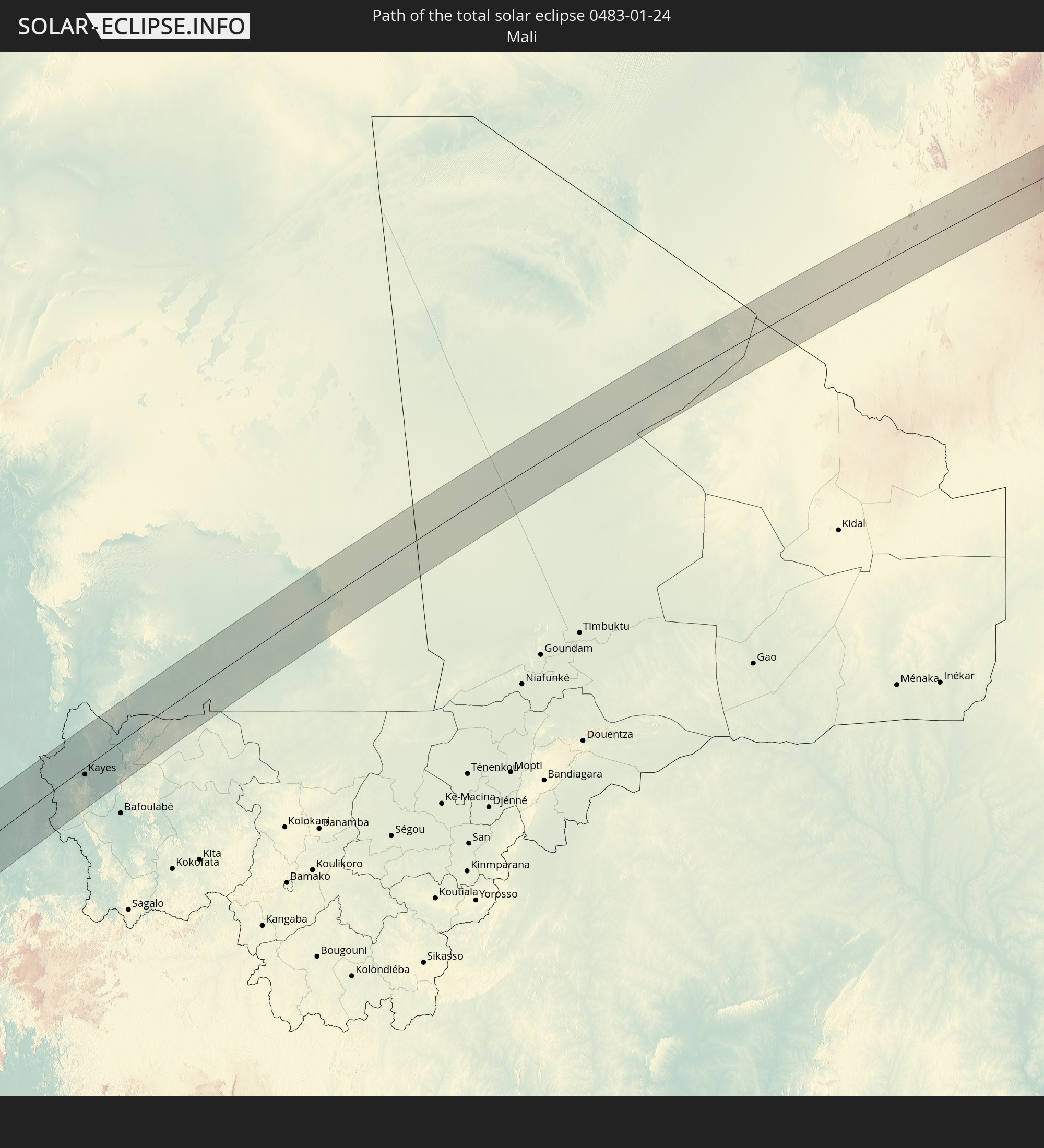 Mali
Mali
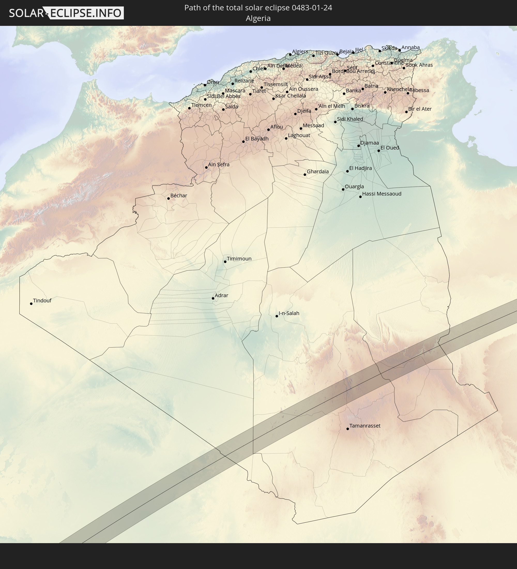 Algerien
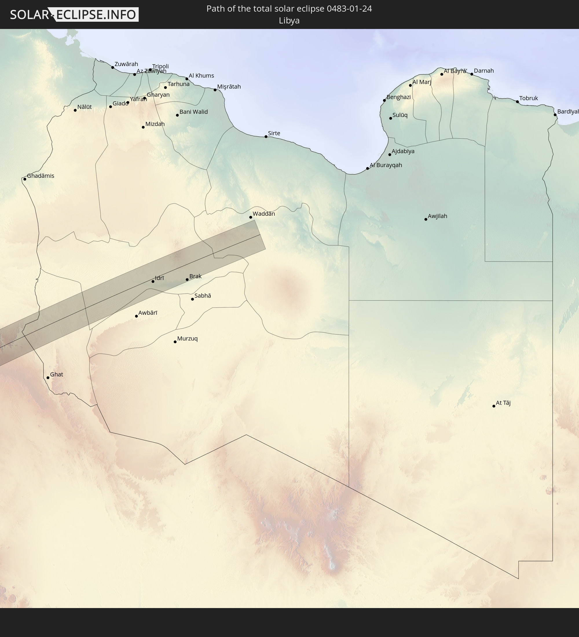 Libyen
In den folgenden Ländern ist die Sonnenfinsternis partiell zu sehen
 Mexiko
 Chile
Chile
 Guatemala
 Ecuador
 El Salvador
 Honduras
 Belize
 Nicaragua
 Costa Rica
 Panama
 Kolumbien
 Peru
Peru
 Jamaika
 Haiti
Haiti
 Brasilien
 Argentinien
 Venezuela
 Dominikanische Republik
 Aruba
Aruba
 Bolivien
 Puerto Rico
 Amerikanische Jungferninseln
 Britische Jungferninseln
 Anguilla
 Saint-Martin
 Saint-Barthélemy
 St. Kitts und Nevis
 Paraguay
 Antigua und Barbuda
 Montserrat
 Trinidad und Tobago
 Guadeloupe
 Grenada
 Dominica
 St. Vincent und die Grenadinen
 Guyana
 Martinique
 St. Lucia
 Barbados
 Uruguay
 Suriname
 Französisch-Guayana
 Portugal
 Kap Verde
 Spanien
 Senegal
 Mauretanien
 Gambia
 Guinea-Bissau
 Guinea
 St. Helena
 Sierra Leone
 Marokko
 Mali
Mali
 Liberia
 Irland
 Algerien
 Vereinigtes Königreich
 Elfenbeinküste
 Burkina Faso
 Gibraltar
 Frankreich
 Isle of Man
 Ghana
Ghana
 Guernsey
 Jersey
 Togo
Togo
 Niger
Niger
 Benin
Benin
 Andorra
 Belgien
 Nigeria
 Niederlande
 Äquatorialguinea
 Luxemburg
 Schweiz
 São Tomé und Príncipe
 Italien
 Monaco
 Tunesien
 Kamerun
 Gabun
Gabun
 Libyen
 Republik Kongo
 Angola
 Demokratische Republik Kongo
 Tschad
 Zentralafrikanische Republik
 Sudan
Sudan
 Uganda
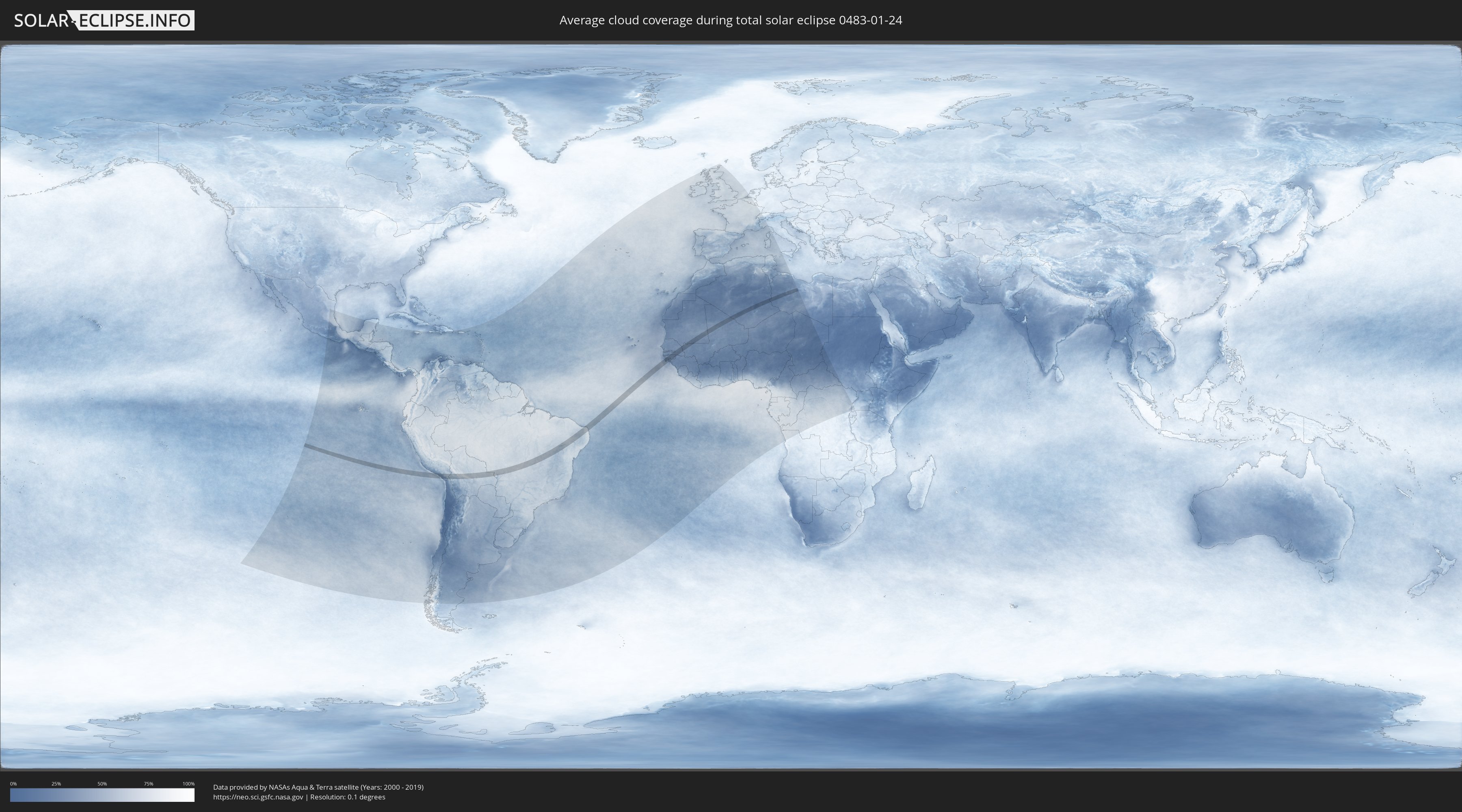
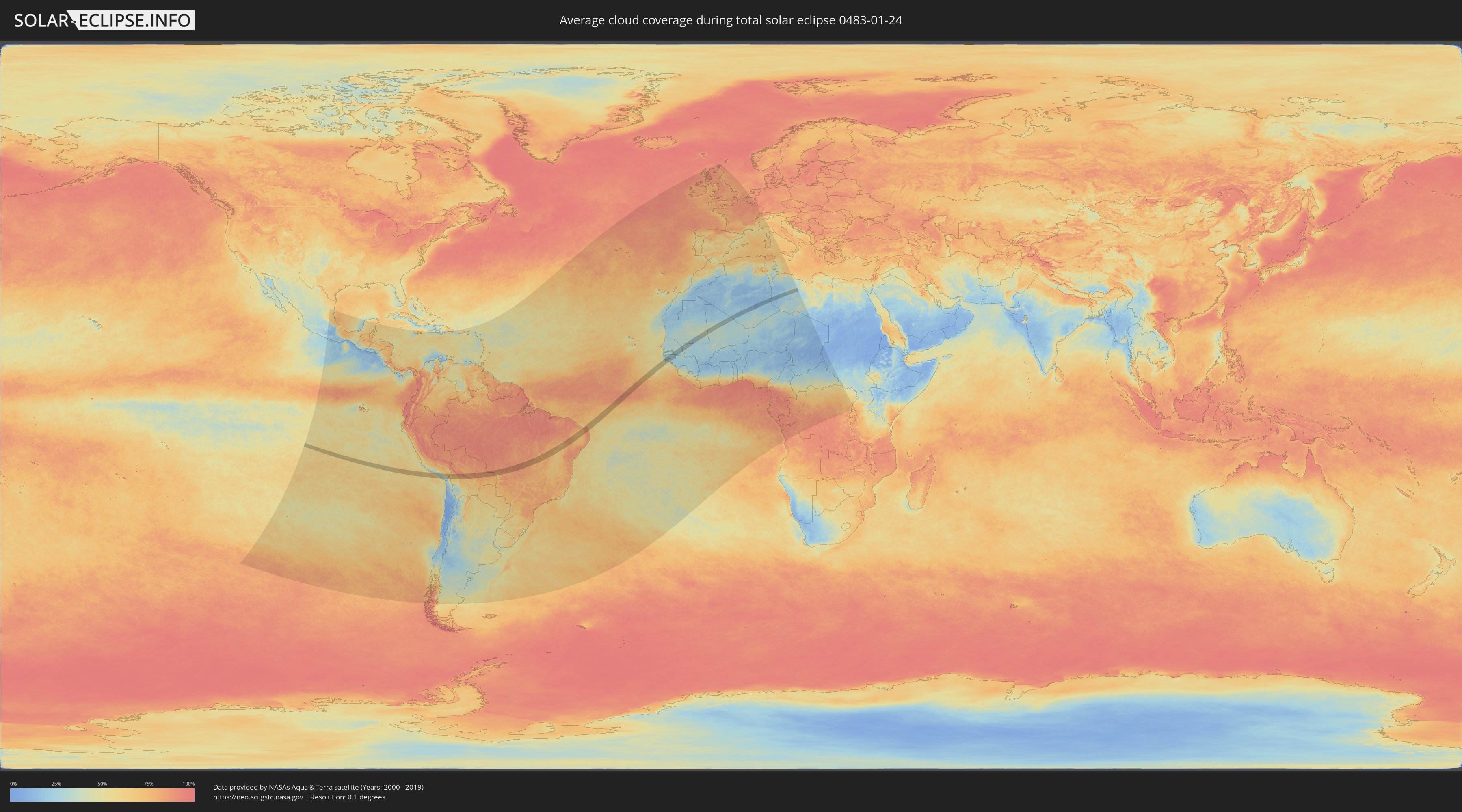
Wie wird das Wetter während der totalen Sonnenfinsternis am 24.01.0483?
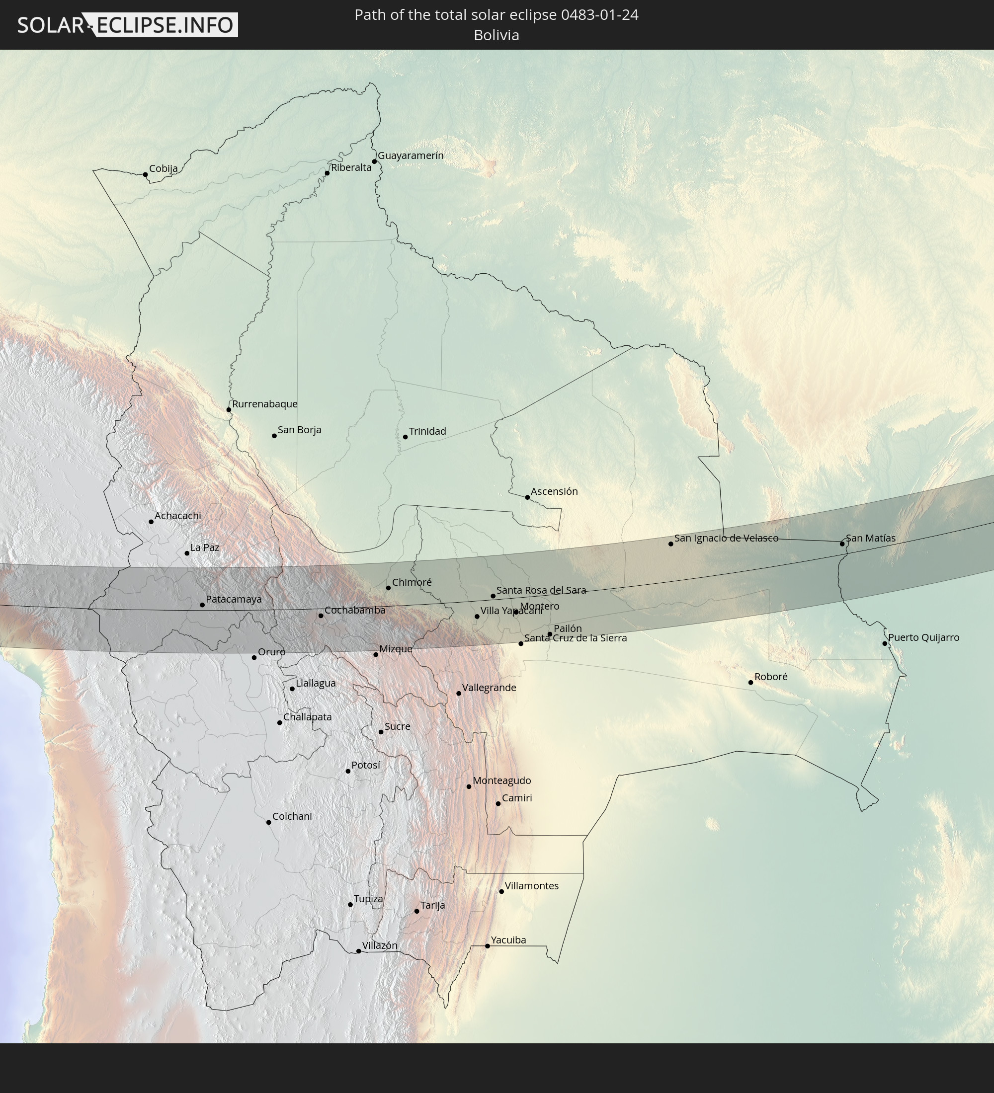
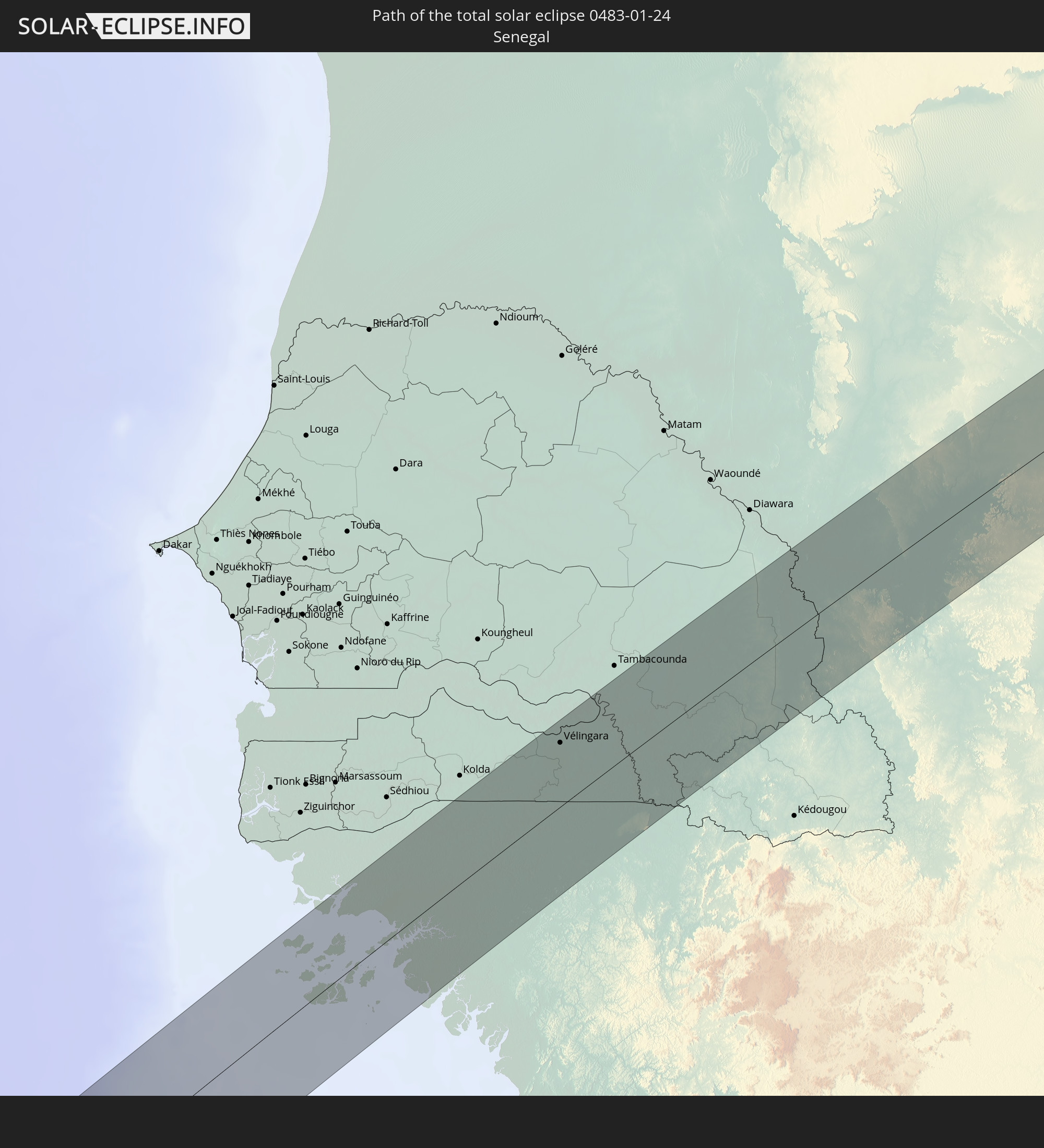
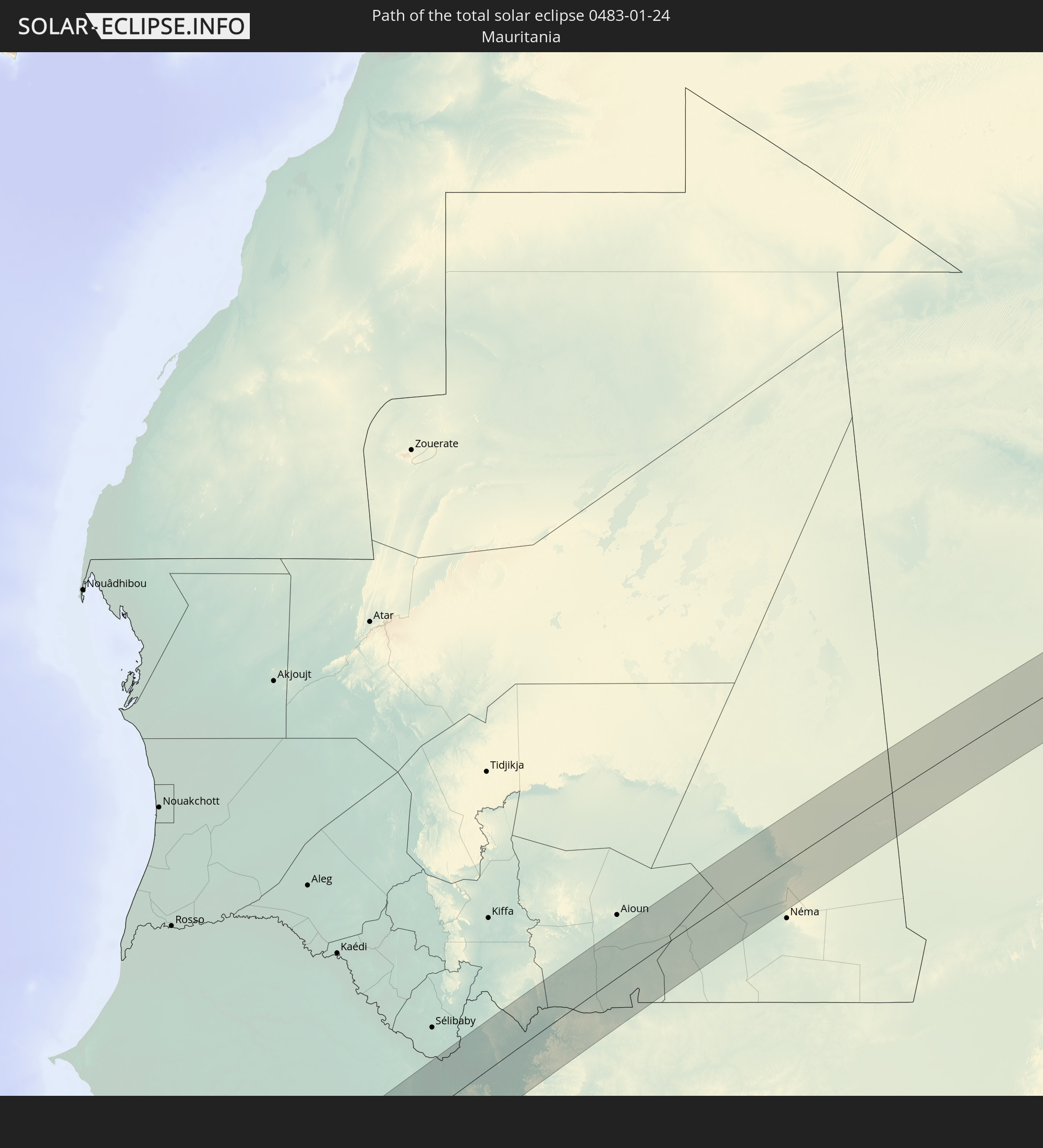
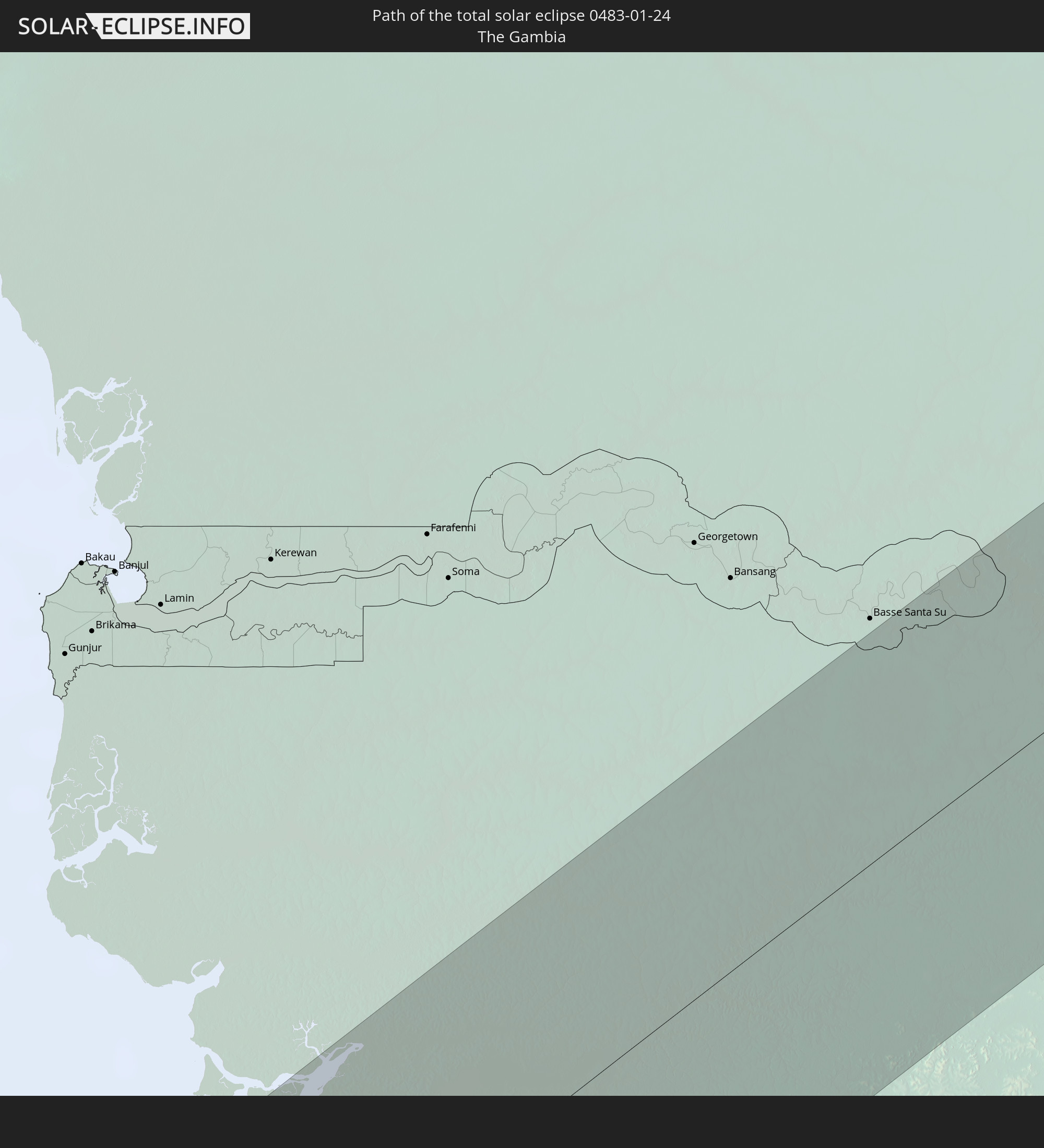
Wo ist der beste Ort, um die totale Sonnenfinsternis vom 24.01.0483 zu beobachten?
Die folgenden Karten zeigen die durchschnittliche Bewölkung für den Tag, an dem die totale Sonnenfinsternis
stattfindet. Mit Hilfe der Karten lässt sich der Ort entlang des Finsternispfades eingrenzen,
der die besten Aussichen auf einen klaren wolkenfreien Himmel bietet.
Trotzdem muss man immer lokale Gegenenheiten beachten und sollte sich genau über das Wetter an seinem
gewählten Beobachtungsort informieren.
Die Daten stammen von den beiden NASA-Satelliten
AQUA und TERRA
und wurden über einen Zeitraum von 19 Jahren (2000 - 2019) gemittelt.
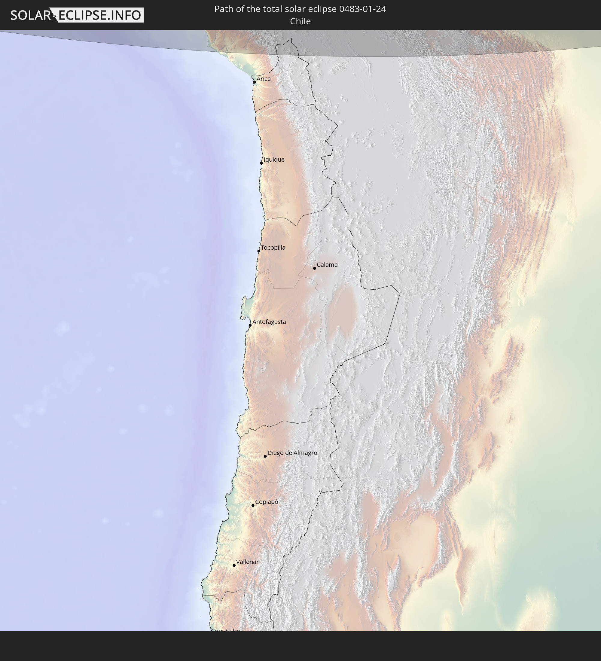
Detaillierte Länderkarten
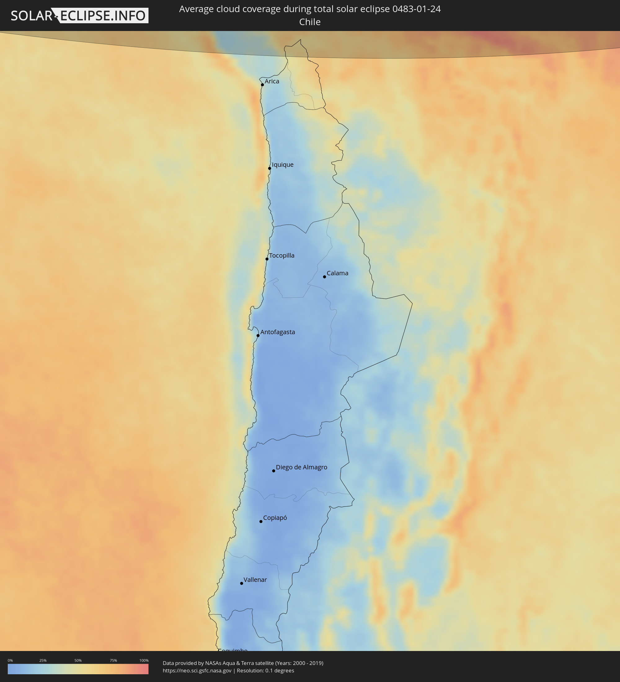 Chile
Chile
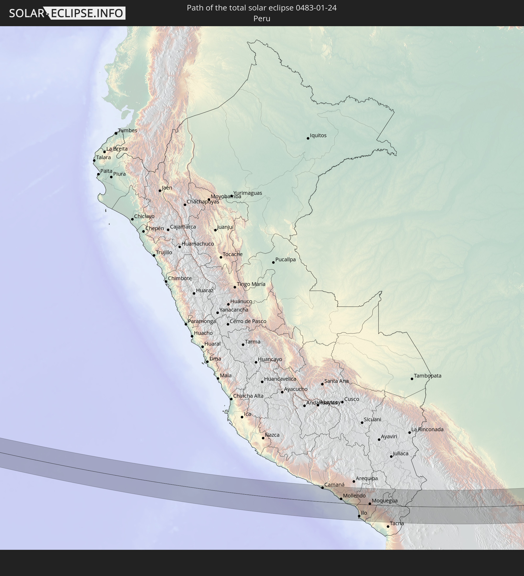
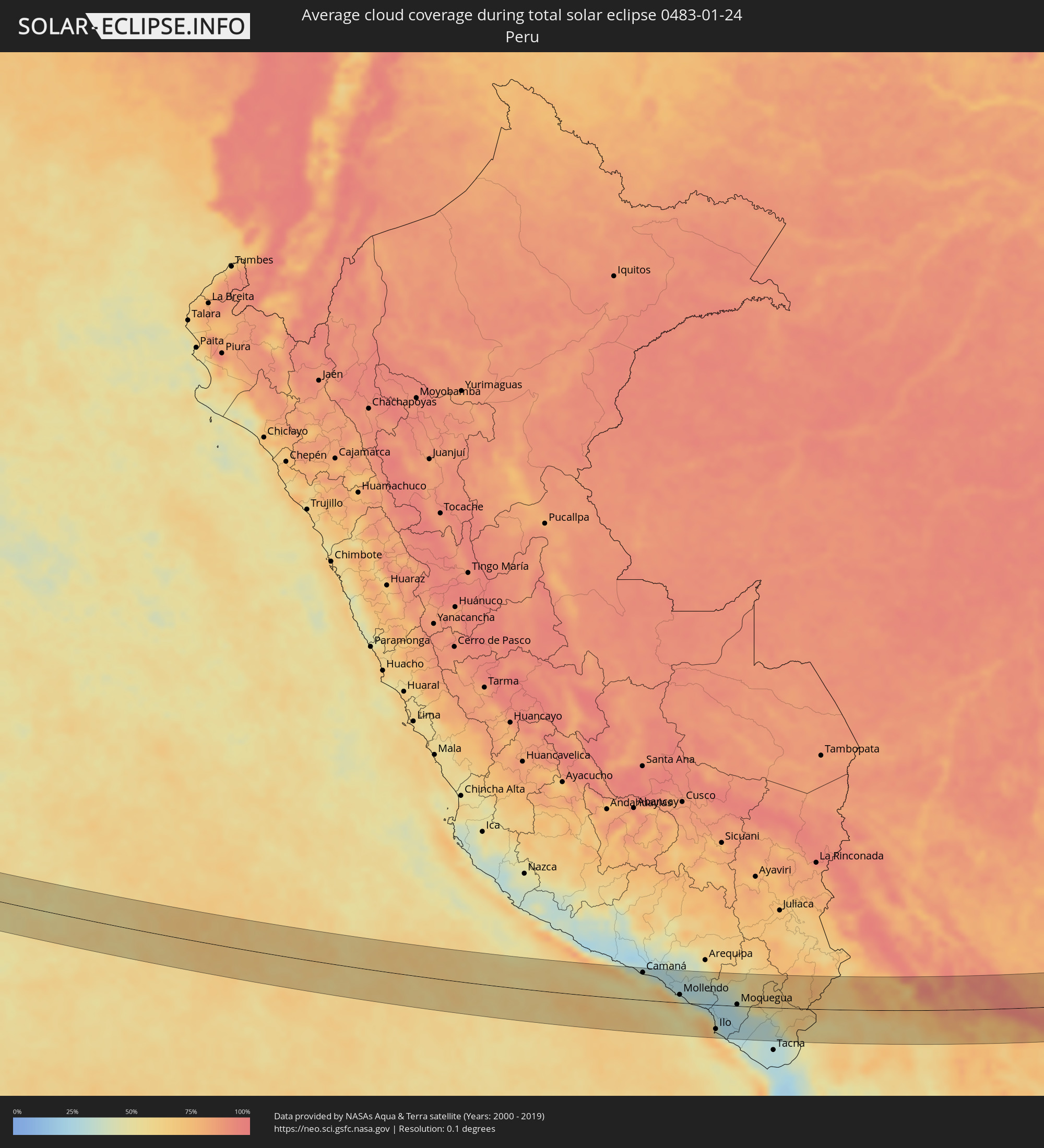 Peru
Peru
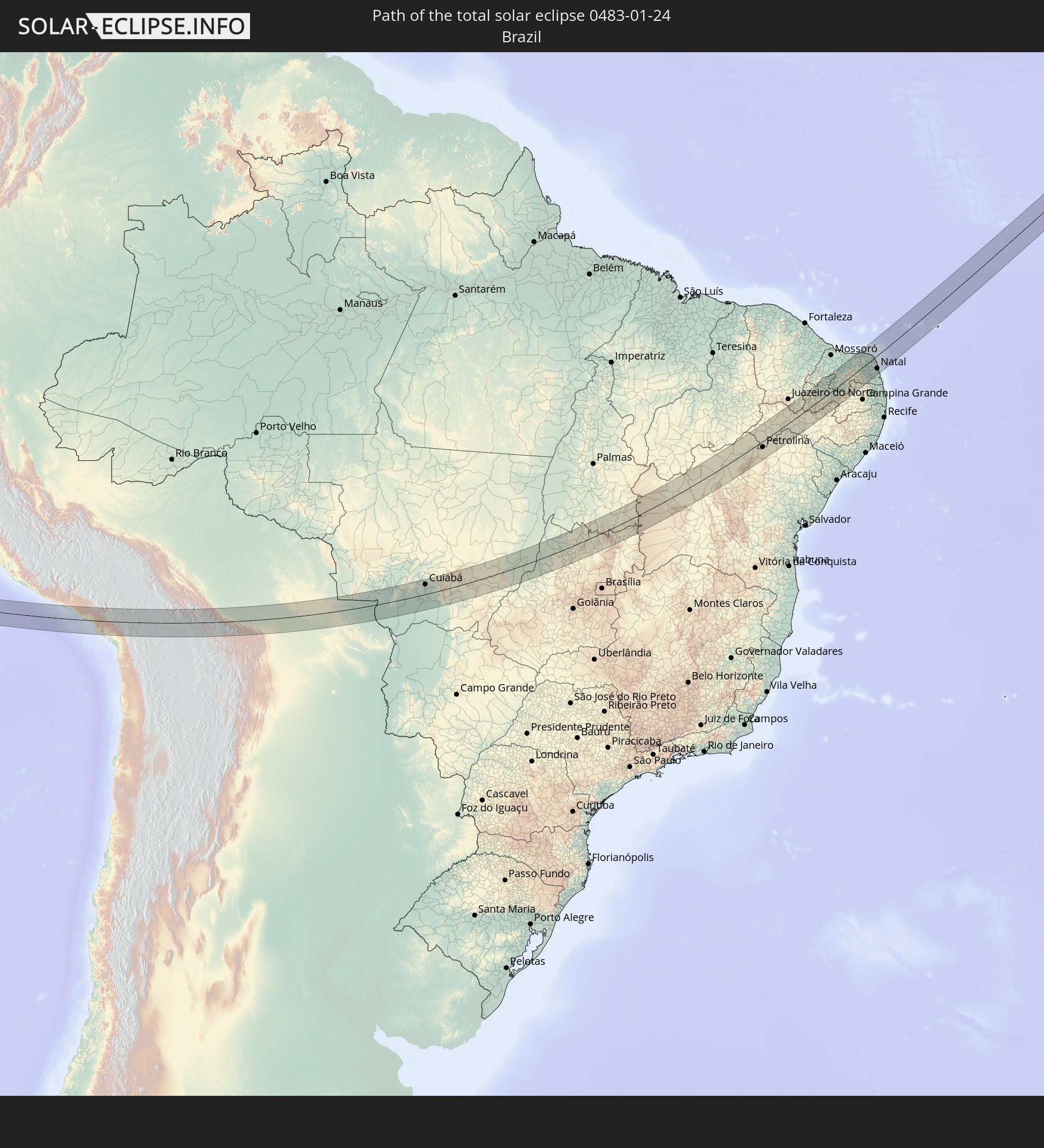
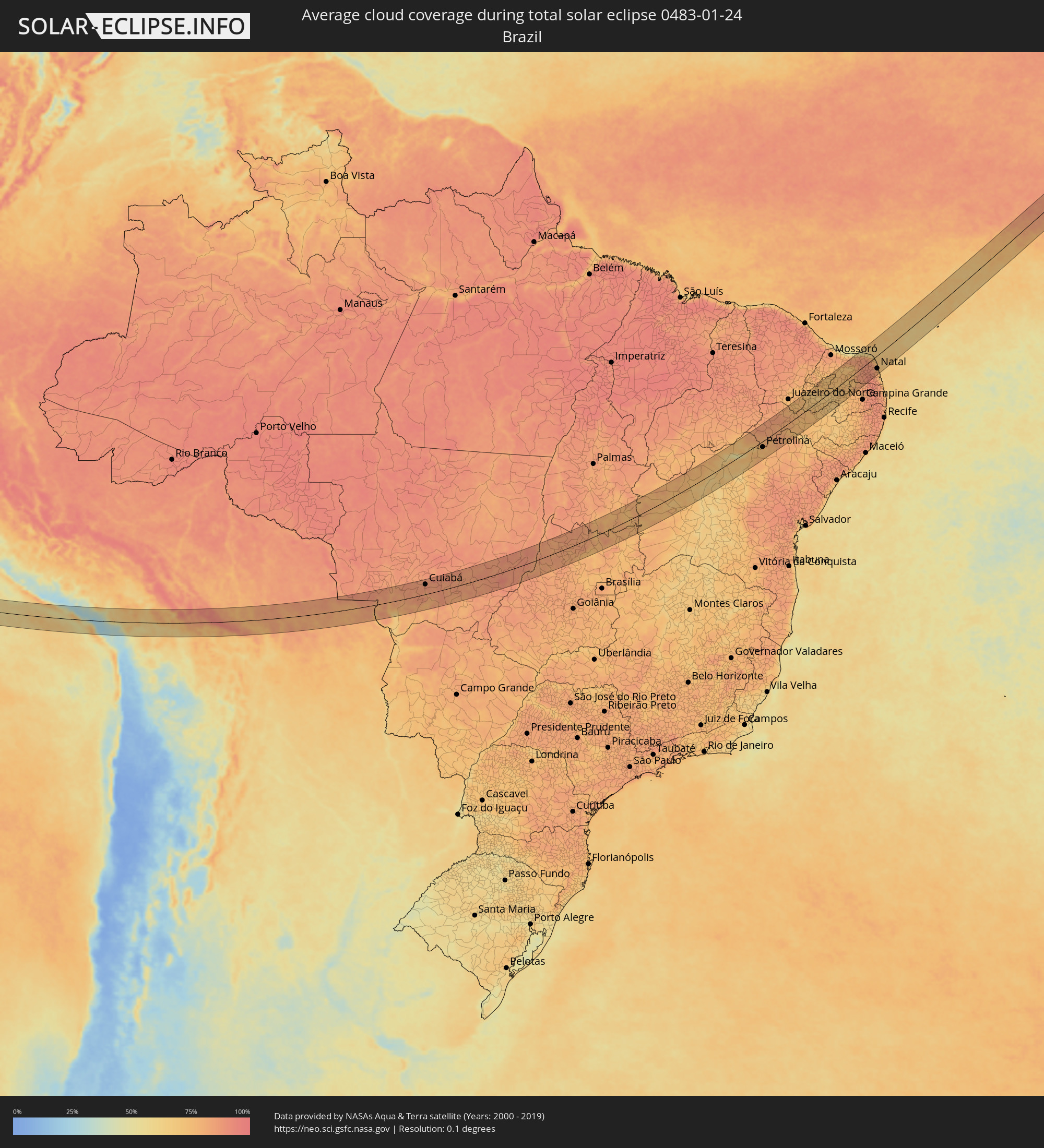 Brasilien
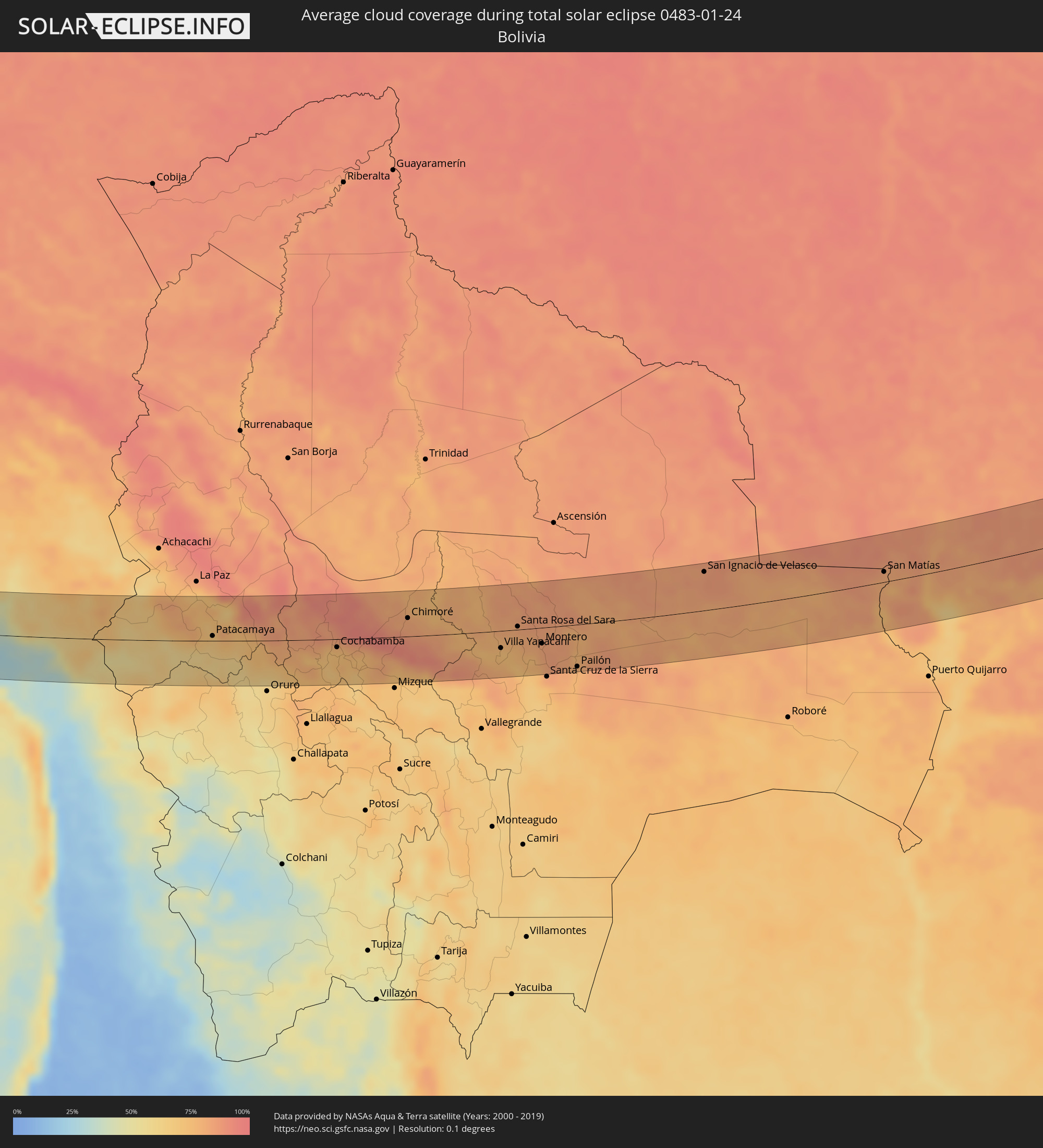 Bolivien
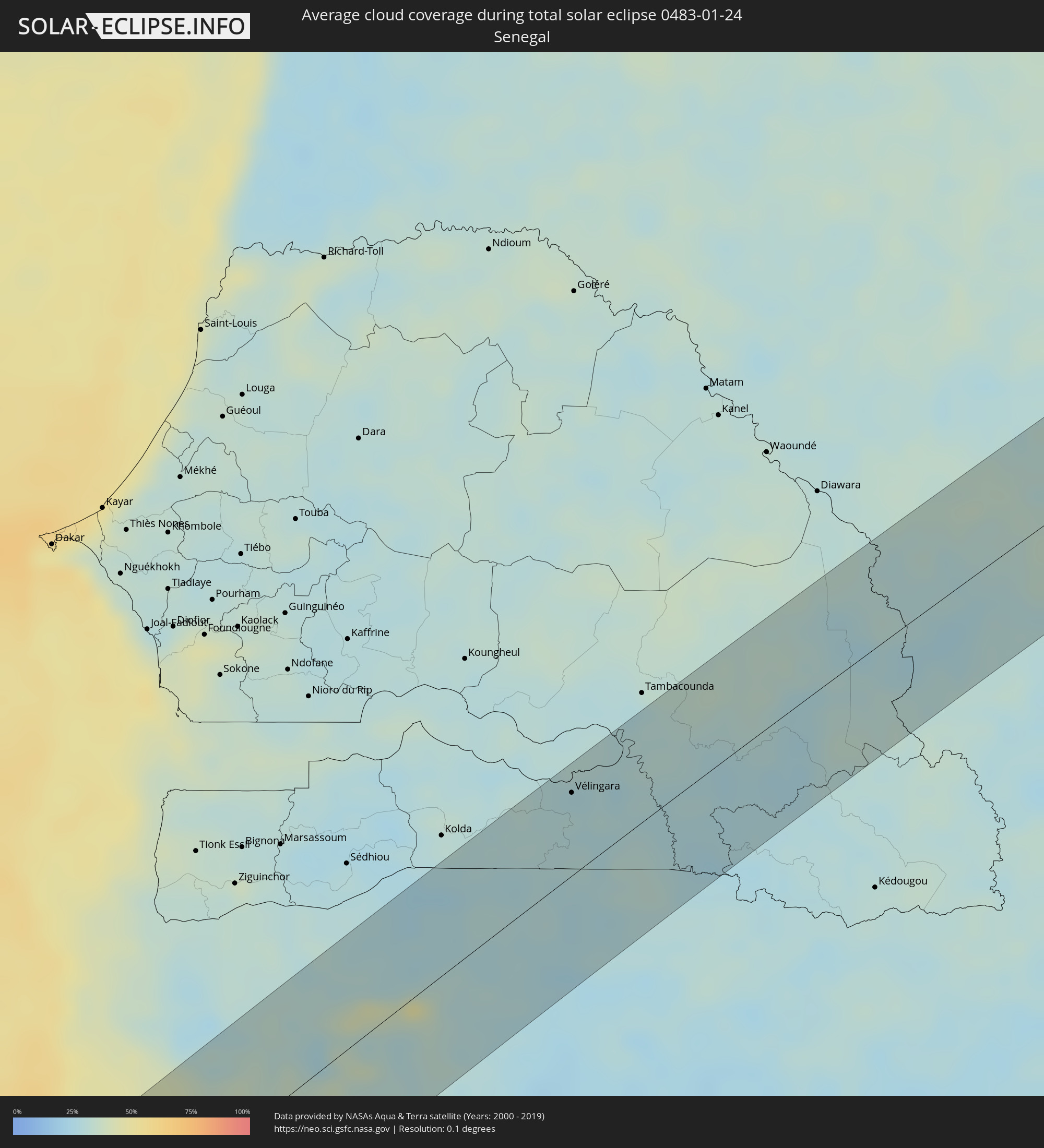 Senegal
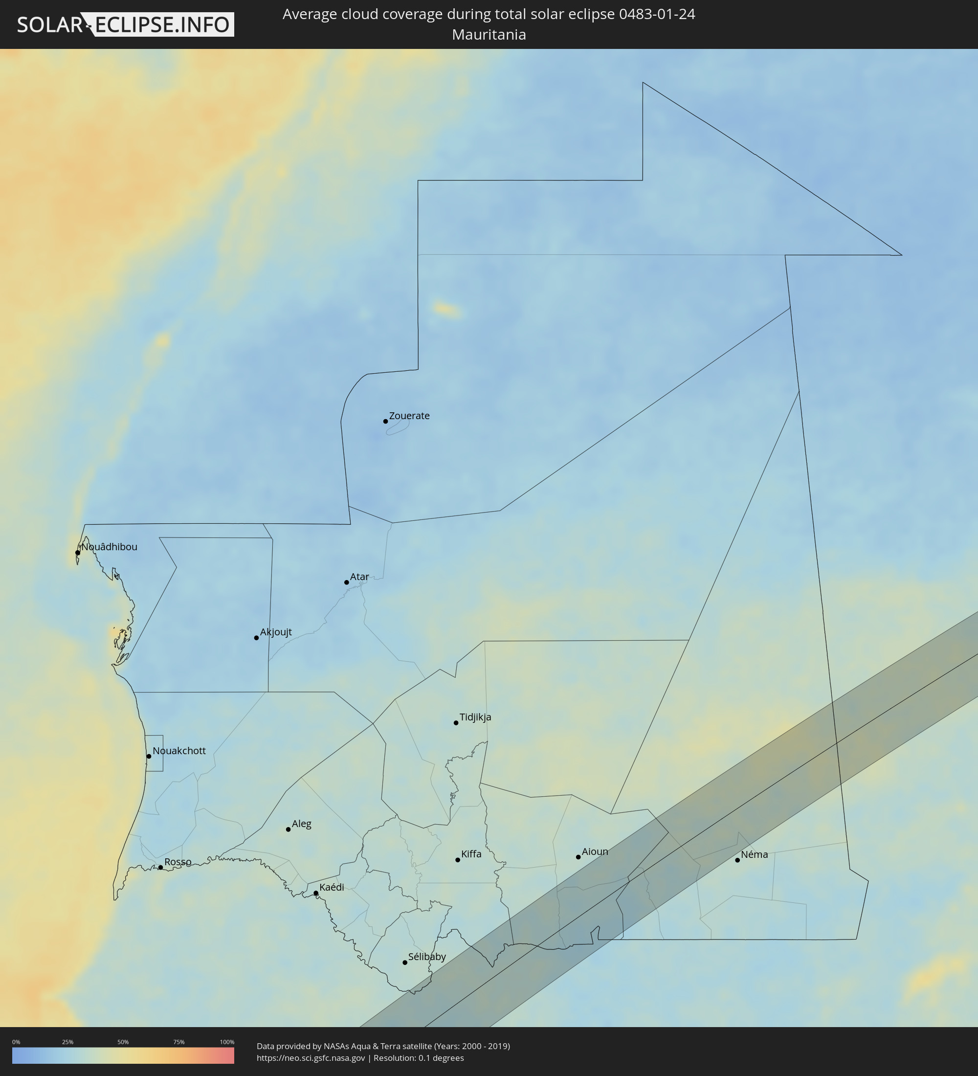 Mauretanien
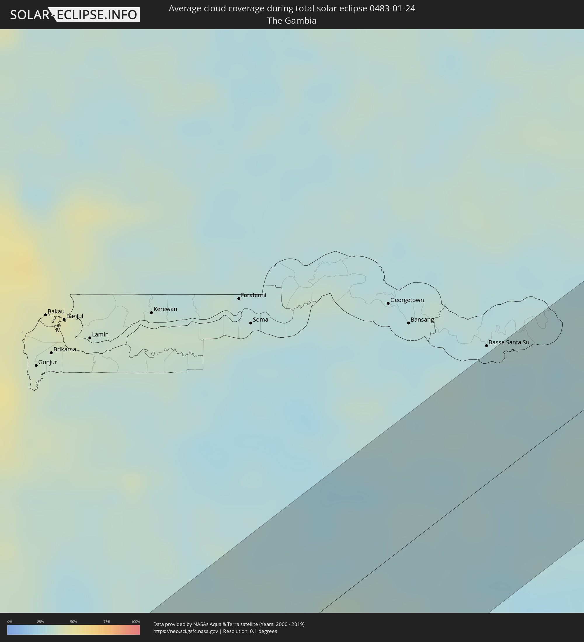 Gambia
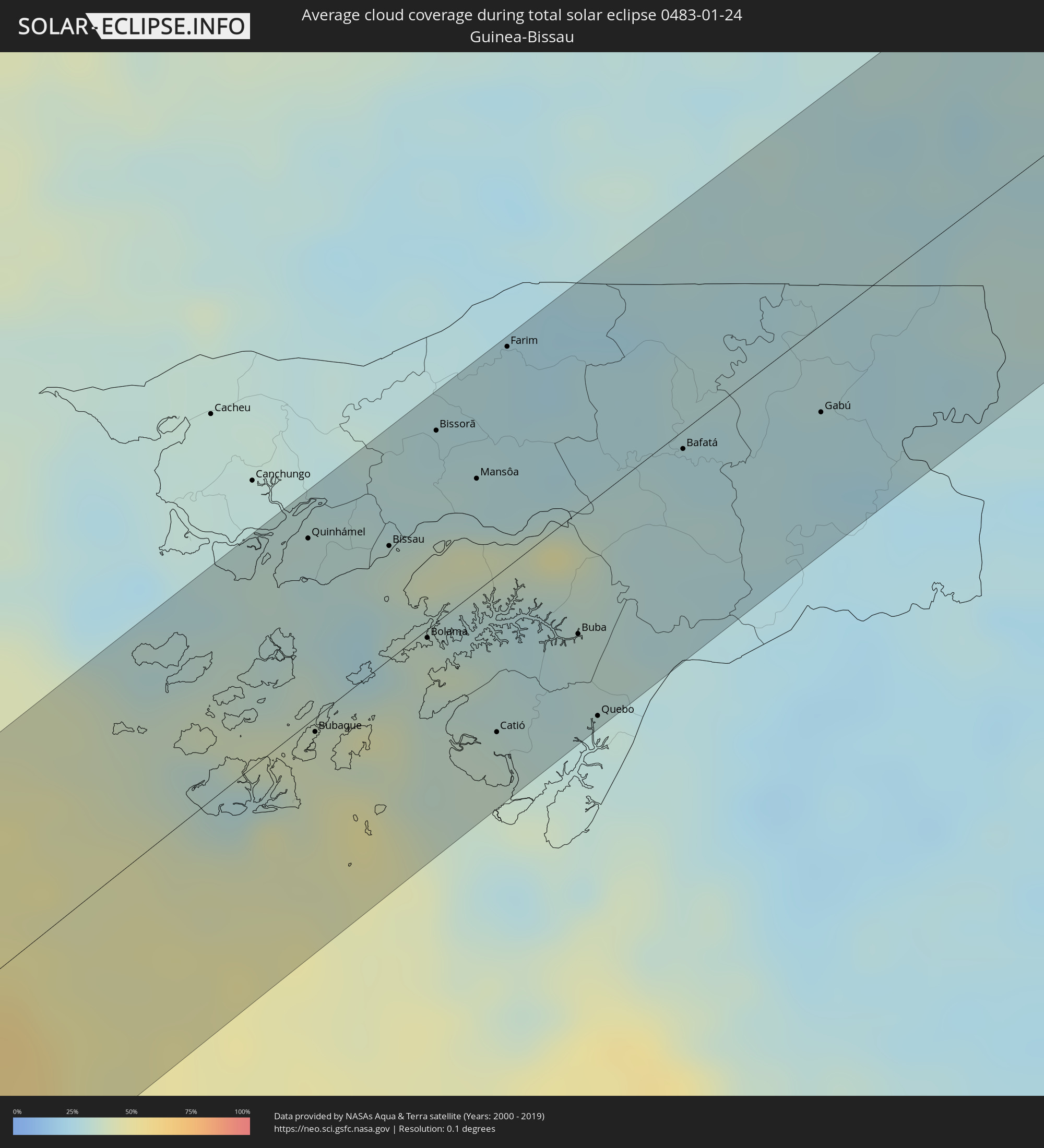 Guinea-Bissau
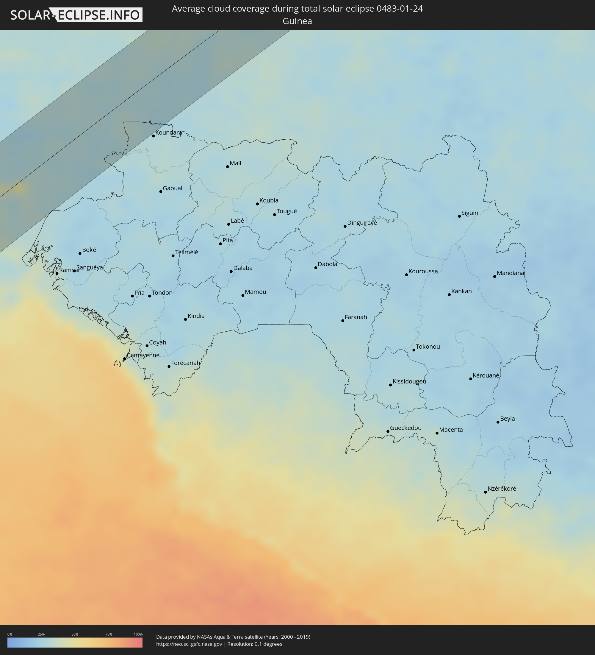 Guinea
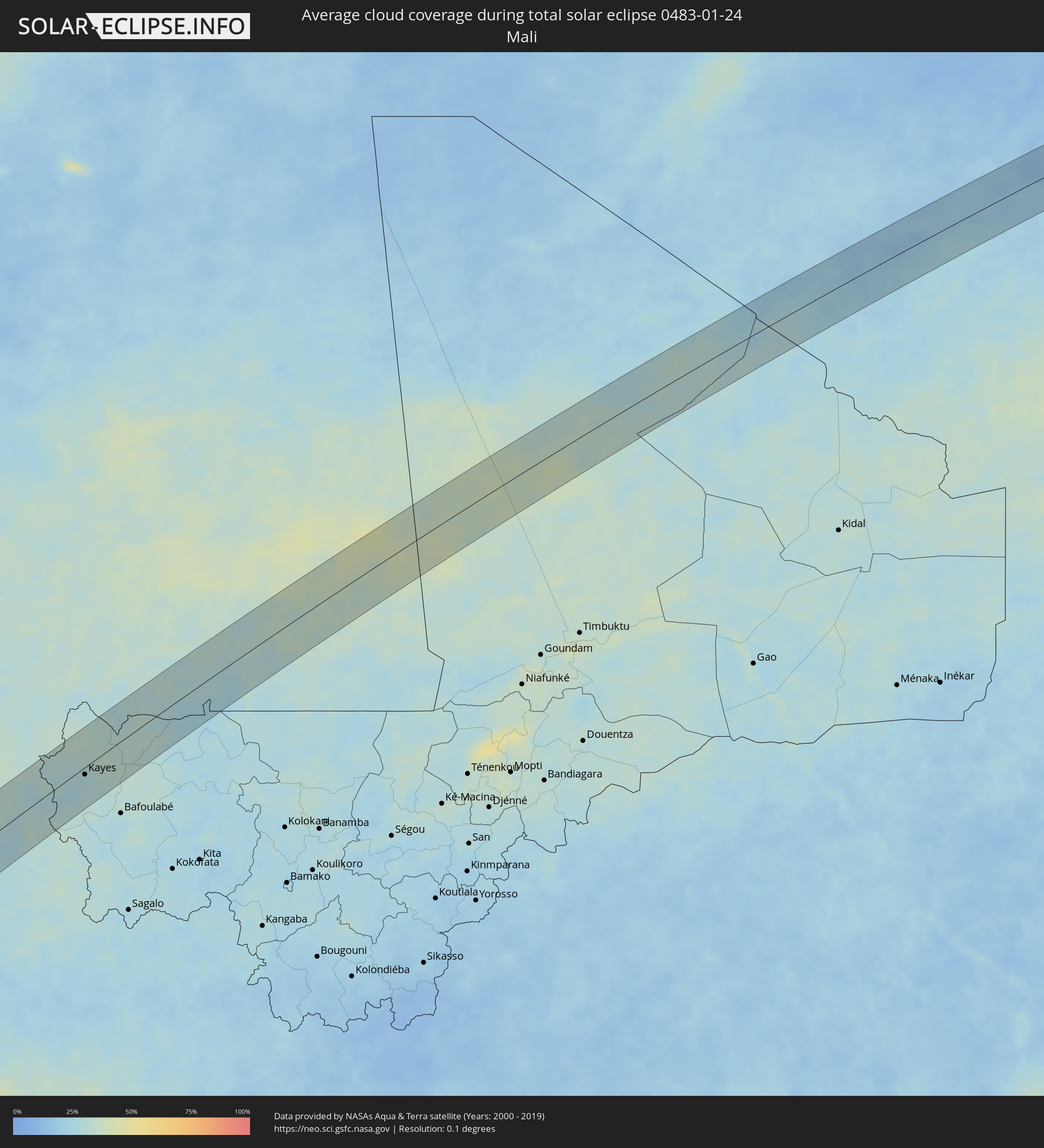 Mali
Mali
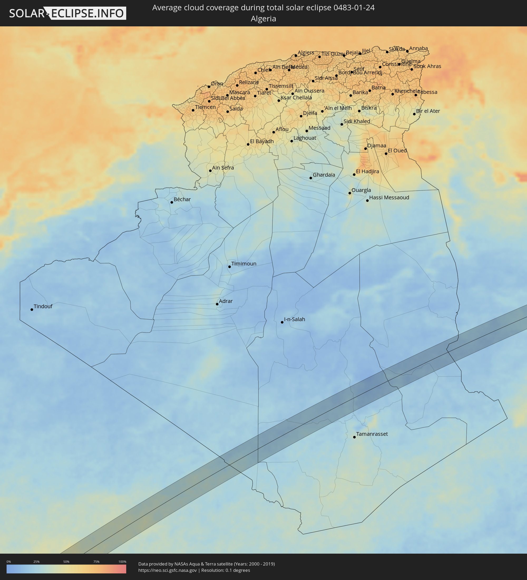 Algerien
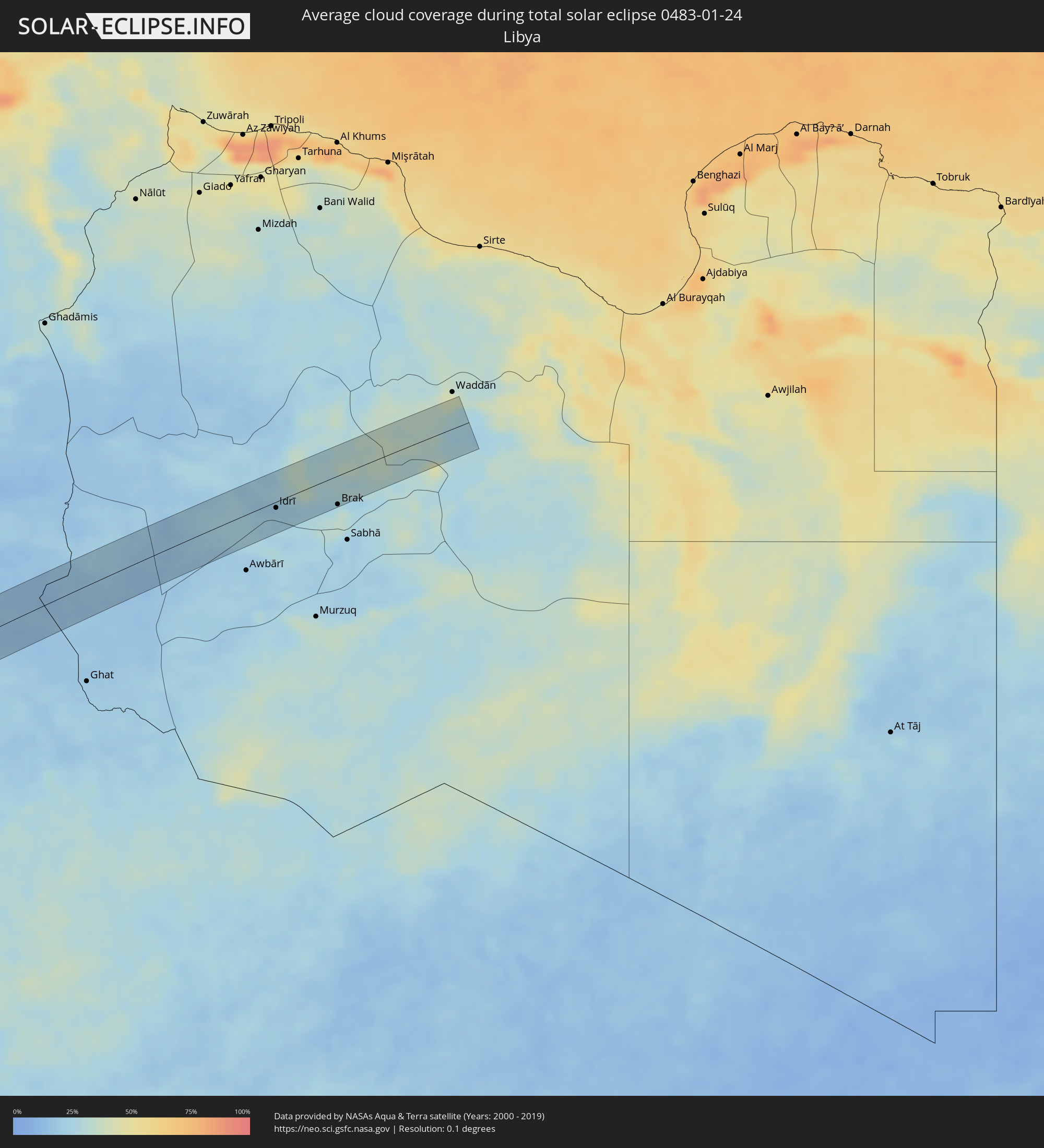 Libyen
Orte im Finsternispfad
Die nachfolgene Tabelle zeigt Städte und Orte mit mehr als 5.000 Einwohnern, die sich im Finsternispfad befinden. Städte mit mehr als 100.000 Einwohnern sind dick gekennzeichnet. Mit einem Klick auf den Ort öffnet sich eine Detailkarte die die Lage des jeweiligen Ortes zusammen mit dem Verlauf der zentralen Finsternis präsentiert.
| Ort | Typ | Dauer der Verfinsterung | Ortszeit bei maximaler Verfinsterung | Entfernung zur Zentrallinie | Ø Bewölkung |
|
Camaná, Arequipa
|
total | - | 08:16:16 UTC-05:08 | 55 km | 49% |
|
Mollendo, Arequipa
|
total | - | 08:17:14 UTC-05:08 | 16 km | 47% |
|
Punta de Bombón, Arequipa
|
total | - | 08:17:33 UTC-05:08 | 1 km | 48% |
|
Cocachacra, Arequipa
|
total | - | 08:17:37 UTC-05:08 | 10 km | 46% |
|
Ilo, Moquegua
|
total | - | 08:18:09 UTC-05:08 | 48 km | 38% |
|
Pacocha, Moquegua
|
total | - | 08:18:10 UTC-05:08 | 42 km | 38% |
|
Moquegua, Moquegua
|
total | - | 08:18:52 UTC-05:08 | 3 km | 34% |
|
Torata, Moquegua
|
total | - | 08:19:03 UTC-05:08 | 17 km | 44% |
|
Ilabaya, Tacna
|
total | - | 08:19:29 UTC-05:08 | 20 km | 33% |
|
Patacamaya, La Paz
|
total | - | 08:59:52 UTC-04:32 | 7 km | 69% |
|
Capinota, Cochabamba
|
total | - | 09:02:40 UTC-04:32 | 48 km | 69% |
|
Cochabamba, Cochabamba
|
total | - | 09:02:59 UTC-04:32 | 12 km | 73% |
|
Tarata, Cochabamba
|
total | - | 09:03:08 UTC-04:32 | 37 km | 73% |
|
Cliza, Cochabamba
|
total | - | 09:03:19 UTC-04:32 | 35 km | 75% |
|
Punata, Cochabamba
|
total | - | 09:03:31 UTC-04:32 | 30 km | 74% |
|
Chimoré, Cochabamba
|
total | - | 09:05:01 UTC-04:32 | 28 km | 82% |
|
Villa Yapacaní, Santa Cruz
|
total | - | 09:07:23 UTC-04:32 | 26 km | 72% |
|
Santa Rosa del Sara, Santa Cruz
|
total | - | 09:08:00 UTC-04:32 | 5 km | 81% |
|
Portachuelo, Santa Cruz
|
total | - | 09:08:17 UTC-04:32 | 24 km | 78% |
|
Montero, Santa Cruz
|
total | - | 09:08:34 UTC-04:32 | 24 km | 82% |
|
Mineros, Santa Cruz
|
total | - | 09:08:43 UTC-04:32 | 0 km | 82% |
|
La Bélgica, Santa Cruz
|
total | - | 09:08:32 UTC-04:32 | 48 km | 82% |
|
Warnes, Santa Cruz
|
total | - | 09:08:39 UTC-04:32 | 44 km | 83% |
|
Pailón, Santa Cruz
|
total | - | 09:09:25 UTC-04:32 | 63 km | 77% |
|
San Ignacio de Velasco, Santa Cruz
|
total | - | 09:13:53 UTC-04:32 | 58 km | 85% |
|
Concepción, Santa Cruz
|
total | - | 09:13:57 UTC-04:32 | 50 km | 86% |
|
San Matías, Santa Cruz
|
total | - | 09:19:30 UTC-04:32 | 15 km | 80% |
|
Poconé, Mato Grosso
|
total | - | 10:17:47 UTC-03:38 | 11 km | 82% |
|
Cuiabá, Mato Grosso
|
total | - | 10:19:35 UTC-03:38 | 47 km | 87% |
|
Lucas, Mato Grosso
|
total | - | 10:19:20 UTC-03:38 | 36 km | 78% |
|
Jaciara, Mato Grosso
|
total | - | 10:21:56 UTC-03:38 | 22 km | 83% |
|
Porangatu, Goiás
|
total | - | 11:11:13 UTC-03:06 | 39 km | 82% |
|
Uruaçu, Goiás
|
total | - | 11:09:52 UTC-03:06 | 73 km | 77% |
|
Barreiras, Bahia
|
total | - | 11:56:10 UTC-02:34 | 30 km | 75% |
|
Barra, Bahia
|
total | - | 12:02:30 UTC-02:34 | 28 km | 66% |
|
Xique Xique, Bahia
|
total | - | 12:03:59 UTC-02:34 | 26 km | 66% |
|
Petrolina, Pernambuco
|
total | - | 12:26:17 UTC-02:19 | 25 km | 75% |
|
Salgueiro, Pernambuco
|
total | - | 12:31:55 UTC-02:19 | 9 km | 78% |
|
Brejo Santo, Ceará
|
total | - | 12:18:50 UTC-02:34 | 53 km | 74% |
|
Serra Talhada, Pernambuco
|
total | - | 12:34:03 UTC-02:19 | 37 km | 76% |
|
Sousa, Paraíba
|
total | - | 12:21:56 UTC-02:34 | 69 km | 68% |
|
Pombal, Paraíba
|
total | - | 12:22:56 UTC-02:34 | 40 km | 69% |
|
Catolé do Rocha, Paraíba
|
total | - | 12:23:48 UTC-02:34 | 74 km | 72% |
|
Afogados da Ingazeira, Pernambuco
|
total | - | 12:36:03 UTC-02:19 | 58 km | 71% |
|
Patos, Paraíba
|
total | - | 12:23:45 UTC-02:34 | 18 km | 67% |
|
Caicó, Rio Grande do Norte
|
total | - | 12:25:09 UTC-02:34 | 20 km | 71% |
|
Currais Novos, Rio Grande do Norte
|
total | - | 12:26:52 UTC-02:34 | 2 km | 73% |
|
Santa Cruz, Rio Grande do Norte
|
total | - | 12:28:04 UTC-02:34 | 33 km | 85% |
|
João Câmara, Rio Grande do Norte
|
total | - | 12:29:44 UTC-02:34 | 13 km | 88% |
|
Ceará Mirim, Rio Grande do Norte
|
total | - | 12:30:28 UTC-02:34 | 23 km | 83% |
|
Macaíba, Rio Grande do Norte
|
total | - | 12:30:15 UTC-02:34 | 47 km | 86% |
|
Natal, Rio Grande do Norte
|
total | - | 12:30:41 UTC-02:34 | 52 km | 76% |
|
Quinhámel, Biombo
|
total | - | 15:00:58 UTC-01:02 | 50 km | 30% |
|
Bubaque, Bolama and Bijagos
|
total | - | 15:00:24 UTC-01:02 | 4 km | 39% |
|
Bissau, Bissau
|
total | - | 15:01:14 UTC-01:02 | 31 km | 36% |
|
Bolama, Bolama and Bijagos
|
total | - | 15:01:06 UTC-01:02 | 2 km | 37% |
|
Bissorã, Oio
|
total | - | 15:01:45 UTC-01:02 | 52 km | 30% |
|
Mansôa, Oio
|
total | - | 15:01:46 UTC-01:02 | 31 km | 30% |
|
Catió, Tombali
|
total | - | 15:01:04 UTC-01:02 | 43 km | 35% |
|
Farim, Oio
|
total | - | 15:02:15 UTC-01:02 | 60 km | 26% |
|
Buba, Quinara
|
total | - | 15:01:39 UTC-01:02 | 34 km | 32% |
|
Quebo, Tombali
|
total | - | 15:01:28 UTC-01:02 | 60 km | 30% |
|
Bafatá, Bafatá
|
total | - | 15:02:35 UTC-01:02 | 5 km | 28% |
|
Gabú, Gabú
|
total | - | 15:03:10 UTC-01:02 | 24 km | 27% |
|
Sabi, Upper River
|
total | - | 15:50:15 UTC-00:16 | 59 km | 29% |
|
Vélingara, Kolda
|
total | - | 15:50:16 UTC-00:16 | 46 km | 28% |
|
Kayes, Kayes
|
total | - | 15:54:03 UTC-00:16 | 11 km | 29% |
|
Idrī, Ash Shāţiʼ
|
total | - | 17:19:41 UTC+00:52 | 9 km | 21% |
|
Brak, Ash Shāţiʼ
|
total | - | 17:19:46 UTC+00:52 | 42 km | 33% |