Totale Sonnenfinsternis vom 29.05.0504
| Wochentag: | Donnerstag |
| Maximale Dauer der Verfinsterung: | 06m44s |
| Maximale Breite des Finsternispfades: | 267 km |
| Saroszyklus: | 84 |
| Bedeckungsgrad: | 100% |
| Magnitude: | 1.0813 |
| Gamma: | 0.1927 |
Wo kann man die Sonnenfinsternis vom 29.05.0504 sehen?
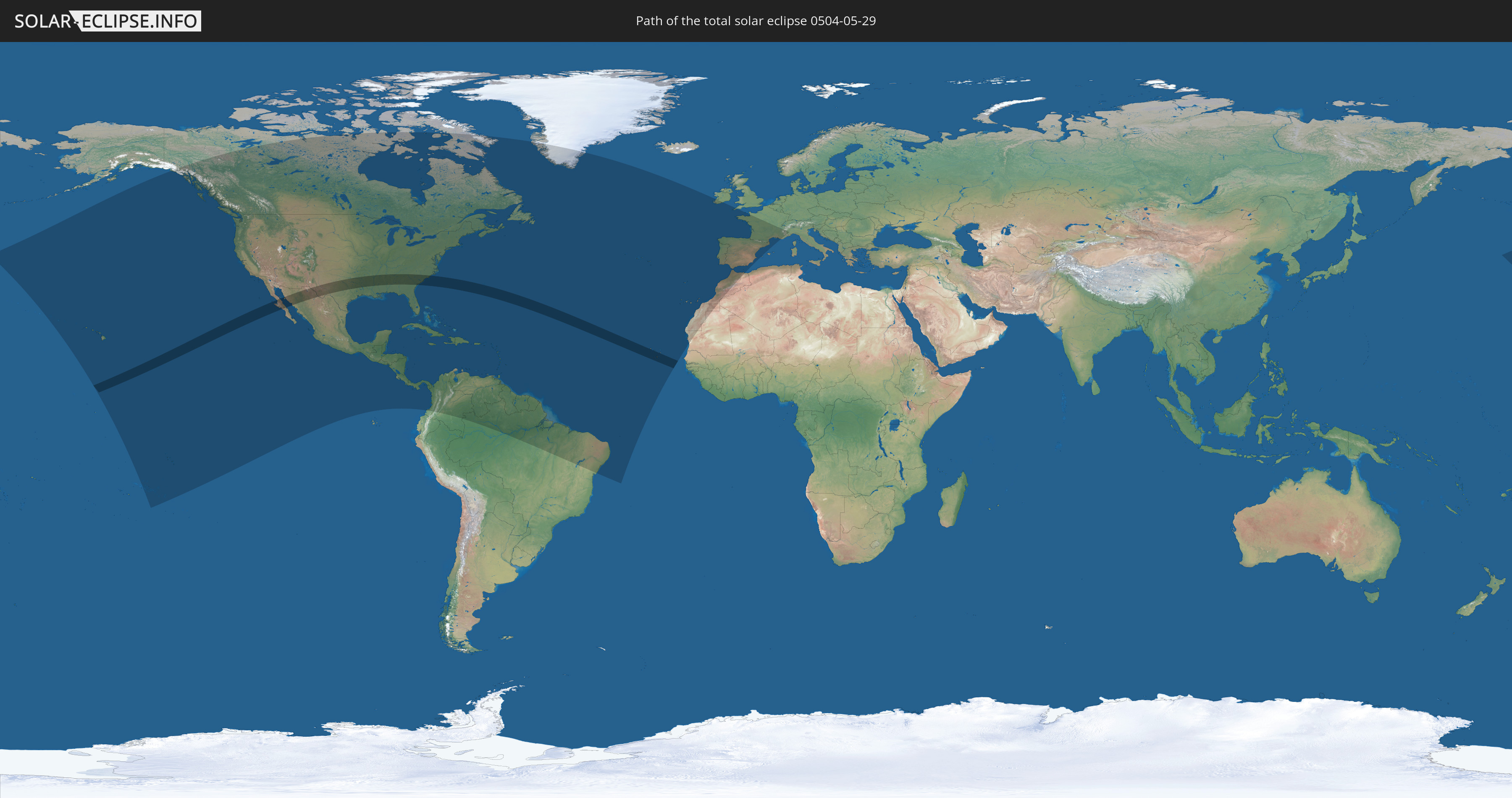
Die Sonnenfinsternis am 29.05.0504 kann man in 61 Ländern als partielle Sonnenfinsternis beobachten.
Der Finsternispfad verläuft durch 3 Länder. Nur in diesen Ländern ist sie als totale Sonnenfinsternis zu sehen.
In den folgenden Ländern ist die Sonnenfinsternis total zu sehen
 Vereinigte Staaten
 Mexiko
 Kap Verde
In den folgenden Ländern ist die Sonnenfinsternis partiell zu sehen
 Vereinigte Staaten
 United States Minor Outlying Islands
 Kiribati
 Französisch-Polynesien
 Kanada
 Mexiko
 Grönland
 Guatemala
 El Salvador
 Honduras
 Belize
 Nicaragua
 Costa Rica
 Kuba
Kuba
 Panama
 Kolumbien
 Kaimaninseln
 Bahamas
 Jamaika
 Haiti
Haiti
 Brasilien
 Venezuela
 Turks- und Caicosinseln
 Dominikanische Republik
 Aruba
Aruba
 Puerto Rico
 Amerikanische Jungferninseln
 Bermuda
 Britische Jungferninseln
 Anguilla
 Saint-Martin
 Saint-Barthélemy
 St. Kitts und Nevis
 Antigua und Barbuda
 Montserrat
 Trinidad und Tobago
 Guadeloupe
 Grenada
 Dominica
 St. Vincent und die Grenadinen
 Guyana
 Martinique
 St. Lucia
 Barbados
 Suriname
 Saint-Pierre und Miquelon
 Französisch-Guayana
 Portugal
 Kap Verde
 Spanien
 Mauretanien
 Marokko
 Irland
 Algerien
 Vereinigtes Königreich
 Gibraltar
 Frankreich
 Guernsey
 Jersey
 Andorra
 Italien
Wie wird das Wetter während der totalen Sonnenfinsternis am 29.05.0504?
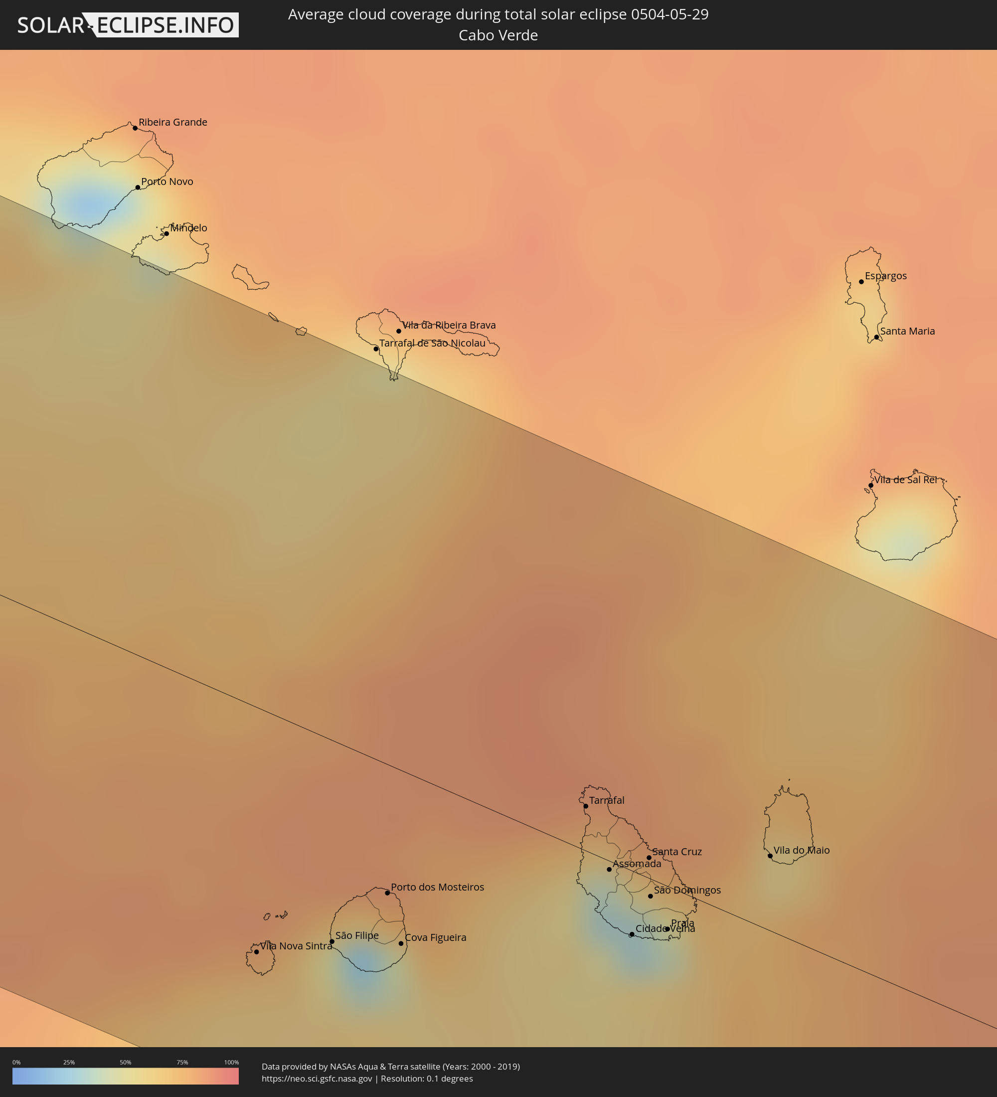
Wo ist der beste Ort, um die totale Sonnenfinsternis vom 29.05.0504 zu beobachten?
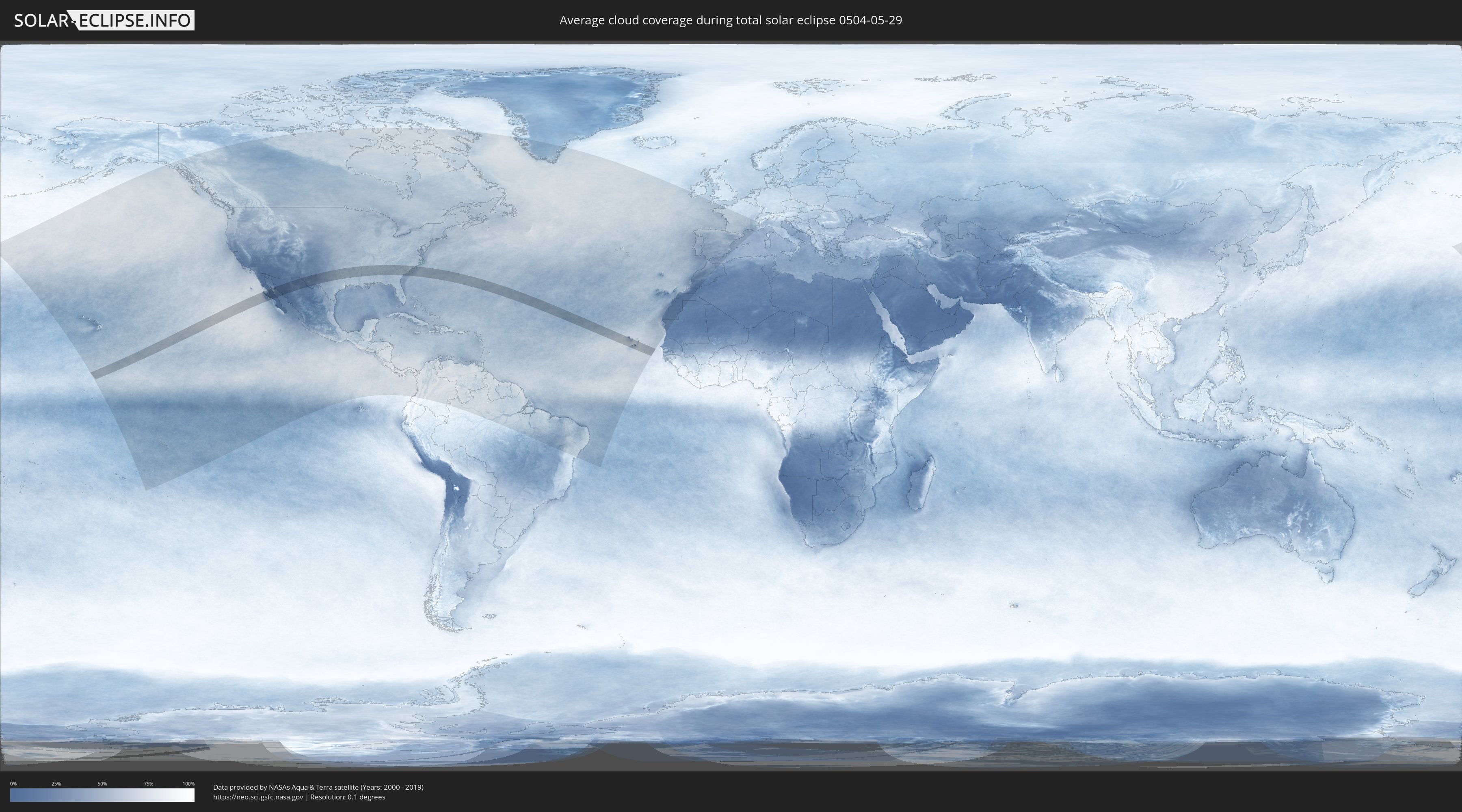
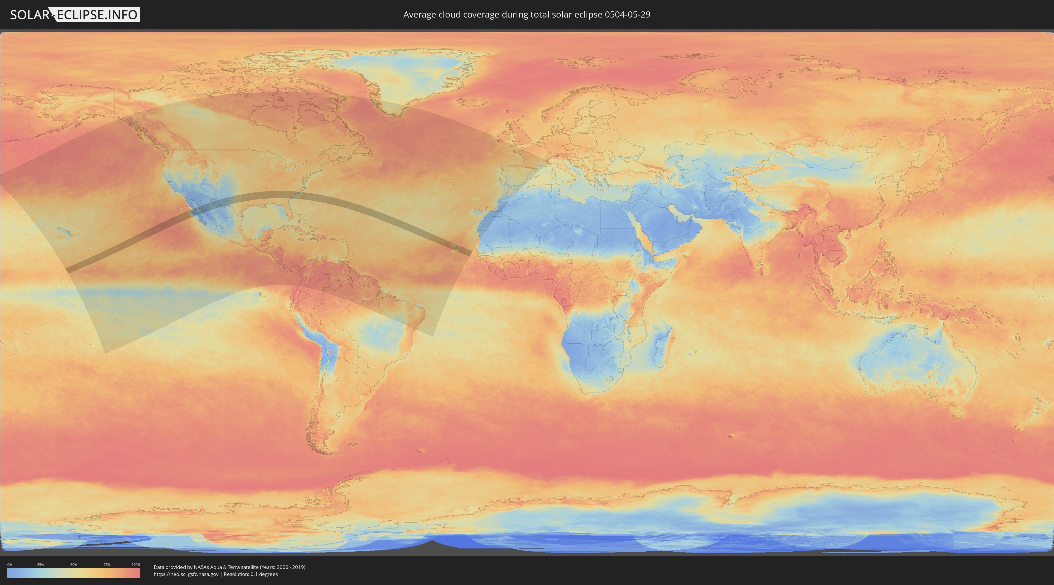
Die folgenden Karten zeigen die durchschnittliche Bewölkung für den Tag, an dem die totale Sonnenfinsternis
stattfindet. Mit Hilfe der Karten lässt sich der Ort entlang des Finsternispfades eingrenzen,
der die besten Aussichen auf einen klaren wolkenfreien Himmel bietet.
Trotzdem muss man immer lokale Gegenenheiten beachten und sollte sich genau über das Wetter an seinem
gewählten Beobachtungsort informieren.
Die Daten stammen von den beiden NASA-Satelliten
AQUA und TERRA
und wurden über einen Zeitraum von 19 Jahren (2000 - 2019) gemittelt.
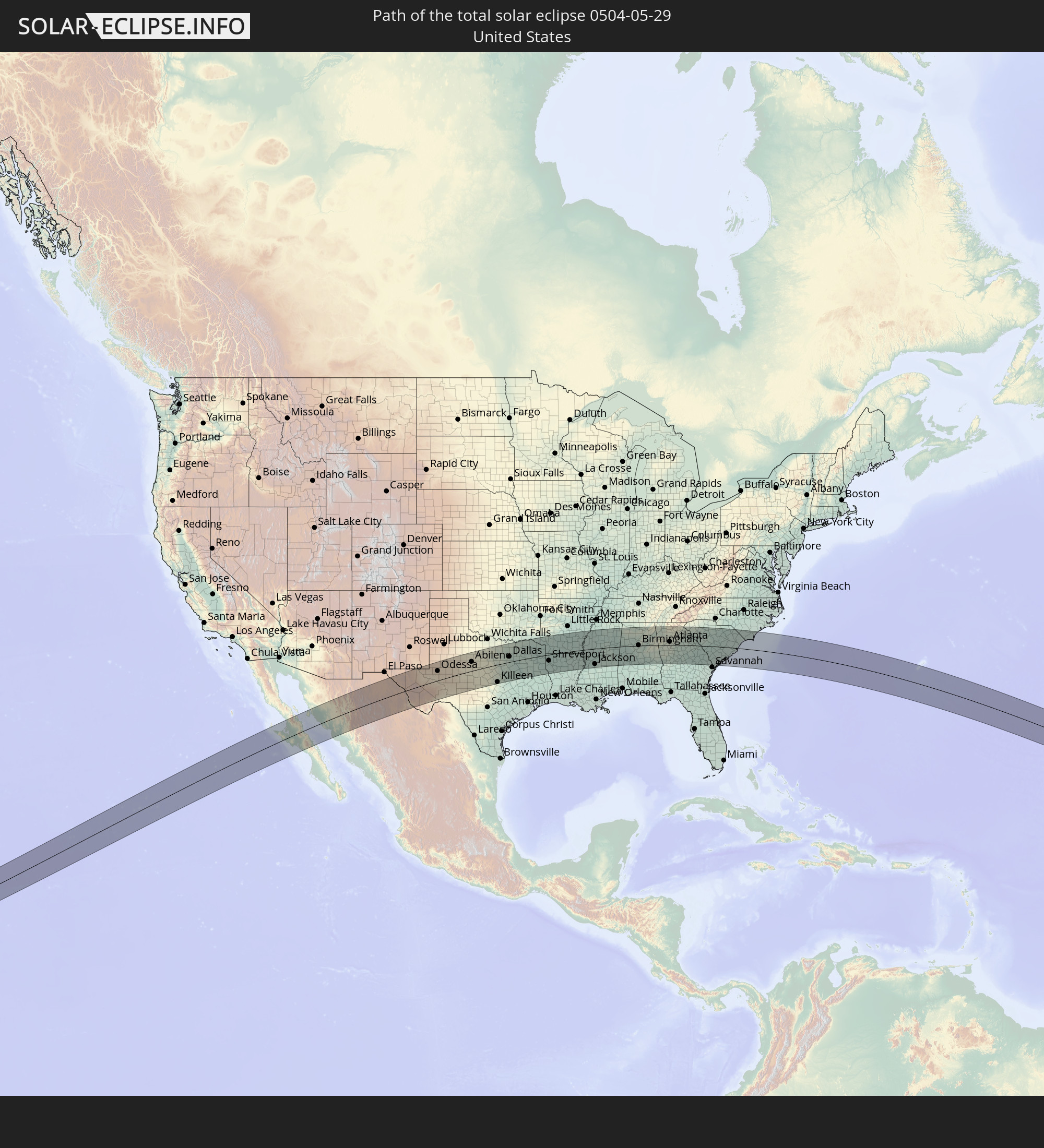
Detaillierte Länderkarten
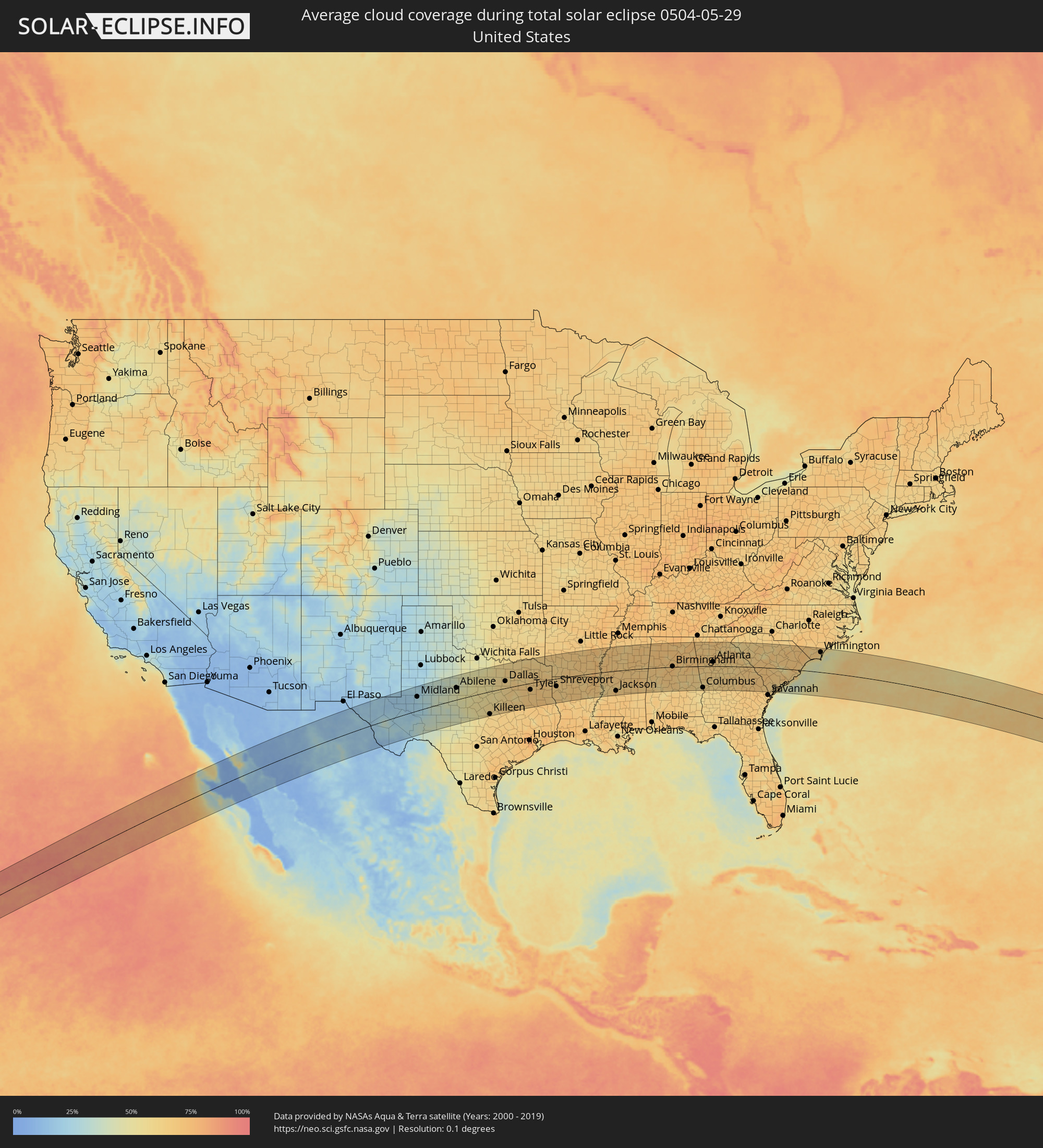 Vereinigte Staaten
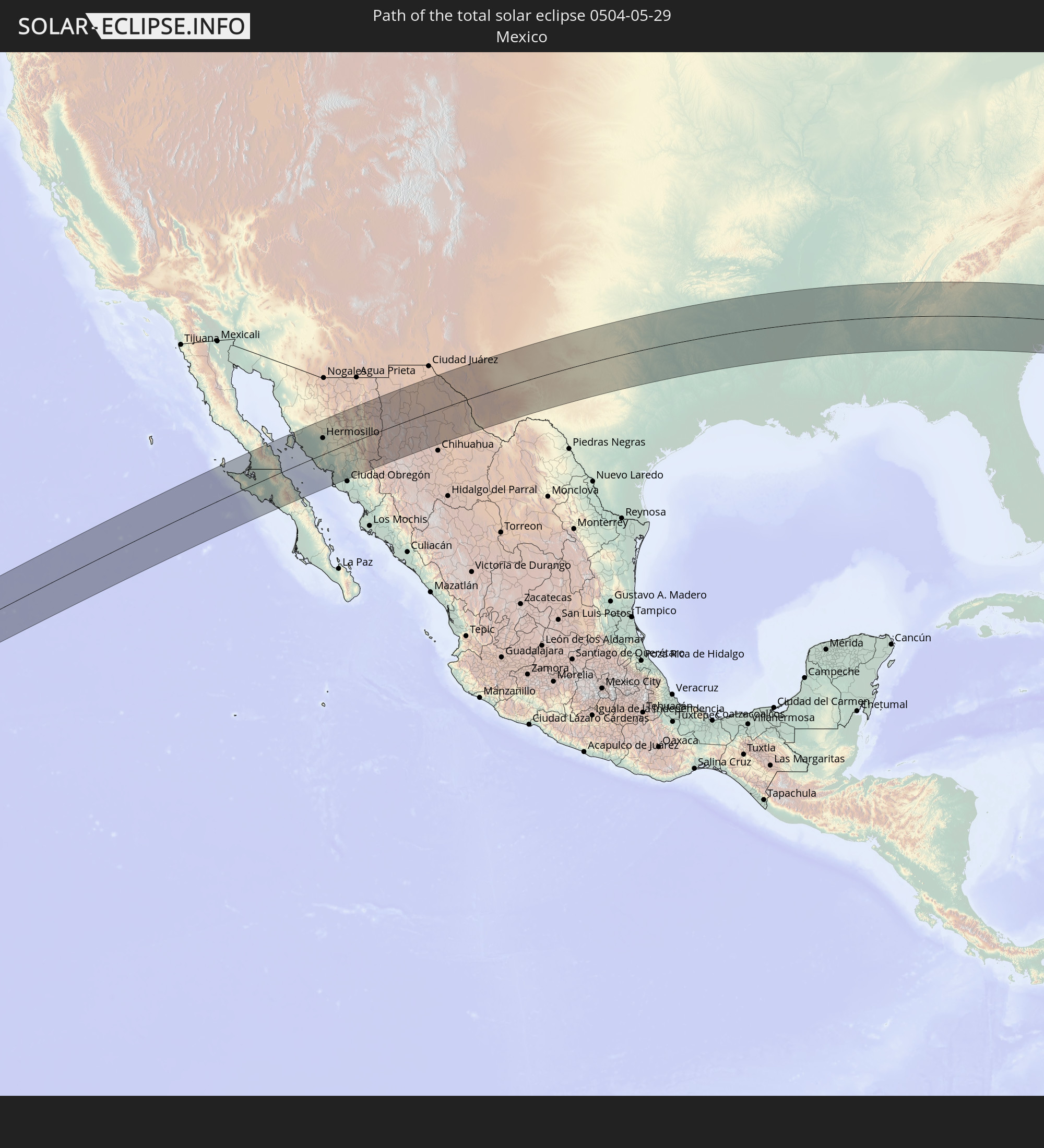
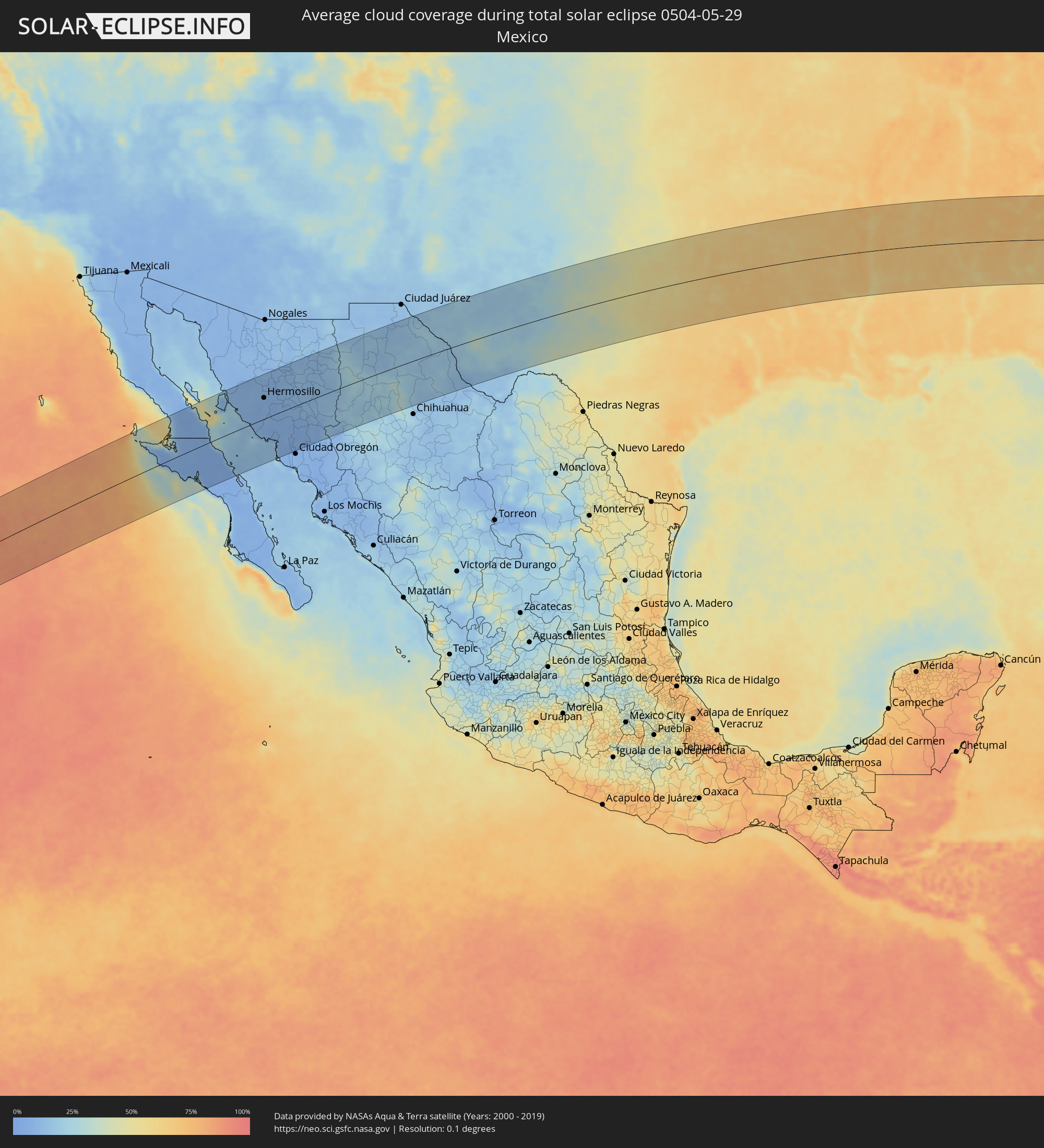 Mexiko
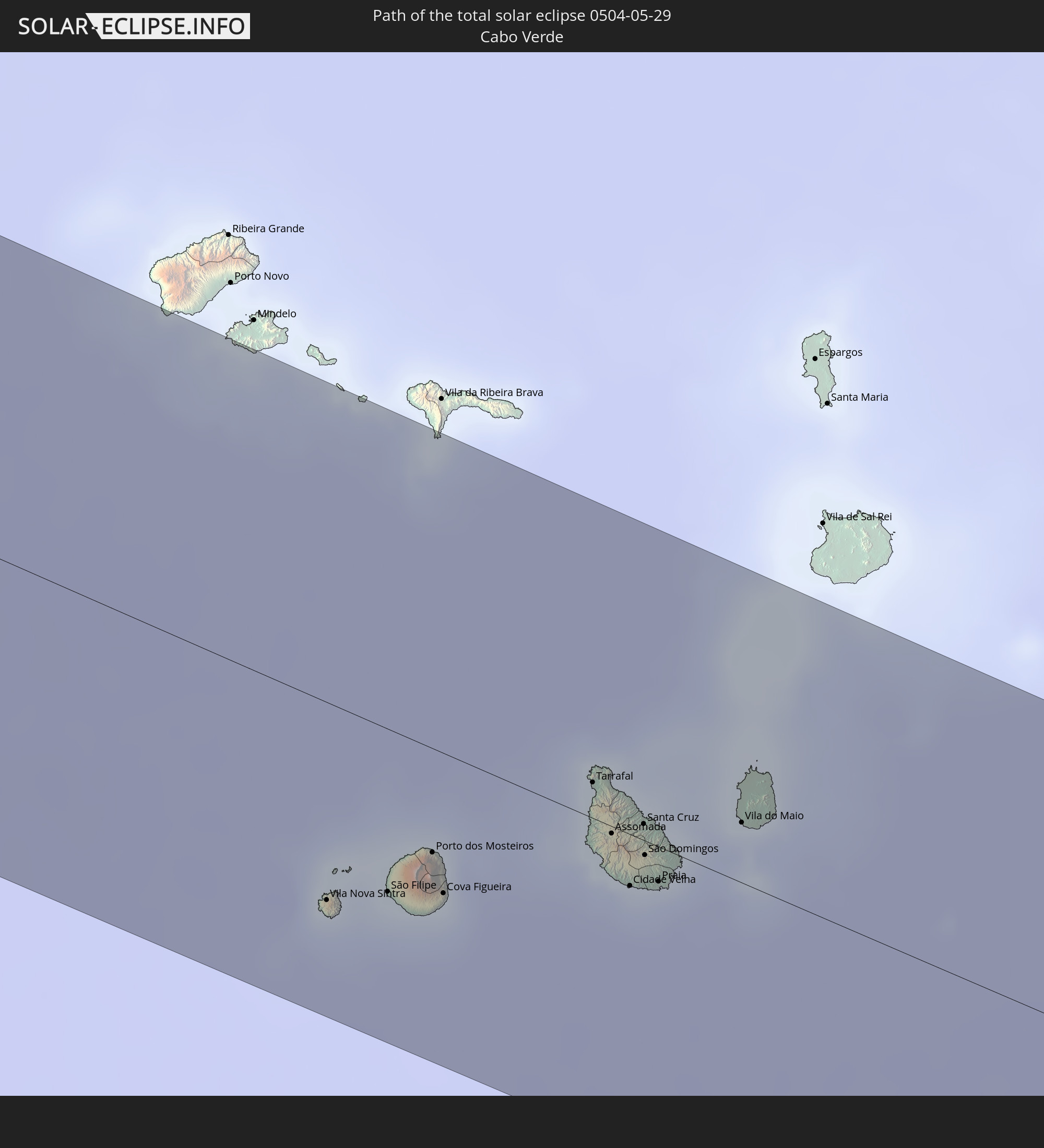
 Kap Verde
Orte im Finsternispfad
Die nachfolgene Tabelle zeigt Städte und Orte mit mehr als 5.000 Einwohnern, die sich im Finsternispfad befinden. Städte mit mehr als 100.000 Einwohnern sind dick gekennzeichnet. Mit einem Klick auf den Ort öffnet sich eine Detailkarte die die Lage des jeweiligen Ortes zusammen mit dem Verlauf der zentralen Finsternis präsentiert.
| Ort | Typ | Dauer der Verfinsterung | Ortszeit bei maximaler Verfinsterung | Entfernung zur Zentrallinie | Ø Bewölkung |
|
San Luis, Baja California
|
total | - | 09:10:09 UTC-07:48 | 102 km | 7% |
|
Villa Alberto Andrés Alvarado Arámburo, Baja California Sur
|
total | - | 09:52:11 UTC-07:05 | 7 km | 6% |
|
Santa Rosalia, Baja California Sur
|
total | - | 09:53:42 UTC-07:05 | 69 km | 5% |
|
Bahía de Kino, Sonora
|
total | - | 09:37:50 UTC-07:23 | 70 km | 18% |
|
Miguel Alemán (La Doce), Sonora
|
total | - | 09:38:39 UTC-07:23 | 54 km | 9% |
|
Hermosillo, Sonora
|
total | - | 09:39:51 UTC-07:23 | 62 km | 8% |
|
Heroica Guaymas, Sonora
|
total | - | 09:38:35 UTC-07:23 | 62 km | 17% |
|
Pesqueira, Sonora
|
total | - | 09:40:19 UTC-07:23 | 88 km | 9% |
|
Empalme, Sonora
|
total | - | 09:38:47 UTC-07:23 | 61 km | 12% |
|
Potam, Sonora
|
total | - | 09:39:07 UTC-07:23 | 111 km | 6% |
|
Vicam, Sonora
|
total | - | 09:39:21 UTC-07:23 | 114 km | 6% |
|
San Pedro Madera, Chihuahua
|
total | - | 10:03:21 UTC-07:05 | 31 km | 20% |
|
Benito Juárez, Chihuahua
|
total | - | 10:04:22 UTC-07:05 | 19 km | 28% |
|
Nuevo Casas Grandes, Chihuahua
|
total | - | 10:05:10 UTC-07:05 | 88 km | 17% |
|
Buenaventura, Chihuahua
|
total | - | 10:05:24 UTC-07:05 | 13 km | 22% |
|
Ejido Benito Juárez, Chihuahua
|
total | - | 10:06:52 UTC-07:05 | 25 km | 16% |
|
Miguel Ahumada, Chihuahua
|
total | - | 10:08:06 UTC-07:05 | 62 km | 17% |
|
Ojinaga, Chihuahua
|
total | - | 10:10:59 UTC-07:05 | 111 km | 13% |
|
Manuel Ojinaga, Chihuahua
|
total | - | 10:11:15 UTC-07:05 | 115 km | 13% |
|
Odessa, Texas
|
total | - | 11:23:28 UTC-06:00 | 67 km | 20% |
|
Midland, Texas
|
total | - | 11:24:13 UTC-06:00 | 76 km | 24% |
|
San Angelo, Texas
|
total | - | 11:27:19 UTC-06:00 | 24 km | 39% |
|
Abilene, Texas
|
total | - | 11:29:40 UTC-06:00 | 65 km | 44% |
|
Copperas Cove, Texas
|
total | - | 11:32:48 UTC-06:00 | 120 km | 61% |
|
Killeen, Texas
|
total | - | 11:33:13 UTC-06:00 | 124 km | 61% |
|
Fort Worth, Texas
|
total | - | 11:35:17 UTC-06:00 | 42 km | 58% |
|
Burleson, Texas
|
total | - | 11:35:09 UTC-06:00 | 22 km | 56% |
|
Keller, Texas
|
total | - | 11:35:34 UTC-06:00 | 63 km | 60% |
|
Waco, Texas
|
total | - | 11:34:52 UTC-06:00 | 89 km | 61% |
|
Mansfield, Texas
|
total | - | 11:35:34 UTC-06:00 | 21 km | 59% |
|
Denton, Texas
|
total | - | 11:36:02 UTC-06:00 | 92 km | 56% |
|
Arlington, Texas
|
total | - | 11:35:46 UTC-06:00 | 39 km | 58% |
|
Flower Mound, Texas
|
total | - | 11:35:59 UTC-06:00 | 69 km | 60% |
|
Carrollton, Texas
|
total | - | 11:36:24 UTC-06:00 | 58 km | 62% |
|
DeSoto, Texas
|
total | - | 11:36:15 UTC-06:00 | 18 km | 59% |
|
Waxahachie, Texas
|
total | - | 11:36:08 UTC-06:00 | 4 km | 60% |
|
Frisco, Texas
|
total | - | 11:36:41 UTC-06:00 | 79 km | 63% |
|
Dallas, Texas
|
total | - | 11:36:29 UTC-06:00 | 38 km | 62% |
|
Plano, Texas
|
total | - | 11:36:53 UTC-06:00 | 62 km | 62% |
|
McKinney, Texas
|
total | - | 11:37:11 UTC-06:00 | 80 km | 61% |
|
Sherman, Texas
|
total | - | 11:37:29 UTC-06:00 | 127 km | 59% |
|
Mesquite, Texas
|
total | - | 11:36:57 UTC-06:00 | 32 km | 60% |
|
Rowlett, Texas
|
total | - | 11:37:07 UTC-06:00 | 47 km | 60% |
|
Tyler, Texas
|
total | - | 11:39:42 UTC-06:00 | 37 km | 68% |
|
Longview, Texas
|
total | - | 11:41:06 UTC-06:00 | 30 km | 68% |
|
Nacogdoches, Texas
|
total | - | 11:40:49 UTC-06:00 | 129 km | 69% |
|
Texarkana, Texas
|
total | - | 11:43:13 UTC-06:00 | 61 km | 64% |
|
Shreveport, Louisiana
|
total | - | 11:43:28 UTC-06:00 | 43 km | 64% |
|
Monroe, Louisiana
|
total | - | 11:47:21 UTC-06:00 | 67 km | 66% |
|
Pine Bluff, Arkansas
|
total | - | 11:48:18 UTC-06:00 | 122 km | 68% |
|
Greenville, Mississippi
|
total | - | 11:50:13 UTC-06:00 | 21 km | 63% |
|
Jackson, Mississippi
|
total | - | 11:51:59 UTC-06:00 | 111 km | 68% |
|
Tupelo, Mississippi
|
total | - | 11:55:58 UTC-06:00 | 95 km | 70% |
|
Meridian, Mississippi
|
total | - | 11:55:37 UTC-06:00 | 116 km | 68% |
|
Tuscaloosa, Alabama
|
total | - | 11:58:30 UTC-06:00 | 28 km | 64% |
|
Decatur, Alabama
|
total | - | 12:00:00 UTC-06:00 | 124 km | 68% |
|
Alabaster, Alabama
|
total | - | 12:00:18 UTC-06:00 | 28 km | 70% |
|
Birmingham, Alabama
|
total | - | 12:00:21 UTC-06:00 | 3 km | 73% |
|
Madison, Alabama
|
total | - | 12:00:33 UTC-06:00 | 134 km | 69% |
|
Prattville, Alabama
|
total | - | 12:01:07 UTC-06:00 | 116 km | 63% |
|
Montgomery, Alabama
|
total | - | 12:01:30 UTC-06:00 | 127 km | 68% |
|
Gadsden, Alabama
|
total | - | 12:02:15 UTC-06:00 | 55 km | 64% |
|
Auburn, Alabama
|
total | - | 12:03:30 UTC-06:00 | 102 km | 63% |
|
Rome, Georgia
|
total | - | 13:04:12 UTC-05:00 | 81 km | 69% |
|
La Grange, Georgia
|
total | - | 13:04:34 UTC-05:00 | 55 km | 65% |
|
Columbus, Georgia
|
total | - | 13:04:42 UTC-05:00 | 119 km | 62% |
|
Newnan, Georgia
|
total | - | 13:05:06 UTC-05:00 | 17 km | 63% |
|
Douglasville, Georgia
|
total | - | 13:05:12 UTC-05:00 | 24 km | 66% |
|
Peachtree City, Georgia
|
total | - | 13:05:35 UTC-05:00 | 15 km | 63% |
|
Mableton, Georgia
|
total | - | 13:05:35 UTC-05:00 | 32 km | 66% |
|
Marietta, Georgia
|
total | - | 13:05:39 UTC-05:00 | 47 km | 69% |
|
Atlanta, Georgia
|
total | - | 13:06:03 UTC-05:00 | 24 km | 67% |
|
Sandy Springs, Georgia
|
total | - | 13:06:03 UTC-05:00 | 44 km | 68% |
|
Johns Creek, Georgia
|
total | - | 13:06:28 UTC-05:00 | 55 km | 69% |
|
Redan, Georgia
|
total | - | 13:06:39 UTC-05:00 | 24 km | 64% |
|
Gainesville, Georgia
|
total | - | 13:07:18 UTC-05:00 | 85 km | 64% |
|
Macon, Georgia
|
total | - | 13:07:55 UTC-05:00 | 77 km | 61% |
|
Warner Robins, Georgia
|
total | - | 13:07:58 UTC-05:00 | 102 km | 64% |
|
Athens, Georgia
|
total | - | 13:08:22 UTC-05:00 | 49 km | 66% |
|
Augusta, Georgia
|
total | - | 13:11:42 UTC-05:00 | 2 km | 63% |
|
Columbia, South Carolina
|
total | - | 13:13:43 UTC-05:00 | 61 km | 65% |
|
Sumter, South Carolina
|
total | - | 13:15:19 UTC-05:00 | 56 km | 68% |
|
Summerville, South Carolina
|
total | - | 13:15:59 UTC-05:00 | 43 km | 69% |
|
Charleston, South Carolina
|
total | - | 13:16:37 UTC-05:00 | 68 km | 60% |
|
Florence, South Carolina
|
total | - | 13:16:31 UTC-05:00 | 91 km | 69% |
|
Wilmington, North Carolina
|
total | - | 13:20:29 UTC-05:00 | 110 km | 58% |
|
Vila Nova Sintra, Brava
|
total | - | 17:58:49 UTC-01:34 | 71 km | 66% |
|
São Filipe, São Filipe
|
total | - | 17:58:47 UTC-01:34 | 58 km | 52% |
|
Porto dos Mosteiros, Mosteiros
|
total | - | 17:58:41 UTC-01:34 | 37 km | 45% |
|
Cova Figueira, Santa Catarina do Fogo
|
total | - | 17:58:46 UTC-01:34 | 50 km | 44% |
|
Tarrafal, Tarrafal
|
total | - | 17:58:29 UTC-01:34 | 13 km | 70% |
|
Assomada, Santa Catarina
|
total | - | 17:58:35 UTC-01:34 | 3 km | 32% |
|
Picos, São Salvador do Mundo
|
total | - | 17:58:35 UTC-01:34 | 2 km | 33% |
|
Cidade Velha, Ribeira Grande de Santiago
|
total | - | 17:58:42 UTC-01:34 | 18 km | 56% |
|
Calheta, São Miguel
|
total | - | 17:58:31 UTC-01:34 | 10 km | 57% |
|
João Teves, São Lourenço dos Órgãos
|
total | - | 17:58:36 UTC-01:34 | 2 km | 33% |
|
Santa Cruz, Santa Cruz
|
total | - | 17:58:33 UTC-01:34 | 6 km | 33% |
|
São Domingos, São Domingos
|
total | - | 17:58:37 UTC-01:34 | 5 km | 33% |
|
Pedra Badejo, Santa Cruz
|
total | - | 17:58:33 UTC-01:34 | 7 km | 49% |
|
Praia, Praia
|
total | - | 17:58:40 UTC-01:34 | 12 km | 60% |
|
Vila do Maio, Maio
|
total | - | 17:58:31 UTC-01:34 | 22 km | 70% |