Ringförmige Sonnenfinsternis vom 22.12.0930
| Wochentag: | Freitag |
| Maximale Dauer der Verfinsterung: | 06m17s |
| Maximale Breite des Finsternispfades: | 266 km |
| Saroszyklus: | 95 |
| Bedeckungsgrad: | 93.6% |
| Magnitude: | 0.9364 |
| Gamma: | -0.455 |
Wo kann man die Sonnenfinsternis vom 22.12.0930 sehen?
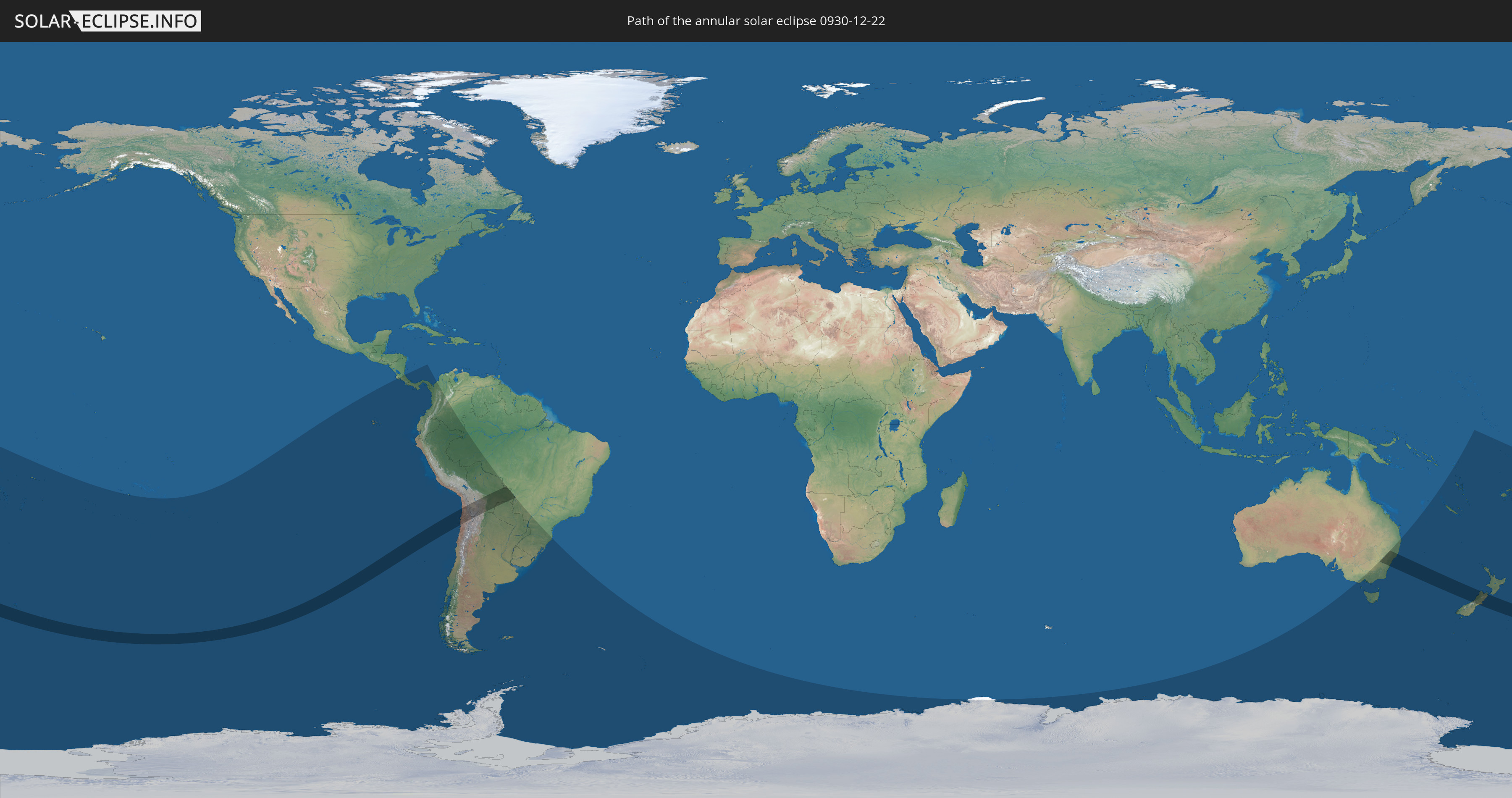
Die Sonnenfinsternis am 22.12.0930 kann man in 30 Ländern als partielle Sonnenfinsternis beobachten.
Der Finsternispfad verläuft durch 7 Länder. Nur in diesen Ländern ist sie als ringförmige Sonnenfinsternis zu sehen.
In den folgenden Ländern ist die Sonnenfinsternis ringförmig zu sehen
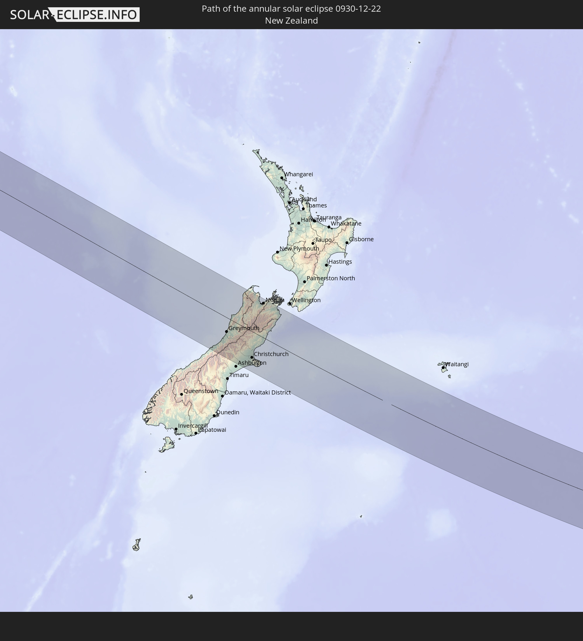 Neuseeland
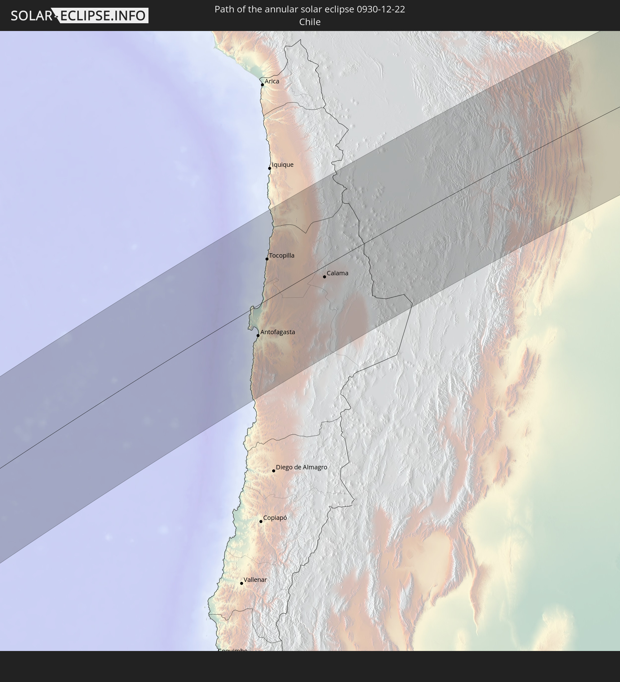 Chile
Chile
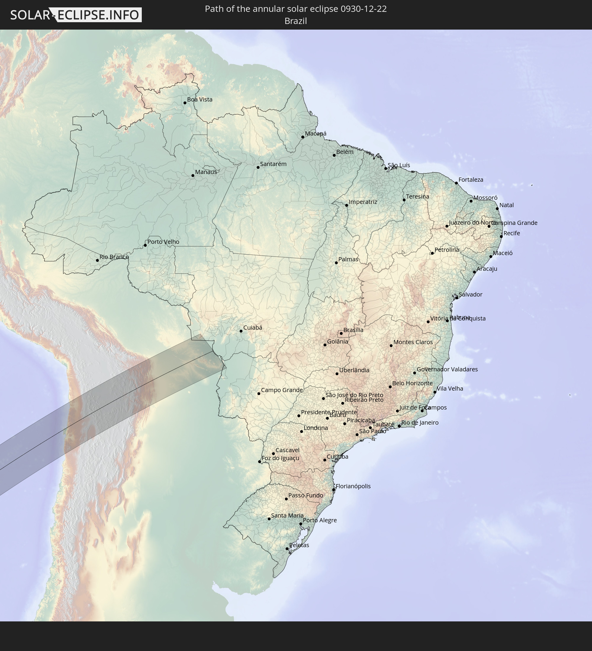 Brasilien
 Argentinien
 Bolivien
 Paraguay
 Australien
In den folgenden Ländern ist die Sonnenfinsternis partiell zu sehen
 Antarktika
 Fidschi
 Neuseeland
 Wallis und Futuna
 Tonga
Tonga
 Samoa
Samoa
 Amerikanisch-Samoa
 Niue
Niue
 Cookinseln
 Französisch-Polynesien
 Pitcairninseln
 Chile
Chile
 Ecuador
 Costa Rica
 Panama
 Kolumbien
 Peru
Peru
 Brasilien
 Argentinien
 Bolivien
 Paraguay
 Falklandinseln
 Uruguay
 Südgeorgien und die Südlichen Sandwichinseln
 Australien
 Salomonen
 Neukaledonien
 Vanuatu
 Norfolkinsel
 Tuvalu
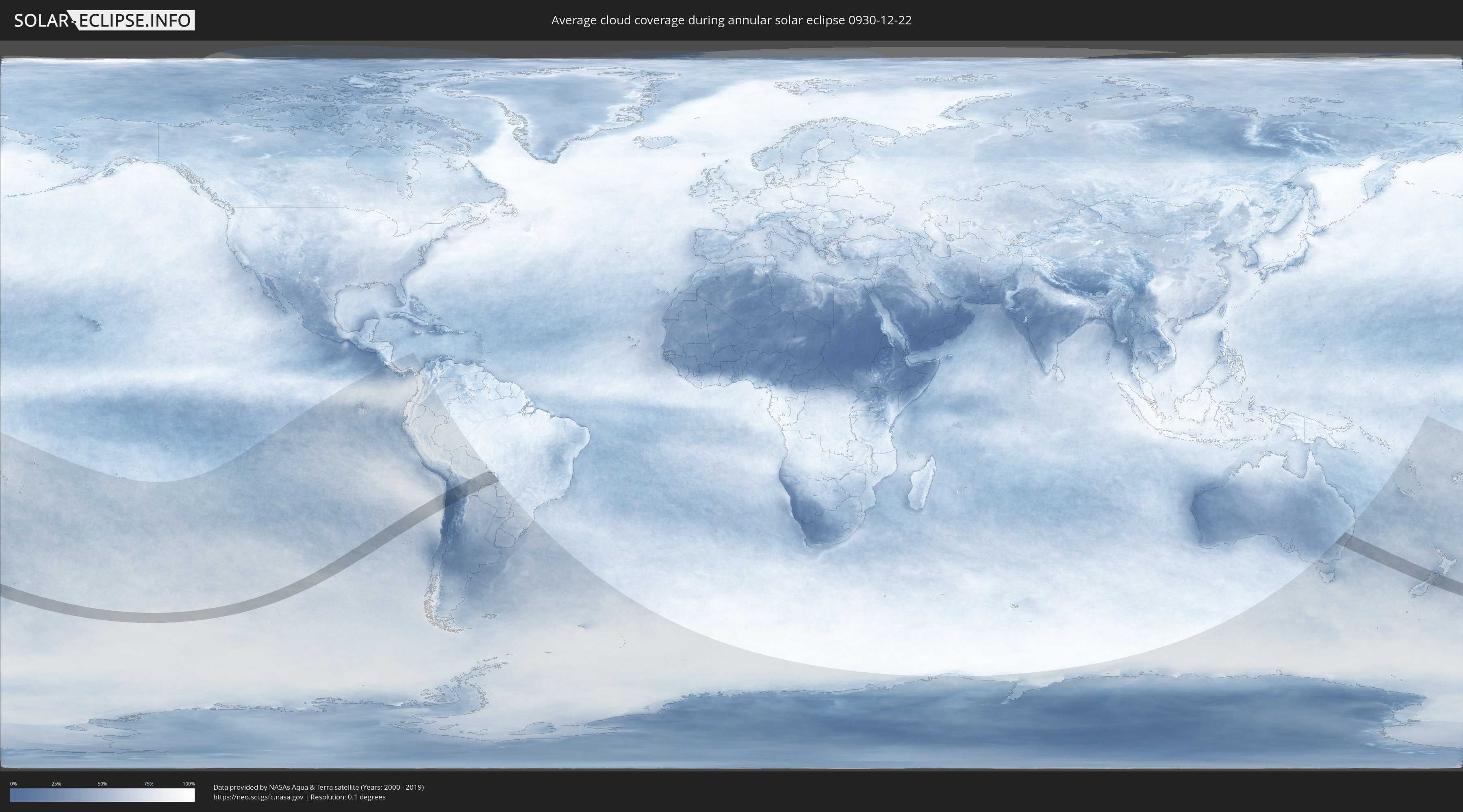
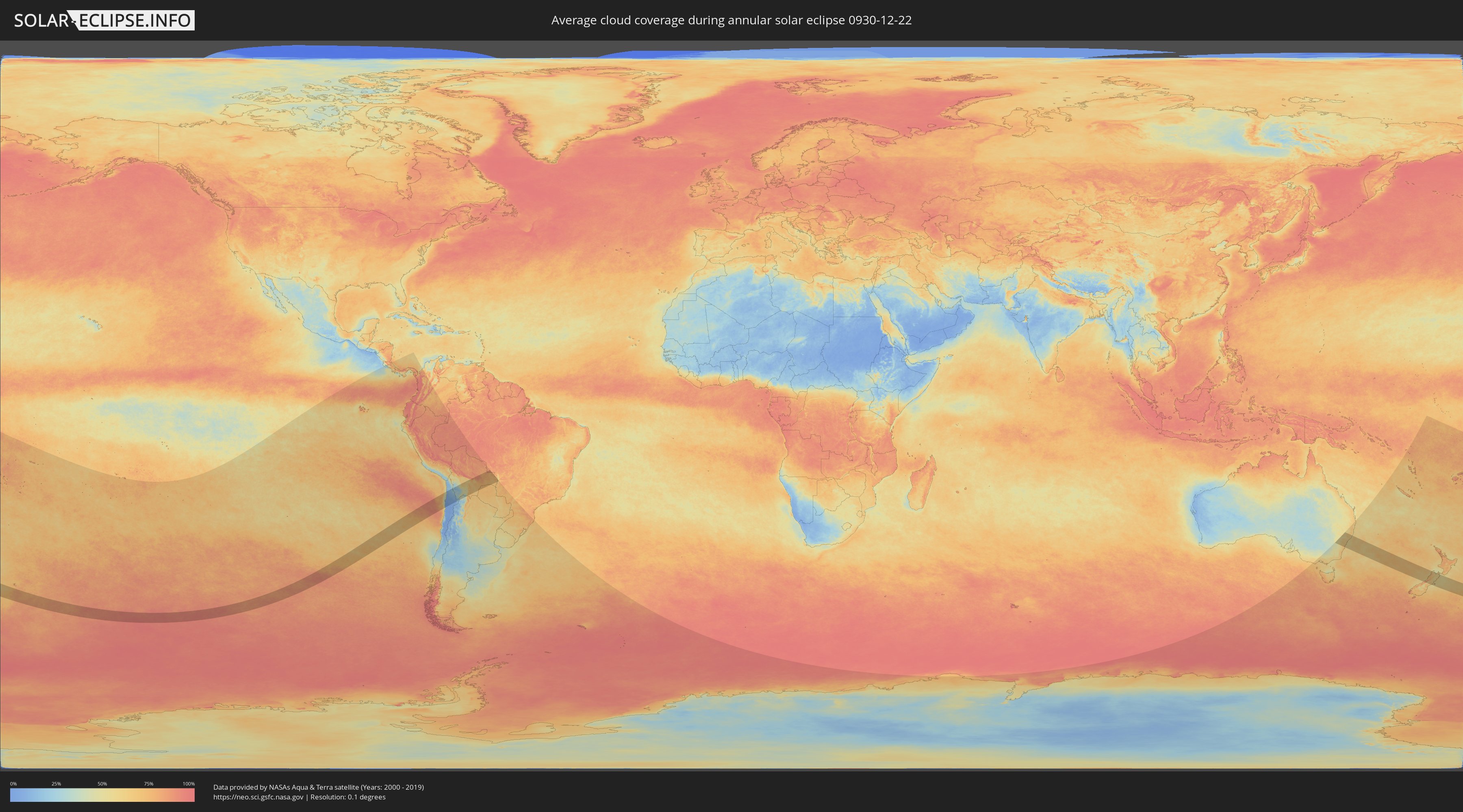
Wie wird das Wetter während der ringförmigen Sonnenfinsternis am 22.12.0930?
Wo ist der beste Ort, um die ringförmige Sonnenfinsternis vom 22.12.0930 zu beobachten?
Die folgenden Karten zeigen die durchschnittliche Bewölkung für den Tag, an dem die ringförmige Sonnenfinsternis
stattfindet. Mit Hilfe der Karten lässt sich der Ort entlang des Finsternispfades eingrenzen,
der die besten Aussichen auf einen klaren wolkenfreien Himmel bietet.
Trotzdem muss man immer lokale Gegenenheiten beachten und sollte sich genau über das Wetter an seinem
gewählten Beobachtungsort informieren.
Die Daten stammen von den beiden NASA-Satelliten
AQUA und TERRA
und wurden über einen Zeitraum von 19 Jahren (2000 - 2019) gemittelt.
Detaillierte Länderkarten
 Neuseeland
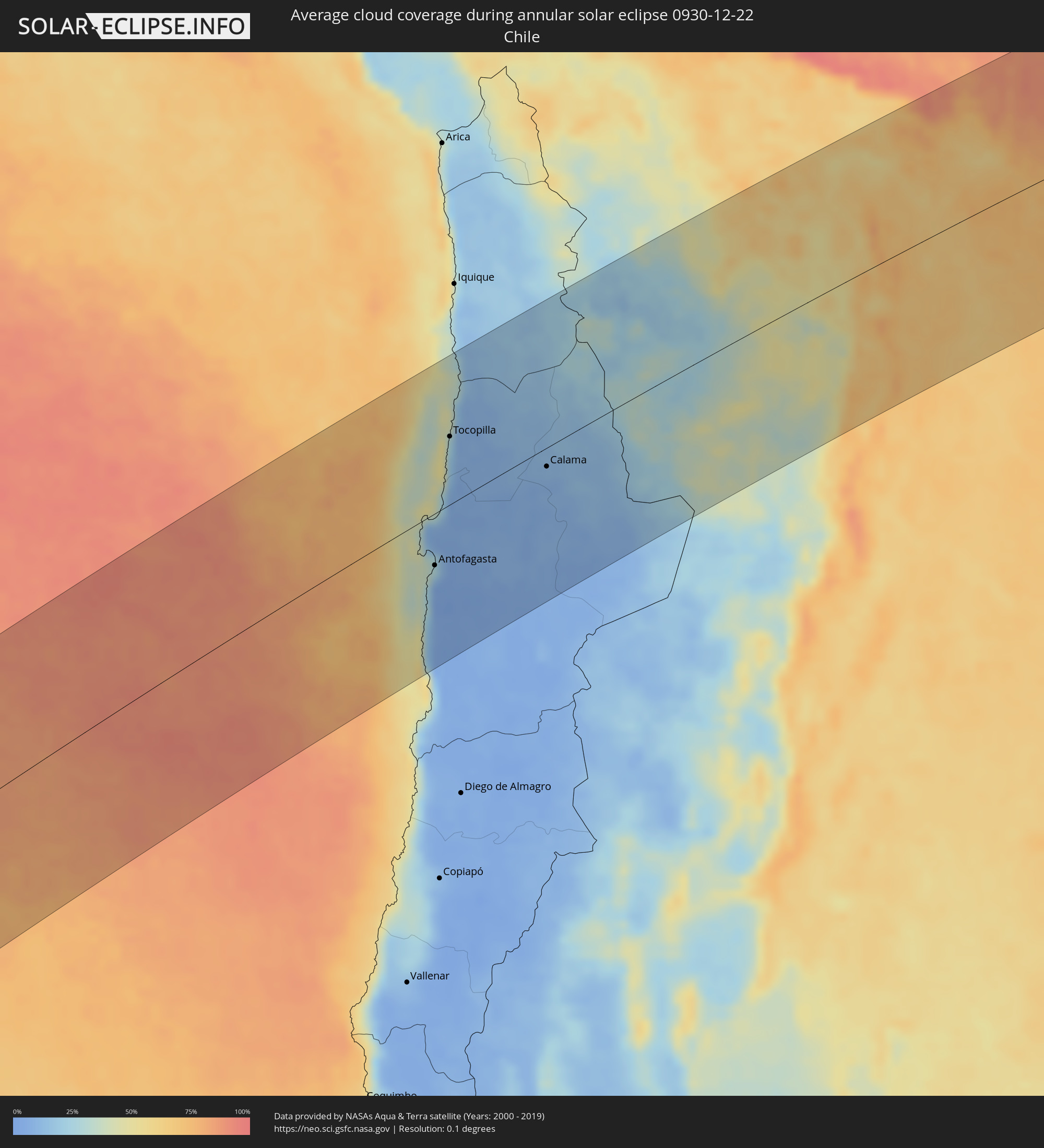 Chile
Chile
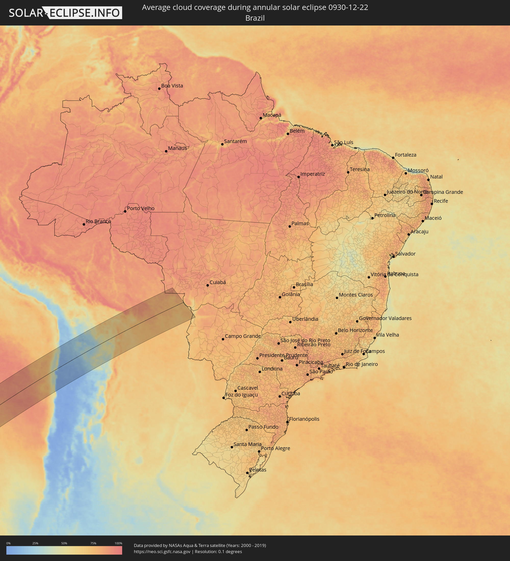 Brasilien
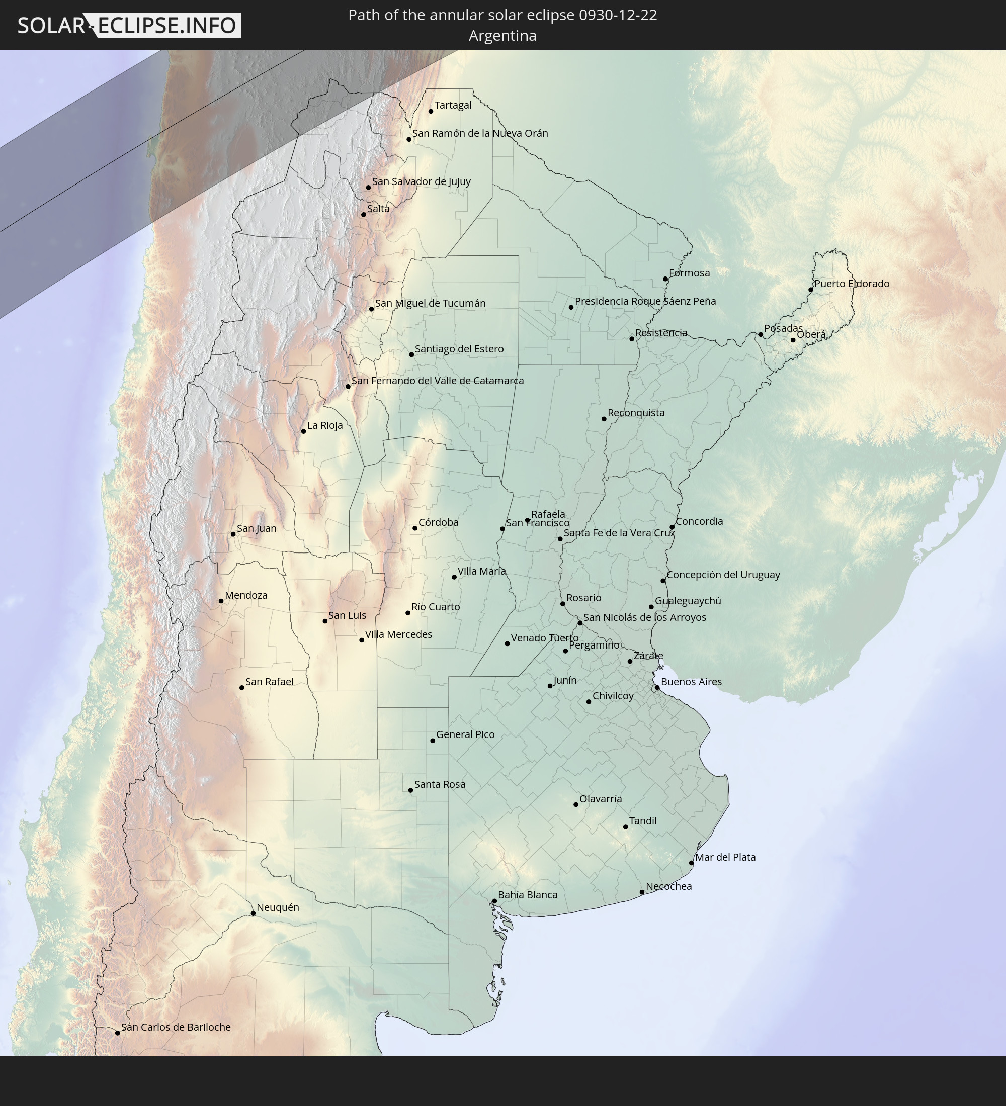
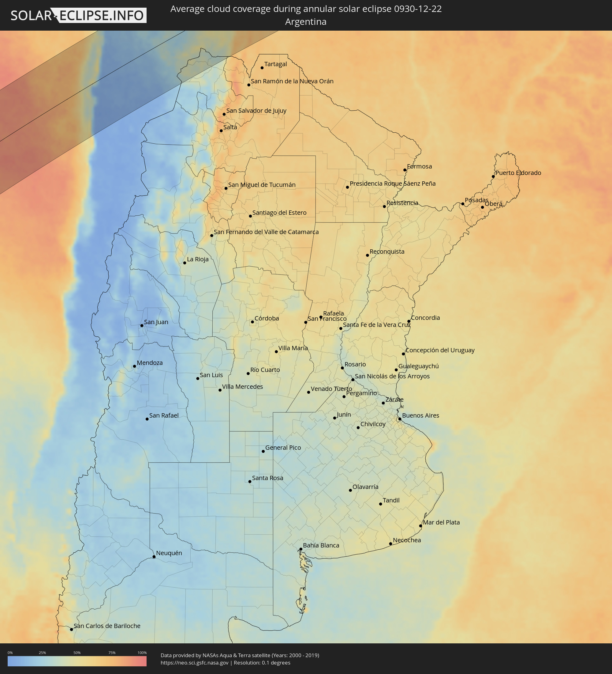 Argentinien
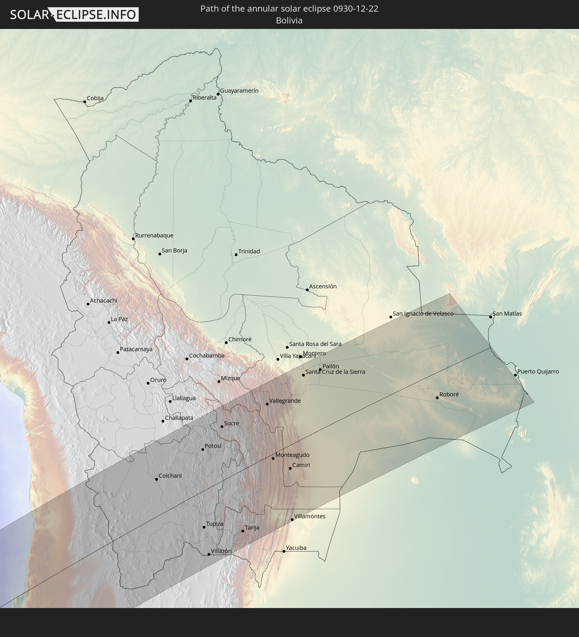
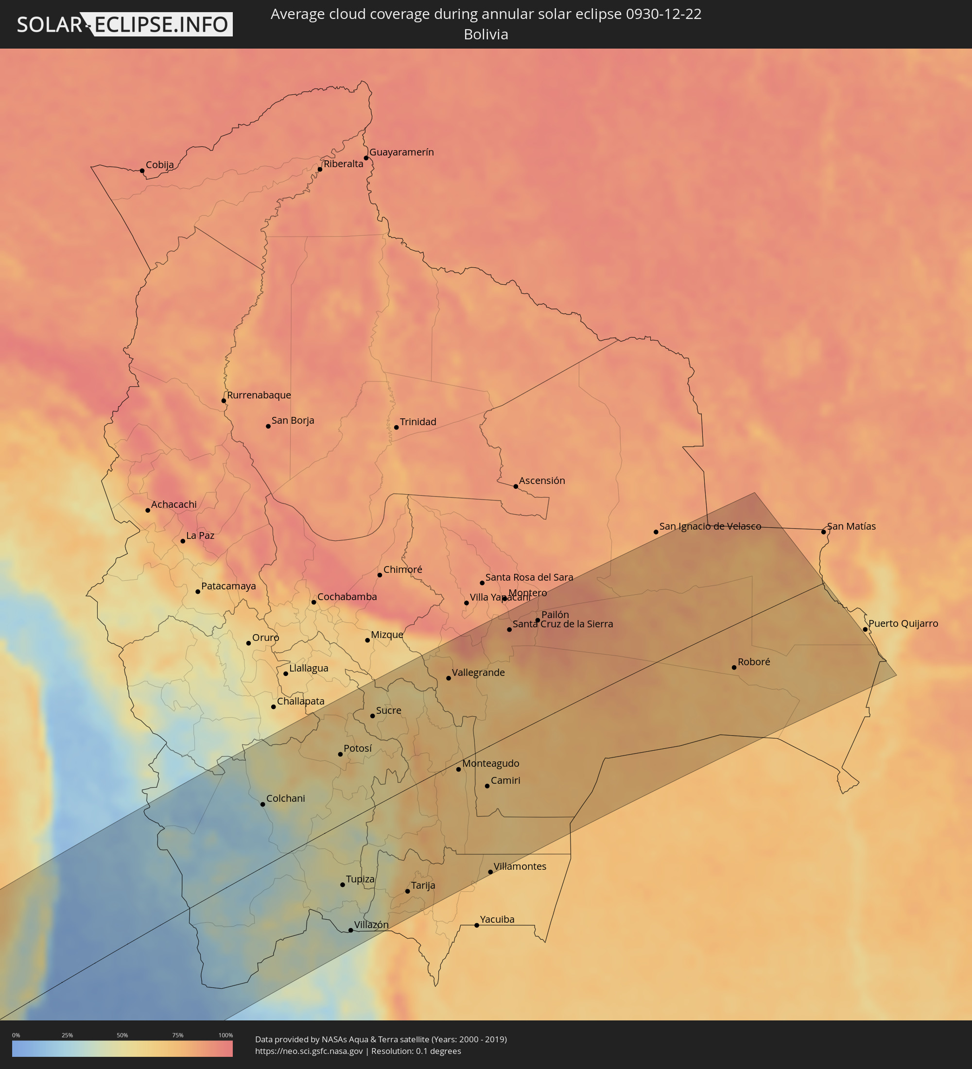 Bolivien
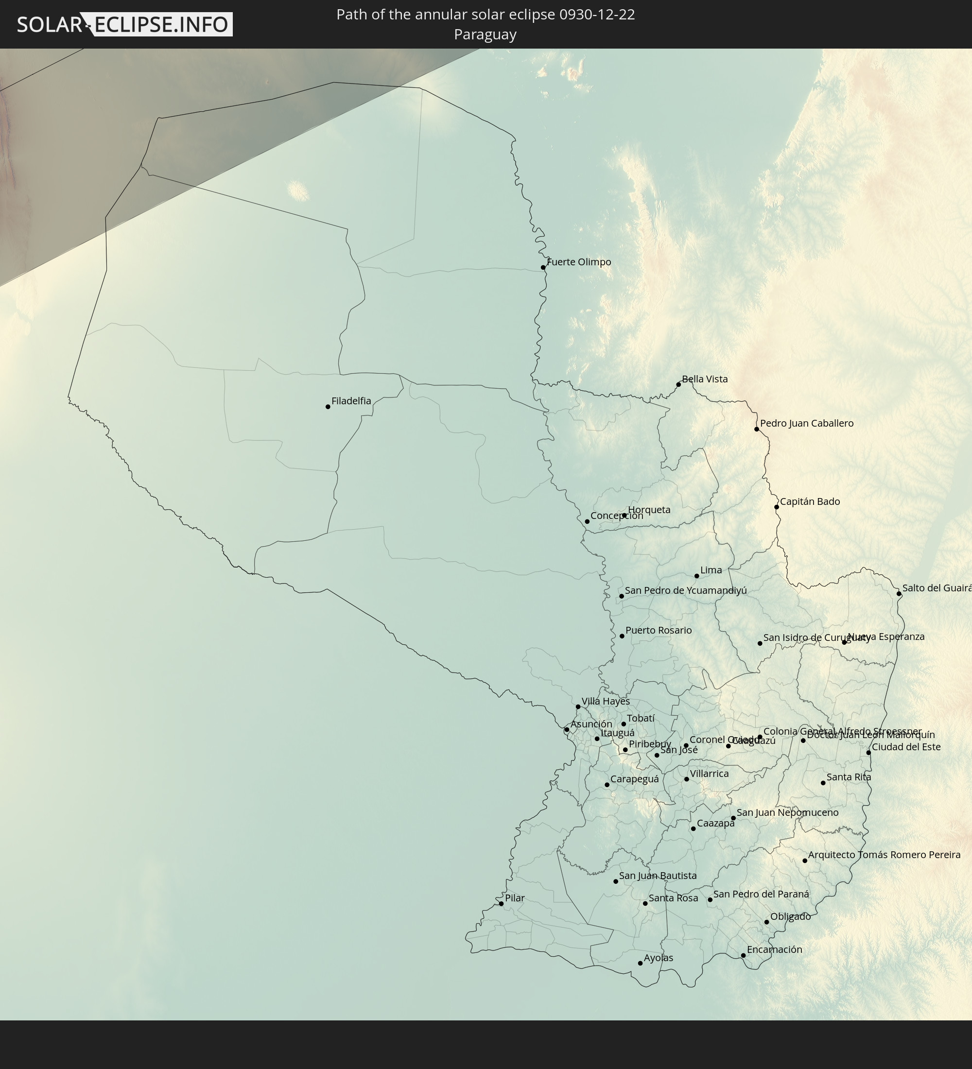
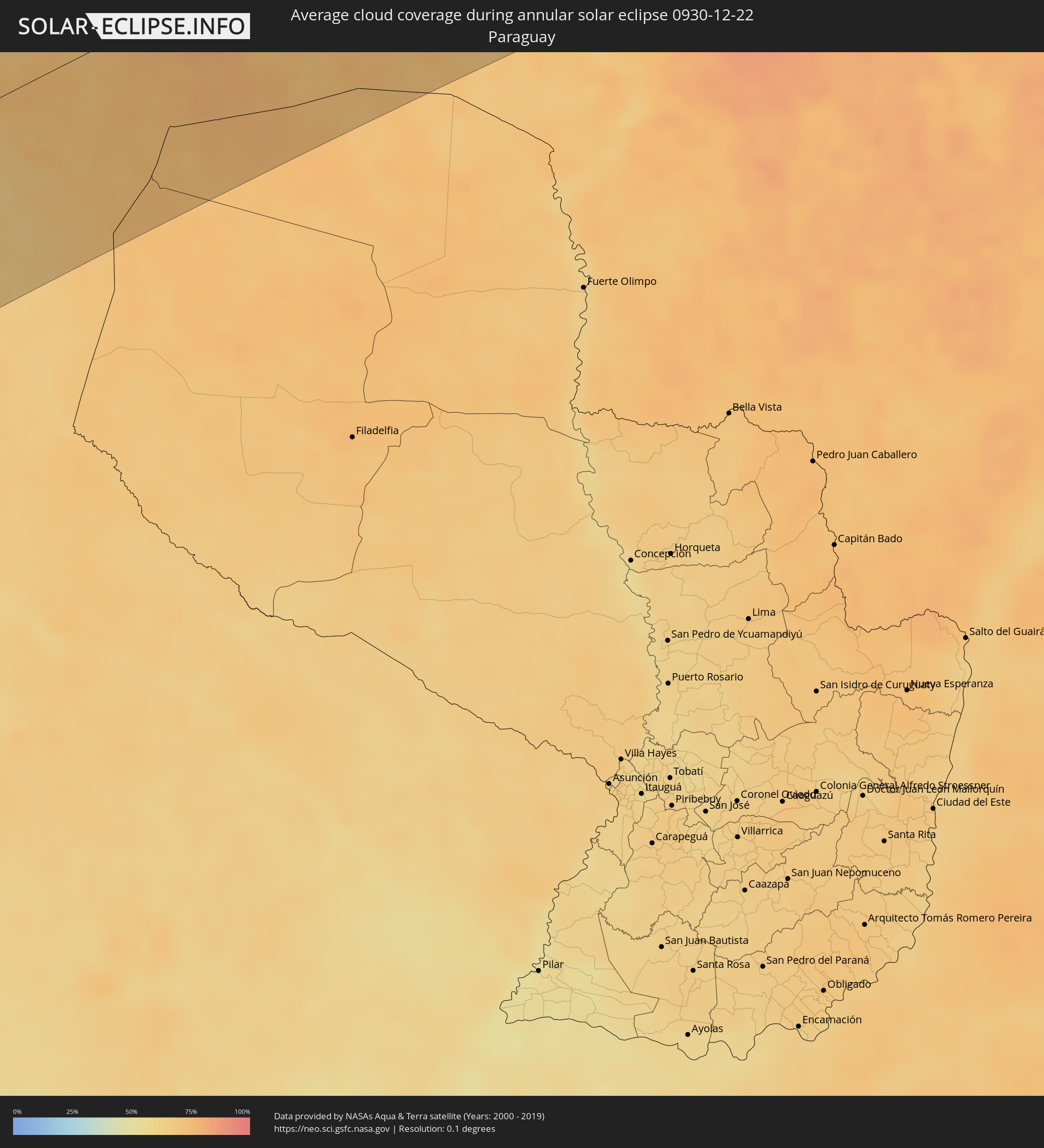 Paraguay
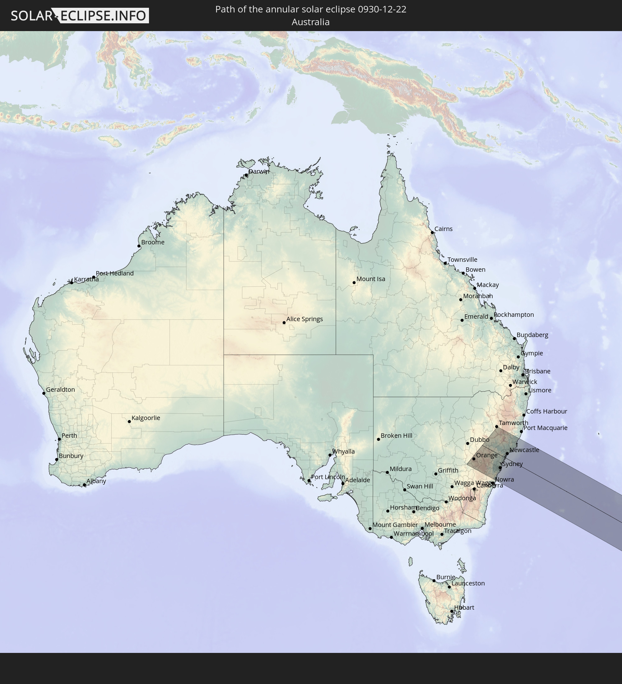
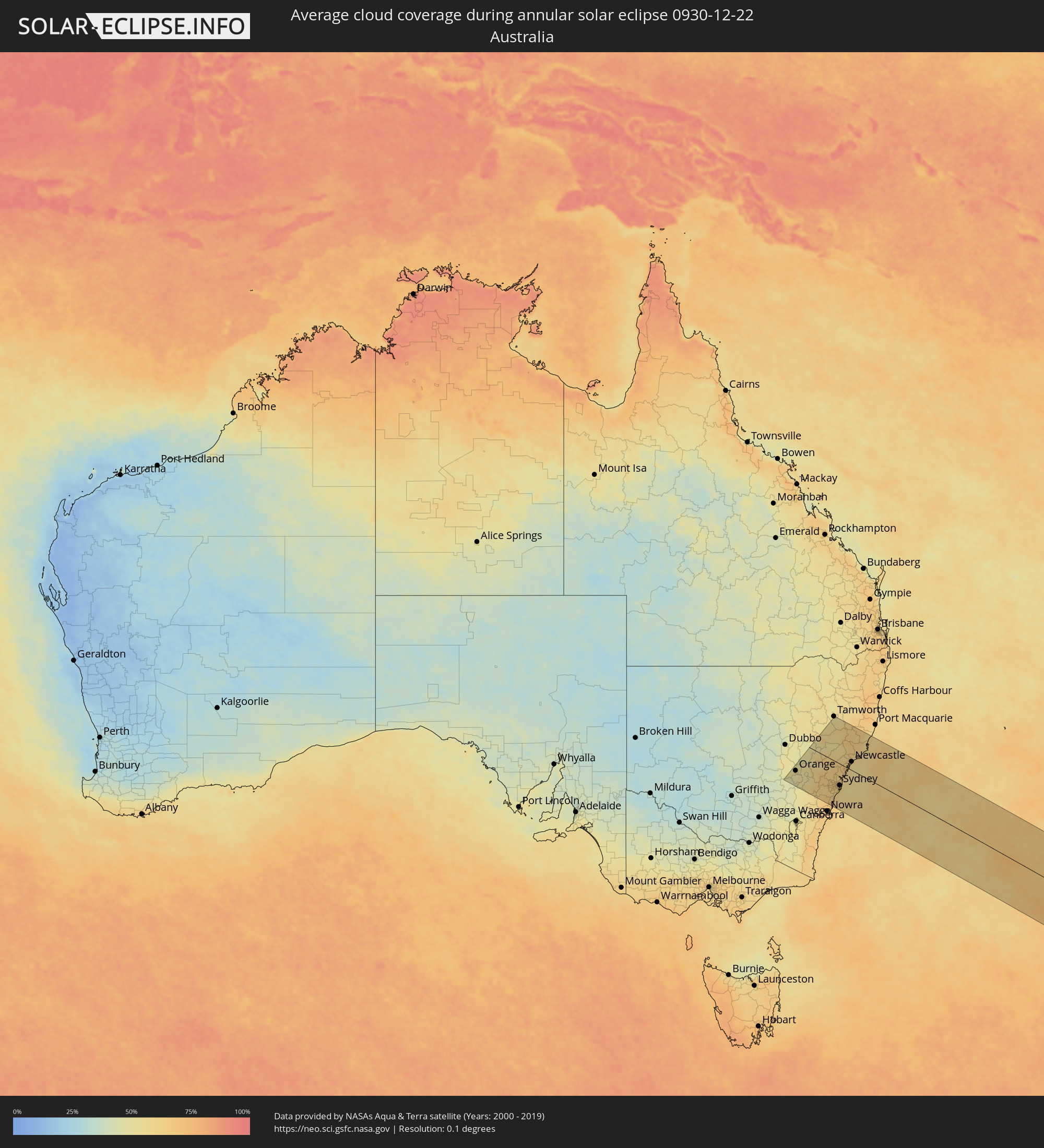 Australien
Orte im Finsternispfad
Die nachfolgene Tabelle zeigt Städte und Orte mit mehr als 5.000 Einwohnern, die sich im Finsternispfad befinden. Städte mit mehr als 100.000 Einwohnern sind dick gekennzeichnet. Mit einem Klick auf den Ort öffnet sich eine Detailkarte die die Lage des jeweiligen Ortes zusammen mit dem Verlauf der zentralen Finsternis präsentiert.
| Ort | Typ | Dauer der Verfinsterung | Ortszeit bei maximaler Verfinsterung | Entfernung zur Zentrallinie | Ø Bewölkung |
|
Antofagasta, Antofagasta
|
ringförmig | - | 17:40:55 UTC-04:42 | 64 km | 15% |
|
Tocopilla, Antofagasta
|
ringförmig | - | 17:42:56 UTC-04:42 | 83 km | 26% |
|
Calama, Antofagasta
|
ringförmig | - | 17:42:20 UTC-04:42 | 22 km | 9% |
|
Colchani, Potosí
|
ringförmig | - | 17:54:49 UTC-04:32 | 86 km | 29% |
|
Uyuni, Potosí
|
ringförmig | - | 17:54:36 UTC-04:32 | 65 km | 28% |
|
Potosí, Potosí
|
ringförmig | - | 17:55:23 UTC-04:32 | 100 km | 60% |
|
Tupiza, Potosí
|
ringförmig | - | 17:53:11 UTC-04:32 | 88 km | 44% |
|
Villazón, Potosí
|
ringförmig | - | 17:52:23 UTC-04:32 | 157 km | 32% |
|
La Quiaca, Jujuy Province
|
ringförmig | - | 18:08:09 UTC-04:16 | 158 km | 32% |
|
Sucre, Chuquisaca
|
ringförmig | - | 17:55:53 UTC-04:32 | 127 km | 64% |
|
Tarija, Tarija
|
ringförmig | - | 17:52:51 UTC-04:32 | 145 km | 70% |
|
Vallegrande, Santa Cruz
|
ringförmig | - | 17:56:09 UTC-04:32 | 125 km | 71% |
|
Monteagudo, Chuquisaca
|
ringförmig | - | 17:54:39 UTC-04:32 | 12 km | 67% |
|
Camiri, Santa Cruz
|
ringförmig | - | 17:54:16 UTC-04:32 | 63 km | 66% |
|
Villamontes, Tarija
|
ringförmig | - | 17:52:50 UTC-04:32 | 179 km | 67% |
|
Santiago del Torno, Santa Cruz
|
ringförmig | - | 17:56:29 UTC-04:32 | 143 km | 72% |
|
La Bélgica, Santa Cruz
|
ringförmig | - | 17:56:53 UTC-04:32 | 176 km | 84% |
|
Santa Cruz de la Sierra, Santa Cruz
|
ringförmig | - | 17:56:38 UTC-04:32 | 151 km | 85% |
|
Warnes, Santa Cruz
|
ringförmig | - | 17:56:55 UTC-04:32 | 177 km | 86% |
|
Cotoca, Santa Cruz
|
ringförmig | - | 17:56:33 UTC-04:32 | 142 km | 84% |
|
San Julian, Santa Cruz
|
ringförmig | - | 17:56:32 UTC-04:32 | 136 km | 87% |
|
Pailón, Santa Cruz
|
ringförmig | - | 17:56:38 UTC-04:32 | 145 km | 85% |
|
Concepción, Santa Cruz
|
ringförmig | - | 17:57:12 UTC-04:32 | 180 km | 79% |
|
Roboré, Santa Cruz
|
ringförmig | - | 17:54:49 UTC-04:32 | 63 km | 72% |
|
Orange, New South Wales
|
ringförmig | - | 05:02:26 UTC+10:00 | 121 km | 50% |
|
Bathurst, New South Wales
|
ringförmig | - | 05:02:21 UTC+10:00 | 113 km | 50% |
|
Mudgee, New South Wales
|
ringförmig | - | 05:01:33 UTC+10:00 | 31 km | 53% |
|
Lithgow, New South Wales
|
ringförmig | - | 05:02:11 UTC+10:00 | 95 km | 60% |
|
Katoomba, New South Wales
|
ringförmig | - | 05:02:21 UTC+10:00 | 110 km | 64% |
|
Bowral, New South Wales
|
ringförmig | - | 05:03:05 UTC+10:00 | 179 km | 66% |
|
Glenmore Park, New South Wales
|
ringförmig | - | 05:02:17 UTC+10:00 | 102 km | 67% |
|
South Windsor, New South Wales
|
ringförmig | - | 05:02:03 UTC+10:00 | 80 km | 64% |
|
Kiama, New South Wales
|
ringförmig | - | 05:03:06 UTC+10:00 | 179 km | 65% |
|
Ingleburn, New South Wales
|
ringförmig | - | 05:02:25 UTC+10:00 | 112 km | 64% |
|
Riverstone, New South Wales
|
ringförmig | - | 05:02:06 UTC+10:00 | 84 km | 64% |
|
Muswellbrook, New South Wales
|
ringförmig | - | 05:00:41 UTC+10:00 | 60 km | 53% |
|
Wollongong, New South Wales
|
ringförmig | - | 05:02:50 UTC+10:00 | 153 km | 66% |
|
Blacktown, New South Wales
|
ringförmig | - | 05:02:09 UTC+10:00 | 88 km | 66% |
|
Tamworth, New South Wales
|
ringförmig | - | 04:59:32 UTC+10:00 | 176 km | 51% |
|
Beaumont Hills, New South Wales
|
ringförmig | - | 05:02:05 UTC+10:00 | 81 km | 64% |
|
Heathcote, New South Wales
|
ringförmig | - | 05:02:26 UTC+10:00 | 114 km | 63% |
|
Bankstown, New South Wales
|
ringförmig | - | 05:02:16 UTC+10:00 | 97 km | 64% |
|
Belfield, New South Wales
|
ringförmig | - | 05:02:14 UTC+10:00 | 93 km | 62% |
|
Concord West, New South Wales
|
ringförmig | - | 05:02:10 UTC+10:00 | 88 km | 62% |
|
Hornsby, New South Wales
|
ringförmig | - | 05:02:01 UTC+10:00 | 73 km | 64% |
|
Caringbah, New South Wales
|
ringförmig | - | 05:02:22 UTC+10:00 | 107 km | 61% |
|
Singleton, New South Wales
|
ringförmig | - | 05:00:52 UTC+10:00 | 42 km | 61% |
|
Alexandria, New South Wales
|
ringförmig | - | 05:02:11 UTC+10:00 | 89 km | 62% |
|
North Sydney, New South Wales
|
ringförmig | - | 05:02:07 UTC+10:00 | 82 km | 59% |
|
Sydney, New South Wales
|
ringförmig | - | 05:02:09 UTC+10:00 | 85 km | 62% |
|
Bronte, New South Wales
|
ringförmig | - | 05:02:09 UTC+10:00 | 87 km | 59% |
|
Dee Why, New South Wales
|
ringförmig | - | 05:01:59 UTC+10:00 | 70 km | 57% |
|
Umina, New South Wales
|
ringförmig | - | 05:01:45 UTC+10:00 | 46 km | 61% |
|
Cessnock, New South Wales
|
ringförmig | - | 05:01:03 UTC+10:00 | 35 km | 62% |
|
Bateau Bay, New South Wales
|
ringförmig | - | 05:01:33 UTC+10:00 | 27 km | 60% |
|
Maitland, New South Wales
|
ringförmig | - | 05:00:52 UTC+10:00 | 46 km | 58% |
|
Rathmines, New South Wales
|
ringförmig | - | 05:01:10 UTC+10:00 | 14 km | 61% |
|
Eleebana, New South Wales
|
ringförmig | - | 05:01:06 UTC+10:00 | 21 km | 61% |
|
Raymond Terrace, New South Wales
|
ringförmig | - | 05:00:49 UTC+10:00 | 49 km | 58% |
|
Newcastle, New South Wales
|
ringförmig | - | 05:00:59 UTC+10:00 | 35 km | 60% |
|
Medowie, New South Wales
|
ringförmig | - | 05:00:45 UTC+10:00 | 56 km | 57% |
|
Port Stephens, New South Wales
|
ringförmig | - | 05:00:39 UTC+10:00 | 71 km | 58% |
|
Taree, New South Wales
|
ringförmig | - | 04:59:43 UTC+10:00 | 164 km | 55% |
|
Forster, New South Wales
|
ringförmig | - | 04:59:57 UTC+10:00 | 141 km | 59% |
|
Greymouth, West Coast
|
ringförmig | - | 06:40:49 UTC+11:30 | 58 km | 61% |
|
Christchurch, Canterbury
|
ringförmig | - | 06:42:44 UTC+11:30 | 106 km | 63% |
|
Kaiapoi, Canterbury
|
ringförmig | - | 06:42:30 UTC+11:30 | 90 km | 64% |
|
Port Motueka, Tasman
|
ringförmig | - | 06:39:21 UTC+11:30 | 144 km | 52% |
|
Richmond, Tasman
|
ringförmig | - | 06:39:41 UTC+11:30 | 131 km | 58% |
|
Nelson, Nelson
|
ringförmig | - | 06:39:37 UTC+11:30 | 141 km | 63% |
|
Blenheim, Marlborough
|
ringförmig | - | 06:40:10 UTC+11:30 | 143 km | 57% |