Totale Sonnenfinsternis vom 18.04.1018
| Wochentag: | Samstag |
| Maximale Dauer der Verfinsterung: | 03m03s |
| Maximale Breite des Finsternispfades: | 117 km |
| Saroszyklus: | 103 |
| Bedeckungsgrad: | 100% |
| Magnitude: | 1.0344 |
| Gamma: | 0.129 |
Wo kann man die Sonnenfinsternis vom 18.04.1018 sehen?
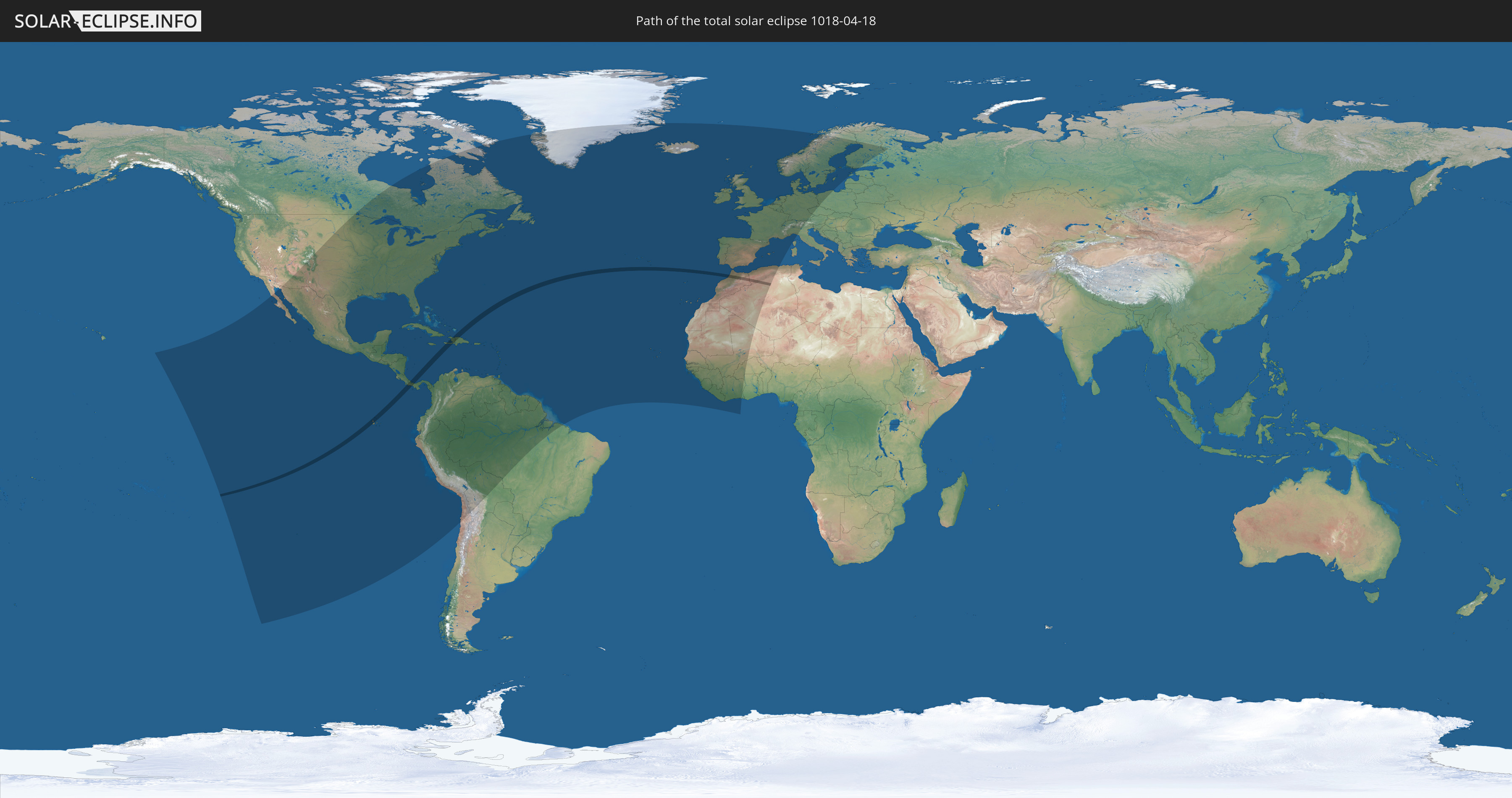
Die Sonnenfinsternis am 18.04.1018 kann man in 94 Ländern als partielle Sonnenfinsternis beobachten.
Der Finsternispfad verläuft durch 7 Länder. Nur in diesen Ländern ist sie als totale Sonnenfinsternis zu sehen.
In den folgenden Ländern ist die Sonnenfinsternis total zu sehen
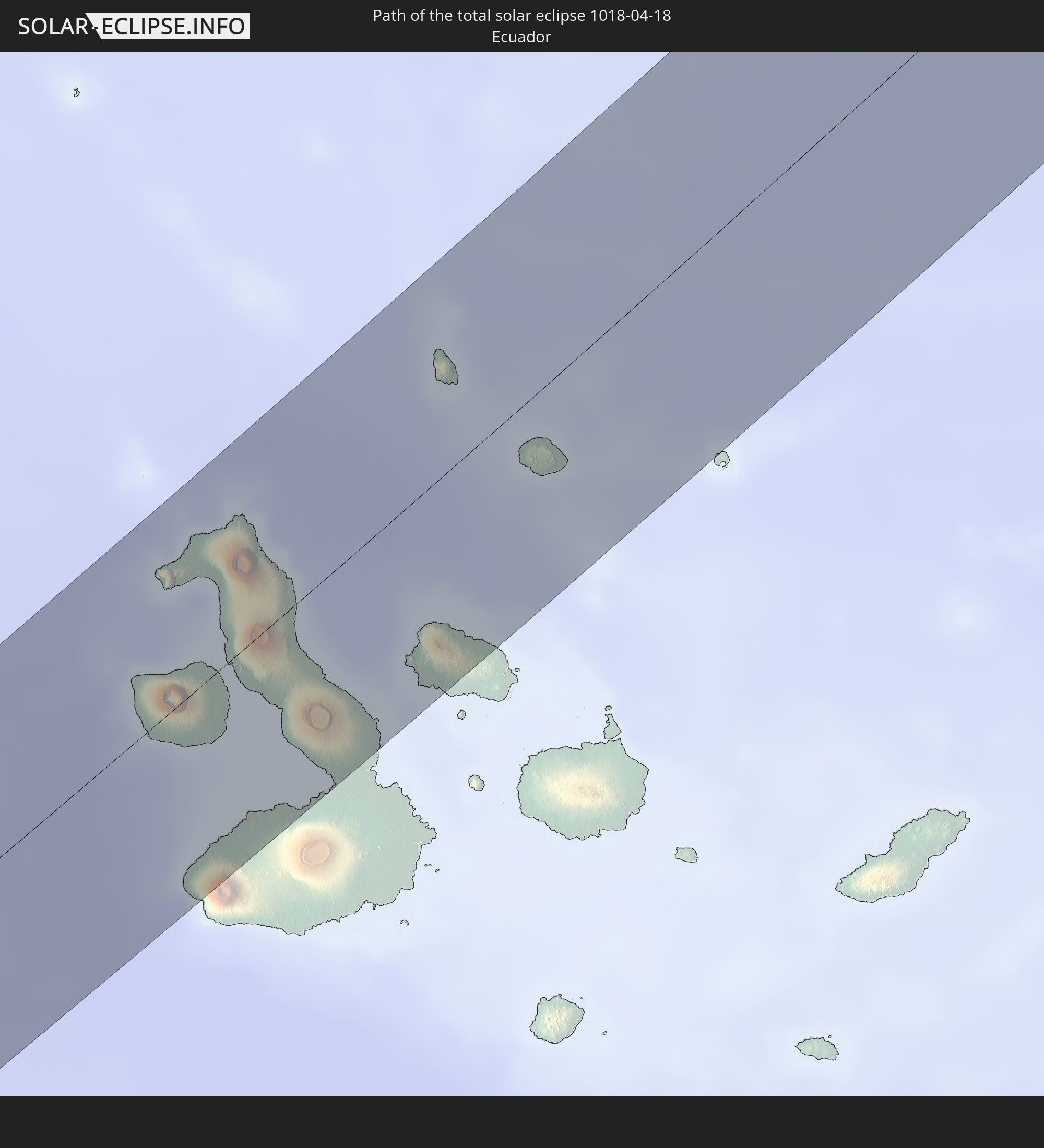 Ecuador
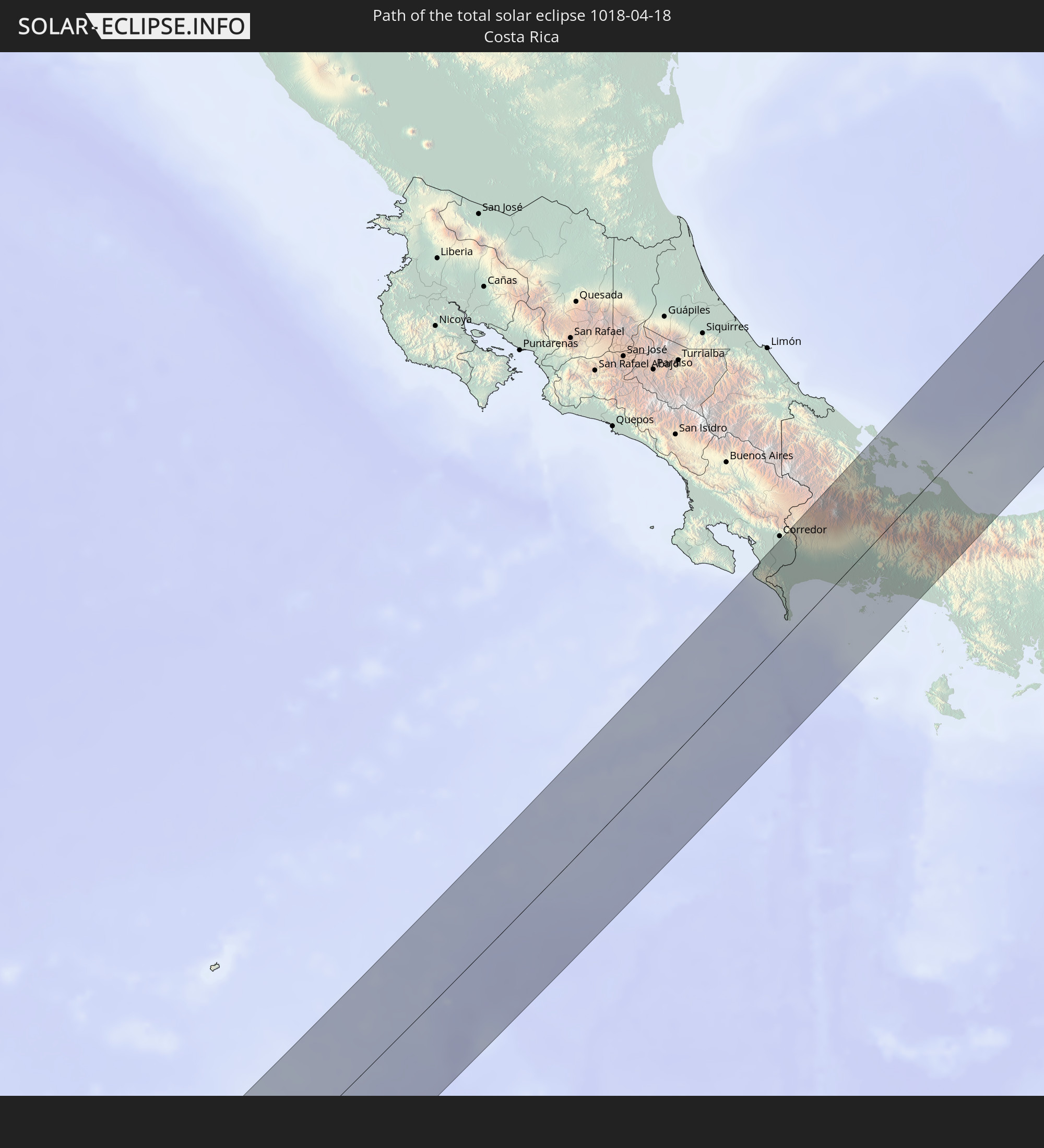 Costa Rica
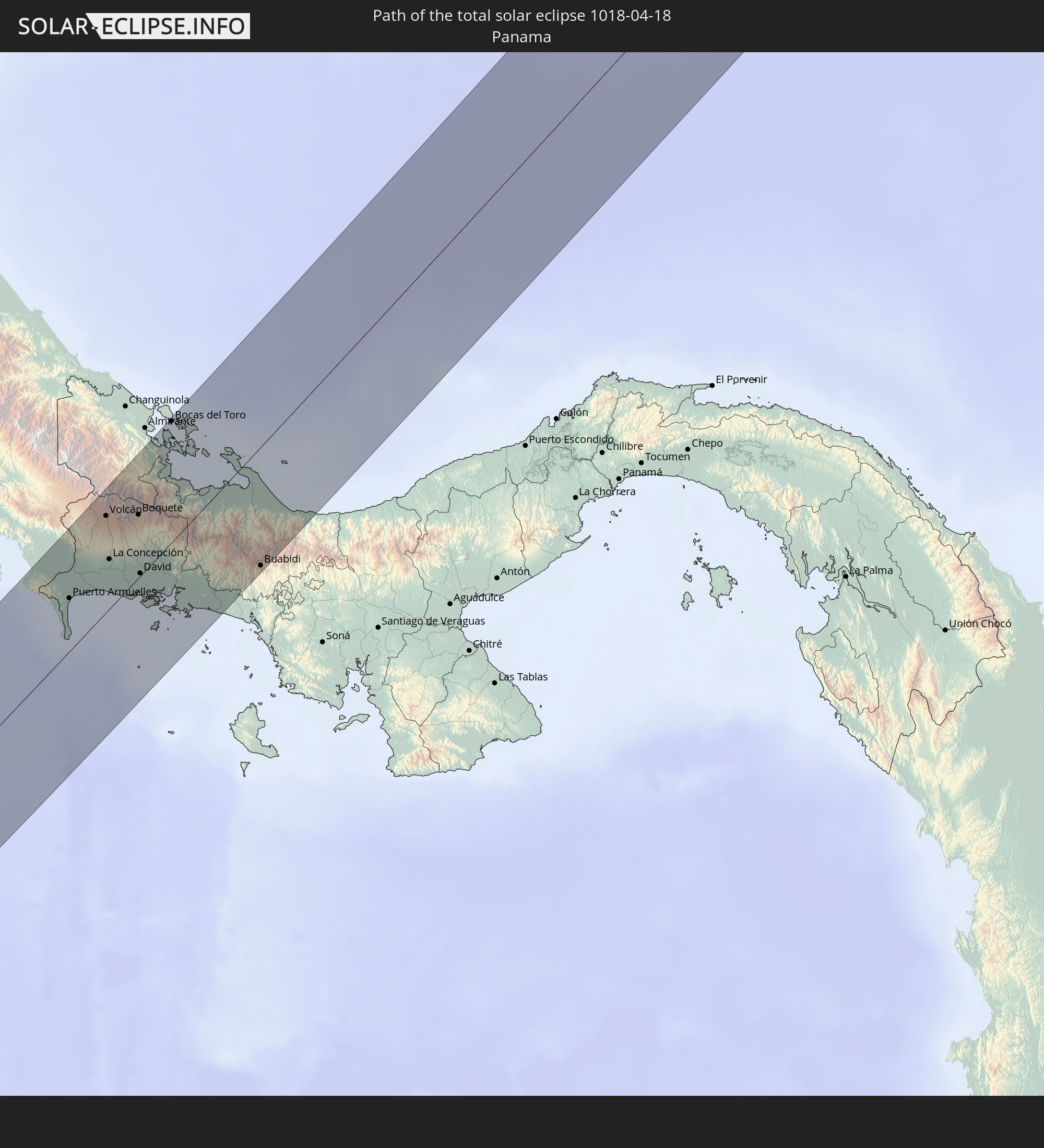 Panama
 Haiti
Haiti
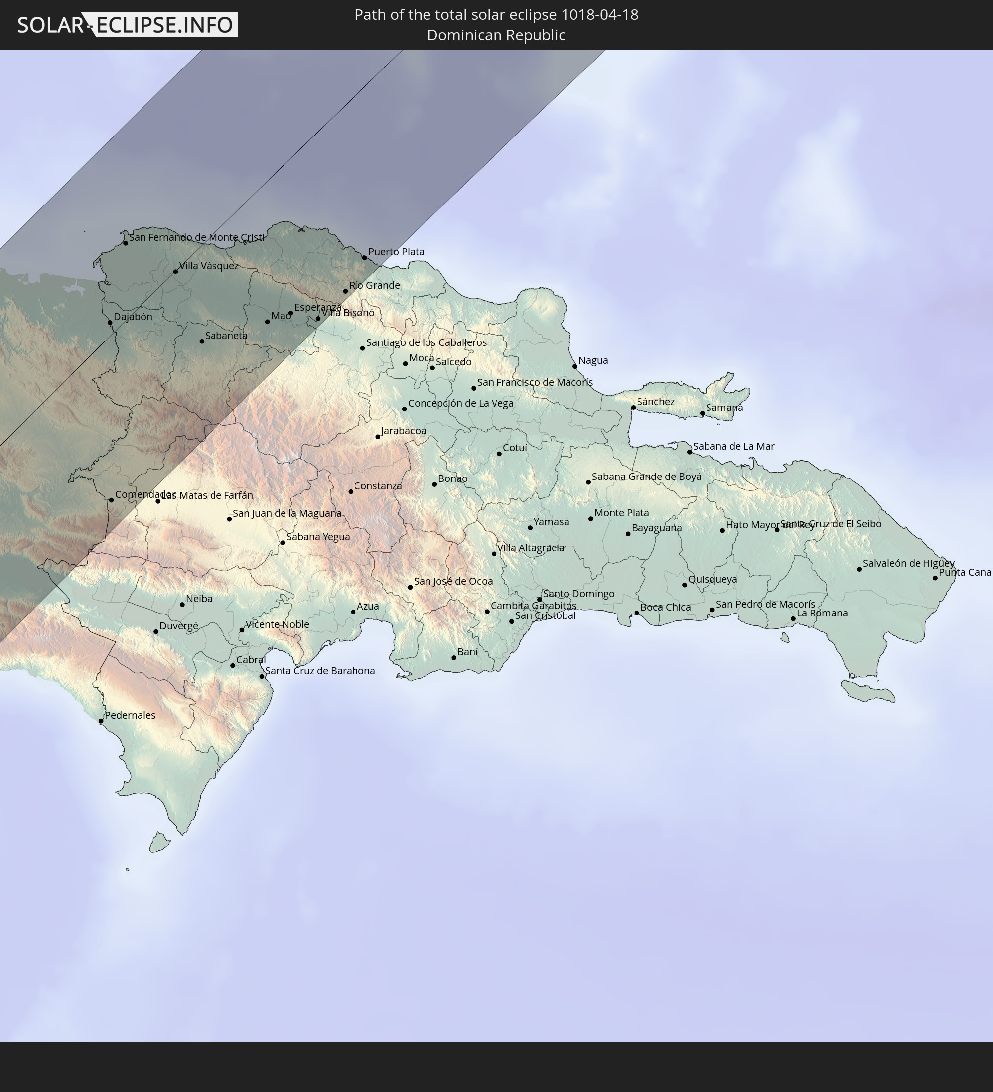 Dominikanische Republik
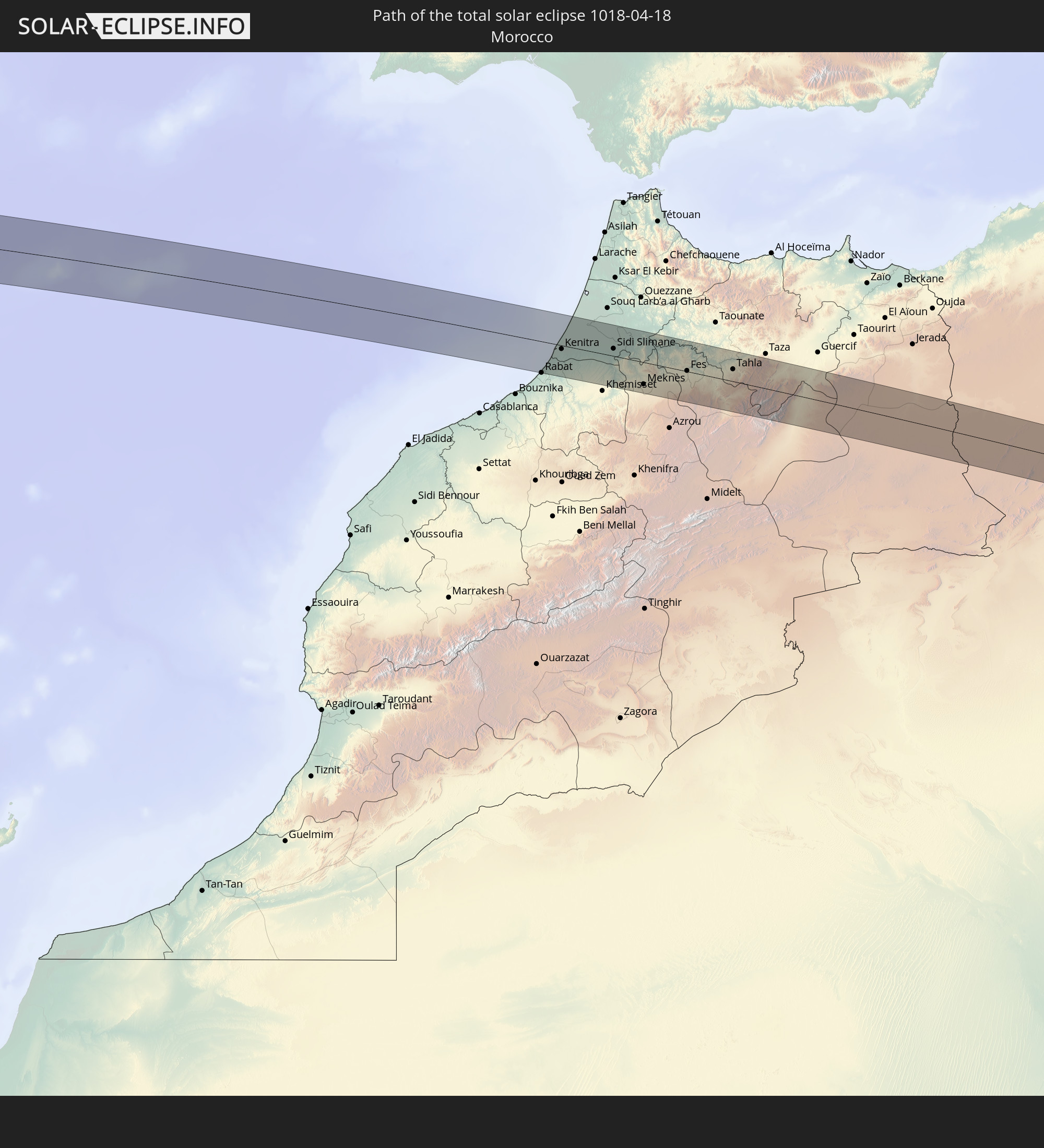 Marokko
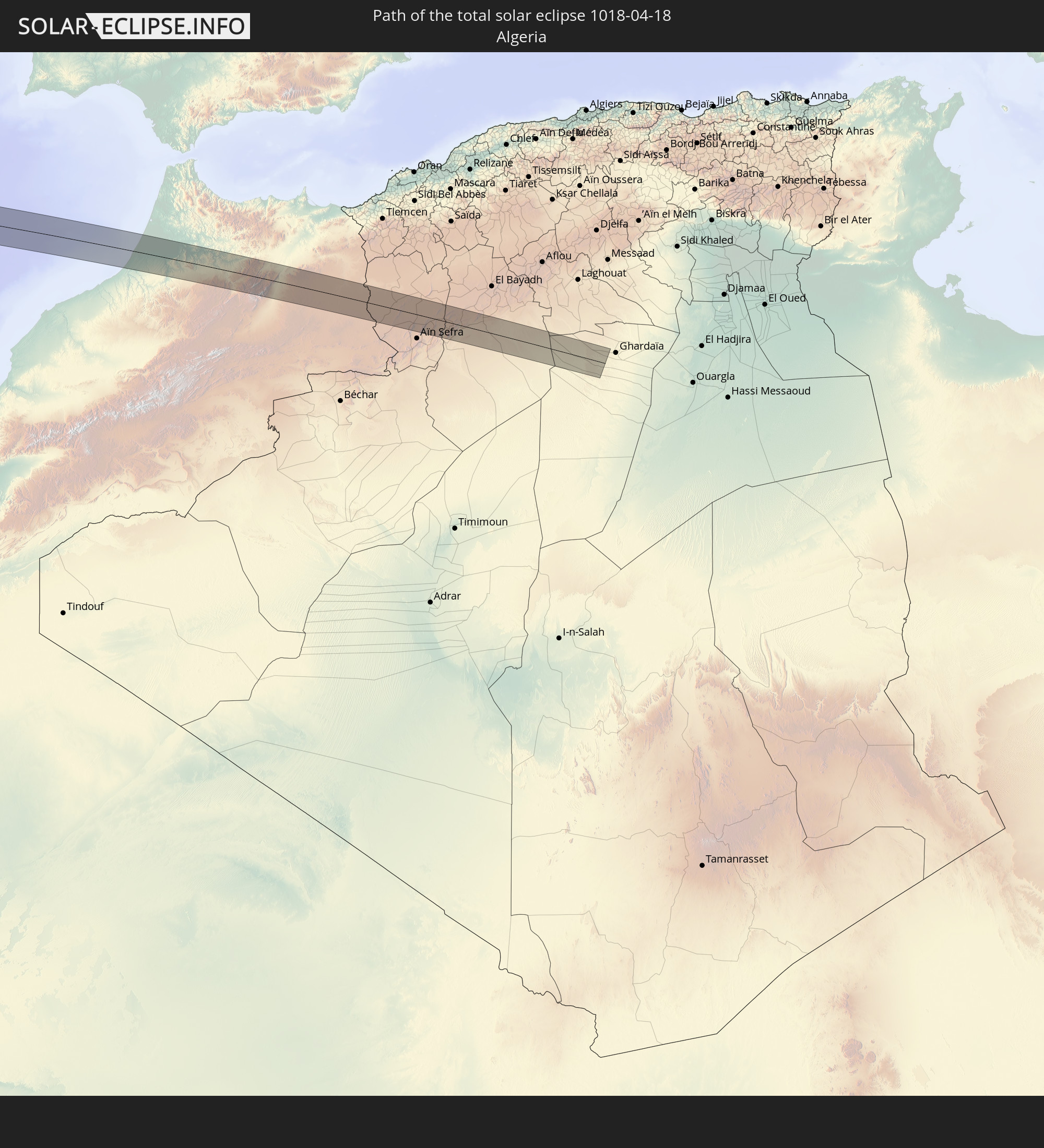 Algerien
In den folgenden Ländern ist die Sonnenfinsternis partiell zu sehen
 Russland
 Vereinigte Staaten
 United States Minor Outlying Islands
 Kanada
 Pitcairninseln
 Mexiko
 Chile
Chile
 Grönland
 Guatemala
 Ecuador
 El Salvador
 Honduras
 Belize
 Nicaragua
 Costa Rica
 Kuba
Kuba
 Panama
 Kolumbien
 Kaimaninseln
 Peru
Peru
 Bahamas
 Jamaika
 Haiti
Haiti
 Brasilien
 Venezuela
 Turks- und Caicosinseln
 Dominikanische Republik
 Aruba
Aruba
 Bolivien
 Puerto Rico
 Amerikanische Jungferninseln
 Bermuda
 Britische Jungferninseln
 Anguilla
 Saint-Martin
 Saint-Barthélemy
 St. Kitts und Nevis
 Antigua und Barbuda
 Montserrat
 Trinidad und Tobago
 Guadeloupe
 Grenada
 Dominica
 St. Vincent und die Grenadinen
 Guyana
 Martinique
 St. Lucia
 Barbados
 Suriname
 Saint-Pierre und Miquelon
 Französisch-Guayana
 Portugal
 Kap Verde
 Island
 Spanien
 Senegal
 Mauretanien
 Gambia
 Guinea-Bissau
 Guinea
 Sierra Leone
 Marokko
 Mali
Mali
 Liberia
 Irland
 Algerien
 Vereinigtes Königreich
 Elfenbeinküste
 Färöer
 Burkina Faso
 Gibraltar
 Frankreich
 Isle of Man
 Ghana
Ghana
 Guernsey
 Jersey
 Andorra
 Belgien
 Niederlande
 Norwegen
 Luxemburg
 Deutschland
 Schweiz
 Italien
 Monaco
 Dänemark
 Liechtenstein
 Österreich
 Schweden
 Tschechien
 Polen
Polen
 Åland Islands
 Finnland
 Estland
Wie wird das Wetter während der totalen Sonnenfinsternis am 18.04.1018?
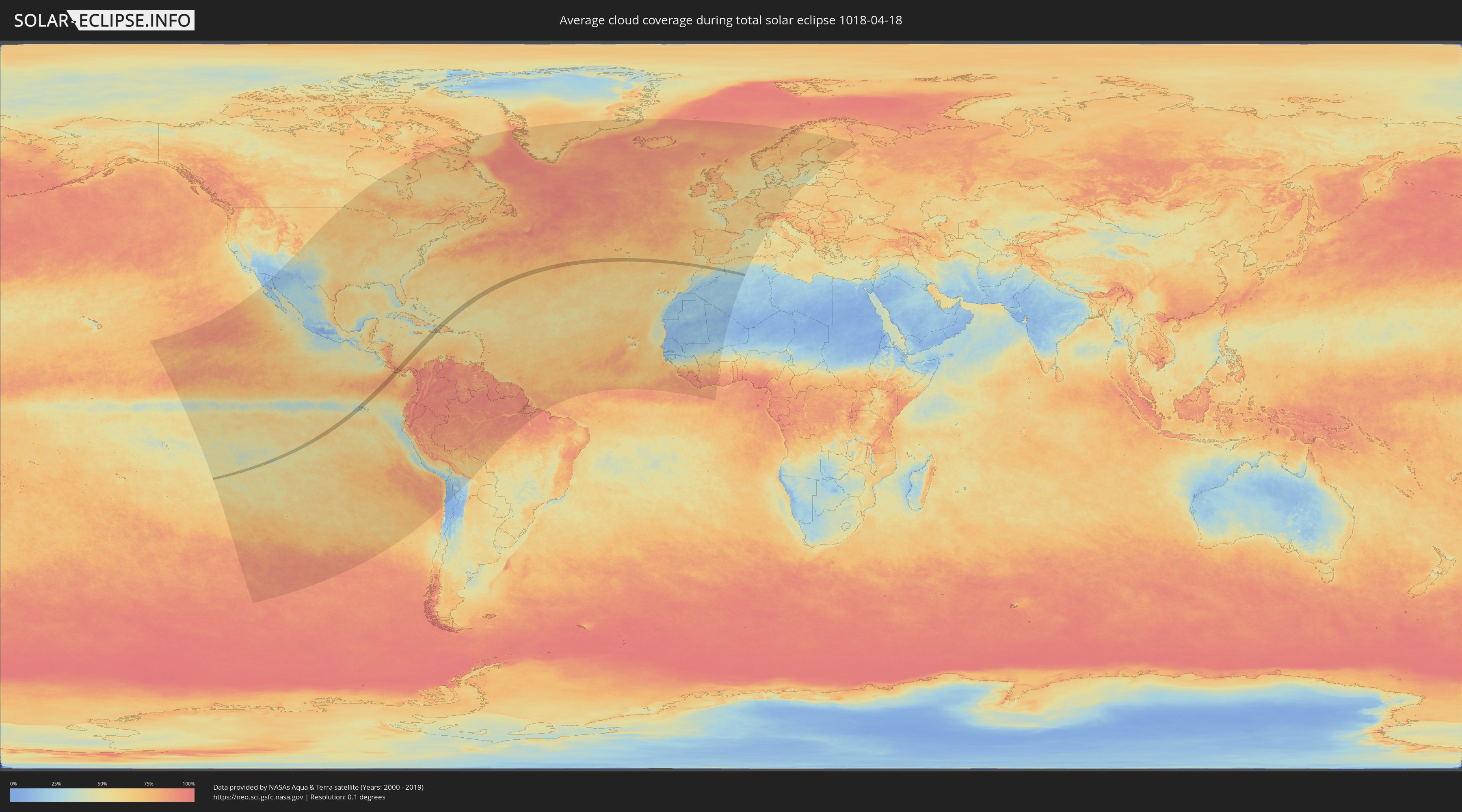
Wo ist der beste Ort, um die totale Sonnenfinsternis vom 18.04.1018 zu beobachten?
Die folgenden Karten zeigen die durchschnittliche Bewölkung für den Tag, an dem die totale Sonnenfinsternis
stattfindet. Mit Hilfe der Karten lässt sich der Ort entlang des Finsternispfades eingrenzen,
der die besten Aussichen auf einen klaren wolkenfreien Himmel bietet.
Trotzdem muss man immer lokale Gegenenheiten beachten und sollte sich genau über das Wetter an seinem
gewählten Beobachtungsort informieren.
Die Daten stammen von den beiden NASA-Satelliten
AQUA und TERRA
und wurden über einen Zeitraum von 19 Jahren (2000 - 2019) gemittelt.

Detaillierte Länderkarten
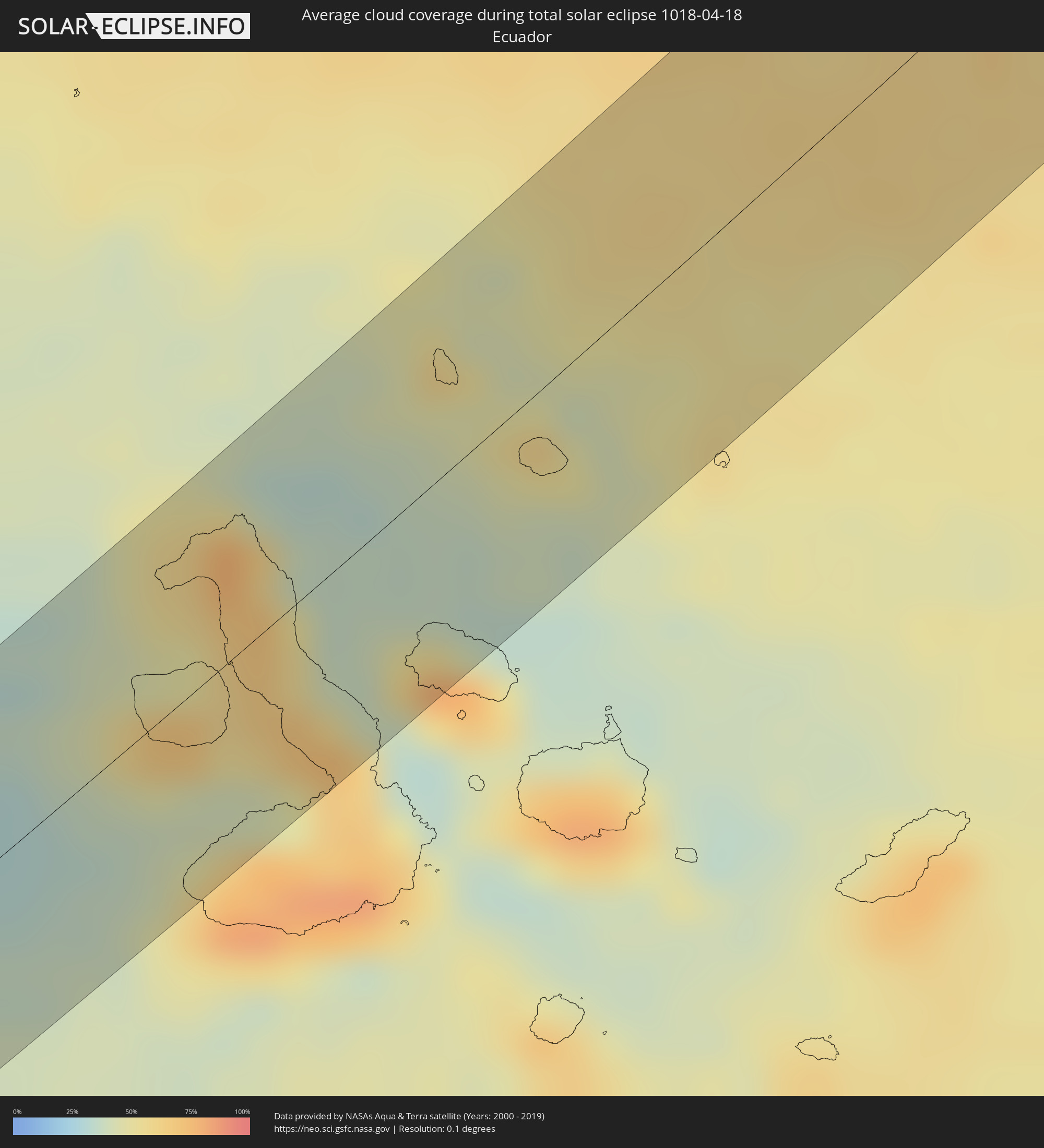 Ecuador
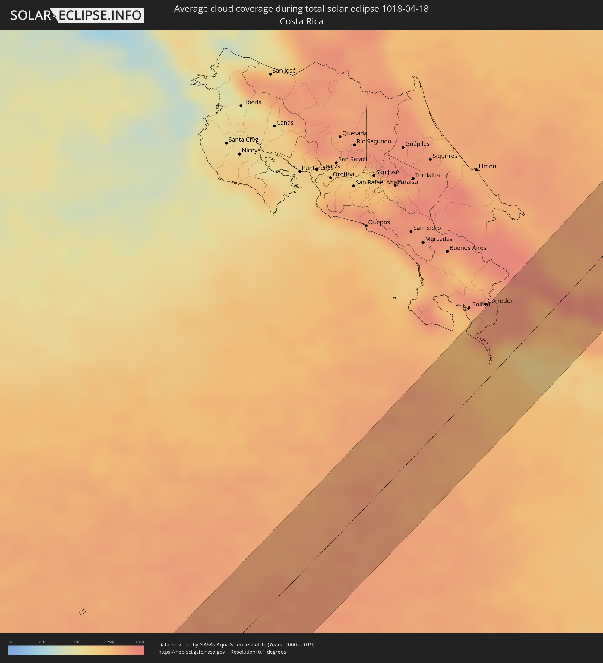 Costa Rica
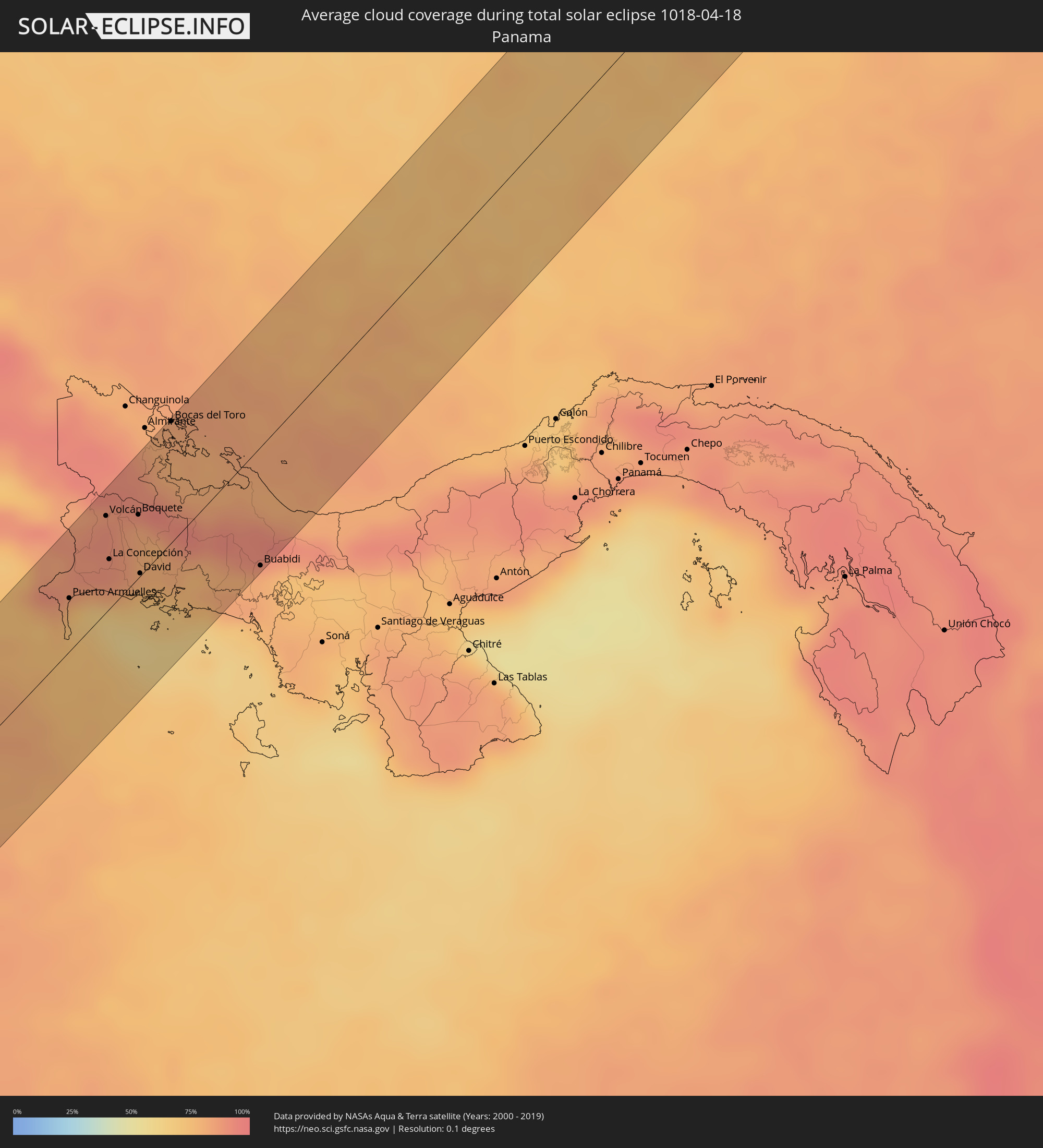 Panama
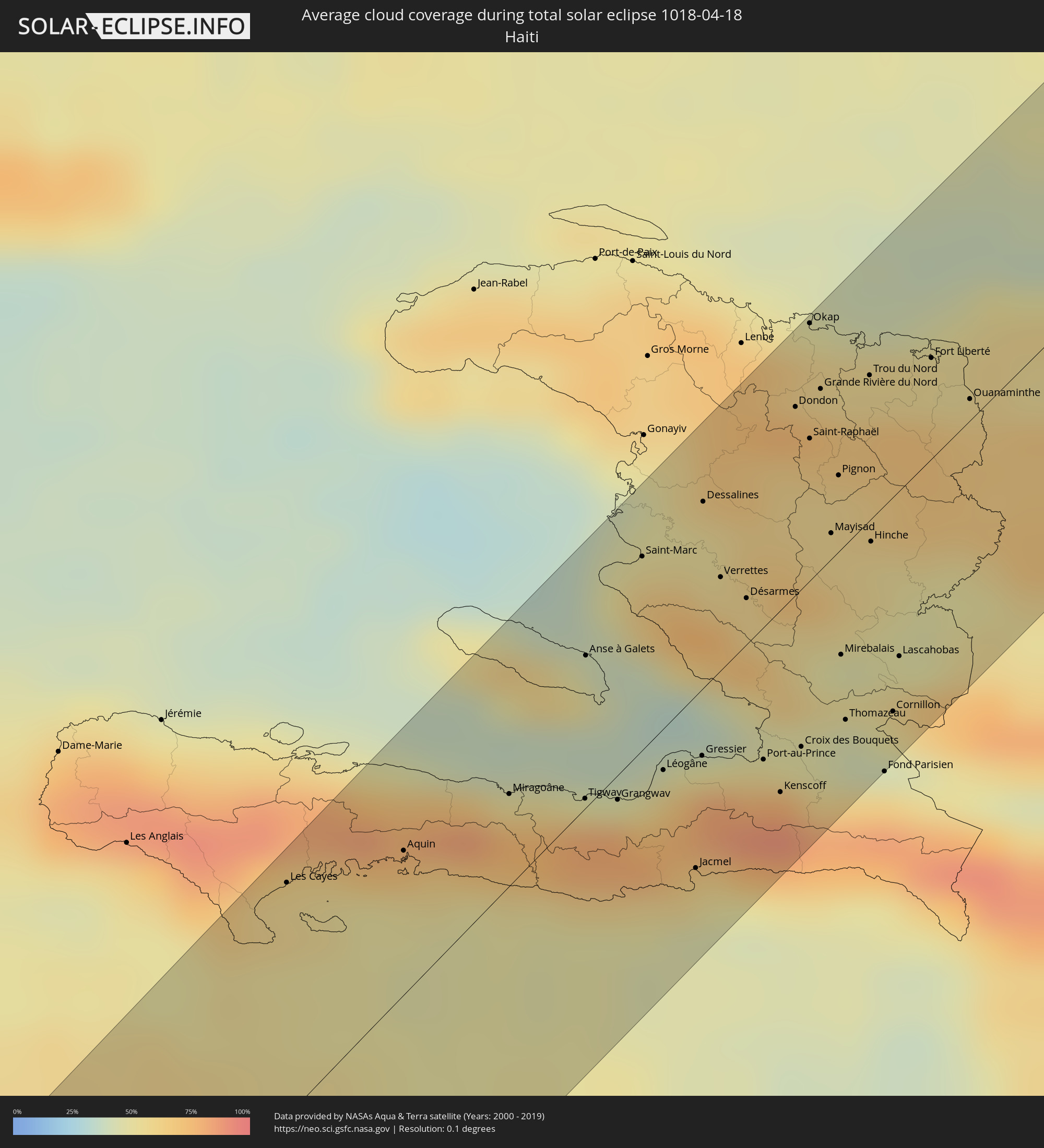 Haiti
Haiti
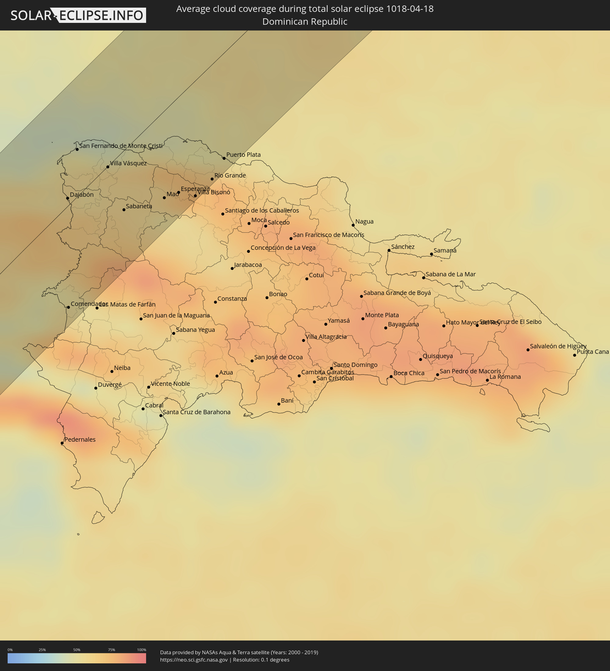 Dominikanische Republik
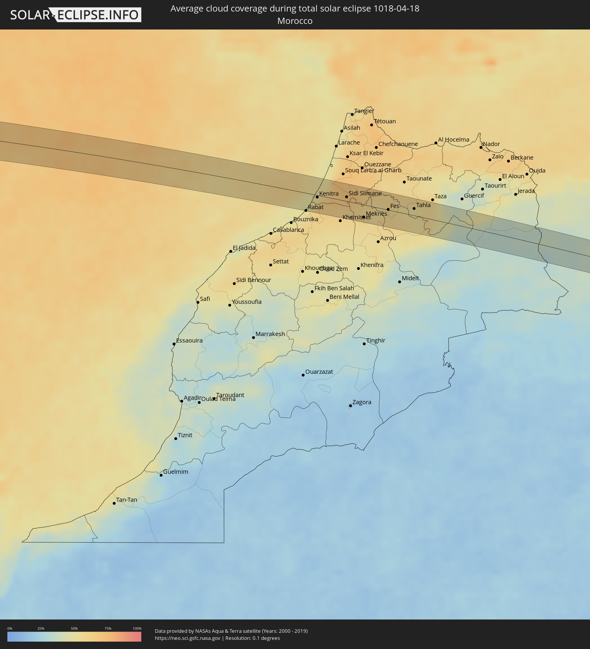 Marokko
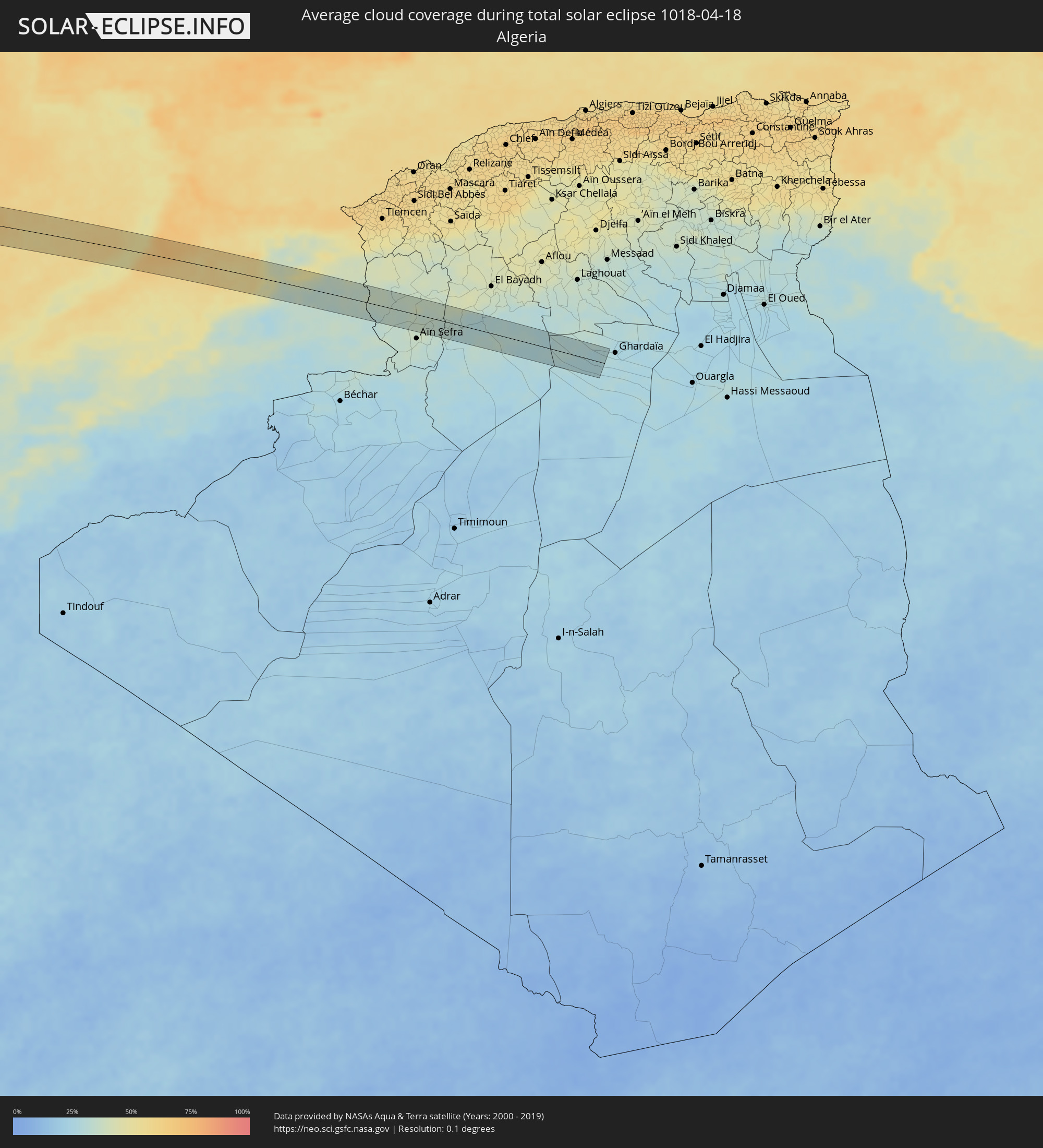 Algerien
Orte im Finsternispfad
Die nachfolgene Tabelle zeigt Städte und Orte mit mehr als 5.000 Einwohnern, die sich im Finsternispfad befinden. Städte mit mehr als 100.000 Einwohnern sind dick gekennzeichnet. Mit einem Klick auf den Ort öffnet sich eine Detailkarte die die Lage des jeweiligen Ortes zusammen mit dem Verlauf der zentralen Finsternis präsentiert.
| Ort | Typ | Dauer der Verfinsterung | Ortszeit bei maximaler Verfinsterung | Entfernung zur Zentrallinie | Ø Bewölkung |
|
Puerto Armuelles, Chiriquí
|
total | - | 10:27:18 UTC-05:19 | 24 km | 82% |
|
Volcán, Chiriquí
|
total | - | 10:28:40 UTC-05:19 | 44 km | 90% |
|
La Concepción, Chiriquí
|
total | - | 10:28:10 UTC-05:19 | 23 km | 89% |
|
Boquete, Chiriquí
|
total | - | 10:28:59 UTC-05:19 | 29 km | 83% |
|
Pedregal, Chiriquí
|
total | - | 10:28:09 UTC-05:19 | 3 km | 75% |
|
David, Chiriquí
|
total | - | 10:28:17 UTC-05:19 | 1 km | 75% |
|
Las Lomas, Chiriquí
|
total | - | 10:28:22 UTC-05:19 | 2 km | 75% |
|
Bocas del Toro, Bocas del Toro
|
total | - | 10:30:27 UTC-05:19 | 55 km | 81% |
|
Buabidi, Ngöbe-Buglé
|
total | - | 10:29:33 UTC-05:19 | 54 km | 81% |
|
Les Cayes, Sud
|
total | - | 11:34:44 UTC-04:49 | 51 km | 57% |
|
Aquin, Sud
|
total | - | 11:35:35 UTC-04:49 | 31 km | 70% |
|
Miragoâne, Nippes
|
total | - | 11:36:31 UTC-04:49 | 20 km | 75% |
|
Tigwav, Ouest
|
total | - | 11:36:56 UTC-04:49 | 2 km | 78% |
|
Anse à Galets, Ouest
|
total | - | 11:37:46 UTC-04:49 | 33 km | 52% |
|
Grangwav, Ouest
|
total | - | 11:37:07 UTC-04:49 | 5 km | 79% |
|
Saint-Marc, Artibonite
|
total | - | 11:38:40 UTC-04:49 | 42 km | 64% |
|
Léogâne, Ouest
|
total | - | 11:37:33 UTC-04:49 | 9 km | 68% |
|
Jacmel, Sud-Est
|
total | - | 11:37:10 UTC-04:49 | 38 km | 51% |
|
Gressier, Ouest
|
total | - | 11:37:51 UTC-04:49 | 15 km | 51% |
|
Dessalines, Artibonite
|
total | - | 11:39:19 UTC-04:49 | 41 km | 55% |
|
Verrettes, Artibonite
|
total | - | 11:39:00 UTC-04:49 | 20 km | 60% |
|
Carrefour, Ouest
|
total | - | 11:38:04 UTC-04:49 | 24 km | 78% |
|
Désarmes, Artibonite
|
total | - | 11:39:01 UTC-04:49 | 10 km | 61% |
|
Port-au-Prince, Ouest
|
total | - | 11:38:11 UTC-04:49 | 29 km | 77% |
|
Delmas 73, Ouest
|
total | - | 11:38:16 UTC-04:49 | 31 km | 77% |
|
Pétionville, Ouest
|
total | - | 11:38:14 UTC-04:49 | 35 km | 77% |
|
Kenscoff, Ouest
|
total | - | 11:38:06 UTC-04:49 | 40 km | 88% |
|
Dondon, Nord
|
total | - | 11:40:24 UTC-04:49 | 41 km | 66% |
|
Croix des Bouquets, Ouest
|
total | - | 11:38:29 UTC-04:49 | 35 km | 47% |
|
Milot, Nord
|
total | - | 11:40:37 UTC-04:49 | 45 km | 71% |
|
Okap, Nord
|
total | - | 11:40:57 UTC-04:49 | 56 km | 48% |
|
Saint-Raphaël, Nord
|
total | - | 11:40:18 UTC-04:49 | 31 km | 59% |
|
Grande Rivière du Nord, Nord
|
total | - | 11:40:39 UTC-04:49 | 40 km | 71% |
|
Mayisad, Centre
|
total | - | 11:39:53 UTC-04:49 | 6 km | 57% |
|
Pignon, Nord
|
total | - | 11:40:16 UTC-04:49 | 17 km | 60% |
|
Mirebalais, Centre
|
total | - | 11:39:15 UTC-04:49 | 23 km | 52% |
|
Thomazeau, Ouest
|
total | - | 11:38:54 UTC-04:49 | 39 km | 45% |
|
Trou du Nord, Nord-Est
|
total | - | 11:41:01 UTC-04:49 | 32 km | 69% |
|
Hinche, Centre
|
total | - | 11:40:04 UTC-04:49 | 5 km | 54% |
|
Cornillon, Ouest
|
total | - | 11:39:13 UTC-04:49 | 47 km | 50% |
|
Lascahobas, Centre
|
total | - | 11:39:35 UTC-04:49 | 36 km | 66% |
|
Fort Liberté, Nord-Est
|
total | - | 11:41:28 UTC-04:49 | 22 km | 54% |
|
Ouanaminthe, Nord-Est
|
total | - | 11:41:28 UTC-04:49 | 5 km | 65% |
|
Dajabón, Dajabón
|
total | - | 11:50:29 UTC-04:40 | 4 km | 65% |
|
Comendador, Elías Piña
|
total | - | 11:49:08 UTC-04:40 | 50 km | 58% |
|
San Fernando de Monte Cristi, Monte Cristi
|
total | - | 11:51:13 UTC-04:40 | 23 km | 57% |
|
Loma de Cabrera, Dajabón
|
total | - | 11:50:28 UTC-04:40 | 14 km | 65% |
|
Las Matas de Santa Cruz, Monte Cristi
|
total | - | 11:51:09 UTC-04:40 | 2 km | 56% |
|
Villa Vásquez, Monte Cristi
|
total | - | 11:51:24 UTC-04:40 | 1 km | 58% |
|
Sabaneta, Santiago Rodríguez
|
total | - | 11:51:04 UTC-04:40 | 29 km | 62% |
|
Monción, Santiago Rodríguez
|
total | - | 11:51:19 UTC-04:40 | 48 km | 66% |
|
Laguna Salada, Valverde
|
total | - | 11:51:56 UTC-04:40 | 34 km | 61% |
|
Mao, Valverde
|
total | - | 11:51:45 UTC-04:40 | 43 km | 53% |
|
Esperanza, Valverde
|
total | - | 11:52:00 UTC-04:40 | 47 km | 53% |
|
Villa Bisonó, Santiago
|
total | - | 11:52:10 UTC-04:40 | 57 km | 57% |
|
Imbert, Puerto Plata
|
total | - | 11:52:39 UTC-04:40 | 45 km | 64% |
|
Río Grande, Puerto Plata
|
total | - | 11:52:36 UTC-04:40 | 56 km | 72% |
|
Puerto Plata, Puerto Plata
|
total | - | 11:53:01 UTC-04:40 | 52 km | 61% |
|
Sale, Rabat-Salé-Zemmour-Zaër
|
total | - | 17:44:55 UTC-00:30 | 31 km | 52% |
|
Kenitra, Gharb-Chrarda-Beni Hssen
|
total | - | 17:44:52 UTC-00:30 | 4 km | 57% |
|
Sidi Yahia El Gharb, Gharb-Chrarda-Beni Hssen
|
total | - | 17:44:53 UTC-00:30 | 6 km | 68% |
|
Sidi Slimane, Gharb-Chrarda-Beni Hssen
|
total | - | 17:44:58 UTC-00:30 | 8 km | 68% |
|
Sidi Qacem, Gharb-Chrarda-Beni Hssen
|
total | - | 17:45:02 UTC-00:30 | 8 km | 62% |
|
Meknès, Meknès-Tafilalet
|
total | - | 17:45:12 UTC-00:30 | 25 km | 57% |
|
Fes, Fès-Boulemane
|
total | - | 17:45:13 UTC-00:30 | 1 km | 59% |
|
Fès al Bali, Fès-Boulemane
|
total | - | 17:45:12 UTC-00:30 | 6 km | 60% |
|
Sefrou, Fès-Boulemane
|
total | - | 17:45:20 UTC-00:30 | 18 km | 58% |
|
Tahla, Taza-Al Hoceima-Taounate
|
total | - | 17:45:17 UTC-00:30 | 14 km | 55% |
|
Naama, Naama
|
total | - | 18:25:35 UTC+00:09 | 15 km | 34% |
|
El Abiodh Sidi Cheikh, El Bayadh
|
total | - | 18:25:44 UTC+00:09 | 6 km | 30% |