Totale Sonnenfinsternis vom 24.01.1023
| Wochentag: | Freitag |
| Maximale Dauer der Verfinsterung: | 03m00s |
| Maximale Breite des Finsternispfades: | 276 km |
| Saroszyklus: | 115 |
| Bedeckungsgrad: | 100% |
| Magnitude: | 1.0385 |
| Gamma: | 0.8869 |
Wo kann man die Sonnenfinsternis vom 24.01.1023 sehen?
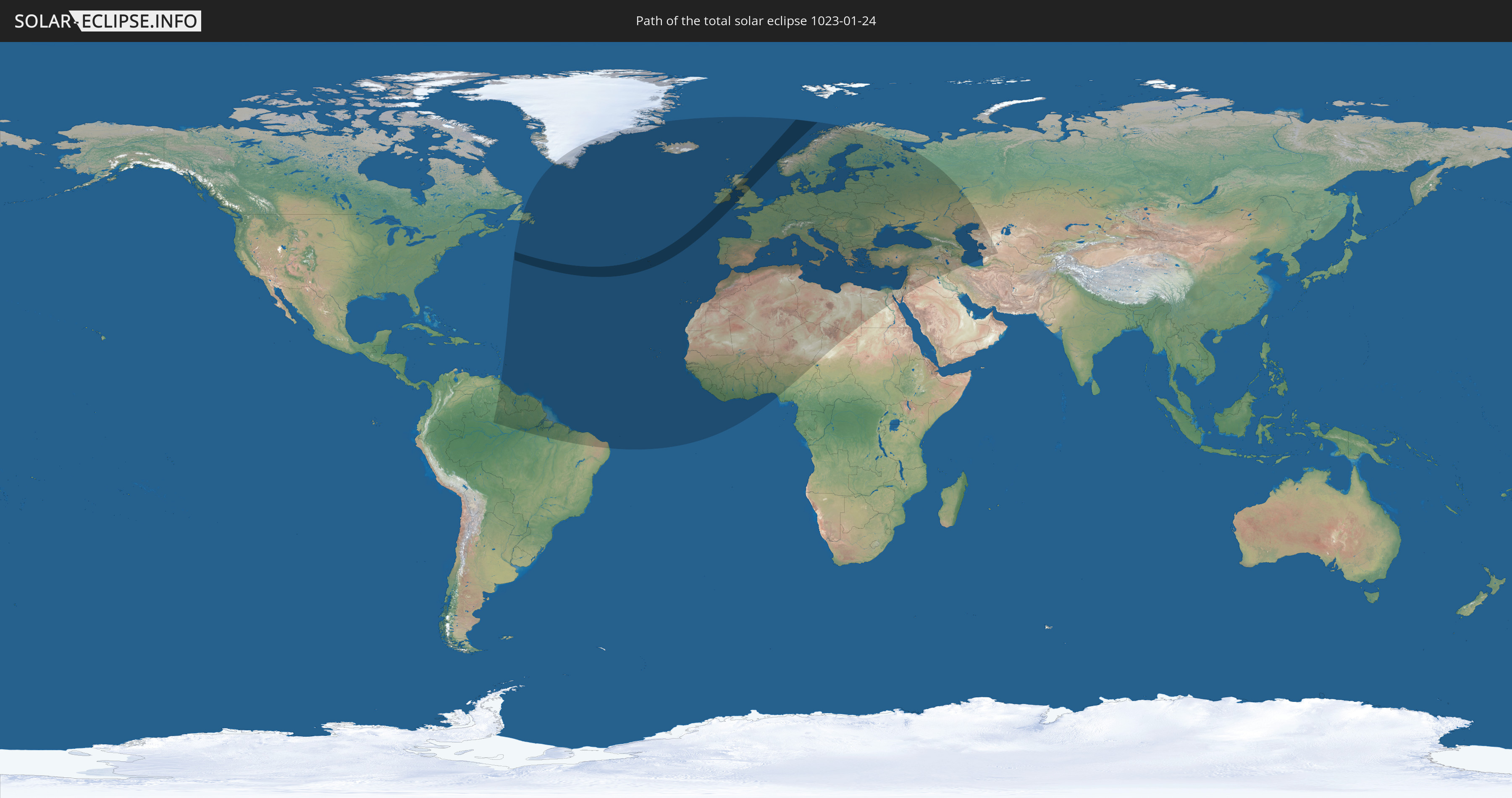
Die Sonnenfinsternis am 24.01.1023 kann man in 98 Ländern als partielle Sonnenfinsternis beobachten.
Der Finsternispfad verläuft durch 5 Länder. Nur in diesen Ländern ist sie als totale Sonnenfinsternis zu sehen.
In den folgenden Ländern ist die Sonnenfinsternis total zu sehen
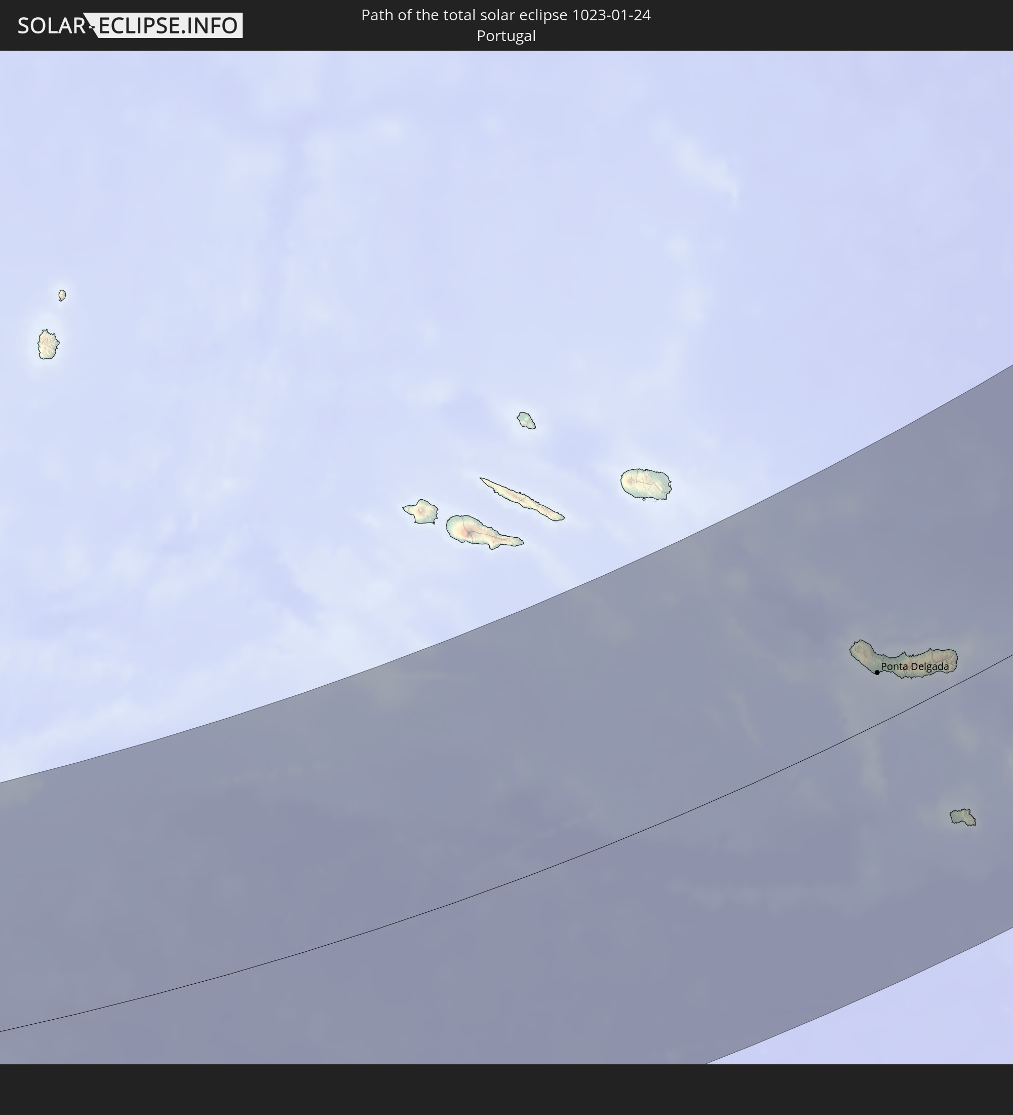 Portugal
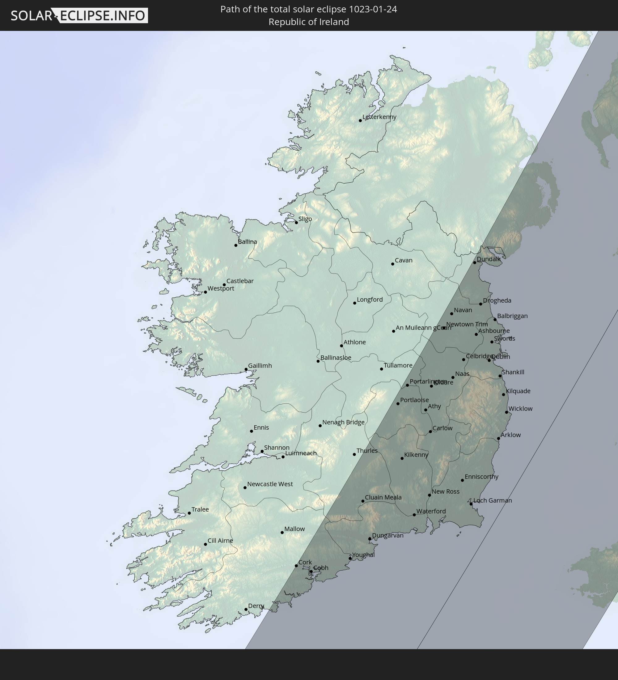 Irland
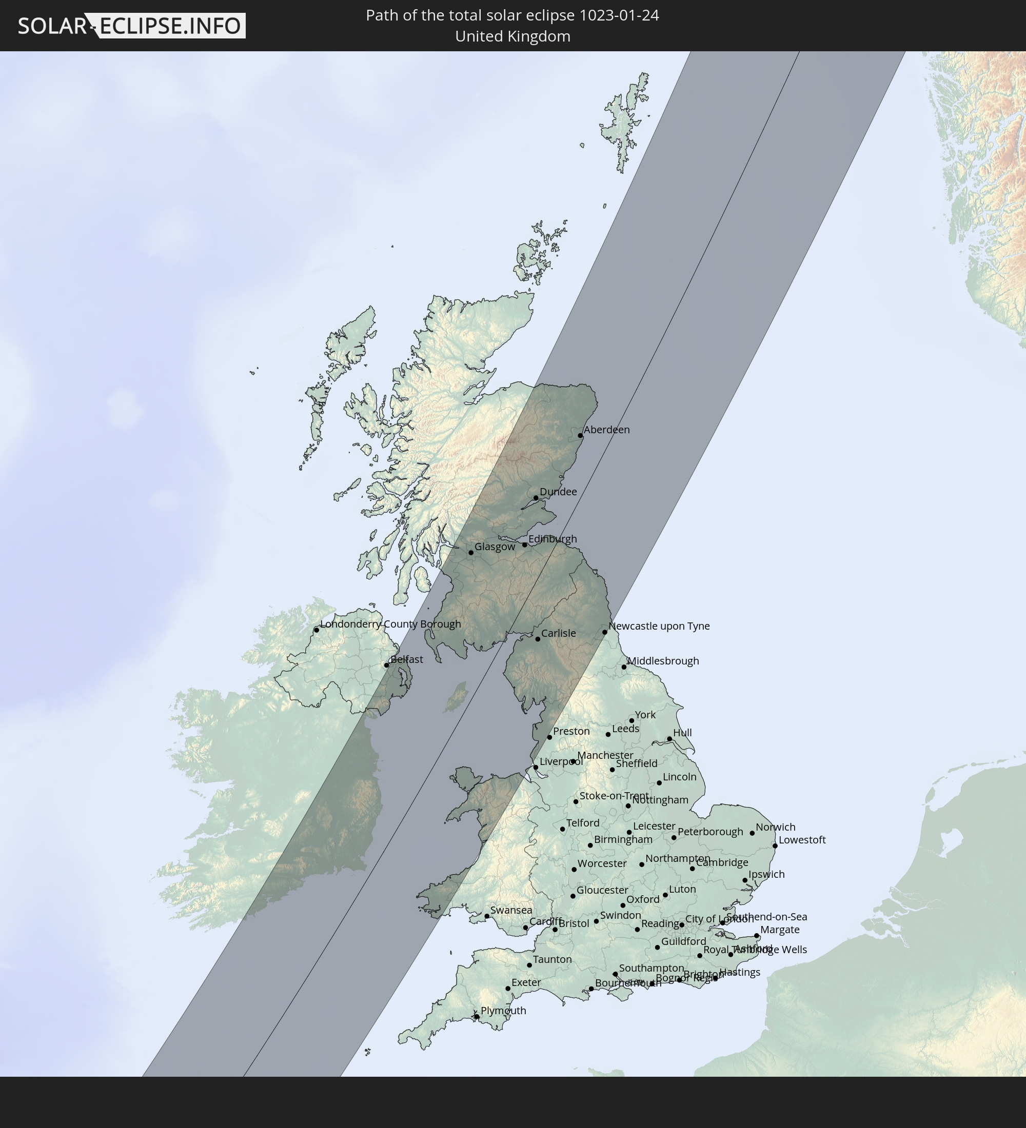 Vereinigtes Königreich
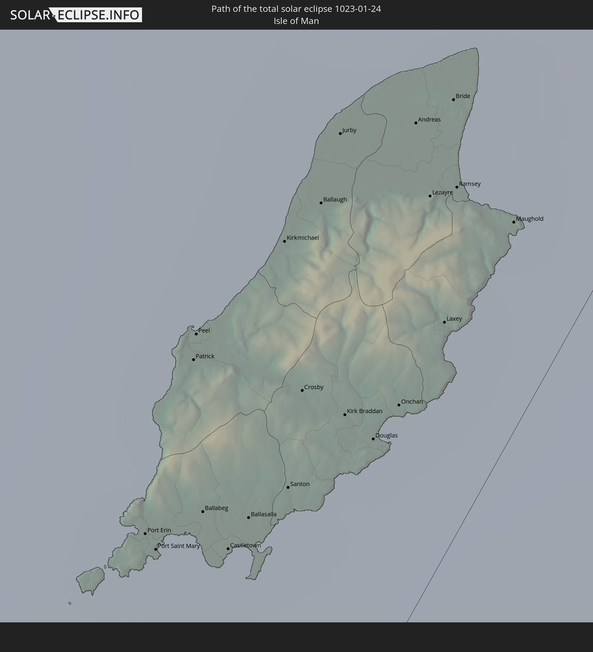 Isle of Man
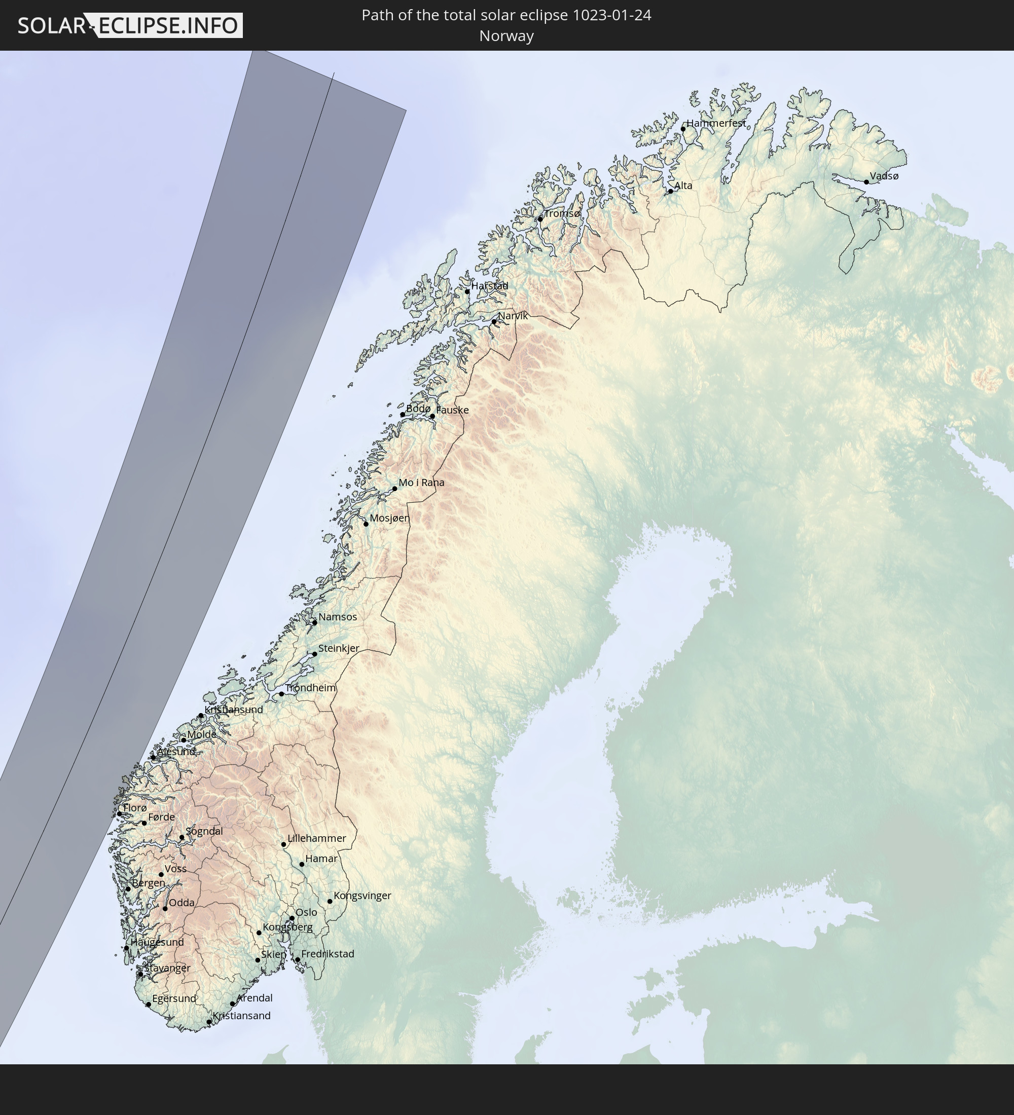 Norwegen
In den folgenden Ländern ist die Sonnenfinsternis partiell zu sehen
 Russland
 Kanada
 Grönland
 Brasilien
 Venezuela
 Guyana
 Barbados
 Suriname
 Saint-Pierre und Miquelon
 Französisch-Guayana
 Portugal
 Kap Verde
 Island
 Spanien
 Senegal
 Mauretanien
 Gambia
 Guinea-Bissau
 Guinea
 Sierra Leone
 Marokko
 Mali
Mali
 Liberia
 Irland
 Spitzbergen
 Algerien
 Vereinigtes Königreich
 Elfenbeinküste
 Färöer
 Burkina Faso
 Gibraltar
 Frankreich
 Isle of Man
 Ghana
Ghana
 Guernsey
 Jersey
 Togo
Togo
 Niger
Niger
 Benin
Benin
 Andorra
 Belgien
 Nigeria
 Niederlande
 Norwegen
 Luxemburg
 Deutschland
 Schweiz
 Italien
 Monaco
 Tunesien
 Dänemark
 Libyen
 Liechtenstein
 Österreich
 Schweden
 Tschechien
 San Marino
 Vatikanstadt
 Slowenien
 Tschad
 Kroatien
 Polen
Polen
 Malta
Malta
 Bosnien und Herzegowina
 Ungarn
 Slowakei
 Montenegro
 Serbien
 Albanien
 Åland Islands
 Griechenland
 Rumänien
 Mazedonien
 Finnland
 Litauen
 Lettland
 Estland
 Ukraine
 Bulgarien
 Weißrussland
 Ägypten
 Türkei
 Moldawien
 Republik Zypern
 Staat Palästina
 Israel
 Saudi-Arabien
 Jordanien
 Libanon
 Syrien
 Irak
Irak
 Georgien
 Armenien
 Iran
Iran
 Aserbaidschan
 Kasachstan
 Turkmenistan
 Usbekistan
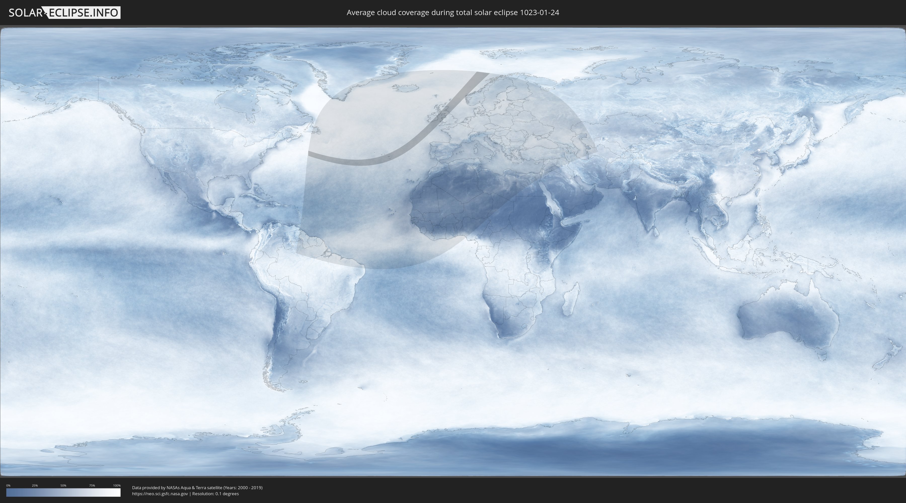
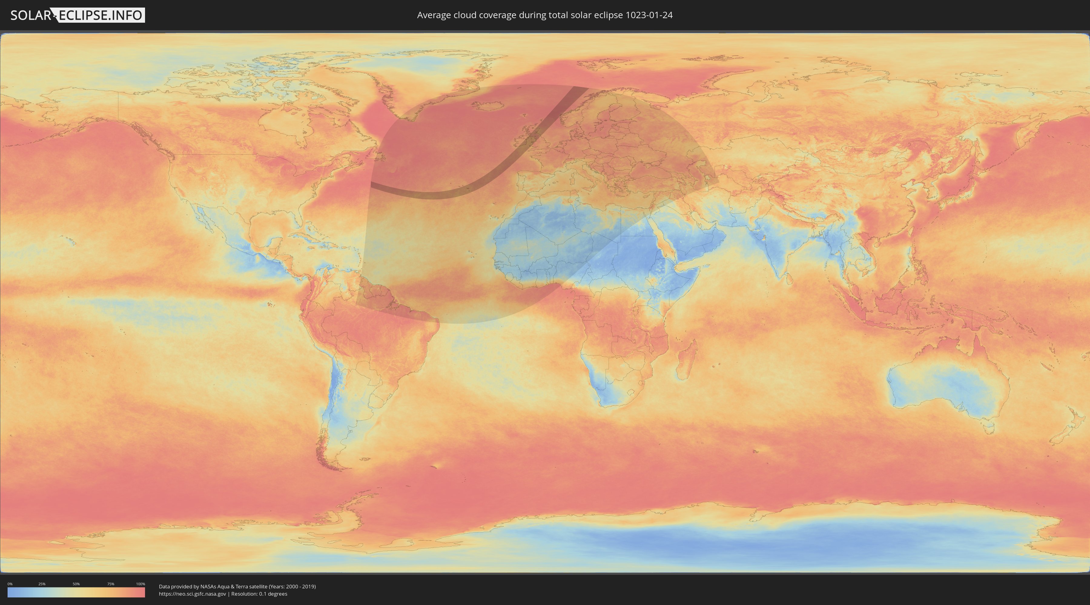
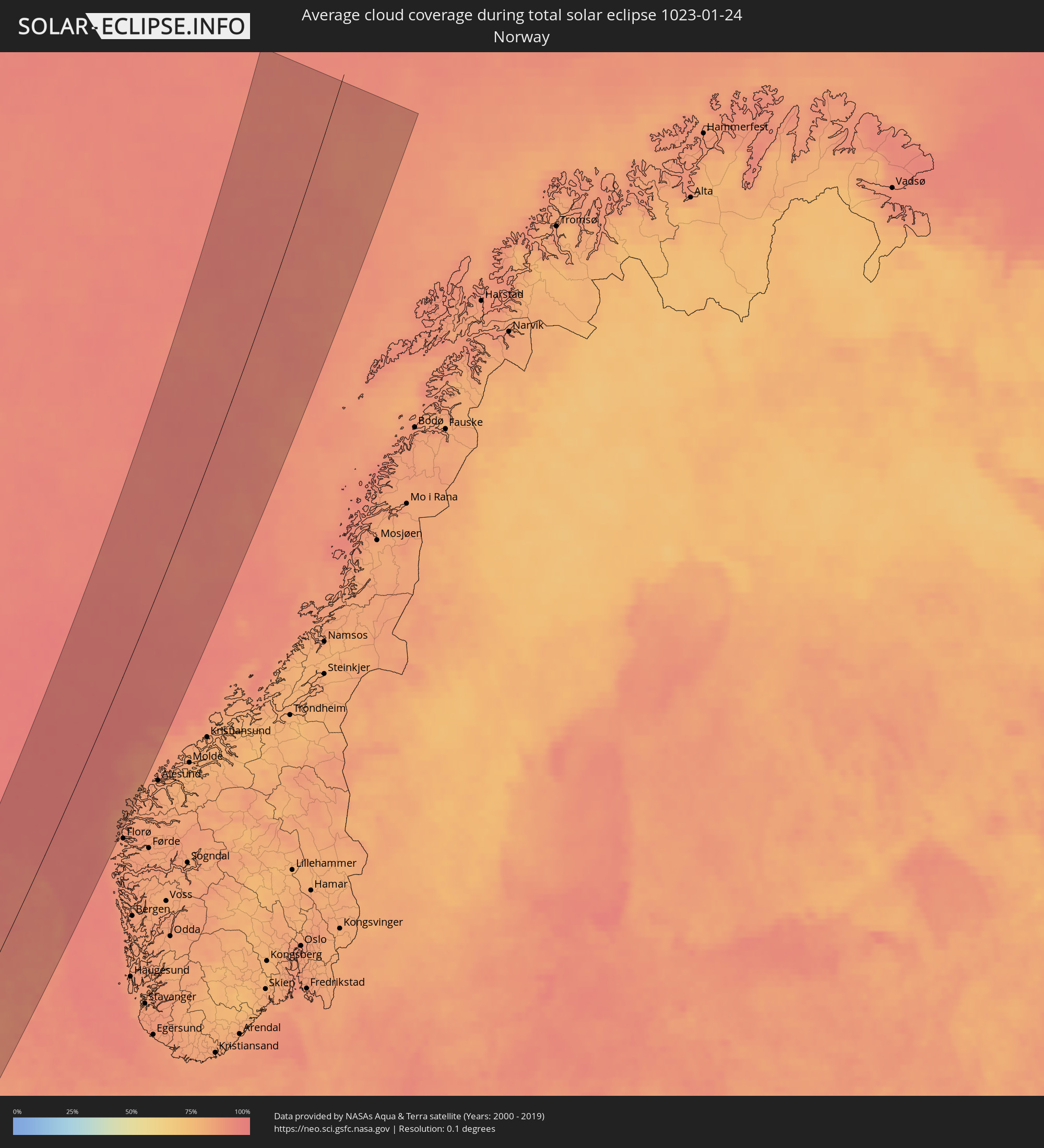
Wie wird das Wetter während der totalen Sonnenfinsternis am 24.01.1023?
Wo ist der beste Ort, um die totale Sonnenfinsternis vom 24.01.1023 zu beobachten?
Die folgenden Karten zeigen die durchschnittliche Bewölkung für den Tag, an dem die totale Sonnenfinsternis
stattfindet. Mit Hilfe der Karten lässt sich der Ort entlang des Finsternispfades eingrenzen,
der die besten Aussichen auf einen klaren wolkenfreien Himmel bietet.
Trotzdem muss man immer lokale Gegenenheiten beachten und sollte sich genau über das Wetter an seinem
gewählten Beobachtungsort informieren.
Die Daten stammen von den beiden NASA-Satelliten
AQUA und TERRA
und wurden über einen Zeitraum von 19 Jahren (2000 - 2019) gemittelt.
Detaillierte Länderkarten
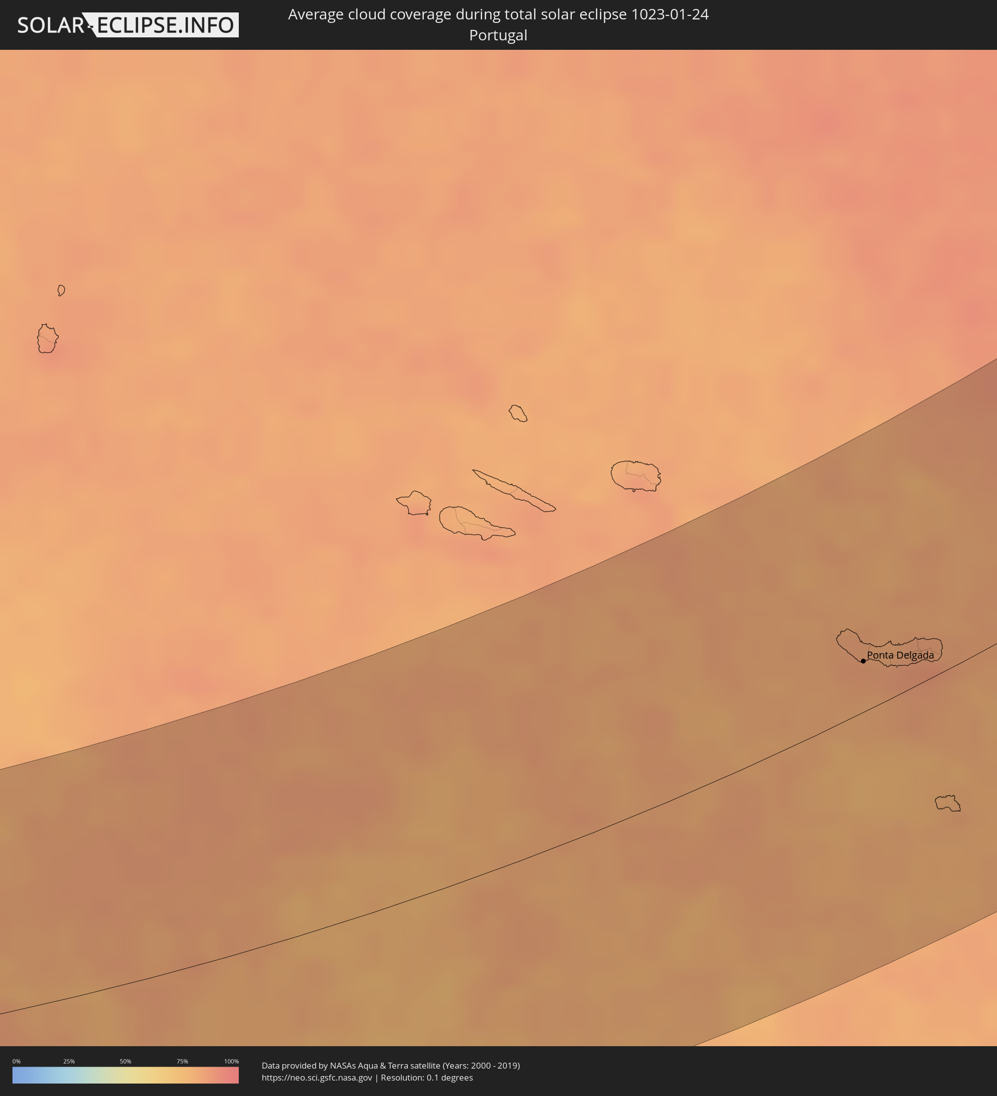 Portugal
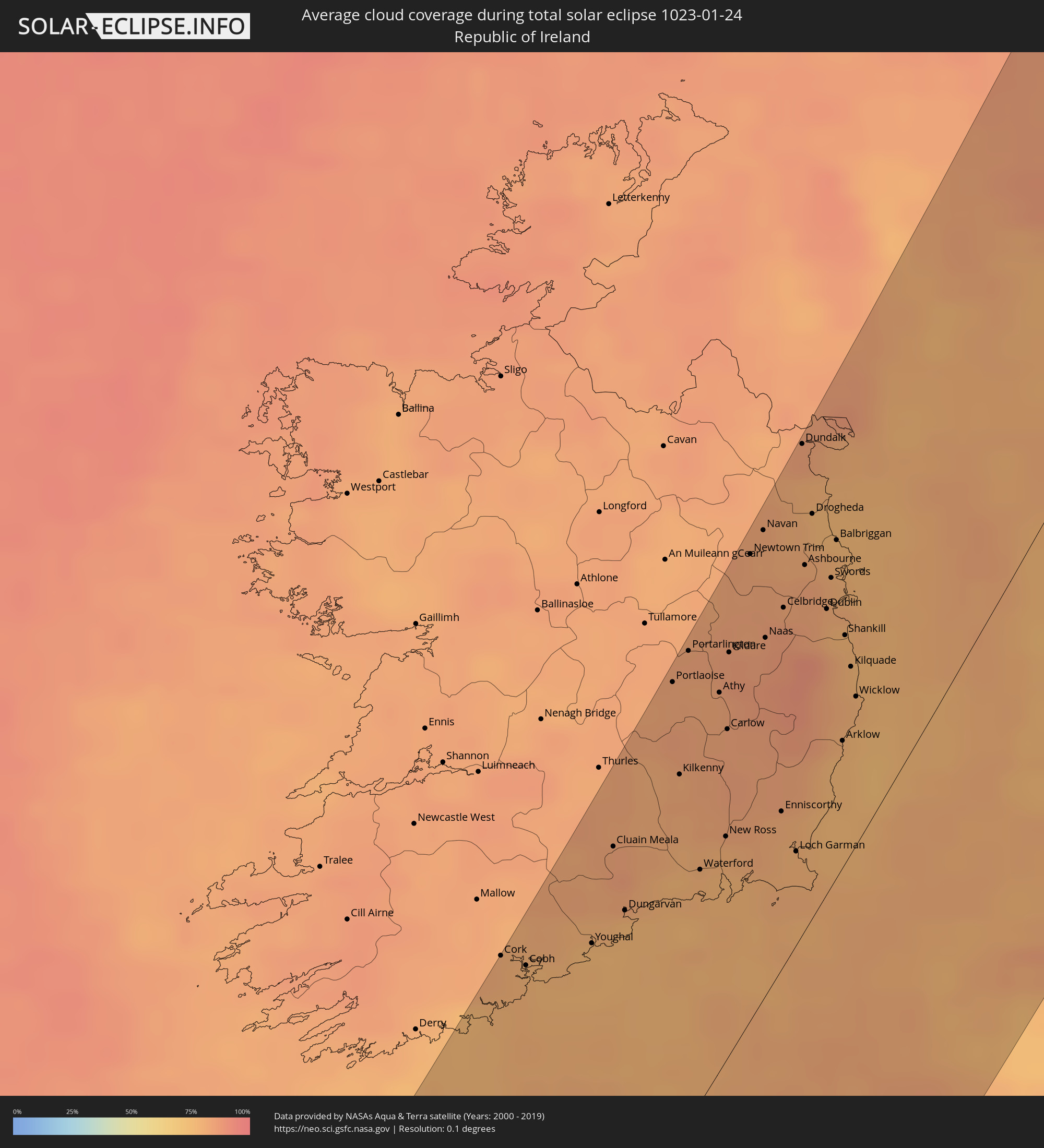 Irland
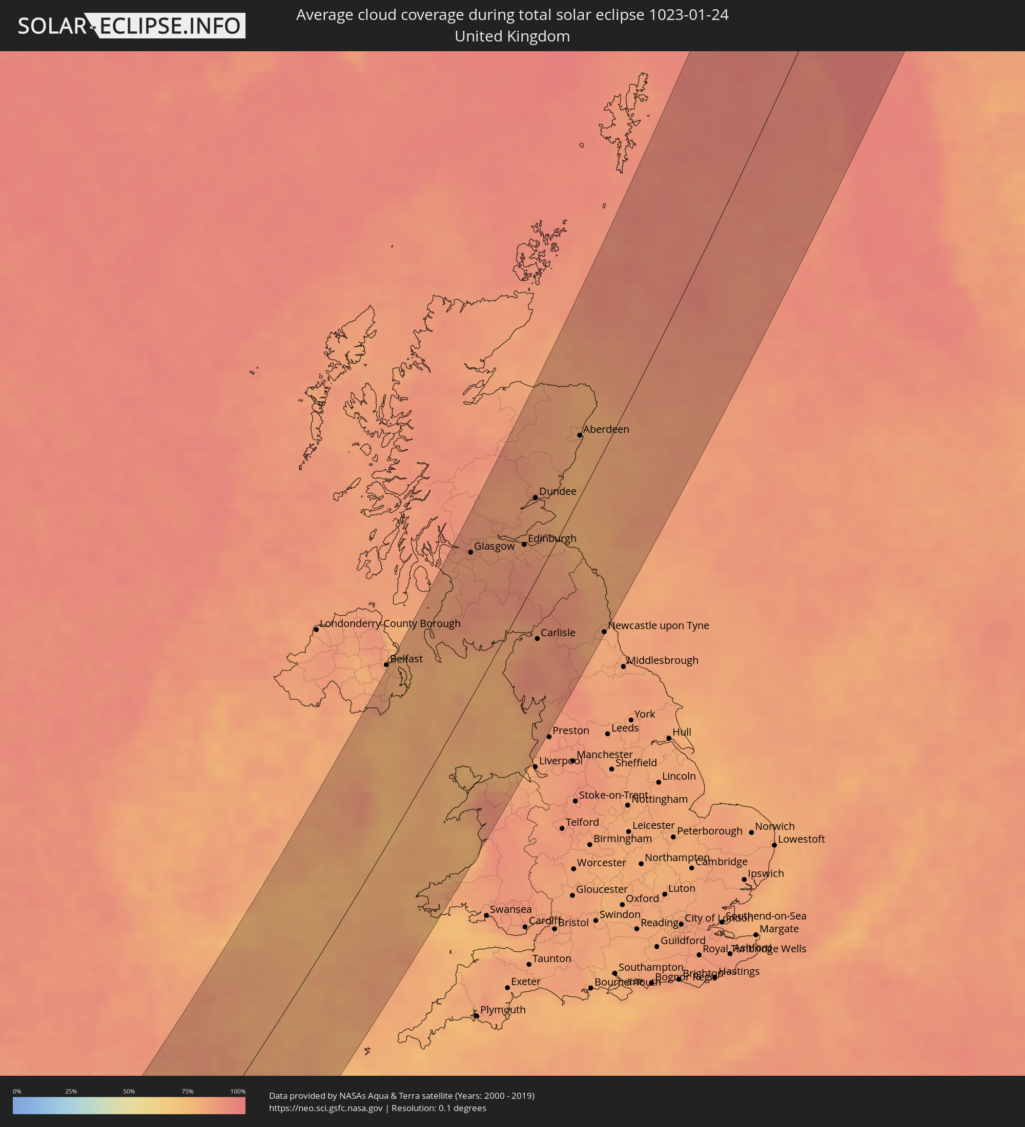 Vereinigtes Königreich
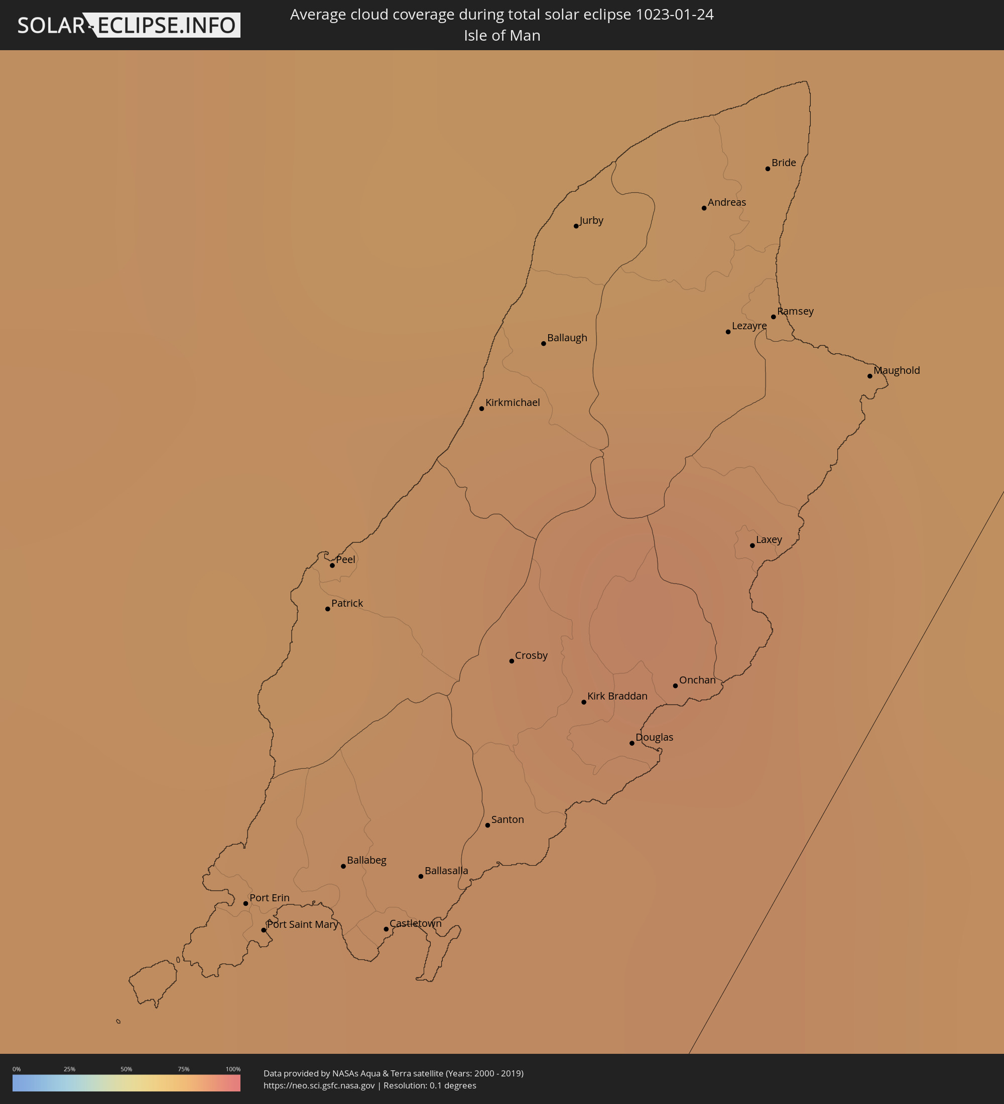 Isle of Man
 Norwegen
Orte im Finsternispfad
Die nachfolgene Tabelle zeigt Städte und Orte mit mehr als 5.000 Einwohnern, die sich im Finsternispfad befinden. Städte mit mehr als 100.000 Einwohnern sind dick gekennzeichnet. Mit einem Klick auf den Ort öffnet sich eine Detailkarte die die Lage des jeweiligen Ortes zusammen mit dem Verlauf der zentralen Finsternis präsentiert.
| Ort | Typ | Dauer der Verfinsterung | Ortszeit bei maximaler Verfinsterung | Entfernung zur Zentrallinie | Ø Bewölkung |
|
Arrifes, Azores
|
total | - | 09:45:34 UTC-01:54 | 32 km | 84% |
|
Ponta Delgada, Azores
|
total | - | 09:45:35 UTC-01:54 | 27 km | 83% |
|
Rosto de Cão, Azores
|
total | - | 09:45:38 UTC-01:54 | 28 km | 84% |
|
Rabo de Peixe, Azores
|
total | - | 09:45:49 UTC-01:54 | 30 km | 83% |
|
Vila Franca do Campo, Azores
|
total | - | 09:45:57 UTC-01:54 | 16 km | 85% |
|
Cork, Munster
|
total | - | 11:56:46 UTC-00:25 | 116 km | 80% |
|
Midleton, Munster
|
total | - | 11:57:09 UTC-00:25 | 100 km | 77% |
|
Youghal, Munster
|
total | - | 11:57:37 UTC-00:25 | 82 km | 76% |
|
Cluain Meala, Munster
|
total | - | 11:58:02 UTC-00:25 | 97 km | 83% |
|
Dungarvan, Munster
|
total | - | 11:58:00 UTC-00:25 | 77 km | 76% |
|
Portlaoise, Leinster
|
total | - | 11:58:56 UTC-00:25 | 111 km | 82% |
|
Kilkenny, Leinster
|
total | - | 11:58:48 UTC-00:25 | 87 km | 81% |
|
Portarlington, Leinster
|
total | - | 11:59:08 UTC-00:25 | 111 km | 83% |
|
Waterford, Munster
|
total | - | 11:58:46 UTC-00:25 | 56 km | 78% |
|
Athy, Leinster
|
total | - | 11:59:19 UTC-00:25 | 90 km | 82% |
|
New Ross, Leinster
|
total | - | 11:59:04 UTC-00:25 | 54 km | 79% |
|
Carlow, Leinster
|
total | - | 11:59:19 UTC-00:25 | 78 km | 84% |
|
Kildare, Leinster
|
total | - | 11:59:29 UTC-00:25 | 95 km | 85% |
|
Newtown Trim, Leinster
|
total | - | 11:59:52 UTC-00:25 | 108 km | 82% |
|
Clane, Leinster
|
total | - | 11:59:51 UTC-00:25 | 89 km | 83% |
|
Navan, Leinster
|
total | - | 12:00:02 UTC-00:25 | 108 km | 82% |
|
Naas, Leinster
|
total | - | 11:59:50 UTC-00:25 | 84 km | 84% |
|
Enniscorthy, Leinster
|
total | - | 11:59:37 UTC-00:25 | 38 km | 80% |
|
Celbridge, Leinster
|
total | - | 12:00:03 UTC-00:25 | 83 km | 85% |
|
Dunboyne, Leinster
|
total | - | 12:00:11 UTC-00:25 | 82 km | 82% |
|
Loch Garman, Leinster
|
total | - | 11:59:40 UTC-00:25 | 22 km | 78% |
|
Dundalk, Leinster
|
total | - | 12:00:31 UTC-00:25 | 112 km | 84% |
|
Ashbourne, Leinster
|
total | - | 12:00:19 UTC-00:25 | 84 km | 83% |
|
Cherry Orchard, Leinster
|
total | - | 12:00:16 UTC-00:25 | 73 km | 84% |
|
Palmerstown
|
total | - | 12:00:16 UTC-00:25 | 74 km | 83% |
|
Castleknock, Leinster
|
total | - | 12:00:18 UTC-00:25 | 75 km | 83% |
|
Ballyfermot, Leinster
|
total | - | 12:00:17 UTC-00:25 | 73 km | 84% |
|
Drogheda, Leinster
|
total | - | 12:00:29 UTC-00:25 | 93 km | 77% |
|
Firhouse, Leinster
|
total | - | 12:00:17 UTC-00:25 | 68 km | 82% |
|
Templeogue, Leinster
|
total | - | 12:00:20 UTC-00:25 | 67 km | 82% |
|
Greenhills, Leinster
|
total | - | 12:00:21 UTC-00:25 | 69 km | 82% |
|
Terenure, Leinster
|
total | - | 12:00:22 UTC-00:25 | 67 km | 82% |
|
Rathgar, Leinster
|
total | - | 12:00:23 UTC-00:25 | 66 km | 82% |
|
Ballinteer, Leinster
|
total | - | 12:00:23 UTC-00:25 | 63 km | 82% |
|
Dublin, Leinster
|
total | - | 12:00:25 UTC-00:25 | 66 km | 78% |
|
Beaumont, Leinster
|
total | - | 12:00:28 UTC-00:25 | 69 km | 80% |
|
Ringsend, Leinster
|
total | - | 12:00:27 UTC-00:25 | 65 km | 78% |
|
Mount Merrion, Leinster
|
total | - | 12:00:27 UTC-00:25 | 62 km | 78% |
|
Donnycarney
|
total | - | 12:00:30 UTC-00:25 | 66 km | 80% |
|
Booterstown
|
total | - | 12:00:28 UTC-00:25 | 61 km | 78% |
|
Balbriggan, Leinster
|
total | - | 12:00:38 UTC-00:25 | 77 km | 78% |
|
Raheny, Leinster
|
total | - | 12:00:32 UTC-00:25 | 65 km | 80% |
|
Blackrock, Leinster
|
total | - | 12:00:30 UTC-00:25 | 60 km | 78% |
|
Lusk, Leinster
|
total | - | 12:00:37 UTC-00:25 | 72 km | 80% |
|
Donabate, Leinster
|
total | - | 12:00:37 UTC-00:25 | 69 km | 80% |
|
Arklow, Leinster
|
total | - | 12:00:18 UTC-00:25 | 30 km | 76% |
|
Sallynoggin, Leinster
|
total | - | 12:00:32 UTC-00:25 | 57 km | 77% |
|
Baldoyle, Leinster
|
total | - | 12:00:37 UTC-00:25 | 62 km | 80% |
|
Little Bray, Leinster
|
total | - | 12:00:32 UTC-00:25 | 51 km | 78% |
|
Kilquade
|
total | - | 12:00:31 UTC-00:25 | 43 km | 78% |
|
Castlereagh, Northern Ireland
|
total | - | 12:26:47 UTC+00:00 | 111 km | 81% |
|
Downpatrick, Northern Ireland
|
total | - | 12:26:53 UTC+00:00 | 89 km | 78% |
|
Bangor, Northern Ireland
|
total | - | 12:27:05 UTC+00:00 | 103 km | 79% |
|
Stranraer, Scotland
|
total | - | 12:27:58 UTC+00:00 | 80 km | 80% |
|
Haverfordwest, Wales
|
total | - | 12:26:42 UTC+00:00 | 96 km | 78% |
|
Saltcoats, Scotland
|
total | - | 12:28:31 UTC+00:00 | 105 km | 85% |
|
Port Erin, Port Erin
|
total | - | 12:27:59 UTC+00:00 | 21 km | 80% |
|
Port Saint Mary, Port St Mary
|
total | - | 12:27:59 UTC+00:00 | 20 km | 81% |
|
Patrick, Patrick
|
total | - | 12:28:06 UTC+00:00 | 24 km | 80% |
|
Peel, Peel
|
total | - | 12:28:06 UTC+00:00 | 25 km | 80% |
|
Ballabeg, Arbory
|
total | - | 12:28:04 UTC+00:00 | 18 km | 81% |
|
Castletown, Castletown
|
total | - | 12:28:06 UTC+00:00 | 15 km | 81% |
|
Ayr, Scotland
|
total | - | 12:28:38 UTC+00:00 | 87 km | 84% |
|
Holyhead, Wales
|
total | - | 12:27:49 UTC+00:00 | 29 km | 77% |
|
Ballasalla, Malew
|
total | - | 12:28:08 UTC+00:00 | 14 km | 81% |
|
Kirkmichael, Michael
|
total | - | 12:28:16 UTC+00:00 | 22 km | 81% |
|
Santon, Santon
|
total | - | 12:28:12 UTC+00:00 | 13 km | 81% |
|
Dumbarton, Scotland
|
total | - | 12:28:53 UTC+00:00 | 108 km | 86% |
|
Crosby, Marown
|
total | - | 12:28:15 UTC+00:00 | 16 km | 80% |
|
Ballaugh, Ballaugh
|
total | - | 12:28:19 UTC+00:00 | 21 km | 84% |
|
Jurby, Jurby
|
total | - | 12:28:22 UTC+00:00 | 23 km | 79% |
|
Kirk Braddan, Braddan
|
total | - | 12:28:18 UTC+00:00 | 12 km | 81% |
|
Kilmarnock, Scotland
|
total | - | 12:28:51 UTC+00:00 | 87 km | 85% |
|
Douglas, Douglas
|
total | - | 12:28:20 UTC+00:00 | 9 km | 81% |
|
Onchan, Onchan
|
total | - | 12:28:23 UTC+00:00 | 9 km | 81% |
|
Andreas, Andreas
|
total | - | 12:28:29 UTC+00:00 | 18 km | 79% |
|
Lezayre, Lezayre
|
total | - | 12:28:29 UTC+00:00 | 14 km | 81% |
|
Laxey, Laxey
|
total | - | 12:28:28 UTC+00:00 | 9 km | 81% |
|
Bride, Bride
|
total | - | 12:28:32 UTC+00:00 | 16 km | 79% |
|
Ramsey, Ramsey
|
total | - | 12:28:31 UTC+00:00 | 13 km | 81% |
|
Maughold, Maughold
|
total | - | 12:28:36 UTC+00:00 | 8 km | 78% |
|
Cumnock, Scotland
|
total | - | 12:29:04 UTC+00:00 | 66 km | 87% |
|
Glasgow, Scotland
|
total | - | 12:29:13 UTC+00:00 | 87 km | 86% |
|
Bangor, Wales
|
total | - | 12:28:25 UTC+00:00 | 62 km | 86% |
|
Hamilton, Scotland
|
total | - | 12:29:27 UTC+00:00 | 69 km | 85% |
|
Cumbernauld, Scotland
|
total | - | 12:29:33 UTC+00:00 | 76 km | 86% |
|
Stirling, Scotland
|
total | - | 12:29:40 UTC+00:00 | 82 km | 84% |
|
Colwyn Bay, Wales
|
total | - | 12:28:57 UTC+00:00 | 82 km | 80% |
|
Polmont, Scotland
|
total | - | 12:29:54 UTC+00:00 | 63 km | 83% |
|
Whitehaven, England
|
total | - | 12:29:35 UTC+00:00 | 20 km | 80% |
|
Livingston, Scotland
|
total | - | 12:30:05 UTC+00:00 | 48 km | 85% |
|
Maryport, England
|
total | - | 12:29:44 UTC+00:00 | 16 km | 84% |
|
Rhyl, Wales
|
total | - | 12:29:15 UTC+00:00 | 94 km | 80% |
|
Dunfermline, Scotland
|
total | - | 12:30:13 UTC+00:00 | 53 km | 82% |
|
Perth, Scotland
|
total | - | 12:30:20 UTC+00:00 | 68 km | 83% |
|
Barrow in Furness, England
|
total | - | 12:29:52 UTC+00:00 | 64 km | 81% |
|
Edinburgh, Scotland
|
total | - | 12:30:29 UTC+00:00 | 33 km | 84% |
|
Kirkcaldy, Scotland
|
total | - | 12:30:34 UTC+00:00 | 39 km | 85% |
|
Blackpool, England
|
total | - | 12:29:58 UTC+00:00 | 91 km | 80% |
|
Southport, England
|
total | - | 12:29:58 UTC+00:00 | 103 km | 83% |
|
Dundee, Scotland
|
total | - | 12:30:53 UTC+00:00 | 47 km | 84% |
|
Carlisle, England
|
total | - | 12:30:28 UTC+00:00 | 38 km | 85% |
|
Forfar, Scotland
|
total | - | 12:31:01 UTC+00:00 | 51 km | 84% |
|
Morecambe, England
|
total | - | 12:30:17 UTC+00:00 | 87 km | 82% |
|
Galashiels, Scotland
|
total | - | 12:30:50 UTC+00:00 | 7 km | 85% |
|
Saint Andrews, Scotland
|
total | - | 12:31:03 UTC+00:00 | 31 km | 81% |
|
Hawick, Scotland
|
total | - | 12:30:48 UTC+00:00 | 18 km | 88% |
|
Penrith, England
|
total | - | 12:30:37 UTC+00:00 | 60 km | 86% |
|
Kendal, England
|
total | - | 12:30:31 UTC+00:00 | 79 km | 86% |
|
Arbroath, Scotland
|
total | - | 12:31:20 UTC+00:00 | 31 km | 81% |
|
Montrose, Scotland
|
total | - | 12:31:32 UTC+00:00 | 30 km | 81% |
|
Inverurie, Scotland
|
total | - | 12:31:45 UTC+00:00 | 56 km | 82% |
|
Stonehaven, Scotland
|
total | - | 12:31:51 UTC+00:00 | 31 km | 80% |
|
Hexham, England
|
total | - | 12:31:29 UTC+00:00 | 80 km | 84% |
|
Aberdeen, Scotland
|
total | - | 12:32:01 UTC+00:00 | 34 km | 79% |
|
Fraserburgh, Scotland
|
total | - | 12:32:14 UTC+00:00 | 56 km | 80% |
|
Berwick-Upon-Tweed, England
|
total | - | 12:31:49 UTC+00:00 | 42 km | 79% |
|
Consett, England
|
total | - | 12:31:46 UTC+00:00 | 102 km | 81% |
|
Peterhead, Scotland
|
total | - | 12:32:26 UTC+00:00 | 36 km | 80% |
|
Newcastle upon Tyne, England
|
total | - | 12:32:03 UTC+00:00 | 107 km | 83% |
|
Blyth, England
|
total | - | 12:32:13 UTC+00:00 | 105 km | 81% |