Totale Sonnenfinsternis vom 15.01.1051
| Wochentag: | Mittwoch |
| Maximale Dauer der Verfinsterung: | 02m18s |
| Maximale Breite des Finsternispfades: | 88 km |
| Saroszyklus: | 106 |
| Bedeckungsgrad: | 100% |
| Magnitude: | 1.0252 |
| Gamma: | -0.2049 |
Wo kann man die Sonnenfinsternis vom 15.01.1051 sehen?
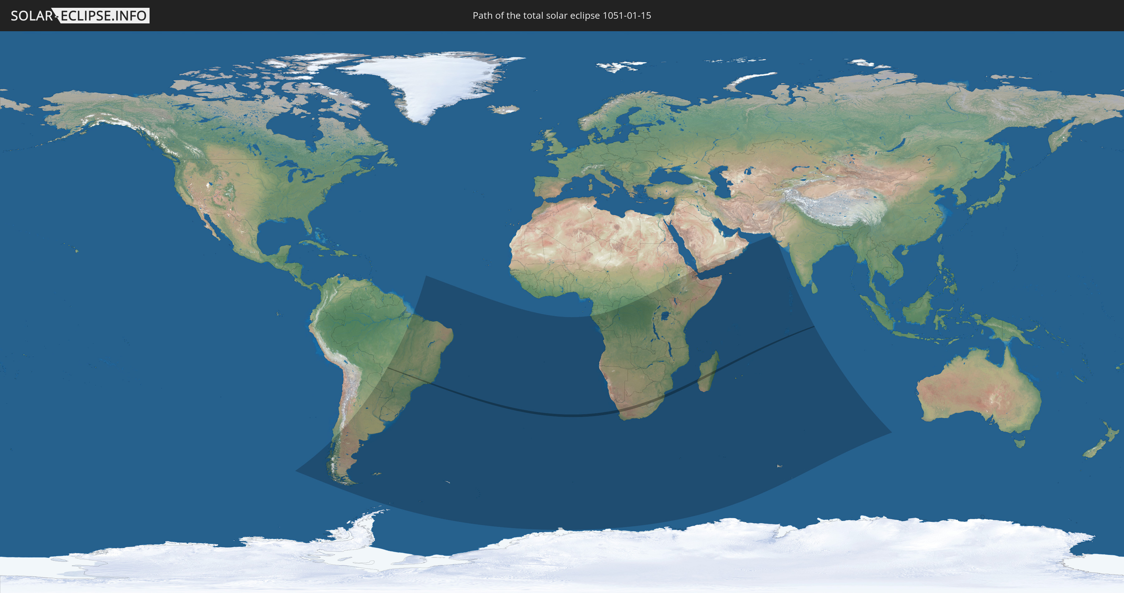
Die Sonnenfinsternis am 15.01.1051 kann man in 47 Ländern als partielle Sonnenfinsternis beobachten.
Der Finsternispfad verläuft durch 7 Länder. Nur in diesen Ländern ist sie als totale Sonnenfinsternis zu sehen.
In den folgenden Ländern ist die Sonnenfinsternis total zu sehen
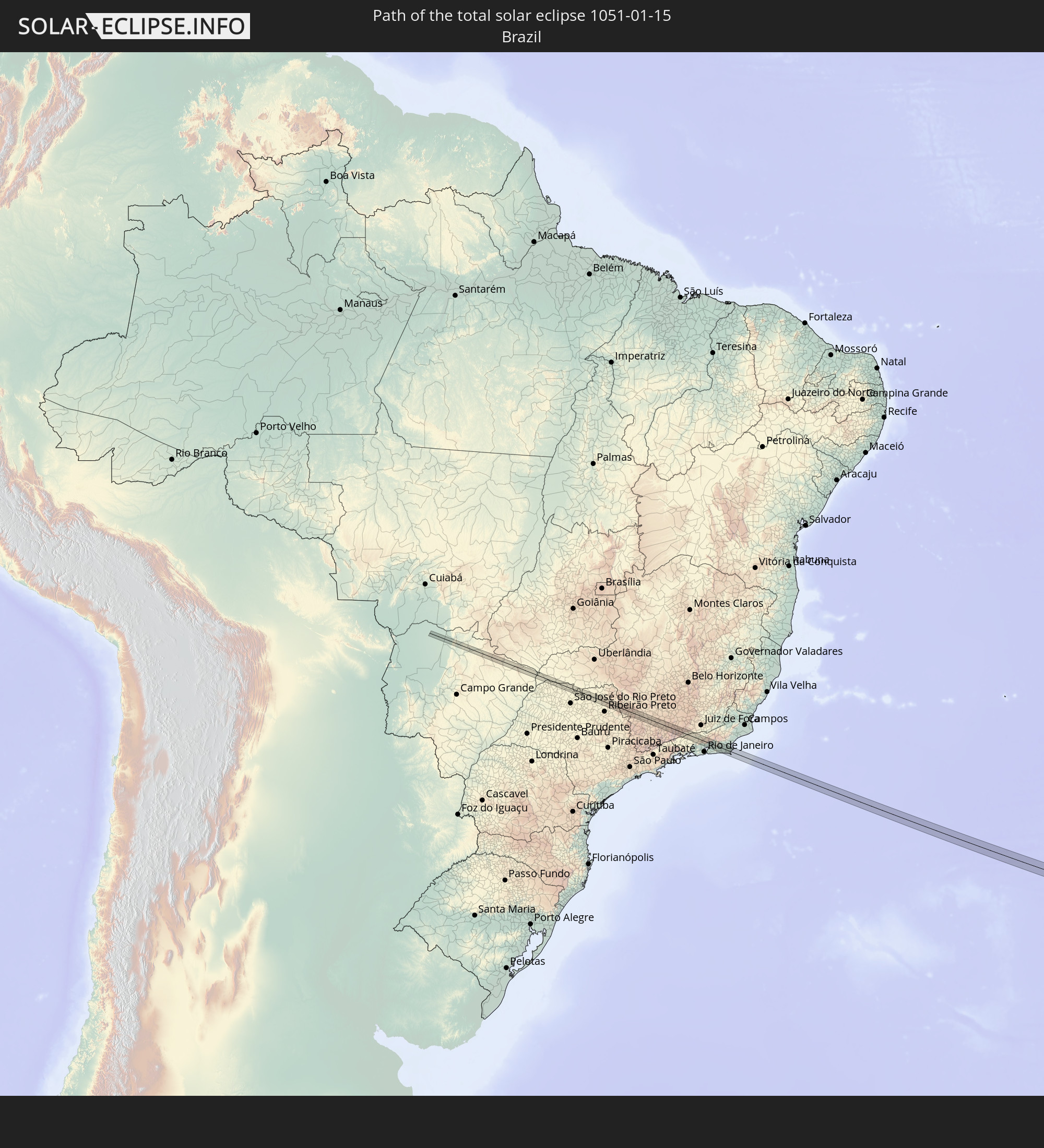 Brasilien
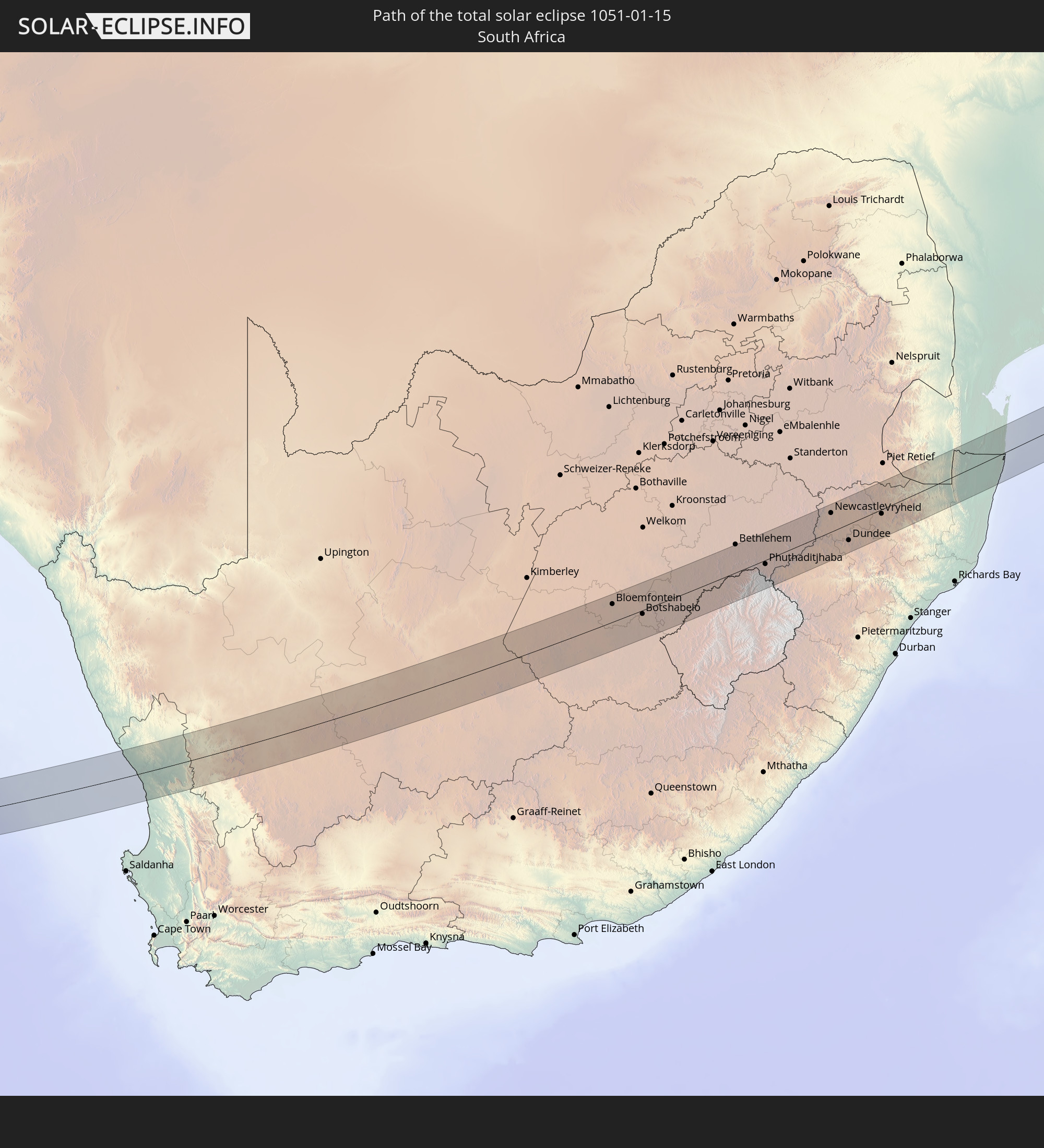 Südafrika
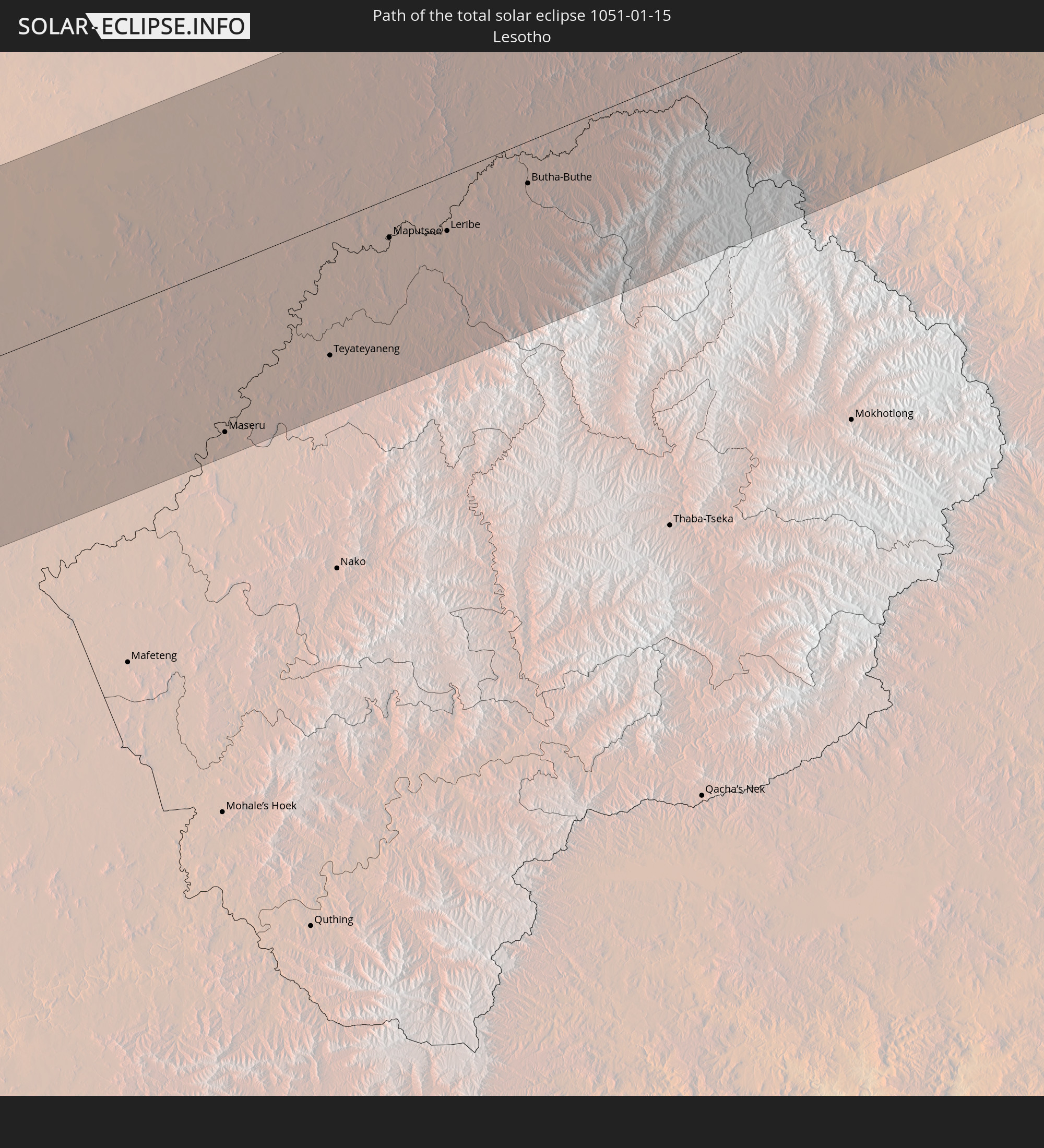 Lesotho
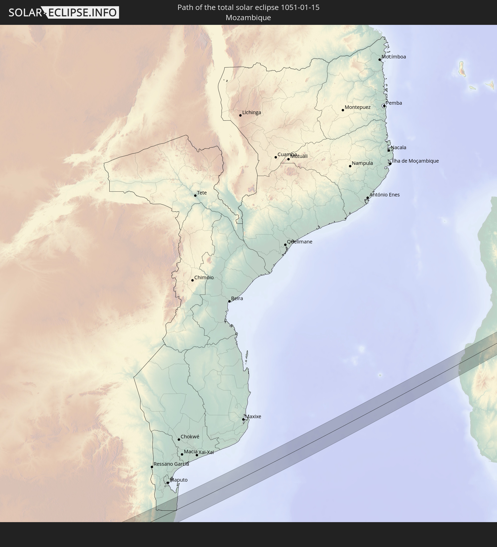 Mosambik
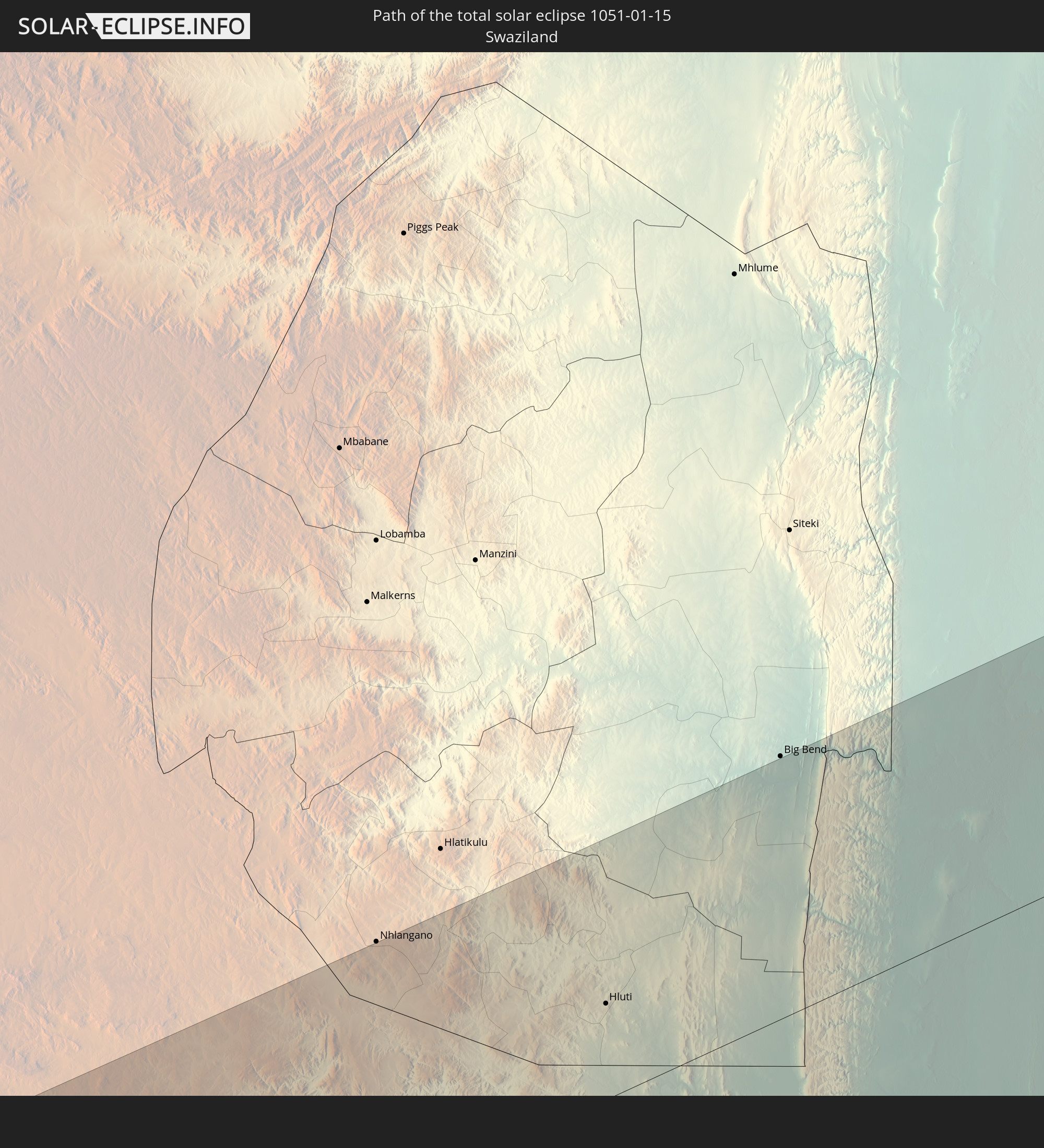 Swasiland
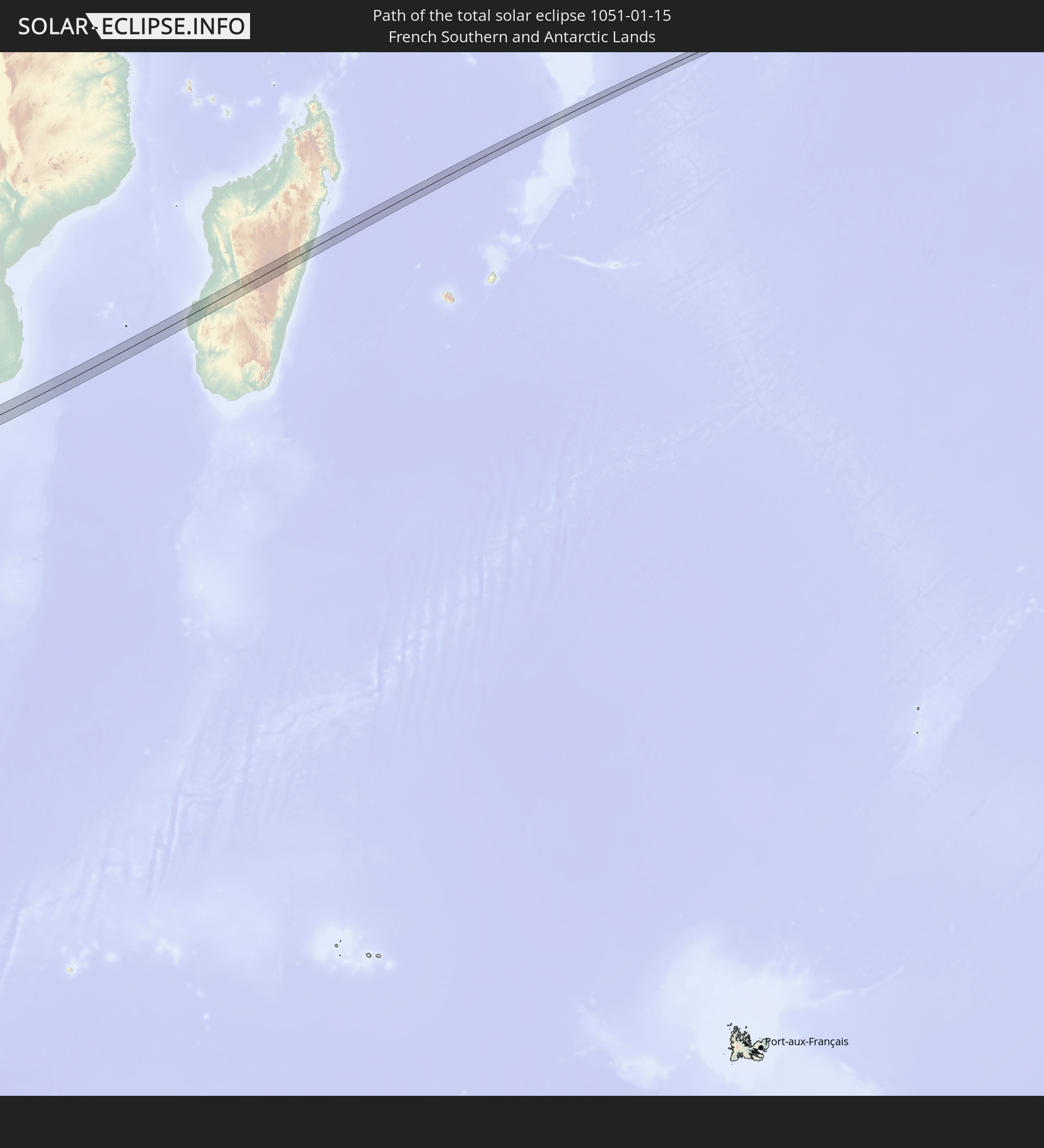 Französische Süd- und Antarktisgebiete
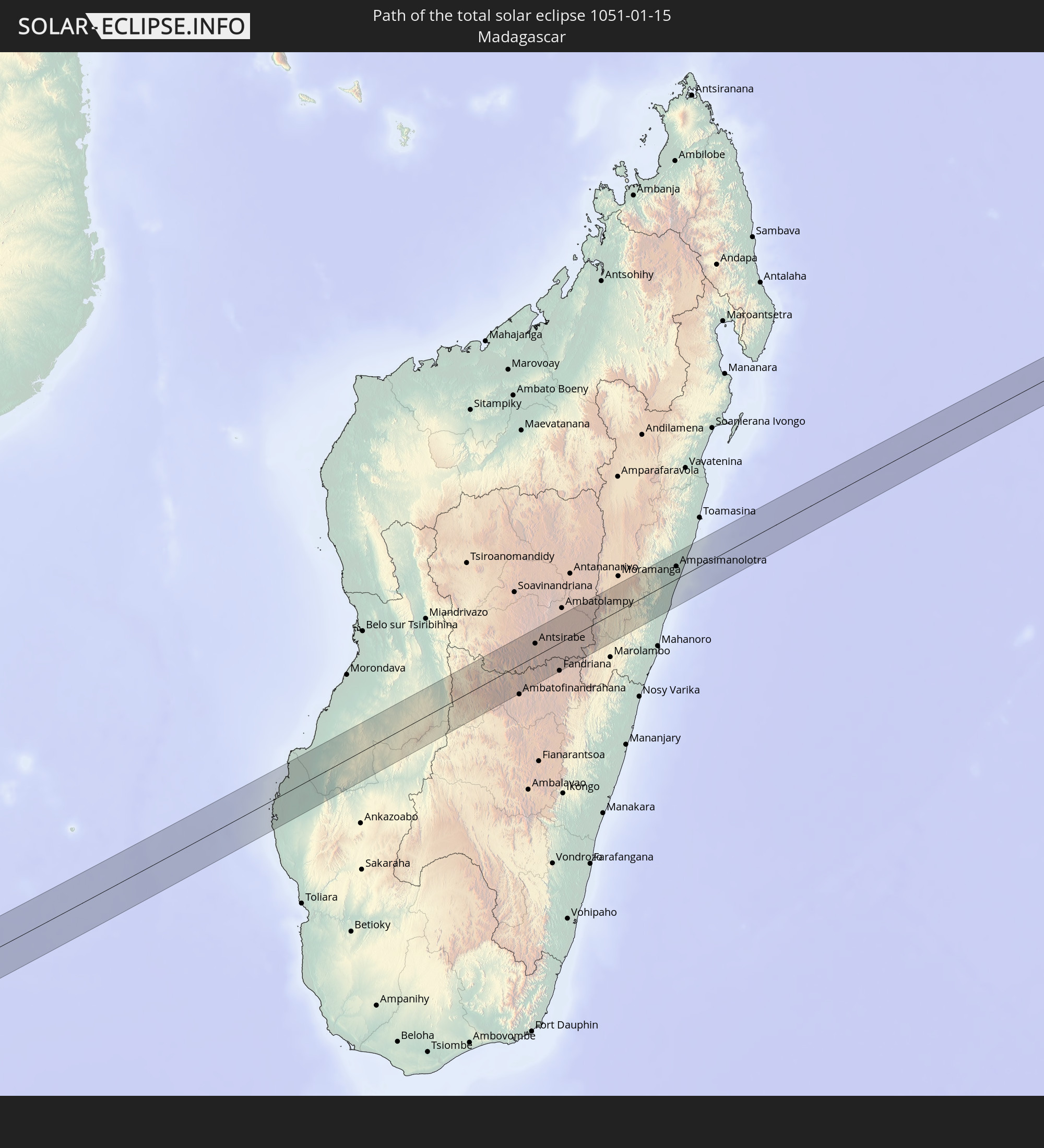 Madagaskar
In den folgenden Ländern ist die Sonnenfinsternis partiell zu sehen
 Antarktika
 Chile
Chile
 Brasilien
 Argentinien
 Paraguay
 Falklandinseln
 Uruguay
 Südgeorgien und die Südlichen Sandwichinseln
 St. Helena
 Bouvetinsel
 Gabun
Gabun
 Republik Kongo
 Angola
 Namibia
 Demokratische Republik Kongo
 Zentralafrikanische Republik
 Südafrika
 Botswana
 Sambia
 Simbabwe
 Lesotho
 Ruanda
 Burundi
 Tansania
 Uganda
 Mosambik
 Swasiland
 Malawi
 Äthiopien
 Kenia
Kenia
 Eritrea
 Französische Süd- und Antarktisgebiete
 Somalia
 Dschibuti
 Jemen
Jemen
 Madagaskar
 Komoren
 Mayotte
 Seychellen
 Oman
Oman
 Réunion
 Mauritius
 Pakistan
 Indien
 Britisches Territorium im Indischen Ozean
 Heard und McDonaldinseln
 Malediven
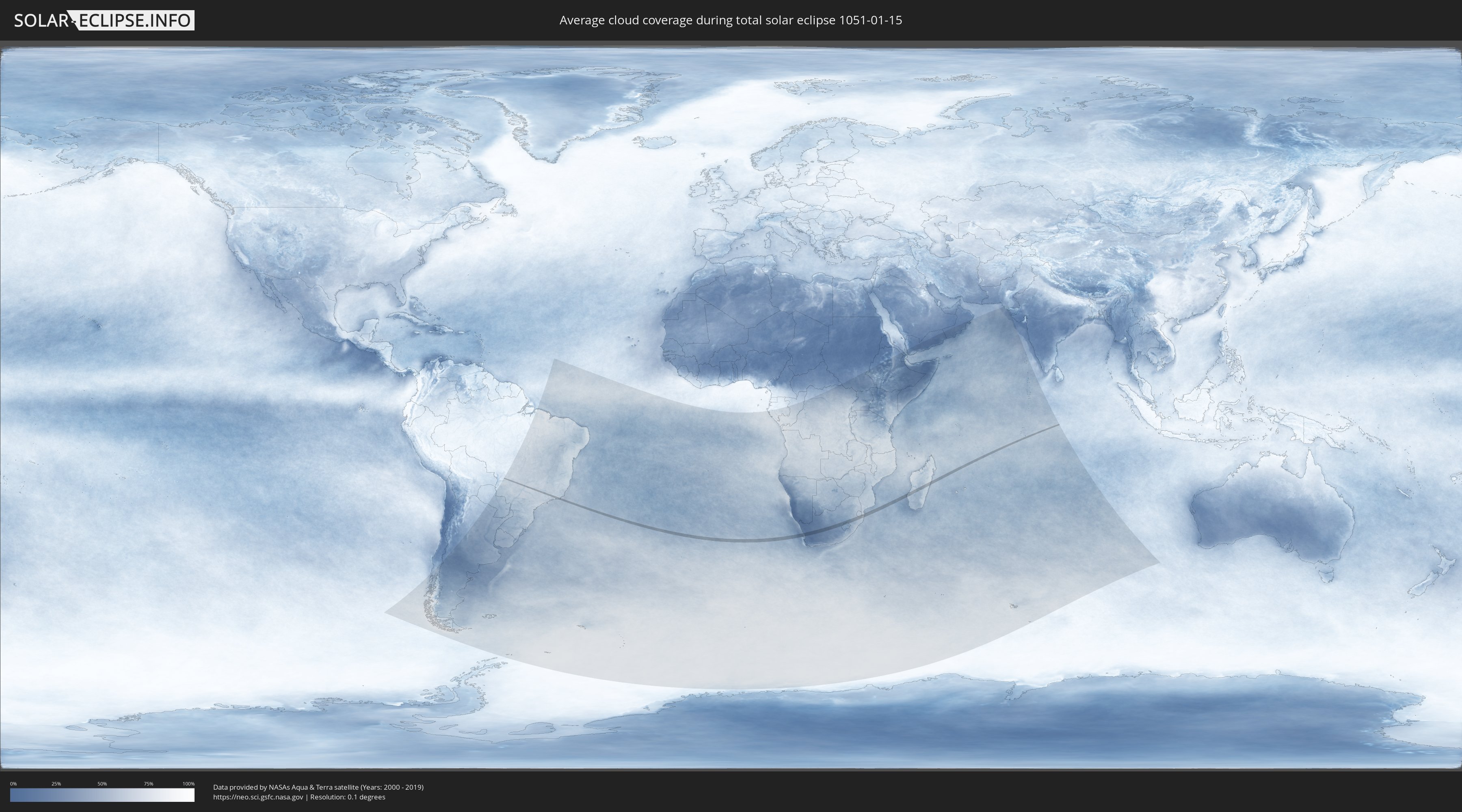
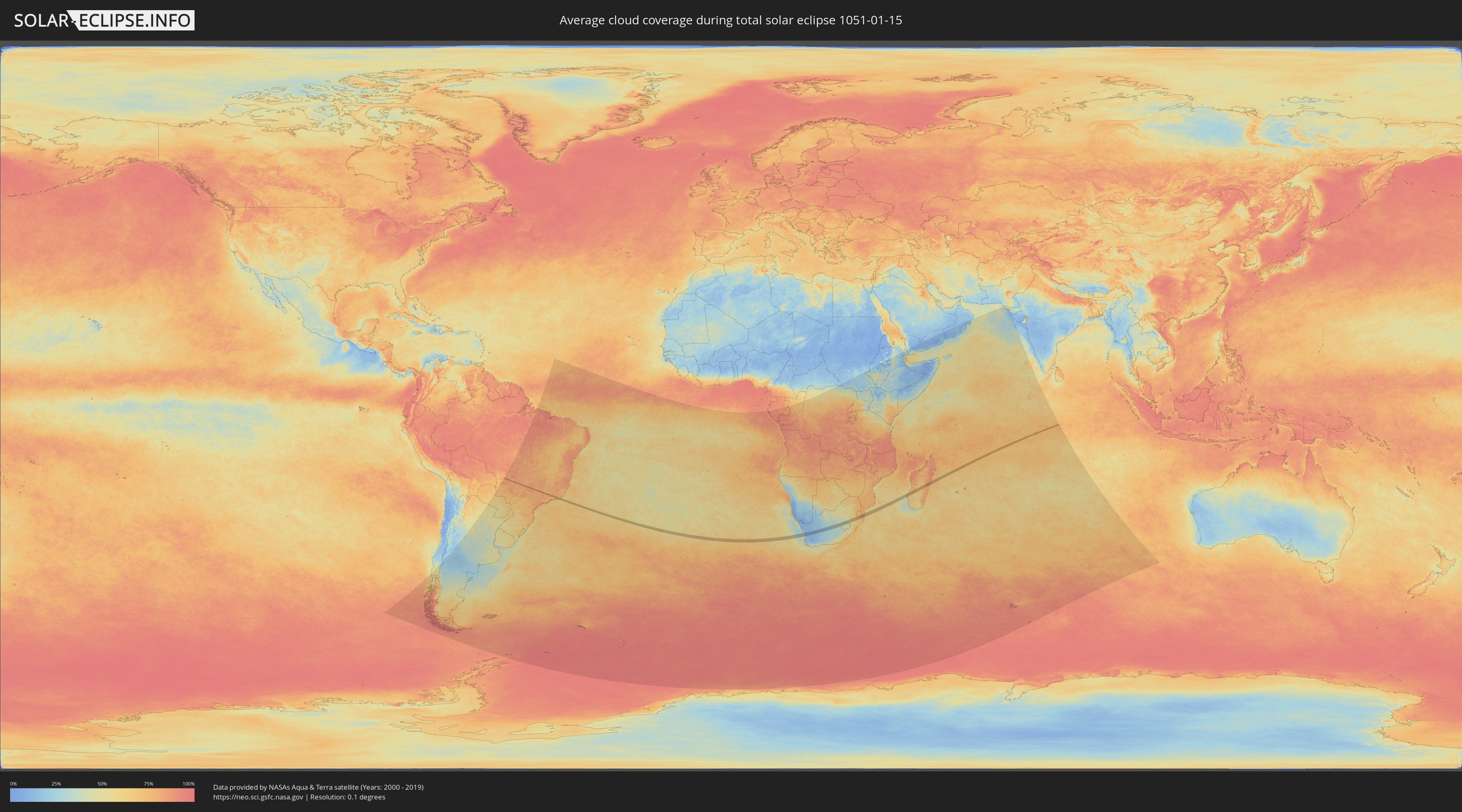
Wie wird das Wetter während der totalen Sonnenfinsternis am 15.01.1051?
Wo ist der beste Ort, um die totale Sonnenfinsternis vom 15.01.1051 zu beobachten?
Die folgenden Karten zeigen die durchschnittliche Bewölkung für den Tag, an dem die totale Sonnenfinsternis
stattfindet. Mit Hilfe der Karten lässt sich der Ort entlang des Finsternispfades eingrenzen,
der die besten Aussichen auf einen klaren wolkenfreien Himmel bietet.
Trotzdem muss man immer lokale Gegenenheiten beachten und sollte sich genau über das Wetter an seinem
gewählten Beobachtungsort informieren.
Die Daten stammen von den beiden NASA-Satelliten
AQUA und TERRA
und wurden über einen Zeitraum von 19 Jahren (2000 - 2019) gemittelt.
Detaillierte Länderkarten
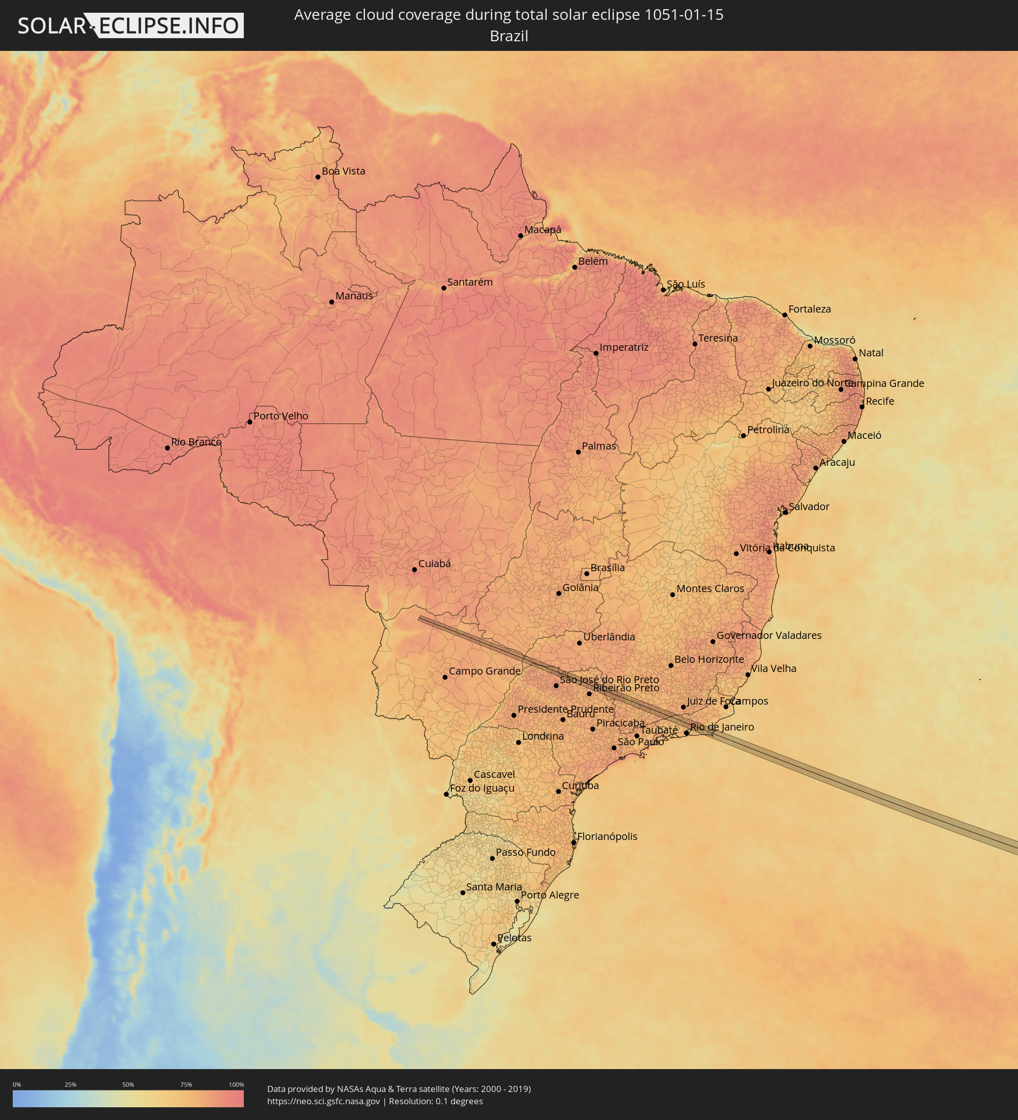 Brasilien
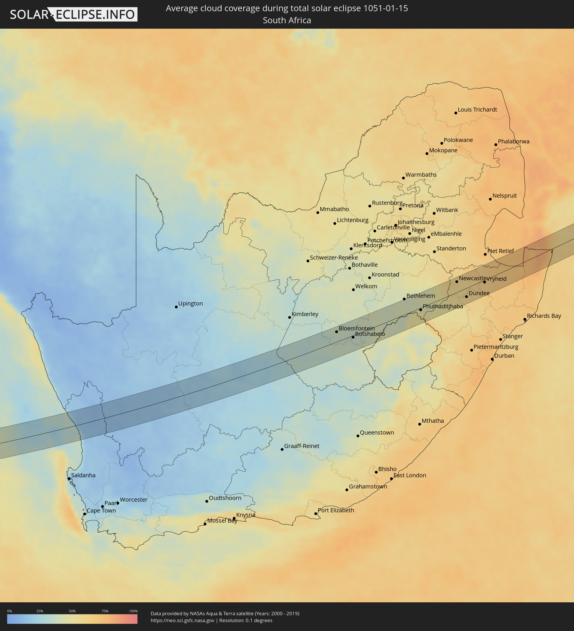 Südafrika
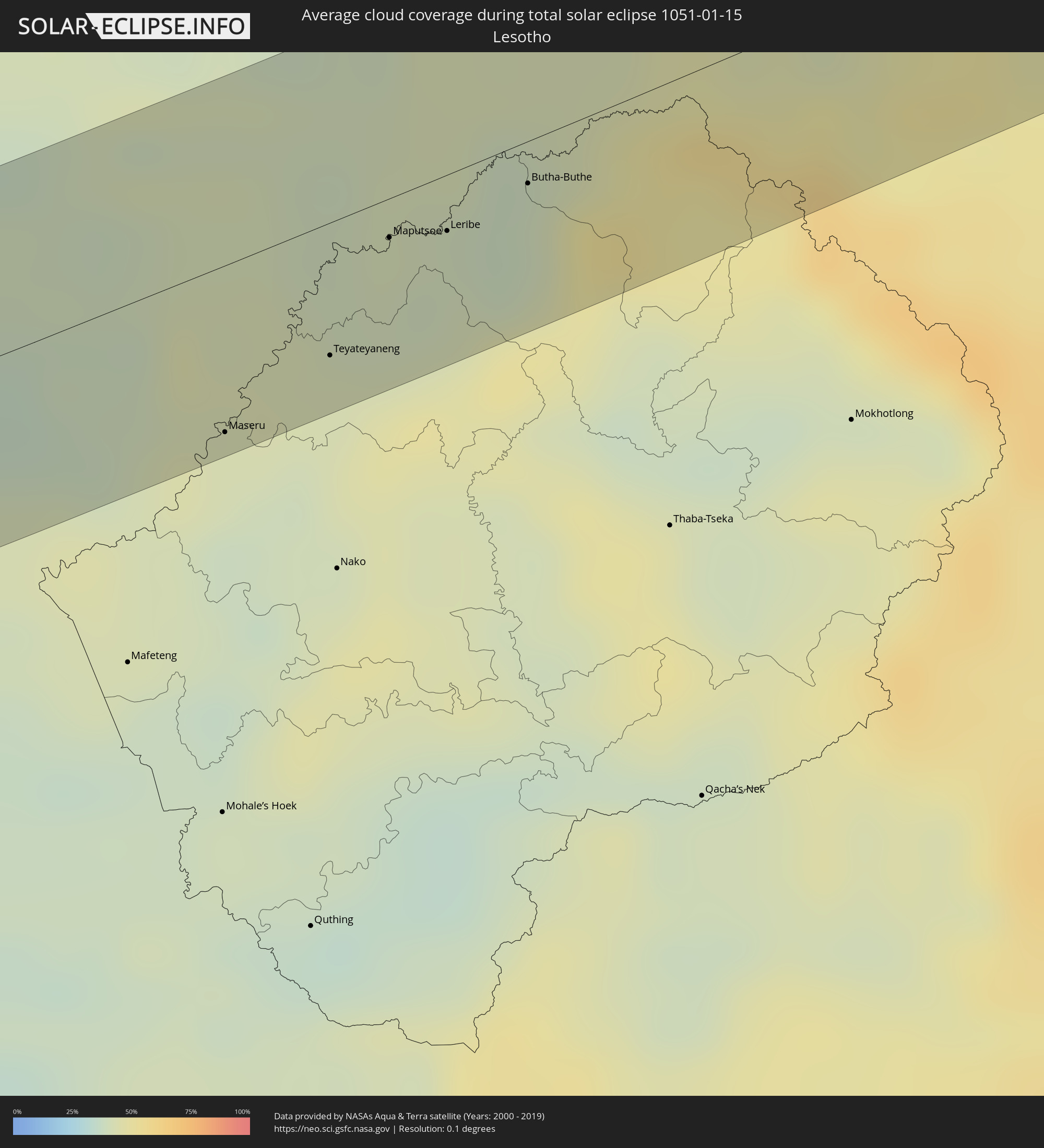 Lesotho
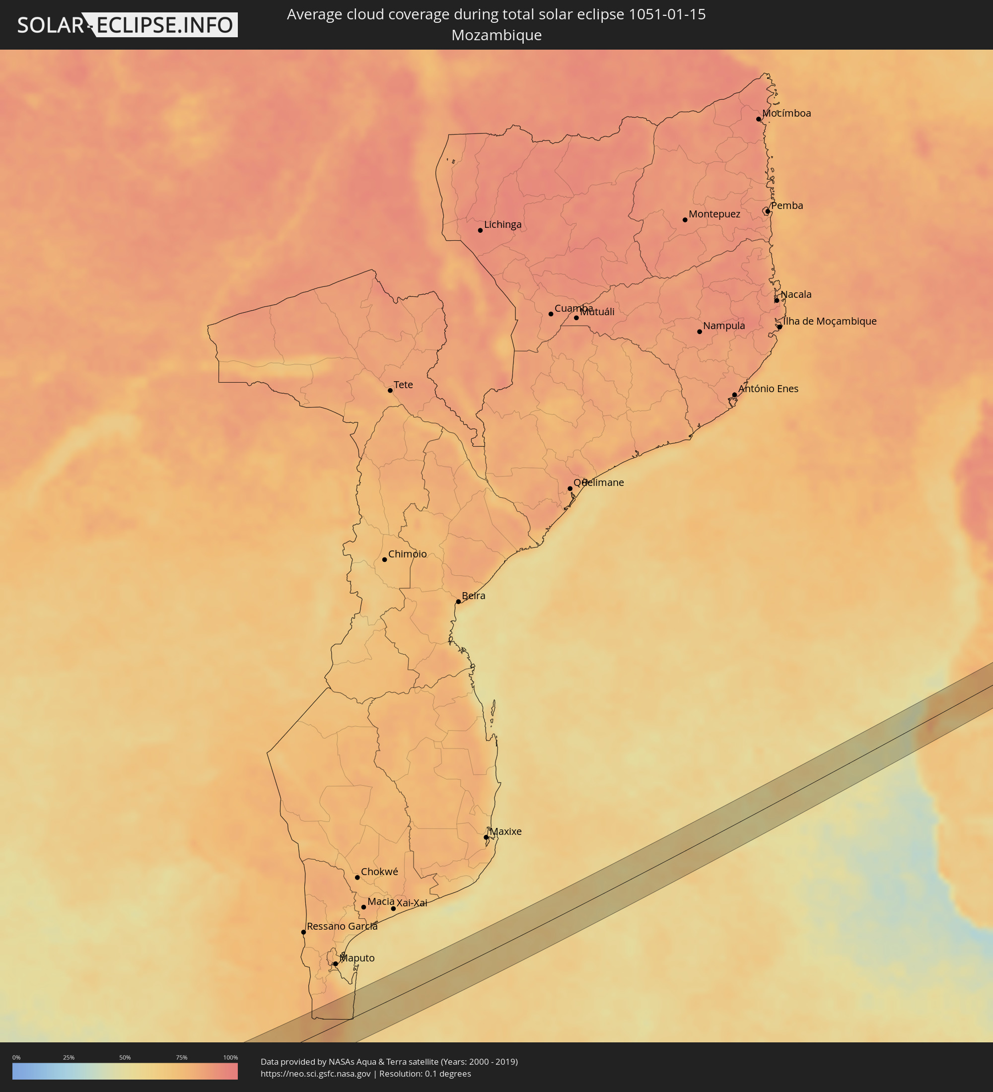 Mosambik
 Swasiland
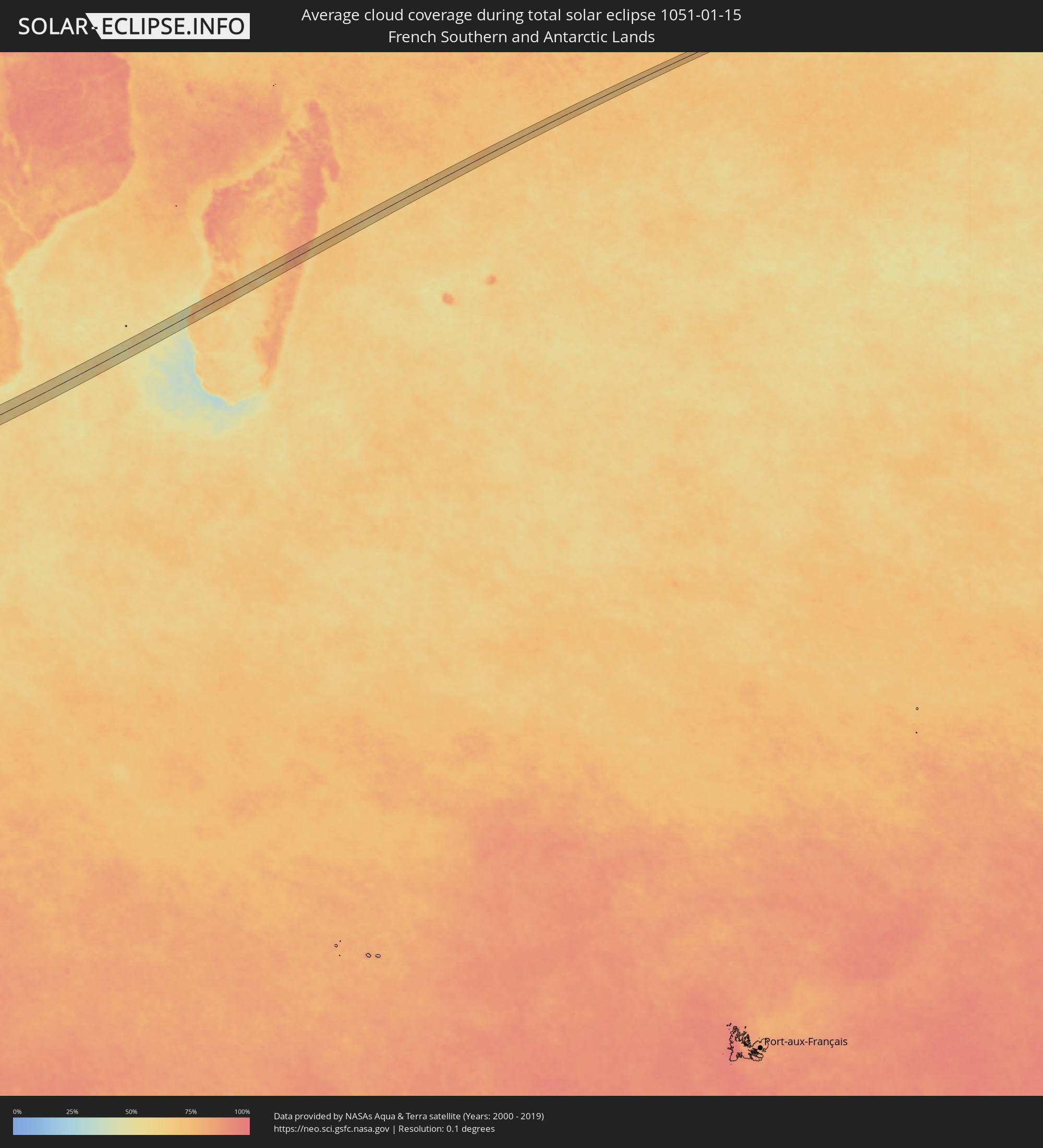 Französische Süd- und Antarktisgebiete
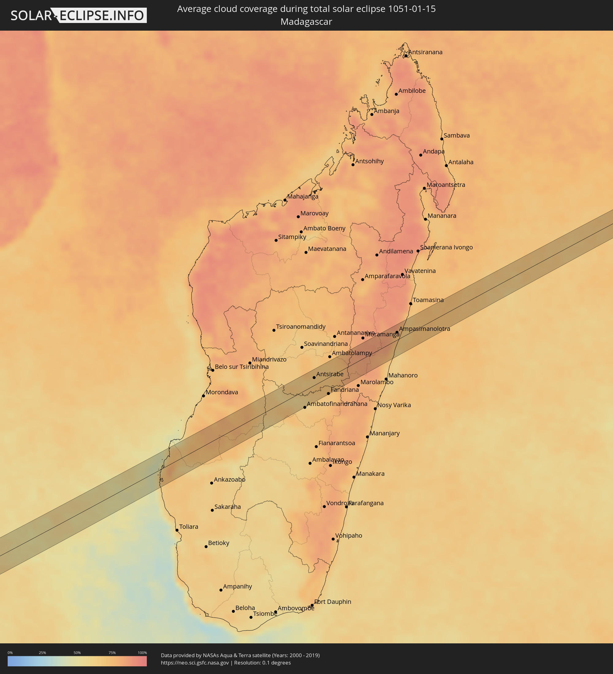 Madagaskar
Orte im Finsternispfad
Die nachfolgene Tabelle zeigt Städte und Orte mit mehr als 5.000 Einwohnern, die sich im Finsternispfad befinden. Städte mit mehr als 100.000 Einwohnern sind dick gekennzeichnet. Mit einem Klick auf den Ort öffnet sich eine Detailkarte die die Lage des jeweiligen Ortes zusammen mit dem Verlauf der zentralen Finsternis präsentiert.
| Ort | Typ | Dauer der Verfinsterung | Ortszeit bei maximaler Verfinsterung | Entfernung zur Zentrallinie | Ø Bewölkung |
|
Iturama, Minas Gerais
|
total | - | 06:24:18 UTC-03:06 | 14 km | 80% |
|
Barretos, São Paulo
|
total | - | 06:24:50 UTC-03:06 | 9 km | 81% |
|
Morro Agudo, São Paulo
|
total | - | 06:24:58 UTC-03:06 | 8 km | 81% |
|
Orlândia, São Paulo
|
total | - | 06:24:58 UTC-03:06 | 0 km | 80% |
|
São Joaquim da Barra, São Paulo
|
total | - | 06:24:52 UTC-03:06 | 15 km | 80% |
|
Batatais, São Paulo
|
total | - | 06:25:06 UTC-03:06 | 6 km | 80% |
|
Altinópolis, São Paulo
|
total | - | 06:25:12 UTC-03:06 | 12 km | 78% |
|
São Sebastião do Paraíso, Minas Gerais
|
total | - | 06:25:09 UTC-03:06 | 14 km | 78% |
|
Monte Santo de Minas, Minas Gerais
|
total | - | 06:25:21 UTC-03:06 | 14 km | 80% |
|
Guaranésia, Minas Gerais
|
total | - | 06:25:26 UTC-03:06 | 19 km | 79% |
|
Guaxupé, Minas Gerais
|
total | - | 06:25:27 UTC-03:06 | 16 km | 81% |
|
Muzambinho, Minas Gerais
|
total | - | 06:25:31 UTC-03:06 | 16 km | 81% |
|
Areado, Minas Gerais
|
total | - | 06:25:32 UTC-03:06 | 1 km | 74% |
|
Alfenas, Minas Gerais
|
total | - | 06:25:36 UTC-03:06 | 1 km | 74% |
|
Paraguaçu, Minas Gerais
|
total | - | 06:25:43 UTC-03:06 | 4 km | 78% |
|
Elói Mendes, Minas Gerais
|
total | - | 06:25:47 UTC-03:06 | 4 km | 79% |
|
Varginha, Minas Gerais
|
total | - | 06:25:45 UTC-03:06 | 8 km | 81% |
|
Três Corações, Minas Gerais
|
total | - | 06:25:53 UTC-03:06 | 1 km | 79% |
|
Conceição do Rio Verde, Minas Gerais
|
total | - | 06:26:02 UTC-03:06 | 13 km | 77% |
|
Caxambu, Minas Gerais
|
total | - | 06:26:08 UTC-03:06 | 17 km | 77% |
|
Baependi, Minas Gerais
|
total | - | 06:26:07 UTC-03:06 | 14 km | 77% |
|
Cruzília, Minas Gerais
|
total | - | 06:26:03 UTC-03:06 | 2 km | 77% |
|
Valença, Rio de Janeiro
|
total | - | 06:26:32 UTC-03:06 | 2 km | 75% |
|
Vassouras, Rio de Janeiro
|
total | - | 06:26:40 UTC-03:06 | 14 km | 71% |
|
Miguel Pereira, Rio de Janeiro
|
total | - | 06:26:44 UTC-03:06 | 11 km | 75% |
|
Paty do Alferes, Rio de Janeiro
|
total | - | 06:26:43 UTC-03:06 | 7 km | 76% |
|
Petrópolis, Rio de Janeiro
|
total | - | 06:26:50 UTC-03:06 | 6 km | 77% |
|
Guapimirim, Rio de Janeiro
|
total | - | 06:26:54 UTC-03:06 | 2 km | 77% |
|
Teresópolis, Rio de Janeiro
|
total | - | 06:26:48 UTC-03:06 | 11 km | 83% |
|
Itaboraí, Rio de Janeiro
|
total | - | 06:27:05 UTC-03:06 | 18 km | 72% |
|
Tanguá, Rio de Janeiro
|
total | - | 06:27:06 UTC-03:06 | 12 km | 69% |
|
Cachoeiras de Macacu, Rio de Janeiro
|
total | - | 06:26:54 UTC-03:06 | 19 km | 71% |
|
Rio Bonito, Rio de Janeiro
|
total | - | 06:27:07 UTC-03:06 | 5 km | 69% |
|
Silva Jardim, Rio de Janeiro
|
total | - | 06:27:07 UTC-03:06 | 9 km | 68% |
|
Araruama, Rio de Janeiro
|
total | - | 06:27:18 UTC-03:06 | 12 km | 71% |
|
Iguaba Grande, Rio de Janeiro
|
total | - | 06:27:18 UTC-03:06 | 5 km | 68% |
|
São Pedro da Aldeia, Rio de Janeiro
|
total | - | 06:27:20 UTC-03:06 | 0 km | 67% |
|
Arraial do Cabo, Rio de Janeiro
|
total | - | 06:27:27 UTC-03:06 | 10 km | 69% |
|
Cabo Frio, Rio de Janeiro
|
total | - | 06:27:23 UTC-03:06 | 2 km | 71% |
|
Armação de Búzios, Rio de Janeiro
|
total | - | 06:27:19 UTC-03:06 | 18 km | 66% |
|
Vredendal, Western Cape
|
total | - | 12:48:16 UTC+01:30 | 14 km | 15% |
|
Calvinia, Northern Cape
|
total | - | 12:51:33 UTC+01:30 | 24 km | 14% |
|
Carnarvon, Northern Cape
|
total | - | 12:57:41 UTC+01:30 | 35 km | 20% |
|
Bloemfontein, Orange Free State
|
total | - | 13:09:11 UTC+01:30 | 27 km | 37% |
|
Botshabelo, Orange Free State
|
total | - | 13:10:10 UTC+01:30 | 6 km | 35% |
|
Thaba Nchu, Orange Free State
|
total | - | 13:10:30 UTC+01:30 | 4 km | 36% |
|
Marquard, Orange Free State
|
total | - | 13:12:28 UTC+01:30 | 31 km | 42% |
|
Ladybrand, Orange Free State
|
total | - | 13:11:54 UTC+01:30 | 25 km | 42% |
|
Maseru, Maseru
|
total | - | 13:11:48 UTC+01:30 | 38 km | 42% |
|
Clocolan, Orange Free State
|
total | - | 13:12:28 UTC+01:30 | 1 km | 43% |
|
Teyateyaneng, Berea
|
total | - | 13:12:36 UTC+01:30 | 30 km | 42% |
|
Maputsoe, Leribe
|
total | - | 13:13:14 UTC+01:30 | 9 km | 41% |
|
Leribe, Leribe
|
total | - | 13:13:35 UTC+01:30 | 13 km | 39% |
|
Butha-Buthe, Butha-Buthe
|
total | - | 13:14:09 UTC+01:30 | 10 km | 38% |
|
Bethlehem, Orange Free State
|
total | - | 13:14:57 UTC+01:30 | 43 km | 40% |
|
Phuthaditjhaba, Orange Free State
|
total | - | 13:15:42 UTC+01:30 | 6 km | 47% |
|
Harrismith, Orange Free State
|
total | - | 13:16:41 UTC+01:30 | 8 km | 45% |
|
Newcastle, KwaZulu-Natal
|
total | - | 13:19:04 UTC+01:30 | 29 km | 57% |
|
Glencoe, KwaZulu-Natal
|
total | - | 13:18:59 UTC+01:30 | 22 km | 55% |
|
Dundee, KwaZulu-Natal
|
total | - | 13:19:10 UTC+01:30 | 25 km | 57% |
|
Mondlo, KwaZulu-Natal
|
total | - | 13:20:25 UTC+01:30 | 25 km | 63% |
|
Vryheid, KwaZulu-Natal
|
total | - | 13:20:51 UTC+01:30 | 7 km | 61% |
|
Hluti, Shiselweni
|
total | - | 13:23:17 UTC+01:30 | 16 km | 69% |
|
Betafo, Vakinankaratra
|
total | - | 14:55:33 UTC+02:27 | 29 km | 64% |
|
Antsirabe, Vakinankaratra
|
total | - | 14:55:44 UTC+02:27 | 17 km | 68% |
|
Soanindrariny, Vakinankaratra
|
total | - | 14:55:55 UTC+02:27 | 3 km | 73% |
|
Antanifotsy, Vakinankaratra
|
total | - | 14:56:21 UTC+02:27 | 23 km | 69% |
|
Fandriana, Amoron'i Mania
|
total | - | 14:55:39 UTC+02:27 | 37 km | 68% |
|
Ampasimanolotra, Atsinanana
|
total | - | 14:59:24 UTC+02:27 | 17 km | 71% |
|
Andovoranto, Atsinanana
|
total | - | 14:59:16 UTC+02:27 | 1 km | 67% |