Totale Sonnenfinsternis vom 11.08.1124
| Wochentag: | Montag |
| Maximale Dauer der Verfinsterung: | 03m19s |
| Maximale Breite des Finsternispfades: | 259 km |
| Saroszyklus: | 121 |
| Bedeckungsgrad: | 100% |
| Magnitude: | 1.0497 |
| Gamma: | 0.7716 |
Wo kann man die Sonnenfinsternis vom 11.08.1124 sehen?
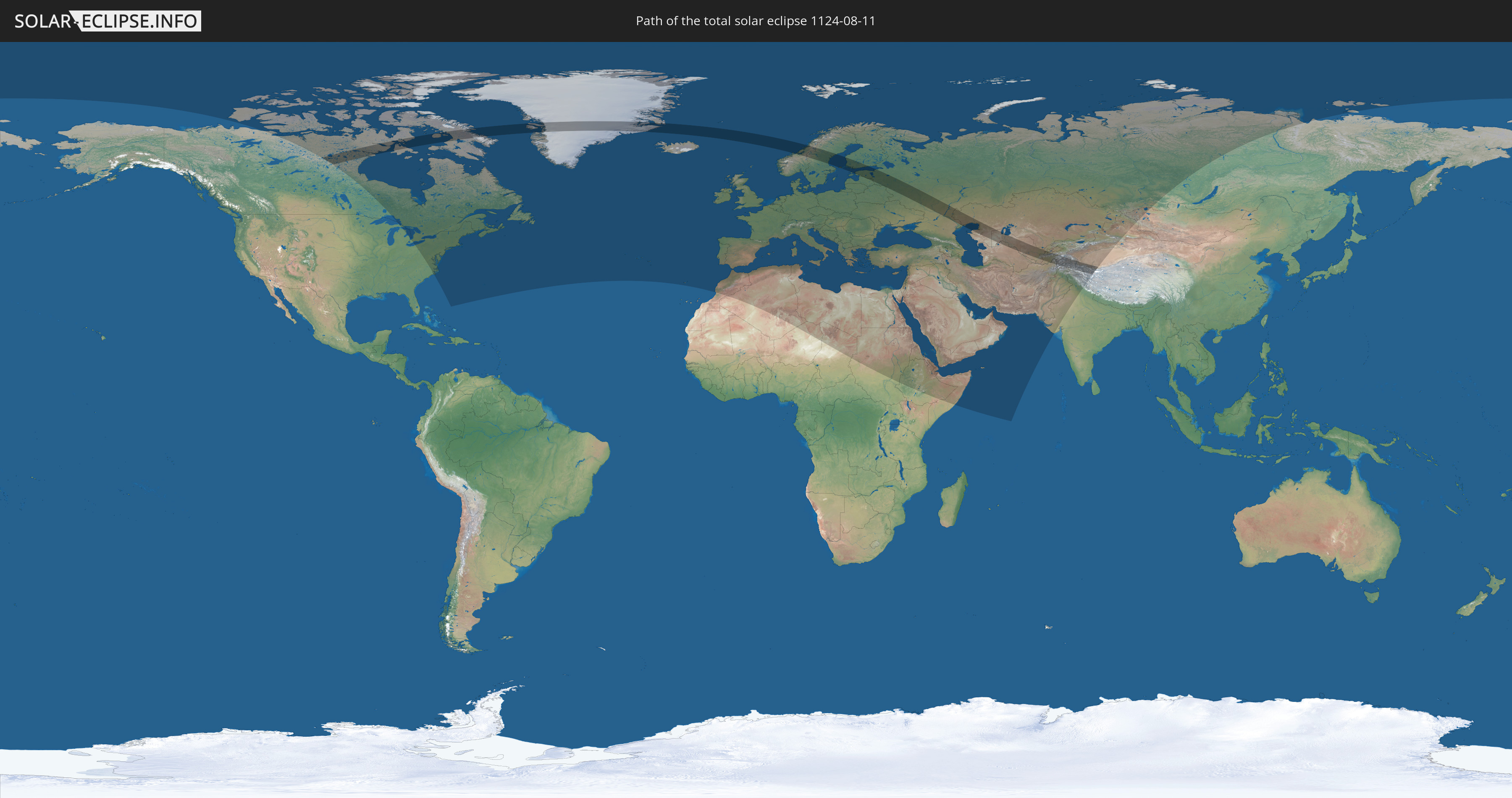
Die Sonnenfinsternis am 11.08.1124 kann man in 97 Ländern als partielle Sonnenfinsternis beobachten.
Der Finsternispfad verläuft durch 19 Länder. Nur in diesen Ländern ist sie als totale Sonnenfinsternis zu sehen.
In den folgenden Ländern ist die Sonnenfinsternis total zu sehen
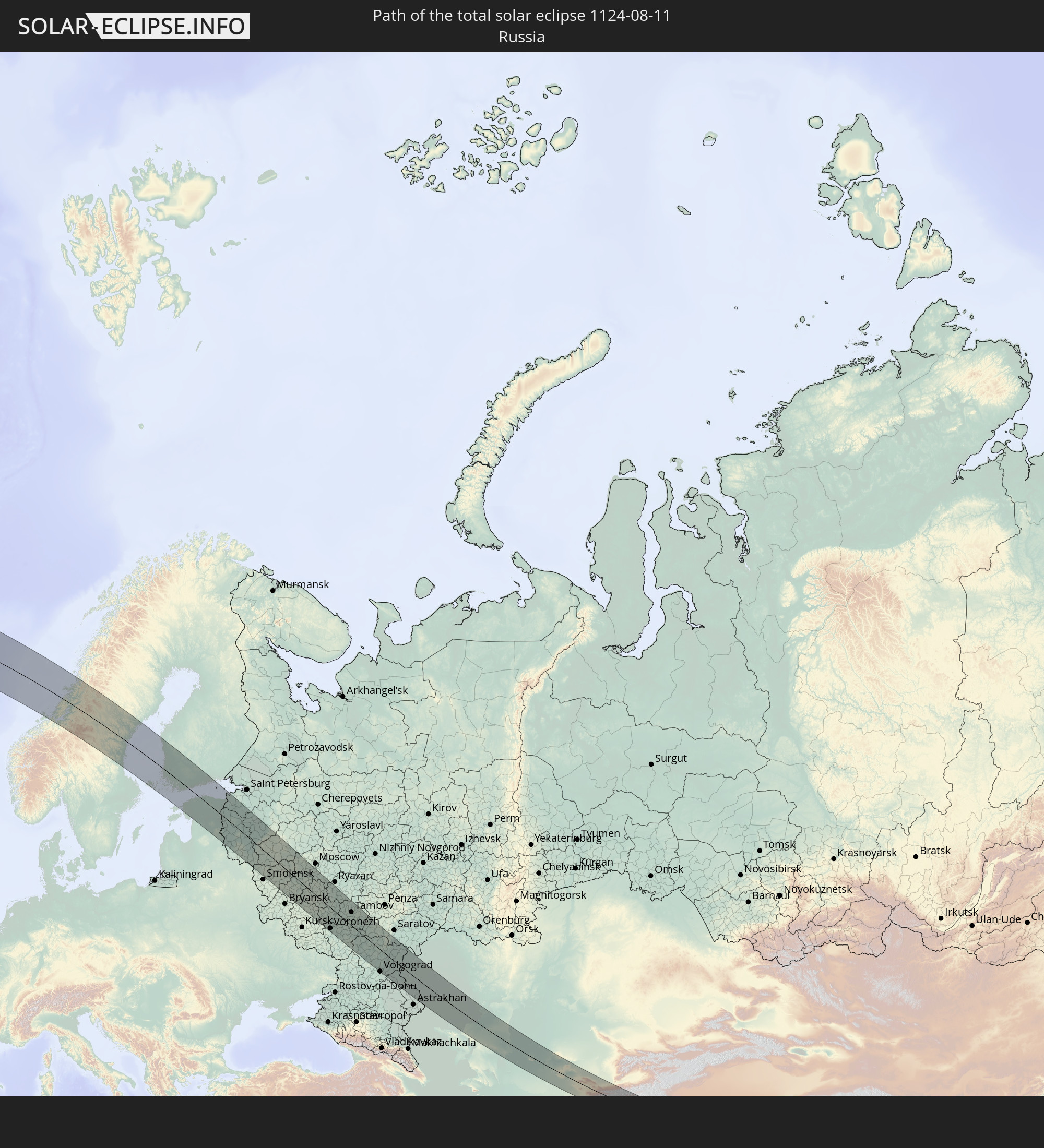 Russland
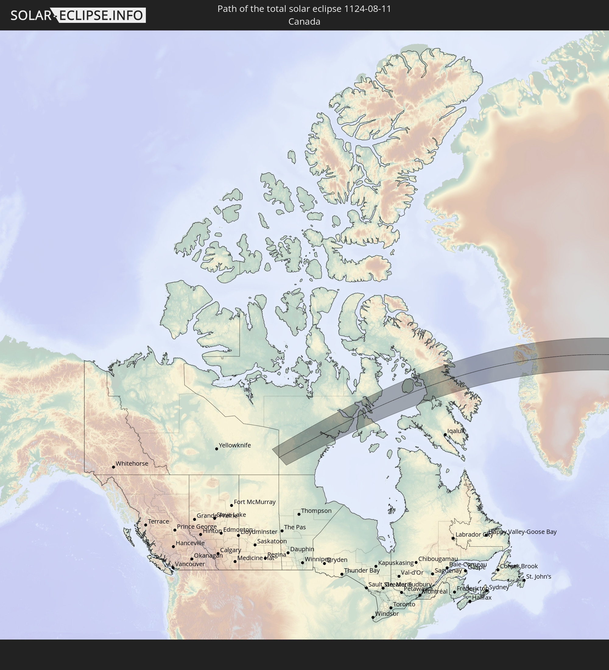 Kanada
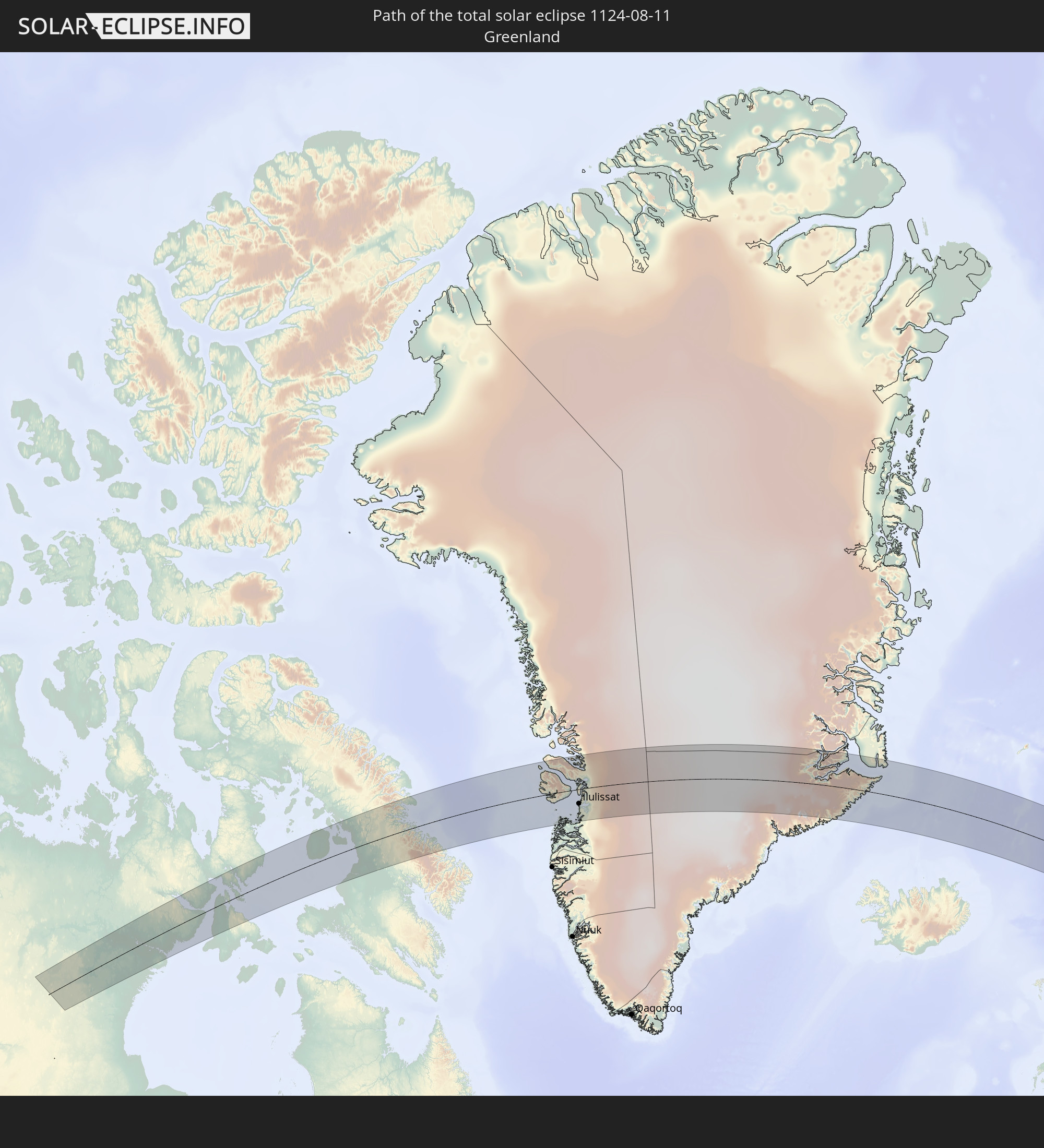 Grönland
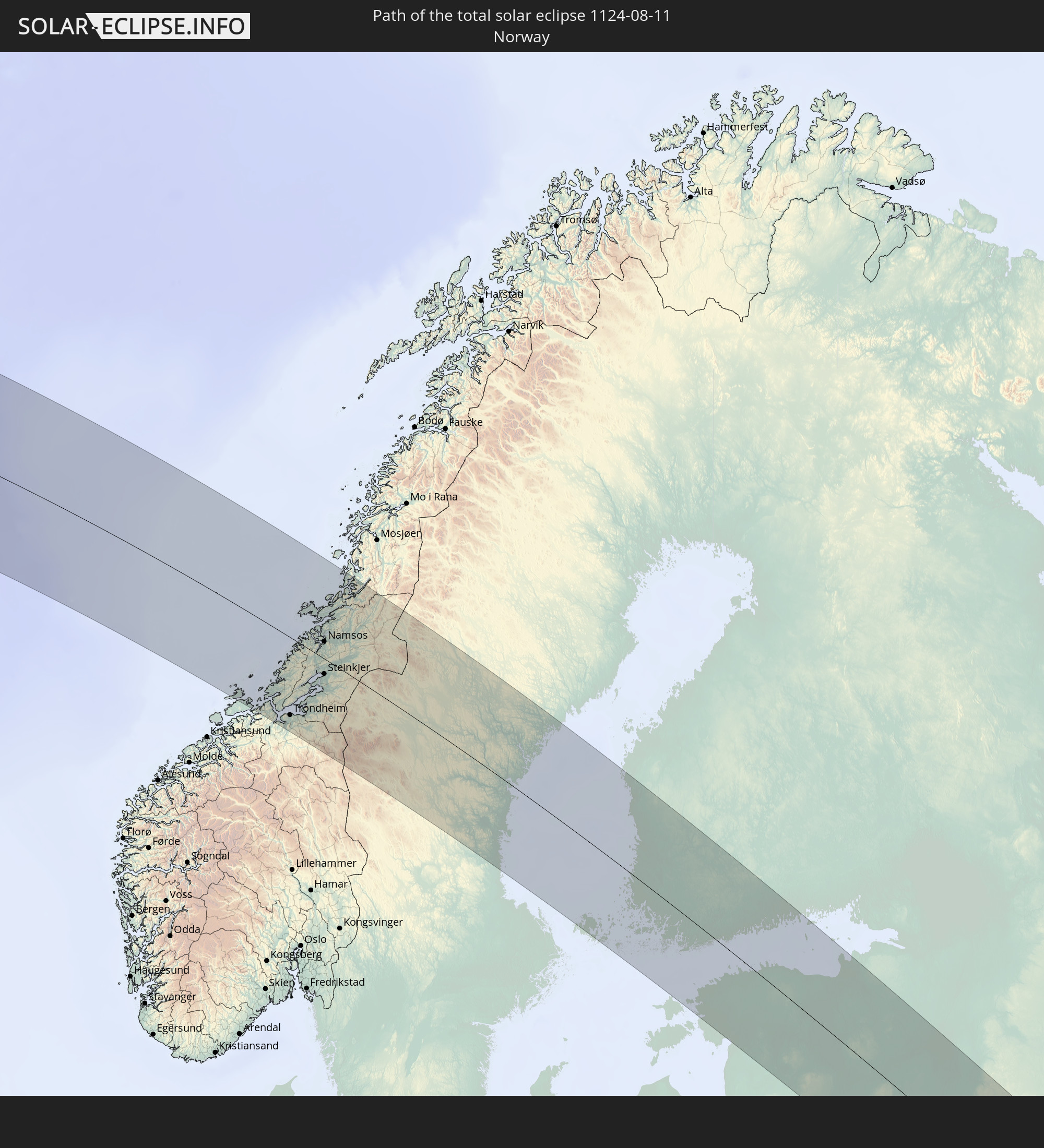 Norwegen
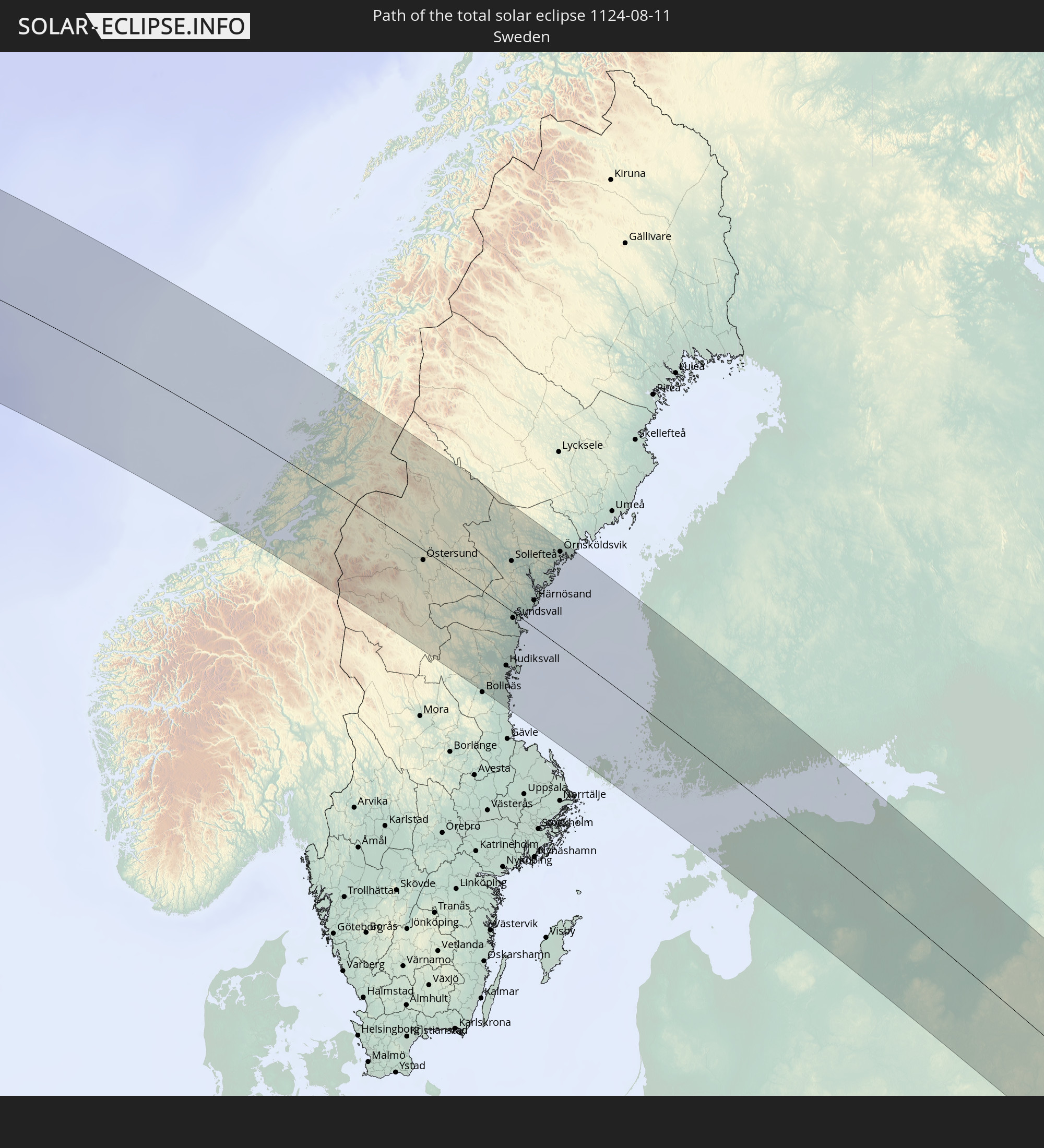 Schweden
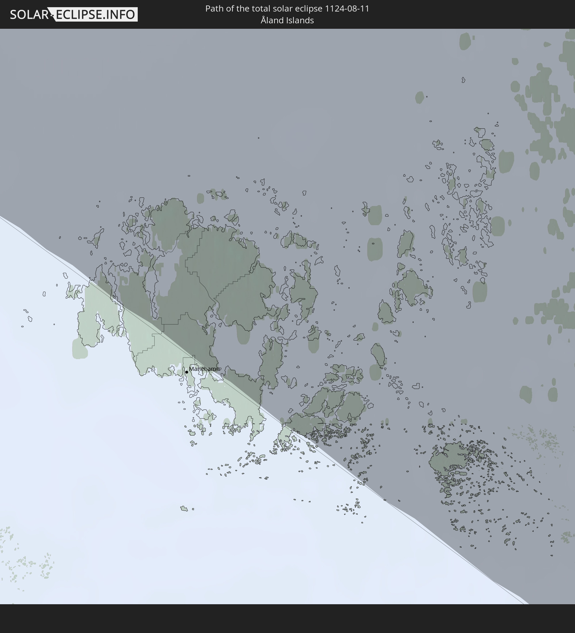 Åland Islands
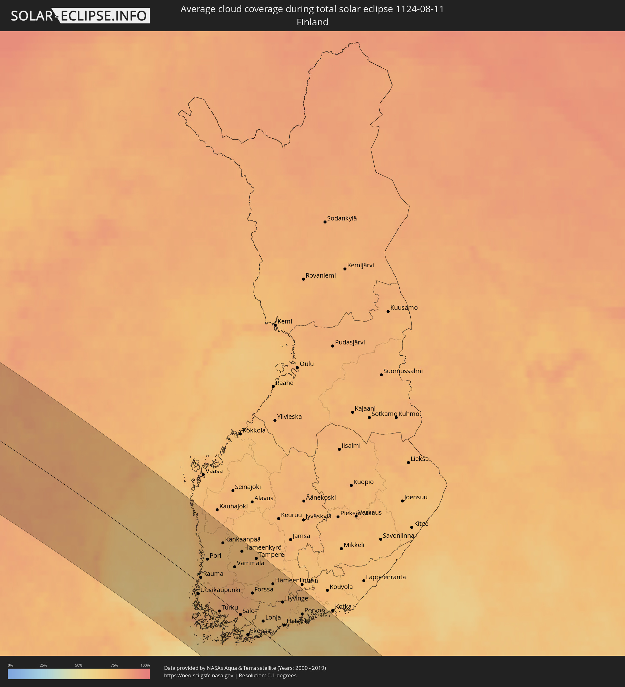
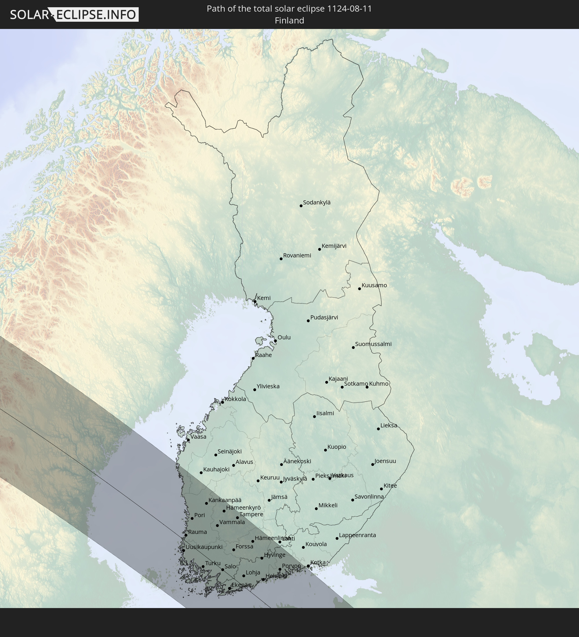 Finnland
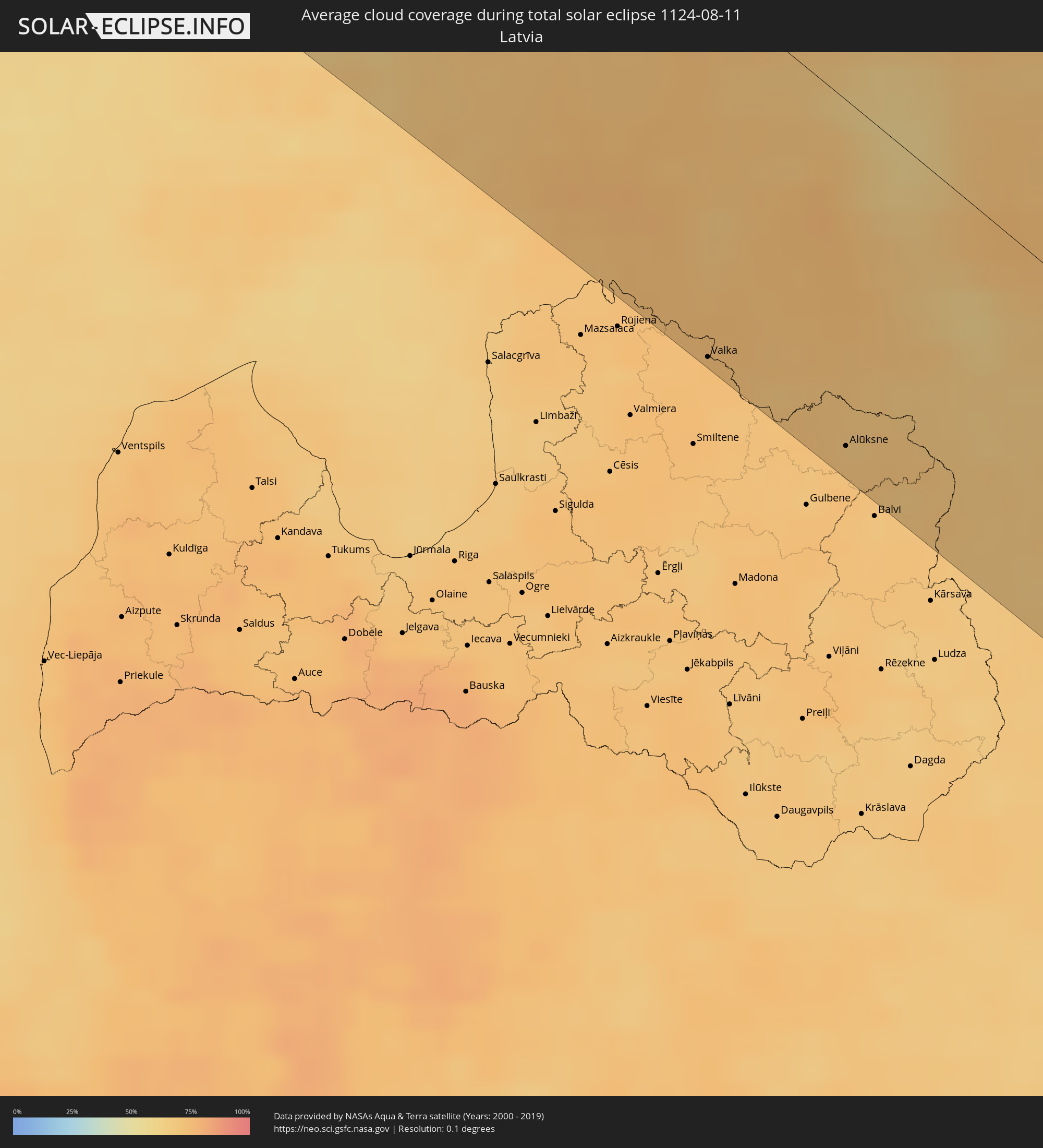
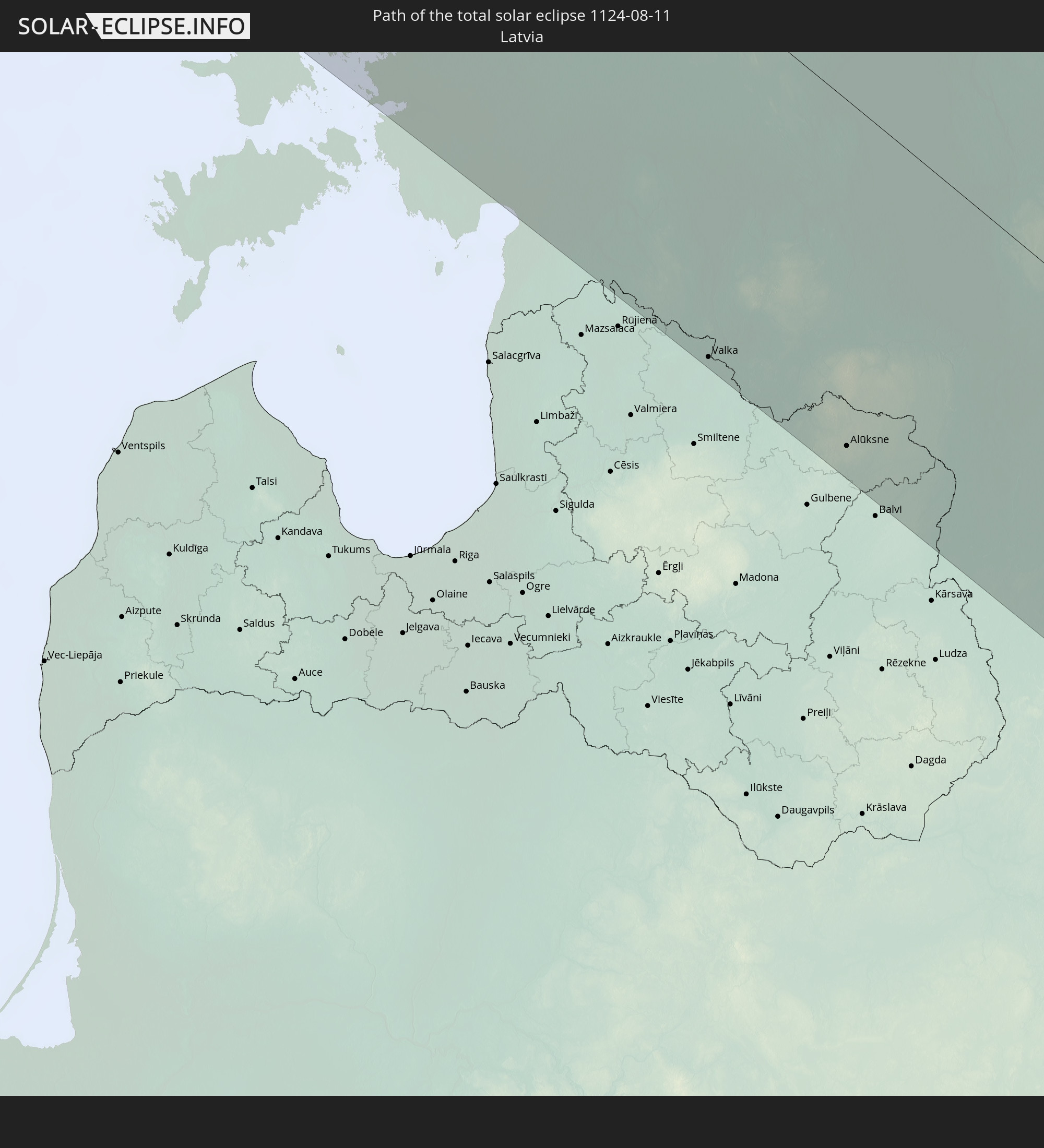 Lettland
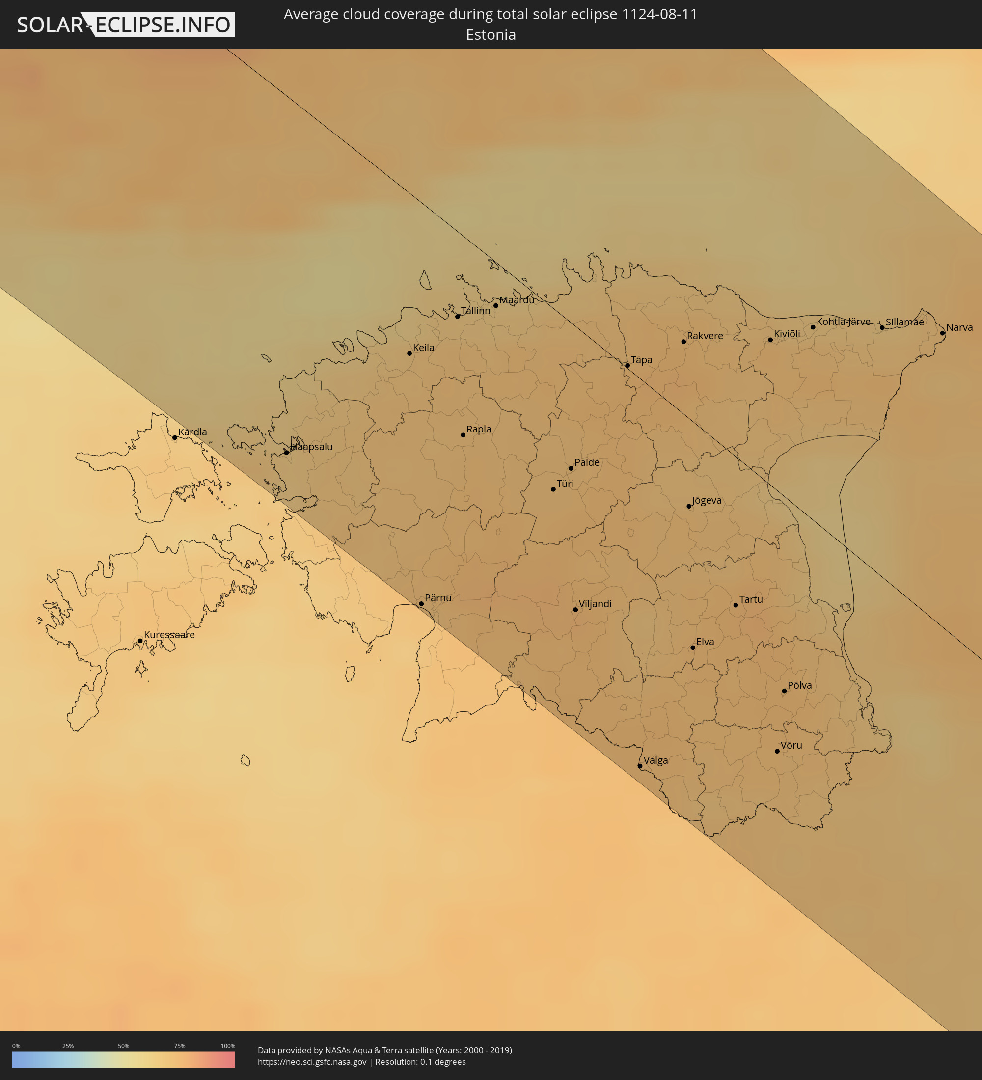
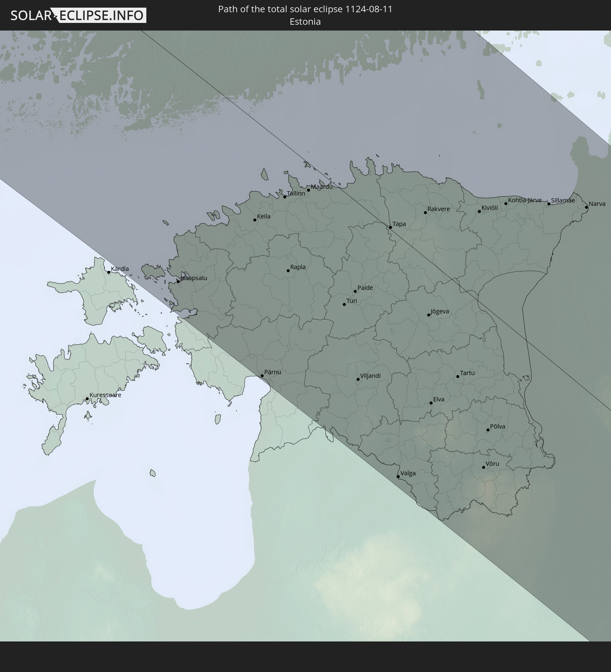 Estland
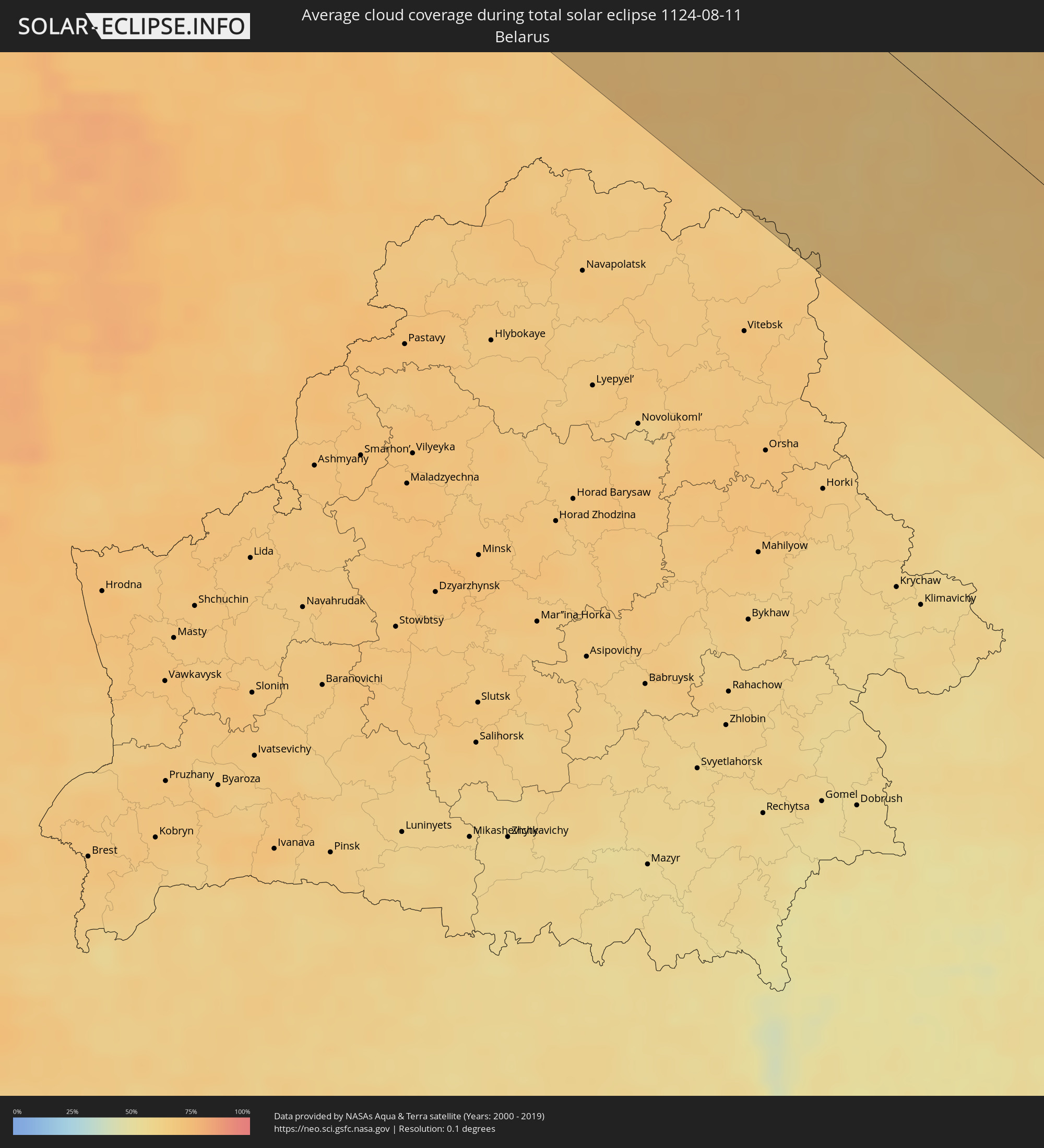
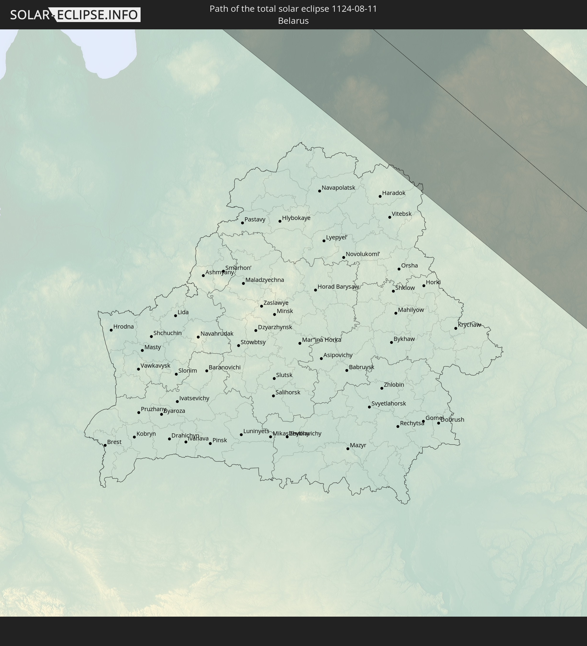 Weißrussland
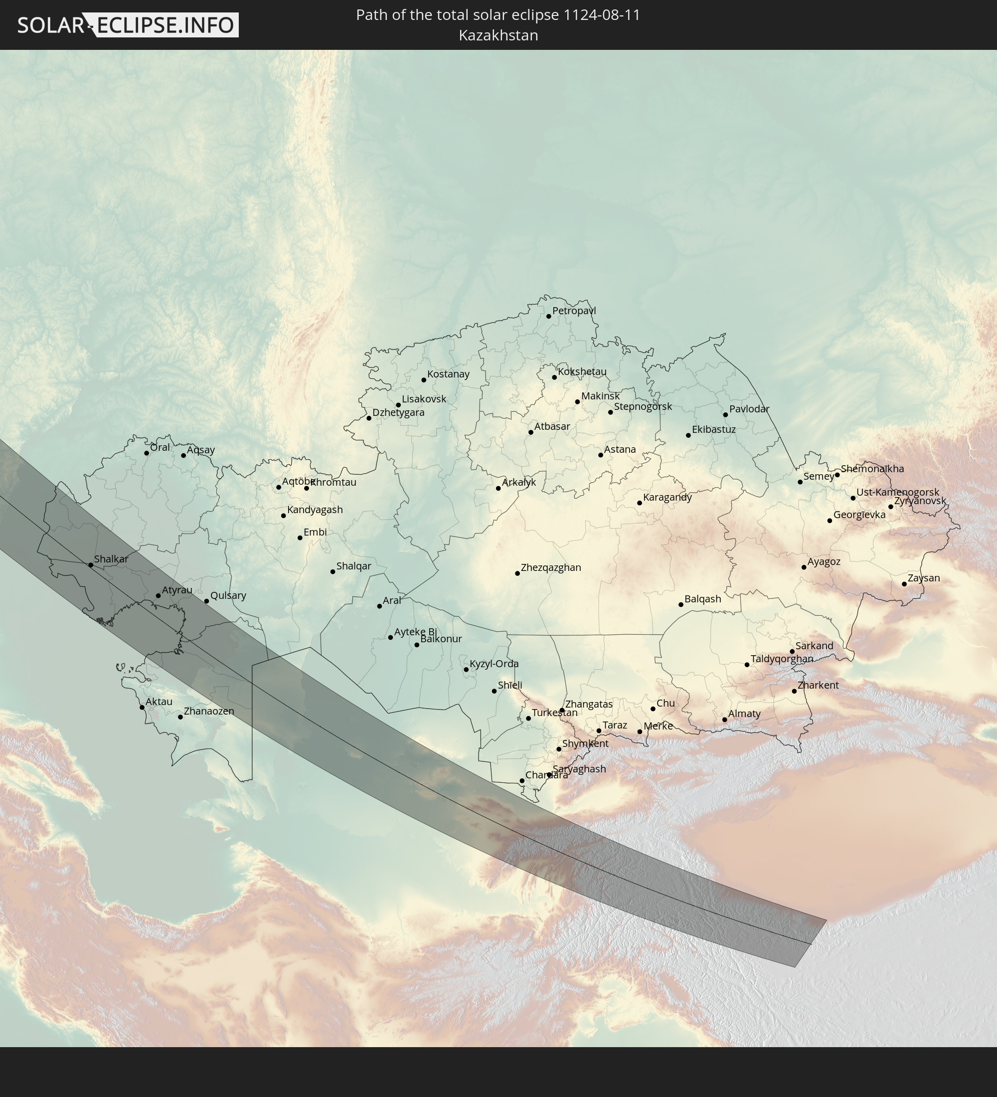 Kasachstan
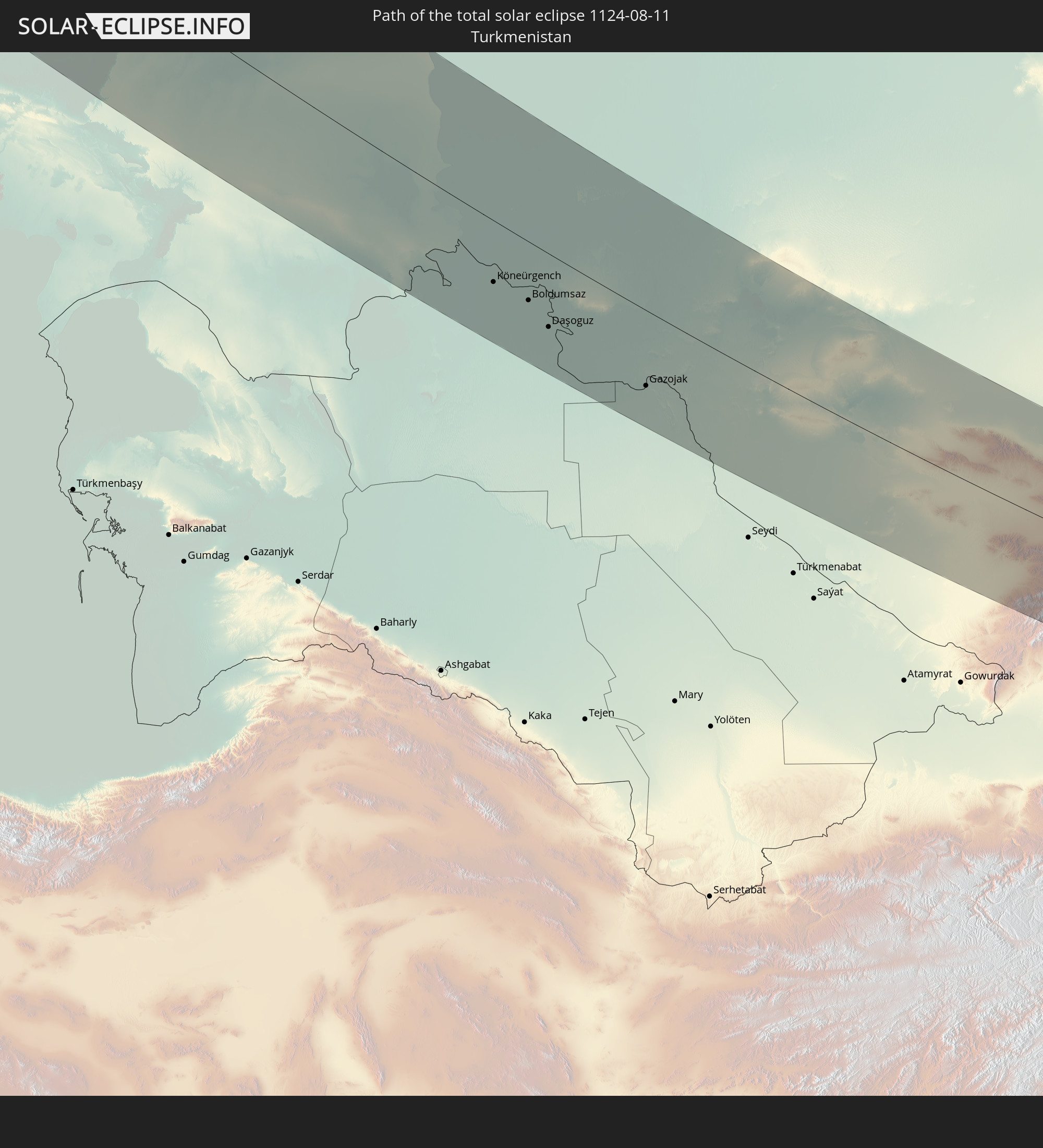 Turkmenistan
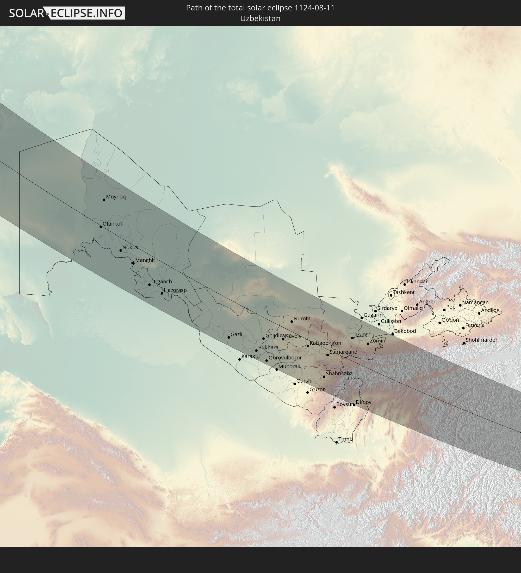 Usbekistan
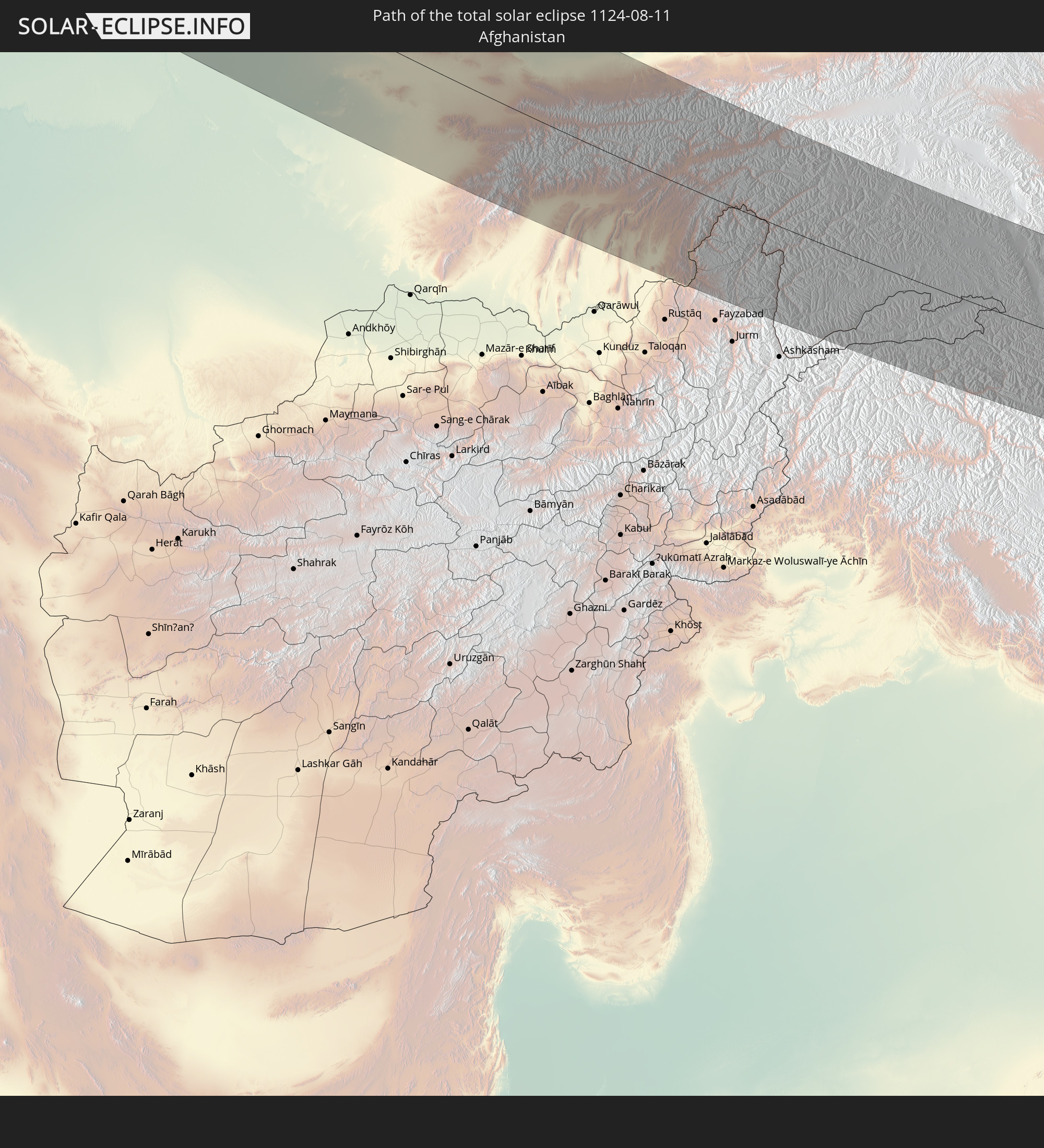 Afghanistan
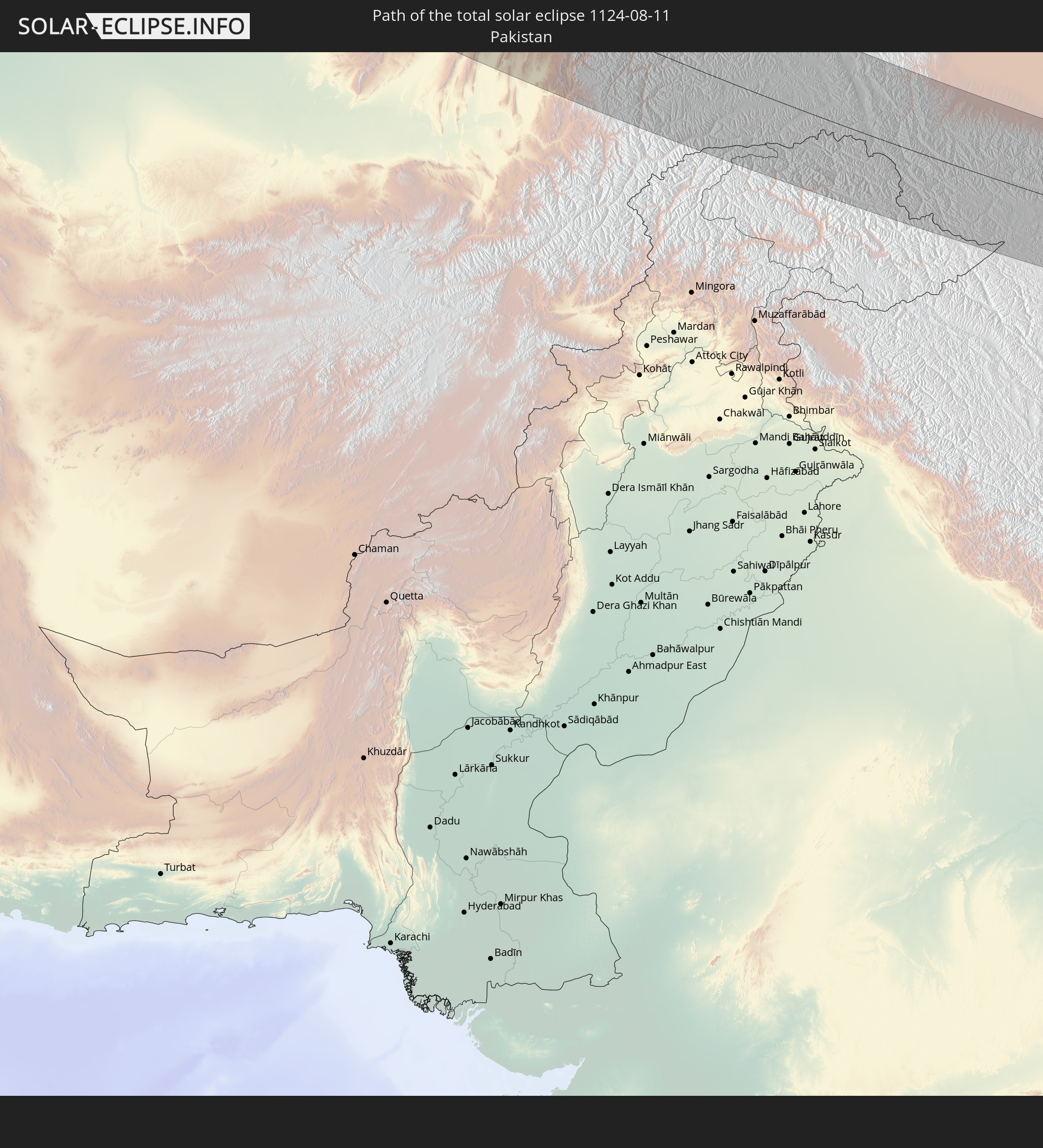 Pakistan
 Tadschikistan
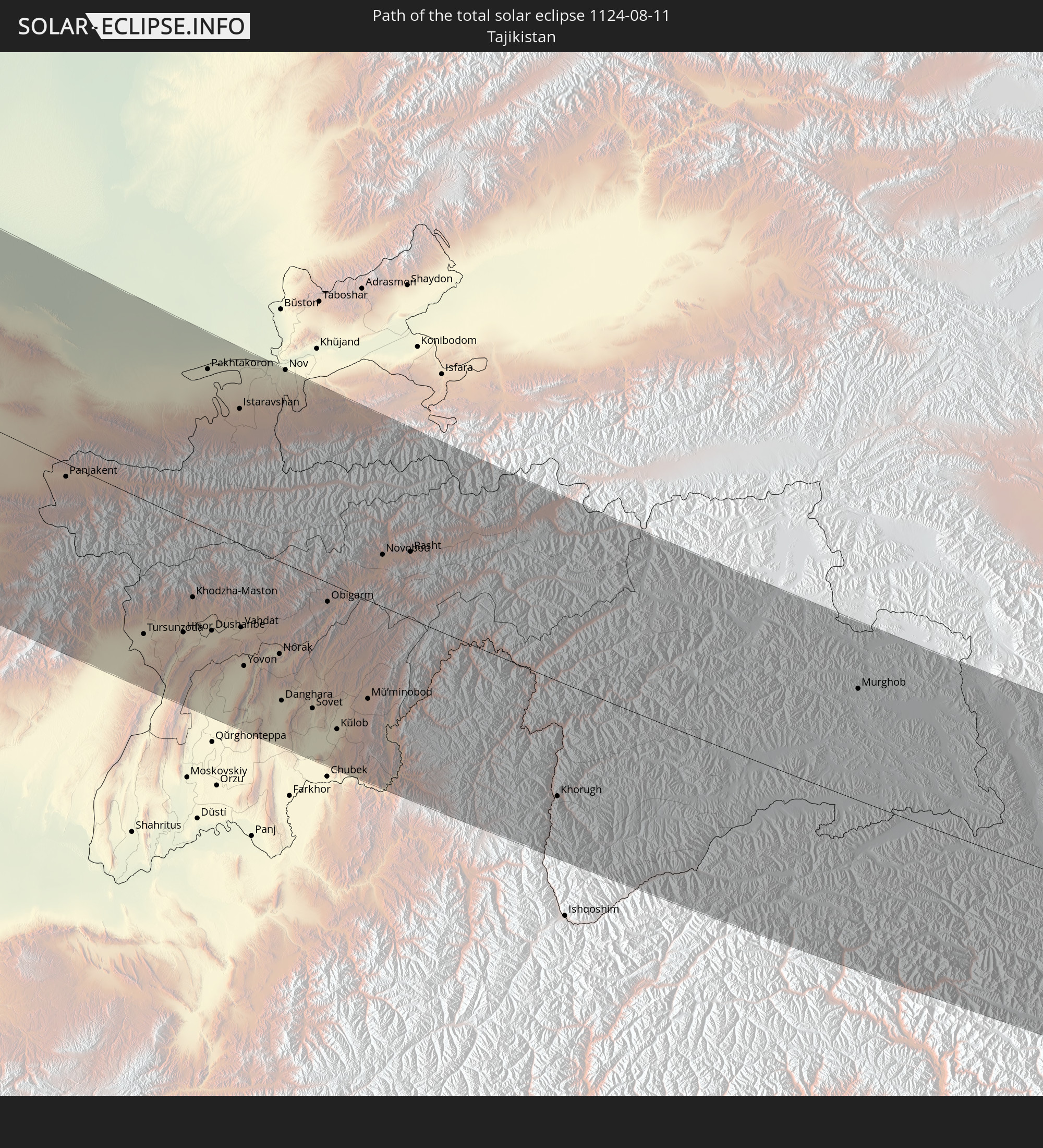
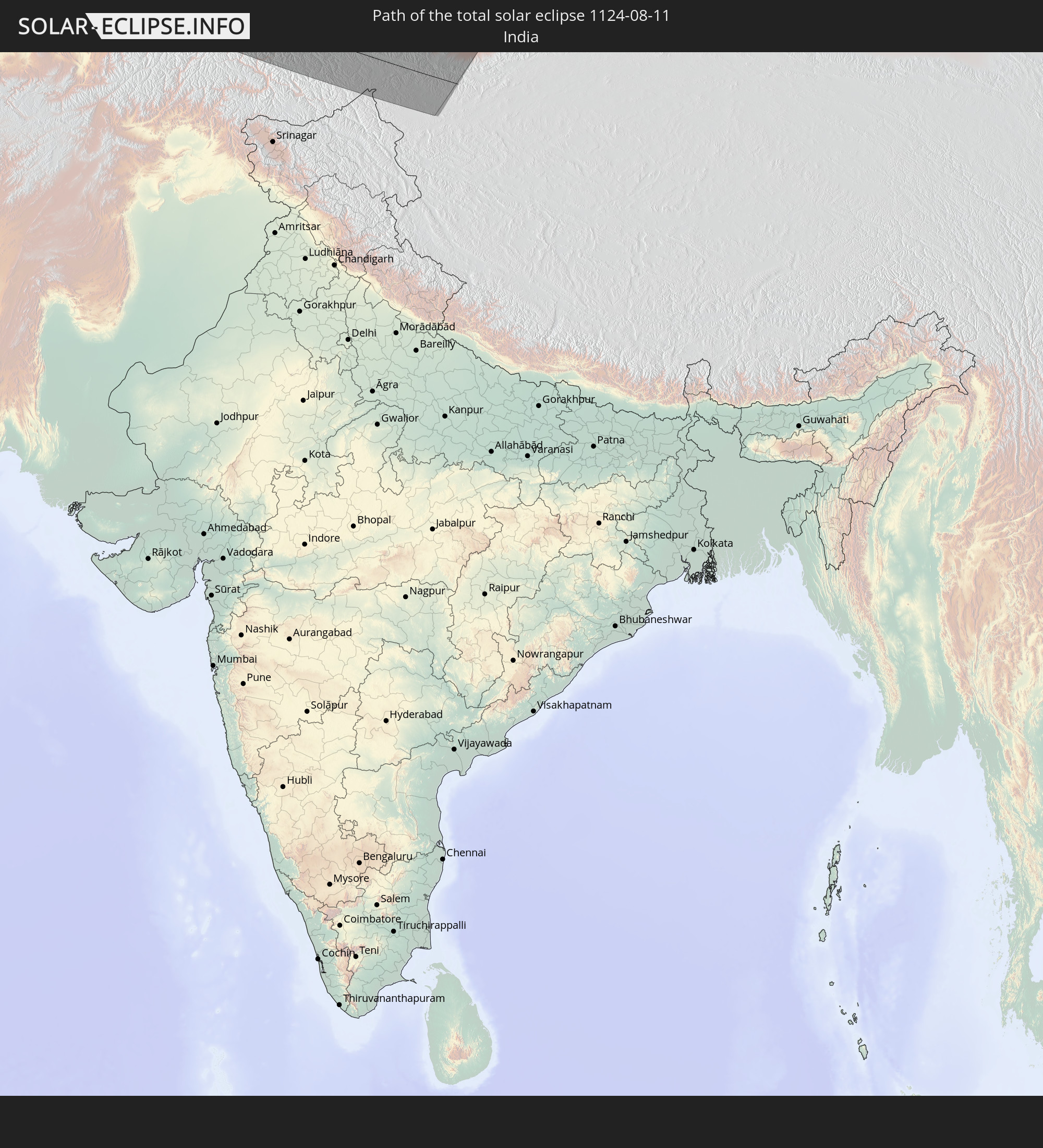 Indien
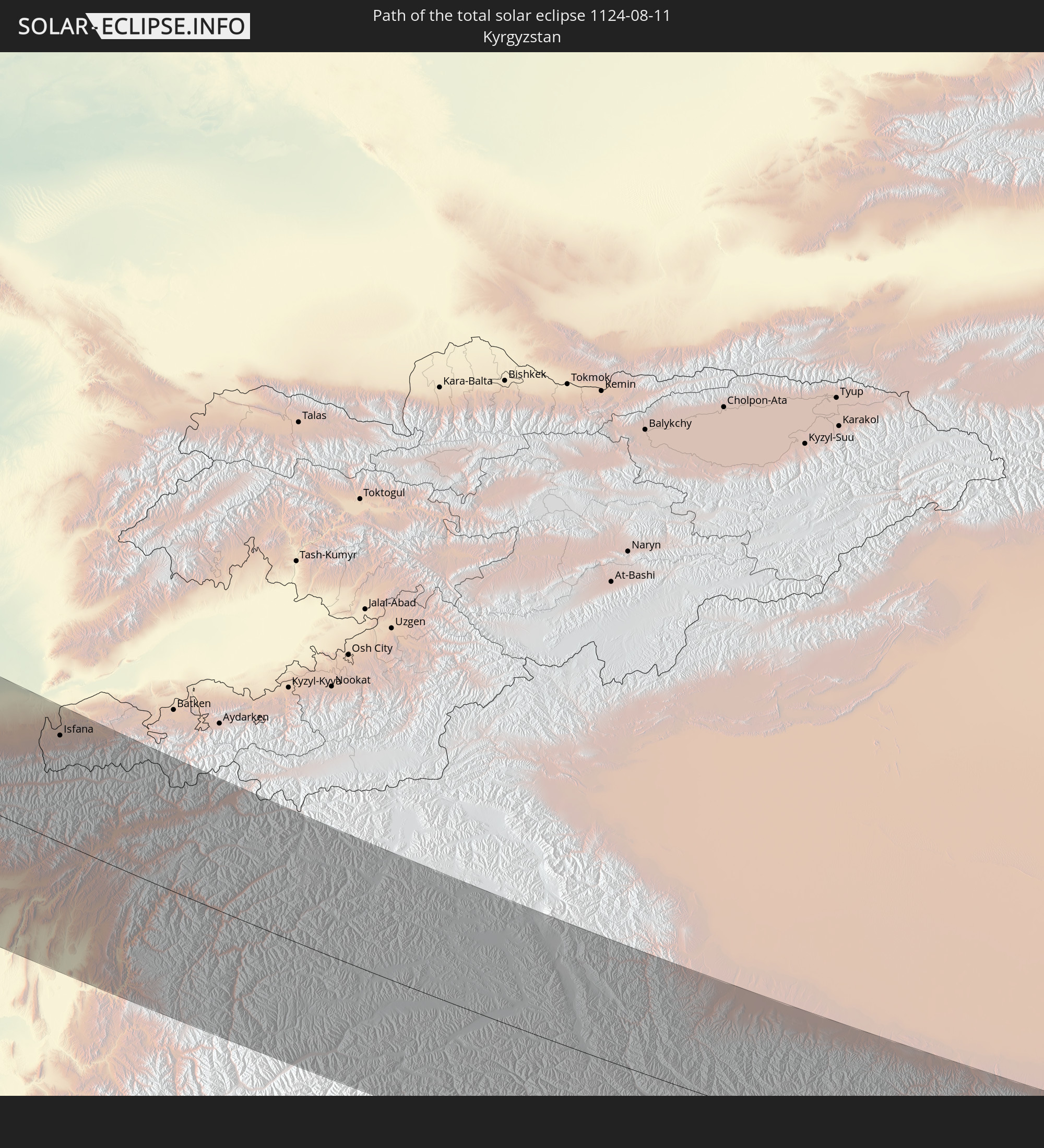 Kirgisistan
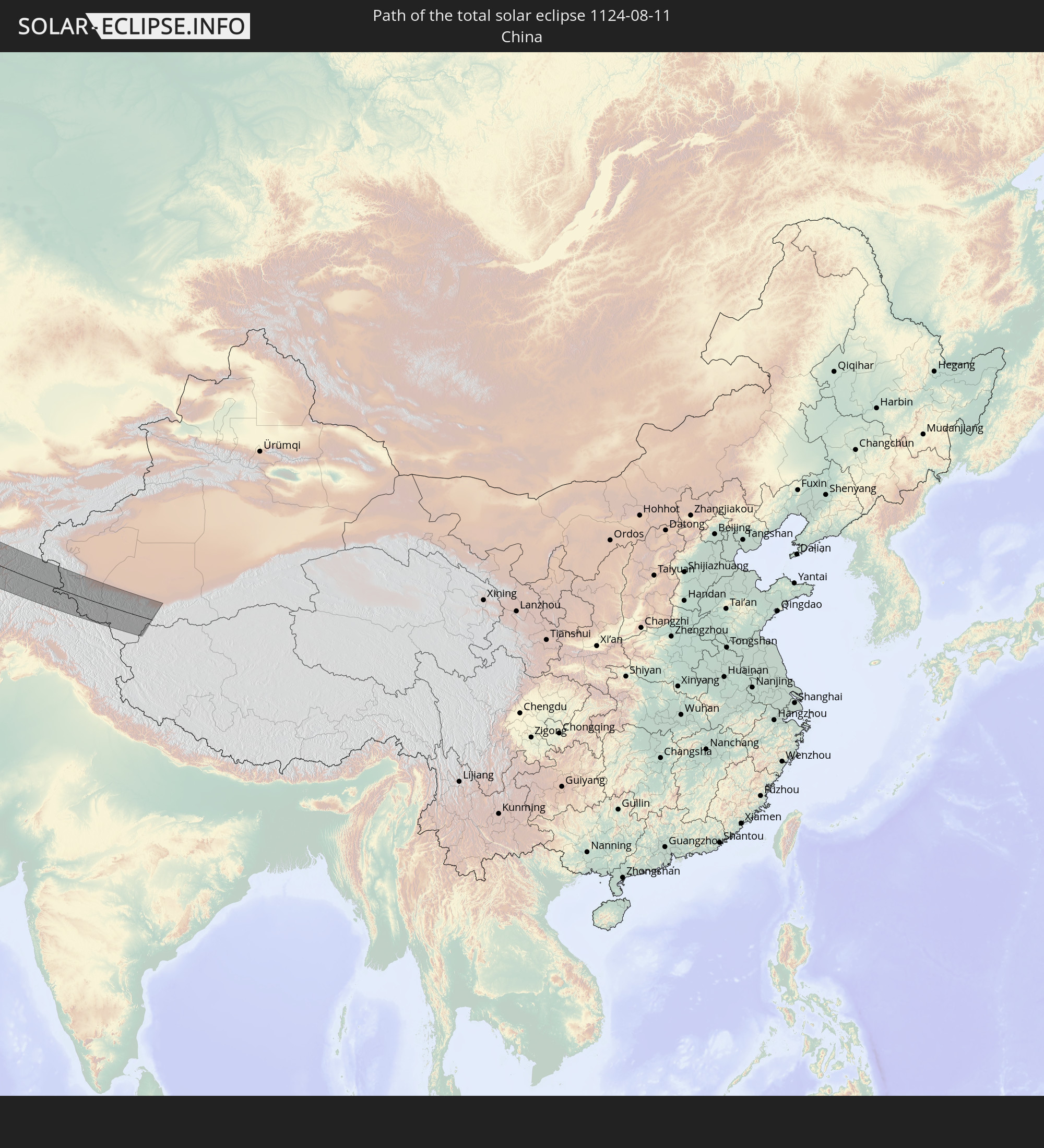 Volksrepublik China
In den folgenden Ländern ist die Sonnenfinsternis partiell zu sehen
 Russland
 Vereinigte Staaten
 Kanada
 Grönland
 Bermuda
 Saint-Pierre und Miquelon
 Portugal
 Island
 Spanien
 Marokko
 Irland
 Spitzbergen
 Algerien
 Vereinigtes Königreich
 Färöer
 Gibraltar
 Frankreich
 Isle of Man
 Guernsey
 Jersey
 Niger
Niger
 Andorra
 Belgien
 Niederlande
 Norwegen
 Luxemburg
 Deutschland
 Schweiz
 Italien
 Monaco
 Tunesien
 Dänemark
 Libyen
 Liechtenstein
 Österreich
 Schweden
 Tschechien
 San Marino
 Vatikanstadt
 Slowenien
 Tschad
 Kroatien
 Polen
Polen
 Malta
Malta
 Bosnien und Herzegowina
 Ungarn
 Slowakei
 Montenegro
 Serbien
 Albanien
 Åland Islands
 Griechenland
 Rumänien
 Mazedonien
 Finnland
 Litauen
 Lettland
 Estland
 Sudan
Sudan
 Ukraine
 Bulgarien
 Weißrussland
 Ägypten
 Türkei
 Moldawien
 Republik Zypern
 Äthiopien
 Staat Palästina
 Israel
 Saudi-Arabien
 Jordanien
 Libanon
 Syrien
 Eritrea
 Irak
Irak
 Georgien
 Somalia
 Dschibuti
 Jemen
Jemen
 Armenien
 Iran
Iran
 Aserbaidschan
 Kasachstan
 Kuwait
 Bahrain
 Katar
Katar
 Vereinigte Arabische Emirate
 Oman
Oman
 Turkmenistan
 Usbekistan
 Afghanistan
 Pakistan
 Tadschikistan
 Indien
 Kirgisistan
 Volksrepublik China
 Mongolei
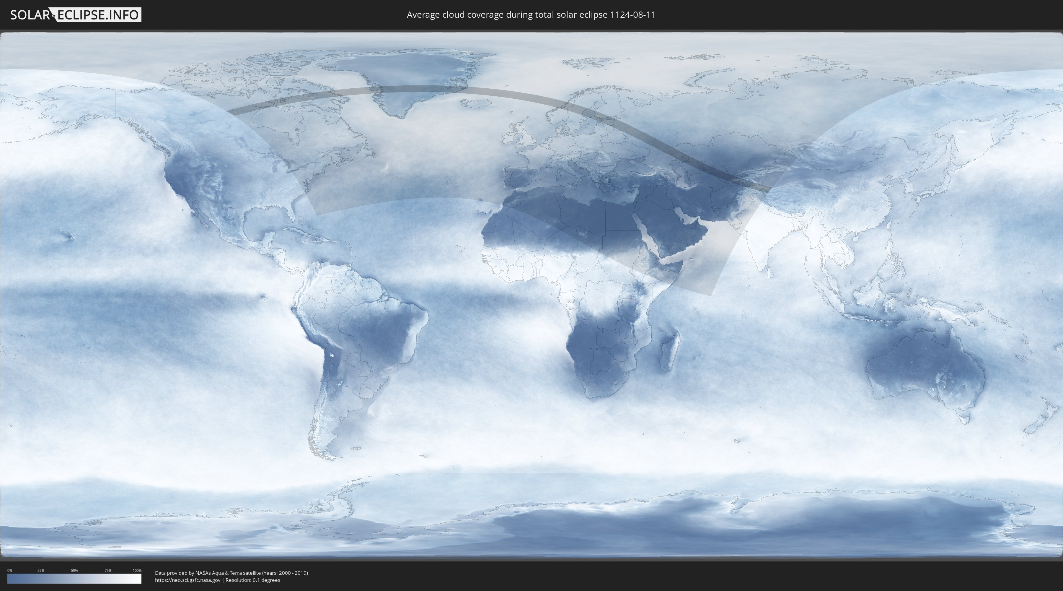
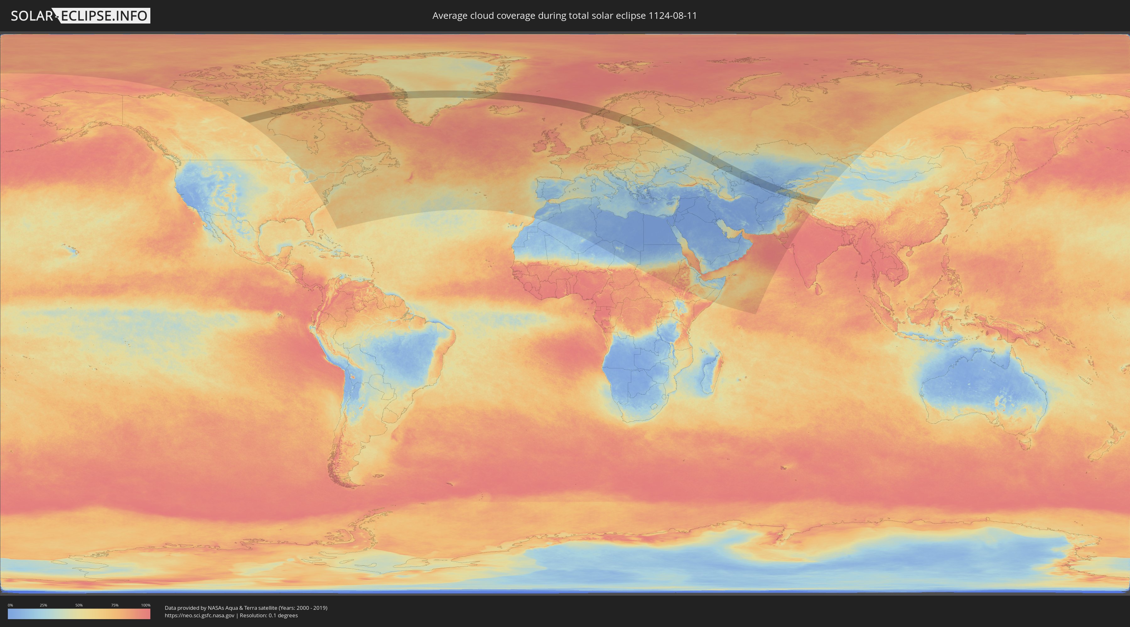
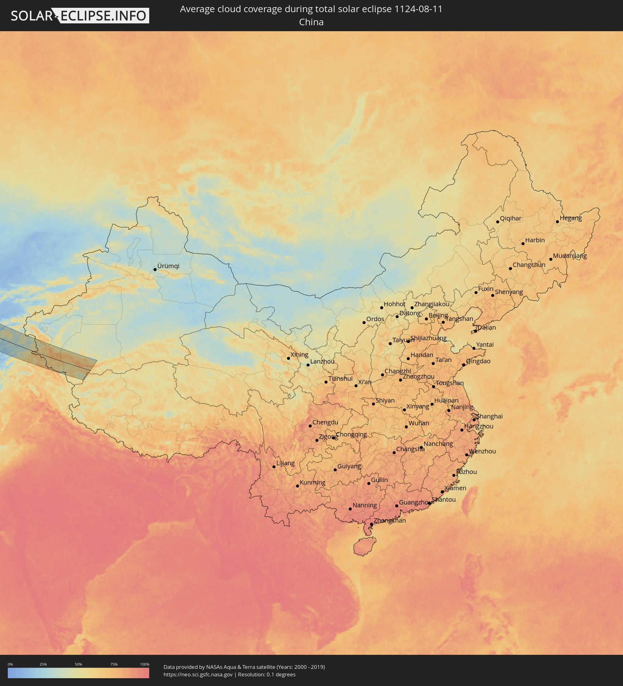
Wie wird das Wetter während der totalen Sonnenfinsternis am 11.08.1124?
Wo ist der beste Ort, um die totale Sonnenfinsternis vom 11.08.1124 zu beobachten?
Die folgenden Karten zeigen die durchschnittliche Bewölkung für den Tag, an dem die totale Sonnenfinsternis
stattfindet. Mit Hilfe der Karten lässt sich der Ort entlang des Finsternispfades eingrenzen,
der die besten Aussichen auf einen klaren wolkenfreien Himmel bietet.
Trotzdem muss man immer lokale Gegenenheiten beachten und sollte sich genau über das Wetter an seinem
gewählten Beobachtungsort informieren.
Die Daten stammen von den beiden NASA-Satelliten
AQUA und TERRA
und wurden über einen Zeitraum von 19 Jahren (2000 - 2019) gemittelt.
Detaillierte Länderkarten
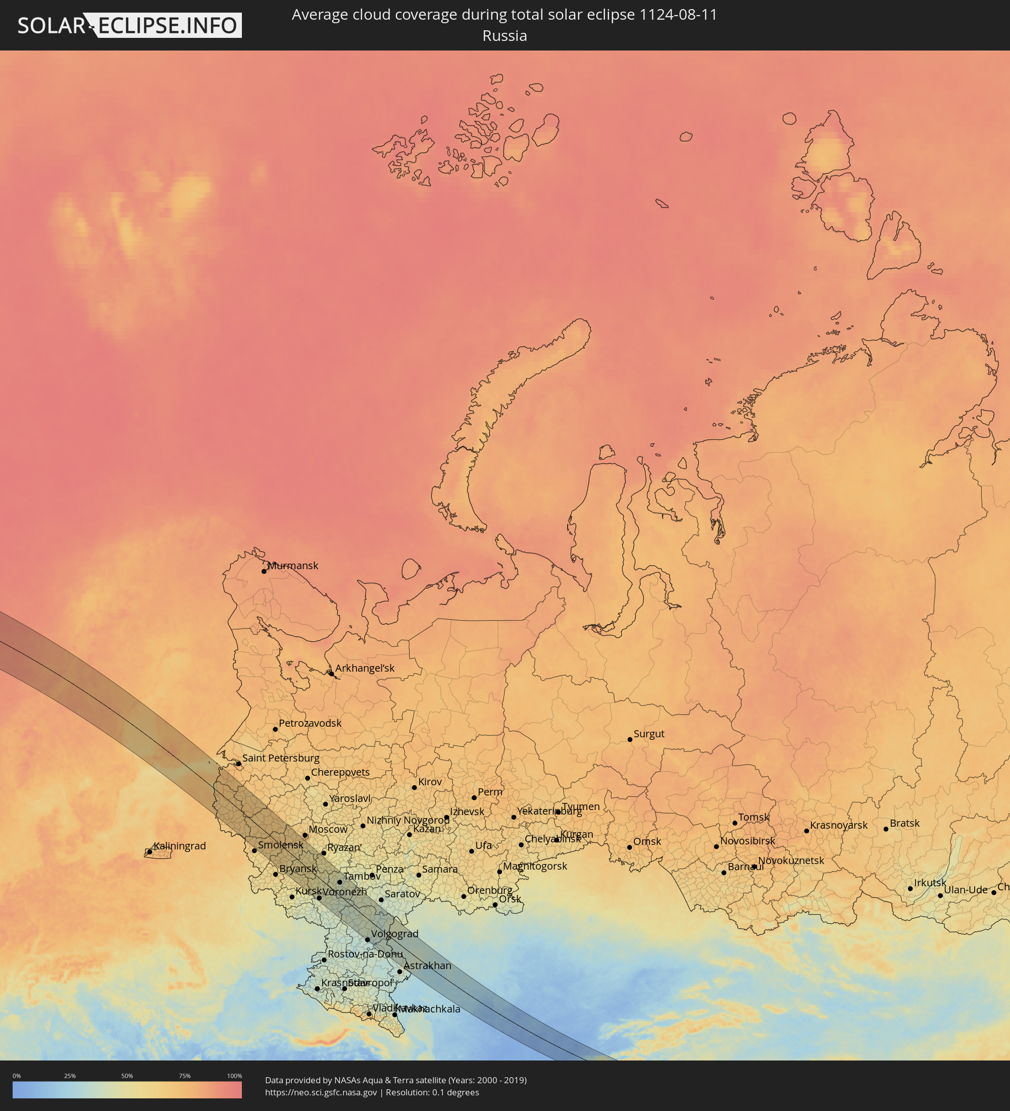 Russland
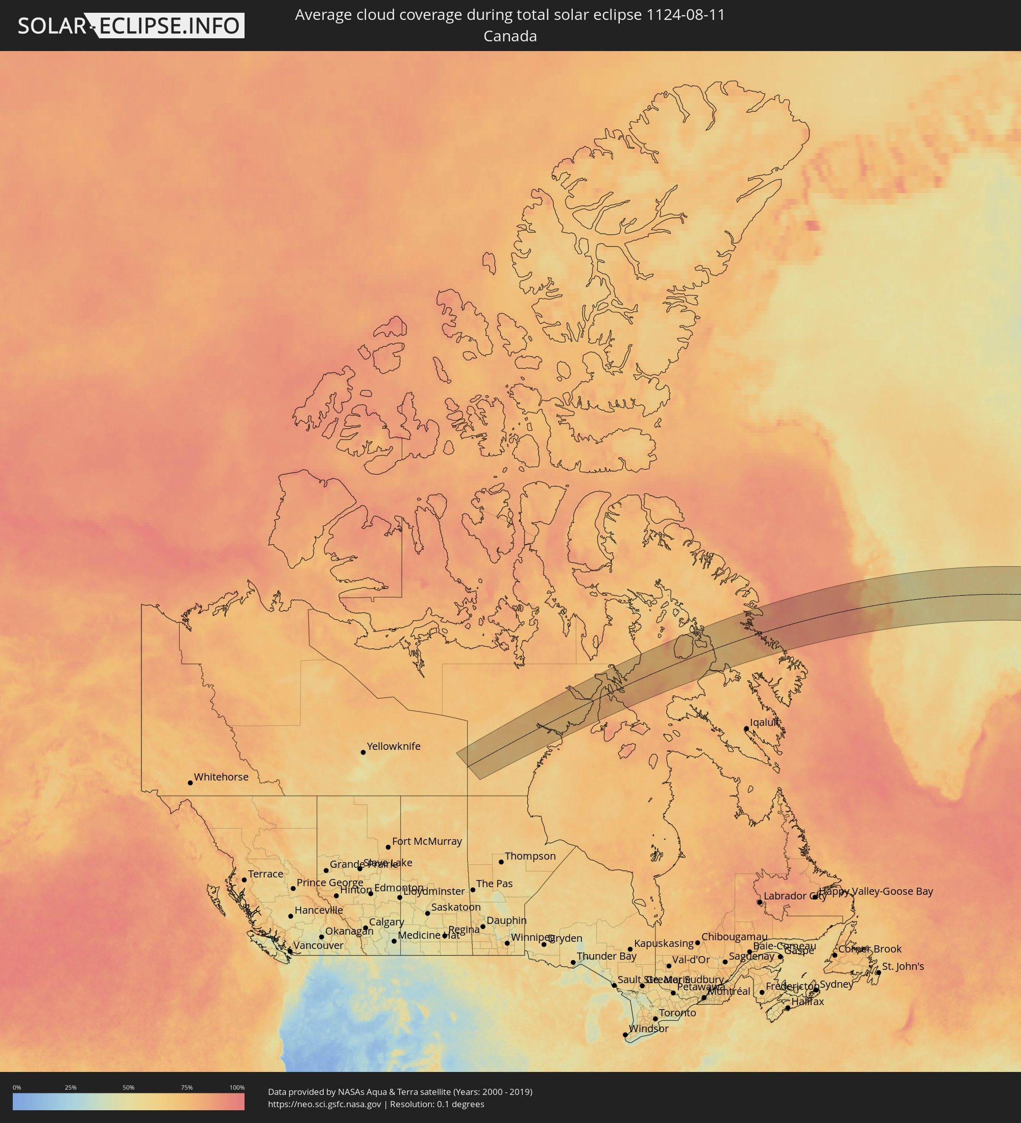 Kanada
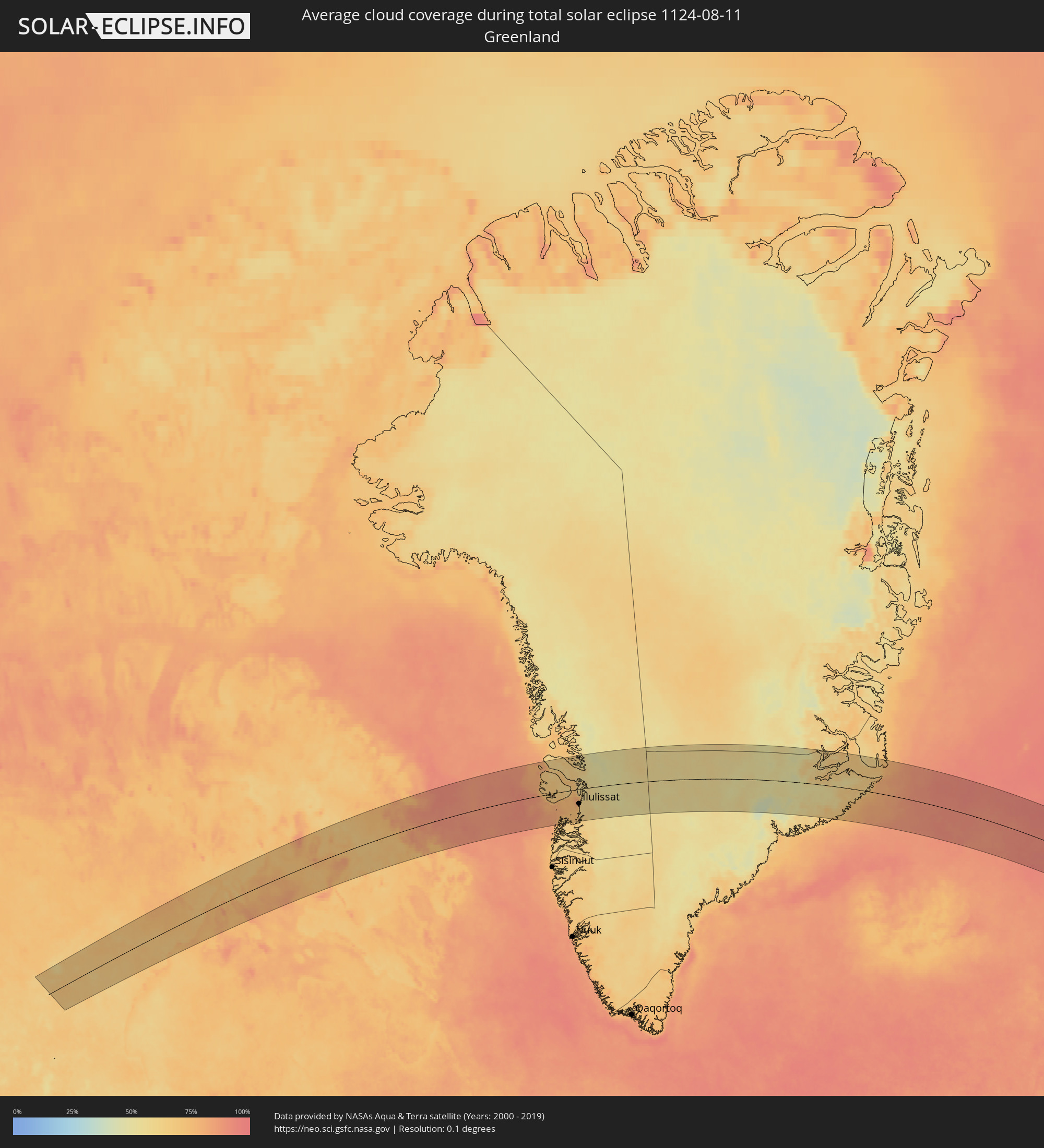 Grönland
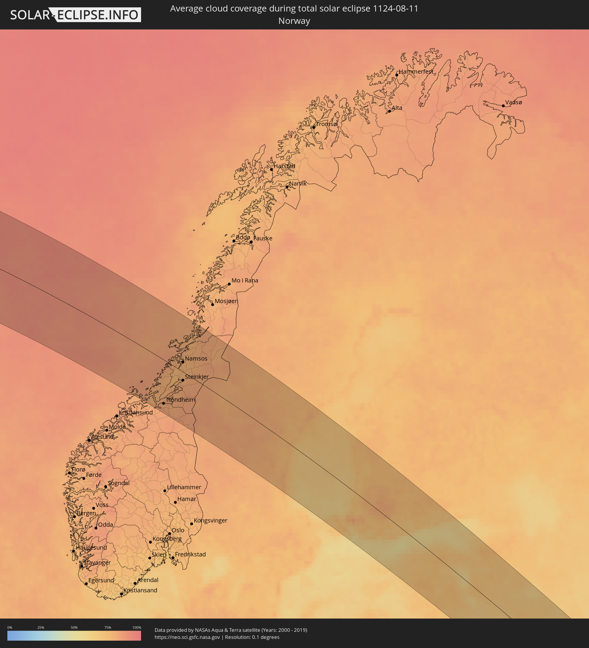 Norwegen
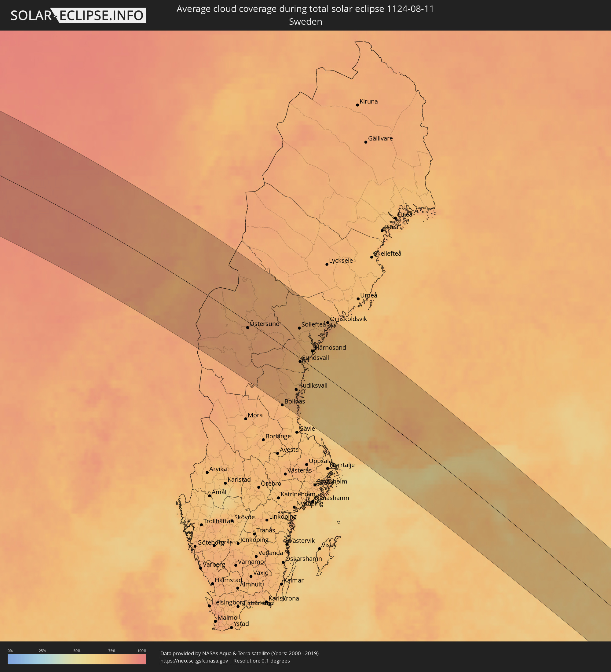 Schweden
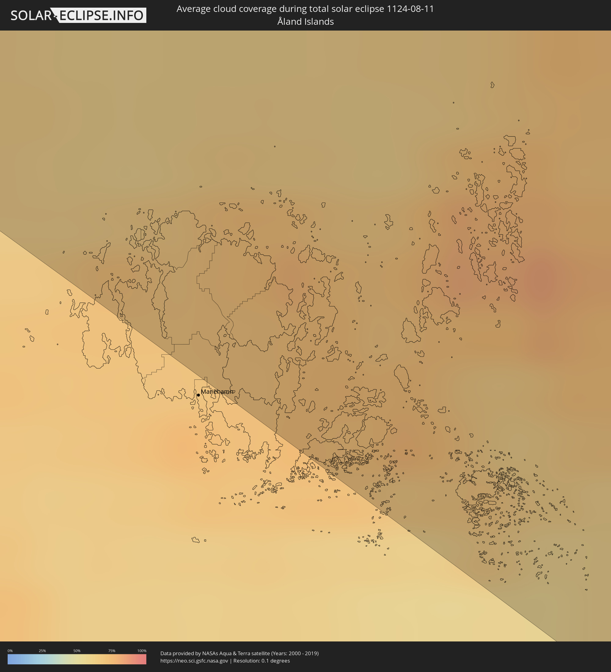 Åland Islands
 Finnland
 Lettland
 Estland
 Weißrussland
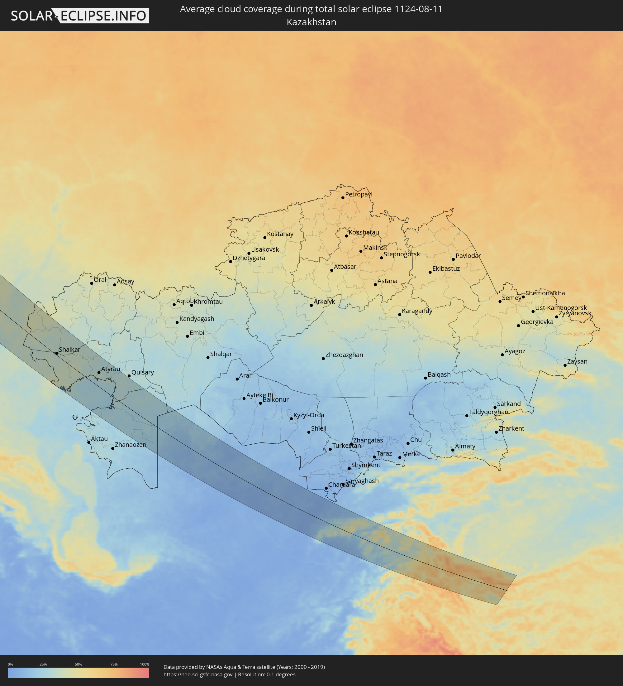 Kasachstan
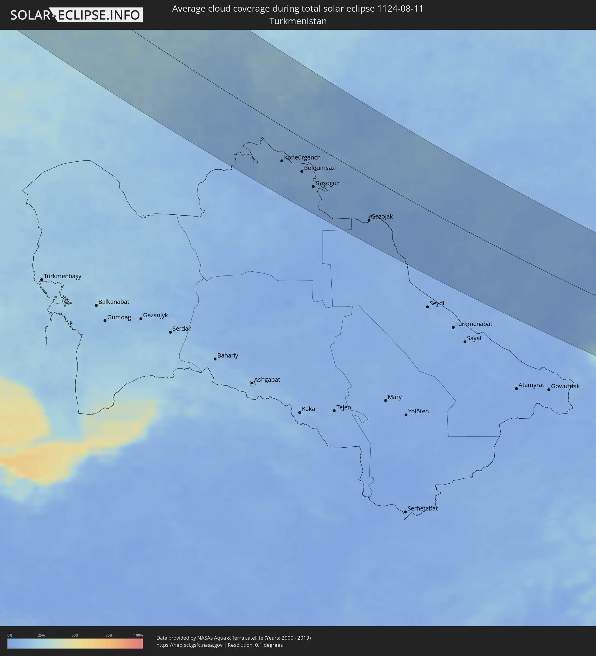 Turkmenistan
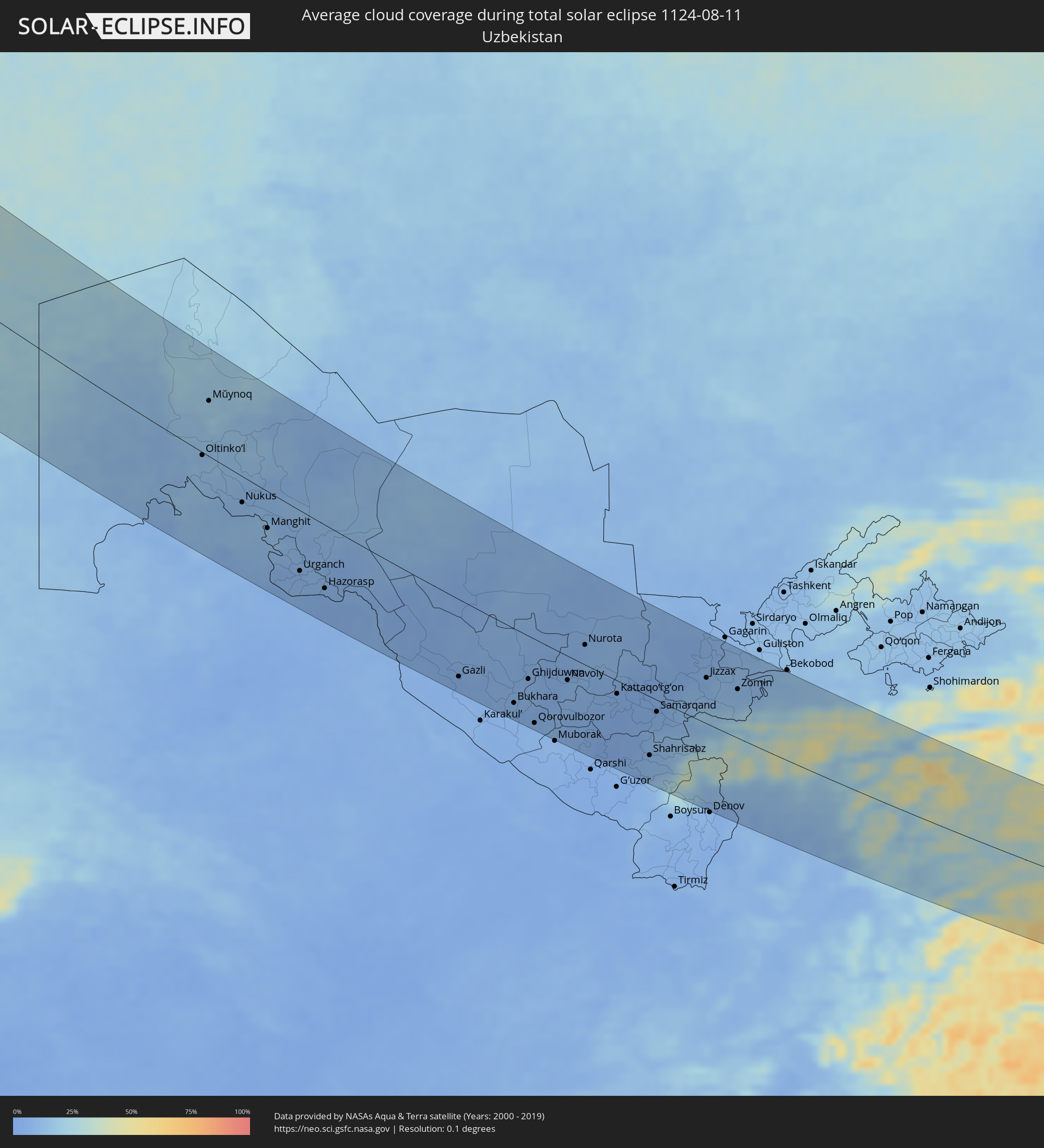 Usbekistan
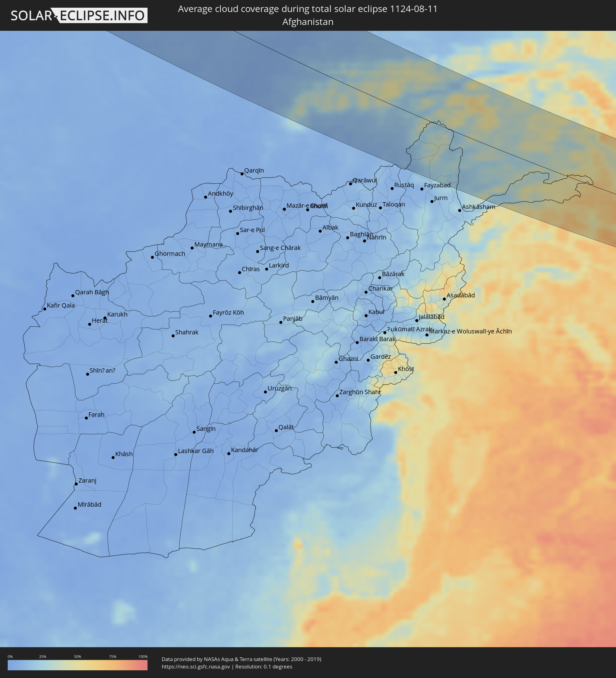 Afghanistan
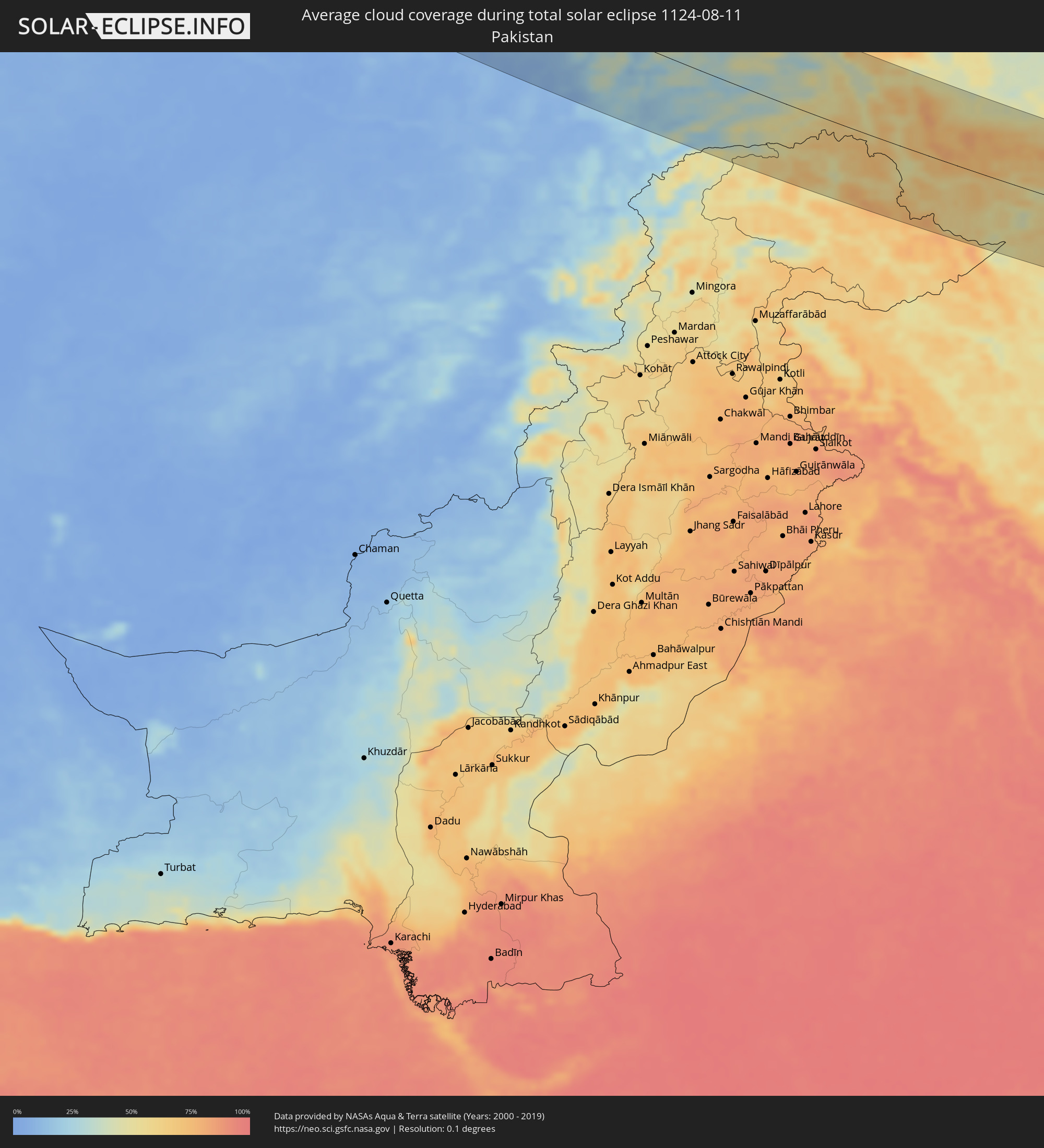 Pakistan
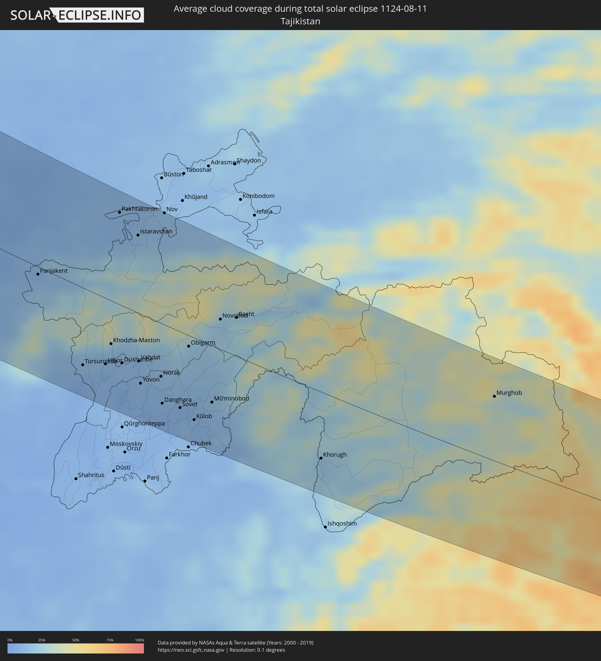 Tadschikistan
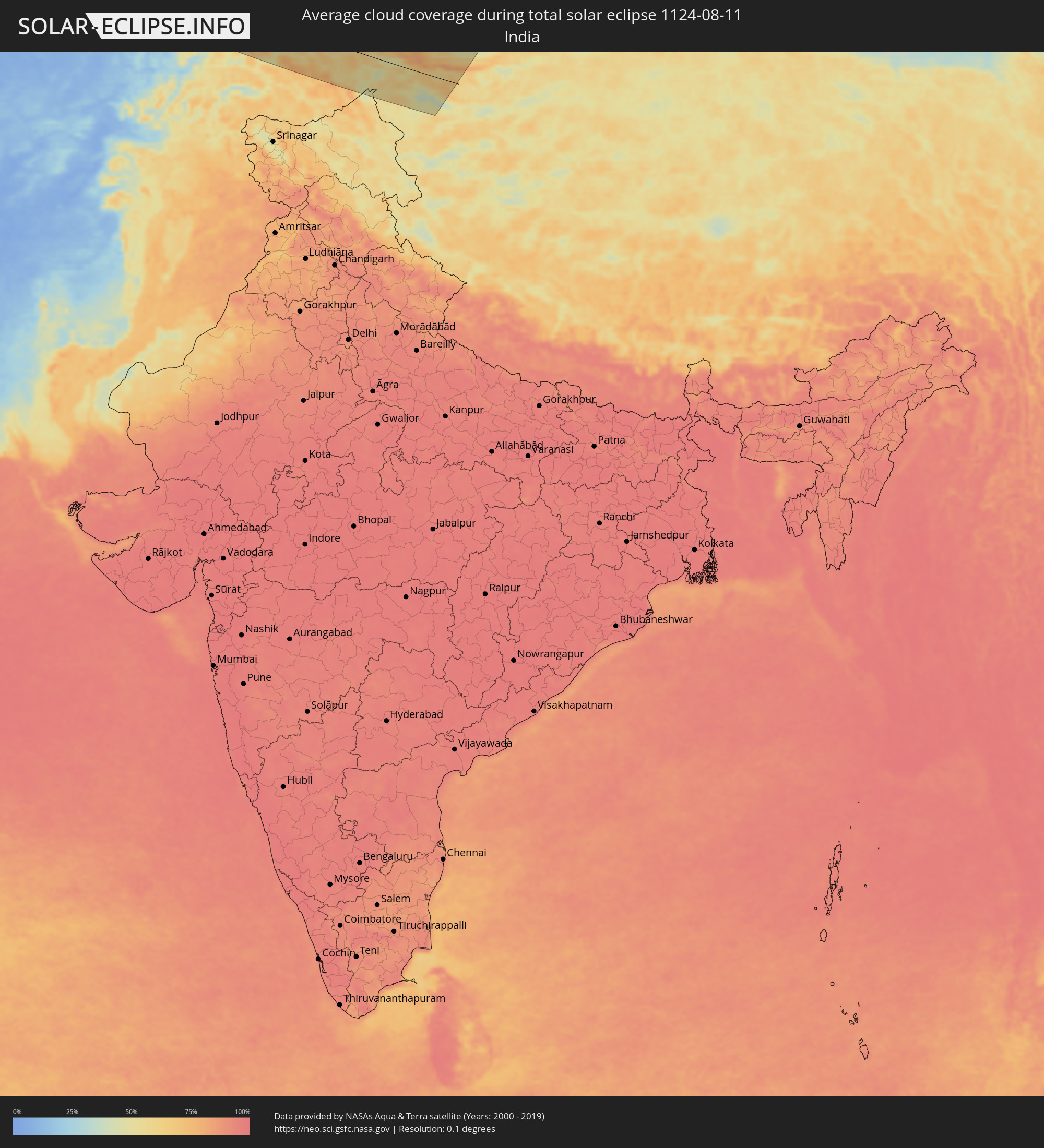 Indien
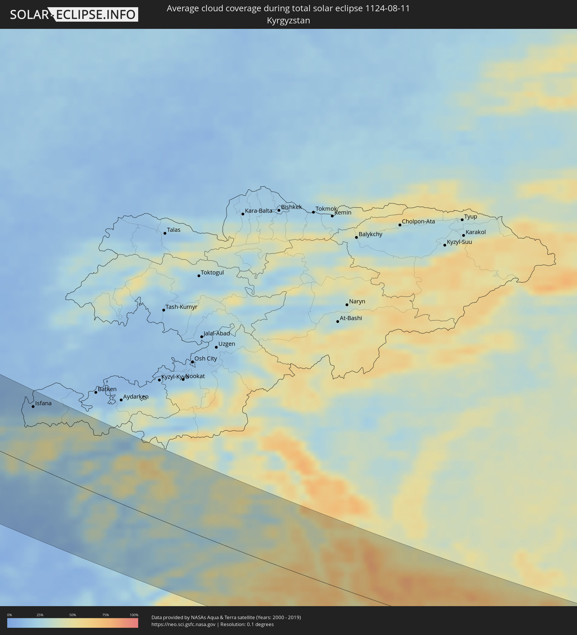 Kirgisistan
 Volksrepublik China
Orte im Finsternispfad
Die nachfolgene Tabelle zeigt Städte und Orte mit mehr als 5.000 Einwohnern, die sich im Finsternispfad befinden. Städte mit mehr als 100.000 Einwohnern sind dick gekennzeichnet. Mit einem Klick auf den Ort öffnet sich eine Detailkarte die die Lage des jeweiligen Ortes zusammen mit dem Verlauf der zentralen Finsternis präsentiert.
| Ort | Typ | Dauer der Verfinsterung | Ortszeit bei maximaler Verfinsterung | Entfernung zur Zentrallinie | Ø Bewölkung |
|
Ilulissat, Qaasuitsup
|
total | - | 07:51:43 UTC-03:26 | 54 km | 68% |
|
Trondheim, Sør-Trøndelag
|
total | - | 13:01:08 UTC+01:00 | 104 km | 82% |
|
Malvik, Sør-Trøndelag
|
total | - | 13:01:24 UTC+01:00 | 97 km | 81% |
|
Stjørdalshalsen, Nord-Trøndelag
|
total | - | 13:01:36 UTC+01:00 | 87 km | 81% |
|
Levanger, Nord-Trøndelag
|
total | - | 13:01:43 UTC+01:00 | 51 km | 81% |
|
Verdal, Nord-Trøndelag
|
total | - | 13:01:51 UTC+01:00 | 41 km | 82% |
|
Steinkjer, Nord-Trøndelag
|
total | - | 13:01:41 UTC+01:00 | 23 km | 80% |
|
Namsos, Nord-Trøndelag
|
total | - | 13:01:19 UTC+01:00 | 26 km | 78% |
|
Östersund, Jämtland
|
total | - | 13:05:16 UTC+01:00 | 19 km | 80% |
|
Ljusdal, Gävleborg
|
total | - | 13:07:58 UTC+01:00 | 95 km | 78% |
|
Söderhamn, Gävleborg
|
total | - | 13:09:27 UTC+01:00 | 114 km | 77% |
|
Hudiksvall, Gävleborg
|
total | - | 13:09:02 UTC+01:00 | 74 km | 77% |
|
Sollefteå, Västernorrland
|
total | - | 13:07:39 UTC+01:00 | 62 km | 77% |
|
Sundsvall, Västernorrland
|
total | - | 13:08:30 UTC+01:00 | 10 km | 76% |
|
Timrå, Västernorrland
|
total | - | 13:08:25 UTC+01:00 | 13 km | 76% |
|
Kramfors, Västernorrland
|
total | - | 13:08:21 UTC+01:00 | 56 km | 75% |
|
Härnösand, Västernorrland
|
total | - | 13:08:49 UTC+01:00 | 34 km | 76% |
|
Örnsköldsvik, Västernorrland
|
total | - | 13:08:47 UTC+01:00 | 116 km | 78% |
|
Rauma, Satakunta
|
total | - | 13:53:36 UTC+01:39 | 14 km | 72% |
|
Pori, Satakunta
|
total | - | 13:53:24 UTC+01:39 | 53 km | 74% |
|
Turku, Southwest Finland
|
total | - | 13:55:09 UTC+01:39 | 23 km | 75% |
|
Salo, Southwest Finland
|
total | - | 13:56:01 UTC+01:39 | 9 km | 75% |
|
Nokia, Pirkanmaa
|
total | - | 13:54:56 UTC+01:39 | 108 km | 75% |
|
Haapsalu, Lääne
|
total | - | 13:57:30 UTC+01:39 | 114 km | 65% |
|
Tampere, Pirkanmaa
|
total | - | 13:55:08 UTC+01:39 | 119 km | 76% |
|
Lohja, Uusimaa
|
total | - | 13:57:02 UTC+01:39 | 23 km | 69% |
|
Vihti, Uusimaa
|
total | - | 13:57:02 UTC+01:39 | 45 km | 71% |
|
Keila, Harjumaa
|
total | - | 13:57:49 UTC+01:39 | 50 km | 69% |
|
Hämeenlinna, Häme
|
total | - | 13:56:23 UTC+01:39 | 99 km | 74% |
|
Pärnu, Pärnumaa
|
total | - | 13:59:10 UTC+01:39 | 128 km | 69% |
|
Espoo, Uusimaa
|
total | - | 13:57:37 UTC+01:39 | 40 km | 71% |
|
Tallinn, Harjumaa
|
total | - | 13:57:56 UTC+01:39 | 27 km | 70% |
|
Nurmijärvi, Uusimaa
|
total | - | 13:57:24 UTC+01:39 | 65 km | 74% |
|
Hyvinge, Uusimaa
|
total | - | 13:57:13 UTC+01:39 | 81 km | 76% |
|
Helsinki, Uusimaa
|
total | - | 13:57:55 UTC+01:39 | 43 km | 72% |
|
Maardu, Harjumaa
|
total | - | 13:58:08 UTC+01:39 | 19 km | 65% |
|
Vantaa, Uusimaa
|
total | - | 13:57:50 UTC+01:39 | 58 km | 72% |
|
Järvenpää, Uusimaa
|
total | - | 13:57:38 UTC+01:39 | 77 km | 73% |
|
Paide, Järvamaa
|
total | - | 13:59:26 UTC+01:39 | 46 km | 72% |
|
Viljandi, Viljandimaa
|
total | - | 14:00:12 UTC+01:39 | 90 km | 75% |
|
Porvoo, Uusimaa
|
total | - | 13:58:15 UTC+01:39 | 89 km | 69% |
|
Valka, Valkas Rajons
|
total | - | 13:59:00 UTC+01:36 | 127 km | 73% |
|
Valga, Valgamaa
|
total | - | 14:01:28 UTC+01:39 | 125 km | 73% |
|
Rakvere, Lääne-Virumaa
|
total | - | 13:59:30 UTC+01:39 | 24 km | 74% |
|
Ape, Apes Novads
|
total | - | 13:59:59 UTC+01:36 | 122 km | 71% |
|
Tartu, Tartu
|
total | - | 14:01:13 UTC+01:39 | 51 km | 74% |
|
Kiviõli, Ida-Virumaa
|
total | - | 14:00:02 UTC+01:39 | 45 km | 72% |
|
Võru, Võrumaa
|
total | - | 14:02:17 UTC+01:39 | 84 km | 71% |
|
Alūksne, Alūksnes Rajons
|
total | - | 14:00:29 UTC+01:36 | 120 km | 70% |
|
Kohtla-Järve, Ida-Virumaa
|
total | - | 14:00:13 UTC+01:39 | 61 km | 71% |
|
Jõhvi, Ida-Virumaa
|
total | - | 14:00:24 UTC+01:39 | 64 km | 70% |
|
Viļaka, Viļaka
|
total | - | 14:01:24 UTC+01:36 | 116 km | 70% |
|
Sillamäe, Ida-Virumaa
|
total | - | 14:00:39 UTC+01:39 | 78 km | 68% |
|
Narva, Ida-Virumaa
|
total | - | 14:01:02 UTC+01:39 | 93 km | 70% |
|
Pskov, Pskov
|
total | - | 14:54:47 UTC+02:30 | 40 km | 67% |
|
Velikiye Luki, Pskov
|
total | - | 14:58:59 UTC+02:30 | 78 km | 65% |
|
Kaluga, Kaluga
|
total | - | 15:06:43 UTC+02:30 | 21 km | 58% |
|
Obninsk, Kaluga
|
total | - | 15:06:01 UTC+02:30 | 65 km | 62% |
|
Serpukhov, Moscow Oblast
|
total | - | 15:06:56 UTC+02:30 | 84 km | 53% |
|
Podolsk, Moscow Oblast
|
total | - | 15:06:10 UTC+02:30 | 133 km | 60% |
|
Tula, Tula
|
total | - | 15:08:19 UTC+02:30 | 36 km | 56% |
|
Novomoskovsk, Tula
|
total | - | 15:09:08 UTC+02:30 | 45 km | 57% |
|
Yelets, Lipetsk
|
total | - | 15:11:43 UTC+02:30 | 63 km | 50% |
|
Voronezh, Voronezj
|
total | - | 15:13:54 UTC+02:30 | 116 km | 41% |
|
Lipetsk, Lipetsk
|
total | - | 15:12:32 UTC+02:30 | 28 km | 46% |
|
Tambov, Tambov
|
total | - | 15:13:38 UTC+02:30 | 78 km | 40% |
|
Balashov, Saratov
|
total | - | 16:06:55 UTC+03:20 | 55 km | 39% |
|
Volgograd, Volgograd
|
total | - | 15:22:48 UTC+02:30 | 133 km | 31% |
|
Volzhskiy, Volgograd
|
total | - | 15:22:51 UTC+02:30 | 116 km | 32% |
|
Kamyshin, Volgograd
|
total | - | 15:20:52 UTC+02:30 | 32 km | 36% |
|
Zhänibek, Batys Qazaqstan
|
total | - | 16:18:02 UTC+03:25 | 36 km | 41% |
|
Shalkar, Atyraū
|
total | - | 16:21:37 UTC+03:25 | 17 km | 34% |
|
Maloye Ganyushkino, Atyraū
|
total | - | 16:24:22 UTC+03:25 | 104 km | 34% |
|
Makhambet, Atyraū
|
total | - | 16:23:33 UTC+03:25 | 98 km | 33% |
|
Balyqshy, Atyraū
|
total | - | 16:24:45 UTC+03:25 | 56 km | 32% |
|
Atyrau, Atyraū
|
total | - | 16:24:40 UTC+03:25 | 62 km | 32% |
|
Qaraton, Atyraū
|
total | - | 16:26:31 UTC+03:25 | 72 km | 30% |
|
Beyneu, Mangghystaū
|
total | - | 16:29:07 UTC+03:25 | 48 km | 25% |
|
Oltinko’l, Karakalpakstan
|
total | - | 17:36:31 UTC+04:27 | 8 km | 11% |
|
Köneürgench, Daşoguz
|
total | - | 17:03:28 UTC+03:53 | 64 km | 10% |
|
Akdepe
|
total | - | 17:03:59 UTC+03:53 | 81 km | 11% |
|
Nukus, Karakalpakstan
|
total | - | 17:37:43 UTC+04:27 | 37 km | 9% |
|
Yylanly, Daşoguz
|
total | - | 17:04:24 UTC+03:53 | 92 km | 8% |
|
Boldumsaz, Daşoguz
|
total | - | 17:03:55 UTC+03:53 | 61 km | 12% |
|
Tagta, Daşoguz
|
total | - | 17:04:46 UTC+03:53 | 97 km | 9% |
|
Daşoguz, Daşoguz
|
total | - | 17:04:28 UTC+03:53 | 77 km | 11% |
|
Khiwa, Xorazm
|
total | - | 17:39:39 UTC+04:27 | 105 km | 7% |
|
Urganch, Xorazm
|
total | - | 17:39:25 UTC+04:27 | 77 km | 7% |
|
Beruniy, Karakalpakstan
|
total | - | 17:39:12 UTC+04:27 | 59 km | 8% |
|
Novyy Turtkul’, Karakalpakstan
|
total | - | 17:39:28 UTC+04:27 | 62 km | 8% |
|
Gazojak, Lebap
|
total | - | 17:05:47 UTC+03:53 | 82 km | 5% |
|
Bukhara, Bukhara
|
total | - | 17:42:45 UTC+04:27 | 100 km | 6% |
|
Ghijduwon, Bukhara
|
total | - | 17:42:15 UTC+04:27 | 58 km | 8% |
|
Navoiy, Navoiy
|
total | - | 17:42:18 UTC+04:27 | 33 km | 7% |
|
Oqtosh, Samarqand
|
total | - | 17:42:35 UTC+04:27 | 29 km | 7% |
|
Kattaqo’rg’on, Samarqand
|
total | - | 17:42:38 UTC+04:27 | 23 km | 6% |
|
Shahrisabz, Qashqadaryo
|
total | - | 17:43:57 UTC+04:27 | 81 km | 8% |
|
Samarqand, Samarqand
|
total | - | 17:43:02 UTC+04:27 | 16 km | 6% |
|
Urgut, Samarqand
|
total | - | 17:43:25 UTC+04:27 | 32 km | 11% |
|
Panjakent, Viloyati Sughd
|
total | - | 17:50:35 UTC+04:35 | 16 km | 10% |
|
Jizzax, Jizzax
|
total | - | 17:42:19 UTC+04:27 | 63 km | 6% |
|
Tursunzoda, Republican Subordination
|
total | - | 17:52:05 UTC+04:35 | 86 km | 9% |
|
Hisor, Republican Subordination
|
total | - | 17:52:03 UTC+04:35 | 73 km | 9% |
|
Dushanbe, Dushanbe
|
total | - | 17:52:02 UTC+04:35 | 64 km | 11% |
|
Yangiyer, Sirdaryo
|
total | - | 17:42:03 UTC+04:27 | 117 km | 10% |
|
Istaravshan, Viloyati Sughd
|
total | - | 17:49:55 UTC+04:35 | 85 km | 15% |
|
Vahdat, Republican Subordination
|
total | - | 17:51:59 UTC+04:35 | 53 km | 11% |
|
Yovon, Khatlon
|
total | - | 17:52:21 UTC+04:35 | 77 km | 10% |
|
Norak, Khatlon
|
total | - | 17:52:13 UTC+04:35 | 59 km | 13% |
|
Danghara, Khatlon
|
total | - | 17:52:39 UTC+04:35 | 88 km | 9% |
|
Nov, Viloyati Sughd
|
total | - | 17:49:32 UTC+04:35 | 123 km | 14% |
|
Isfana, Batken
|
total | - | 18:13:13 UTC+04:58 | 96 km | 20% |
|
Suluktu, Batken
|
total | - | 18:13:04 UTC+04:58 | 107 km | 14% |
|
Vose’, Khatlon
|
total | - | 17:53:04 UTC+04:35 | 108 km | 10% |
|
Kŭlob, Khatlon
|
total | - | 17:52:54 UTC+04:35 | 93 km | 9% |
|
Mŭ’minobod, Khatlon
|
total | - | 17:52:36 UTC+04:35 | 66 km | 12% |
|
Rasht
|
total | - | 17:51:11 UTC+04:35 | 46 km | 26% |
|
Khorugh, Gorno-Badakhshan
|
total | - | 17:53:22 UTC+04:35 | 76 km | 17% |
|
Khandūd, Badakhshan
|
total | - | 17:18:50 UTC+04:00 | 108 km | 19% |
|
Murghob, Gorno-Badakhshan
|
total | - | 17:52:03 UTC+04:35 | 75 km | 31% |