Totale Sonnenfinsternis vom 02.08.1152
| Wochentag: | Samstag |
| Maximale Dauer der Verfinsterung: | 05m55s |
| Maximale Breite des Finsternispfades: | 225 km |
| Saroszyklus: | 112 |
| Bedeckungsgrad: | 100% |
| Magnitude: | 1.0685 |
| Gamma: | -0.125 |
Wo kann man die Sonnenfinsternis vom 02.08.1152 sehen?
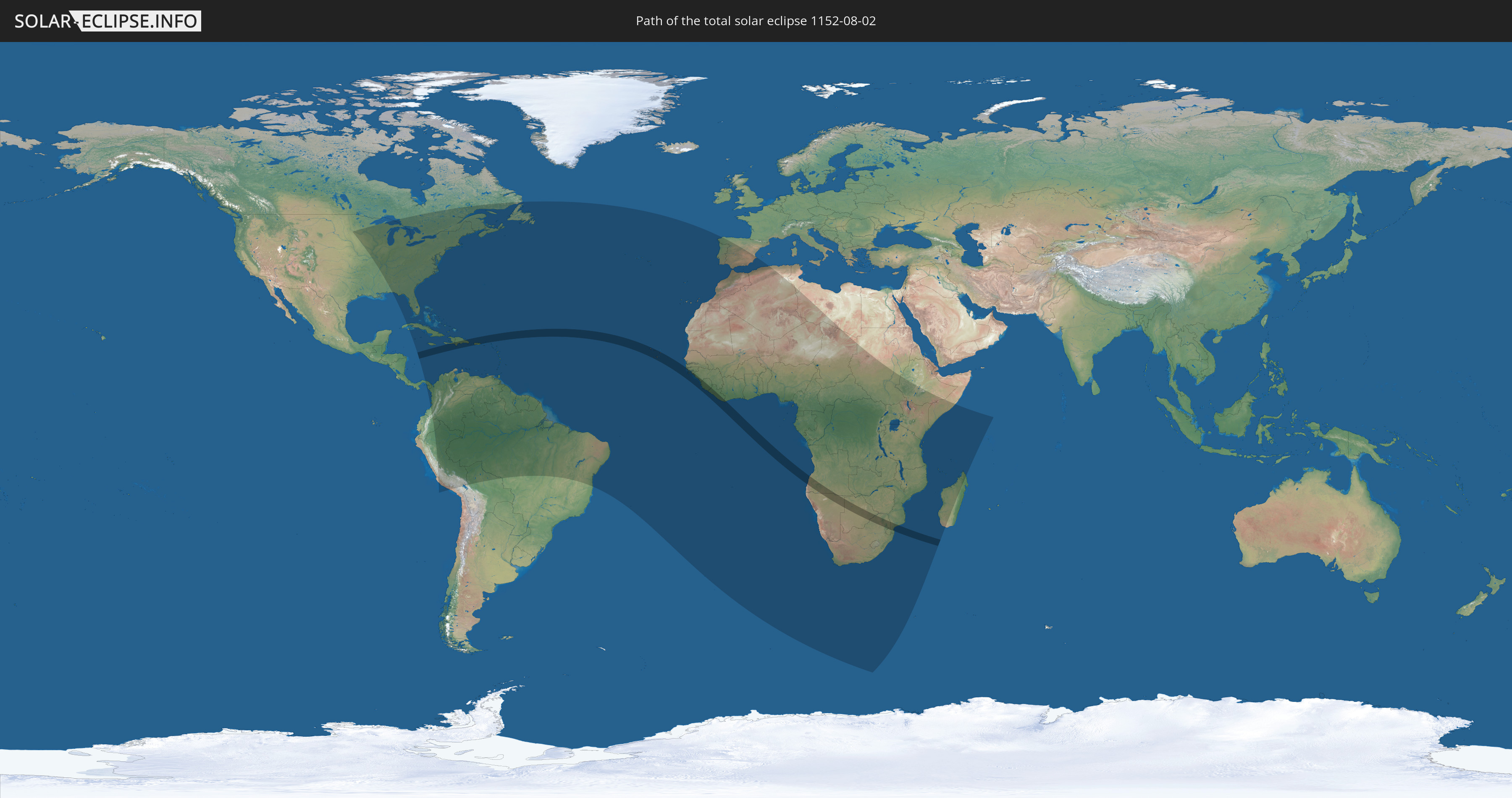
Die Sonnenfinsternis am 02.08.1152 kann man in 95 Ländern als partielle Sonnenfinsternis beobachten.
Der Finsternispfad verläuft durch 20 Länder. Nur in diesen Ländern ist sie als totale Sonnenfinsternis zu sehen.
In den folgenden Ländern ist die Sonnenfinsternis total zu sehen
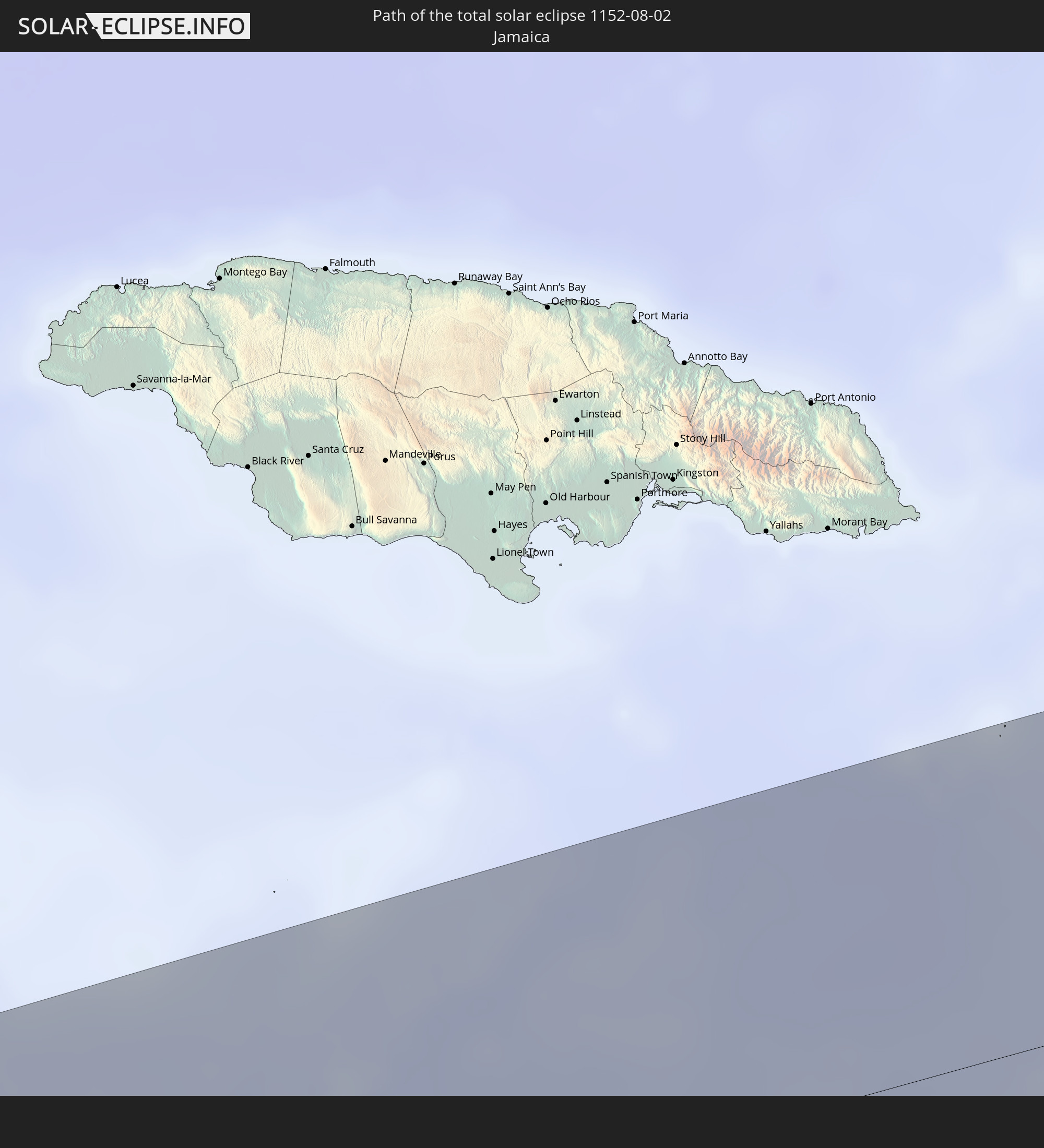 Jamaika
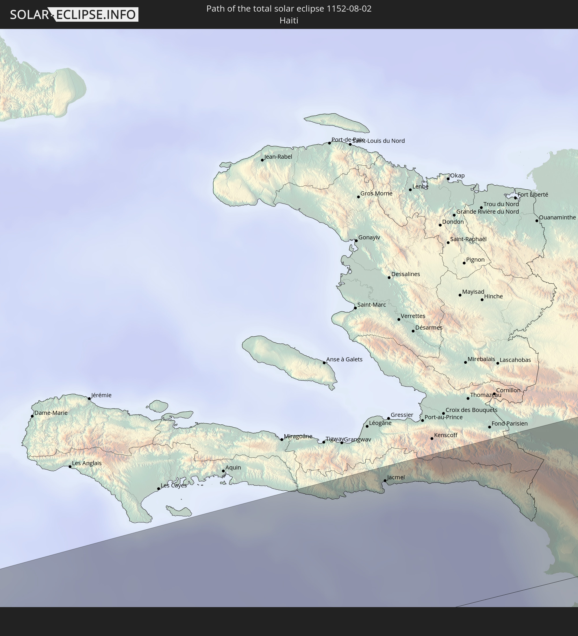 Haiti
Haiti
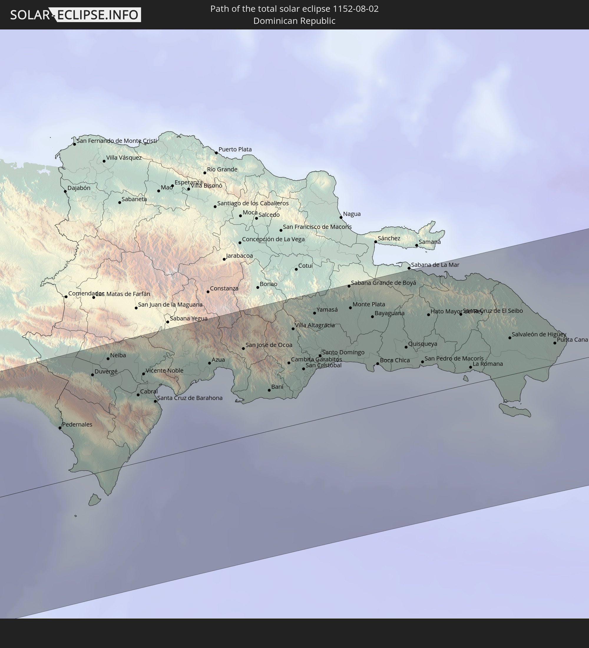 Dominikanische Republik
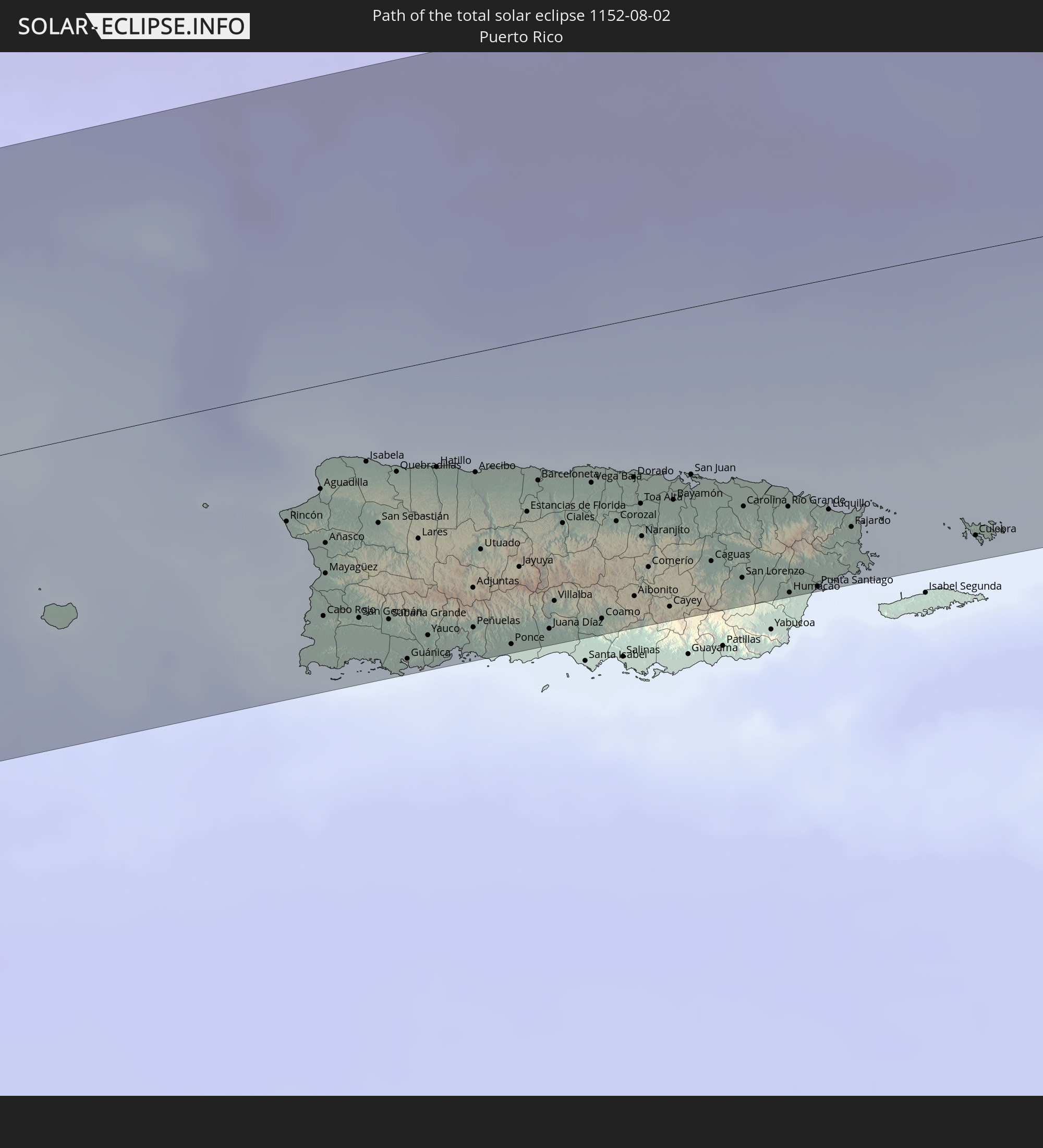 Puerto Rico
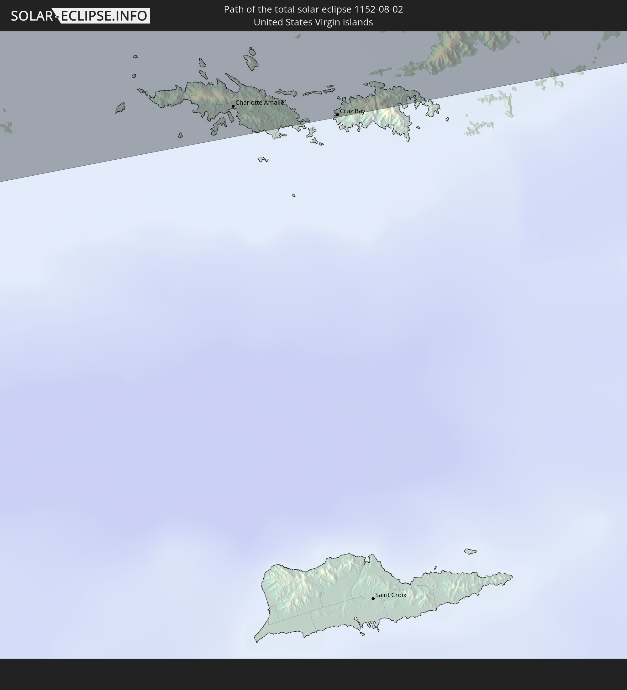 Amerikanische Jungferninseln
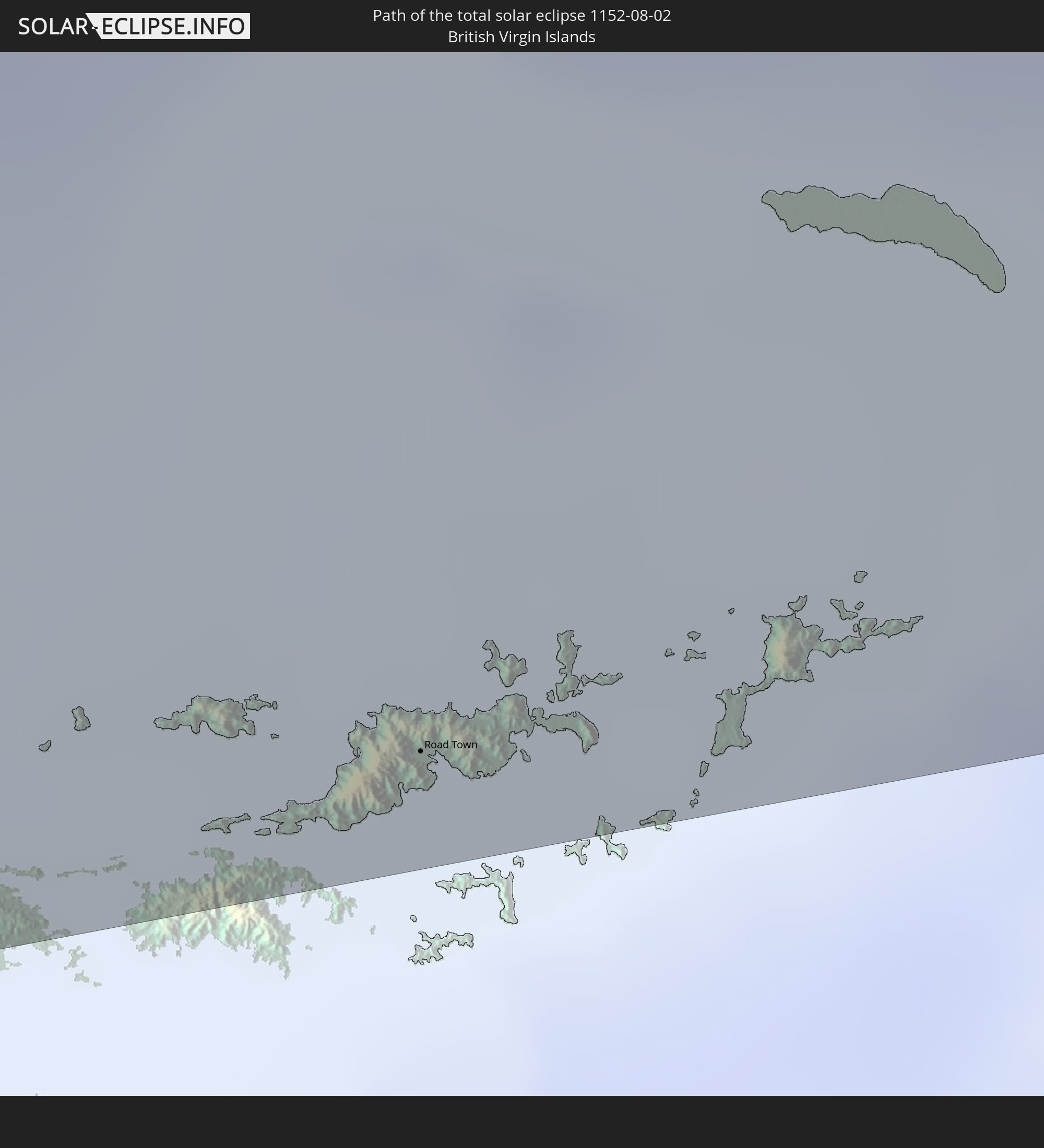 Britische Jungferninseln
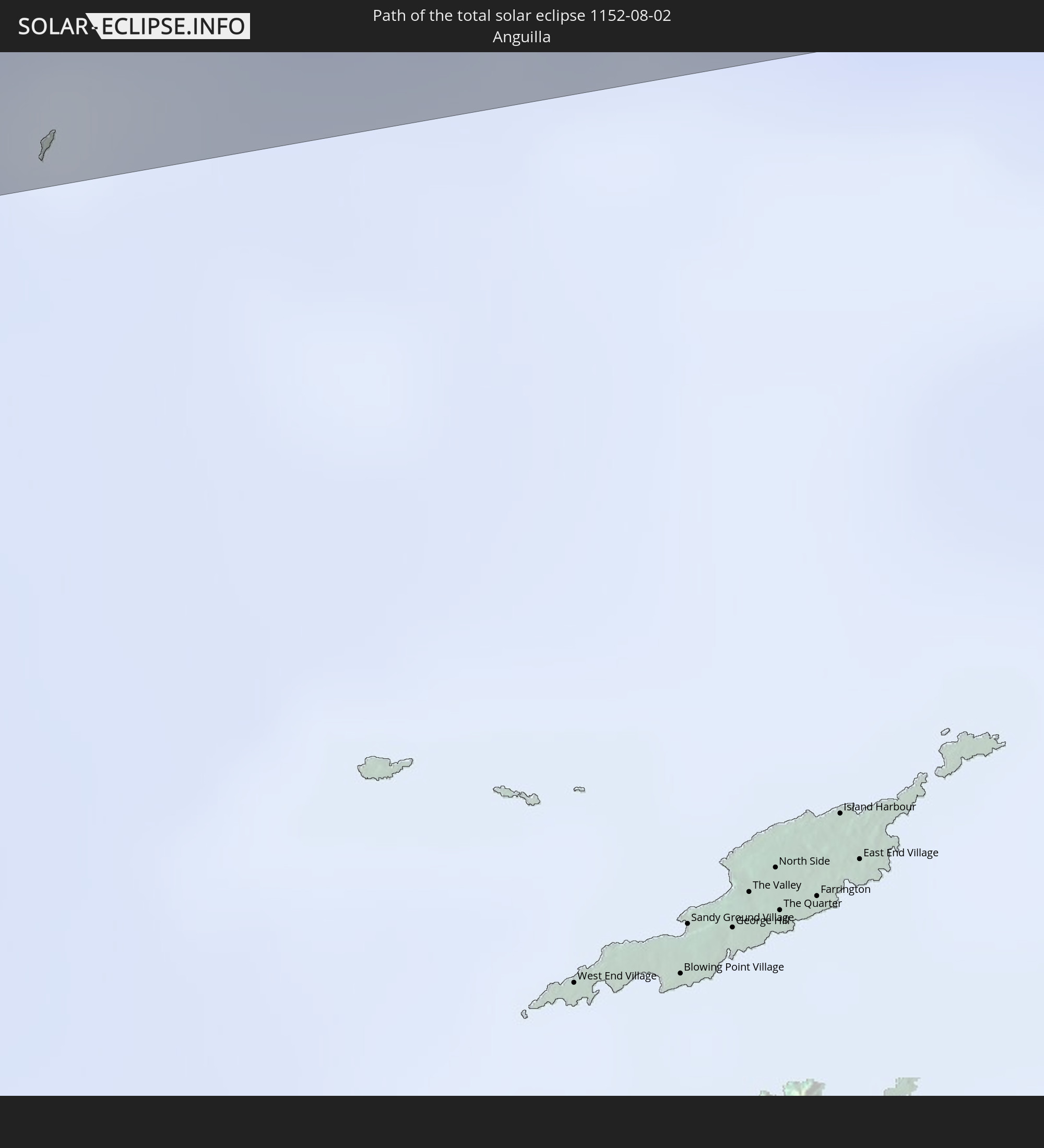 Anguilla
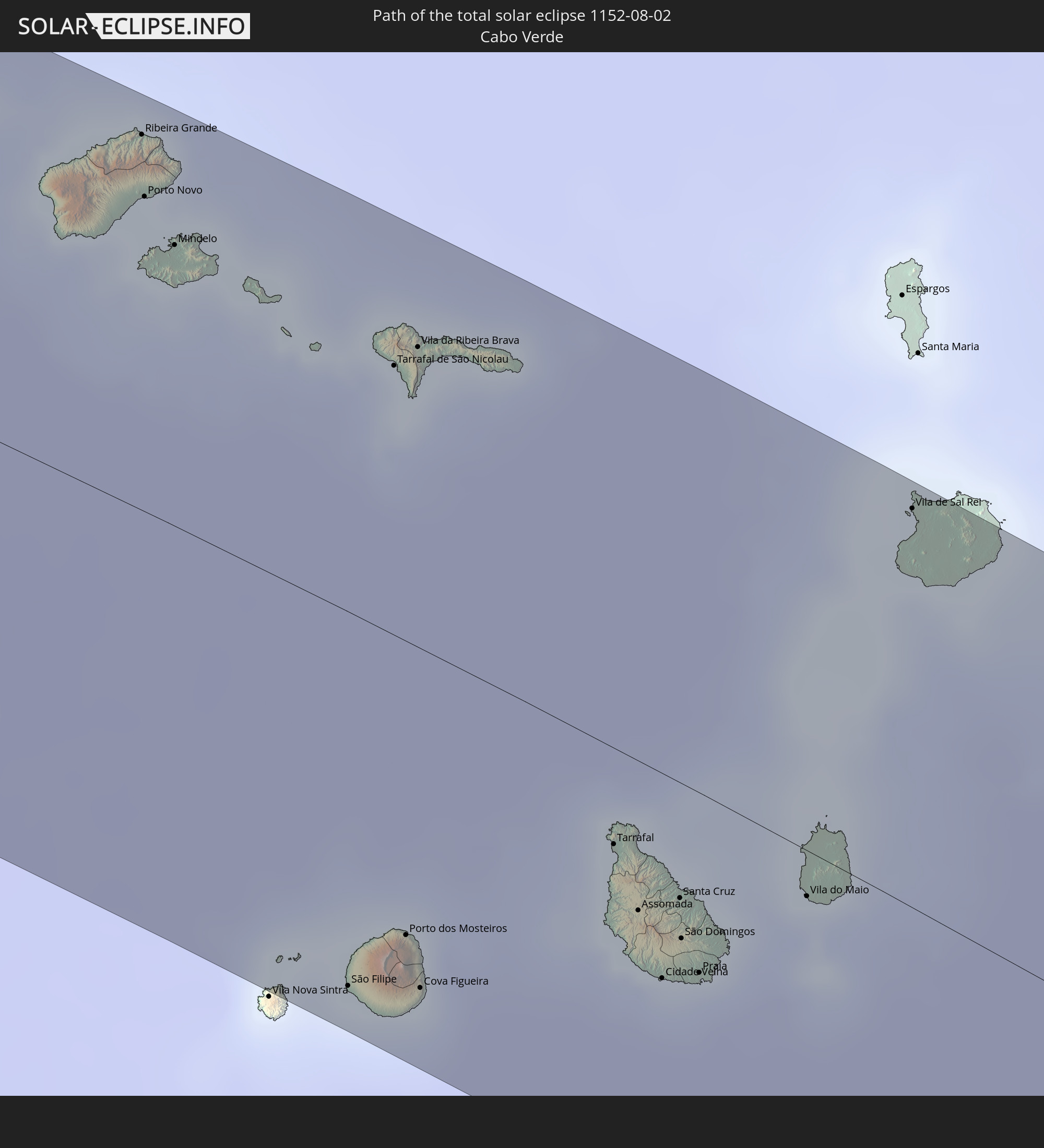 Kap Verde
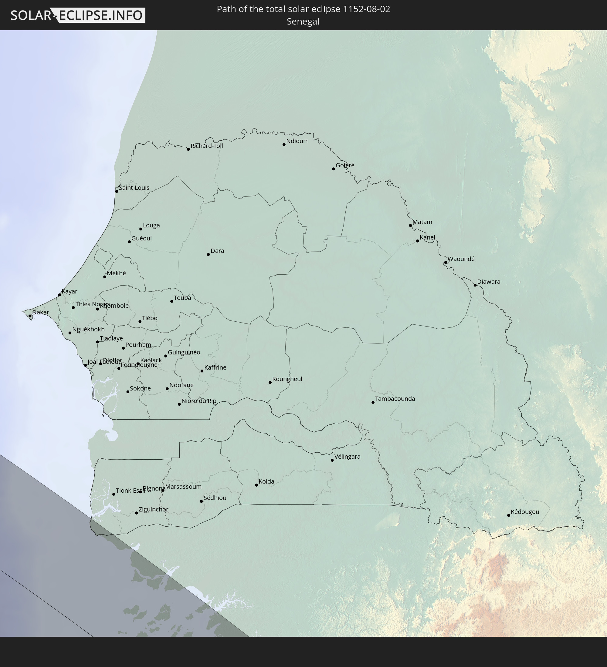 Senegal
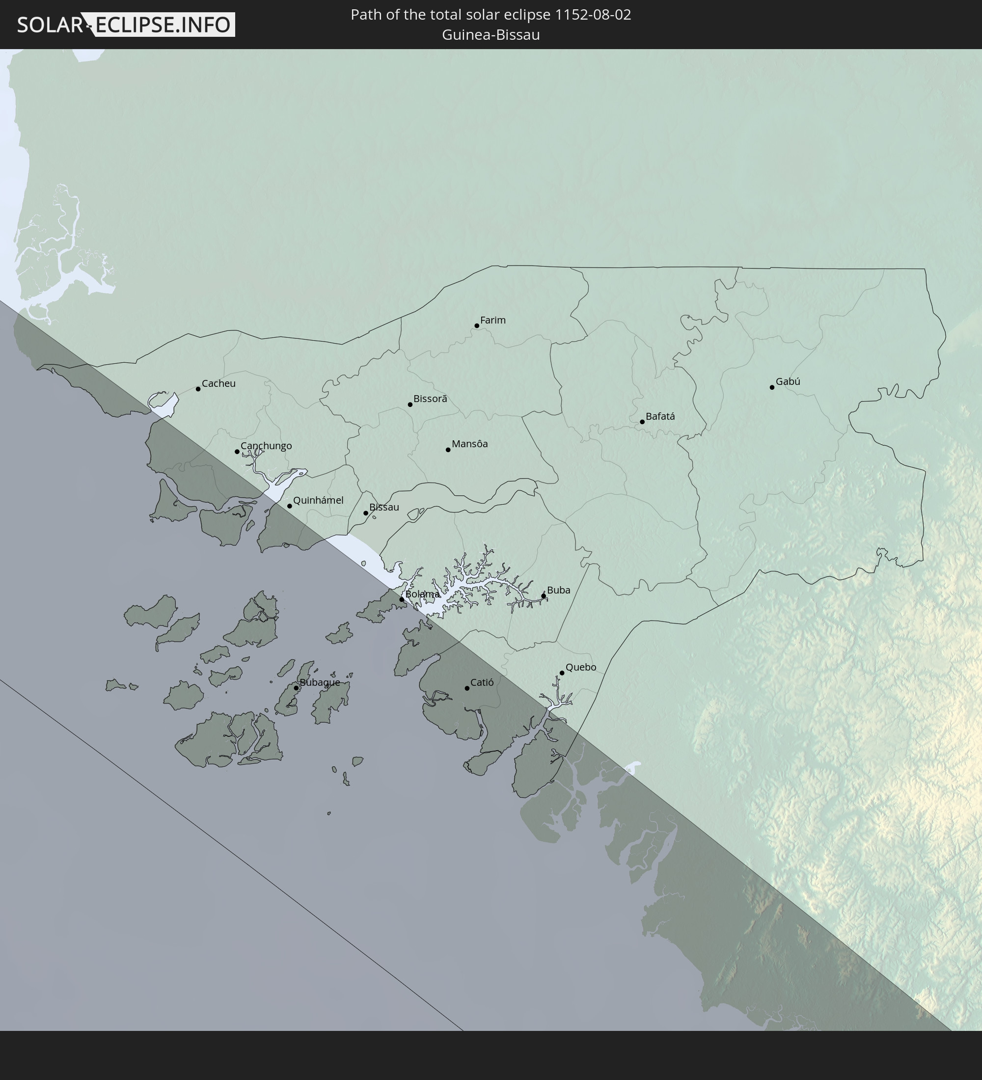 Guinea-Bissau
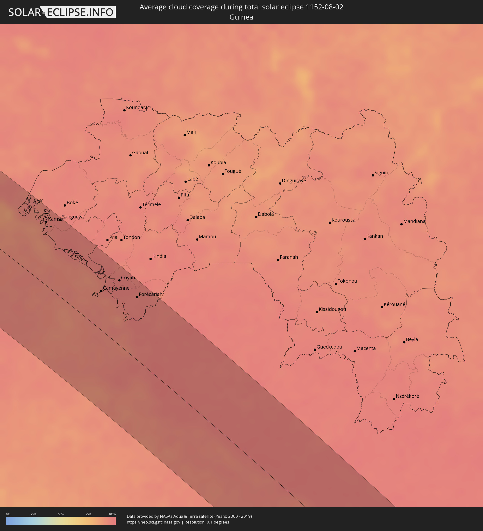
 Guinea
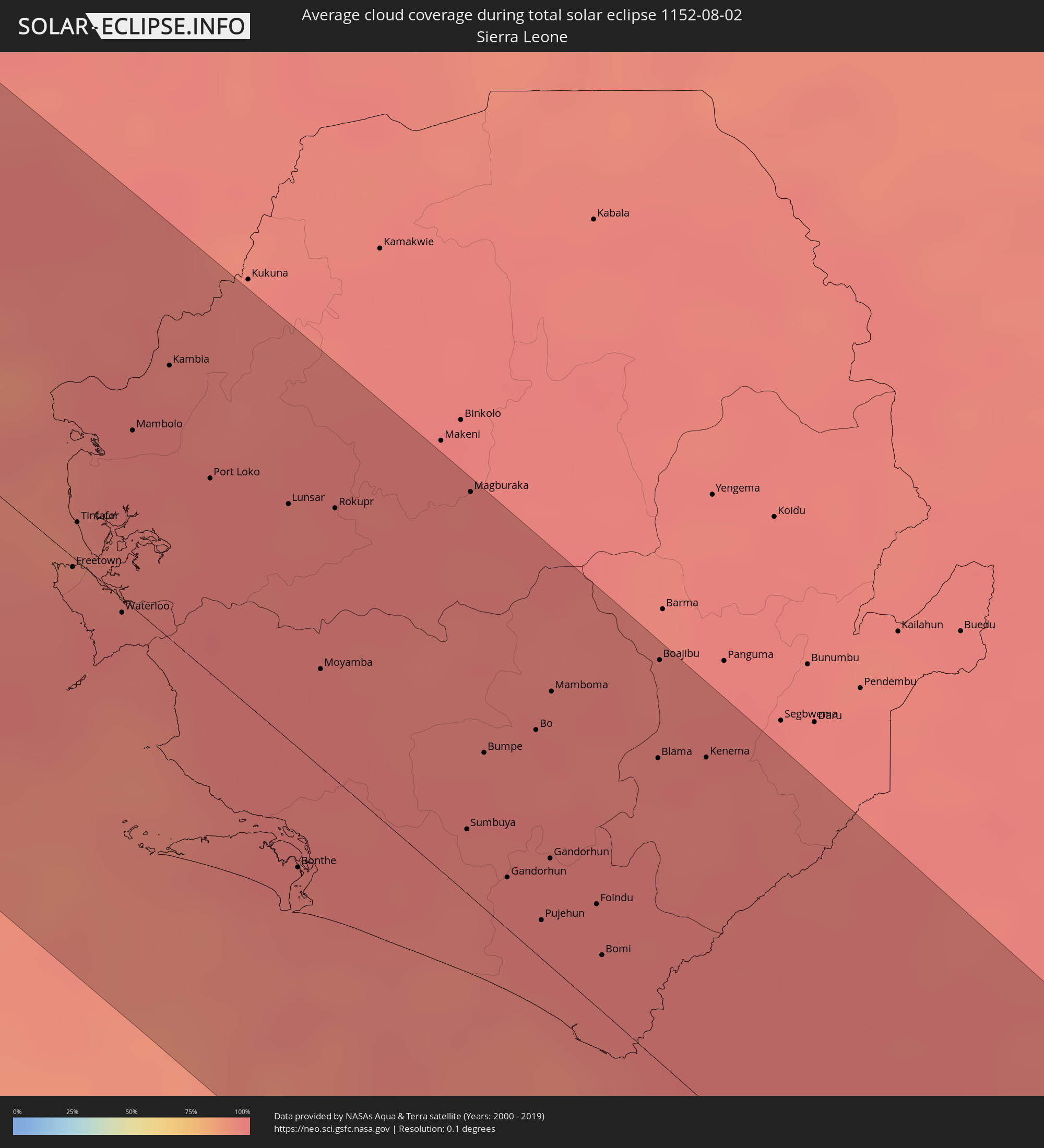
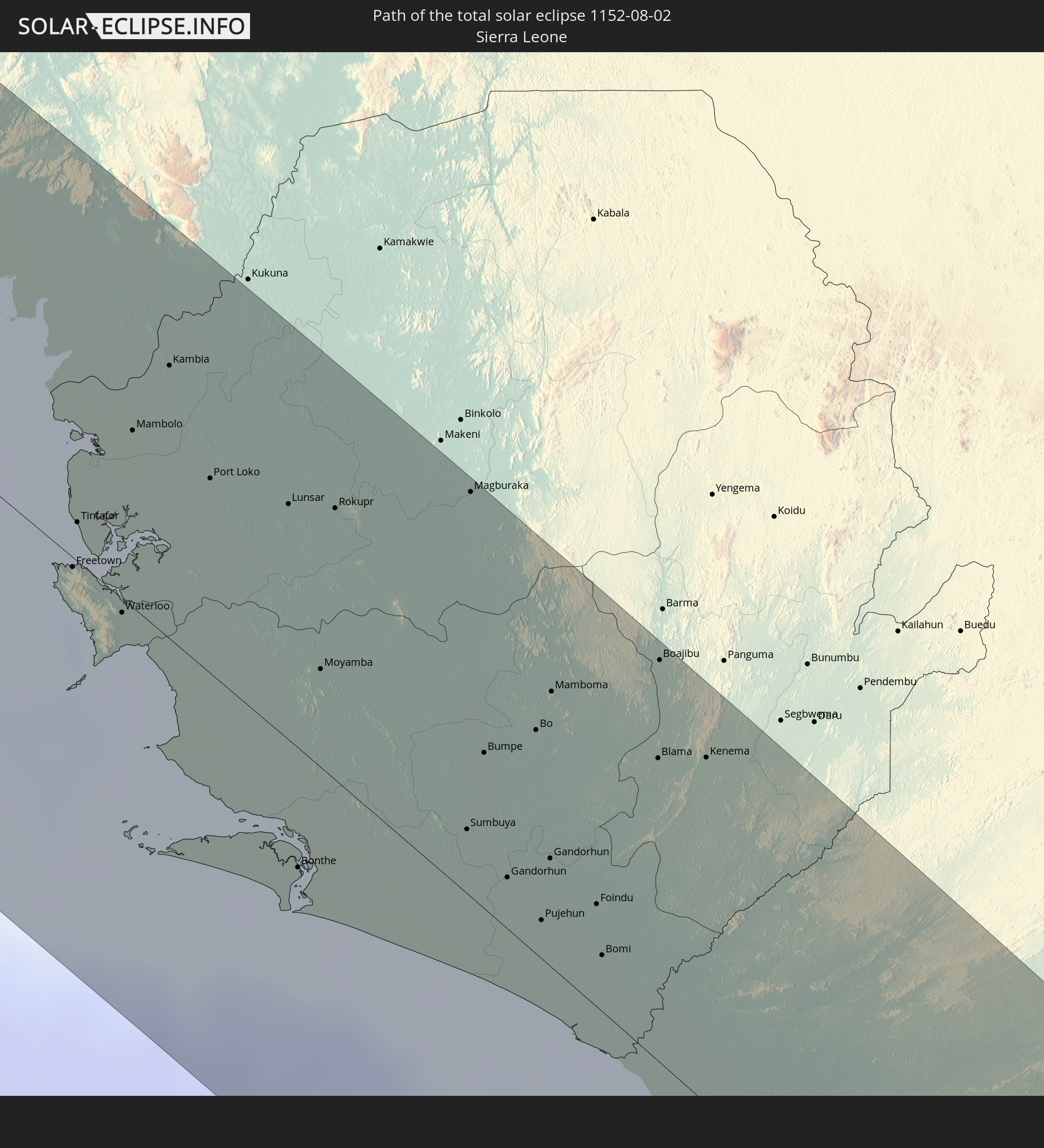 Sierra Leone
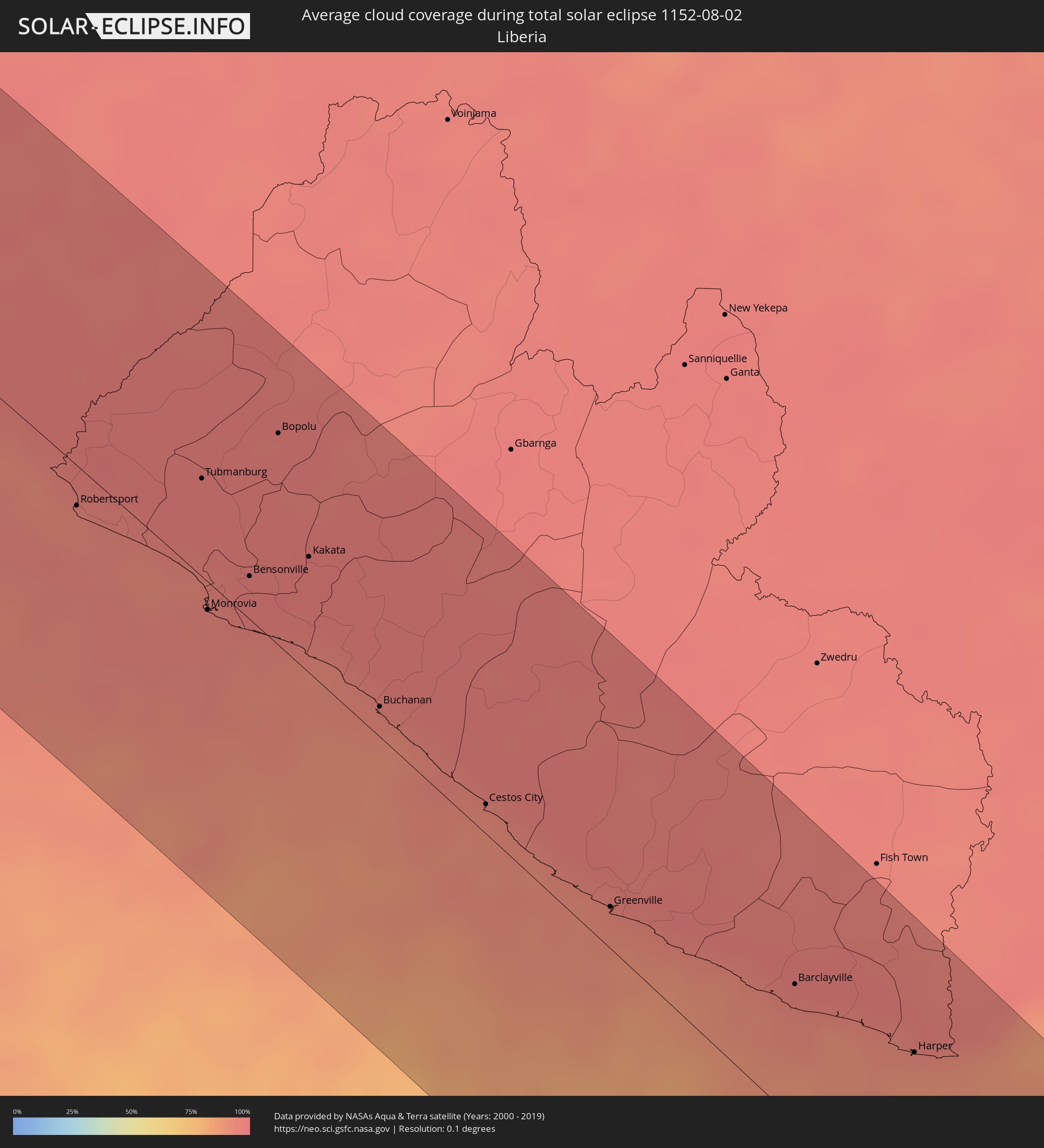
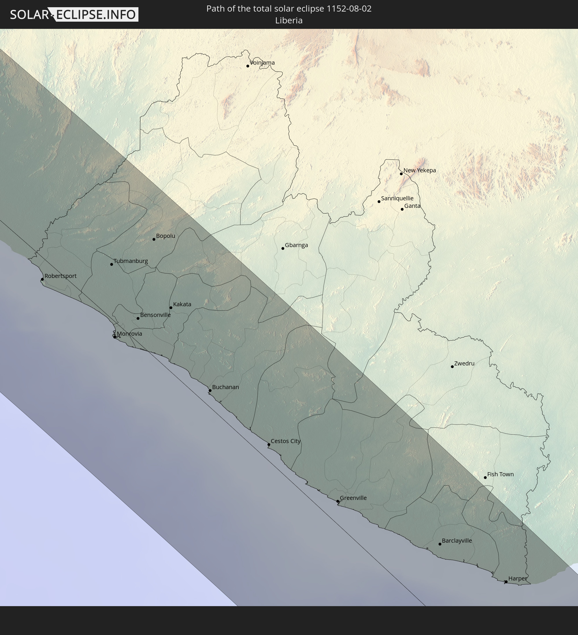 Liberia
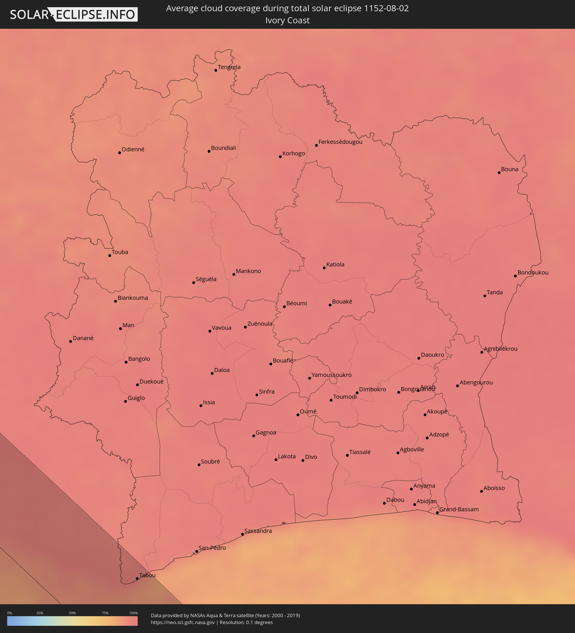
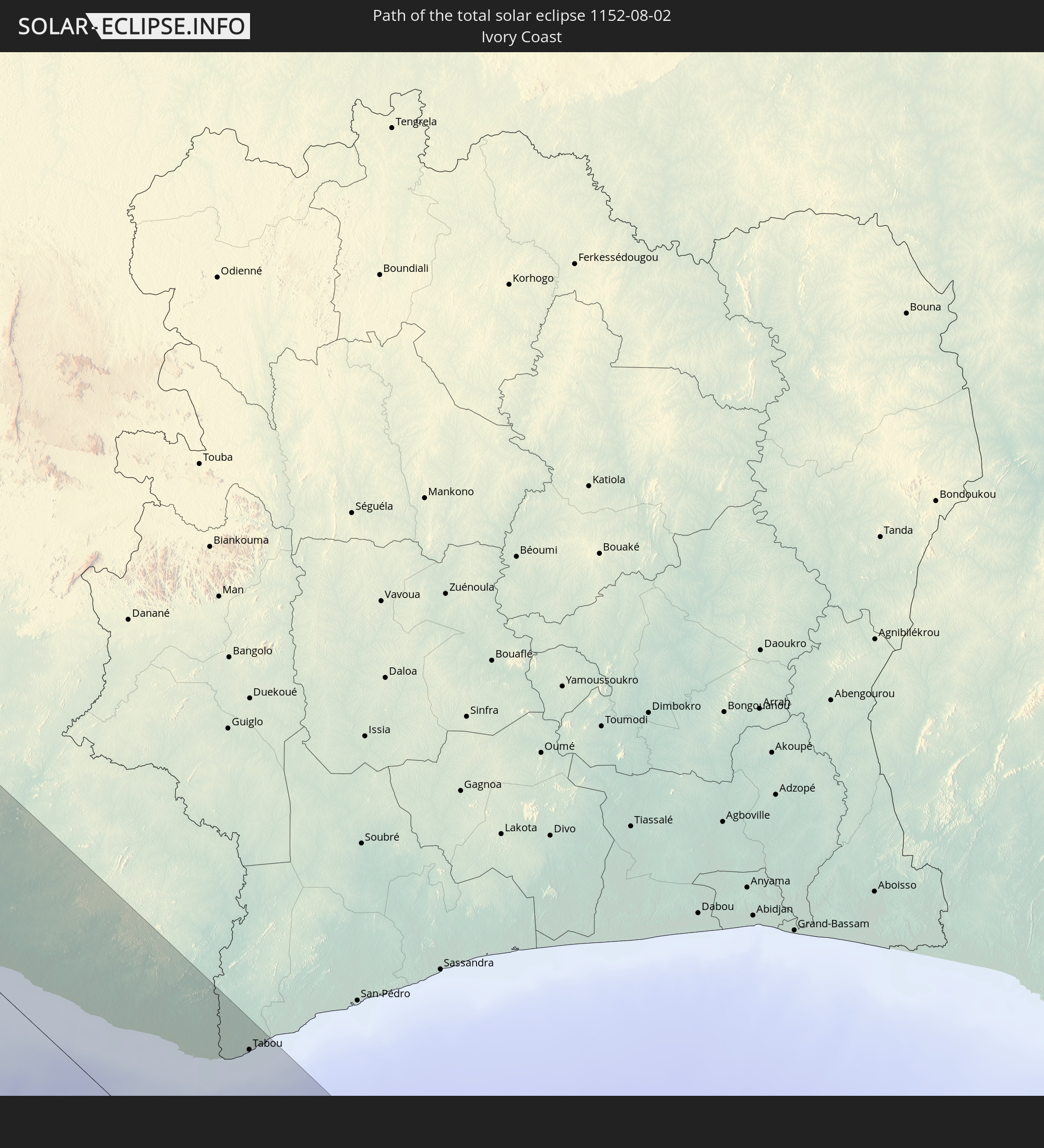 Elfenbeinküste
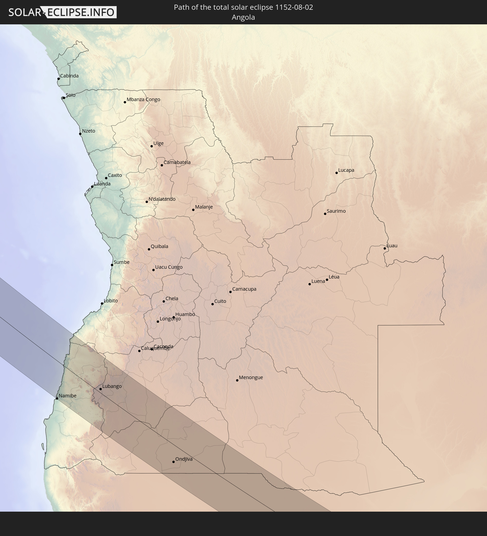 Angola
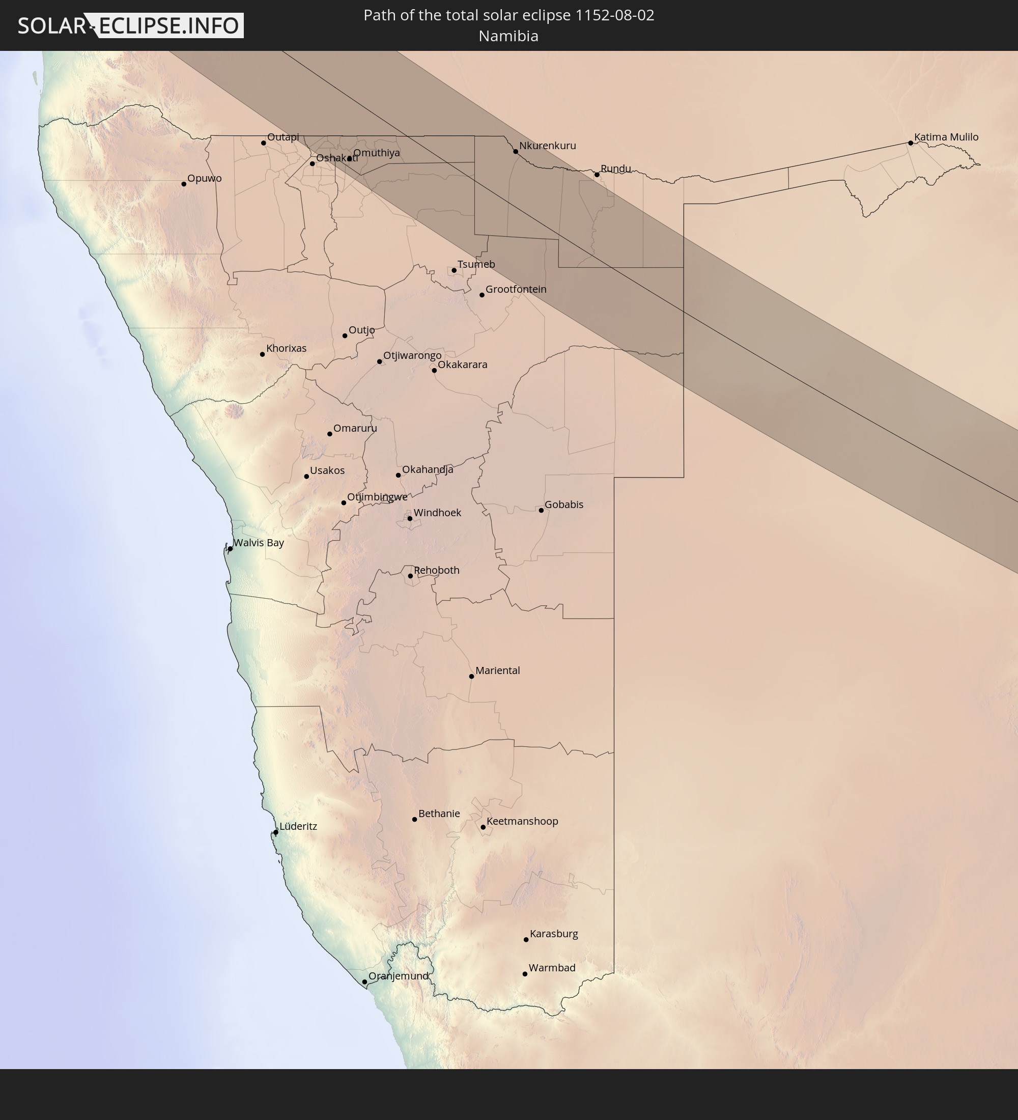 Namibia
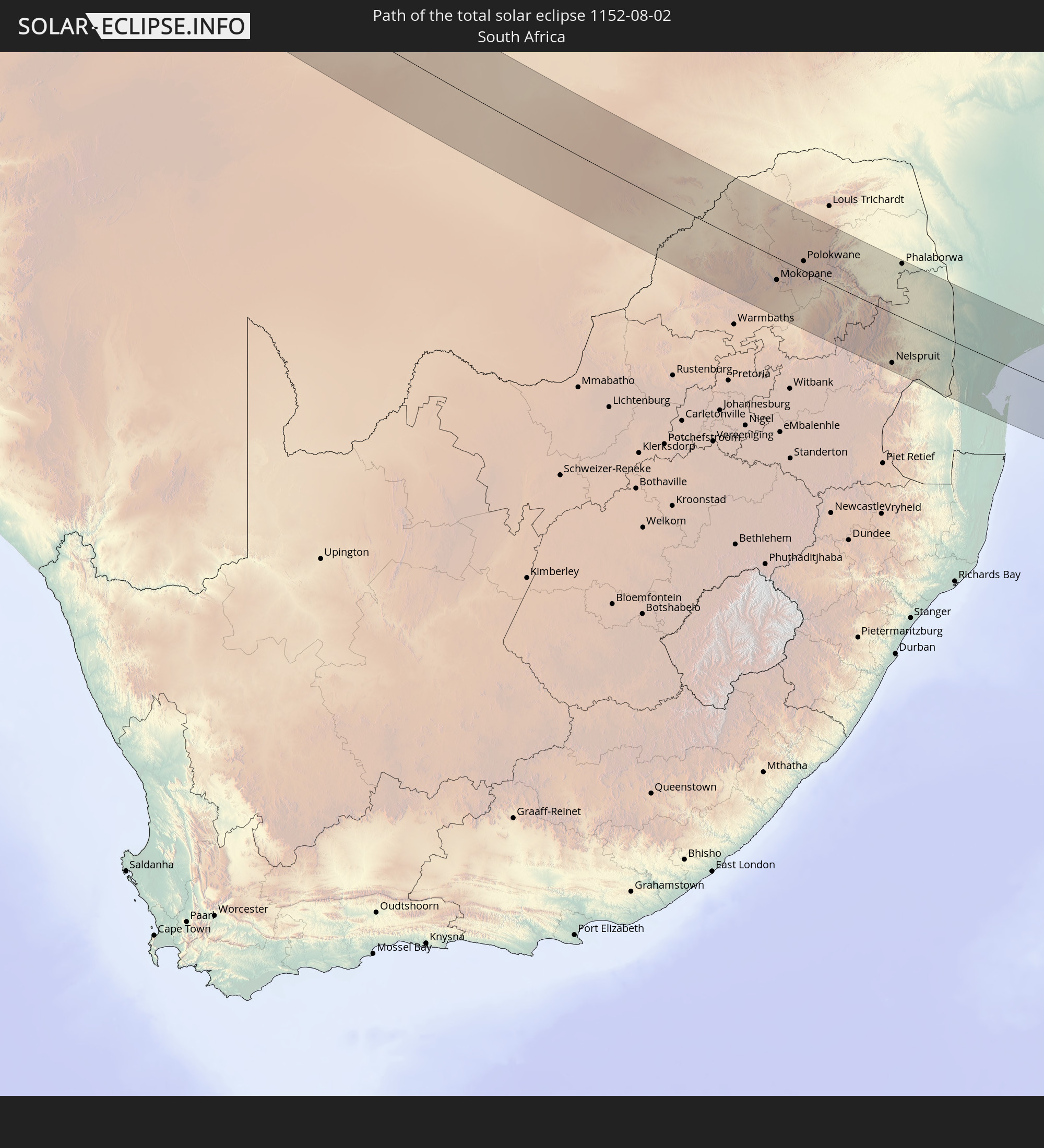 Südafrika
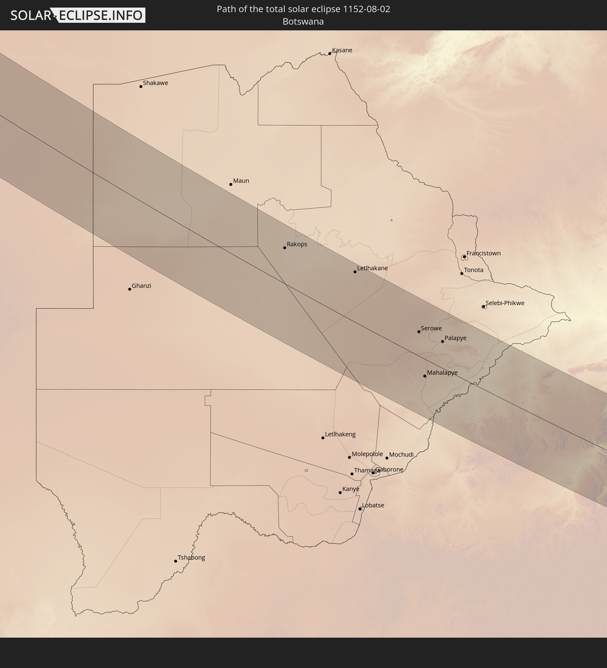 Botswana
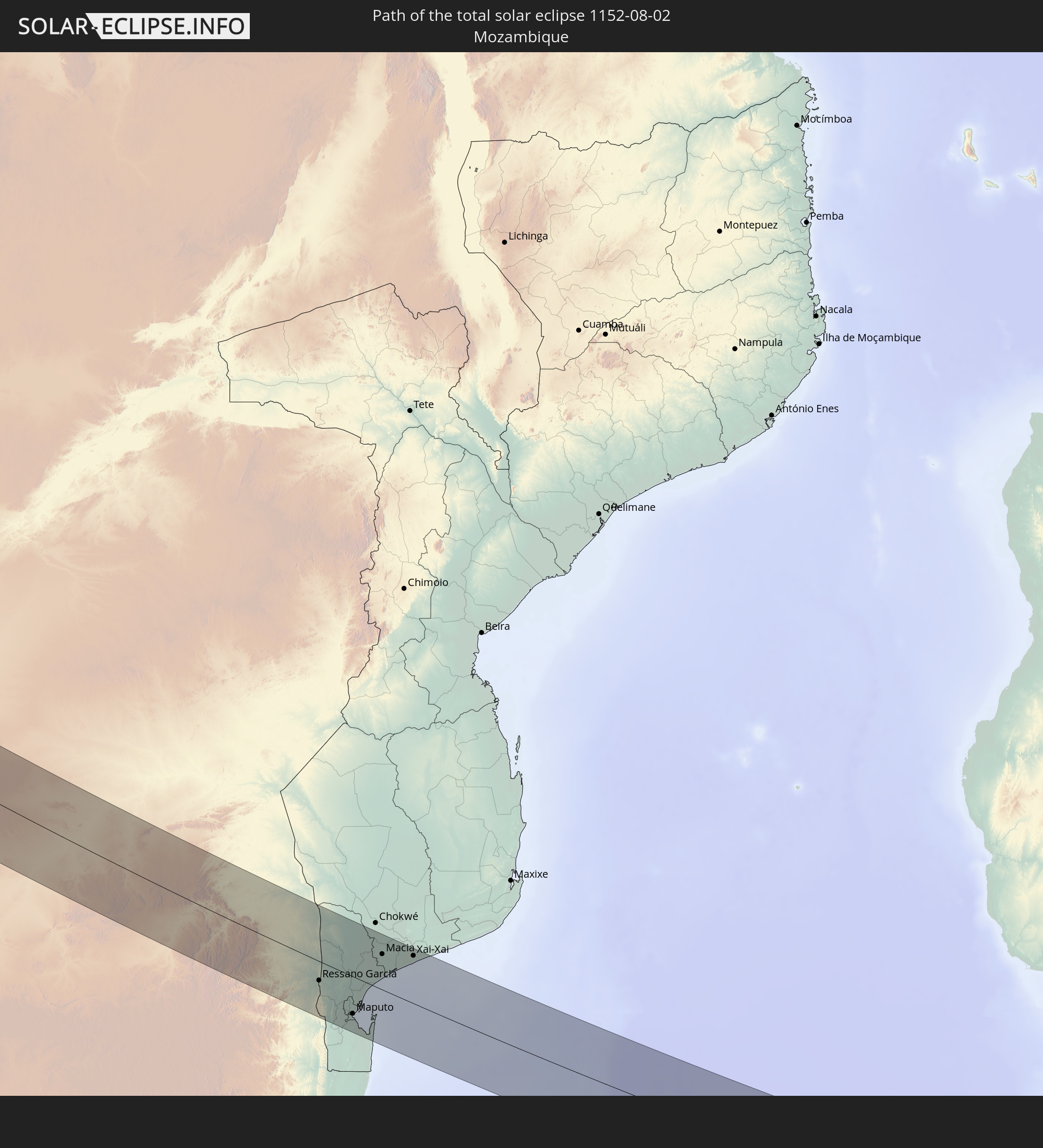 Mosambik
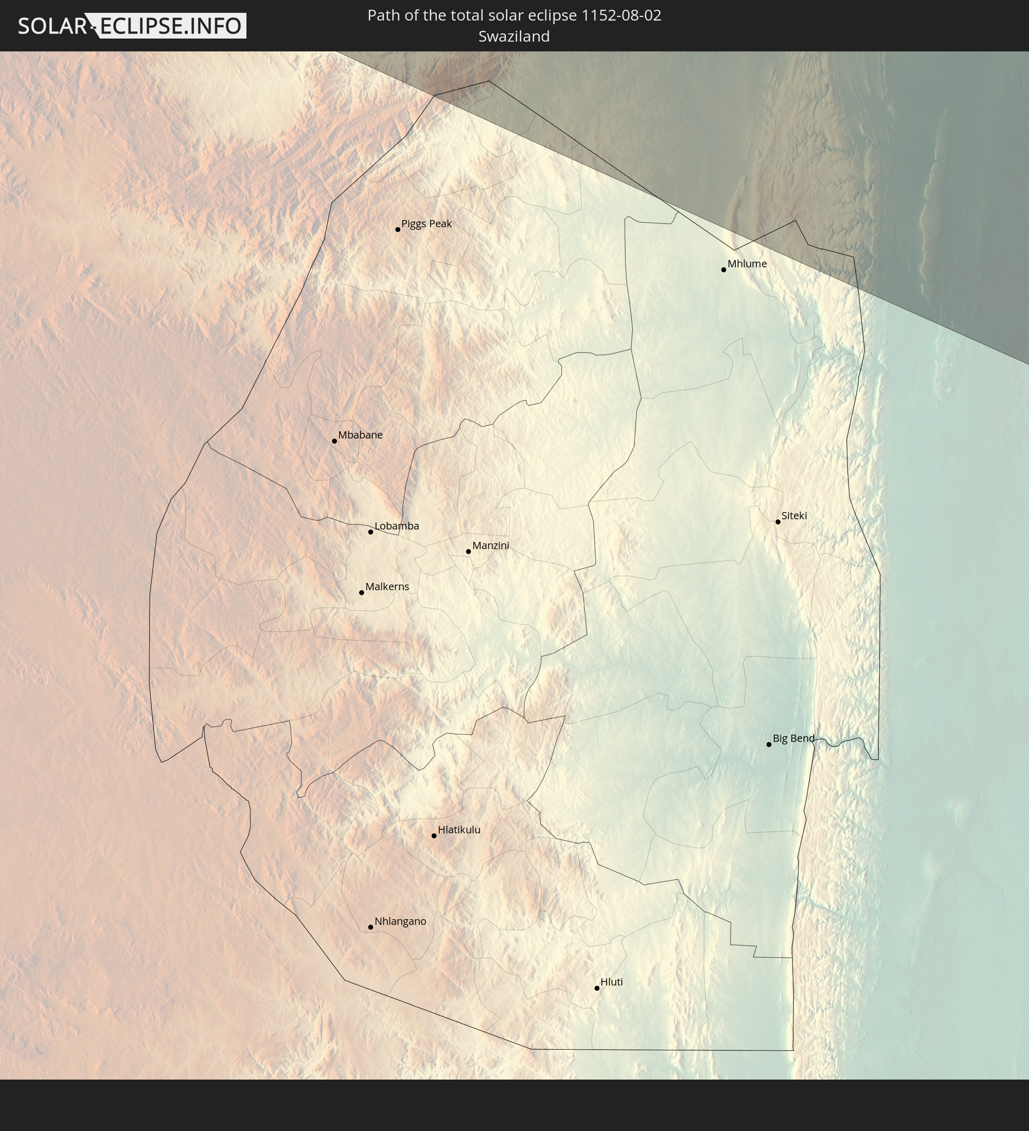 Swasiland
In den folgenden Ländern ist die Sonnenfinsternis partiell zu sehen
 Vereinigte Staaten
 United States Minor Outlying Islands
 Kanada
 Ecuador
 Kuba
Kuba
 Panama
 Kolumbien
 Kaimaninseln
 Peru
Peru
 Bahamas
 Jamaika
 Haiti
Haiti
 Brasilien
 Venezuela
 Turks- und Caicosinseln
 Dominikanische Republik
 Aruba
Aruba
 Bolivien
 Puerto Rico
 Amerikanische Jungferninseln
 Bermuda
 Britische Jungferninseln
 Anguilla
 Saint-Martin
 Saint-Barthélemy
 St. Kitts und Nevis
 Antigua und Barbuda
 Montserrat
 Trinidad und Tobago
 Guadeloupe
 Grenada
 Dominica
 St. Vincent und die Grenadinen
 Guyana
 Martinique
 St. Lucia
 Barbados
 Suriname
 Saint-Pierre und Miquelon
 Französisch-Guayana
 Portugal
 Kap Verde
 Spanien
 Senegal
 Mauretanien
 Gambia
 Guinea-Bissau
 Guinea
 St. Helena
 Sierra Leone
 Marokko
 Mali
Mali
 Liberia
 Algerien
 Elfenbeinküste
 Burkina Faso
 Gibraltar
 Ghana
Ghana
 Togo
Togo
 Niger
Niger
 Benin
Benin
 Nigeria
 Äquatorialguinea
 São Tomé und Príncipe
 Tunesien
 Kamerun
 Gabun
Gabun
 Libyen
 Republik Kongo
 Angola
 Namibia
 Demokratische Republik Kongo
 Tschad
 Zentralafrikanische Republik
 Südafrika
 Botswana
 Sudan
Sudan
 Sambia
 Simbabwe
 Lesotho
 Ruanda
 Burundi
 Tansania
 Uganda
 Mosambik
 Swasiland
 Malawi
 Äthiopien
 Kenia
Kenia
 Französische Süd- und Antarktisgebiete
 Somalia
 Madagaskar
 Komoren
 Mayotte
 Seychellen
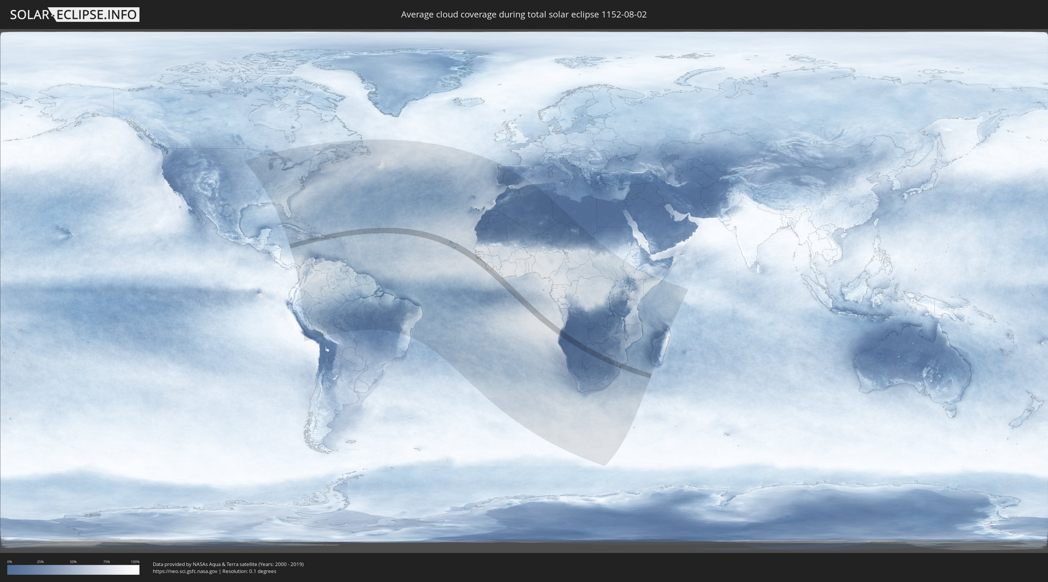
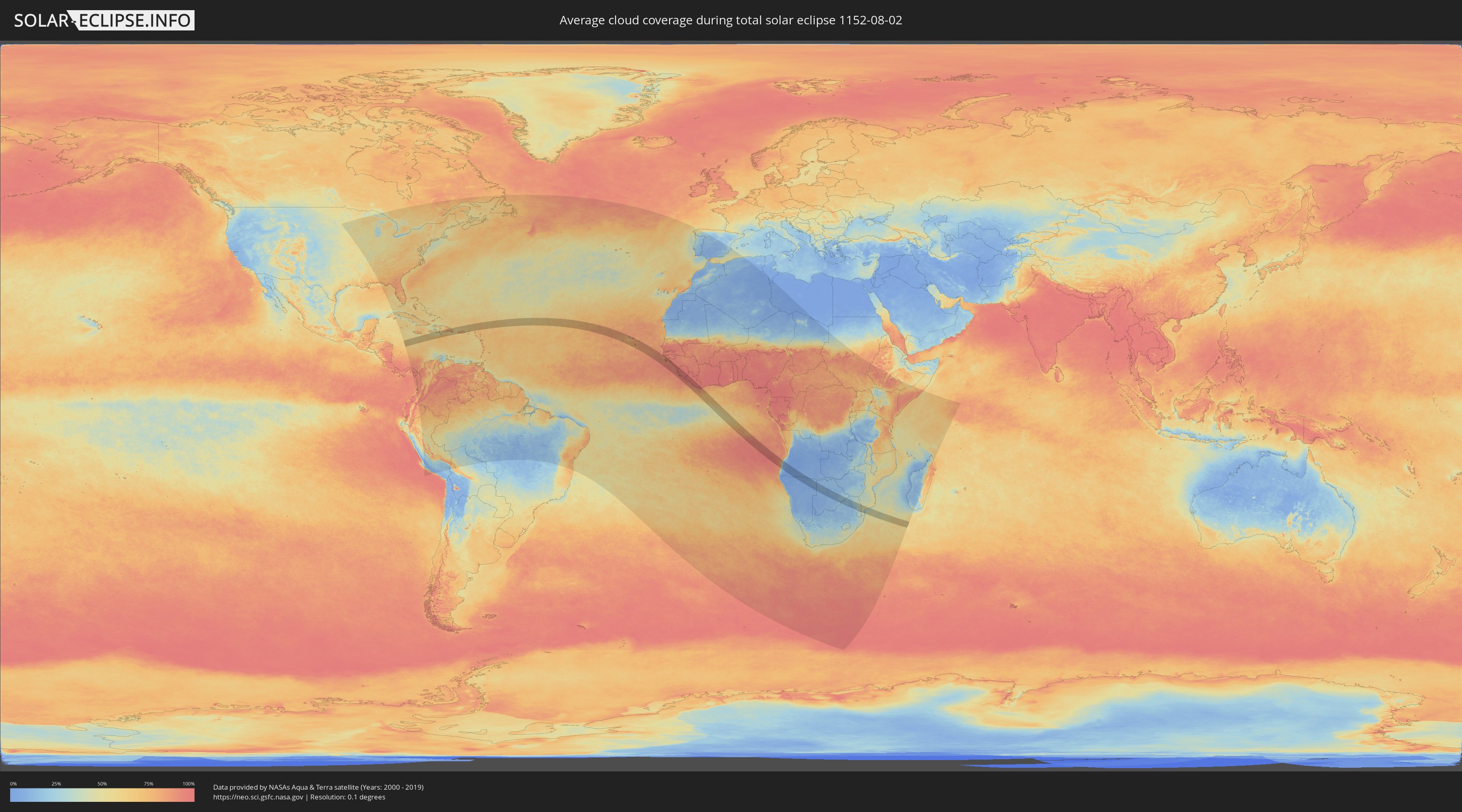
Wie wird das Wetter während der totalen Sonnenfinsternis am 02.08.1152?
Wo ist der beste Ort, um die totale Sonnenfinsternis vom 02.08.1152 zu beobachten?
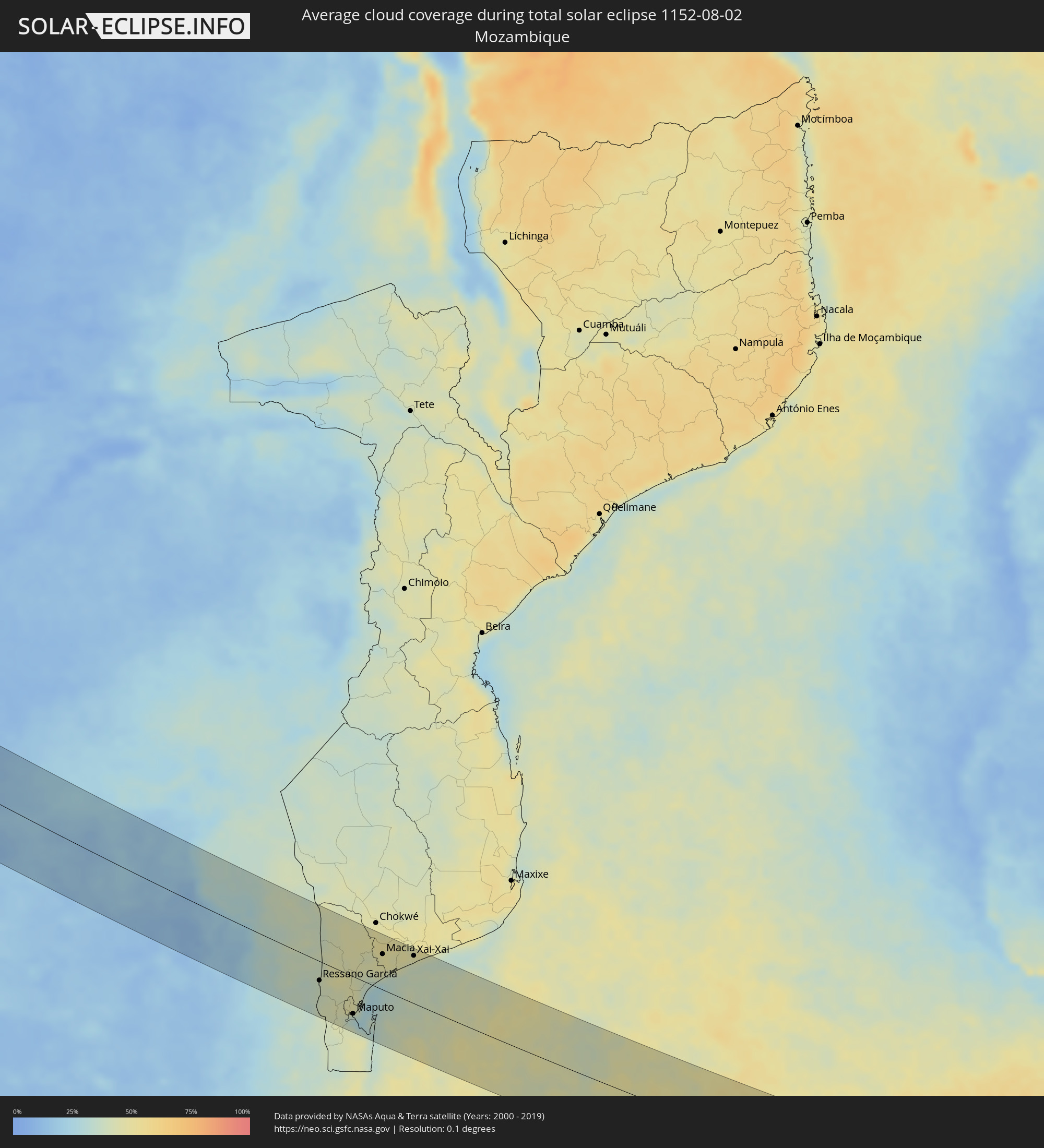
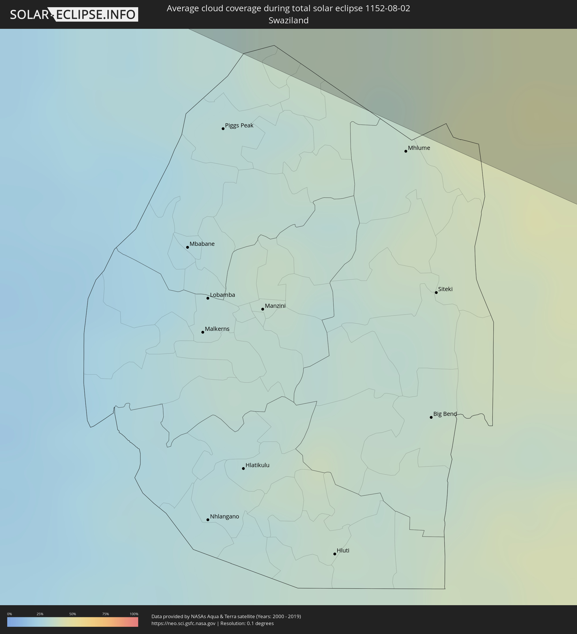
Die folgenden Karten zeigen die durchschnittliche Bewölkung für den Tag, an dem die totale Sonnenfinsternis
stattfindet. Mit Hilfe der Karten lässt sich der Ort entlang des Finsternispfades eingrenzen,
der die besten Aussichen auf einen klaren wolkenfreien Himmel bietet.
Trotzdem muss man immer lokale Gegenenheiten beachten und sollte sich genau über das Wetter an seinem
gewählten Beobachtungsort informieren.
Die Daten stammen von den beiden NASA-Satelliten
AQUA und TERRA
und wurden über einen Zeitraum von 19 Jahren (2000 - 2019) gemittelt.
Detaillierte Länderkarten
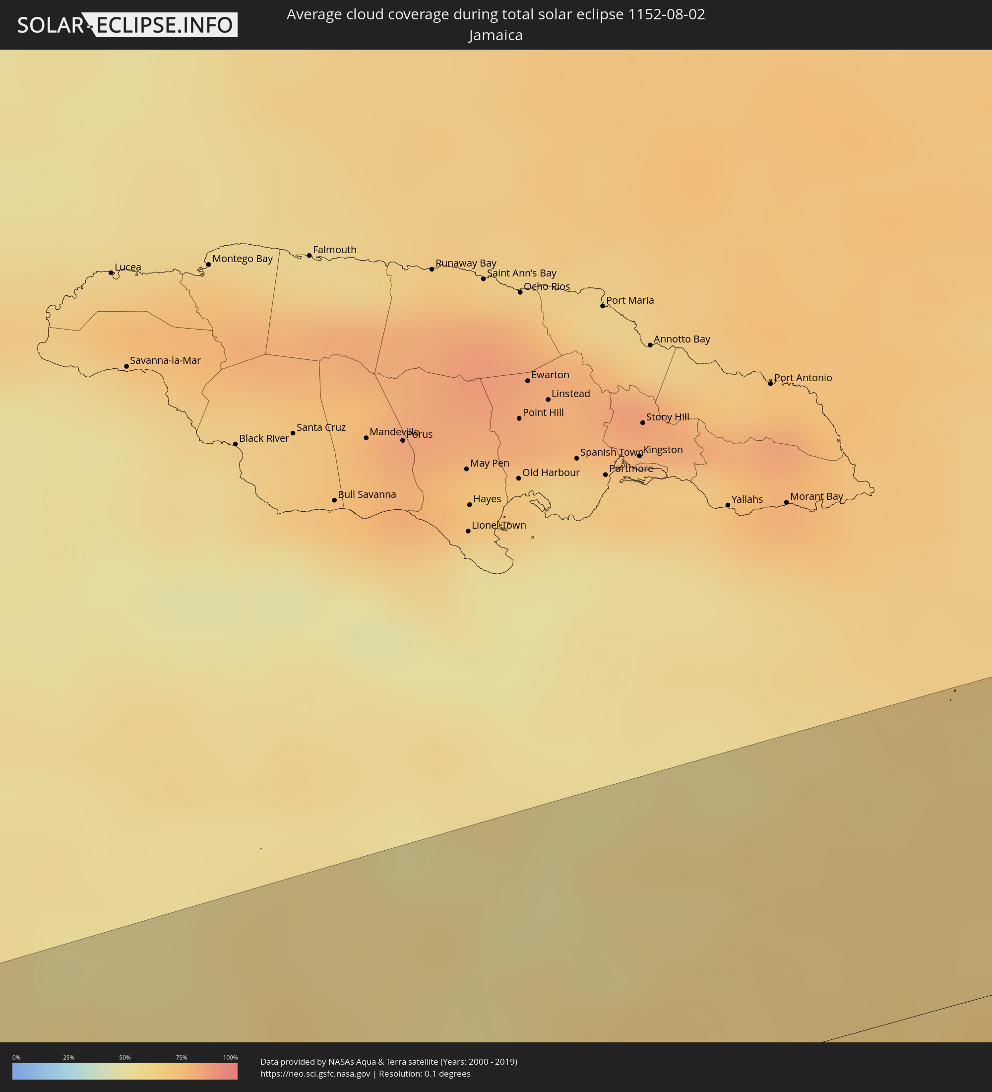 Jamaika
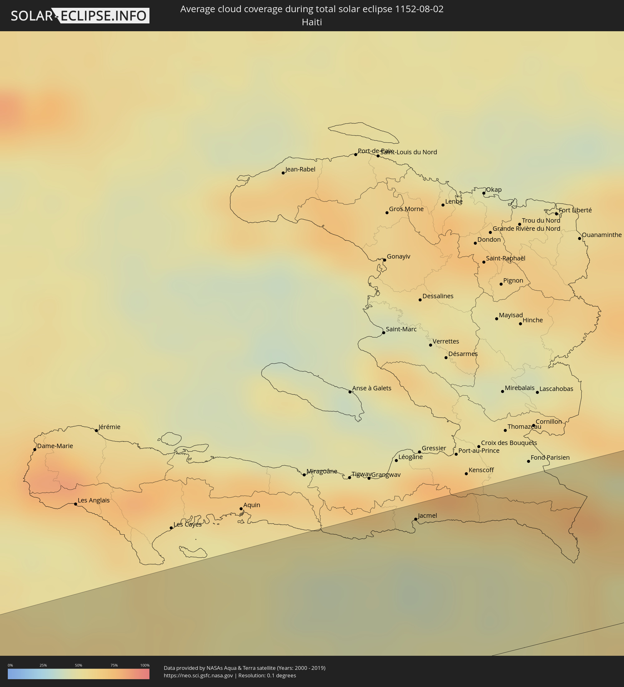 Haiti
Haiti
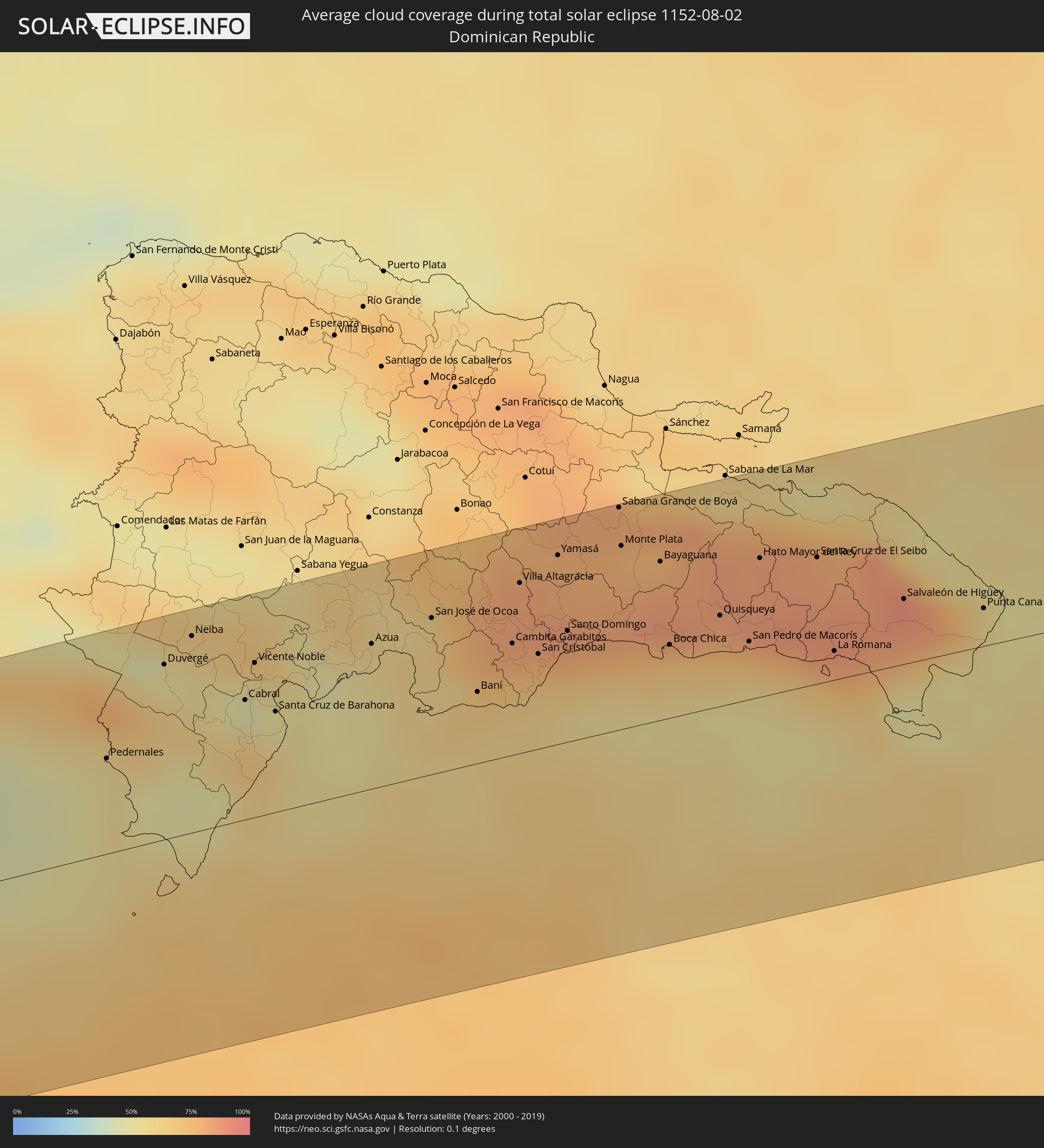 Dominikanische Republik
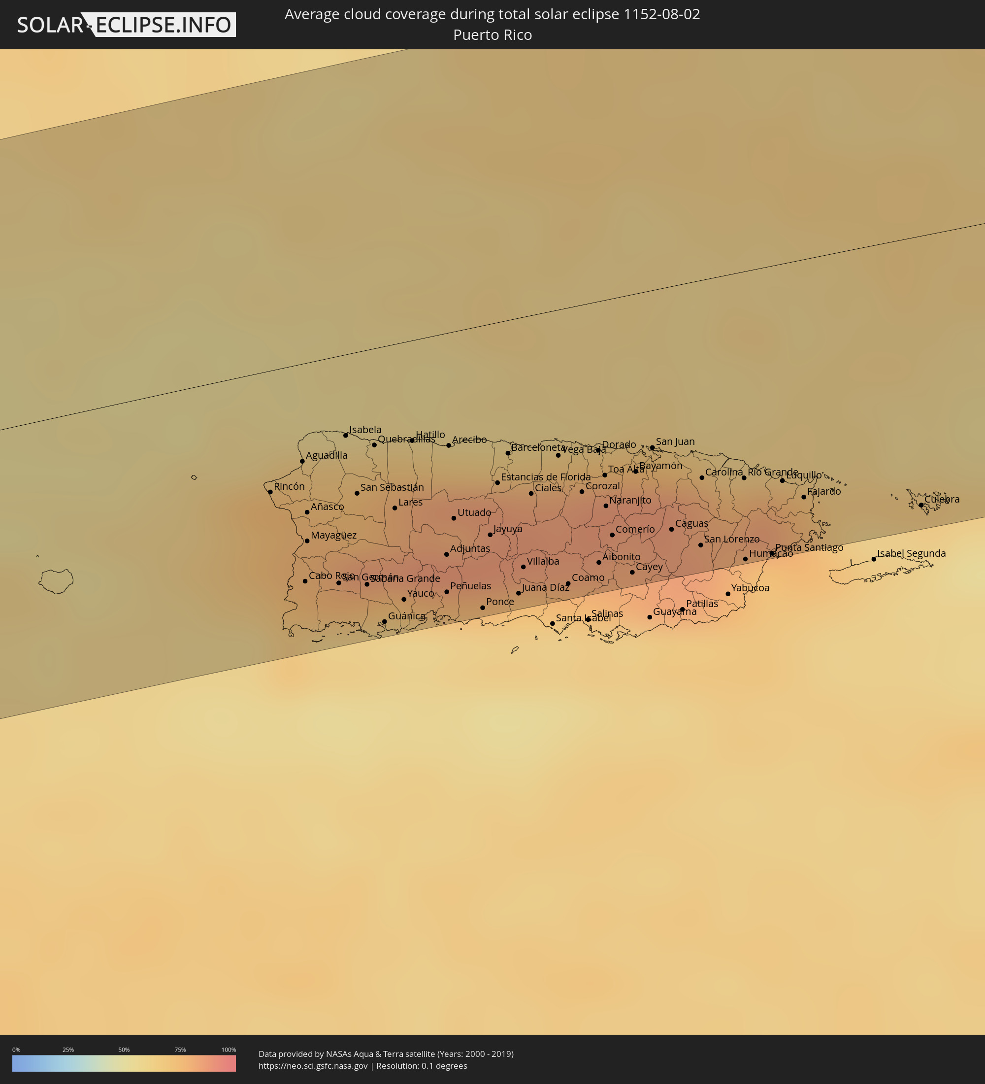 Puerto Rico
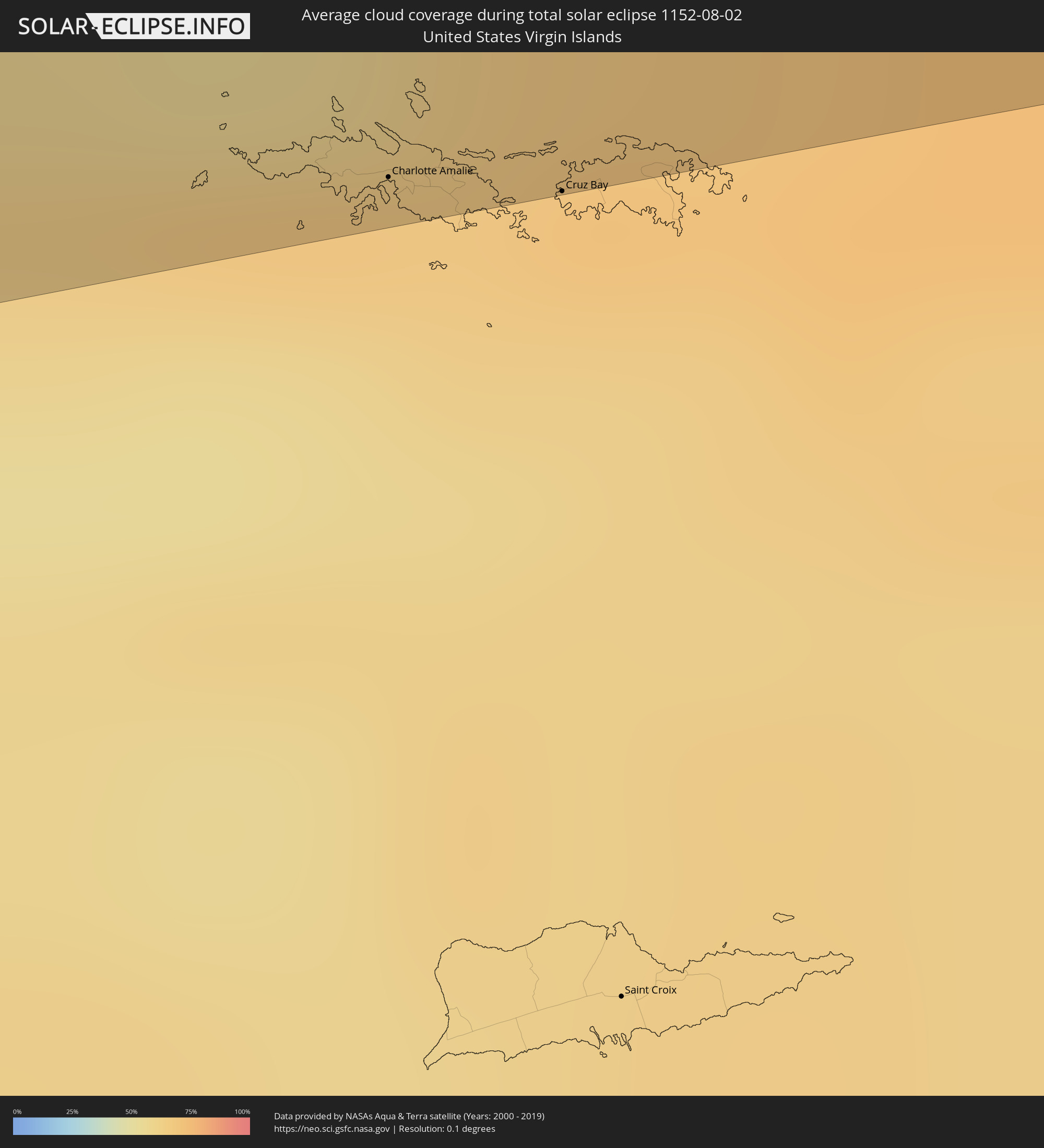 Amerikanische Jungferninseln
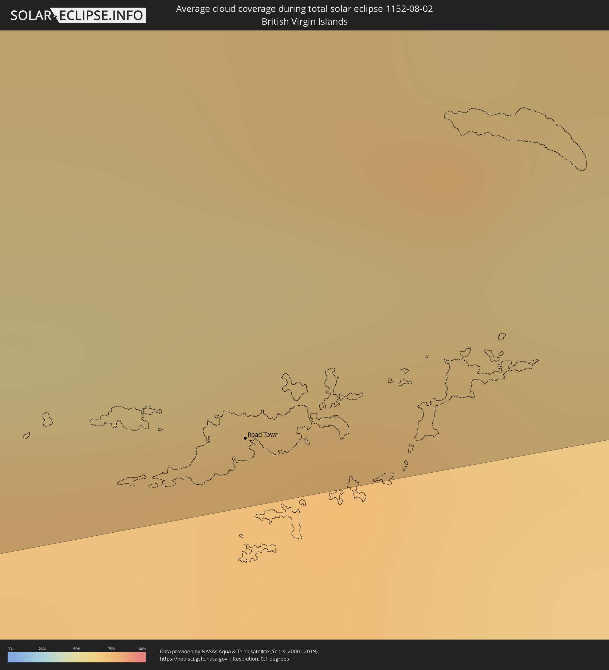 Britische Jungferninseln
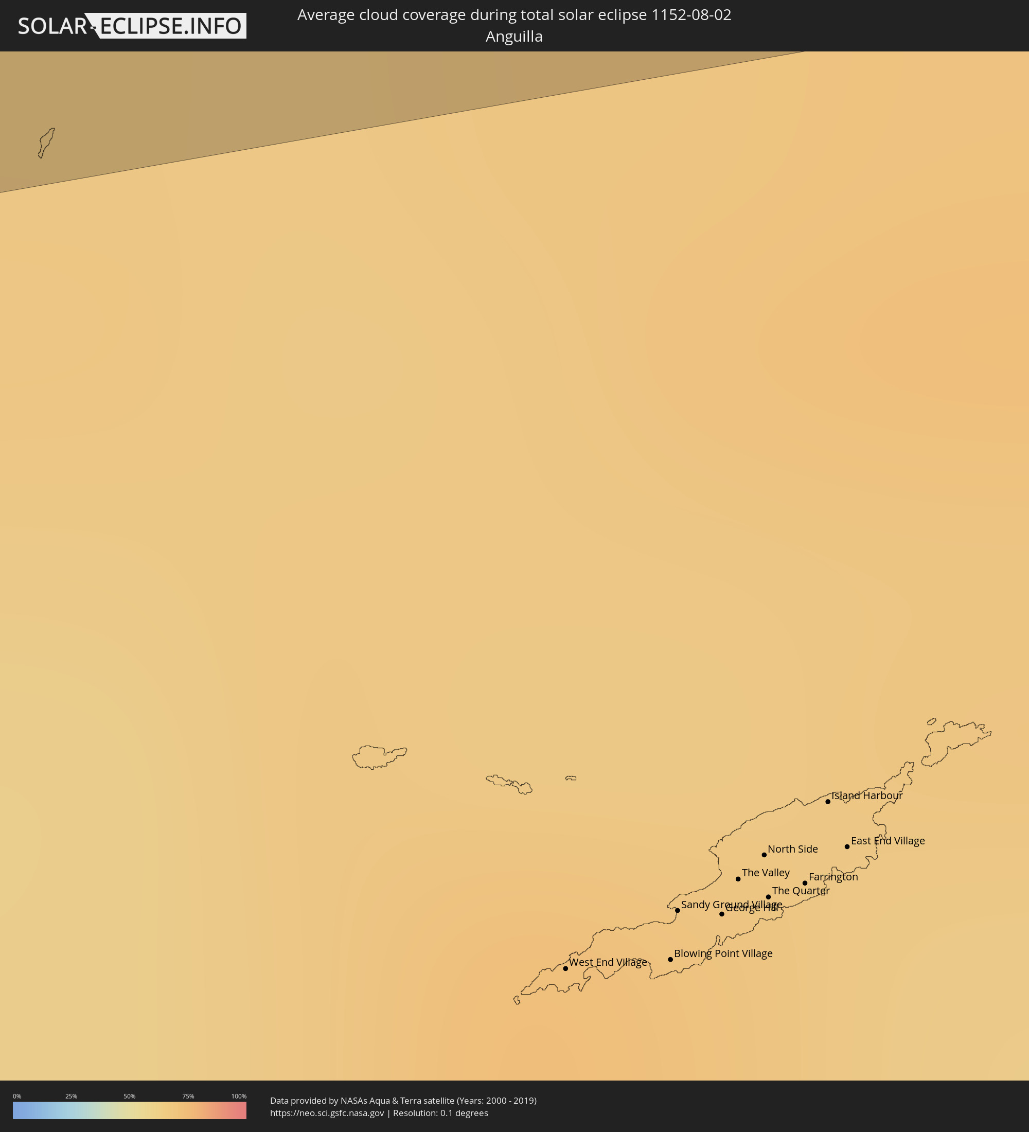 Anguilla
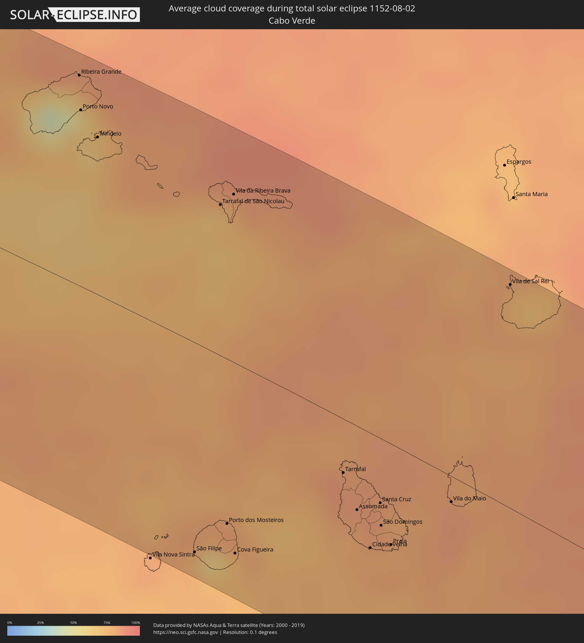 Kap Verde
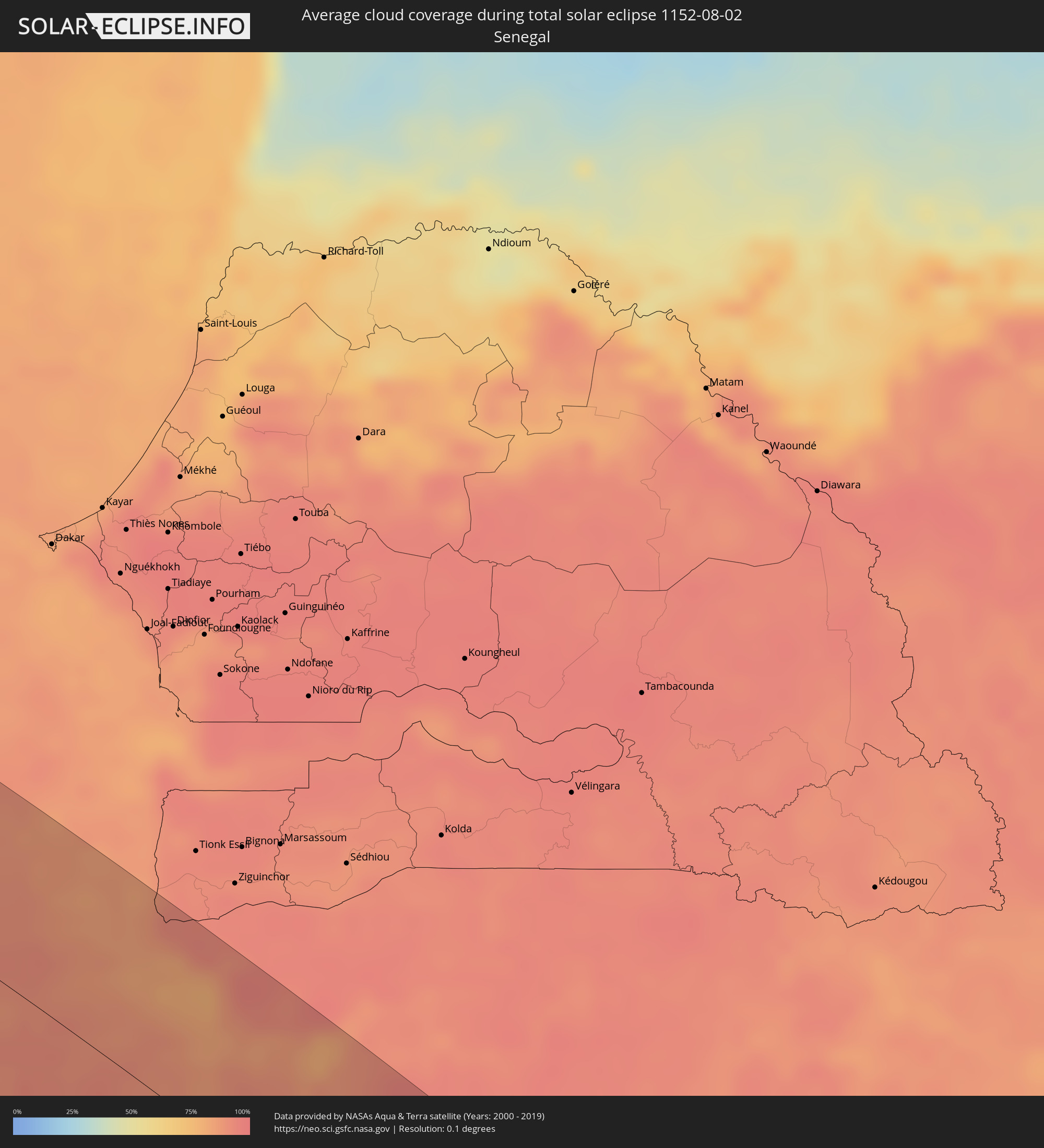 Senegal
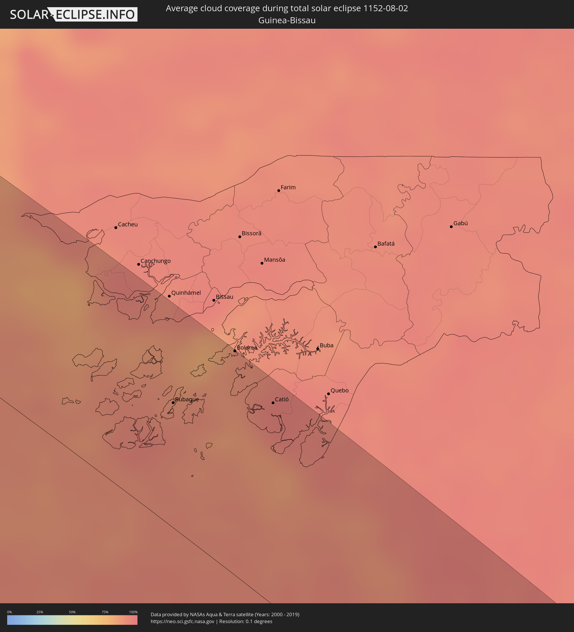 Guinea-Bissau
 Guinea
 Sierra Leone
 Liberia
 Elfenbeinküste
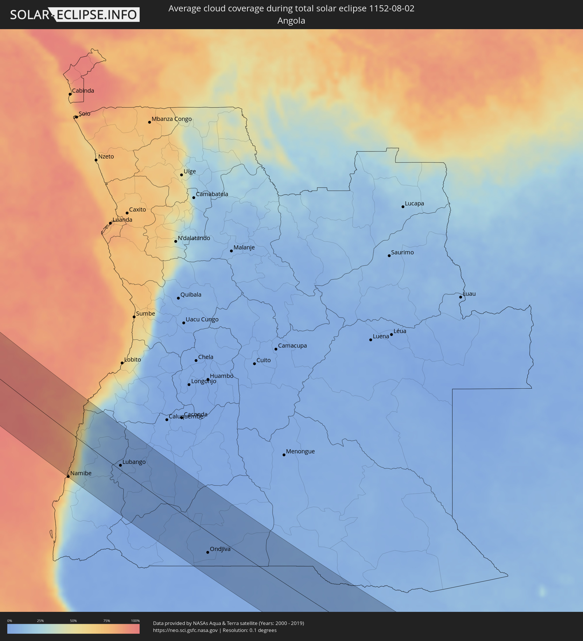 Angola
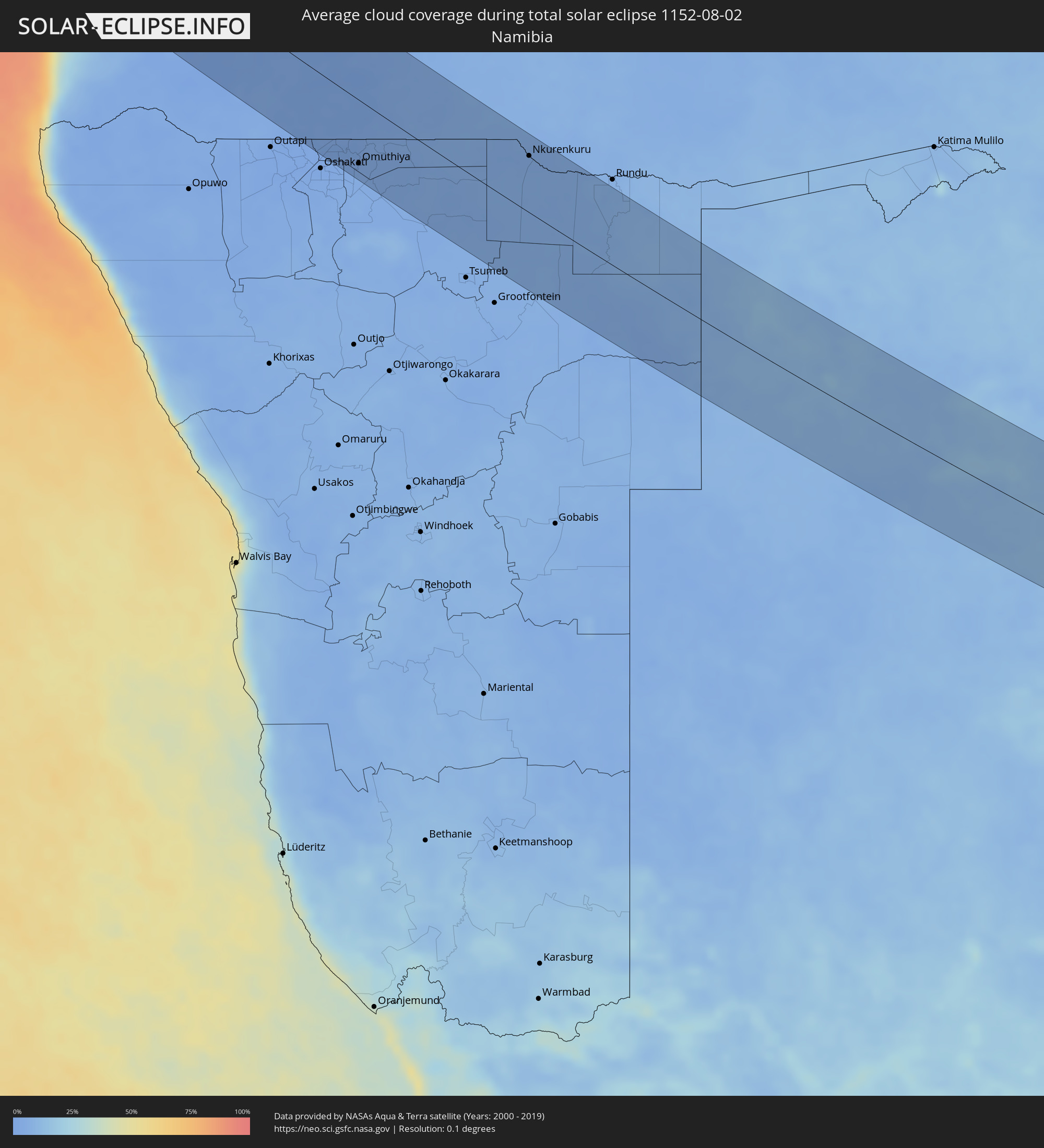 Namibia
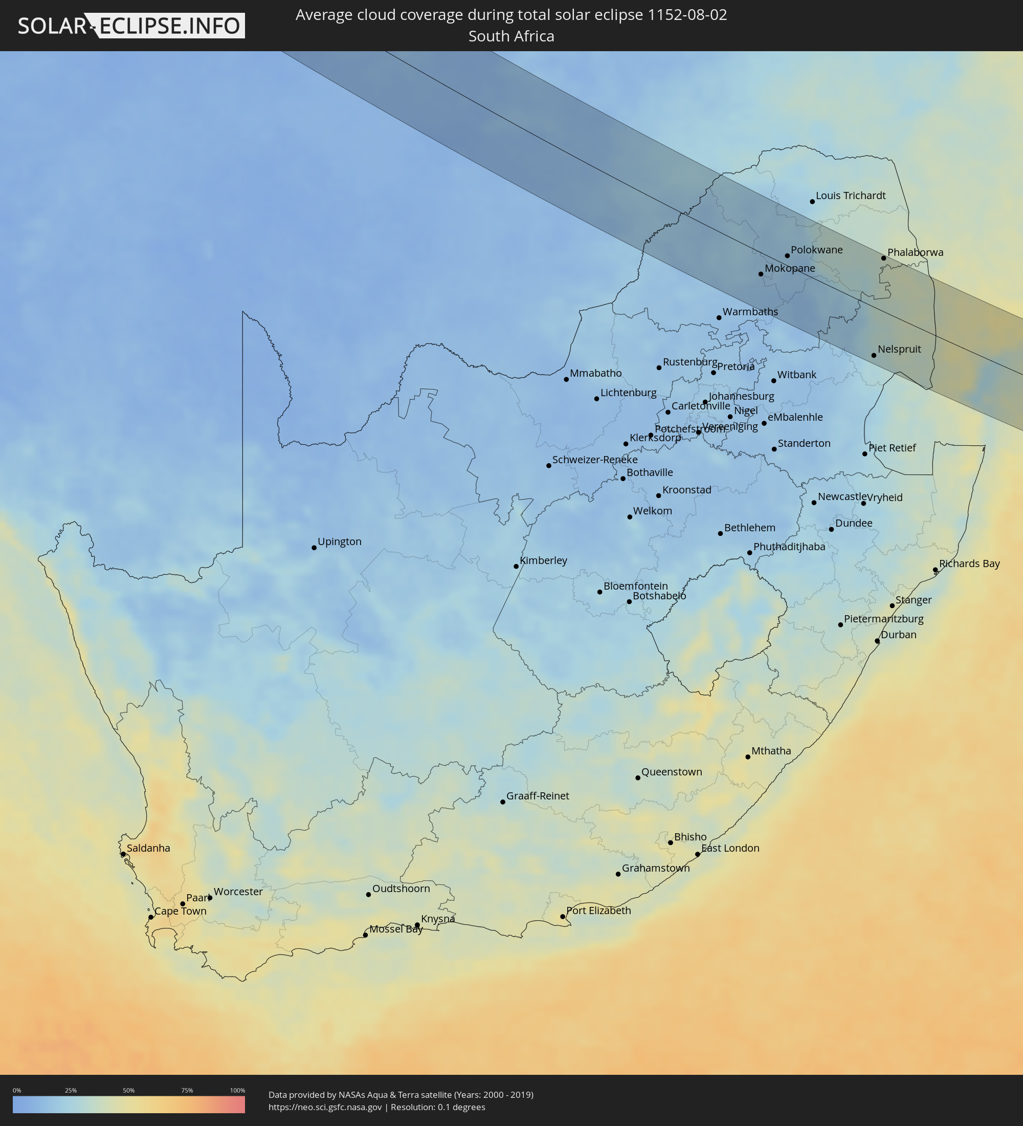 Südafrika
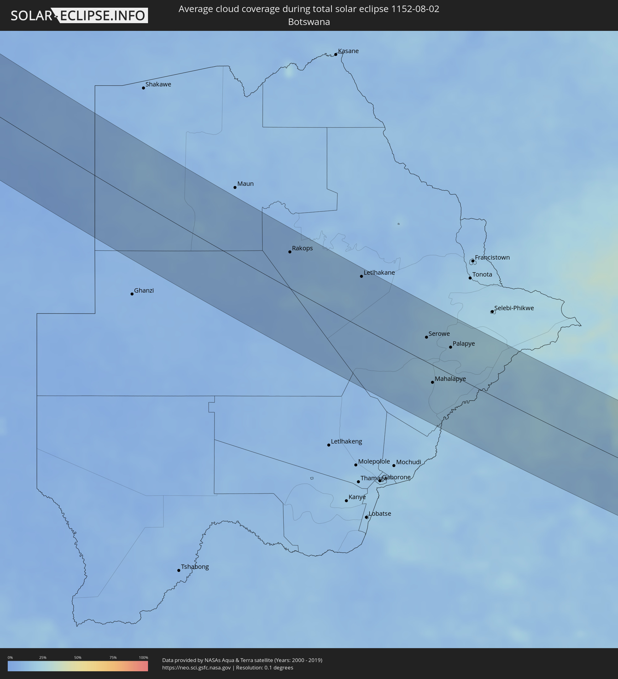 Botswana
 Mosambik
 Swasiland
Orte im Finsternispfad
Die nachfolgene Tabelle zeigt Städte und Orte mit mehr als 5.000 Einwohnern, die sich im Finsternispfad befinden. Städte mit mehr als 100.000 Einwohnern sind dick gekennzeichnet. Mit einem Klick auf den Ort öffnet sich eine Detailkarte die die Lage des jeweiligen Ortes zusammen mit dem Verlauf der zentralen Finsternis präsentiert.
| Ort | Typ | Dauer der Verfinsterung | Ortszeit bei maximaler Verfinsterung | Entfernung zur Zentrallinie | Ø Bewölkung |
|
Jacmel, Sud-Est
|
total | - | 06:19:46 UTC-04:49 | 79 km | 50% |
|
Santa Cruz de Barahona, Barahona
|
total | - | 06:29:11 UTC-04:40 | 39 km | 54% |
|
Azua, Azua
|
total | - | 06:29:18 UTC-04:40 | 57 km | 58% |
|
San José de Ocoa, San José de Ocoa
|
total | - | 06:29:23 UTC-04:40 | 61 km | 63% |
|
Baní, Peravia
|
total | - | 06:29:26 UTC-04:40 | 28 km | 66% |
|
Villa Altagracia, San Cristóbal
|
total | - | 06:29:30 UTC-04:40 | 67 km | 82% |
|
Santo Domingo, Nacional
|
total | - | 06:29:33 UTC-04:40 | 43 km | 80% |
|
Boca Chica, Santo Domingo
|
total | - | 06:29:42 UTC-04:40 | 29 km | 73% |
|
San Pedro de Macorís, San Pedro de Macorís
|
total | - | 06:29:48 UTC-04:40 | 23 km | 73% |
|
Hato Mayor del Rey, Hato Mayor
|
total | - | 06:29:50 UTC-04:40 | 54 km | 84% |
|
Santa Cruz de El Seibo, El Seíbo
|
total | - | 06:29:55 UTC-04:40 | 50 km | 82% |
|
La Romana, La Romana
|
total | - | 06:29:56 UTC-04:40 | 11 km | 70% |
|
Salvaleón de Higüey, La Altagracia
|
total | - | 06:30:03 UTC-04:40 | 25 km | 86% |
|
Punta Cana, La Altagracia
|
total | - | 06:30:10 UTC-04:40 | 15 km | 60% |
|
Aguadilla, Aguadilla
|
total | - | 07:10:43 UTC-04:00 | 30 km | 74% |
|
Mayagüez, Mayaguez
|
total | - | 07:10:43 UTC-04:00 | 55 km | 78% |
|
Yauco, Yauco
|
total | - | 07:10:51 UTC-04:00 | 80 km | 59% |
|
Arecibo, Arecibo
|
total | - | 07:10:55 UTC-04:00 | 35 km | 68% |
|
Ponce, Ponce
|
total | - | 07:10:58 UTC-04:00 | 87 km | 62% |
|
Barceloneta, Barceloneta
|
total | - | 07:11:00 UTC-04:00 | 41 km | 68% |
|
Vega Baja, Vega Baja
|
total | - | 07:11:05 UTC-04:00 | 45 km | 82% |
|
Cayey, Cayey
|
total | - | 07:11:11 UTC-04:00 | 86 km | 78% |
|
San Juan, San Juan
|
total | - | 07:11:13 UTC-04:00 | 49 km | 74% |
|
Caguas, Caguas
|
total | - | 07:11:15 UTC-04:00 | 75 km | 84% |
|
Carolina, Carolina
|
total | - | 07:11:18 UTC-04:00 | 61 km | 82% |
|
Humacao, Humacao
|
total | - | 07:11:22 UTC-04:00 | 89 km | 69% |
|
Fajardo, Fajardo
|
total | - | 07:11:27 UTC-04:00 | 74 km | 77% |
|
Charlotte Amalie, Saint Thomas Island
|
total | - | 07:05:47 UTC-04:06 | 87 km | 62% |
|
Cruz Bay, Saint John Island
|
total | - | 07:05:51 UTC-04:06 | 91 km | 62% |
|
Road Town
|
total | - | 07:05:57 UTC-04:06 | 84 km | 72% |
|
Ribeira Grande, Ribeira Grande
|
total | - | 10:39:09 UTC-01:34 | 101 km | 67% |
|
Porto Novo, Porto Novo
|
total | - | 10:39:23 UTC-01:34 | 85 km | 65% |
|
Mindelo, São Vicente
|
total | - | 10:39:45 UTC-01:34 | 76 km | 67% |
|
São Filipe, São Filipe
|
total | - | 10:43:35 UTC-01:34 | 100 km | 78% |
|
Tarrafal de São Nicolau, Tarrafal de São Nicolau
|
total | - | 10:41:35 UTC-01:34 | 72 km | 71% |
|
Vila da Ribeira Brava, Ribeira Brava
|
total | - | 10:41:40 UTC-01:34 | 80 km | 76% |
|
Cova Figueira, Santa Catarina do Fogo
|
total | - | 10:44:04 UTC-01:34 | 91 km | 74% |
|
Tarrafal, Tarrafal
|
total | - | 10:44:47 UTC-01:34 | 26 km | 84% |
|
Picos, São Salvador do Mundo
|
total | - | 10:45:20 UTC-01:34 | 39 km | 83% |
|
Calheta, São Miguel
|
total | - | 10:45:17 UTC-01:34 | 27 km | 84% |
|
Santa Cruz, Santa Cruz
|
total | - | 10:45:25 UTC-01:34 | 31 km | 83% |
|
Praia, Praia
|
total | - | 10:45:50 UTC-01:34 | 48 km | 81% |
|
Vila do Maio, Maio
|
total | - | 10:46:14 UTC-01:34 | 12 km | 85% |
|
Bubaque, Bolama and Bijagos
|
total | - | 11:41:27 UTC-01:02 | 63 km | 91% |
|
Bolama, Bolama and Bijagos
|
total | - | 11:41:45 UTC-01:02 | 112 km | 89% |
|
Catió, Tombali
|
total | - | 11:42:47 UTC-01:02 | 101 km | 95% |
|
Kamsar, Boke
|
total | - | 12:31:34 UTC-00:16 | 91 km | 94% |
|
Sanguéya, Boke
|
total | - | 12:32:02 UTC-00:16 | 110 km | 95% |
|
Camayenne, Conakry
|
total | - | 12:35:41 UTC-00:16 | 55 km | 92% |
|
Conakry, Conakry
|
total | - | 12:35:42 UTC-00:16 | 56 km | 92% |
|
Dubréka, Kindia
|
total | - | 12:35:35 UTC-00:16 | 89 km | 97% |
|
Coyah, Kindia
|
total | - | 12:36:03 UTC-00:16 | 91 km | 97% |
|
Freetown, Western Area
|
total | - | 12:38:38 UTC-00:16 | 3 km | 96% |
|
Forécariah, Kindia
|
total | - | 12:37:13 UTC-00:16 | 88 km | 96% |
|
Waterloo, Western Area
|
total | - | 12:39:16 UTC-00:16 | 4 km | 96% |
|
Kambia, Northern Province
|
total | - | 12:38:09 UTC-00:16 | 74 km | 97% |
|
Port Loko, Northern Province
|
total | - | 12:39:06 UTC-00:16 | 53 km | 97% |
|
Lunsar, Northern Province
|
total | - | 12:39:49 UTC-00:16 | 64 km | 96% |
|
Bonthe, Southern Province
|
total | - | 12:42:02 UTC-00:16 | 32 km | 95% |
|
Rokupr, Northern Province
|
total | - | 12:40:10 UTC-00:16 | 73 km | 96% |
|
Magburaka, Northern Province
|
total | - | 12:41:02 UTC-00:16 | 109 km | 97% |
|
Bumpe, Southern Province
|
total | - | 12:42:41 UTC-00:16 | 42 km | 97% |
|
Gandorhun, Southern Province
|
total | - | 12:43:35 UTC-00:16 | 14 km | 97% |
|
Bo, Southern Province
|
total | - | 12:42:54 UTC-00:16 | 60 km | 97% |
|
Gandorhun, Southern Province
|
total | - | 12:43:46 UTC-00:16 | 29 km | 97% |
|
Robertsport, Grand Cape Mount
|
total | - | 12:18:58 UTC-00:43 | 14 km | 93% |
|
Kenema, Eastern Province
|
total | - | 12:44:16 UTC-00:16 | 92 km | 95% |
|
Tubmanburg, Bomi
|
total | - | 12:19:56 UTC-00:43 | 35 km | 97% |
|
Monrovia, Montserrado
|
total | - | 12:21:03 UTC-00:43 | 10 km | 94% |
|
Bensonville, Montserrado
|
total | - | 12:21:11 UTC-00:43 | 16 km | 97% |
|
Bopolu, Gbarpolu
|
total | - | 12:20:17 UTC-00:43 | 76 km | 97% |
|
Kakata, Margibi
|
total | - | 12:21:35 UTC-00:43 | 42 km | 98% |
|
Buchanan, Grand Bassa
|
total | - | 12:23:27 UTC-00:43 | 11 km | 95% |
|
Cestos City, River Cess
|
total | - | 12:25:13 UTC-00:43 | 11 km | 93% |
|
Greenville, Sinoe
|
total | - | 12:27:12 UTC-00:43 | 15 km | 93% |
|
Barclayville, Grand Kru
|
total | - | 12:29:29 UTC-00:43 | 48 km | 97% |
|
Harper, Maryland
|
total | - | 12:31:06 UTC-00:43 | 64 km | 93% |
|
Tabou, Bas-Sassandra
|
total | - | 12:58:44 UTC-00:16 | 95 km | 89% |
|
Namibe, Namibe
|
total | - | 14:26:23 UTC+00:13 | 101 km | 50% |
|
Lubango, Huíla
|
total | - | 14:27:26 UTC+00:13 | 10 km | 4% |
|
Ondjiva, Cunene
|
total | - | 14:31:16 UTC+00:13 | 47 km | 2% |
|
Omuthiya, Oshikoto
|
total | - | 15:48:35 UTC+01:30 | 78 km | 3% |
|
Eenhana, Ohangwena
|
total | - | 15:48:29 UTC+01:30 | 48 km | 3% |
|
Nkurenkuru, Kavango West
|
total | - | 15:50:23 UTC+01:30 | 71 km | 4% |
|
Rakops, Central
|
total | - | 16:36:28 UTC+02:10 | 57 km | 9% |
|
Orapa, Central
|
total | - | 16:37:08 UTC+02:10 | 79 km | 12% |
|
Letlhakane, Central
|
total | - | 16:37:17 UTC+02:10 | 80 km | 11% |
|
Serowe, Central
|
total | - | 16:38:14 UTC+02:10 | 38 km | 17% |
|
Mahalapye, Central
|
total | - | 16:38:34 UTC+02:10 | 27 km | 17% |
|
Palapye, Central
|
total | - | 16:38:29 UTC+02:10 | 42 km | 19% |
|
Mokopane, Limpopo
|
total | - | 15:59:30 UTC+01:30 | 35 km | 15% |
|
Polokwane, Limpopo
|
total | - | 15:59:35 UTC+01:30 | 15 km | 17% |
|
Lebowakgomo, Limpopo
|
total | - | 15:59:41 UTC+01:30 | 13 km | 16% |
|
Mankoeng, Limpopo
|
total | - | 15:59:43 UTC+01:30 | 31 km | 15% |
|
Duiwelskloof, Limpopo
|
total | - | 15:59:46 UTC+01:30 | 66 km | 30% |
|
Tzaneen, Limpopo
|
total | - | 15:59:49 UTC+01:30 | 53 km | 31% |
|
Ga-Kgapane, Limpopo
|
total | - | 15:59:47 UTC+01:30 | 75 km | 33% |
|
Nkowakowa, Limpopo
|
total | - | 15:59:52 UTC+01:30 | 53 km | 31% |
|
Lydenburg, Mpumalanga
|
total | - | 16:00:15 UTC+01:30 | 62 km | 19% |
|
Nelspruit, Mpumalanga
|
total | - | 16:00:31 UTC+01:30 | 77 km | 28% |
|
White River, Mpumalanga
|
total | - | 16:00:30 UTC+01:30 | 61 km | 30% |
|
Phalaborwa, Limpopo
|
total | - | 16:00:11 UTC+01:30 | 84 km | 35% |
|
Komatipoort, Mpumalanga
|
total | - | 16:00:48 UTC+01:30 | 32 km | 38% |
|
Ressano Garcia, Maputo
|
total | - | 16:41:09 UTC+02:10 | 31 km | 38% |
|
Matola, Maputo
|
total | - | 16:41:24 UTC+02:10 | 64 km | 36% |
|
Maputo, Maputo City
|
total | - | 16:41:26 UTC+02:10 | 59 km | 31% |
|
Macia, Gaza
|
total | - | 16:41:22 UTC+02:10 | 57 km | 47% |
|
Xai-Xai, Gaza
|
total | - | 16:41:31 UTC+02:10 | 77 km | 40% |