Totale Sonnenfinsternis vom 06.11.1268
| Wochentag: | Dienstag |
| Maximale Dauer der Verfinsterung: | 04m16s |
| Maximale Breite des Finsternispfades: | 172 km |
| Saroszyklus: | 121 |
| Bedeckungsgrad: | 100% |
| Magnitude: | 1.0448 |
| Gamma: | 0.4959 |
Wo kann man die Sonnenfinsternis vom 06.11.1268 sehen?
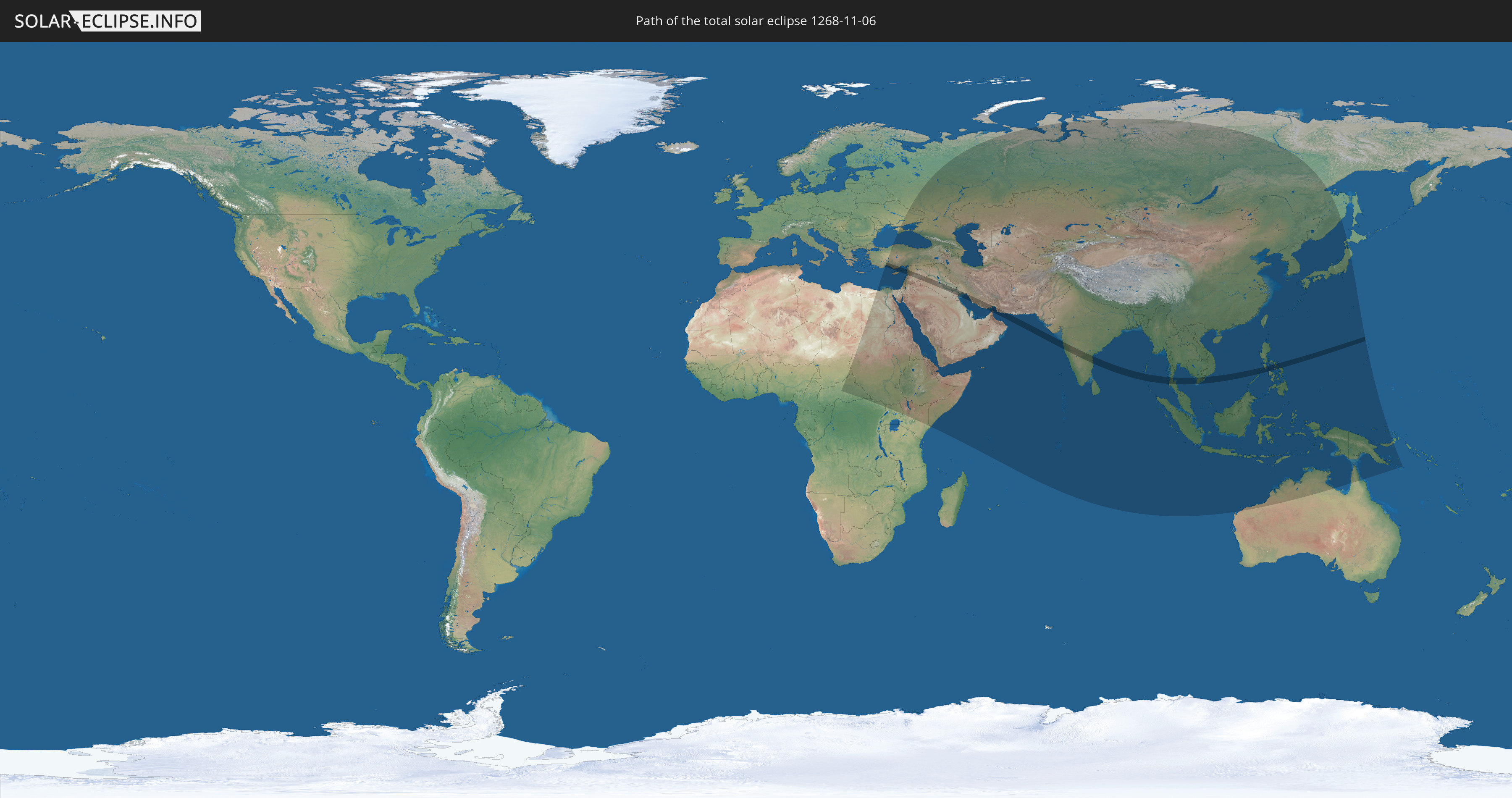
Die Sonnenfinsternis am 06.11.1268 kann man in 74 Ländern als partielle Sonnenfinsternis beobachten.
Der Finsternispfad verläuft durch 14 Länder. Nur in diesen Ländern ist sie als totale Sonnenfinsternis zu sehen.
In den folgenden Ländern ist die Sonnenfinsternis total zu sehen
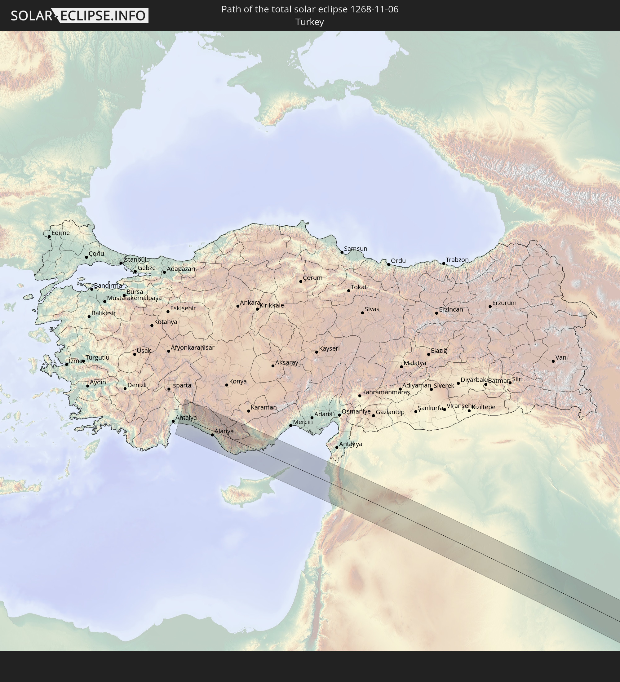 Türkei
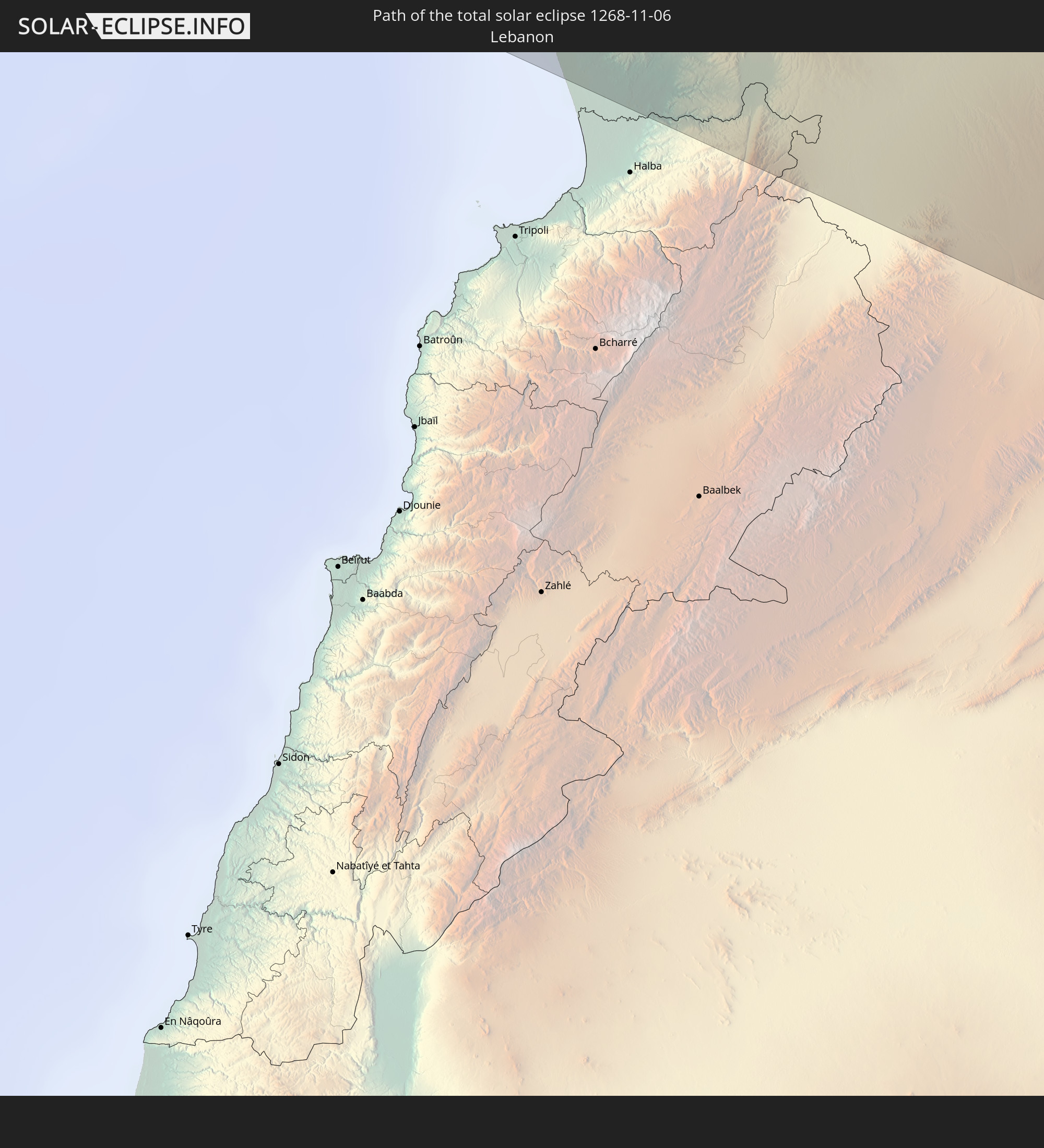 Libanon
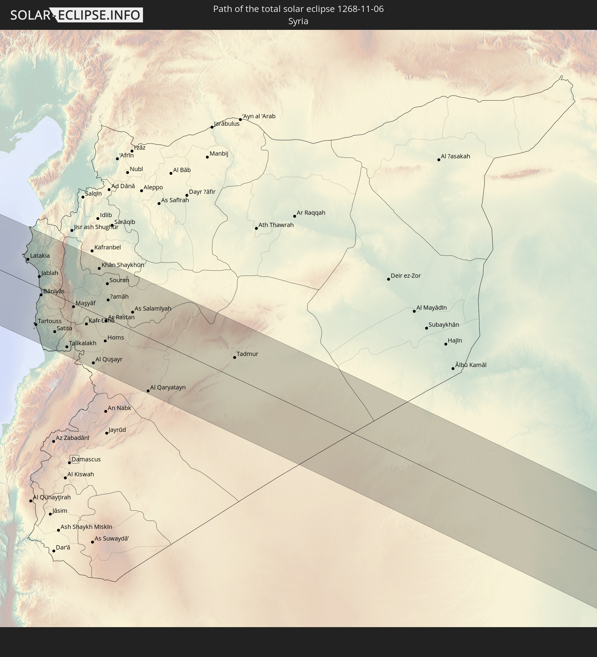 Syrien
 Irak
Irak
 Iran
Iran
 Kuwait
 Vereinigte Arabische Emirate
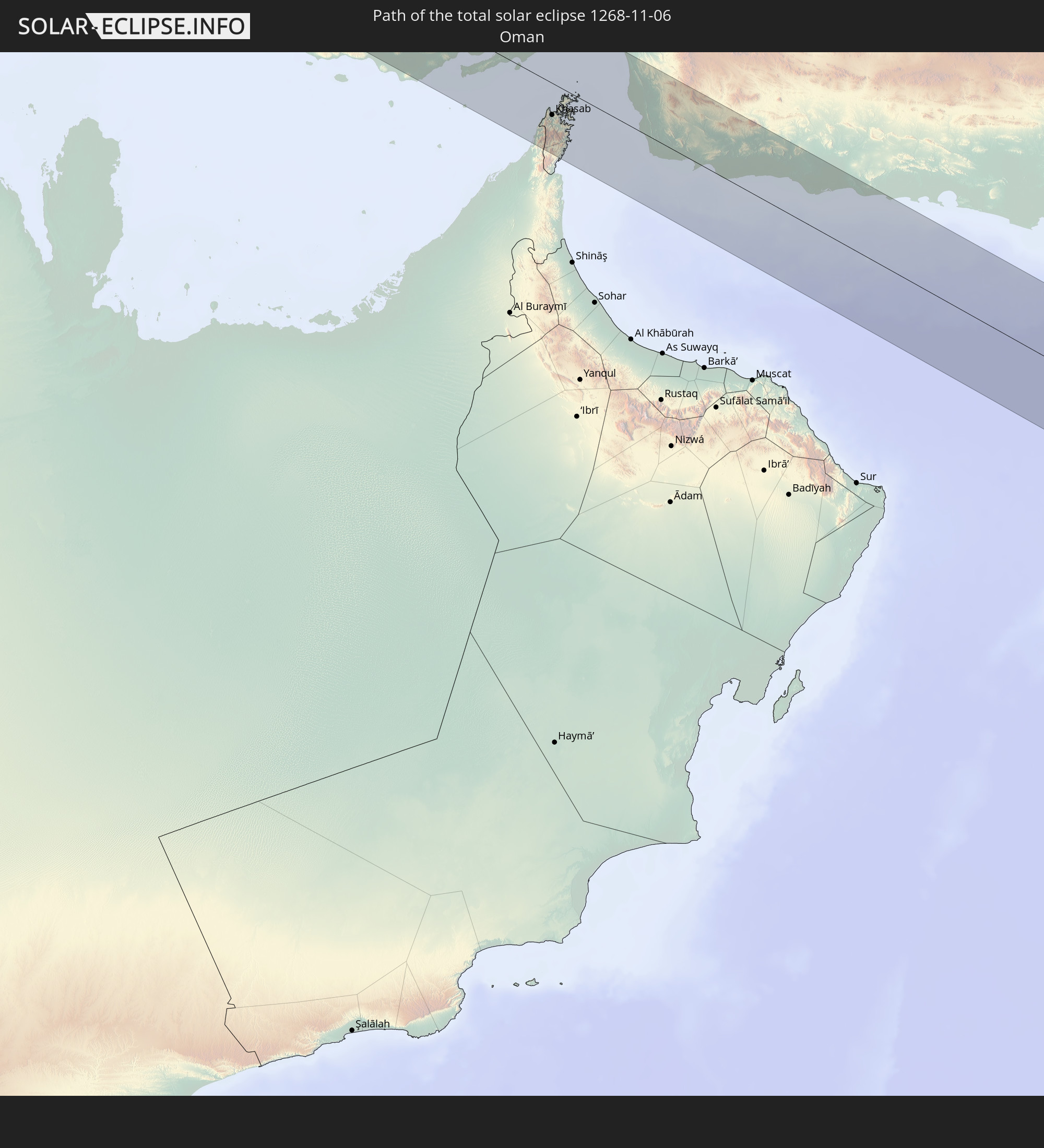 Oman
Oman
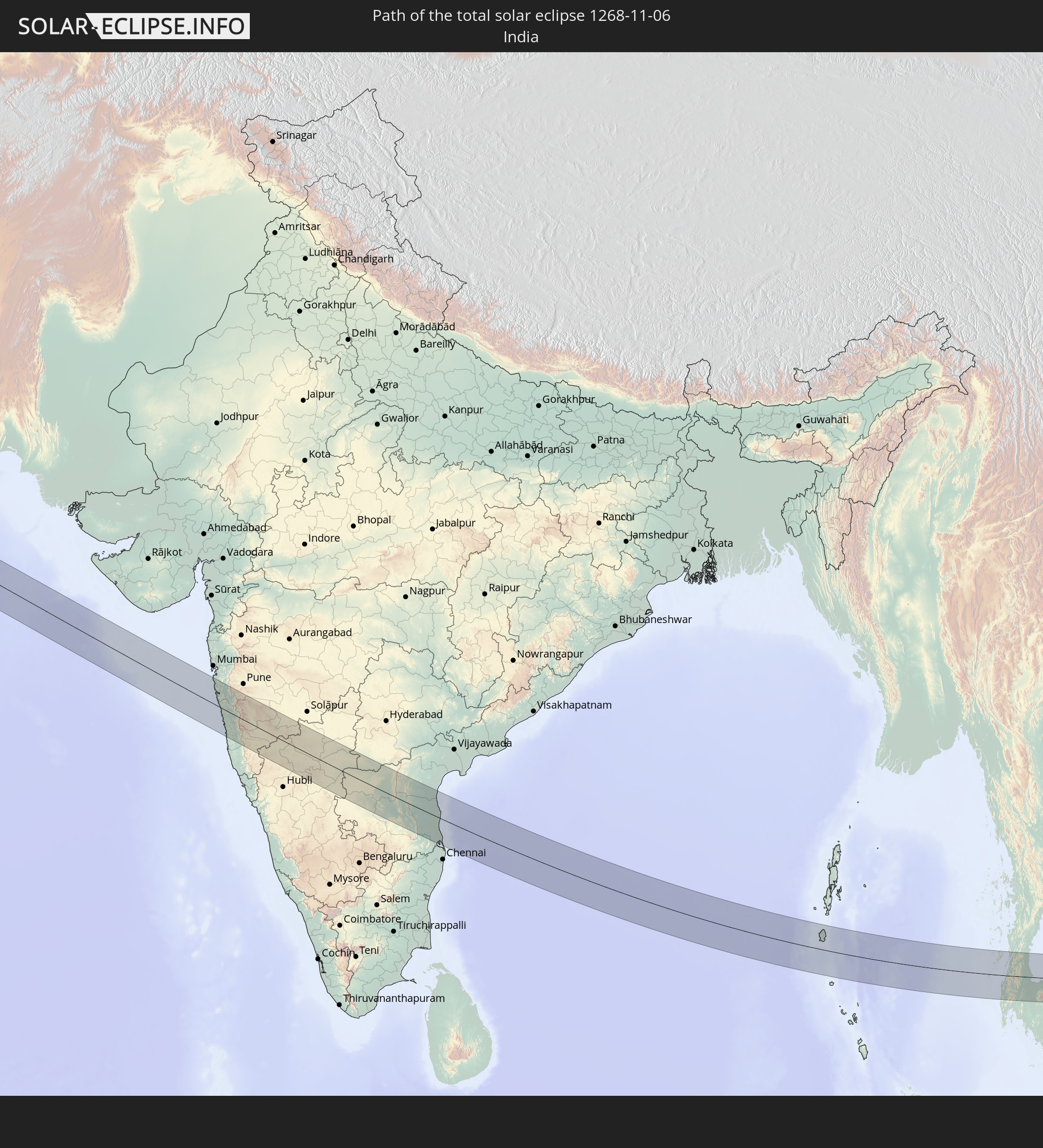 Indien
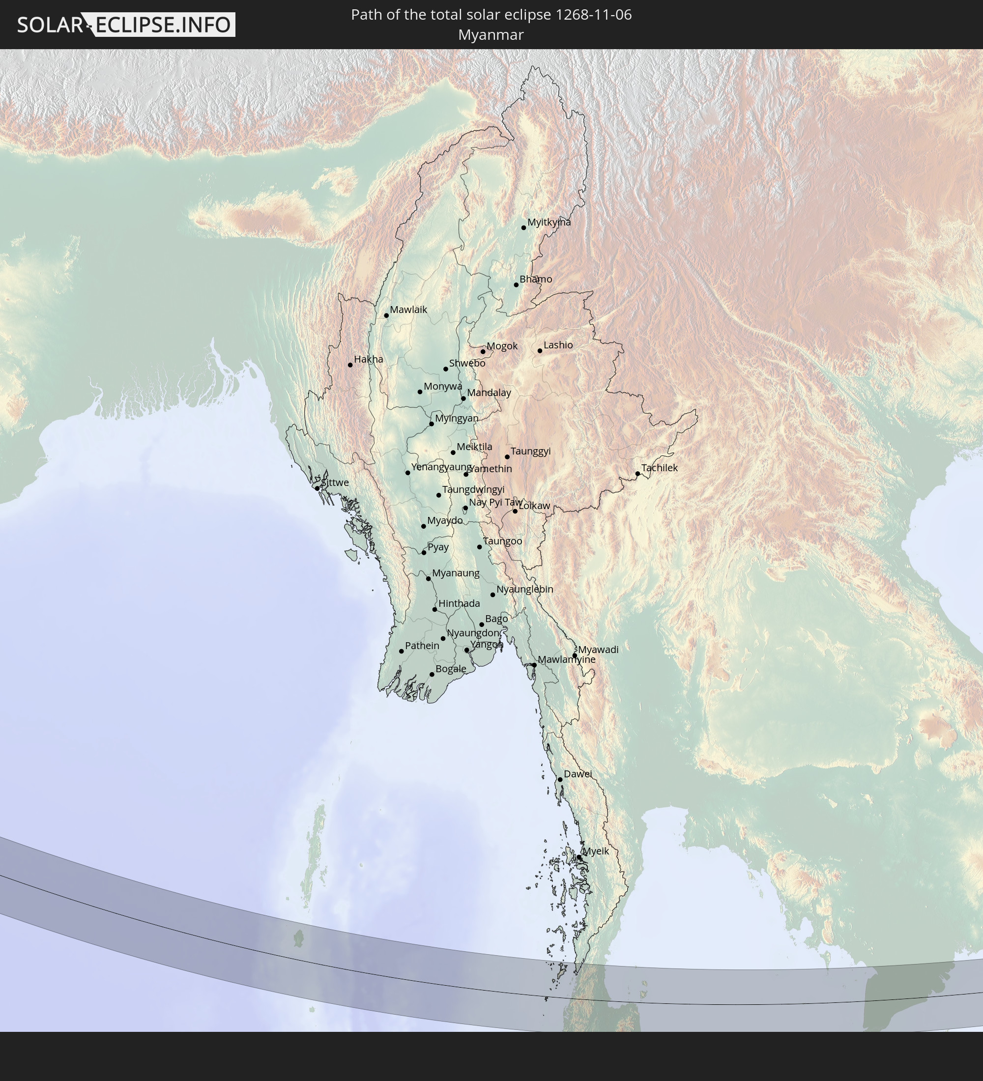 Myanmar
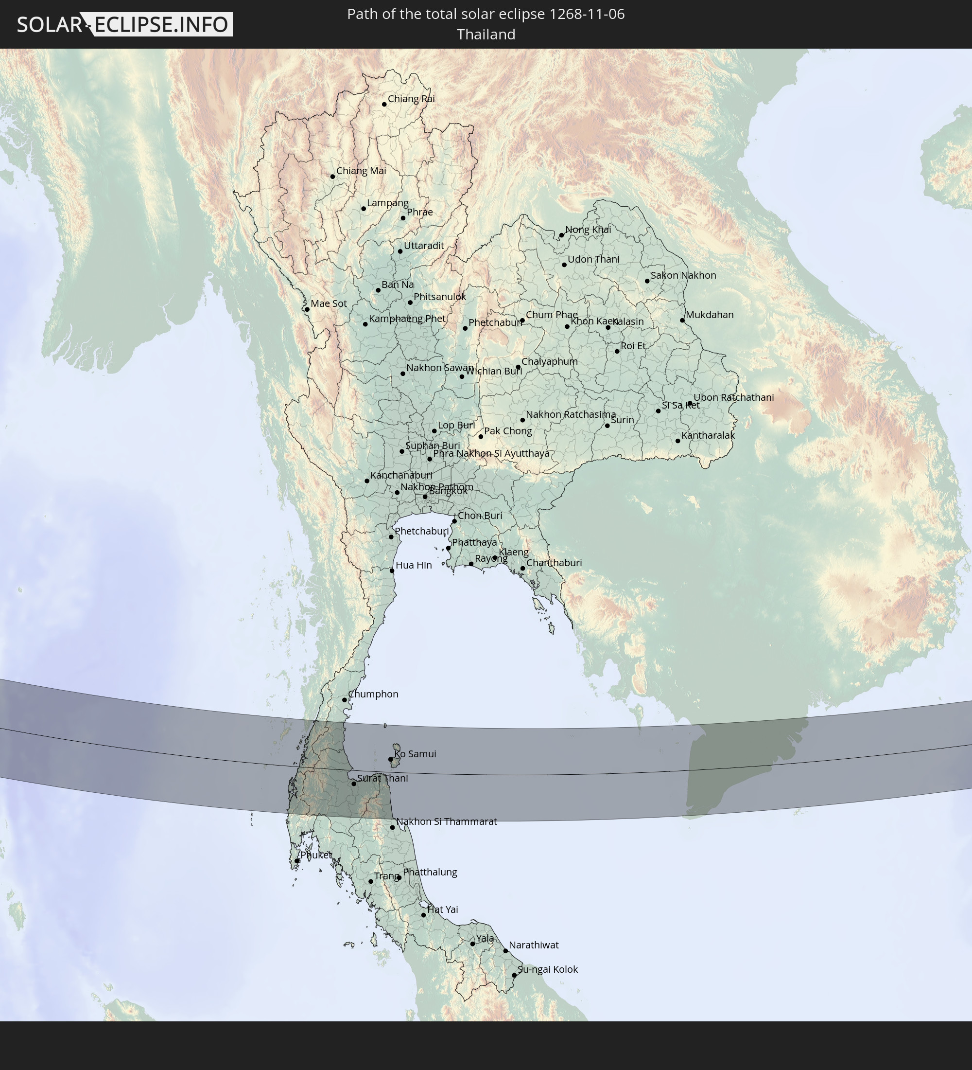 Thailand
 Vietnam
 Kambodscha
 Philippinen
In den folgenden Ländern ist die Sonnenfinsternis partiell zu sehen
 Russland
 Demokratische Republik Kongo
 Tschad
 Zentralafrikanische Republik
 Sudan
Sudan
 Ukraine
 Ägypten
 Türkei
 Uganda
 Republik Zypern
 Äthiopien
 Kenia
Kenia
 Staat Palästina
 Israel
 Saudi-Arabien
 Jordanien
 Libanon
 Syrien
 Eritrea
 Irak
Irak
 Georgien
 Somalia
 Dschibuti
 Jemen
Jemen
 Armenien
 Iran
Iran
 Aserbaidschan
 Seychellen
 Kasachstan
 Kuwait
 Bahrain
 Katar
Katar
 Vereinigte Arabische Emirate
 Oman
Oman
 Turkmenistan
 Usbekistan
 Afghanistan
 Pakistan
 Tadschikistan
 Indien
 Kirgisistan
 Britisches Territorium im Indischen Ozean
 Malediven
 Volksrepublik China
 Sri Lanka
 Nepal
Nepal
 Mongolei
 Bangladesch
 Bhutan
 Myanmar
 Indonesien
 Kokosinseln
 Thailand
 Malaysia
 Laos
Laos
 Vietnam
 Kambodscha
 Singapur
 Weihnachtsinsel
 Australien
 Macau
Macau
 Hongkong
 Brunei
 Taiwan
 Philippinen
 Japan
Japan
 Osttimor
 Nordkorea
 Südkorea
 Palau
Palau
 Föderierte Staaten von Mikronesien
 Papua-Neuguinea
 Guam
Guam
 Nördliche Marianen
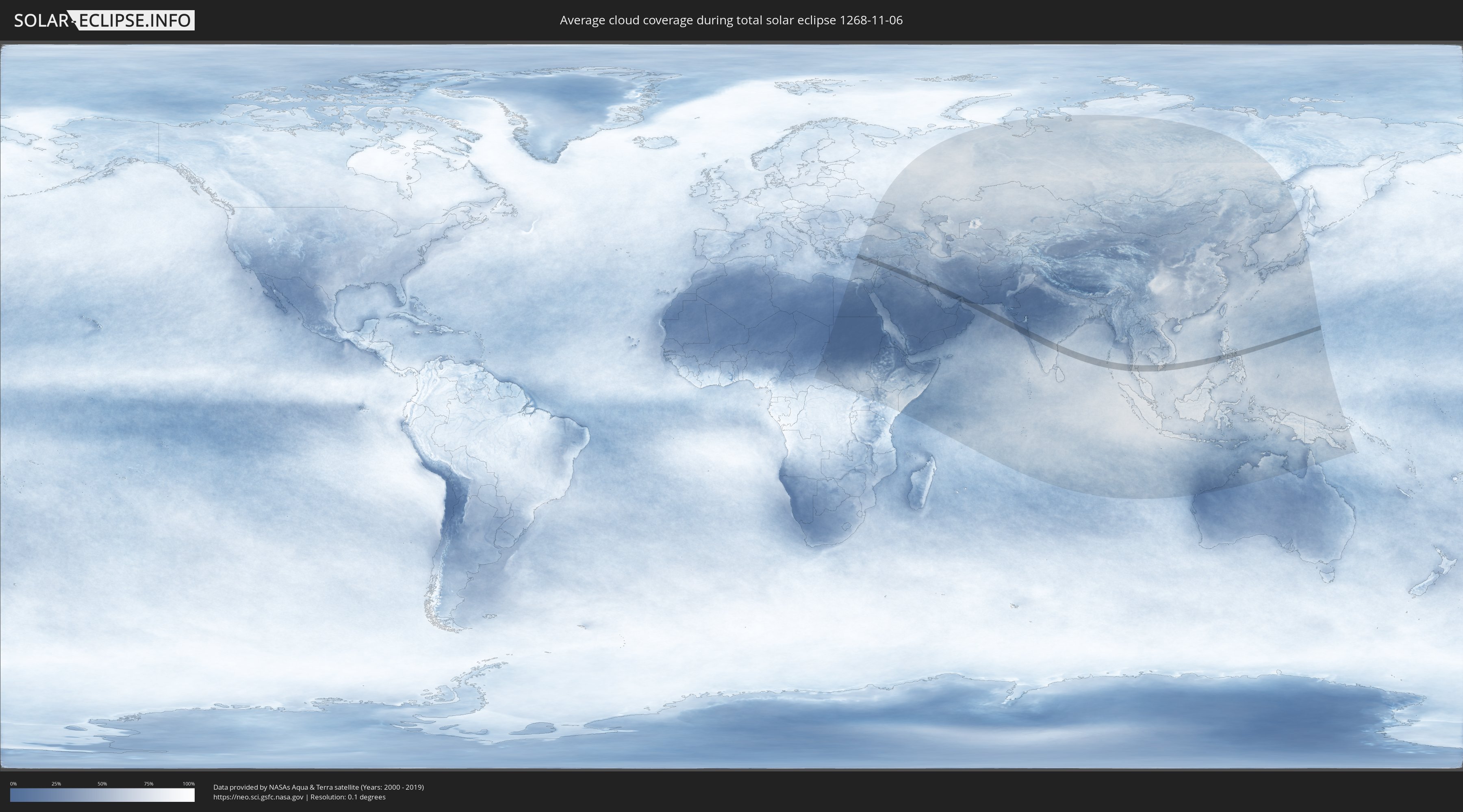
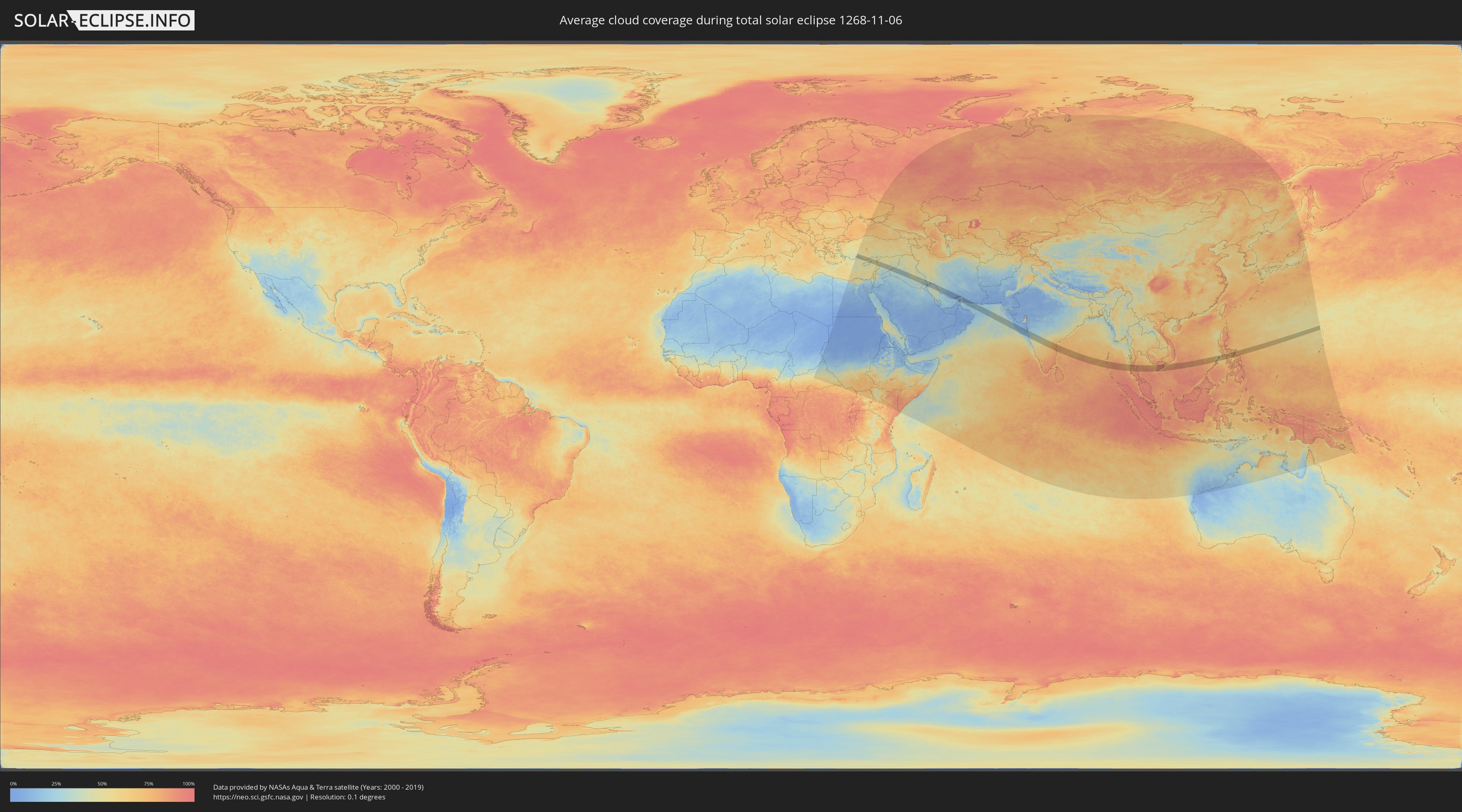
Wie wird das Wetter während der totalen Sonnenfinsternis am 06.11.1268?
Wo ist der beste Ort, um die totale Sonnenfinsternis vom 06.11.1268 zu beobachten?
Die folgenden Karten zeigen die durchschnittliche Bewölkung für den Tag, an dem die totale Sonnenfinsternis
stattfindet. Mit Hilfe der Karten lässt sich der Ort entlang des Finsternispfades eingrenzen,
der die besten Aussichen auf einen klaren wolkenfreien Himmel bietet.
Trotzdem muss man immer lokale Gegenenheiten beachten und sollte sich genau über das Wetter an seinem
gewählten Beobachtungsort informieren.
Die Daten stammen von den beiden NASA-Satelliten
AQUA und TERRA
und wurden über einen Zeitraum von 19 Jahren (2000 - 2019) gemittelt.
Detaillierte Länderkarten
 Türkei
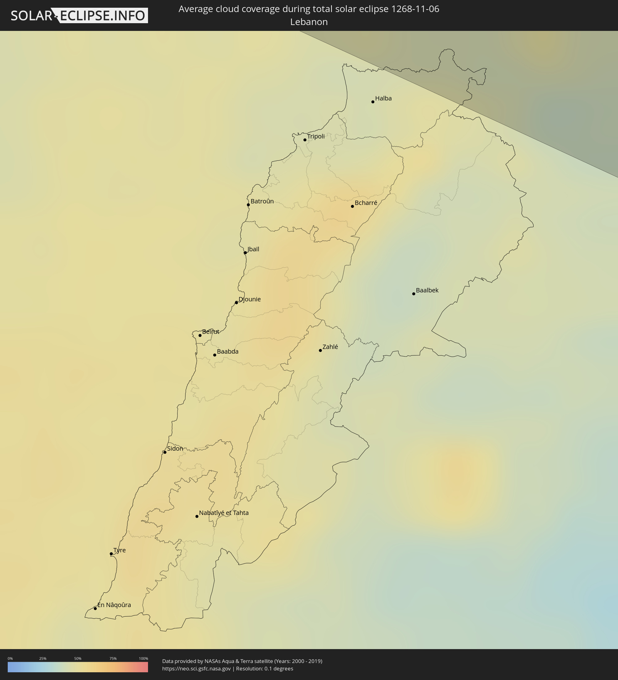 Libanon
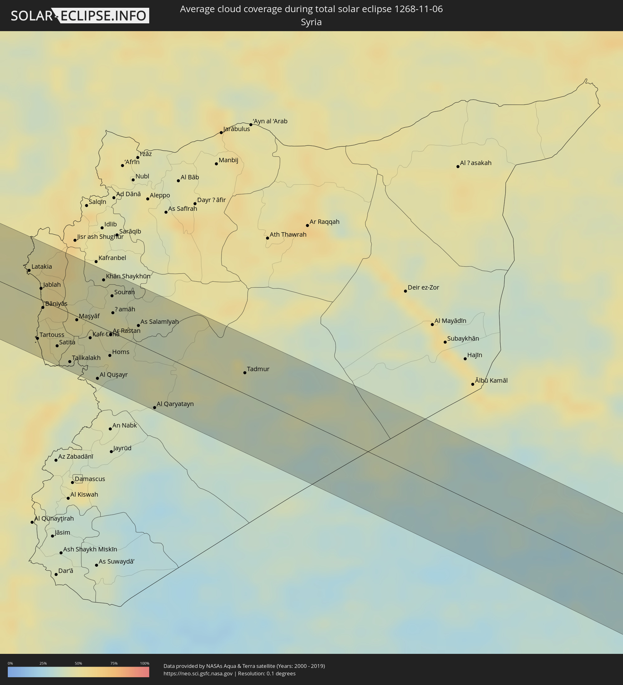 Syrien
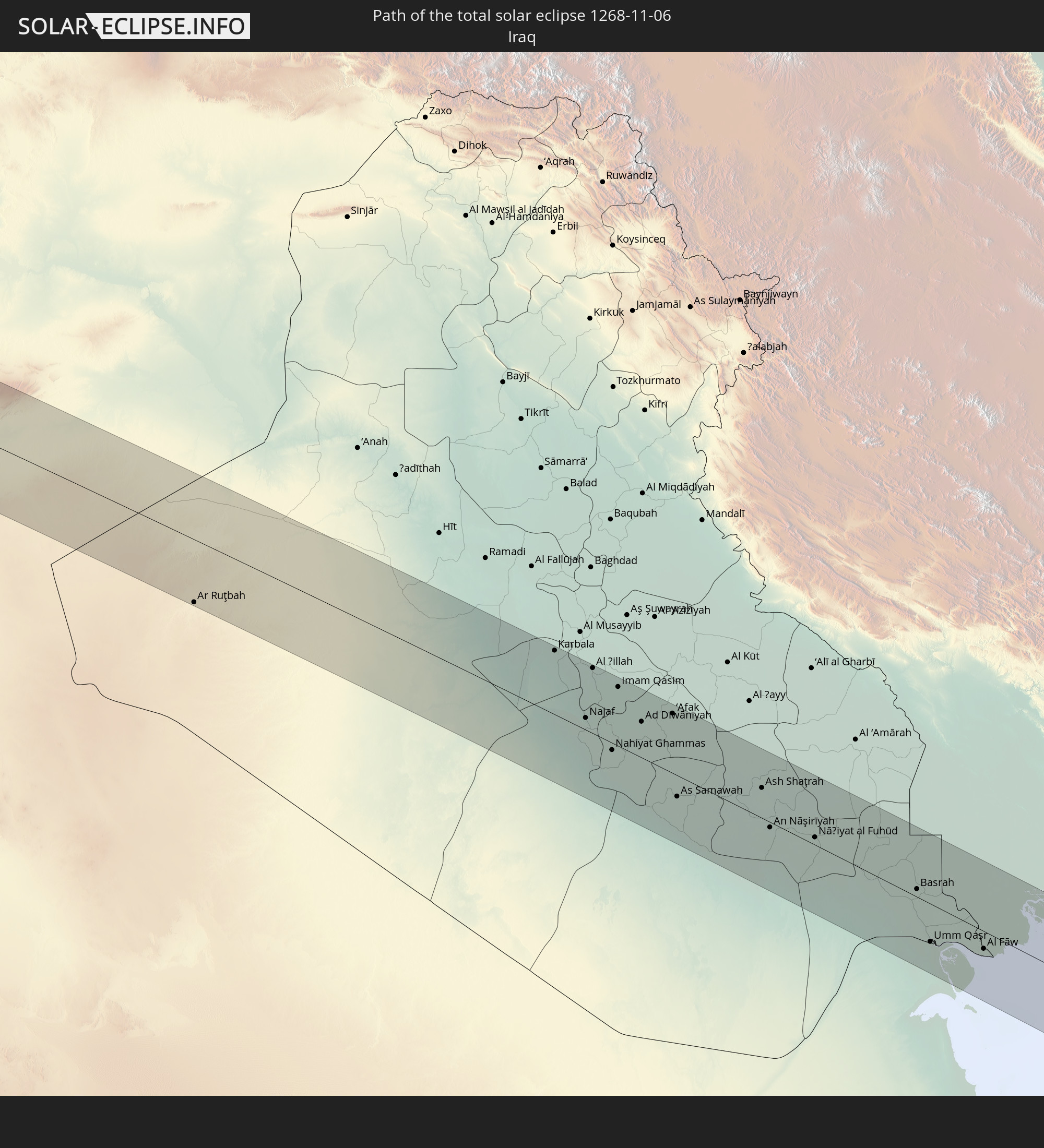
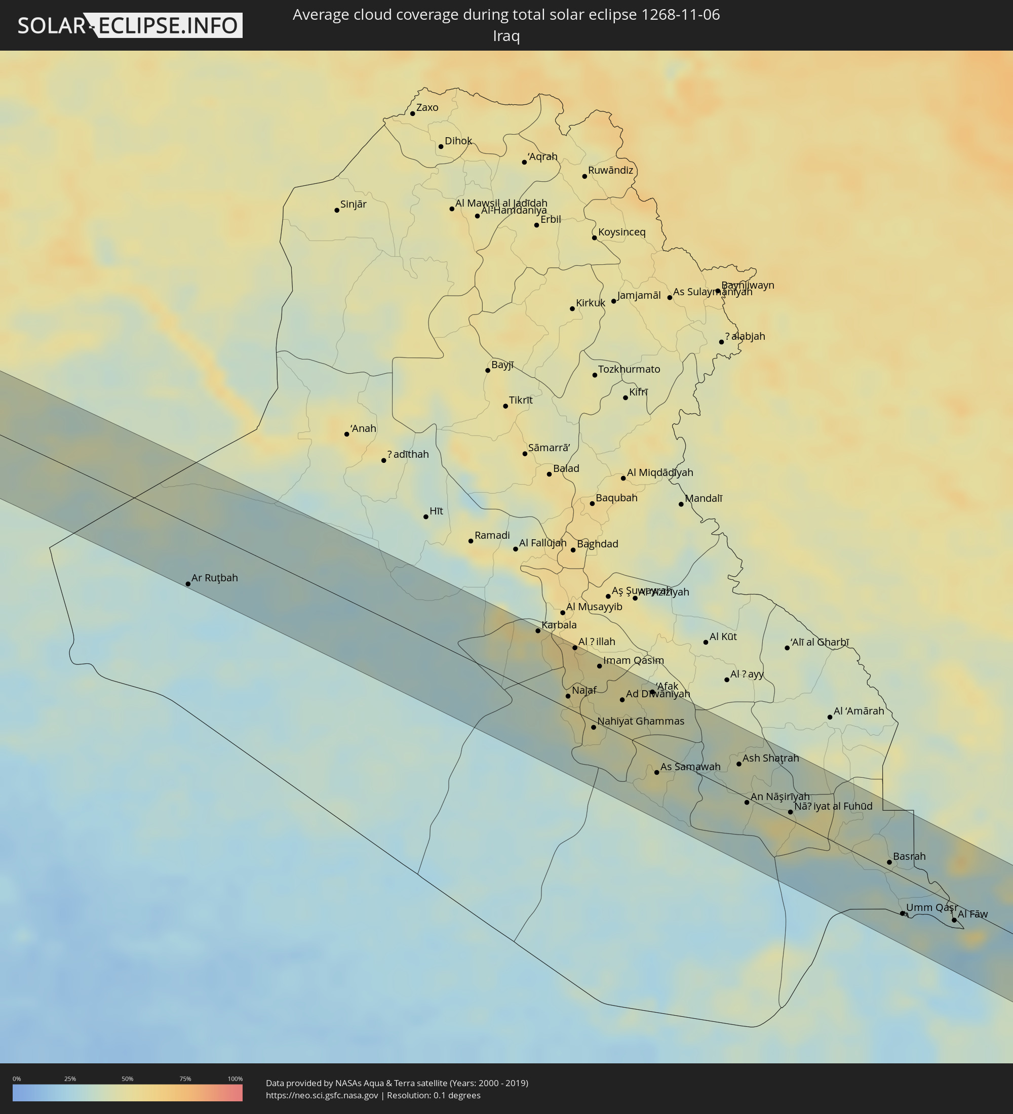 Irak
Irak
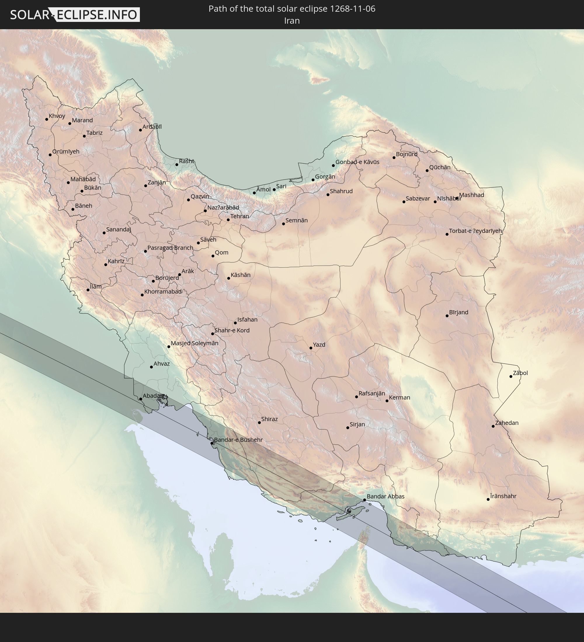
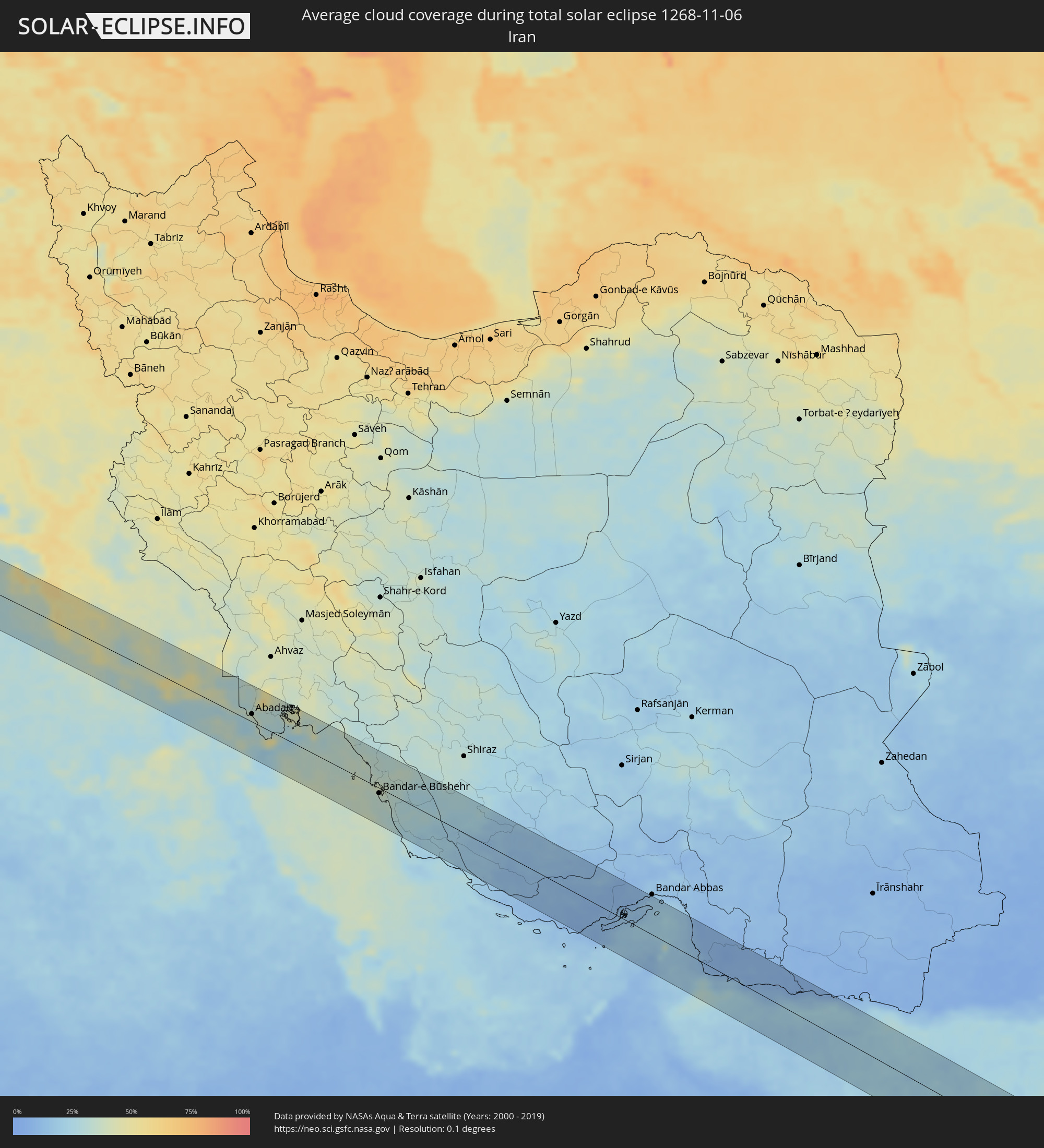 Iran
Iran
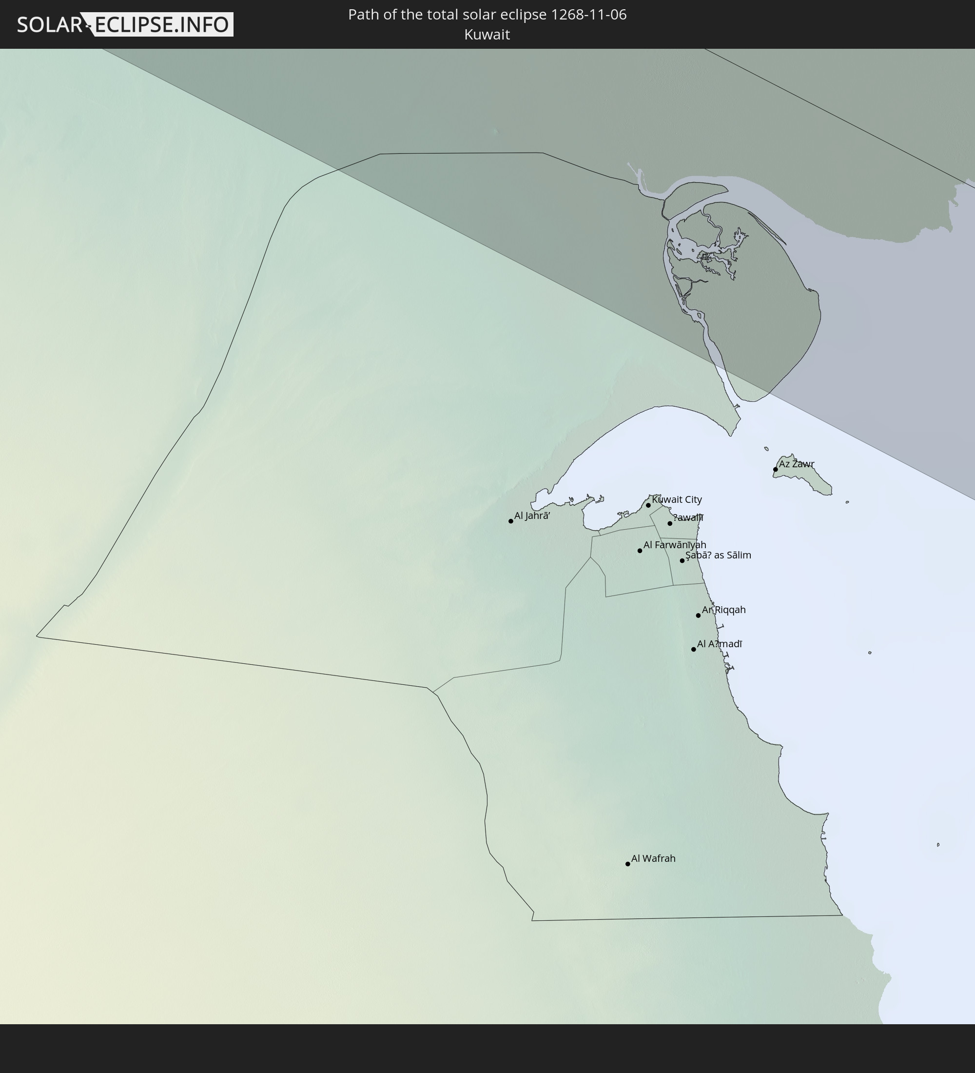
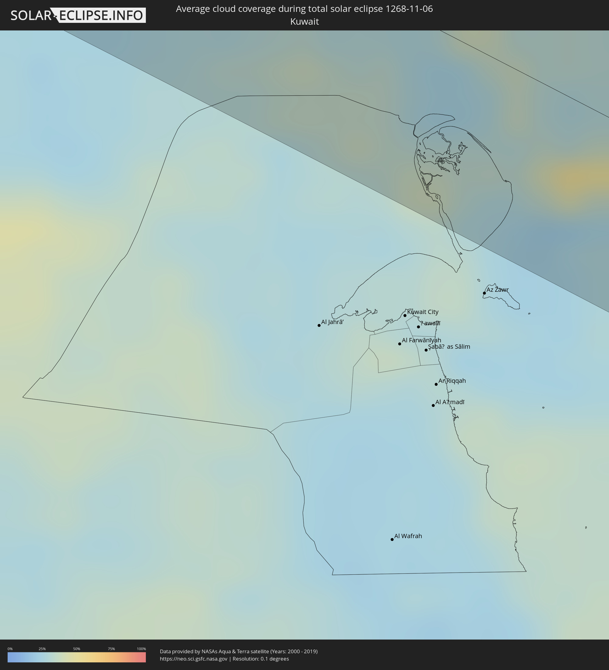 Kuwait
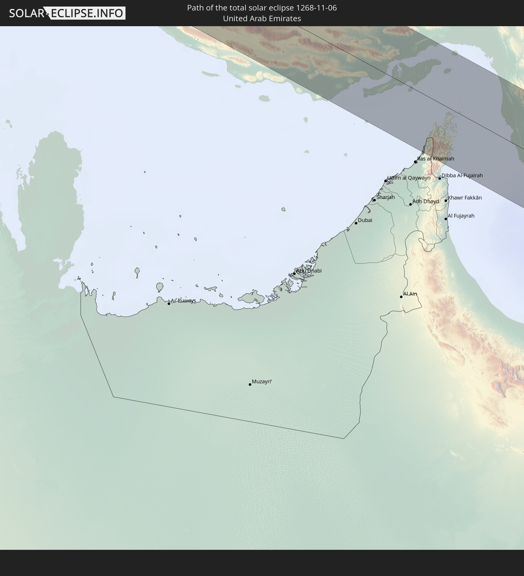
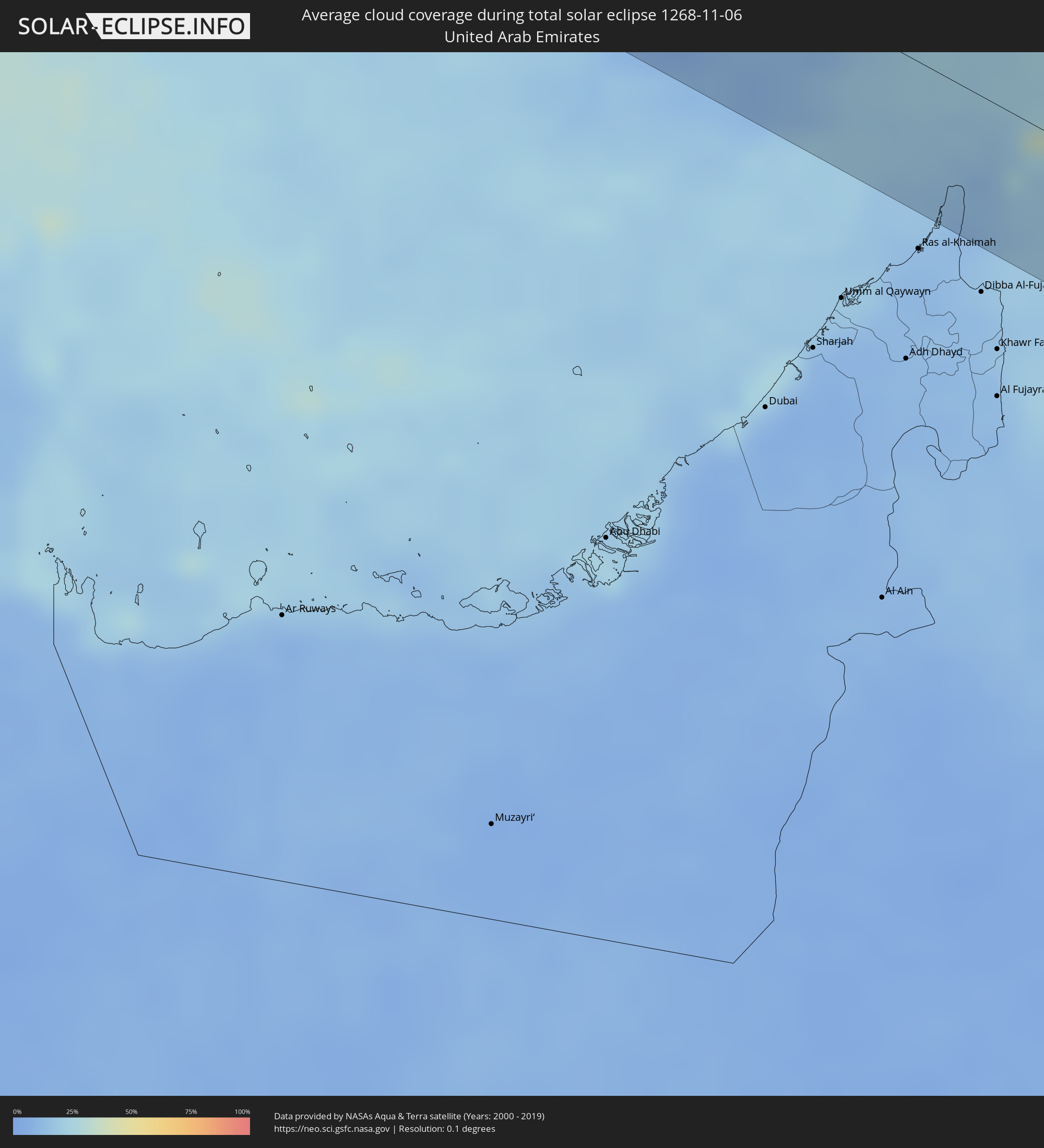 Vereinigte Arabische Emirate
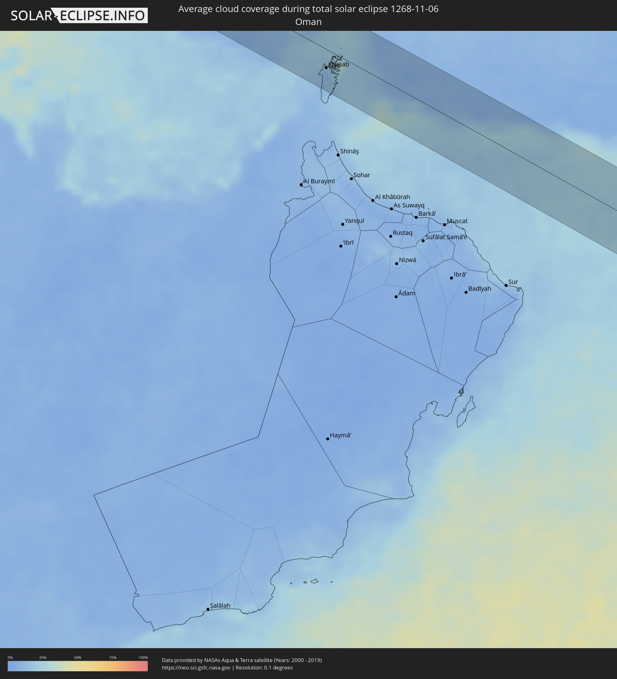 Oman
Oman
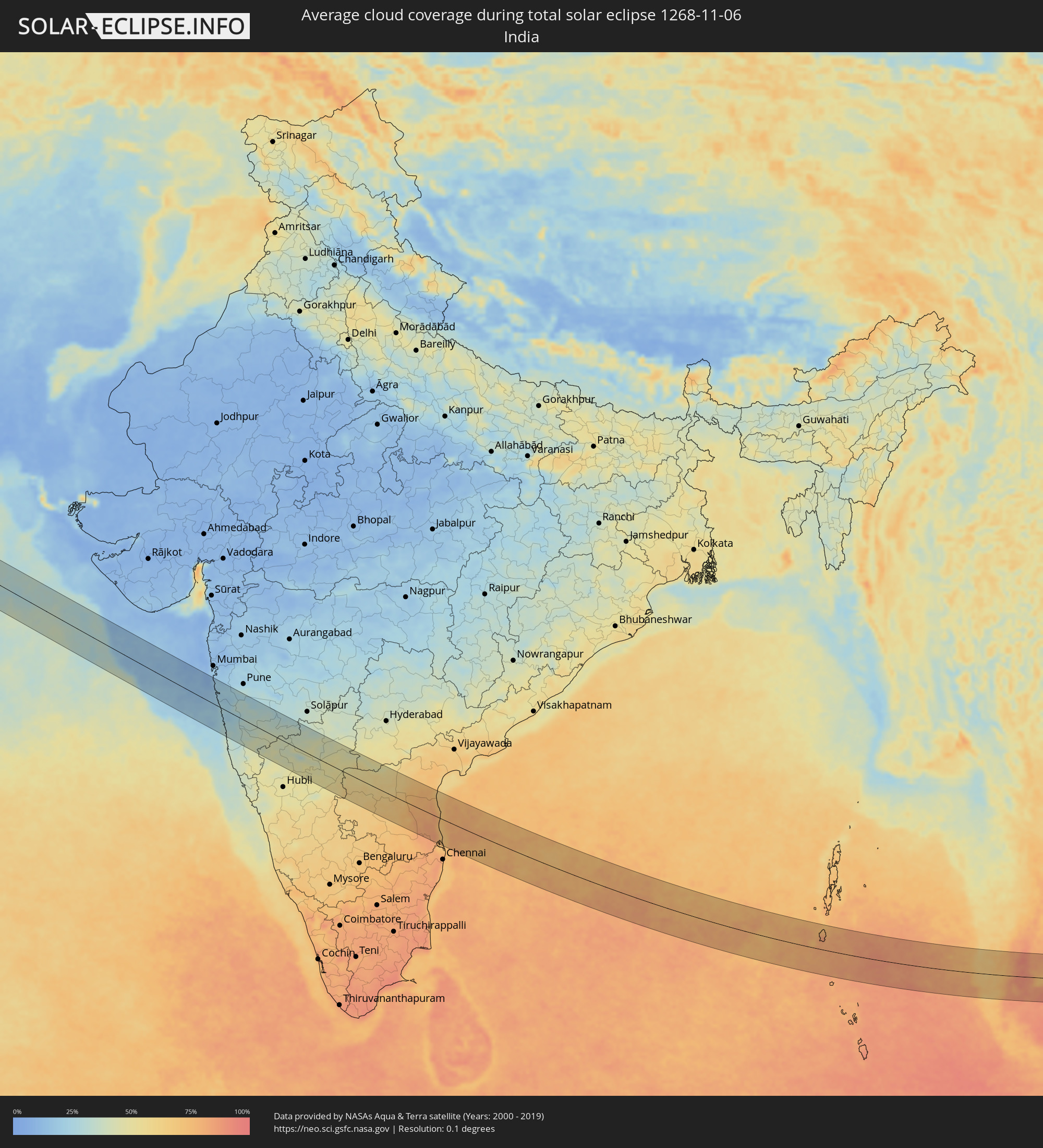 Indien
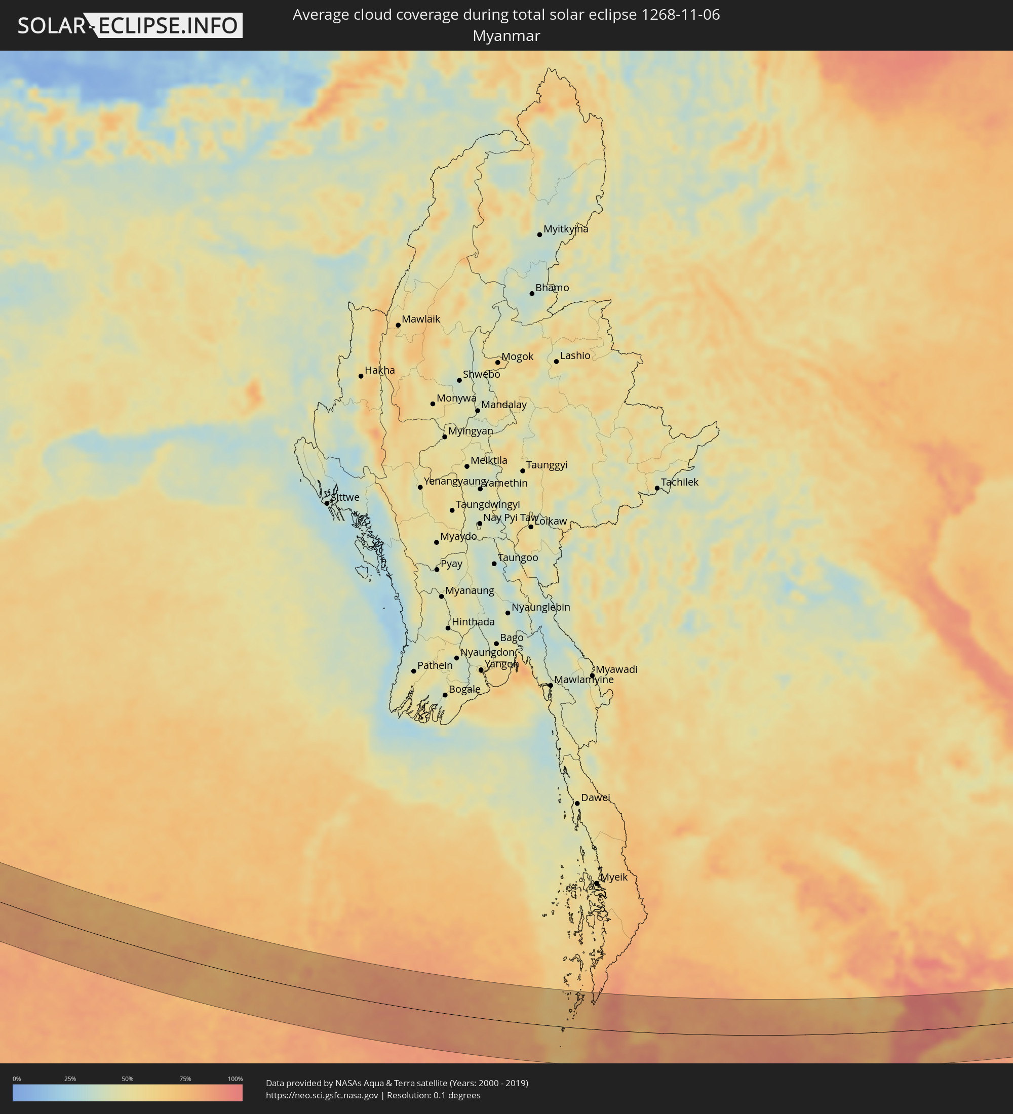 Myanmar
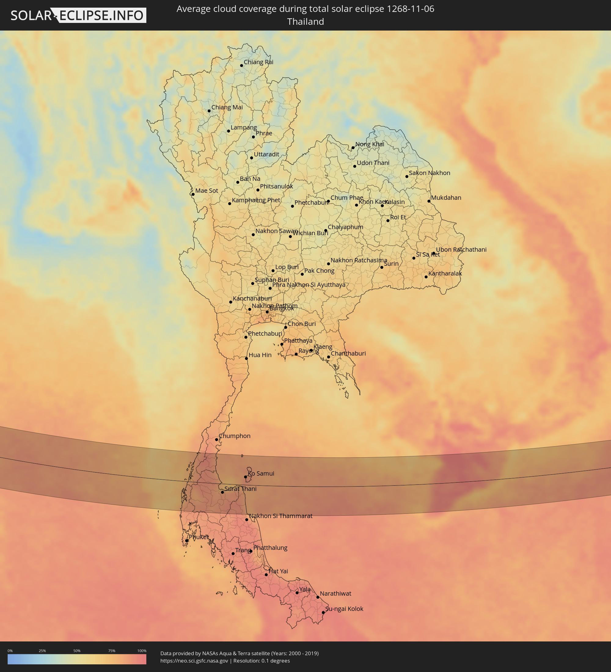 Thailand
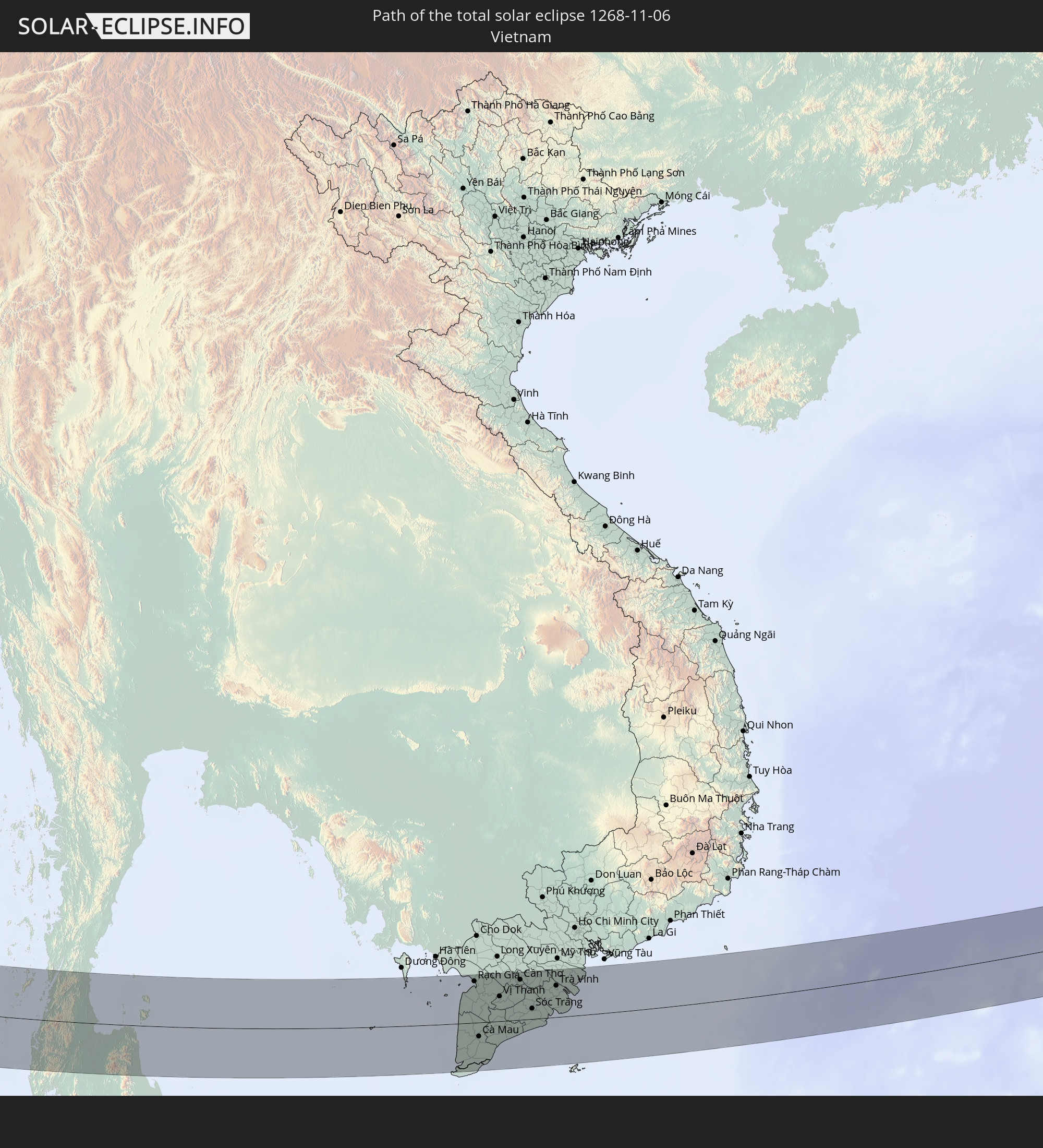
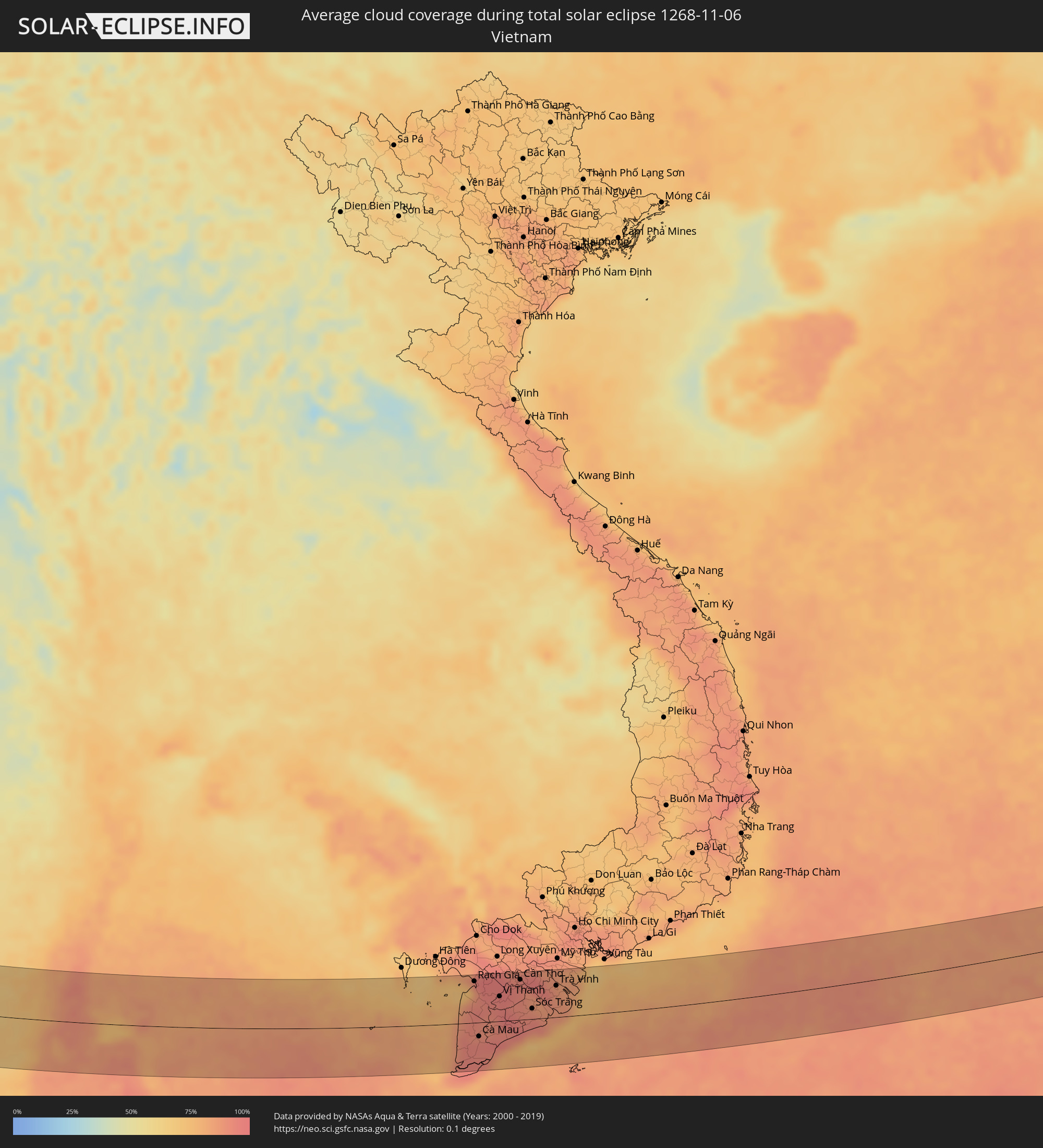 Vietnam
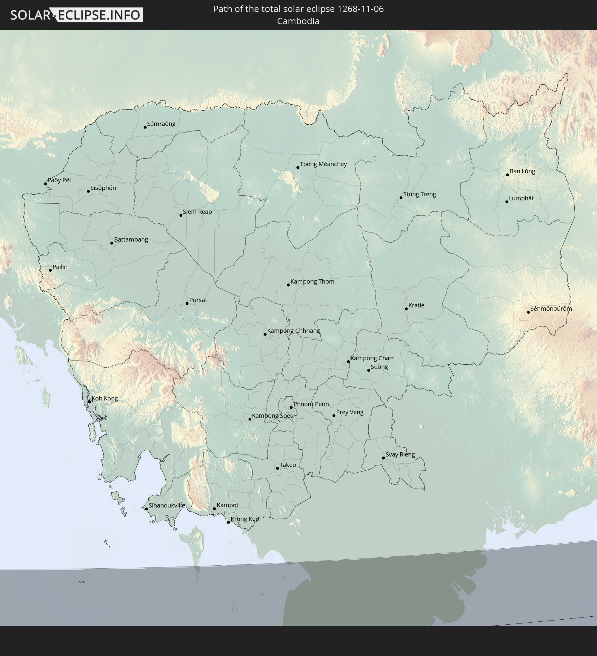
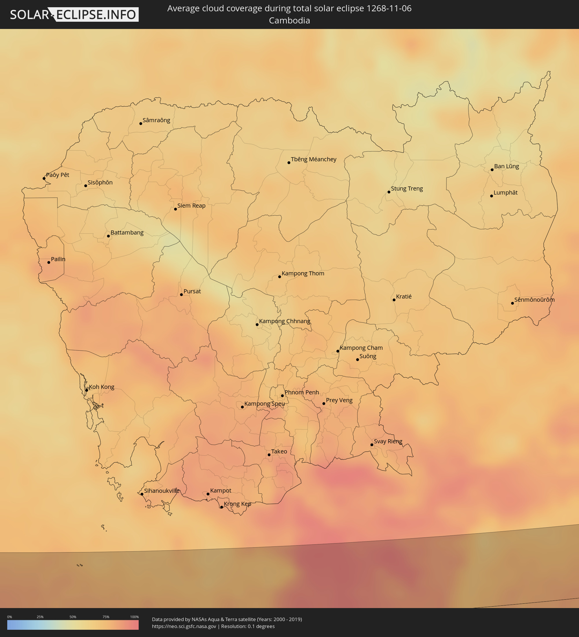 Kambodscha
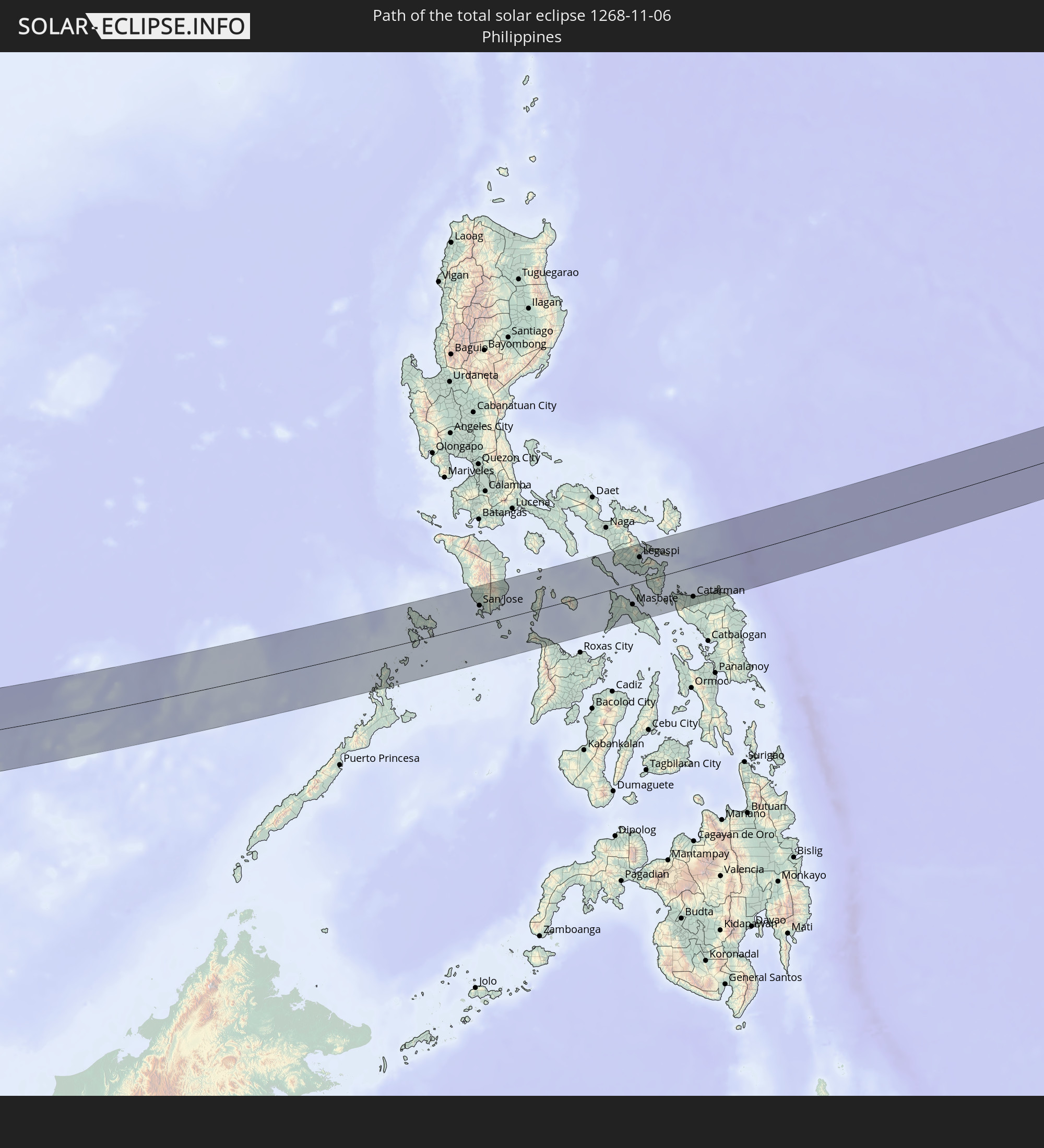
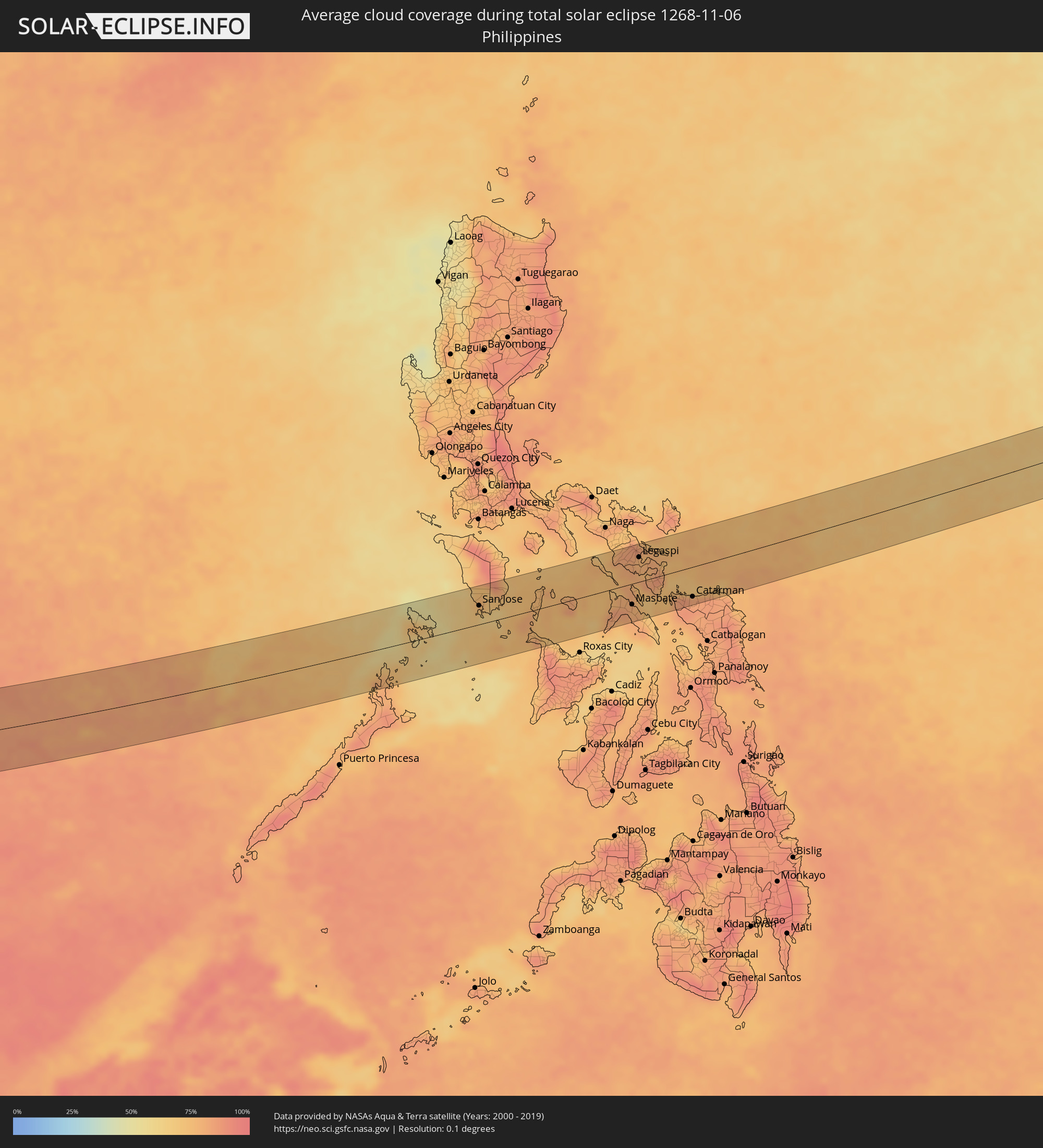 Philippinen
Orte im Finsternispfad
Die nachfolgene Tabelle zeigt Städte und Orte mit mehr als 5.000 Einwohnern, die sich im Finsternispfad befinden. Städte mit mehr als 100.000 Einwohnern sind dick gekennzeichnet. Mit einem Klick auf den Ort öffnet sich eine Detailkarte die die Lage des jeweiligen Ortes zusammen mit dem Verlauf der zentralen Finsternis präsentiert.
| Ort | Typ | Dauer der Verfinsterung | Ortszeit bei maximaler Verfinsterung | Entfernung zur Zentrallinie | Ø Bewölkung |
|
Belek, Antalya
|
total | - | 06:36:21 UTC+01:56 | 17 km | 43% |
|
Serik, Antalya
|
total | - | 06:36:24 UTC+01:56 | 14 km | 43% |
|
Side, Antalya
|
total | - | 06:36:22 UTC+01:56 | 11 km | 45% |
|
Manavgat, Antalya
|
total | - | 06:36:24 UTC+01:56 | 8 km | 45% |
|
İbradı, Antalya
|
total | - | 06:36:39 UTC+01:56 | 30 km | 43% |
|
Avsallar, Antalya
|
total | - | 06:36:22 UTC+01:56 | 13 km | 41% |
|
Akseki, Antalya
|
total | - | 06:36:40 UTC+01:56 | 32 km | 42% |
|
Alanya, Antalya
|
total | - | 06:36:23 UTC+01:56 | 13 km | 41% |
|
Mahmutlar, Antalya
|
total | - | 06:36:22 UTC+01:56 | 14 km | 41% |
|
Gazipaşa, Antalya
|
total | - | 06:36:17 UTC+01:56 | 29 km | 43% |
|
Hadim, Konya
|
total | - | 06:36:48 UTC+01:56 | 49 km | 49% |
|
Taşkent, Konya
|
total | - | 06:36:46 UTC+01:56 | 44 km | 50% |
|
Sarıveliler, Karaman
|
total | - | 06:36:39 UTC+01:56 | 25 km | 49% |
|
Anamur, Mersin
|
total | - | 06:36:18 UTC+01:56 | 30 km | 52% |
|
Ermenek, Karaman
|
total | - | 06:36:41 UTC+01:56 | 29 km | 50% |
|
Bozyazı, Mersin
|
total | - | 06:36:22 UTC+01:56 | 23 km | 49% |
|
Aydıncık, Mersin
|
total | - | 06:36:29 UTC+01:56 | 6 km | 46% |
|
Gülnar, Mersin
|
total | - | 06:36:38 UTC+01:56 | 17 km | 47% |
|
Mut, Mersin
|
total | - | 06:36:51 UTC+01:56 | 49 km | 55% |
|
Silifke, Mersin
|
total | - | 06:36:50 UTC+01:56 | 40 km | 52% |
|
Rizokárpaso, Ammochostos
|
total | - | 06:53:01 UTC+02:13 | 23 km | 51% |
|
Latakia, Latakia
|
total | - | 07:05:12 UTC+02:25 | 23 km | 45% |
|
Tartouss, Tartus
|
total | - | 07:04:51 UTC+02:25 | 39 km | 48% |
|
Jablah, Latakia
|
total | - | 07:05:09 UTC+02:25 | 11 km | 48% |
|
Bāniyās, Tartus
|
total | - | 07:05:02 UTC+02:25 | 7 km | 49% |
|
Satita, Tartus
|
total | - | 07:04:53 UTC+02:25 | 37 km | 46% |
|
Tallkalakh, Homs
|
total | - | 07:04:51 UTC+02:25 | 47 km | 44% |
|
Maşyāf, Hama
|
total | - | 07:05:07 UTC+02:25 | 4 km | 51% |
|
Al Quşayr, Homs
|
total | - | 07:04:53 UTC+02:25 | 51 km | 45% |
|
Kafr Zaytā, Hama
|
total | - | 07:05:25 UTC+02:25 | 38 km | 47% |
|
Ḩalfāyā, Hama
|
total | - | 07:05:20 UTC+02:25 | 26 km | 46% |
|
Khān Shaykhūn, Idlib
|
total | - | 07:05:28 UTC+02:25 | 46 km | 45% |
|
Ţayyibat al Imām, Hama
|
total | - | 07:05:23 UTC+02:25 | 31 km | 46% |
|
Homs, Homs
|
total | - | 07:05:04 UTC+02:25 | 23 km | 43% |
|
Tallbīsah, Homs
|
total | - | 07:05:09 UTC+02:25 | 12 km | 48% |
|
Ar Rastan, Homs
|
total | - | 07:05:12 UTC+02:25 | 3 km | 44% |
|
Souran, Hama
|
total | - | 07:05:25 UTC+02:25 | 35 km | 46% |
|
Ḩamāh, Hama
|
total | - | 07:05:19 UTC+02:25 | 19 km | 46% |
|
As Salamīyah, Hama
|
total | - | 07:05:22 UTC+02:25 | 18 km | 41% |
|
Al Qaryatayn, Homs
|
total | - | 07:05:00 UTC+02:25 | 54 km | 34% |
|
Tadmur, Homs
|
total | - | 07:05:38 UTC+02:25 | 20 km | 41% |
|
Karbala, Karbalāʼ
|
total | - | 07:40:09 UTC+02:57 | 56 km | 45% |
|
Al Hindīyah, Karbalāʼ
|
total | - | 07:40:15 UTC+02:57 | 57 km | 53% |
|
Najaf, An Najaf
|
total | - | 07:40:05 UTC+02:57 | 10 km | 47% |
|
Al Ḩillah, Bābil
|
total | - | 07:40:20 UTC+02:57 | 57 km | 57% |
|
Kufa, An Najaf
|
total | - | 07:40:10 UTC+02:57 | 17 km | 53% |
|
Al Mishkhāb, An Najaf
|
total | - | 07:40:05 UTC+02:57 | 6 km | 48% |
|
Ash Shāmīyah, Al Qādisīyah
|
total | - | 07:40:14 UTC+02:57 | 15 km | 47% |
|
Nahiyat Ghammas, Al Qādisīyah
|
total | - | 07:40:09 UTC+02:57 | 6 km | 45% |
|
Nāḩiyat ash Shināfīyah, Al Qādisīyah
|
total | - | 07:40:06 UTC+02:57 | 21 km | 39% |
|
Imam Qasim, Bābil
|
total | - | 07:40:26 UTC+02:57 | 52 km | 49% |
|
Ad Dīwānīyah, Al Qādisīyah
|
total | - | 07:40:28 UTC+02:57 | 32 km | 47% |
|
Ar Rumaythah, Al Muthanná
|
total | - | 07:40:27 UTC+02:57 | 3 km | 49% |
|
As Samawah, Al Muthanná
|
total | - | 07:40:26 UTC+02:57 | 19 km | 39% |
|
Ash Shaţrah, Dhi Qar
|
total | - | 07:41:06 UTC+02:57 | 27 km | 42% |
|
An Nāşirīyah, Dhi Qar
|
total | - | 07:41:01 UTC+02:57 | 5 km | 43% |
|
Az Zubayr, Basra Governorate
|
total | - | 07:41:52 UTC+02:57 | 8 km | 29% |
|
Al Hārithah, Basra Governorate
|
total | - | 07:41:59 UTC+02:57 | 14 km | 38% |
|
Basrah, Basra Governorate
|
total | - | 07:41:59 UTC+02:57 | 7 km | 32% |
|
Umm Qaşr, Basra Governorate
|
total | - | 07:41:55 UTC+02:57 | 34 km | 33% |
|
Khorramshahr, Khuzestan
|
total | - | 08:10:25 UTC+03:25 | 18 km | 37% |
|
Abadan, Khuzestan
|
total | - | 08:10:28 UTC+03:25 | 13 km | 33% |
|
Al Fāw, Basra Governorate
|
total | - | 07:42:21 UTC+02:57 | 16 km | 41% |
|
Shādegān, Khuzestan
|
total | - | 08:10:53 UTC+03:25 | 60 km | 39% |
|
Khārk, Bushehr
|
total | - | 08:11:53 UTC+03:25 | 3 km | 39% |
|
Bandar-e Ganāveh, Bushehr
|
total | - | 08:12:09 UTC+03:25 | 37 km | 36% |
|
Bandar-e Būshehr, Bushehr
|
total | - | 08:12:16 UTC+03:25 | 9 km | 35% |
|
Borāzjān, Bushehr
|
total | - | 08:12:42 UTC+03:25 | 38 km | 33% |
|
Fīrūzābād, Fars
|
total | - | 08:13:55 UTC+03:25 | 58 km | 25% |
|
Gerāsh, Fars
|
total | - | 08:15:17 UTC+03:25 | 15 km | 14% |
|
Bandar-e Lengeh, Hormozgan
|
total | - | 08:15:56 UTC+03:25 | 58 km | 11% |
|
Khasab, Musandam
|
total | - | 08:32:56 UTC+03:41 | 30 km | 11% |
|
Qeshm, Hormozgan
|
total | - | 08:17:36 UTC+03:25 | 46 km | 20% |
|
Roha, Maharashtra
|
total | - | 10:42:52 UTC+05:21 | 62 km | 22% |
|
Ratnagiri, Maharashtra
|
total | - | 10:44:00 UTC+05:21 | 70 km | 34% |
|
Satara, Maharashtra
|
total | - | 10:45:13 UTC+05:21 | 33 km | 31% |
|
Kolhāpur, Maharashtra
|
total | - | 10:46:17 UTC+05:21 | 53 km | 42% |
|
Ichalkaranji, Maharashtra
|
total | - | 10:46:49 UTC+05:21 | 42 km | 40% |
|
Sāngli, Maharashtra
|
total | - | 10:46:59 UTC+05:21 | 21 km | 41% |
|
Bagalkot, Karnataka
|
total | - | 10:50:03 UTC+05:21 | 31 km | 46% |
|
Bijapur, Karnataka
|
total | - | 10:49:44 UTC+05:21 | 33 km | 41% |
|
Gangāwati, Karnataka
|
total | - | 10:52:33 UTC+05:21 | 66 km | 49% |
|
Bellary, Karnataka
|
total | - | 10:53:43 UTC+05:21 | 75 km | 58% |
|
Ādoni, Andhra Pradesh
|
total | - | 10:54:18 UTC+05:21 | 10 km | 57% |
|
Rāichūr, Karnataka
|
total | - | 10:54:09 UTC+05:21 | 51 km | 52% |
|
Guntakal Junction, Andhra Pradesh
|
total | - | 10:54:49 UTC+05:21 | 52 km | 59% |
|
Emmiganūr, Andhra Pradesh
|
total | - | 10:54:45 UTC+05:21 | 14 km | 54% |
|
Tādpatri, Andhra Pradesh
|
total | - | 10:56:39 UTC+05:21 | 47 km | 65% |
|
Nandyāl, Andhra Pradesh
|
total | - | 10:57:30 UTC+05:21 | 33 km | 60% |
|
Proddatūr, Andhra Pradesh
|
total | - | 10:58:08 UTC+05:21 | 38 km | 66% |
|
Cuddapah, Andhra Pradesh
|
total | - | 10:59:03 UTC+05:21 | 52 km | 68% |
|
Nellore, Andhra Pradesh
|
total | - | 11:02:09 UTC+05:21 | 2 km | 82% |
|
Kāvali, Andhra Pradesh
|
total | - | 11:01:52 UTC+05:21 | 45 km | 77% |
|
Ranong, Ranong
|
total | - | 13:21:10 UTC+06:42 | 62 km | 81% |
|
Ban Nam Yuen, Chumphon
|
total | - | 13:21:53 UTC+06:42 | 53 km | 88% |
|
Lang Suan, Chumphon
|
total | - | 13:22:27 UTC+06:42 | 63 km | 87% |
|
Chaiya, Surat Thani
|
total | - | 13:23:10 UTC+06:42 | 1 km | 84% |
|
Phunphin, Surat Thani
|
total | - | 13:23:27 UTC+06:42 | 29 km | 85% |
|
Surat Thani, Surat Thani
|
total | - | 13:23:43 UTC+06:42 | 25 km | 86% |
|
Ban Na San, Surat Thani
|
total | - | 13:24:02 UTC+06:42 | 63 km | 89% |
|
Wiang Sa, Surat Thani
|
total | - | 13:24:09 UTC+06:42 | 81 km | 88% |
|
Don Sak, Surat Thani
|
total | - | 13:24:36 UTC+06:42 | 4 km | 82% |
|
Ko Samui, Surat Thani
|
total | - | 13:25:07 UTC+06:42 | 22 km | 87% |
|
Ko Pha Ngan, Nakhon Si Thammarat
|
total | - | 13:25:14 UTC+06:42 | 47 km | 86% |
|
Rạch Giá, Kiến Giang
|
total | - | 14:02:55 UTC+07:06 | 70 km | 87% |
|
Cà Mau, Cà Mau
|
total | - | 14:03:36 UTC+07:06 | 24 km | 94% |
|
Vị Thanh, Hau Giang
|
total | - | 14:04:00 UTC+07:06 | 42 km | 96% |
|
Thành phố Bạc Liêu, Bạc Liêu
|
total | - | 14:04:56 UTC+07:06 | 14 km | 94% |
|
Cần Thơ, Cần Thơ
|
total | - | 14:04:37 UTC+07:06 | 68 km | 93% |
|
Sóc Trăng, Sóc Trăng
|
total | - | 14:05:20 UTC+07:06 | 18 km | 92% |
|
Trà Vinh, Trà Vinh
|
total | - | 14:06:00 UTC+07:06 | 53 km | 87% |
|
El Nido, Mimaropa
|
total | - | 15:23:40 UTC+08:00 | 49 km | 79% |
|
Coron, Mimaropa
|
total | - | 15:24:23 UTC+08:00 | 18 km | 64% |
|
Calintaan, Mimaropa
|
total | - | 15:25:04 UTC+08:00 | 60 km | 65% |
|
San Jose, Mimaropa
|
total | - | 15:25:23 UTC+08:00 | 33 km | 70% |
|
Bulalacao, Mimaropa
|
total | - | 15:25:46 UTC+08:00 | 23 km | 63% |
|
Mansalay, Mimaropa
|
total | - | 15:25:47 UTC+08:00 | 41 km | 71% |
|
Pandan, Western Visayas
|
total | - | 15:27:05 UTC+08:00 | 61 km | 80% |
|
Romblon, Mimaropa
|
total | - | 15:26:51 UTC+08:00 | 24 km | 74% |
|
Pio Duran, Bicol
|
total | - | 15:28:04 UTC+08:00 | 40 km | 78% |
|
Polangui, Bicol
|
total | - | 15:27:58 UTC+08:00 | 67 km | 82% |
|
Masbate, Bicol
|
total | - | 15:28:39 UTC+08:00 | 36 km | 78% |
|
Pilar, Bicol
|
total | - | 15:28:24 UTC+08:00 | 22 km | 78% |
|
Tabaco, Bicol
|
total | - | 15:28:13 UTC+08:00 | 67 km | 82% |
|
Legaspi, Bicol
|
total | - | 15:28:21 UTC+08:00 | 43 km | 77% |
|
Bulan, Bicol
|
total | - | 15:28:47 UTC+08:00 | 11 km | 82% |
|
Sorsogon, Bicol
|
total | - | 15:28:45 UTC+08:00 | 18 km | 81% |
|
Irosin, Bicol
|
total | - | 15:28:57 UTC+08:00 | 13 km | 81% |
|
Gubat, Bicol
|
total | - | 15:28:56 UTC+08:00 | 8 km | 80% |
|
Catarman, Eastern Visayas
|
total | - | 15:29:46 UTC+08:00 | 52 km | 82% |
|
Laoang, Eastern Visayas
|
total | - | 15:30:10 UTC+08:00 | 55 km | 75% |