Hybride Sonnenfinsternis vom 04.06.1285
| Wochentag: | Montag |
| Maximale Dauer der Verfinsterung: | 01m15s |
| Maximale Breite des Finsternispfades: | 54 km |
| Saroszyklus: | 106 |
| Bedeckungsgrad: | 100% |
| Magnitude: | 1.0143 |
| Gamma: | 0.4024 |
Wo kann man die Sonnenfinsternis vom 04.06.1285 sehen?
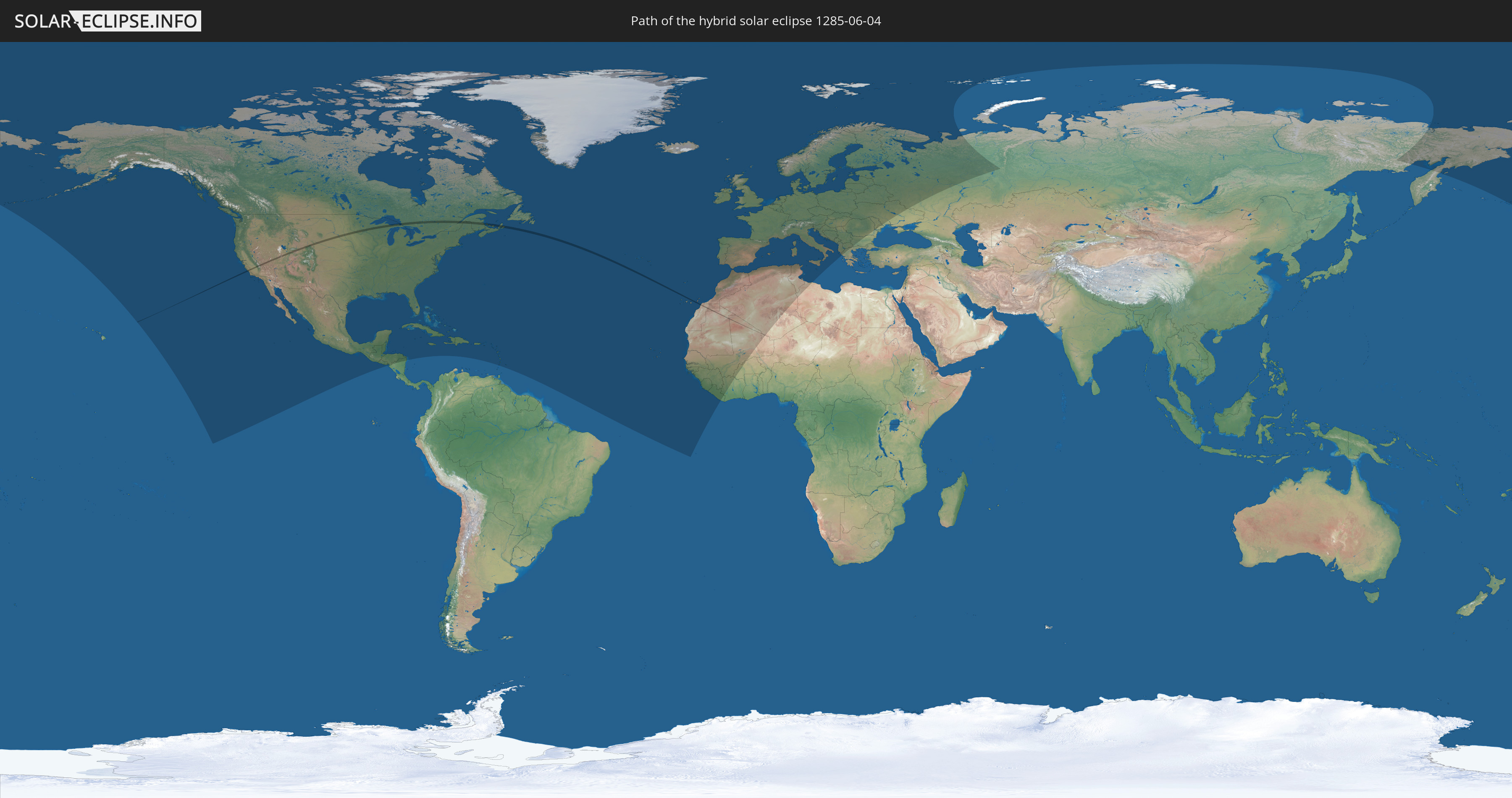
Die Sonnenfinsternis am 04.06.1285 kann man in 100 Ländern als partielle Sonnenfinsternis beobachten.
Der Finsternispfad verläuft durch 6 Länder. Nur in diesen Ländern ist sie als hybride Sonnenfinsternis zu sehen.
In den folgenden Ländern ist die Sonnenfinsternis hybrid zu sehen
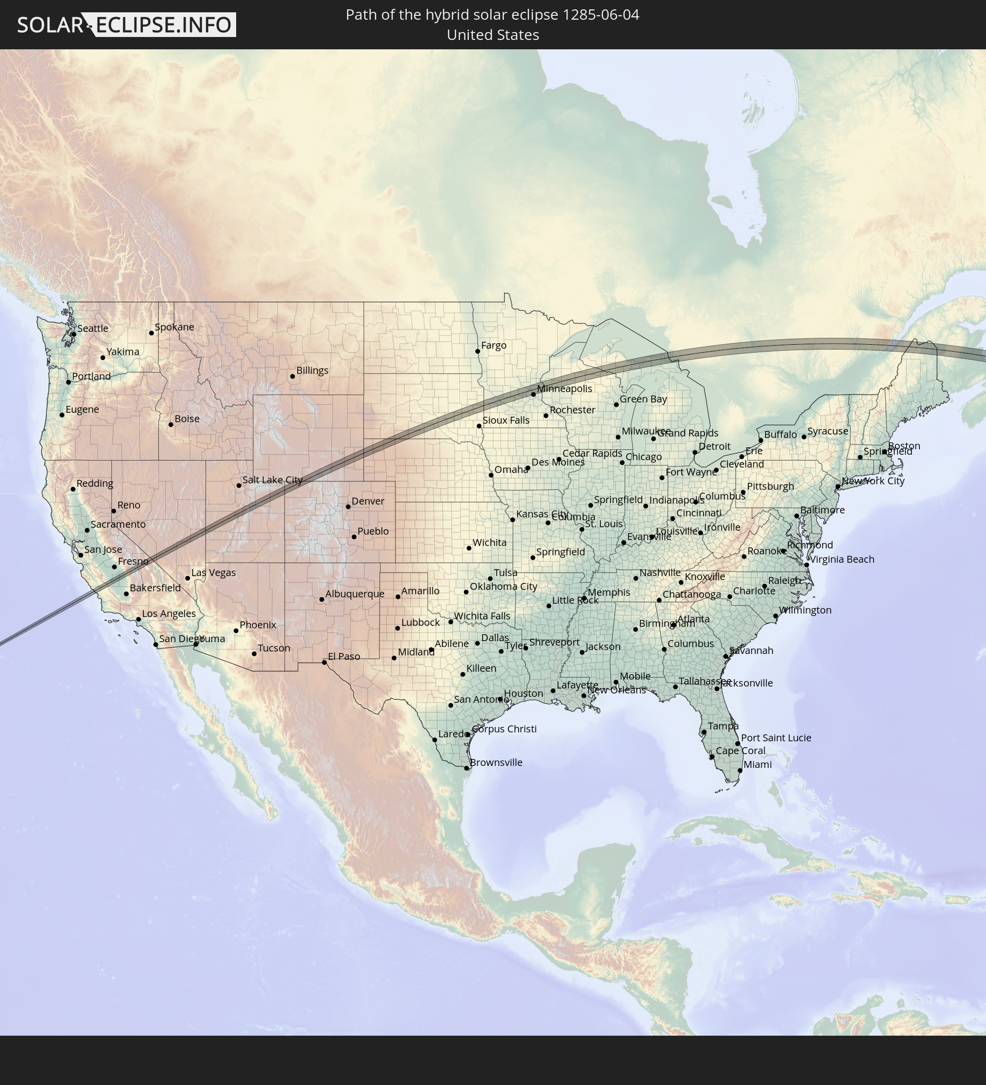 Vereinigte Staaten
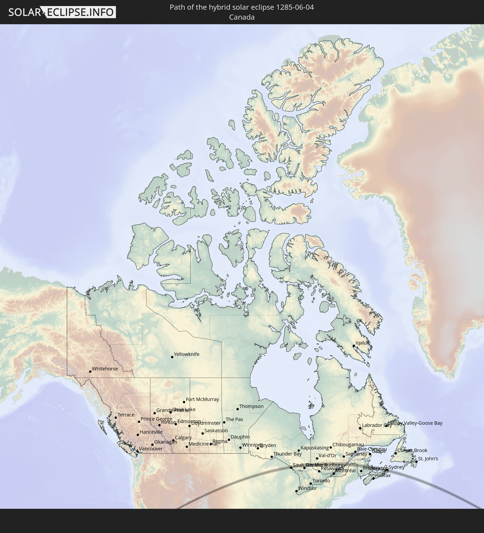 Kanada
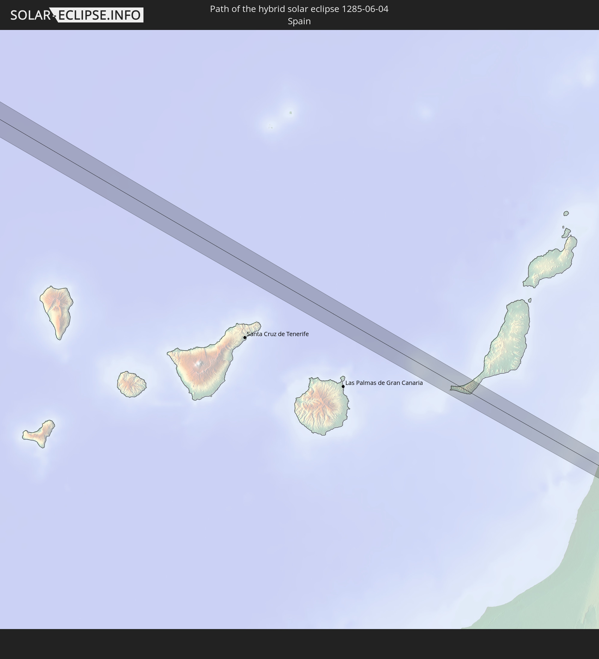 Spanien
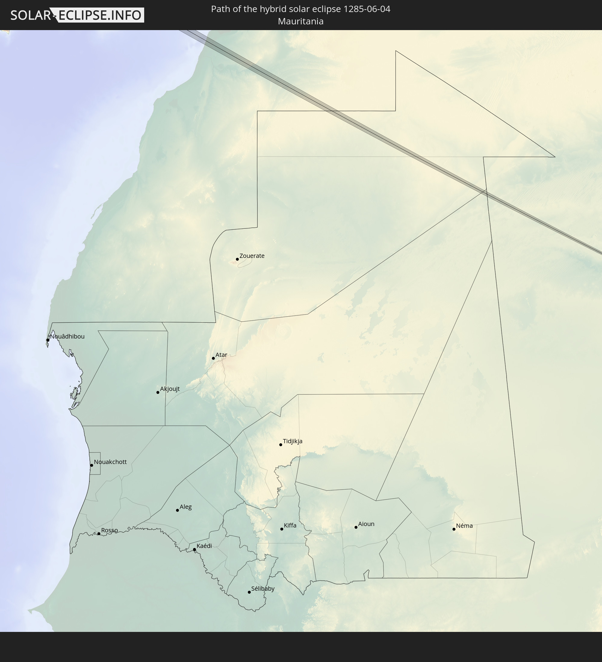 Mauretanien
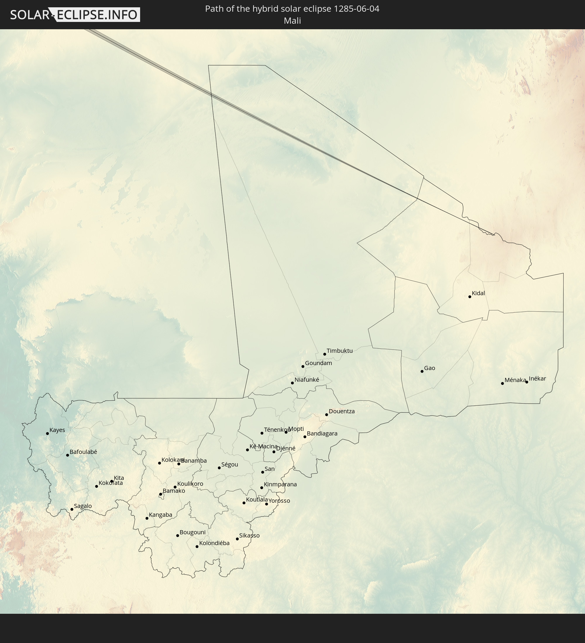 Mali
Mali
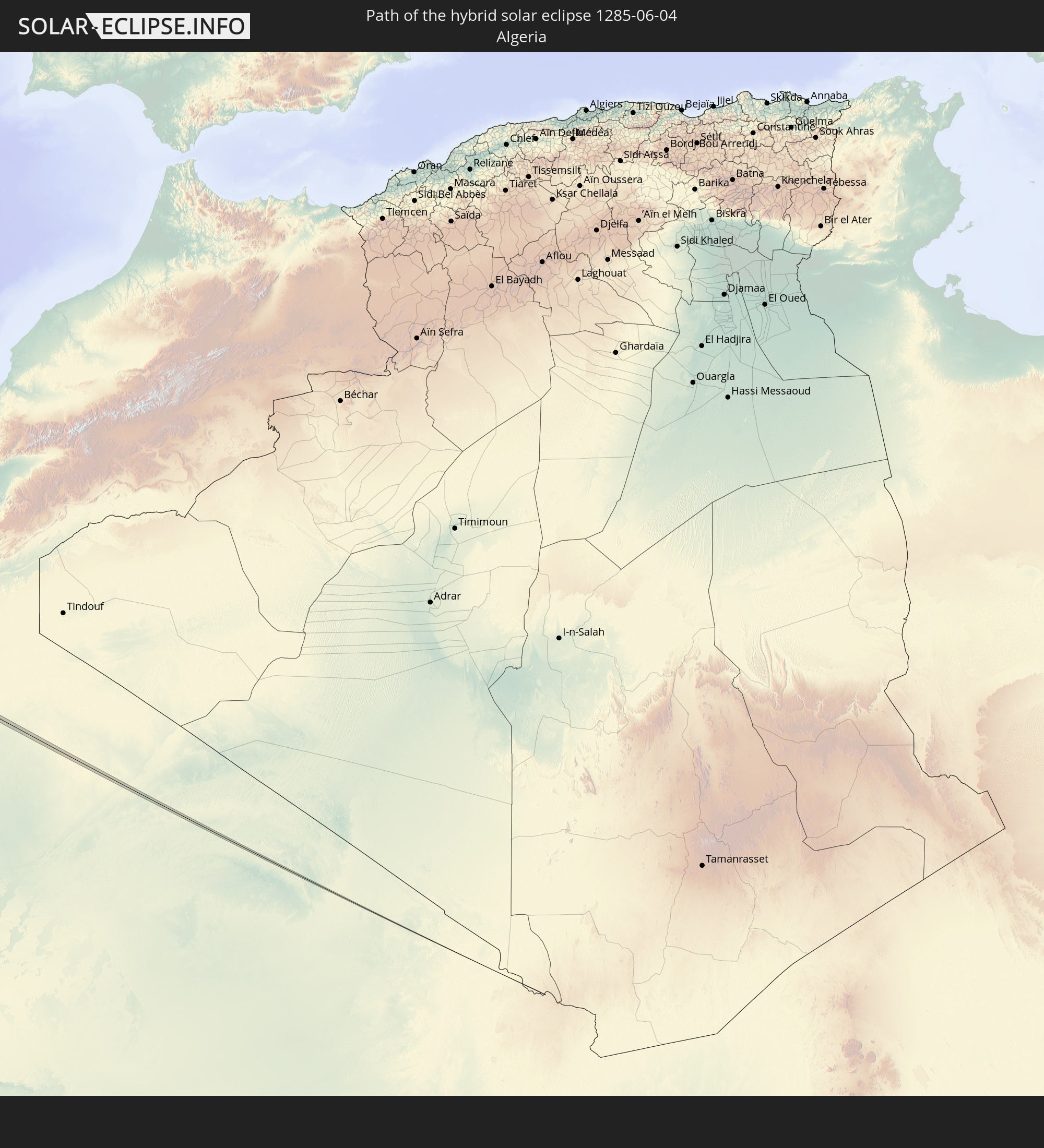 Algerien
In den folgenden Ländern ist die Sonnenfinsternis partiell zu sehen
 Russland
 Vereinigte Staaten
 United States Minor Outlying Islands
 Kanada
 Mexiko
 Grönland
 Guatemala
 El Salvador
 Honduras
 Belize
 Nicaragua
 Kuba
Kuba
 Kaimaninseln
 Bahamas
 Jamaika
 Haiti
Haiti
 Turks- und Caicosinseln
 Dominikanische Republik
 Puerto Rico
 Amerikanische Jungferninseln
 Bermuda
 Britische Jungferninseln
 Anguilla
 Saint-Martin
 Saint-Barthélemy
 St. Kitts und Nevis
 Antigua und Barbuda
 Montserrat
 Guadeloupe
 Dominica
 St. Vincent und die Grenadinen
 Martinique
 St. Lucia
 Barbados
 Saint-Pierre und Miquelon
 Portugal
 Kap Verde
 Island
 Spanien
 Senegal
 Mauretanien
 Gambia
 Guinea-Bissau
 Guinea
 Sierra Leone
 Marokko
 Mali
Mali
 Liberia
 Irland
 Spitzbergen
 Algerien
 Vereinigtes Königreich
 Elfenbeinküste
 Färöer
 Burkina Faso
 Gibraltar
 Frankreich
 Isle of Man
 Guernsey
 Jersey
 Andorra
 Belgien
 Niederlande
 Norwegen
 Luxemburg
 Deutschland
 Schweiz
 Italien
 Monaco
 Tunesien
 Dänemark
 Libyen
 Liechtenstein
 Österreich
 Schweden
 Tschechien
 San Marino
 Vatikanstadt
 Slowenien
 Kroatien
 Polen
Polen
 Malta
Malta
 Bosnien und Herzegowina
 Ungarn
 Slowakei
 Montenegro
 Serbien
 Albanien
 Åland Islands
 Griechenland
 Rumänien
 Mazedonien
 Finnland
 Litauen
 Lettland
 Estland
 Ukraine
 Bulgarien
 Weißrussland
 Moldawien
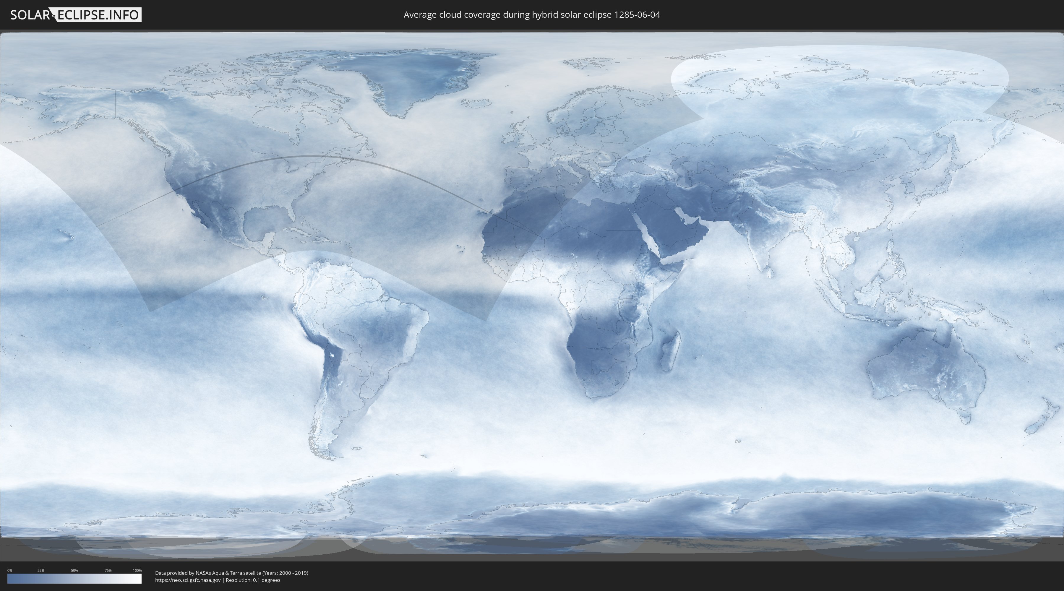
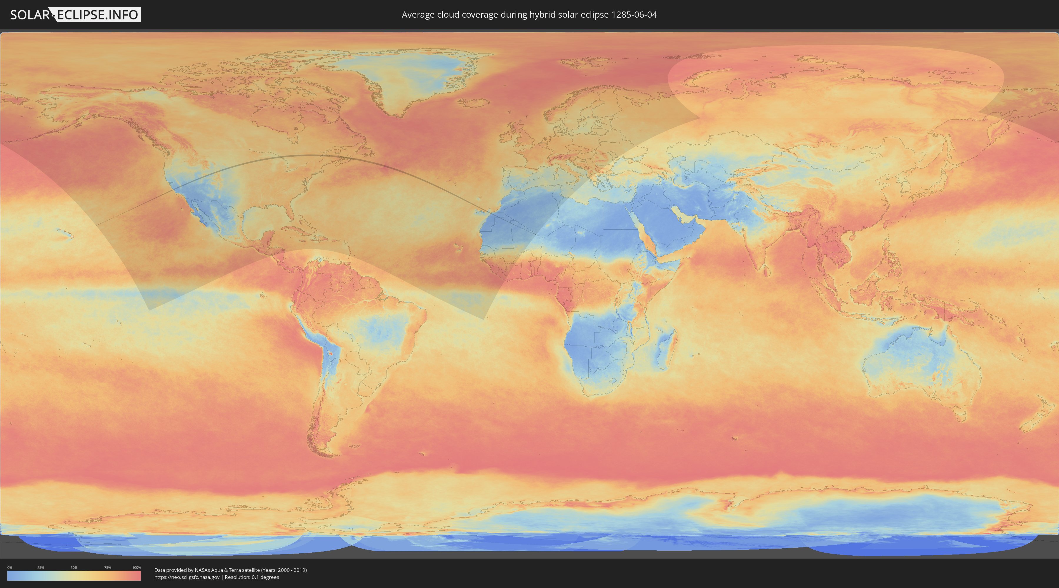
Wie wird das Wetter während der hybriden Sonnenfinsternis am 04.06.1285?
Wo ist der beste Ort, um die hybride Sonnenfinsternis vom 04.06.1285 zu beobachten?
Die folgenden Karten zeigen die durchschnittliche Bewölkung für den Tag, an dem die hybride Sonnenfinsternis
stattfindet. Mit Hilfe der Karten lässt sich der Ort entlang des Finsternispfades eingrenzen,
der die besten Aussichen auf einen klaren wolkenfreien Himmel bietet.
Trotzdem muss man immer lokale Gegenenheiten beachten und sollte sich genau über das Wetter an seinem
gewählten Beobachtungsort informieren.
Die Daten stammen von den beiden NASA-Satelliten
AQUA und TERRA
und wurden über einen Zeitraum von 19 Jahren (2000 - 2019) gemittelt.
Detaillierte Länderkarten
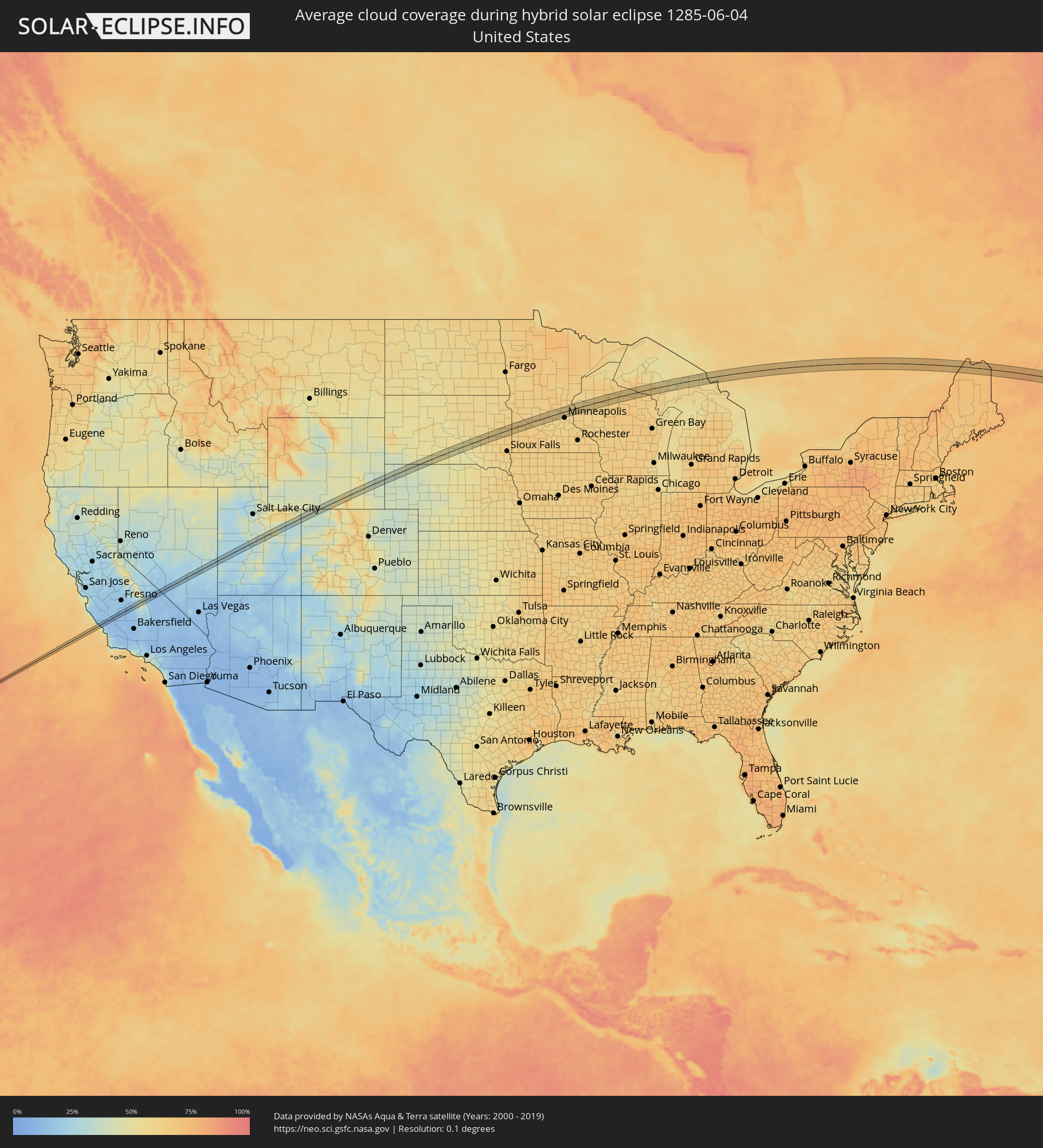 Vereinigte Staaten
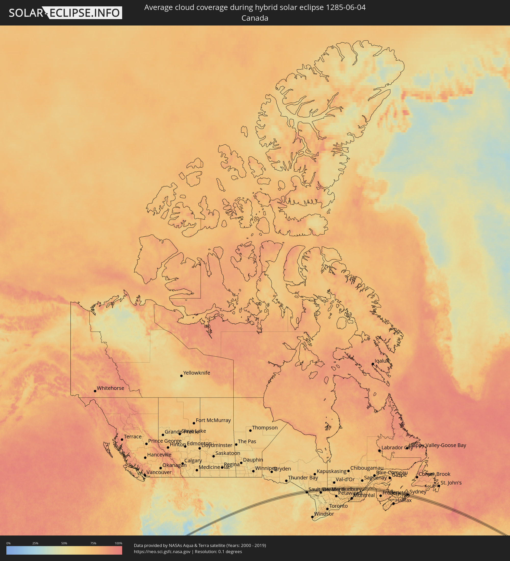 Kanada
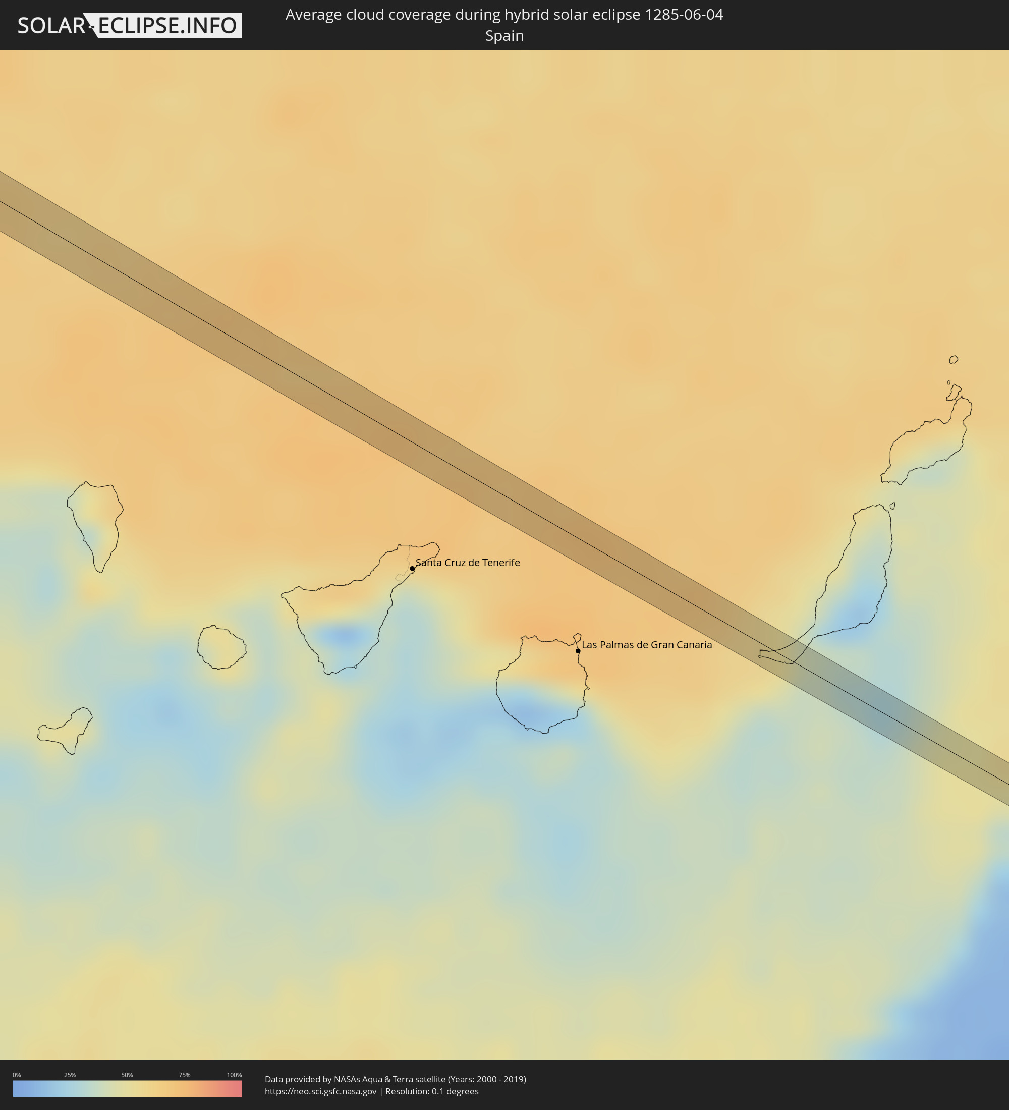 Spanien
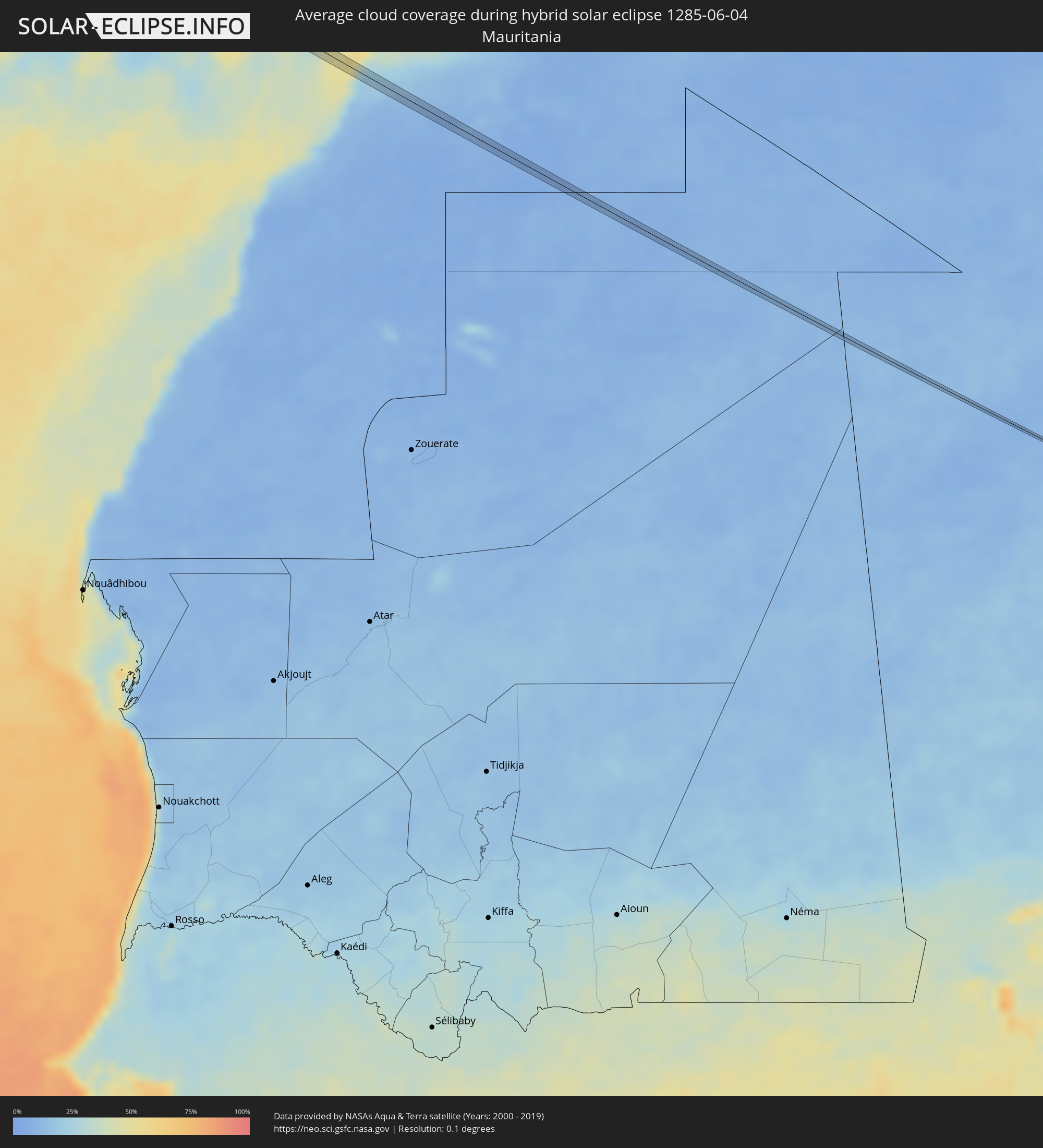 Mauretanien
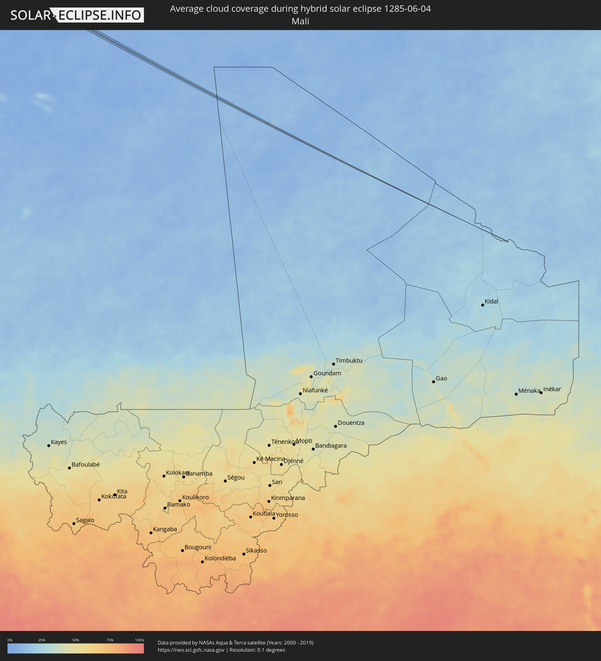 Mali
Mali
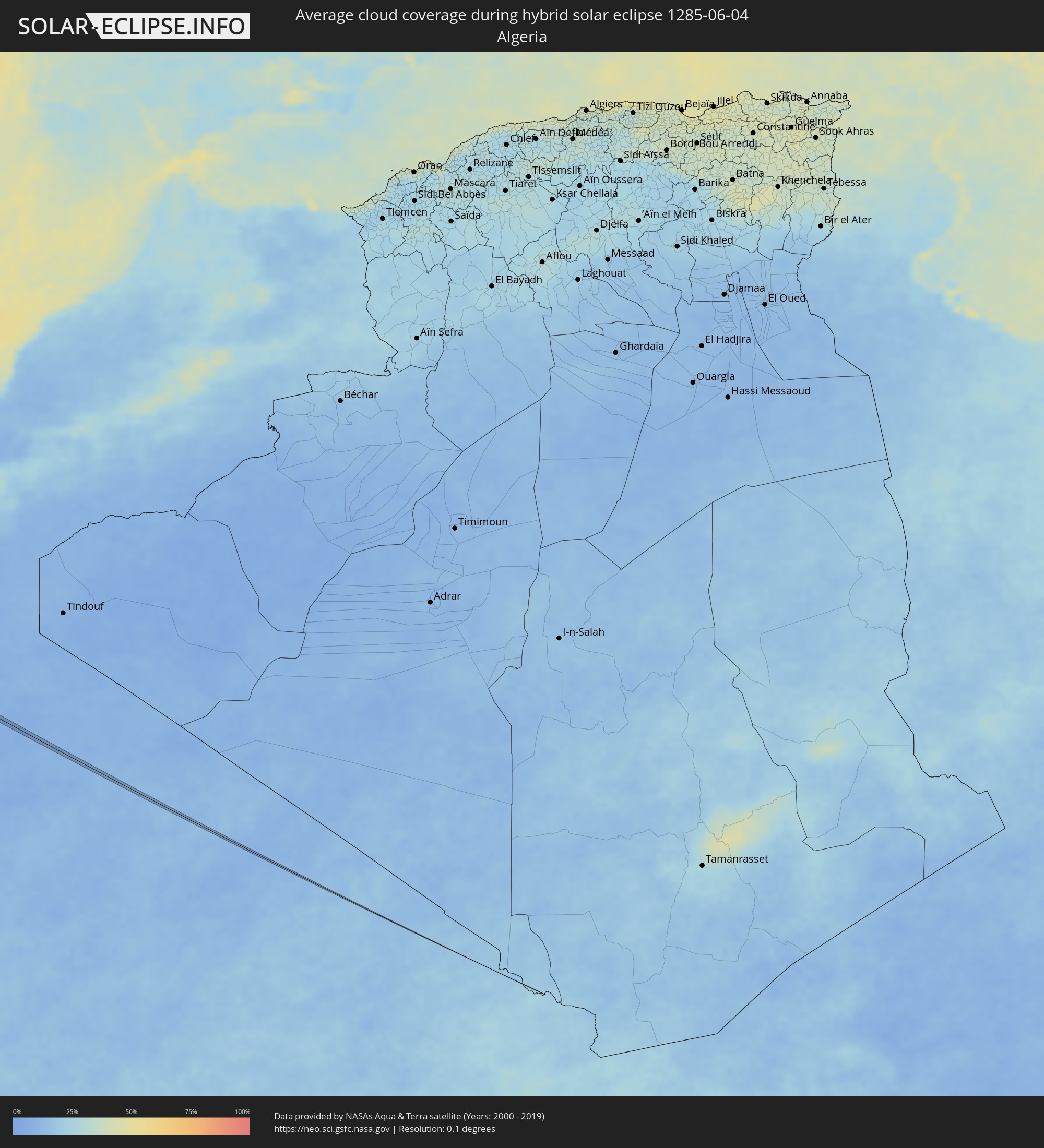 Algerien
Orte im Finsternispfad
Die nachfolgene Tabelle zeigt Städte und Orte mit mehr als 5.000 Einwohnern, die sich im Finsternispfad befinden. Städte mit mehr als 100.000 Einwohnern sind dick gekennzeichnet. Mit einem Klick auf den Ort öffnet sich eine Detailkarte die die Lage des jeweiligen Ortes zusammen mit dem Verlauf der zentralen Finsternis präsentiert.
| Ort | Typ | Dauer der Verfinsterung | Ortszeit bei maximaler Verfinsterung | Entfernung zur Zentrallinie | Ø Bewölkung |
|
Cambria, California
|
total | - | 07:19:35 UTC-08:00 | 2 km | 44% |
|
Paso Robles, California
|
total | - | 07:19:52 UTC-08:00 | 10 km | 15% |
|
Avenal, California
|
total | - | 07:20:42 UTC-08:00 | 3 km | 14% |
|
Hanford, California
|
total | - | 07:21:25 UTC-08:00 | 13 km | 13% |
|
Corcoran, California
|
total | - | 07:21:08 UTC-08:00 | 13 km | 11% |
|
Tulare, California
|
total | - | 07:21:25 UTC-08:00 | 12 km | 13% |
|
Visalia, California
|
total | - | 07:21:37 UTC-08:00 | 2 km | 15% |
|
Farmersville, California
|
total | - | 07:21:37 UTC-08:00 | 9 km | 15% |
|
Exeter, California
|
total | - | 07:21:40 UTC-08:00 | 12 km | 16% |
|
Woodlake, California
|
total | - | 07:21:51 UTC-08:00 | 2 km | 17% |
|
Roosevelt, Utah
|
total | - | 08:34:35 UTC-07:00 | 8 km | 34% |
|
Vernal, Utah
|
total | - | 08:35:15 UTC-07:00 | 6 km | 37% |
|
Chadron, Nebraska
|
total | - | 08:45:58 UTC-07:00 | 17 km | 40% |
|
Brookings, South Dakota
|
total | - | 09:56:22 UTC-06:00 | 12 km | 63% |
|
Litchfield, Minnesota
|
total | - | 10:00:47 UTC-06:00 | 17 km | 60% |
|
Hutchinson, Minnesota
|
total | - | 10:00:44 UTC-06:00 | 12 km | 61% |
|
Buffalo, Minnesota
|
total | - | 10:01:51 UTC-06:00 | 7 km | 60% |
|
Monticello, Minnesota
|
total | - | 10:02:08 UTC-06:00 | 19 km | 60% |
|
Delano, Minnesota
|
total | - | 10:01:50 UTC-06:00 | 9 km | 58% |
|
Big Lake, Minnesota
|
total | - | 10:02:14 UTC-06:00 | 21 km | 61% |
|
Minnetrista, Minnesota
|
total | - | 10:01:49 UTC-06:00 | 22 km | 58% |
|
Mound, Minnesota
|
total | - | 10:01:54 UTC-06:00 | 23 km | 58% |
|
Saint Michael, Minnesota
|
total | - | 10:02:13 UTC-06:00 | 6 km | 59% |
|
Albertville, Minnesota
|
total | - | 10:02:16 UTC-06:00 | 8 km | 59% |
|
Orono, Minnesota
|
total | - | 10:02:02 UTC-06:00 | 21 km | 58% |
|
Otsego, Minnesota
|
total | - | 10:02:24 UTC-06:00 | 11 km | 62% |
|
Elk River, Minnesota
|
total | - | 10:02:29 UTC-06:00 | 14 km | 62% |
|
Rogers, Minnesota
|
total | - | 10:02:22 UTC-06:00 | 1 km | 60% |
|
Corcoran, Minnesota
|
total | - | 10:02:16 UTC-06:00 | 9 km | 61% |
|
Maple Grove, Minnesota
|
total | - | 10:02:23 UTC-06:00 | 14 km | 61% |
|
Plymouth, Minnesota
|
total | - | 10:02:19 UTC-06:00 | 20 km | 59% |
|
Ramsey, Minnesota
|
total | - | 10:02:37 UTC-06:00 | 6 km | 61% |
|
Champlin, Minnesota
|
total | - | 10:02:37 UTC-06:00 | 3 km | 60% |
|
Anoka, Minnesota
|
total | - | 10:02:38 UTC-06:00 | 2 km | 60% |
|
New Hope, Minnesota
|
total | - | 10:02:27 UTC-06:00 | 19 km | 61% |
|
Crystal, Minnesota
|
total | - | 10:02:29 UTC-06:00 | 20 km | 61% |
|
Saint Francis, Minnesota
|
total | - | 10:02:54 UTC-06:00 | 18 km | 61% |
|
Brooklyn Park, Minnesota
|
total | - | 10:02:34 UTC-06:00 | 14 km | 61% |
|
West Coon Rapids, Minnesota
|
total | - | 10:02:39 UTC-06:00 | 7 km | 61% |
|
Golden Valley, Minnesota
|
total | - | 10:02:29 UTC-06:00 | 23 km | 61% |
|
Robbinsdale, Minnesota
|
total | - | 10:02:31 UTC-06:00 | 21 km | 61% |
|
Brooklyn Center, Minnesota
|
total | - | 10:02:35 UTC-06:00 | 16 km | 62% |
|
Oak Grove, Minnesota
|
total | - | 10:02:54 UTC-06:00 | 12 km | 61% |
|
Andover, Minnesota
|
total | - | 10:02:50 UTC-06:00 | 0 km | 61% |
|
Coon Rapids, Minnesota
|
total | - | 10:02:42 UTC-06:00 | 12 km | 62% |
|
Fridley, Minnesota
|
total | - | 10:02:42 UTC-06:00 | 17 km | 62% |
|
Columbia Heights, Minnesota
|
total | - | 10:02:39 UTC-06:00 | 21 km | 61% |
|
Ham Lake, Minnesota
|
total | - | 10:02:55 UTC-06:00 | 1 km | 60% |
|
Spring Lake Park, Minnesota
|
total | - | 10:02:46 UTC-06:00 | 15 km | 62% |
|
Blaine, Minnesota
|
total | - | 10:02:50 UTC-06:00 | 9 km | 60% |
|
Mounds View, Minnesota
|
total | - | 10:02:49 UTC-06:00 | 16 km | 62% |
|
East Bethel, Minnesota
|
total | - | 10:03:04 UTC-06:00 | 7 km | 60% |
|
New Brighton, Minnesota
|
total | - | 10:02:47 UTC-06:00 | 20 km | 62% |
|
Arden Hills, Minnesota
|
total | - | 10:02:50 UTC-06:00 | 23 km | 62% |
|
Shoreview, Minnesota
|
total | - | 10:02:53 UTC-06:00 | 20 km | 58% |
|
Lino Lakes, Minnesota
|
total | - | 10:03:04 UTC-06:00 | 13 km | 58% |
|
Vadnais Heights, Minnesota
|
total | - | 10:02:58 UTC-06:00 | 24 km | 58% |
|
White Bear Lake, Minnesota
|
total | - | 10:03:06 UTC-06:00 | 22 km | 57% |
|
Wyoming, Minnesota
|
total | - | 10:03:25 UTC-06:00 | 4 km | 58% |
|
Hugo, Minnesota
|
total | - | 10:03:13 UTC-06:00 | 15 km | 57% |
|
Forest Lake, Minnesota
|
total | - | 10:03:22 UTC-06:00 | 2 km | 58% |
|
North Branch, Minnesota
|
total | - | 10:03:38 UTC-06:00 | 22 km | 62% |
|
Rice Lake, Wisconsin
|
total | - | 10:05:37 UTC-06:00 | 5 km | 60% |
|
Iron River, Michigan
|
total | - | 10:11:23 UTC-06:00 | 1 km | 63% |
|
Sault Ste. Marie, Michigan
|
total | - | 11:19:17 UTC-05:00 | 21 km | 58% |
|
Sault Ste. Marie, Ontario
|
total | - | 11:19:20 UTC-05:00 | 18 km | 58% |
|
La Tuque, Quebec
|
total | - | 11:41:30 UTC-05:00 | 23 km | 67% |
|
Montmagny, Quebec
|
total | - | 11:45:51 UTC-05:00 | 19 km | 67% |
|
Caribou, Maine
|
total | - | 11:50:49 UTC-05:00 | 16 km | 74% |
|
Miramichi, New Brunswick
|
total | - | 12:41:09 UTC-04:14 | 27 km | 75% |
|
Summerside, Prince Edward Island
|
total | - | 12:44:45 UTC-04:14 | 22 km | 74% |
|
Sydney Mines, Nova Scotia
|
total | - | 12:51:31 UTC-04:14 | 16 km | 72% |
|
Sydney, Nova Scotia
|
total | - | 12:51:40 UTC-04:14 | 6 km | 71% |
|
Glace Bay, Nova Scotia
|
total | - | 12:52:02 UTC-04:14 | 17 km | 71% |
 Smara, Oued Ed-Dahab-Lagouira
|
total | - | 17:28:54 UTC-00:52 | 1 km | 7% |