Totale Sonnenfinsternis vom 12.03.1290
| Wochentag: | Sonntag |
| Maximale Dauer der Verfinsterung: | 04m52s |
| Maximale Breite des Finsternispfades: | 238 km |
| Saroszyklus: | 118 |
| Bedeckungsgrad: | 100% |
| Magnitude: | 1.0604 |
| Gamma: | -0.5611 |
Wo kann man die Sonnenfinsternis vom 12.03.1290 sehen?
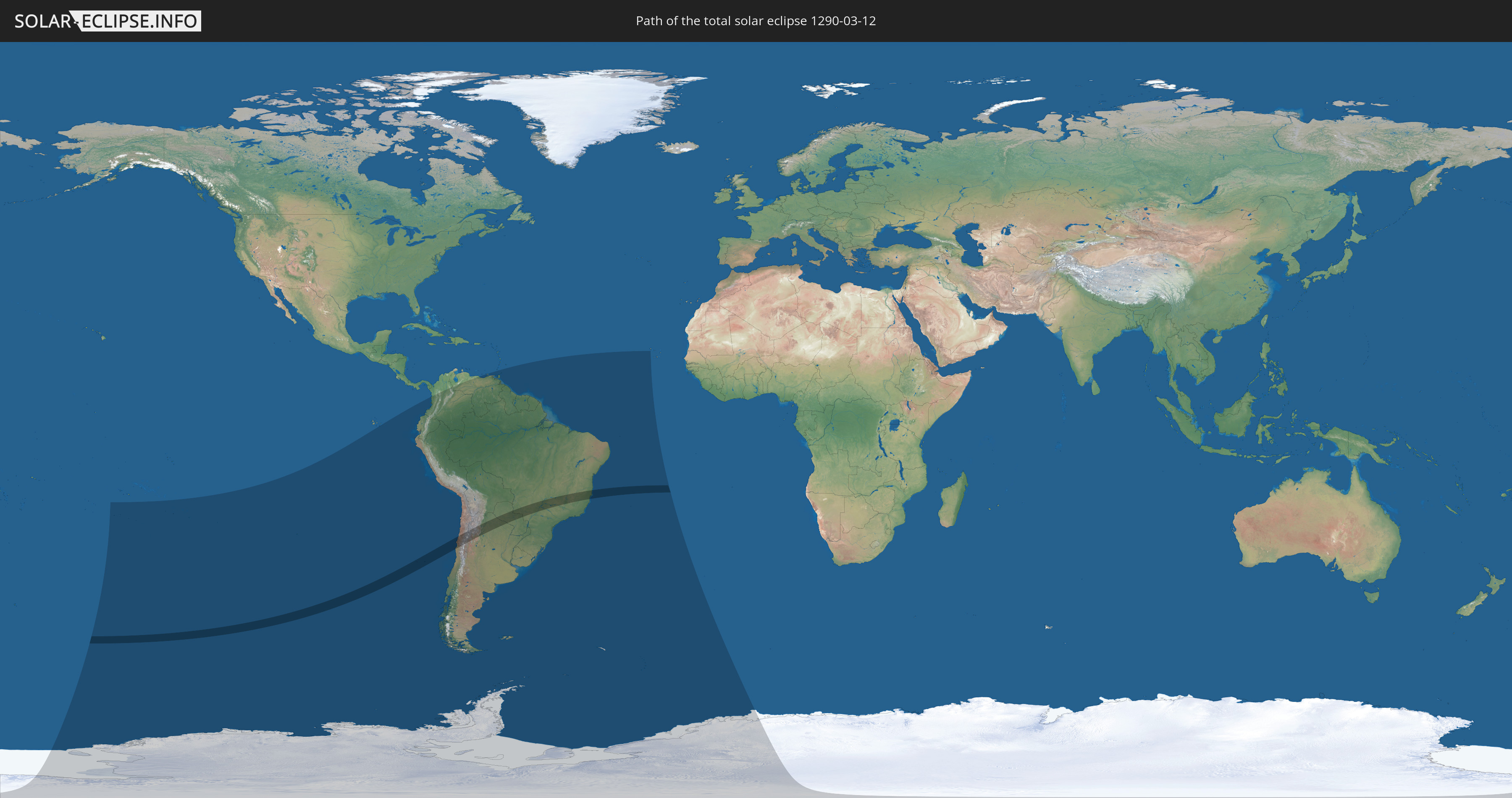
Die Sonnenfinsternis am 12.03.1290 kann man in 19 Ländern als partielle Sonnenfinsternis beobachten.
Der Finsternispfad verläuft durch 4 Länder. Nur in diesen Ländern ist sie als totale Sonnenfinsternis zu sehen.
In den folgenden Ländern ist die Sonnenfinsternis total zu sehen
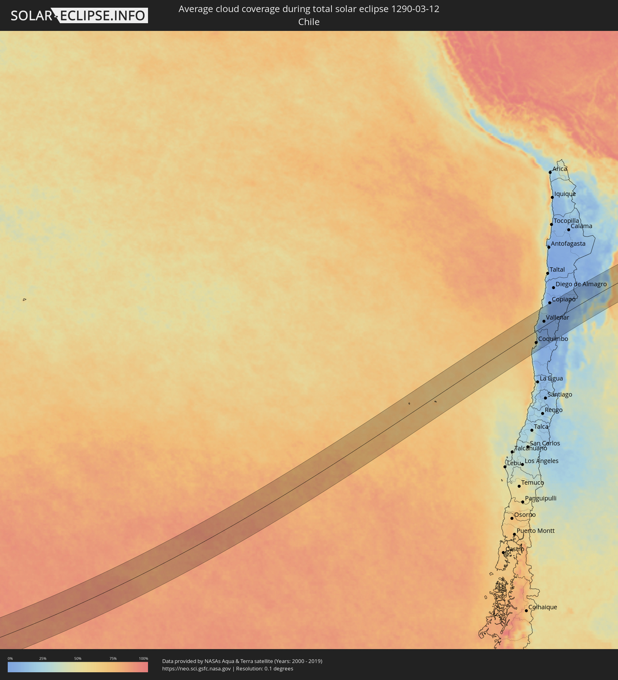
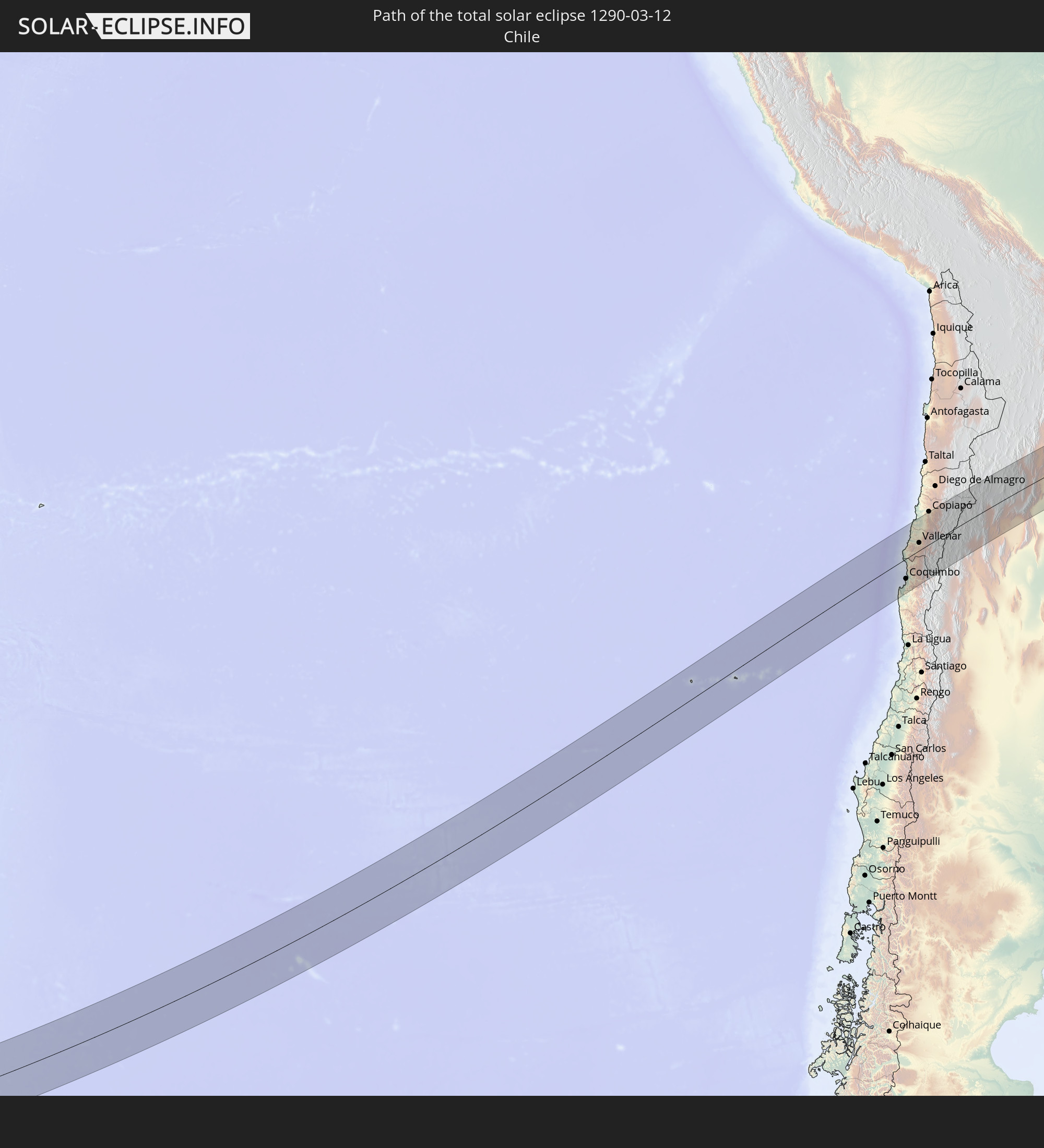 Chile
Chile
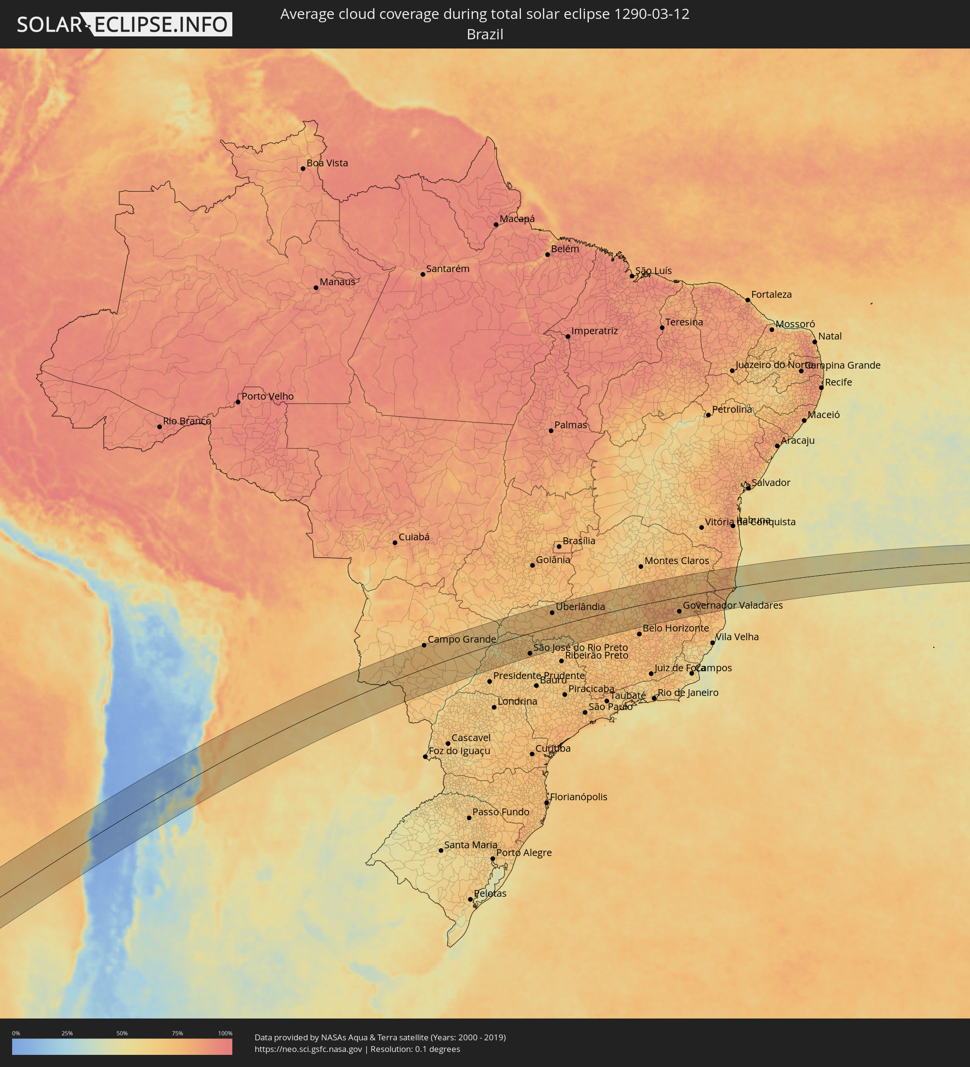
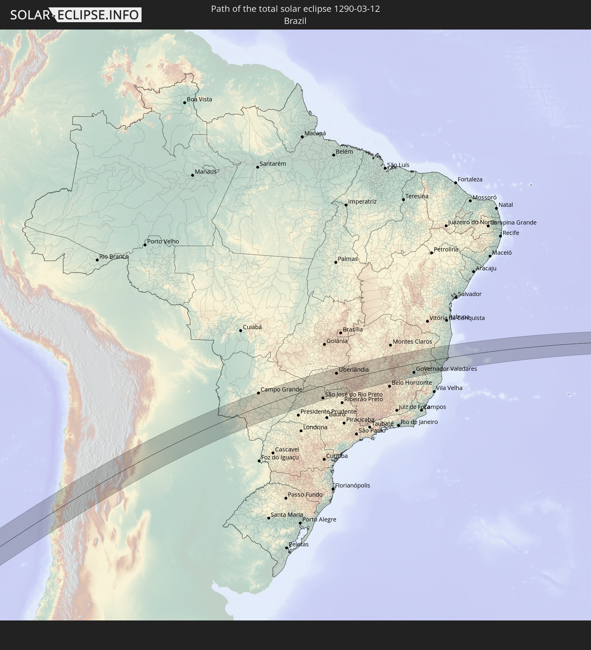 Brasilien
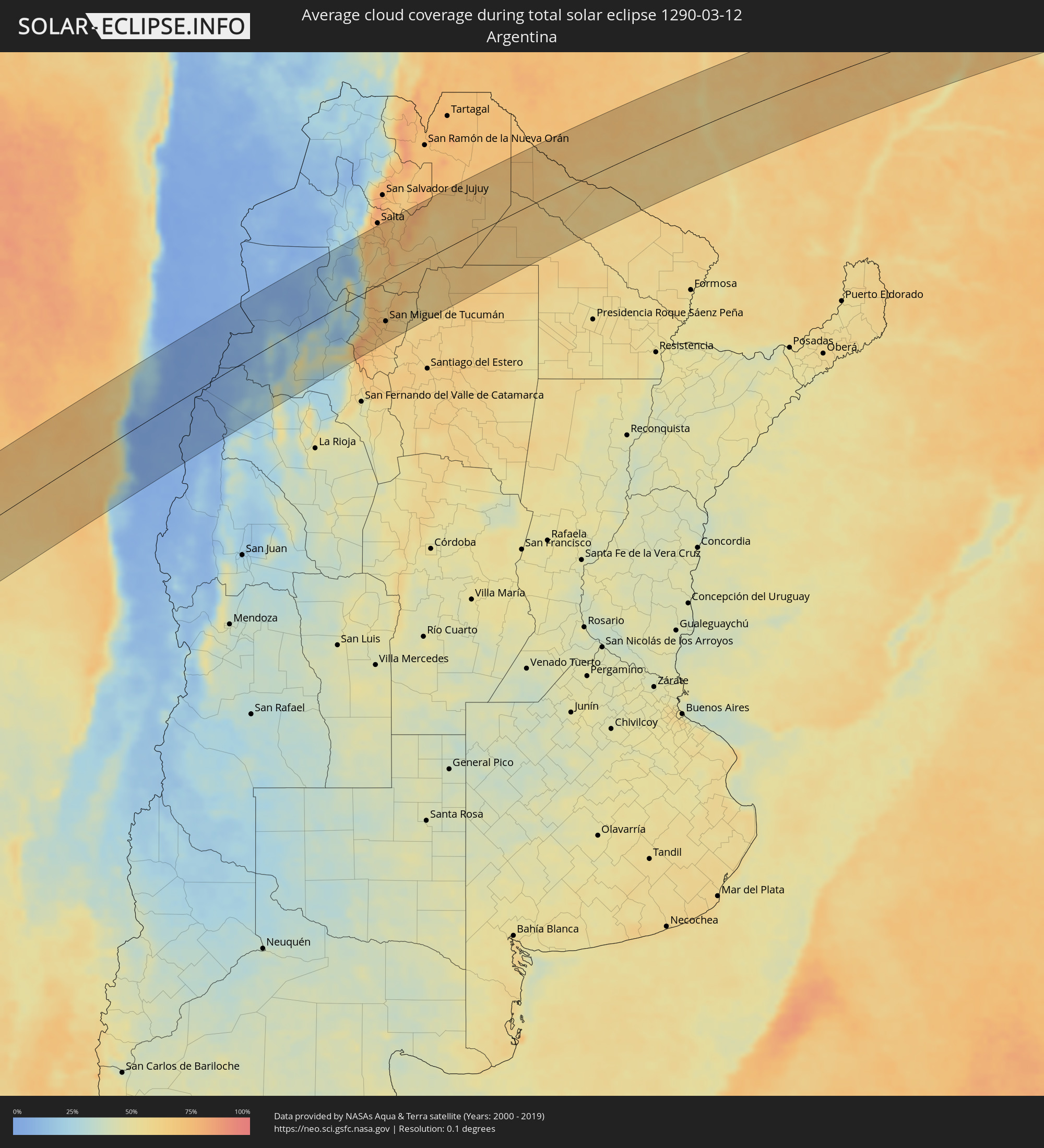
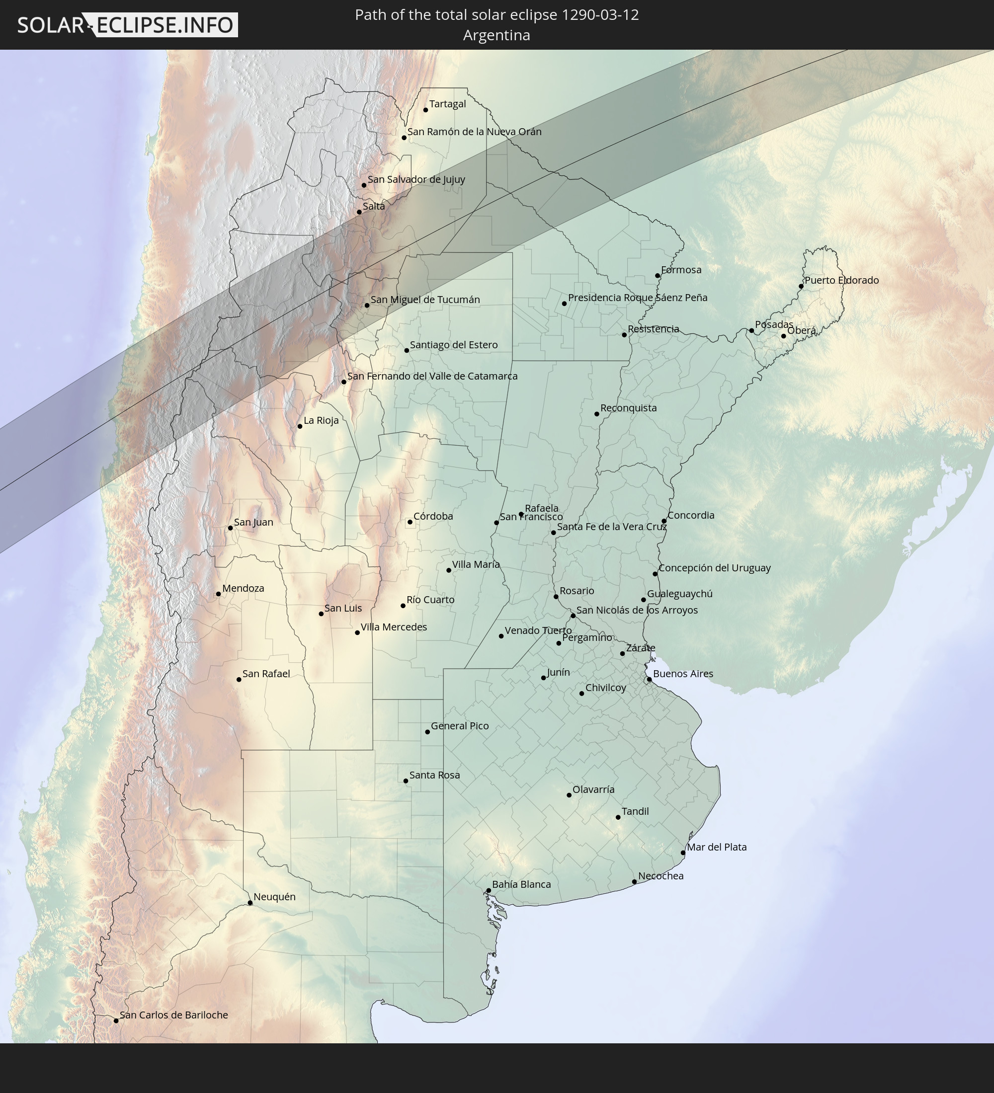 Argentinien
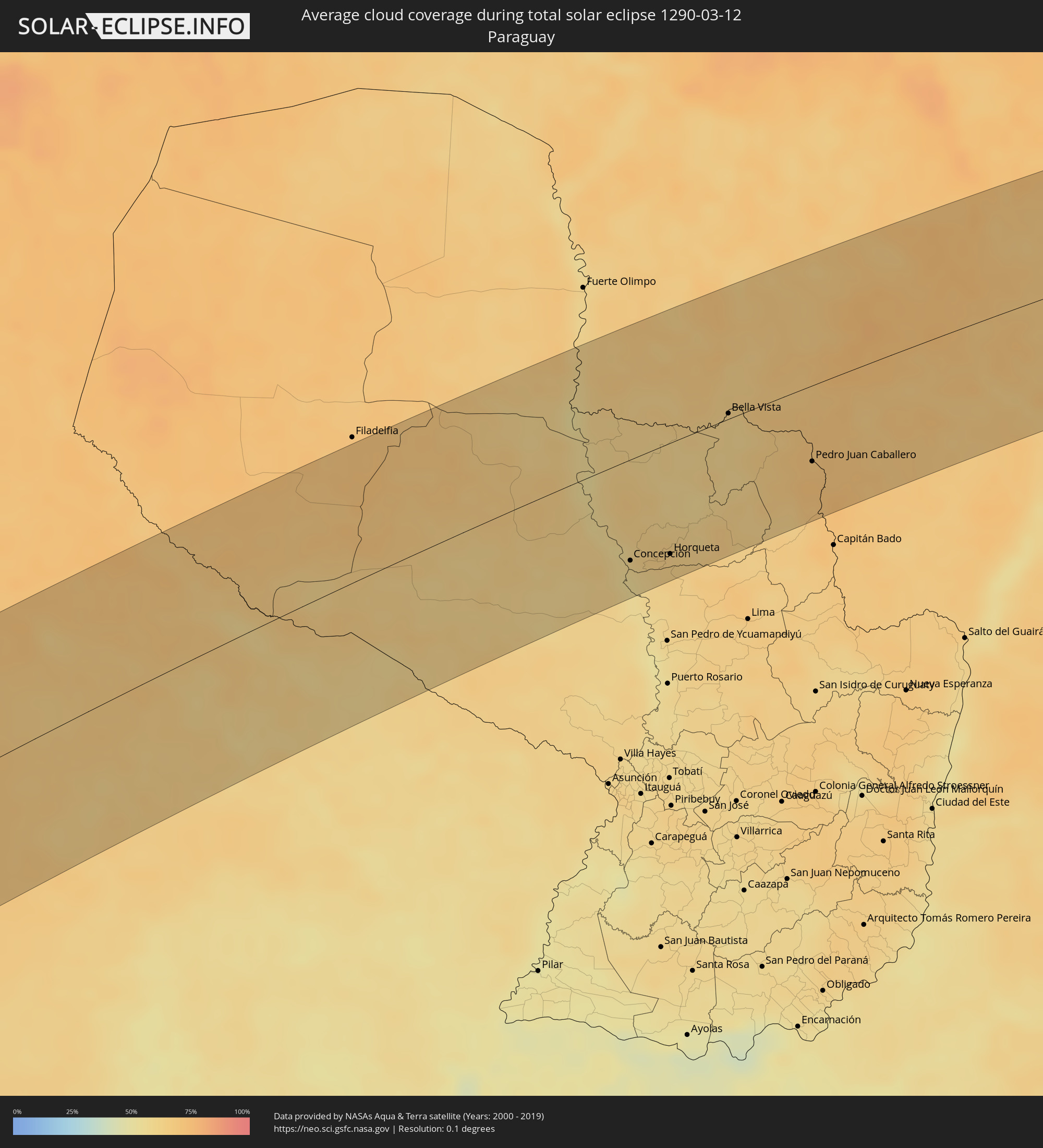
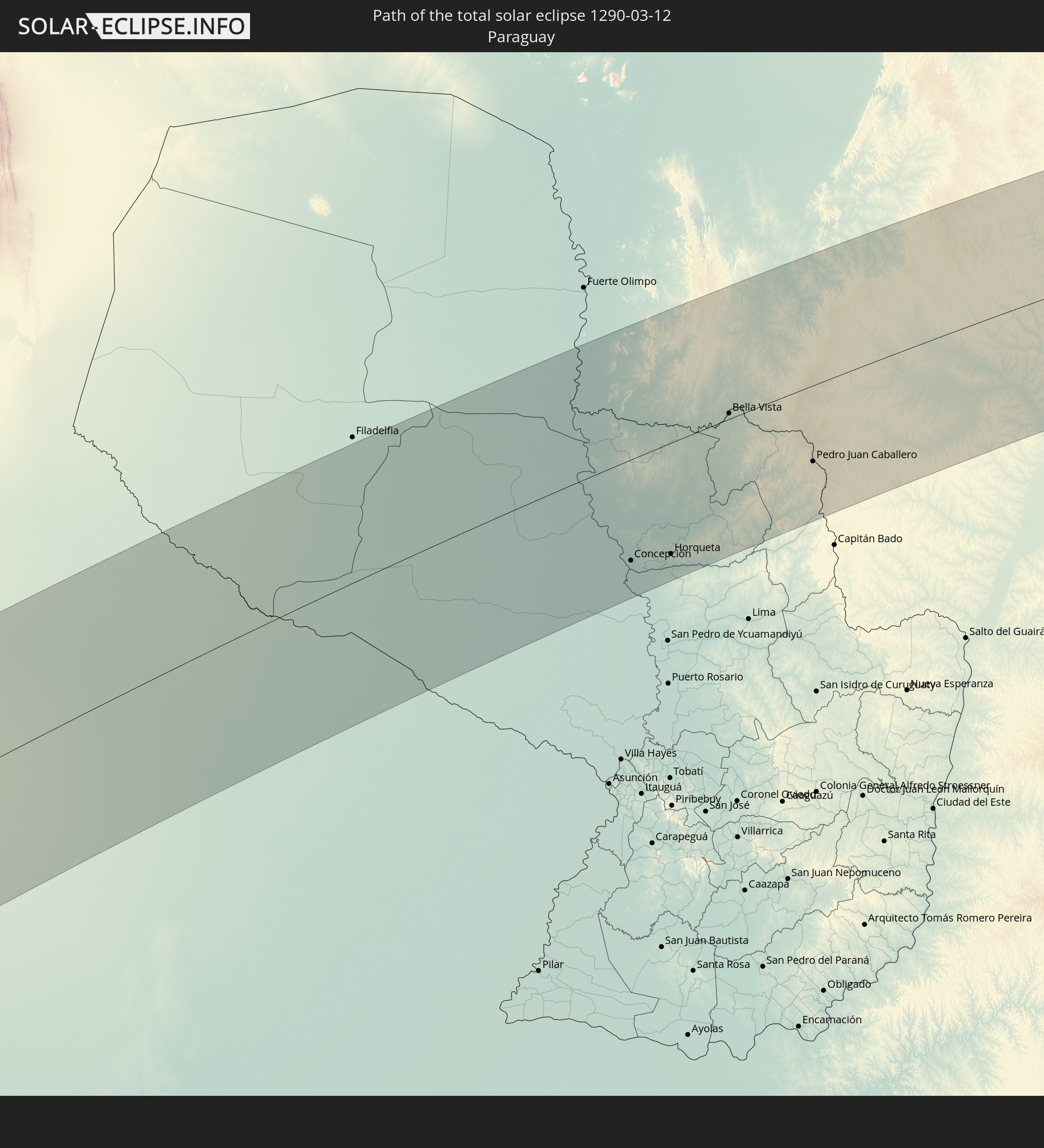 Paraguay
In den folgenden Ländern ist die Sonnenfinsternis partiell zu sehen


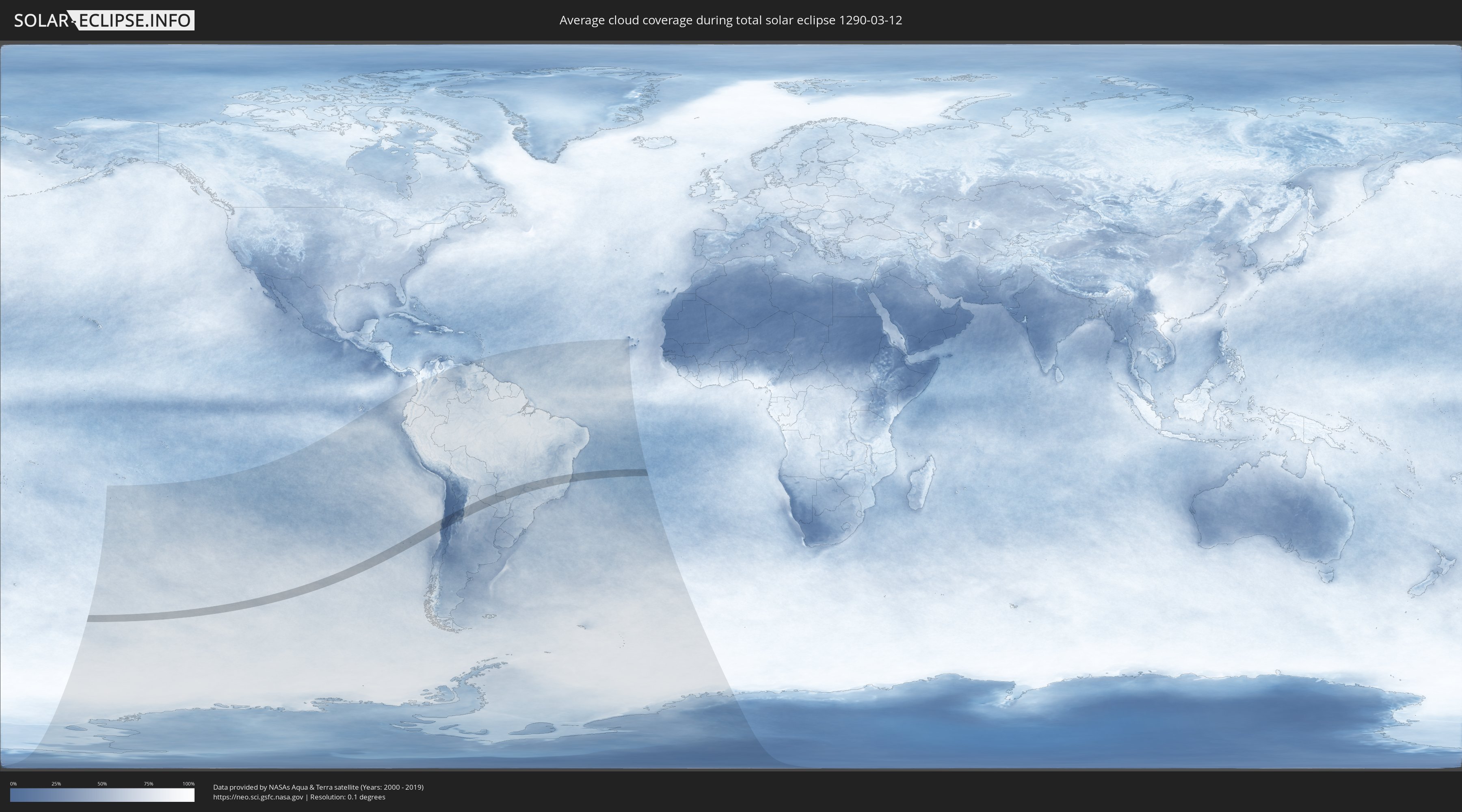
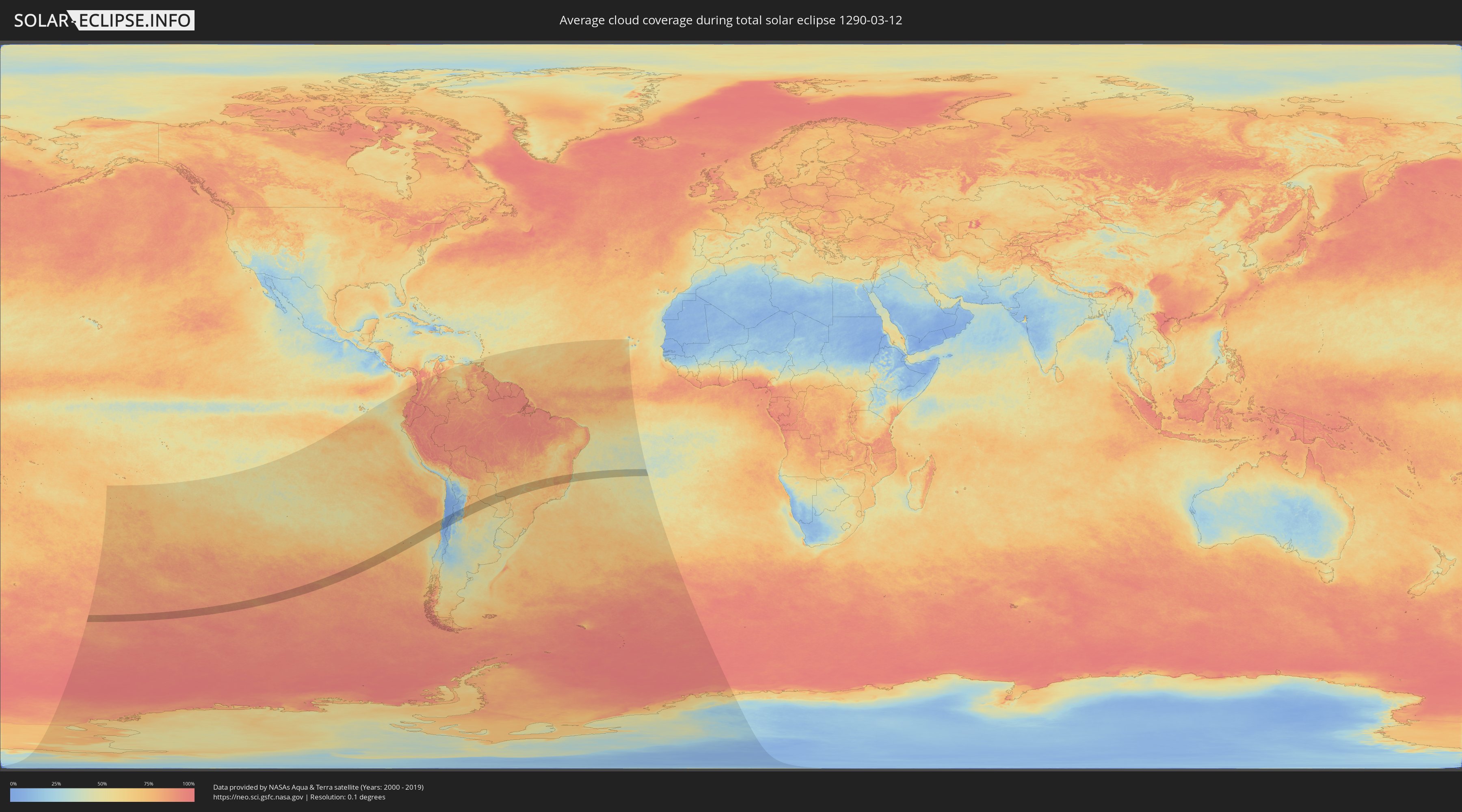
Wie wird das Wetter während der totalen Sonnenfinsternis am 12.03.1290?
Wo ist der beste Ort, um die totale Sonnenfinsternis vom 12.03.1290 zu beobachten?
Die folgenden Karten zeigen die durchschnittliche Bewölkung für den Tag, an dem die totale Sonnenfinsternis
stattfindet. Mit Hilfe der Karten lässt sich der Ort entlang des Finsternispfades eingrenzen,
der die besten Aussichen auf einen klaren wolkenfreien Himmel bietet.
Trotzdem muss man immer lokale Gegenenheiten beachten und sollte sich genau über das Wetter an seinem
gewählten Beobachtungsort informieren.
Die Daten stammen von den beiden NASA-Satelliten
AQUA und TERRA
und wurden über einen Zeitraum von 19 Jahren (2000 - 2019) gemittelt.
Detaillierte Länderkarten
 Chile
Chile
 Brasilien
 Argentinien
 Paraguay
Orte im Finsternispfad
Die nachfolgene Tabelle zeigt Städte und Orte mit mehr als 5.000 Einwohnern, die sich im Finsternispfad befinden. Städte mit mehr als 100.000 Einwohnern sind dick gekennzeichnet. Mit einem Klick auf den Ort öffnet sich eine Detailkarte die die Lage des jeweiligen Ortes zusammen mit dem Verlauf der zentralen Finsternis präsentiert.
| Ort | Typ | Dauer der Verfinsterung | Ortszeit bei maximaler Verfinsterung | Entfernung zur Zentrallinie | Ø Bewölkung |
 Coquimbo, Coquimbo
|
total | - | 13:38:56 UTC-04:42 | 72 km | 33% |
|
La Serena, Coquimbo
|
total | - | 13:39:10 UTC-04:42 | 72 km | 35% |
|
Vallenar, Atacama
|
total | - | 13:42:09 UTC-04:42 | 28 km | 11% |
|
Vicuña, Coquimbo
|
total | - | 13:40:00 UTC-04:42 | 112 km | 3% |
|
Copiapó, Atacama
|
total | - | 13:44:52 UTC-04:42 | 121 km | 6% |
 Fiambalá, Catamarca Province
|
total | - | 14:15:26 UTC-04:16 | 47 km | 17% |
|
Tinogasta, Catamarca Province
|
total | - | 14:14:56 UTC-04:16 | 86 km | 32% |
|
Andalgalá, Catamarca Province
|
total | - | 14:17:56 UTC-04:16 | 103 km | 33% |
|
Cafayate, Salta Province
|
total | - | 14:21:00 UTC-04:16 | 28 km | 45% |
|
Aguilares, Tucumán Province
|
total | - | 14:19:28 UTC-04:16 | 122 km | 70% |
|
Chicoana, Salta Province
|
total | - | 14:23:21 UTC-04:16 | 101 km | 65% |
|
Monteros, Tucumán Province
|
total | - | 14:20:06 UTC-04:16 | 102 km | 70% |
|
El Carril, Salta Province
|
total | - | 14:23:28 UTC-04:16 | 102 km | 65% |
|
Famaillá, Tucumán Province
|
total | - | 14:20:27 UTC-04:16 | 95 km | 70% |
|
Simoca, Tucumán Province
|
total | - | 14:20:12 UTC-04:16 | 118 km | 69% |
|
Yerba Buena, Tucumán Province
|
total | - | 14:20:59 UTC-04:16 | 76 km | 72% |
|
Bella Vista, Tucumán Province
|
total | - | 14:20:39 UTC-04:16 | 98 km | 70% |
|
Trancas, Tucumán Province
|
total | - | 14:22:00 UTC-04:16 | 20 km | 60% |
|
Tafí Viejo, Tucumán Province
|
total | - | 14:21:13 UTC-04:16 | 71 km | 73% |
|
San Miguel de Tucumán, Tucumán Province
|
total | - | 14:21:08 UTC-04:16 | 82 km | 70% |
|
Alderetes, Tucumán Province
|
total | - | 14:21:18 UTC-04:16 | 85 km | 69% |
|
El Galpón, Salta Province
|
total | - | 14:24:27 UTC-04:16 | 32 km | 65% |
|
Las Lajitas, Salta Province
|
total | - | 14:26:17 UTC-04:16 | 81 km | 66% |
|
Joaquín V. González, Salta Province
|
total | - | 14:25:45 UTC-04:16 | 39 km | 64% |
|
El Quebrachal, Salta Province
|
total | - | 14:25:38 UTC-04:16 | 14 km | 64% |
|
Apolinario Saravia, Salta Province
|
total | - | 14:27:07 UTC-04:16 | 94 km | 67% |
|
Taco Pozo, Chaco Province
|
total | - | 14:26:26 UTC-04:16 | 56 km | 68% |
|
Ingeniero Guillermo N. Juárez, Formosa Province
|
total | - | 14:31:36 UTC-04:16 | 49 km | 69% |
|
Las Lomitas, Formosa Province
|
total | - | 14:32:20 UTC-04:16 | 88 km | 61% |
 Colonia Menno, Boquerón
|
total | - | 15:03:26 UTC-03:50 | 115 km | 71% |
|
Concepción, Concepción
|
total | - | 15:05:24 UTC-03:50 | 89 km | 58% |
|
Horqueta, Concepción
|
total | - | 15:06:02 UTC-03:50 | 98 km | 64% |
|
Bella Vista, Amambay
|
total | - | 15:08:42 UTC-03:50 | 5 km | 62% |
 Jardim, Mato Grosso do Sul
|
total | - | 15:22:27 UTC-03:38 | 58 km | 68% |
|
Pedro Juan Caballero, Amambay
|
total | - | 15:09:10 UTC-03:50 | 68 km | 70% |
|
Ponta Porã, Mato Grosso do Sul
|
total | - | 15:21:23 UTC-03:38 | 67 km | 70% |
|
Dourados, Mato Grosso do Sul
|
total | - | 15:23:08 UTC-03:38 | 69 km | 70% |
|
Campo Grande, Mato Grosso do Sul
|
total | - | 15:26:04 UTC-03:38 | 111 km | 74% |
|
Campo Verde, Mato Grosso do Sul
|
total | - | 15:26:52 UTC-03:38 | 93 km | 70% |
|
Presidente Epitácio, São Paulo
|
total | - | 15:59:18 UTC-03:06 | 116 km | 61% |
|
Três Lagoas, Mato Grosso do Sul
|
total | - | 15:29:16 UTC-03:38 | 27 km | 60% |
|
Andradina, São Paulo
|
total | - | 16:01:29 UTC-03:06 | 49 km | 69% |
|
Ilha Solteira, São Paulo
|
total | - | 16:02:13 UTC-03:06 | 1 km | 54% |
|
Paranaíba, Mato Grosso do Sul
|
total | - | 15:31:30 UTC-03:38 | 75 km | 61% |
|
Mirandopólis, São Paulo
|
total | - | 16:01:28 UTC-03:06 | 83 km | 67% |
|
Santa Fé do Sul, São Paulo
|
total | - | 16:03:02 UTC-03:06 | 10 km | 60% |
|
Guararapes, São Paulo
|
total | - | 16:01:49 UTC-03:06 | 111 km | 67% |
|
Jales, São Paulo
|
total | - | 16:03:23 UTC-03:06 | 8 km | 67% |
|
Araçatuba, São Paulo
|
total | - | 16:02:08 UTC-03:06 | 112 km | 72% |
|
Fernandópolis, São Paulo
|
total | - | 16:03:42 UTC-03:06 | 19 km | 72% |
|
Iturama, Minas Gerais
|
total | - | 16:04:34 UTC-03:06 | 38 km | 67% |
|
Votuporanga, São Paulo
|
total | - | 16:03:48 UTC-03:06 | 42 km | 72% |
|
Ituiutaba, Minas Gerais
|
total | - | 16:06:27 UTC-03:06 | 97 km | 67% |
|
São José do Rio Preto, São Paulo
|
total | - | 16:03:53 UTC-03:06 | 103 km | 72% |
|
Frutal, Minas Gerais
|
total | - | 16:05:31 UTC-03:06 | 31 km | 71% |
|
Olímpia, São Paulo
|
total | - | 16:04:31 UTC-03:06 | 108 km | 67% |
|
Barretos, São Paulo
|
total | - | 16:05:09 UTC-03:06 | 98 km | 68% |
|
Guaíra, São Paulo
|
total | - | 16:05:46 UTC-03:06 | 80 km | 69% |
|
Uberlândia, Minas Gerais
|
total | - | 16:07:47 UTC-03:06 | 69 km | 74% |
|
Araguari, Minas Gerais
|
total | - | 16:08:16 UTC-03:06 | 96 km | 71% |
|
Uberaba, Minas Gerais
|
total | - | 16:06:58 UTC-03:06 | 30 km | 70% |
|
Ituverava, São Paulo
|
total | - | 16:06:17 UTC-03:06 | 97 km | 67% |
|
Igarapava, São Paulo
|
total | - | 16:06:45 UTC-03:06 | 66 km | 61% |
|
Monte Carmelo, Minas Gerais
|
total | - | 16:08:51 UTC-03:06 | 69 km | 75% |
|
Patrocínio, Minas Gerais
|
total | - | 16:09:03 UTC-03:06 | 31 km | 77% |
|
Araxá, Minas Gerais
|
total | - | 16:08:11 UTC-03:06 | 40 km | 71% |
|
Patos de Minas, Minas Gerais
|
total | - | 16:10:00 UTC-03:06 | 59 km | 72% |
|
Carmo do Paranaíba, Minas Gerais
|
total | - | 16:09:37 UTC-03:06 | 8 km | 72% |
|
São Gotardo, Minas Gerais
|
total | - | 16:09:26 UTC-03:06 | 32 km | 76% |
|
Bom Despacho, Minas Gerais
|
total | - | 16:09:35 UTC-03:06 | 98 km | 73% |
|
Pompéu, Minas Gerais
|
total | - | 16:10:35 UTC-03:06 | 51 km | 71% |
|
Curvelo, Minas Gerais
|
total | - | 16:11:40 UTC-03:06 | 12 km | 69% |
|
Sete Lagoas, Minas Gerais
|
total | - | 16:10:51 UTC-03:06 | 93 km | 76% |
|
Matozinhos, Minas Gerais
|
total | - | 16:10:52 UTC-03:06 | 107 km | 74% |
|
Diamantina, Minas Gerais
|
total | - | 16:13:03 UTC-03:06 | 25 km | 77% |
|
Guanhães, Minas Gerais
|
total | - | 16:12:54 UTC-03:06 | 47 km | 83% |
|
Governador Valadares, Minas Gerais
|
total | - | 16:13:34 UTC-03:06 | 76 km | 75% |
|
Teófilo Otoni, Minas Gerais
|
total | - | 16:15:12 UTC-03:06 | 24 km | 73% |
|
Nova Venécia, Espírito Santo
|
total | - | 16:14:53 UTC-03:06 | 91 km | 78% |
|
Nanuque, Minas Gerais
|
total | - | 16:16:03 UTC-03:06 | 4 km | 76% |
|
São Mateus, Espírito Santo
|
total | - | 16:15:15 UTC-03:06 | 102 km | 71% |
|
Mucuri, Bahia
|
total | - | 16:48:44 UTC-02:34 | 38 km | 55% |
|
Itamaraju, Bahia
|
total | - | 16:50:04 UTC-02:34 | 77 km | 79% |
|
Nova Viçosa, Bahia
|
total | - | 16:49:06 UTC-02:34 | 19 km | 56% |