Hybride Sonnenfinsternis vom 26.06.1405
| Wochentag: | Mittwoch |
| Maximale Dauer der Verfinsterung: | 01m26s |
| Maximale Breite des Finsternispfades: | 46 km |
| Saroszyklus: | 117 |
| Bedeckungsgrad: | 100% |
| Magnitude: | 1.0134 |
| Gamma: | -0.037 |
Wo kann man die Sonnenfinsternis vom 26.06.1405 sehen?
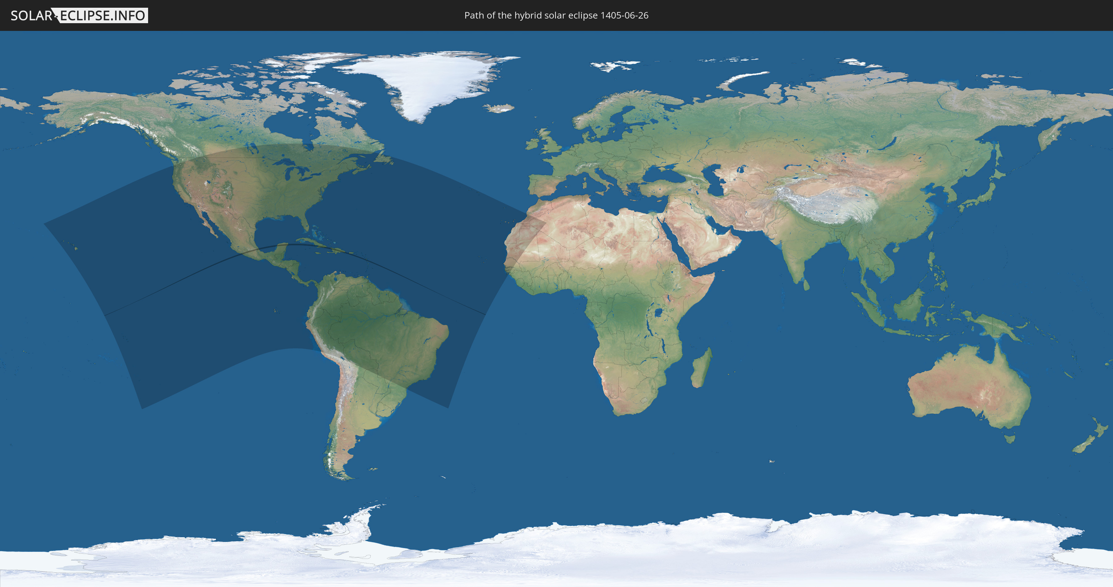
Die Sonnenfinsternis am 26.06.1405 kann man in 60 Ländern als partielle Sonnenfinsternis beobachten.
Der Finsternispfad verläuft durch 6 Länder. Nur in diesen Ländern ist sie als hybride Sonnenfinsternis zu sehen.
In den folgenden Ländern ist die Sonnenfinsternis hybrid zu sehen
 Mexiko
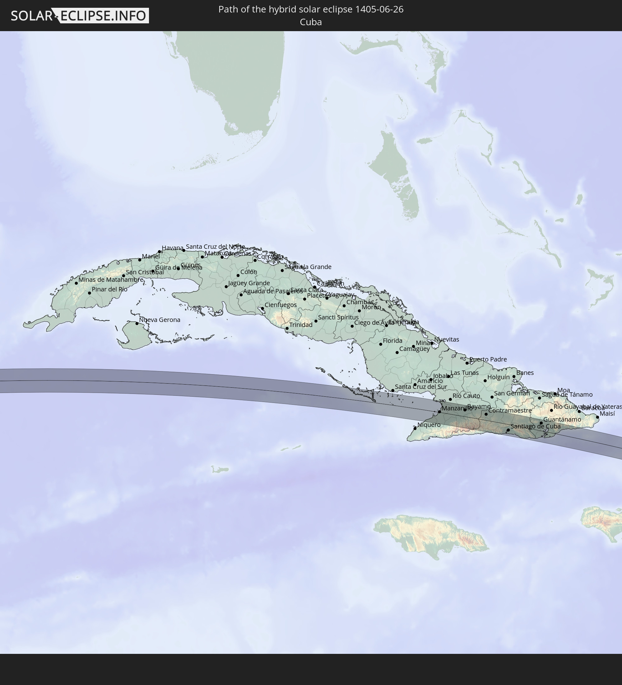 Kuba
Kuba
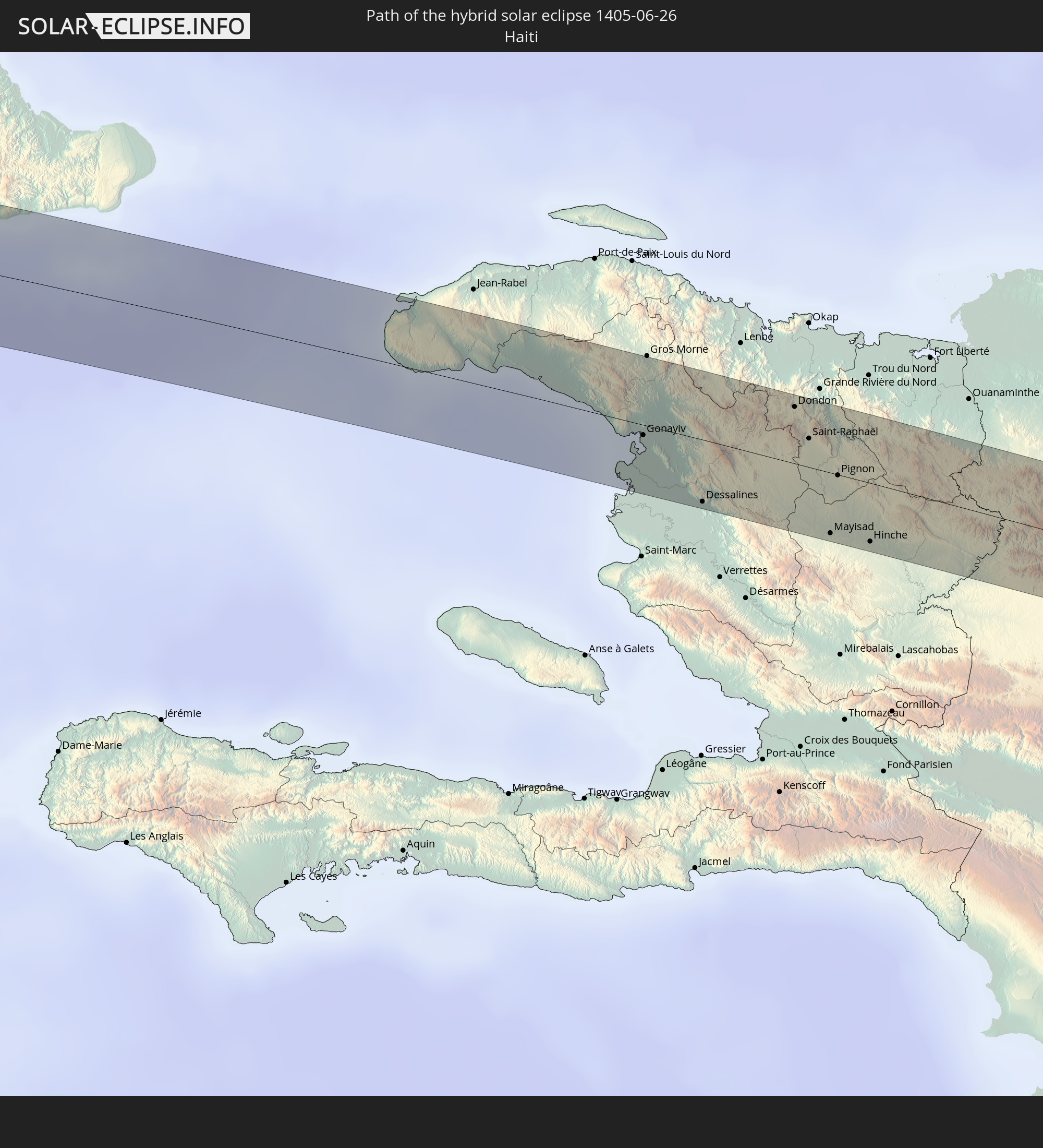 Haiti
Haiti
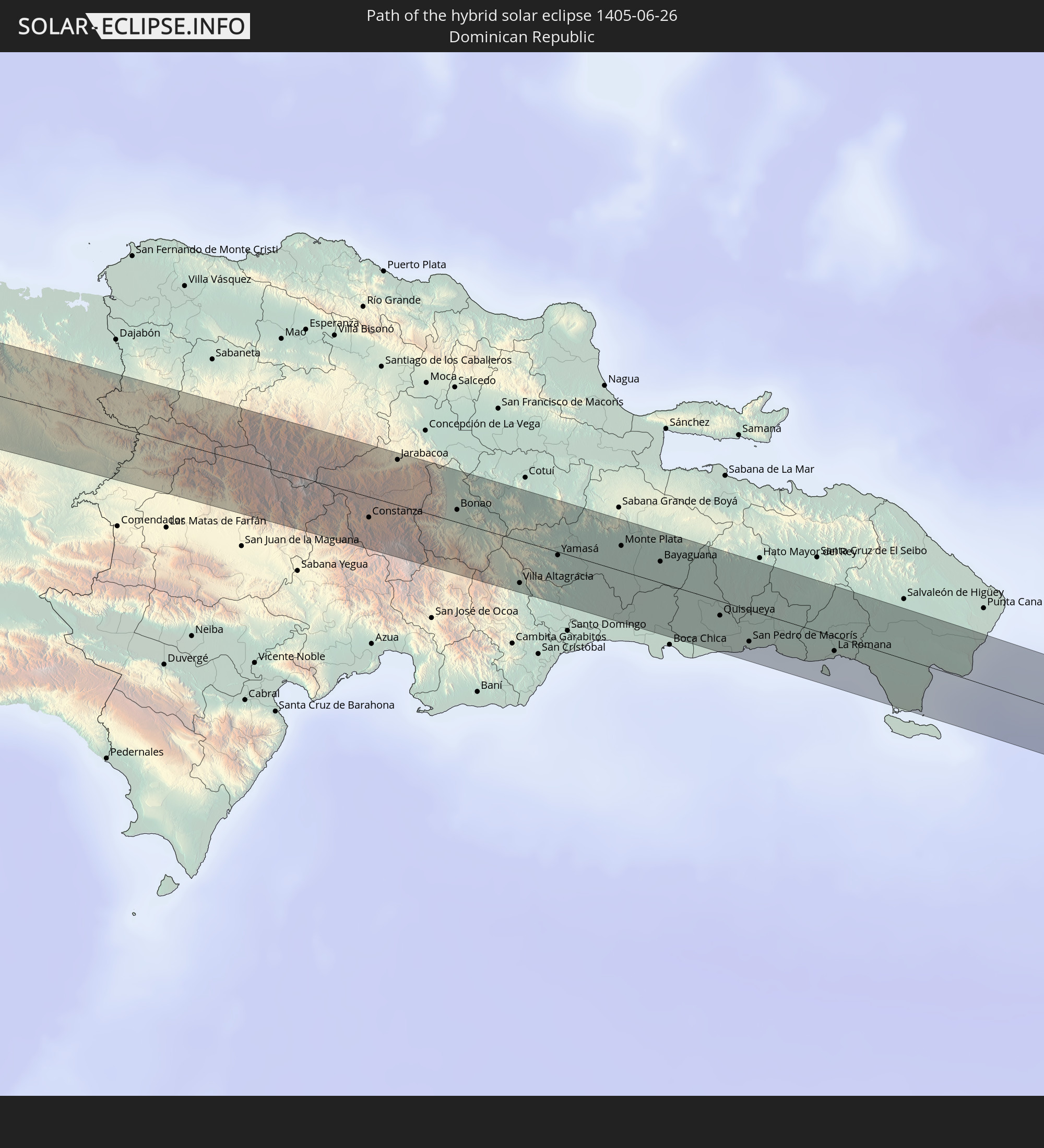 Dominikanische Republik
 Puerto Rico
 Guadeloupe
In den folgenden Ländern ist die Sonnenfinsternis partiell zu sehen
 Vereinigte Staaten
 United States Minor Outlying Islands
 Französisch-Polynesien
 Kanada
 Pitcairninseln
 Mexiko
 Guatemala
 Ecuador
 El Salvador
 Honduras
 Belize
 Nicaragua
 Costa Rica
 Kuba
Kuba
 Panama
 Kolumbien
 Kaimaninseln
 Peru
Peru
 Bahamas
 Jamaika
 Haiti
Haiti
 Brasilien
 Venezuela
 Turks- und Caicosinseln
 Dominikanische Republik
 Aruba
Aruba
 Bolivien
 Puerto Rico
 Amerikanische Jungferninseln
 Bermuda
 Britische Jungferninseln
 Anguilla
 Saint-Martin
 Saint-Barthélemy
 St. Kitts und Nevis
 Paraguay
 Antigua und Barbuda
 Montserrat
 Trinidad und Tobago
 Guadeloupe
 Grenada
 Dominica
 St. Vincent und die Grenadinen
 Guyana
 Martinique
 St. Lucia
 Barbados
 Suriname
 Saint-Pierre und Miquelon
 Französisch-Guayana
 Portugal
 Kap Verde
 Spanien
 Senegal
 Mauretanien
 Gambia
 Guinea-Bissau
 Marokko
 Mali
Mali
 Algerien
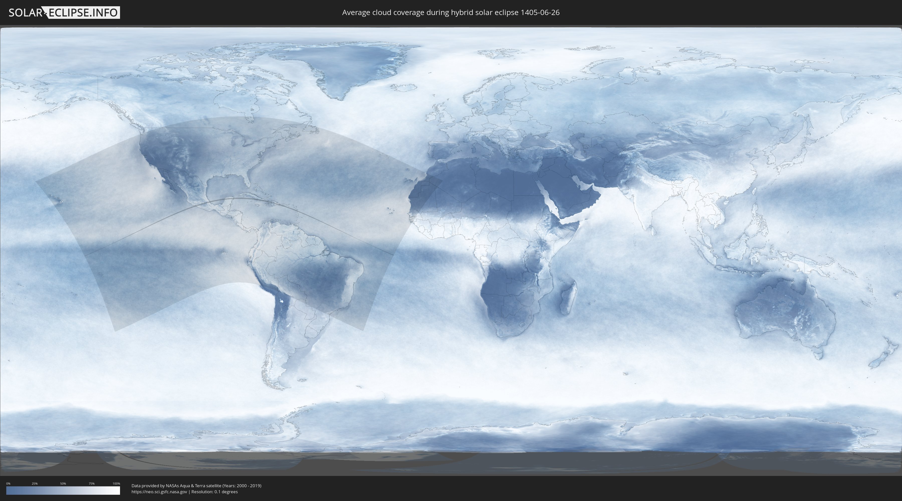
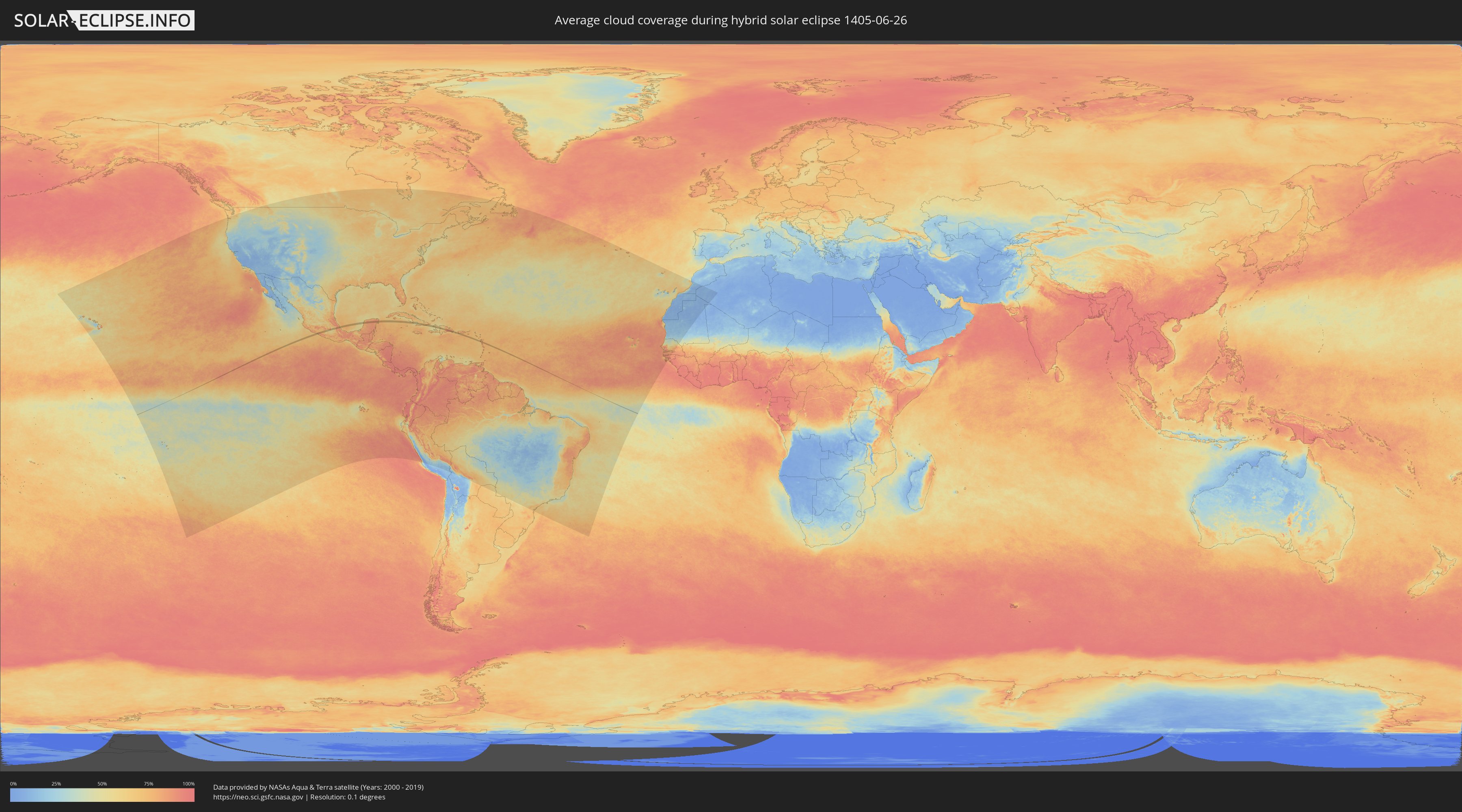
Wie wird das Wetter während der hybriden Sonnenfinsternis am 26.06.1405?
Wo ist der beste Ort, um die hybride Sonnenfinsternis vom 26.06.1405 zu beobachten?
Die folgenden Karten zeigen die durchschnittliche Bewölkung für den Tag, an dem die hybride Sonnenfinsternis
stattfindet. Mit Hilfe der Karten lässt sich der Ort entlang des Finsternispfades eingrenzen,
der die besten Aussichen auf einen klaren wolkenfreien Himmel bietet.
Trotzdem muss man immer lokale Gegenenheiten beachten und sollte sich genau über das Wetter an seinem
gewählten Beobachtungsort informieren.
Die Daten stammen von den beiden NASA-Satelliten
AQUA und TERRA
und wurden über einen Zeitraum von 19 Jahren (2000 - 2019) gemittelt.
Detaillierte Länderkarten
 Mexiko
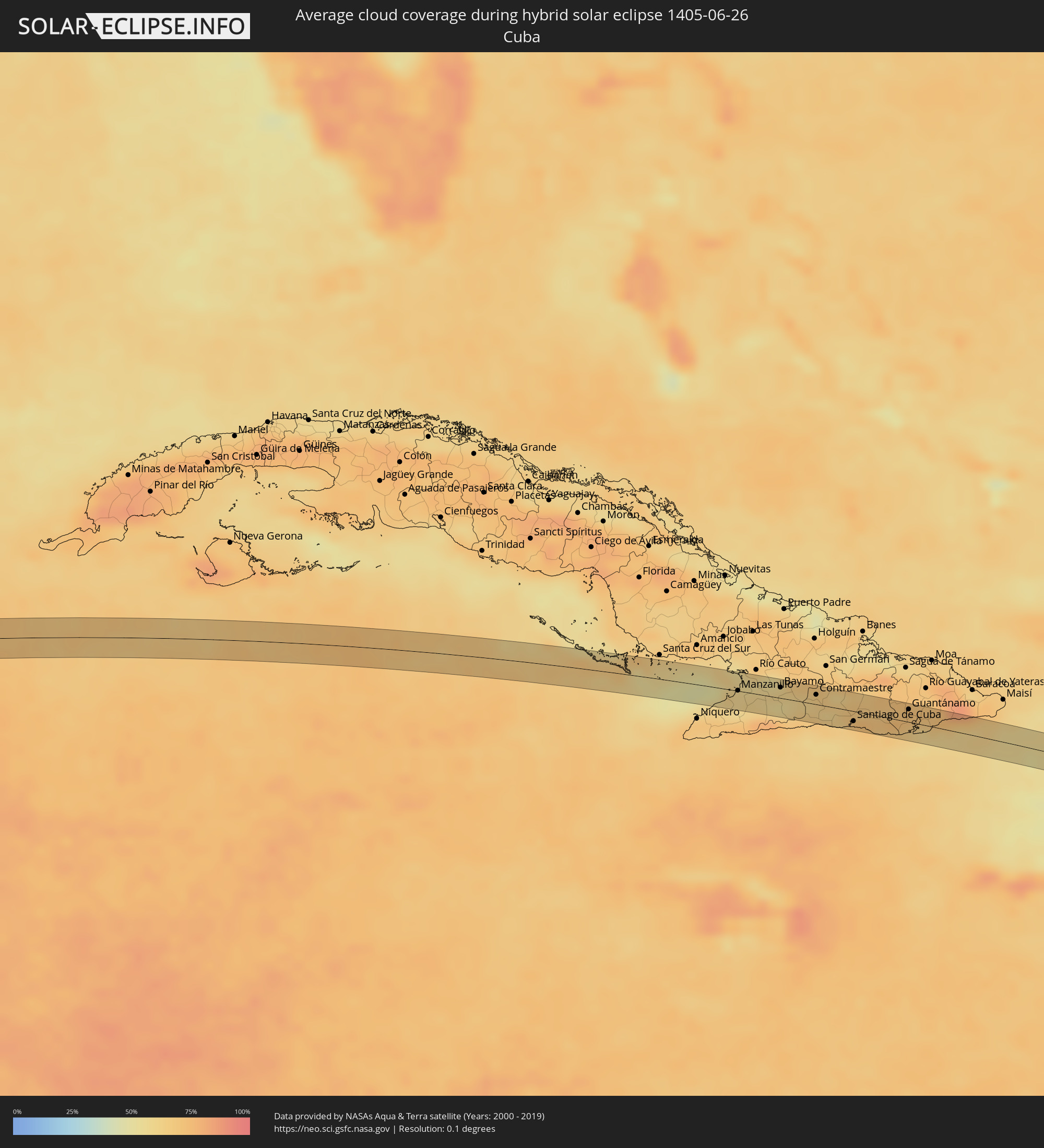 Kuba
Kuba
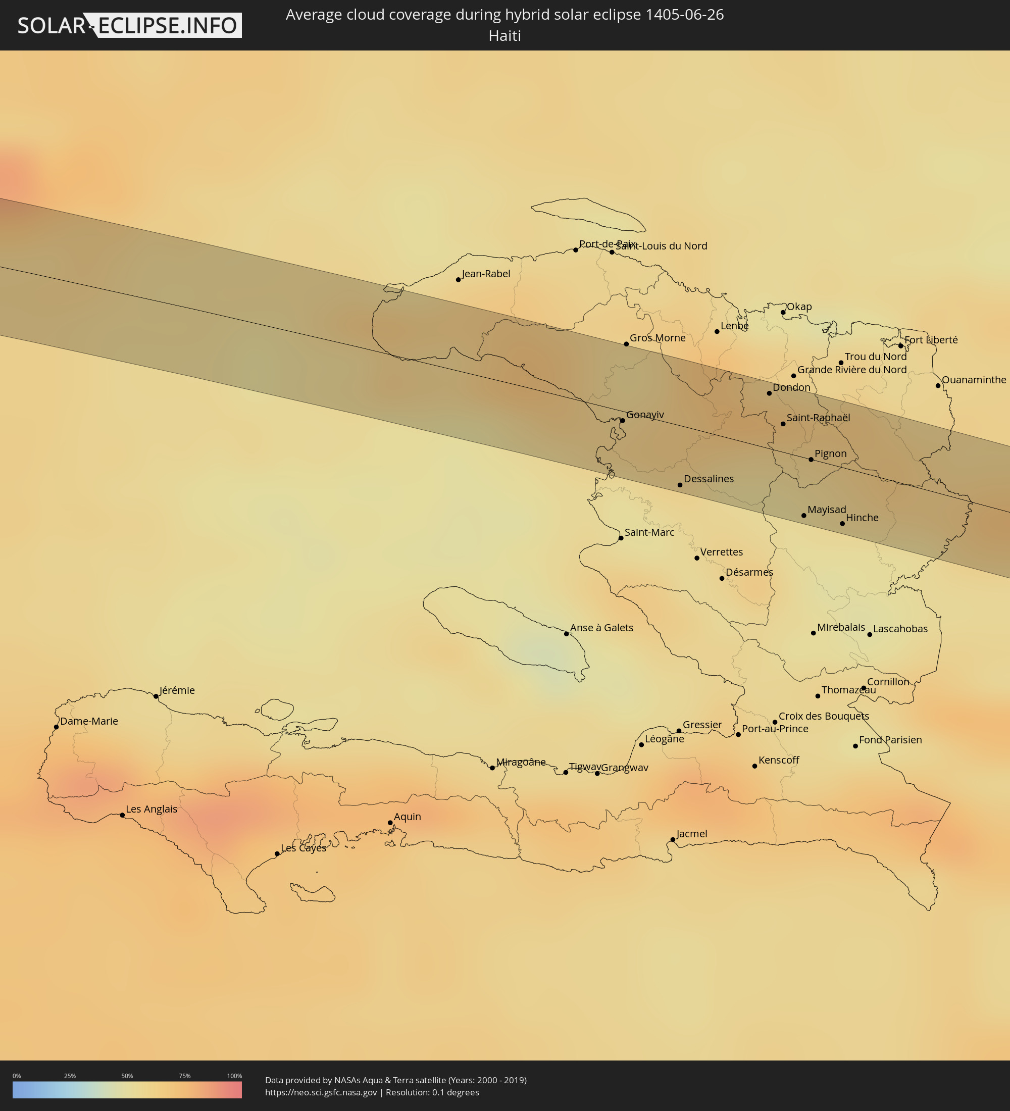 Haiti
Haiti
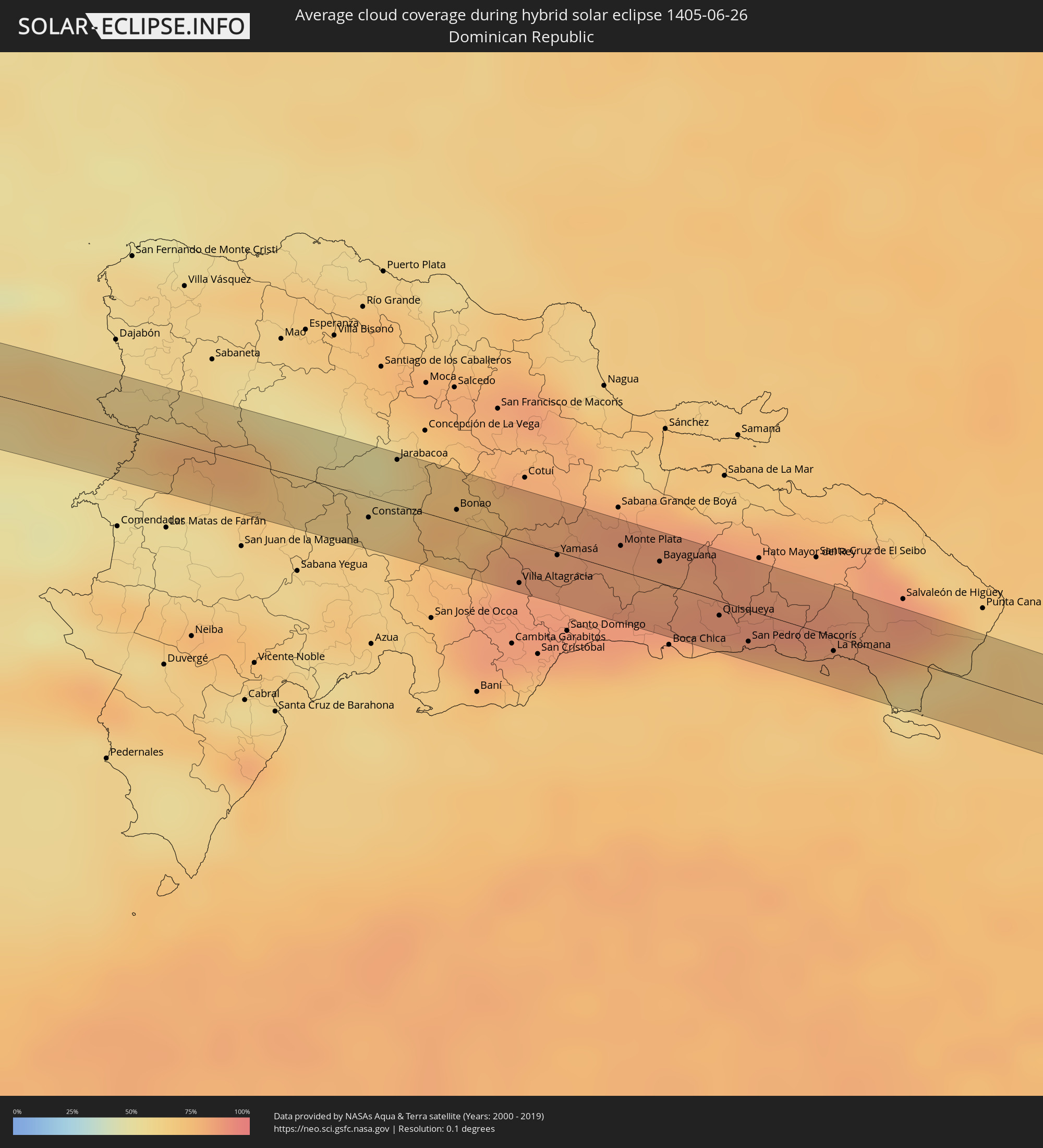 Dominikanische Republik
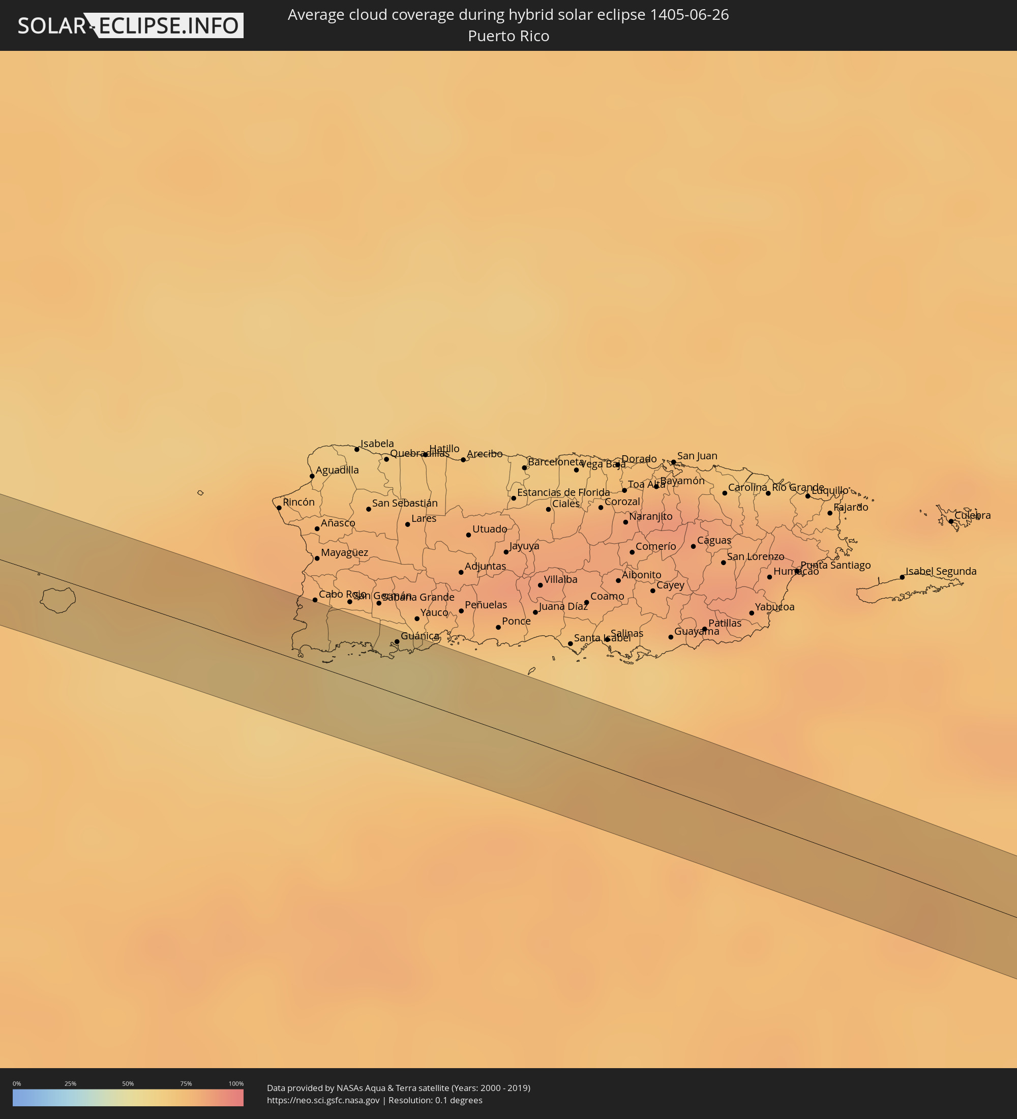 Puerto Rico
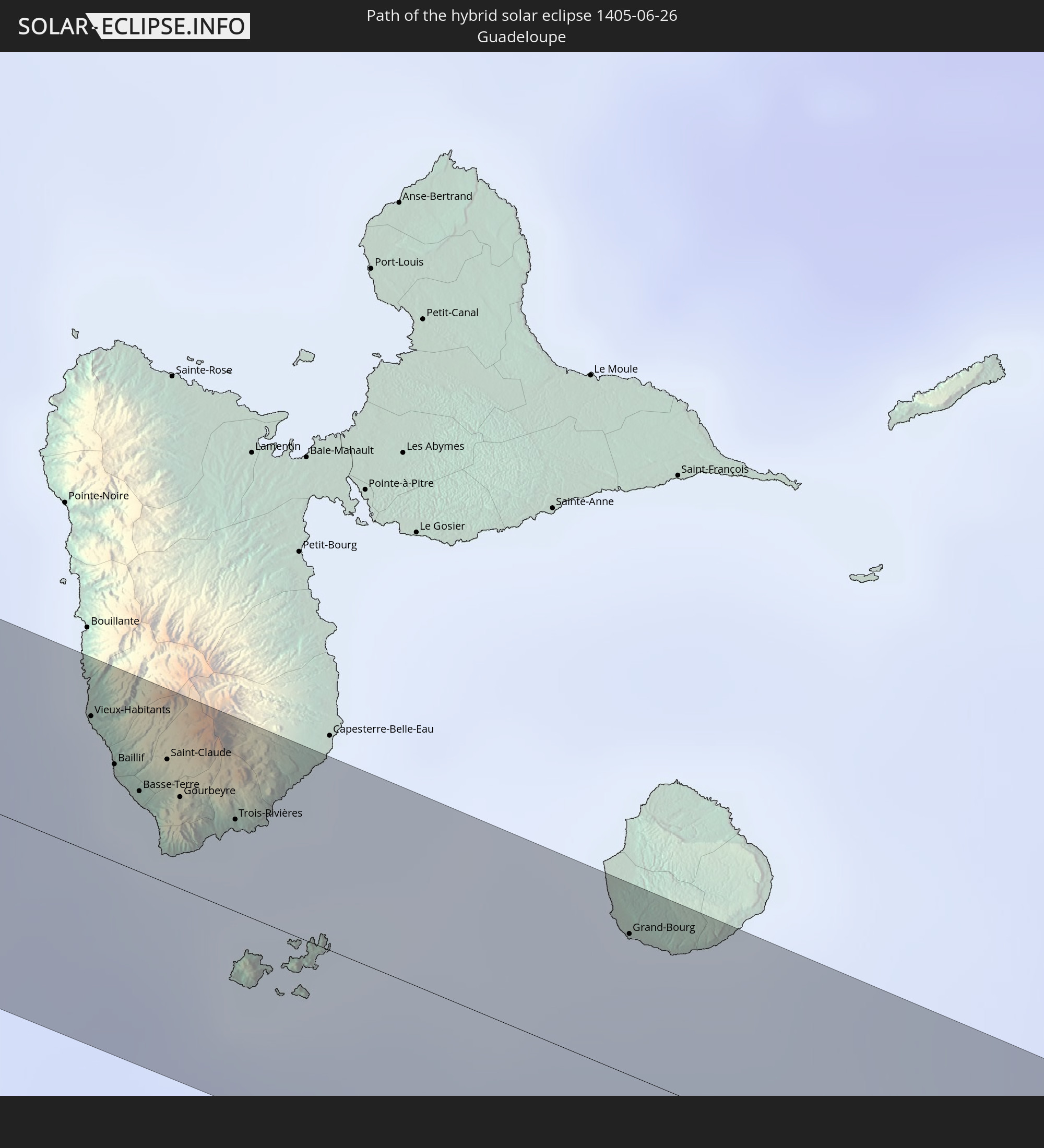
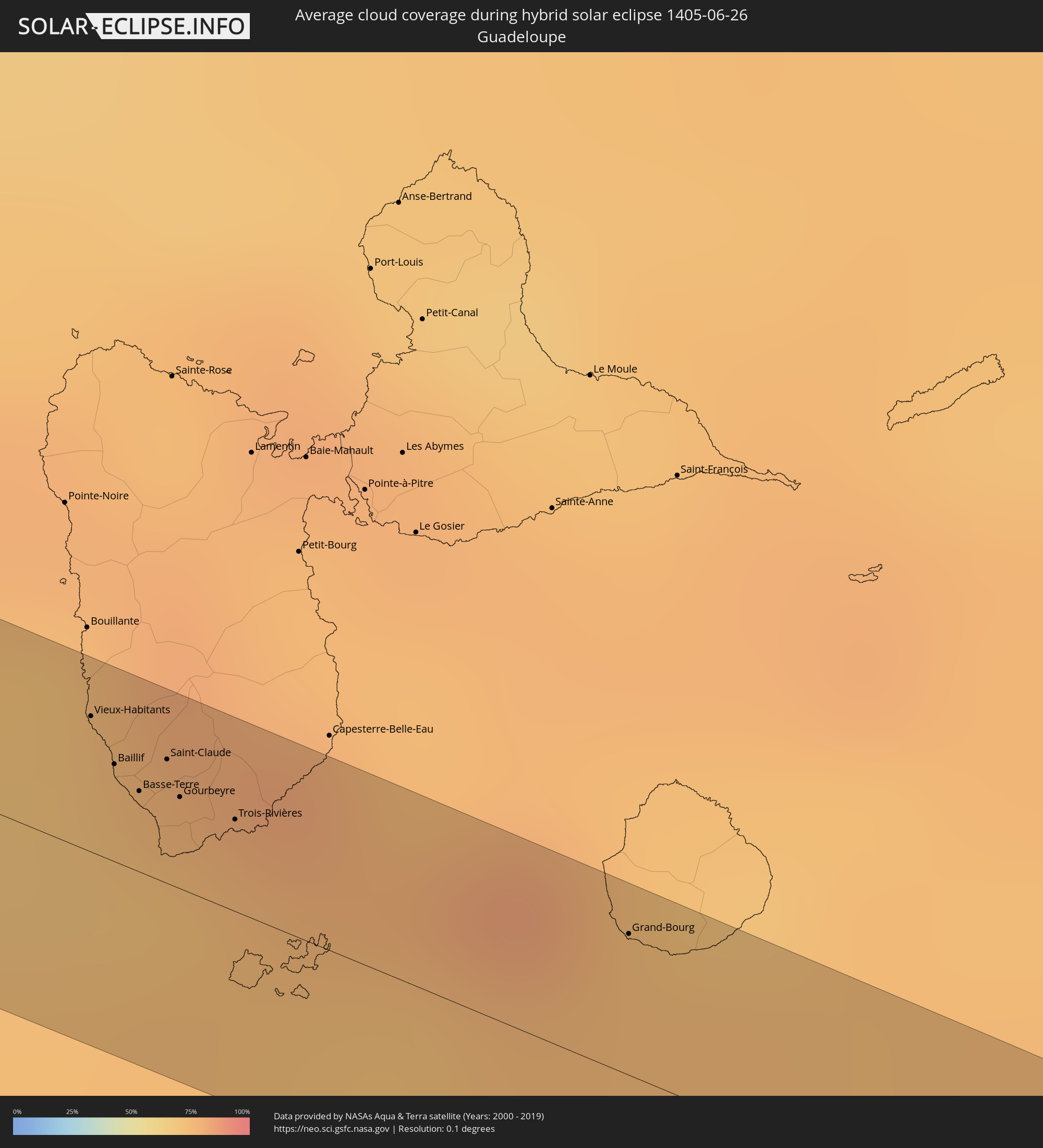 Guadeloupe
Orte im Finsternispfad
Die nachfolgene Tabelle zeigt Städte und Orte mit mehr als 5.000 Einwohnern, die sich im Finsternispfad befinden. Städte mit mehr als 100.000 Einwohnern sind dick gekennzeichnet. Mit einem Klick auf den Ort öffnet sich eine Detailkarte die die Lage des jeweiligen Ortes zusammen mit dem Verlauf der zentralen Finsternis präsentiert.
| Ort | Typ | Dauer der Verfinsterung | Ortszeit bei maximaler Verfinsterung | Entfernung zur Zentrallinie | Ø Bewölkung |
|
Ciudad Altamirano, Guerrero
|
total | - | 10:15:34 UTC-06:36 | 12 km | 76% |
|
Arcelia, Guerrero
|
total | - | 10:16:31 UTC-06:36 | 5 km | 74% |
|
Teloloapan, Guerrero
|
total | - | 10:17:38 UTC-06:36 | 13 km | 62% |
|
Taxco de Alarcón, Guerrero
|
total | - | 10:18:29 UTC-06:36 | 2 km | 67% |
|
La Joya, Morelos
|
total | - | 10:18:57 UTC-06:36 | 6 km | 51% |
|
Coatetelco, Morelos
|
total | - | 10:19:23 UTC-06:36 | 8 km | 50% |
|
Zacatepec, Morelos
|
total | - | 10:19:40 UTC-06:36 | 4 km | 53% |
|
Jiutepec, Morelos
|
total | - | 10:19:54 UTC-06:36 | 20 km | 61% |
|
Cuautla Morelos, Morelos
|
total | - | 10:20:27 UTC-06:36 | 4 km | 64% |
|
Tepalcingo, Morelos
|
total | - | 10:20:33 UTC-06:36 | 21 km | 51% |
|
Tetela del Volcán, Morelos
|
total | - | 10:21:06 UTC-06:36 | 7 km | 78% |
|
Atlixco, Puebla
|
total | - | 10:21:55 UTC-06:36 | 1 km | 58% |
|
Santa María Zacatepec, Puebla
|
total | - | 10:22:17 UTC-06:36 | 21 km | 53% |
|
Puebla, Puebla
|
total | - | 10:22:39 UTC-06:36 | 7 km | 56% |
|
Amozoc de Mota, Puebla
|
total | - | 10:23:06 UTC-06:36 | 4 km | 60% |
|
Tepeaca, Puebla
|
total | - | 10:23:25 UTC-06:36 | 9 km | 58% |
|
Grajales, Puebla
|
total | - | 10:23:54 UTC-06:36 | 16 km | 60% |
|
Tlaixpan, Puebla
|
total | - | 10:23:49 UTC-06:36 | 20 km | 61% |
|
San Salvador El Seco, Puebla
|
total | - | 10:24:16 UTC-06:36 | 1 km | 71% |
|
Zacatepec, Puebla
|
total | - | 10:24:41 UTC-06:36 | 13 km | 63% |
|
Ciudad Serdán, Puebla
|
total | - | 10:24:42 UTC-06:36 | 19 km | 73% |
|
Tlanalapan, Puebla
|
total | - | 10:25:23 UTC-06:36 | 4 km | 74% |
|
Huatusco de Chicuellar, Veracruz
|
total | - | 10:26:10 UTC-06:36 | 16 km | 84% |
|
Coatepec, Veracruz
|
total | - | 10:26:25 UTC-06:36 | 17 km | 83% |
|
Villa Zempoala, Veracruz
|
total | - | 10:27:59 UTC-06:36 | 2 km | 78% |
|
Calkiní, Campeche
|
total | - | 10:47:47 UTC-06:36 | 23 km | 80% |
|
Maxcanú, Yucatán
|
total | - | 10:48:02 UTC-06:36 | 1 km | 78% |
|
Muna, Yucatán
|
total | - | 10:48:55 UTC-06:36 | 14 km | 80% |
|
Acanceh, Yucatán
|
total | - | 10:49:52 UTC-06:36 | 19 km | 82% |
|
Tekit, Yucatán
|
total | - | 10:50:09 UTC-06:36 | 13 km | 85% |
|
Chichén-Itzá, Yucatán
|
total | - | 10:52:39 UTC-06:36 | 6 km | 82% |
|
Valladolid, Yucatán
|
total | - | 10:53:50 UTC-06:36 | 7 km | 87% |
|
Chemax, Yucatán
|
total | - | 10:54:40 UTC-06:36 | 13 km | 85% |
|
Playa del Carmen, Quintana Roo
|
total | - | 11:46:59 UTC-05:47 | 22 km | 78% |
|
Campechuela, Granma
|
total | - | 12:36:15 UTC-05:29 | 14 km | 62% |
|
Manzanillo, Granma
|
total | - | 12:36:41 UTC-05:29 | 0 km | 59% |
|
Yara, Granma
|
total | - | 12:37:14 UTC-05:29 | 4 km | 61% |
|
Bartolomé Masó, Granma
|
total | - | 12:37:19 UTC-05:29 | 16 km | 63% |
|
Bayamo, Granma
|
total | - | 12:38:08 UTC-05:29 | 12 km | 61% |
|
Guisa, Granma
|
total | - | 12:38:31 UTC-05:29 | 1 km | 57% |
|
Jiguaní, Granma
|
total | - | 12:38:48 UTC-05:29 | 15 km | 62% |
|
Contramaestre, Santiago de Cuba
|
total | - | 12:39:23 UTC-05:29 | 11 km | 63% |
|
Palma Soriano, Santiago de Cuba
|
total | - | 12:40:12 UTC-05:29 | 6 km | 61% |
|
San Luis, Santiago de Cuba
|
total | - | 12:40:39 UTC-05:29 | 6 km | 66% |
|
Santiago de Cuba, Santiago de Cuba
|
total | - | 12:40:49 UTC-05:29 | 11 km | 66% |
|
Guantánamo, Guantánamo
|
total | - | 12:42:35 UTC-05:29 | 14 km | 71% |
|
Gonayiv, Artibonite
|
total | - | 13:31:00 UTC-04:49 | 3 km | 53% |
|
Dessalines, Artibonite
|
total | - | 13:31:38 UTC-04:49 | 19 km | 56% |
|
Dondon, Nord
|
total | - | 13:32:12 UTC-04:49 | 17 km | 61% |
|
Saint-Raphaël, Nord
|
total | - | 13:32:24 UTC-04:49 | 9 km | 55% |
|
Mayisad, Centre
|
total | - | 13:32:47 UTC-04:49 | 18 km | 51% |
|
Pignon, Nord
|
total | - | 13:32:43 UTC-04:49 | 0 km | 55% |
|
Hinche, Centre
|
total | - | 13:33:07 UTC-04:49 | 18 km | 51% |
|
Constanza, La Vega
|
total | - | 13:45:49 UTC-04:40 | 8 km | 65% |
|
Jarabacoa, La Vega
|
total | - | 13:45:56 UTC-04:40 | 17 km | 60% |
|
Bonao, Monseñor Nouel
|
total | - | 13:46:42 UTC-04:40 | 5 km | 71% |
|
Piedra Blanca, Monseñor Nouel
|
total | - | 13:47:01 UTC-04:40 | 2 km | 78% |
|
Villa Altagracia, San Cristóbal
|
total | - | 13:47:33 UTC-04:40 | 16 km | 86% |
|
Esperalvillo, Monte Plata
|
total | - | 13:47:48 UTC-04:40 | 3 km | 84% |
|
Yamasá, Monte Plata
|
total | - | 13:47:51 UTC-04:40 | 1 km | 84% |
|
Monte Plata, Monte Plata
|
total | - | 13:48:28 UTC-04:40 | 10 km | 83% |
|
Bayaguana, Monte Plata
|
total | - | 13:48:54 UTC-04:40 | 8 km | 82% |
|
Los Llanos, San Pedro de Macorís
|
total | - | 13:49:23 UTC-04:40 | 1 km | 86% |
|
Quisqueya, San Pedro de Macorís
|
total | - | 13:49:40 UTC-04:40 | 6 km | 86% |
|
San Pedro de Macorís, San Pedro de Macorís
|
total | - | 13:50:02 UTC-04:40 | 12 km | 78% |
|
Guaymate, La Romana
|
total | - | 13:50:45 UTC-04:40 | 11 km | 87% |
|
La Romana, La Romana
|
total | - | 13:50:55 UTC-04:40 | 6 km | 74% |
|
San Rafael del Yuma, La Altagracia
|
total | - | 13:51:40 UTC-04:40 | 4 km | 62% |
|
Puerto Real, Cabo Rojo
|
total | - | 14:35:42 UTC-04:00 | 16 km | 73% |
|
Lajas, Lajas
|
total | - | 14:36:02 UTC-04:00 | 18 km | 61% |
|
Guánica, Guanica
|
total | - | 14:36:29 UTC-04:00 | 15 km | 58% |
|
Vieux-Habitants, Guadeloupe
|
total | - | 14:43:39 UTC-04:06 | 11 km | 71% |
|
Baillif, Guadeloupe
|
total | - | 14:43:44 UTC-04:06 | 8 km | 73% |
|
Basse-Terre, Guadeloupe
|
total | - | 14:43:47 UTC-04:06 | 7 km | 73% |
|
Saint-Claude, Guadeloupe
|
total | - | 14:43:49 UTC-04:06 | 10 km | 73% |
|
Gourbeyre, Guadeloupe
|
total | - | 14:43:52 UTC-04:06 | 8 km | 73% |
|
Trois-Rivières, Guadeloupe
|
total | - | 14:43:58 UTC-04:06 | 8 km | 77% |
|
Grand-Bourg, Guadeloupe
|
total | - | 14:44:43 UTC-04:06 | 12 km | 75% |