Totale Sonnenfinsternis vom 20.08.1514
| Wochentag: | Donnerstag |
| Maximale Dauer der Verfinsterung: | 05m38s |
| Maximale Breite des Finsternispfades: | 228 km |
| Saroszyklus: | 127 |
| Bedeckungsgrad: | 100% |
| Magnitude: | 1.0667 |
| Gamma: | 0.3032 |
Wo kann man die Sonnenfinsternis vom 20.08.1514 sehen?
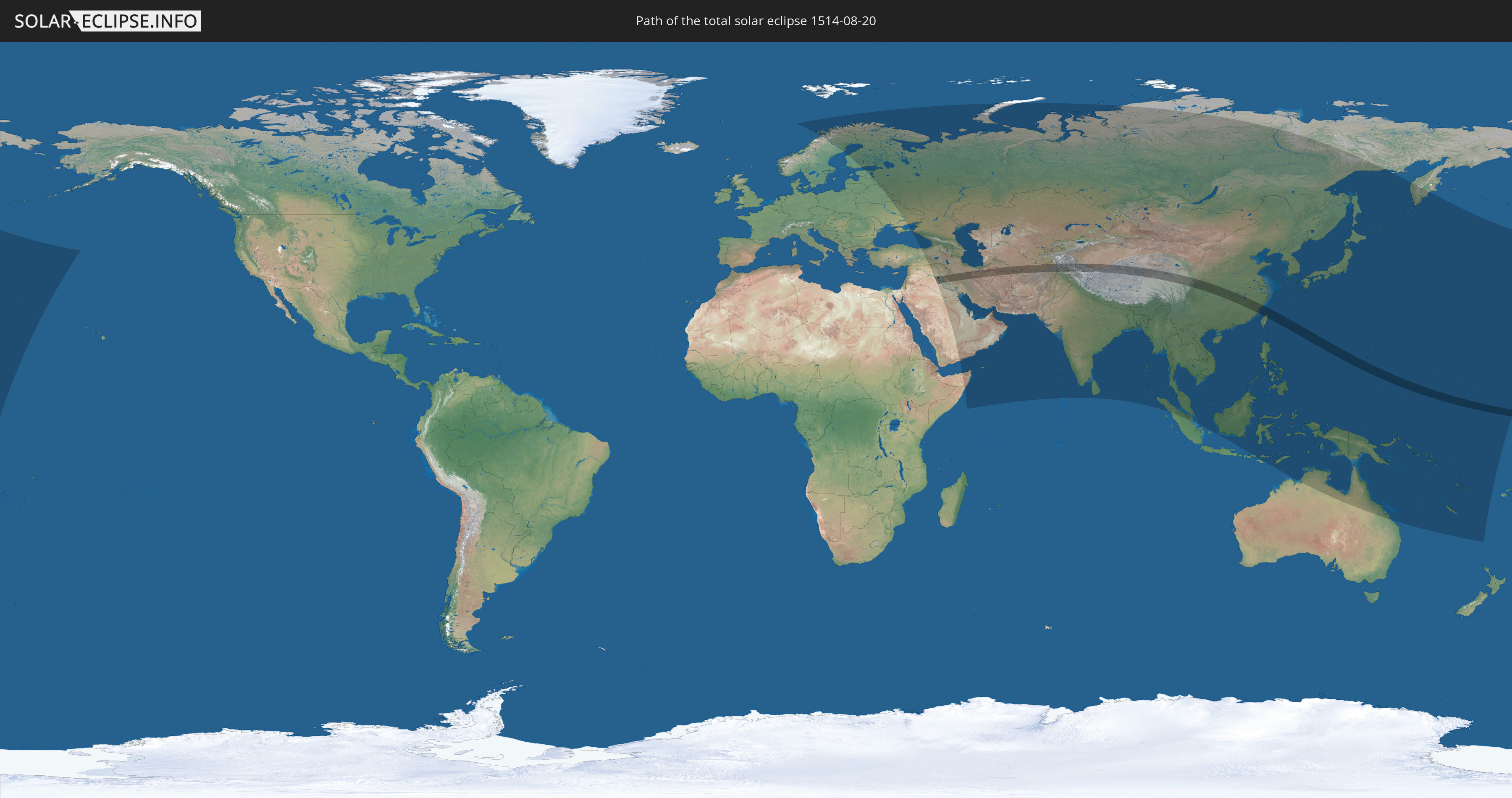
Die Sonnenfinsternis am 20.08.1514 kann man in 68 Ländern als partielle Sonnenfinsternis beobachten.
Der Finsternispfad verläuft durch 14 Länder. Nur in diesen Ländern ist sie als totale Sonnenfinsternis zu sehen.
In den folgenden Ländern ist die Sonnenfinsternis total zu sehen
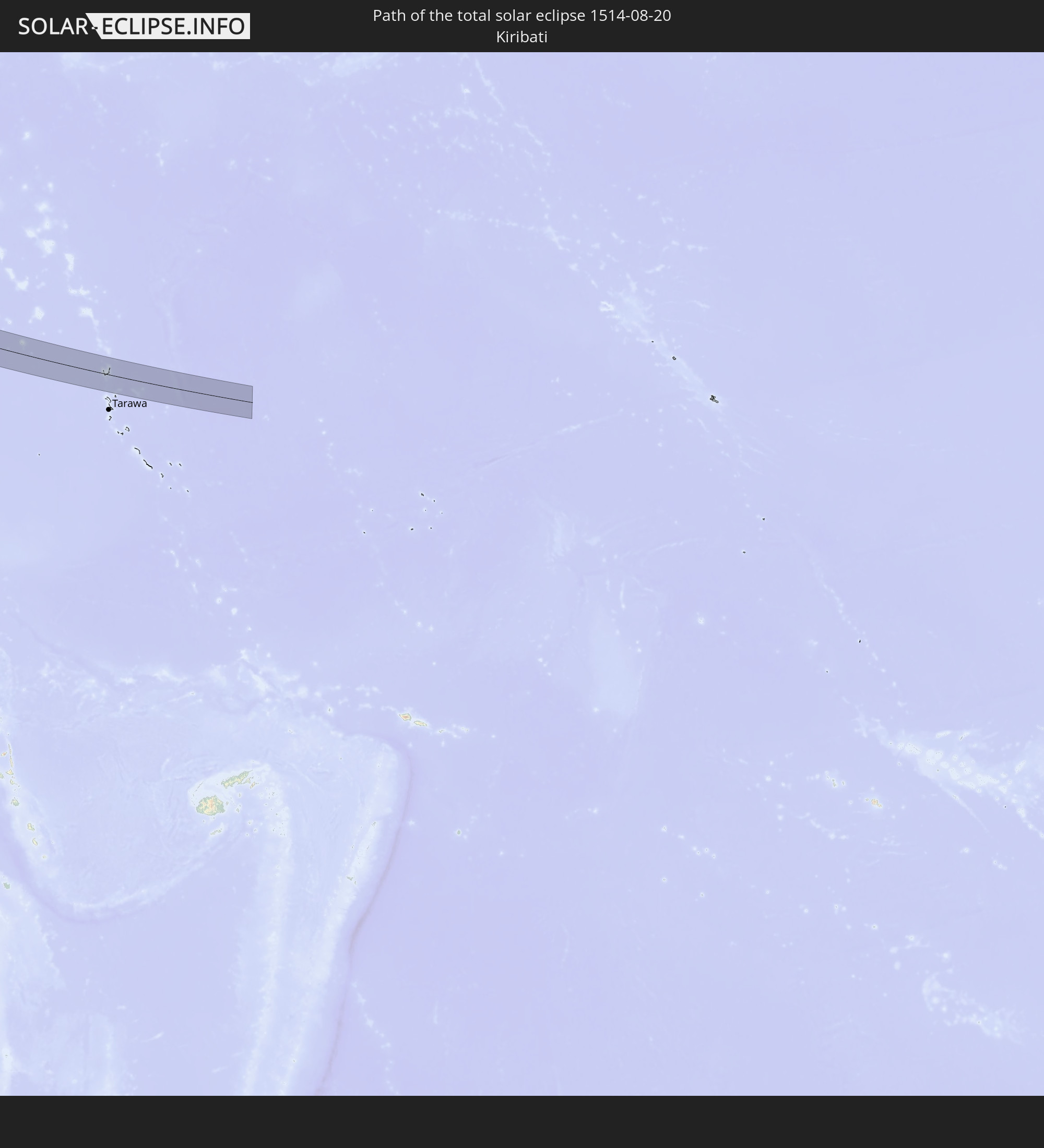 Kiribati
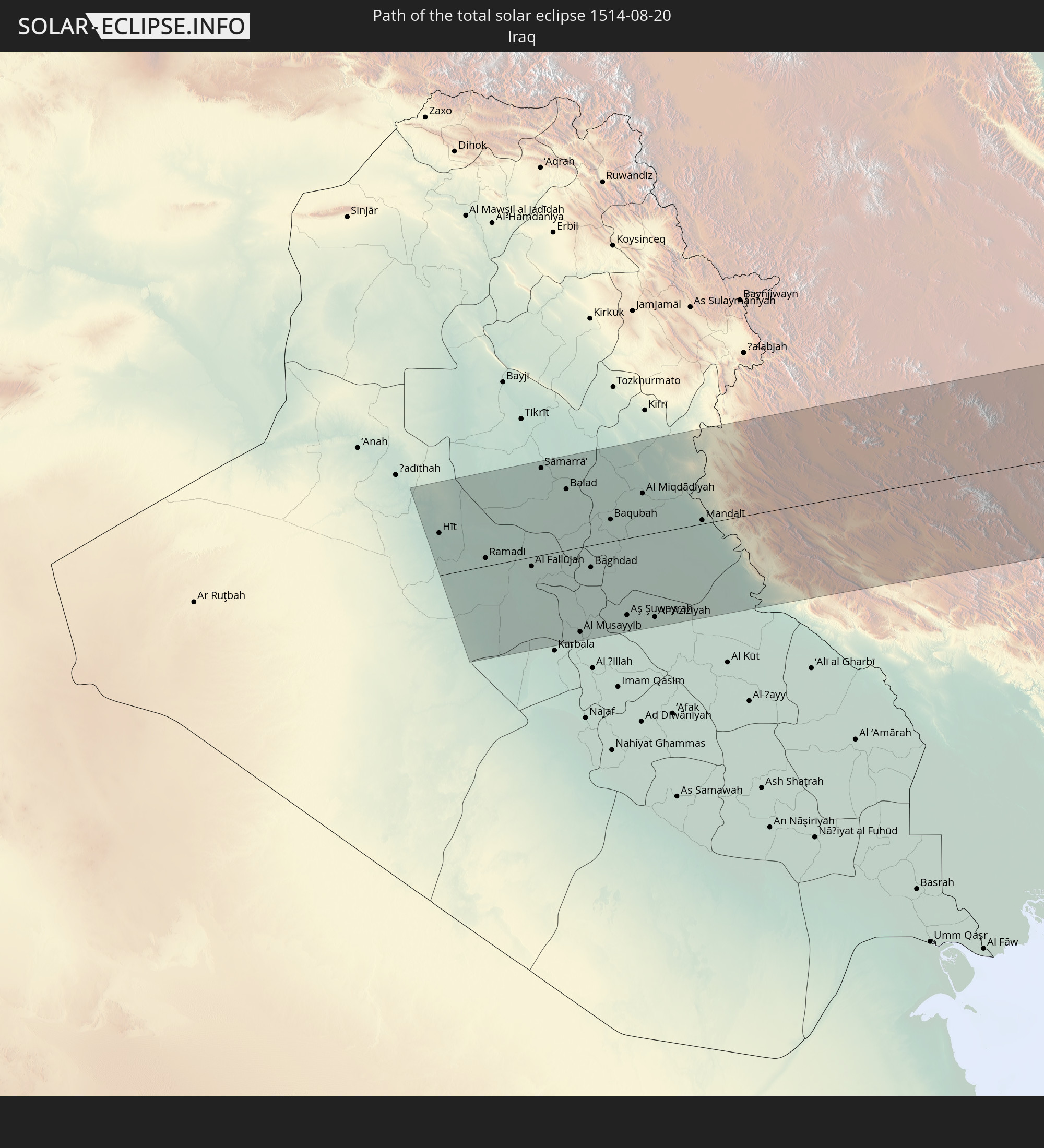 Irak
Irak
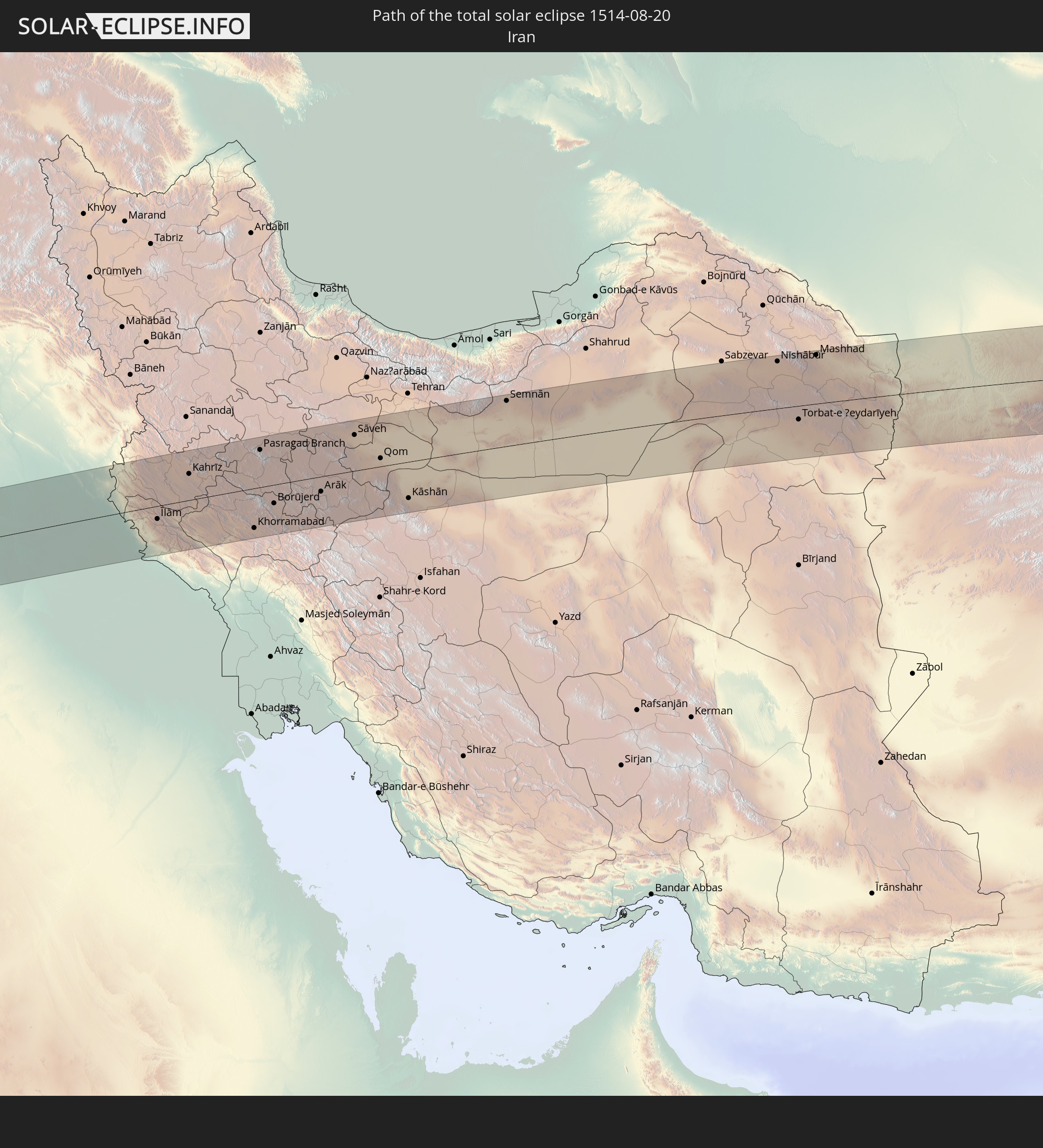 Iran
Iran
 Turkmenistan
 Afghanistan
 Pakistan
 Tadschikistan
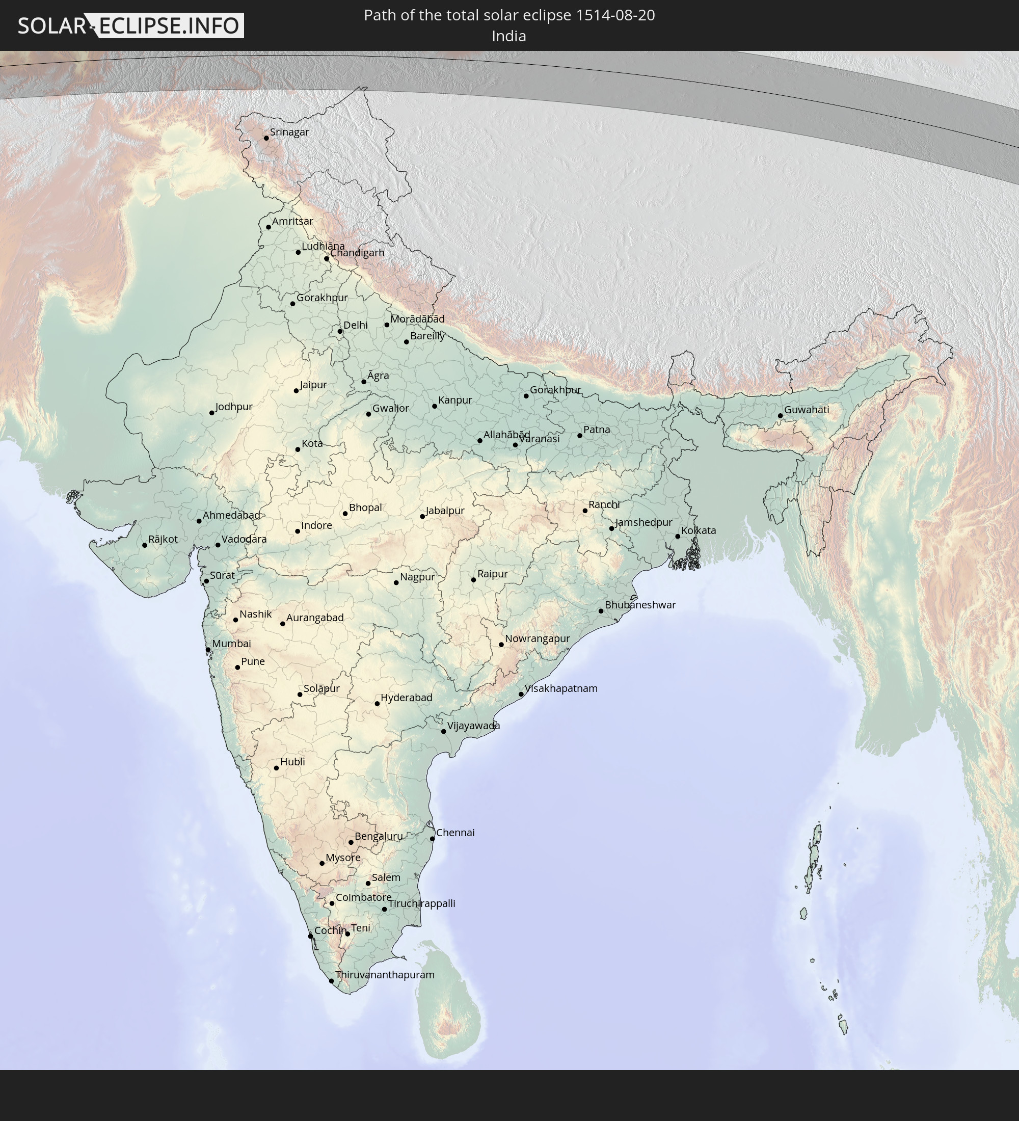 Indien
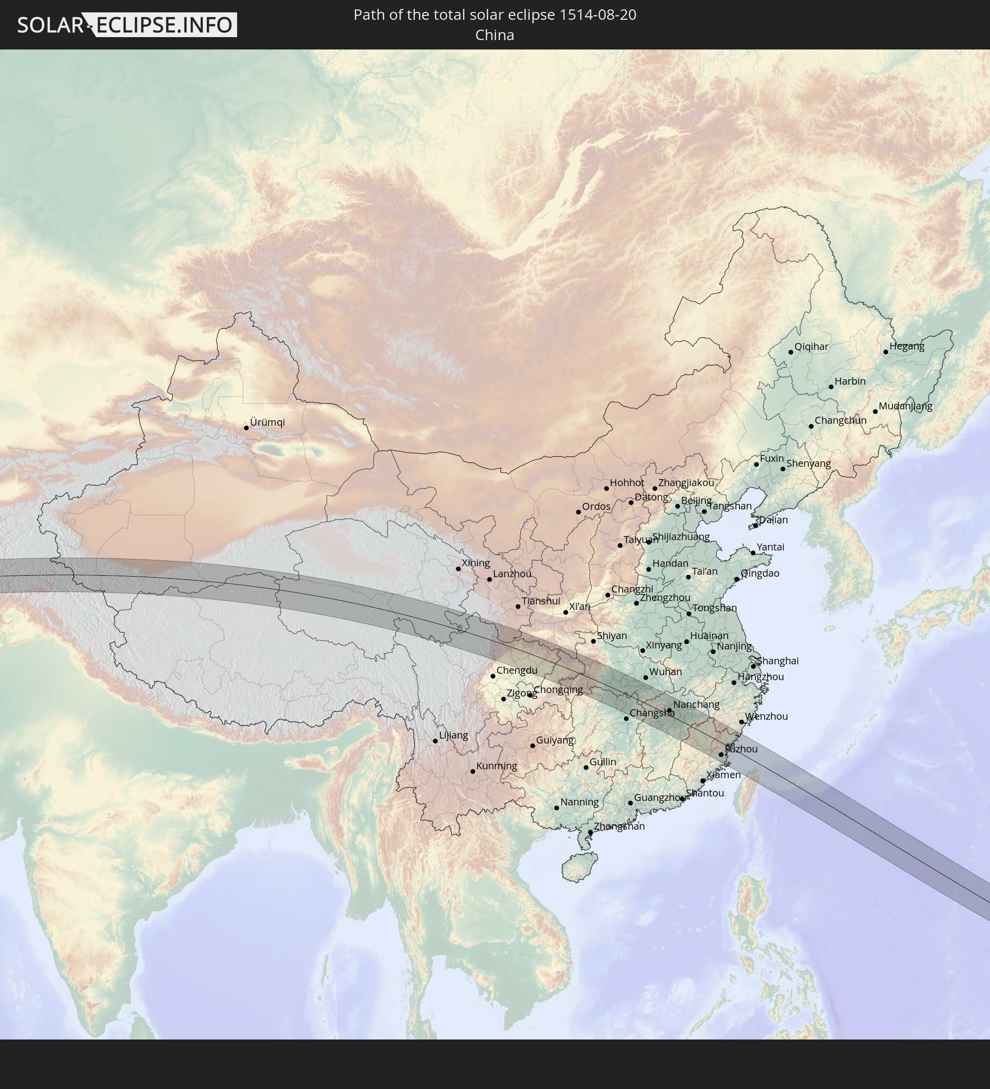 Volksrepublik China
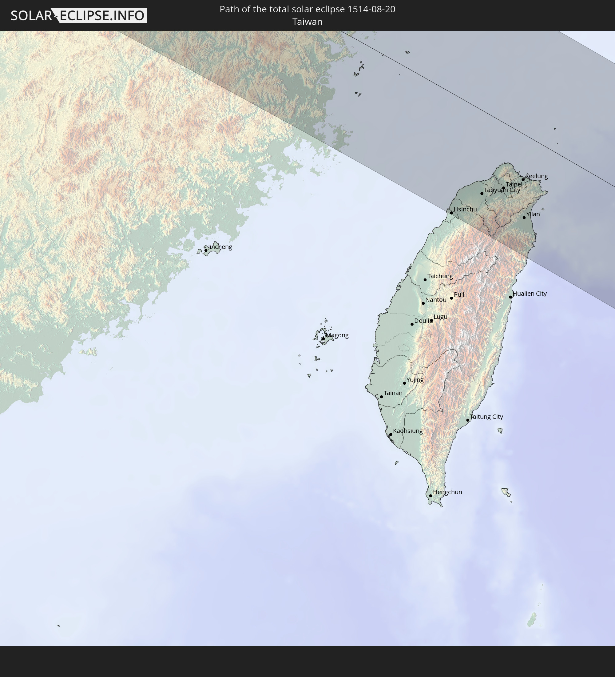 Taiwan
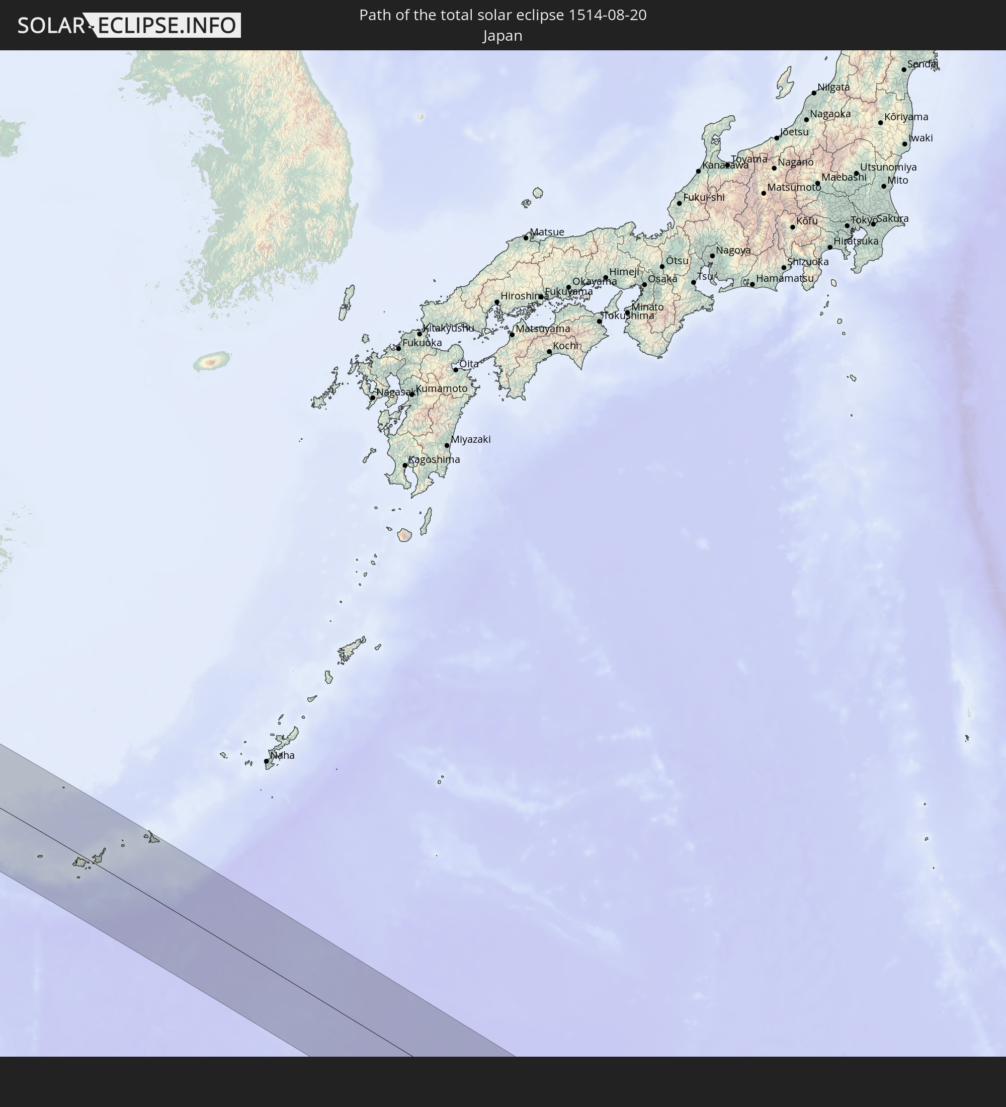 Japan
Japan
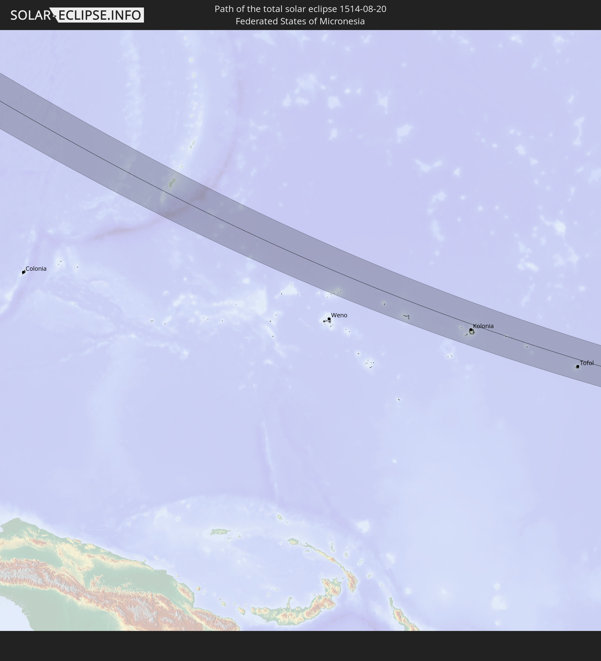 Föderierte Staaten von Mikronesien
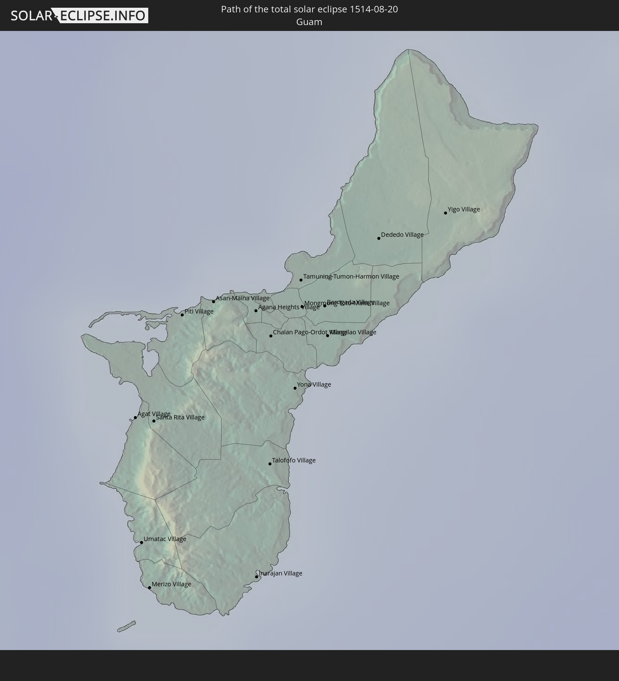 Guam
Guam
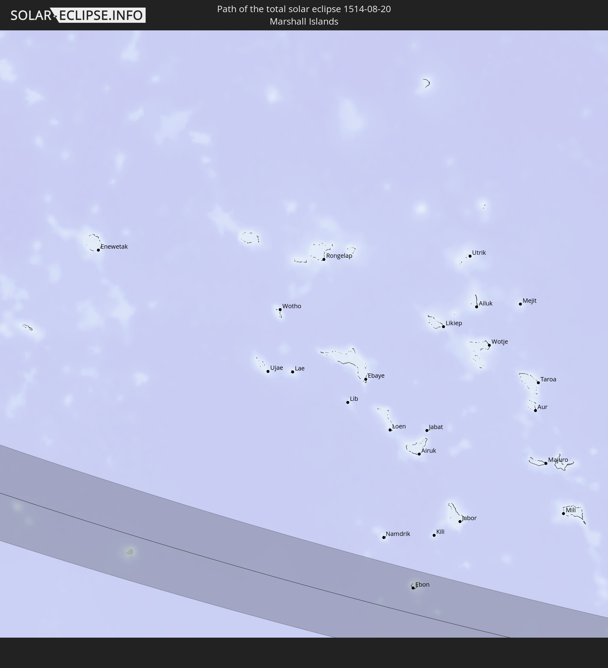 Marshallinseln
In den folgenden Ländern ist die Sonnenfinsternis partiell zu sehen
 Russland
 United States Minor Outlying Islands
 Kiribati
 Norwegen
 Schweden
 Finnland
 Estland
 Ukraine
 Weißrussland
 Türkei
 Saudi-Arabien
 Syrien
 Irak
Irak
 Georgien
 Somalia
 Jemen
Jemen
 Armenien
 Iran
Iran
 Aserbaidschan
 Kasachstan
 Kuwait
 Bahrain
 Katar
Katar
 Vereinigte Arabische Emirate
 Oman
Oman
 Turkmenistan
 Usbekistan
 Afghanistan
 Pakistan
 Tadschikistan
 Indien
 Kirgisistan
 Malediven
 Volksrepublik China
 Sri Lanka
 Nepal
Nepal
 Mongolei
 Bangladesch
 Bhutan
 Myanmar
 Indonesien
 Thailand
 Malaysia
 Laos
Laos
 Vietnam
 Kambodscha
 Singapur
 Australien
 Macau
Macau
 Hongkong
 Brunei
 Taiwan
 Philippinen
 Japan
Japan
 Osttimor
 Nordkorea
 Südkorea
 Palau
Palau
 Föderierte Staaten von Mikronesien
 Papua-Neuguinea
 Guam
Guam
 Nördliche Marianen
 Salomonen
 Neukaledonien
 Marshallinseln
 Vanuatu
 Nauru
Nauru
 Tuvalu
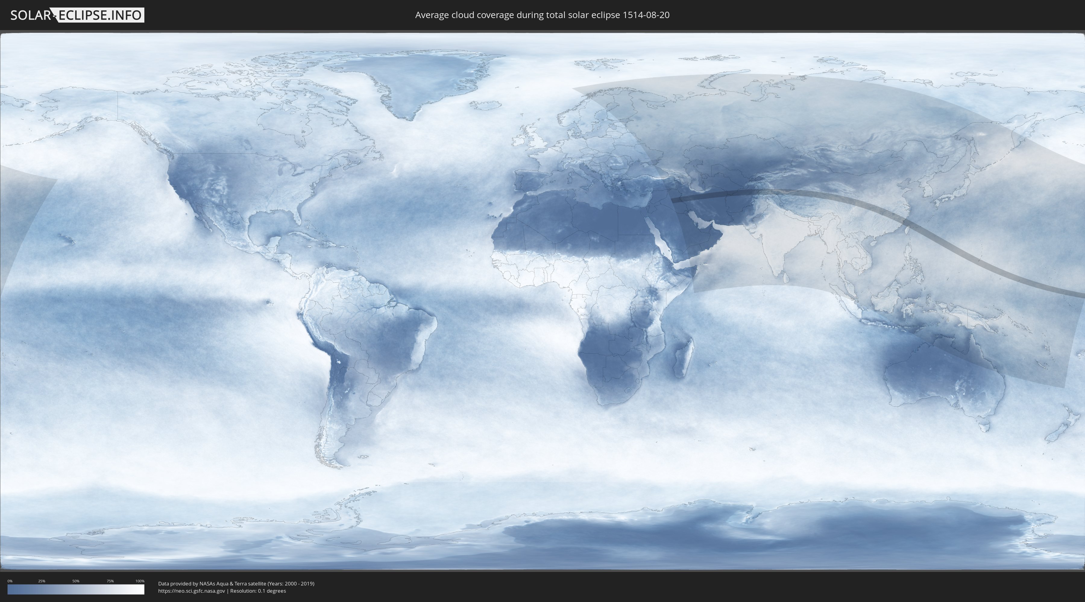
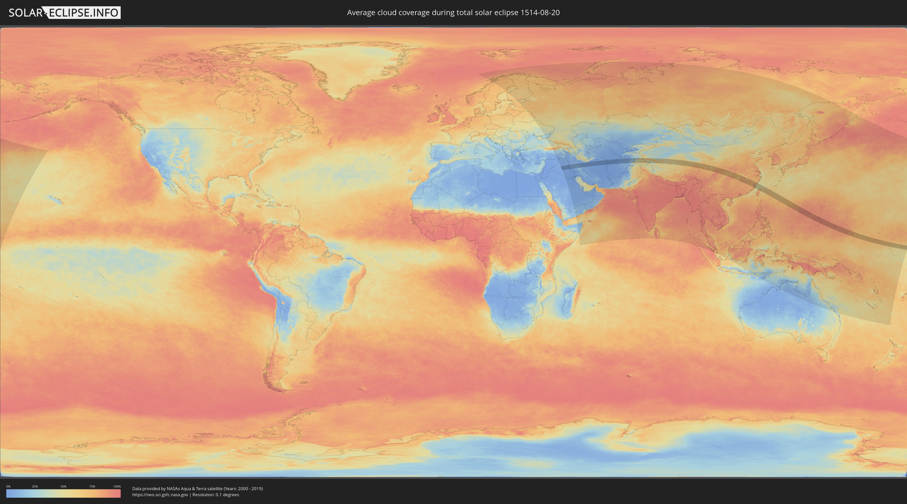
Wie wird das Wetter während der totalen Sonnenfinsternis am 20.08.1514?
Wo ist der beste Ort, um die totale Sonnenfinsternis vom 20.08.1514 zu beobachten?
Die folgenden Karten zeigen die durchschnittliche Bewölkung für den Tag, an dem die totale Sonnenfinsternis
stattfindet. Mit Hilfe der Karten lässt sich der Ort entlang des Finsternispfades eingrenzen,
der die besten Aussichen auf einen klaren wolkenfreien Himmel bietet.
Trotzdem muss man immer lokale Gegenenheiten beachten und sollte sich genau über das Wetter an seinem
gewählten Beobachtungsort informieren.
Die Daten stammen von den beiden NASA-Satelliten
AQUA und TERRA
und wurden über einen Zeitraum von 19 Jahren (2000 - 2019) gemittelt.
Detaillierte Länderkarten
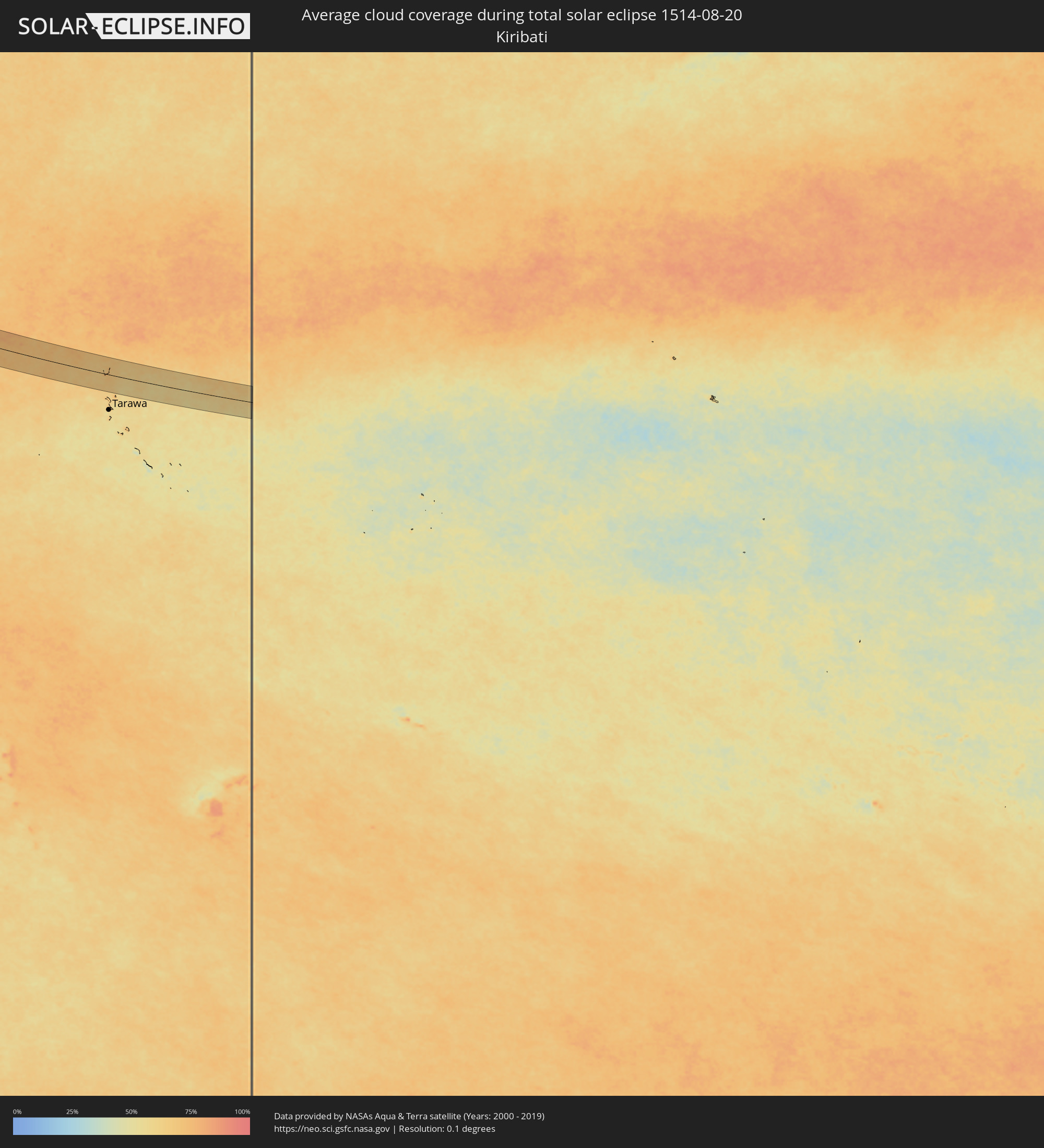 Kiribati
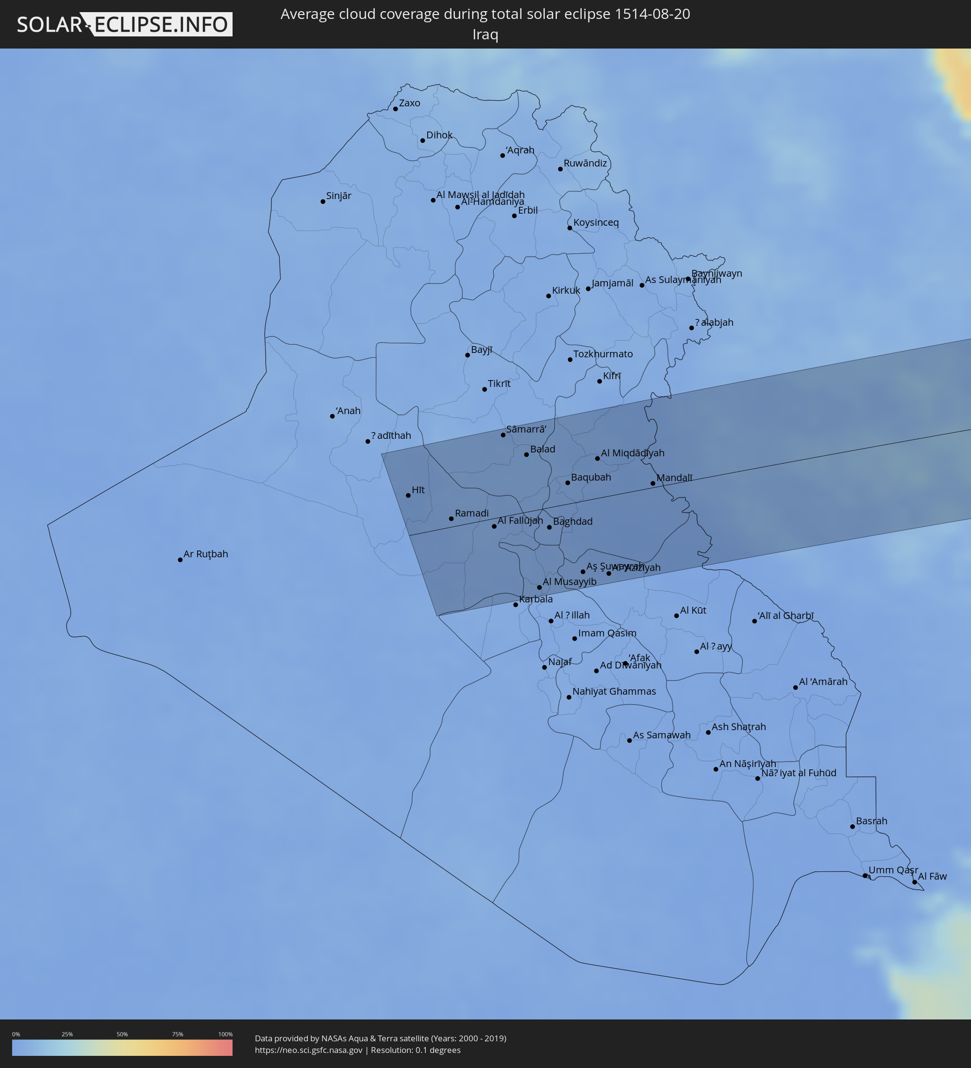 Irak
Irak
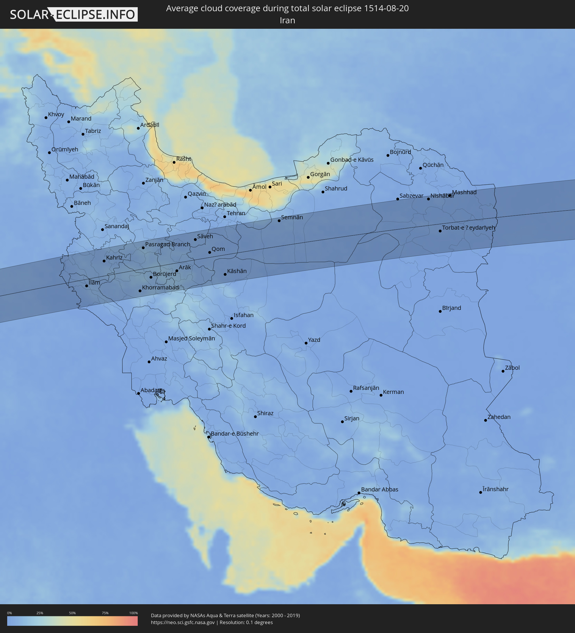 Iran
Iran
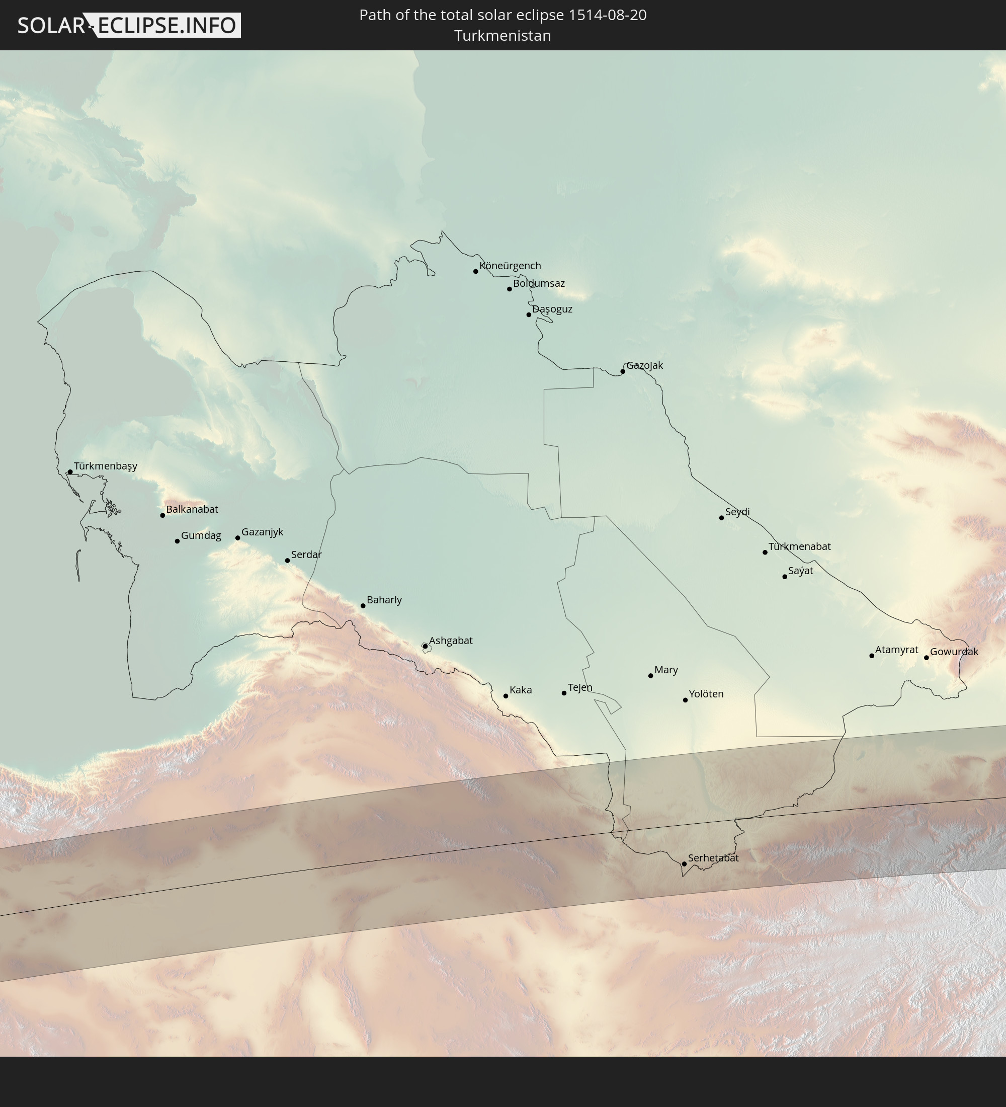
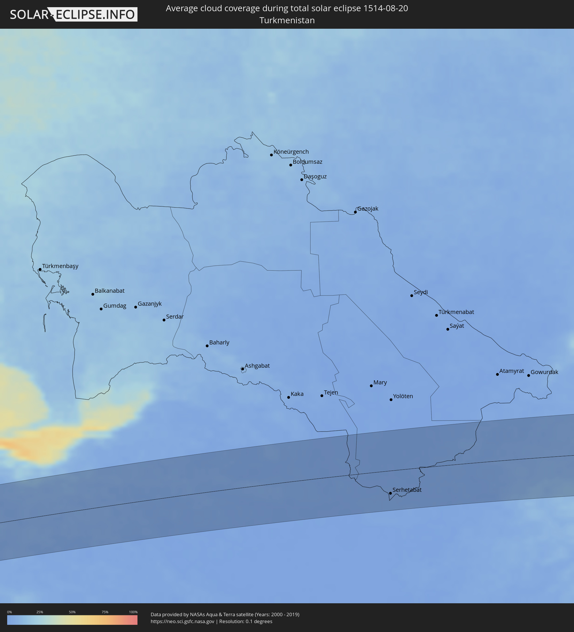 Turkmenistan
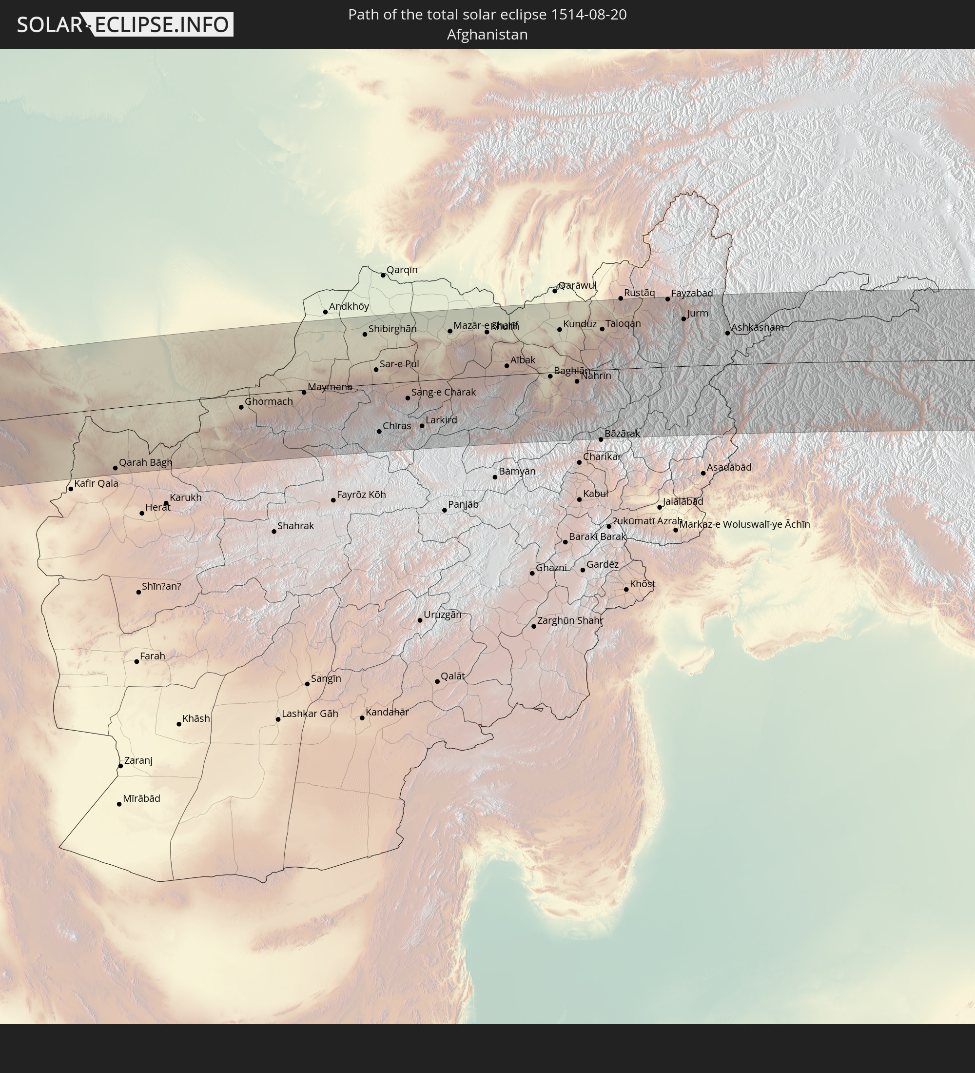
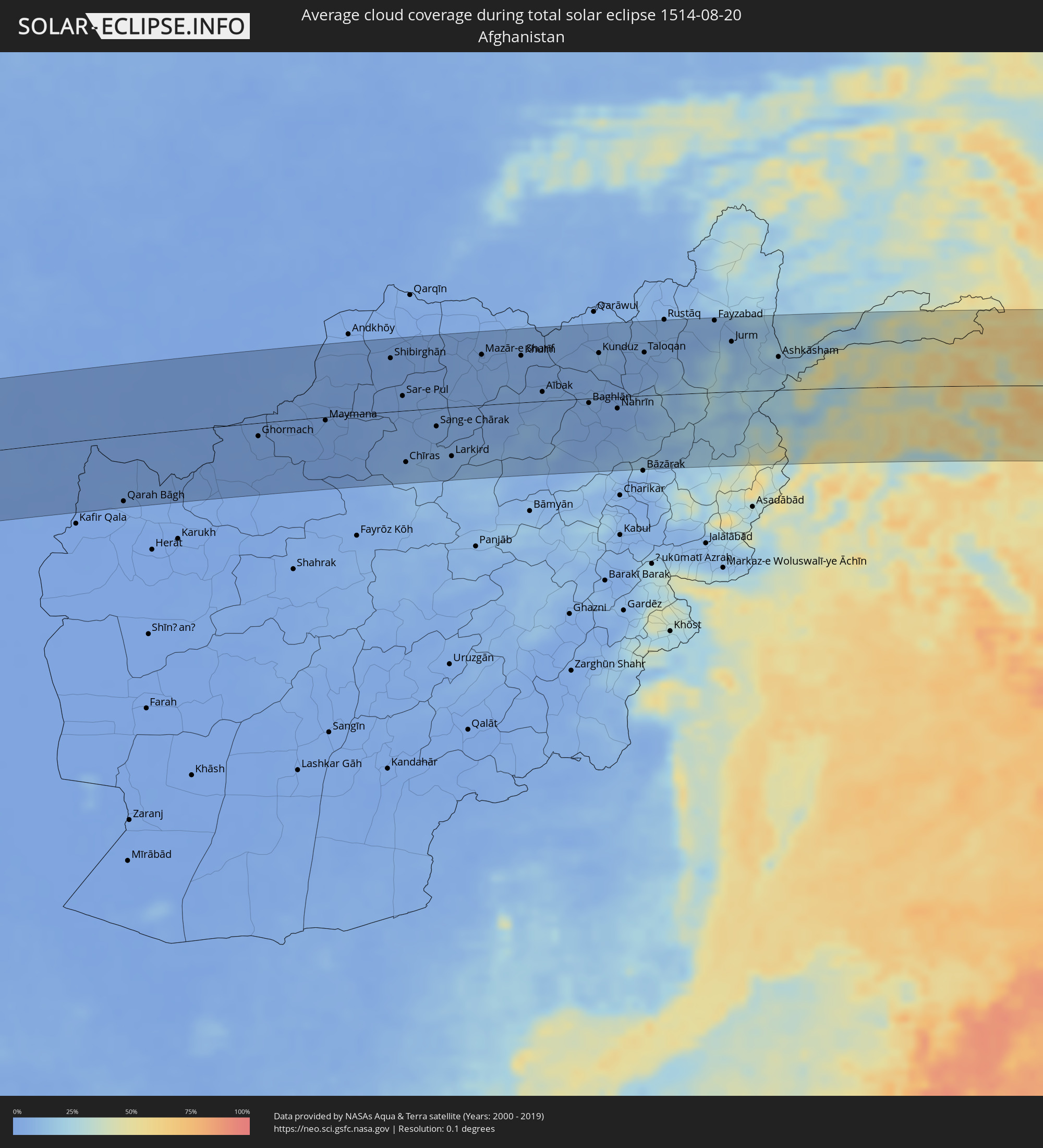 Afghanistan
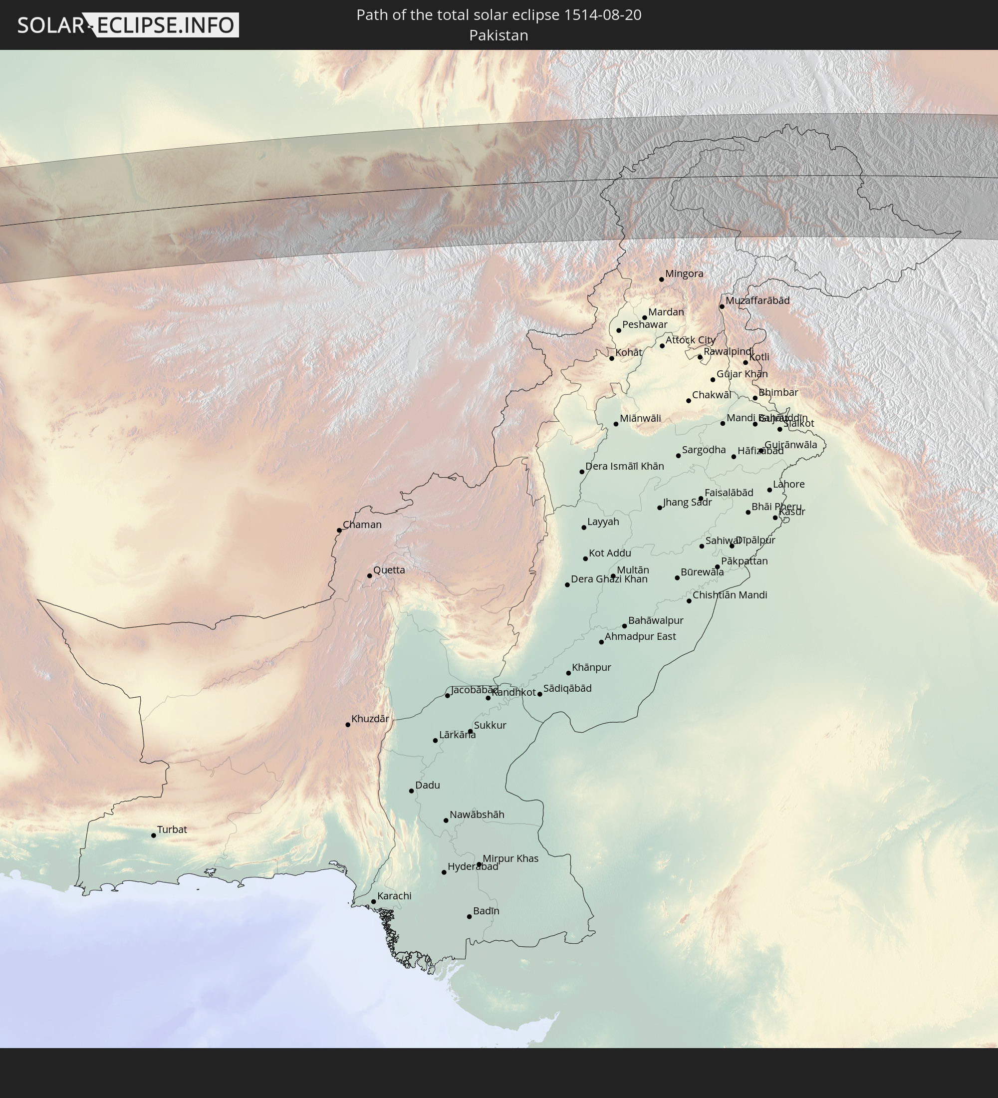
 Pakistan
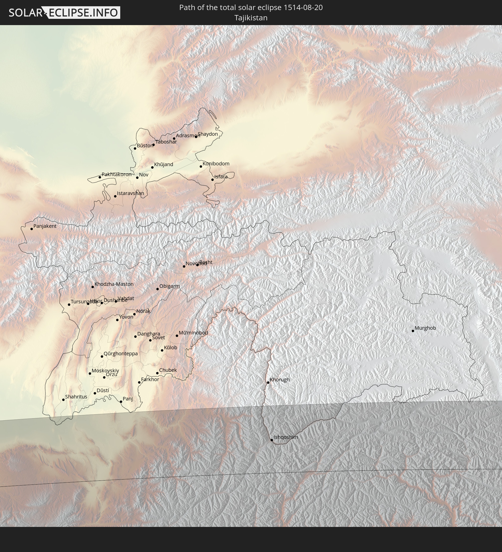
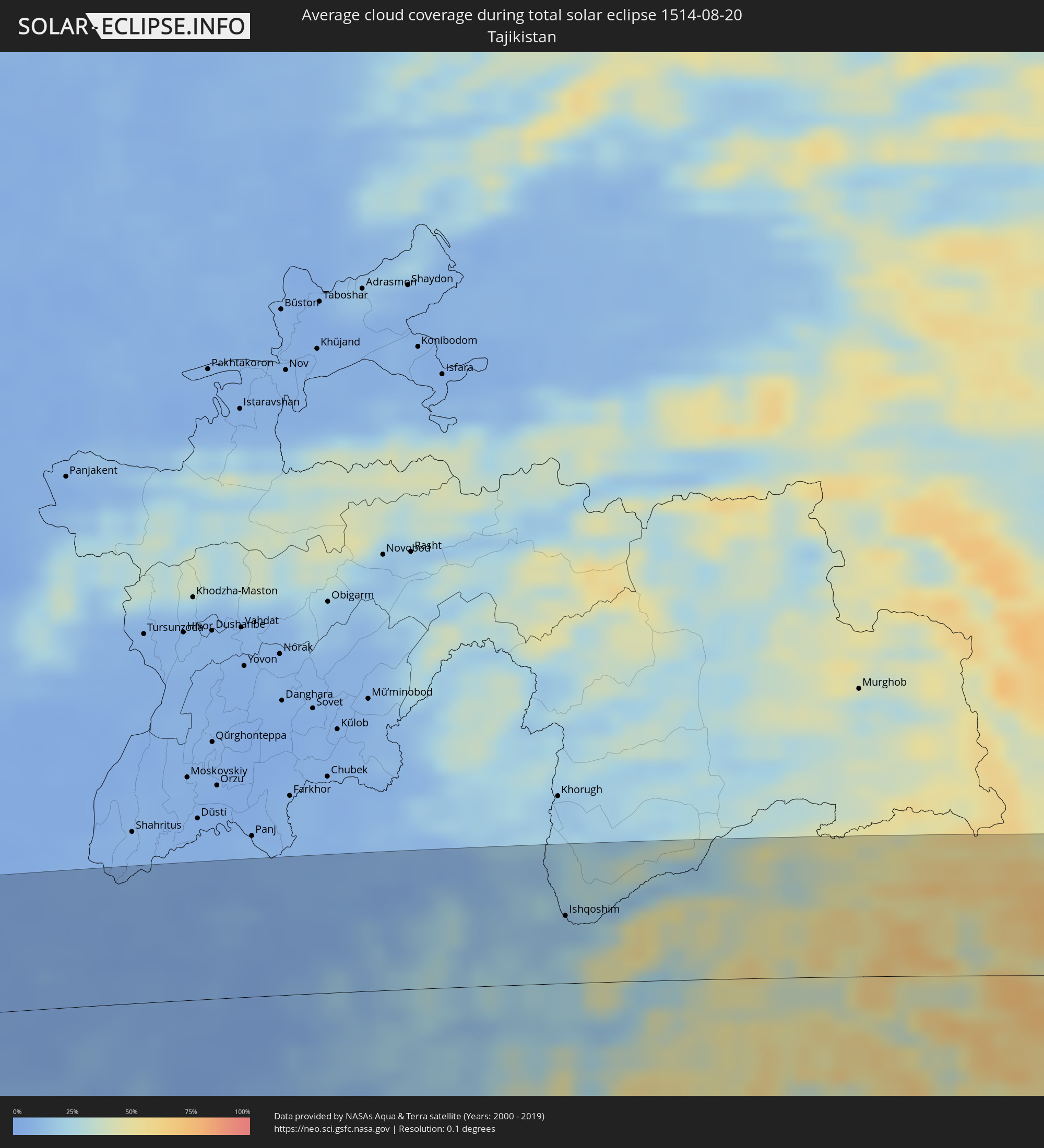 Tadschikistan
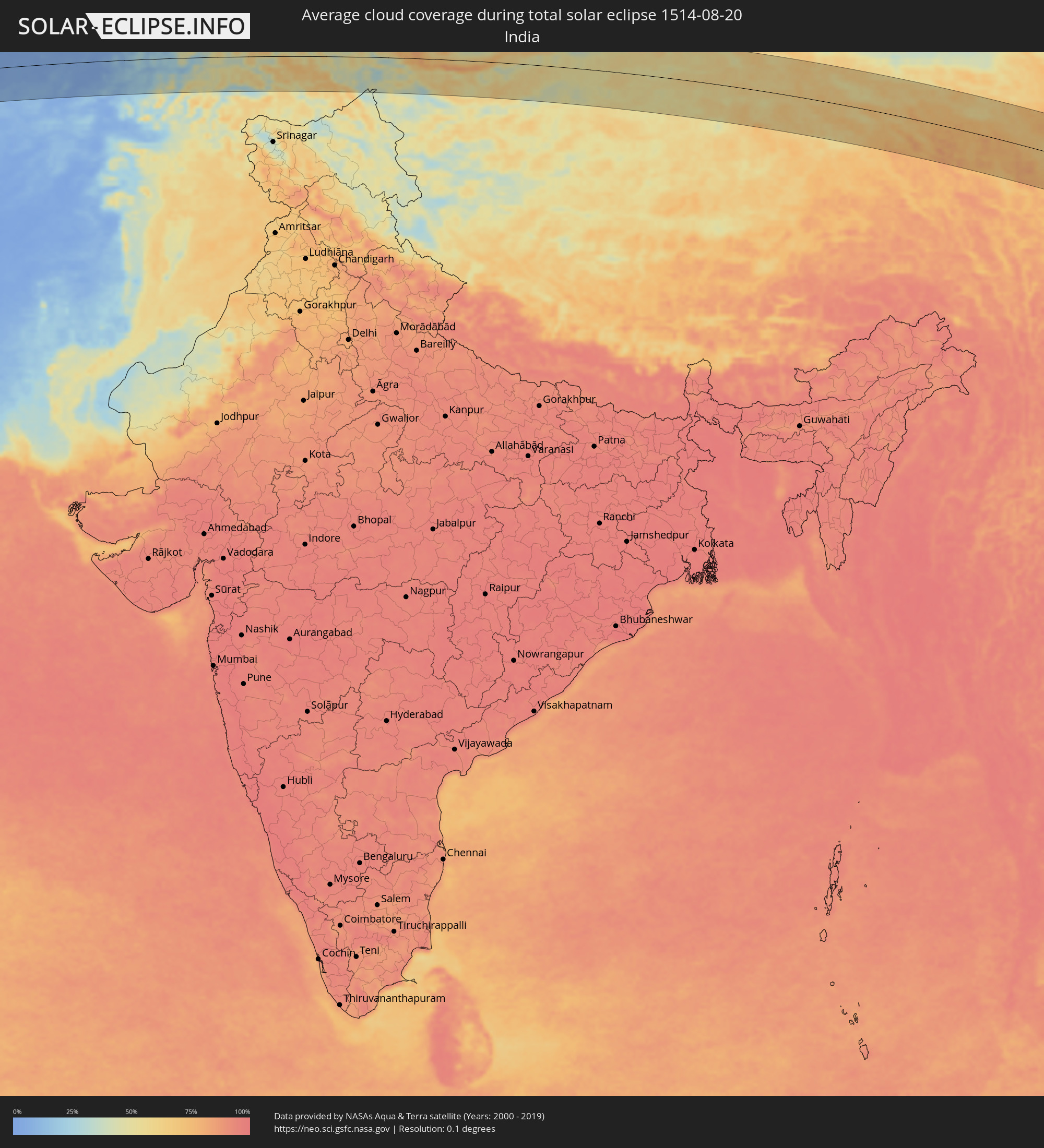 Indien
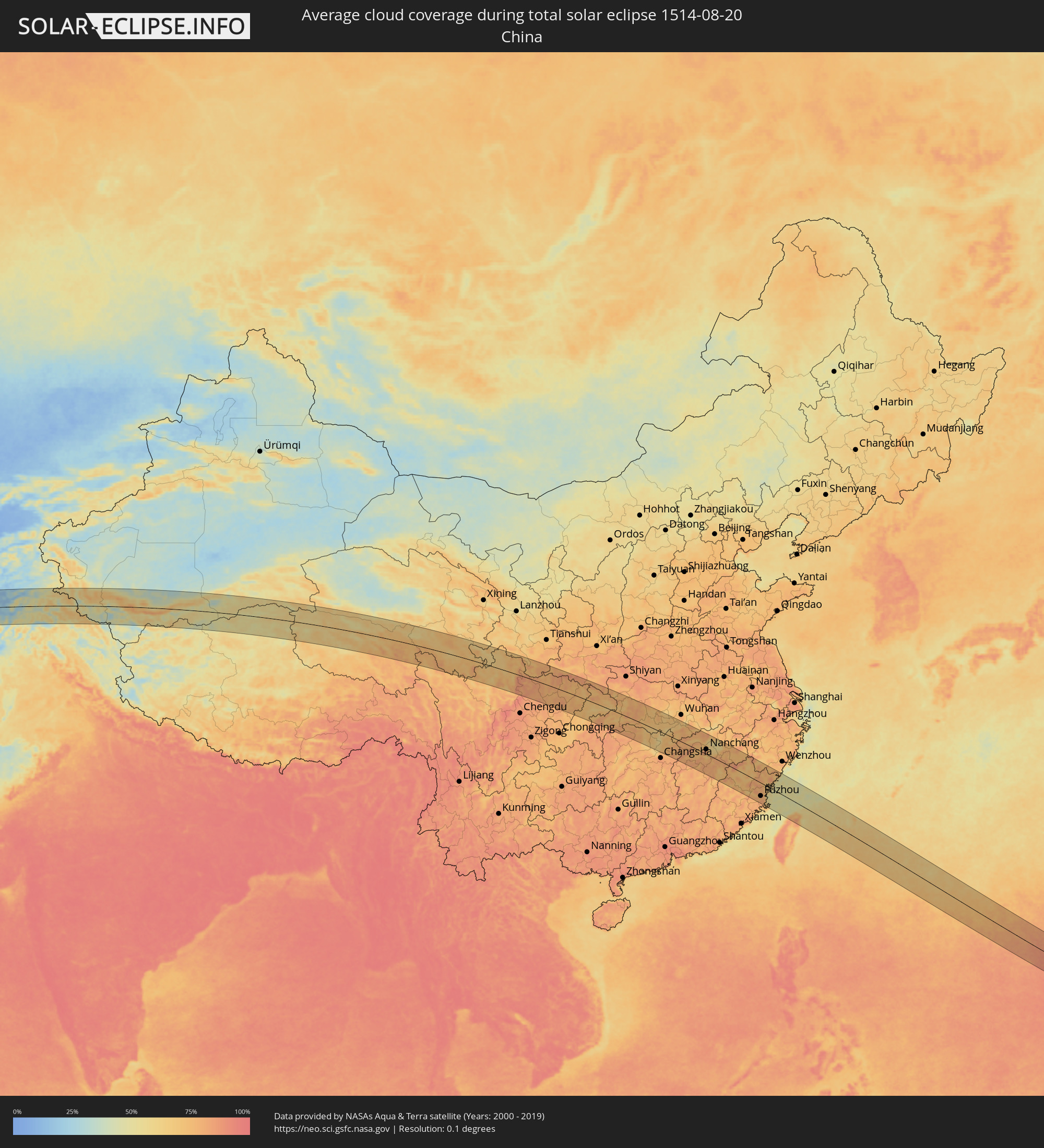 Volksrepublik China
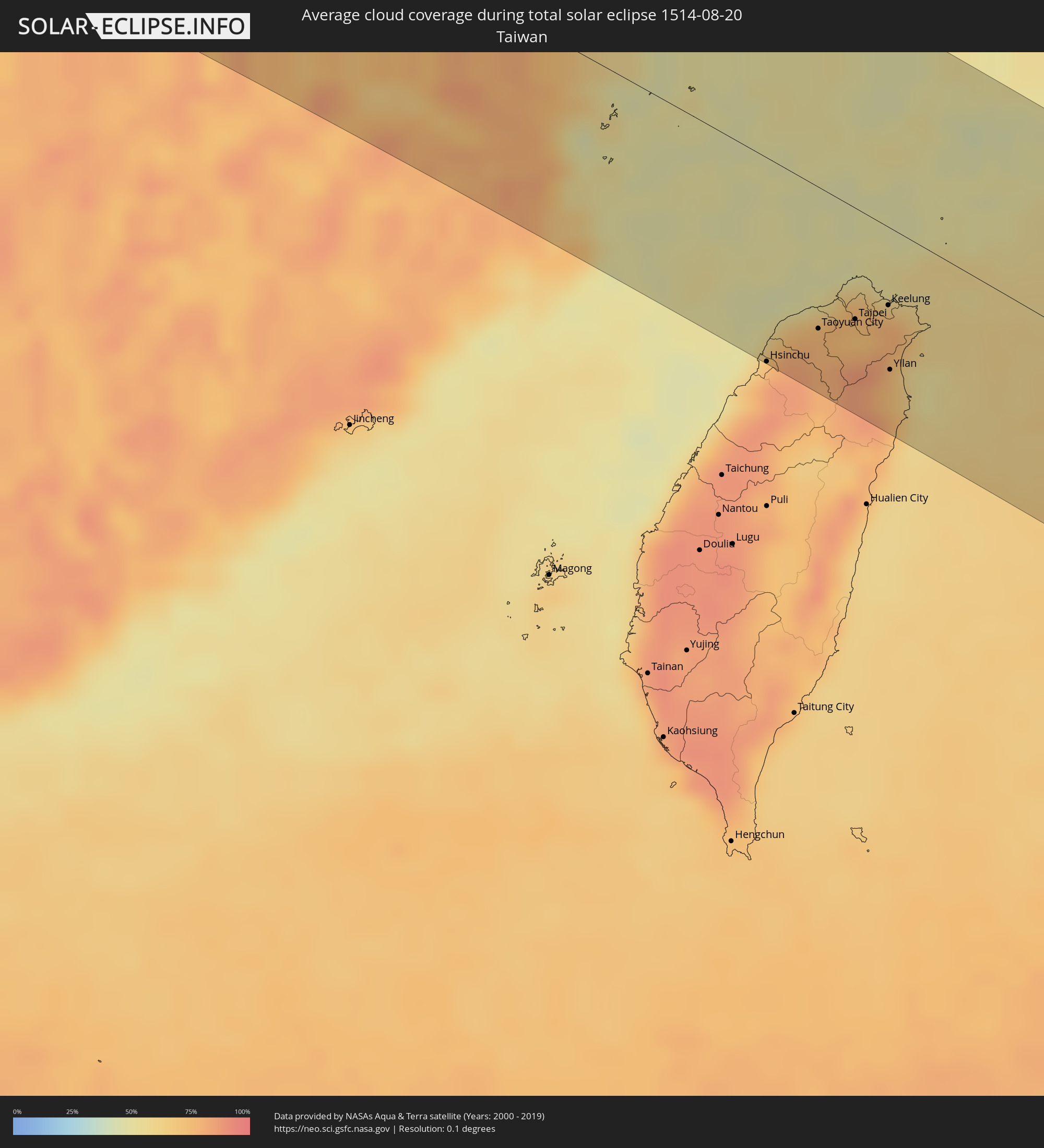 Taiwan
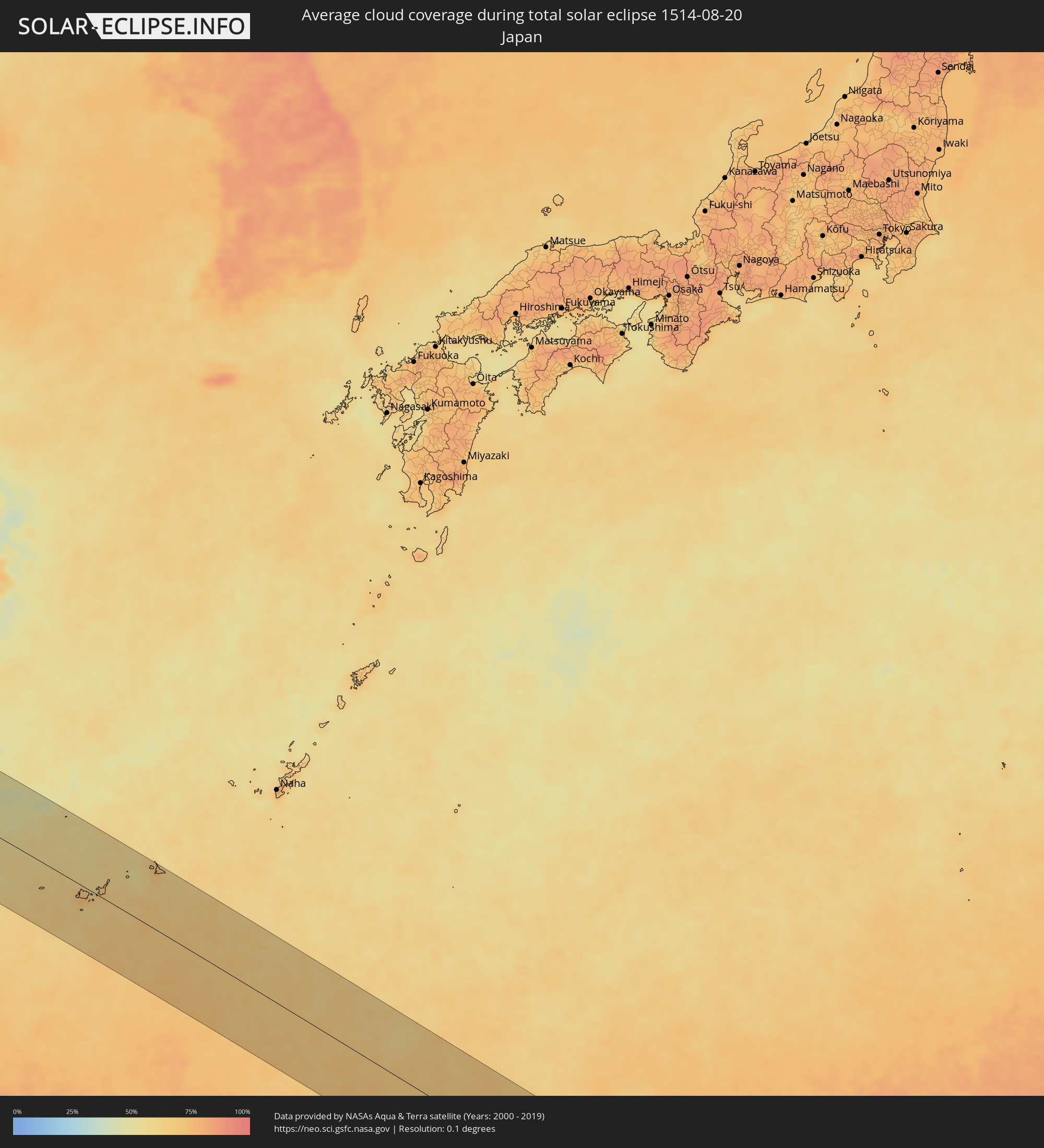 Japan
Japan
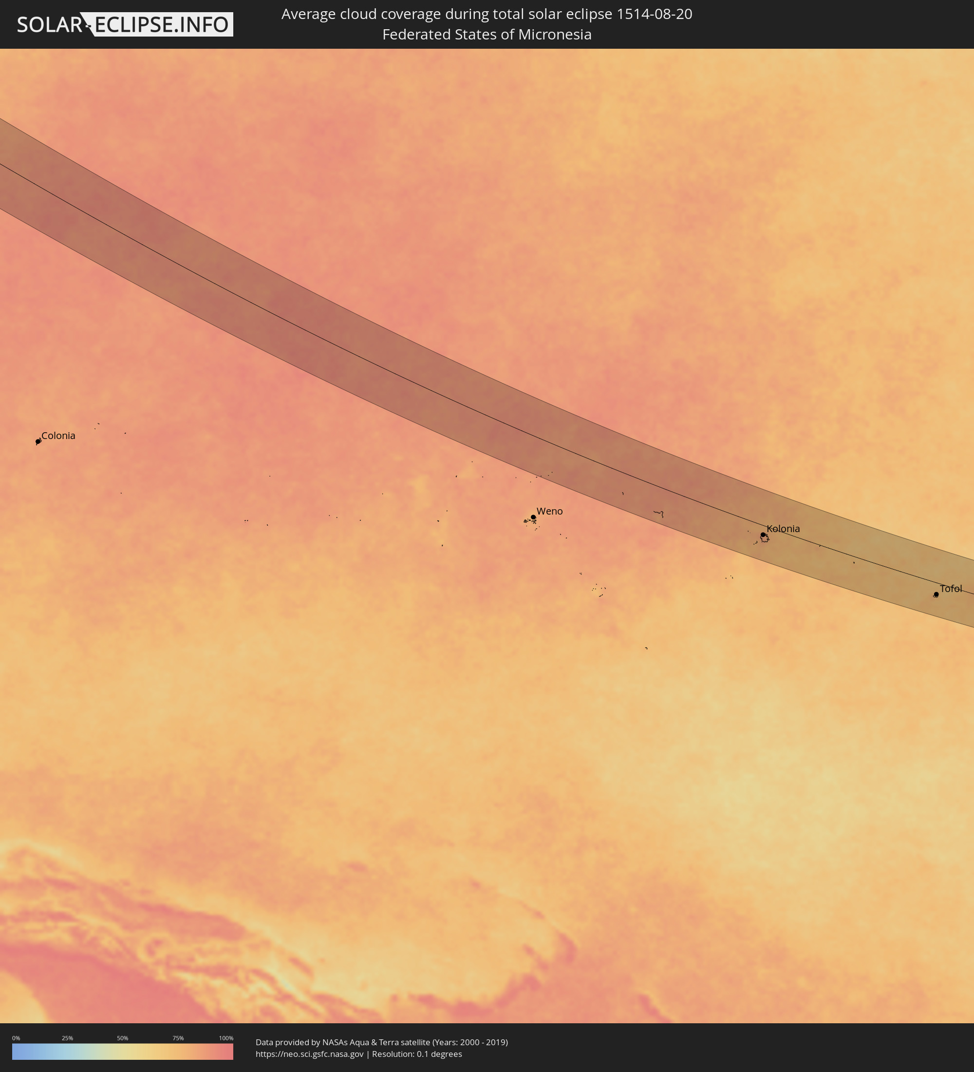 Föderierte Staaten von Mikronesien
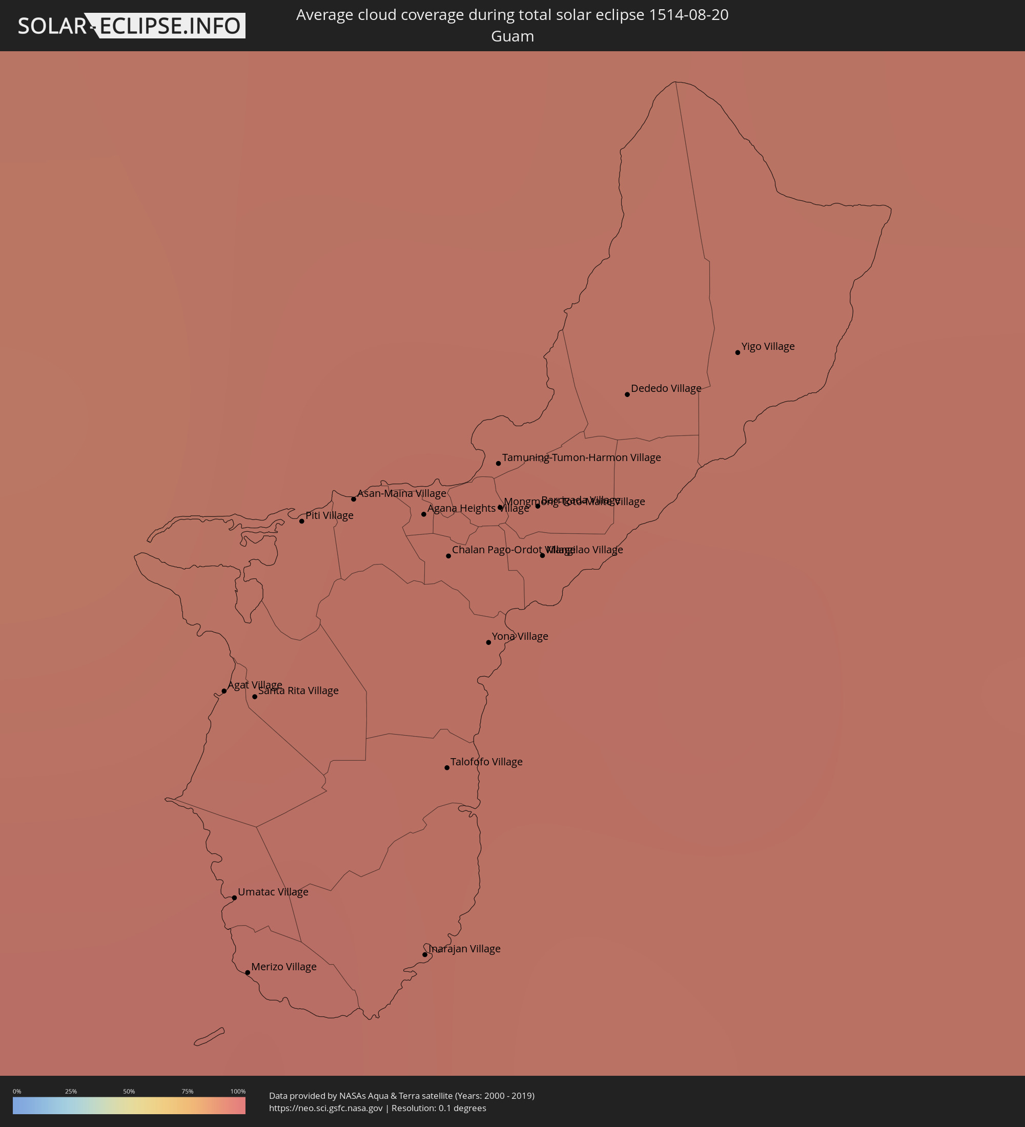 Guam
Guam
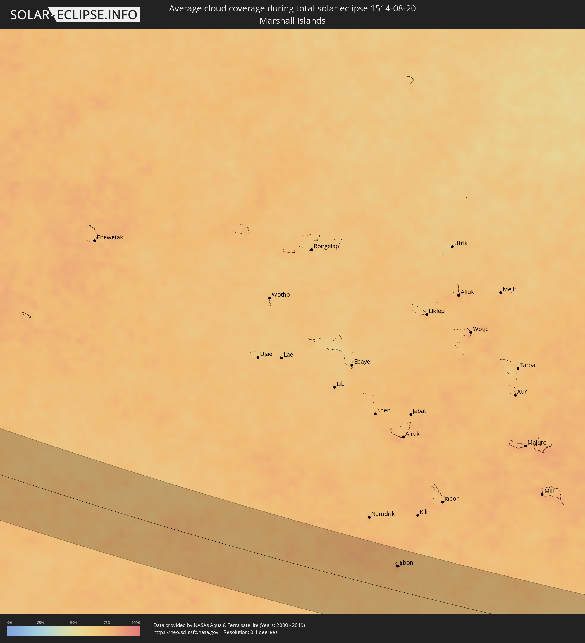 Marshallinseln
Orte im Finsternispfad
Die nachfolgene Tabelle zeigt Städte und Orte mit mehr als 5.000 Einwohnern, die sich im Finsternispfad befinden. Städte mit mehr als 100.000 Einwohnern sind dick gekennzeichnet. Mit einem Klick auf den Ort öffnet sich eine Detailkarte die die Lage des jeweiligen Ortes zusammen mit dem Verlauf der zentralen Finsternis präsentiert.
| Ort | Typ | Dauer der Verfinsterung | Ortszeit bei maximaler Verfinsterung | Entfernung zur Zentrallinie | Ø Bewölkung |
|
Hīt, Anbar
|
total | - | 05:41:48 UTC+02:57 | 40 km | 2% |
|
Ramadi, Anbar
|
total | - | 05:41:37 UTC+02:57 | 8 km | 3% |
|
Al Fallūjah, Anbar
|
total | - | 05:41:32 UTC+02:57 | 9 km | 4% |
|
Sāmarrā’, Salah ad Din Governorate
|
total | - | 05:42:04 UTC+02:57 | 82 km | 4% |
|
Balad, Salah ad Din Governorate
|
total | - | 05:41:56 UTC+02:57 | 57 km | 5% |
|
Abū Ghurayb, Mayorality of Baghdad
|
total | - | 05:41:28 UTC+02:57 | 21 km | 3% |
|
Ad Dujayl, Salah ad Din Governorate
|
total | - | 05:41:49 UTC+02:57 | 37 km | 5% |
|
Nāḩīyat Saddat al Hindīyah, Bābil
|
total | - | 05:41:05 UTC+02:57 | 87 km | 3% |
|
Al Musayyib, Bābil
|
total | - | 05:41:07 UTC+02:57 | 80 km | 3% |
|
Baghdad, Mayorality of Baghdad
|
total | - | 05:41:28 UTC+02:57 | 21 km | 3% |
|
Khāliş, Diyālá
|
total | - | 05:41:46 UTC+02:57 | 28 km | 4% |
|
Baqubah, Diyālá
|
total | - | 05:41:44 UTC+02:57 | 21 km | 4% |
|
Aş Şuwayrah, Wāsiţ
|
total | - | 05:41:11 UTC+02:57 | 73 km | 2% |
|
Al Miqdādīyah, Diyālá
|
total | - | 05:41:51 UTC+02:57 | 39 km | 2% |
|
Al ‘Azīzīyah, Wāsiţ
|
total | - | 05:41:09 UTC+02:57 | 80 km | 3% |
|
Mandalī, Diyālá
|
total | - | 05:41:41 UTC+02:57 | 3 km | 2% |
|
Īlām, Īlām
|
total | - | 06:09:43 UTC+03:25 | 24 km | 5% |
|
Kahrīz, Kermānshāh
|
total | - | 06:10:13 UTC+03:25 | 47 km | 5% |
|
Kūhdasht, Lorestān
|
total | - | 06:09:39 UTC+03:25 | 55 km | 5% |
|
Khorramabad, Lorestān
|
total | - | 06:09:38 UTC+03:25 | 72 km | 9% |
|
Pasragad Branch, Hamadān
|
total | - | 06:10:31 UTC+03:25 | 67 km | 14% |
|
Borūjerd, Lorestān
|
total | - | 06:09:55 UTC+03:25 | 34 km | 8% |
|
Malāyer, Hamadān
|
total | - | 06:10:12 UTC+03:25 | 9 km | 14% |
|
Arāk, Markazi
|
total | - | 06:10:07 UTC+03:25 | 27 km | 12% |
|
Sāveh, Markazi
|
total | - | 06:10:48 UTC+03:25 | 64 km | 5% |
|
Qom, Qom
|
total | - | 06:10:35 UTC+03:25 | 15 km | 5% |
|
Kāshān, Isfahan
|
total | - | 06:10:12 UTC+03:25 | 66 km | 3% |
|
Qarchak, Tehrān
|
total | - | 06:11:14 UTC+03:25 | 91 km | 4% |
|
Semnān, Semnān
|
total | - | 06:11:37 UTC+03:25 | 81 km | 5% |
|
Kāshmar, Razavi Khorasan
|
total | - | 06:12:40 UTC+03:25 | 20 km | 1% |
|
Nīshābūr, Razavi Khorasan
|
total | - | 06:13:28 UTC+03:25 | 84 km | 1% |
|
Torbat-e Ḩeydarīyeh, Razavi Khorasan
|
total | - | 06:12:57 UTC+03:25 | 25 km | 2% |
|
Mashhad, Razavi Khorasan
|
total | - | 06:13:49 UTC+03:25 | 87 km | 2% |
|
Serhetabat, Mary
|
total | - | 06:42:01 UTC+03:53 | 55 km | 2% |
|
Ghormach, Badghis
|
total | - | 06:49:30 UTC+04:00 | 18 km | 1% |
|
Maymana, Faryab
|
total | - | 06:50:09 UTC+04:00 | 5 km | 1% |
|
Shibirghān, Jowzjan
|
total | - | 06:51:13 UTC+04:00 | 71 km | 1% |
|
Sar-e Pul, Sar-e Pol
|
total | - | 06:51:00 UTC+04:00 | 20 km | 2% |
|
Sang-e Chārak, Sar-e Pol
|
total | - | 06:51:03 UTC+04:00 | 24 km | 5% |
|
Balkh, Balkh
|
total | - | 06:51:57 UTC+04:00 | 74 km | 4% |
|
Mazār-e Sharīf, Balkh
|
total | - | 06:52:03 UTC+04:00 | 67 km | 4% |
|
Khulm, Balkh
|
total | - | 06:52:24 UTC+04:00 | 62 km | 4% |
|
Aībak, Samangan
|
total | - | 06:52:19 UTC+04:00 | 12 km | 4% |
|
Baghlān, Baghlan
|
total | - | 06:52:41 UTC+04:00 | 6 km | 5% |
|
Pul-e Khumrī, Baghlan
|
total | - | 06:52:34 UTC+04:00 | 27 km | 4% |
|
Kunduz, Kunduz
|
total | - | 06:53:11 UTC+04:00 | 60 km | 8% |
|
Khanabad, Kunduz
|
total | - | 06:53:20 UTC+04:00 | 53 km | 5% |
|
Nahrīn, Baghlan
|
total | - | 06:52:56 UTC+04:00 | 15 km | 3% |
|
Ārt Khwājah, Takhar
|
total | - | 06:53:51 UTC+04:00 | 96 km | 6% |
|
Taloqan, Takhar
|
total | - | 06:53:40 UTC+04:00 | 57 km | 5% |
|
Fayzabad, Badakhshan
|
total | - | 06:54:40 UTC+04:00 | 95 km | 7% |
|
Ishqoshim, Gorno-Badakhshan
|
total | - | 07:30:23 UTC+04:35 | 48 km | 16% |
|
Tāl, Khyber Pakhtunkhwa
|
total | - | 07:23:07 UTC+04:28 | 92 km | 43% |
|
Gilgit, Gilgit-Baltistan
|
total | - | 07:25:09 UTC+04:28 | 46 km | 53% |
|
Guangyuan, Sichuan
|
total | - | 11:45:04 UTC+08:00 | 26 km | 77% |
|
Wanxian, Chongqing
|
total | - | 11:51:35 UTC+08:00 | 57 km | 68% |
|
Yichang, Hubei
|
total | - | 11:58:05 UTC+08:00 | 41 km | 79% |
|
Zhicheng, Hubei
|
total | - | 11:58:56 UTC+08:00 | 7 km | 78% |
|
Jingmen, Hubei
|
total | - | 11:59:49 UTC+08:00 | 109 km | 75% |
|
Shashi, Hubei
|
total | - | 12:00:35 UTC+08:00 | 37 km | 75% |
|
Qianjiang, Hubei
|
total | - | 12:01:54 UTC+08:00 | 75 km | 75% |
|
Yueyang, Hunan
|
total | - | 12:03:23 UTC+08:00 | 22 km | 70% |
|
Jingling, Hubei
|
total | - | 12:02:09 UTC+08:00 | 106 km | 71% |
|
Xiantao, Hubei
|
total | - | 12:03:11 UTC+08:00 | 92 km | 72% |
|
Xindi, Hubei
|
total | - | 12:03:47 UTC+08:00 | 37 km | 62% |
|
Puqi, Hubei
|
total | - | 12:04:49 UTC+08:00 | 45 km | 77% |
|
Xianning, Hubei
|
total | - | 12:05:40 UTC+08:00 | 76 km | 79% |
|
Nanchang, Jiangxi
|
total | - | 12:10:23 UTC+08:00 | 26 km | 82% |
|
Shangrao, Jiangxi
|
total | - | 12:15:22 UTC+08:00 | 97 km | 75% |
|
Nanping, Fujian
|
total | - | 12:18:09 UTC+08:00 | 69 km | 75% |
|
Fuzhou, Fujian
|
total | - | 12:21:31 UTC+08:00 | 73 km | 79% |
|
Hsinchu, Taiwan
|
total | - | 12:27:04 UTC+08:00 | 114 km | 78% |
|
Daxi, Taiwan
|
total | - | 12:27:41 UTC+08:00 | 90 km | 77% |
|
Taoyuan City, Taiwan
|
total | - | 12:27:33 UTC+08:00 | 79 km | 76% |
|
Banqiao, Taipei
|
total | - | 12:27:54 UTC+08:00 | 68 km | 73% |
|
Taipei, Taipei
|
total | - | 12:28:00 UTC+08:00 | 62 km | 73% |
|
Keelung, Taiwan
|
total | - | 12:28:22 UTC+08:00 | 43 km | 77% |
|
Yilan, Taiwan
|
total | - | 12:28:55 UTC+08:00 | 79 km | 69% |
|
Ishigaki, Okinawa
|
total | - | 13:34:54 UTC+09:00 | 4 km | 64% |
|
Hirara, Okinawa
|
total | - | 13:36:43 UTC+09:00 | 108 km | 75% |
|
Agat Village, Agat
|
total | - | 15:29:15 UTC+10:00 | 40 km | 94% |
|
Umatac Village, Umatac
|
total | - | 15:29:24 UTC+10:00 | 32 km | 93% |
|
Merizo Village, Merizo
|
total | - | 15:29:27 UTC+10:00 | 29 km | 93% |
|
Santa Rita Village, Santa Rita
|
total | - | 15:29:17 UTC+10:00 | 41 km | 94% |
|
Piti Village, Piti
|
total | - | 15:29:12 UTC+10:00 | 50 km | 93% |
|
Asan-Maina Village, Asan
|
total | - | 15:29:13 UTC+10:00 | 52 km | 93% |
|
Agana Heights Village, Agana Heights
|
total | - | 15:29:16 UTC+10:00 | 53 km | 93% |
|
Inarajan Village, Inarajan
|
total | - | 15:29:32 UTC+10:00 | 33 km | 93% |
|
Hagåtña, Hagatna
|
total | - | 15:29:15 UTC+10:00 | 54 km | 93% |
|
Guam Government House, Hagatna
|
total | - | 15:29:16 UTC+10:00 | 53 km | 93% |
|
Sinajana Village, Sinajana
|
total | - | 15:29:17 UTC+10:00 | 53 km | 93% |
|
Talofofo Village, Talofofo
|
total | - | 15:29:26 UTC+10:00 | 42 km | 92% |
|
Chalan Pago-Ordot Village, Chalan Pago-Ordot
|
total | - | 15:29:18 UTC+10:00 | 51 km | 92% |
|
Yona Village, Yona
|
total | - | 15:29:23 UTC+10:00 | 48 km | 92% |
|
Mongmong-Toto-Maite Village, Mongmong-Toto-Maite
|
total | - | 15:29:18 UTC+10:00 | 54 km | 93% |
|
Barrigada Village, Barrigada
|
total | - | 15:29:20 UTC+10:00 | 55 km | 93% |
|
Dededo Village, Dededo
|
total | - | 15:29:19 UTC+10:00 | 62 km | 93% |
|
Palikir - National Government Center, Pohnpei
|
total | - | 16:50:40 UTC+11:00 | 34 km | 84% |
|
Kolonia Town, Pohnpei
|
total | - | 16:50:39 UTC+11:00 | 28 km | 83% |
|
Kolonia, Pohnpei
|
total | - | 16:50:39 UTC+11:00 | 28 km | 83% |
|
Tofol, Kosrae
|
total | - | 16:54:58 UTC+11:00 | 35 km | 74% |
|
Ebon, Ebon Atoll
|
total | - | 16:57:40 UTC+11:00 | 55 km | 80% |