Totale Sonnenfinsternis vom 29.05.1919
| Wochentag: | Donnerstag |
| Maximale Dauer der Verfinsterung: | 06m51s |
| Maximale Breite des Finsternispfades: | 244 km |
| Saroszyklus: | 136 |
| Bedeckungsgrad: | 100% |
| Magnitude: | 1.0719 |
| Gamma: | -0.2955 |
Wo kann man die Sonnenfinsternis vom 29.05.1919 sehen?
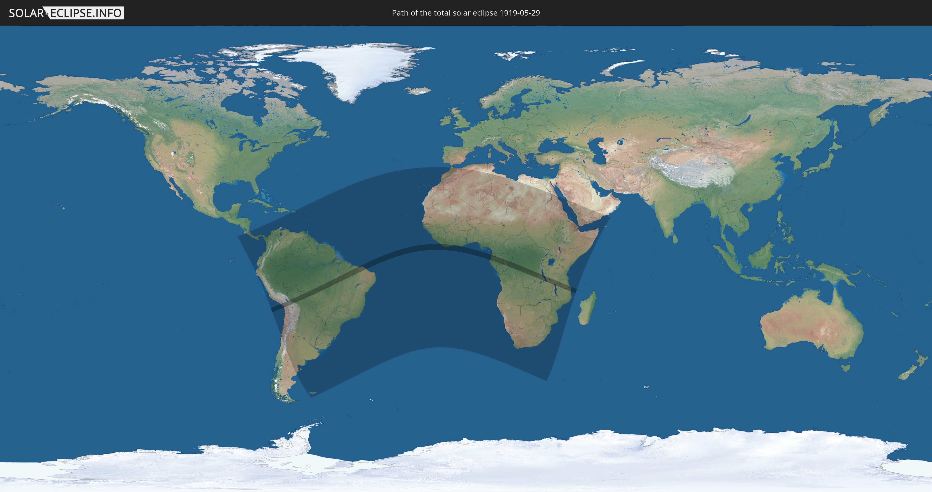
Die Sonnenfinsternis am 29.05.1919 kann man in 89 Ländern als partielle Sonnenfinsternis beobachten.
Der Finsternispfad verläuft durch 16 Länder. Nur in diesen Ländern ist sie als totale Sonnenfinsternis zu sehen.
In den folgenden Ländern ist die Sonnenfinsternis total zu sehen
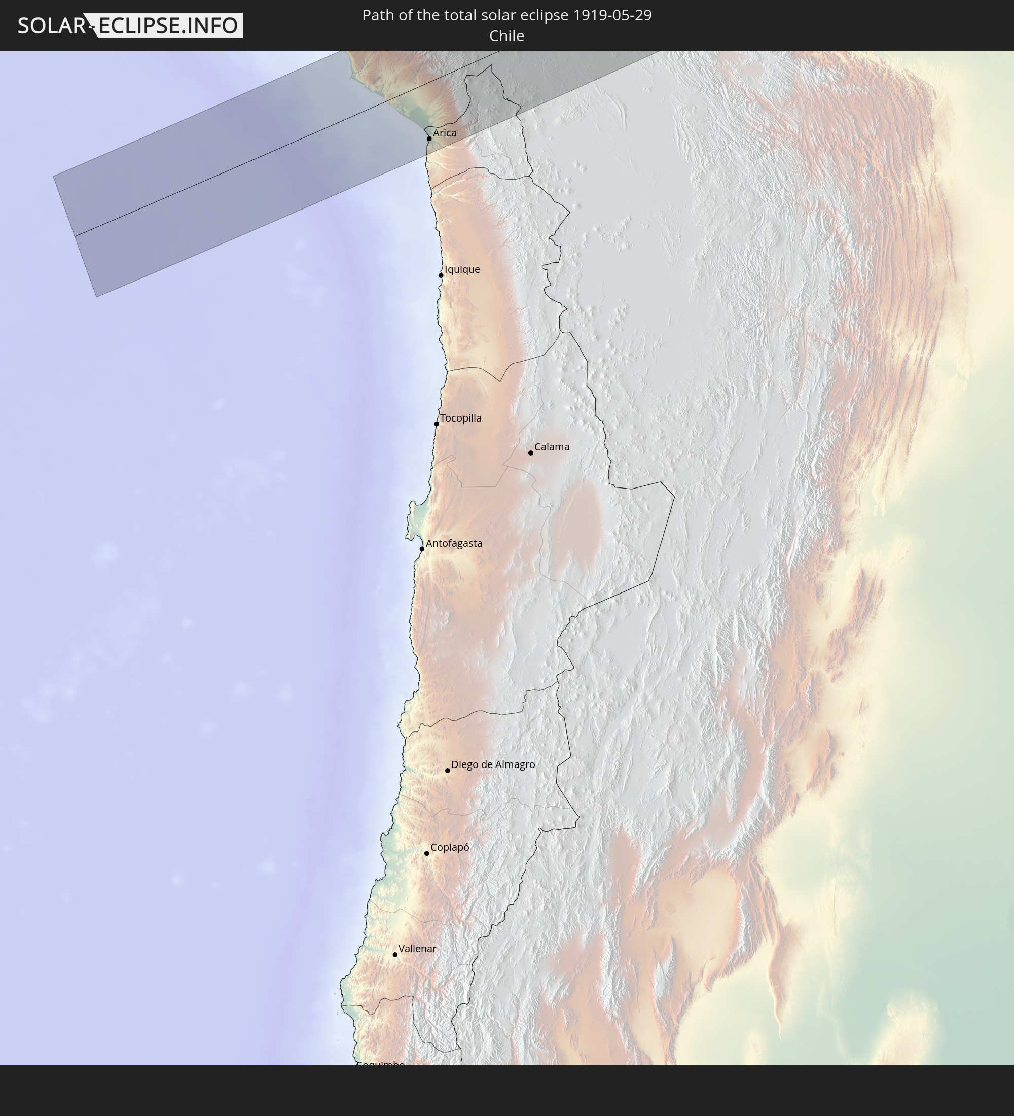 Chile
Chile
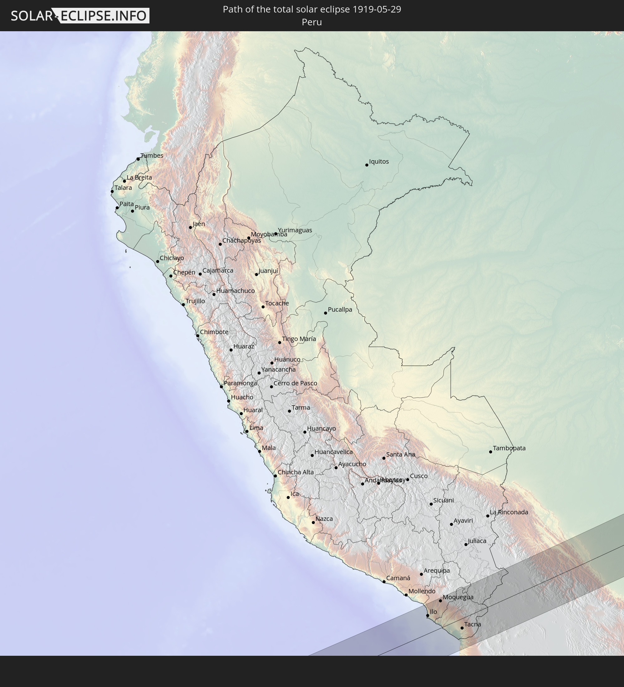 Peru
Peru
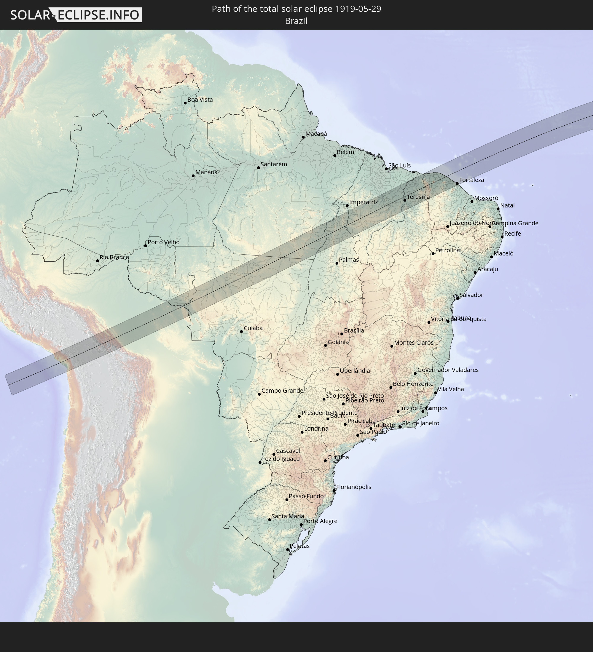 Brasilien
 Bolivien
 Liberia
 Elfenbeinküste
 Ghana
Ghana
 Äquatorialguinea
 São Tomé und Príncipe
 Gabun
Gabun
 Republik Kongo
 Demokratische Republik Kongo
 Sambia
 Tansania
 Mosambik
 Malawi
In den folgenden Ländern ist die Sonnenfinsternis partiell zu sehen
 Chile
Chile
 Ecuador
 Costa Rica
 Panama
 Kolumbien
 Peru
Peru
 Brasilien
 Argentinien
 Venezuela
 Aruba
Aruba
 Bolivien
 Puerto Rico
 Amerikanische Jungferninseln
 Britische Jungferninseln
 Anguilla
 Saint-Martin
 Saint-Barthélemy
 St. Kitts und Nevis
 Paraguay
 Antigua und Barbuda
 Montserrat
 Trinidad und Tobago
 Guadeloupe
 Grenada
 Dominica
 St. Vincent und die Grenadinen
 Falklandinseln
 Guyana
 Martinique
 St. Lucia
 Barbados
 Uruguay
 Suriname
 Französisch-Guayana
 Portugal
 Kap Verde
 Spanien
 Senegal
 Mauretanien
 Gambia
 Guinea-Bissau
 Guinea
 St. Helena
 Sierra Leone
 Marokko
 Mali
Mali
 Liberia
 Algerien
 Elfenbeinküste
 Burkina Faso
 Ghana
Ghana
 Togo
Togo
 Niger
Niger
 Benin
Benin
 Nigeria
 Äquatorialguinea
 São Tomé und Príncipe
 Tunesien
 Kamerun
 Gabun
Gabun
 Libyen
 Republik Kongo
 Angola
 Namibia
 Demokratische Republik Kongo
 Tschad
 Zentralafrikanische Republik
 Südafrika
 Botswana
 Sudan
Sudan
 Sambia
 Ägypten
 Simbabwe
 Lesotho
 Ruanda
 Burundi
 Tansania
 Uganda
 Mosambik
 Swasiland
 Malawi
 Äthiopien
 Kenia
Kenia
 Saudi-Arabien
 Eritrea
 Somalia
 Dschibuti
 Jemen
Jemen
 Oman
Oman
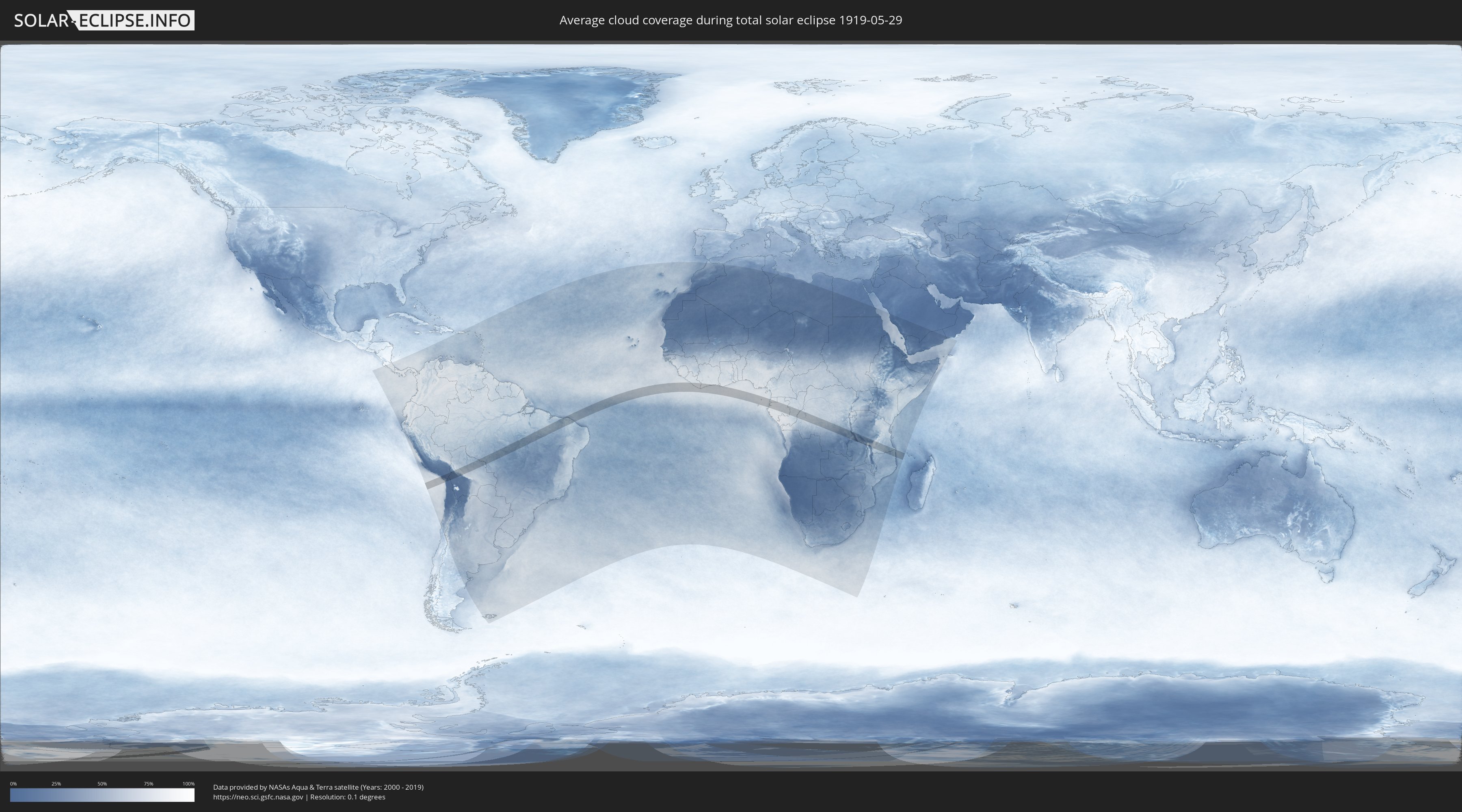
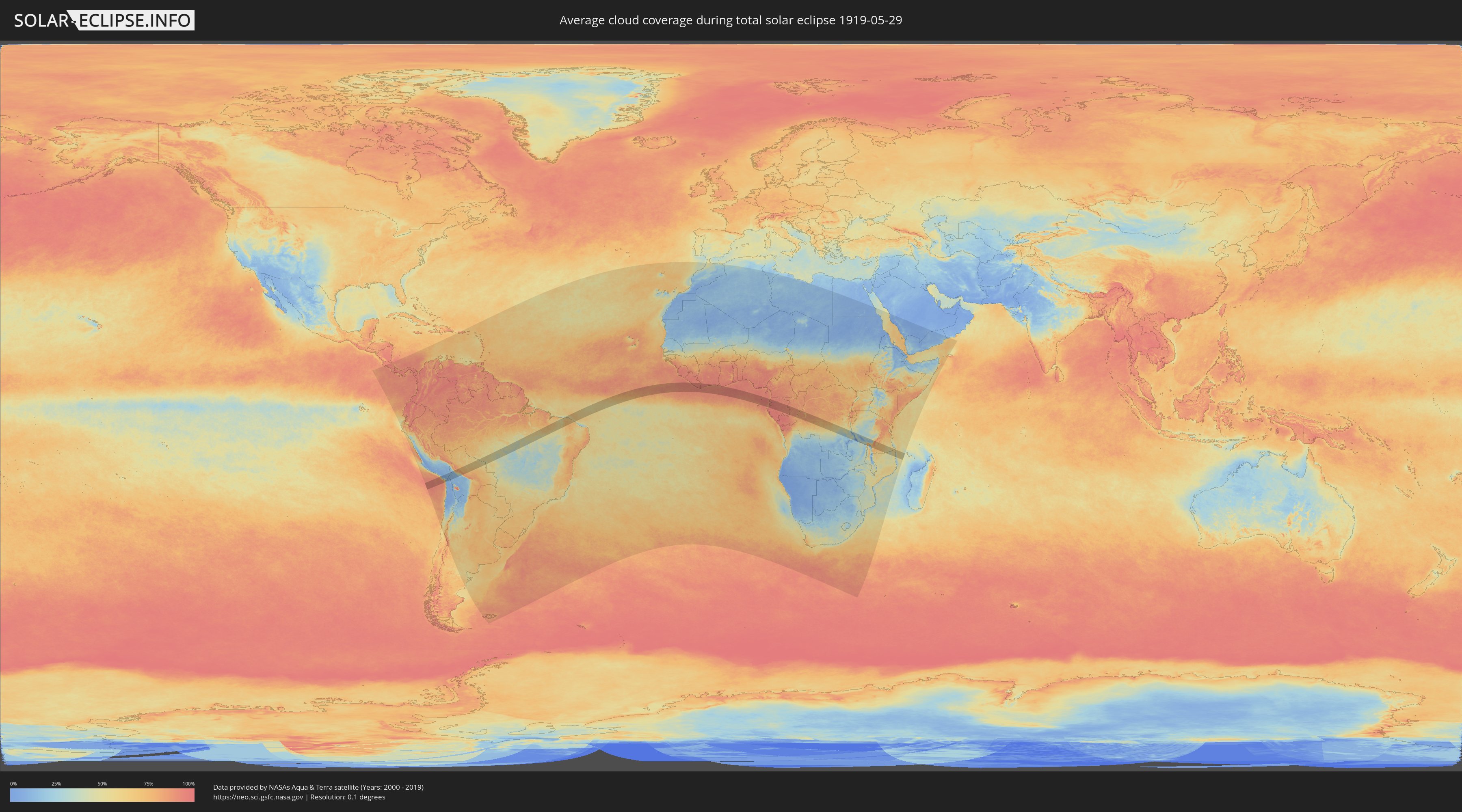
Wie wird das Wetter während der totalen Sonnenfinsternis am 29.05.1919?
Wo ist der beste Ort, um die totale Sonnenfinsternis vom 29.05.1919 zu beobachten?
Die folgenden Karten zeigen die durchschnittliche Bewölkung für den Tag, an dem die totale Sonnenfinsternis
stattfindet. Mit Hilfe der Karten lässt sich der Ort entlang des Finsternispfades eingrenzen,
der die besten Aussichen auf einen klaren wolkenfreien Himmel bietet.
Trotzdem muss man immer lokale Gegenenheiten beachten und sollte sich genau über das Wetter an seinem
gewählten Beobachtungsort informieren.
Die Daten stammen von den beiden NASA-Satelliten
AQUA und TERRA
und wurden über einen Zeitraum von 19 Jahren (2000 - 2019) gemittelt.
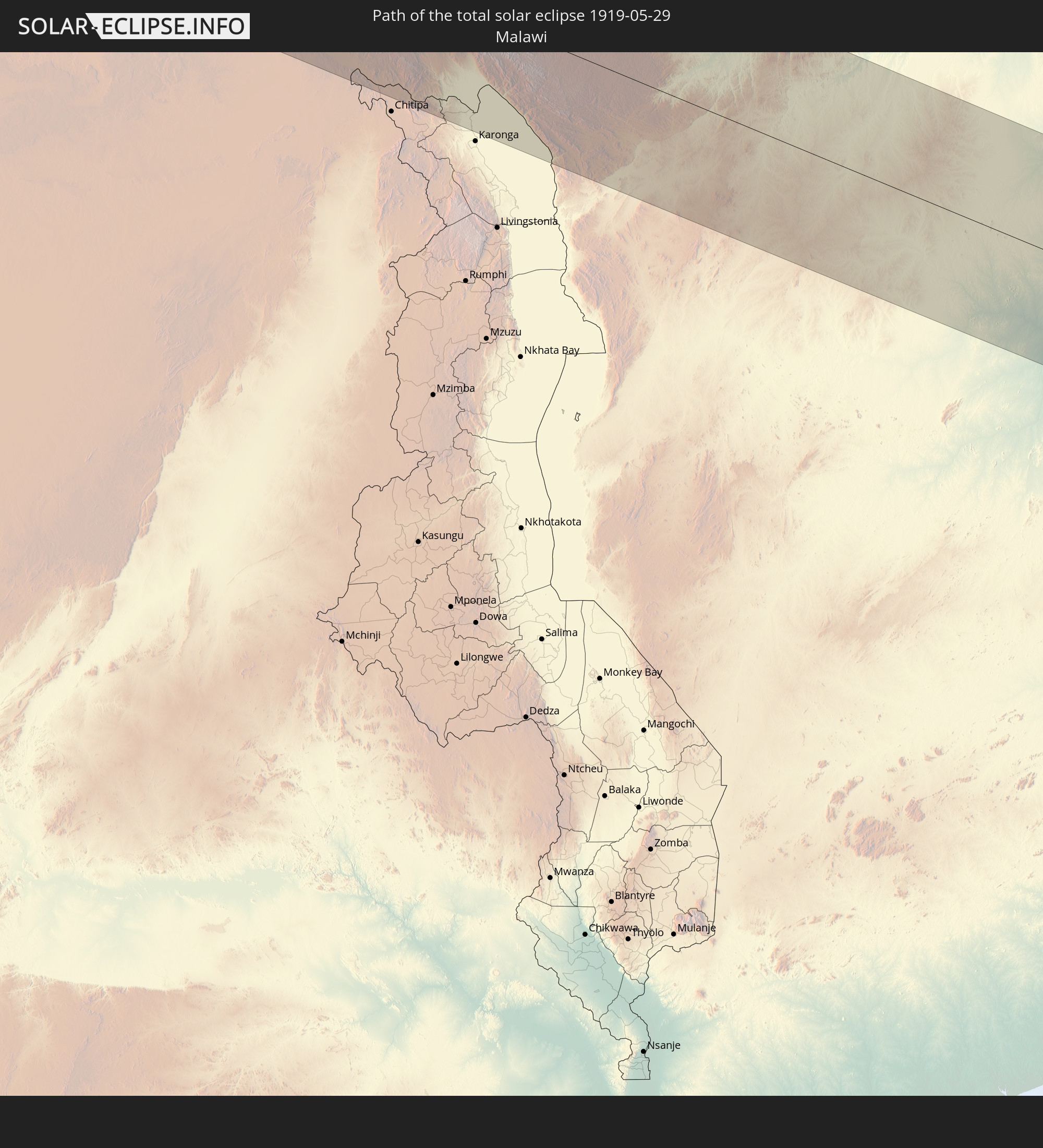
Detaillierte Länderkarten
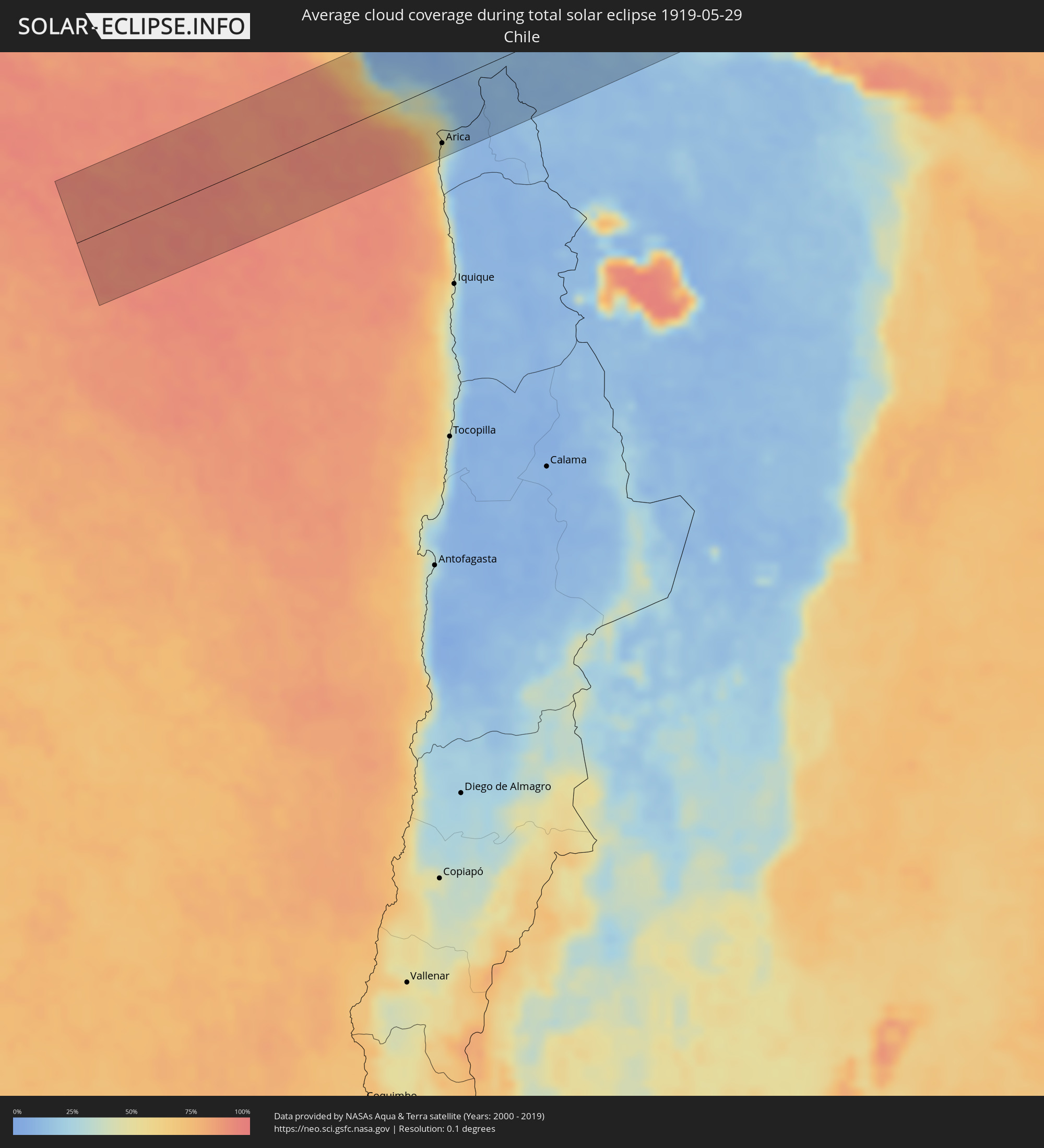 Chile
Chile
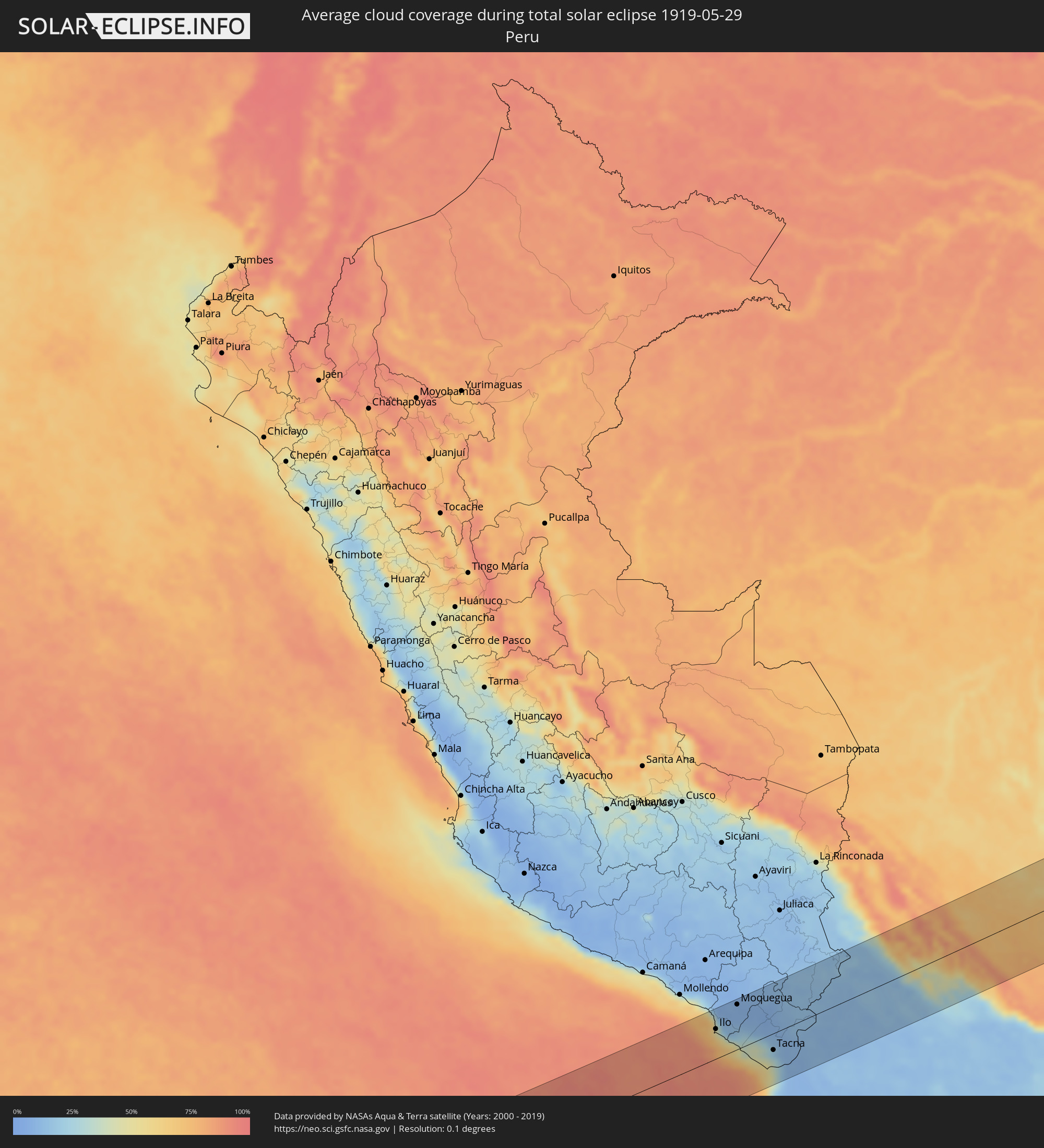 Peru
Peru
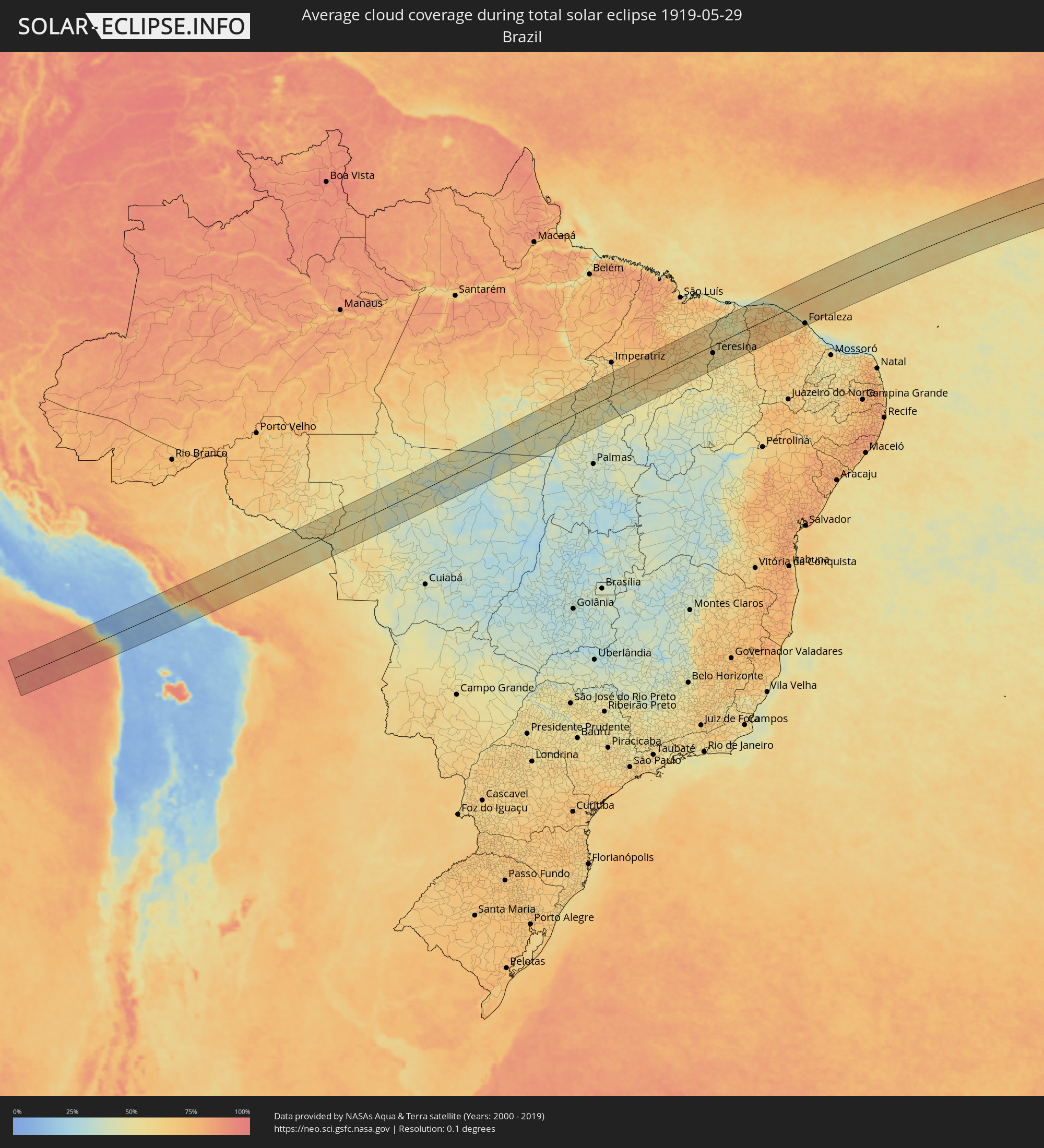 Brasilien
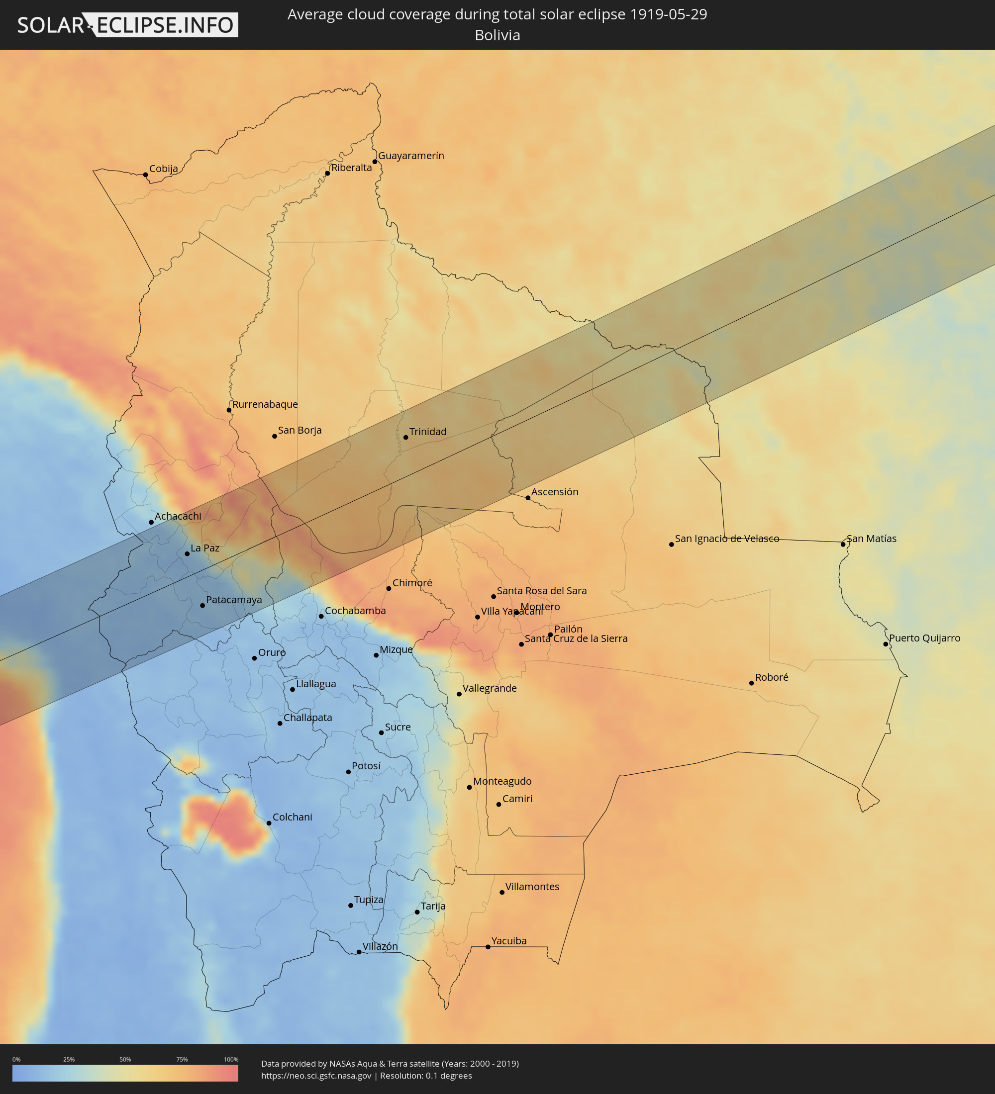 Bolivien
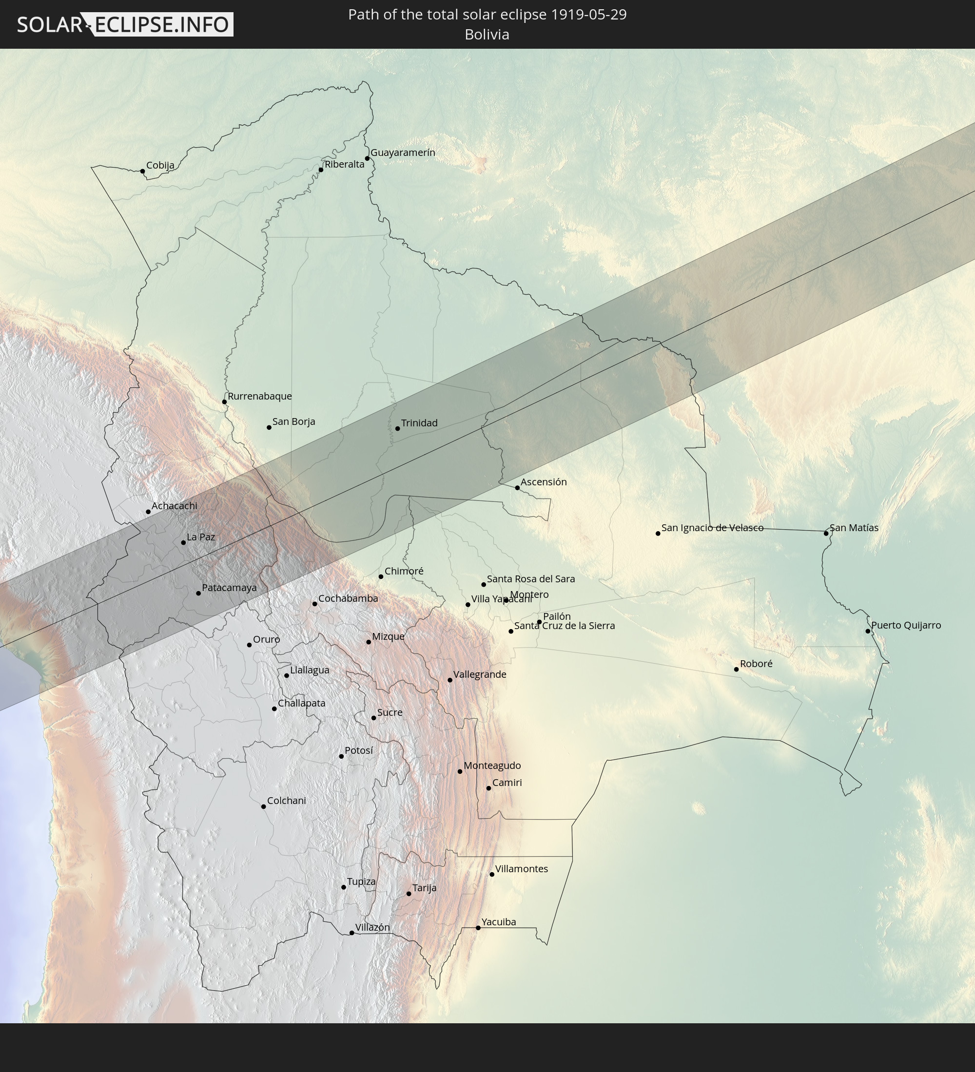
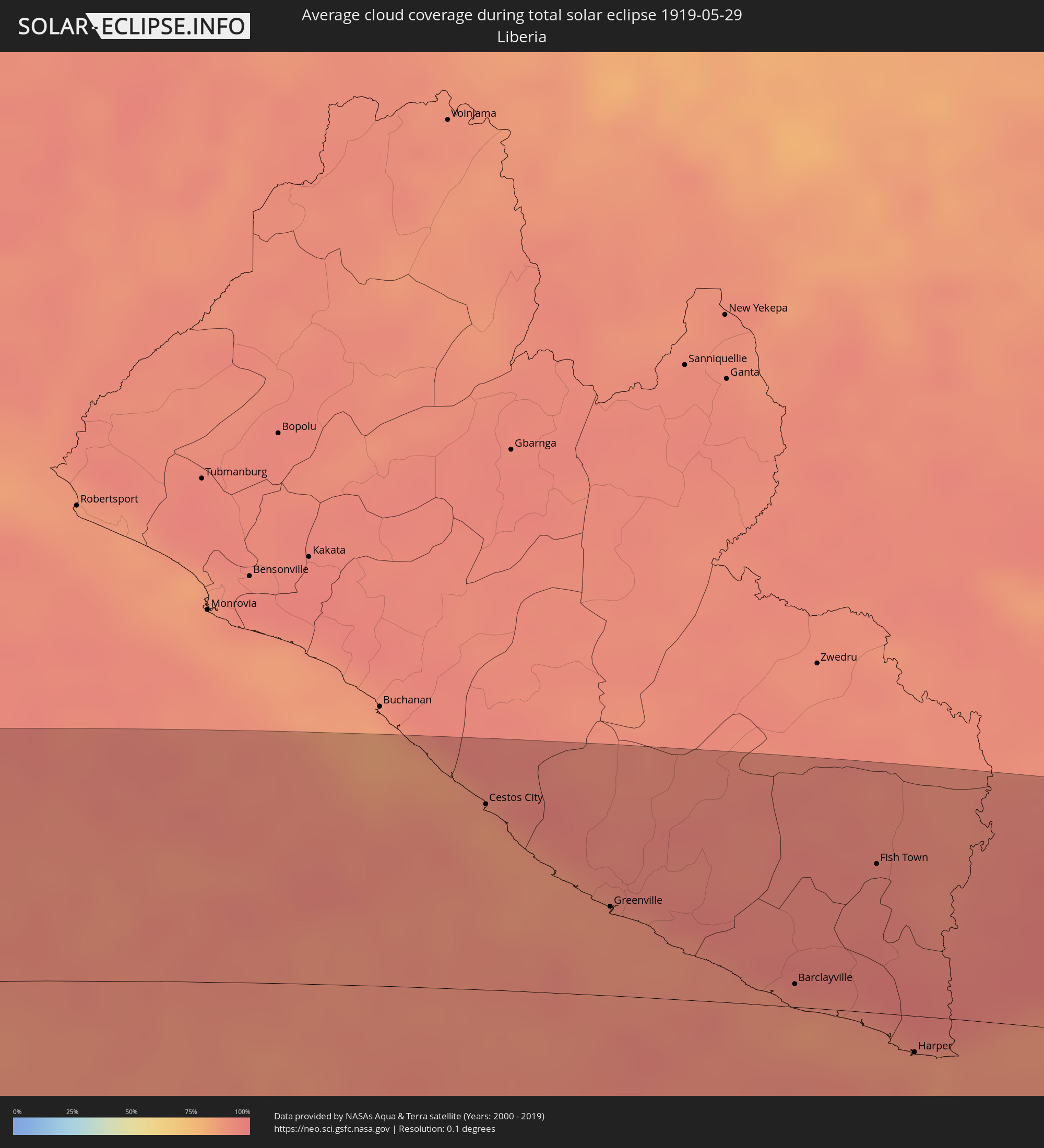 Liberia
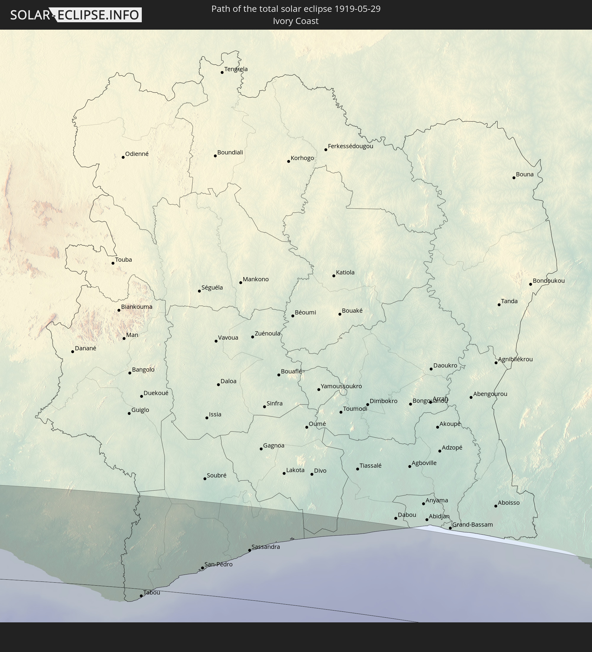
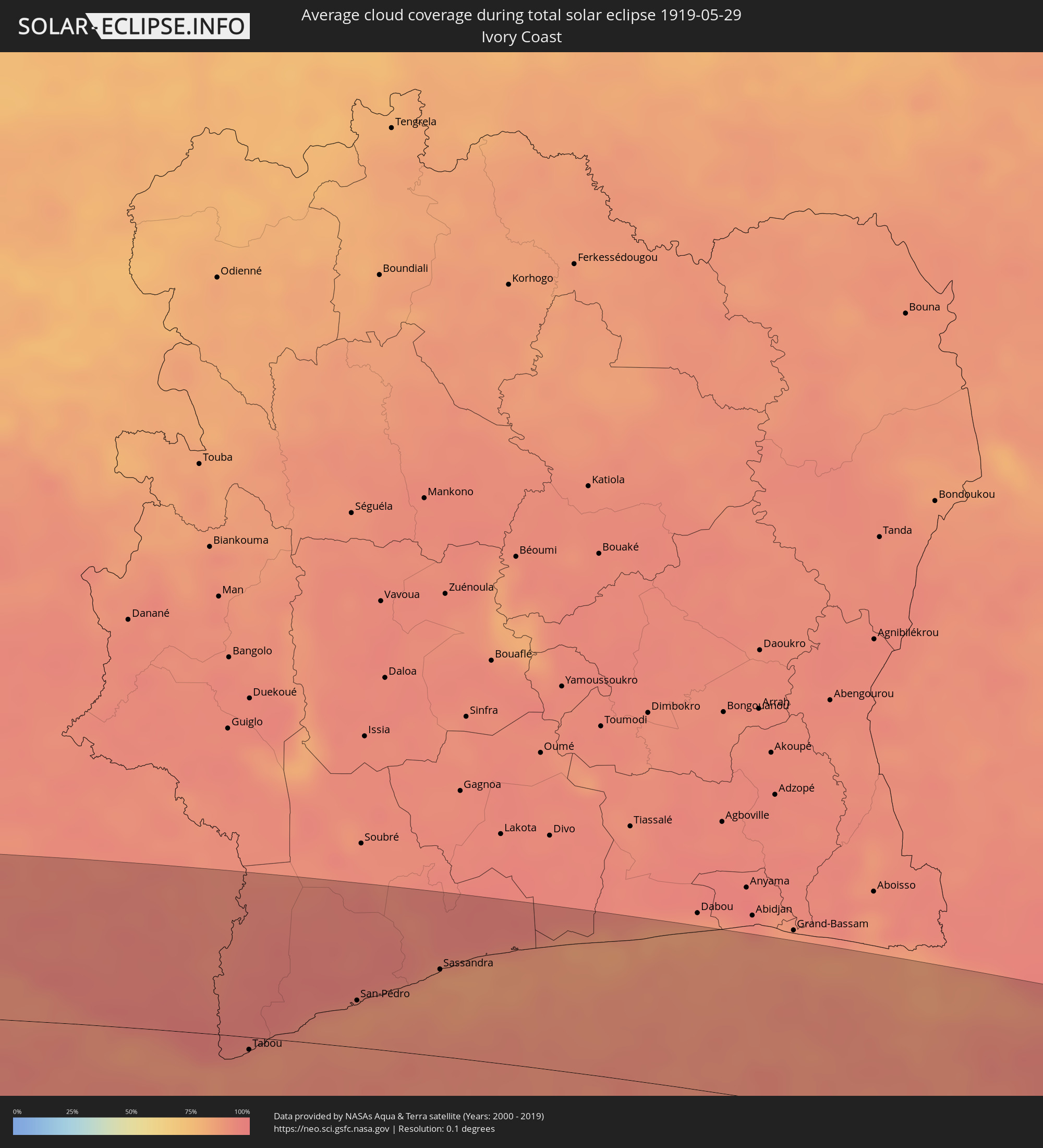 Elfenbeinküste
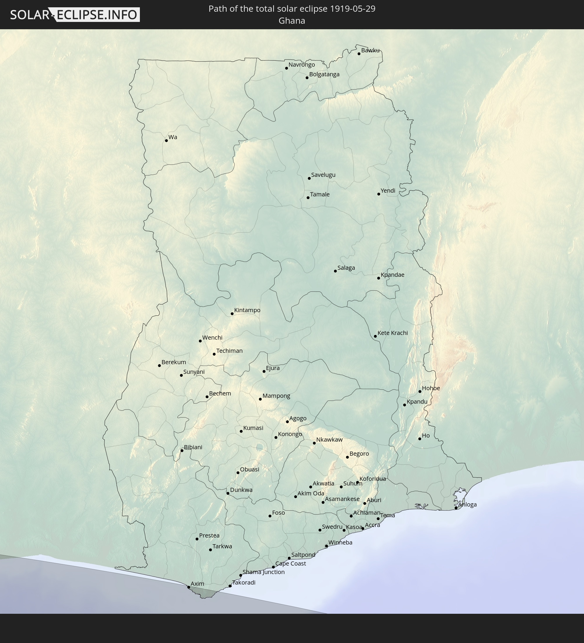
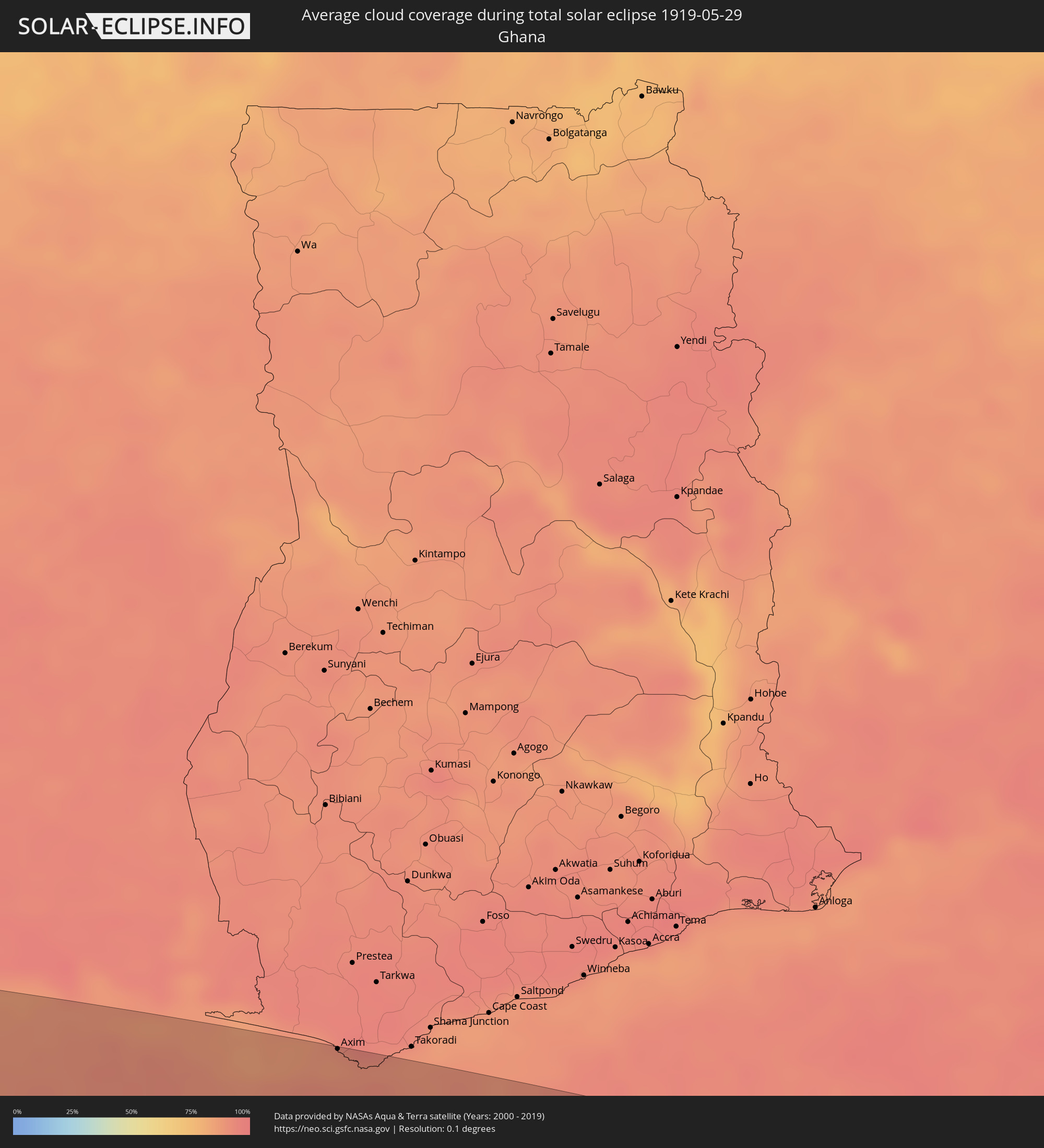 Ghana
Ghana
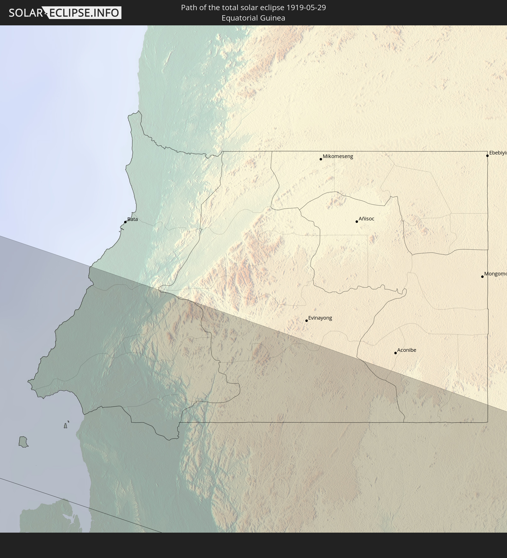
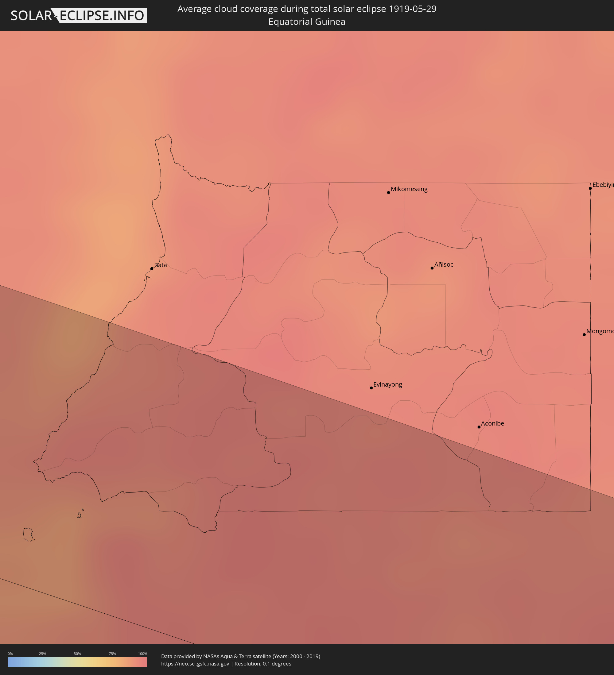 Äquatorialguinea
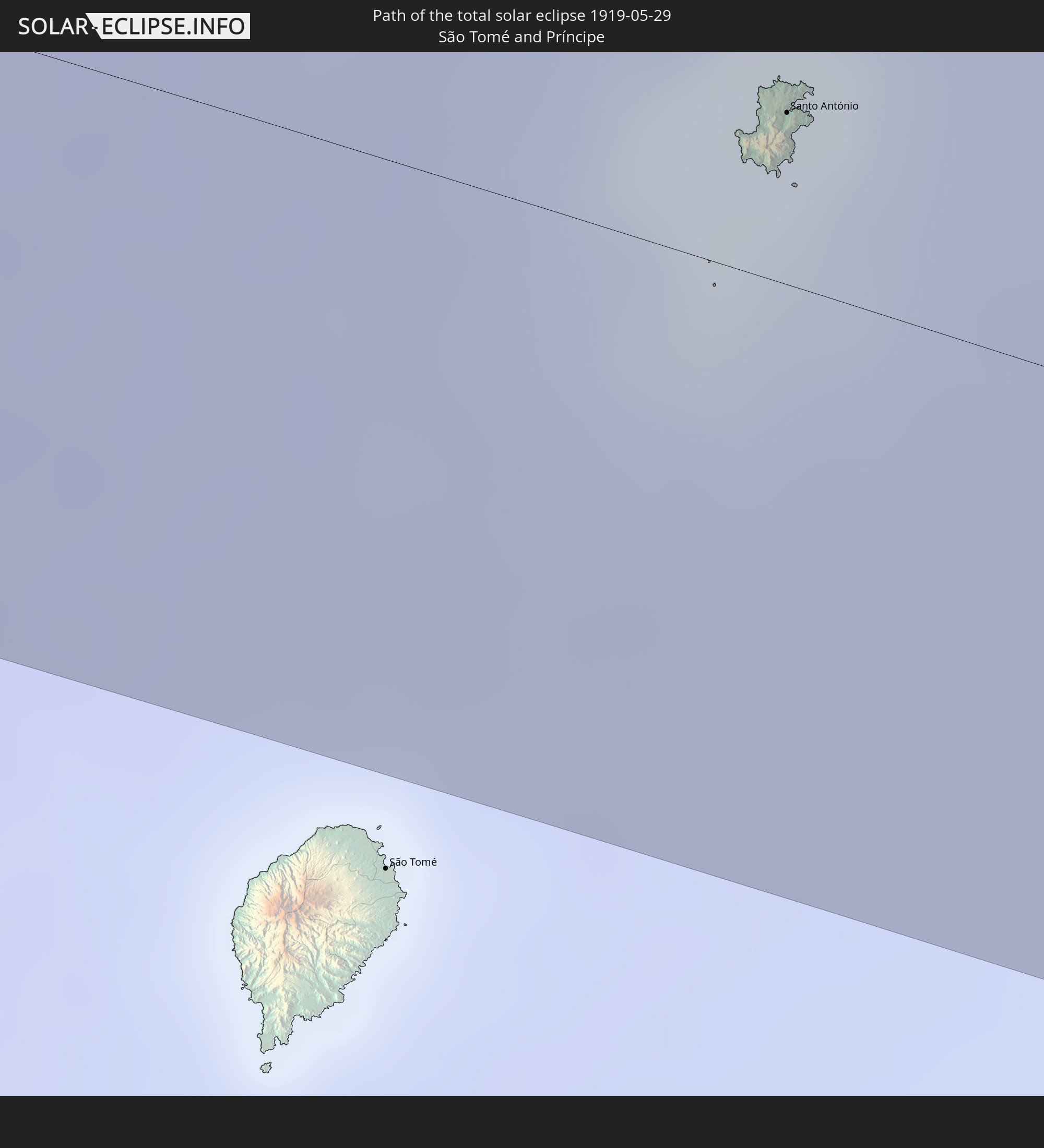
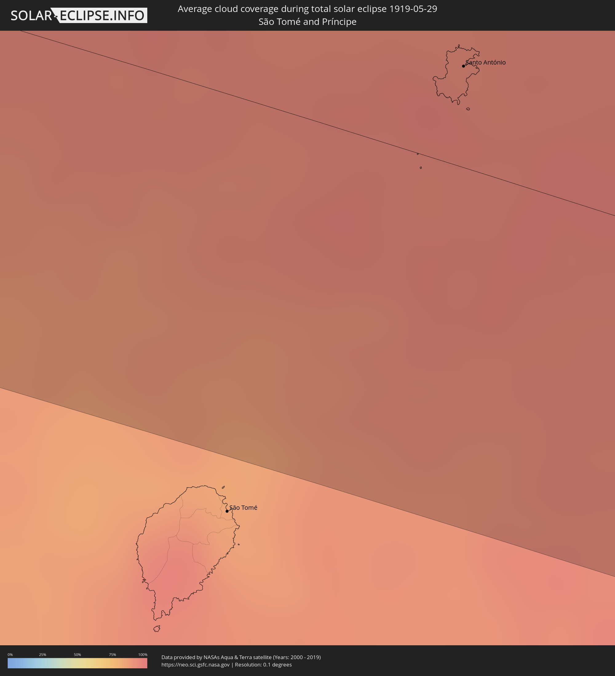 São Tomé und Príncipe
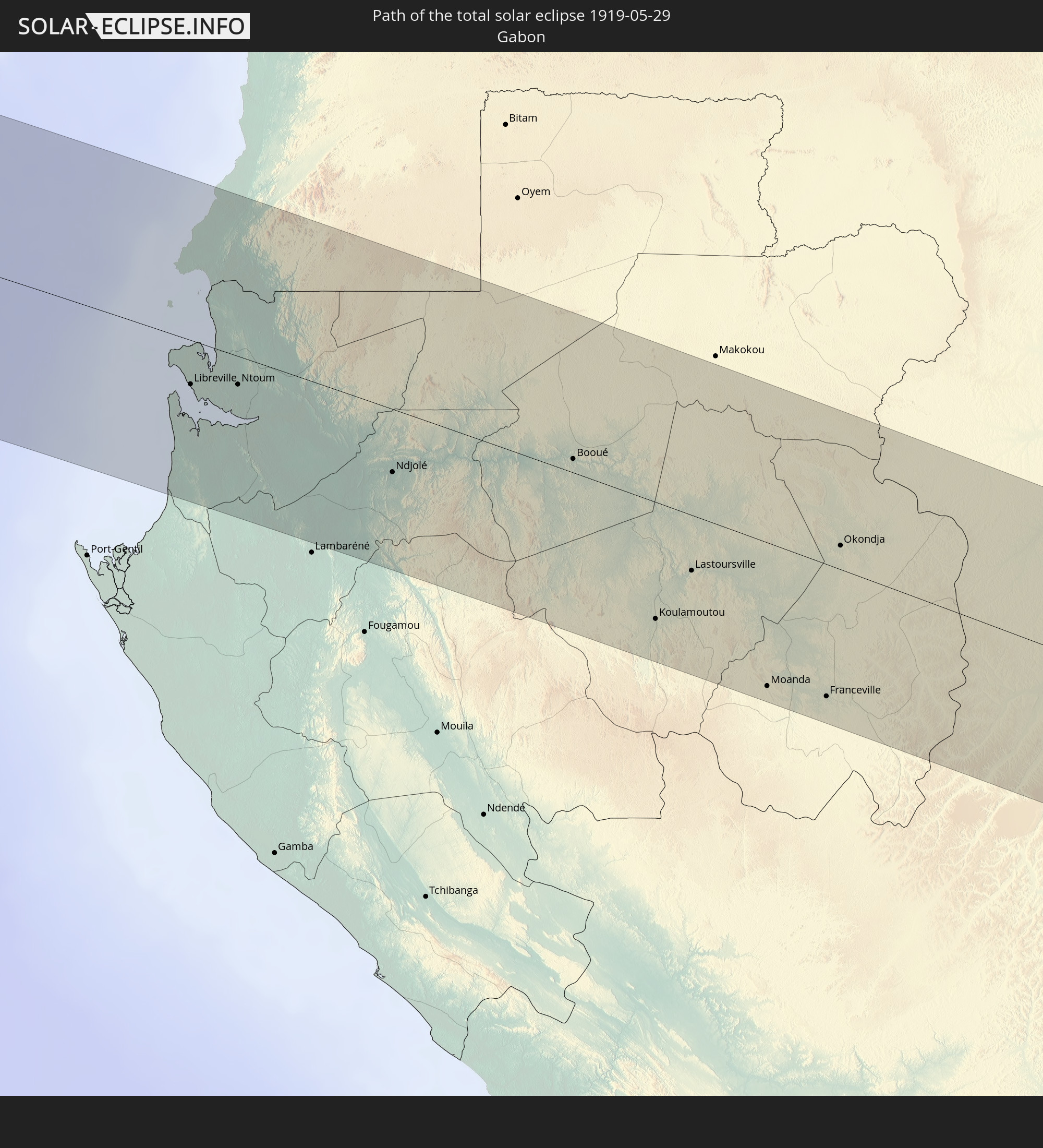
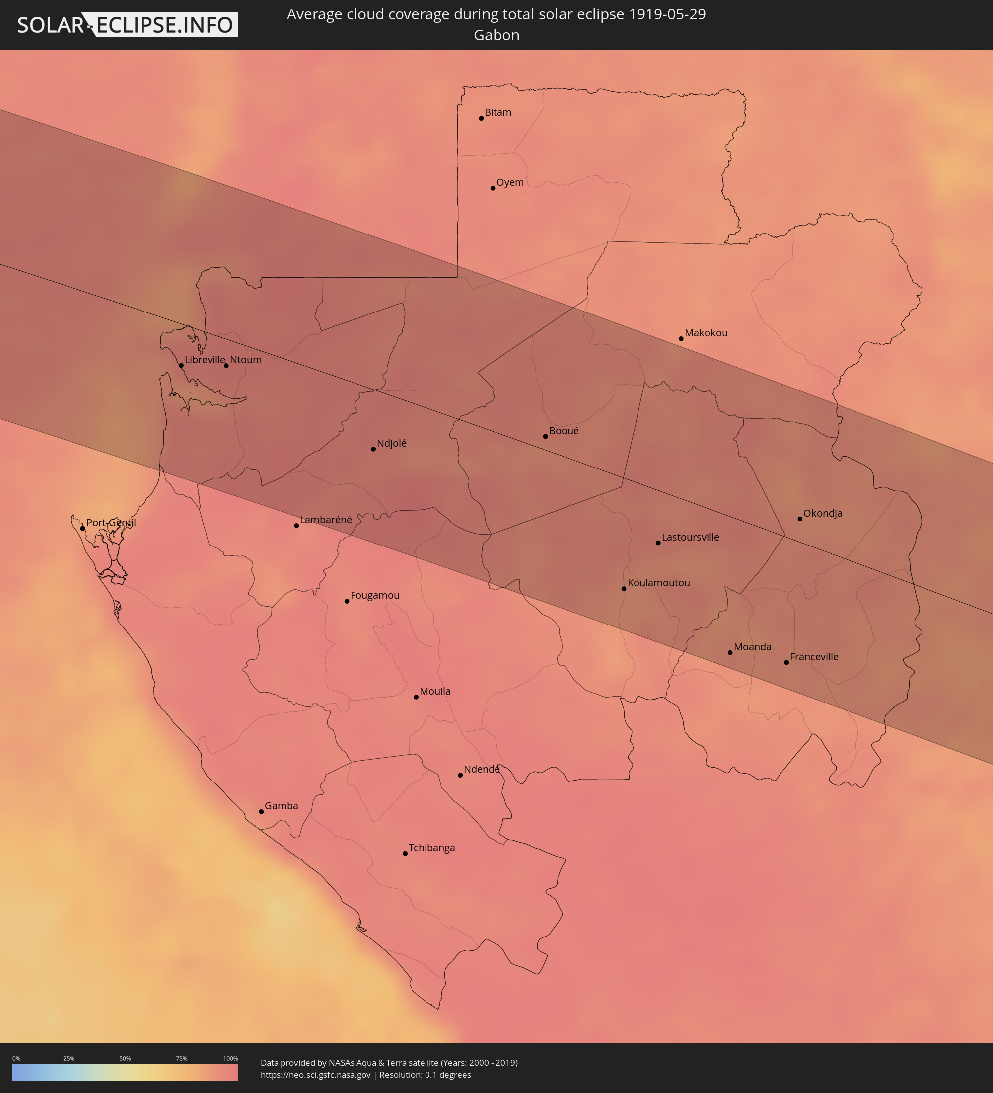 Gabun
Gabun
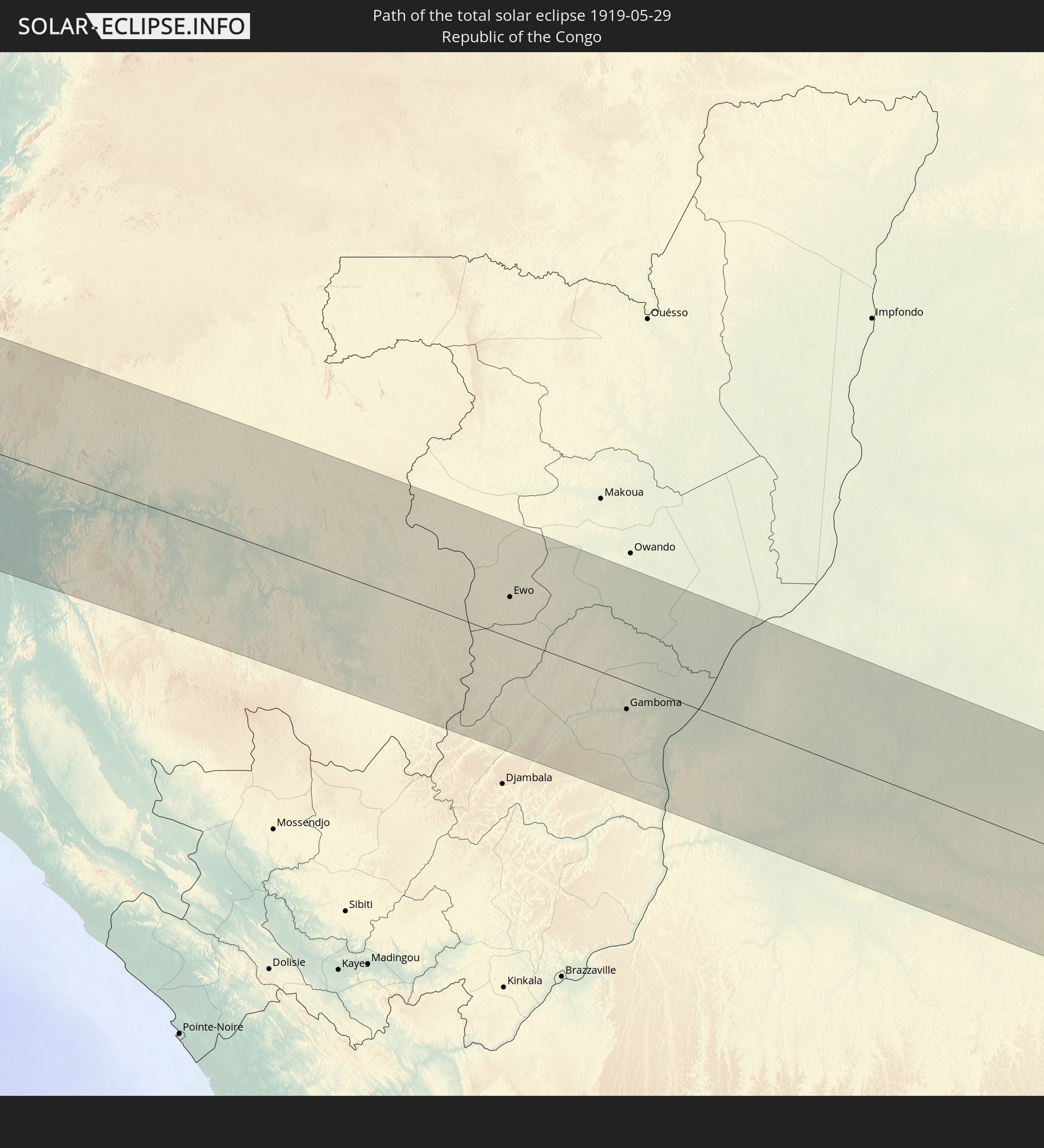
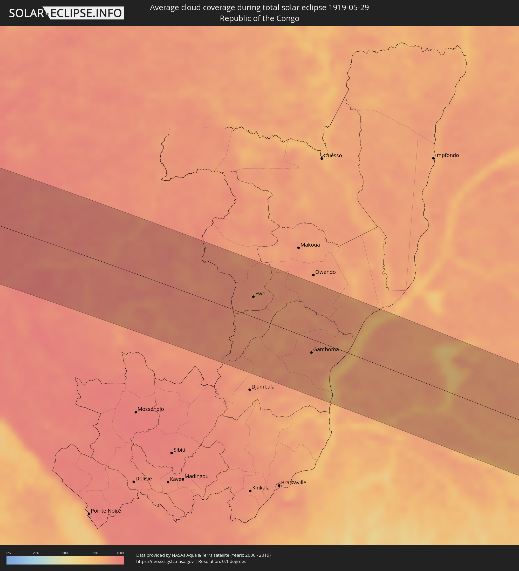 Republik Kongo
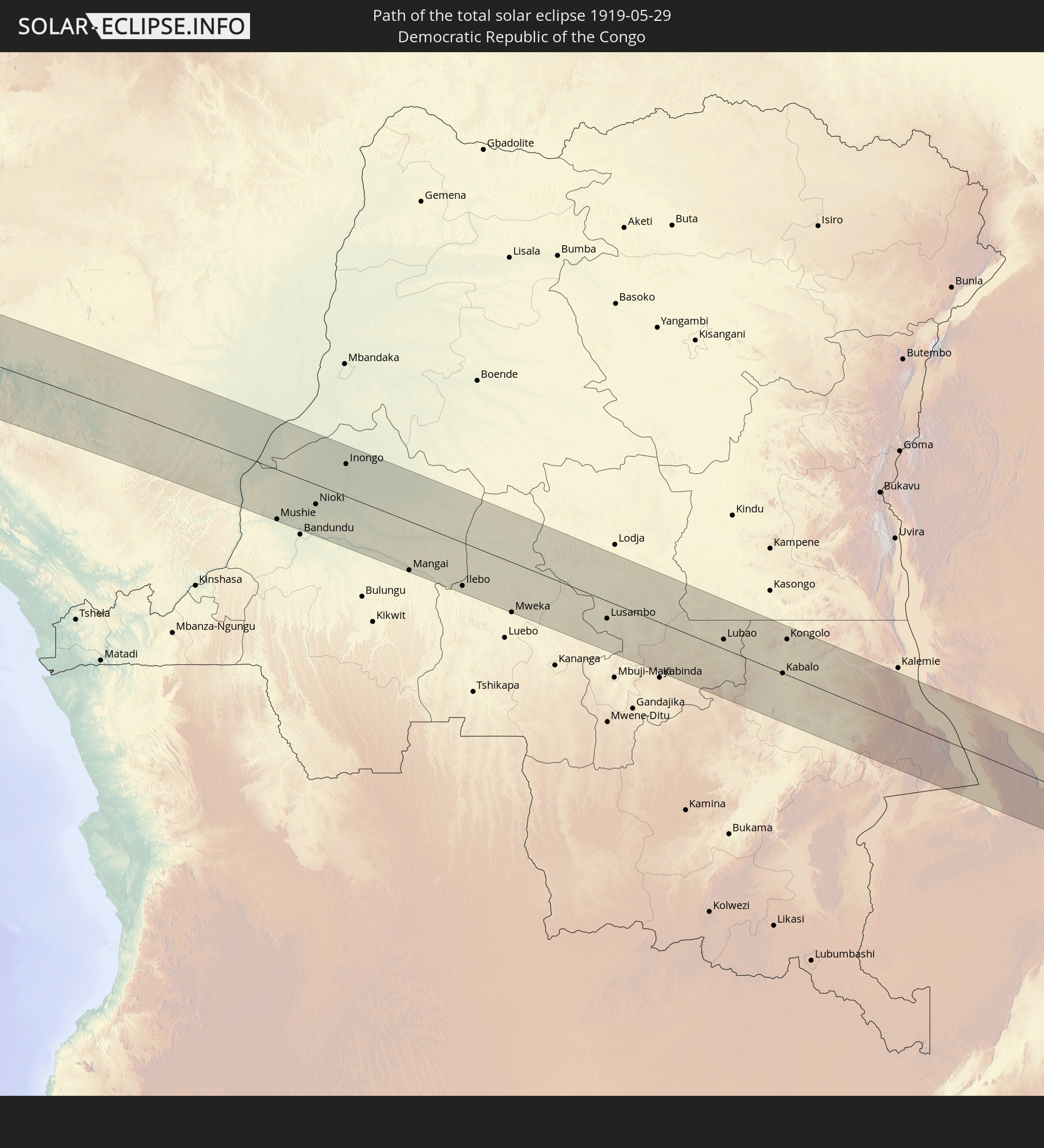
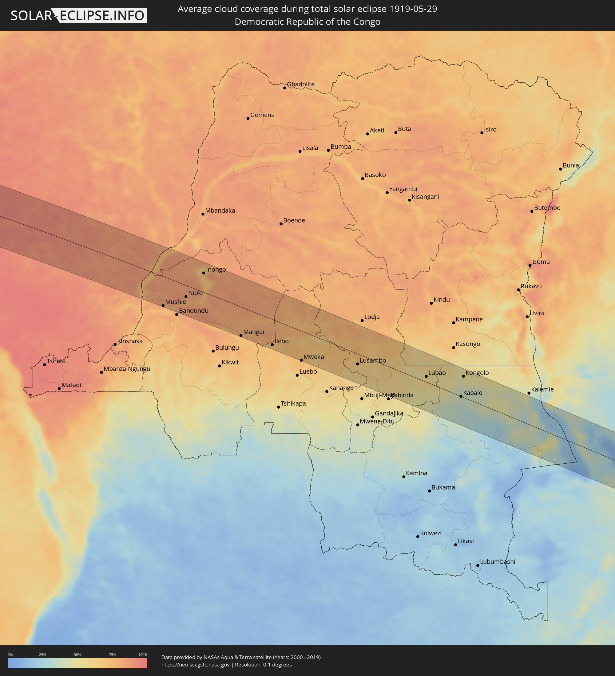 Demokratische Republik Kongo
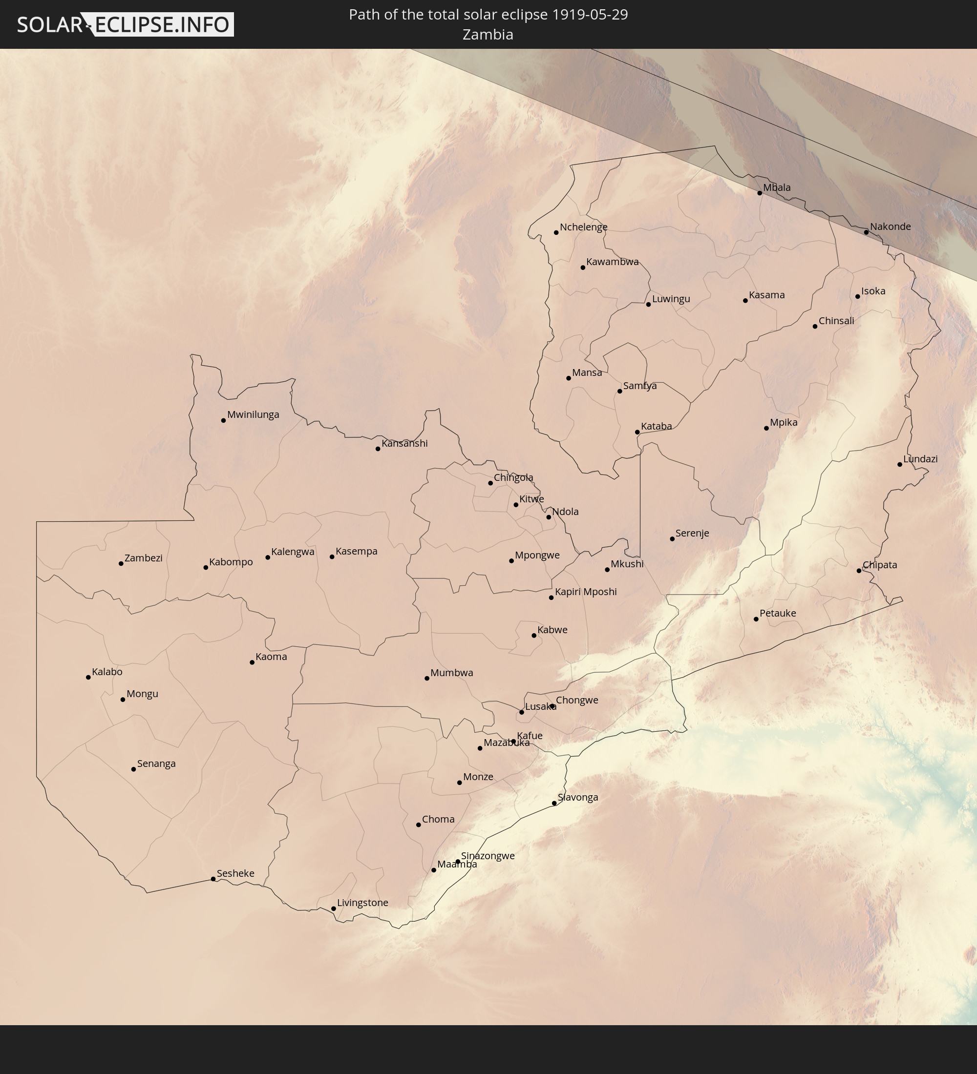
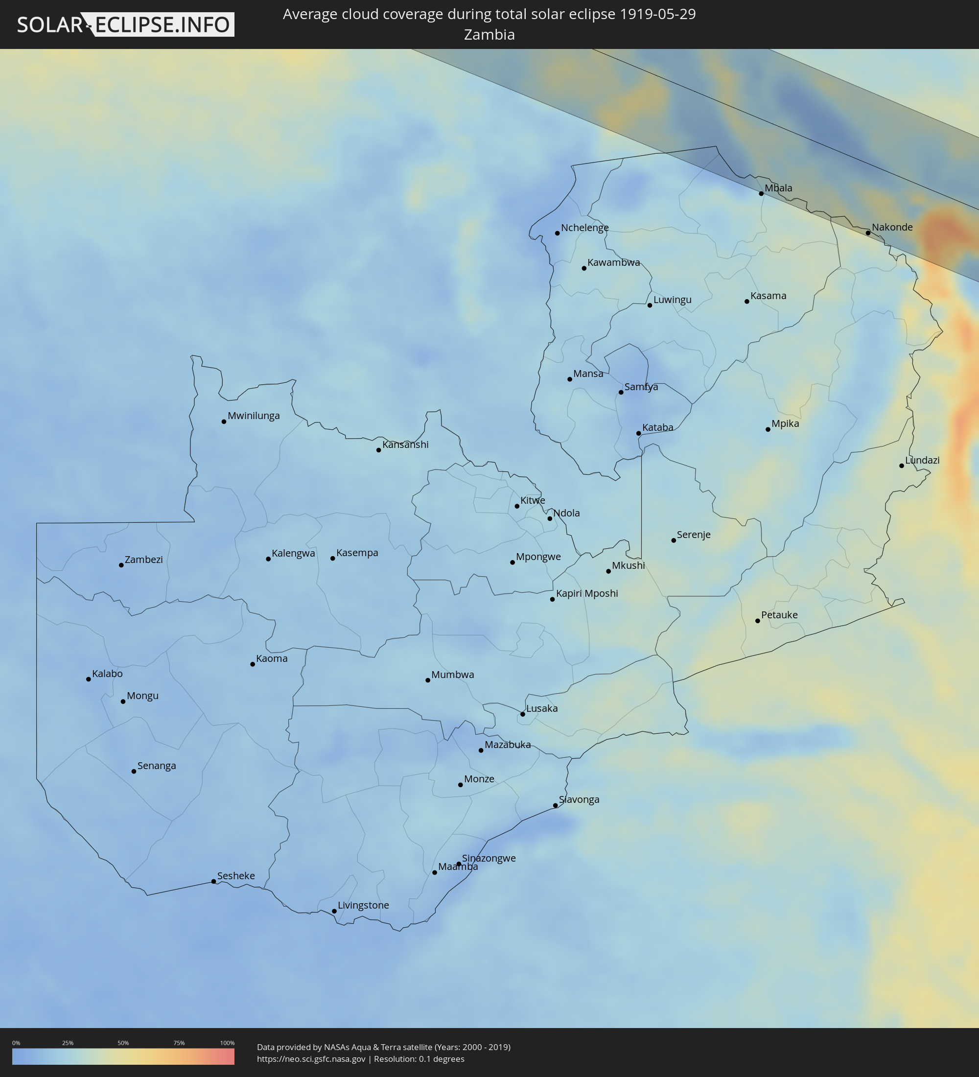 Sambia
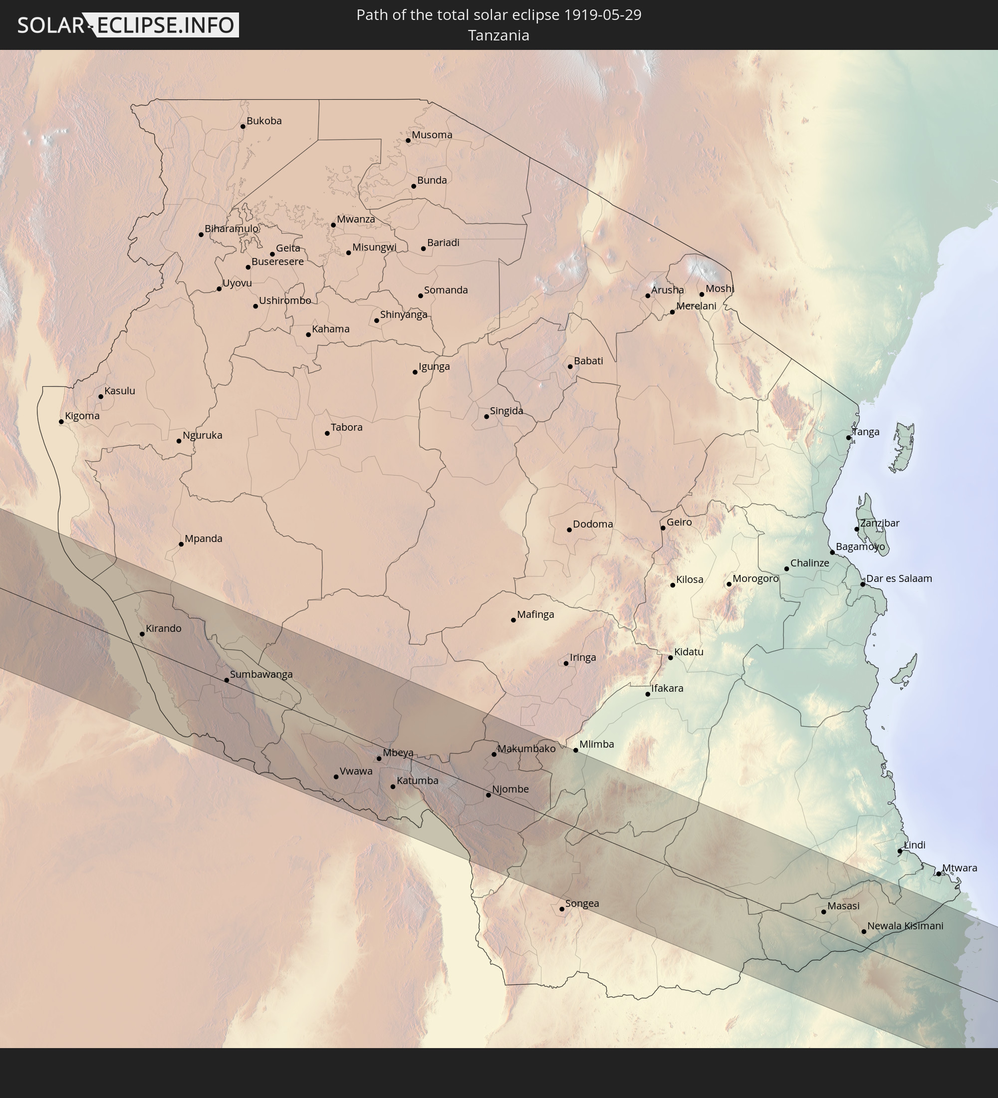
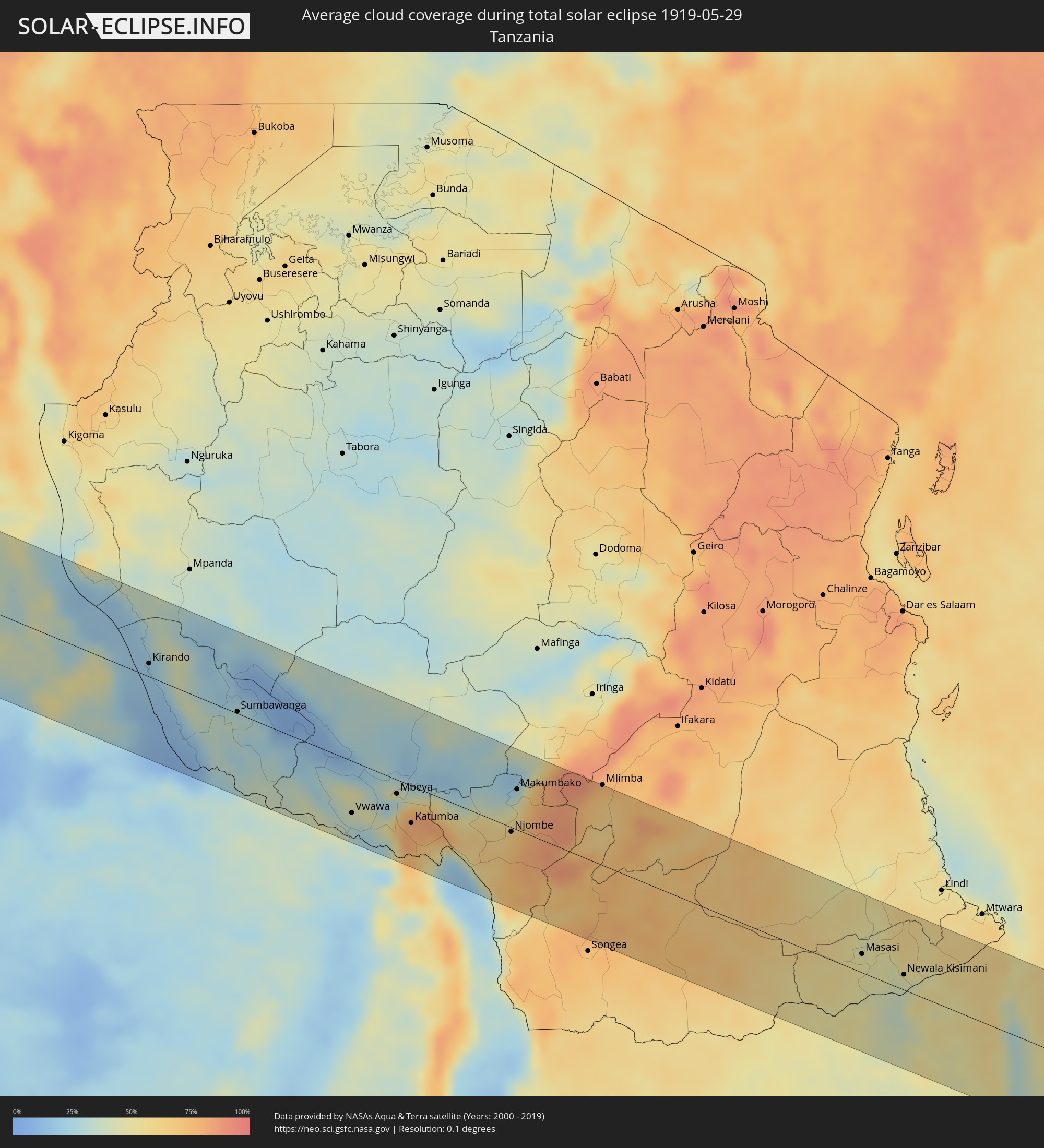 Tansania
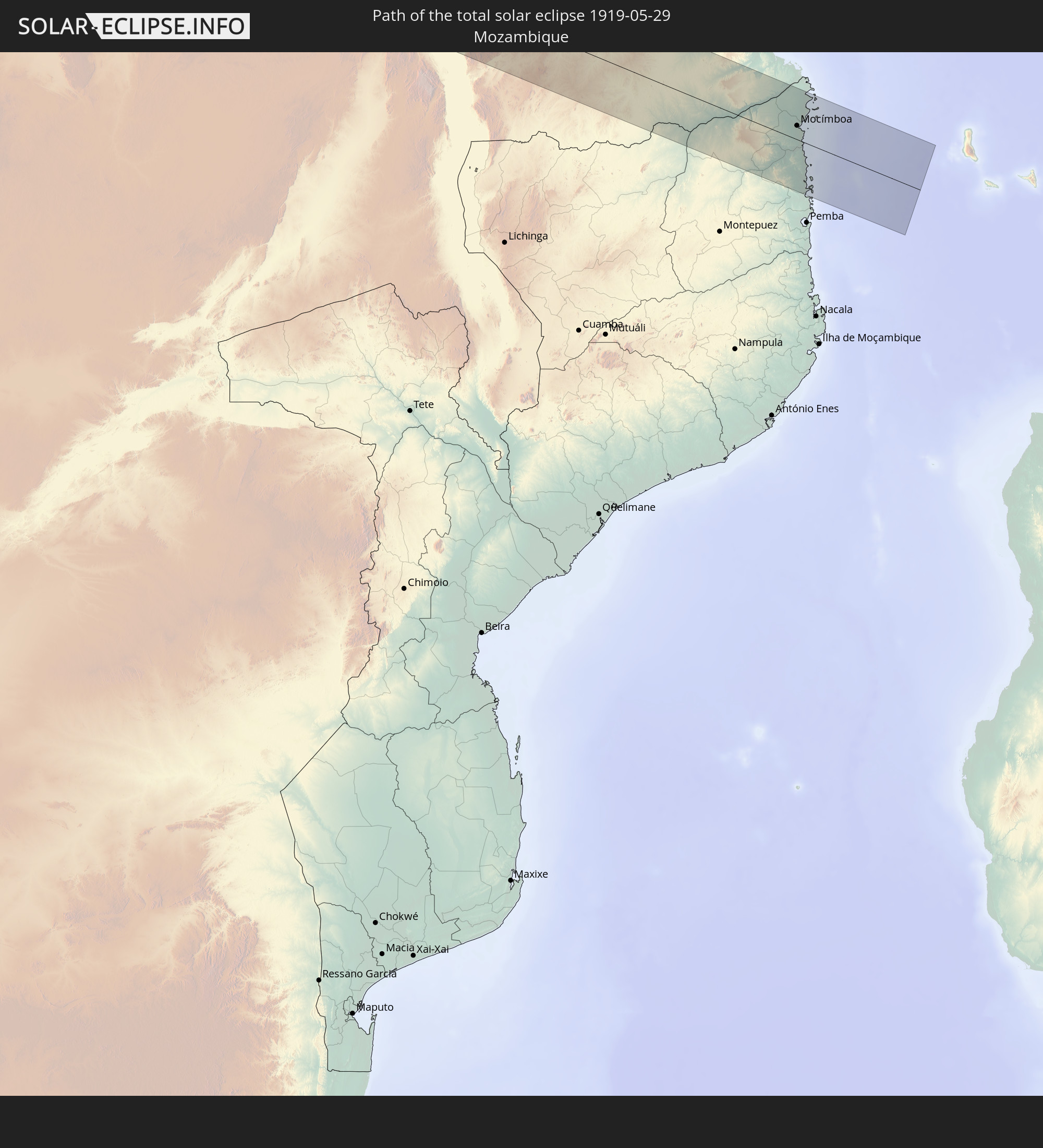
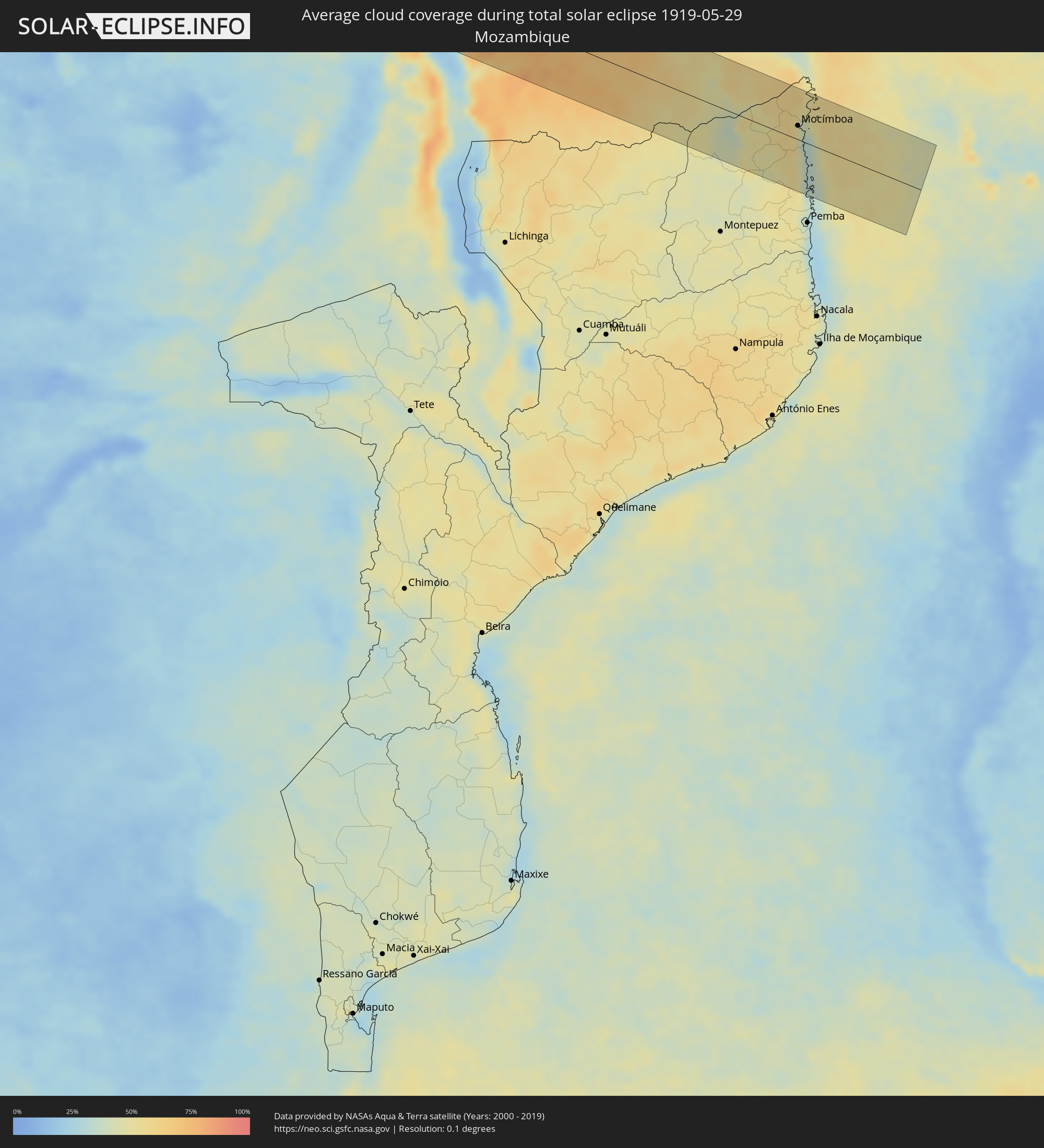 Mosambik
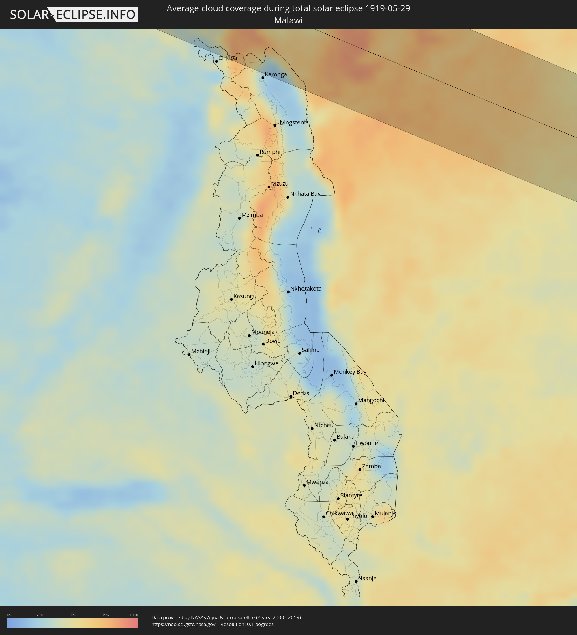 Malawi
Orte im Finsternispfad
Die nachfolgene Tabelle zeigt Städte und Orte mit mehr als 5.000 Einwohnern, die sich im Finsternispfad befinden. Städte mit mehr als 100.000 Einwohnern sind dick gekennzeichnet. Mit einem Klick auf den Ort öffnet sich eine Detailkarte die die Lage des jeweiligen Ortes zusammen mit dem Verlauf der zentralen Finsternis präsentiert.
| Ort | Typ | Dauer der Verfinsterung | Ortszeit bei maximaler Verfinsterung | Entfernung zur Zentrallinie | Ø Bewölkung |
|
Ilo, Moquegua
|
total | - | 06:30:07 UTC-05:00 | 54 km | 42% |
|
Pacocha, Moquegua
|
total | - | 06:30:06 UTC-05:00 | 60 km | 42% |
|
Moquegua, Moquegua
|
total | - | 06:30:08 UTC-05:00 | 82 km | 8% |
|
Torata, Moquegua
|
total | - | 06:30:08 UTC-05:00 | 90 km | 8% |
|
Ilabaya, Tacna
|
total | - | 06:30:16 UTC-05:00 | 41 km | 8% |
|
Arica, Arica y Parinacota
|
total | - | 07:30:30 UTC-04:00 | 75 km | 43% |
|
Tacna, Tacna
|
total | - | 06:30:25 UTC-05:00 | 30 km | 34% |
|
Desaguadero, Puno
|
total | - | 06:57:57 UTC-04:32 | 64 km | 14% |
|
San Pedro, La Paz
|
total | - | 06:57:58 UTC-04:32 | 89 km | 17% |
|
La Paz, La Paz
|
total | - | 06:58:13 UTC-04:32 | 32 km | 12% |
|
Patacamaya, La Paz
|
total | - | 06:58:22 UTC-04:32 | 53 km | 15% |
|
Trinidad, El Beni
|
total | - | 06:59:20 UTC-04:32 | 55 km | 65% |
|
Vilhena, Rondônia
|
total | - | 07:34:33 UTC-04:00 | 46 km | 55% |
|
Sinop, Mato Grosso
|
total | - | 07:38:08 UTC-04:00 | 87 km | 43% |
|
Araguaína, Tocantins
|
total | - | 08:47:03 UTC-03:00 | 21 km | 55% |
|
Barra do Corda, Maranhão
|
total | - | 08:51:50 UTC-03:00 | 43 km | 69% |
|
Codó, Maranhão
|
total | - | 08:54:23 UTC-03:00 | 81 km | 63% |
|
Caxias, Maranhão
|
total | - | 08:55:03 UTC-03:00 | 15 km | 67% |
|
Coelho Neto, Maranhão
|
total | - | 08:55:53 UTC-03:00 | 58 km | 55% |
|
Teresina, Piauí
|
total | - | 08:55:51 UTC-03:00 | 35 km | 62% |
|
Piripiri, Piauí
|
total | - | 08:57:58 UTC-03:00 | 4 km | 56% |
|
Tianguá, Ceará
|
total | - | 08:59:37 UTC-03:00 | 13 km | 71% |
|
Camocim, Ceará
|
total | - | 09:00:20 UTC-03:00 | 89 km | 65% |
|
Sobral, Ceará
|
total | - | 09:00:49 UTC-03:00 | 14 km | 73% |
|
Itapagé, Ceará
|
total | - | 09:02:14 UTC-03:00 | 50 km | 72% |
|
Itapipoca, Ceará
|
total | - | 09:02:21 UTC-03:00 | 31 km | 67% |
|
Fortaleza, Ceará
|
total | - | 09:04:14 UTC-03:00 | 103 km | 61% |
|
Cestos City, River Cess
|
total | - | 12:47:00 UTC-00:44 | 90 km | 89% |
|
Greenville, Sinoe
|
total | - | 12:48:38 UTC-00:44 | 43 km | 90% |
|
Barclayville, Grand Kru
|
total | - | 12:51:05 UTC-00:44 | 11 km | 94% |
|
Fish Town, River Gee
|
total | - | 12:52:11 UTC-00:44 | 72 km | 94% |
|
Harper, Maryland
|
total | - | 12:52:39 UTC-00:44 | 18 km | 89% |
|
Tabou, Bas-Sassandra
|
total | - | 13:38:14 UTC+00:00 | 9 km | 89% |
|
San-Pédro, Bas-Sassandra
|
total | - | 13:40:23 UTC+00:00 | 34 km | 87% |
|
Sassandra, Bas-Sassandra
|
total | - | 13:42:00 UTC+00:00 | 64 km | 85% |
|
Grand-Lahou, Lagunes
|
total | - | 13:45:03 UTC+00:00 | 98 km | 84% |
|
Axim, Western
|
total | - | 13:52:45 UTC+00:00 | 116 km | 90% |
|
Santo António, Príncipe
|
total | - | 14:15:48 UTC+00:00 | 31 km | 94% |
|
Libreville, Estuaire
|
total | - | 14:49:53 UTC+00:30 | 30 km | 94% |
|
Ntoum, Estuaire
|
total | - | 14:50:26 UTC+00:30 | 19 km | 95% |
|
Ndjolé, Moyen-Ogooué
|
total | - | 14:52:18 UTC+00:30 | 43 km | 94% |
|
Booué, Ogooué-Ivindo
|
total | - | 14:54:15 UTC+00:30 | 9 km | 91% |
|
Koulamoutou, Ogooué-Lolo
|
total | - | 14:55:17 UTC+00:30 | 79 km | 87% |
|
Lastoursville, Ogooué-Lolo
|
total | - | 14:55:37 UTC+00:30 | 38 km | 88% |
|
Mounana, Haut-Ogooué
|
total | - | 14:56:24 UTC+00:30 | 82 km | 91% |
|
Moanda, Haut-Ogooué
|
total | - | 14:56:29 UTC+00:30 | 97 km | 89% |
|
Franceville, Haut-Ogooué
|
total | - | 14:57:05 UTC+00:30 | 90 km | 89% |
|
Okondja, Haut-Ogooué
|
total | - | 14:57:05 UTC+00:30 | 16 km | 92% |
|
Ewo, Cuvette-Ouest
|
total | - | 14:58:48 UTC+00:30 | 38 km | 87% |
|
Gamboma, Plateaux
|
total | - | 15:00:24 UTC+00:30 | 26 km | 84% |
|
Bolobo, Bandundu
|
total | - | 15:00:56 UTC+00:30 | 40 km | 69% |
|
Mushie, Bandundu
|
total | - | 15:01:56 UTC+00:30 | 102 km | 72% |
|
Nioki, Bandundu
|
total | - | 15:02:53 UTC+00:30 | 40 km | 77% |
|
Inongo, Bandundu
|
total | - | 15:03:31 UTC+00:30 | 66 km | 70% |
|
Mangai, Bandundu
|
total | - | 15:05:11 UTC+00:30 | 100 km | 72% |
|
Ilebo, Kasaï-Occidental
|
total | - | 16:36:21 UTC+02:00 | 89 km | 70% |
|
Mweka, Kasaï-Occidental
|
total | - | 16:37:23 UTC+02:00 | 102 km | 71% |
|
Lusambo, Kasaï-Oriental
|
total | - | 16:39:11 UTC+02:00 | 36 km | 66% |
|
Lubao, Kasaï-Oriental
|
total | - | 16:41:08 UTC+02:00 | 19 km | 57% |
|
Kabalo, Katanga
|
total | - | 16:42:00 UTC+02:00 | 1 km | 37% |
|
Kongolo, Katanga
|
total | - | 16:42:04 UTC+02:00 | 72 km | 47% |
|
Kirando, Rukwa
|
total | - | 17:14:17 UTC+02:30 | 15 km | 20% |
|
Namanyere, Rukwa
|
total | - | 17:14:31 UTC+02:30 | 24 km | 32% |
|
Sumbawanga, Rukwa
|
total | - | 17:14:47 UTC+02:30 | 2 km | 32% |
|
Nakonde, Muchinga Province
|
total | - | 16:45:10 UTC+02:00 | 92 km | 41% |
|
Tunduma, Mbeya
|
total | - | 17:15:11 UTC+02:30 | 86 km | 39% |
|
Vwawa, Mbeya
|
total | - | 17:15:17 UTC+02:30 | 60 km | 38% |
|
Mbeya, Mbeya
|
total | - | 17:15:32 UTC+02:30 | 16 km | 43% |
|
Katumba, Mbeya
|
total | - | 17:15:34 UTC+02:30 | 44 km | 79% |
|
Kyela, Mbeya
|
total | - | 17:15:37 UTC+02:30 | 70 km | 39% |
|
Rujewa, Mbeya
|
total | - | 17:15:56 UTC+02:30 | 44 km | 28% |
|
Njombe, Njombe
|
total | - | 17:16:00 UTC+02:30 | 5 km | 70% |
|
Makumbako, Njombe
|
total | - | 17:16:05 UTC+02:30 | 47 km | 43% |
|
Malinyi, Morogoro
|
total | - | 17:16:31 UTC+02:30 | 93 km | 72% |
|
Masasi, Mtwara
|
total | - | 17:16:58 UTC+02:30 | 22 km | 47% |
|
Lukuledi, Mtwara
|
total | - | 17:17:00 UTC+02:30 | 37 km | 47% |
|
Newala Kisimani, Mtwara
|
total | - | 17:17:02 UTC+02:30 | 18 km | 44% |
|
Mocímboa, Cabo Delgado
|
total | - | 16:47:09 UTC+02:00 | 24 km | 43% |