Totale Sonnenfinsternis vom 20.04.2042
| Wochentag: | Sonntag |
| Maximale Dauer der Verfinsterung: | 04m51s |
| Maximale Breite des Finsternispfades: | 210 km |
| Saroszyklus: | 139 |
| Bedeckungsgrad: | 100% |
| Magnitude: | 1.0614 |
| Gamma: | 0.2956 |
Wo kann man die Sonnenfinsternis vom 20.04.2042 sehen?
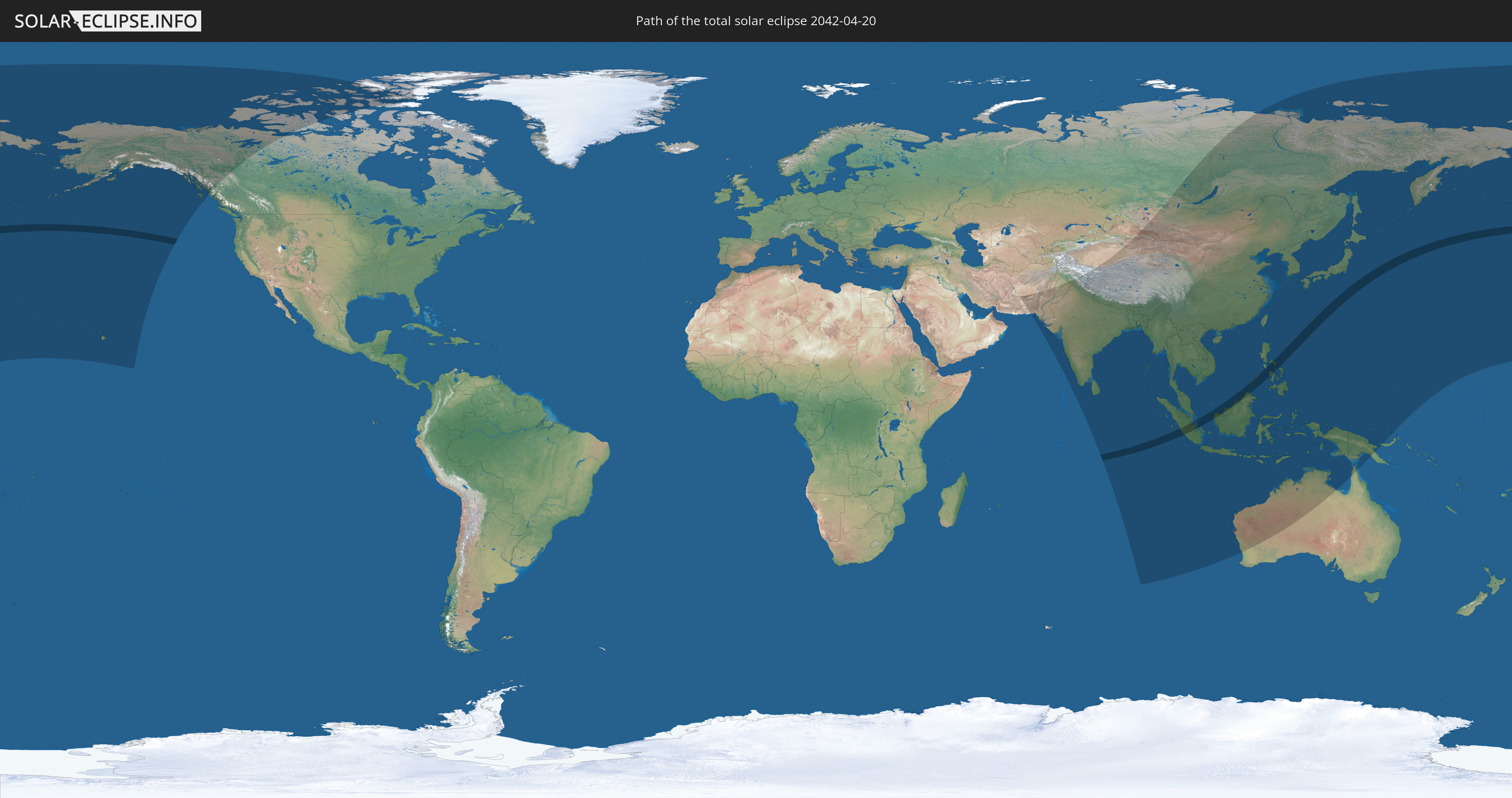
Die Sonnenfinsternis am 20.04.2042 kann man in 39 Ländern als partielle Sonnenfinsternis beobachten.
Der Finsternispfad verläuft durch 4 Länder. Nur in diesen Ländern ist sie als totale Sonnenfinsternis zu sehen.
In den folgenden Ländern ist die Sonnenfinsternis total zu sehen
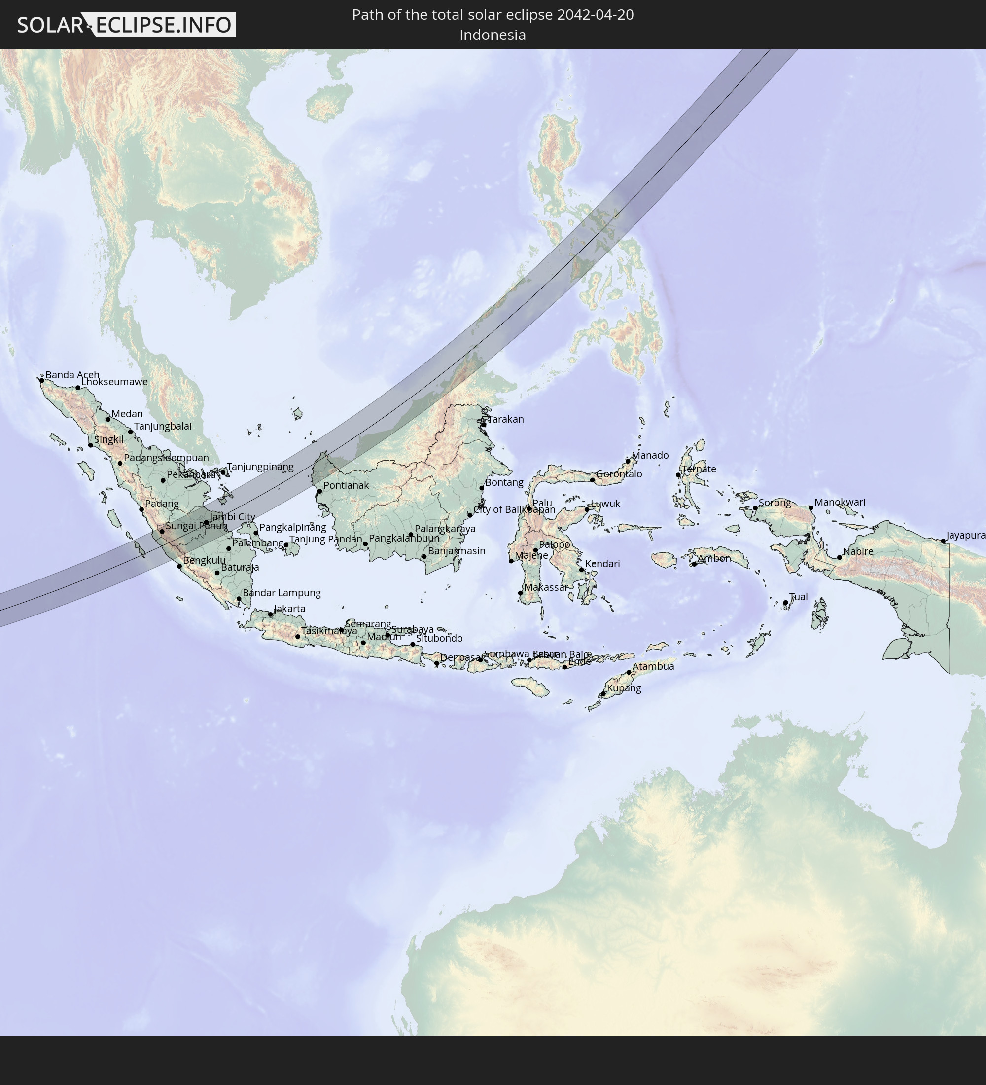 Indonesien
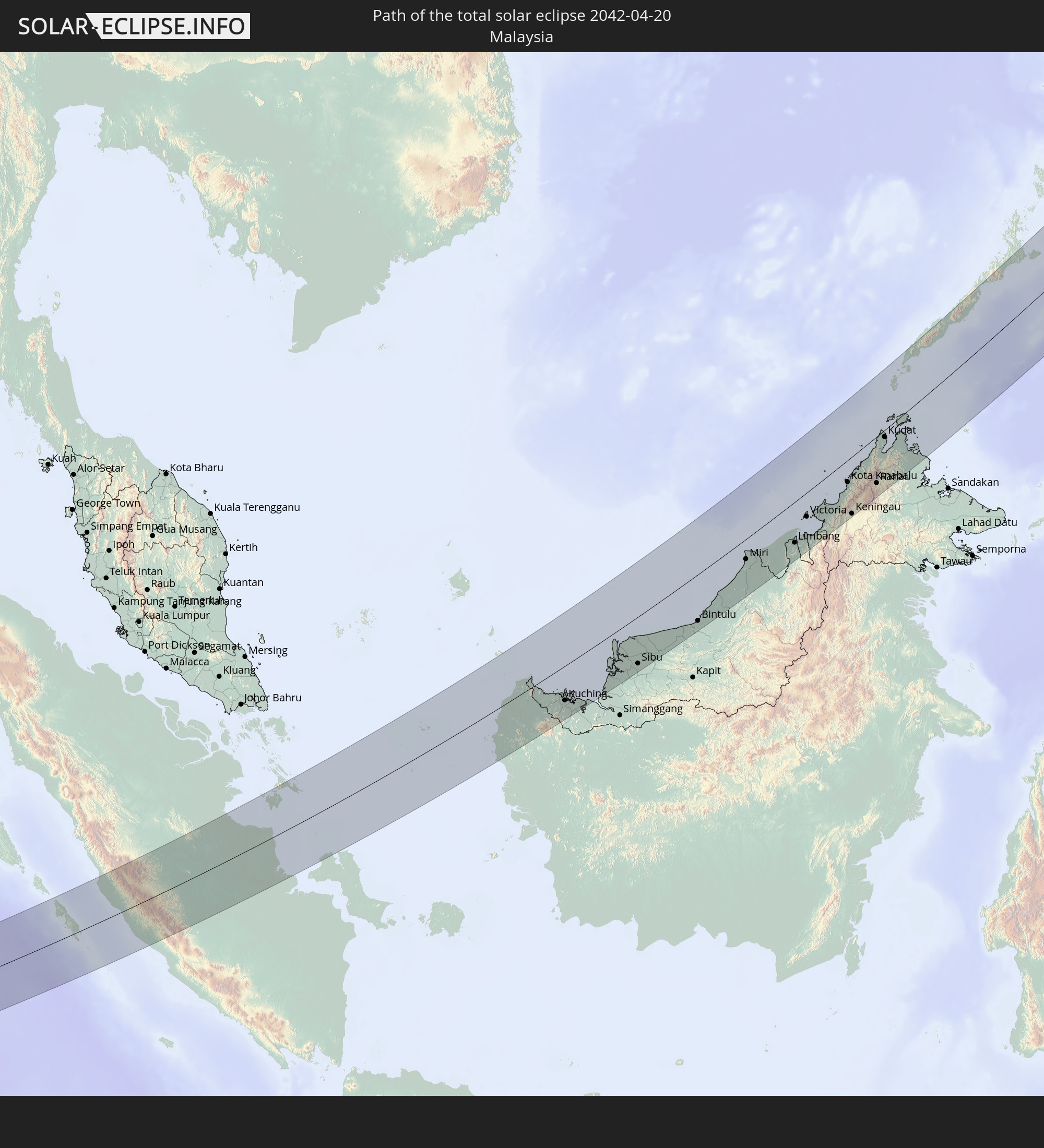 Malaysia
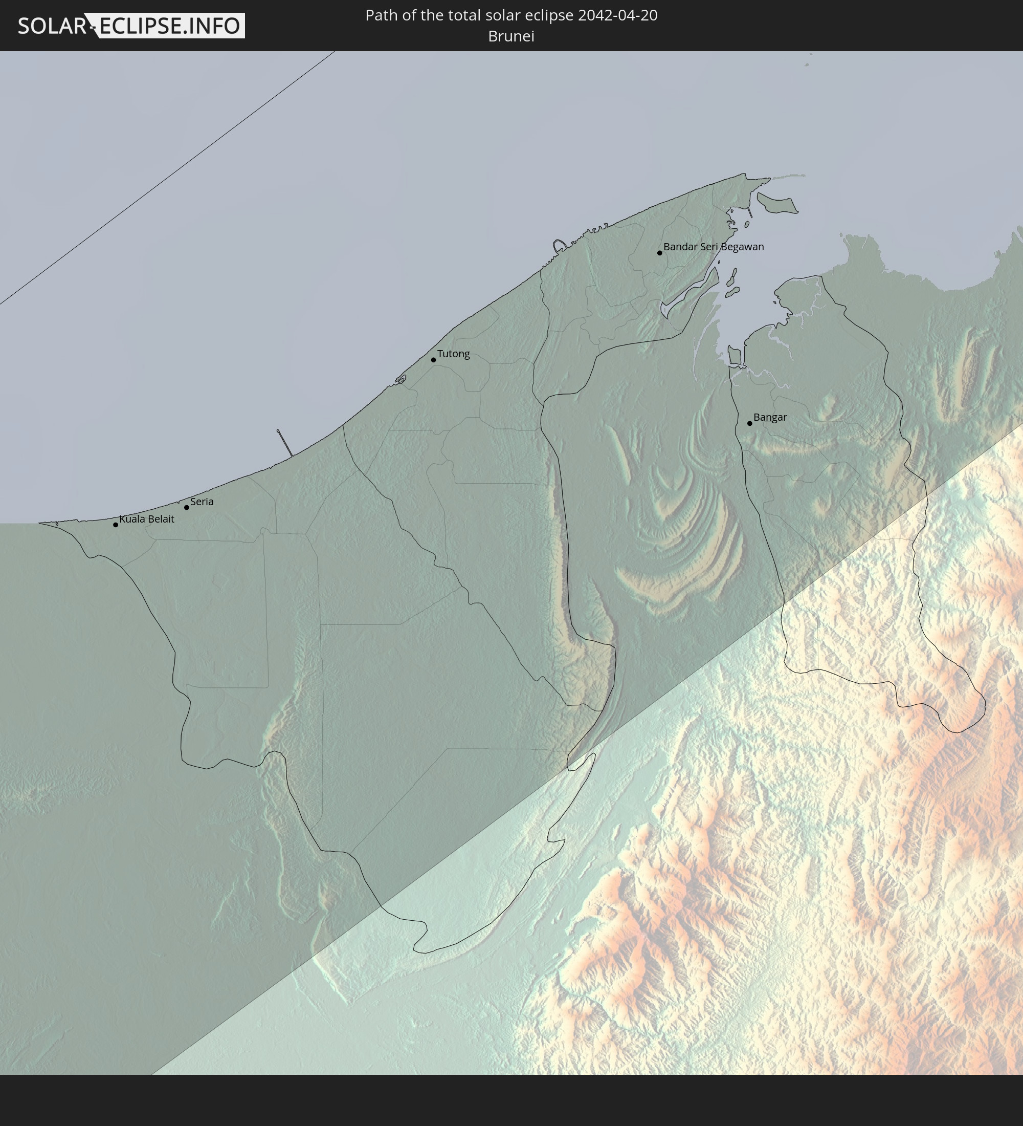 Brunei
 Philippinen
In den folgenden Ländern ist die Sonnenfinsternis partiell zu sehen
 Russland
 Vereinigte Staaten
 United States Minor Outlying Islands
 Kanada
 Afghanistan
 Pakistan
 Indien
 Volksrepublik China
 Sri Lanka
 Nepal
Nepal
 Mongolei
 Bangladesch
 Bhutan
 Myanmar
 Indonesien
 Kokosinseln
 Thailand
 Malaysia
 Laos
Laos
 Vietnam
 Kambodscha
 Singapur
 Weihnachtsinsel
 Australien
 Macau
Macau
 Hongkong
 Brunei
 Taiwan
 Philippinen
 Japan
Japan
 Osttimor
 Nordkorea
 Südkorea
 Palau
Palau
 Föderierte Staaten von Mikronesien
 Papua-Neuguinea
 Guam
Guam
 Nördliche Marianen
 Marshallinseln
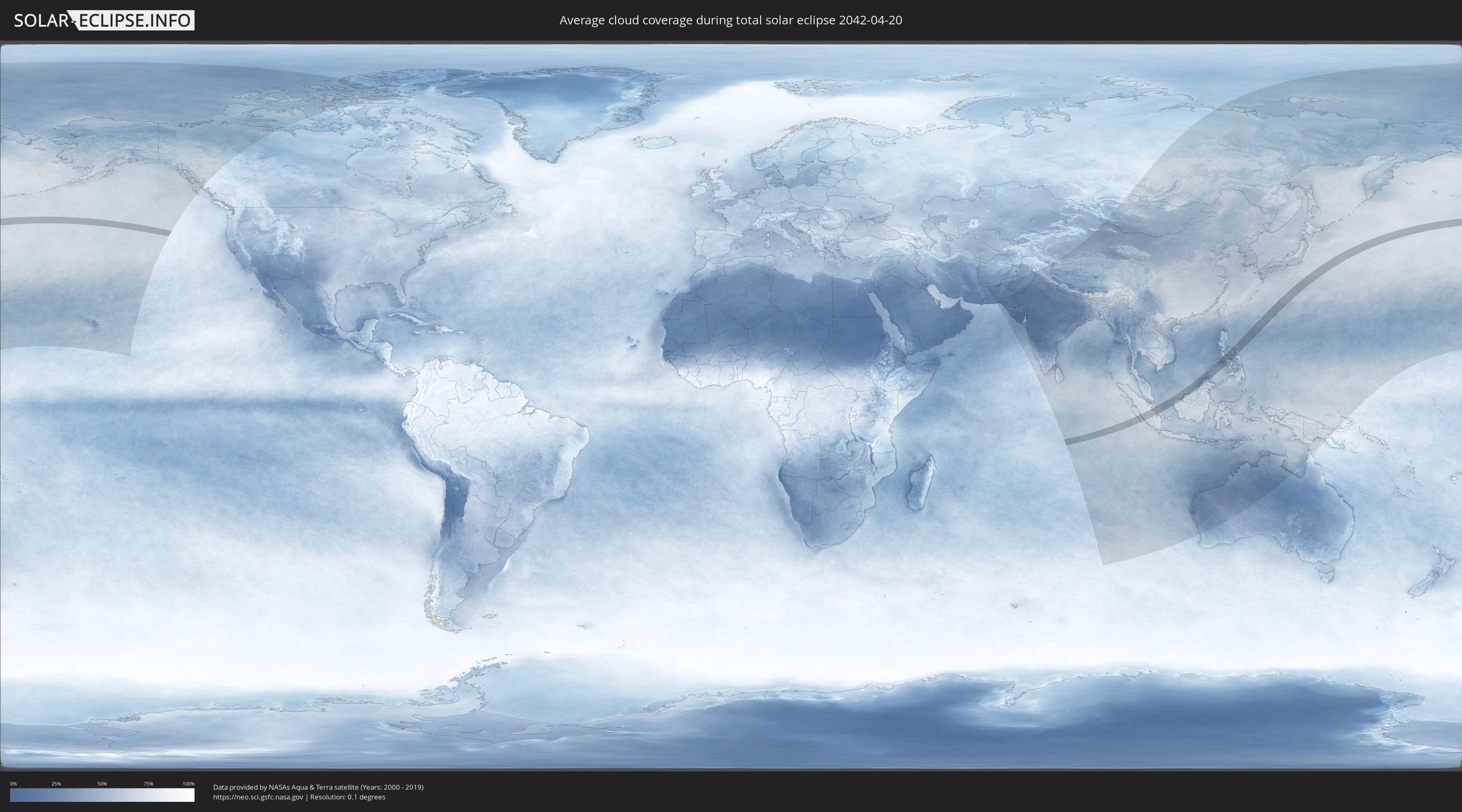
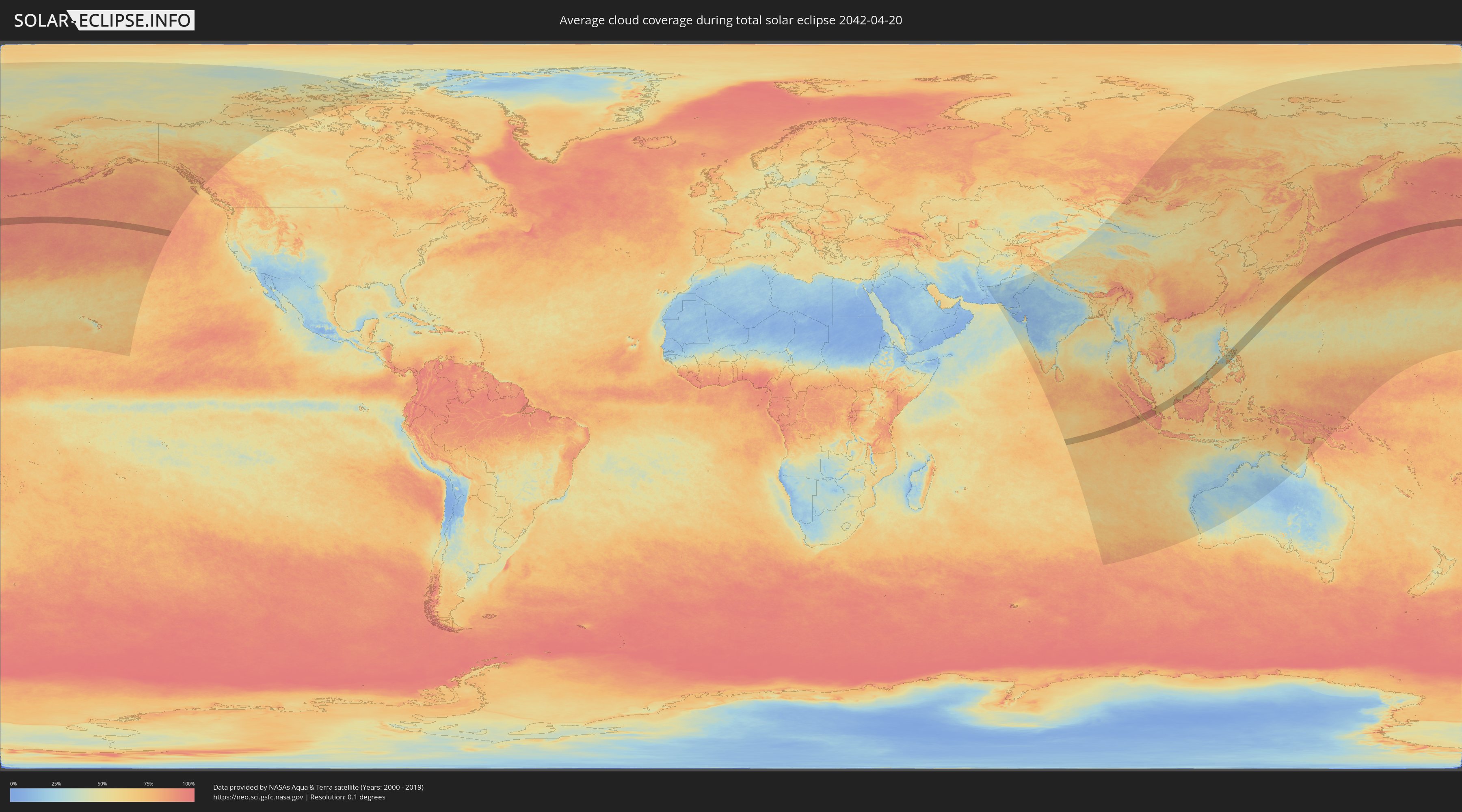
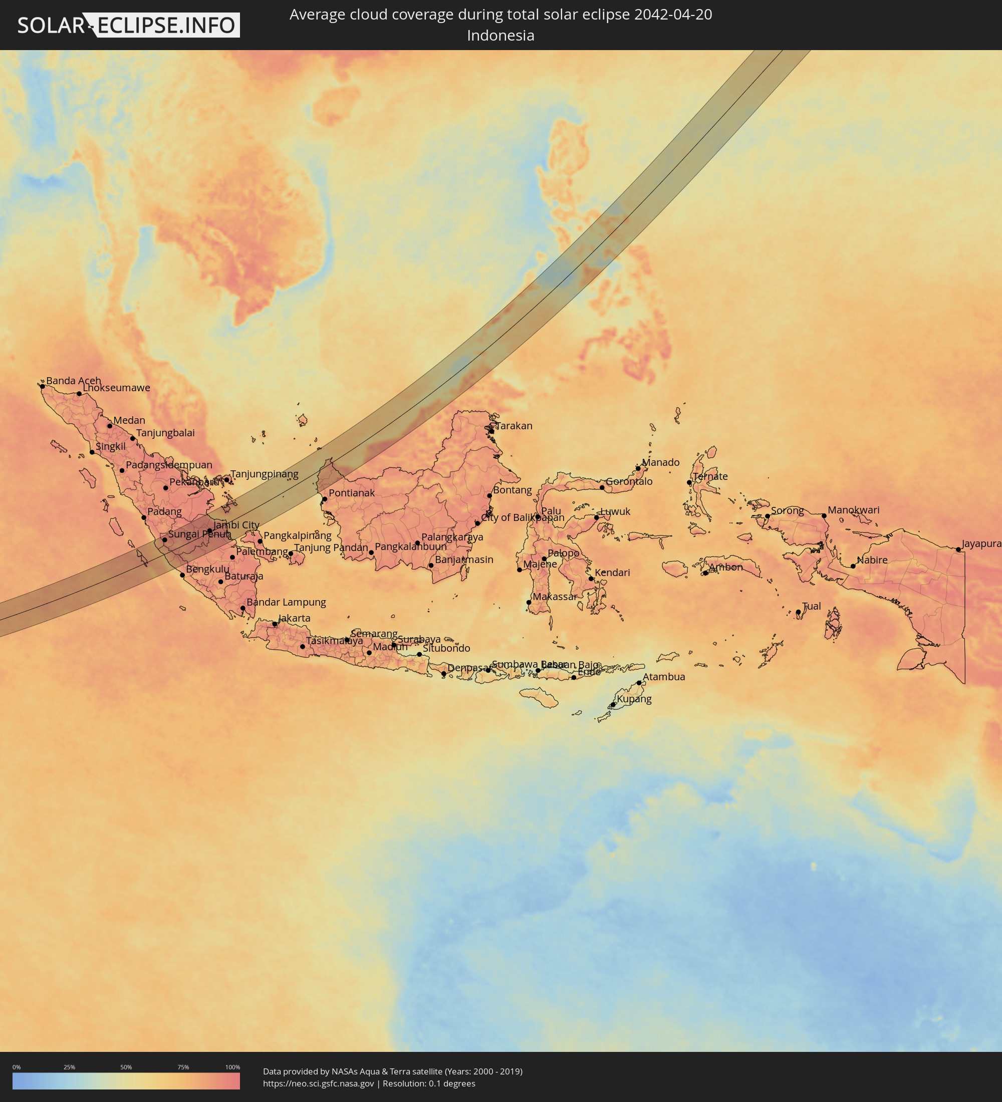
Wie wird das Wetter während der totalen Sonnenfinsternis am 20.04.2042?
Wo ist der beste Ort, um die totale Sonnenfinsternis vom 20.04.2042 zu beobachten?
Die folgenden Karten zeigen die durchschnittliche Bewölkung für den Tag, an dem die totale Sonnenfinsternis
stattfindet. Mit Hilfe der Karten lässt sich der Ort entlang des Finsternispfades eingrenzen,
der die besten Aussichen auf einen klaren wolkenfreien Himmel bietet.
Trotzdem muss man immer lokale Gegenenheiten beachten und sollte sich genau über das Wetter an seinem
gewählten Beobachtungsort informieren.
Die Daten stammen von den beiden NASA-Satelliten
AQUA und TERRA
und wurden über einen Zeitraum von 19 Jahren (2000 - 2019) gemittelt.
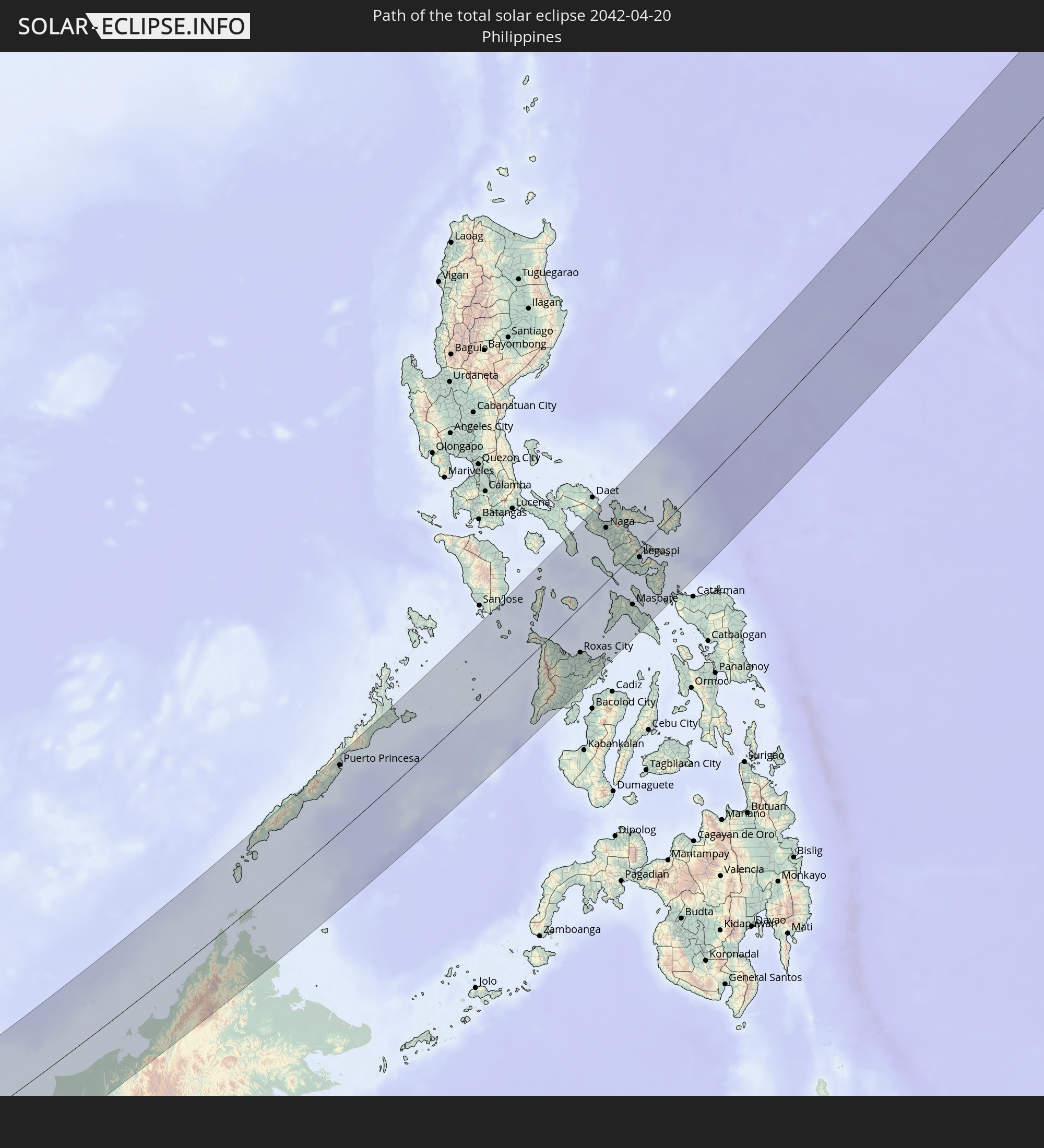
Detaillierte Länderkarten
 Indonesien
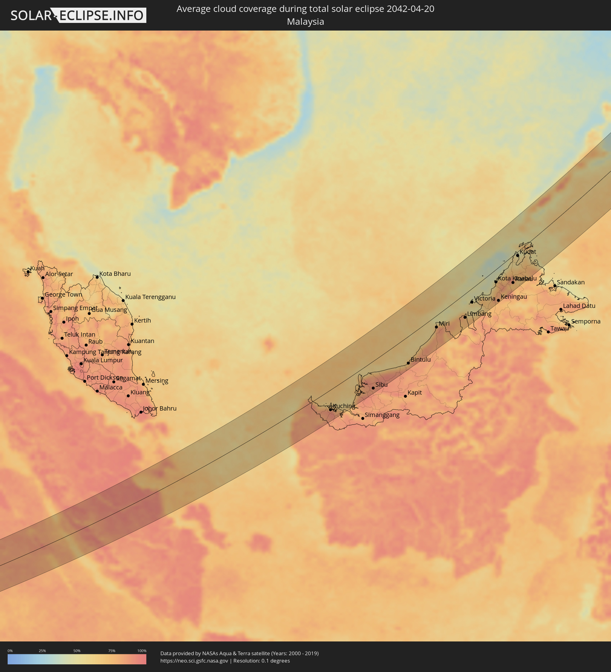 Malaysia
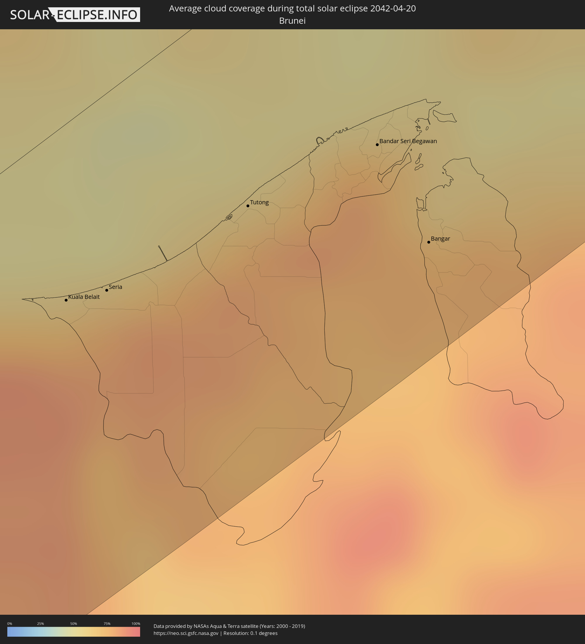 Brunei
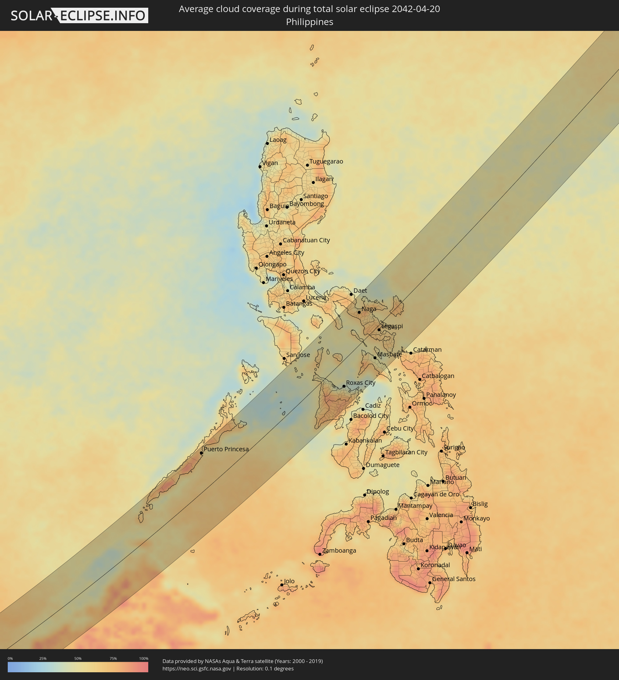 Philippinen
Orte im Finsternispfad
Die nachfolgene Tabelle zeigt Städte und Orte mit mehr als 5.000 Einwohnern, die sich im Finsternispfad befinden. Städte mit mehr als 100.000 Einwohnern sind dick gekennzeichnet. Mit einem Klick auf den Ort öffnet sich eine Detailkarte die die Lage des jeweiligen Ortes zusammen mit dem Verlauf der zentralen Finsternis präsentiert.
| Ort | Typ | Dauer der Verfinsterung | Ortszeit bei maximaler Verfinsterung | Entfernung zur Zentrallinie | Ø Bewölkung |
|
Sungai Penuh, Jambi
|
total | - | 07:45:44 UTC+07:00 | 67 km | 87% |
|
Bejubang Dua, Jambi
|
total | - | 07:46:54 UTC+07:00 | 1 km | 92% |
|
Kuala Tungkal, Jambi
|
total | - | 07:48:07 UTC+07:00 | 89 km | 89% |
|
Mendaha, Jambi
|
total | - | 07:47:56 UTC+07:00 | 62 km | 94% |
|
Jambi City, Jambi
|
total | - | 07:47:16 UTC+07:00 | 3 km | 95% |
|
Simpang, Jambi
|
total | - | 07:47:54 UTC+07:00 | 12 km | 90% |
|
Sungai Raya, West Kalimantan
|
total | - | 07:53:13 UTC+07:00 | 61 km | 66% |
|
Pemangkat, West Kalimantan
|
total | - | 07:53:53 UTC+07:00 | 20 km | 78% |
|
Singkawang, West Kalimantan
|
total | - | 07:53:34 UTC+07:00 | 46 km | 85% |
|
Kuching, Sarawak
|
total | - | 08:55:23 UTC+08:00 | 65 km | 89% |
|
Sarikei, Sarawak
|
total | - | 08:57:04 UTC+08:00 | 85 km | 90% |
|
Sibu, Sarawak
|
total | - | 08:57:34 UTC+08:00 | 87 km | 85% |
|
Bintulu, Sarawak
|
total | - | 08:59:49 UTC+08:00 | 85 km | 74% |
|
Miri, Sarawak
|
total | - | 09:02:32 UTC+08:00 | 36 km | 80% |
|
Kuala Belait, Belait
|
total | - | 09:03:00 UTC+08:00 | 36 km | 72% |
|
Seria, Belait
|
total | - | 09:03:07 UTC+08:00 | 40 km | 77% |
|
Tutong, Tutong
|
total | - | 09:03:42 UTC+08:00 | 45 km | 78% |
|
Bandar Seri Begawan, Brunei and Muara
|
total | - | 09:04:12 UTC+08:00 | 52 km | 80% |
|
Limbang, Sarawak
|
total | - | 09:03:57 UTC+08:00 | 73 km | 76% |
|
Bangar, Temburong
|
total | - | 09:03:57 UTC+08:00 | 80 km | 76% |
|
Victoria, Labuan
|
total | - | 09:05:00 UTC+08:00 | 43 km | 61% |
|
Bandar Labuan, Sabah
|
total | - | 09:05:03 UTC+08:00 | 43 km | 59% |
|
Beaufort, Sabah
|
total | - | 09:05:35 UTC+08:00 | 71 km | 71% |
|
Papar, Sabah
|
total | - | 09:06:23 UTC+08:00 | 50 km | 60% |
|
Kinarut, Sabah
|
total | - | 09:06:38 UTC+08:00 | 50 km | 67% |
|
Putatan, Sabah
|
total | - | 09:06:49 UTC+08:00 | 42 km | 72% |
|
Kota Kinabalu, Sabah
|
total | - | 09:06:55 UTC+08:00 | 38 km | 75% |
|
Donggongon, Sabah
|
total | - | 09:06:50 UTC+08:00 | 46 km | 72% |
|
Keningau, Sabah
|
total | - | 09:05:58 UTC+08:00 | 100 km | 75% |
|
Kota Belud, Sabah
|
total | - | 09:07:52 UTC+08:00 | 31 km | 62% |
|
Ranau, Sabah
|
total | - | 09:07:27 UTC+08:00 | 81 km | 73% |
|
Kudat, Sabah
|
total | - | 09:09:09 UTC+08:00 | 12 km | 57% |
|
Balabac, Mimaropa
|
total | - | 09:11:13 UTC+08:00 | 66 km | 69% |
|
Rio Tuba, Mimaropa
|
total | - | 09:12:30 UTC+08:00 | 83 km | 52% |
|
Pañgobilian, Mimaropa
|
total | - | 09:13:27 UTC+08:00 | 77 km | 53% |
|
Quezon, Mimaropa
|
total | - | 09:14:24 UTC+08:00 | 101 km | 68% |
|
Panitian, Mimaropa
|
total | - | 09:14:13 UTC+08:00 | 85 km | 58% |
|
Narra, Mimaropa
|
total | - | 09:14:51 UTC+08:00 | 77 km | 65% |
|
Puerto Princesa, Mimaropa
|
total | - | 09:16:02 UTC+08:00 | 92 km | 63% |
|
Roxas, Mimaropa
|
total | - | 09:17:45 UTC+08:00 | 95 km | 56% |
|
Cuyo, Mimaropa
|
total | - | 09:20:39 UTC+08:00 | 14 km | 43% |
|
Bulalacao, Mimaropa
|
total | - | 09:23:45 UTC+08:00 | 107 km | 48% |
|
Sibalom, Western Visayas
|
total | - | 09:21:45 UTC+08:00 | 67 km | 71% |
|
Pandan, Western Visayas
|
total | - | 09:23:36 UTC+08:00 | 3 km | 64% |
|
Miagao, Western Visayas
|
total | - | 09:21:44 UTC+08:00 | 95 km | 49% |
|
Romblon, Mimaropa
|
total | - | 09:25:22 UTC+08:00 | 56 km | 49% |
|
Kalibo (poblacion), Western Visayas
|
total | - | 09:23:51 UTC+08:00 | 20 km | 47% |
|
Tigbauan, Western Visayas
|
total | - | 09:21:58 UTC+08:00 | 104 km | 62% |
|
San Miguel, Western Visayas
|
total | - | 09:22:16 UTC+08:00 | 102 km | 72% |
|
Janiuay, Western Visayas
|
total | - | 09:22:38 UTC+08:00 | 91 km | 78% |
|
Aurora, Calabarzon
|
total | - | 09:27:07 UTC+08:00 | 98 km | 61% |
|
Passi, Western Visayas
|
total | - | 09:23:06 UTC+08:00 | 89 km | 81% |
|
Dao, Western Visayas
|
total | - | 09:23:41 UTC+08:00 | 69 km | 77% |
|
Roxas City, Western Visayas
|
total | - | 09:24:07 UTC+08:00 | 59 km | 47% |
|
Sipocot, Bicol
|
total | - | 09:28:30 UTC+08:00 | 96 km | 58% |
|
Pilar, Western Visayas
|
total | - | 09:24:14 UTC+08:00 | 85 km | 61% |
|
Pasacao, Bicol
|
total | - | 09:28:06 UTC+08:00 | 71 km | 58% |
|
Mambulo, Bicol
|
total | - | 09:28:30 UTC+08:00 | 86 km | 68% |
|
San Fernando, Bicol
|
total | - | 09:28:20 UTC+08:00 | 67 km | 70% |
|
Estancia, Western Visayas
|
total | - | 09:24:22 UTC+08:00 | 100 km | 52% |
|
Naga, Bicol
|
total | - | 09:28:29 UTC+08:00 | 69 km | 72% |
|
Claveria, Bicol
|
total | - | 09:27:12 UTC+08:00 | 8 km | 51% |
|
Bula, Bicol
|
total | - | 09:28:19 UTC+08:00 | 50 km | 61% |
|
Tinambac, Bicol
|
total | - | 09:29:02 UTC+08:00 | 73 km | 69% |
|
Pantao, Bicol
|
total | - | 09:27:52 UTC+08:00 | 24 km | 71% |
|
Iriga City, Bicol
|
total | - | 09:28:25 UTC+08:00 | 36 km | 65% |
|
Pio Duran, Bicol
|
total | - | 09:27:42 UTC+08:00 | 2 km | 62% |
|
Polangui, Bicol
|
total | - | 09:28:15 UTC+08:00 | 20 km | 72% |
|
Goa, Bicol
|
total | - | 09:29:02 UTC+08:00 | 51 km | 56% |
|
Donsol, Bicol
|
total | - | 09:27:40 UTC+08:00 | 19 km | 62% |
|
Masbate, Bicol
|
total | - | 09:26:41 UTC+08:00 | 63 km | 50% |
|
Pilar, Bicol
|
total | - | 09:27:48 UTC+08:00 | 24 km | 62% |
|
Tabaco, Bicol
|
total | - | 09:28:42 UTC+08:00 | 6 km | 67% |
|
San Jacinto, Bicol
|
total | - | 09:27:12 UTC+08:00 | 56 km | 48% |
|
Legaspi, Bicol
|
total | - | 09:28:18 UTC+08:00 | 12 km | 63% |
|
San Fernando, Bicol
|
total | - | 09:27:05 UTC+08:00 | 65 km | 44% |
|
Bulan, Bicol
|
total | - | 09:27:35 UTC+08:00 | 59 km | 63% |
|
Sorsogon, Bicol
|
total | - | 09:28:18 UTC+08:00 | 44 km | 66% |
|
Irosin, Bicol
|
total | - | 09:27:50 UTC+08:00 | 69 km | 59% |
|
Gubat, Bicol
|
total | - | 09:28:22 UTC+08:00 | 59 km | 59% |
|
Virac, Bicol
|
total | - | 09:29:47 UTC+08:00 | 15 km | 59% |
|
Allen, Eastern Visayas
|
total | - | 09:27:47 UTC+08:00 | 104 km | 66% |