Totale Sonnenfinsternis vom 03.06.2505
| Wochentag: | Mittwoch |
| Maximale Dauer der Verfinsterung: | 03m50s |
| Maximale Breite des Finsternispfades: | 163 km |
| Saroszyklus: | 155 |
| Bedeckungsgrad: | 100% |
| Magnitude: | 1.0464 |
| Gamma: | 0.3165 |
Wo kann man die Sonnenfinsternis vom 03.06.2505 sehen?
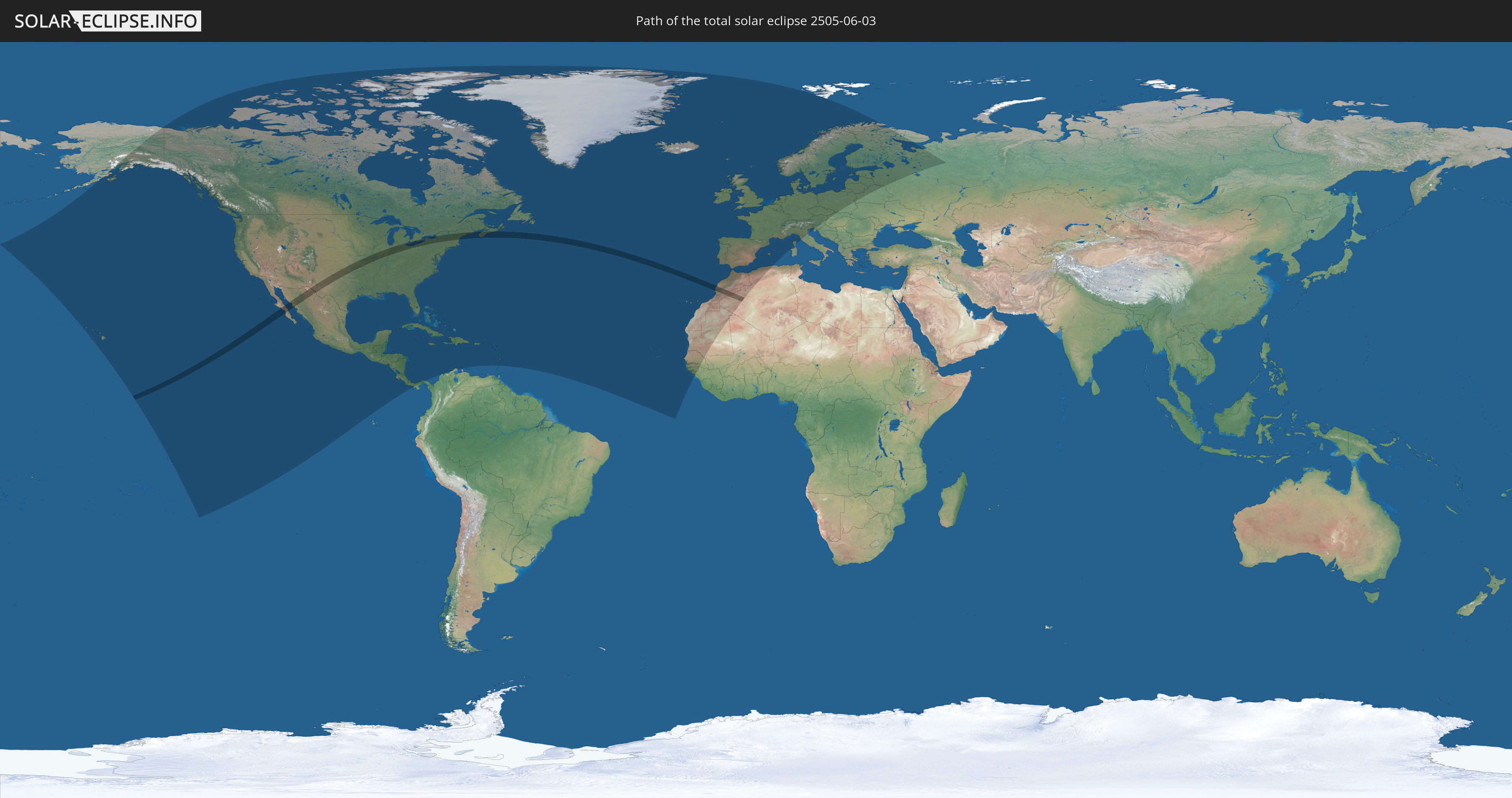
Die Sonnenfinsternis am 03.06.2505 kann man in 87 Ländern als partielle Sonnenfinsternis beobachten.
Der Finsternispfad verläuft durch 6 Länder. Nur in diesen Ländern ist sie als totale Sonnenfinsternis zu sehen.
In den folgenden Ländern ist die Sonnenfinsternis total zu sehen
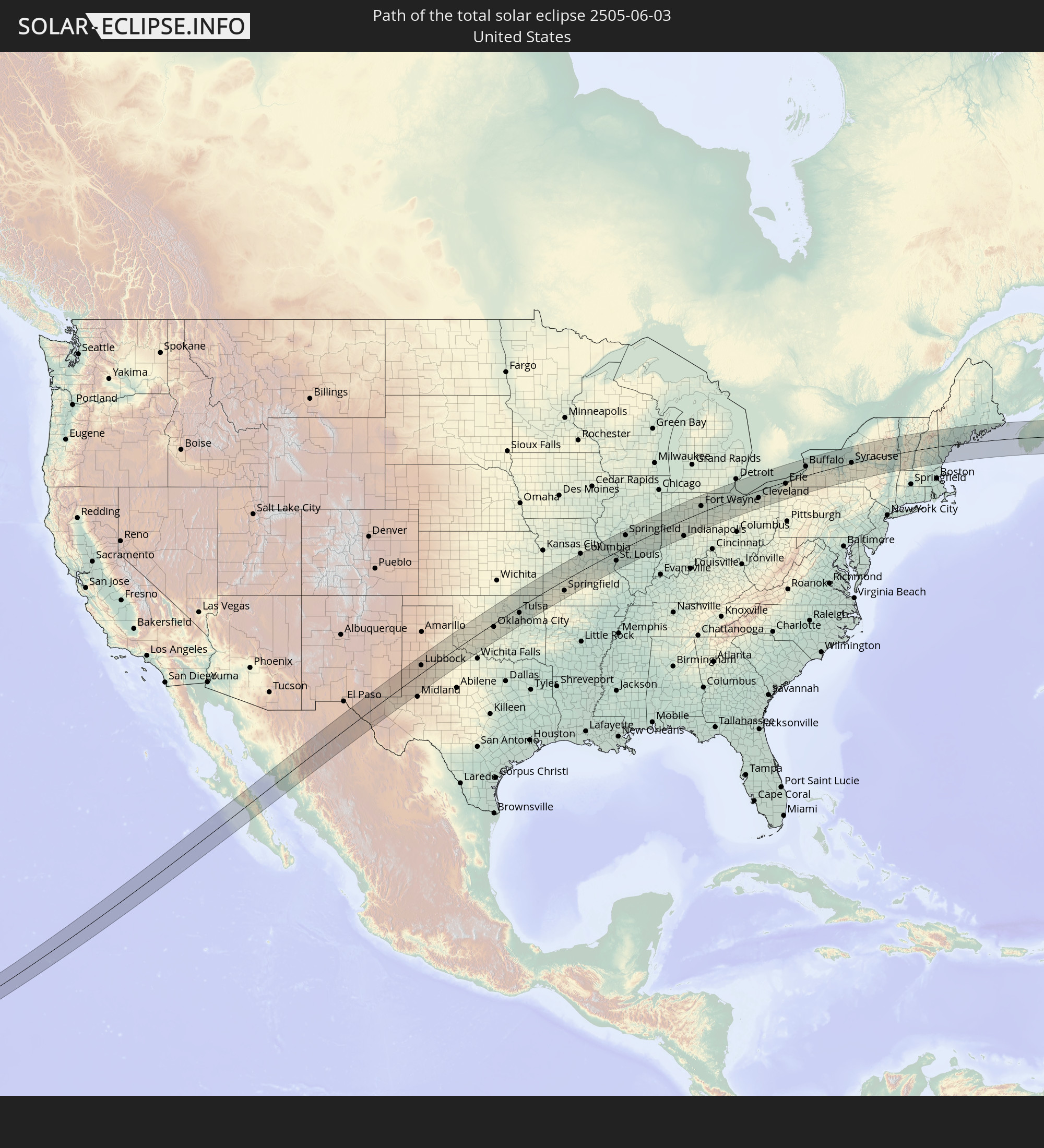 Vereinigte Staaten
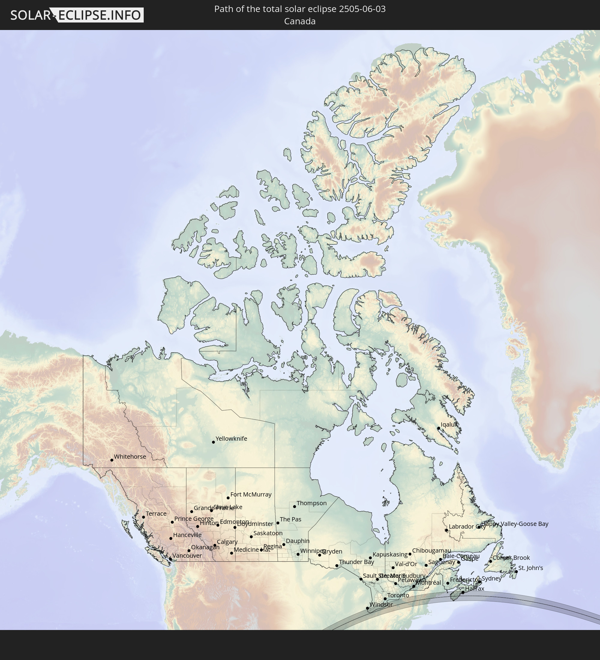 Kanada
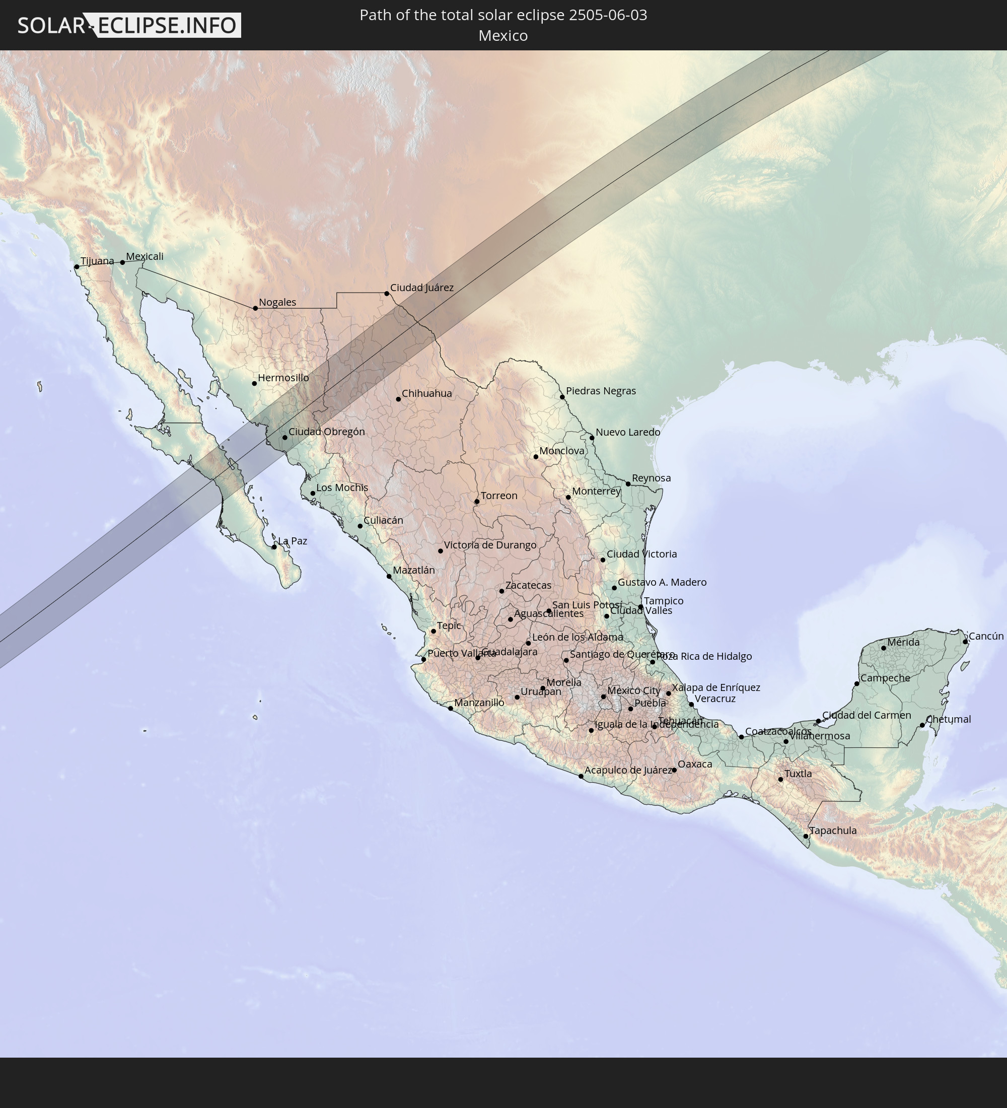 Mexiko
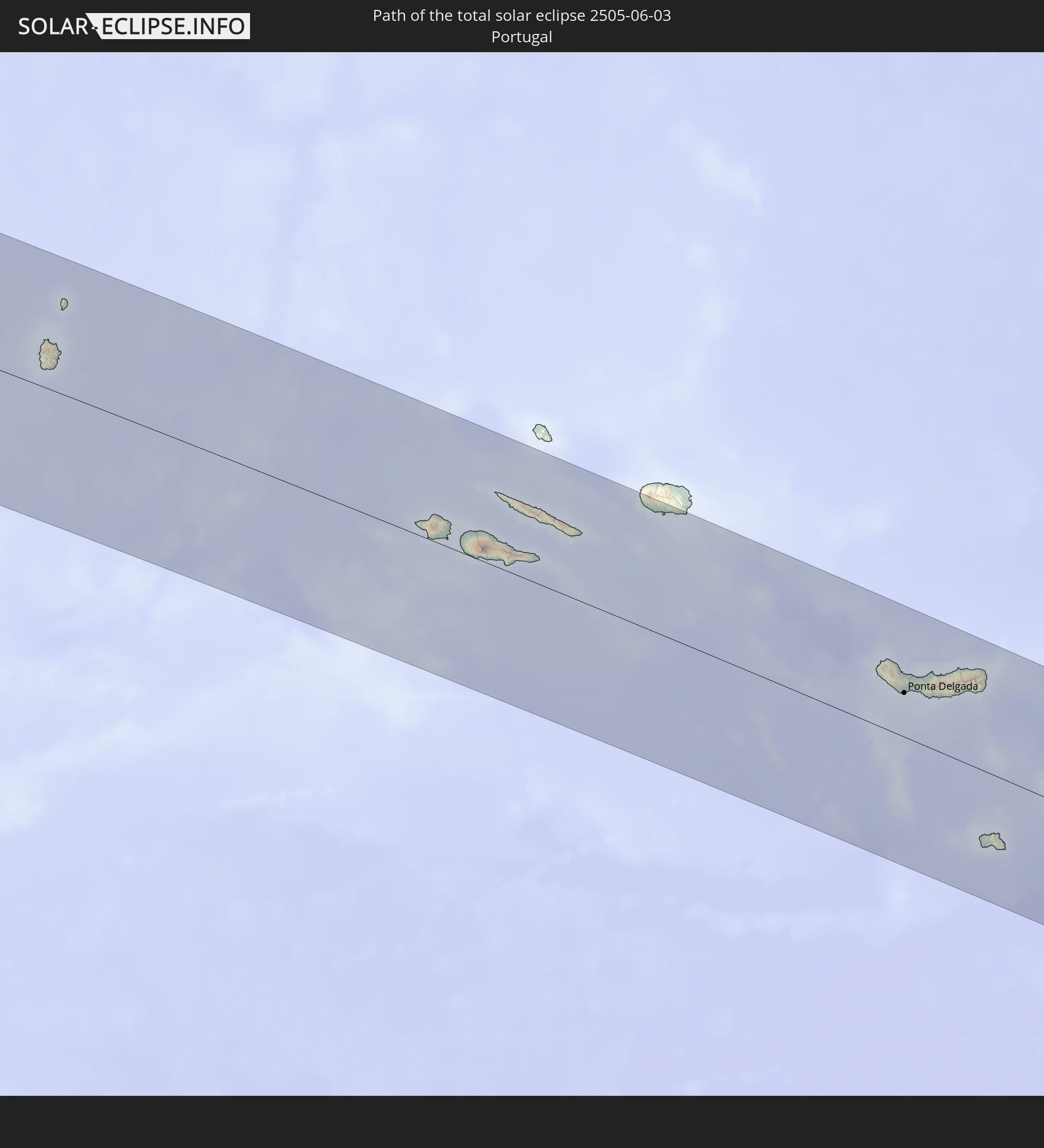 Portugal
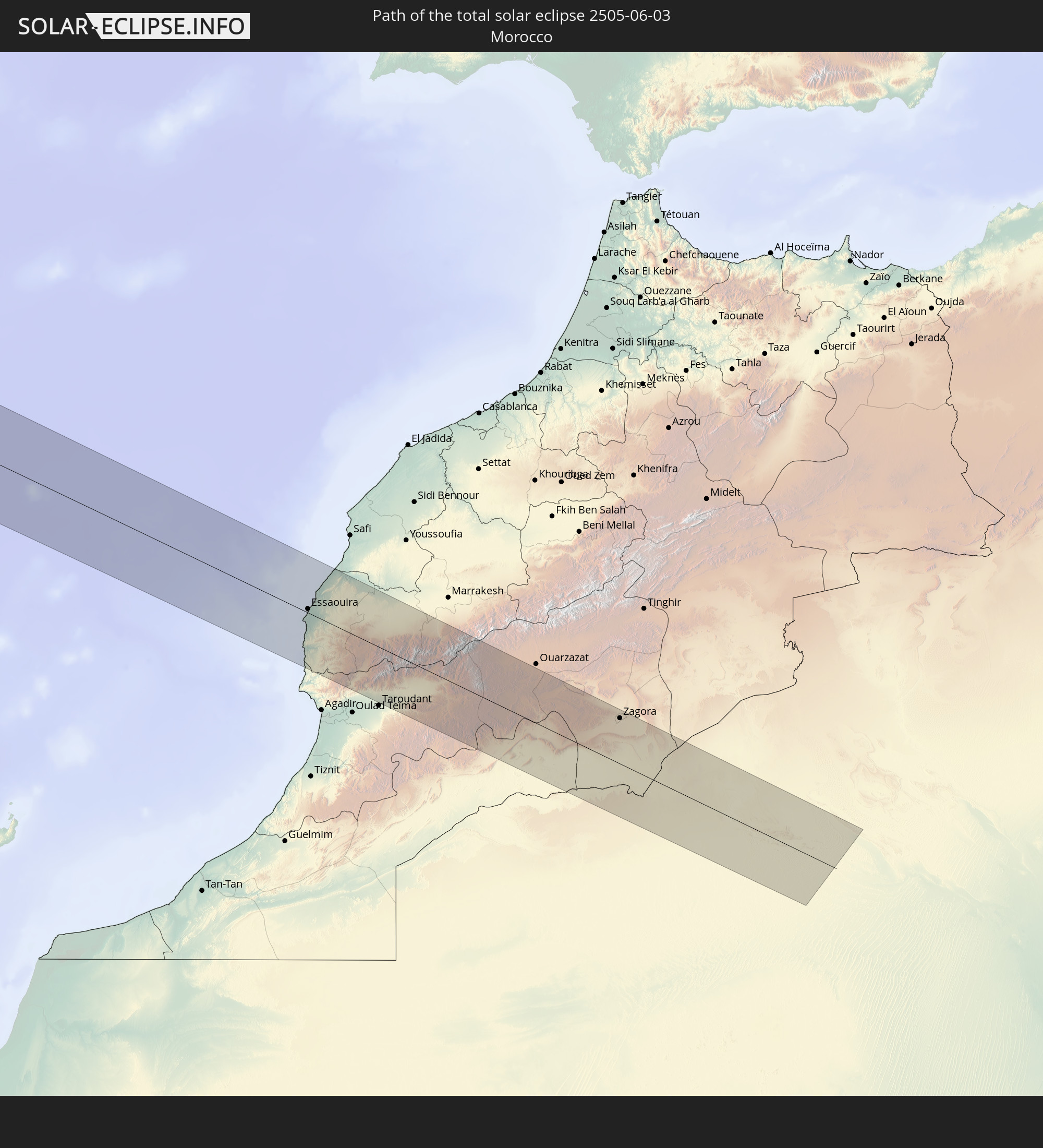 Marokko
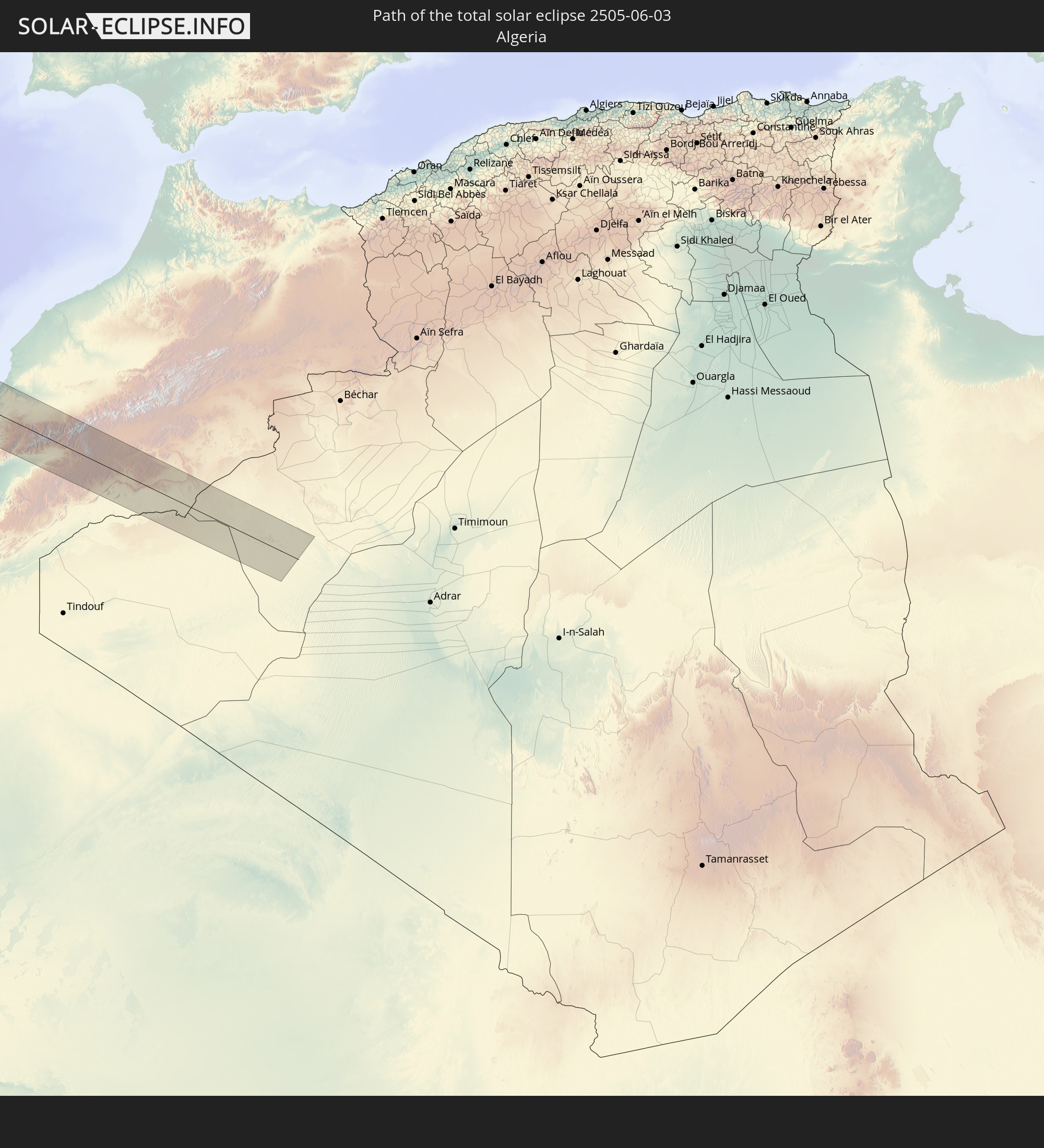 Algerien
In den folgenden Ländern ist die Sonnenfinsternis partiell zu sehen
 Russland
 Vereinigte Staaten
 United States Minor Outlying Islands
 Französisch-Polynesien
 Kanada
 Mexiko
 Grönland
 Guatemala
 Ecuador
 El Salvador
 Honduras
 Belize
 Nicaragua
 Costa Rica
 Kuba
Kuba
 Panama
 Kolumbien
 Kaimaninseln
 Bahamas
 Jamaika
 Haiti
Haiti
 Turks- und Caicosinseln
 Dominikanische Republik
 Aruba
Aruba
 Puerto Rico
 Amerikanische Jungferninseln
 Bermuda
 Britische Jungferninseln
 Anguilla
 Saint-Martin
 Saint-Barthélemy
 St. Kitts und Nevis
 Antigua und Barbuda
 Montserrat
 Guadeloupe
 Dominica
 St. Vincent und die Grenadinen
 Martinique
 St. Lucia
 Barbados
 Saint-Pierre und Miquelon
 Portugal
 Kap Verde
 Island
 Spanien
 Senegal
 Mauretanien
 Gambia
 Guinea-Bissau
 Guinea
 Marokko
 Mali
Mali
 Irland
 Spitzbergen
 Algerien
 Vereinigtes Königreich
 Färöer
 Gibraltar
 Frankreich
 Isle of Man
 Guernsey
 Jersey
 Andorra
 Belgien
 Niederlande
 Norwegen
 Luxemburg
 Deutschland
 Schweiz
 Italien
 Monaco
 Dänemark
 Liechtenstein
 Österreich
 Schweden
 Tschechien
 Slowenien
 Kroatien
 Polen
Polen
 Ungarn
 Slowakei
 Åland Islands
 Finnland
 Litauen
 Lettland
 Estland
 Weißrussland
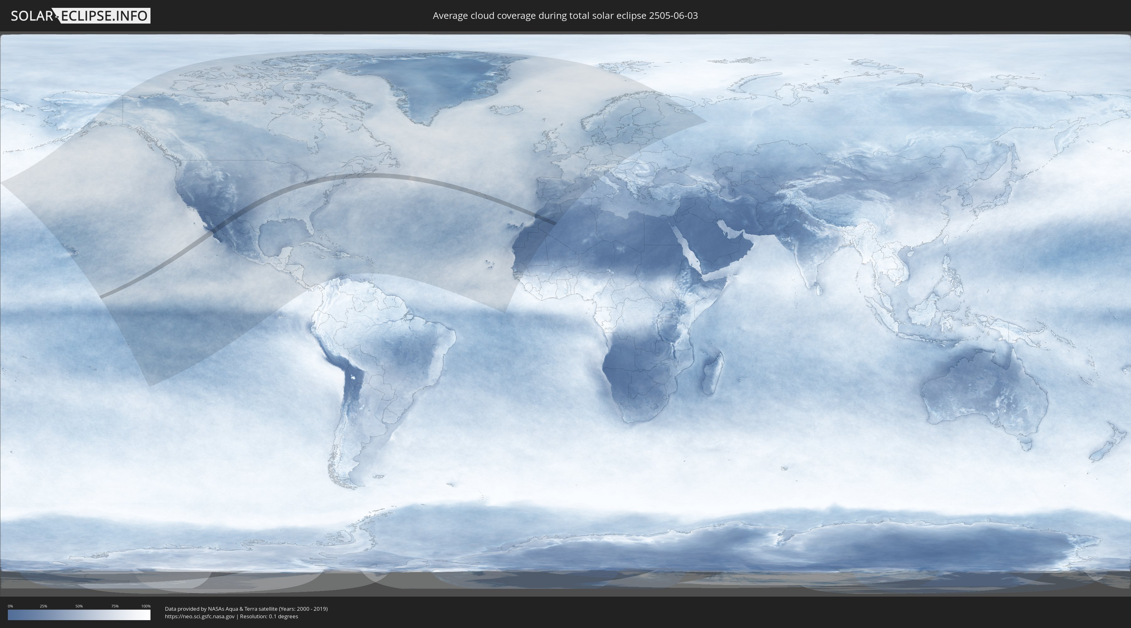
Wie wird das Wetter während der totalen Sonnenfinsternis am 03.06.2505?
Wo ist der beste Ort, um die totale Sonnenfinsternis vom 03.06.2505 zu beobachten?
Die folgenden Karten zeigen die durchschnittliche Bewölkung für den Tag, an dem die totale Sonnenfinsternis
stattfindet. Mit Hilfe der Karten lässt sich der Ort entlang des Finsternispfades eingrenzen,
der die besten Aussichen auf einen klaren wolkenfreien Himmel bietet.
Trotzdem muss man immer lokale Gegenenheiten beachten und sollte sich genau über das Wetter an seinem
gewählten Beobachtungsort informieren.
Die Daten stammen von den beiden NASA-Satelliten
AQUA und TERRA
und wurden über einen Zeitraum von 19 Jahren (2000 - 2019) gemittelt.

Detaillierte Länderkarten
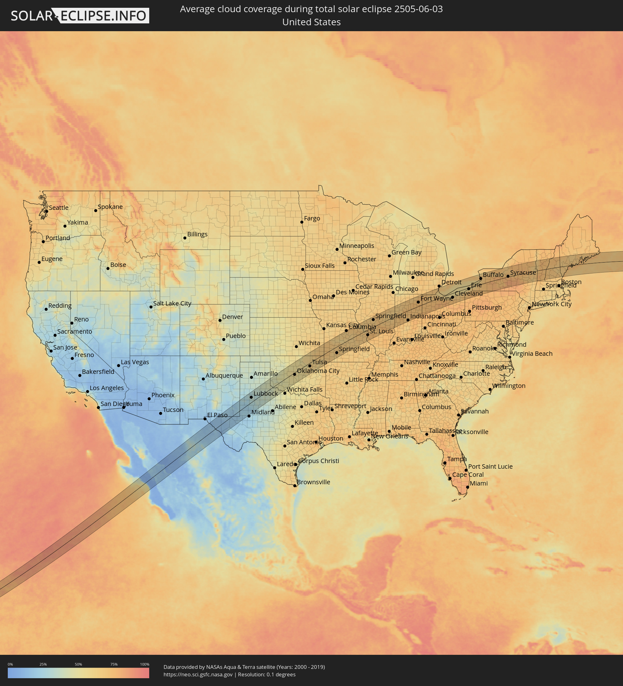 Vereinigte Staaten
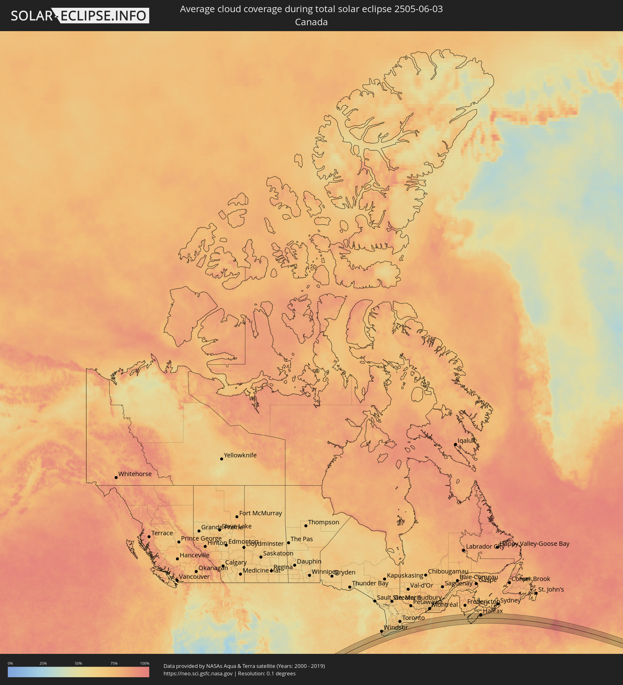 Kanada
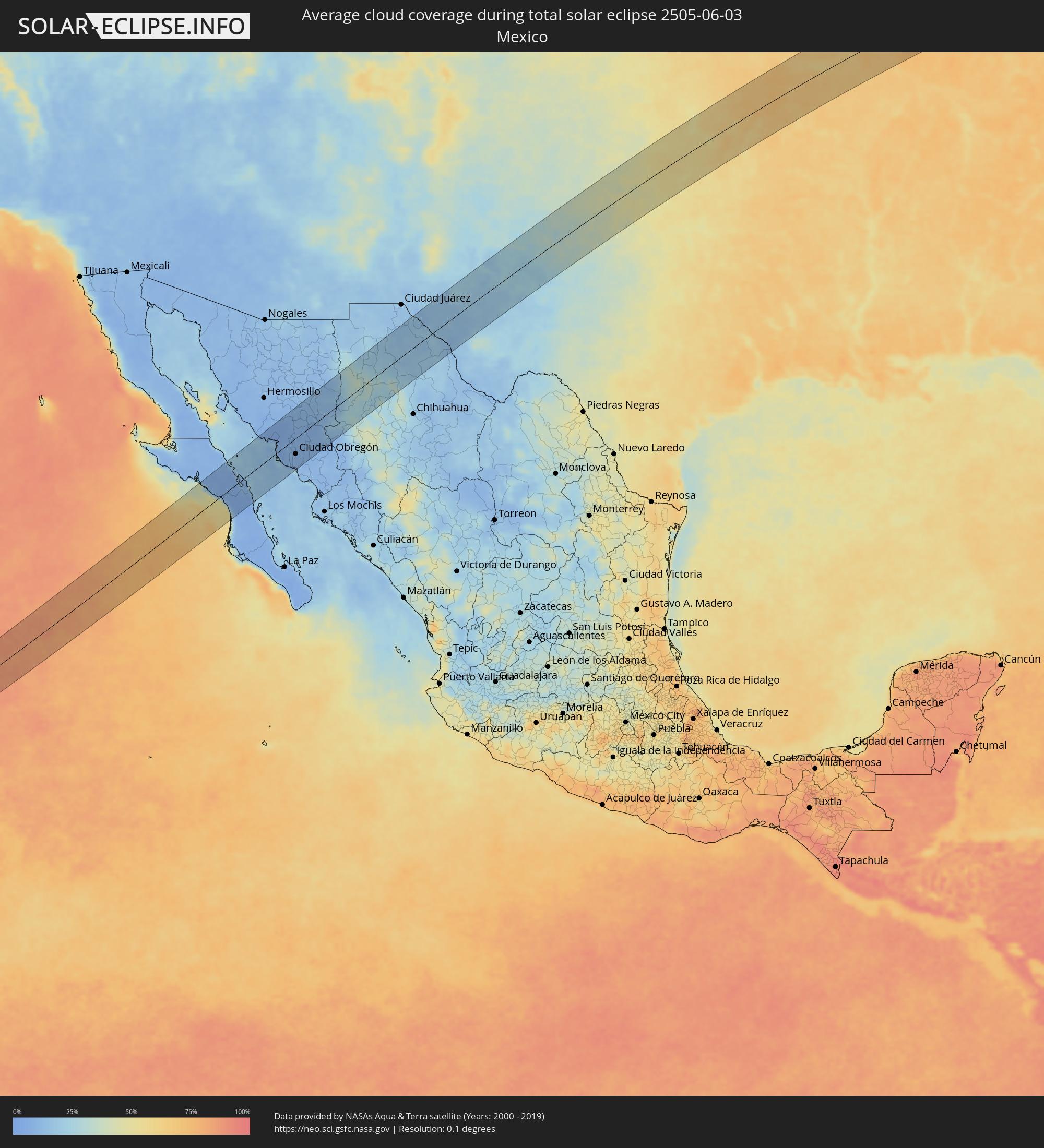 Mexiko
 Portugal
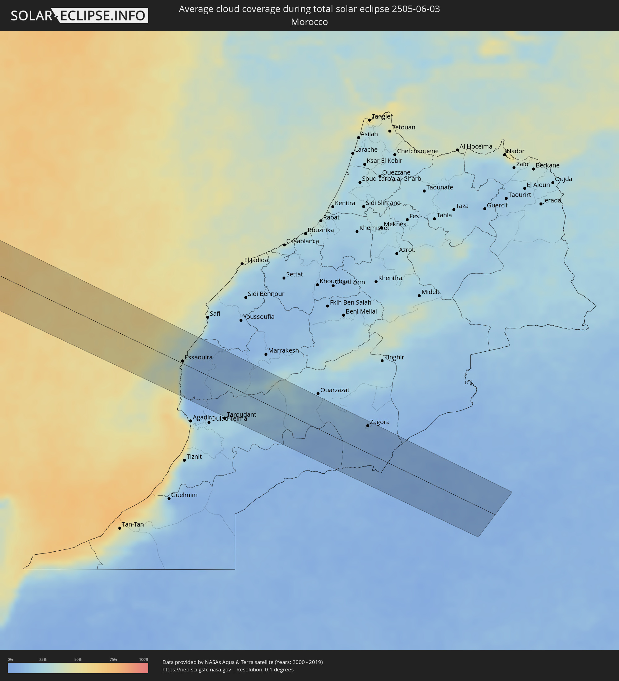 Marokko
 Algerien
Orte im Finsternispfad
Die nachfolgene Tabelle zeigt Städte und Orte mit mehr als 5.000 Einwohnern, die sich im Finsternispfad befinden. Städte mit mehr als 100.000 Einwohnern sind dick gekennzeichnet. Mit einem Klick auf den Ort öffnet sich eine Detailkarte die die Lage des jeweiligen Ortes zusammen mit dem Verlauf der zentralen Finsternis präsentiert.
| Ort | Typ | Dauer der Verfinsterung | Ortszeit bei maximaler Verfinsterung | Entfernung zur Zentrallinie | Ø Bewölkung |
|
Heroica Guaymas, Sonora
|
total | - | 09:23:43 UTC-07:00 | 56 km | 17% |
|
Empalme, Sonora
|
total | - | 09:23:53 UTC-07:00 | 55 km | 10% |
|
Potam, Sonora
|
total | - | 09:23:46 UTC-07:00 | 1 km | 5% |
|
Vicam, Sonora
|
total | - | 09:23:56 UTC-07:00 | 5 km | 7% |
|
San Ignacio Río Muerto, Sonora
|
total | - | 09:23:37 UTC-07:00 | 28 km | 9% |
|
Campo Sesenta, Sonora
|
total | - | 09:23:50 UTC-07:00 | 34 km | 11% |
|
Pueblo Yaqui, Sonora
|
total | - | 09:23:45 UTC-07:00 | 46 km | 10% |
|
Cocorit, Sonora
|
total | - | 09:24:13 UTC-07:00 | 31 km | 10% |
|
Ciudad Obregón, Sonora
|
total | - | 09:24:05 UTC-07:00 | 40 km | 9% |
|
El Tobarito, Sonora
|
total | - | 09:23:56 UTC-07:00 | 53 km | 9% |
|
Marte R. Gómez (Tobarito), Sonora
|
total | - | 09:23:57 UTC-07:00 | 54 km | 9% |
|
Villa Juarez, Sonora
|
total | - | 09:23:35 UTC-07:00 | 78 km | 11% |
|
San Pedro Madera, Chihuahua
|
total | - | 09:29:11 UTC-07:00 | 3 km | 26% |
|
Benito Juárez, Chihuahua
|
total | - | 09:30:24 UTC-07:00 | 39 km | 34% |
|
Buenaventura, Chihuahua
|
total | - | 09:31:11 UTC-07:00 | 20 km | 25% |
|
Ejido Benito Juárez, Chihuahua
|
total | - | 09:32:28 UTC-07:00 | 13 km | 19% |
|
Miguel Ahumada, Chihuahua
|
total | - | 09:33:46 UTC-07:00 | 33 km | 16% |
|
Lubbock, Texas
|
total | - | 10:45:32 UTC-06:00 | 36 km | 32% |
|
Lawton, Oklahoma
|
total | - | 10:52:50 UTC-06:00 | 51 km | 47% |
|
Oklahoma City, Oklahoma
|
total | - | 10:55:42 UTC-06:00 | 15 km | 54% |
|
Edmond, Oklahoma
|
total | - | 10:56:03 UTC-06:00 | 0 km | 55% |
|
Norman, Oklahoma
|
total | - | 10:55:26 UTC-06:00 | 42 km | 50% |
|
Tulsa, Oklahoma
|
total | - | 10:59:25 UTC-06:00 | 25 km | 62% |
|
Broken Arrow, Oklahoma
|
total | - | 10:59:37 UTC-06:00 | 44 km | 64% |
|
Joplin, Missouri
|
total | - | 11:03:27 UTC-06:00 | 6 km | 70% |
|
Springfield, Missouri
|
total | - | 11:05:52 UTC-06:00 | 48 km | 69% |
|
Columbia, Missouri
|
total | - | 11:10:04 UTC-06:00 | 79 km | 69% |
|
O'Fallon, Missouri
|
total | - | 11:12:54 UTC-06:00 | 2 km | 69% |
|
Chesterfield, Missouri
|
total | - | 11:12:57 UTC-06:00 | 22 km | 66% |
|
Saint Charles, Missouri
|
total | - | 11:13:17 UTC-06:00 | 13 km | 68% |
|
St. Louis, Missouri
|
total | - | 11:13:37 UTC-06:00 | 40 km | 70% |
|
Springfield, Illinois
|
total | - | 11:16:09 UTC-06:00 | 55 km | 64% |
|
Decatur, Illinois
|
total | - | 11:17:30 UTC-06:00 | 32 km | 70% |
|
Champaign, Illinois
|
total | - | 11:19:11 UTC-06:00 | 33 km | 64% |
|
Terre Haute, Indiana
|
total | - | 12:20:02 UTC-05:00 | 62 km | 67% |
|
Lafayette, Indiana
|
total | - | 12:22:09 UTC-05:00 | 15 km | 68% |
|
Indianapolis, Indiana
|
total | - | 12:22:51 UTC-05:00 | 76 km | 70% |
|
Carmel, Indiana
|
total | - | 12:23:09 UTC-05:00 | 56 km | 66% |
|
Anderson, Indiana
|
total | - | 12:24:09 UTC-05:00 | 57 km | 71% |
|
Muncie, Indiana
|
total | - | 12:24:50 UTC-05:00 | 58 km | 71% |
|
Fort Wayne, Indiana
|
total | - | 12:26:17 UTC-05:00 | 30 km | 73% |
|
Toledo, Ohio
|
total | - | 12:29:50 UTC-05:00 | 36 km | 68% |
|
Amherstburg, Ontario
|
total | - | 12:31:12 UTC-05:00 | 69 km | 65% |
|
Lorain, Ohio
|
total | - | 12:32:21 UTC-05:00 | 25 km | 62% |
|
Cleveland, Ohio
|
total | - | 12:33:21 UTC-05:00 | 34 km | 66% |
|
Euclid, Ohio
|
total | - | 12:33:45 UTC-05:00 | 29 km | 64% |
|
Cuyahoga Falls, Ohio
|
total | - | 12:33:29 UTC-05:00 | 78 km | 73% |
|
Mentor, Ohio
|
total | - | 12:34:11 UTC-05:00 | 26 km | 63% |
|
Aylmer, Ontario
|
total | - | 12:35:42 UTC-05:00 | 81 km | 64% |
|
Norfolk County, Ontario
|
total | - | 12:36:54 UTC-05:00 | 73 km | 62% |
|
Erie, Pennsylvania
|
total | - | 12:37:00 UTC-05:00 | 9 km | 66% |
|
Welland, Ontario
|
total | - | 12:39:10 UTC-05:00 | 61 km | 68% |
|
Port Colborne, Ontario
|
total | - | 12:39:09 UTC-05:00 | 52 km | 63% |
|
Thorold, Ontario
|
total | - | 12:39:21 UTC-05:00 | 74 km | 67% |
|
Niagara Falls, Ontario
|
total | - | 12:39:35 UTC-05:00 | 70 km | 67% |
|
Niagara Falls, New York
|
total | - | 12:39:36 UTC-05:00 | 69 km | 67% |
|
Fort Erie, Ontario
|
total | - | 12:39:44 UTC-05:00 | 45 km | 63% |
|
Buffalo, New York
|
total | - | 12:39:50 UTC-05:00 | 42 km | 63% |
|
Rochester, New York
|
total | - | 12:42:24 UTC-05:00 | 44 km | 72% |
|
Syracuse, New York
|
total | - | 12:45:11 UTC-05:00 | 3 km | 77% |
|
Utica, New York
|
total | - | 12:46:58 UTC-05:00 | 8 km | 76% |
|
Schenectady, New York
|
total | - | 12:49:23 UTC-05:00 | 62 km | 67% |
|
West Albany, New York
|
total | - | 12:49:39 UTC-05:00 | 78 km | 67% |
|
Manchester, New Hampshire
|
total | - | 12:54:12 UTC-05:00 | 77 km | 68% |
|
Portland, Maine
|
total | - | 12:56:31 UTC-05:00 | 18 km | 66% |
|
Yarmouth, Nova Scotia
|
total | - | 14:04:02 UTC-04:00 | 31 km | 70% |
|
Bridgewater, Nova Scotia
|
total | - | 14:06:40 UTC-04:00 | 23 km | 69% |
|
Lower Sacvkille, Nova Scotia
|
total | - | 14:07:58 UTC-04:00 | 65 km | 71% |
|
Dartmouth, Nova Scotia
|
total | - | 14:08:10 UTC-04:00 | 53 km | 71% |
|
Halifax, Nova Scotia
|
total | - | 14:08:11 UTC-04:00 | 50 km | 70% |
|
Cole Harbour, Nova Scotia
|
total | - | 14:08:20 UTC-04:00 | 53 km | 72% |
|
Ribeira Grande, Azores
|
total | - | 18:52:53 UTC+00:00 | 2 km | 74% |
|
Horta, Azores
|
total | - | 17:52:54 UTC-01:00 | 5 km | 77% |
|
Madalena, Azores
|
total | - | 17:52:57 UTC-01:00 | 9 km | 81% |
|
Angra do Heroísmo, Azores
|
total | - | 17:53:26 UTC-01:00 | 64 km | 86% |
|
Arrifes, Azores
|
total | - | 17:55:00 UTC-01:00 | 25 km | 76% |
|
Ponta Delgada, Azores
|
total | - | 17:55:03 UTC-01:00 | 23 km | 70% |
|
Rosto de Cão, Azores
|
total | - | 17:55:02 UTC-01:00 | 25 km | 76% |
|
Rabo de Peixe, Azores
|
total | - | 17:55:01 UTC-01:00 | 33 km | 79% |
|
Vila Franca do Campo, Azores
|
total | - | 17:55:09 UTC-01:00 | 29 km | 73% |
|
Essaouira, Marrakech-Tensift-Al Haouz
|
total | - | 20:02:56 UTC+01:00 | 4 km | 30% |
|
Zagora, Souss-Massa-Drâa
|
total | - | 20:03:12 UTC+01:00 | 50 km | 8% |
|
Mhamid, Souss-Massa-Drâa
|
total | - | 20:03:34 UTC+01:00 | 3 km | 8% |