Total solar eclipse of 04/06/-0107
| Day of week: | Tuesday |
| Maximum duration of eclipse: | 06m10s |
| Maximum width of eclipse path: | 223 km |
| Saros cycle: | 66 |
| Coverage: | 100% |
| Magnitude: | 1.0684 |
| Gamma: | -0.064 |
Wo kann man die Sonnenfinsternis vom 04/06/-0107 sehen?
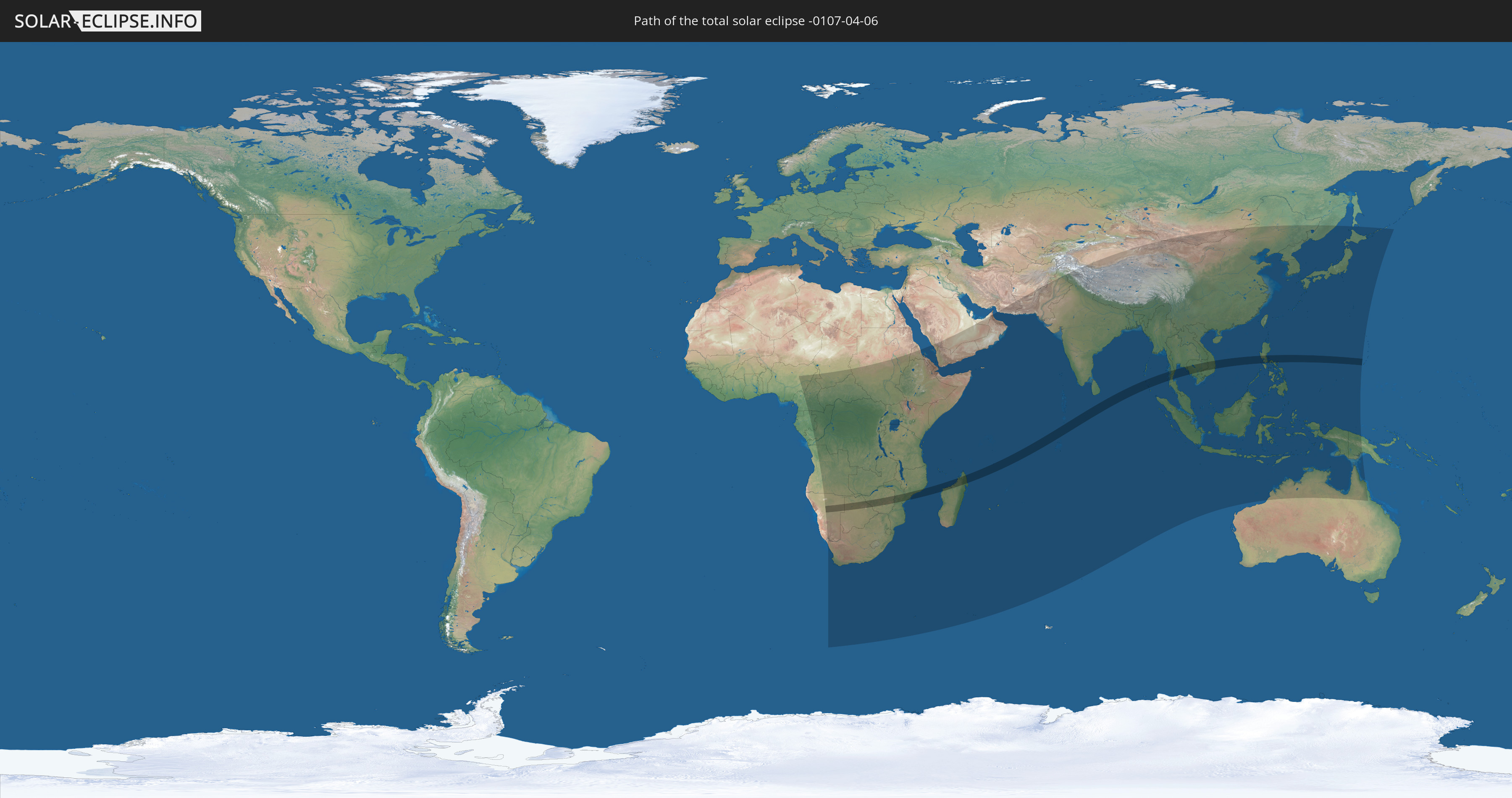
Die Sonnenfinsternis am 04/06/-0107 kann man in 75 Ländern als partielle Sonnenfinsternis beobachten.
Der Finsternispfad verläuft durch 13 Länder. Nur in diesen Ländern ist sie als total Sonnenfinsternis zu sehen.
In den folgenden Ländern ist die Sonnenfinsternis total zu sehen
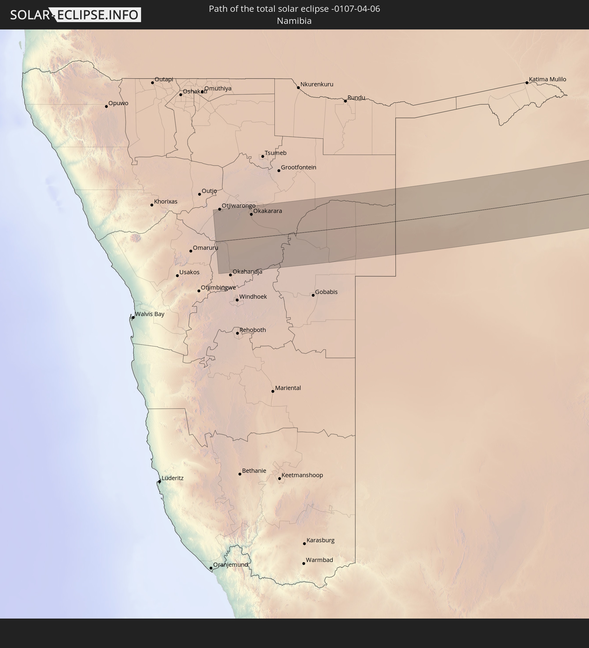 Namibia
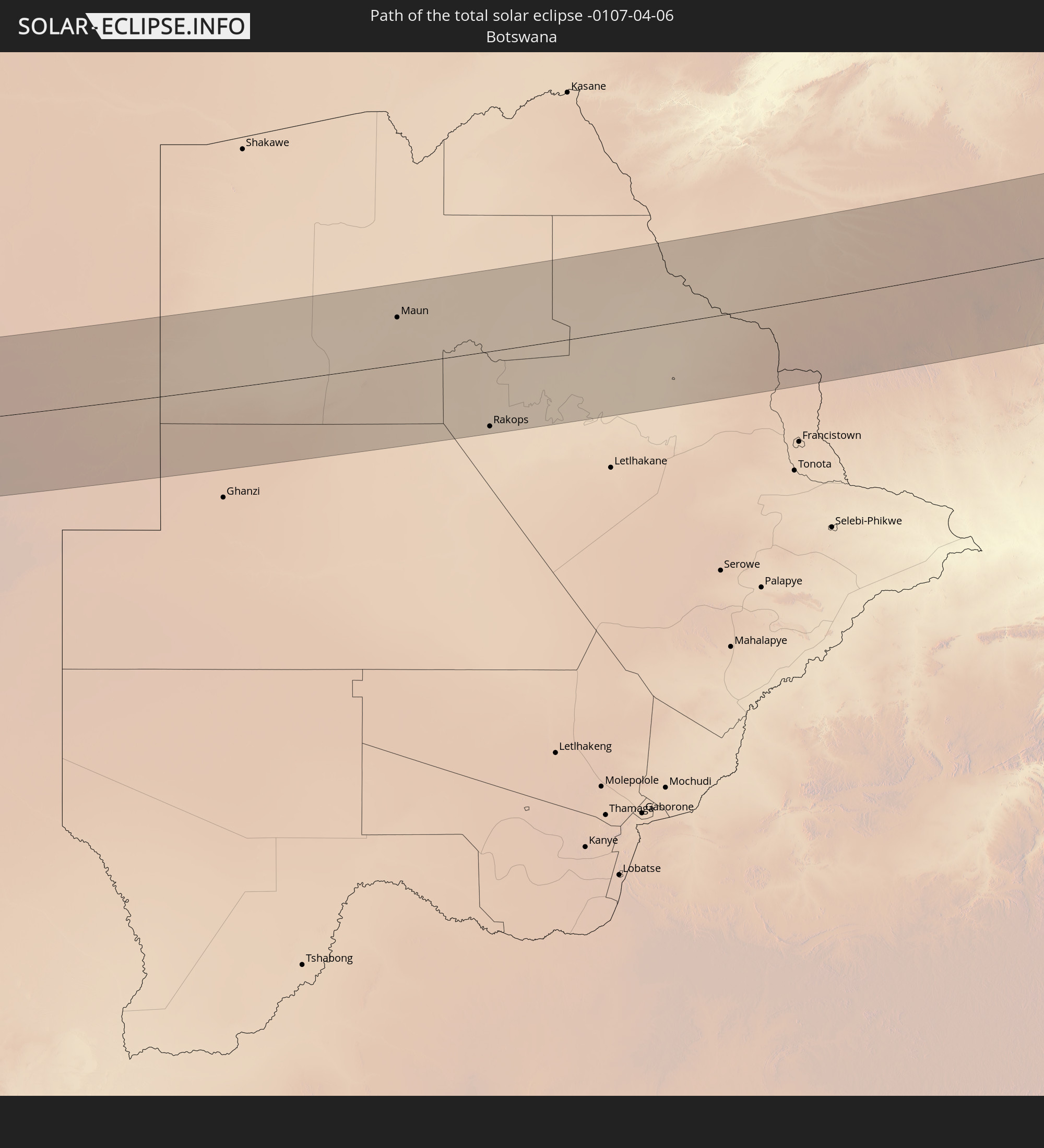 Botswana
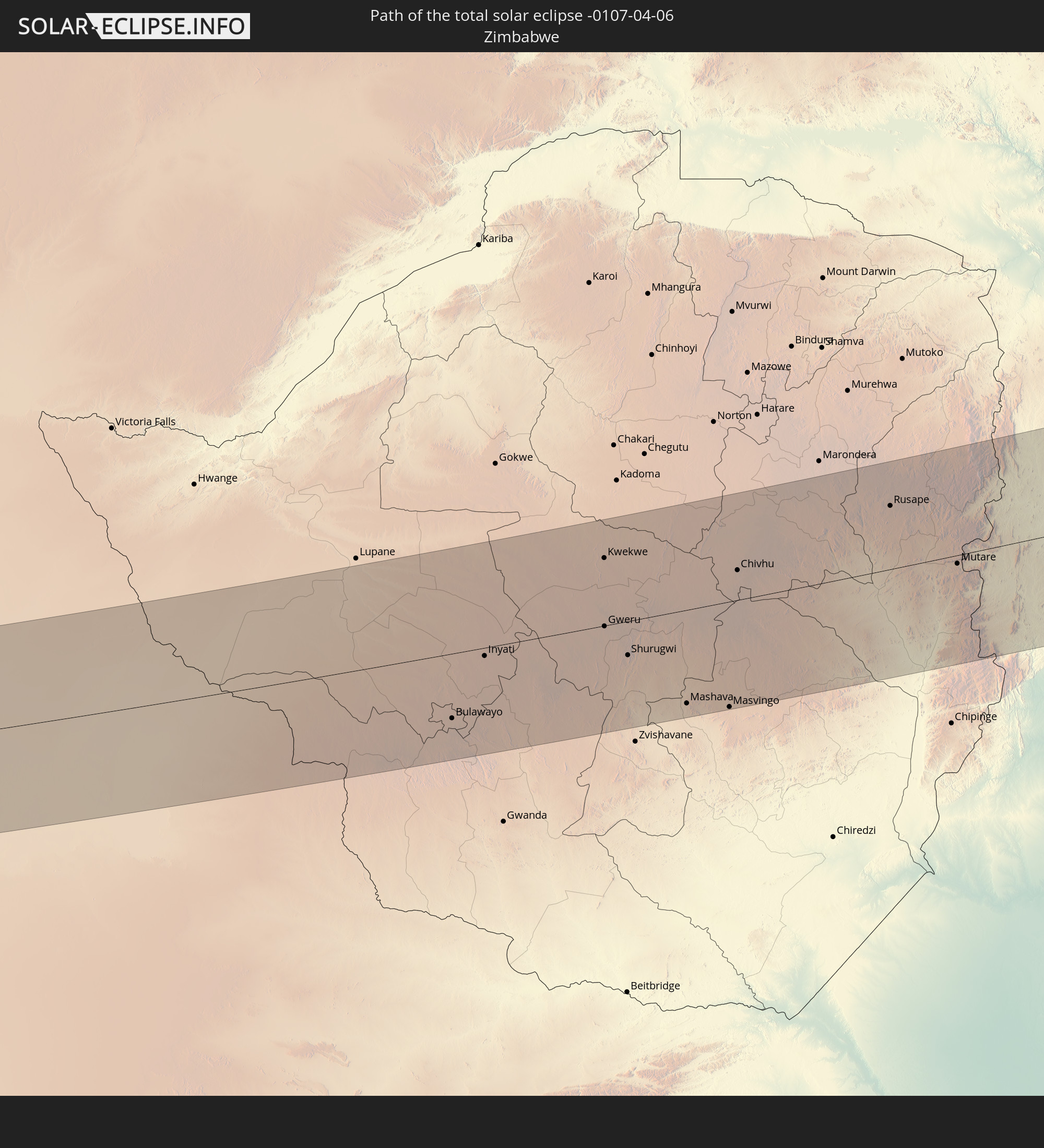 Zimbabwe
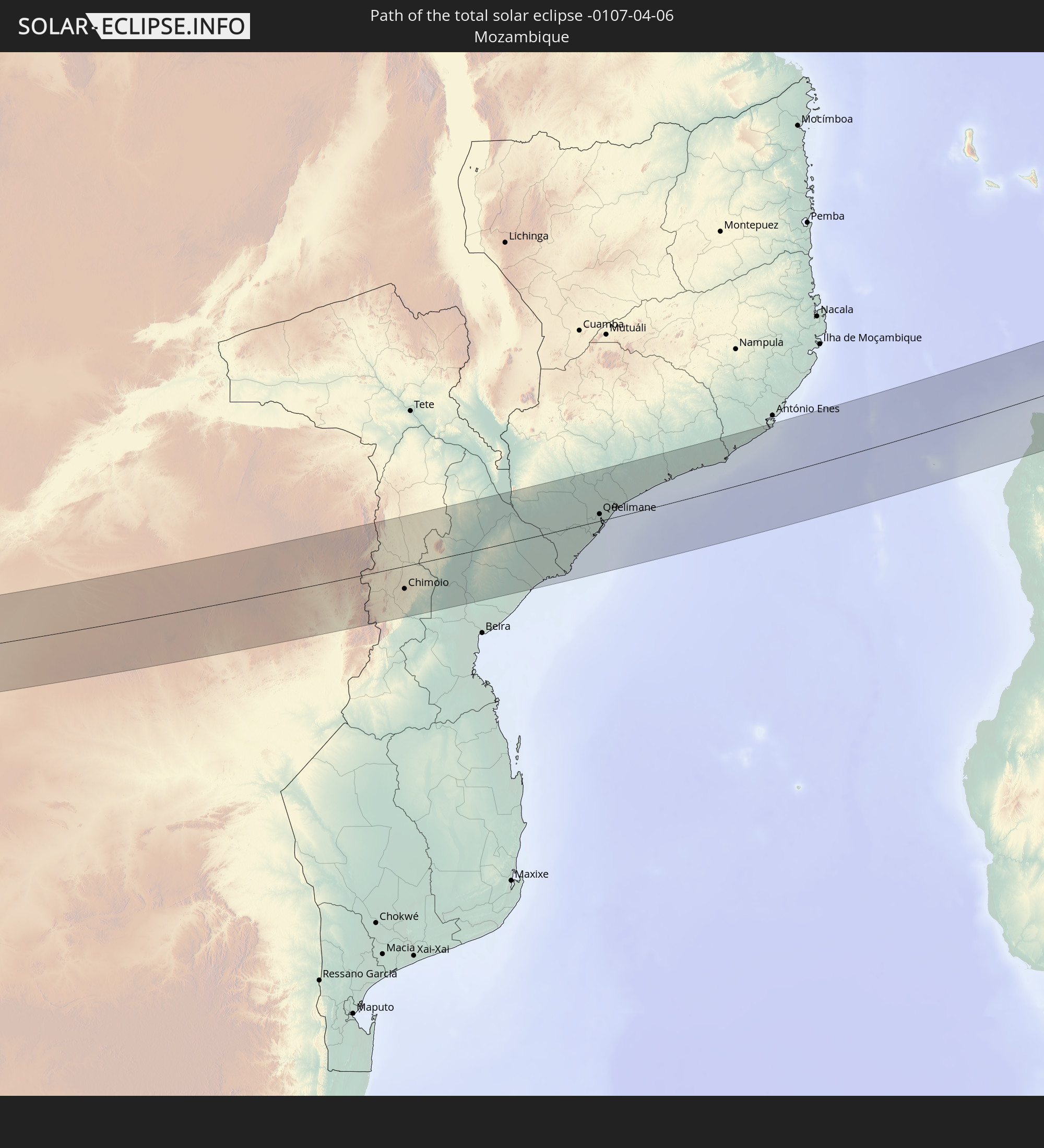 Mozambique
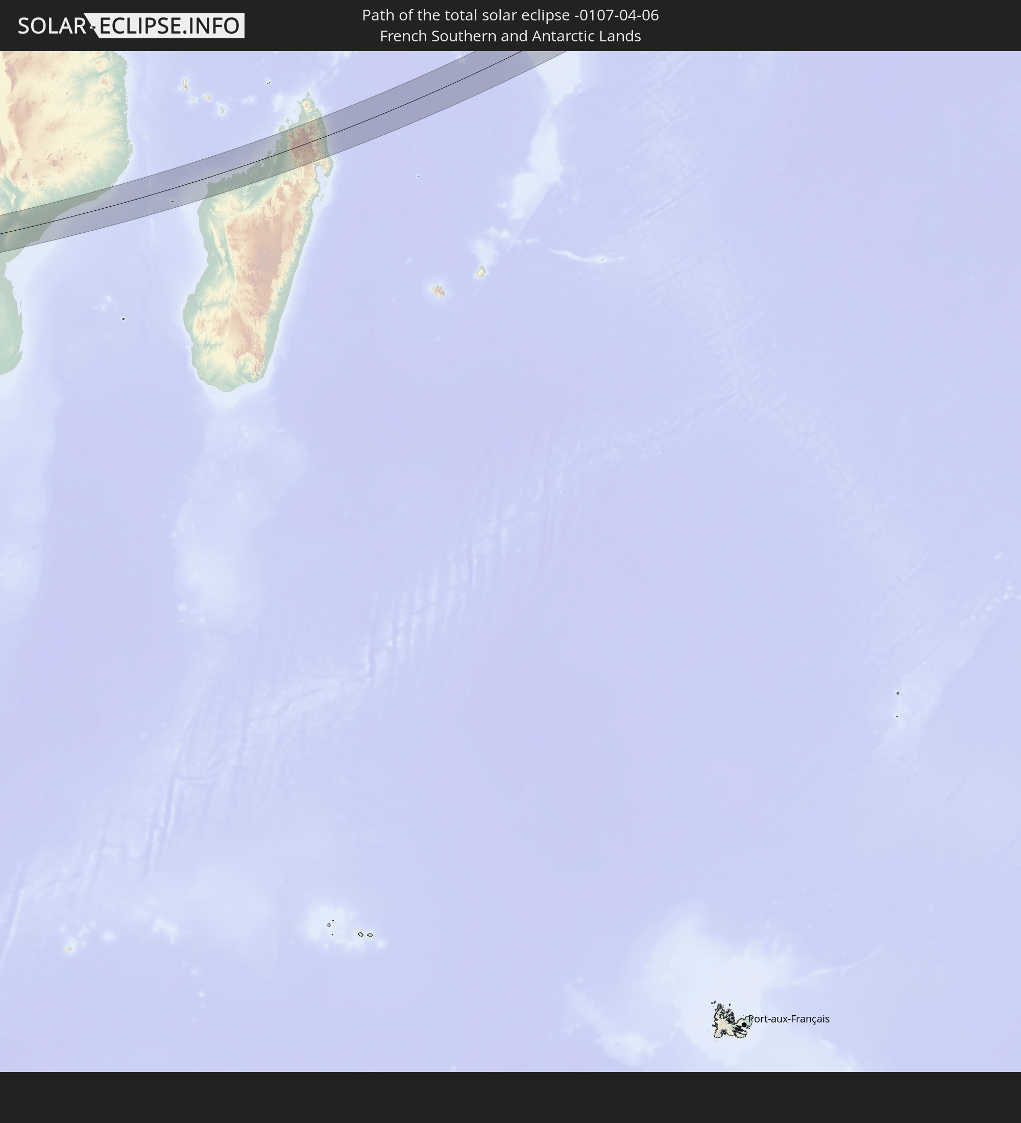 French Southern and Antarctic Lands
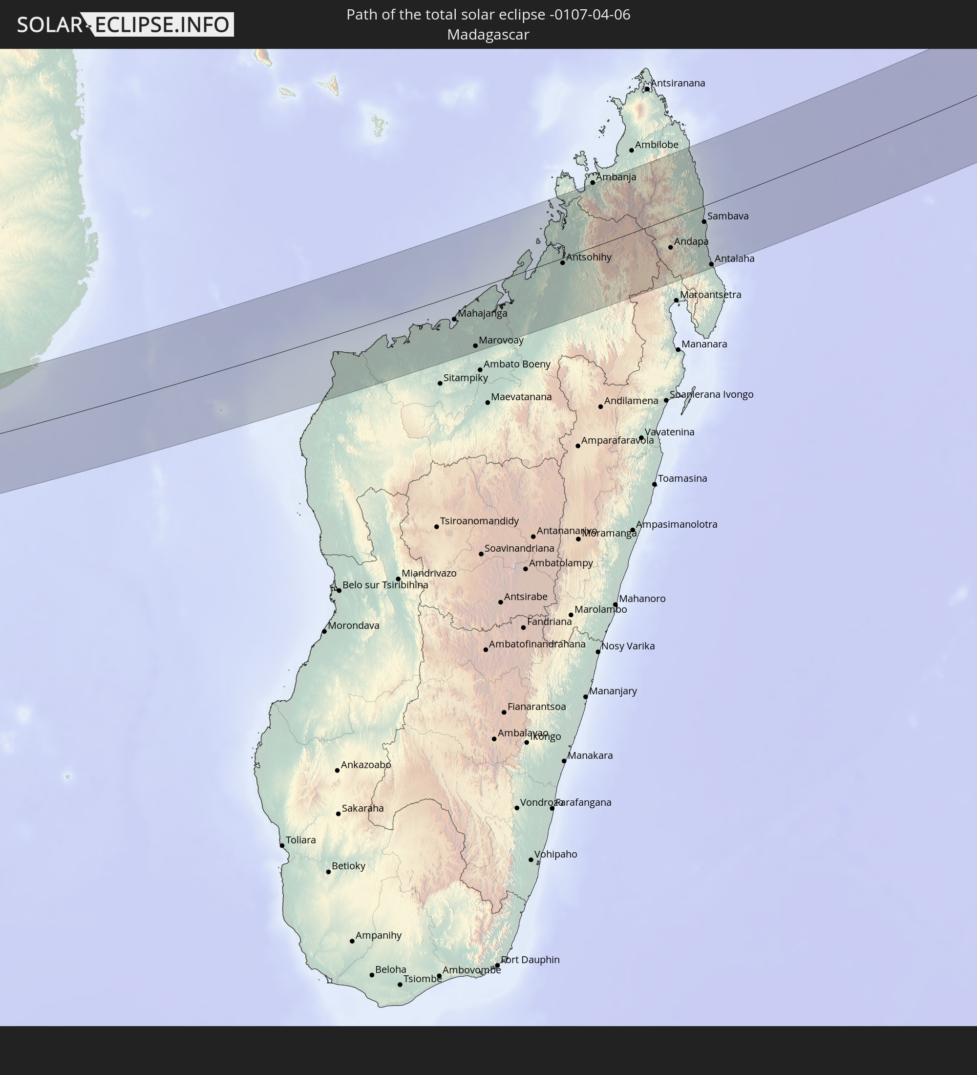 Madagascar
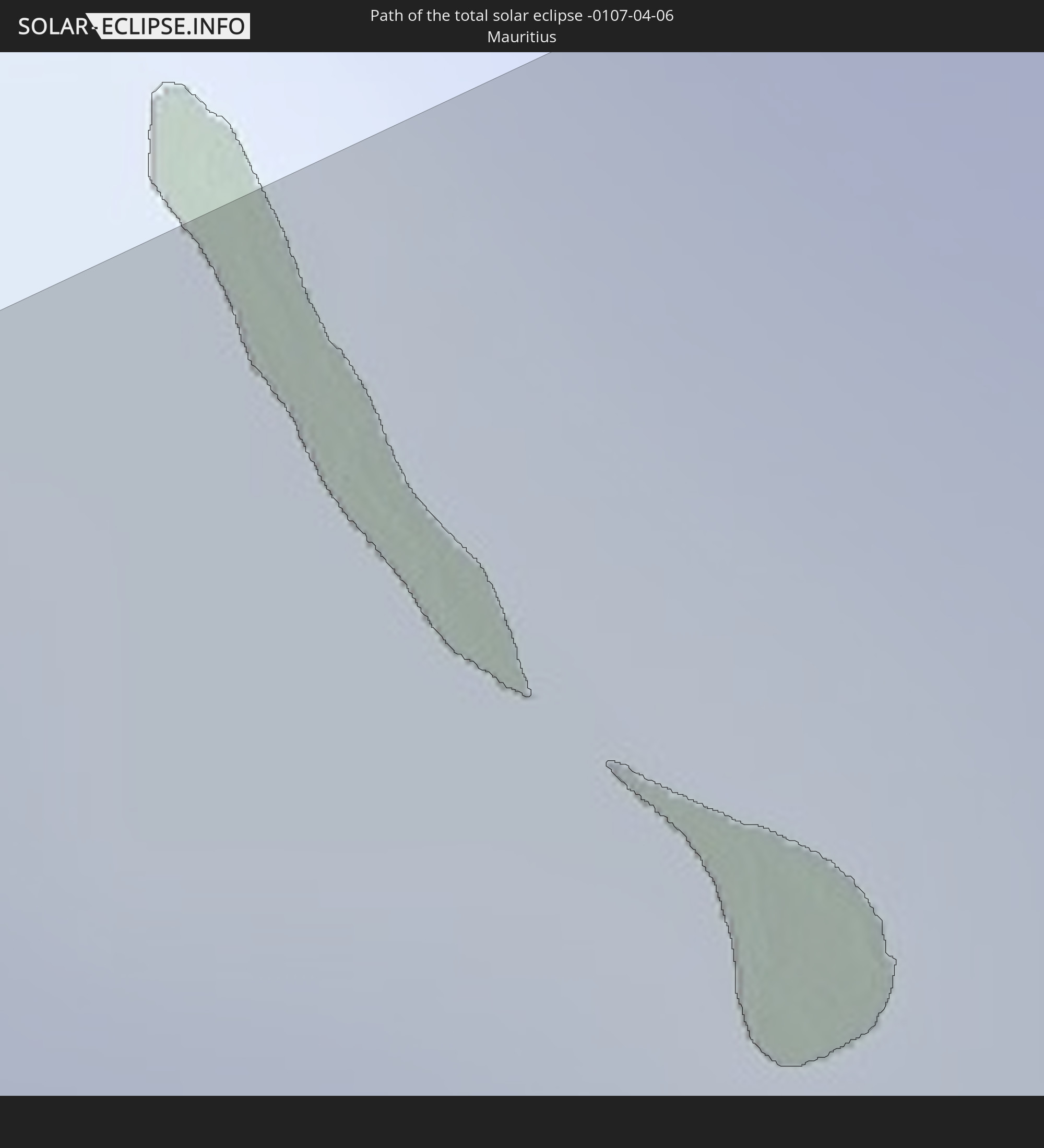 Mauritius
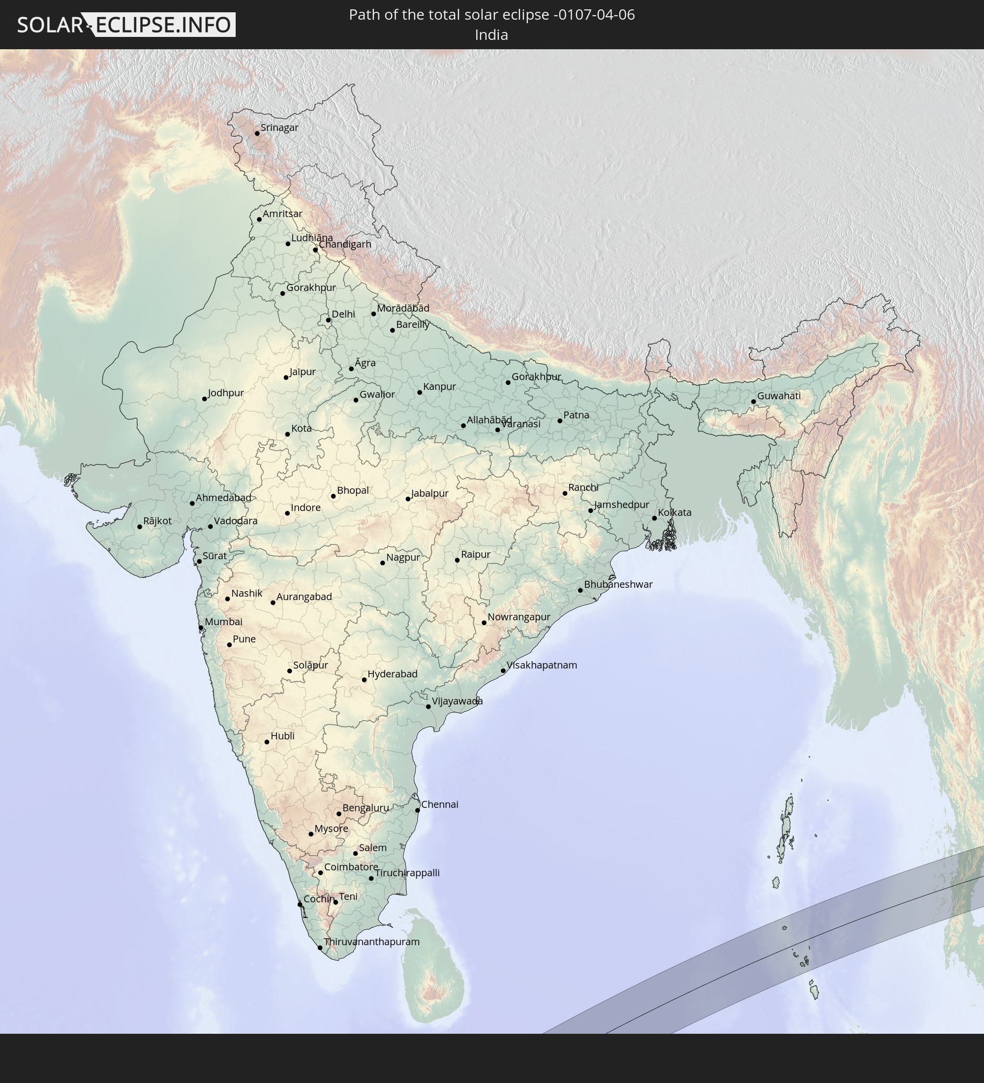 India
India
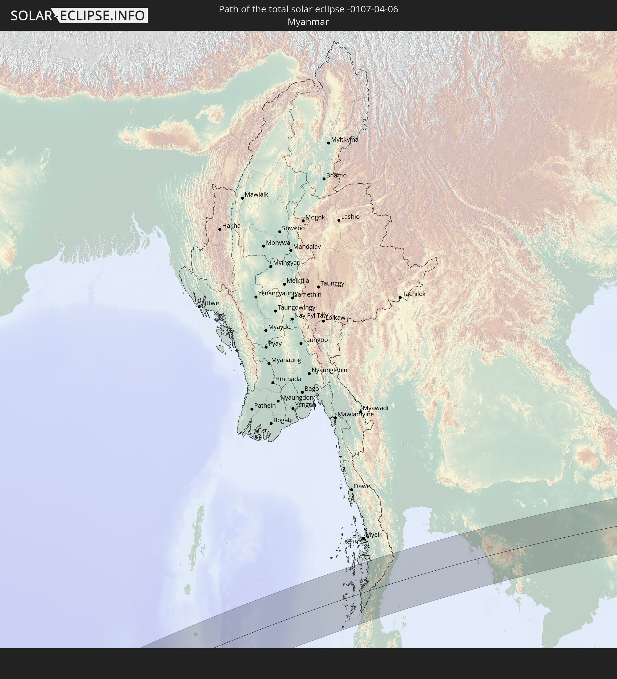 Myanmar
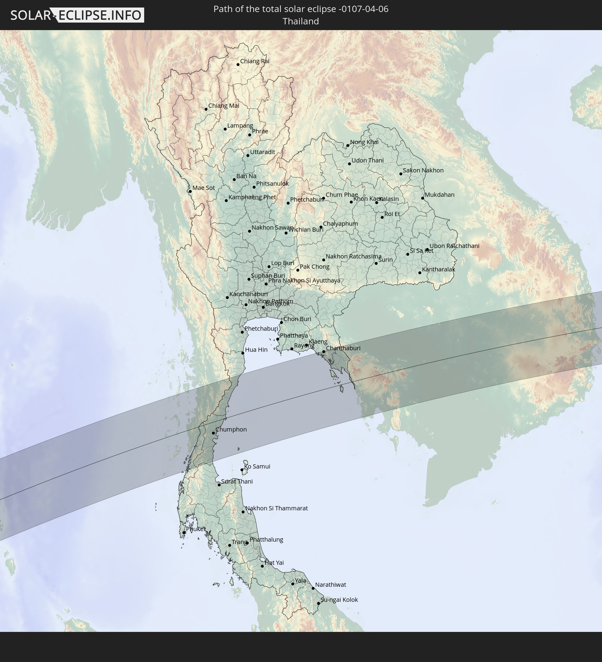 Thailand
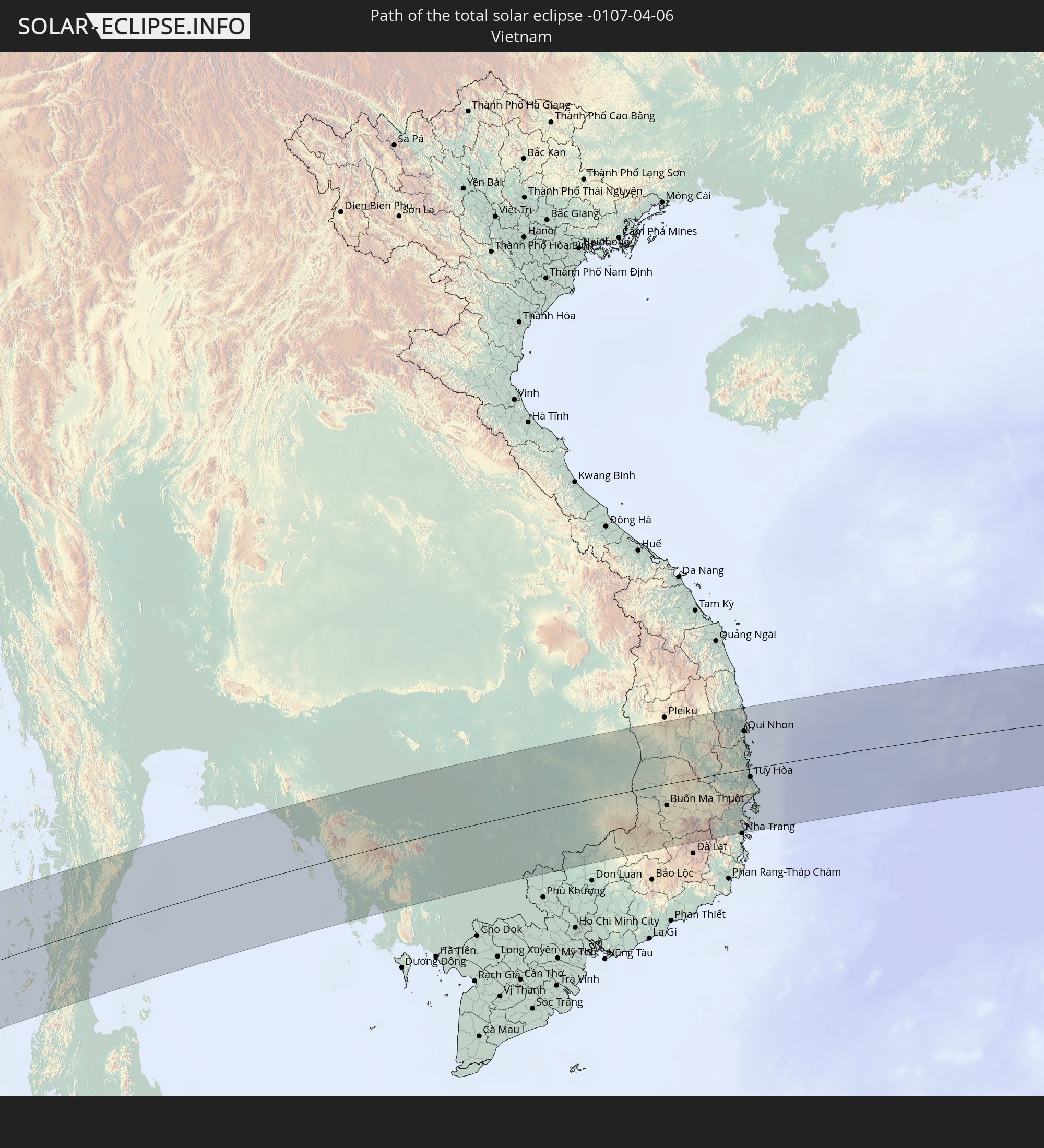 Vietnam
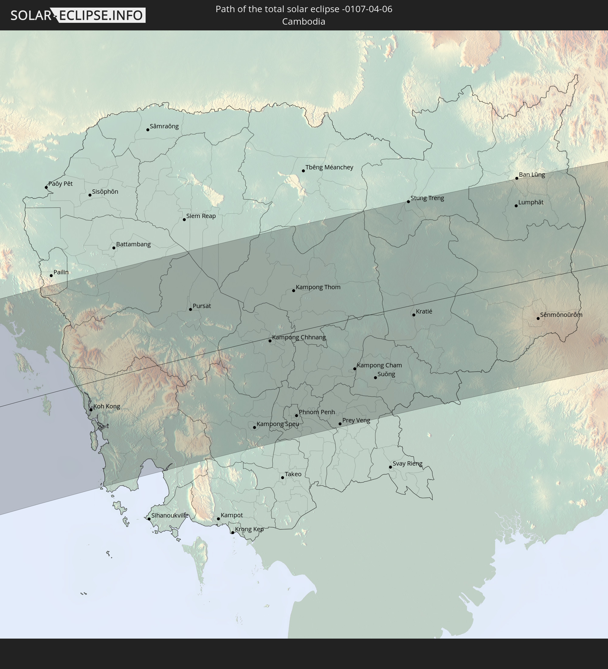 Cambodia
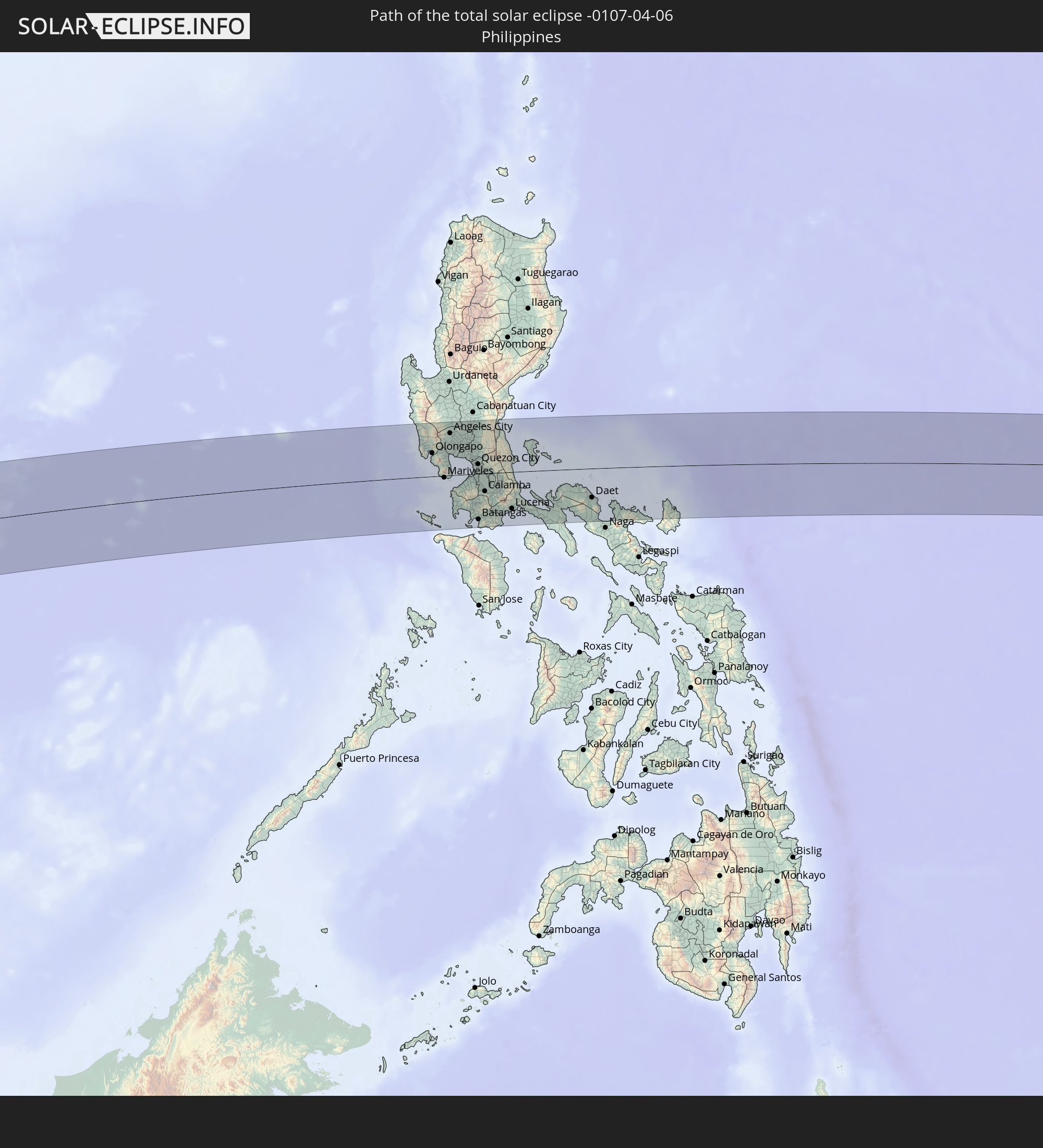 Philippines
In den folgenden Ländern ist die Sonnenfinsternis partiell zu sehen
 Russia
 Nigeria
 Cameroon
 Gabon
Gabon
 Republic of the Congo
 Angola
 Namibia
 Democratic Republic of the Congo
 Chad
Chad
 Central African Republic
 South Africa
 Botswana
 Sudan
Sudan
 Zambia
 Zimbabwe
 Lesotho
 Rwanda
 Burundi
 Tanzania
 Uganda
 Mozambique
 Swaziland
 Malawi
 Ethiopia
 Kenya
Kenya
 Saudi Arabia
 Eritrea
 French Southern and Antarctic Lands
 Somalia
 Djibouti
 Yemen
Yemen
 Madagascar
 Comoros
 Iran
Iran
 Mayotte
 Seychelles
 United Arab Emirates
 Oman
Oman
 Réunion
 Mauritius
 Afghanistan
 Pakistan
 India
India
 British Indian Ocean Territory
 Maldives
 China
China
 Sri Lanka
 Nepal
Nepal
 Mongolia
 Bangladesh
 Bhutan
 Myanmar
 Indonesia
 Cocos Islands
 Thailand
 Malaysia
 Laos
Laos
 Vietnam
 Cambodia
 Singapore
 Christmas Island
 Australia
 Macau
Macau
 Hong Kong
 Brunei
 Taiwan
 Philippines
 Japan
Japan
 East Timor
 North Korea
 South Korea
 Palau
Palau
 Federated States of Micronesia
 Papua New Guinea
 Northern Mariana Islands
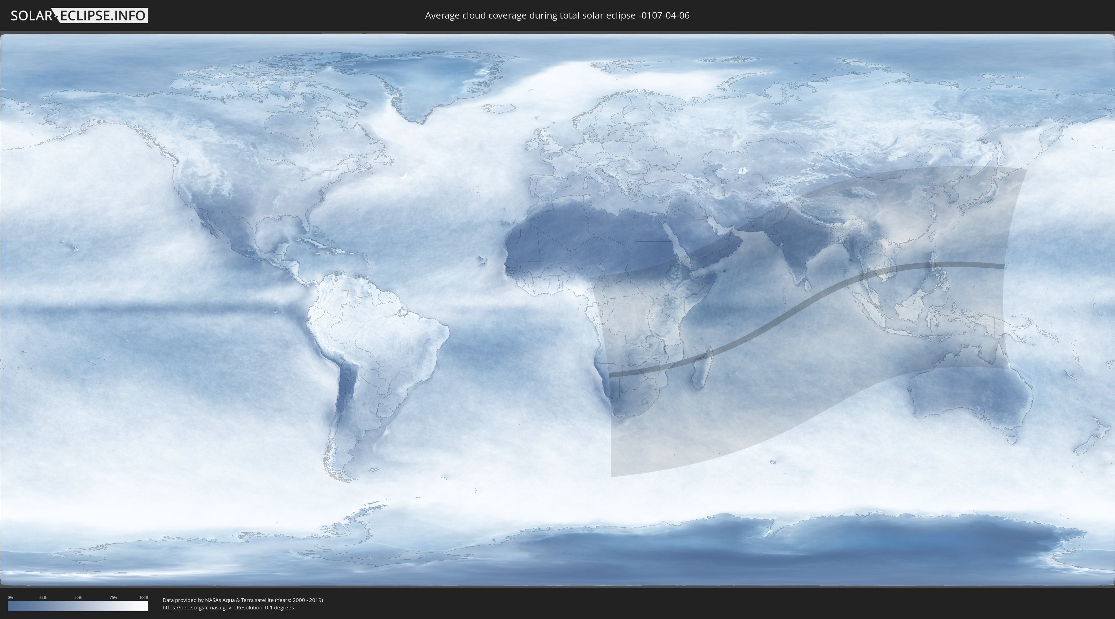
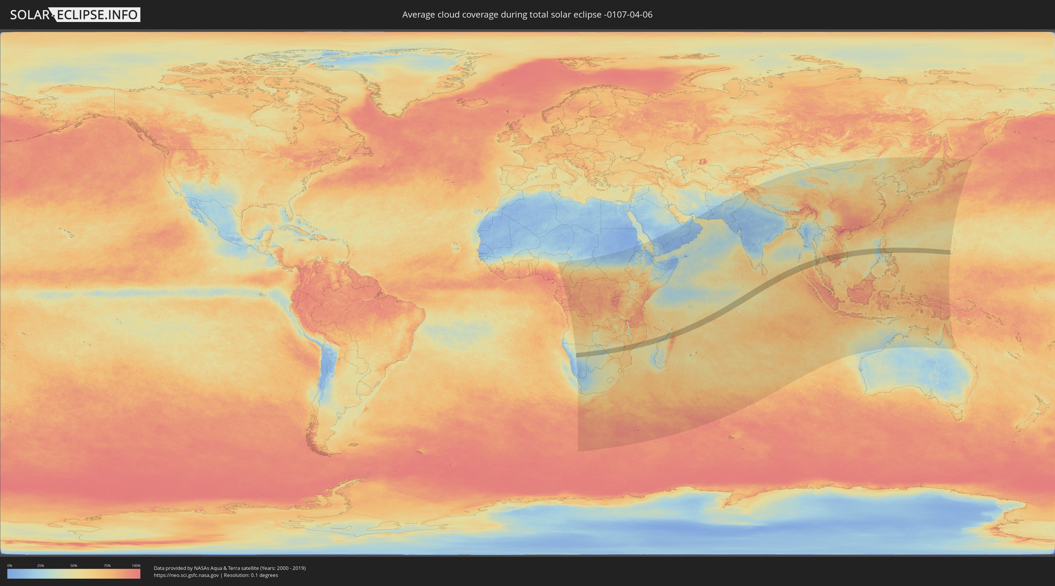
How will be the weather during the total solar eclipse on 04/06/-0107?
Where is the best place to see the total solar eclipse of 04/06/-0107?
The following maps show the average cloud coverage for the day of the total solar eclipse.
With the help of these maps, it is possible to find the place along the eclipse path, which has the best
chance of a cloudless sky.
Nevertheless, you should consider local circumstances and inform about the weather of your chosen
observation site.
The data is provided by NASAs satellites
AQUA and TERRA.
The cloud maps are averaged over a period of 19 years (2000 - 2019).
Detailed country maps
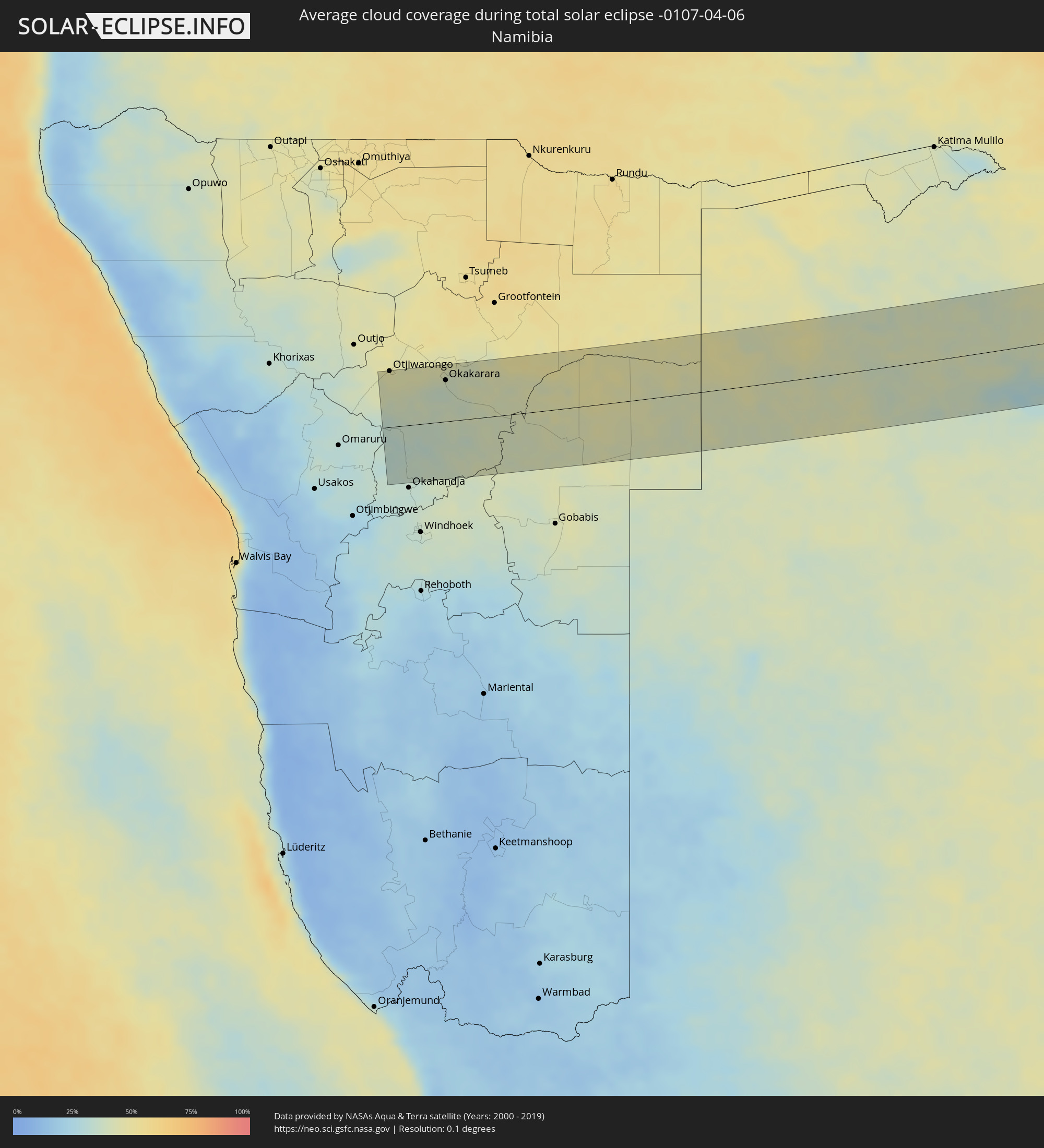 Namibia
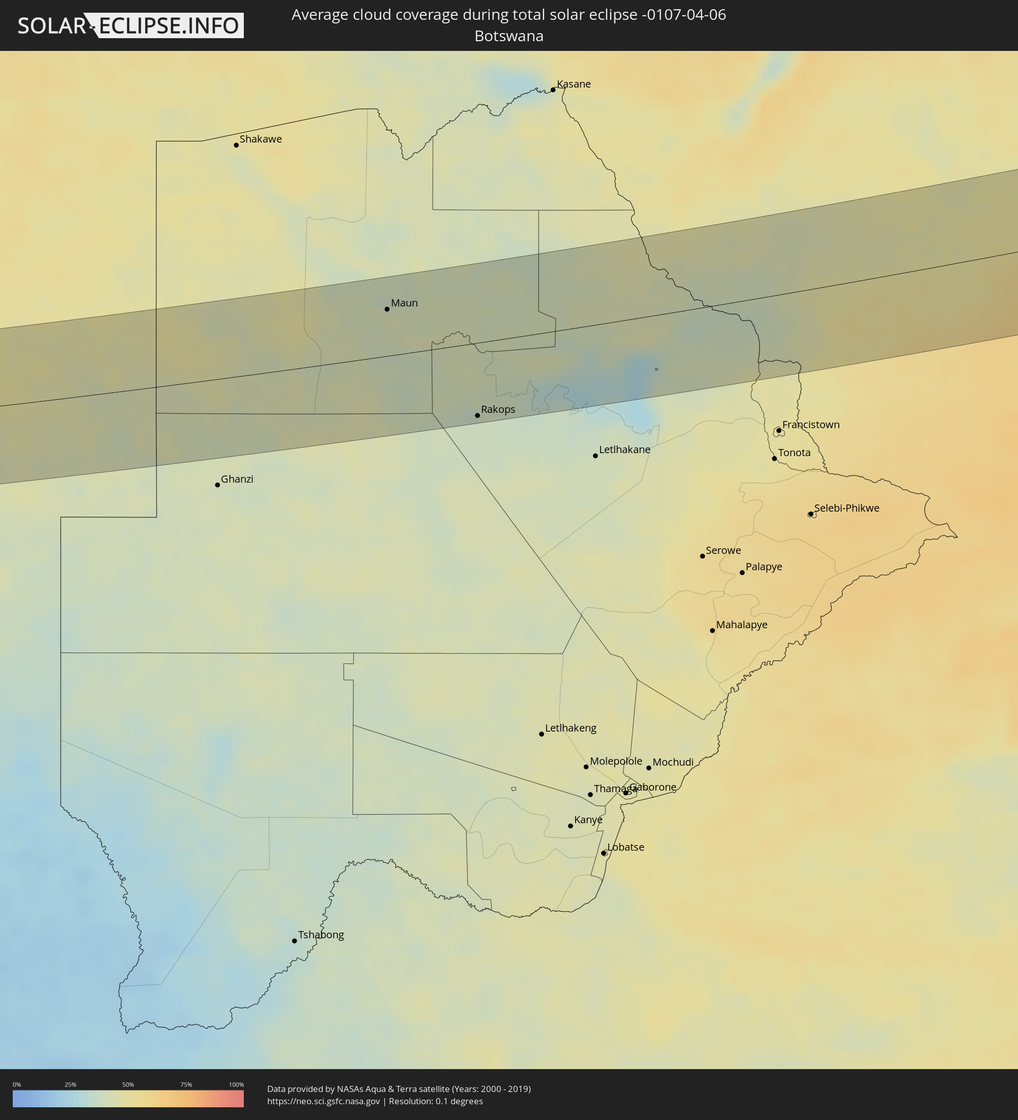 Botswana
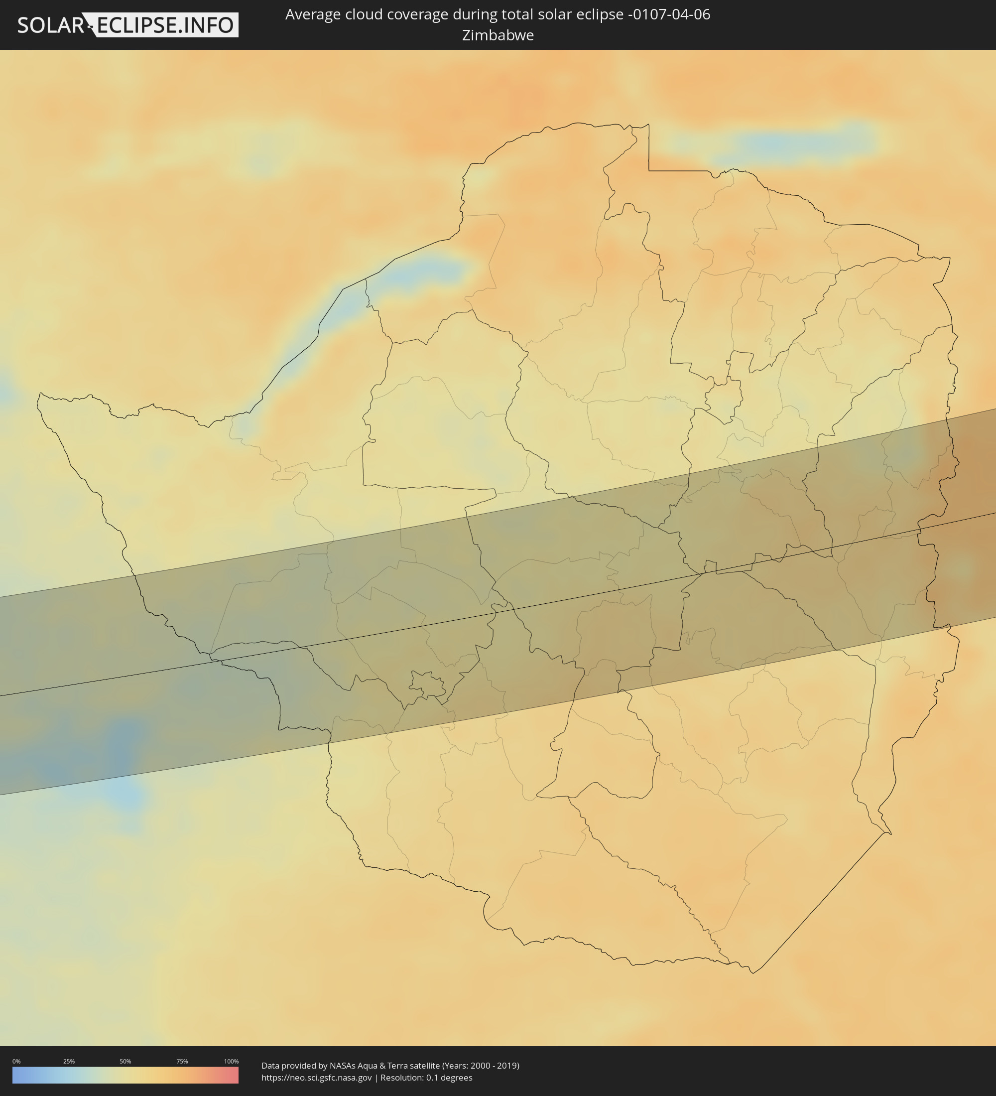 Zimbabwe
 Mozambique
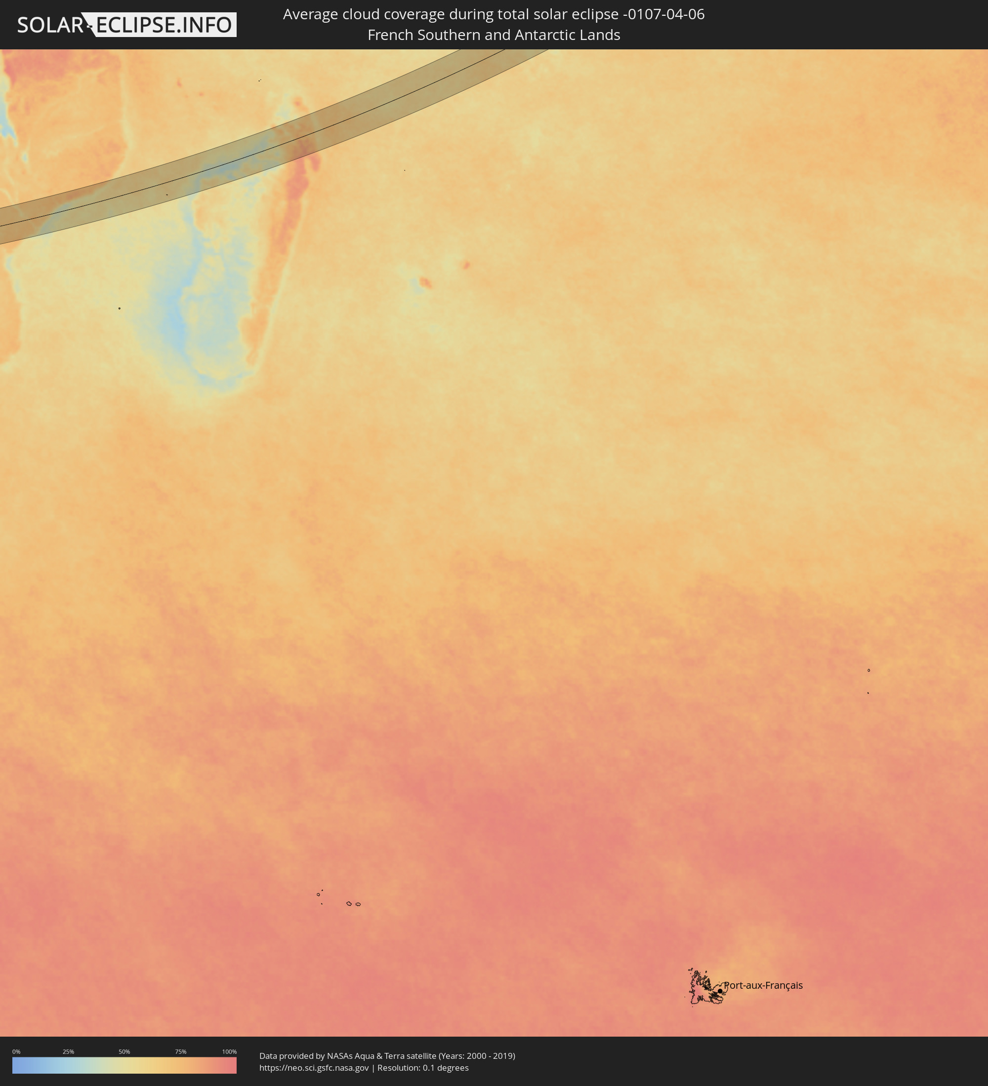 French Southern and Antarctic Lands
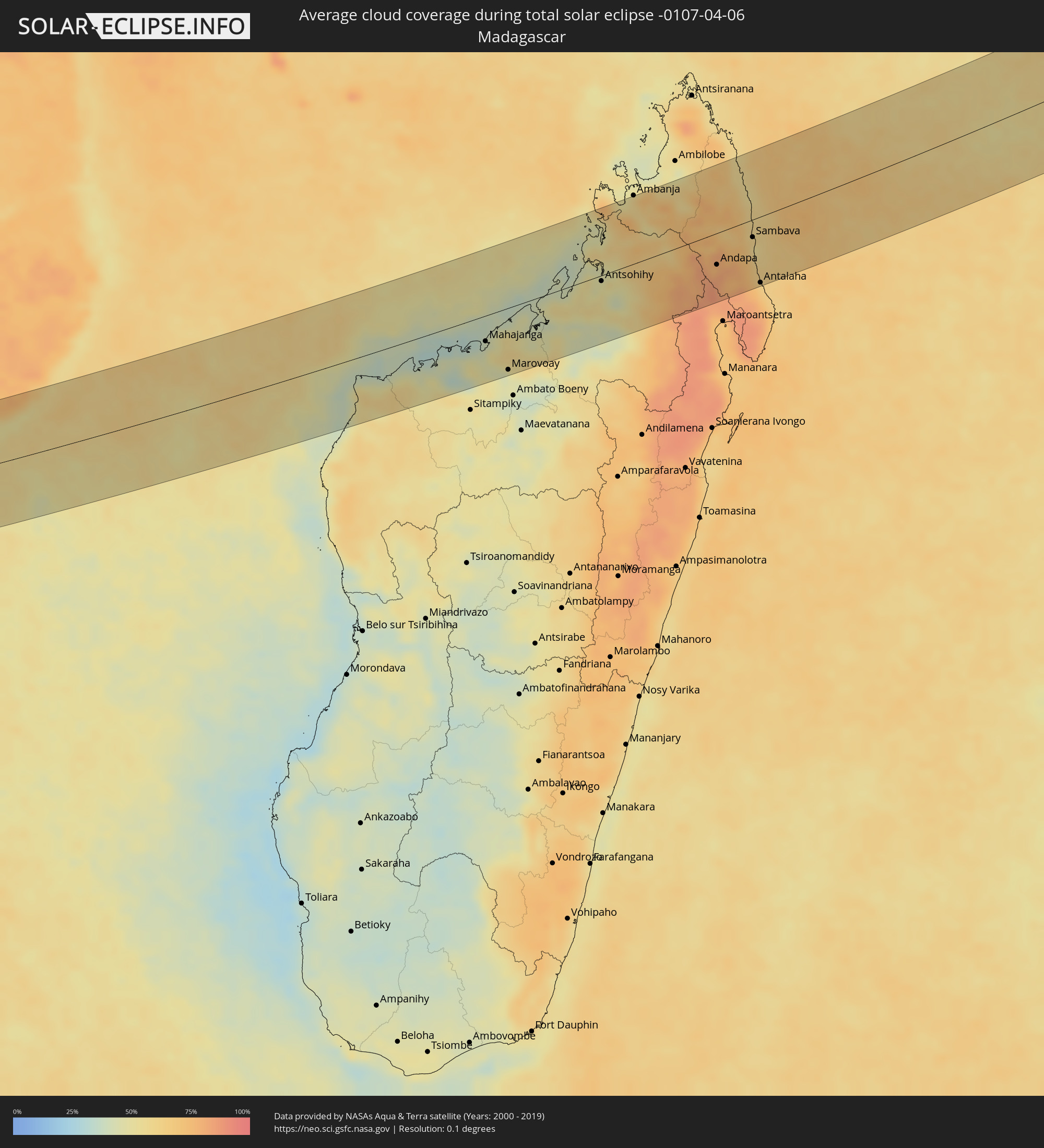 Madagascar
 Mauritius
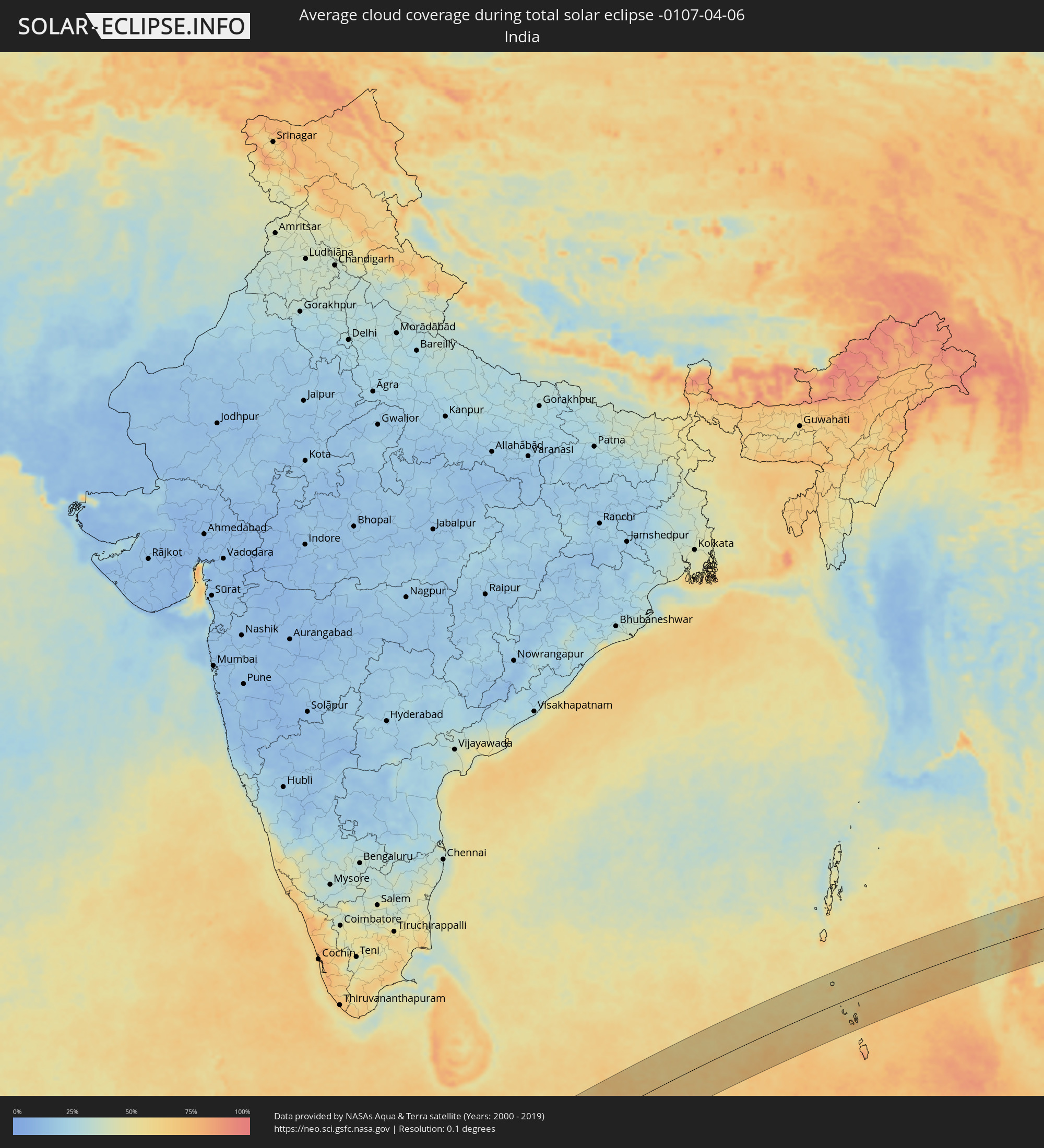 India
India
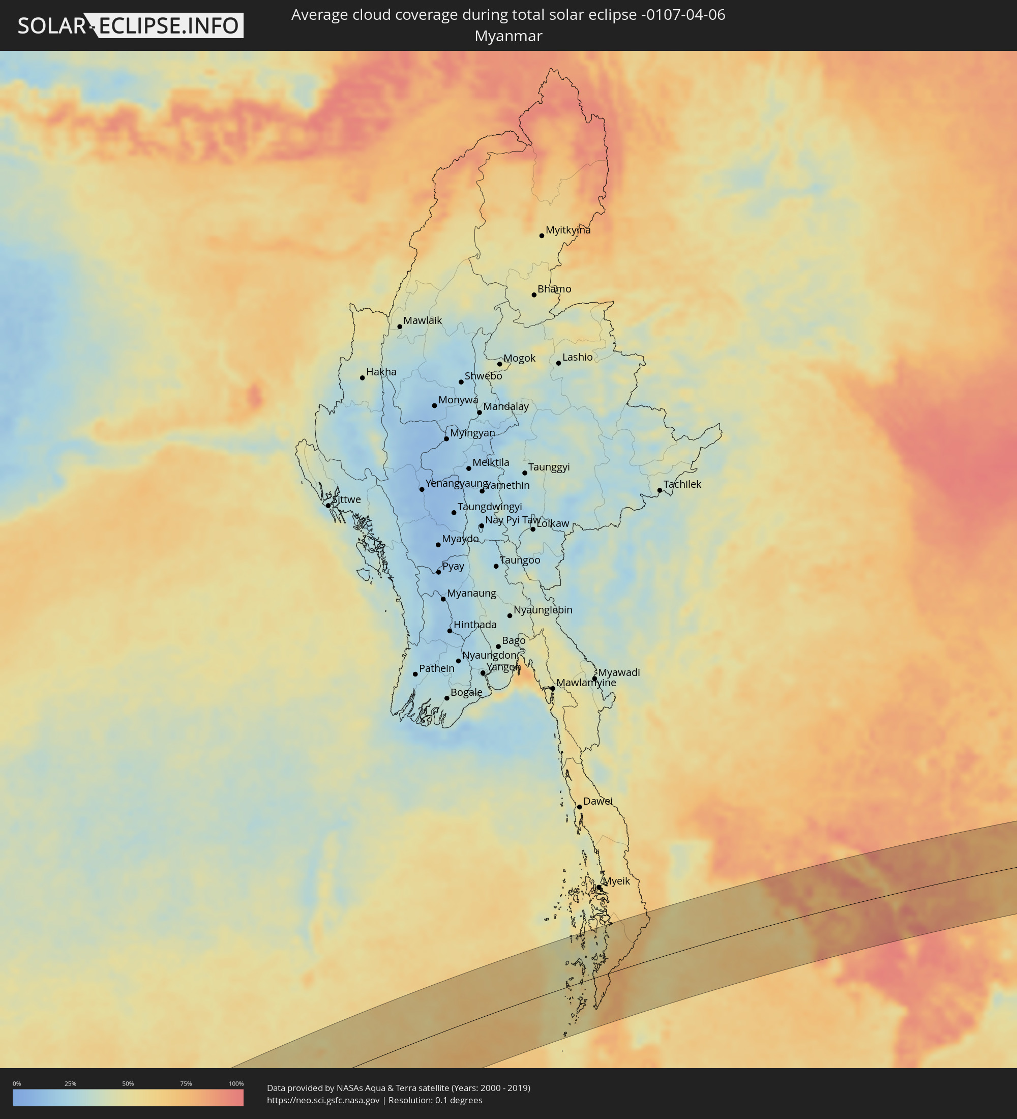 Myanmar
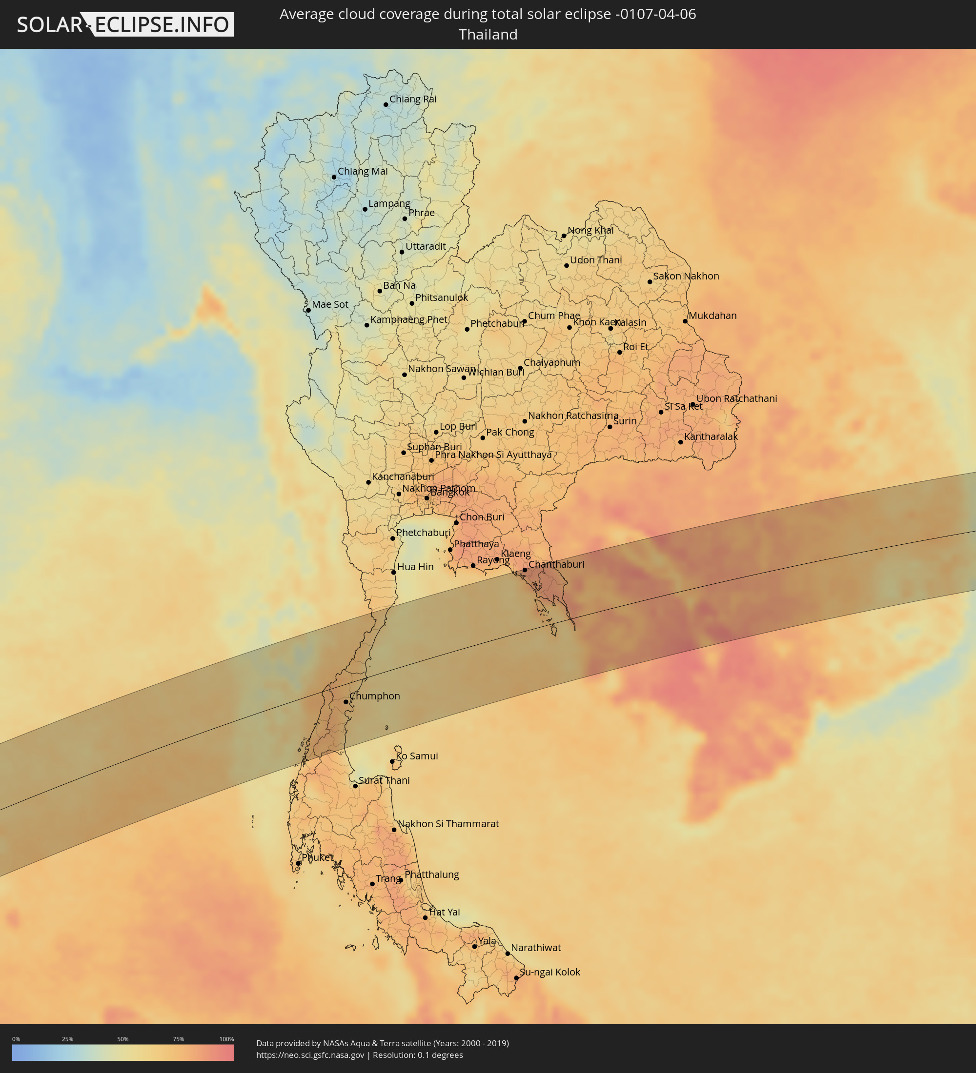 Thailand
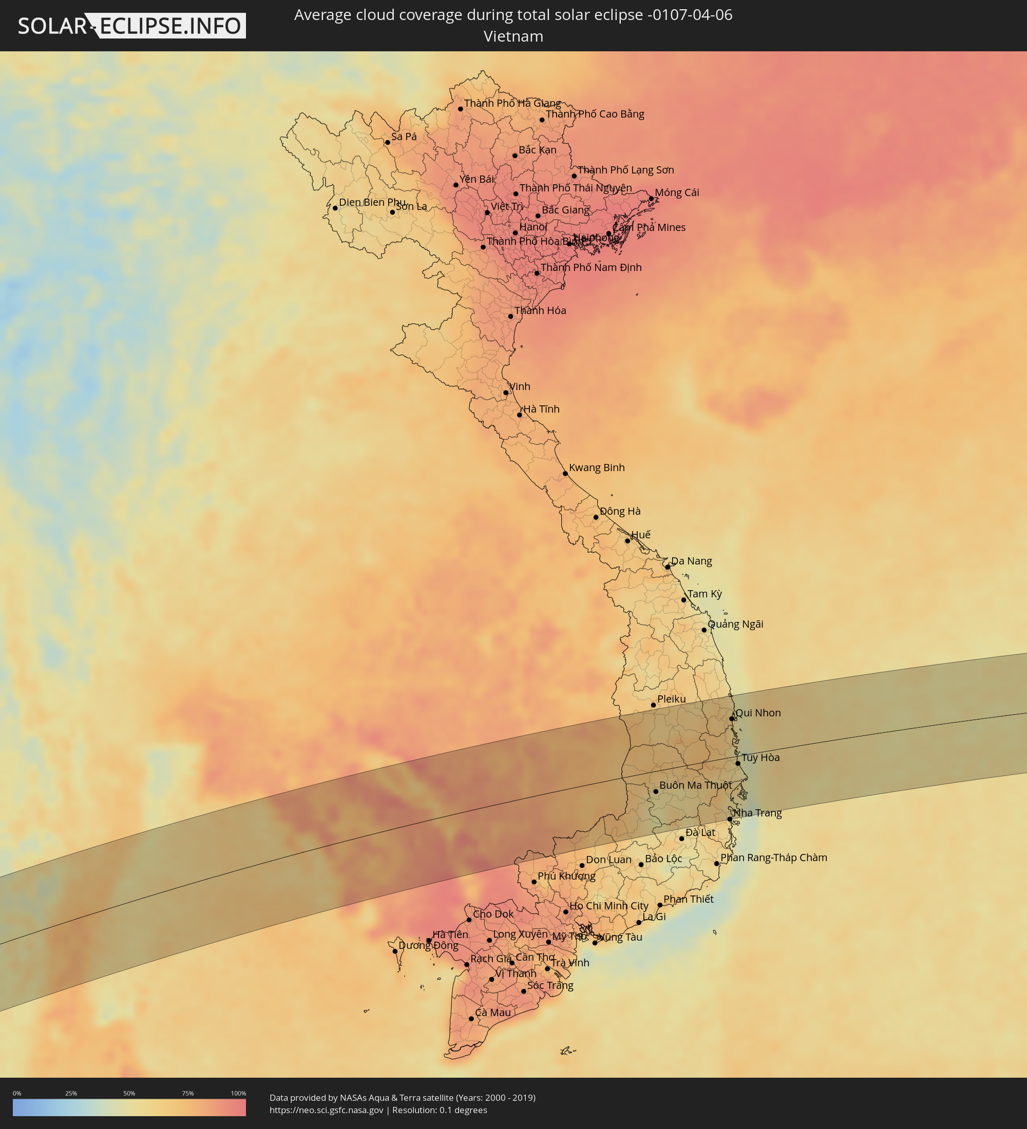 Vietnam
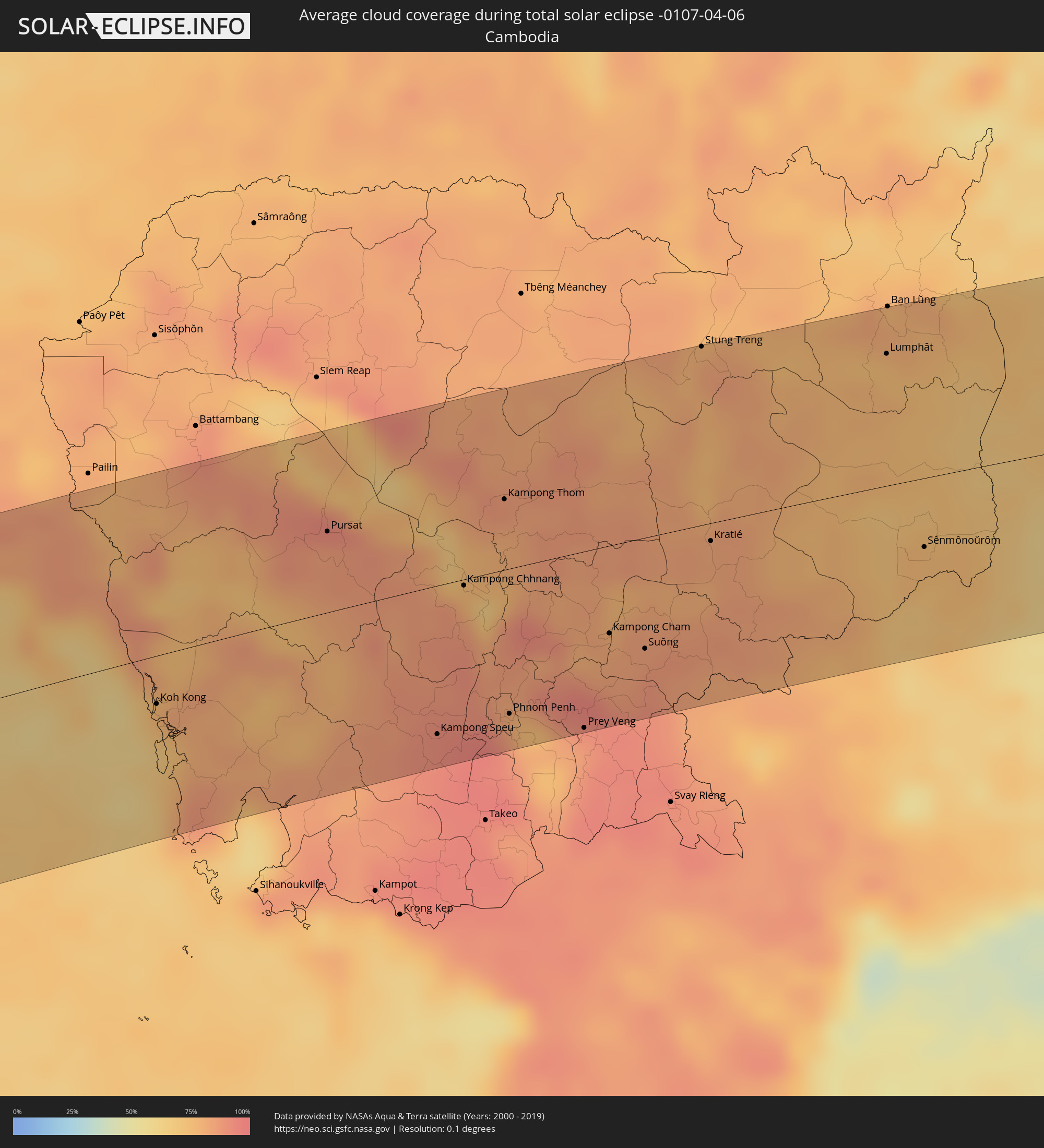 Cambodia
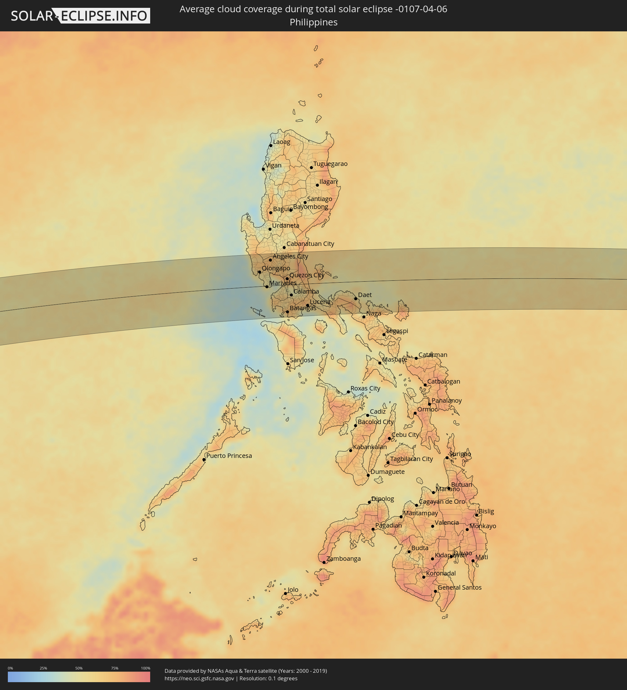 Philippines
Cities inside the path of the eclipse
The following table shows all locations with a population of more than 5,000 inside the eclipse path. Cities which have more than 100,000 inhabitants are marked bold. A click at the locations opens a detailed map.
| City | Type | Eclipse duration | Local time of max. eclipse | Distance to central line | Ø Cloud coverage |
|
Otjiwarongo, Otjozondjupa
|
total | - | 06:34:34 UTC+01:30 | 81 km | 45% |
|
Okakarara, Otjozondjupa
|
total | - | 06:34:35 UTC+01:30 | 60 km | 38% |
|
Maun, North-West
|
total | - | 07:15:37 UTC+02:10 | 50 km | 41% |
|
Rakops, Central
|
total | - | 07:15:49 UTC+02:10 | 79 km | 39% |
|
Chimoio, Manica
|
total | - | 07:19:29 UTC+02:10 | 41 km | 70% |
|
Quelimane, Zambézia
|
total | - | 07:21:50 UTC+02:10 | 12 km | 61% |
|
Mahajanga, Boeny
|
total | - | 07:48:01 UTC+02:27 | 38 km | 43% |
|
Marovoay, Boeny
|
total | - | 07:48:11 UTC+02:27 | 90 km | 43% |
|
Antsohihy, Sofia
|
total | - | 07:50:22 UTC+02:27 | 8 km | 50% |
|
Bealanana, Sofia
|
total | - | 07:51:29 UTC+02:27 | 1 km | 63% |
|
Andapa, Sava
|
total | - | 07:52:34 UTC+02:27 | 46 km | 83% |
|
Ambodivoara, Sava
|
total | - | 07:53:11 UTC+02:27 | 26 km | 72% |
|
Sambava, Sava
|
total | - | 07:53:28 UTC+02:27 | 26 km | 54% |
|
Ampahana, Sava
|
total | - | 07:53:14 UTC+02:27 | 78 km | 67% |
|
Antalaha, Sava
|
total | - | 07:53:13 UTC+02:27 | 96 km | 65% |
|
Ranong, Ranong
|
total | - | 14:27:20 UTC+06:42 | 70 km | 71% |
|
Ban Nam Yuen, Chumphon
|
total | - | 14:27:44 UTC+06:42 | 87 km | 75% |
|
Lang Suan, Chumphon
|
total | - | 14:28:15 UTC+06:42 | 87 km | 66% |
|
Chumphon, Chumphon
|
total | - | 14:28:57 UTC+06:42 | 32 km | 71% |
|
Bang Saphan, Prachuap Khiri Khan
|
total | - | 14:30:16 UTC+06:42 | 33 km | 60% |
|
Prachuap Khiri Khan, Prachuap Khiri Khan
|
total | - | 14:31:20 UTC+06:42 | 89 km | 59% |
|
Laem Sing, Chanthaburi
|
total | - | 14:36:17 UTC+06:42 | 91 km | 75% |
|
Chanthaburi, Chanthaburi
|
total | - | 14:36:26 UTC+06:42 | 104 km | 83% |
|
Khlung, Chanthaburi
|
total | - | 14:36:33 UTC+06:42 | 84 km | 81% |
|
Trat, Trat
|
total | - | 14:36:56 UTC+06:42 | 53 km | 70% |
|
Bo Rai, Trat
|
total | - | 14:37:13 UTC+06:42 | 88 km | 85% |
|
Koh Kong, Koh Kong
|
total | - | 14:37:21 UTC+06:42 | 28 km | 71% |
|
Smach Mean Chey, Koh Kong
|
total | - | 14:37:24 UTC+06:42 | 37 km | 65% |
|
Pursat, Pursat
|
total | - | 14:39:42 UTC+06:42 | 47 km | 86% |
|
Kampong Speu, Kampong Speu
|
total | - | 14:40:02 UTC+06:42 | 86 km | 91% |
|
Kampong Chhnang, Kampong Chhnang
|
total | - | 14:40:50 UTC+06:42 | 4 km | 77% |
|
Kampong Thom, Kampong Thom
|
total | - | 14:41:32 UTC+06:42 | 41 km | 86% |
|
Phnom Penh, Phnom Penh
|
total | - | 14:40:49 UTC+06:42 | 84 km | 87% |
|
Ta Khmau, Kandal
|
total | - | 14:40:49 UTC+06:42 | 94 km | 81% |
|
Prey Veng, Prey Veng
|
total | - | 14:41:29 UTC+06:42 | 103 km | 84% |
|
Kampong Cham, Kampong Cham
|
total | - | 14:42:04 UTC+06:42 | 51 km | 83% |
|
Suŏng, Tboung Khmum
|
total | - | 14:42:21 UTC+06:42 | 65 km | 88% |
|
Stung Treng, Stung Treng
|
total | - | 14:43:51 UTC+06:42 | 104 km | 82% |
|
Kratié, Kratie
|
total | - | 14:43:19 UTC+06:42 | 10 km | 82% |
|
Lumphăt, Ratanakiri
|
total | - | 14:45:29 UTC+06:42 | 77 km | 74% |
|
Sênmônoŭrôm, Mondolkiri
|
total | - | 14:45:14 UTC+06:42 | 40 km | 75% |
|
Gia Nghĩa, Ðắk Nông
|
total | - | 15:10:23 UTC+07:06 | 100 km | 57% |
|
Buôn Ma Thuột, Ðắc Lắk
|
total | - | 15:11:19 UTC+07:06 | 35 km | 54% |
|
Sông Cầu, Phú Yên
|
total | - | 15:13:33 UTC+07:06 | 28 km | 61% |
|
Qui Nhon, Bình Định
|
total | - | 15:13:42 UTC+07:06 | 63 km | 61% |
|
Tuy Hòa, Phú Yên
|
total | - | 15:13:31 UTC+07:06 | 14 km | 54% |
|
Olongapo, Central Luzon
|
total | - | 16:20:39 UTC+08:00 | 42 km | 52% |
|
Dinalupihan, Central Luzon
|
total | - | 16:20:49 UTC+08:00 | 46 km | 56% |
|
Mariveles, Central Luzon
|
total | - | 16:20:45 UTC+08:00 | 3 km | 43% |
|
Balanga, Central Luzon
|
total | - | 16:20:51 UTC+08:00 | 23 km | 50% |
|
Angeles City, Central Luzon
|
total | - | 16:20:59 UTC+08:00 | 76 km | 72% |
|
Capas, Central Luzon
|
total | - | 16:21:02 UTC+08:00 | 96 km | 71% |
|
San Fernando, Central Luzon
|
total | - | 16:21:03 UTC+08:00 | 61 km | 68% |
|
Arayat, Central Luzon
|
total | - | 16:21:09 UTC+08:00 | 75 km | 62% |
|
Malolos, Central Luzon
|
total | - | 16:21:08 UTC+08:00 | 40 km | 68% |
|
Baliuag, Central Luzon
|
total | - | 16:21:14 UTC+08:00 | 52 km | 71% |
|
Cavite City, Calabarzon
|
total | - | 16:21:08 UTC+08:00 | 0 km | 58% |
|
Dasmariñas, Calabarzon
|
total | - | 16:21:08 UTC+08:00 | 18 km | 64% |
|
Gapan, Central Luzon
|
total | - | 16:21:20 UTC+08:00 | 91 km | 69% |
|
San Miguel, Central Luzon
|
total | - | 16:21:20 UTC+08:00 | 72 km | 73% |
|
San Jose del Monte, Central Luzon
|
total | - | 16:21:20 UTC+08:00 | 35 km | 76% |
|
Quezon City, Metro Manila
|
total | - | 16:21:18 UTC+08:00 | 17 km | 65% |
|
Batangas, Calabarzon
|
total | - | 16:21:06 UTC+08:00 | 82 km | 71% |
|
Lipa City, Calabarzon
|
total | - | 16:21:14 UTC+08:00 | 62 km | 69% |
|
Calamba, Calabarzon
|
total | - | 16:21:18 UTC+08:00 | 32 km | 67% |
|
Binangonan, Calabarzon
|
total | - | 16:21:23 UTC+08:00 | 4 km | 53% |
|
Rodriguez, Calabarzon
|
total | - | 16:21:27 UTC+08:00 | 29 km | 73% |
|
San Pablo, Calabarzon
|
total | - | 16:21:25 UTC+08:00 | 49 km | 74% |
|
Santa Cruz, Calabarzon
|
total | - | 16:21:33 UTC+08:00 | 26 km | 57% |
|
Lucena, Calabarzon
|
total | - | 16:21:38 UTC+08:00 | 66 km | 51% |
|
Daet, Bicol
|
total | - | 16:22:48 UTC+08:00 | 52 km | 61% |