Total solar eclipse of 03/26/-0144
| Day of week: | Monday |
| Maximum duration of eclipse: | 04m47s |
| Maximum width of eclipse path: | 229 km |
| Saros cycle: | 56 |
| Coverage: | 100% |
| Magnitude: | 1.0584 |
| Gamma: | 0.5482 |
Wo kann man die Sonnenfinsternis vom 03/26/-0144 sehen?
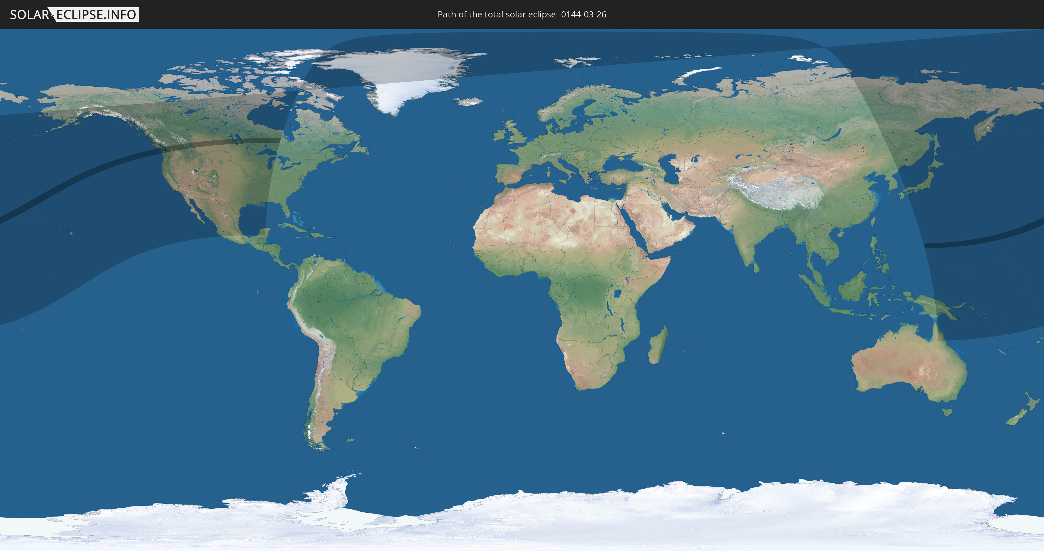
Die Sonnenfinsternis am 03/26/-0144 kann man in 22 Ländern als partielle Sonnenfinsternis beobachten.
Der Finsternispfad verläuft durch 4 Länder. Nur in diesen Ländern ist sie als total Sonnenfinsternis zu sehen.
In den folgenden Ländern ist die Sonnenfinsternis total zu sehen
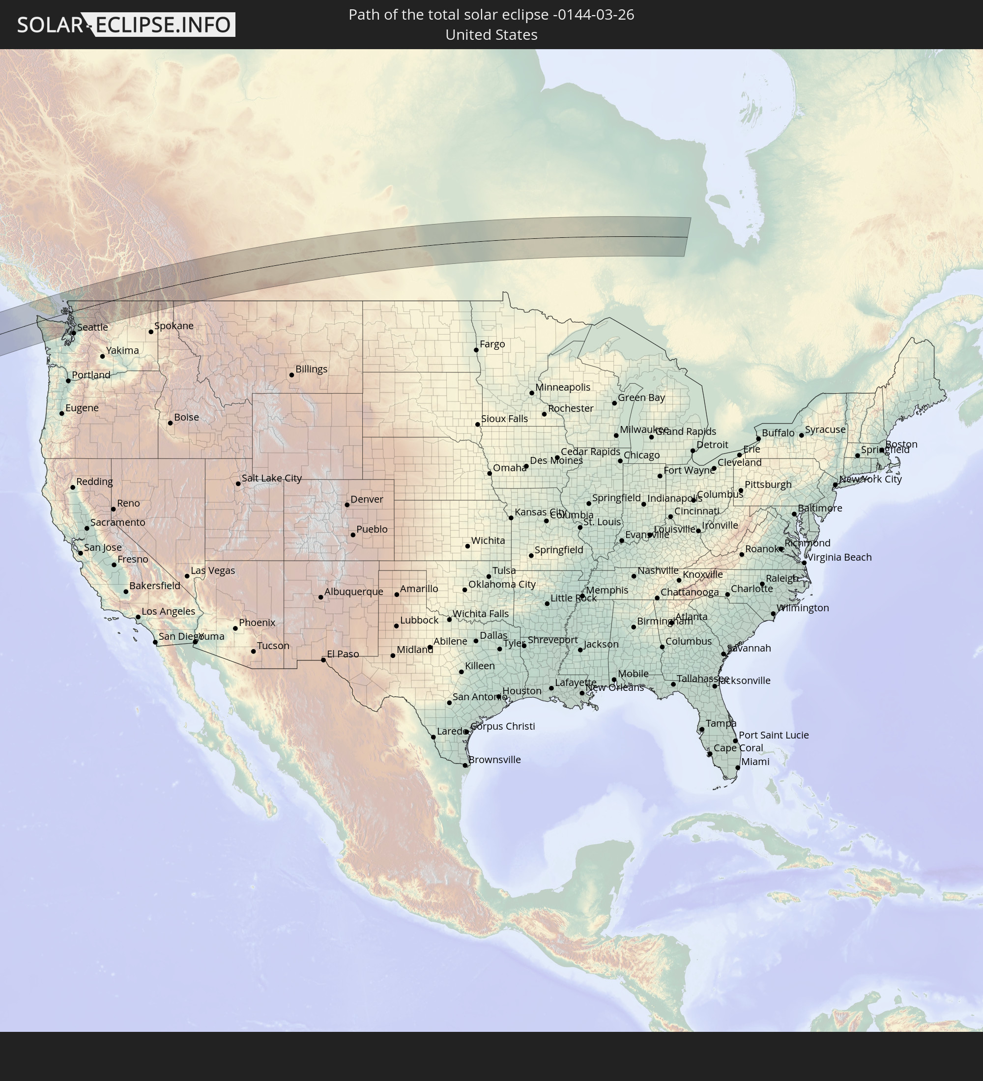 United States
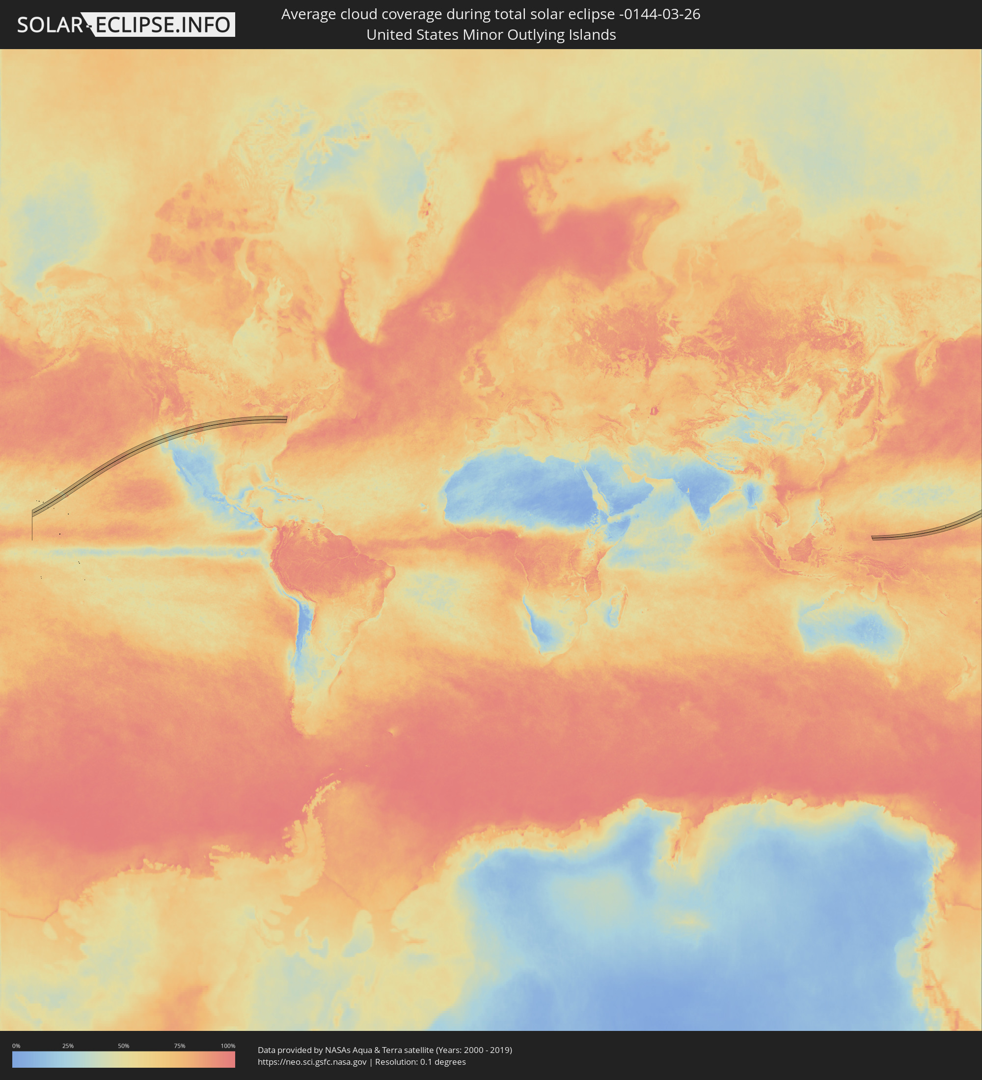
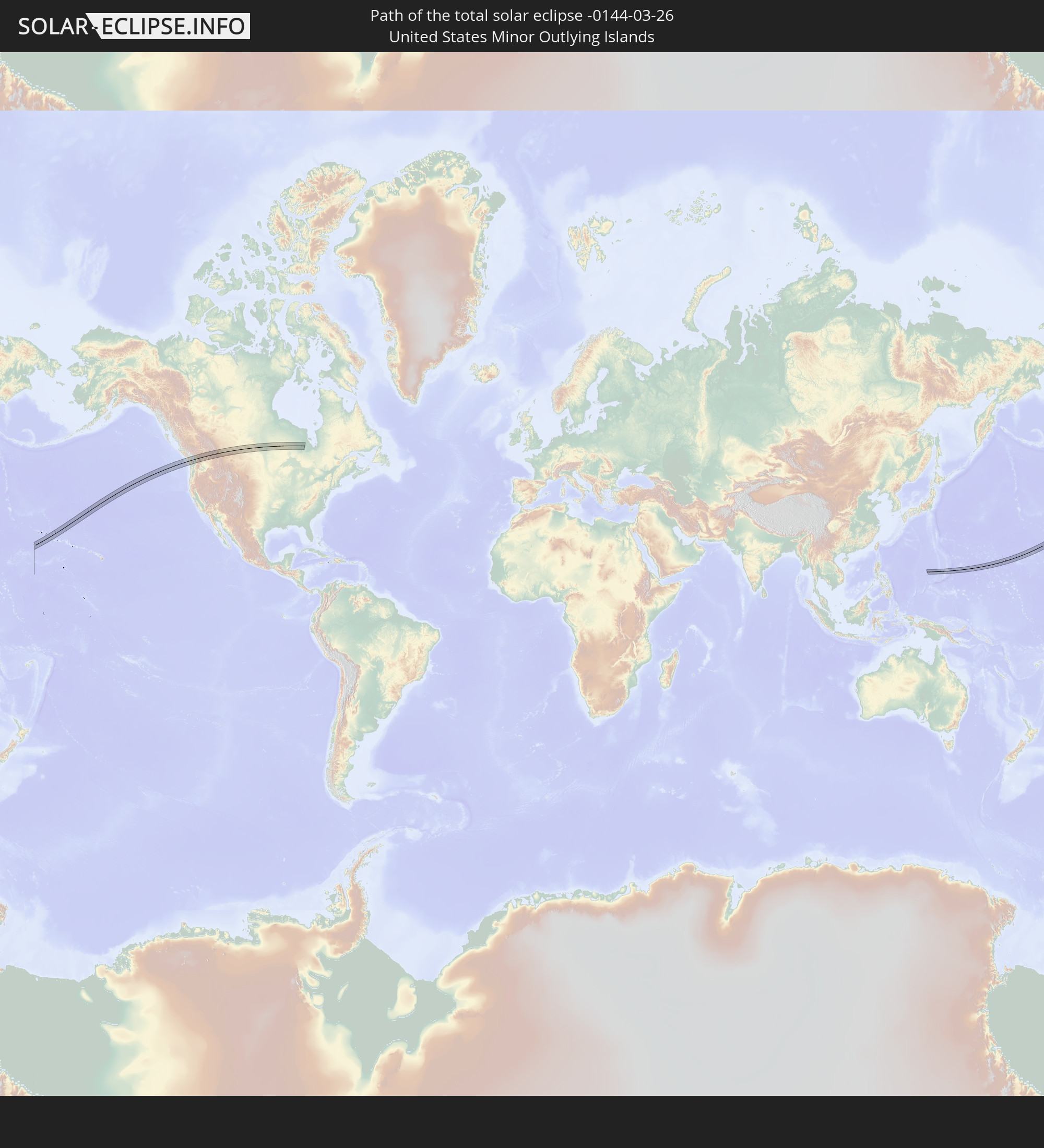 United States Minor Outlying Islands
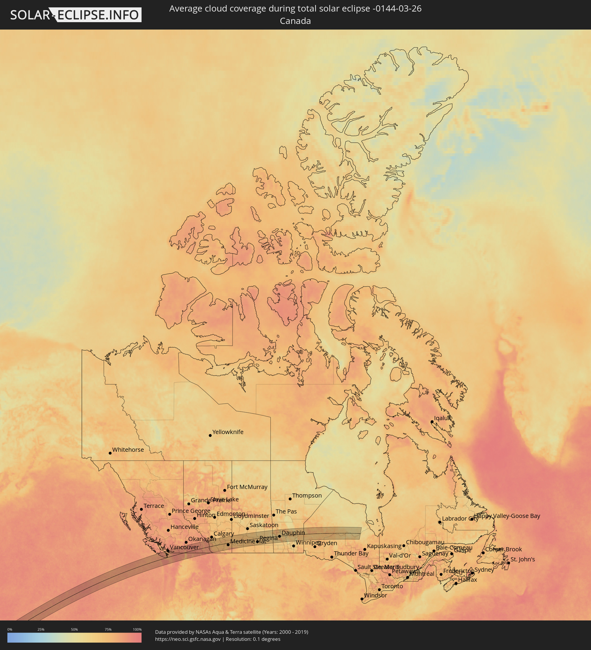
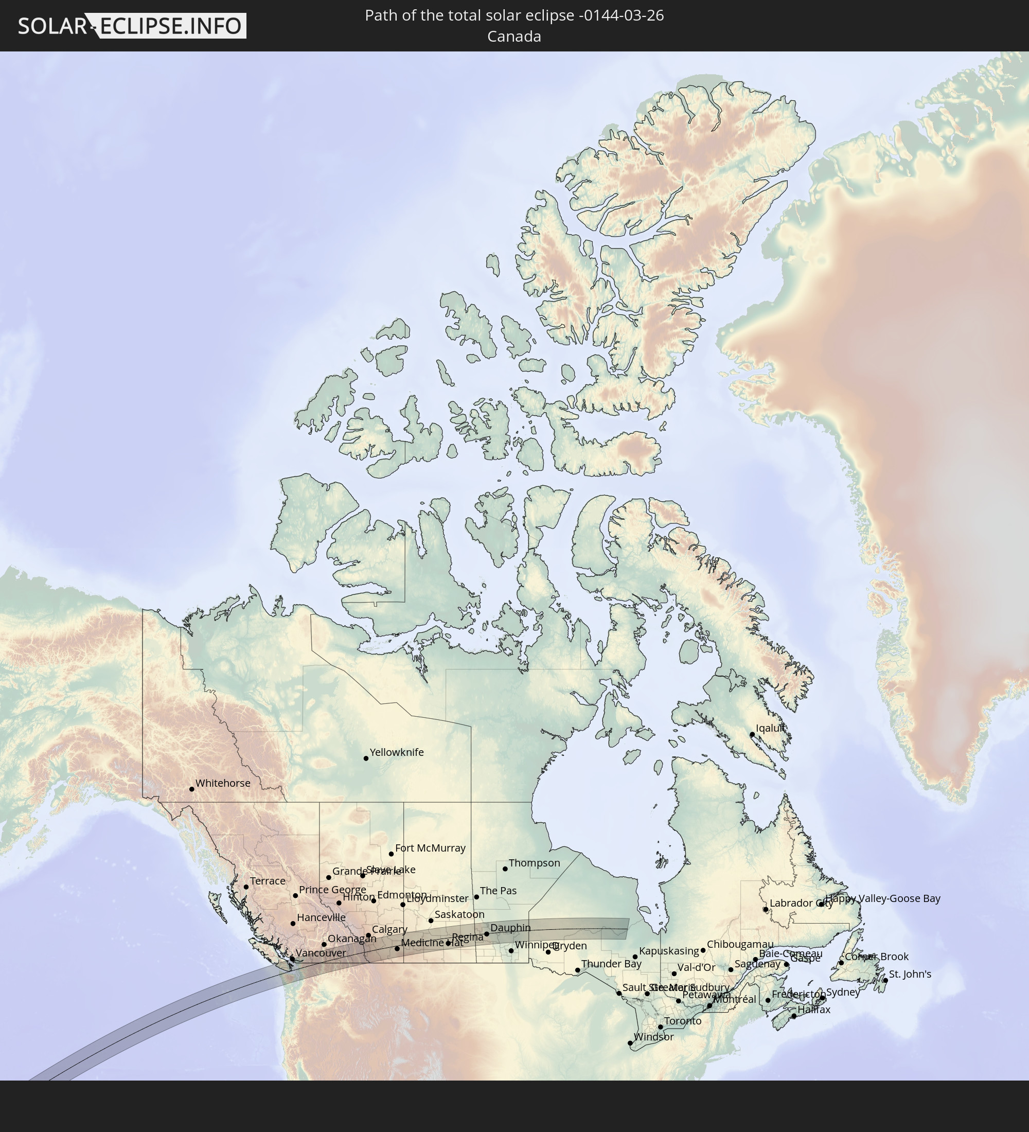 Canada
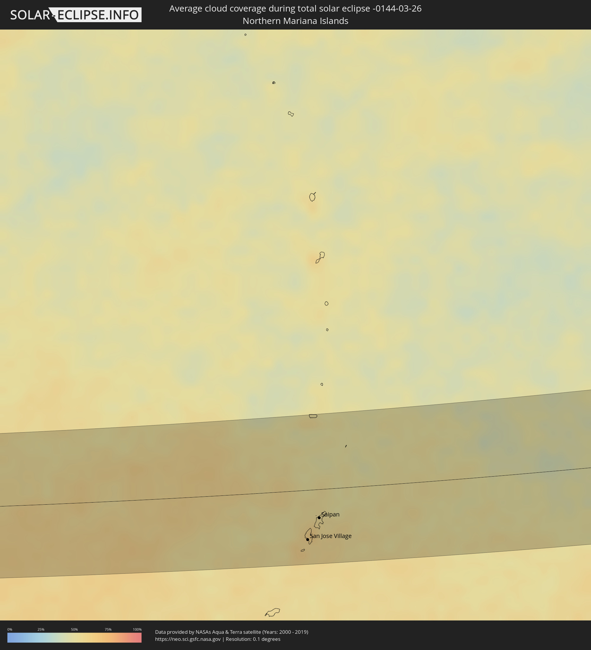
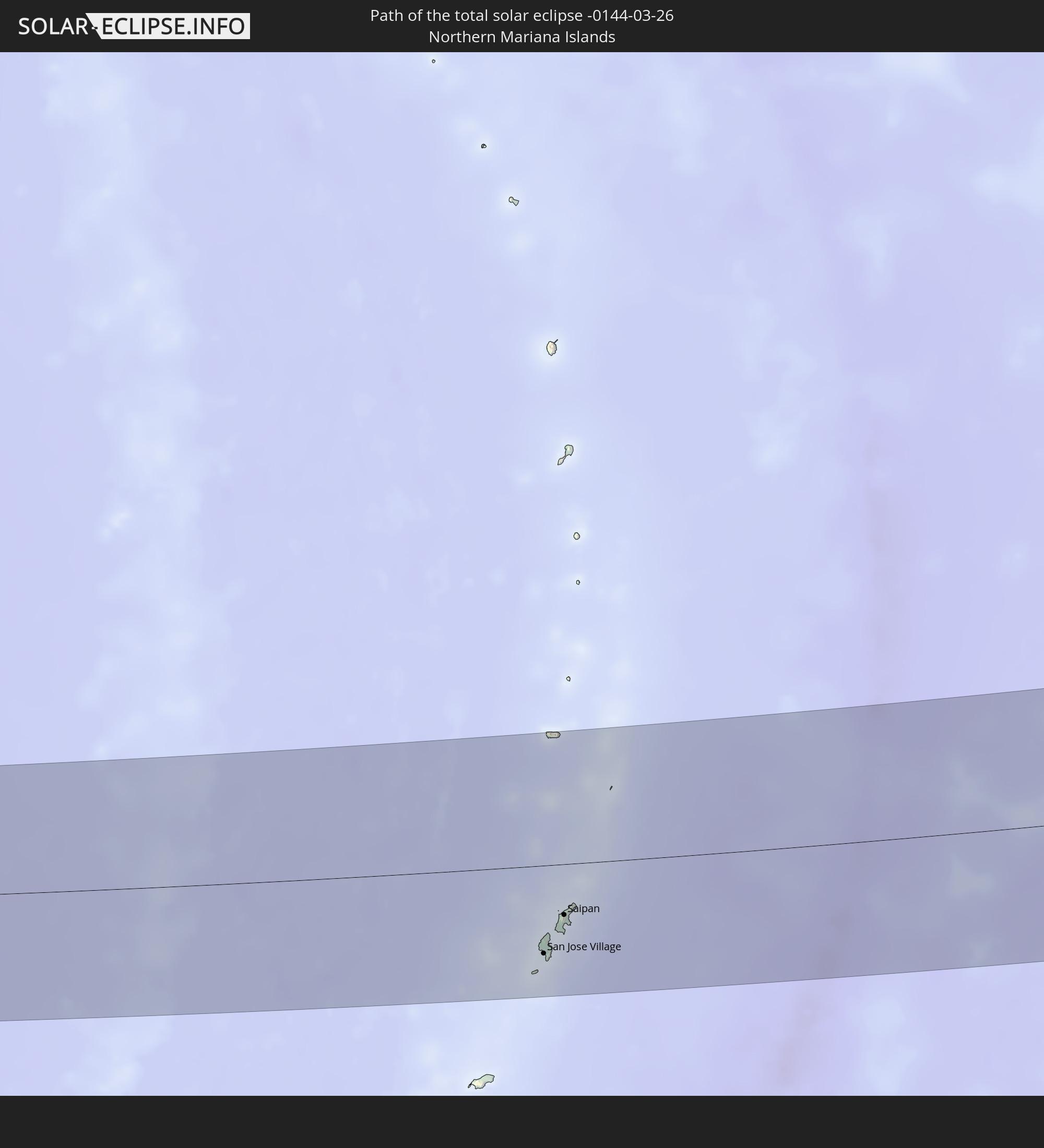 Northern Mariana Islands
In den folgenden Ländern ist die Sonnenfinsternis partiell zu sehen


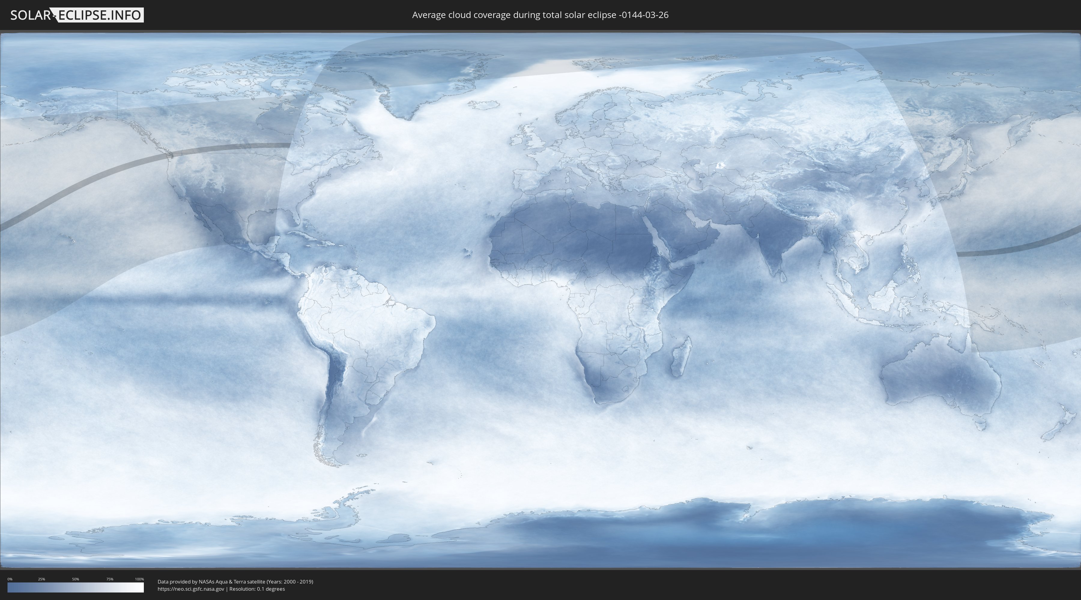
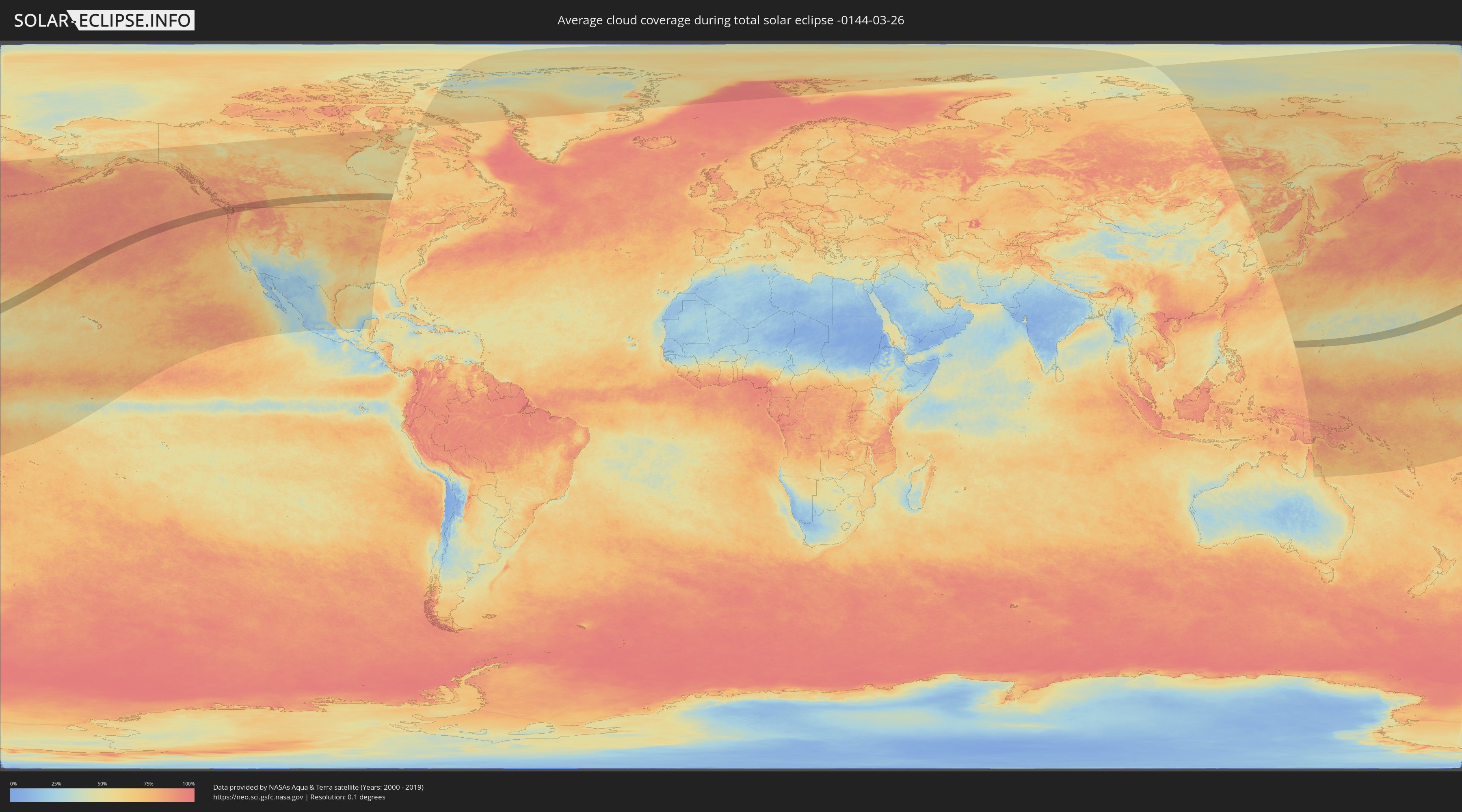
How will be the weather during the total solar eclipse on 03/26/-0144?
Where is the best place to see the total solar eclipse of 03/26/-0144?
The following maps show the average cloud coverage for the day of the total solar eclipse.
With the help of these maps, it is possible to find the place along the eclipse path, which has the best
chance of a cloudless sky.
Nevertheless, you should consider local circumstances and inform about the weather of your chosen
observation site.
The data is provided by NASAs satellites
AQUA and TERRA.
The cloud maps are averaged over a period of 19 years (2000 - 2019).
Detailed country maps
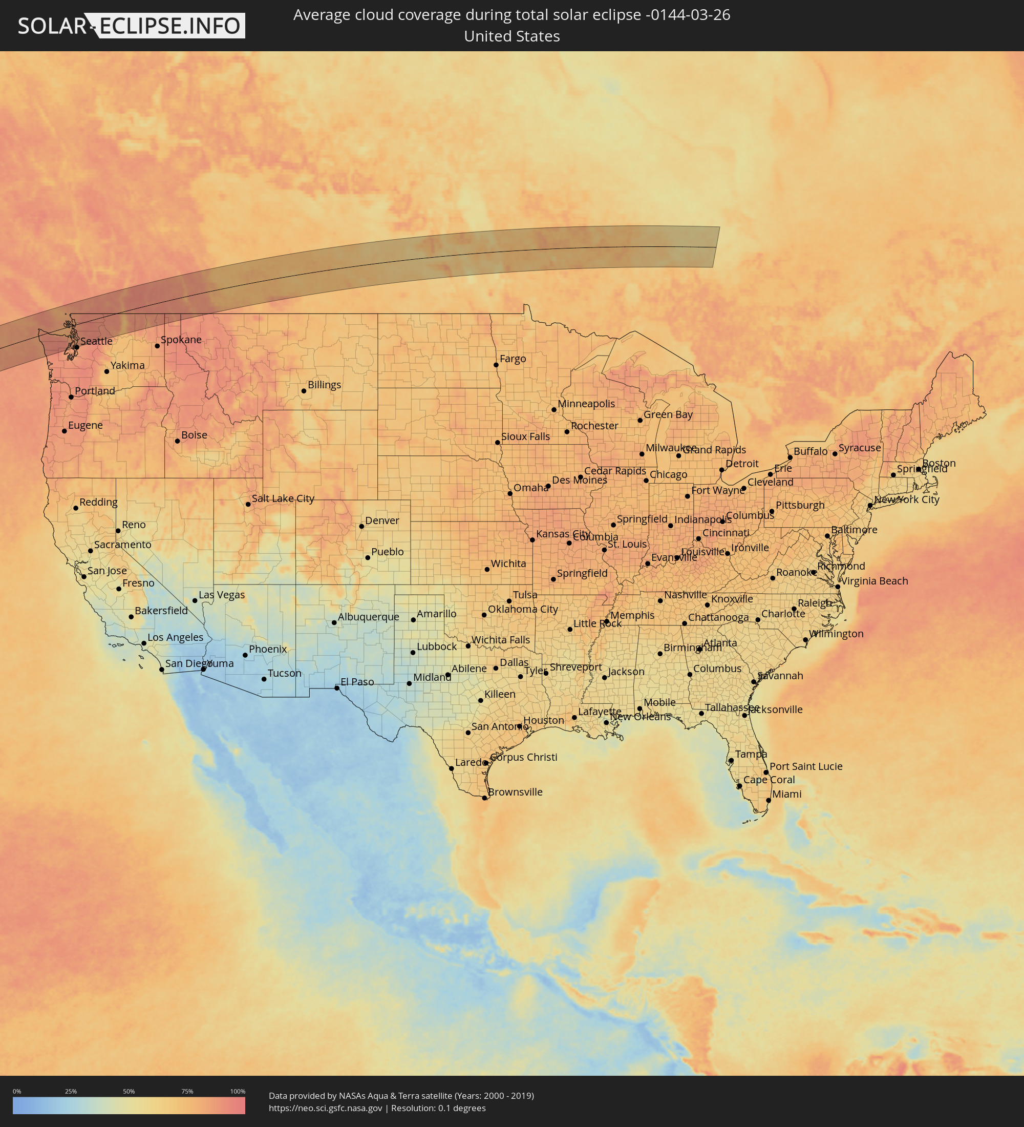 United States
 United States Minor Outlying Islands
 Canada
 Northern Mariana Islands
Cities inside the path of the eclipse
The following table shows all locations with a population of more than 5,000 inside the eclipse path. Cities which have more than 100,000 inhabitants are marked bold. A click at the locations opens a detailed map.
| City | Type | Eclipse duration | Local time of max. eclipse | Distance to central line | Ø Cloud coverage |
 Nanaimo, British Columbia
|
total | - | 15:29:40 UTC-08:00 | 97 km | 81% |
|
Ladysmith, British Columbia
|
total | - | 15:29:53 UTC-08:00 | 76 km | 84% |
|
Sooke, British Columbia
|
total | - | 15:30:19 UTC-08:00 | 9 km | 80% |
|
Duncan, British Columbia
|
total | - | 15:30:06 UTC-08:00 | 52 km | 85% |
|
North Cowichan, British Columbia
|
total | - | 15:30:05 UTC-08:00 | 57 km | 85% |
|
Langford, British Columbia
|
total | - | 15:30:29 UTC-08:00 | 12 km | 81% |
|
Colwood, British Columbia
|
total | - | 15:30:31 UTC-08:00 | 10 km | 81% |
 Port Angeles, Washington
|
total | - | 15:30:44 UTC-08:00 | 25 km | 90% |
|
North Saanich, British Columbia
|
total | - | 15:30:26 UTC-08:00 | 33 km | 84% |
|
Victoria, British Columbia
|
total | - | 15:30:37 UTC-08:00 | 7 km | 80% |
|
Oak Bay, British Columbia
|
total | - | 15:30:40 UTC-08:00 | 8 km | 79% |
|
Richmond, British Columbia
|
total | - | 15:30:24 UTC-08:00 | 81 km | 82% |
|
West End, British Columbia
|
total | - | 15:30:20 UTC-08:00 | 93 km | 82% |
|
Vancouver, British Columbia
|
total | - | 15:30:22 UTC-08:00 | 89 km | 82% |
|
Sequim, Washington
|
total | - | 15:31:04 UTC-08:00 | 36 km | 87% |
|
Ladner, British Columbia
|
total | - | 15:30:30 UTC-08:00 | 71 km | 80% |
|
North Vancouver, British Columbia
|
total | - | 15:30:22 UTC-08:00 | 95 km | 82% |
|
Burnaby, British Columbia
|
total | - | 15:30:31 UTC-08:00 | 87 km | 83% |
|
New Westminster, British Columbia
|
total | - | 15:30:35 UTC-08:00 | 80 km | 85% |
|
Delta, British Columbia
|
total | - | 15:30:38 UTC-08:00 | 73 km | 81% |
|
Port Moody, British Columbia
|
total | - | 15:30:35 UTC-08:00 | 87 km | 85% |
|
Anmore, British Columbia
|
total | - | 15:30:34 UTC-08:00 | 91 km | 85% |
|
Surrey, British Columbia
|
total | - | 15:30:43 UTC-08:00 | 68 km | 83% |
|
White Rock, British Columbia
|
total | - | 15:30:48 UTC-08:00 | 58 km | 80% |
|
Port Townsend, Washington
|
total | - | 15:31:22 UTC-08:00 | 39 km | 82% |
|
Coquitlam, British Columbia
|
total | - | 15:30:41 UTC-08:00 | 85 km | 84% |
|
Birch Bay, Washington
|
total | - | 15:30:55 UTC-08:00 | 46 km | 82% |
|
Bangor Trident Base, Washington
|
total | - | 15:31:38 UTC-08:00 | 82 km | 85% |
|
Silverdale, Washington
|
total | - | 15:31:42 UTC-08:00 | 91 km | 85% |
|
Pitt Meadows, British Columbia
|
total | - | 15:30:47 UTC-08:00 | 77 km | 85% |
|
Langley, British Columbia
|
total | - | 15:30:53 UTC-08:00 | 64 km | 85% |
|
Tracyton, Washington
|
total | - | 15:31:45 UTC-08:00 | 96 km | 85% |
|
Poulsbo, Washington
|
total | - | 15:31:42 UTC-08:00 | 82 km | 84% |
|
Oak Harbor, Washington
|
total | - | 15:31:22 UTC-08:00 | 23 km | 83% |
|
Walnut Grove, British Columbia
|
total | - | 15:30:51 UTC-08:00 | 70 km | 86% |
|
Anacortes, Washington
|
total | - | 15:31:16 UTC-08:00 | 0 km | 83% |
|
Maple Ridge, British Columbia
|
total | - | 15:30:51 UTC-08:00 | 75 km | 86% |
|
Ferndale, Washington
|
total | - | 15:31:06 UTC-08:00 | 35 km | 82% |
|
Langley, British Columbia
|
total | - | 15:30:57 UTC-08:00 | 60 km | 87% |
|
Camano, Washington
|
total | - | 15:31:33 UTC-08:00 | 38 km | 83% |
|
Bainbridge Island, Washington
|
total | - | 15:31:52 UTC-08:00 | 97 km | 84% |
|
Bellingham, Washington
|
total | - | 15:31:14 UTC-08:00 | 24 km | 83% |
|
Aldergrove, British Columbia
|
total | - | 15:31:04 UTC-08:00 | 55 km | 86% |
|
Lynden, Washington
|
total | - | 15:31:09 UTC-08:00 | 43 km | 86% |
|
Edmonds, Washington
|
total | - | 15:31:54 UTC-08:00 | 80 km | 83% |
|
Stanwood, Washington
|
total | - | 15:31:39 UTC-08:00 | 34 km | 83% |
|
Sudden Valley, Washington
|
total | - | 15:31:23 UTC-08:00 | 17 km | 88% |
|
Shoreline, Washington
|
total | - | 15:31:58 UTC-08:00 | 87 km | 84% |
|
Mount Vernon, Washington
|
total | - | 15:31:35 UTC-08:00 | 16 km | 88% |
|
Burlington, Washington
|
total | - | 15:31:33 UTC-08:00 | 10 km | 87% |
|
Lynnwood, Washington
|
total | - | 15:31:57 UTC-08:00 | 80 km | 84% |
|
Mountlake Terrace, Washington
|
total | - | 15:31:59 UTC-08:00 | 84 km | 84% |
|
Mukilteo, Washington
|
total | - | 15:31:53 UTC-08:00 | 67 km | 84% |
|
Tulalip, Washington
|
total | - | 15:31:50 UTC-08:00 | 54 km | 85% |
|
Alderwood Manor, Washington
|
total | - | 15:31:59 UTC-08:00 | 81 km | 84% |
|
Lake Forest Park, Washington
|
total | - | 15:32:01 UTC-08:00 | 88 km | 84% |
|
Brier, Washington
|
total | - | 15:32:01 UTC-08:00 | 85 km | 84% |
|
Abbotsford, British Columbia
|
total | - | 15:31:16 UTC-08:00 | 51 km | 85% |
|
Kenmore, Washington
|
total | - | 15:32:03 UTC-08:00 | 88 km | 86% |
|
Martha Lake, Washington
|
total | - | 15:32:00 UTC-08:00 | 79 km | 87% |
|
Sedro-Woolley, Washington
|
total | - | 15:31:37 UTC-08:00 | 9 km | 87% |
|
Inglewood-Finn Hill, Washington
|
total | - | 15:32:05 UTC-08:00 | 93 km | 84% |
|
Bothell, Washington
|
total | - | 15:32:05 UTC-08:00 | 89 km | 86% |
|
Mill Creek, Washington
|
total | - | 15:32:02 UTC-08:00 | 78 km | 87% |
|
Everett, Washington
|
total | - | 15:31:58 UTC-08:00 | 66 km | 86% |
|
Kingsgate, Washington
|
total | - | 15:32:08 UTC-08:00 | 93 km | 84% |
|
Marysville, Washington
|
total | - | 15:31:57 UTC-08:00 | 58 km | 86% |
|
North Creek, Washington
|
total | - | 15:32:05 UTC-08:00 | 83 km | 86% |
|
Woodinville, Washington
|
total | - | 15:32:08 UTC-08:00 | 90 km | 86% |
|
Silver Firs, Washington
|
total | - | 15:32:04 UTC-08:00 | 79 km | 87% |
|
Arlington, Washington
|
total | - | 15:31:54 UTC-08:00 | 44 km | 88% |
|
Maltby, Washington
|
total | - | 15:32:09 UTC-08:00 | 86 km | 86% |
|
West Lake Stevens, Washington
|
total | - | 15:32:03 UTC-08:00 | 66 km | 87% |
|
Snohomish, Washington
|
total | - | 15:32:06 UTC-08:00 | 75 km | 86% |
|
Cottage Lake, Washington
|
total | - | 15:32:13 UTC-08:00 | 93 km | 87% |
|
Lake Stevens, Washington
|
total | - | 15:32:04 UTC-08:00 | 64 km | 87% |
|
Duvall, Washington
|
total | - | 15:32:18 UTC-08:00 | 95 km | 87% |
|
Monroe, Washington
|
total | - | 15:32:15 UTC-08:00 | 83 km | 88% |
|
Chilliwack, British Columbia
|
total | - | 15:31:28 UTC-08:00 | 57 km | 86% |
|
Woods Creek, Washington
|
total | - | 15:32:18 UTC-08:00 | 82 km | 88% |
|
Summerland, British Columbia
|
total | - | 15:33:08 UTC-08:00 | 59 km | 83% |
|
Penticton, British Columbia
|
total | - | 15:33:17 UTC-08:00 | 45 km | 81% |
|
West Kelowna, British Columbia
|
total | - | 15:33:01 UTC-08:00 | 86 km | 83% |
|
Kelowna, British Columbia
|
total | - | 15:33:05 UTC-08:00 | 87 km | 81% |
|
Trail, British Columbia
|
total | - | 15:35:03 UTC-08:00 | 29 km | 90% |
|
Castlegar, British Columbia
|
total | - | 15:34:56 UTC-08:00 | 8 km | 89% |
|
Nelson, British Columbia
|
total | - | 15:35:05 UTC-08:00 | 7 km | 89% |
|
Kimberley, British Columbia
|
total | - | 16:02:04 UTC-07:33 | 4 km | 86% |
|
Cranbrook, British Columbia
|
total | - | 16:02:20 UTC-07:33 | 18 km | 85% |
|
Fernie, British Columbia
|
total | - | 16:02:50 UTC-07:33 | 29 km | 87% |
|
Okotoks, Alberta
|
total | - | 16:02:36 UTC-07:33 | 89 km | 71% |
|
High River, Alberta
|
total | - | 16:02:48 UTC-07:33 | 71 km | 69% |
|
Lethbridge, Alberta
|
total | - | 16:04:12 UTC-07:33 | 40 km | 76% |
|
Coaldale, Alberta
|
total | - | 16:04:19 UTC-07:33 | 41 km | 75% |
|
Taber, Alberta
|
total | - | 16:04:34 UTC-07:33 | 40 km | 75% |
|
Brooks, Alberta
|
total | - | 16:04:04 UTC-07:33 | 44 km | 78% |
|
Medicine Hat, Alberta
|
total | - | 16:05:15 UTC-07:33 | 32 km | 75% |
|
Swift Current, Saskatchewan
|
total | - | 16:41:53 UTC-06:58 | 39 km | 71% |
|
Moose Jaw, Saskatchewan
|
total | - | 16:42:53 UTC-06:58 | 49 km | 73% |
|
Regina, Saskatchewan
|
total | - | 16:43:15 UTC-06:58 | 52 km | 77% |
|
Yorkton, Saskatchewan
|
total | - | 16:43:25 UTC-06:58 | 15 km | 64% |
|
Dauphin, Manitoba
|
total | - | 17:42:56 UTC-06:00 | 10 km | 72% |
 San Jose Village, Tinian
|
total | - | 06:51:58 UTC+10:00 | 62 km | 62% |
|
Saipan, Saipan
|
total | - | 06:52:15 UTC+10:00 | 36 km | 56% |