Total solar eclipse of 01/31/-0234
| Day of week: | Wednesday |
| Maximum duration of eclipse: | 03m24s |
| Maximum width of eclipse path: | 122 km |
| Saros cycle: | 56 |
| Coverage: | 100% |
| Magnitude: | 1.0337 |
| Gamma: | 0.3623 |
Wo kann man die Sonnenfinsternis vom 01/31/-0234 sehen?
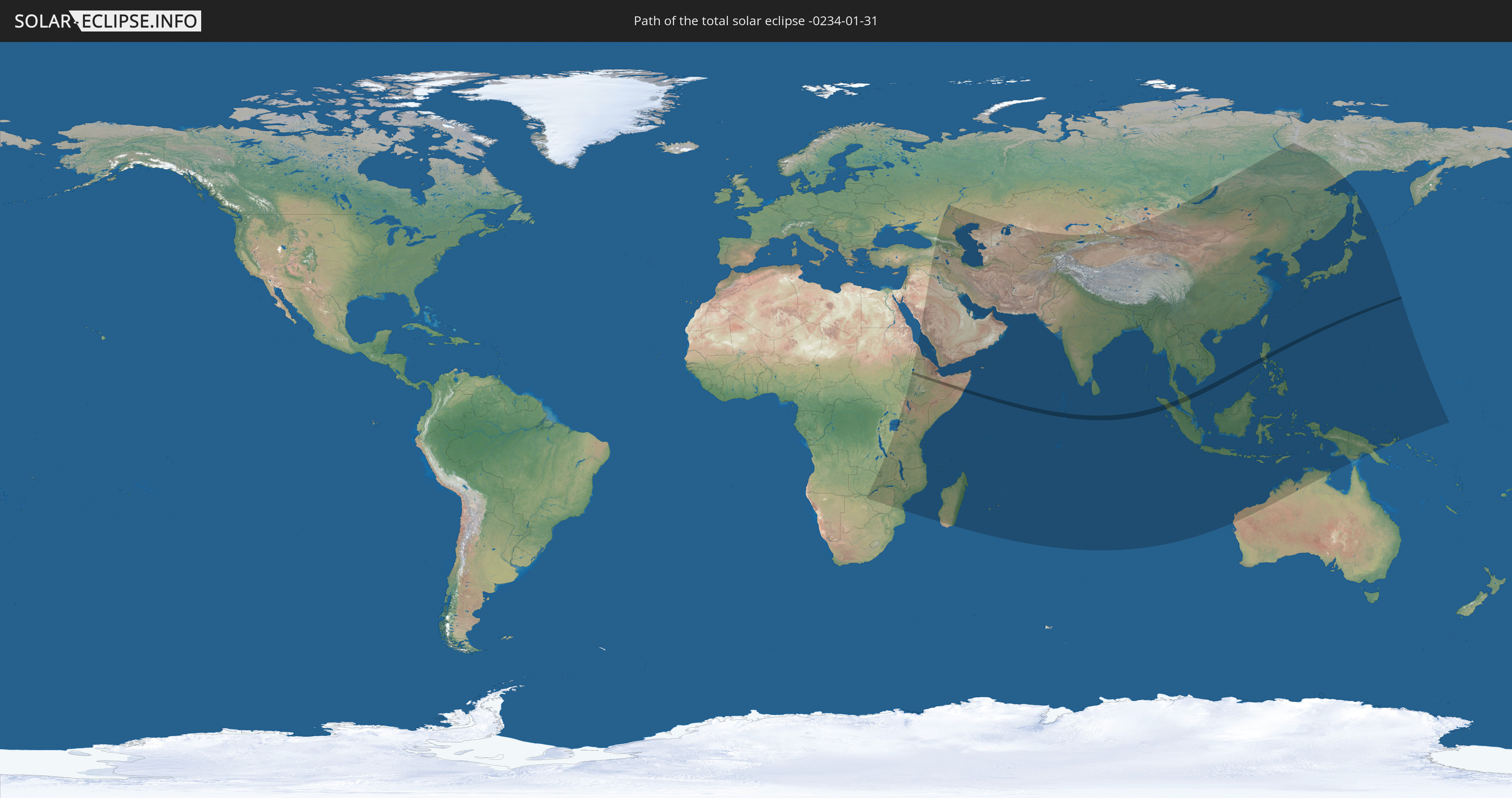
Die Sonnenfinsternis am 01/31/-0234 kann man in 76 Ländern als partielle Sonnenfinsternis beobachten.
Der Finsternispfad verläuft durch 7 Länder. Nur in diesen Ländern ist sie als total Sonnenfinsternis zu sehen.
In den folgenden Ländern ist die Sonnenfinsternis total zu sehen
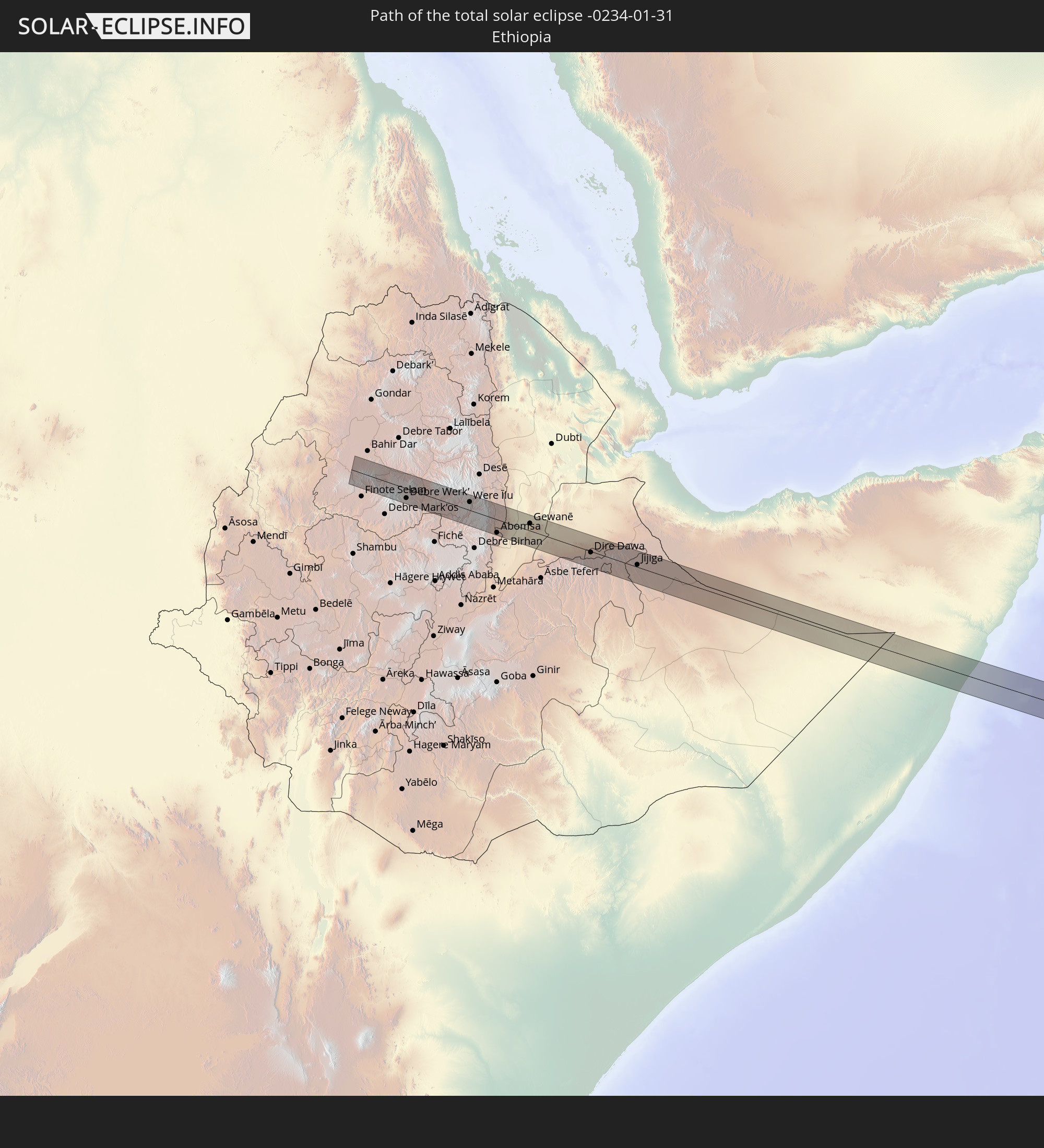 Ethiopia
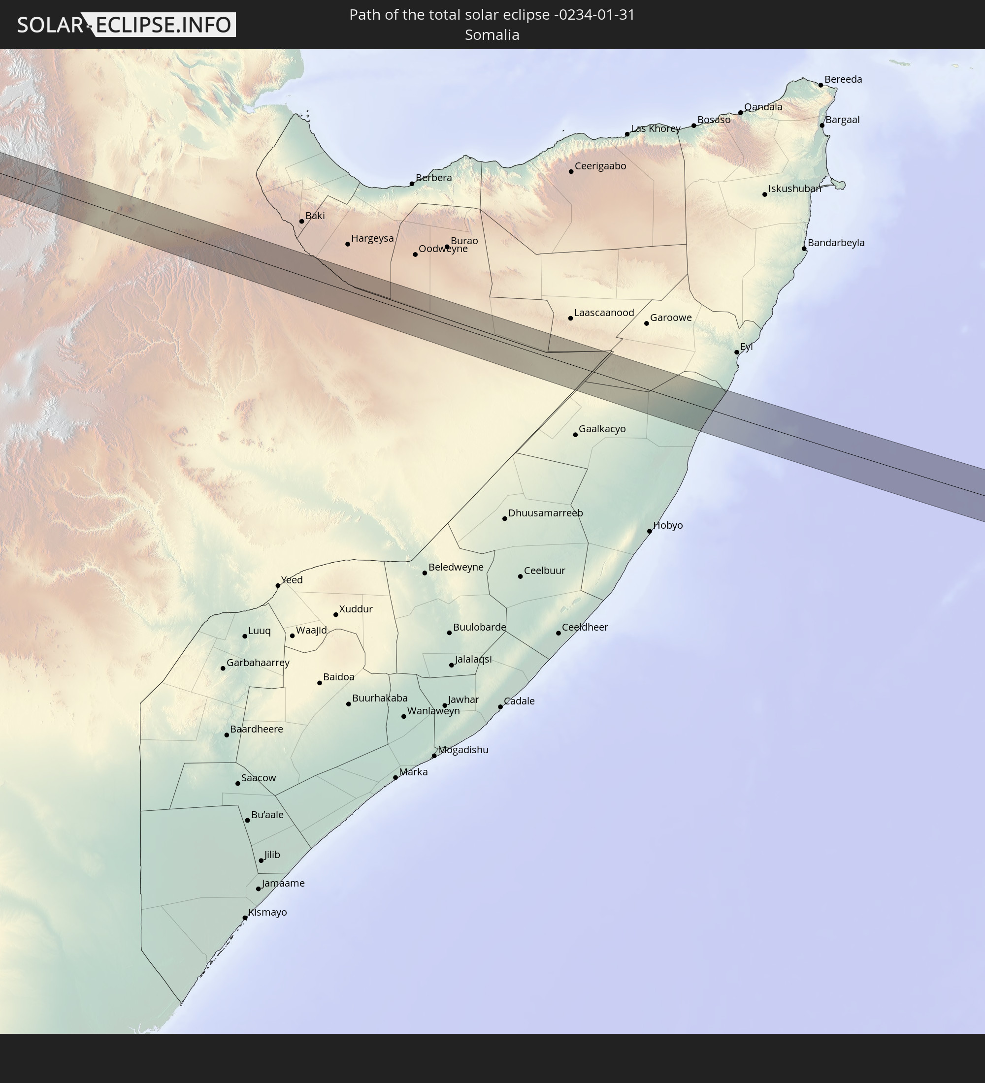 Somalia
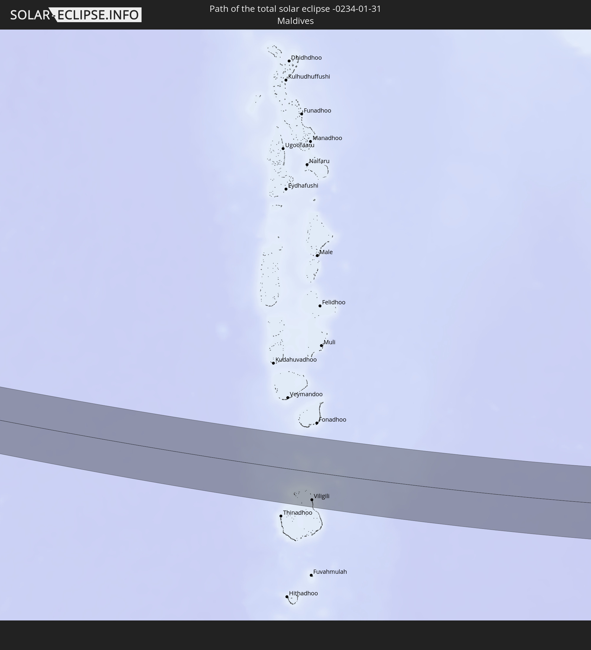 Maldives
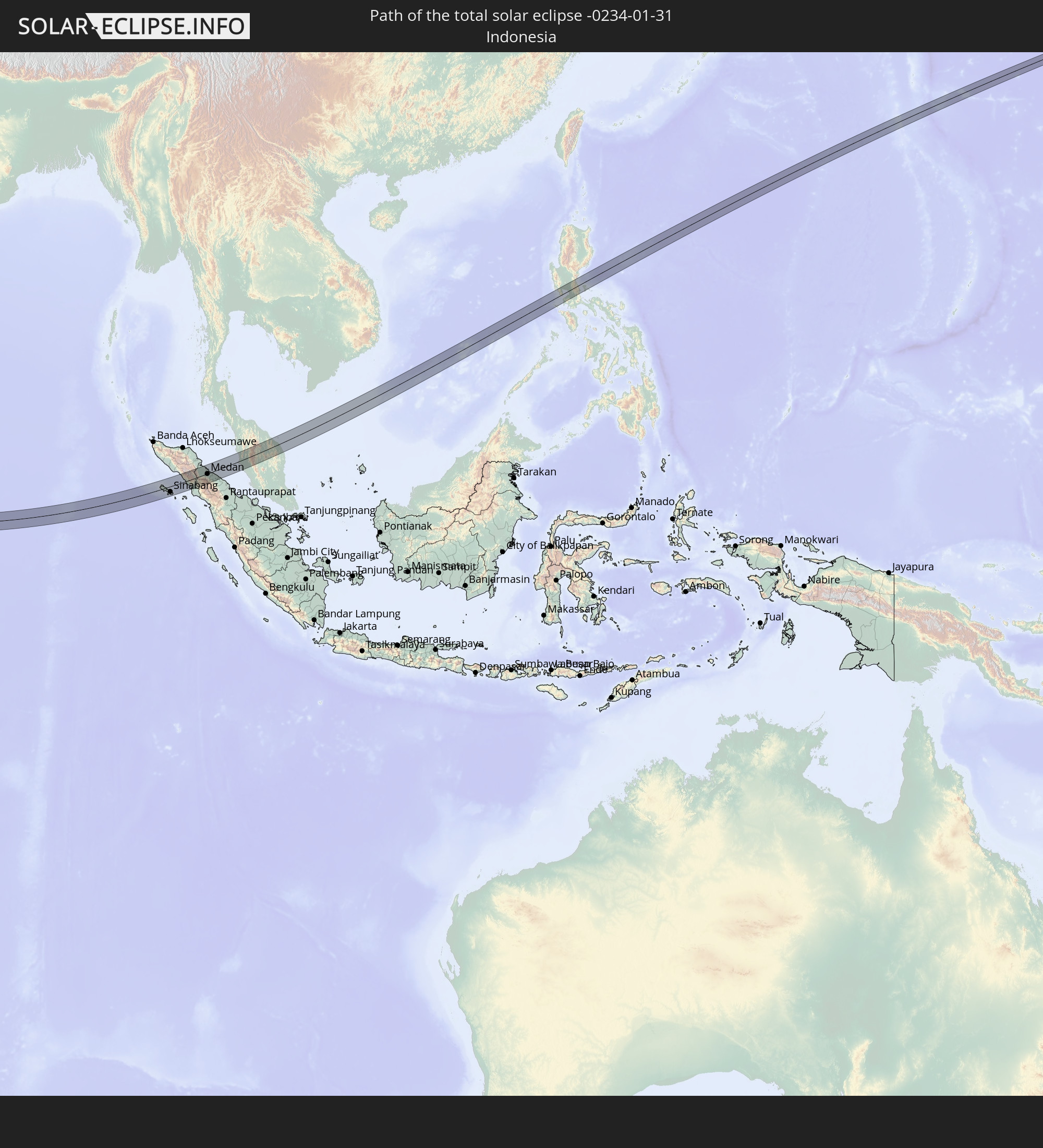 Indonesia
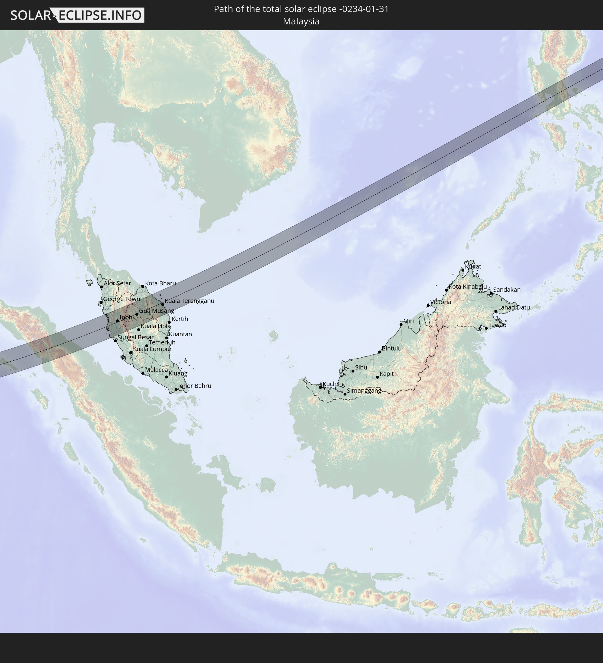 Malaysia
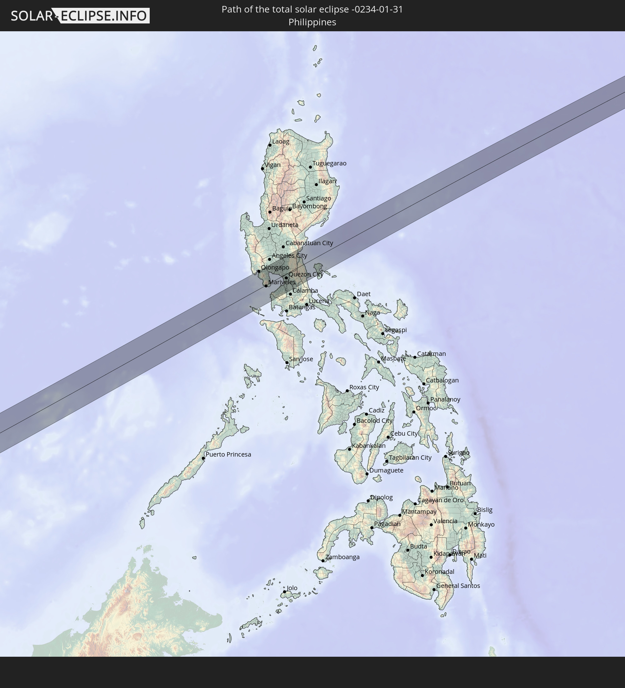 Philippines
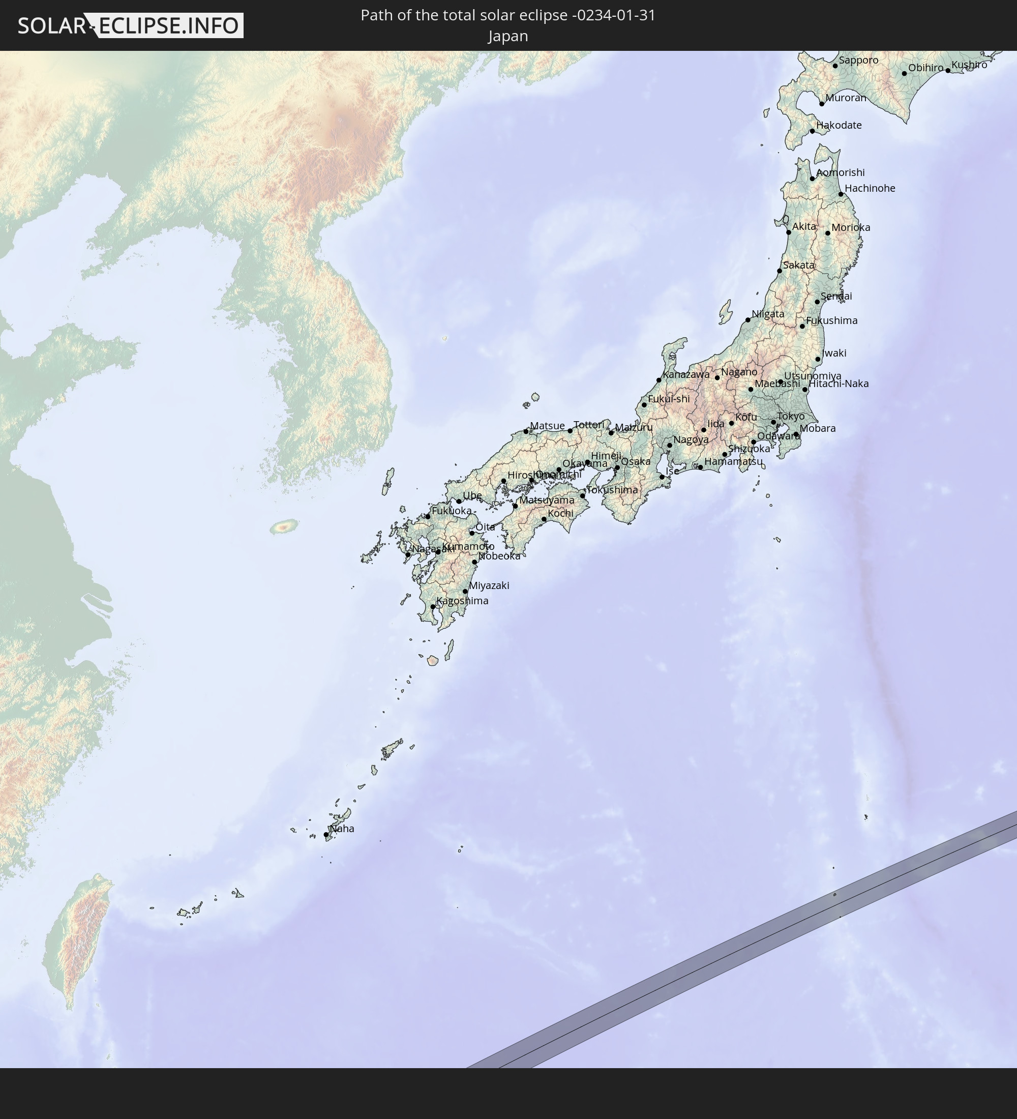 Japan
Japan
In den folgenden Ländern ist die Sonnenfinsternis partiell zu sehen
 Russia
 Democratic Republic of the Congo
 Sudan
Sudan
 Zambia
 Zimbabwe
 Turkey
 Tanzania
 Uganda
 Mozambique
 Malawi
 Ethiopia
 Kenya
Kenya
 Saudi Arabia
 Syria
Syria
 Eritrea
 Iraq
Iraq
 Georgia
 French Southern and Antarctic Lands
 Somalia
 Djibouti
 Yemen
Yemen
 Madagascar
 Comoros
 Armenia
 Iran
Iran
 Azerbaijan
 Mayotte
 Seychelles
 Kazakhstan
 Kuwait
 Bahrain
 Qatar
Qatar
 United Arab Emirates
 Oman
Oman
 Turkmenistan
 Réunion
 Uzbekistan
 Mauritius
 Afghanistan
 Pakistan
 Tajikistan
 India
India
 Kyrgyzstan
 British Indian Ocean Territory
 Maldives
 China
China
 Sri Lanka
 Nepal
Nepal
 Mongolia
 Bangladesh
 Bhutan
 Myanmar
 Indonesia
 Cocos Islands
 Thailand
 Malaysia
 Laos
Laos
 Vietnam
 Cambodia
 Singapore
 Christmas Island
 Australia
 Macau
Macau
 Hong Kong
 Brunei
 Taiwan
 Philippines
 Japan
Japan
 East Timor
 North Korea
 South Korea
 Palau
Palau
 Federated States of Micronesia
 Papua New Guinea
 Guam
Guam
 Northern Mariana Islands
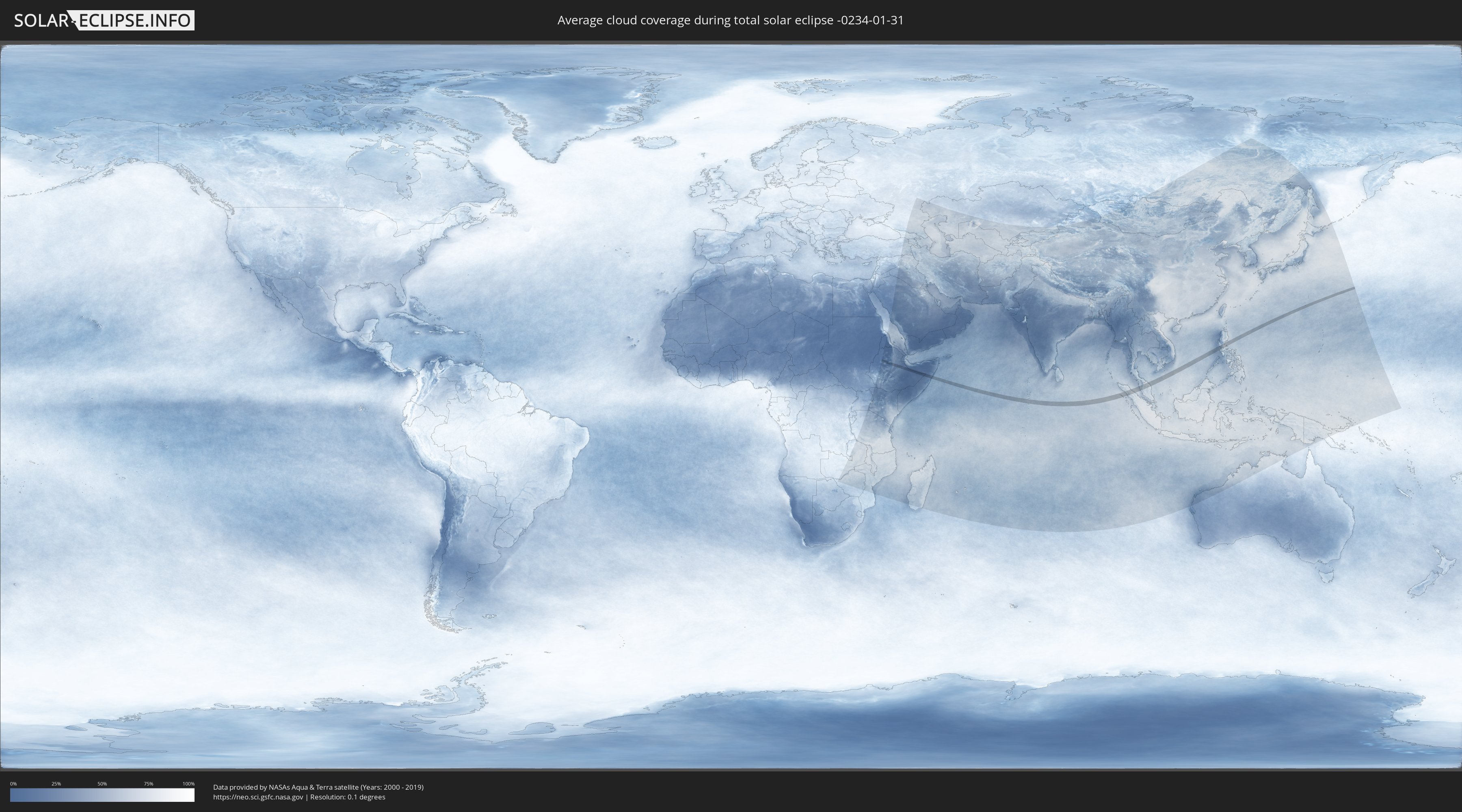
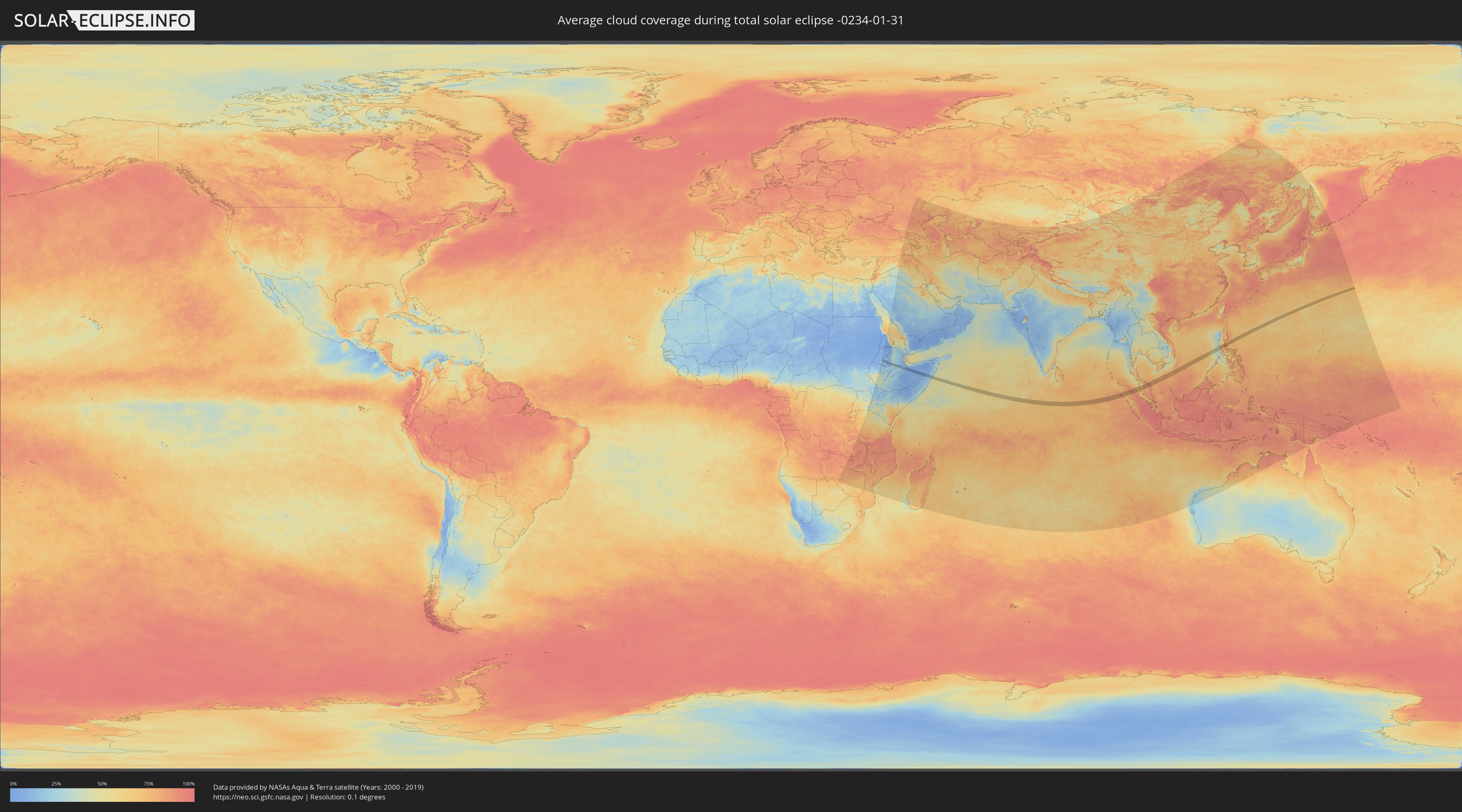
How will be the weather during the total solar eclipse on 01/31/-0234?
Where is the best place to see the total solar eclipse of 01/31/-0234?
The following maps show the average cloud coverage for the day of the total solar eclipse.
With the help of these maps, it is possible to find the place along the eclipse path, which has the best
chance of a cloudless sky.
Nevertheless, you should consider local circumstances and inform about the weather of your chosen
observation site.
The data is provided by NASAs satellites
AQUA and TERRA.
The cloud maps are averaged over a period of 19 years (2000 - 2019).
Detailed country maps
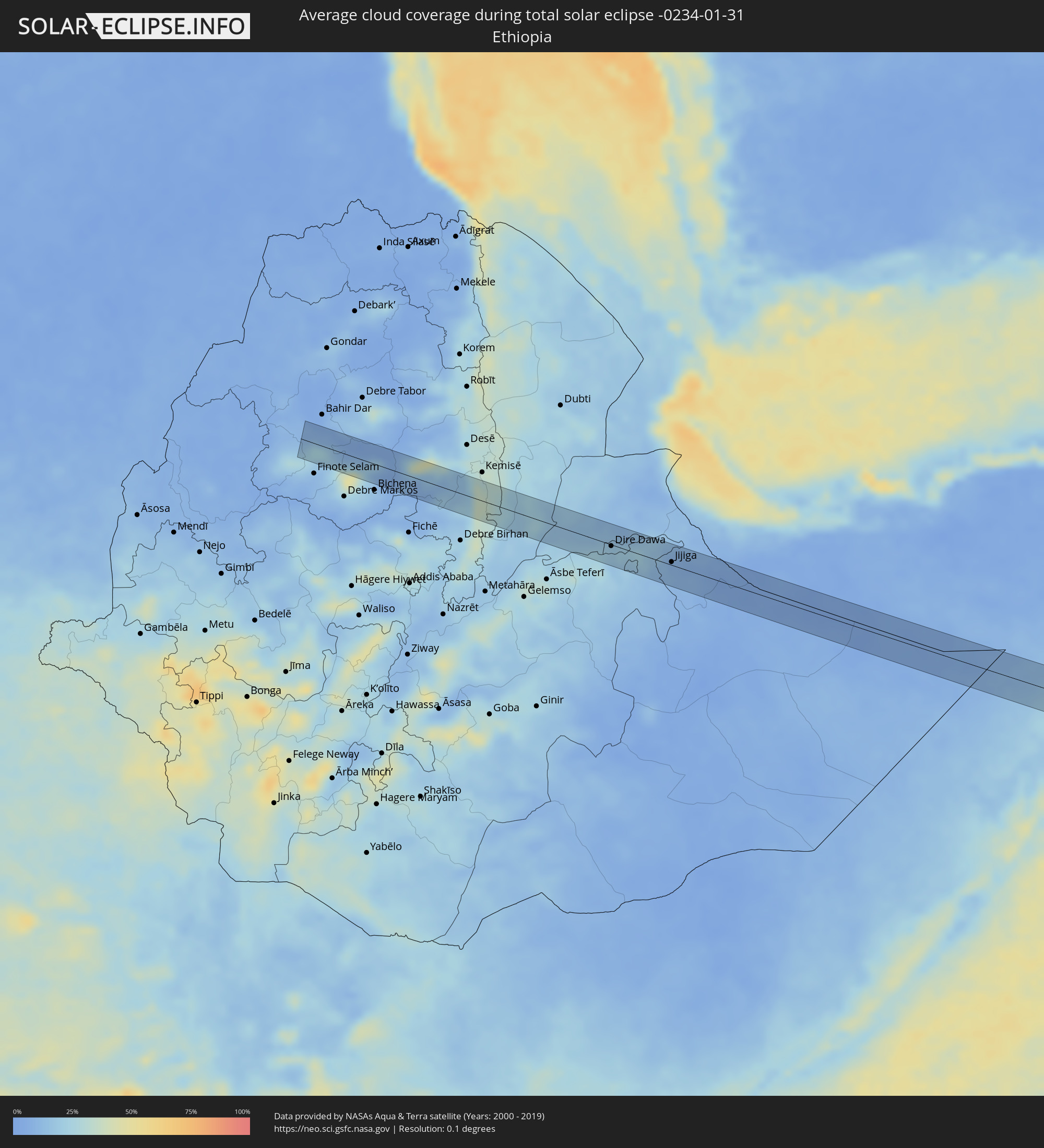 Ethiopia
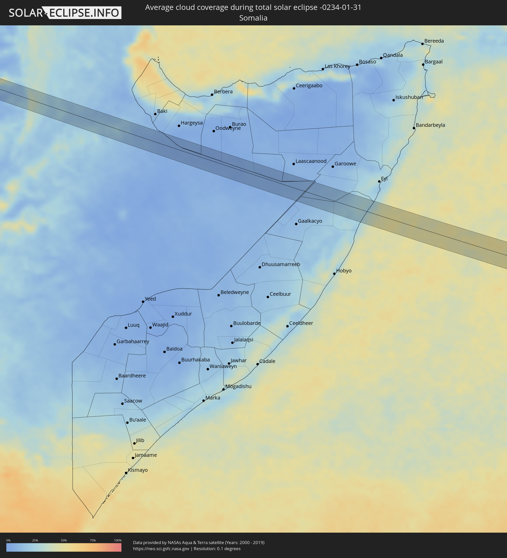 Somalia
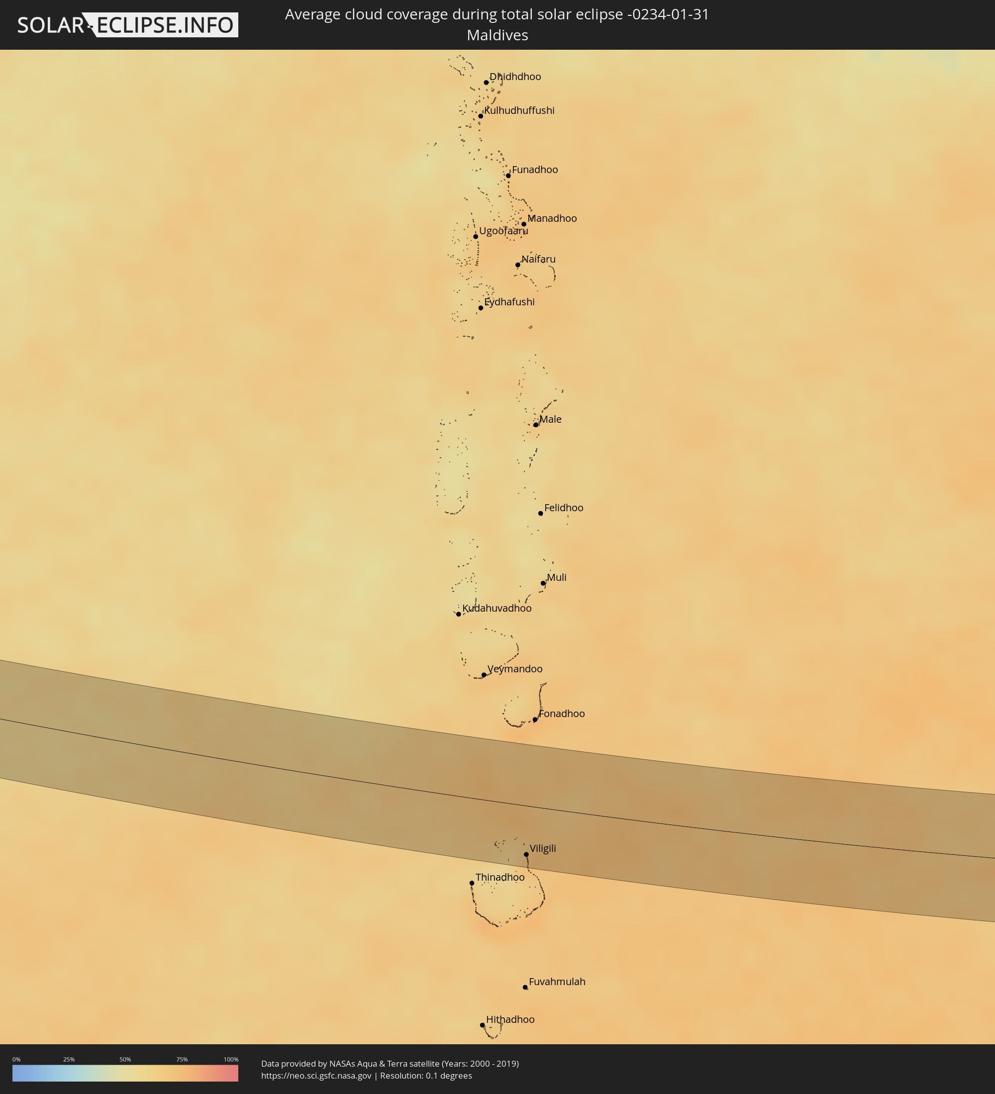 Maldives
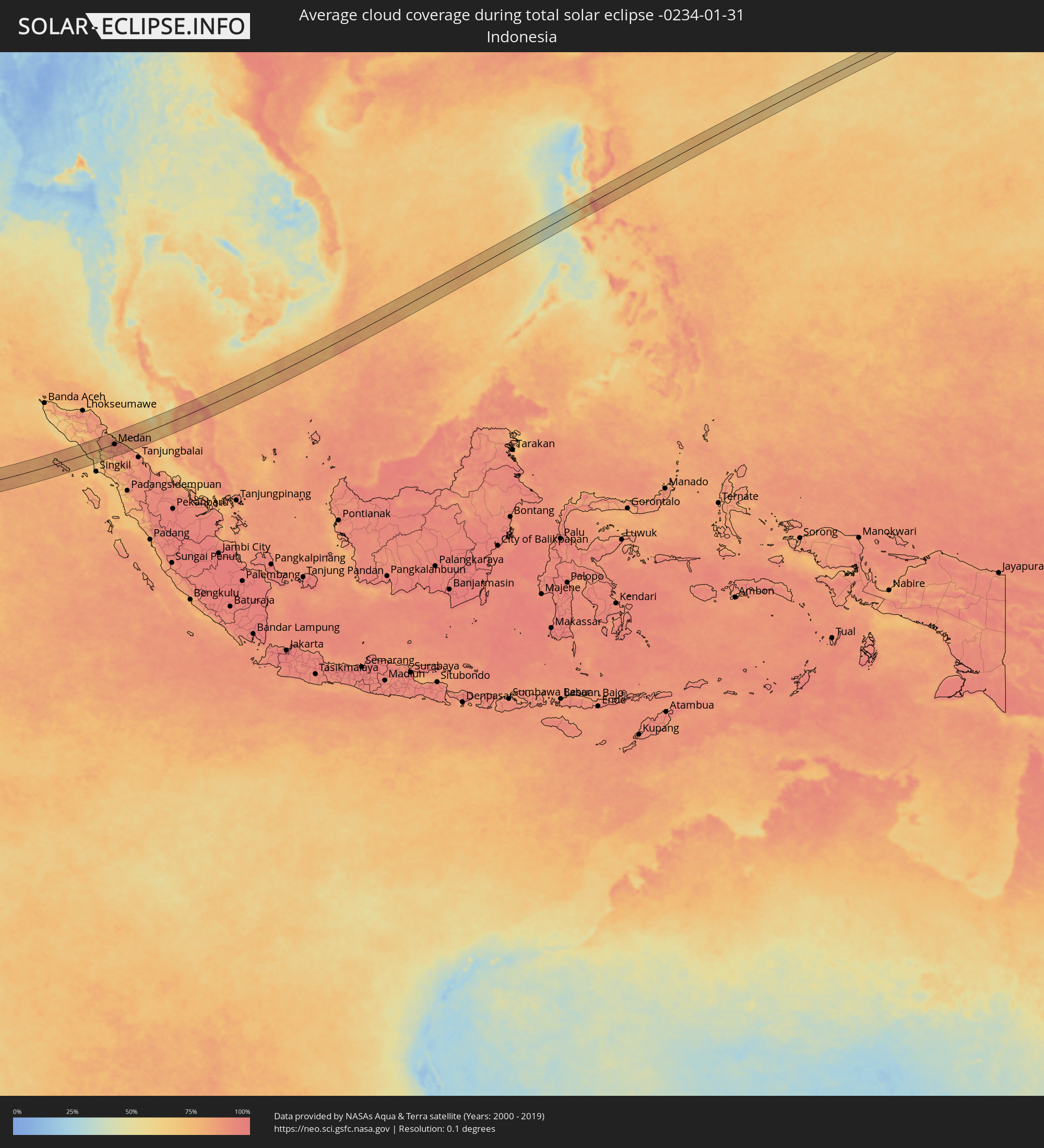 Indonesia
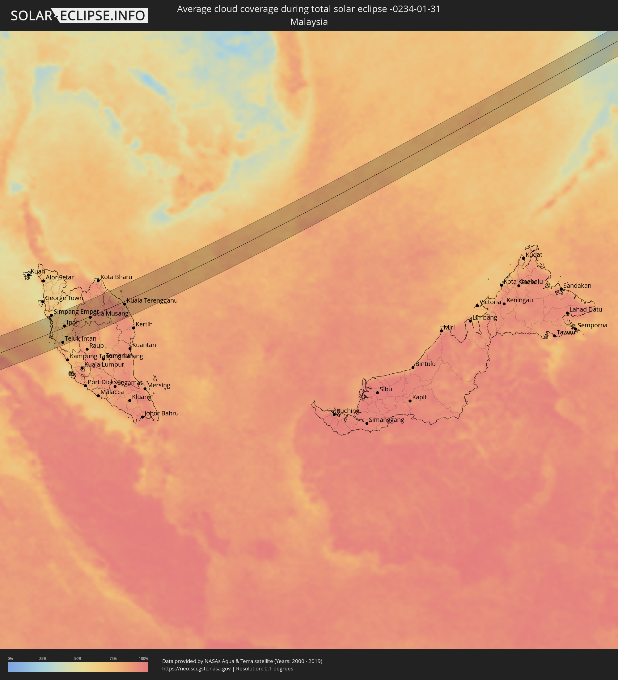 Malaysia
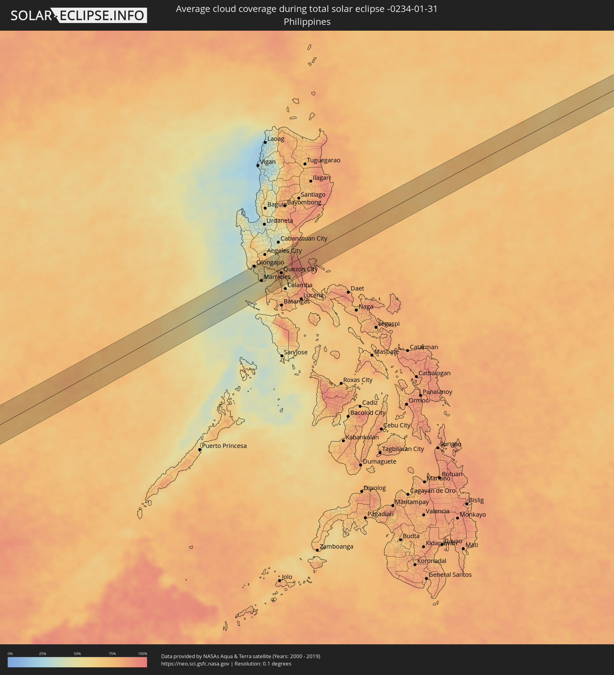 Philippines
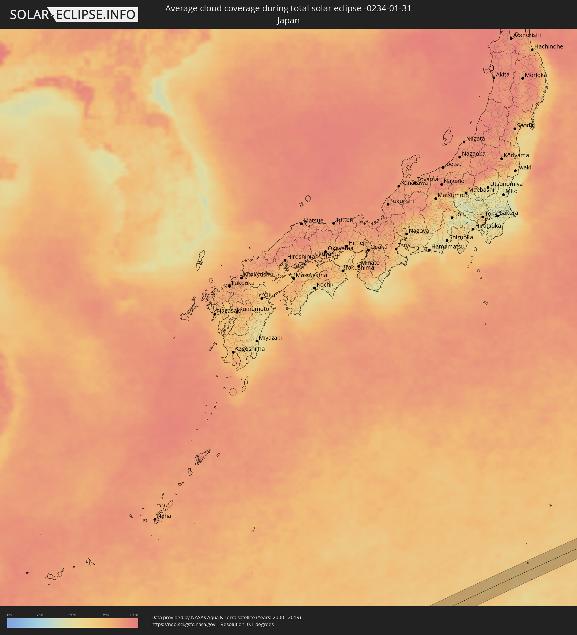 Japan
Japan
Cities inside the path of the eclipse
The following table shows all locations with a population of more than 5,000 inside the eclipse path. Cities which have more than 100,000 inhabitants are marked bold. A click at the locations opens a detailed map.
| City | Type | Eclipse duration | Local time of max. eclipse | Distance to central line | Ø Cloud coverage |
|
Addiet Canna, Amhara
|
total | - | 06:31:52 UTC+02:27 | 19 km | 9% |
|
Debre Werk’, Amhara
|
total | - | 06:31:45 UTC+02:27 | 20 km | 15% |
|
Were Īlu, Amhara
|
total | - | 06:31:58 UTC+02:27 | 17 km | 14% |
|
Abomsa, Amhara
|
total | - | 06:31:52 UTC+02:27 | 28 km | 31% |
|
Gewanē, Āfar
|
total | - | 06:32:06 UTC+02:27 | 15 km | 22% |
|
Dire Dawa, Dire Dawa
|
total | - | 06:32:14 UTC+02:27 | 2 km | 19% |
|
Harar, Harari
|
total | - | 06:32:13 UTC+02:27 | 23 km | 19% |
|
Jijiga, Somali
|
total | - | 06:32:27 UTC+02:27 | 5 km | 8% |
|
Viligili, Gaafu Alifu Atholhu
|
total | - | 09:32:22 UTC+04:54 | 43 km | 68% |
|
Sinabang, Aceh
|
total | - | 12:53:00 UTC+07:07 | 36 km | 80% |
|
Pangkalan Brandan, North Sumatra
|
total | - | 13:00:24 UTC+07:07 | 58 km | 86% |
|
Tanjungtiram, North Sumatra
|
total | - | 13:00:43 UTC+07:07 | 59 km | 78% |
|
Stabat, North Sumatra
|
total | - | 13:00:40 UTC+07:07 | 21 km | 94% |
|
Binjai, North Sumatra
|
total | - | 13:00:39 UTC+07:07 | 6 km | 93% |
|
Kabanjahe, North Sumatra
|
total | - | 13:00:12 UTC+07:07 | 46 km | 83% |
|
Berastagi, North Sumatra
|
total | - | 13:00:21 UTC+07:07 | 37 km | 84% |
|
Sunggal, North Sumatra
|
total | - | 13:01:02 UTC+07:07 | 1 km | 95% |
|
Medan, North Sumatra
|
total | - | 13:01:12 UTC+07:07 | 3 km | 94% |
|
Labuhan Deli, North Sumatra
|
total | - | 13:01:22 UTC+07:07 | 12 km | 94% |
|
Belawan, North Sumatra
|
total | - | 13:01:26 UTC+07:07 | 17 km | 87% |
|
Deli Tua, North Sumatra
|
total | - | 13:01:11 UTC+07:07 | 11 km | 92% |
|
Percut, North Sumatra
|
total | - | 13:01:51 UTC+07:07 | 6 km | 94% |
|
Perbaungan, North Sumatra
|
total | - | 13:02:05 UTC+07:07 | 15 km | 93% |
|
Tebingtinggi, North Sumatra
|
total | - | 13:02:30 UTC+07:07 | 48 km | 91% |
|
Pantai Remis, Perak
|
total | - | 12:56:15 UTC+06:55 | 9 km | 65% |
|
Lumut, Perak
|
total | - | 12:56:03 UTC+06:55 | 14 km | 69% |
|
Simpang Empat, Perak
|
total | - | 12:56:44 UTC+06:55 | 60 km | 68% |
|
Taiping, Perak
|
total | - | 12:56:57 UTC+06:55 | 45 km | 74% |
|
Kuala Kangsar, Perak
|
total | - | 12:57:28 UTC+06:55 | 28 km | 62% |
|
Teluk Intan, Perak
|
total | - | 12:57:02 UTC+06:55 | 52 km | 74% |
|
Batu Gajah, Perak
|
total | - | 12:57:31 UTC+06:55 | 7 km | 64% |
|
Ipoh, Perak
|
total | - | 12:57:45 UTC+06:55 | 3 km | 75% |
|
Kampar, Perak
|
total | - | 12:57:41 UTC+06:55 | 29 km | 72% |
|
Tapah Road, Perak
|
total | - | 12:57:42 UTC+06:55 | 45 km | 69% |
|
Bidur, Perak
|
total | - | 12:57:54 UTC+06:55 | 54 km | 73% |
|
Tanah Rata, Pahang
|
total | - | 12:58:31 UTC+06:55 | 22 km | 84% |
|
Gua Musang, Kelantan
|
total | - | 13:00:39 UTC+06:55 | 5 km | 81% |
|
Jertih, Terengganu
|
total | - | 13:02:59 UTC+06:55 | 59 km | 86% |
|
Kuala Terengganu, Terengganu
|
total | - | 13:04:30 UTC+06:55 | 12 km | 87% |
|
Marang, Terengganu
|
total | - | 13:04:35 UTC+06:55 | 27 km | 82% |
|
Morong, Central Luzon
|
total | - | 14:54:43 UTC+08:00 | 32 km | 50% |
|
Olongapo, Central Luzon
|
total | - | 14:54:49 UTC+08:00 | 46 km | 48% |
|
Dinalupihan, Central Luzon
|
total | - | 14:55:07 UTC+08:00 | 42 km | 58% |
|
Mariveles, Central Luzon
|
total | - | 14:54:59 UTC+08:00 | 3 km | 46% |
|
Balanga, Central Luzon
|
total | - | 14:55:10 UTC+08:00 | 18 km | 56% |
|
Pulungmasle, Central Luzon
|
total | - | 14:55:20 UTC+08:00 | 48 km | 63% |
|
San Roque Dau First, Central Luzon
|
total | - | 14:55:21 UTC+08:00 | 45 km | 63% |
|
Nasugbu, Calabarzon
|
total | - | 14:55:03 UTC+08:00 | 47 km | 71% |
|
Guagua, Central Luzon
|
total | - | 14:55:27 UTC+08:00 | 41 km | 63% |
|
Minalin, Central Luzon
|
total | - | 14:55:31 UTC+08:00 | 39 km | 61% |
|
Lourdes, Central Luzon
|
total | - | 14:55:32 UTC+08:00 | 38 km | 61% |
|
San Fernando, Central Luzon
|
total | - | 14:55:34 UTC+08:00 | 44 km | 61% |
|
Naic, Calabarzon
|
total | - | 14:55:23 UTC+08:00 | 29 km | 71% |
|
San Jose, Central Luzon
|
total | - | 14:55:43 UTC+08:00 | 40 km | 58% |
|
General Emilio Aguinaldo, Calabarzon
|
total | - | 14:55:22 UTC+08:00 | 44 km | 72% |
|
Malolos, Central Luzon
|
total | - | 14:55:41 UTC+08:00 | 20 km | 72% |
|
Palangue, Calabarzon
|
total | - | 14:55:26 UTC+08:00 | 35 km | 71% |
|
Halayhay, Calabarzon
|
total | - | 14:55:29 UTC+08:00 | 26 km | 66% |
|
Balucuc, Central Luzon
|
total | - | 14:55:44 UTC+08:00 | 30 km | 58% |
|
Candaba, Central Luzon
|
total | - | 14:55:49 UTC+08:00 | 43 km | 51% |
|
Paradahan, Calabarzon
|
total | - | 14:55:32 UTC+08:00 | 34 km | 76% |
|
Lambakin, Central Luzon
|
total | - | 14:55:44 UTC+08:00 | 8 km | 75% |
|
Indang, Calabarzon
|
total | - | 14:55:30 UTC+08:00 | 47 km | 75% |
|
Bahay Pare, Central Luzon
|
total | - | 14:55:52 UTC+08:00 | 34 km | 67% |
|
Baliuag, Central Luzon
|
total | - | 14:55:52 UTC+08:00 | 26 km | 67% |
|
Culianin, Central Luzon
|
total | - | 14:55:51 UTC+08:00 | 22 km | 69% |
|
Cavite City, Calabarzon
|
total | - | 14:55:40 UTC+08:00 | 20 km | 73% |
|
Dasmariñas, Calabarzon
|
total | - | 14:55:40 UTC+08:00 | 37 km | 76% |
|
Camias, Central Luzon
|
total | - | 14:56:04 UTC+08:00 | 43 km | 64% |
|
San Miguel, Central Luzon
|
total | - | 14:56:04 UTC+08:00 | 40 km | 71% |
|
Del Monte, Calabarzon
|
total | - | 14:55:56 UTC+08:00 | 11 km | 79% |
|
San Jose del Monte, Central Luzon
|
total | - | 14:56:03 UTC+08:00 | 5 km | 77% |
|
Quezon City, Metro Manila
|
total | - | 14:55:59 UTC+08:00 | 12 km | 76% |
|
Sibul, Central Luzon
|
total | - | 14:56:13 UTC+08:00 | 38 km | 67% |
|
Santa Rosa, Calabarzon
|
total | - | 14:55:56 UTC+08:00 | 48 km | 71% |
|
Binangonan, Calabarzon
|
total | - | 14:56:08 UTC+08:00 | 37 km | 58% |
|
Rodriguez, Calabarzon
|
total | - | 14:56:16 UTC+08:00 | 9 km | 75% |
|
Quisao, Calabarzon
|
total | - | 14:56:21 UTC+08:00 | 47 km | 58% |
|
Sampaloc, Calabarzon
|
total | - | 14:56:26 UTC+08:00 | 38 km | 70% |
|
Real, Calabarzon
|
total | - | 14:56:52 UTC+08:00 | 39 km | 88% |