Total solar eclipse of 01/21/-0252
| Day of week: | Friday |
| Maximum duration of eclipse: | 02m57s |
| Maximum width of eclipse path: | 104 km |
| Saros cycle: | 56 |
| Coverage: | 100% |
| Magnitude: | 1.0287 |
| Gamma: | 0.3453 |
Wo kann man die Sonnenfinsternis vom 01/21/-0252 sehen?
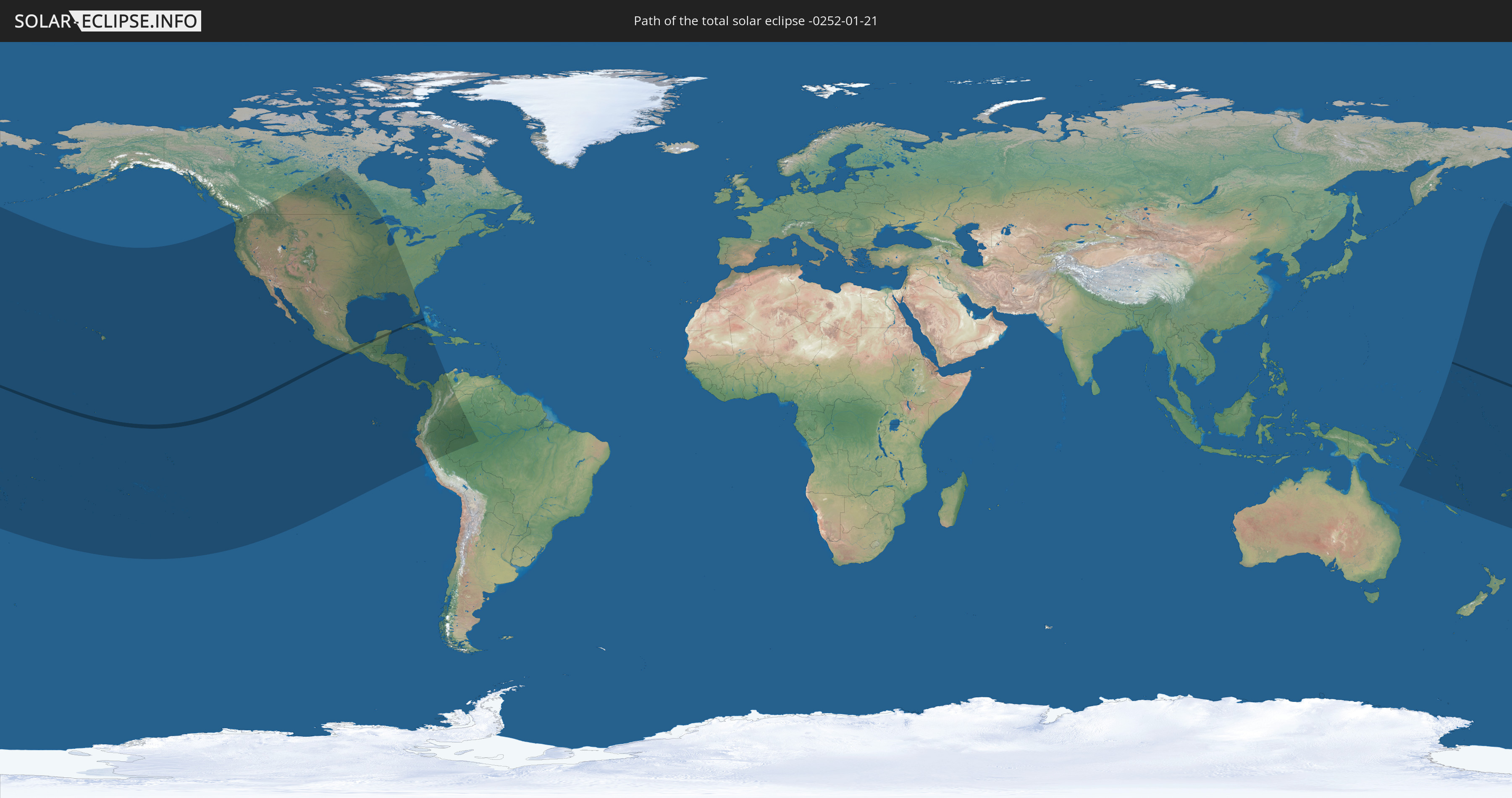
Die Sonnenfinsternis am 01/21/-0252 kann man in 39 Ländern als partielle Sonnenfinsternis beobachten.
Der Finsternispfad verläuft durch 4 Länder. Nur in diesen Ländern ist sie als total Sonnenfinsternis zu sehen.
In den folgenden Ländern ist die Sonnenfinsternis total zu sehen
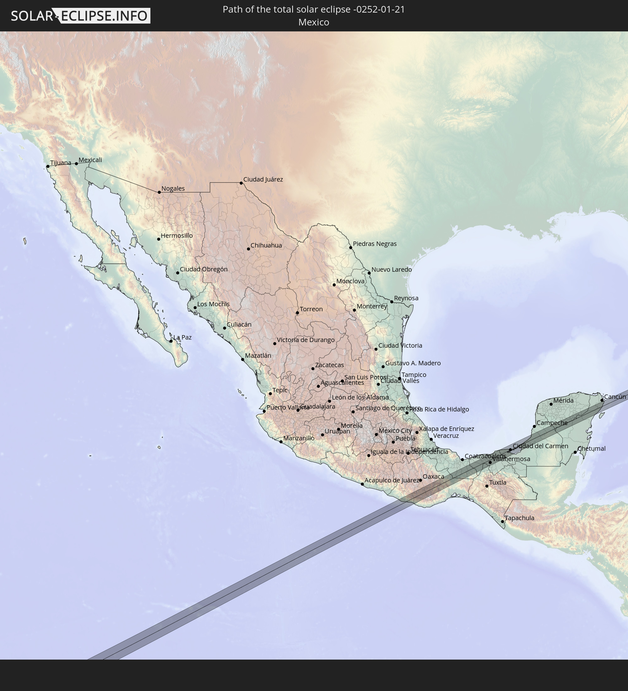 Mexico
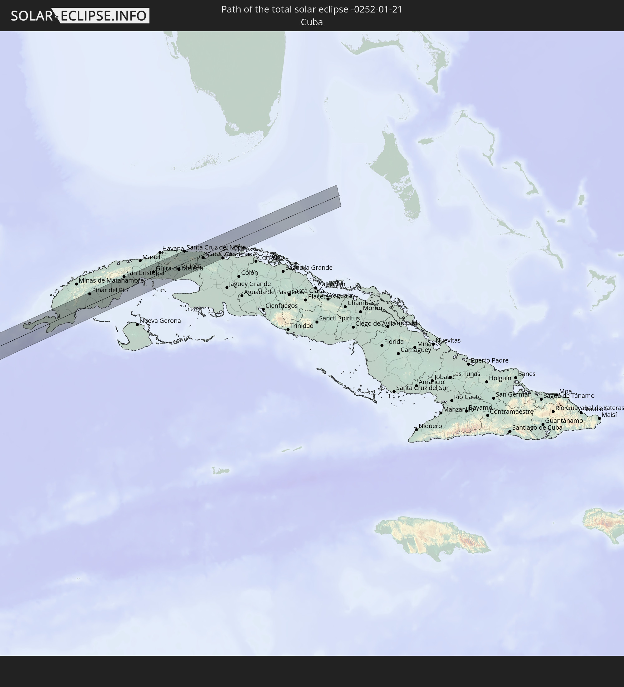 Cuba
Cuba
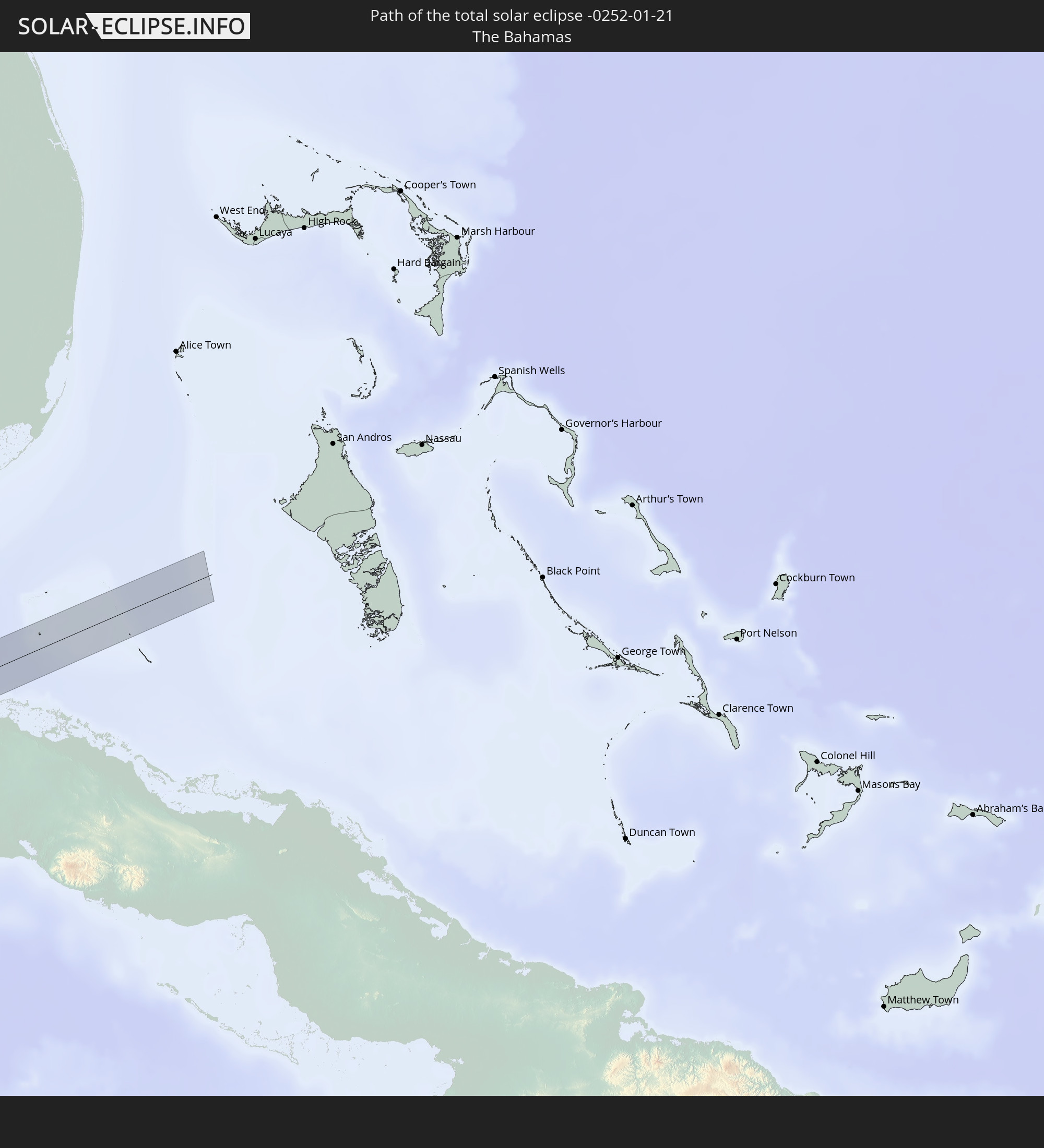 The Bahamas
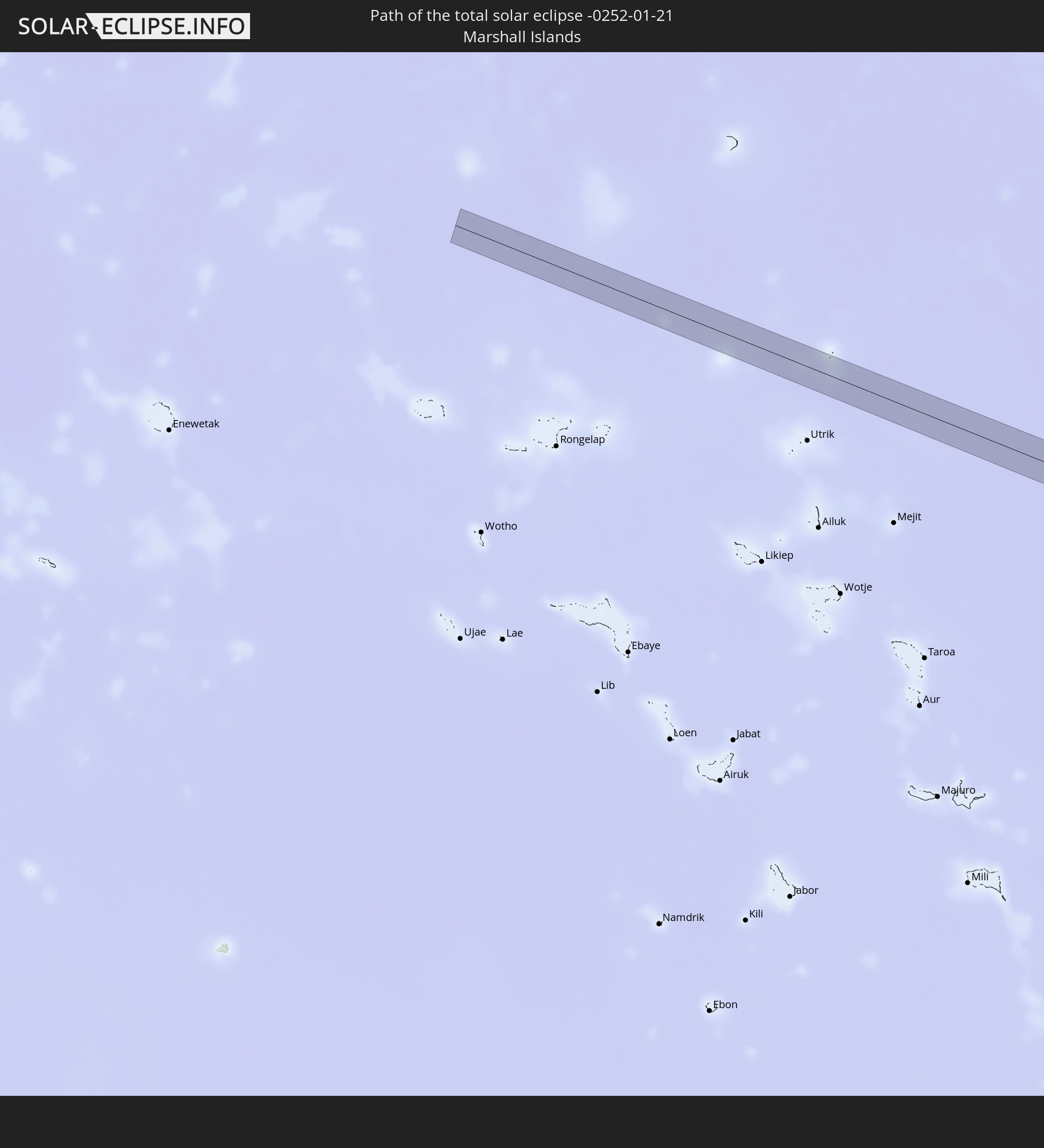 Marshall Islands
In den folgenden Ländern ist die Sonnenfinsternis partiell zu sehen
 Fiji
Fiji
 United States
 United States Minor Outlying Islands
 Wallis and Futuna
 Tonga
Tonga
 Kiribati
 Samoa
Samoa
 Tokelau
 American Samoa
 Niue
Niue
 Cook Islands
 French Polynesia
 Canada
 Pitcairn Islands
 Mexico
 Greenland
 Guatemala
 Ecuador
 El Salvador
 Honduras
 Belize
 Nicaragua
 Costa Rica
 Cuba
Cuba
 Panama
 Colombia
 Cayman Islands
 Peru
Peru
 The Bahamas
 Jamaica
 Brazil
 Venezuela
 Federated States of Micronesia
 Solomon Islands
 New Caledonia
 Marshall Islands
 Vanuatu
 Nauru
Nauru
 Tuvalu
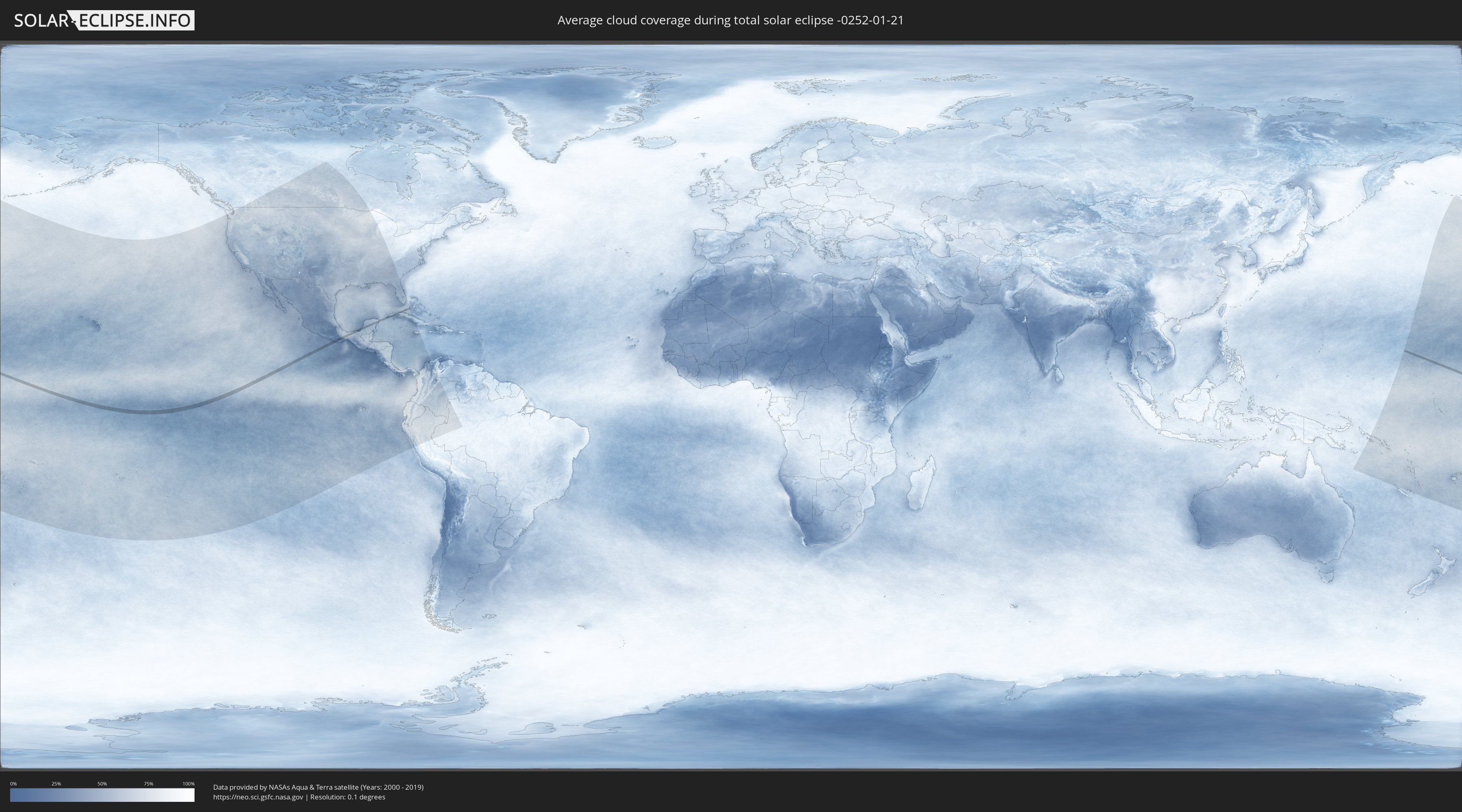
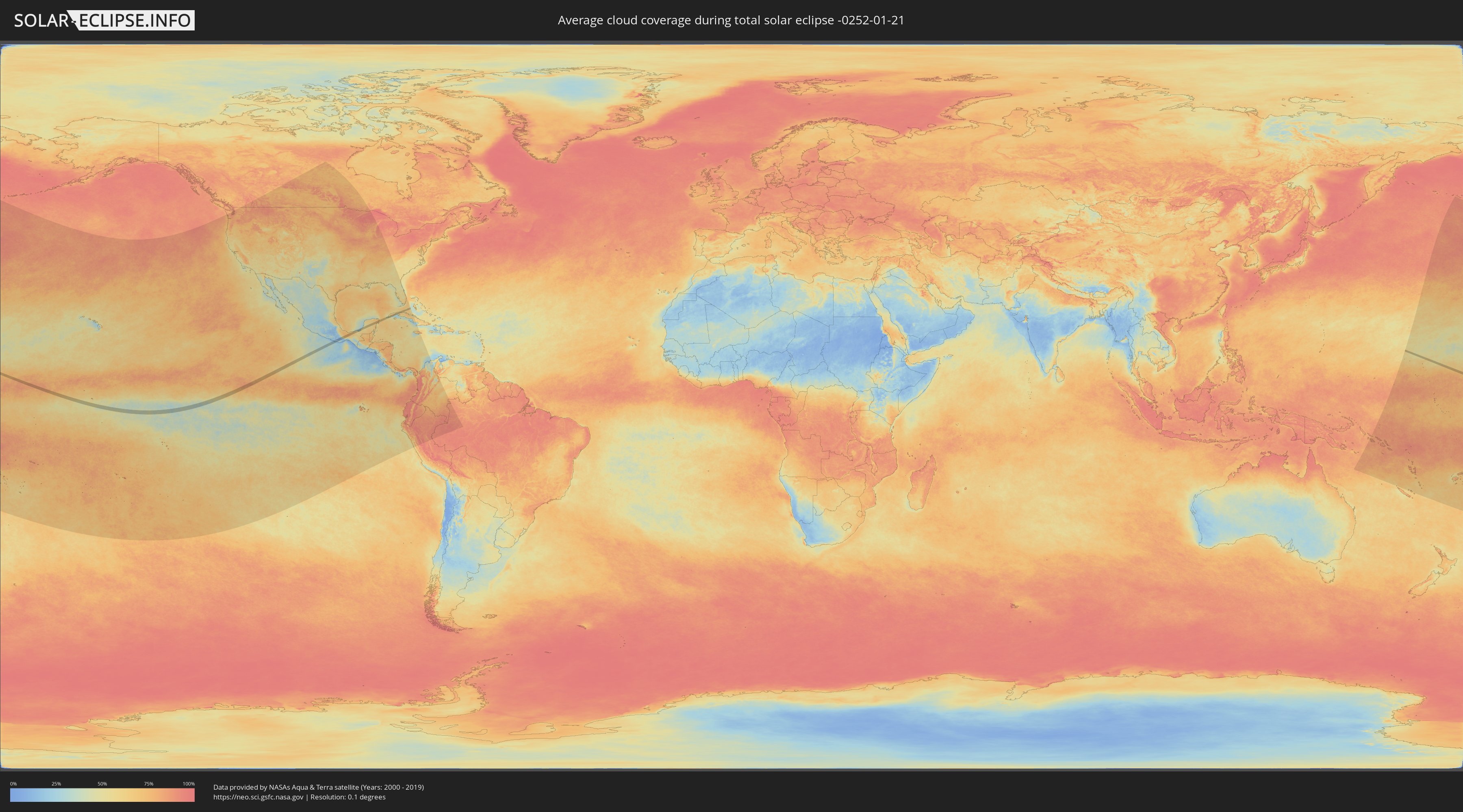
How will be the weather during the total solar eclipse on 01/21/-0252?
Where is the best place to see the total solar eclipse of 01/21/-0252?
The following maps show the average cloud coverage for the day of the total solar eclipse.
With the help of these maps, it is possible to find the place along the eclipse path, which has the best
chance of a cloudless sky.
Nevertheless, you should consider local circumstances and inform about the weather of your chosen
observation site.
The data is provided by NASAs satellites
AQUA and TERRA.
The cloud maps are averaged over a period of 19 years (2000 - 2019).
Detailed country maps
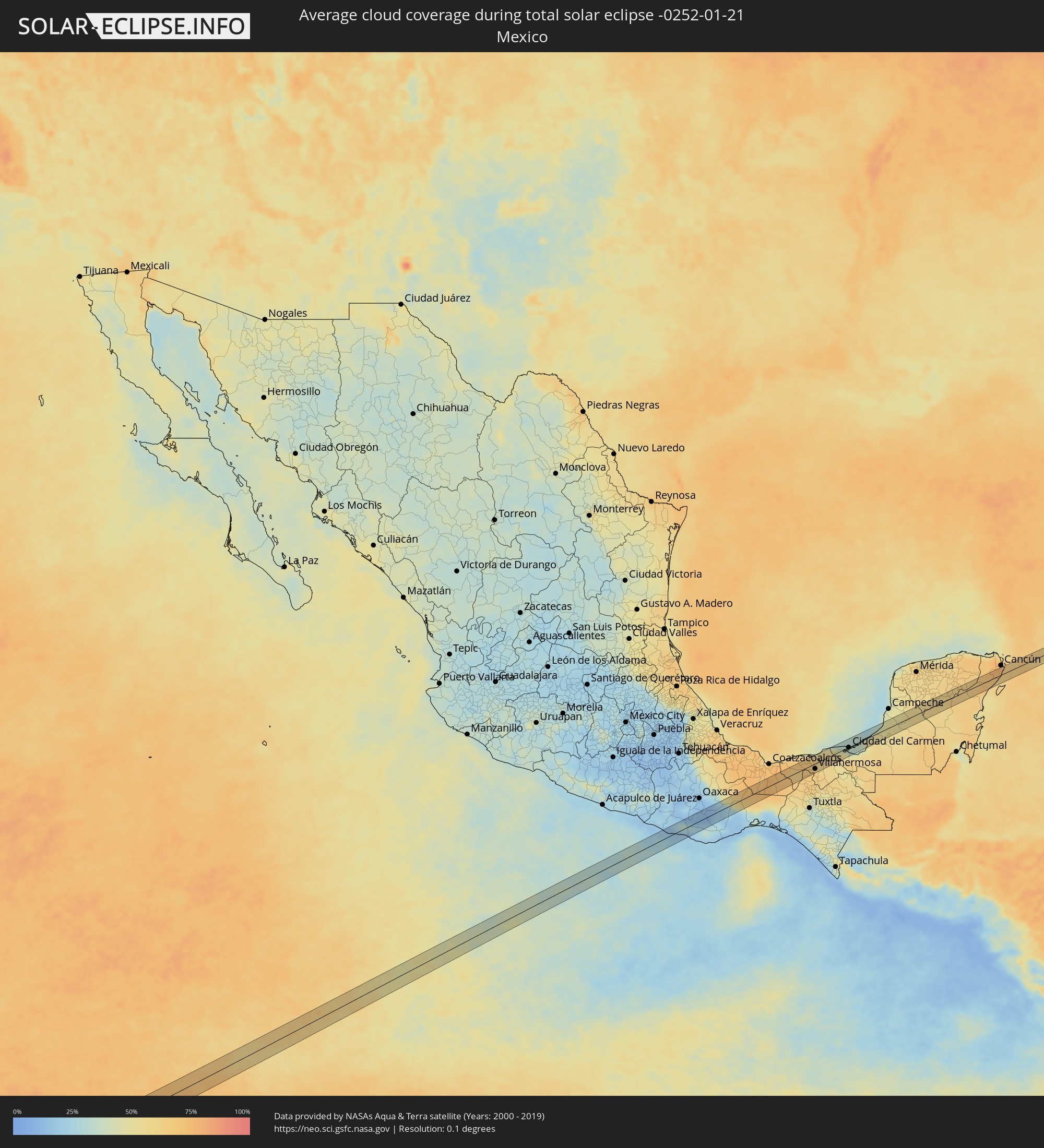 Mexico
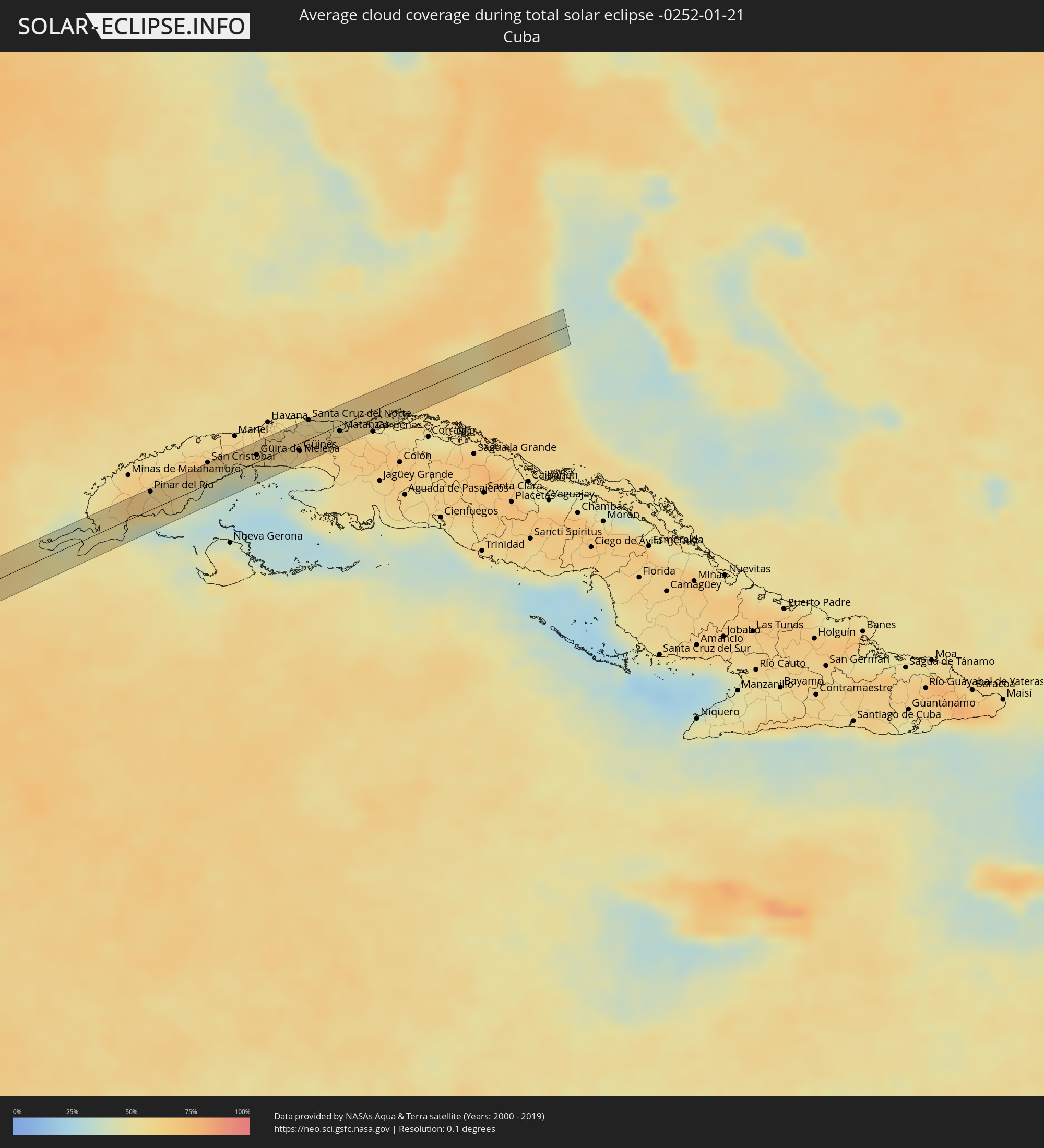 Cuba
Cuba
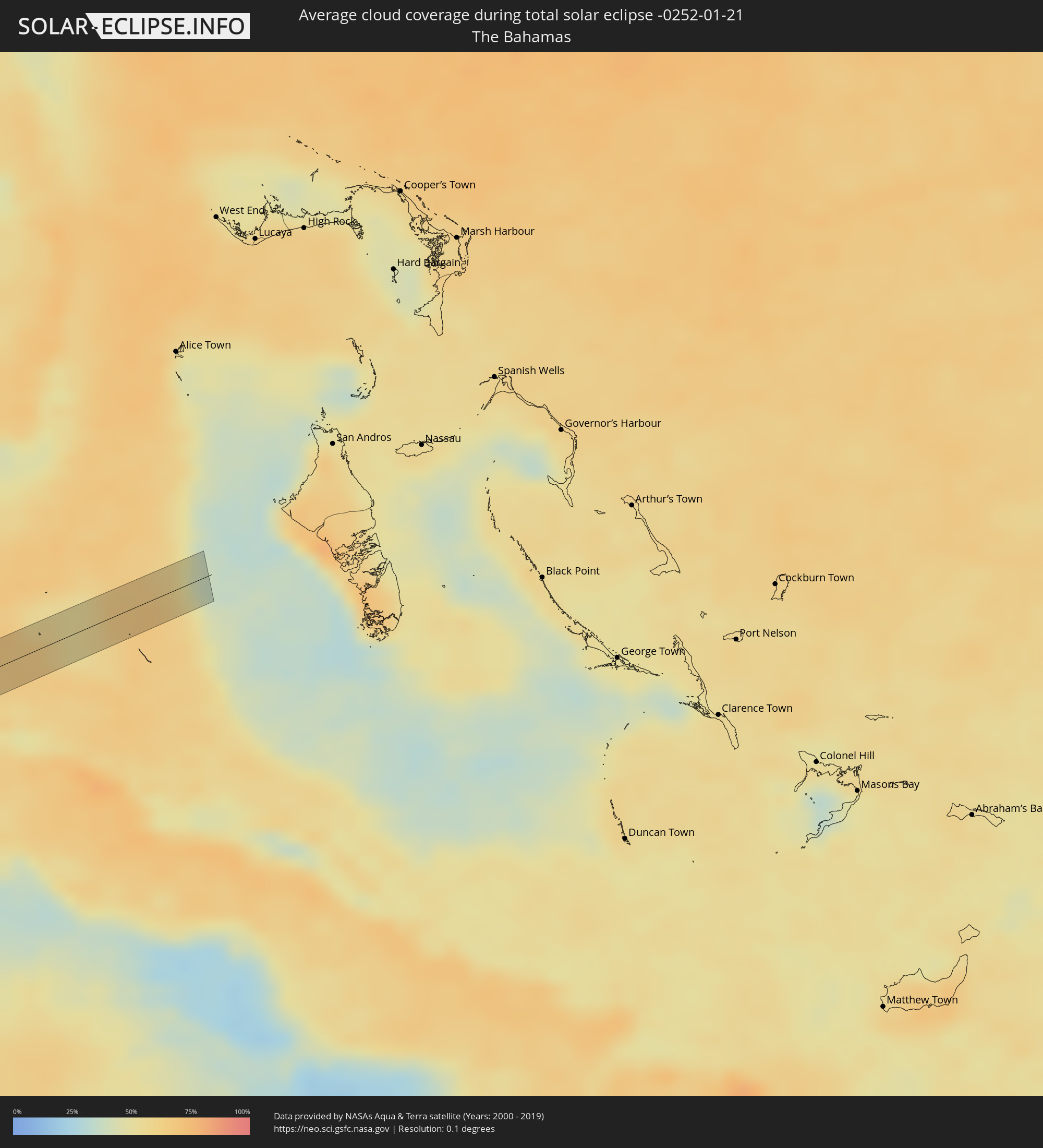 The Bahamas
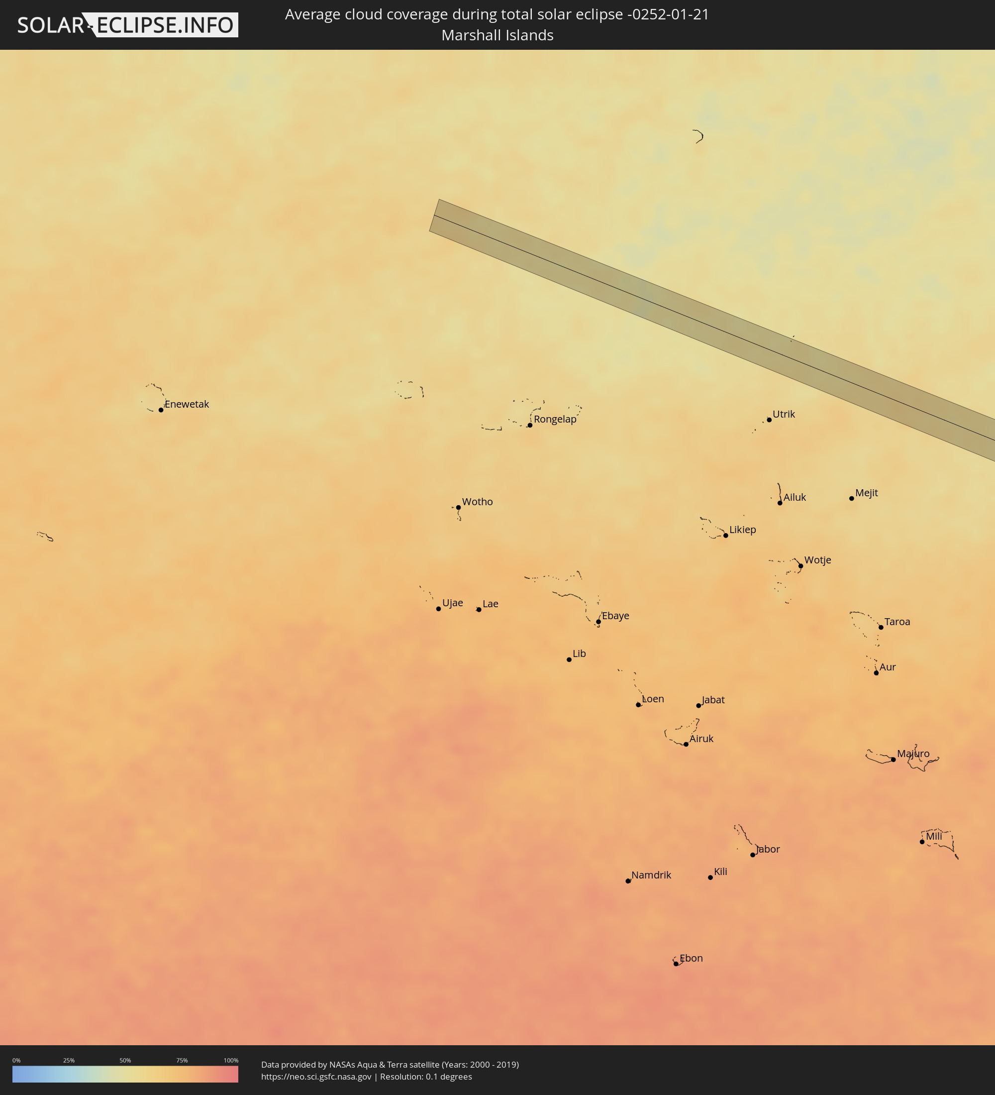 Marshall Islands
Cities inside the path of the eclipse
The following table shows all locations with a population of more than 5,000 inside the eclipse path. Cities which have more than 100,000 inhabitants are marked bold. A click at the locations opens a detailed map.
| City | Type | Eclipse duration | Local time of max. eclipse | Distance to central line | Ø Cloud coverage |
|
San Miguel Panixtlahuaca, Oaxaca
|
total | - | 16:07:52 UTC-06:36 | 21 km | 29% |
|
Santa Catarina Juquila, Oaxaca
|
total | - | 16:07:57 UTC-06:36 | 16 km | 35% |
|
Ejutla de Crespo, Oaxaca
|
total | - | 16:08:26 UTC-06:36 | 21 km | 13% |
|
Miahuatlán de Porfirio Díaz, Oaxaca
|
total | - | 16:08:32 UTC-06:36 | 8 km | 18% |
|
San Dionisio Ocotepec, Oaxaca
|
total | - | 16:08:42 UTC-06:36 | 29 km | 12% |
|
Colonia Rincón Viejo, Oaxaca
|
total | - | 16:09:44 UTC-06:36 | 27 km | 61% |
|
Matías Romero, Oaxaca
|
total | - | 16:09:44 UTC-06:36 | 28 km | 61% |
|
Chontalpa, Tabasco
|
total | - | 16:10:49 UTC-06:36 | 23 km | 64% |
|
Huimanguillo, Tabasco
|
total | - | 16:10:52 UTC-06:36 | 10 km | 62% |
|
Cárdenas, Tabasco
|
total | - | 16:10:52 UTC-06:36 | 6 km | 66% |
|
Santa Rosalía, Tabasco
|
total | - | 16:10:52 UTC-06:36 | 13 km | 67% |
|
Miguel Hidalgo, Tabasco
|
total | - | 16:10:53 UTC-06:36 | 28 km | 67% |
|
Comalcalco, Tabasco
|
total | - | 16:10:57 UTC-06:36 | 25 km | 68% |
|
Cunduacán, Tabasco
|
total | - | 16:10:59 UTC-06:36 | 3 km | 66% |
|
Luis Gil Pérez, Tabasco
|
total | - | 16:11:04 UTC-06:36 | 21 km | 66% |
|
Jalpa de Méndez, Tabasco
|
total | - | 16:11:03 UTC-06:36 | 8 km | 67% |
|
Anacleto Canabal 2da. Sección, Tabasco
|
total | - | 16:11:06 UTC-06:36 | 13 km | 64% |
|
Nacajuca, Tabasco
|
total | - | 16:11:05 UTC-06:36 | 6 km | 65% |
|
La Selva, Tabasco
|
total | - | 16:11:08 UTC-06:36 | 12 km | 64% |
|
Bosque de Saloya, Tabasco
|
total | - | 16:11:08 UTC-06:36 | 12 km | 64% |
|
La Lima, Tabasco
|
total | - | 16:11:09 UTC-06:36 | 24 km | 62% |
|
Pomoca, Tabasco
|
total | - | 16:11:09 UTC-06:36 | 10 km | 60% |
|
Villahermosa, Tabasco
|
total | - | 16:11:09 UTC-06:36 | 17 km | 60% |
|
Macultepec, Tabasco
|
total | - | 16:11:11 UTC-06:36 | 4 km | 62% |
|
Tamulte de las Sabanas, Tabasco
|
total | - | 16:11:14 UTC-06:36 | 6 km | 59% |
|
Frontera, Tabasco
|
total | - | 16:11:17 UTC-06:36 | 26 km | 60% |
|
Ciudad del Carmen, Campeche
|
total | - | 16:11:47 UTC-06:36 | 2 km | 34% |
|
Sabancuy, Campeche
|
total | - | 16:12:07 UTC-06:36 | 1 km | 47% |
|
Champotón, Campeche
|
total | - | 16:12:20 UTC-06:36 | 18 km | 48% |
|
Hopelchén, Campeche
|
total | - | 16:12:44 UTC-06:36 | 18 km | 56% |
|
Tzucacab, Yucatán
|
total | - | 16:13:04 UTC-06:36 | 15 km | 58% |
|
Peto, Yucatán
|
total | - | 16:13:08 UTC-06:36 | 15 km | 59% |
|
Chemax, Yucatán
|
total | - | 16:13:29 UTC-06:36 | 24 km | 64% |
|
Playa del Carmen, Quintana Roo
|
total | - | 17:03:22 UTC-05:47 | 16 km | 59% |
|
Alfredo V. Bonfil, Quintana Roo
|
total | - | 17:03:22 UTC-05:47 | 20 km | 68% |
|
Guane, Pinar del Río
|
total | - | 17:21:31 UTC-05:29 | 14 km | 52% |
|
San Luis, Pinar del Río
|
total | - | 17:21:36 UTC-05:29 | 8 km | 58% |
|
Pinar del Río, Pinar del Río
|
total | - | 17:21:35 UTC-05:29 | 19 km | 63% |
|
Consolación del Sur, Pinar del Río
|
total | - | 17:21:36 UTC-05:29 | 20 km | 62% |
|
Los Palacios, Pinar del Río
|
total | - | 17:21:39 UTC-05:29 | 17 km | 61% |
|
Candelaria, Artemisa
|
total | - | 17:21:41 UTC-05:29 | 21 km | 58% |
|
Artemisa, Artemisa
|
total | - | 17:21:43 UTC-05:29 | 20 km | 58% |
|
Alquízar, Artemisa
|
total | - | 17:21:46 UTC-05:29 | 12 km | 55% |
|
Güira de Melena, Artemisa
|
total | - | 17:21:47 UTC-05:29 | 8 km | 53% |
|
San Antonio de los Baños, Artemisa
|
total | - | 17:21:46 UTC-05:29 | 17 km | 63% |
|
La Salud, Mayabeque
|
total | - | 17:21:47 UTC-05:29 | 12 km | 62% |
|
Bejucal, Mayabeque
|
total | - | 17:21:46 UTC-05:29 | 16 km | 62% |
|
Santiago de las Vegas, La Habana
|
total | - | 17:21:46 UTC-05:29 | 20 km | 63% |
|
Quivicán, Mayabeque
|
total | - | 17:21:49 UTC-05:29 | 4 km | 54% |
|
Arroyo Naranjo, La Habana
|
total | - | 17:21:46 UTC-05:29 | 21 km | 62% |
|
Batabanó, Mayabeque
|
total | - | 17:21:51 UTC-05:29 | 9 km | 39% |
|
Jamaica, Mayabeque
|
total | - | 17:21:49 UTC-05:29 | 12 km | 62% |
|
San José de las Lajas, Mayabeque
|
total | - | 17:21:49 UTC-05:29 | 10 km | 62% |
|
Güines, Mayabeque
|
total | - | 17:21:53 UTC-05:29 | 8 km | 53% |
|
Jaruco, Mayabeque
|
total | - | 17:21:50 UTC-05:29 | 12 km | 63% |
|
Santa Cruz del Norte, Mayabeque
|
total | - | 17:21:49 UTC-05:29 | 20 km | 57% |
|
San Nicolás de Bari, Mayabeque
|
total | - | 17:21:55 UTC-05:29 | 18 km | 54% |
|
Madruga, Mayabeque
|
total | - | 17:21:54 UTC-05:29 | 8 km | 61% |
|
Matanzas, Matanzas
|
total | - | 17:21:55 UTC-05:29 | 6 km | 63% |
|
Varadero, Matanzas
|
total | - | 17:21:57 UTC-05:29 | 8 km | 57% |