Total solar eclipse of 04/28/-0592
| Day of week: | Tuesday |
| Maximum duration of eclipse: | 03m05s |
| Maximum width of eclipse path: | 109 km |
| Saros cycle: | 48 |
| Coverage: | 100% |
| Magnitude: | 1.0317 |
| Gamma: | 0.1609 |
Wo kann man die Sonnenfinsternis vom 04/28/-0592 sehen?
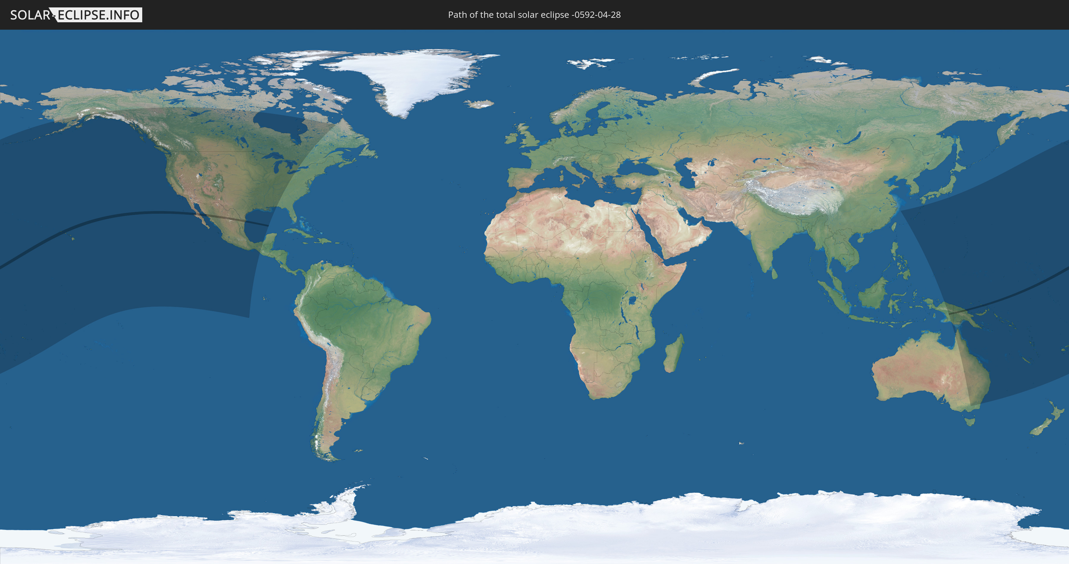
Die Sonnenfinsternis am 04/28/-0592 kann man in 29 Ländern als partielle Sonnenfinsternis beobachten.
Der Finsternispfad verläuft durch 5 Länder. Nur in diesen Ländern ist sie als total Sonnenfinsternis zu sehen.
In den folgenden Ländern ist die Sonnenfinsternis total zu sehen
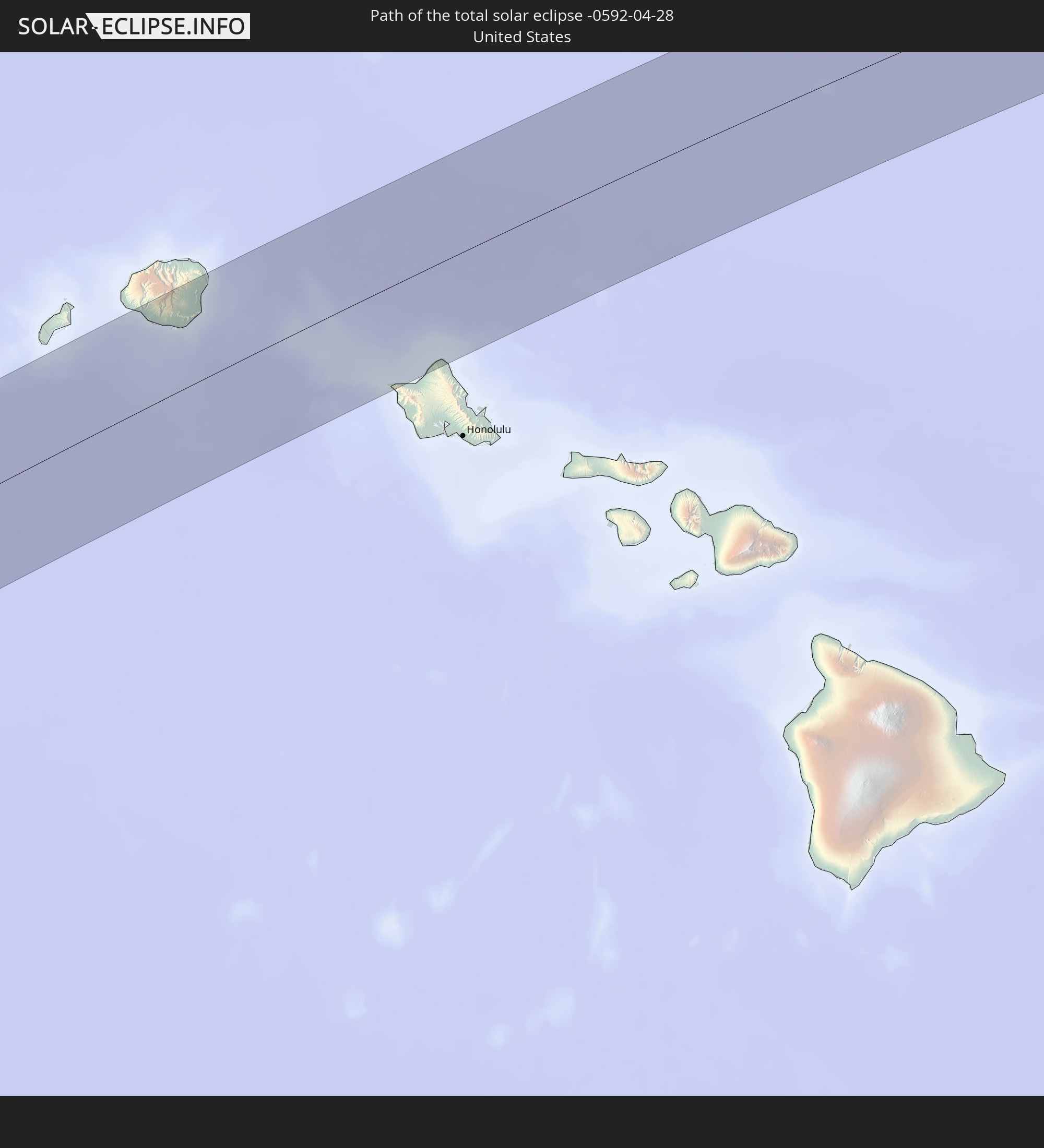 United States
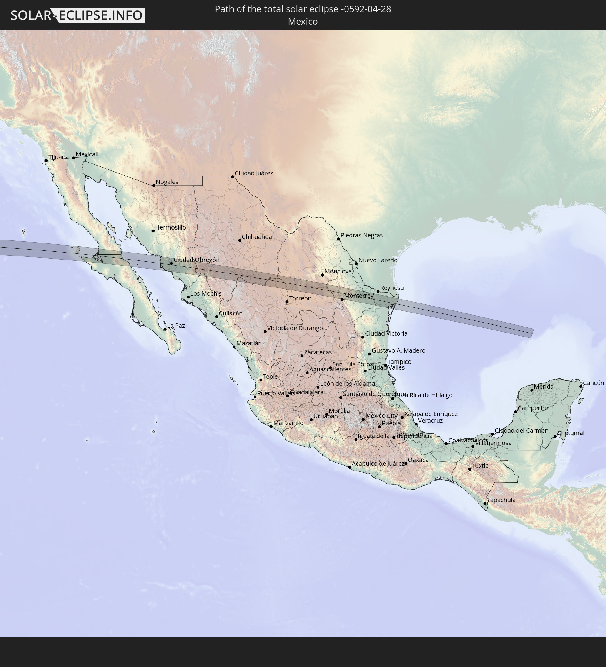 Mexico
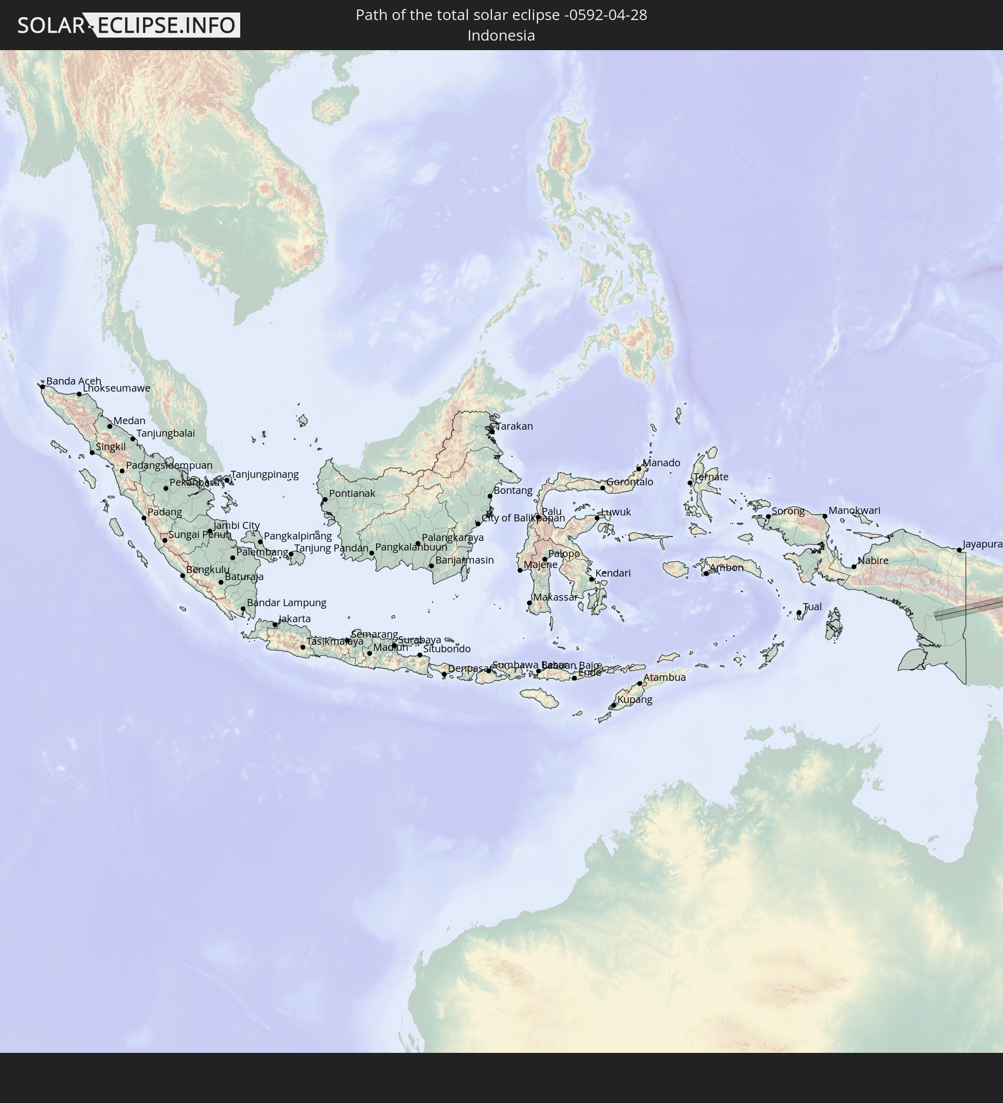 Indonesia
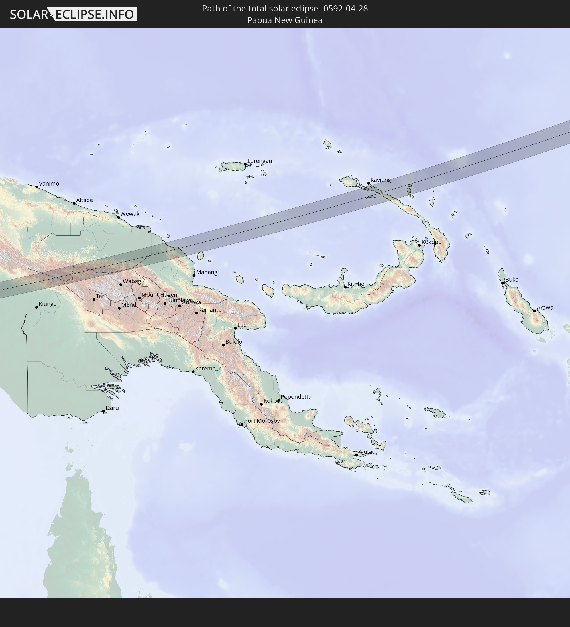 Papua New Guinea
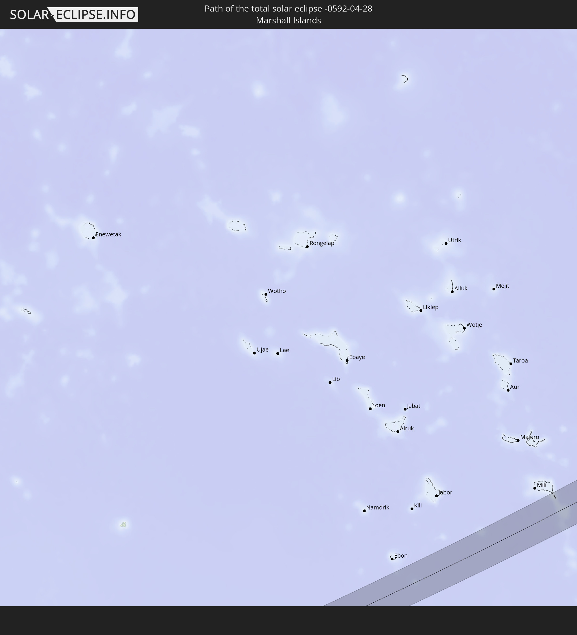 Marshall Islands
In den folgenden Ländern ist die Sonnenfinsternis partiell zu sehen
 Fiji
Fiji
 United States
 United States Minor Outlying Islands
 Wallis and Futuna
 Tonga
Tonga
 Kiribati
 Samoa
Samoa
 Tokelau
 American Samoa
 Niue
Niue
 Cook Islands
 Canada
 Mexico
 Greenland
 Indonesia
 Australia
 Japan
Japan
 Palau
Palau
 Federated States of Micronesia
 Papua New Guinea
 Guam
Guam
 Northern Mariana Islands
 Solomon Islands
 New Caledonia
 Marshall Islands
 Vanuatu
 Nauru
Nauru
 Norfolk Island
 Tuvalu
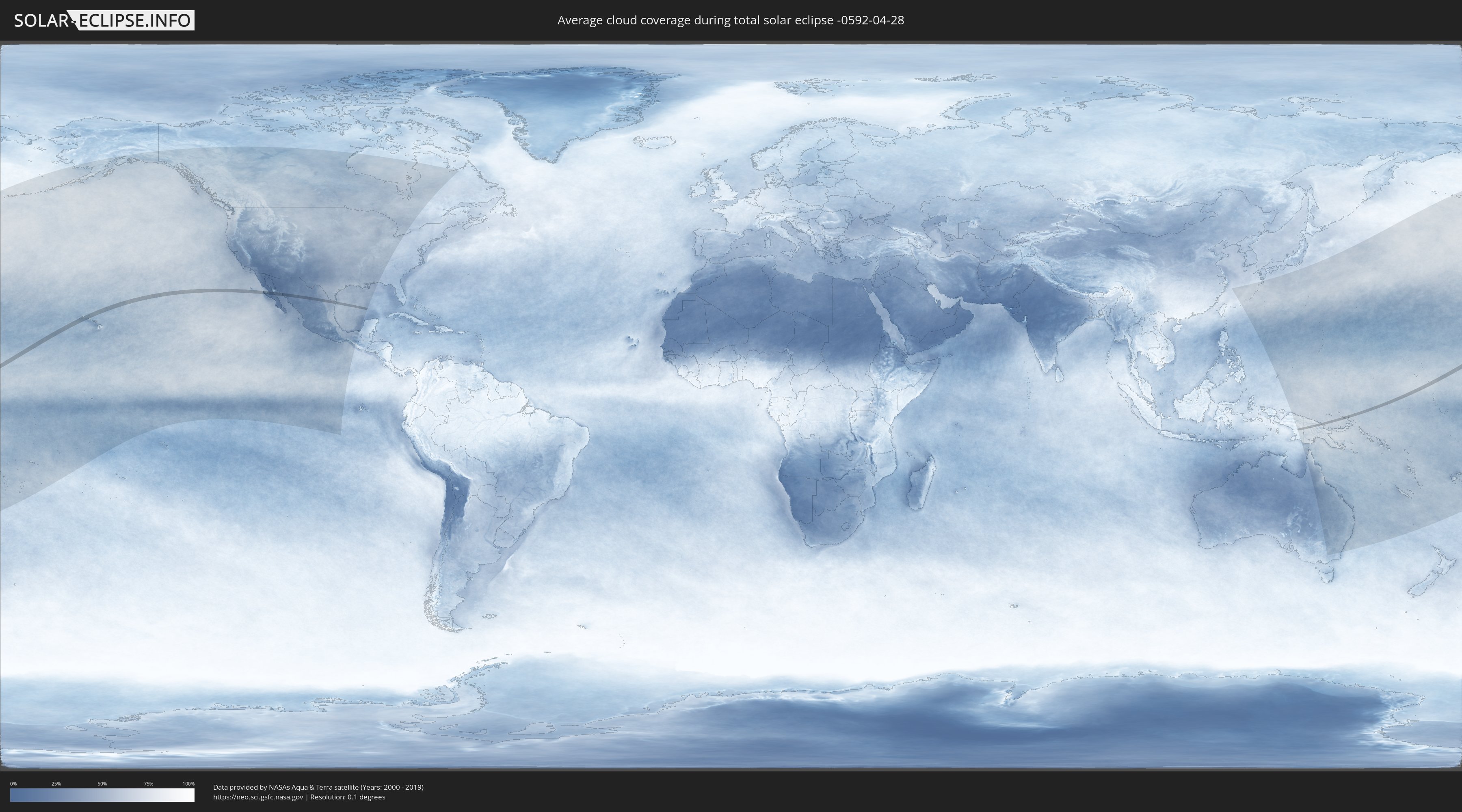
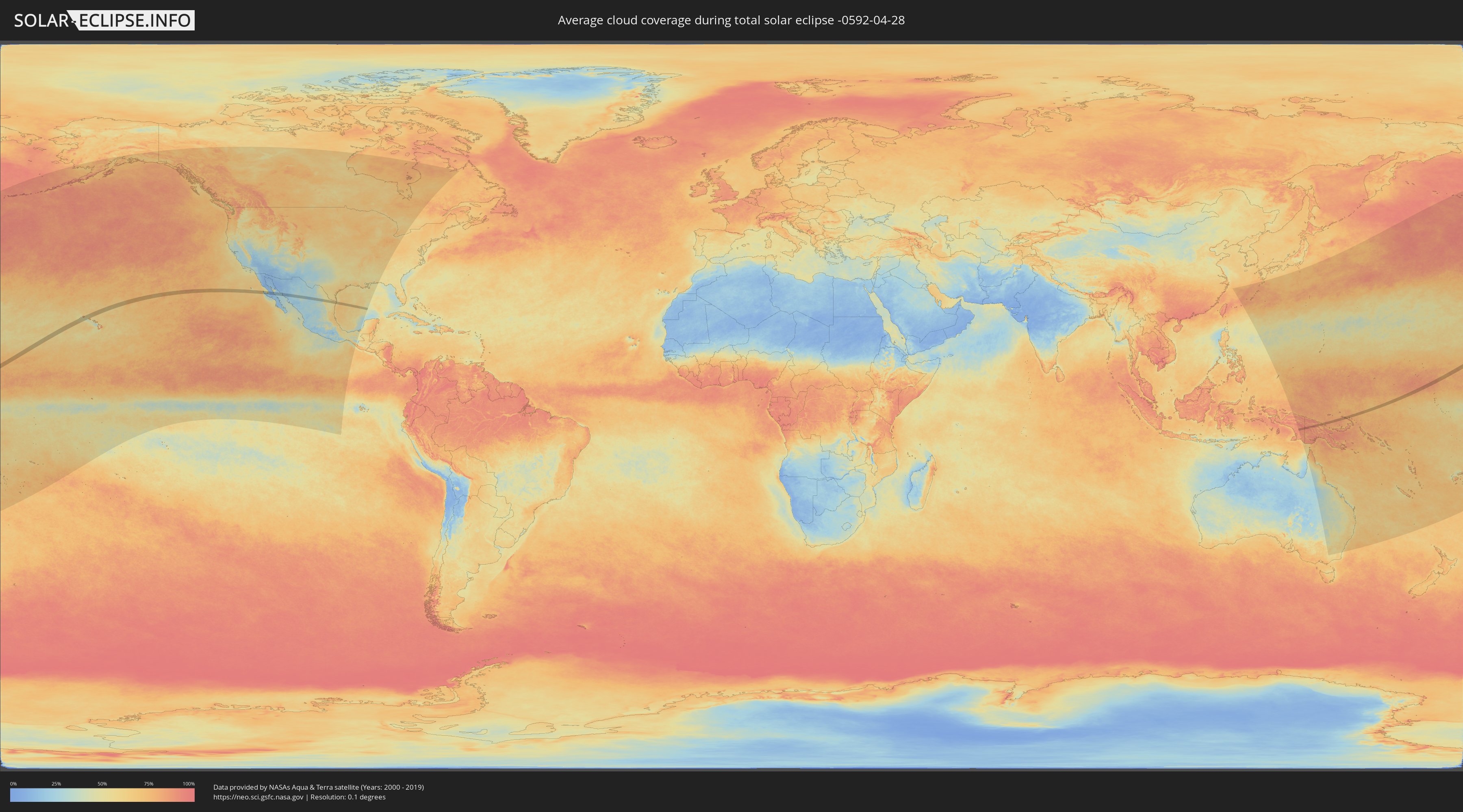
How will be the weather during the total solar eclipse on 04/28/-0592?
Where is the best place to see the total solar eclipse of 04/28/-0592?
The following maps show the average cloud coverage for the day of the total solar eclipse.
With the help of these maps, it is possible to find the place along the eclipse path, which has the best
chance of a cloudless sky.
Nevertheless, you should consider local circumstances and inform about the weather of your chosen
observation site.
The data is provided by NASAs satellites
AQUA and TERRA.
The cloud maps are averaged over a period of 19 years (2000 - 2019).
Detailed country maps
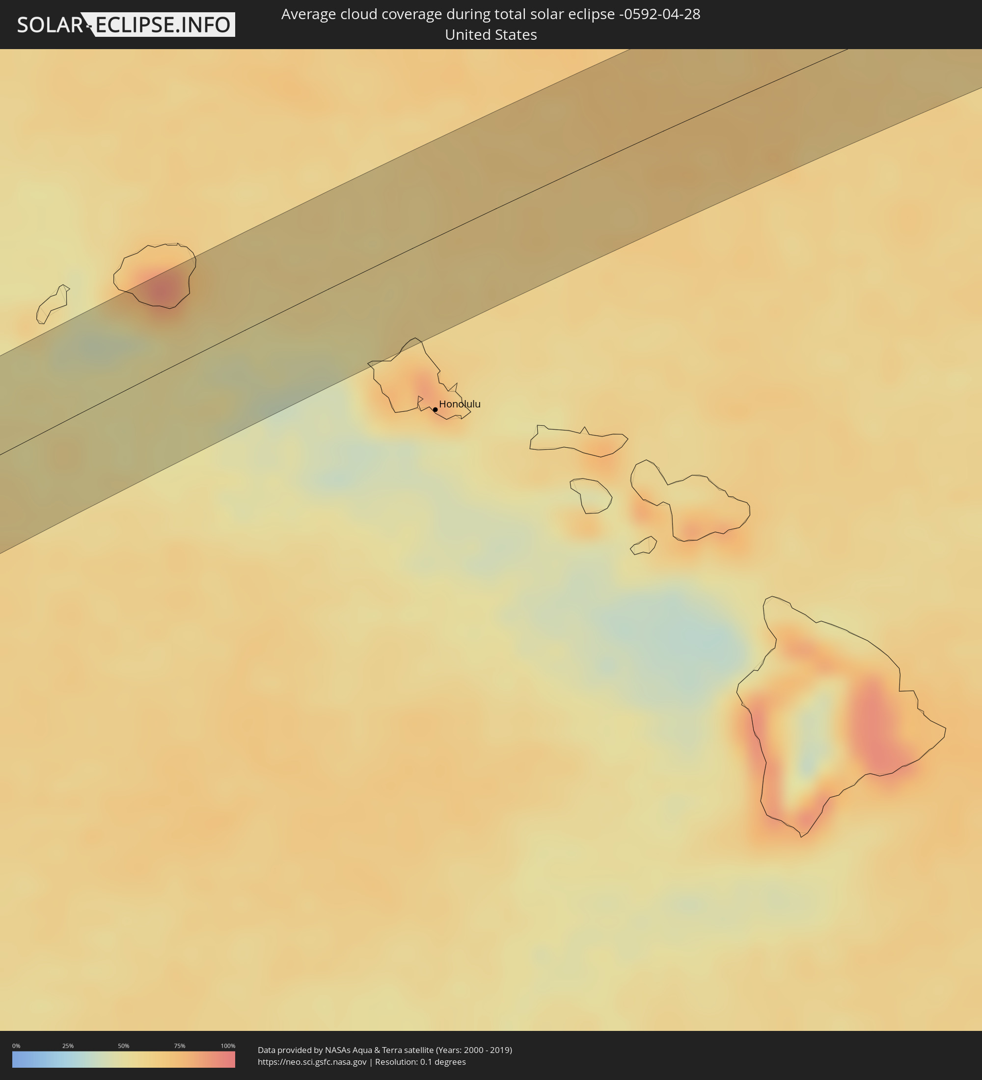 United States
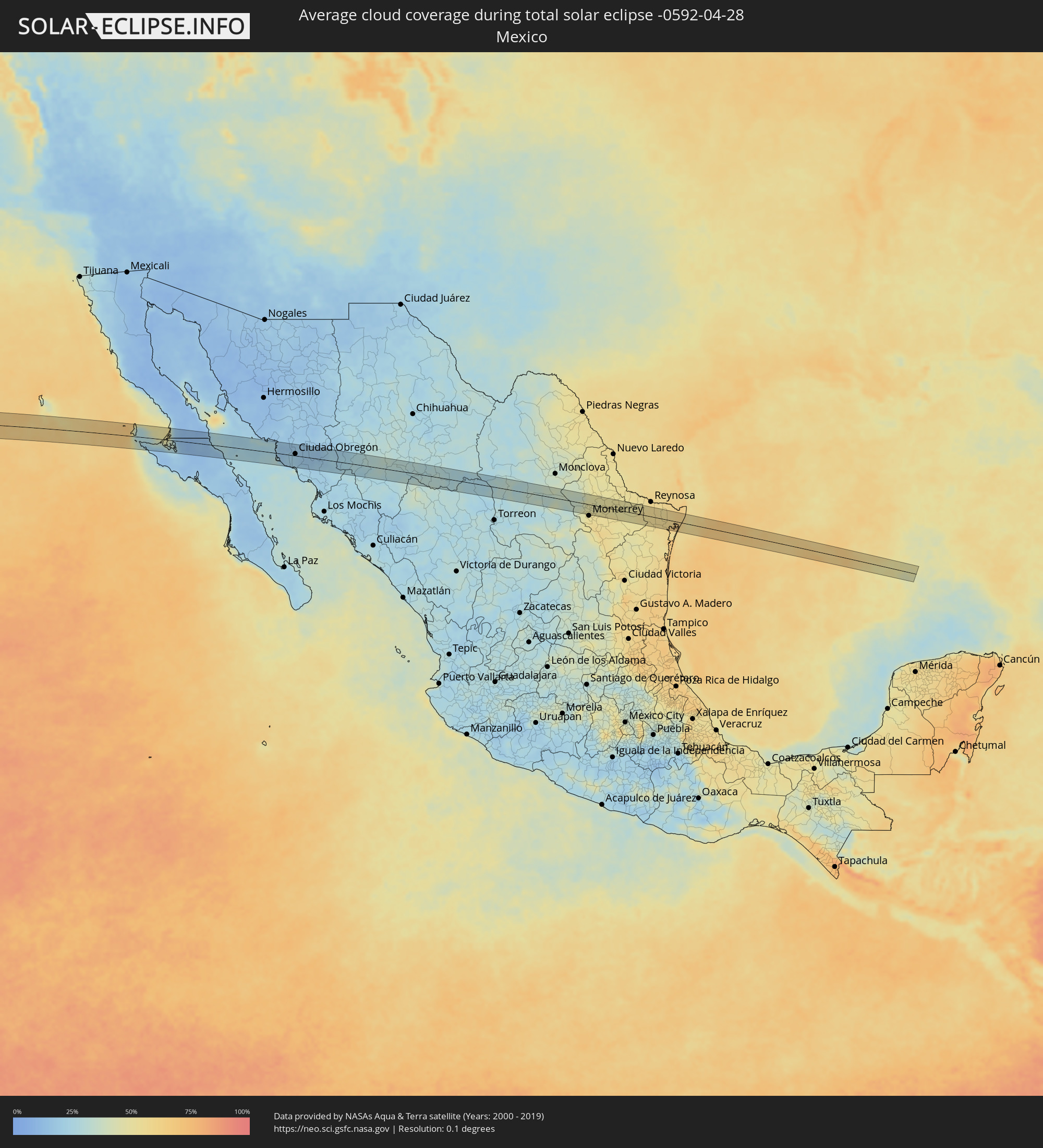 Mexico
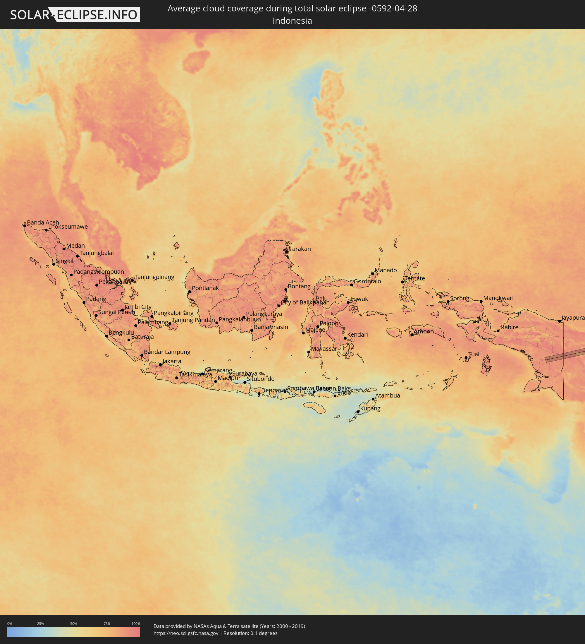 Indonesia
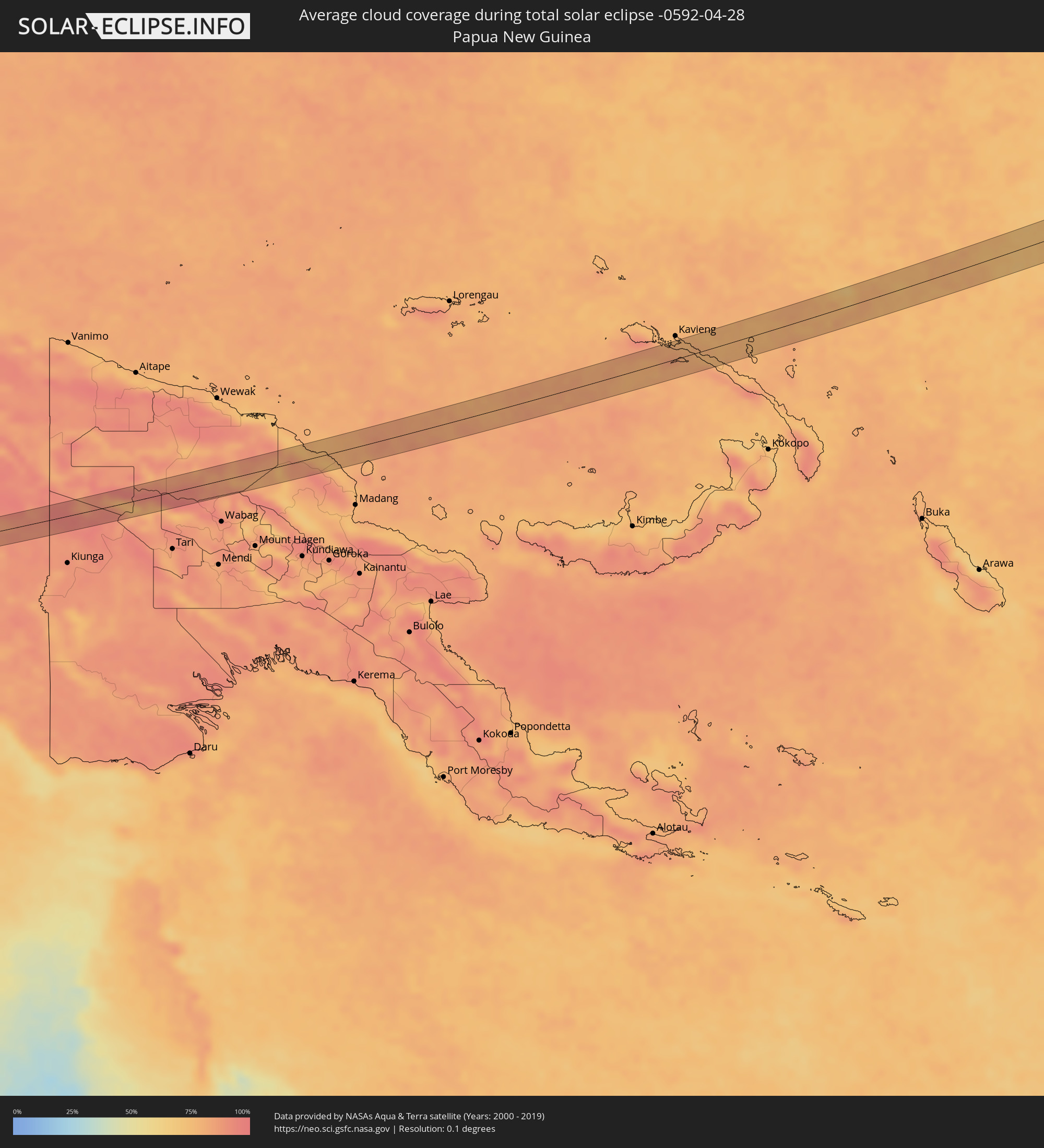 Papua New Guinea
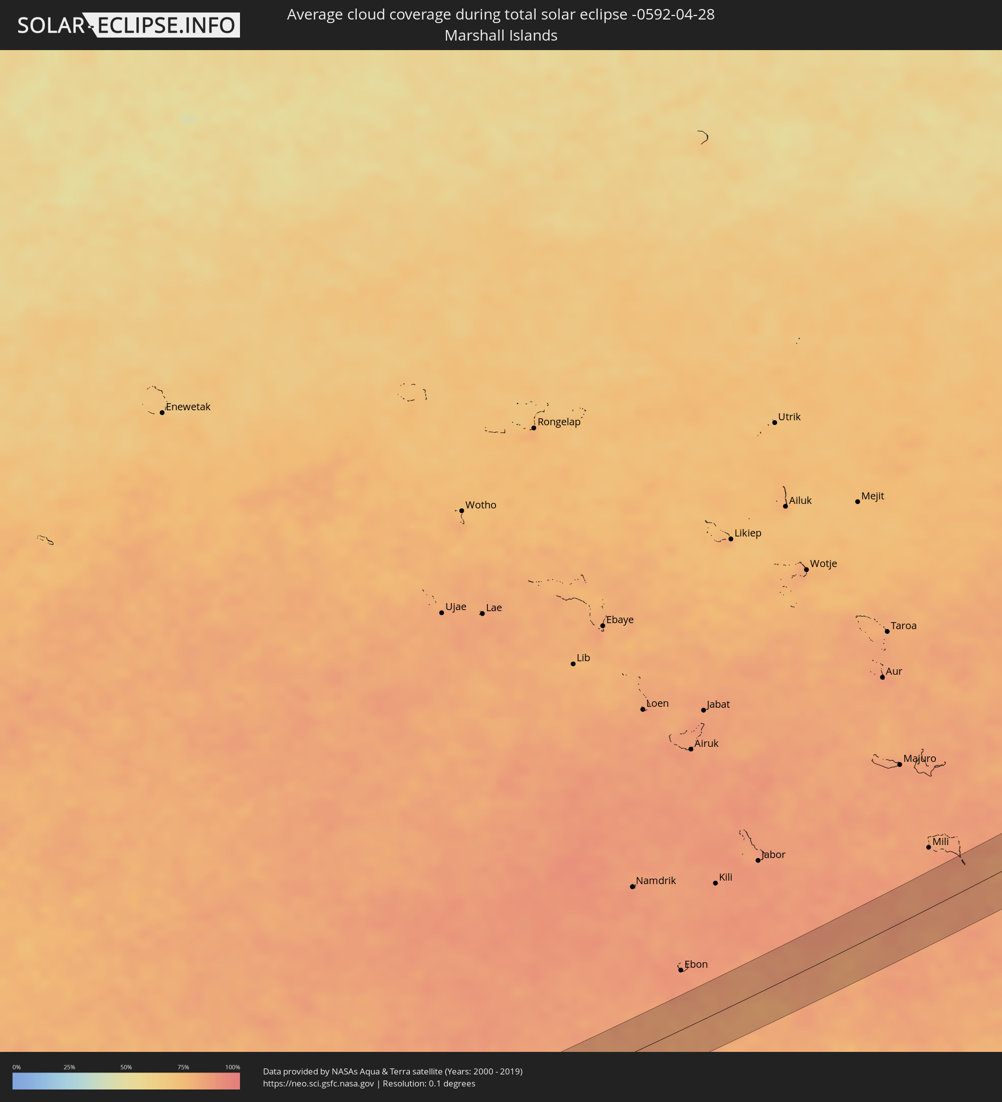 Marshall Islands
Cities inside the path of the eclipse
The following table shows all locations with a population of more than 5,000 inside the eclipse path. Cities which have more than 100,000 inhabitants are marked bold. A click at the locations opens a detailed map.
| City | Type | Eclipse duration | Local time of max. eclipse | Distance to central line | Ø Cloud coverage |
|
Wailua Homesteads, Hawaii
|
total | - | 12:05:00 UTC-10:30 | 49 km | 86% |
|
Lihue, Hawaii
|
total | - | 12:04:53 UTC-10:30 | 40 km | 79% |
|
Kapa‘a, Hawaii
|
total | - | 12:05:09 UTC-10:30 | 47 km | 71% |
|
Villa Alberto Andrés Alvarado Arámburo, Baja California Sur
|
total | - | 17:00:43 UTC-07:05 | 19 km | 11% |
|
Potam, Sonora
|
total | - | 16:44:37 UTC-07:23 | 15 km | 16% |
|
Vicam, Sonora
|
total | - | 16:44:41 UTC-07:23 | 18 km | 17% |
|
San Ignacio Río Muerto, Sonora
|
total | - | 16:44:50 UTC-07:23 | 6 km | 21% |
|
Campo Sesenta, Sonora
|
total | - | 16:44:55 UTC-07:23 | 0 km | 20% |
|
Pueblo Yaqui, Sonora
|
total | - | 16:45:00 UTC-07:23 | 10 km | 20% |
|
Cocorit, Sonora
|
total | - | 16:44:56 UTC-07:23 | 15 km | 18% |
|
Ciudad Obregón, Sonora
|
total | - | 16:45:00 UTC-07:23 | 6 km | 19% |
|
El Tobarito, Sonora
|
total | - | 16:45:05 UTC-07:23 | 6 km | 19% |
|
Marte R. Gómez (Tobarito), Sonora
|
total | - | 16:45:05 UTC-07:23 | 7 km | 19% |
|
Villa Juarez, Sonora
|
total | - | 16:45:15 UTC-07:23 | 32 km | 24% |
|
Navojoa, Sonora
|
total | - | 16:45:31 UTC-07:23 | 33 km | 19% |
|
Alamos, Sonora
|
total | - | 16:45:51 UTC-07:23 | 31 km | 24% |
|
Santa Bárbara, Chihuahua
|
total | - | 17:05:46 UTC-07:05 | 8 km | 31% |
|
Hidalgo del Parral, Chihuahua
|
total | - | 17:05:46 UTC-07:05 | 8 km | 31% |
|
García, Nuevo León
|
total | - | 17:37:13 UTC-06:36 | 27 km | 45% |
|
Valle de Lincoln, Nuevo León
|
total | - | 17:37:15 UTC-06:36 | 27 km | 46% |
|
Parque Industrial Ciudad Mitras, Nuevo León
|
total | - | 17:37:16 UTC-06:36 | 27 km | 50% |
|
Mitras Poniente, Nuevo León
|
total | - | 17:37:17 UTC-06:36 | 27 km | 50% |
|
General Escobedo, Nuevo León
|
total | - | 17:37:18 UTC-06:36 | 23 km | 51% |
|
San Nicolás de los Garza, Nuevo León
|
total | - | 17:37:19 UTC-06:36 | 29 km | 51% |
|
Emiliano Zapata, Nuevo León
|
total | - | 17:37:15 UTC-06:36 | 10 km | 48% |
|
Villas de Alcalá, Nuevo León
|
total | - | 17:37:16 UTC-06:36 | 8 km | 48% |
|
Real del Sol, Nuevo León
|
total | - | 17:37:15 UTC-06:36 | 5 km | 48% |
|
Ciénega de Flores, Nuevo León
|
total | - | 17:37:15 UTC-06:36 | 3 km | 46% |
|
Apodaca, Nuevo León
|
total | - | 17:37:21 UTC-06:36 | 24 km | 51% |
|
Fraccionamiento Real Palmas, Nuevo León
|
total | - | 17:37:16 UTC-06:36 | 8 km | 48% |
|
Misión San Pablo, Nuevo León
|
total | - | 17:37:22 UTC-06:36 | 26 km | 52% |
|
Loma la Paz, Nuevo León
|
total | - | 17:37:23 UTC-06:36 | 29 km | 52% |
|
General Zuazua, Nuevo León
|
total | - | 17:37:18 UTC-06:36 | 8 km | 47% |
|
Pesquería, Nuevo León
|
total | - | 17:37:22 UTC-06:36 | 19 km | 50% |
|
Hidalgo, Nuevo León
|
total | - | 17:37:25 UTC-06:36 | 3 km | 50% |
|
China, Nuevo León
|
total | - | 17:37:35 UTC-06:36 | 13 km | 50% |
|
Valle Hermoso, Tamaulipas
|
total | - | 17:37:52 UTC-06:36 | 12 km | 56% |