Total solar eclipse of 09/19/-0627
| Day of week: | Friday |
| Maximum duration of eclipse: | 03m11s |
| Maximum width of eclipse path: | 174 km |
| Saros cycle: | 63 |
| Coverage: | 100% |
| Magnitude: | 1.0405 |
| Gamma: | 0.6314 |
Wo kann man die Sonnenfinsternis vom 09/19/-0627 sehen?
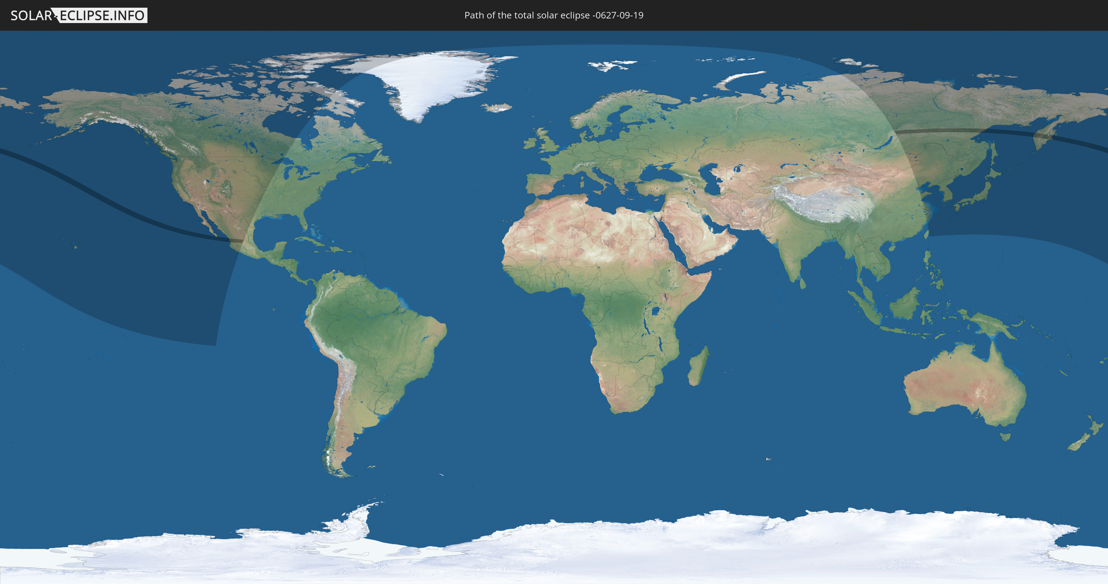
Die Sonnenfinsternis am 09/19/-0627 kann man in 13 Ländern als partielle Sonnenfinsternis beobachten.
Der Finsternispfad verläuft durch 3 Länder. Nur in diesen Ländern ist sie als total Sonnenfinsternis zu sehen.
In den folgenden Ländern ist die Sonnenfinsternis total zu sehen
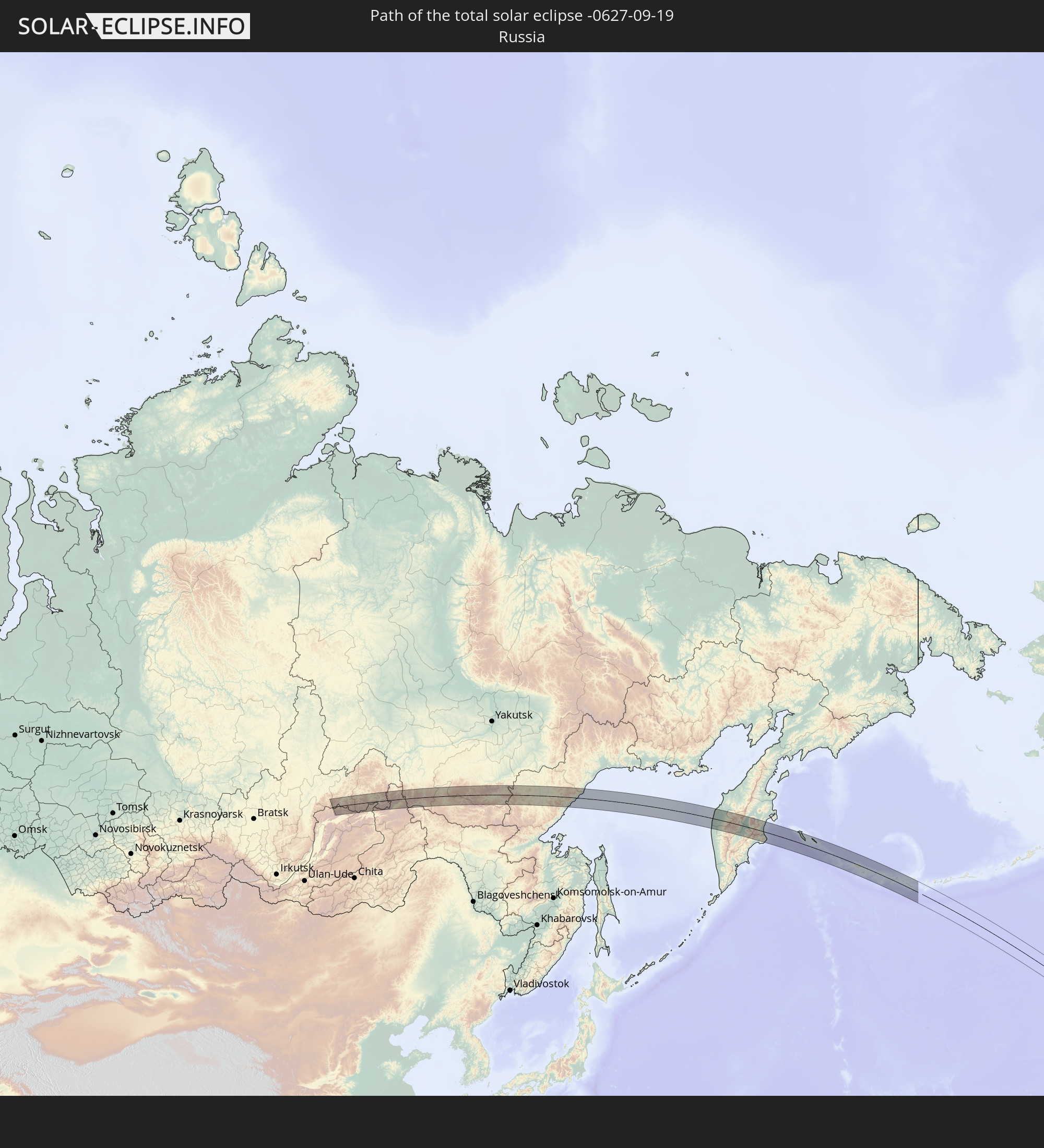 Russia
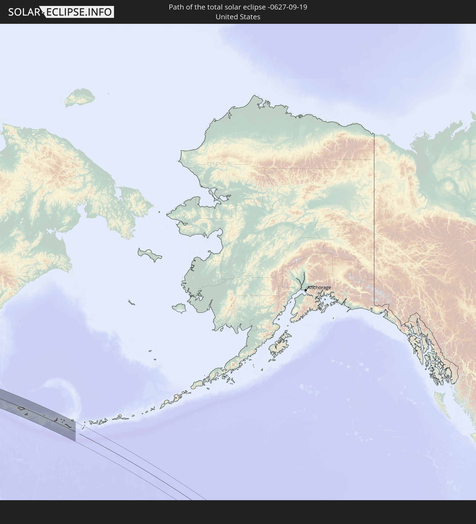 United States
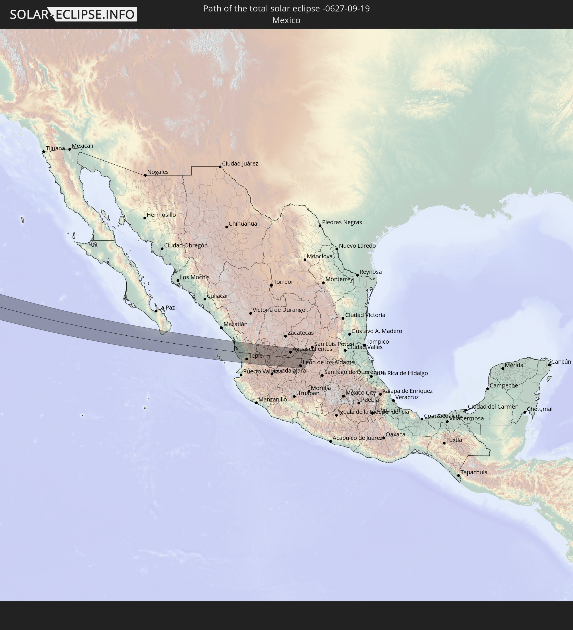 Mexico
In den folgenden Ländern ist die Sonnenfinsternis partiell zu sehen


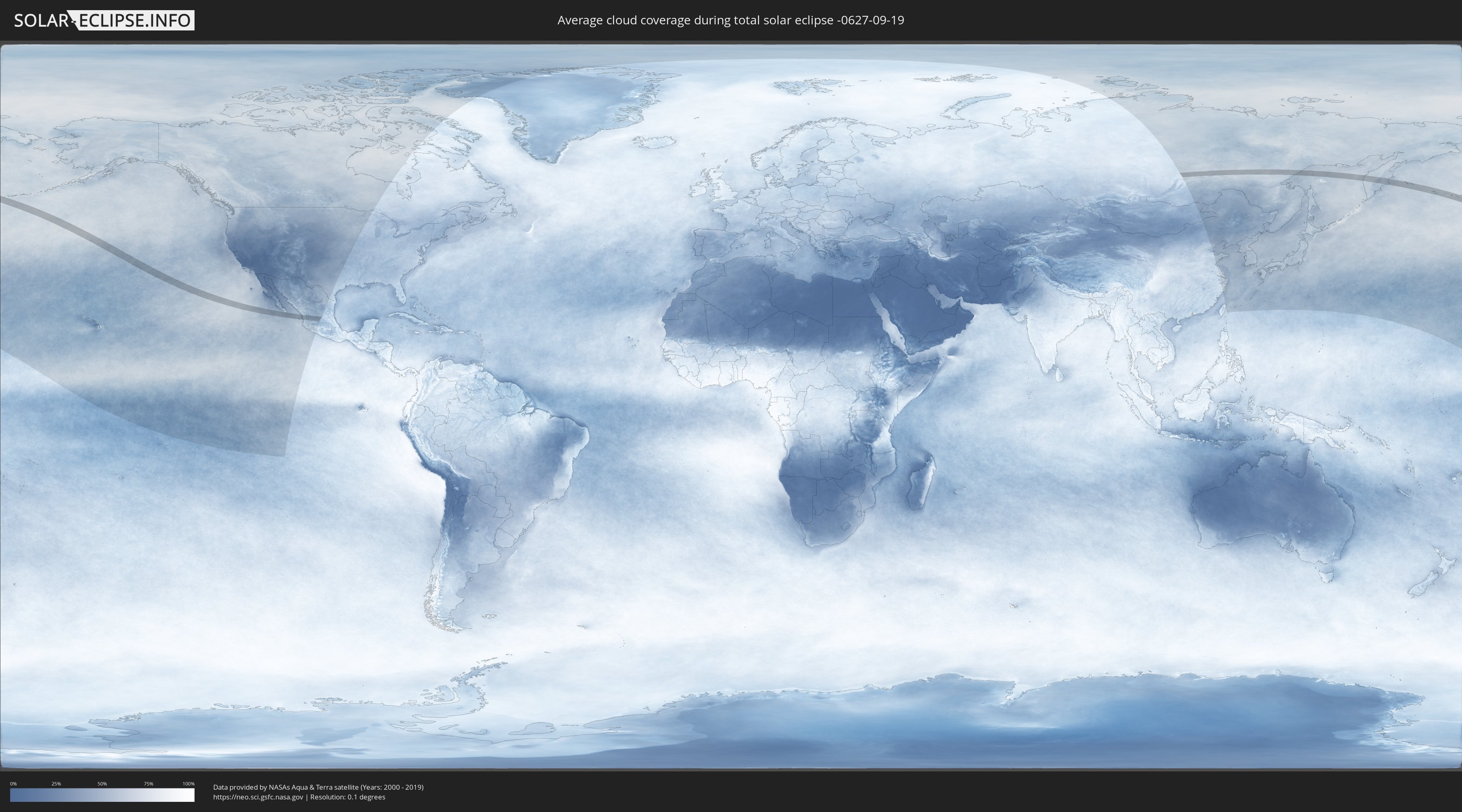
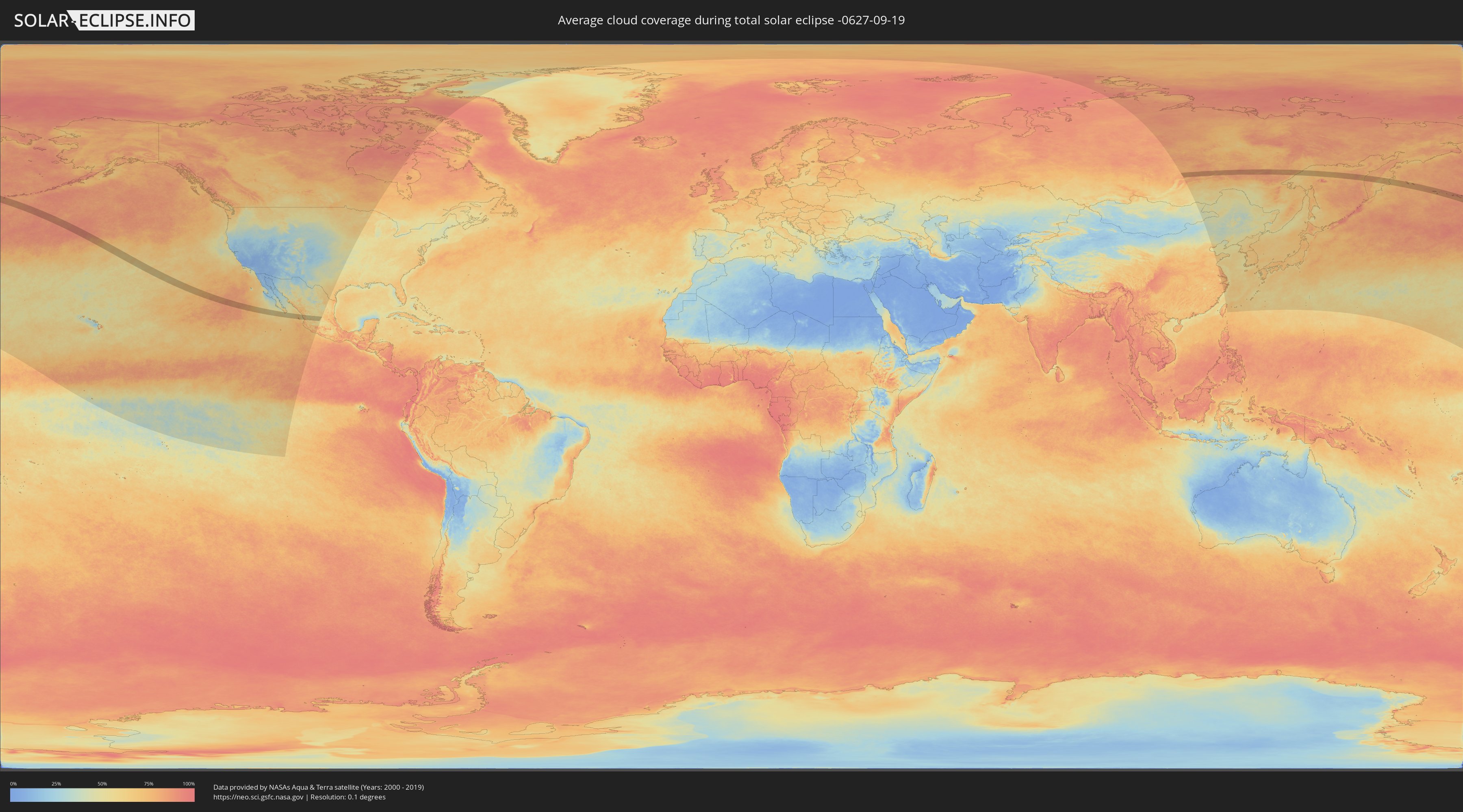
How will be the weather during the total solar eclipse on 09/19/-0627?
Where is the best place to see the total solar eclipse of 09/19/-0627?
The following maps show the average cloud coverage for the day of the total solar eclipse.
With the help of these maps, it is possible to find the place along the eclipse path, which has the best
chance of a cloudless sky.
Nevertheless, you should consider local circumstances and inform about the weather of your chosen
observation site.
The data is provided by NASAs satellites
AQUA and TERRA.
The cloud maps are averaged over a period of 19 years (2000 - 2019).
Detailed country maps
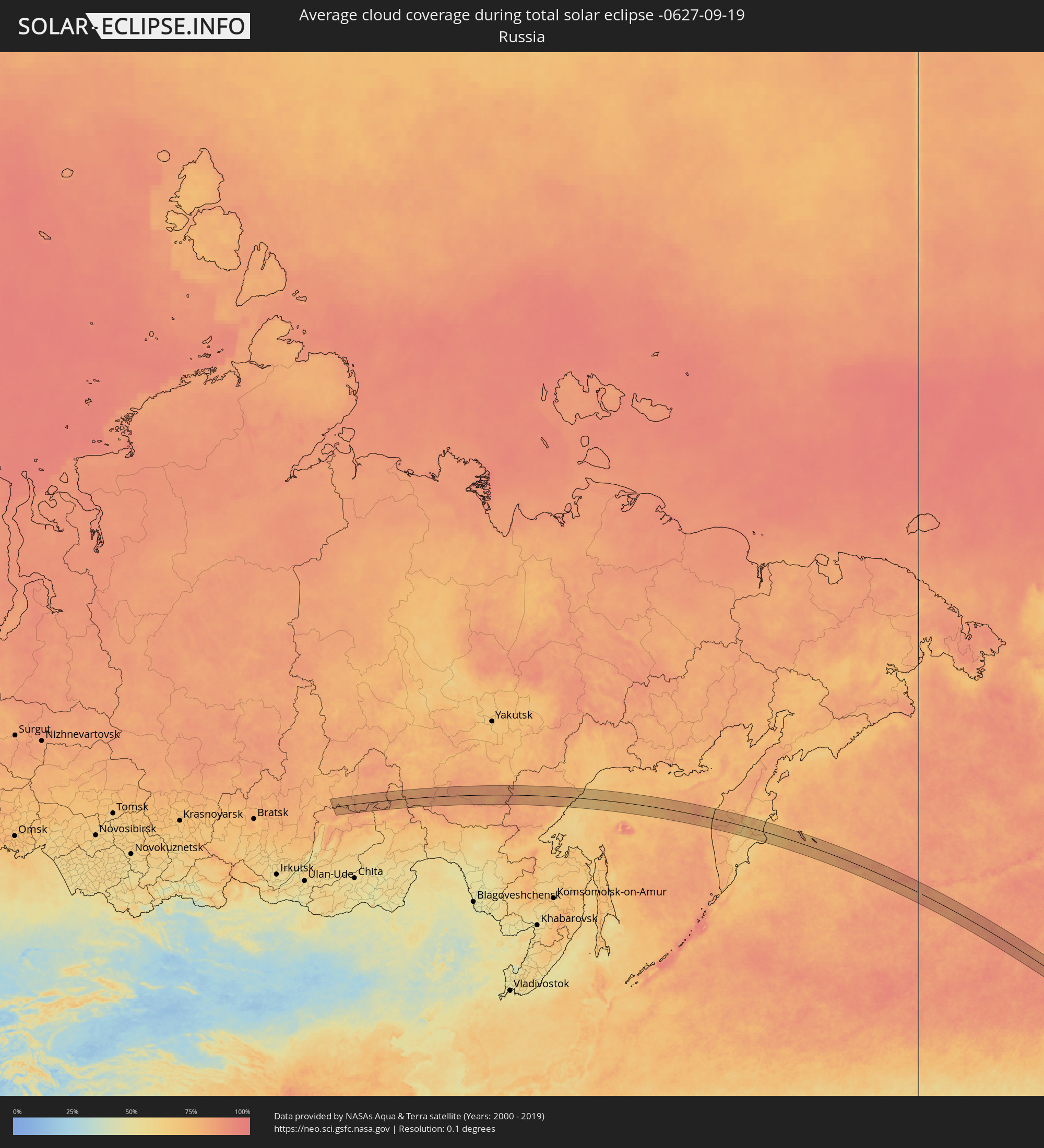 Russia
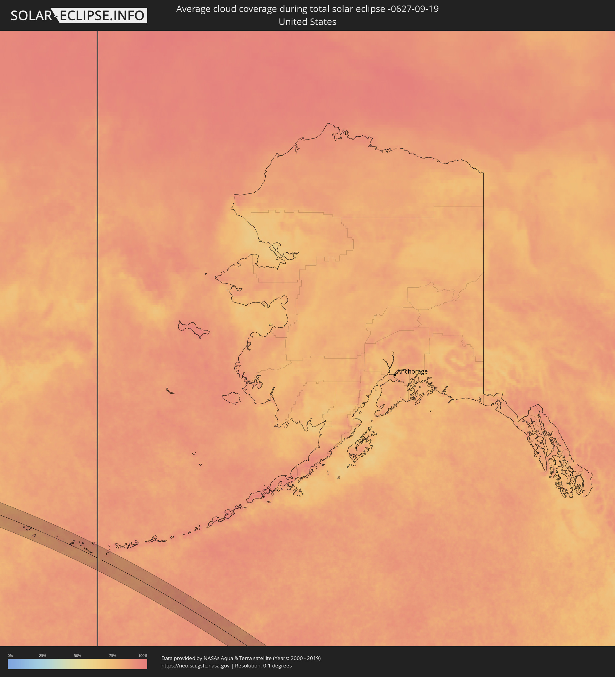 United States
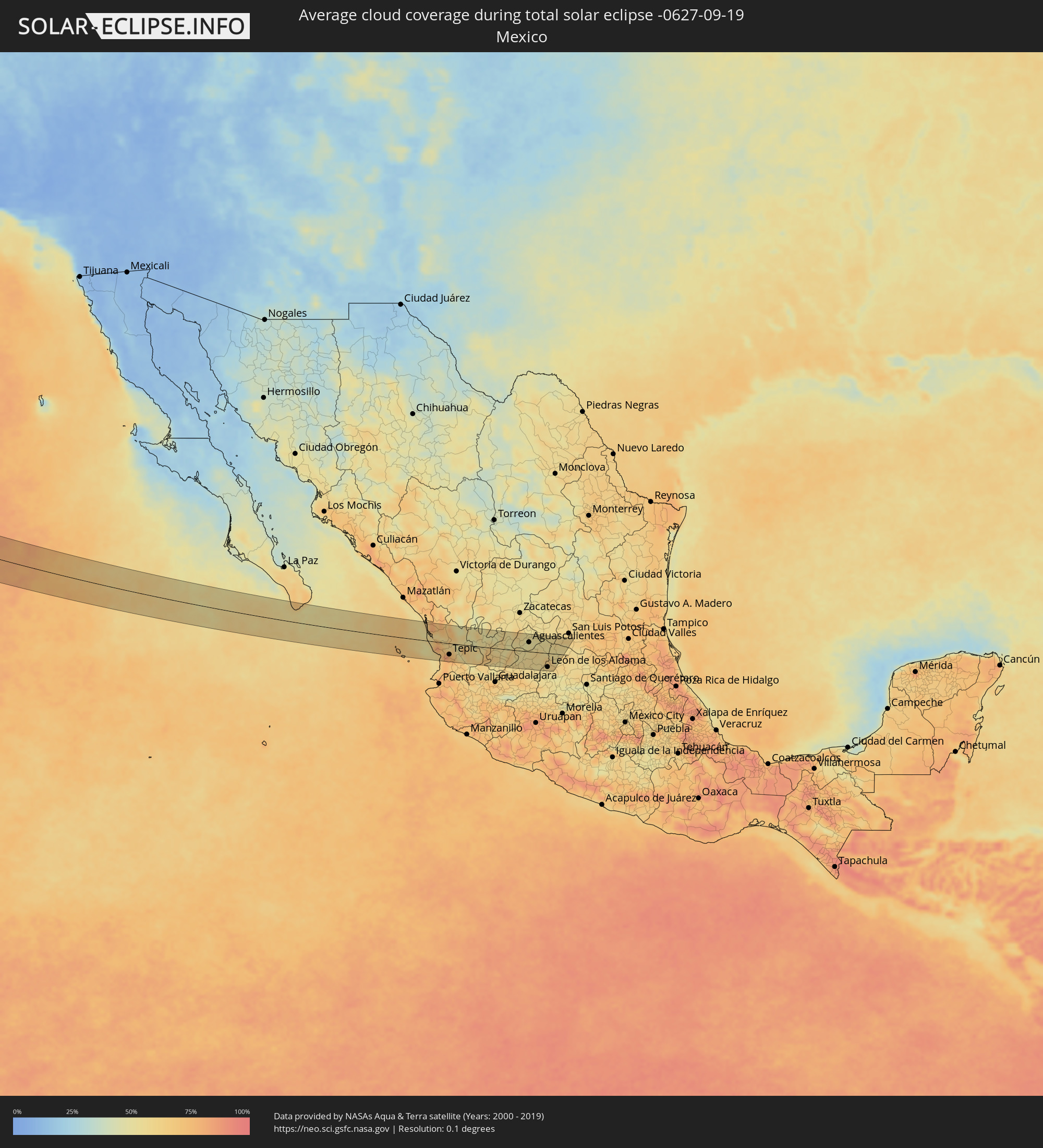 Mexico
Cities inside the path of the eclipse
The following table shows all locations with a population of more than 5,000 inside the eclipse path. Cities which have more than 100,000 inhabitants are marked bold. A click at the locations opens a detailed map.
| City | Type | Eclipse duration | Local time of max. eclipse | Distance to central line | Ø Cloud coverage |
 Las Palmas, Baja California Sur
|
total | - | 17:39:52 UTC-07:05 | 49 km | 59% |
|
Cabo San Lucas, Baja California Sur
|
total | - | 17:39:56 UTC-07:05 | 45 km | 59% |
|
Tecuala, Nayarit
|
total | - | 17:41:01 UTC-07:05 | 54 km | 80% |
|
San Felipe Aztatán, Nayarit
|
total | - | 17:41:03 UTC-07:05 | 53 km | 78% |
|
San Blas, Nayarit
|
total | - | 17:42:04 UTC-07:05 | 39 km | 58% |
|
Villa Hidalgo, Nayarit
|
total | - | 17:41:50 UTC-07:05 | 16 km | 73% |
|
Santiago Ixcuintla, Nayarit
|
total | - | 17:41:45 UTC-07:05 | 8 km | 76% |
|
Estación Ruiz, Nayarit
|
total | - | 17:41:35 UTC-07:05 | 8 km | 59% |
|
Tepic, Nayarit
|
total | - | 17:42:07 UTC-07:05 | 38 km | 76% |
|
Puga, Nayarit
|
total | - | 17:42:02 UTC-07:05 | 29 km | 70% |
|
Tlaltenango de Sánchez Román, Zacatecas
|
total | - | 18:10:51 UTC-06:36 | 10 km | 56% |
|
Colotlán, Jalisco
|
total | - | 18:10:27 UTC-06:36 | 47 km | 51% |
|
Juchipila, Zacatecas
|
total | - | 18:11:17 UTC-06:36 | 29 km | 60% |
|
Jalpa, Zacatecas
|
total | - | 18:11:01 UTC-06:36 | 3 km | 59% |
|
Tabasco, Zacatecas
|
total | - | 18:10:45 UTC-06:36 | 23 km | 51% |
|
Yahualica de González Gallo, Jalisco
|
total | - | 18:11:33 UTC-06:36 | 52 km | 57% |
|
Nochistlán de Mejía, Zacatecas
|
total | - | 18:11:20 UTC-06:36 | 32 km | 56% |
|
Calvillo, Aguascalientes
|
total | - | 18:10:45 UTC-06:36 | 23 km | 58% |
|
Villa Hidalgo, Jalisco
|
total | - | 18:10:57 UTC-06:36 | 5 km | 54% |
|
Teocaltiche, Jalisco
|
total | - | 18:11:14 UTC-06:36 | 21 km | 53% |
|
Jalostotitlán, Jalisco
|
total | - | 18:11:32 UTC-06:36 | 50 km | 57% |
|
Jesús María, Aguascalientes
|
total | - | 18:10:36 UTC-06:36 | 39 km | 53% |
|
Pocitos, Aguascalientes
|
total | - | 18:10:39 UTC-06:36 | 35 km | 51% |
|
San Juan de los Lagos, Jalisco
|
total | - | 18:11:26 UTC-06:36 | 39 km | 57% |
|
Jesús Gómez Portugal (Margaritas), Aguascalientes
|
total | - | 18:10:33 UTC-06:36 | 44 km | 53% |
|
Jesús Gómez Portugal, Aguascalientes
|
total | - | 18:10:34 UTC-06:36 | 44 km | 53% |
|
Aguascalientes, Aguascalientes
|
total | - | 18:10:42 UTC-06:36 | 31 km | 51% |
|
Encarnación de Díaz, Jalisco
|
total | - | 18:11:06 UTC-06:36 | 8 km | 58% |
|
Unión de San Antonio, Jalisco
|
total | - | 18:11:33 UTC-06:36 | 50 km | 54% |
|
Lagos de Moreno, Jalisco
|
total | - | 18:11:17 UTC-06:36 | 24 km | 57% |
|
Centro Familiar la Soledad, Guanajuato
|
total | - | 18:11:32 UTC-06:36 | 47 km | 52% |
|
La Ermita, Guanajuato
|
total | - | 18:11:31 UTC-06:36 | 45 km | 58% |
|
León de los Aldama, Guanajuato
|
total | - | 18:11:32 UTC-06:36 | 47 km | 52% |
|
Medina, Guanajuato
|
total | - | 18:11:30 UTC-06:36 | 44 km | 54% |
|
Ojuelos de Jalisco, Jalisco
|
total | - | 18:10:40 UTC-06:36 | 36 km | 56% |
|
Duarte, Guanajuato
|
total | - | 18:11:34 UTC-06:36 | 50 km | 54% |
|
Ocampo, Guanajuato
|
total | - | 18:10:55 UTC-06:36 | 13 km | 54% |
|
San Felipe, Guanajuato
|
total | - | 18:11:06 UTC-06:36 | 4 km | 63% |