Total solar eclipse of 10/08/-0740
| Day of week: | Wednesday |
| Maximum duration of eclipse: | 04m01s |
| Maximum width of eclipse path: | 145 km |
| Saros cycle: | 51 |
| Coverage: | 100% |
| Magnitude: | 1.0432 |
| Gamma: | 0.1077 |
Wo kann man die Sonnenfinsternis vom 10/08/-0740 sehen?
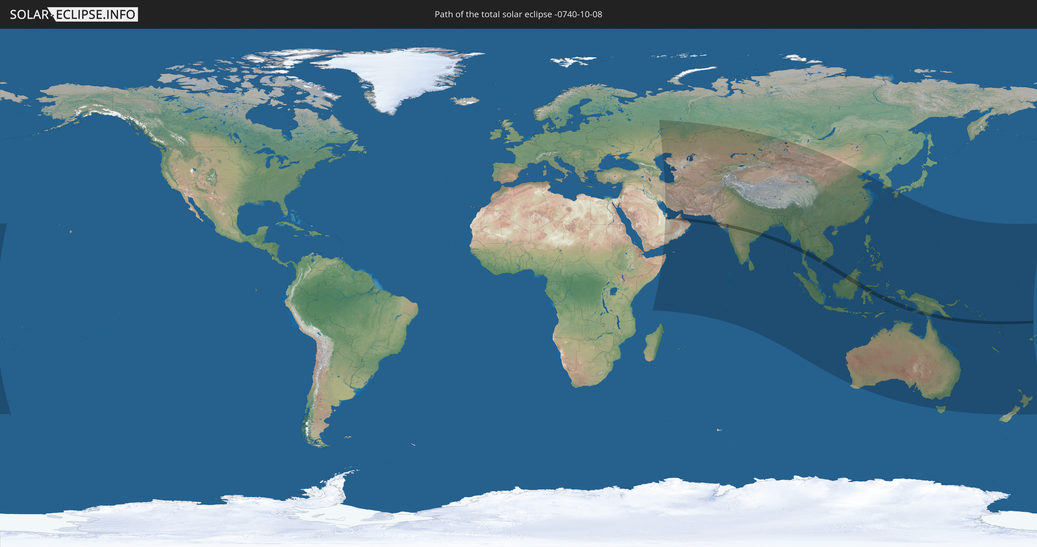
Die Sonnenfinsternis am 10/08/-0740 kann man in 61 Ländern als partielle Sonnenfinsternis beobachten.
Der Finsternispfad verläuft durch 15 Länder. Nur in diesen Ländern ist sie als total Sonnenfinsternis zu sehen.
In den folgenden Ländern ist die Sonnenfinsternis total zu sehen
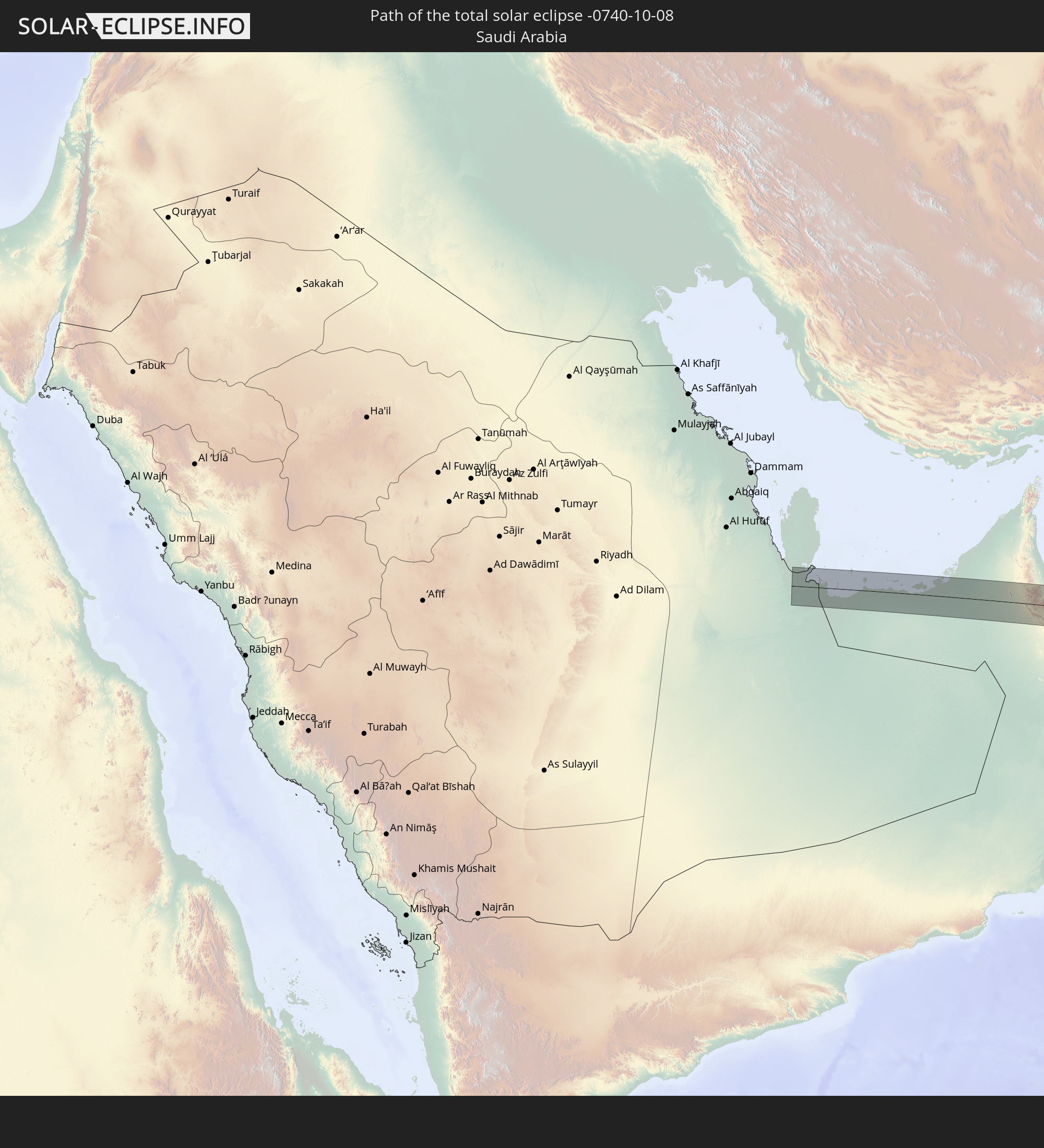 Saudi Arabia
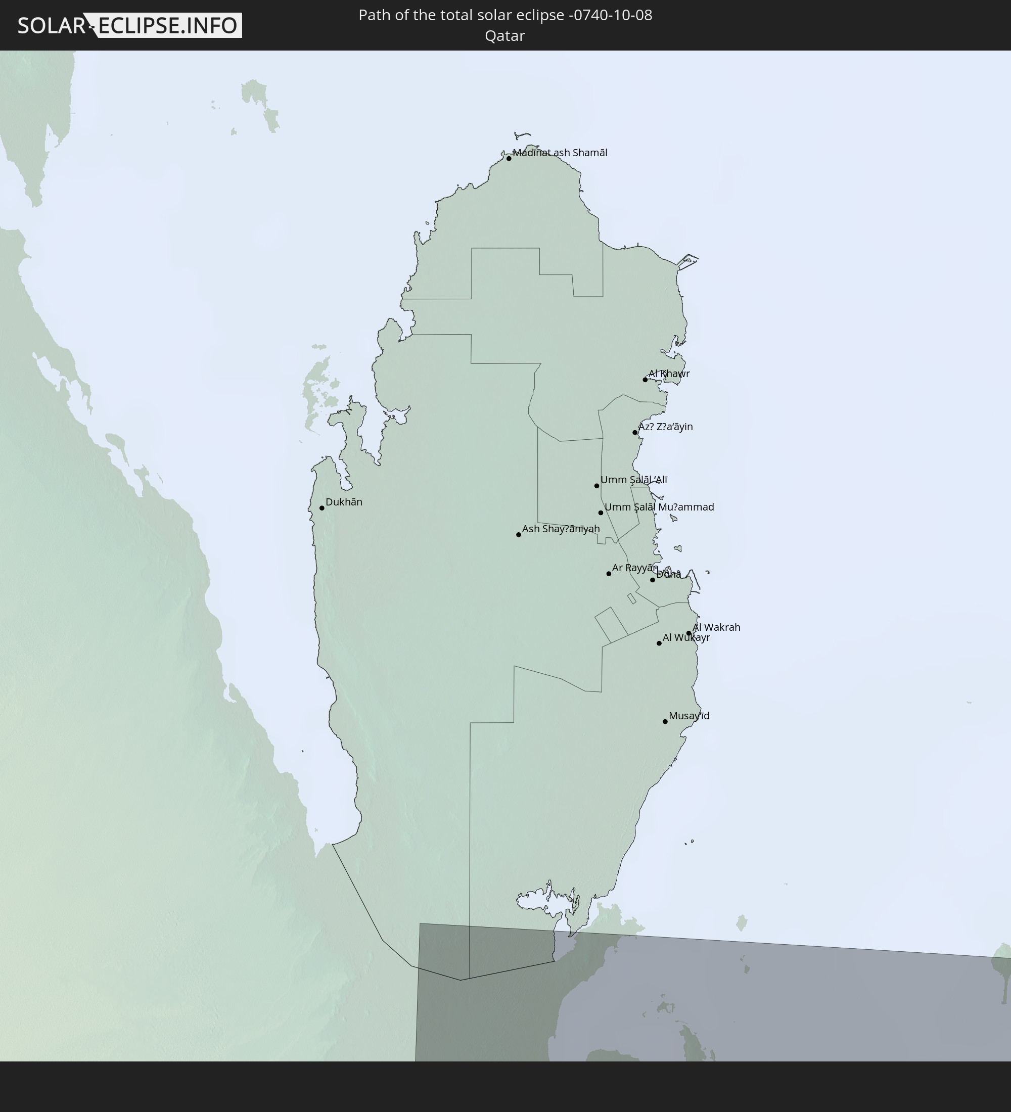 Qatar
Qatar
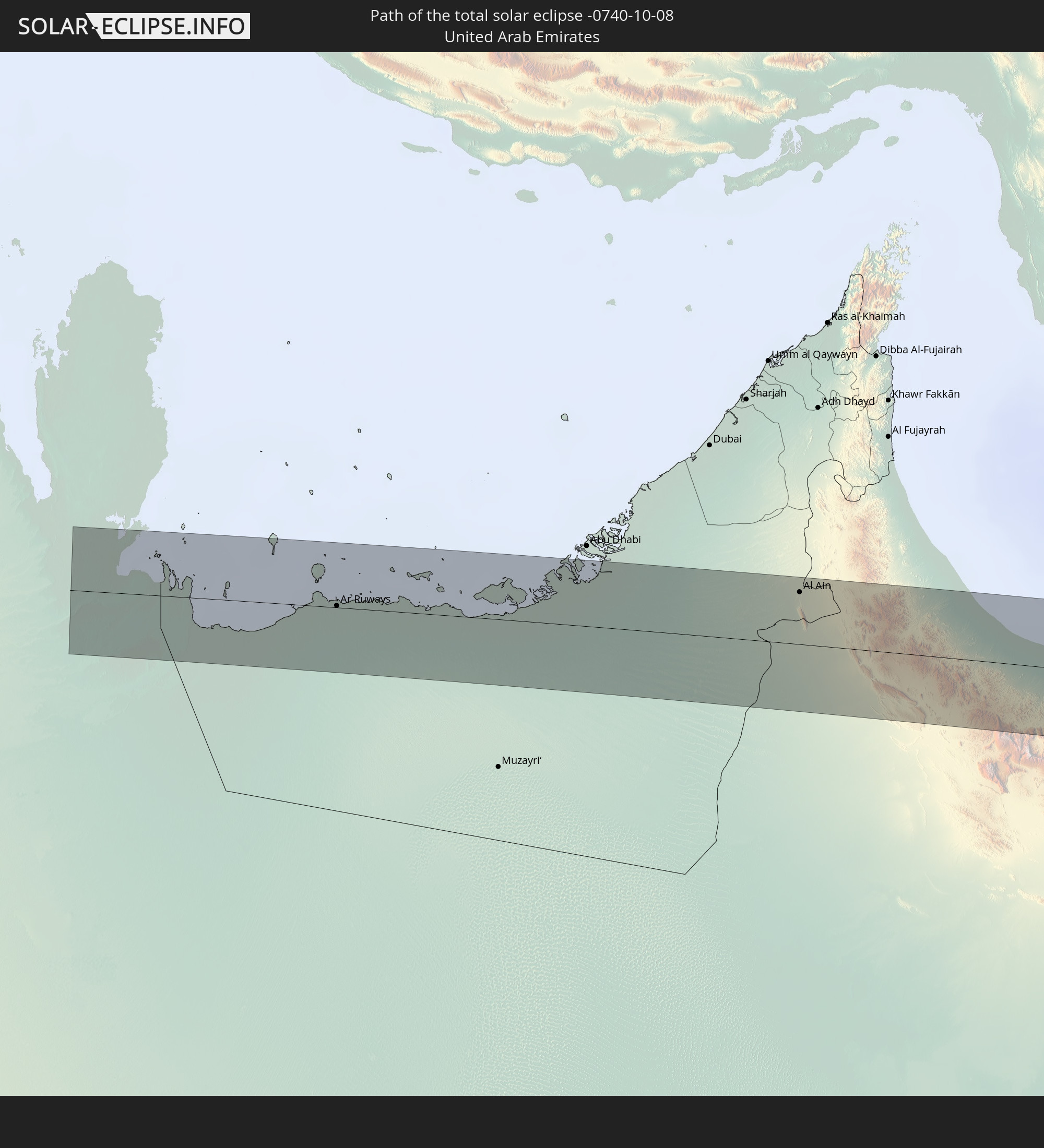 United Arab Emirates
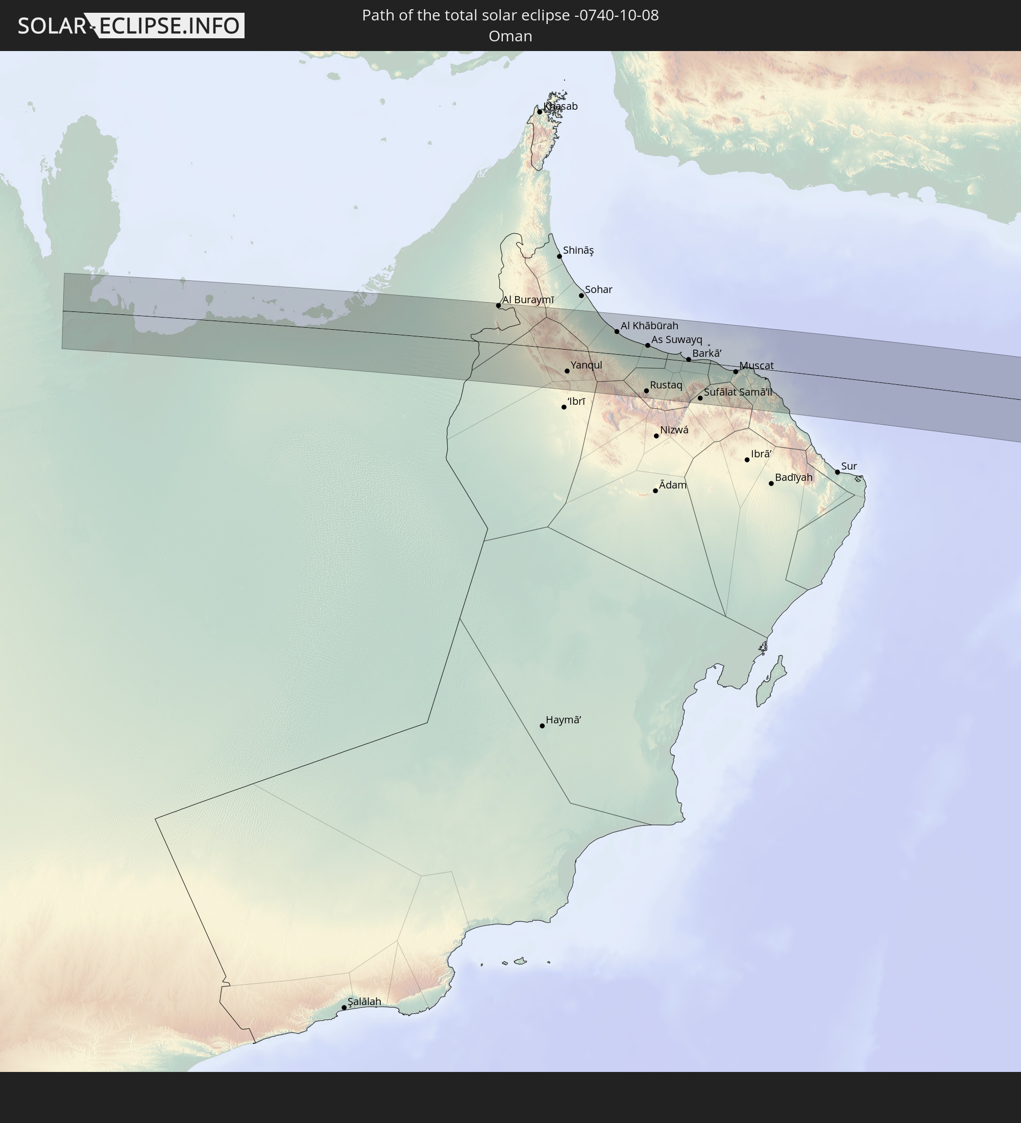 Oman
Oman
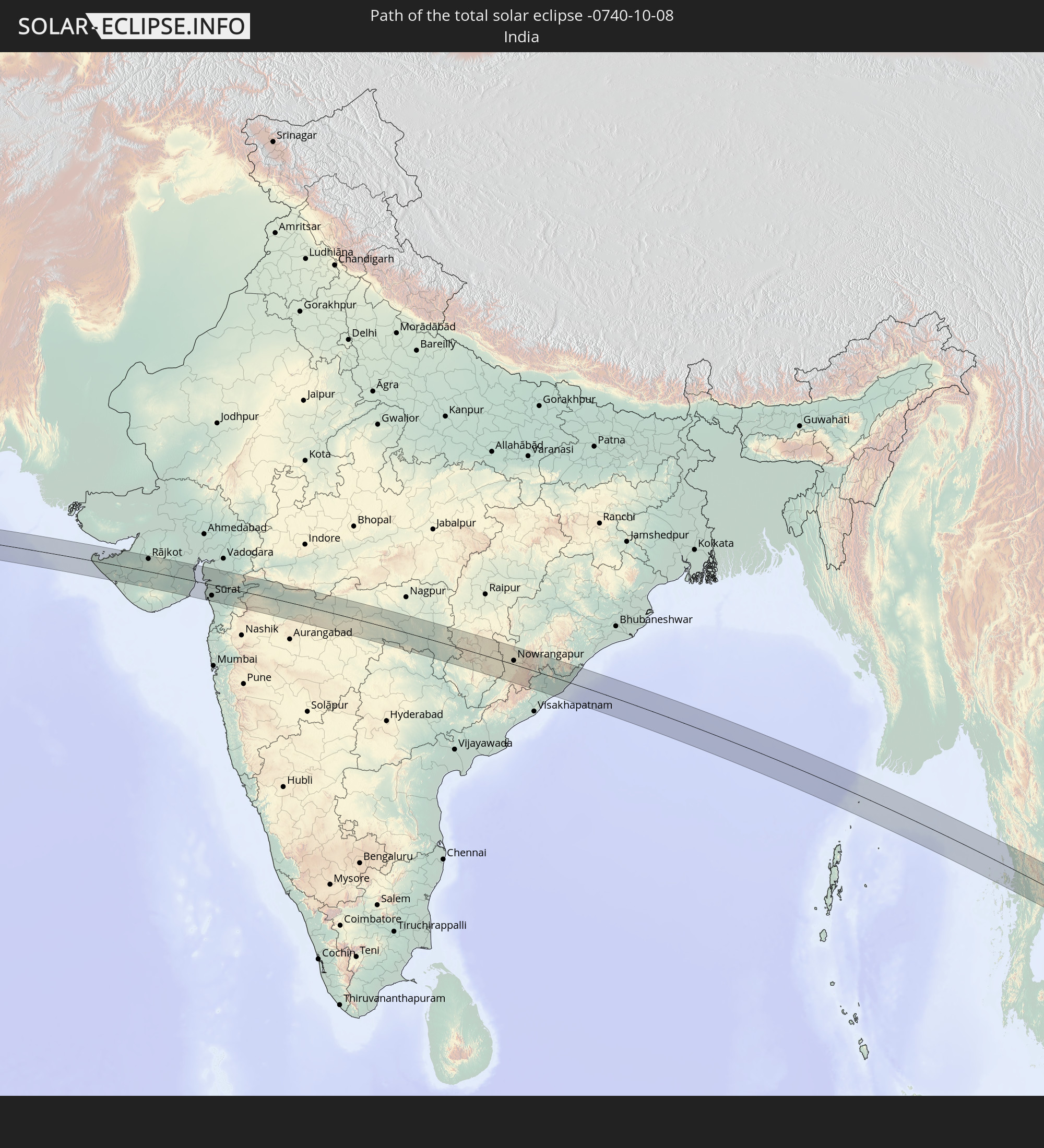 India
India
 Myanmar
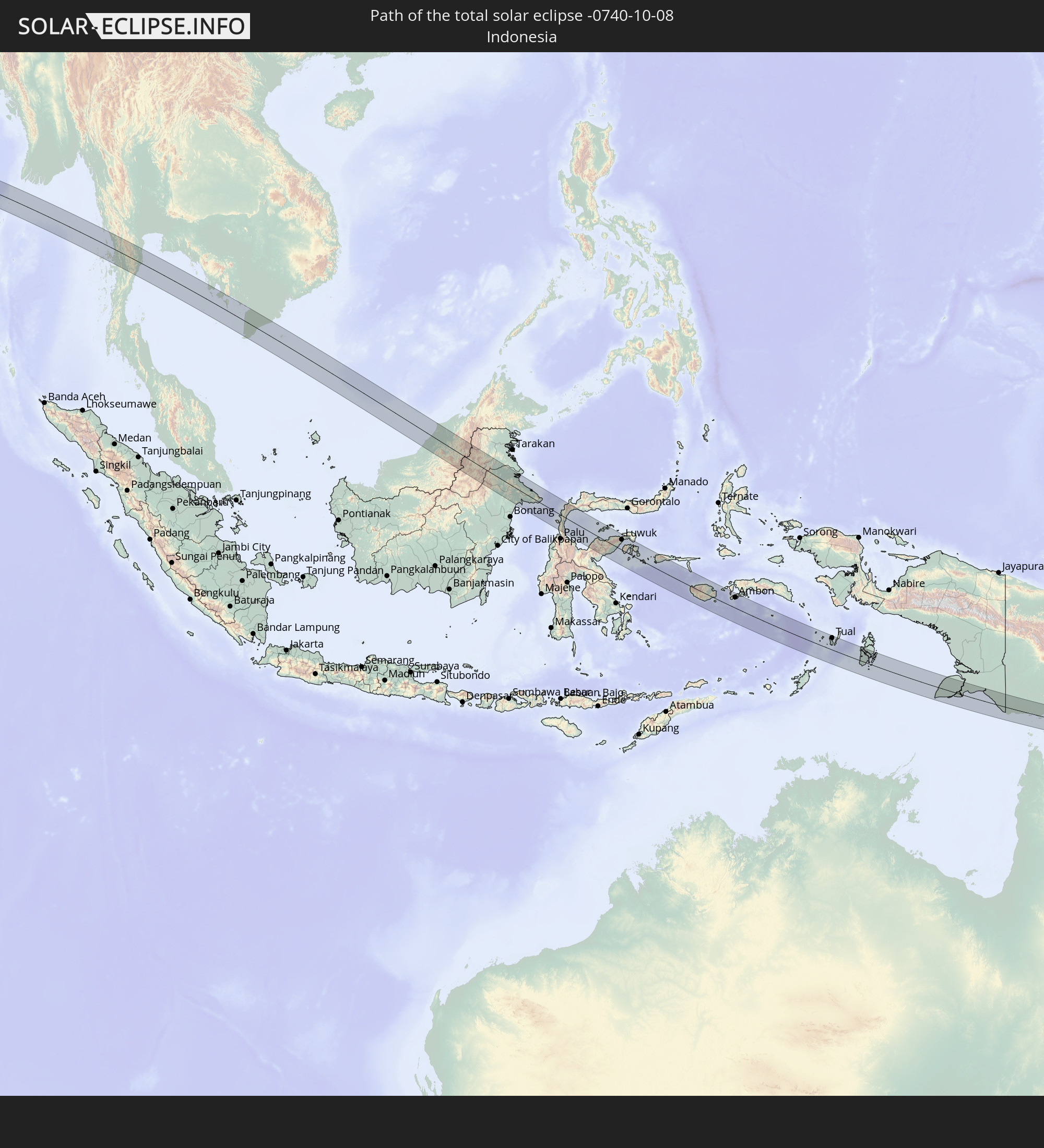 Indonesia
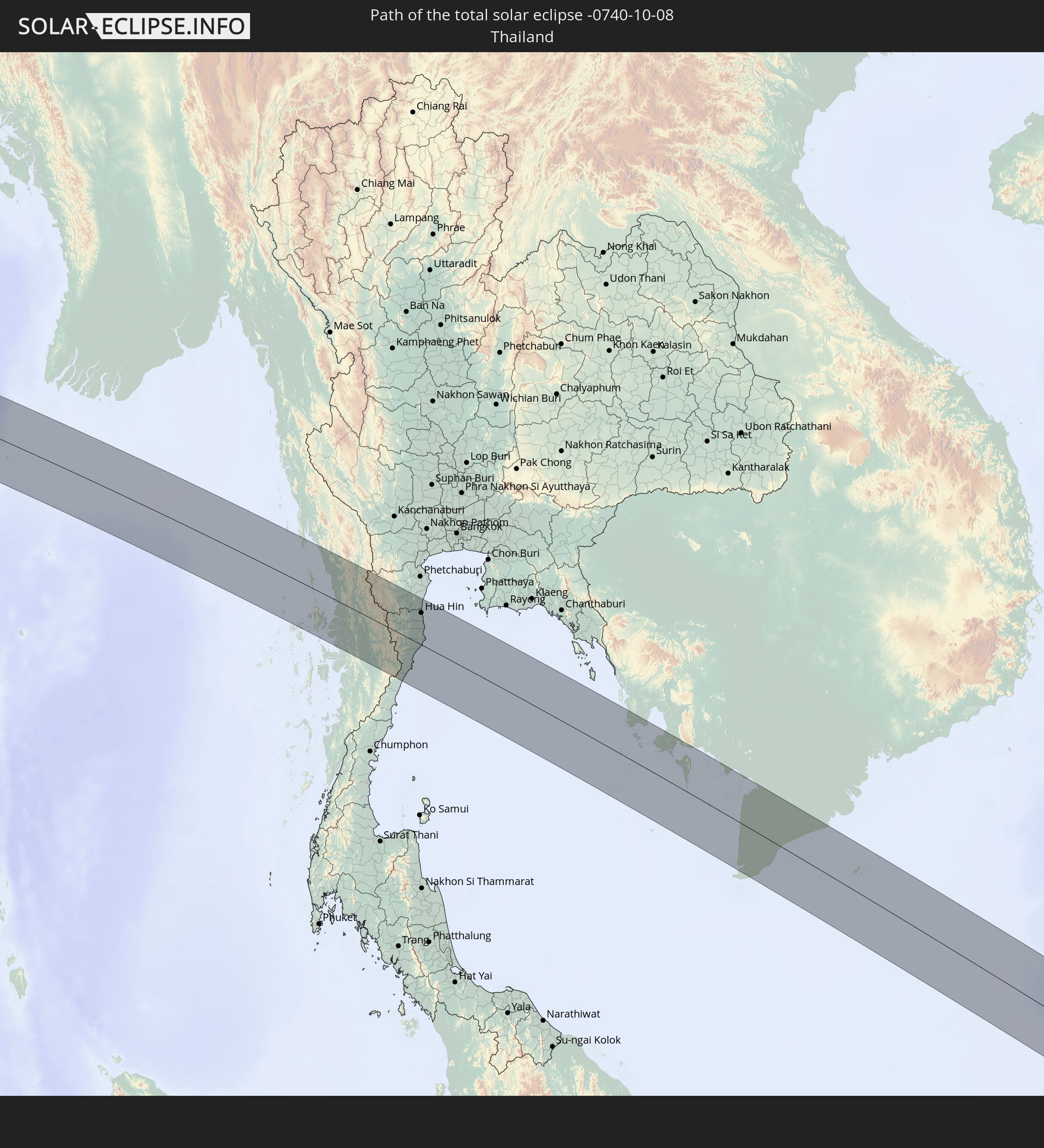 Thailand
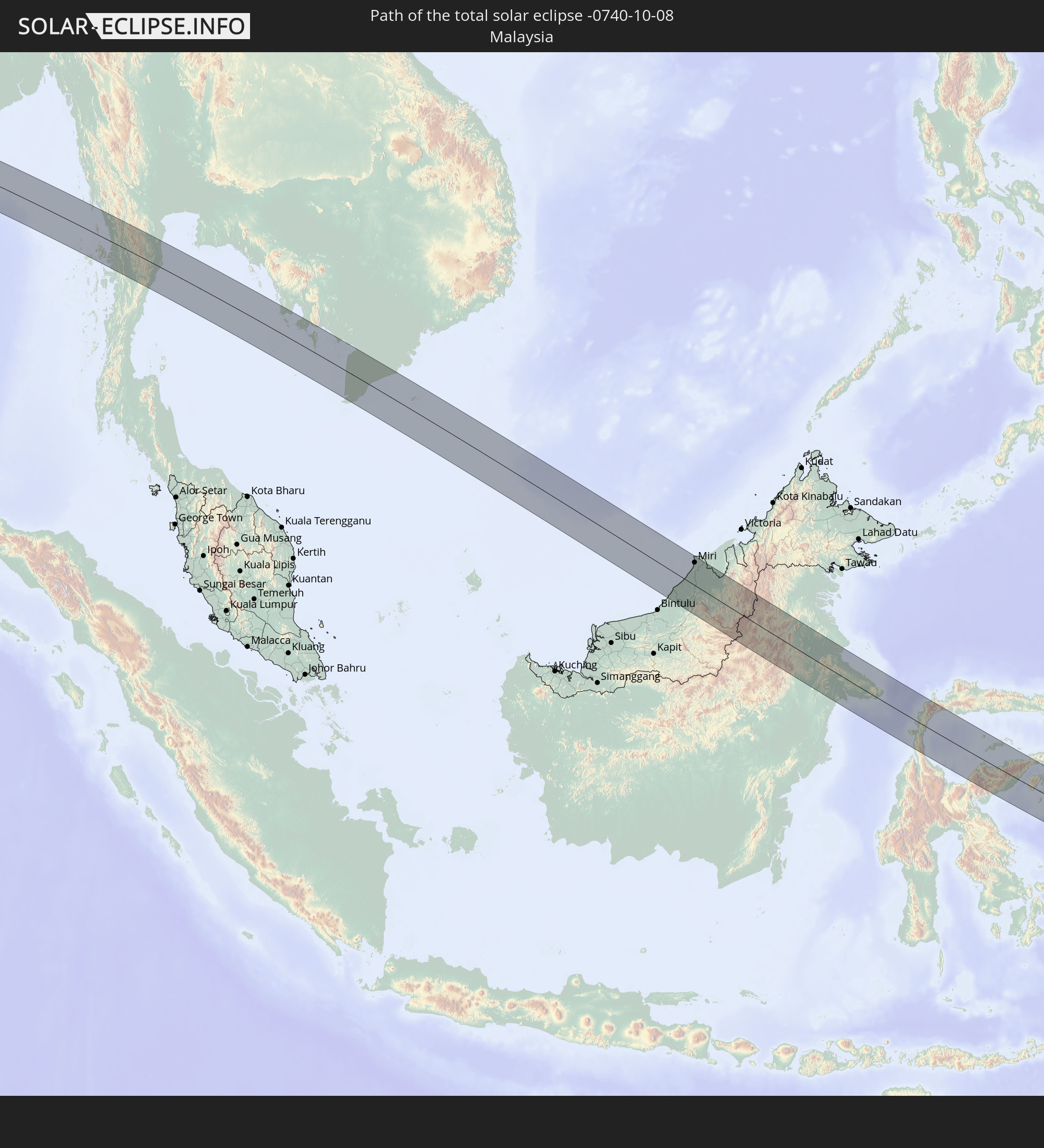 Malaysia
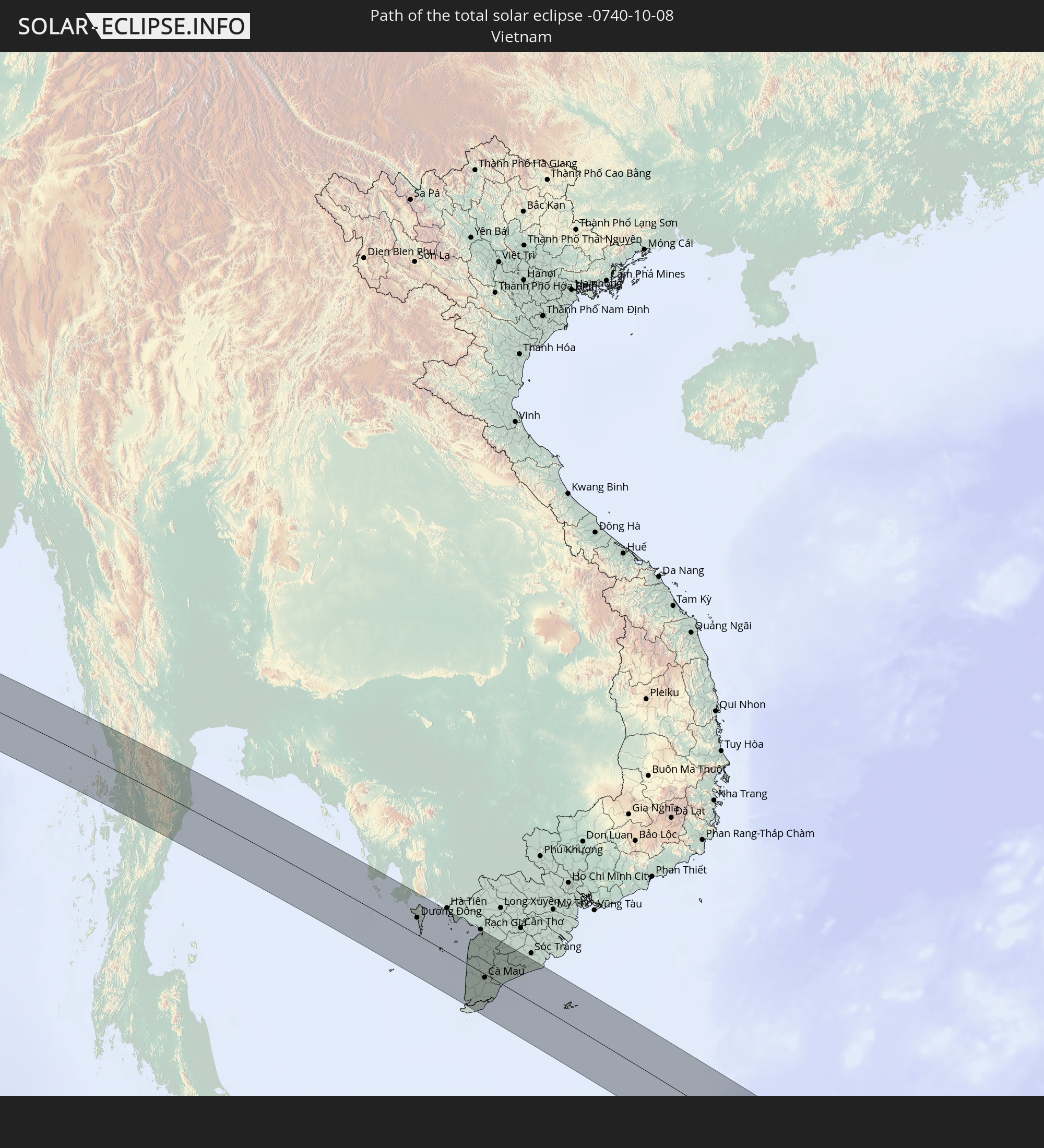 Vietnam
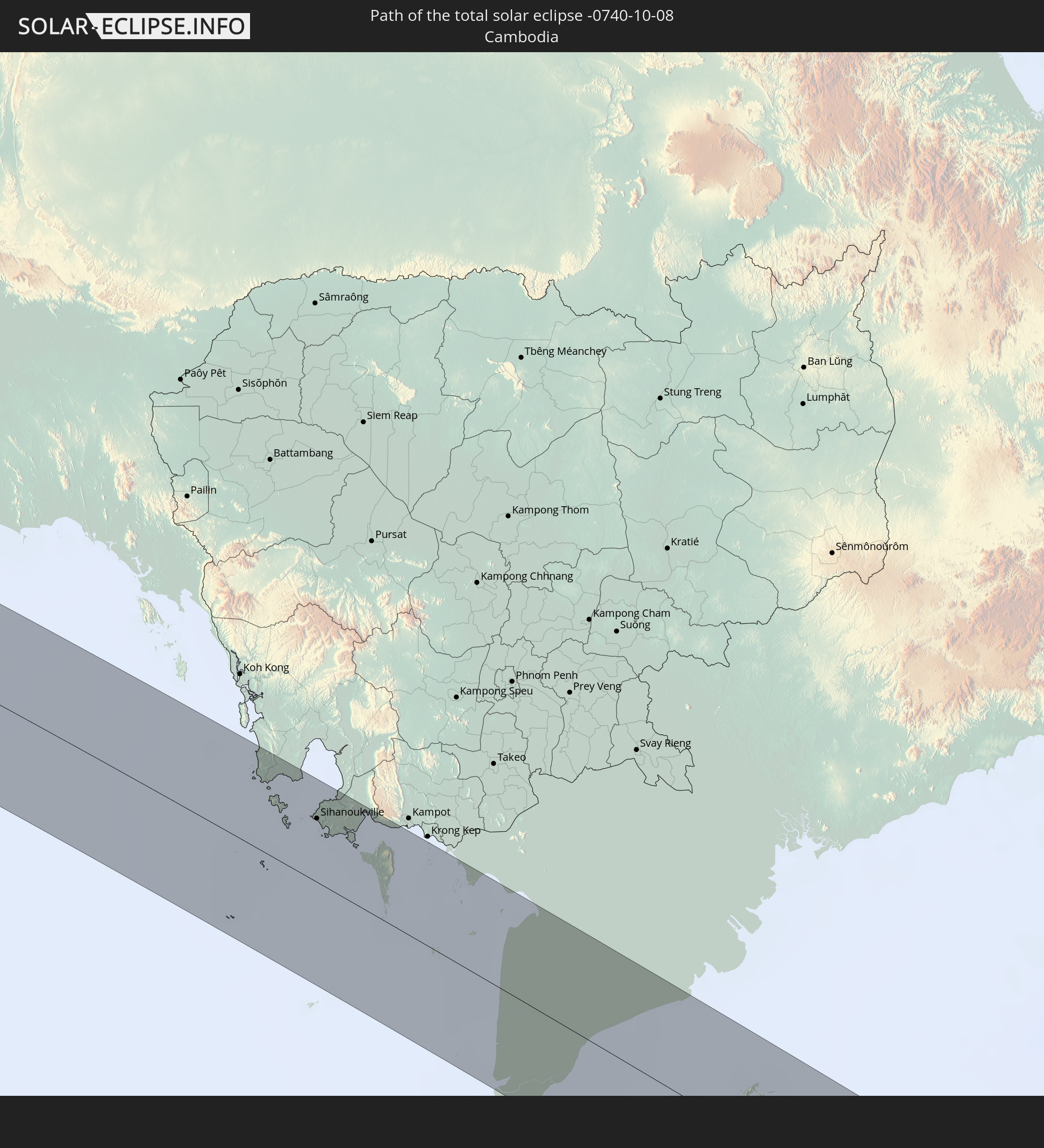 Cambodia
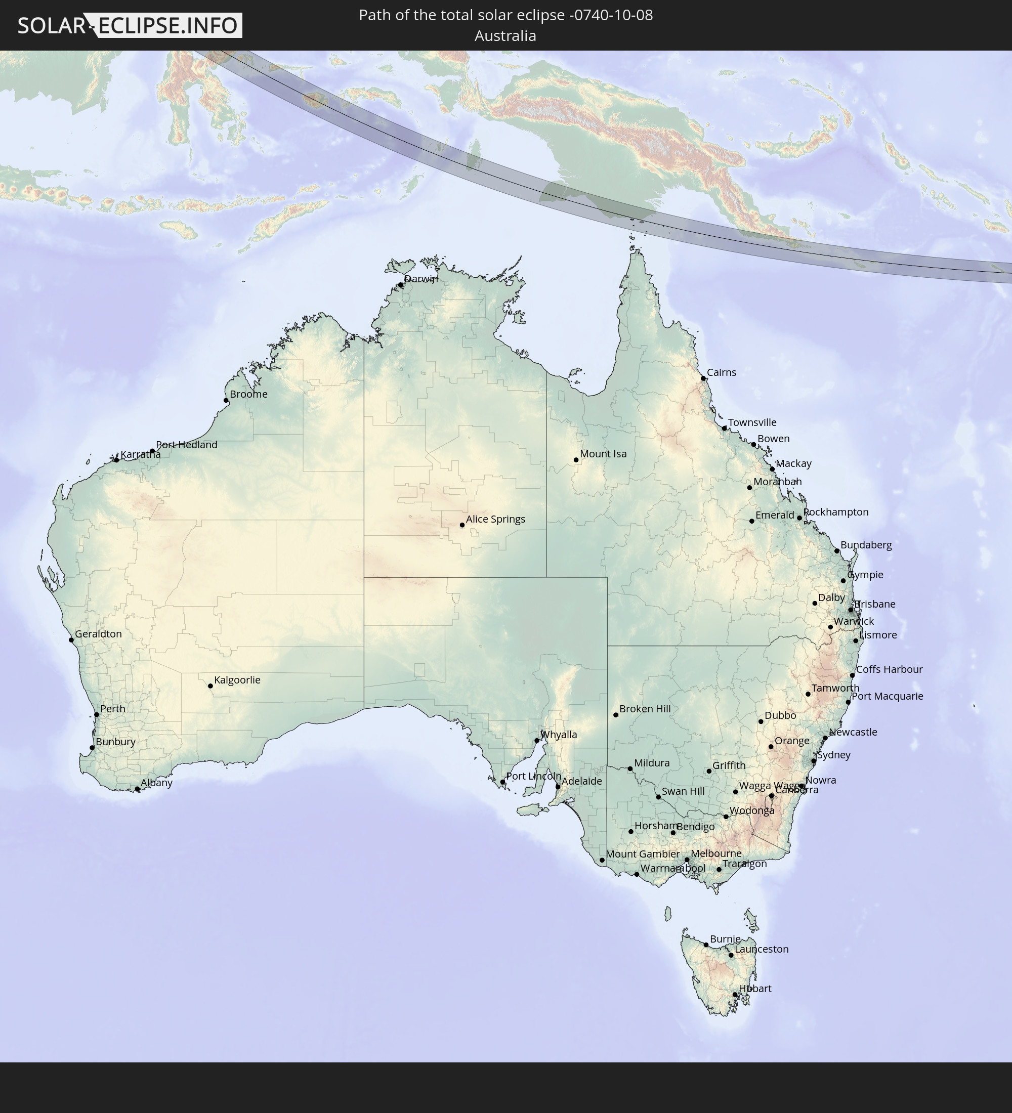 Australia
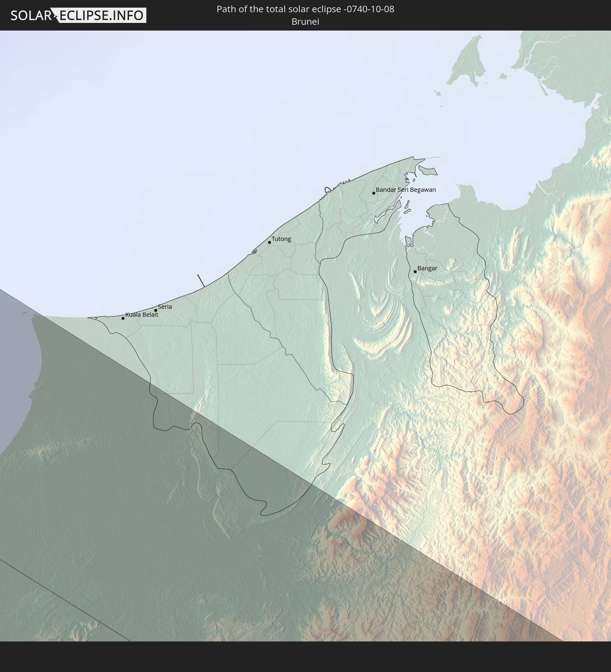 Brunei
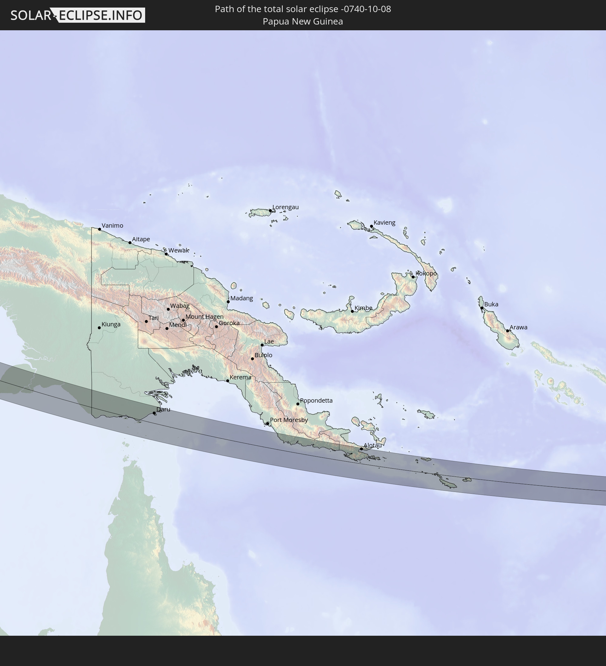 Papua New Guinea
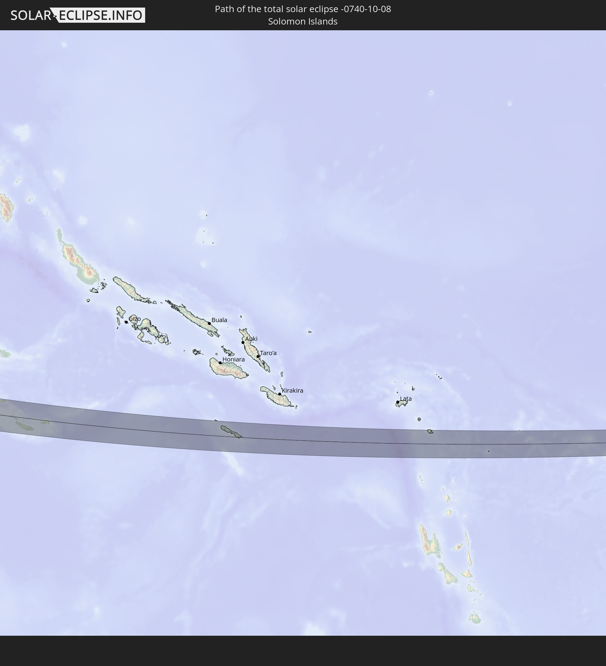 Solomon Islands
In den folgenden Ländern ist die Sonnenfinsternis partiell zu sehen
 Fiji
Fiji
 Russia
 New Zealand
 United States Minor Outlying Islands
 Kiribati
 Saudi Arabia
 Somalia
 Yemen
Yemen
 Iran
Iran
 Azerbaijan
 Seychelles
 Kazakhstan
 Qatar
Qatar
 United Arab Emirates
 Oman
Oman
 Turkmenistan
 Uzbekistan
 Afghanistan
 Pakistan
 Tajikistan
 India
India
 Kyrgyzstan
 British Indian Ocean Territory
 Maldives
 China
China
 Sri Lanka
 Nepal
Nepal
 Mongolia
 Bangladesh
 Bhutan
 Myanmar
 Indonesia
 Cocos Islands
 Thailand
 Malaysia
 Laos
Laos
 Vietnam
 Cambodia
 Singapore
 Christmas Island
 Australia
 Macau
Macau
 Hong Kong
 Brunei
 Taiwan
 Philippines
 Japan
Japan
 East Timor
 South Korea
 Palau
Palau
 Federated States of Micronesia
 Papua New Guinea
 Guam
Guam
 Northern Mariana Islands
 Solomon Islands
 New Caledonia
 Marshall Islands
 Vanuatu
 Nauru
Nauru
 Norfolk Island
 Tuvalu
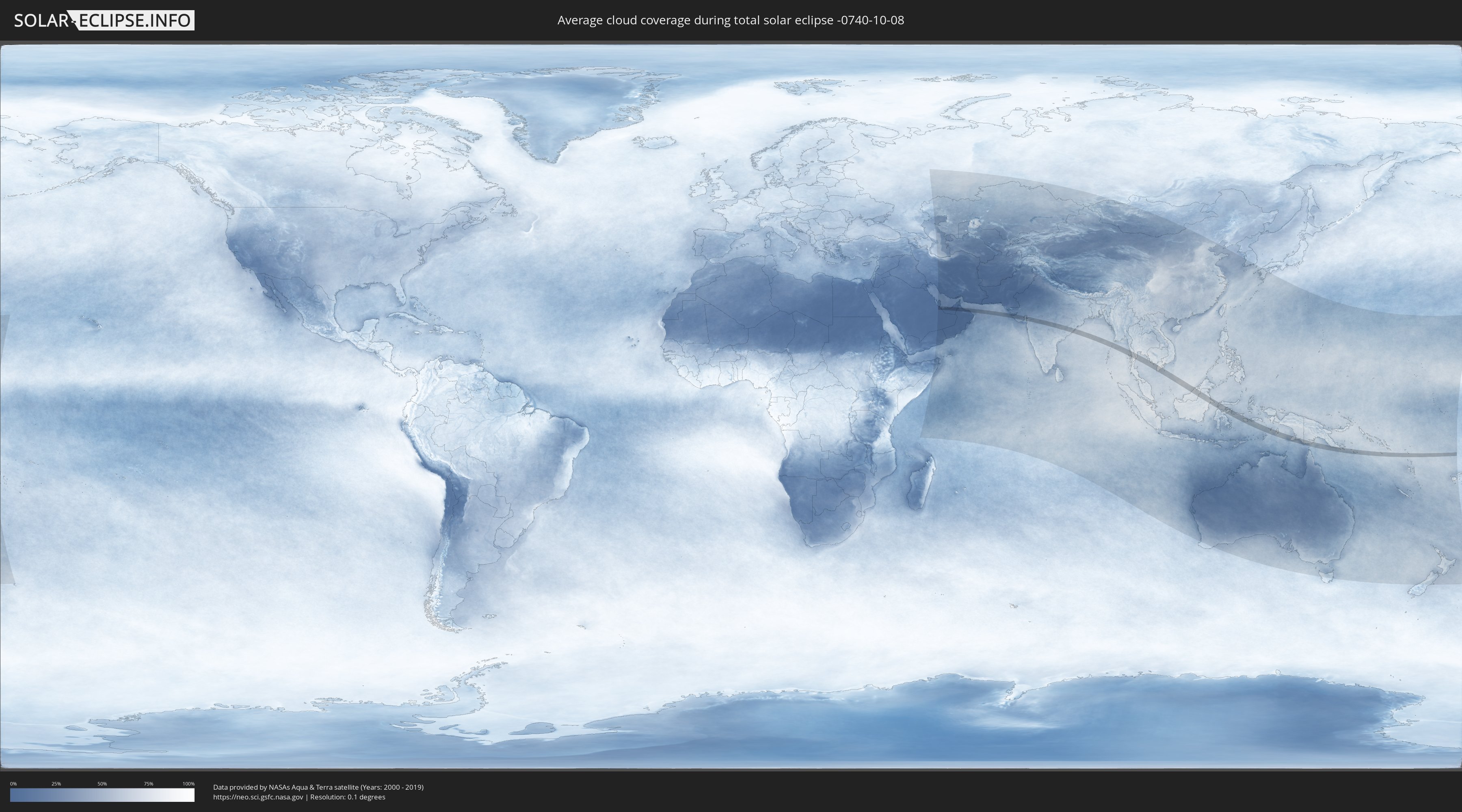
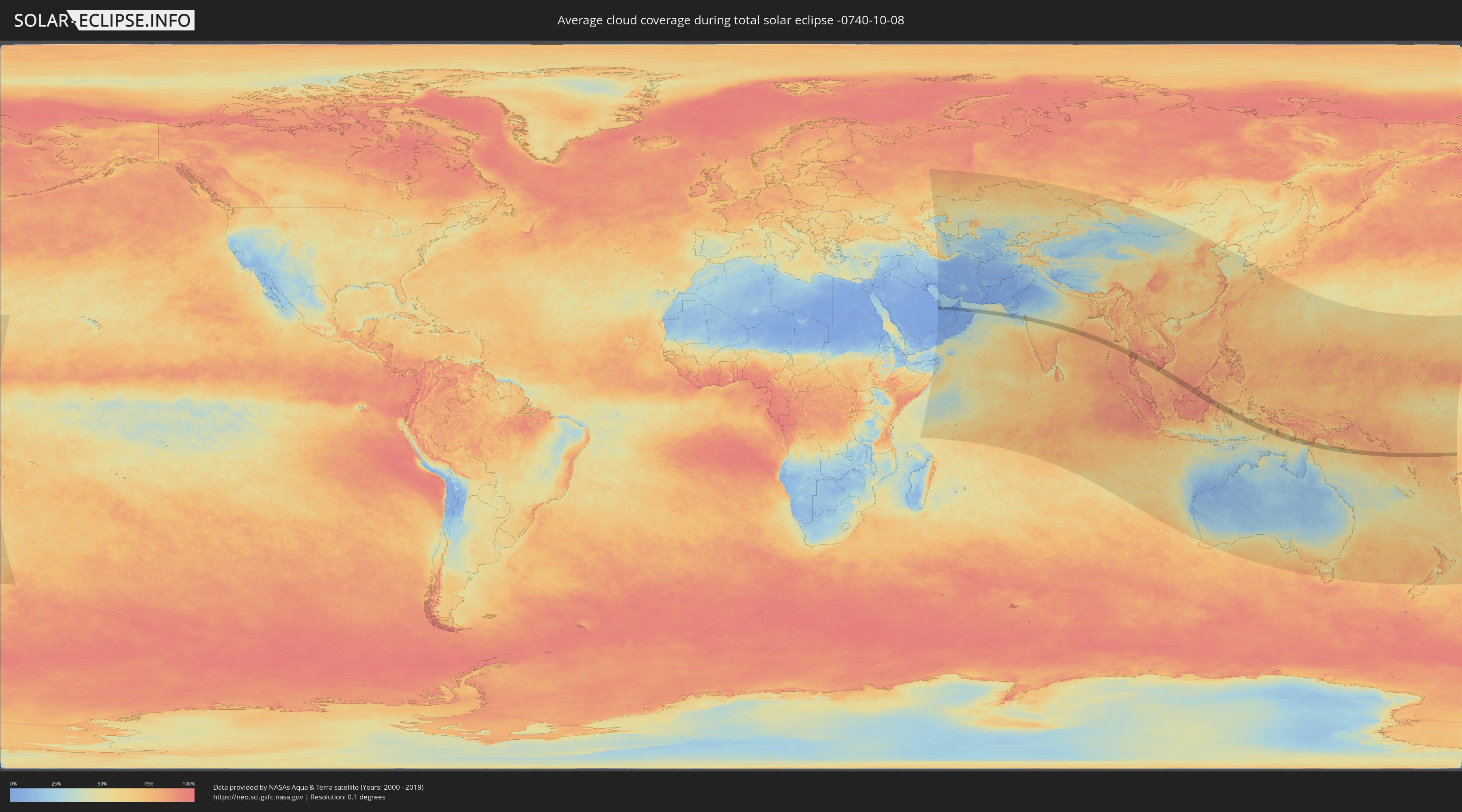
How will be the weather during the total solar eclipse on 10/08/-0740?
Where is the best place to see the total solar eclipse of 10/08/-0740?
The following maps show the average cloud coverage for the day of the total solar eclipse.
With the help of these maps, it is possible to find the place along the eclipse path, which has the best
chance of a cloudless sky.
Nevertheless, you should consider local circumstances and inform about the weather of your chosen
observation site.
The data is provided by NASAs satellites
AQUA and TERRA.
The cloud maps are averaged over a period of 19 years (2000 - 2019).
Detailed country maps
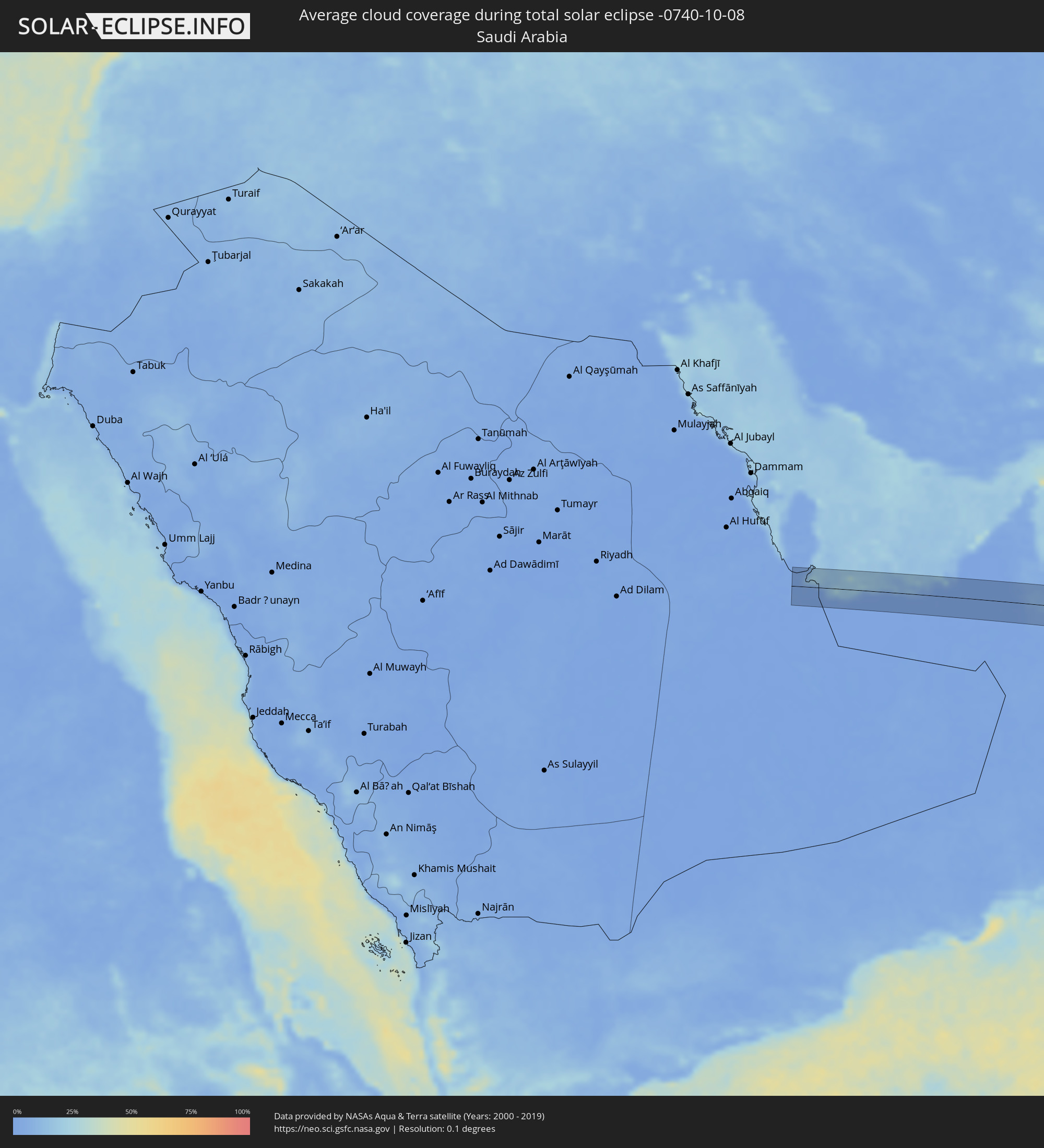 Saudi Arabia
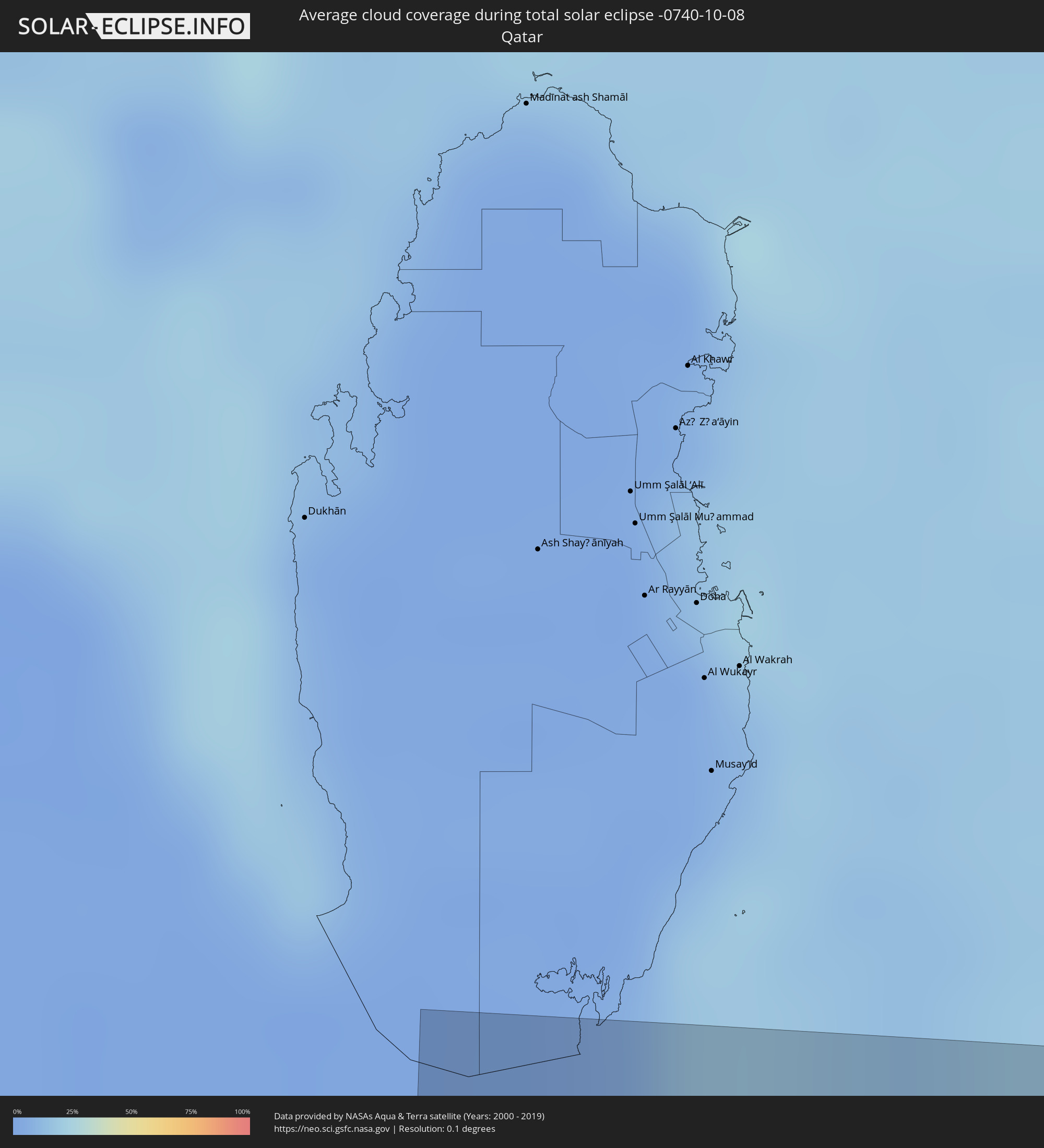 Qatar
Qatar
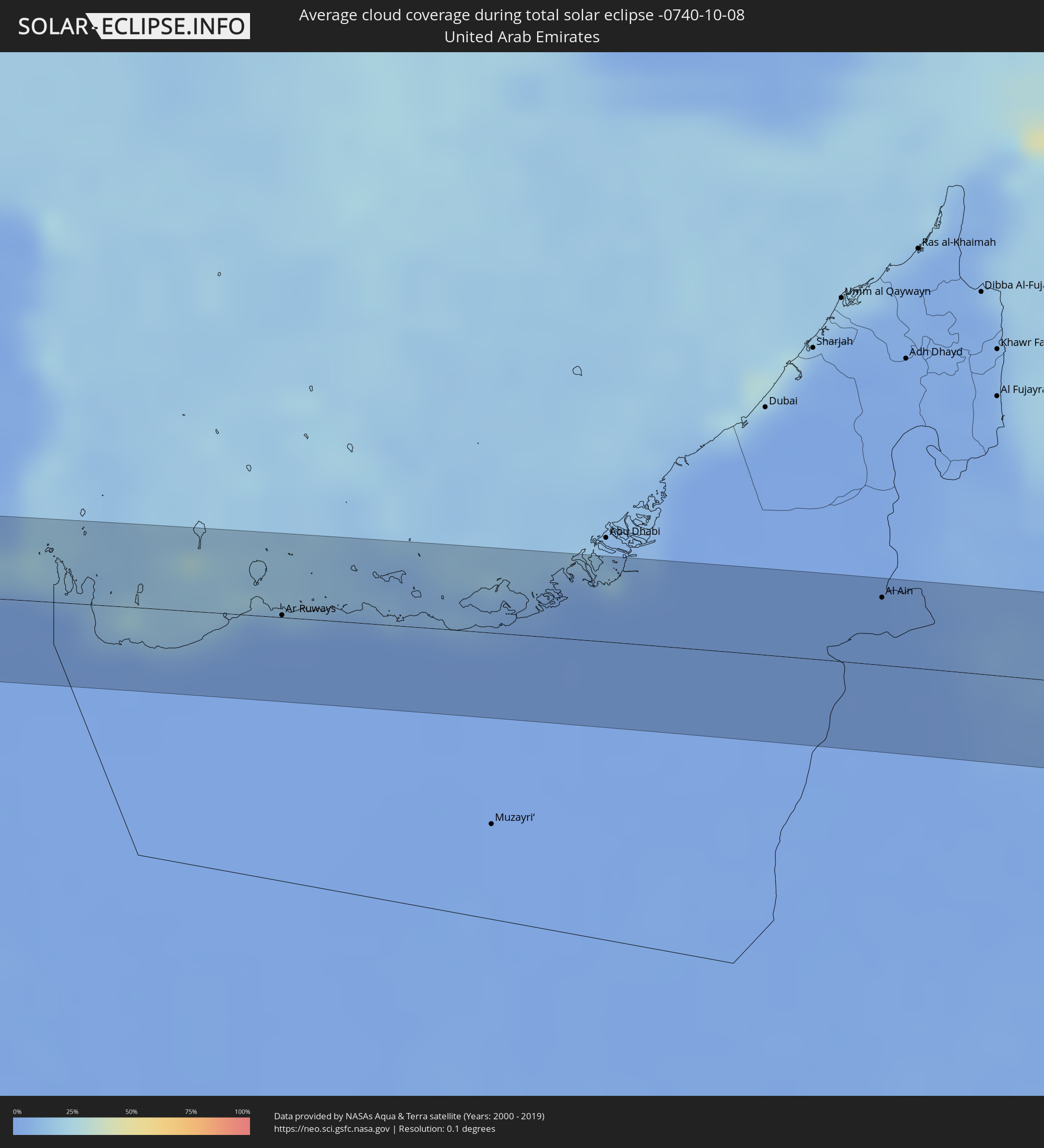 United Arab Emirates
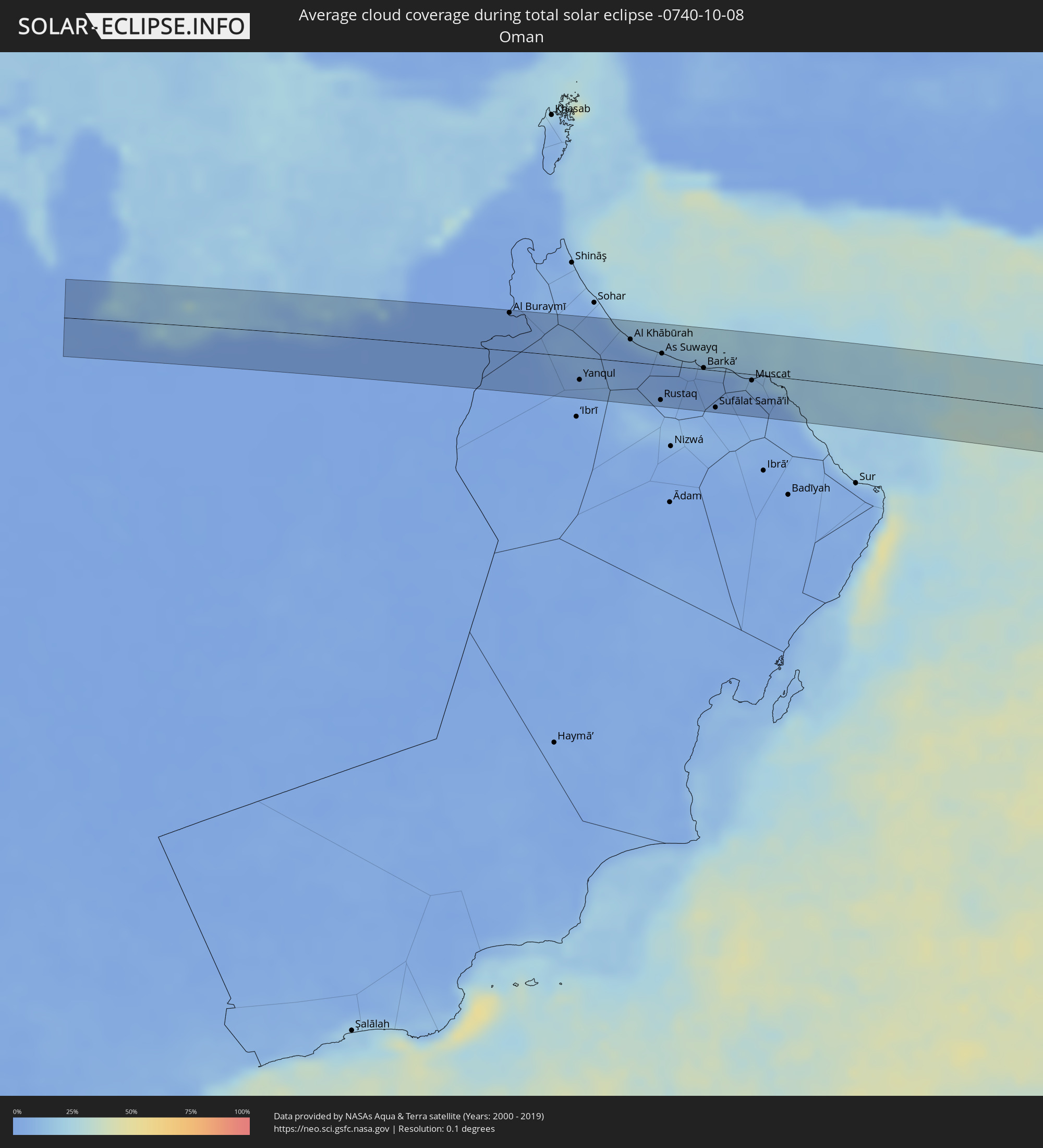 Oman
Oman
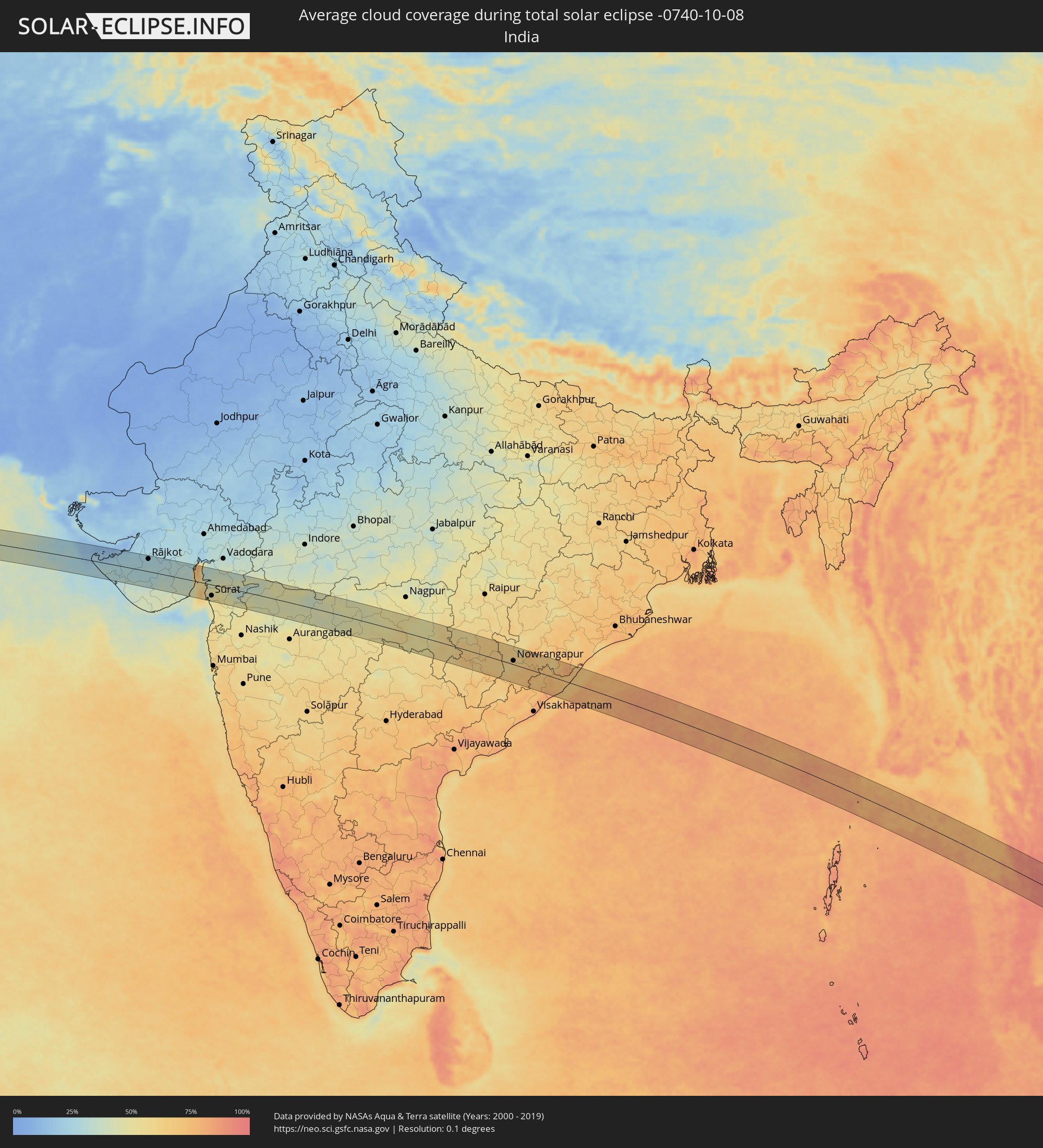 India
India
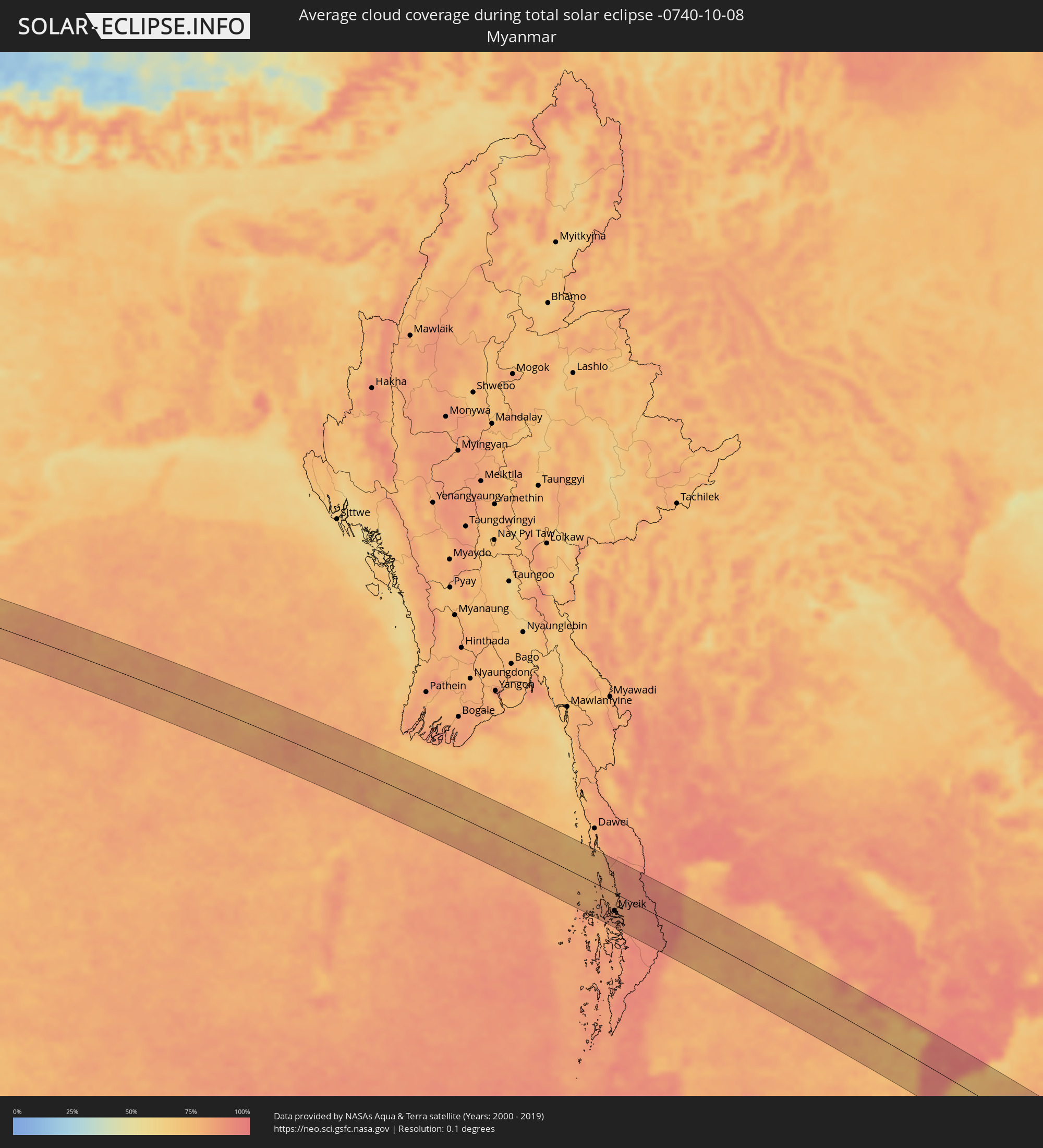 Myanmar
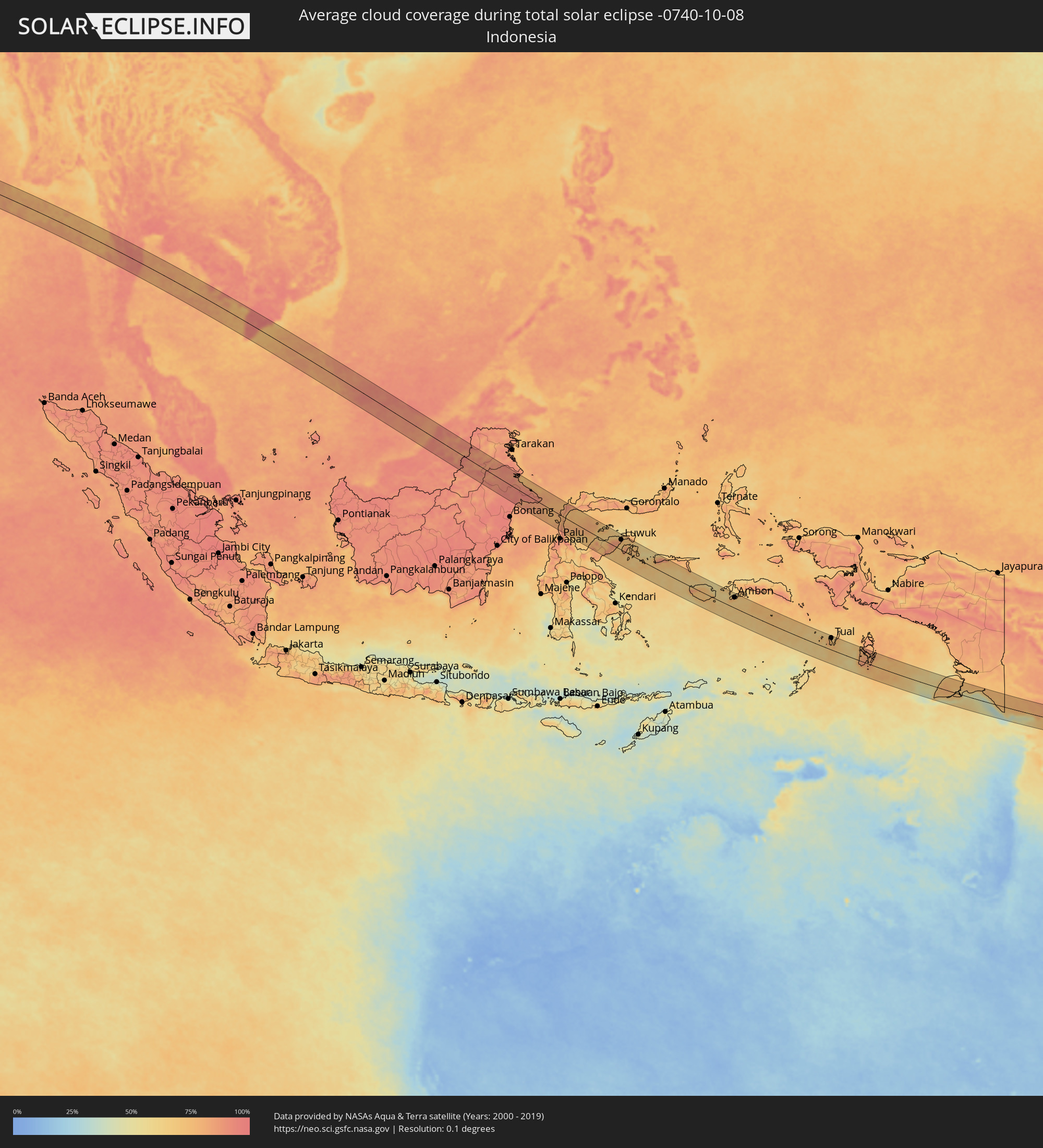 Indonesia
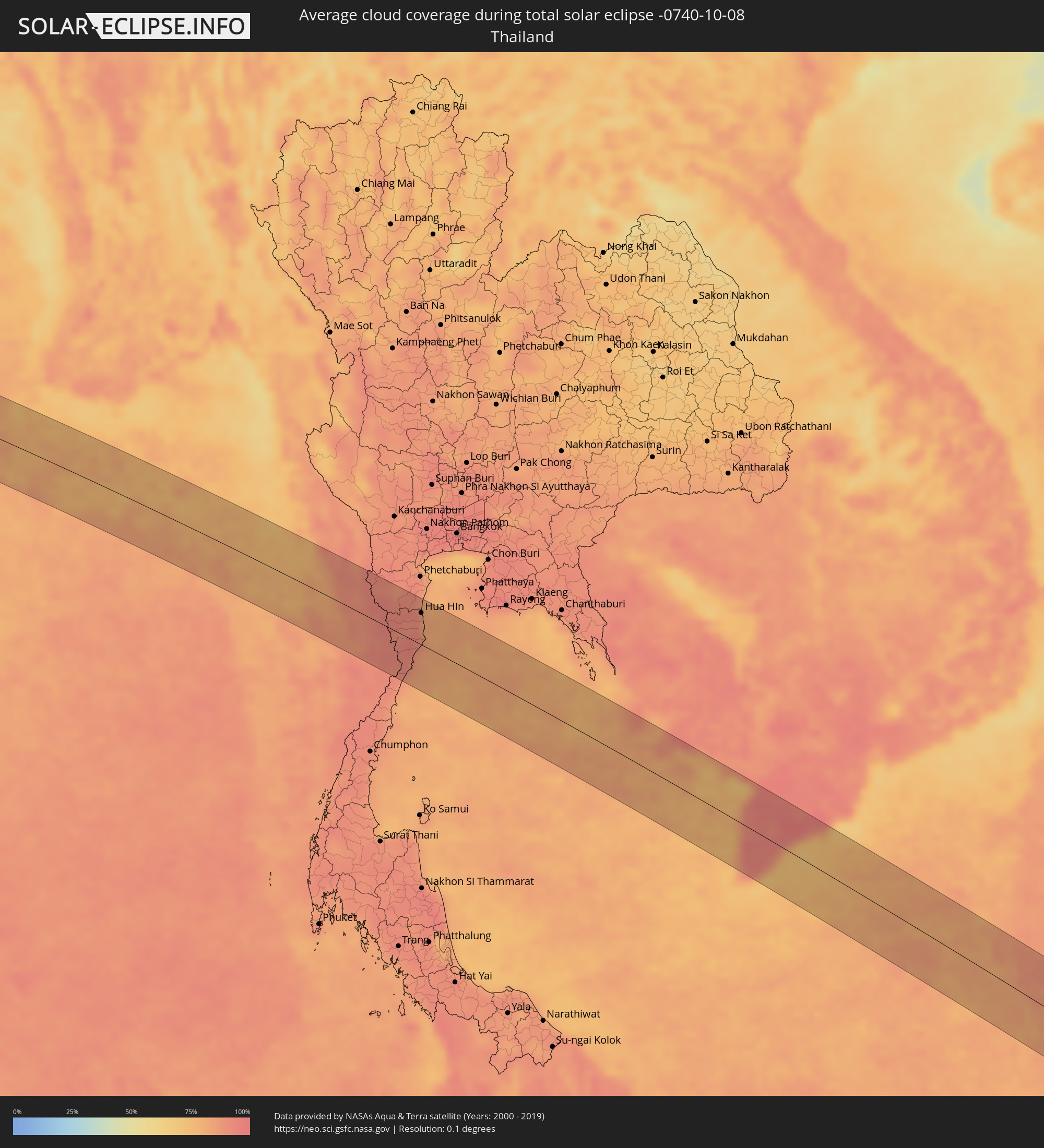 Thailand
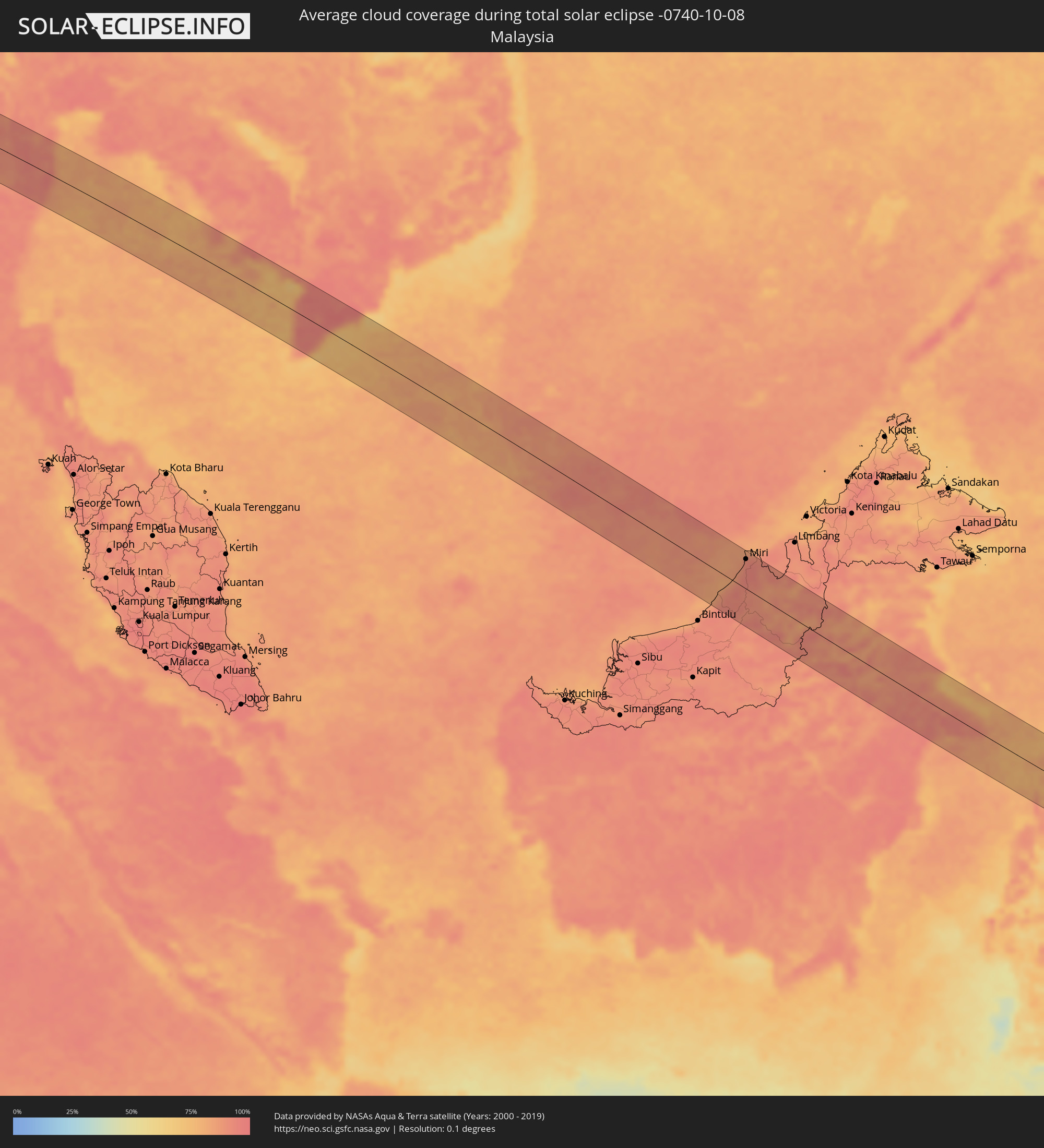 Malaysia
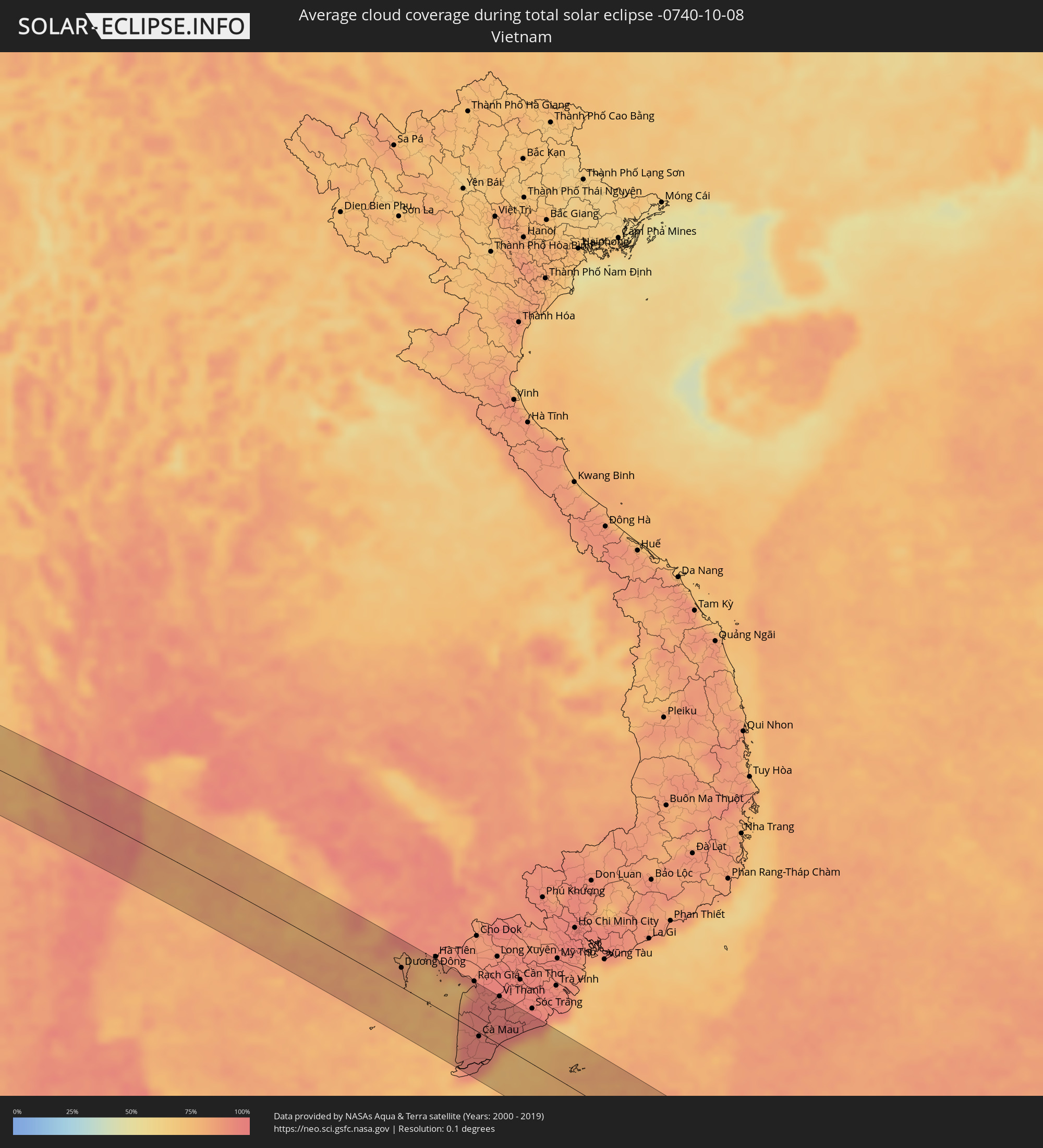 Vietnam
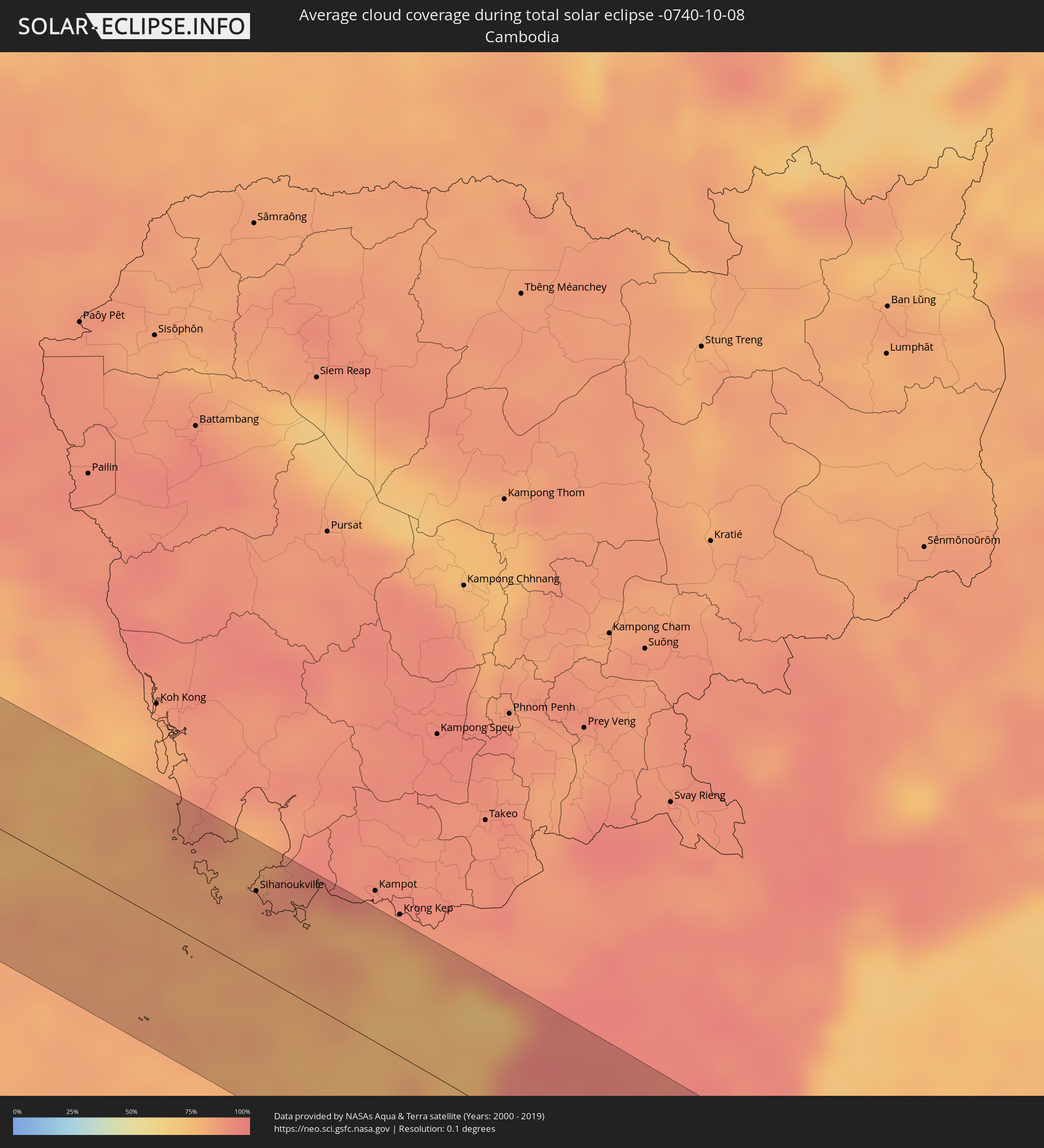 Cambodia
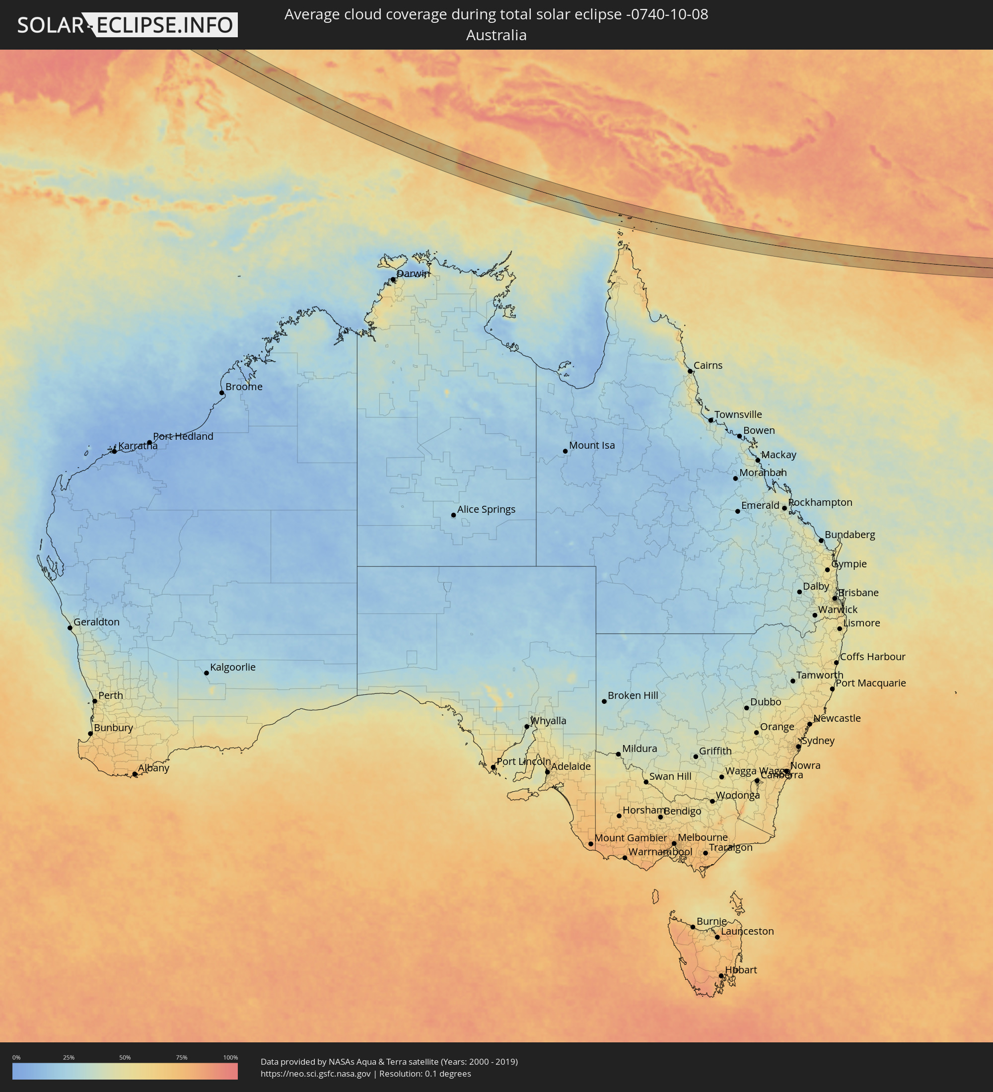 Australia
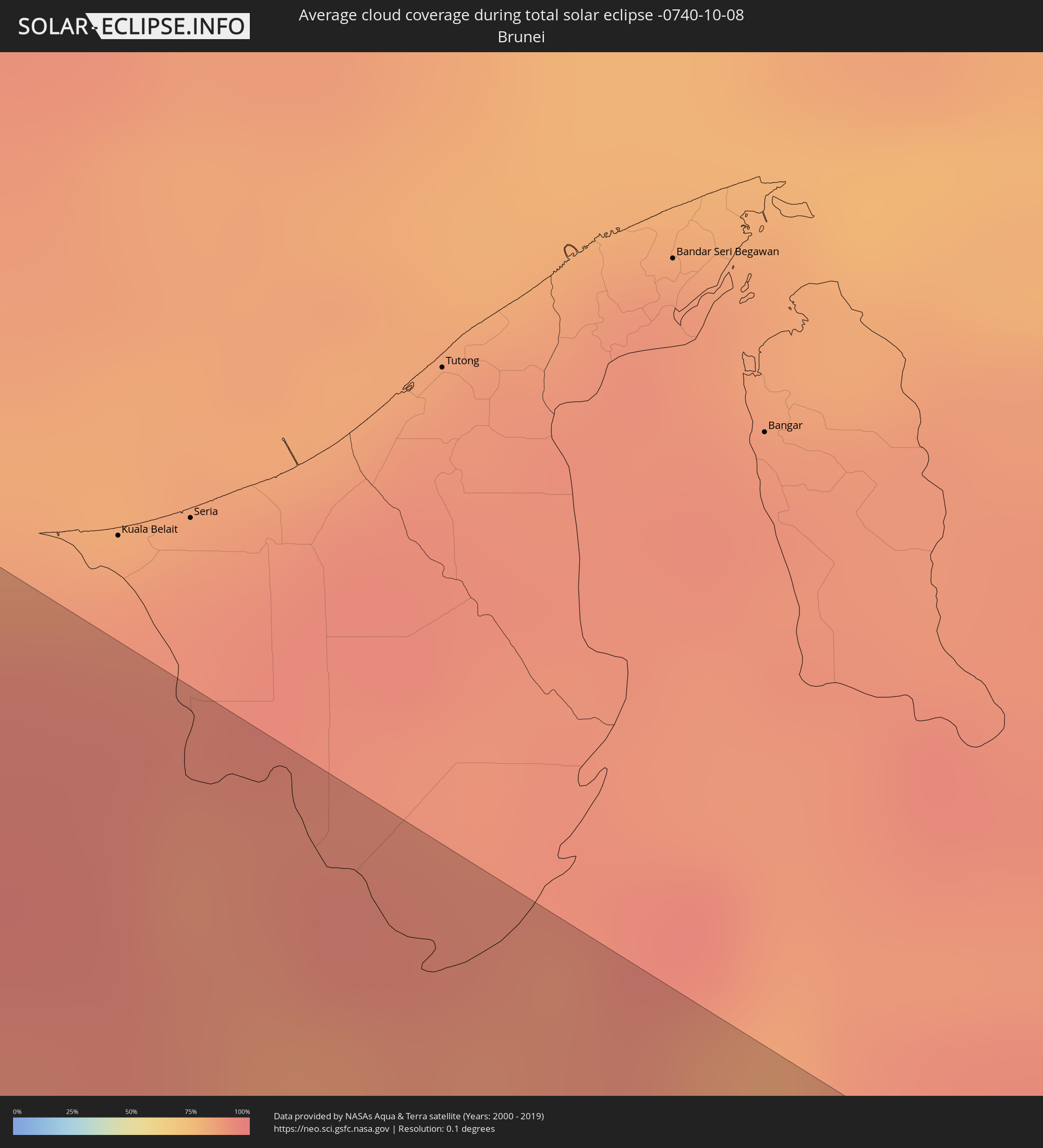 Brunei
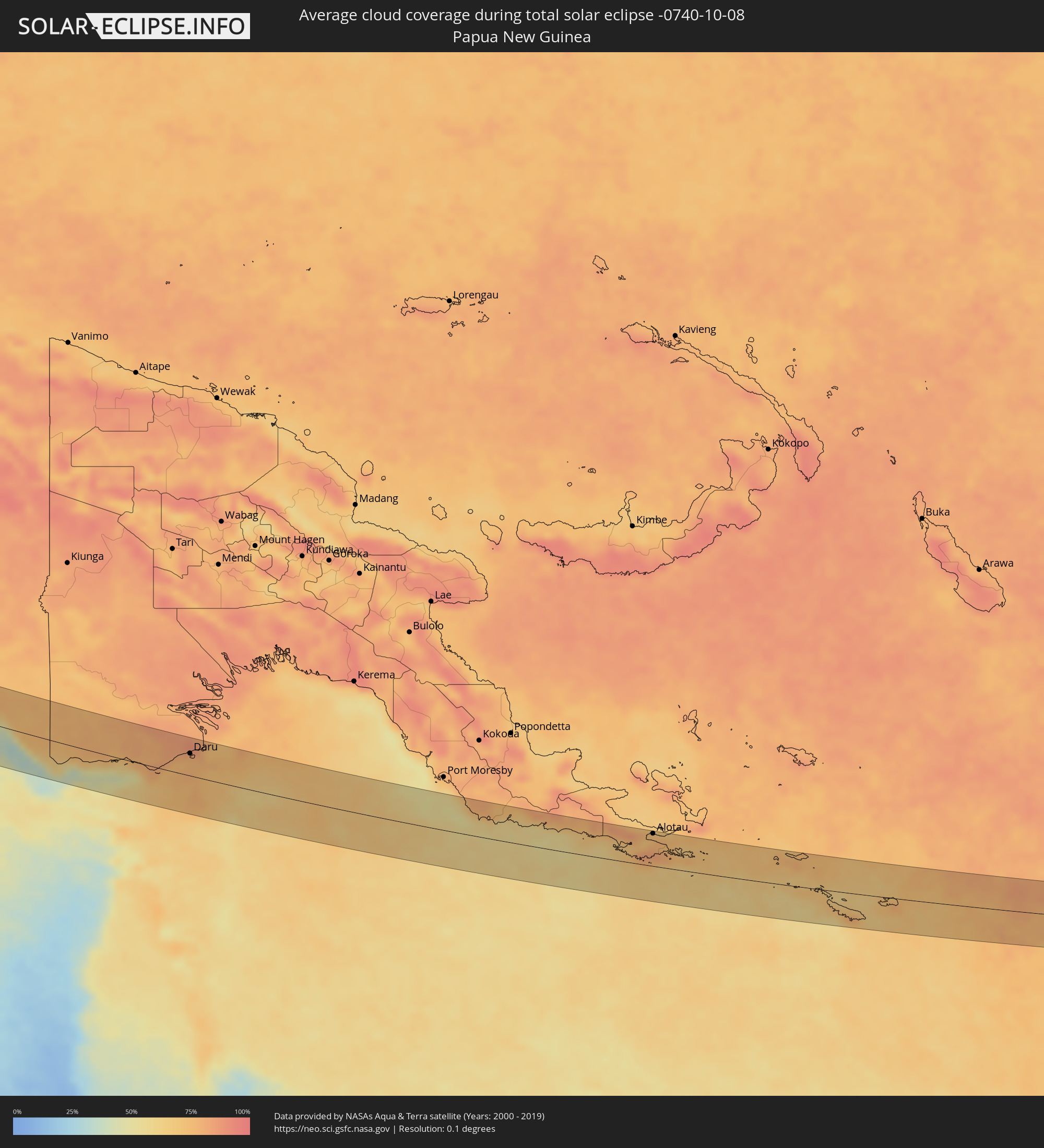 Papua New Guinea
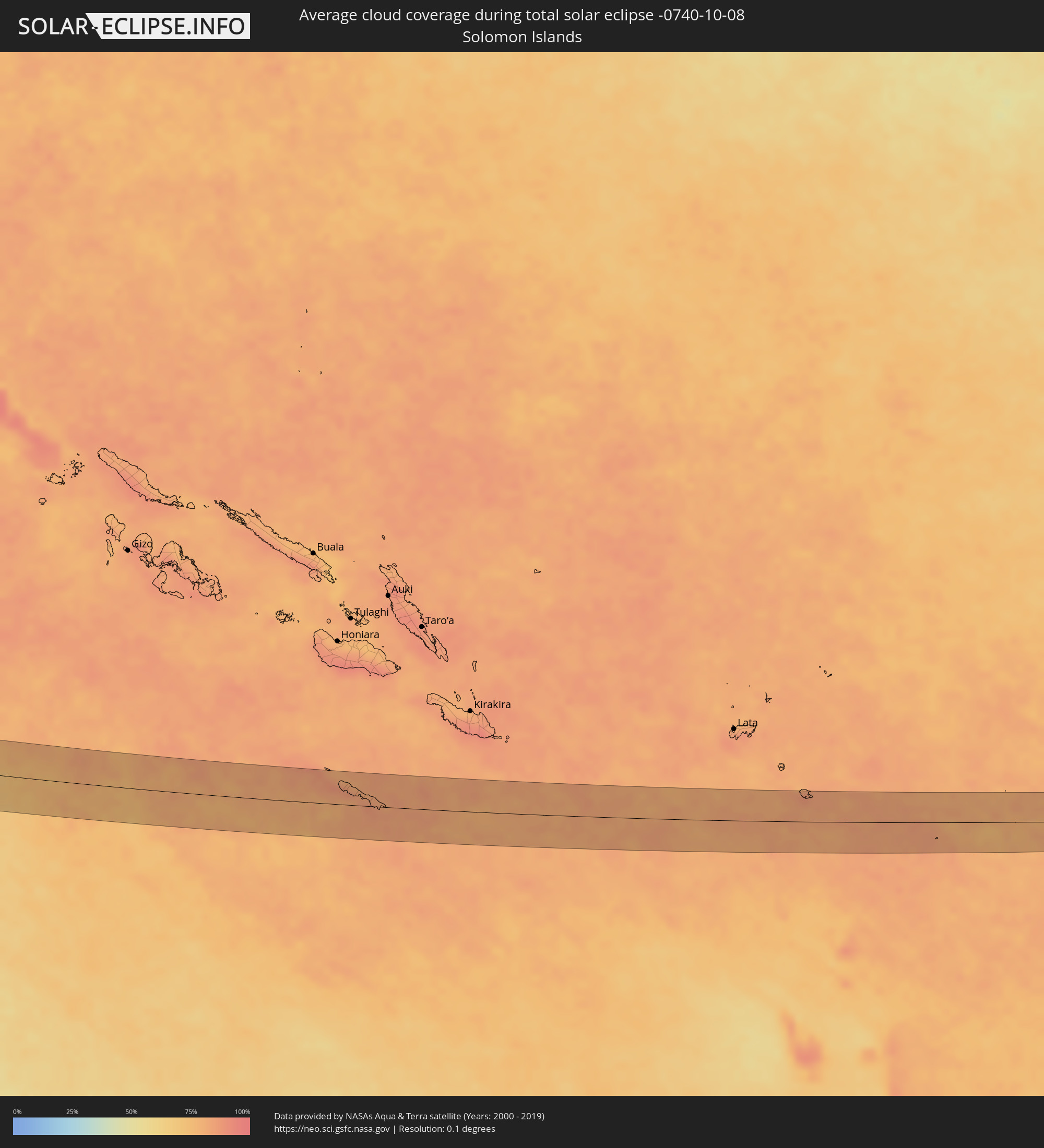 Solomon Islands
Cities inside the path of the eclipse
The following table shows all locations with a population of more than 5,000 inside the eclipse path. Cities which have more than 100,000 inhabitants are marked bold. A click at the locations opens a detailed map.
| City | Type | Eclipse duration | Local time of max. eclipse | Distance to central line | Ø Cloud coverage |
|
Ar Ruways, Abu Dhabi
|
total | - | 06:14:58 UTC+03:41 | 1 km | 2% |
|
Al Ain, Abu Dhabi
|
total | - | 06:15:17 UTC+03:41 | 35 km | 1% |
|
Al Buraymī, Al Buraimi
|
total | - | 06:15:18 UTC+03:41 | 41 km | 1% |
|
Yanqul, Az̧ Z̧āhirah
|
total | - | 06:15:20 UTC+03:41 | 25 km | 3% |
|
Şaḩam, Al Batinah North Governorate
|
total | - | 06:15:28 UTC+03:41 | 43 km | 7% |
|
Al Khābūrah, Al Batinah North Governorate
|
total | - | 06:15:29 UTC+03:41 | 25 km | 4% |
|
Rustaq, Al Batinah South Governorate
|
total | - | 06:15:28 UTC+03:41 | 38 km | 6% |
|
As Suwayq, Al Batinah North Governorate
|
total | - | 06:15:32 UTC+03:41 | 13 km | 2% |
|
Barkā’, Al Batinah South Governorate
|
total | - | 06:15:36 UTC+03:41 | 2 km | 3% |
|
Sufālat Samā’il, Muḩāfaz̧at ad Dākhilīyah
|
total | - | 06:15:35 UTC+03:41 | 40 km | 4% |
|
Bidbid, Muḩāfaz̧at ad Dākhilīyah
|
total | - | 06:15:37 UTC+03:41 | 29 km | 3% |
|
Seeb, Muḩāfaz̧at Masqaţ
|
total | - | 06:15:40 UTC+03:41 | 1 km | 6% |
|
Bawshar, Muḩāfaz̧at Masqaţ
|
total | - | 06:15:42 UTC+03:41 | 10 km | 4% |
|
Muscat, Muḩāfaz̧at Masqaţ
|
total | - | 06:15:42 UTC+03:41 | 7 km | 4% |
|
Jāmnagar, Gujarat
|
total | - | 08:00:33 UTC+05:21 | 46 km | 23% |
|
Jūnāgadh, Gujarat
|
total | - | 08:00:52 UTC+05:21 | 50 km | 34% |
|
Jetpur, Gujarat
|
total | - | 08:00:57 UTC+05:21 | 21 km | 29% |
|
Rājkot, Gujarat
|
total | - | 08:01:01 UTC+05:21 | 41 km | 26% |
|
Gondal, Gujarat
|
total | - | 08:01:03 UTC+05:21 | 5 km | 29% |
|
Amreli, Gujarat
|
total | - | 08:01:22 UTC+05:21 | 26 km | 35% |
|
Botād, Gujarat
|
total | - | 08:01:37 UTC+05:21 | 45 km | 30% |
|
Bhāvnagar, Gujarat
|
total | - | 08:02:00 UTC+05:21 | 13 km | 35% |
|
Sūrat, Gujarat
|
total | - | 08:02:34 UTC+05:21 | 36 km | 47% |
|
Bharūch, Gujarat
|
total | - | 08:02:37 UTC+05:21 | 22 km | 42% |
|
Nandurbar, Maharashtra
|
total | - | 08:03:38 UTC+05:21 | 15 km | 38% |
|
Dhūlia, Maharashtra
|
total | - | 08:04:09 UTC+05:21 | 23 km | 44% |
|
Jalgaon, Maharashtra
|
total | - | 08:04:48 UTC+05:21 | 7 km | 46% |
|
Bhusāval, Maharashtra
|
total | - | 08:04:59 UTC+05:21 | 17 km | 41% |
|
Akola, Maharashtra
|
total | - | 08:06:09 UTC+05:21 | 12 km | 45% |
|
Amrāvati, Maharashtra
|
total | - | 08:06:48 UTC+05:21 | 55 km | 44% |
|
Yavatmāl, Maharashtra
|
total | - | 08:07:18 UTC+05:21 | 8 km | 49% |
|
Chānda, Maharashtra
|
total | - | 08:08:35 UTC+05:21 | 8 km | 53% |
|
Nowrangapur, Odisha
|
total | - | 08:12:26 UTC+05:21 | 12 km | 62% |
|
Chicacole, Andhra Pradesh
|
total | - | 08:14:28 UTC+05:21 | 43 km | 76% |
|
Myeik, Tanintharyi
|
total | - | 09:46:52 UTC+06:24 | 34 km | 87% |
|
Prachuap Khiri Khan, Prachuap Khiri Khan
|
total | - | 10:07:17 UTC+06:42 | 36 km | 87% |
|
Kui Buri, Prachuap Khiri Khan
|
total | - | 10:07:09 UTC+06:42 | 7 km | 88% |
|
Sam Roi Yot, Prachuap Khiri Khan
|
total | - | 10:06:58 UTC+06:42 | 13 km | 92% |
|
Pran Buri, Prachuap Khiri Khan
|
total | - | 10:06:54 UTC+06:42 | 26 km | 94% |
|
Hua Hin, Prachuap Khiri Khan
|
total | - | 10:06:49 UTC+06:42 | 47 km | 84% |
|
Sihanoukville, Preah Sihanouk
|
total | - | 10:16:58 UTC+06:42 | 43 km | 83% |
|
Dương Đông, Kiến Giang
|
total | - | 10:43:03 UTC+07:06 | 28 km | 82% |
|
Cà Mau, Cà Mau
|
total | - | 10:47:12 UTC+07:06 | 6 km | 96% |
|
Vị Thanh, Hau Giang
|
total | - | 10:47:08 UTC+07:06 | 70 km | 95% |
|
Thành phố Bạc Liêu, Bạc Liêu
|
total | - | 10:48:24 UTC+07:06 | 38 km | 93% |
|
Miri, Sarawak
|
total | - | 11:31:12 UTC+07:21 | 56 km | 92% |
|
Luwuk, Central Sulawesi
|
total | - | 12:38:55 UTC+07:57 | 47 km | 70% |
|
Ambon, Maluku
|
total | - | 14:21:24 UTC+09:22 | 50 km | 69% |
|
Tual, Maluku
|
total | - | 14:34:12 UTC+09:22 | 58 km | 69% |
|
Daru, Western Province
|
total | - | 15:34:00 UTC+10:00 | 37 km | 77% |
|
Alotau, Milne Bay
|
total | - | 15:44:35 UTC+10:00 | 55 km | 76% |