Annular solar eclipse of 10/27/-0815
| Day of week: | Saturday |
| Maximum duration of eclipse: | 08m07s |
| Maximum width of eclipse path: | 1123 km |
| Saros cycle: | 59 |
| Coverage: | 91.2% |
| Magnitude: | 0.9122 |
| Gamma: | 0.9531 |
Wo kann man die Sonnenfinsternis vom 10/27/-0815 sehen?
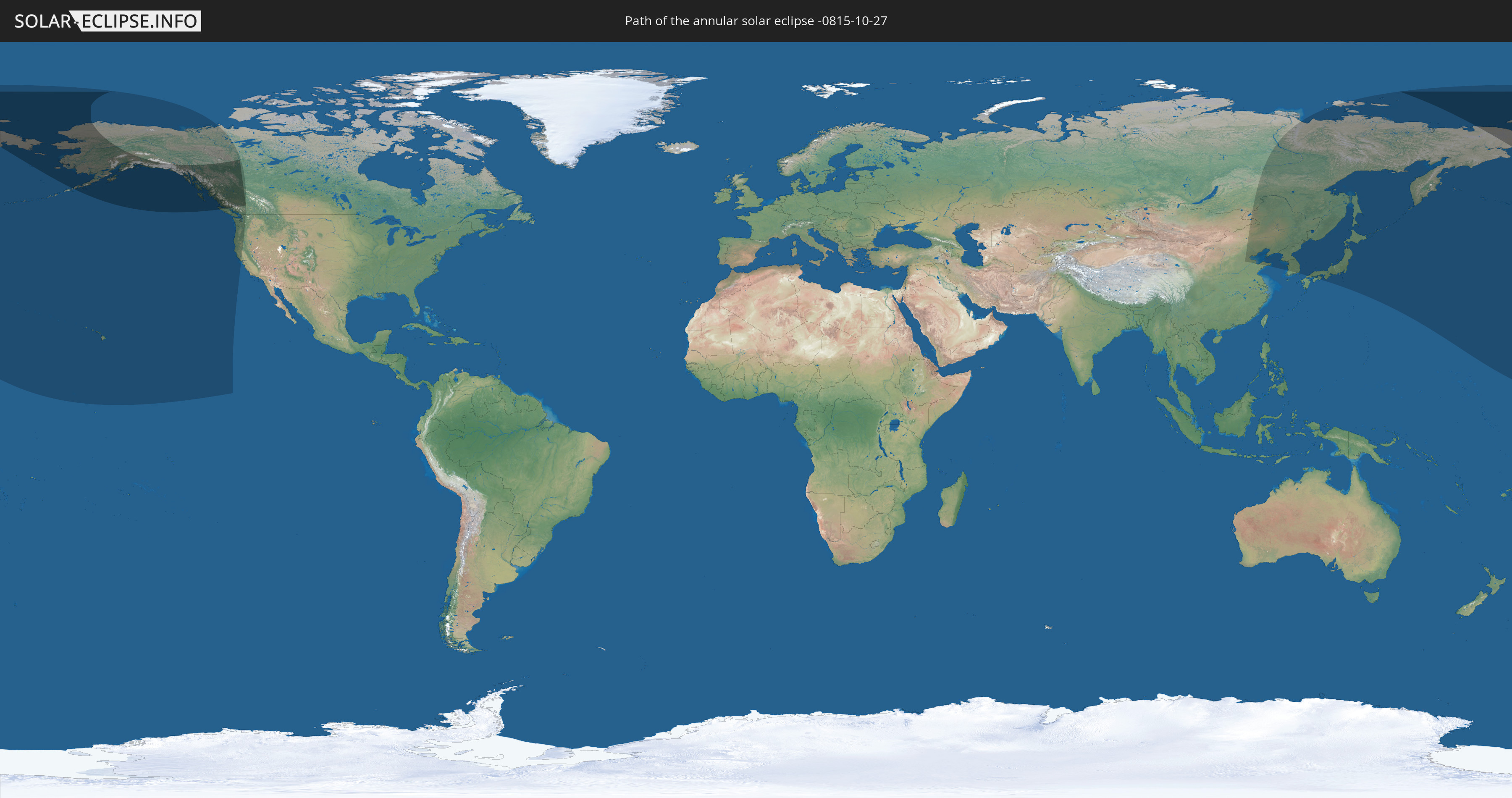
Die Sonnenfinsternis am 10/27/-0815 kann man in 10 Ländern als partielle Sonnenfinsternis beobachten.
Der Finsternispfad verläuft durch 3 Länder. Nur in diesen Ländern ist sie als annular Sonnenfinsternis zu sehen.
In den folgenden Ländern ist die Sonnenfinsternis annular zu sehen
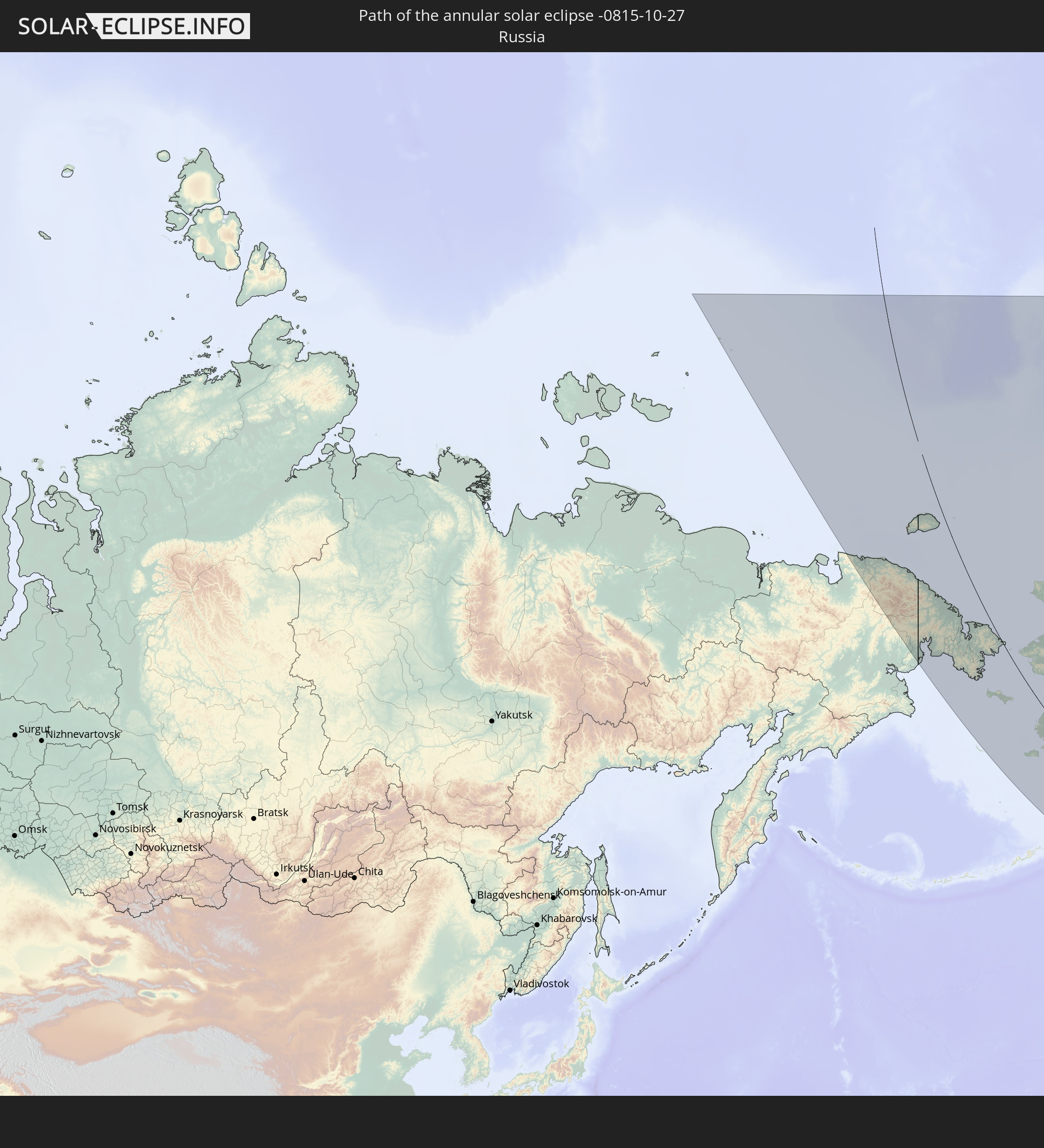 Russia
 United States
 Canada
In den folgenden Ländern ist die Sonnenfinsternis partiell zu sehen


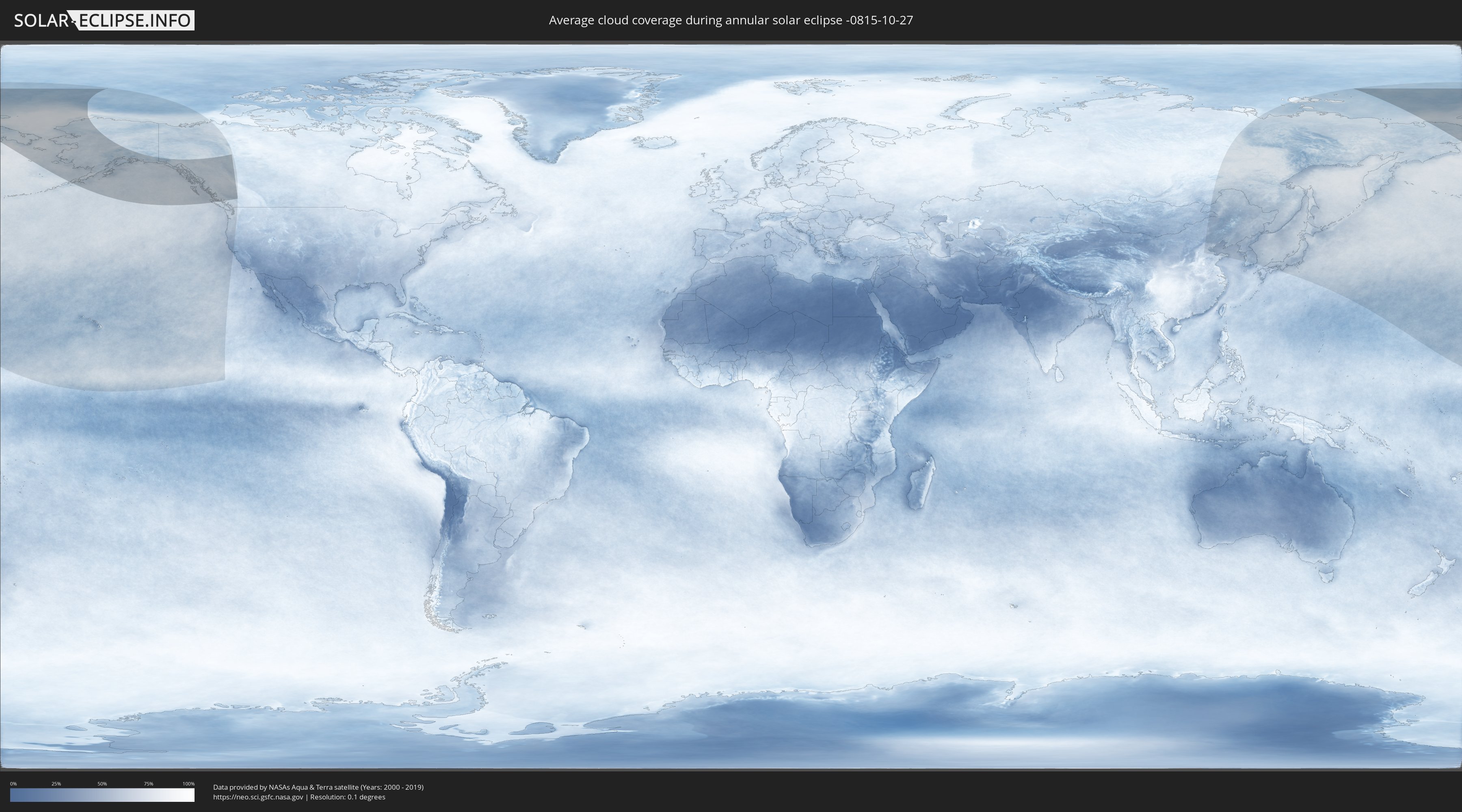
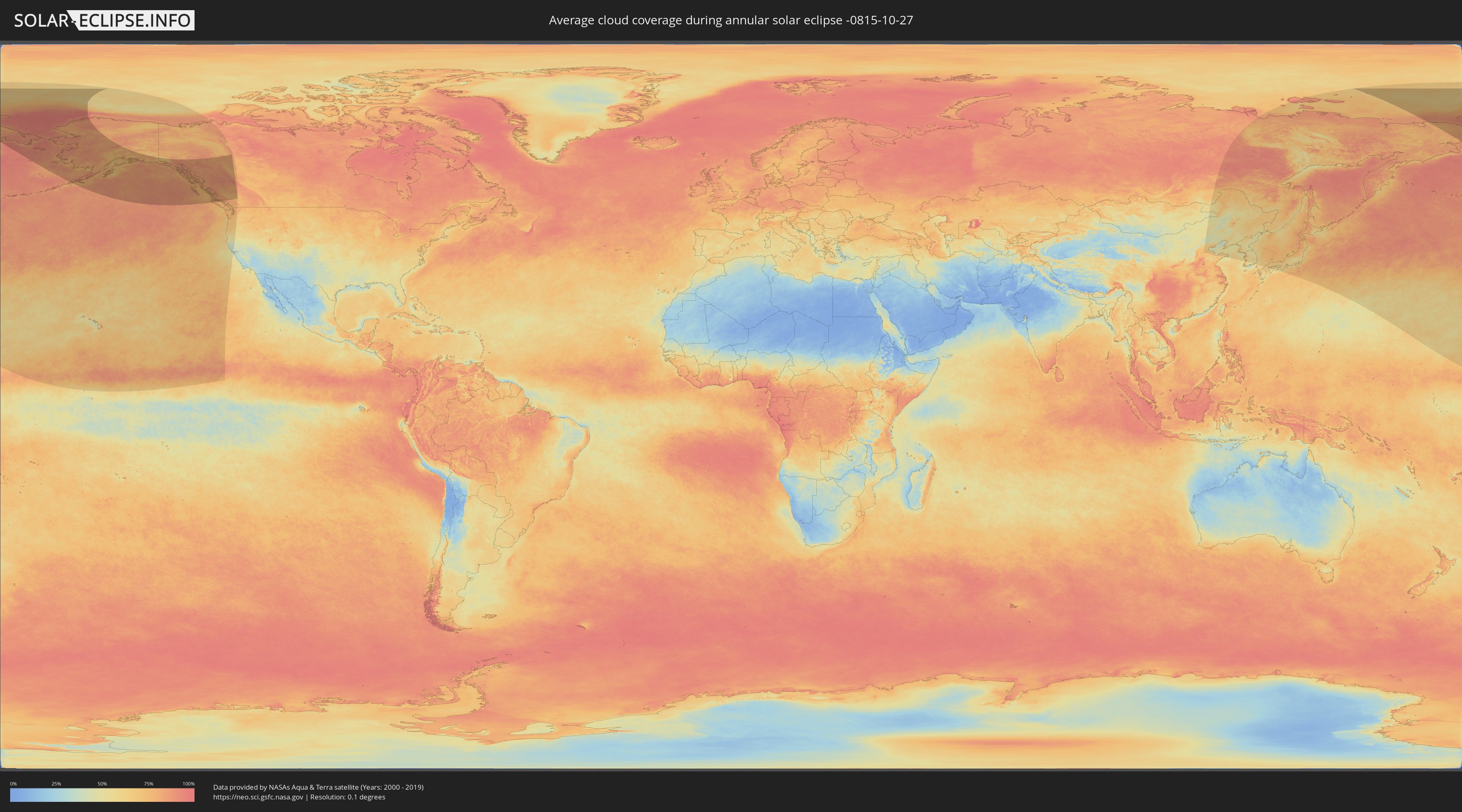
How will be the weather during the annular solar eclipse on 10/27/-0815?
Where is the best place to see the annular solar eclipse of 10/27/-0815?
The following maps show the average cloud coverage for the day of the annular solar eclipse.
With the help of these maps, it is possible to find the place along the eclipse path, which has the best
chance of a cloudless sky.
Nevertheless, you should consider local circumstances and inform about the weather of your chosen
observation site.
The data is provided by NASAs satellites
AQUA and TERRA.
The cloud maps are averaged over a period of 19 years (2000 - 2019).
Detailed country maps
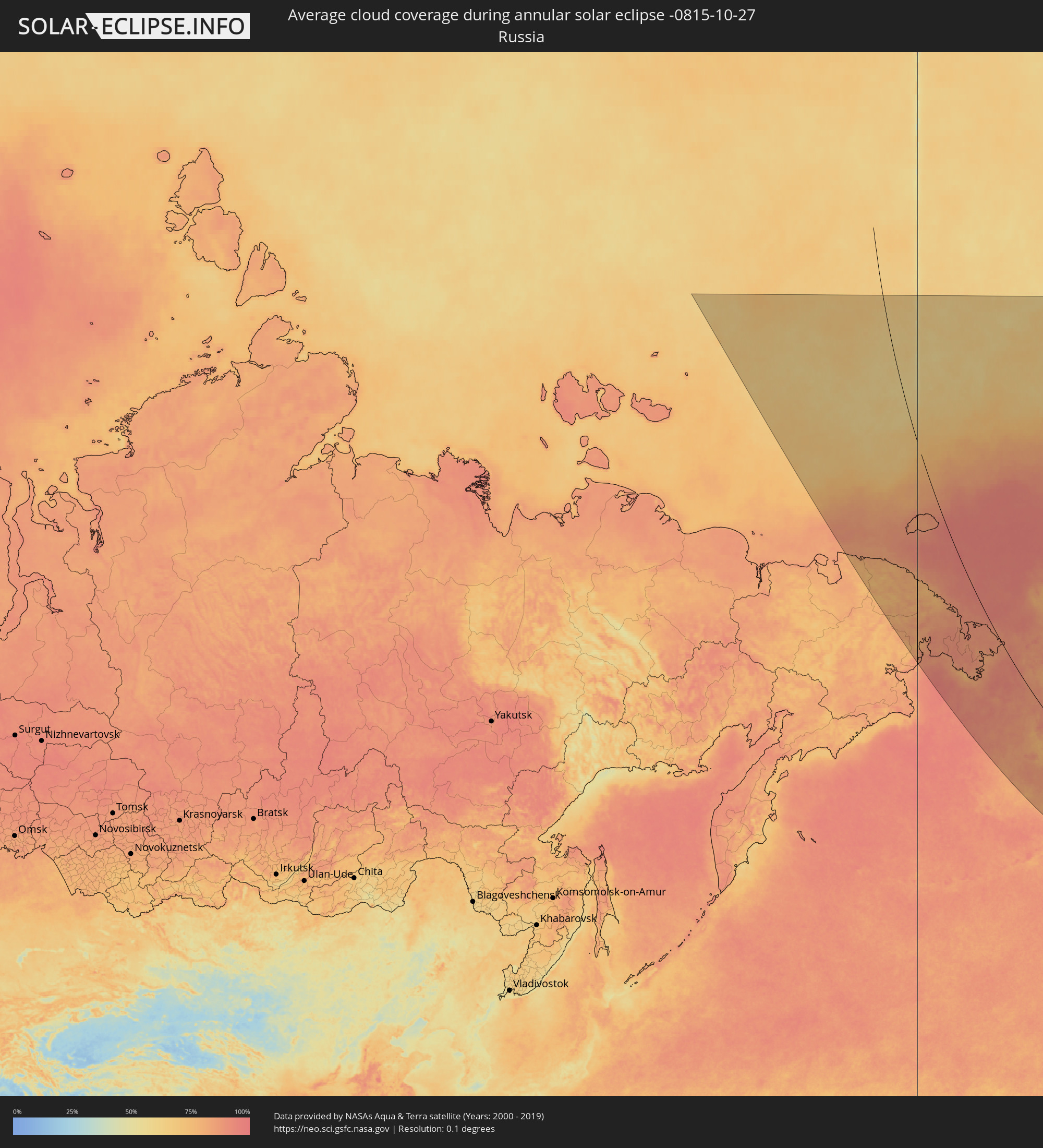 Russia
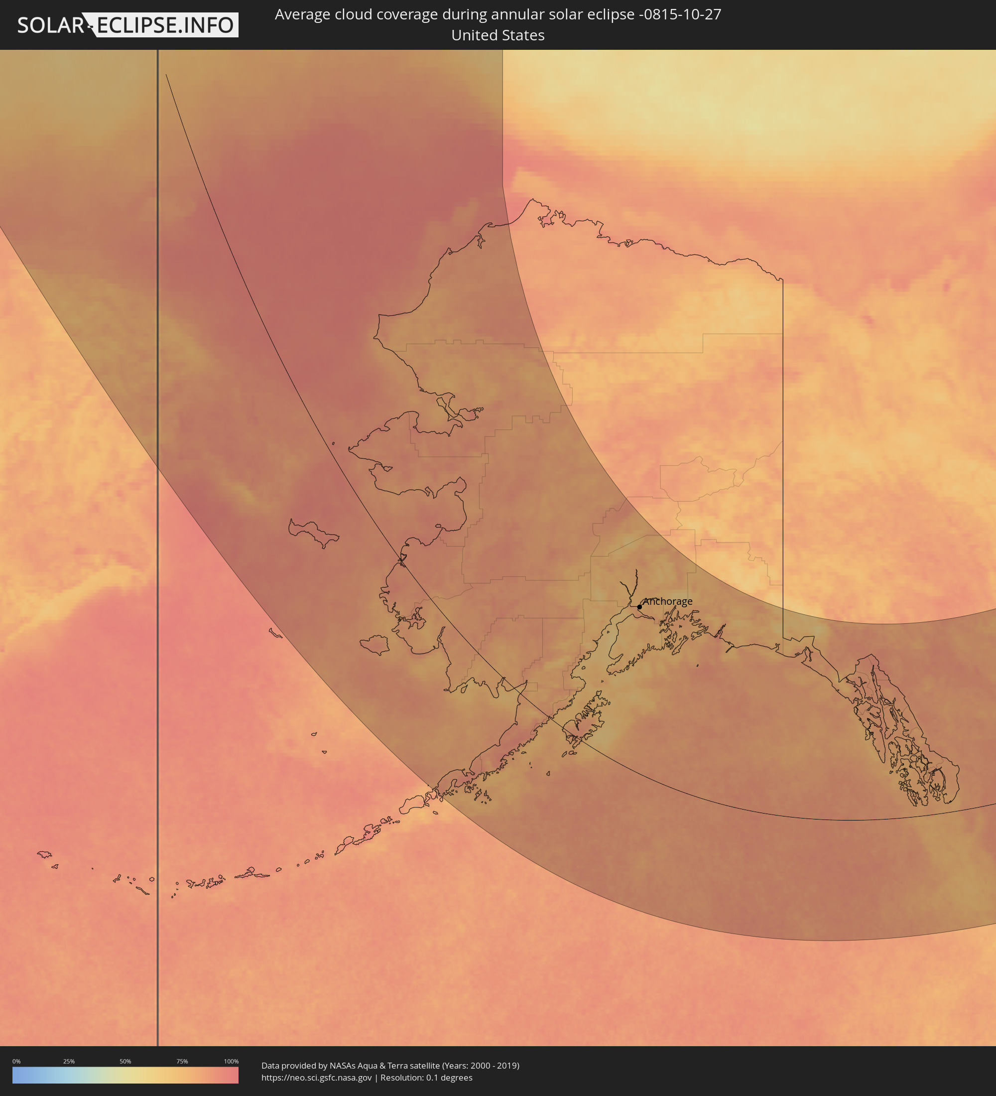 United States
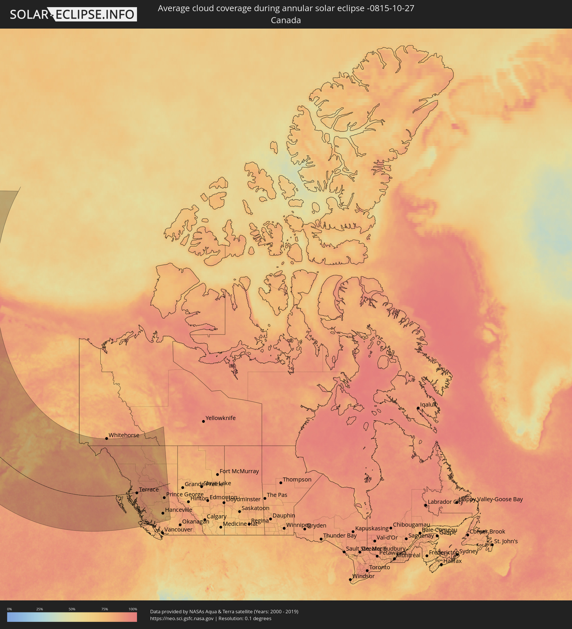 Canada
Cities inside the path of the eclipse
The following table shows all locations with a population of more than 5,000 inside the eclipse path. Cities which have more than 100,000 inhabitants are marked bold. A click at the locations opens a detailed map.
| City | Type | Eclipse duration | Local time of max. eclipse | Distance to central line | Ø Cloud coverage |
 Bethel, Alaska
|
annular | - | 14:11:17 UTC-10:00 | 1 km | 80% |
|
Kodiak, Alaska
|
annular | - | 14:26:19 UTC-10:00 | 115 km | 72% |
|
Homer, Alaska
|
annular | - | 14:24:16 UTC-10:00 | 310 km | 69% |
|
Kalifornsky, Alaska
|
annular | - | 14:23:18 UTC-10:00 | 386 km | 67% |
|
Kenai, Alaska
|
annular | - | 14:23:07 UTC-10:00 | 398 km | 66% |
|
Sterling, Alaska
|
annular | - | 14:23:39 UTC-10:00 | 415 km | 73% |
|
Anchorage, Alaska
|
annular | - | 14:23:24 UTC-10:00 | 502 km | 76% |
|
Elmendorf Air Force Base, Alaska
|
annular | - | 14:23:36 UTC-10:00 | 515 km | 74% |
|
Meadow Lakes, Alaska
|
annular | - | 14:23:02 UTC-10:00 | 546 km | 76% |
|
Knik-Fairview, Alaska
|
annular | - | 14:23:13 UTC-10:00 | 537 km | 80% |
|
Eagle River, Alaska
|
annular | - | 14:23:33 UTC-10:00 | 523 km | 74% |
|
Wasilla, Alaska
|
annular | - | 14:23:15 UTC-10:00 | 549 km | 76% |
|
Tanaina, Alaska
|
annular | - | 14:23:11 UTC-10:00 | 553 km | 76% |
|
Lakes, Alaska
|
annular | - | 14:23:20 UTC-10:00 | 555 km | 76% |
|
Gateway, Alaska
|
annular | - | 14:23:27 UTC-10:00 | 555 km | 76% |
|
Palmer, Alaska
|
annular | - | 14:23:32 UTC-10:00 | 562 km | 75% |
|
Sitka, Alaska
|
annular | - | 14:43:43 UTC-10:00 | 320 km | 78% |
 Whitehorse, Yukon
|
annular | - | 16:36:40 UTC-08:00 | 726 km | 82% |
|
Juneau, Alaska
|
annular | - | 14:41:53 UTC-10:00 | 455 km | 83% |
|
Ketchikan, Alaska
|
annular | - | 14:49:43 UTC-10:00 | 108 km | 78% |
|
Prince Rupert, British Columbia
|
annular | - | 16:52:38 UTC-08:00 | 18 km | 77% |
|
Kitimat, British Columbia
|
annular | - | 16:54:09 UTC-08:00 | 65 km | 79% |
|
Terrace, British Columbia
|
annular | - | 16:53:14 UTC-08:00 | 15 km | 80% |
|
Smithers, British Columbia
|
annular | - | 16:53:29 UTC-08:00 | 5 km | 86% |
|
Hanceville, British Columbia
|
annular | - | 17:01:13 UTC-08:00 | 380 km | 76% |
|
Prince George, British Columbia
|
annular | - | 16:57:19 UTC-08:00 | 170 km | 80% |
|
Quesnel, British Columbia
|
annular | - | 16:59:19 UTC-08:00 | 275 km | 80% |
|
Williams Lake, British Columbia
|
annular | - | 17:01:07 UTC-08:00 | 371 km | 74% |