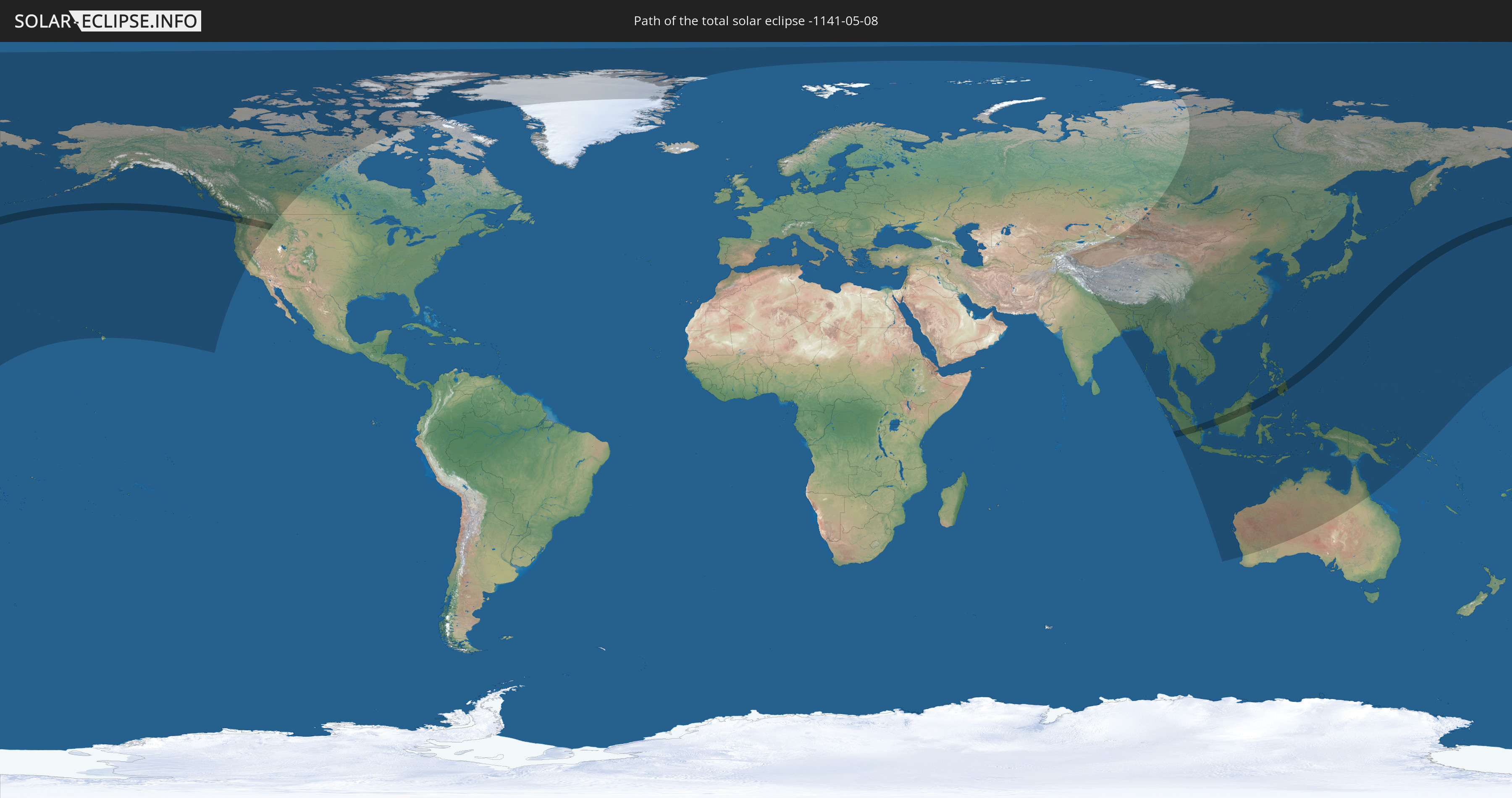
Total solar eclipse of 05/08/-1141
| Day of week: | Tuesday |
| Maximum duration of eclipse: | 04m36s |
| Maximum width of eclipse path: | 207 km |
| Saros cycle: | 39 |
| Coverage: | 100% |
| Magnitude: | 1.0587 |
| Gamma: | 0.375 |
Wo kann man die Sonnenfinsternis vom 05/08/-1141 sehen?
Die Sonnenfinsternis am 05/08/-1141 kann man in 39 Ländern als partielle Sonnenfinsternis beobachten.
Der Finsternispfad verläuft durch 5 Länder. Nur in diesen Ländern ist sie als total Sonnenfinsternis zu sehen.
In den folgenden Ländern ist die Sonnenfinsternis total zu sehen
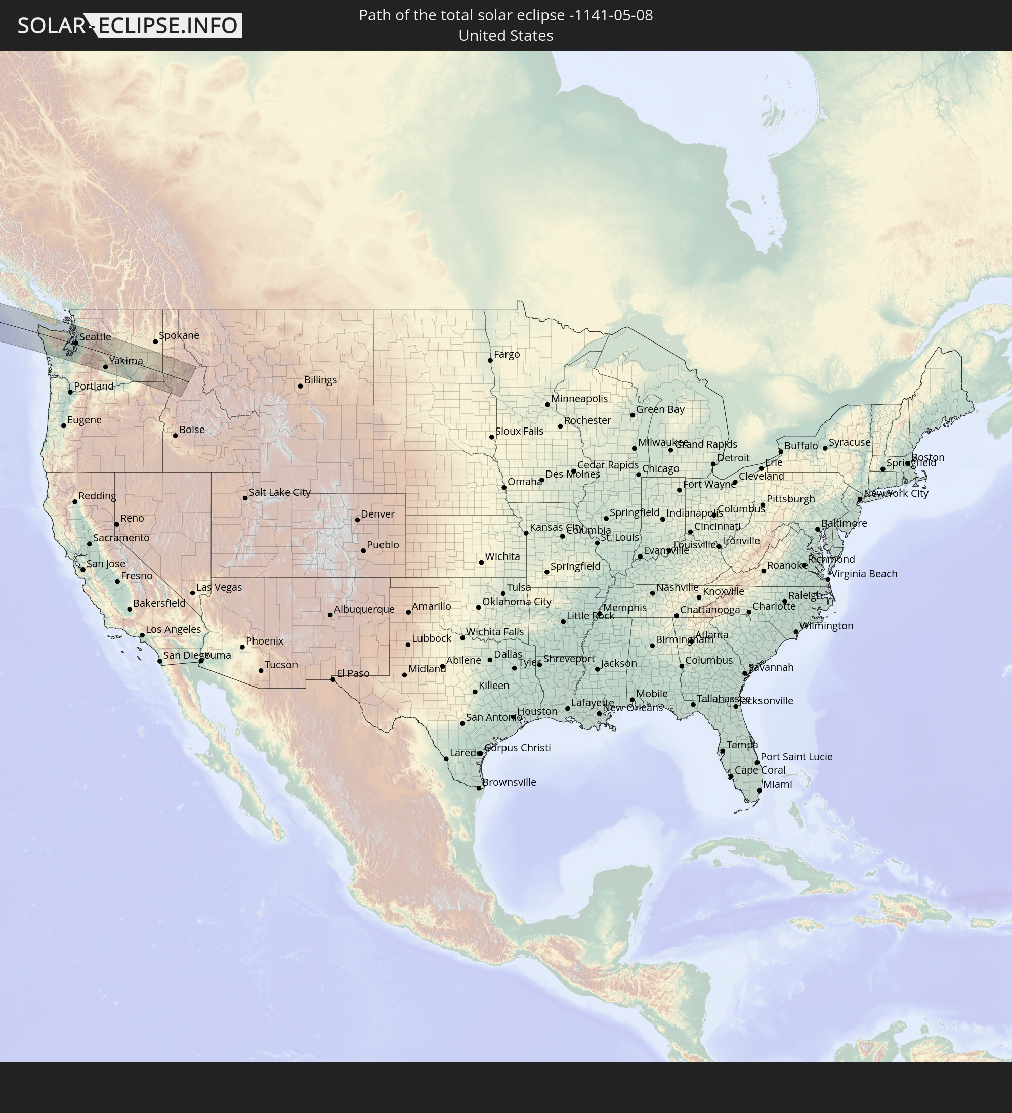 United States
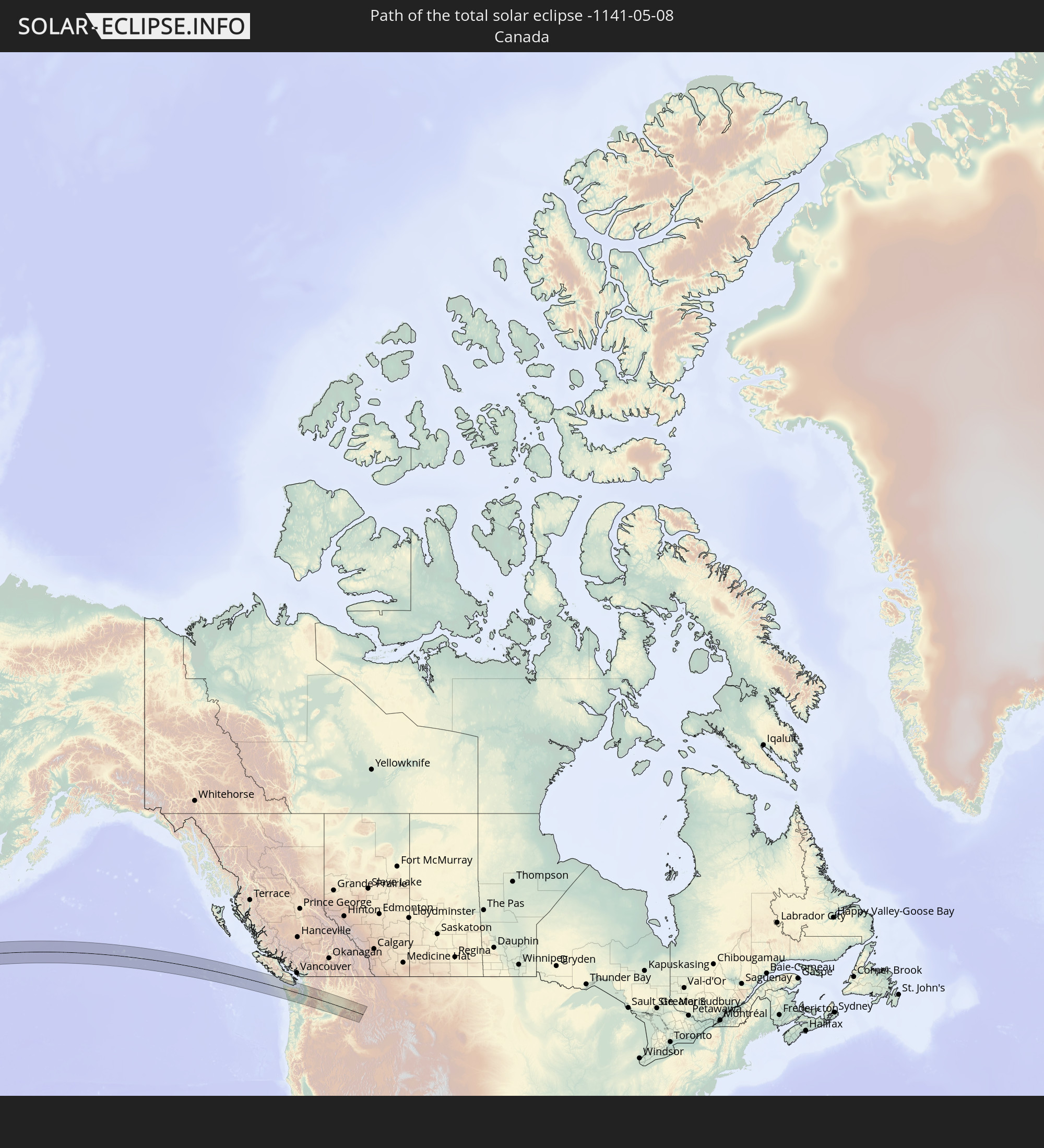 Canada
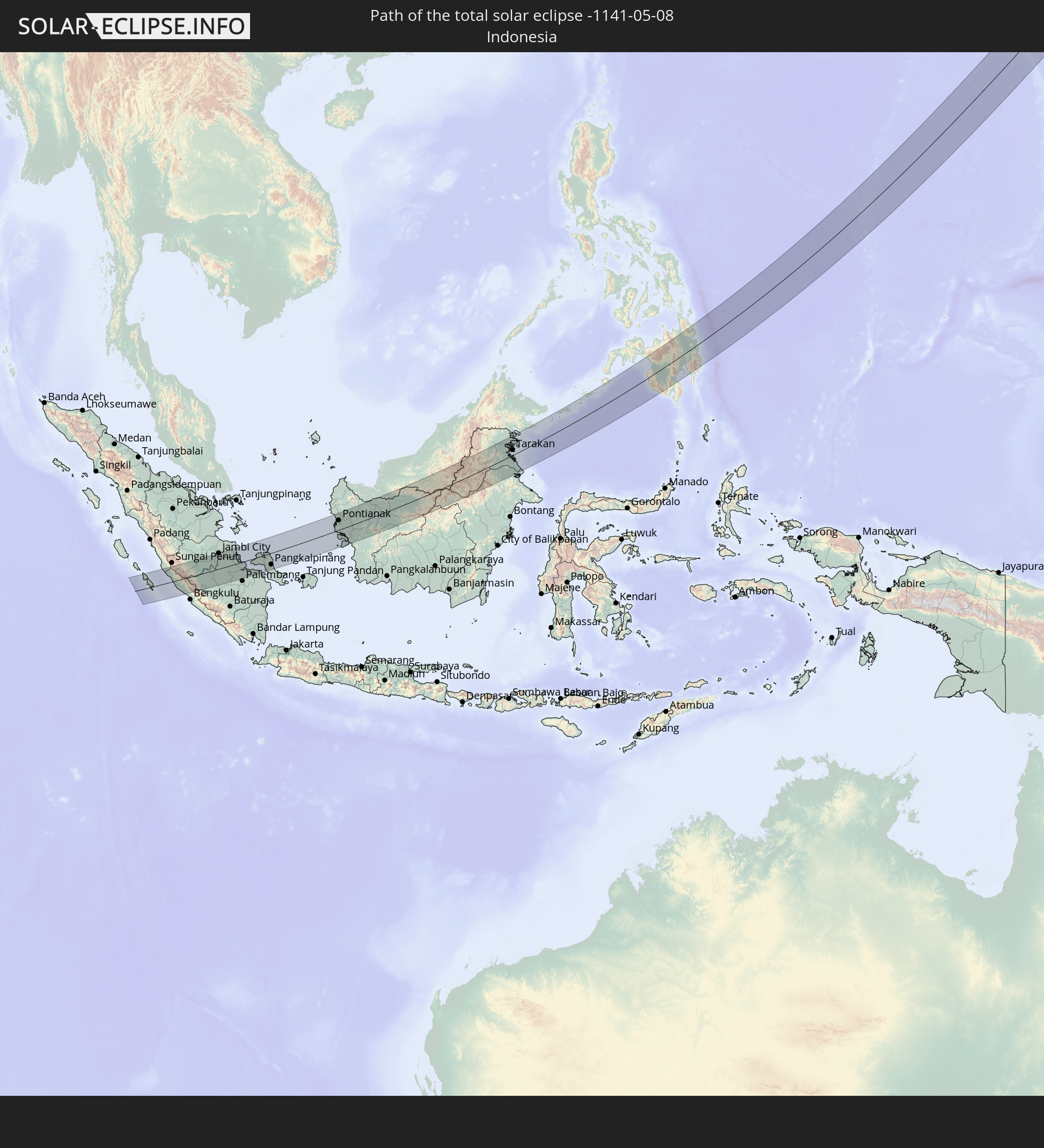 Indonesia
 Malaysia
 Philippines
In den folgenden Ländern ist die Sonnenfinsternis partiell zu sehen
 Russia
 United States
 United States Minor Outlying Islands
 Canada
 Greenland
 Pakistan
 Tajikistan
 India
India
 China
China
 Nepal
Nepal
 Mongolia
 Bangladesh
 Bhutan
 Myanmar
 Indonesia
 Thailand
 Malaysia
 Laos
Laos
 Vietnam
 Cambodia
 Singapore
 Christmas Island
 Australia
 Macau
Macau
 Hong Kong
 Brunei
 Taiwan
 Philippines
 Japan
Japan
 East Timor
 North Korea
 South Korea
 Palau
Palau
 Federated States of Micronesia
 Papua New Guinea
 Guam
Guam
 Northern Mariana Islands
 Solomon Islands
 Marshall Islands
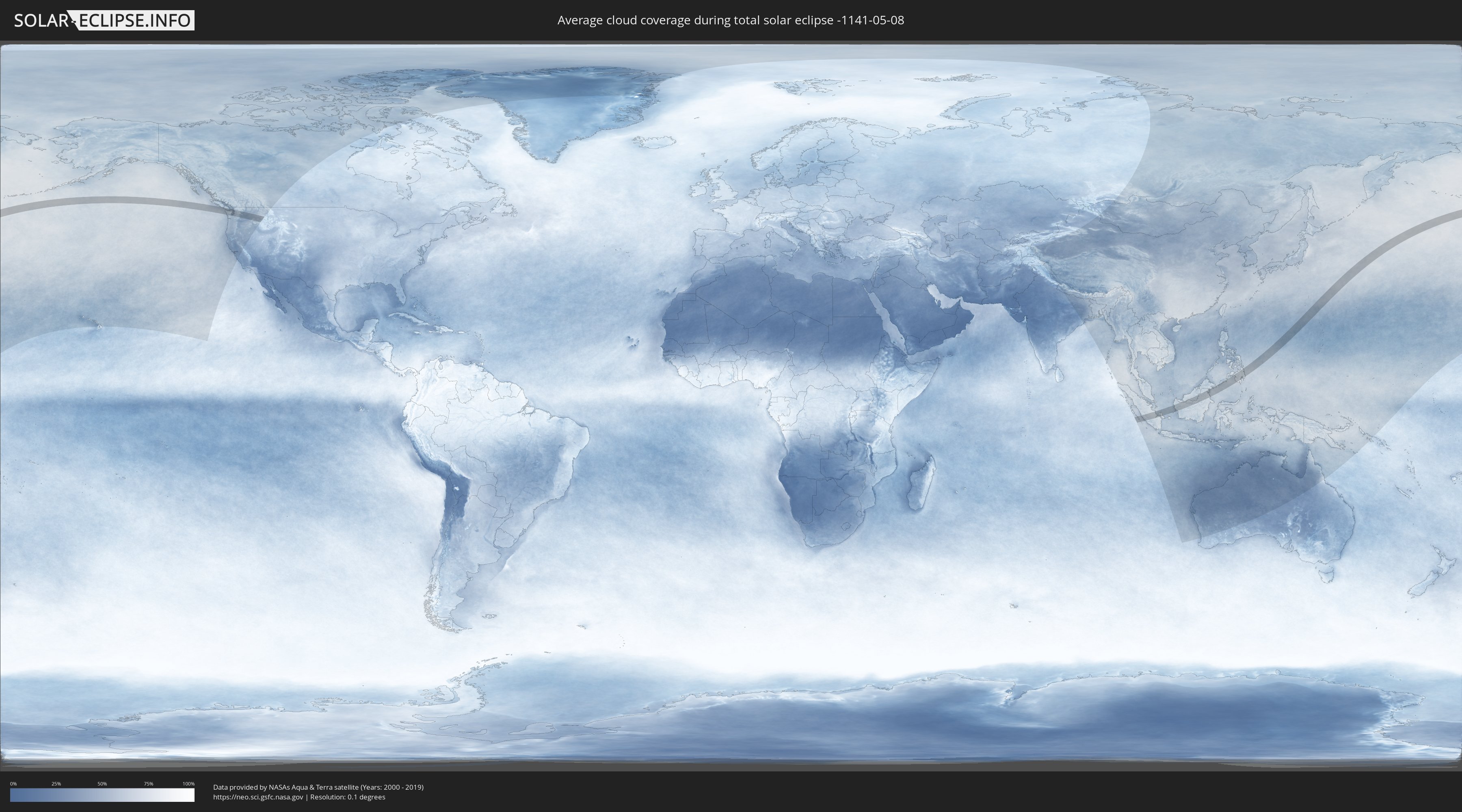
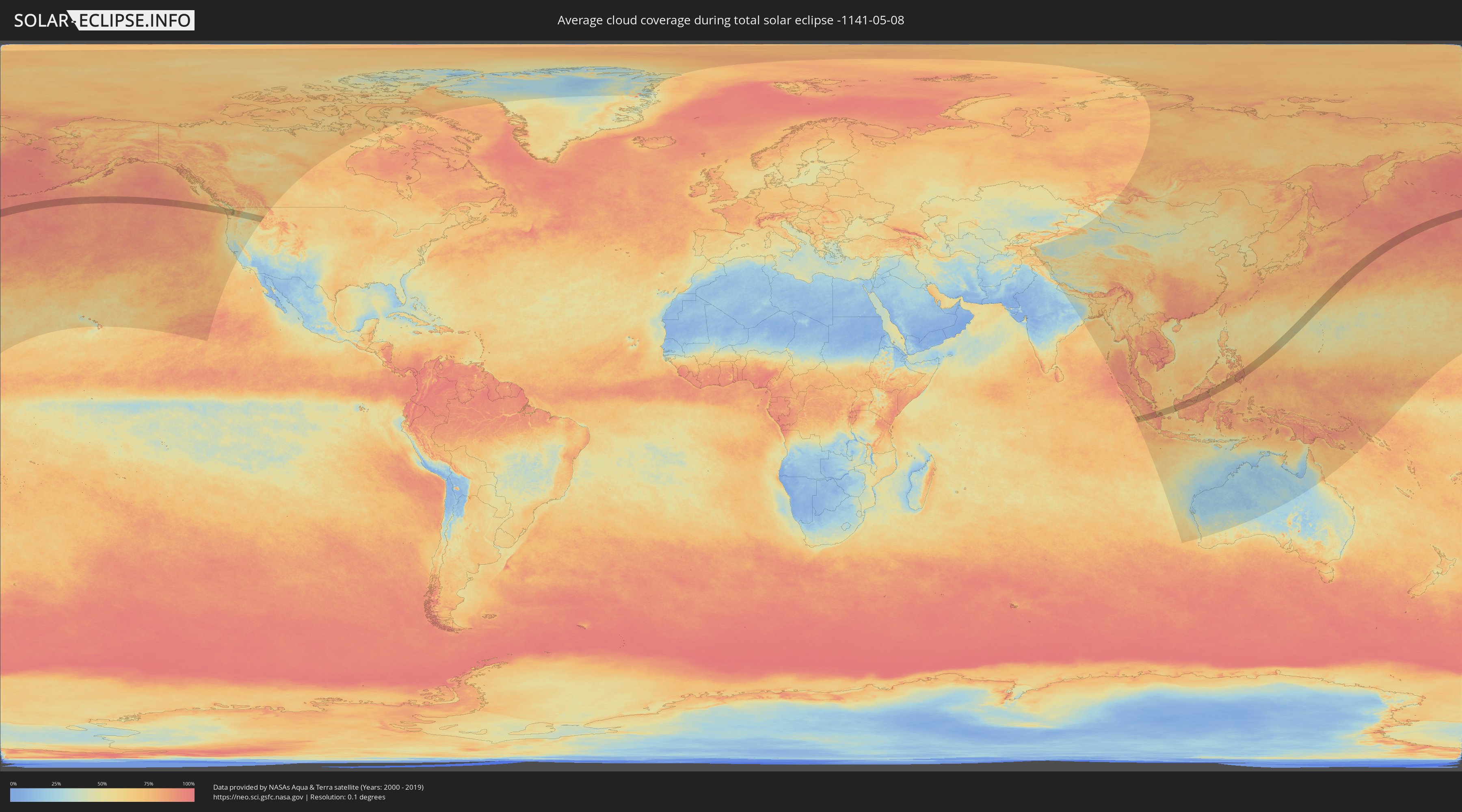
How will be the weather during the total solar eclipse on 05/08/-1141?
Where is the best place to see the total solar eclipse of 05/08/-1141?
The following maps show the average cloud coverage for the day of the total solar eclipse.
With the help of these maps, it is possible to find the place along the eclipse path, which has the best
chance of a cloudless sky.
Nevertheless, you should consider local circumstances and inform about the weather of your chosen
observation site.
The data is provided by NASAs satellites
AQUA and TERRA.
The cloud maps are averaged over a period of 19 years (2000 - 2019).
Detailed country maps
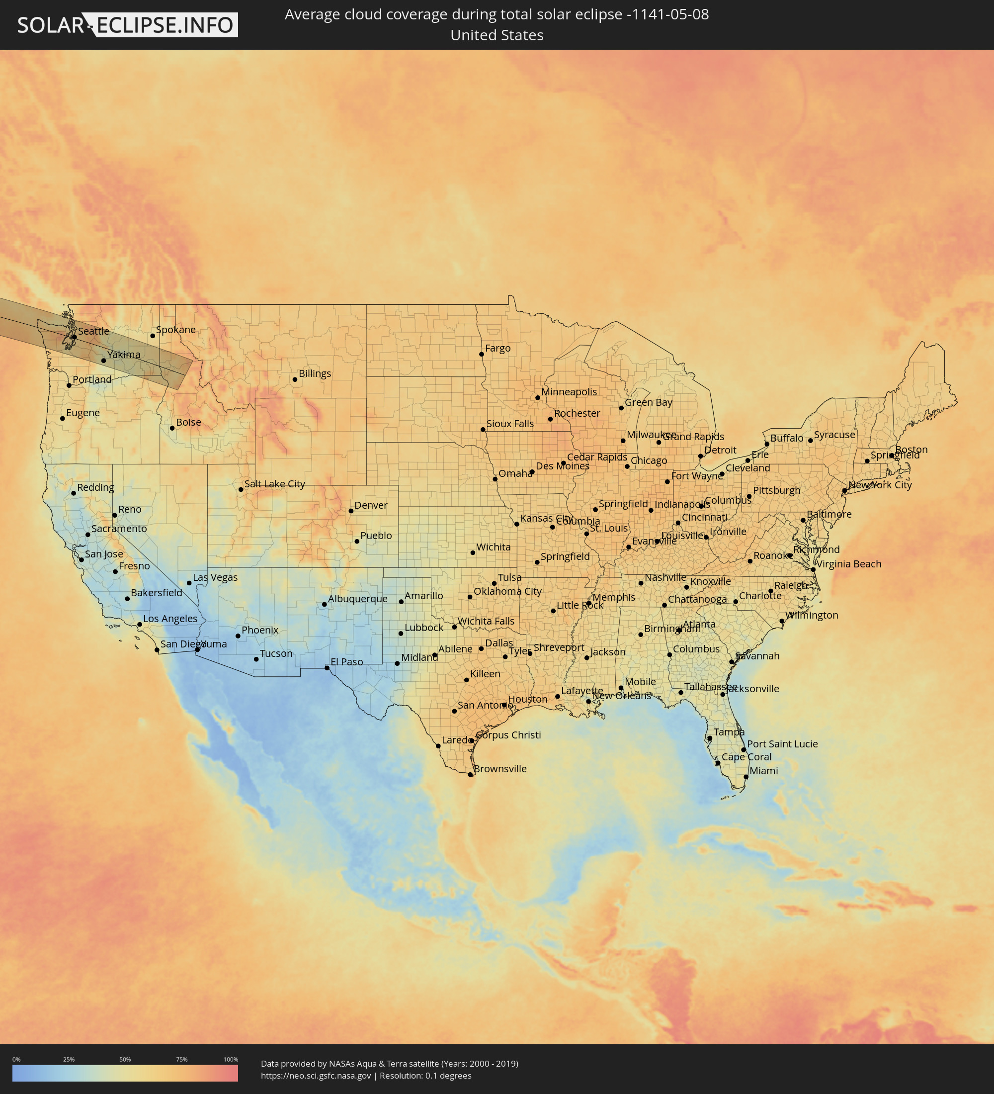 United States
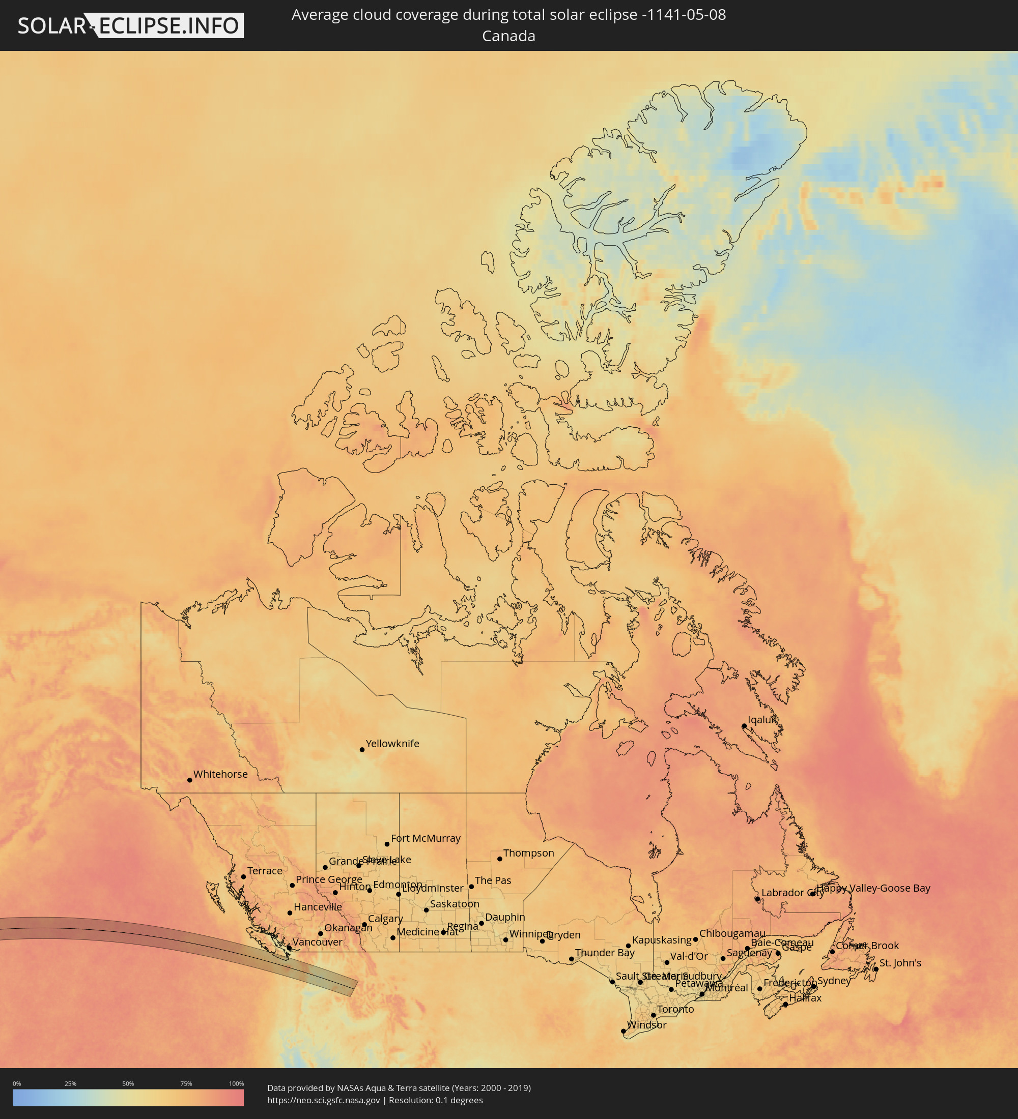 Canada
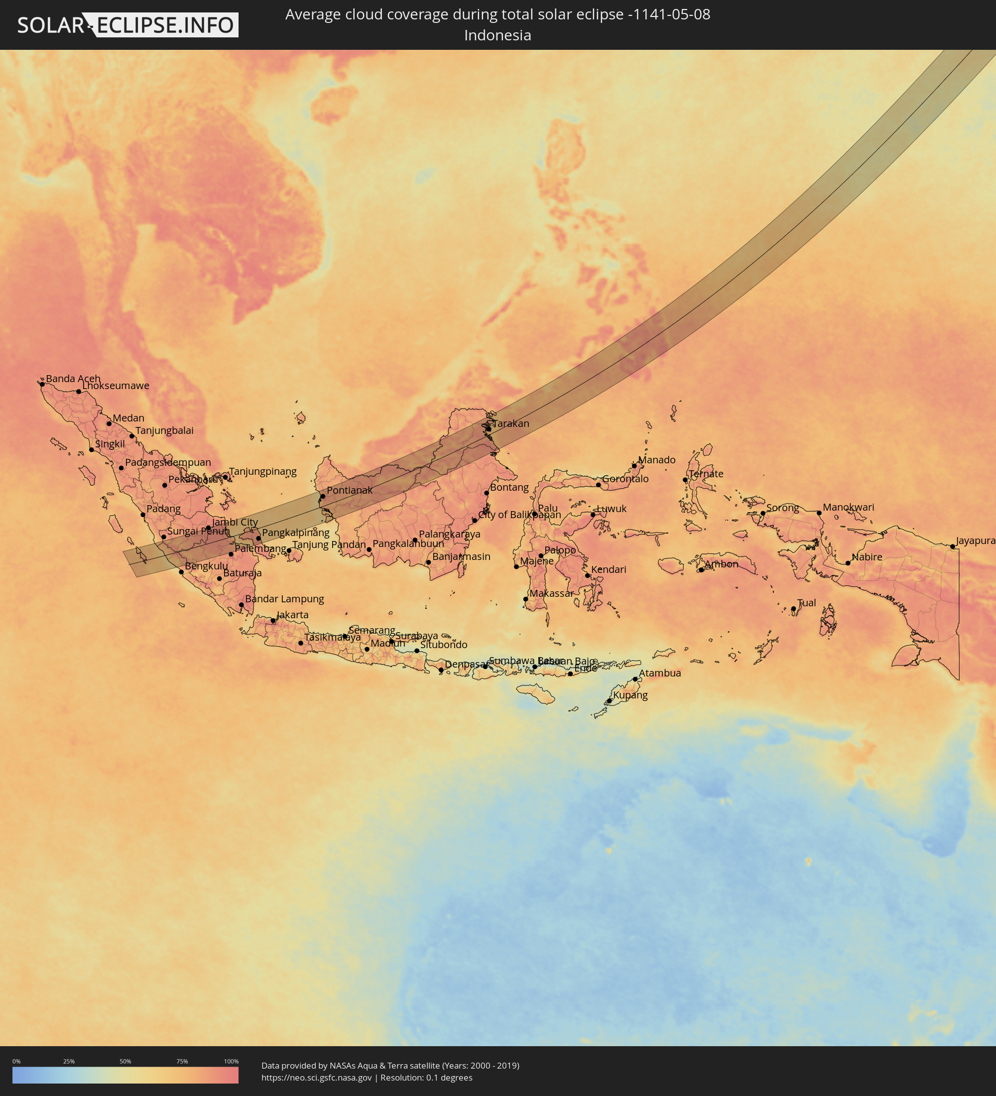 Indonesia
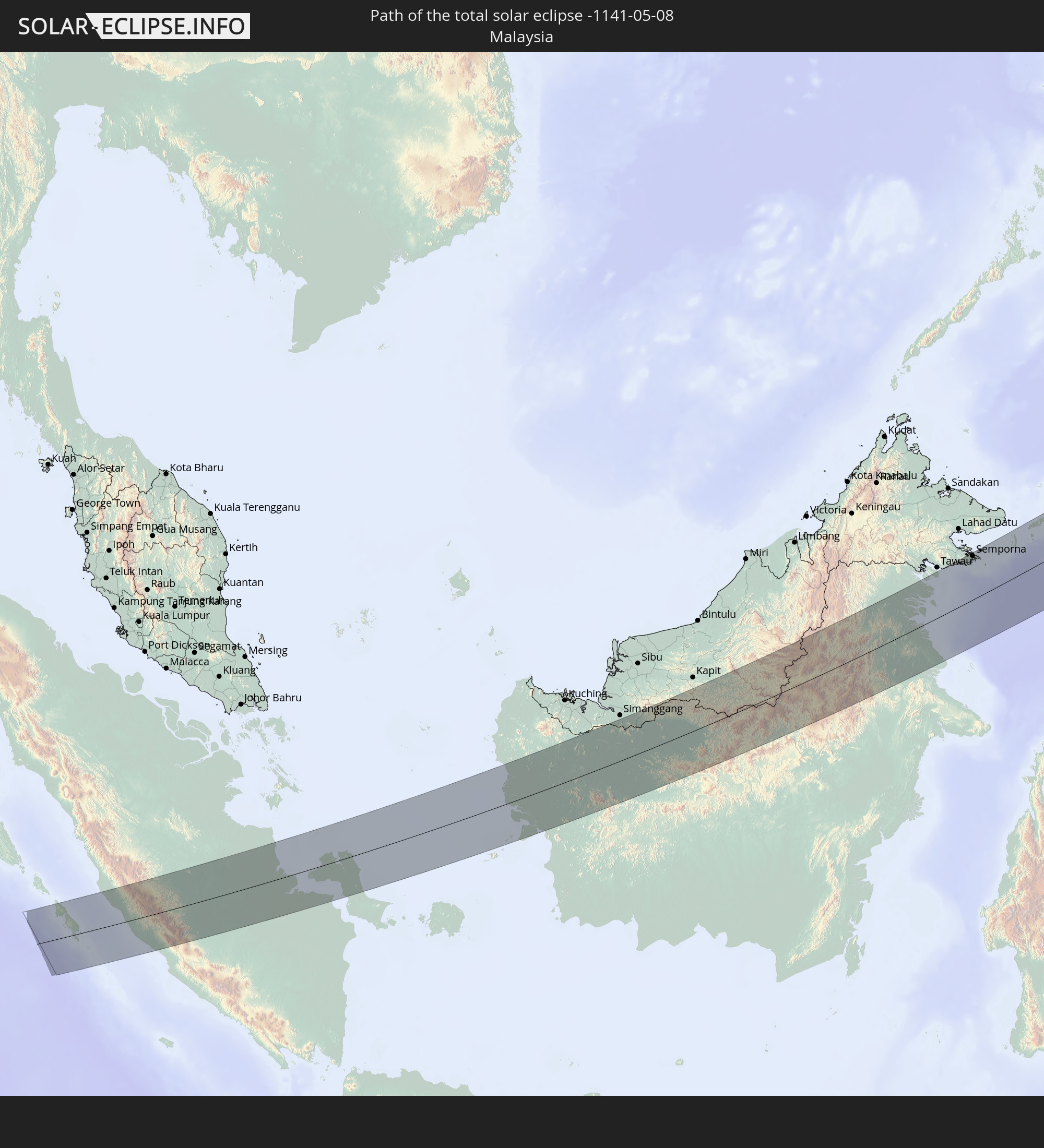
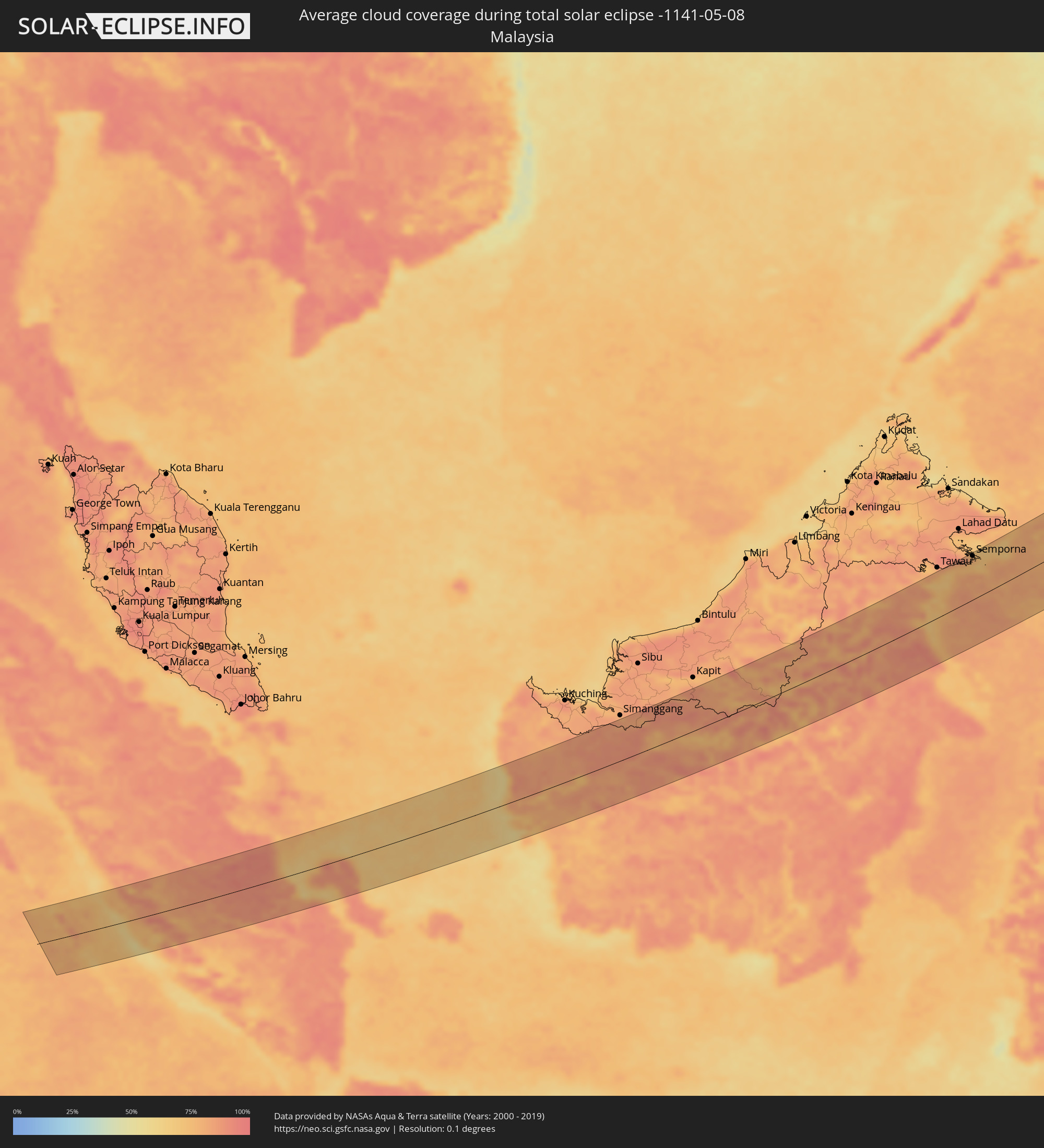 Malaysia
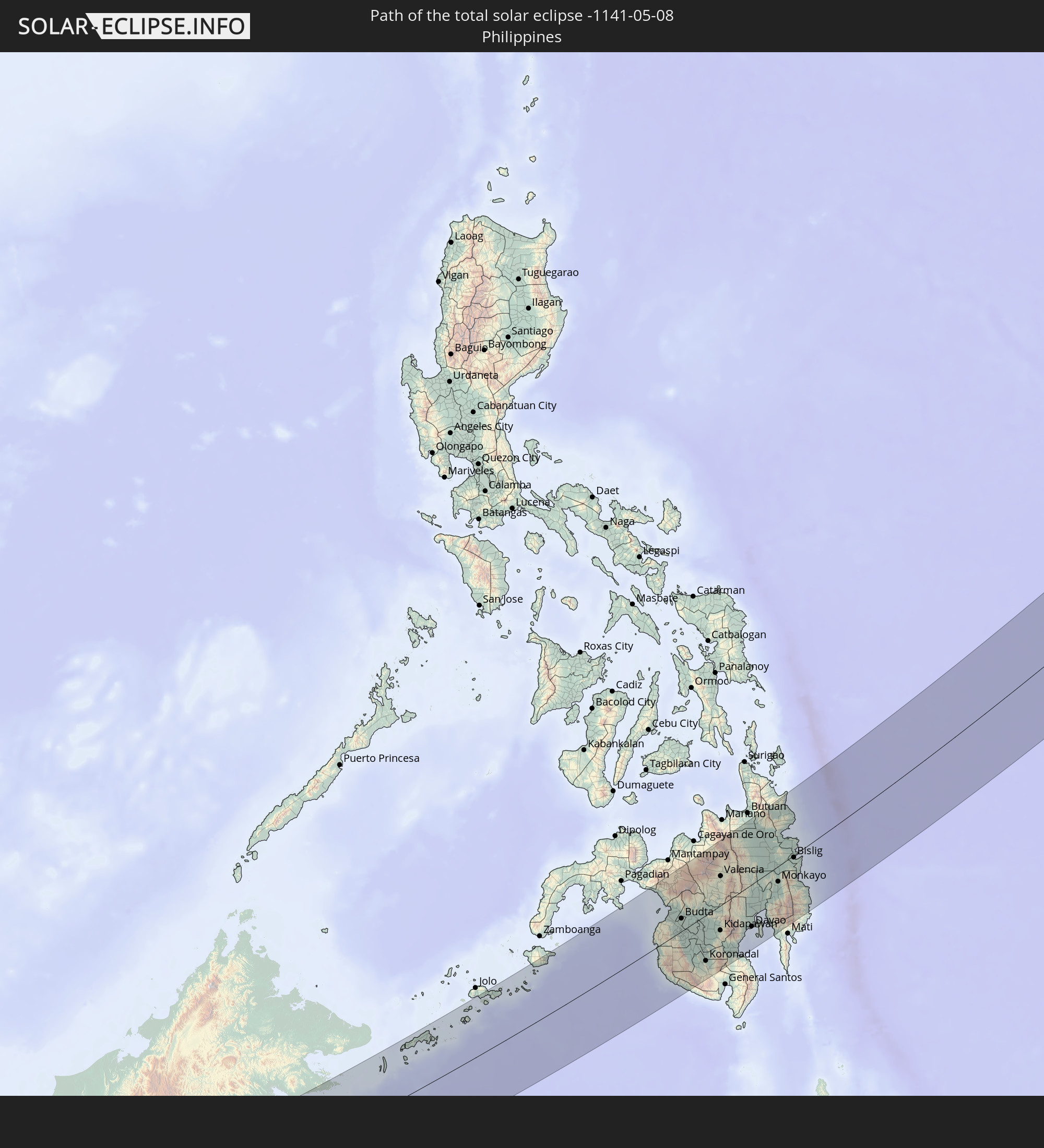
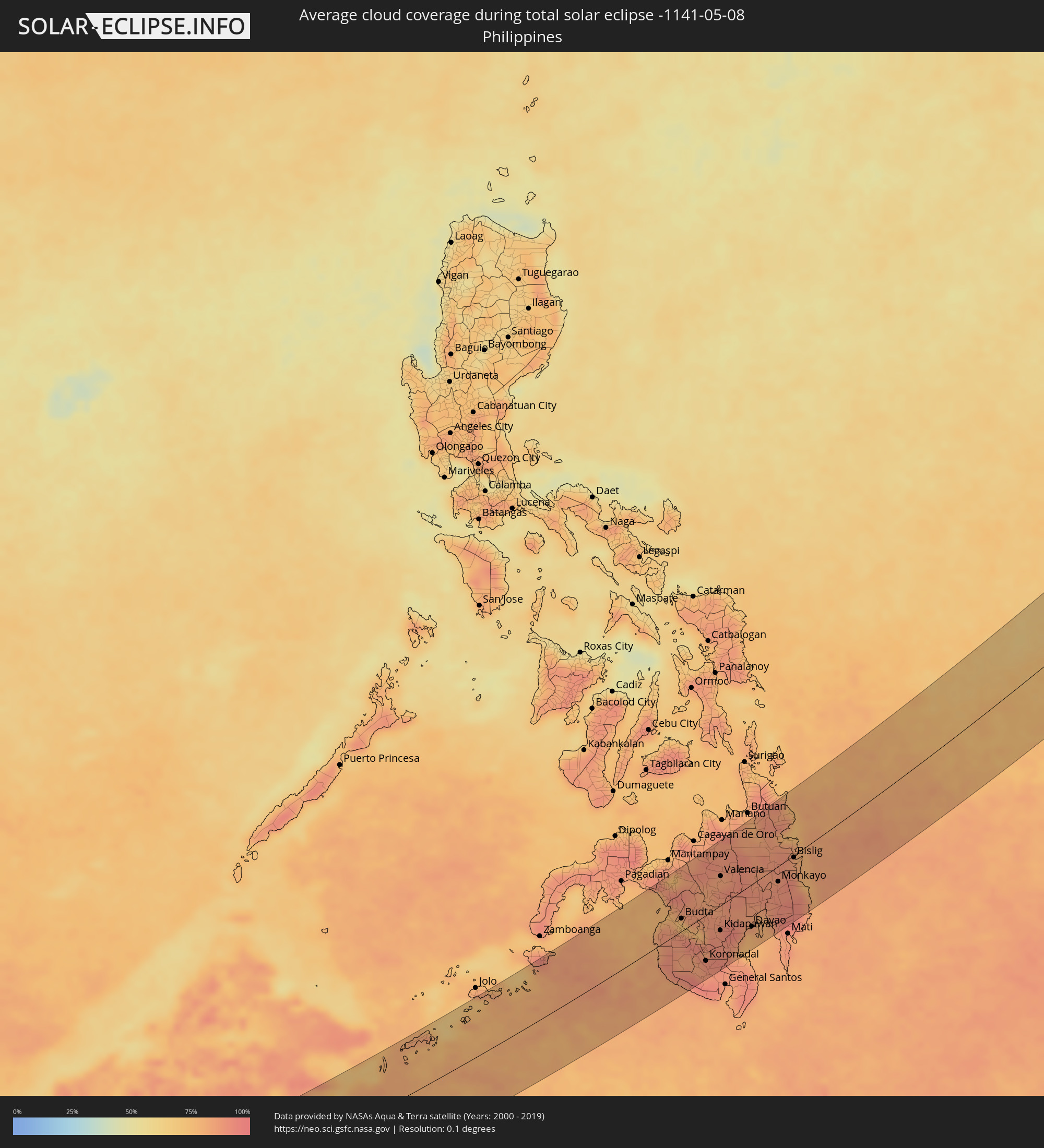 Philippines
Cities inside the path of the eclipse
The following table shows all locations with a population of more than 5,000 inside the eclipse path. Cities which have more than 100,000 inhabitants are marked bold. A click at the locations opens a detailed map.
| City | Type | Eclipse duration | Local time of max. eclipse | Distance to central line | Ø Cloud coverage |
|
Sooke, British Columbia
|
total | - | 18:31:35 UTC-08:00 | 55 km | 53% |
|
Langford, British Columbia
|
total | - | 18:31:31 UTC-08:00 | 68 km | 50% |
|
Colwood, British Columbia
|
total | - | 18:31:32 UTC-08:00 | 67 km | 50% |
|
Port Angeles, Washington
|
total | - | 18:31:48 UTC-08:00 | 34 km | 65% |
|
Victoria, British Columbia
|
total | - | 18:31:32 UTC-08:00 | 69 km | 51% |
|
Oak Bay, British Columbia
|
total | - | 18:31:31 UTC-08:00 | 72 km | 53% |
|
Shelton, Washington
|
total | - | 18:32:33 UTC-08:00 | 55 km | 58% |
|
Olympia, Washington
|
total | - | 18:32:41 UTC-08:00 | 69 km | 58% |
|
Port Townsend, Washington
|
total | - | 18:31:47 UTC-08:00 | 49 km | 56% |
|
Poulsbo, Washington
|
total | - | 18:32:06 UTC-08:00 | 11 km | 60% |
|
Oak Harbor, Washington
|
total | - | 18:31:38 UTC-08:00 | 70 km | 58% |
|
Bremerton, Washington
|
total | - | 18:32:14 UTC-08:00 | 7 km | 59% |
|
DuPont, Washington
|
total | - | 18:32:38 UTC-08:00 | 57 km | 59% |
|
Fort Lewis, Washington
|
total | - | 18:32:37 UTC-08:00 | 55 km | 59% |
|
Camano, Washington
|
total | - | 18:31:43 UTC-08:00 | 60 km | 57% |
|
Tacoma, Washington
|
total | - | 18:32:29 UTC-08:00 | 36 km | 60% |
|
Klahanie, Washington
|
total | - | 18:32:21 UTC-08:00 | 17 km | 59% |
|
Waller, Washington
|
total | - | 18:32:32 UTC-08:00 | 40 km | 63% |
|
Summit, Washington
|
total | - | 18:32:34 UTC-08:00 | 44 km | 63% |
|
Shoreline, Washington
|
total | - | 18:32:04 UTC-08:00 | 19 km | 62% |
|
Seattle, Washington
|
total | - | 18:32:12 UTC-08:00 | 4 km | 58% |
|
Alderwood Manor, Washington
|
total | - | 18:32:01 UTC-08:00 | 28 km | 62% |
|
South Hill, Washington
|
total | - | 18:32:34 UTC-08:00 | 44 km | 61% |
|
Kent, Washington
|
total | - | 18:32:22 UTC-08:00 | 18 km | 62% |
|
Everett, Washington
|
total | - | 18:31:52 UTC-08:00 | 46 km | 62% |
|
Arlington, Washington
|
total | - | 18:31:41 UTC-08:00 | 71 km | 67% |
|
Redmond, Washington
|
total | - | 18:32:08 UTC-08:00 | 15 km | 64% |
|
Issaquah, Washington
|
total | - | 18:32:14 UTC-08:00 | 2 km | 65% |
|
Enumclaw, Washington
|
total | - | 18:32:30 UTC-08:00 | 32 km | 63% |
|
Monroe, Washington
|
total | - | 18:31:58 UTC-08:00 | 38 km | 65% |
|
Snoqualmie, Washington
|
total | - | 18:32:14 UTC-08:00 | 7 km | 66% |
|
Ellensburg, Washington
|
total | - | 18:32:35 UTC-08:00 | 21 km | 45% |
|
Yakima, Washington
|
total | - | 18:32:54 UTC-08:00 | 62 km | 49% |
|
Wenatchee, Washington
|
total | - | 18:32:12 UTC-08:00 | 30 km | 47% |
|
Toppenish, Washington
|
total | - | 18:33:03 UTC-08:00 | 81 km | 46% |
|
Sunnyside, Washington
|
total | - | 18:33:04 UTC-08:00 | 79 km | 46% |
|
Ephrata, Washington
|
total | - | 18:32:13 UTC-08:00 | 37 km | 51% |
|
West Richland, Washington
|
total | - | 18:33:01 UTC-08:00 | 66 km | 49% |
|
Moses Lake, Washington
|
total | - | 18:32:21 UTC-08:00 | 23 km | 43% |
|
Othello, Washington
|
total | - | 18:32:35 UTC-08:00 | 6 km | 46% |
|
Kennewick, Washington
|
total | - | 18:33:04 UTC-08:00 | 70 km | 47% |
|
Walla Walla, Washington
|
total | - | 18:33:05 UTC-08:00 | 67 km | 52% |
|
Pullman, Washington
|
total | - | 18:32:23 UTC-08:00 | 32 km | 56% |
|
Clarkston, Washington
|
total | - | 18:32:37 UTC-08:00 | 3 km | 53% |
|
Lewiston, Idaho
|
total | - | 18:32:37 UTC-08:00 | 3 km | 53% |
|
Lubuklinggau, South Sumatra
|
total | - | 06:25:06 UTC+07:07 | 80 km | 80% |
|
Bejubang Dua, Jambi
|
total | - | 06:26:19 UTC+07:07 | 68 km | 92% |
|
Jambi City, Jambi
|
total | - | 06:26:28 UTC+07:07 | 79 km | 94% |
|
Muntok, Bangka–Belitung Islands
|
total | - | 06:25:57 UTC+07:07 | 20 km | 68% |
|
Pangkalpinang, Bangka–Belitung Islands
|
total | - | 06:25:51 UTC+07:07 | 58 km | 88% |
|
Sungailiat, Bangka–Belitung Islands
|
total | - | 06:26:06 UTC+07:07 | 29 km | 85% |
|
Pontianak, West Kalimantan
|
total | - | 06:27:54 UTC+07:07 | 47 km | 88% |
|
Sembakung, East Kalimantan
|
total | - | 07:24:08 UTC+07:57 | 91 km | 84% |
|
Tanjung Selor, North Kalimantan
|
total | - | 07:22:58 UTC+07:57 | 12 km | 90% |
|
Tarakan, North Kalimantan
|
total | - | 07:23:37 UTC+07:57 | 24 km | 78% |
|
Semporna, Sabah
|
total | - | 23:27:50 UTC+00:00 | 88 km | 79% |
|
Sitangkai, Autonomous Region in Muslim Mindanao
|
total | - | 07:28:22 UTC+08:00 | 64 km | 75% |
|
Bongao, Autonomous Region in Muslim Mindanao
|
total | - | 07:29:00 UTC+08:00 | 80 km | 78% |
|
Kansipati, Autonomous Region in Muslim Mindanao
|
total | - | 07:30:56 UTC+08:00 | 93 km | 81% |
|
Kalamansig, Soccsksargen
|
total | - | 07:33:08 UTC+08:00 | 18 km | 87% |
|
Cotabato, Autonomous Region in Muslim Mindanao
|
total | - | 07:34:12 UTC+08:00 | 33 km | 81% |
|
Parang, Autonomous Region in Muslim Mindanao
|
total | - | 07:34:26 UTC+08:00 | 45 km | 82% |
|
Budta, Autonomous Region in Muslim Mindanao
|
total | - | 07:34:17 UTC+08:00 | 20 km | 72% |
|
Maganoy, Autonomous Region in Muslim Mindanao
|
total | - | 07:33:48 UTC+08:00 | 12 km | 89% |
|
Laguilayan, Soccsksargen
|
total | - | 07:33:32 UTC+08:00 | 37 km | 89% |
|
Norala, Davao
|
total | - | 07:33:26 UTC+08:00 | 57 km | 85% |
|
Wao, Autonomous Region in Muslim Mindanao
|
total | - | 07:35:07 UTC+08:00 | 50 km | 85% |
|
Pikit, Soccsksargen
|
total | - | 07:34:12 UTC+08:00 | 8 km | 79% |
|
Tacurong, Soccsksargen
|
total | - | 07:33:41 UTC+08:00 | 42 km | 89% |
|
Sebu, Soccsksargen
|
total | - | 07:33:01 UTC+08:00 | 88 km | 93% |
|
Kalilangan, Northern Mindanao
|
total | - | 07:35:22 UTC+08:00 | 59 km | 85% |
|
Surallah, Soccsksargen
|
total | - | 07:33:16 UTC+08:00 | 76 km | 84% |
|
Kabacan, Soccsksargen
|
total | - | 07:34:22 UTC+08:00 | 13 km | 83% |
|
Koronadal, Soccsksargen
|
total | - | 07:33:30 UTC+08:00 | 70 km | 89% |
|
Tupi, Davao
|
total | - | 07:33:19 UTC+08:00 | 92 km | 89% |
|
Maramag, Northern Mindanao
|
total | - | 07:35:26 UTC+08:00 | 37 km | 84% |
|
Kidapawan, Soccsksargen
|
total | - | 07:34:23 UTC+08:00 | 38 km | 91% |
|
Valencia, Northern Mindanao
|
total | - | 07:35:42 UTC+08:00 | 45 km | 83% |
|
Malaybalay, Northern Mindanao
|
total | - | 07:36:06 UTC+08:00 | 66 km | 88% |
|
Bansalan, Davao
|
total | - | 07:34:08 UTC+08:00 | 66 km | 89% |
|
Digos, Davao
|
total | - | 07:34:10 UTC+08:00 | 78 km | 75% |
|
Davao, Davao
|
total | - | 07:34:47 UTC+08:00 | 64 km | 84% |
|
New Visayas, Davao
|
total | - | 07:35:27 UTC+08:00 | 23 km | 86% |
|
Panabo, Davao
|
total | - | 07:35:10 UTC+08:00 | 47 km | 80% |
|
Bayugan, Caraga
|
total | - | 07:37:24 UTC+08:00 | 81 km | 89% |
|
Talacogon, Caraga
|
total | - | 07:36:57 UTC+08:00 | 52 km | 84% |
|
Tagum, Davao
|
total | - | 07:35:27 UTC+08:00 | 42 km | 84% |
|
New Corella, Davao
|
total | - | 07:35:40 UTC+08:00 | 30 km | 89% |
|
Bah-Bah, Caraga
|
total | - | 07:37:16 UTC+08:00 | 58 km | 86% |
|
Veruela, Caraga
|
total | - | 07:36:29 UTC+08:00 | 6 km | 89% |
|
San Mariano, Davao
|
total | - | 07:35:39 UTC+08:00 | 49 km | 89% |
|
Monkayo, Davao
|
total | - | 07:36:09 UTC+08:00 | 23 km | 90% |
|
Compostela, Davao
|
total | - | 07:35:58 UTC+08:00 | 39 km | 89% |
|
Lianga, Caraga
|
total | - | 07:37:25 UTC+08:00 | 49 km | 77% |
|
Tandag, Caraga
|
total | - | 07:38:10 UTC+08:00 | 83 km | 76% |
|
Bislig, Caraga
|
total | - | 07:36:56 UTC+08:00 | 3 km | 82% |