Annular solar eclipse of 01/29/-1406
| Day of week: | Monday |
| Maximum duration of eclipse: | 09m06s |
| Maximum width of eclipse path: | 262 km |
| Saros cycle: | 18 |
| Coverage: | 93.5% |
| Magnitude: | 0.9352 |
| Gamma: | 0.389 |
Wo kann man die Sonnenfinsternis vom 01/29/-1406 sehen?
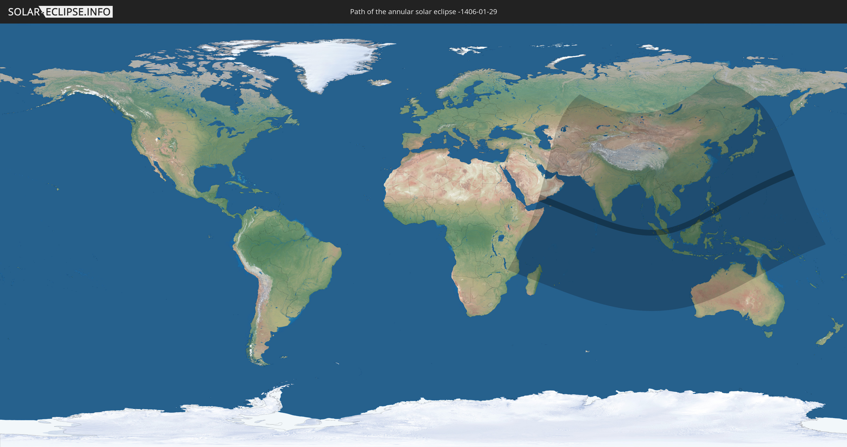
Die Sonnenfinsternis am 01/29/-1406 kann man in 63 Ländern als partielle Sonnenfinsternis beobachten.
Der Finsternispfad verläuft durch 9 Länder. Nur in diesen Ländern ist sie als annular Sonnenfinsternis zu sehen.
In den folgenden Ländern ist die Sonnenfinsternis annular zu sehen
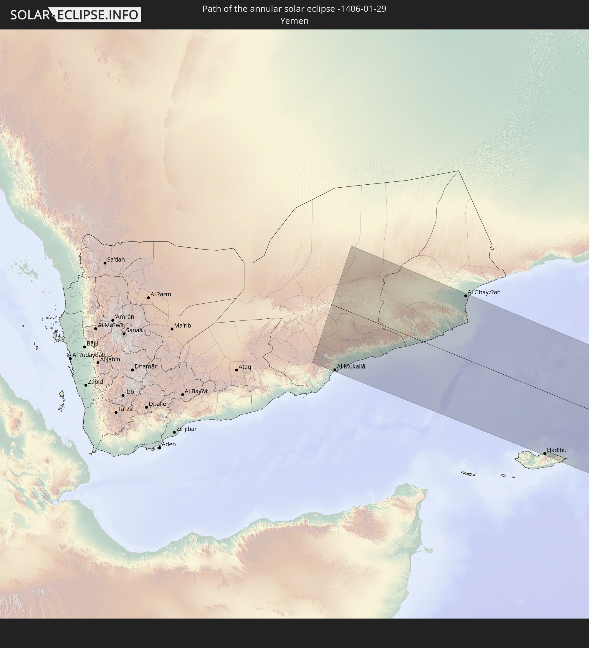 Yemen
Yemen
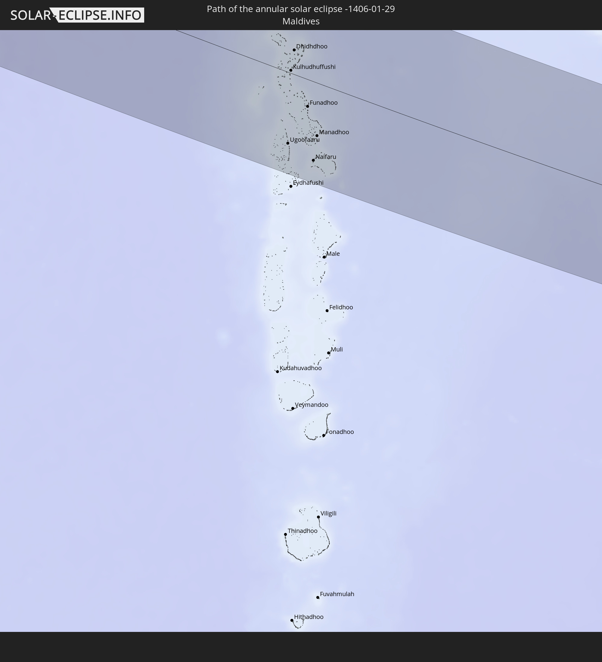 Maldives
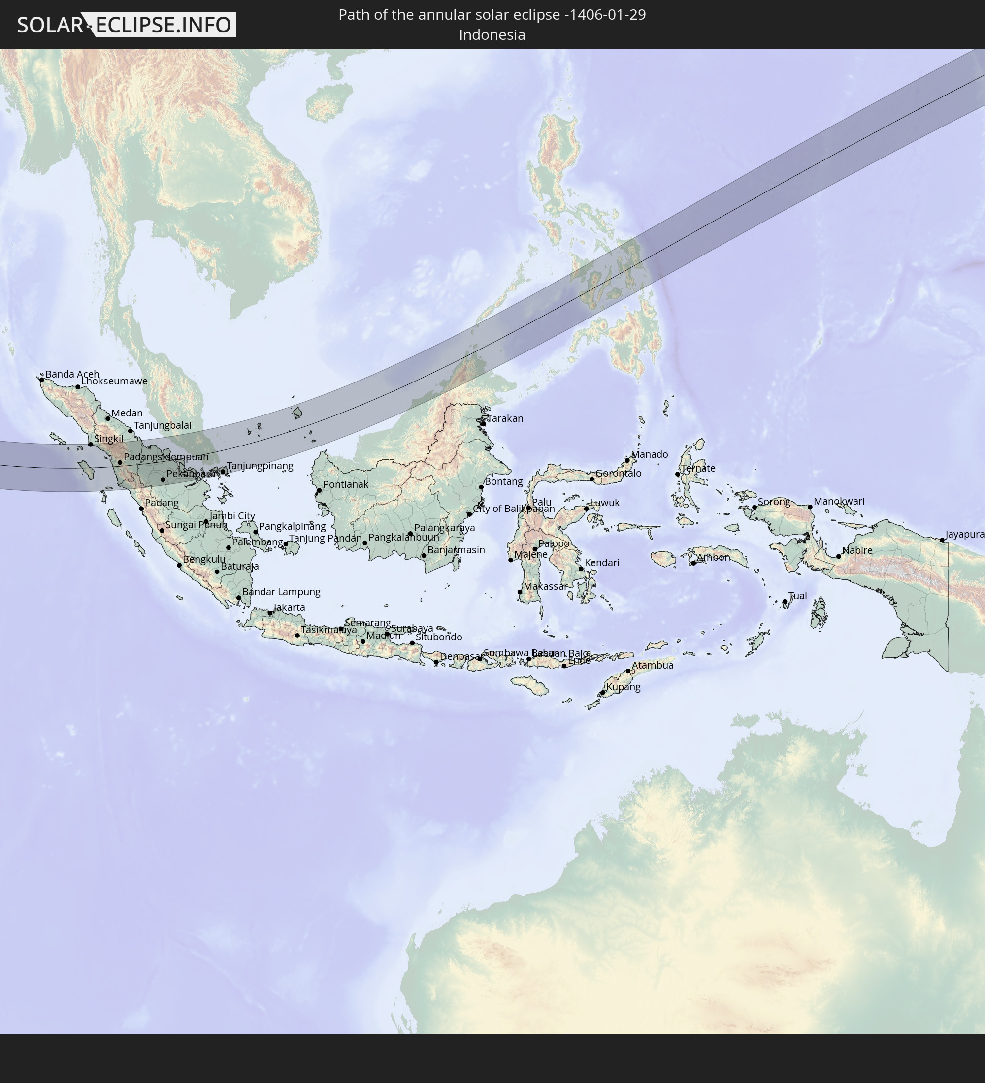 Indonesia
 Malaysia
 Singapore
 Brunei
 Philippines
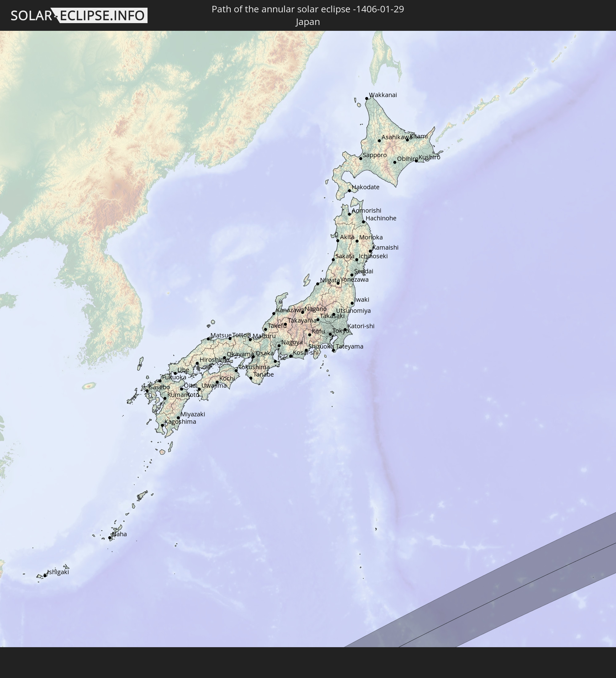 Japan
Japan
 Northern Mariana Islands
In den folgenden Ländern ist die Sonnenfinsternis partiell zu sehen
 Russia
 Tanzania
 Mozambique
 Malawi
 Ethiopia
 Saudi Arabia
 French Southern and Antarctic Lands
 Somalia
 Yemen
Yemen
 Madagascar
 Comoros
 Iran
Iran
 Mayotte
 Seychelles
 Kazakhstan
 Qatar
Qatar
 United Arab Emirates
 Oman
Oman
 Turkmenistan
 Réunion
 Uzbekistan
 Mauritius
 Afghanistan
 Pakistan
 Tajikistan
 India
India
 Kyrgyzstan
 British Indian Ocean Territory
 Maldives
 China
China
 Sri Lanka
 Nepal
Nepal
 Mongolia
 Bangladesh
 Bhutan
 Myanmar
 Indonesia
 Cocos Islands
 Thailand
 Malaysia
 Laos
Laos
 Vietnam
 Cambodia
 Singapore
 Christmas Island
 Australia
 Macau
Macau
 Hong Kong
 Brunei
 Taiwan
 Philippines
 Japan
Japan
 East Timor
 North Korea
 South Korea
 Palau
Palau
 Federated States of Micronesia
 Papua New Guinea
 Guam
Guam
 Northern Mariana Islands
 Solomon Islands
 Marshall Islands
 Nauru
Nauru
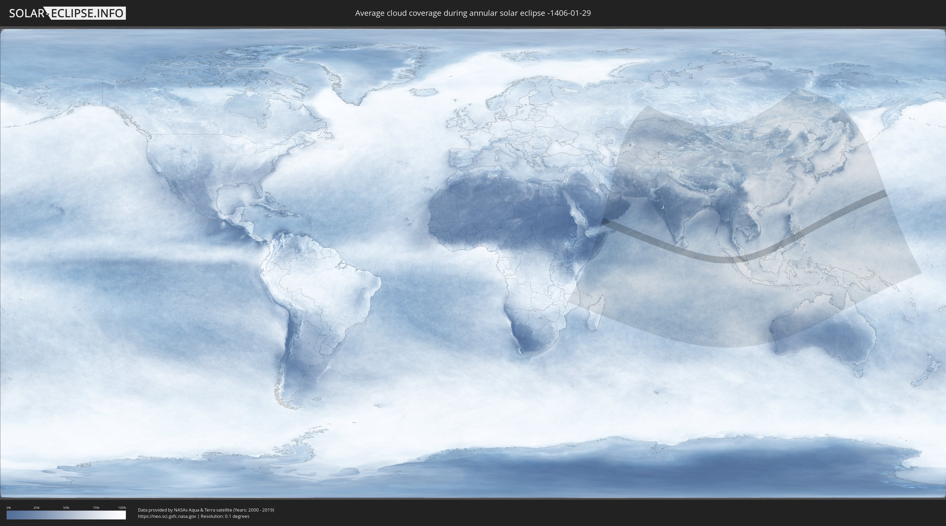
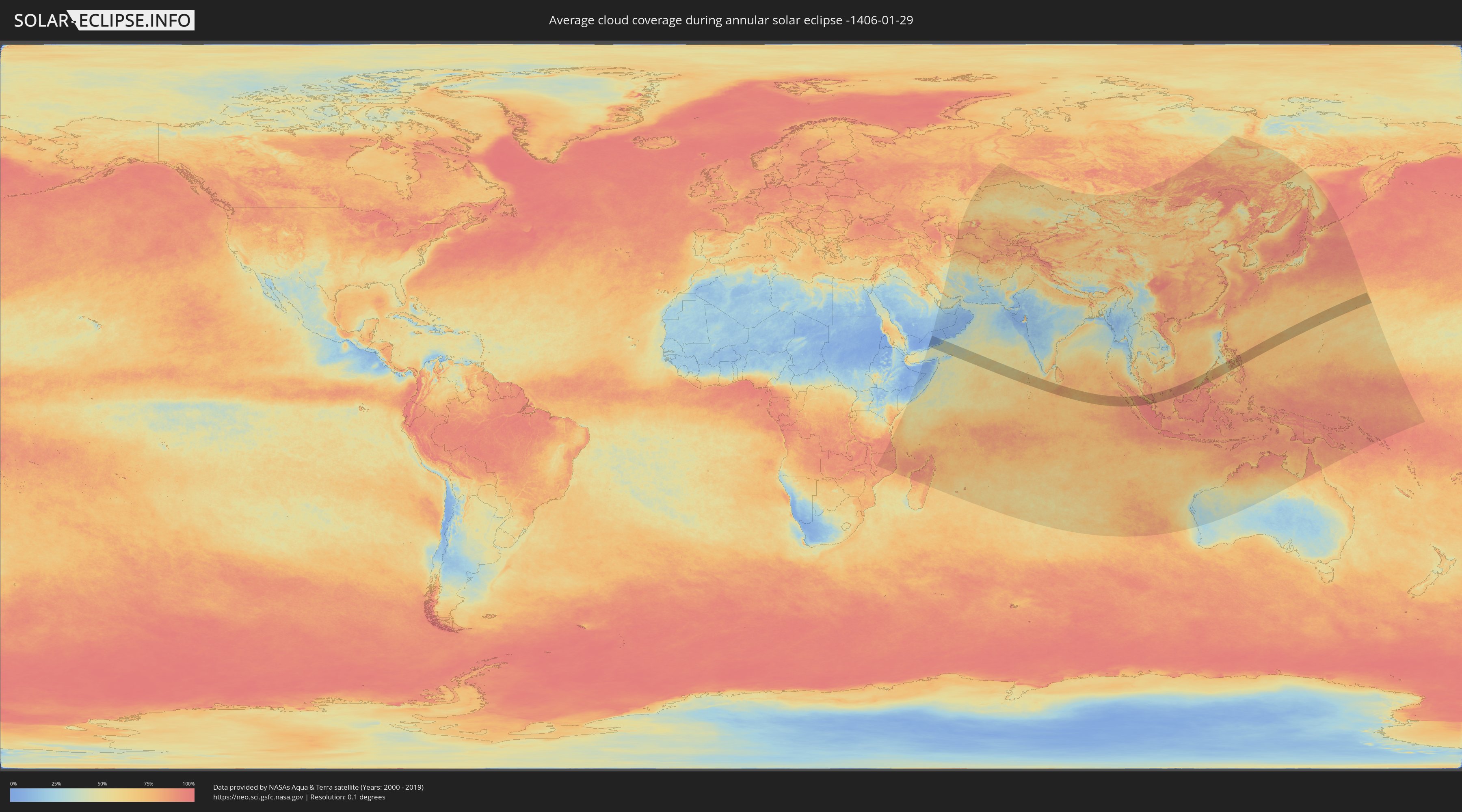
How will be the weather during the annular solar eclipse on 01/29/-1406?
Where is the best place to see the annular solar eclipse of 01/29/-1406?
The following maps show the average cloud coverage for the day of the annular solar eclipse.
With the help of these maps, it is possible to find the place along the eclipse path, which has the best
chance of a cloudless sky.
Nevertheless, you should consider local circumstances and inform about the weather of your chosen
observation site.
The data is provided by NASAs satellites
AQUA and TERRA.
The cloud maps are averaged over a period of 19 years (2000 - 2019).
Detailed country maps
 Yemen
Yemen
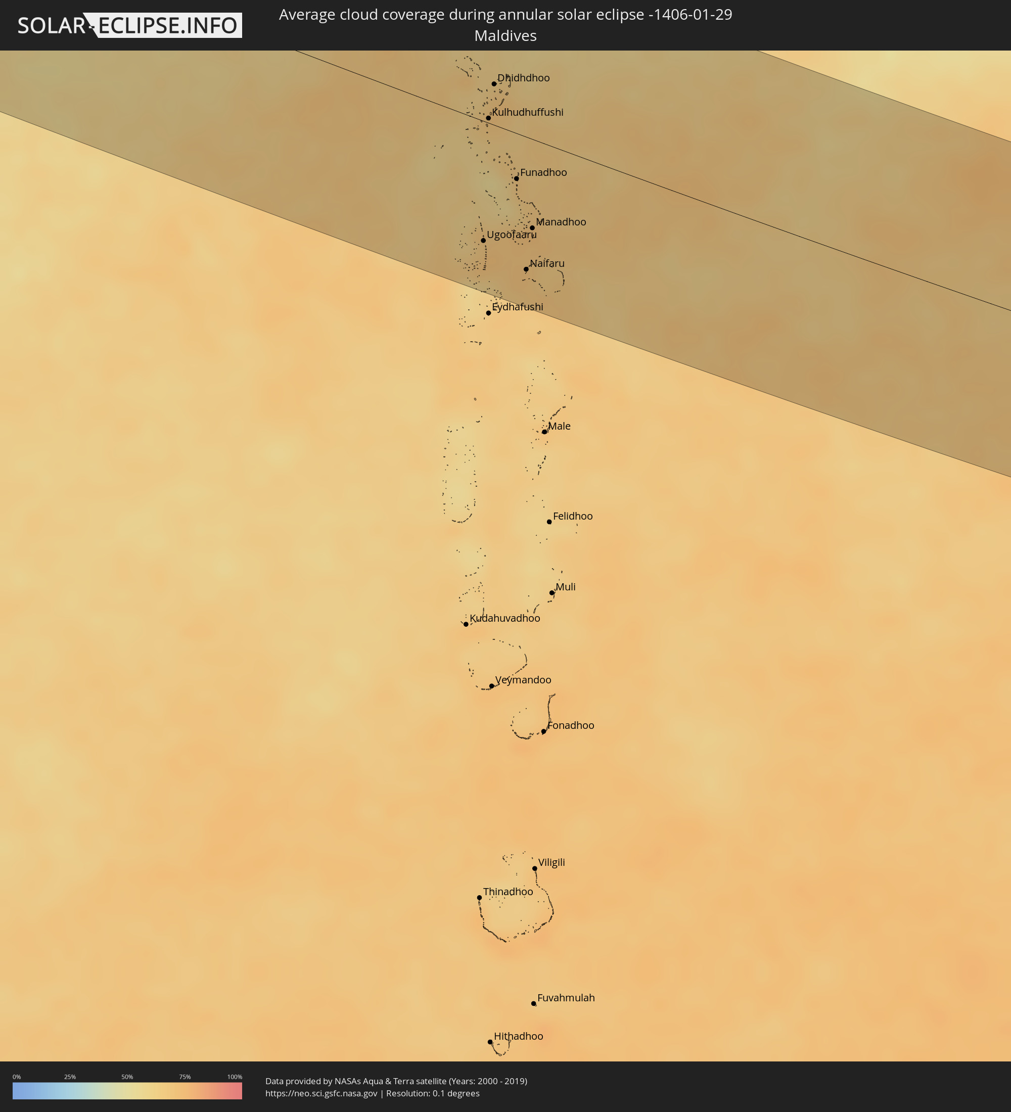 Maldives
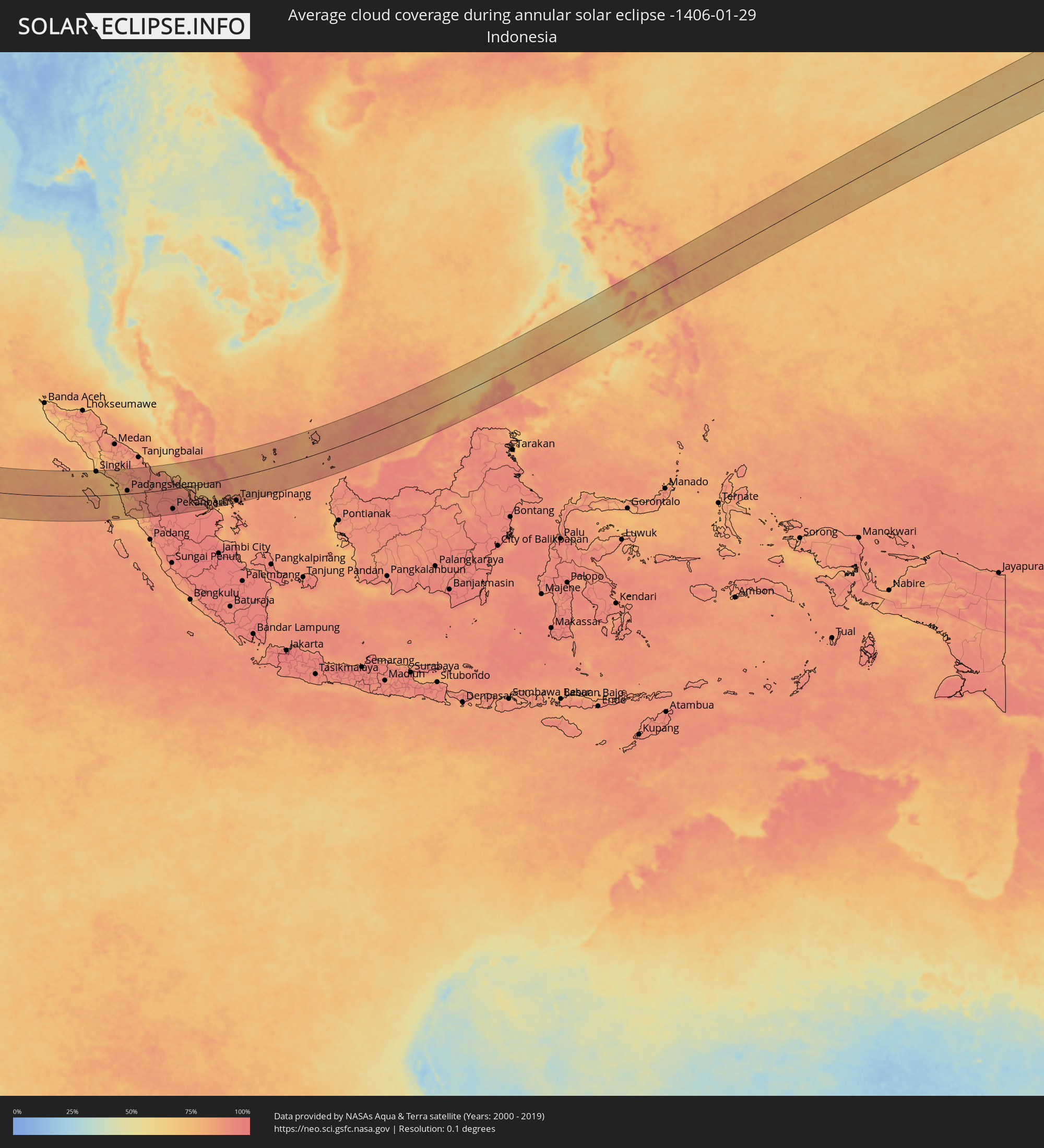 Indonesia
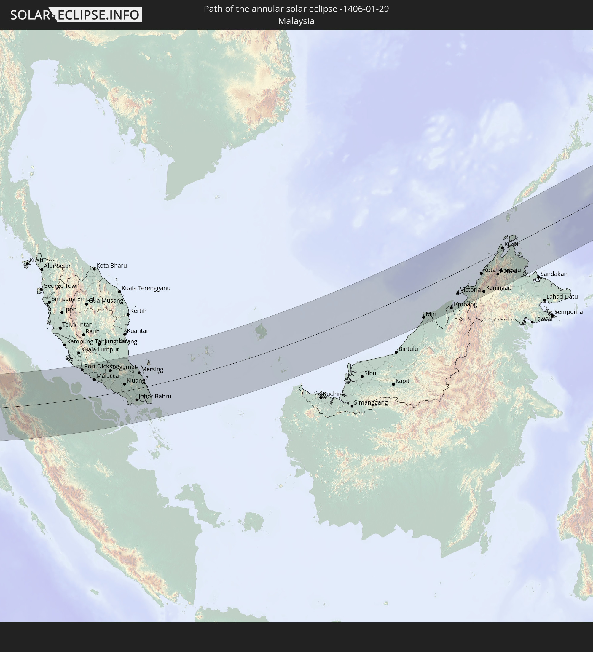
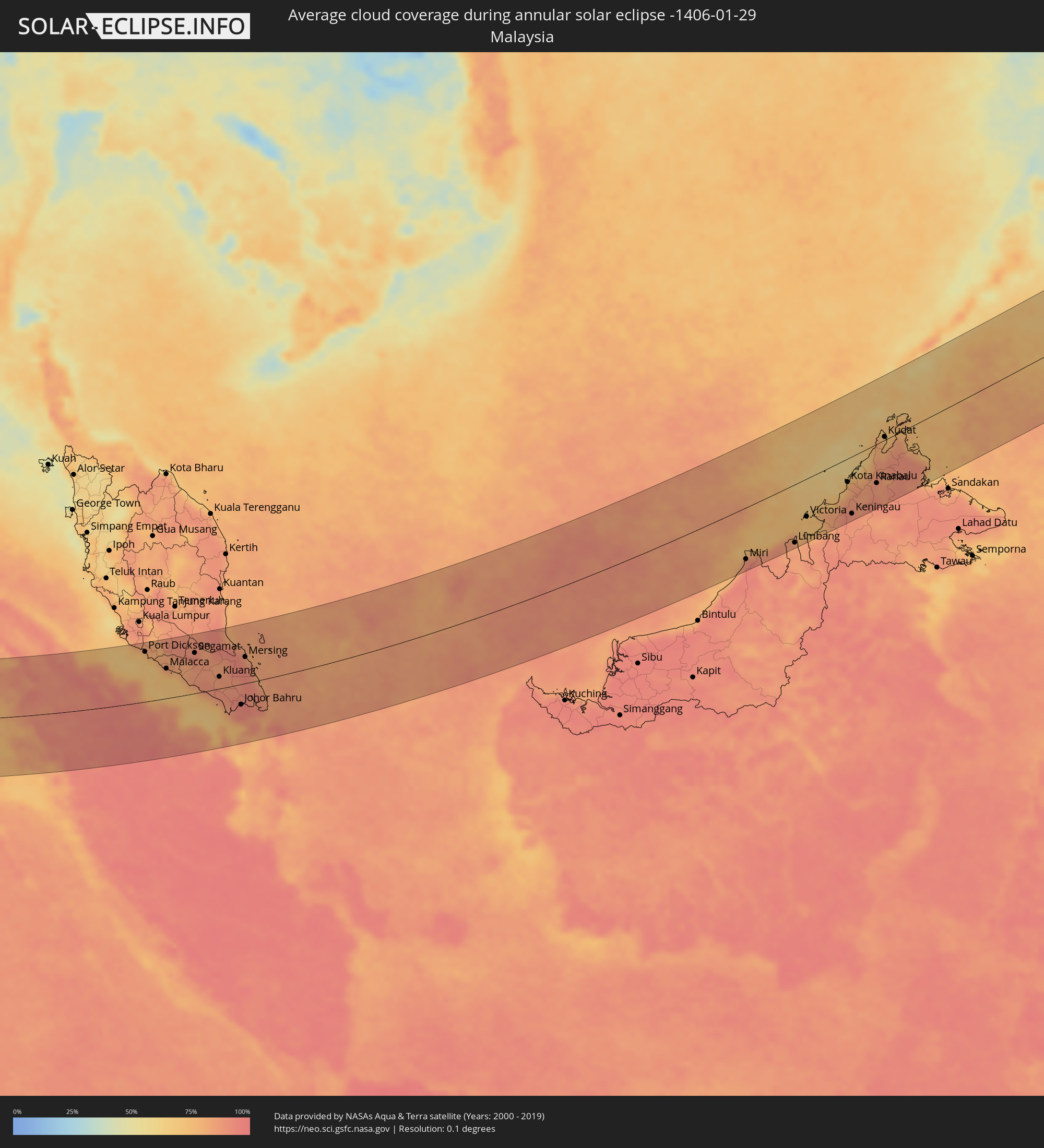 Malaysia
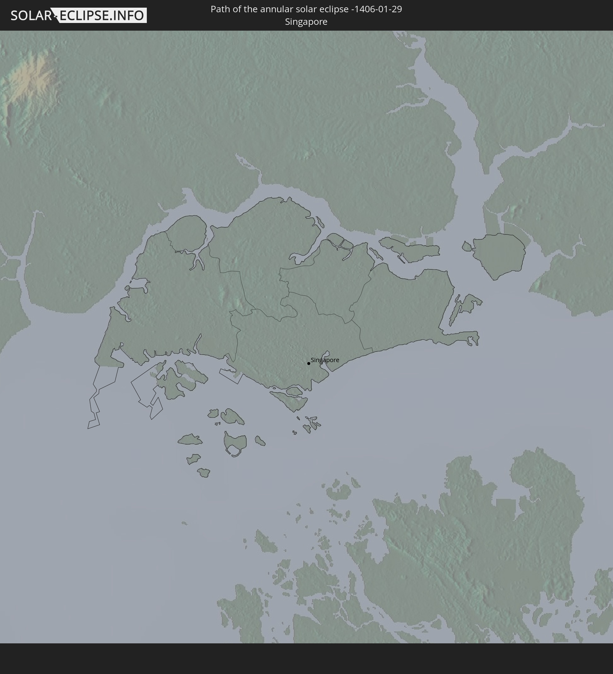
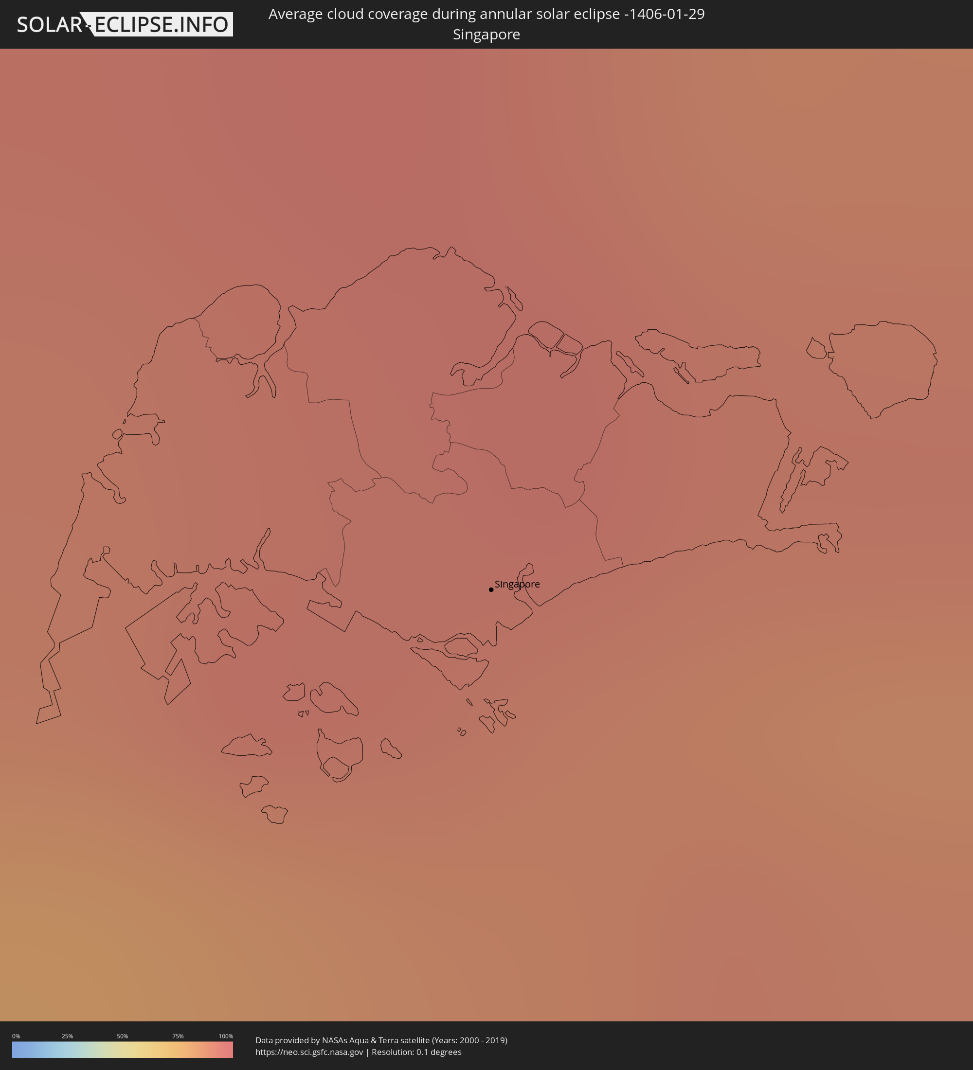 Singapore
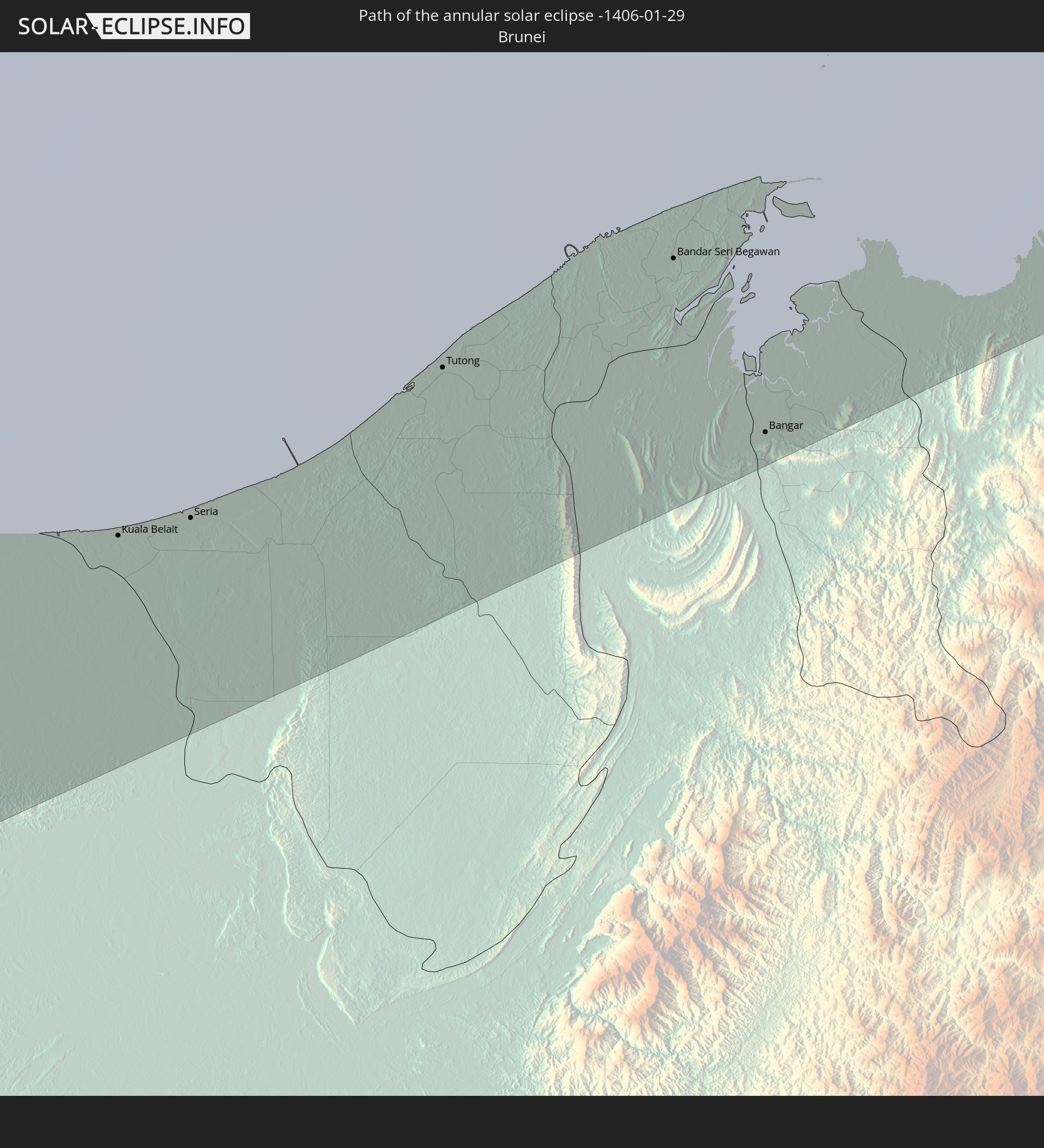
 Brunei
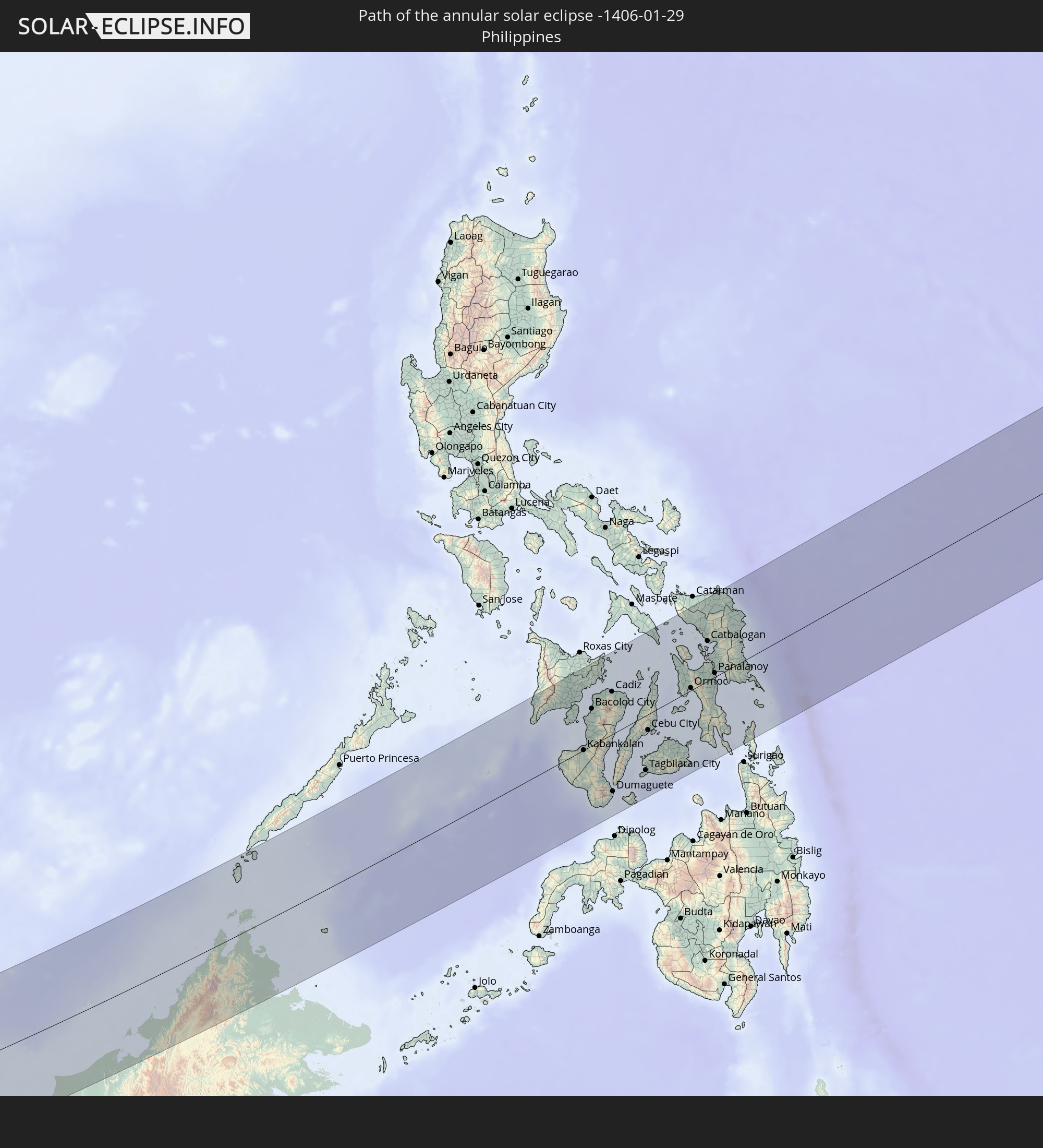
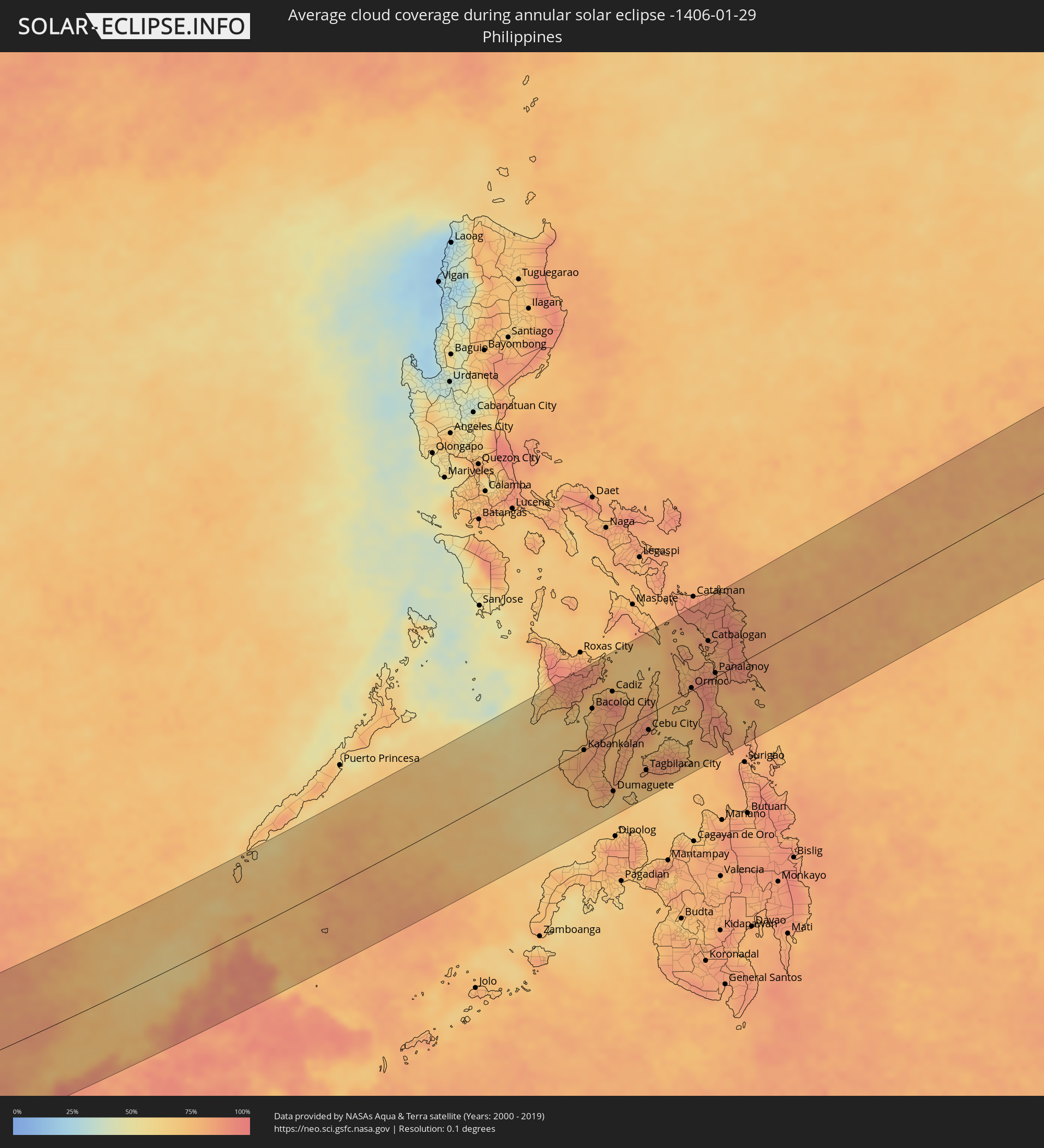 Philippines
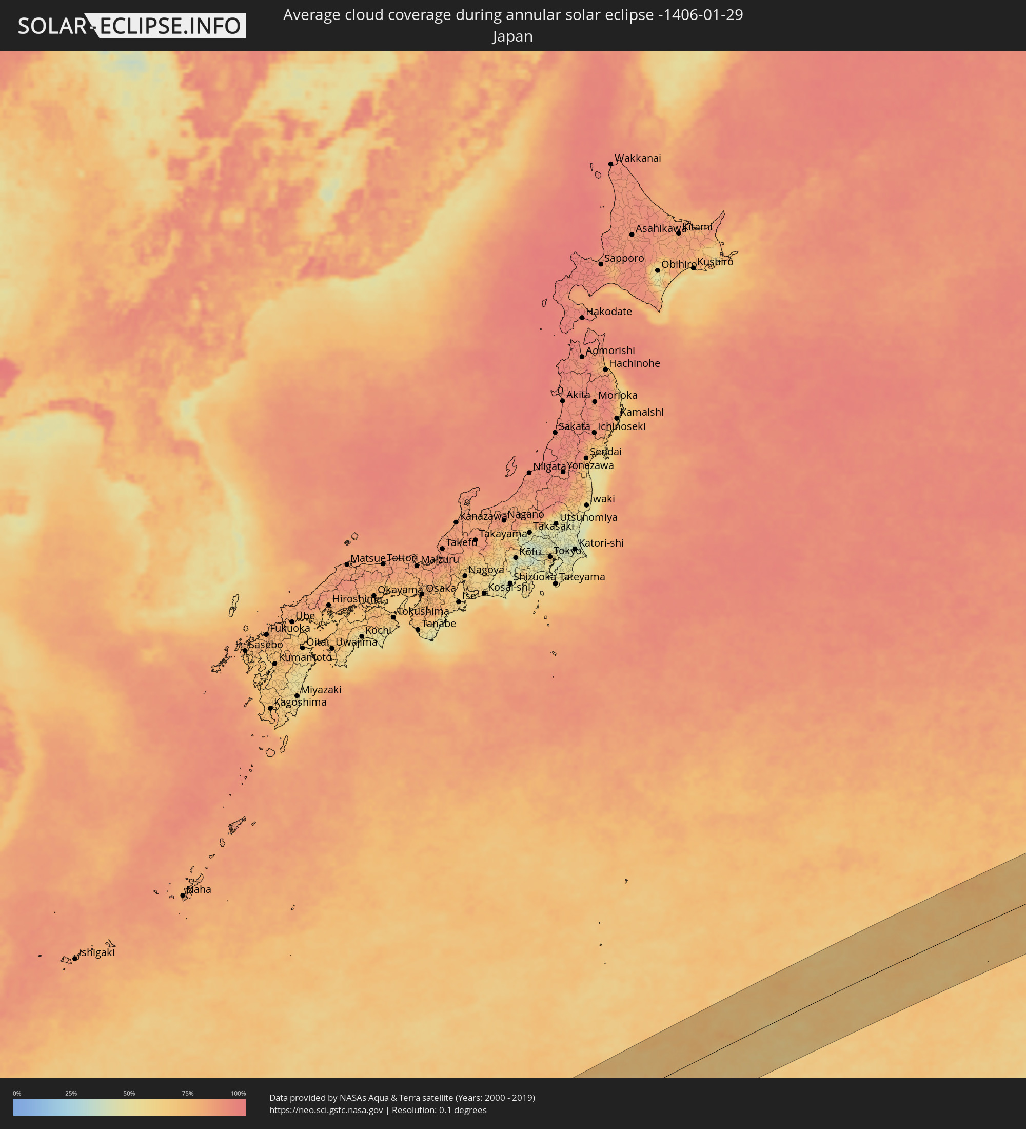 Japan
Japan
 Northern Mariana Islands
Cities inside the path of the eclipse
The following table shows all locations with a population of more than 5,000 inside the eclipse path. Cities which have more than 100,000 inhabitants are marked bold. A click at the locations opens a detailed map.
| City | Type | Eclipse duration | Local time of max. eclipse | Distance to central line | Ø Cloud coverage |
|
Al Mukallā, Muḩāfaz̧at Ḩaḑramawt
|
annular | - | 06:33:16 UTC+03:06 | 149 km | 28% |
|
Al Ghayz̧ah, Al Mahrah
|
annular | - | 06:34:40 UTC+03:06 | 146 km | 22% |
|
Hadibu, Soqatra Governorate
|
annular | - | 06:33:56 UTC+03:06 | 146 km | 46% |
|
Ugoofaaru, Raa Atoll
|
annular | - | 08:37:01 UTC+04:54 | 97 km | 67% |
|
Kulhudhuffushi, Haa Dhaalu Atholhu
|
annular | - | 08:37:08 UTC+04:54 | 4 km | 67% |
|
Dhidhdhoo, Haa Alifu Atholhu
|
annular | - | 08:37:14 UTC+04:54 | 33 km | 65% |
|
Funadhoo, Shaviyani Atholhu
|
annular | - | 08:37:27 UTC+04:54 | 37 km | 67% |
|
Naifaru, Lhaviyani Atholhu
|
annular | - | 08:37:32 UTC+04:54 | 108 km | 69% |
|
Manadhoo, Noonu Atoll
|
annular | - | 08:37:38 UTC+04:54 | 72 km | 72% |
|
Singkil, Aceh
|
annular | - | 12:00:20 UTC+07:07 | 127 km | 73% |
|
Sibolga, North Sumatra
|
annular | - | 12:04:08 UTC+07:07 | 60 km | 78% |
|
Padangsidempuan, North Sumatra
|
annular | - | 12:05:57 UTC+07:07 | 17 km | 88% |
|
Bandar, North Sumatra
|
annular | - | 12:08:18 UTC+07:07 | 86 km | 90% |
|
Rantauprapat, North Sumatra
|
annular | - | 12:08:40 UTC+07:07 | 91 km | 90% |
|
Balaipungut, Riau
|
annular | - | 12:14:03 UTC+07:07 | 43 km | 94% |
|
Pekanbaru, Riau
|
annular | - | 12:14:20 UTC+07:07 | 105 km | 97% |
|
Dumai, Riau
|
annular | - | 12:15:05 UTC+07:07 | 22 km | 92% |
|
Tanjung Sepat, Selangor
|
annular | - | 12:04:27 UTC+06:55 | 129 km | 79% |
|
Sepang, Selangor
|
annular | - | 12:05:16 UTC+06:55 | 130 km | 81% |
|
Port Dickson, Negeri Sembilan
|
annular | - | 12:05:23 UTC+06:55 | 112 km | 72% |
|
Seremban, Negeri Sembilan
|
annular | - | 12:06:04 UTC+06:55 | 130 km | 84% |
|
Kampong Masjid Tanah, Melaka
|
annular | - | 12:06:34 UTC+06:55 | 86 km | 80% |
|
Sungai Udang, Melaka
|
annular | - | 12:06:37 UTC+06:55 | 76 km | 76% |
|
Tampin, Negeri Sembilan
|
annular | - | 12:07:07 UTC+06:55 | 97 km | 81% |
|
Malacca, Melaka
|
annular | - | 12:06:58 UTC+06:55 | 66 km | 76% |
|
Batu Berendam, Melaka
|
annular | - | 12:07:02 UTC+06:55 | 72 km | 76% |
|
Bahau, Negeri Sembilan
|
annular | - | 12:08:05 UTC+06:55 | 130 km | 89% |
|
Tangkak, Johor
|
annular | - | 12:08:17 UTC+06:55 | 68 km | 82% |
|
Muar, Johor
|
annular | - | 12:08:14 UTC+06:55 | 43 km | 77% |
|
Segamat, Johor
|
annular | - | 12:09:35 UTC+06:55 | 90 km | 91% |
|
Batu Pahat, Johor
|
annular | - | 12:09:36 UTC+06:55 | 15 km | 85% |
|
Yong Peng, Johor
|
annular | - | 12:10:16 UTC+06:55 | 30 km | 89% |
|
Kluang, Johor
|
annular | - | 12:11:19 UTC+06:55 | 26 km | 85% |
|
Pontian Kechil, Johor
|
annular | - | 12:11:12 UTC+06:55 | 35 km | 83% |
|
Pekan Nenas, Johor
|
annular | - | 12:11:44 UTC+06:55 | 35 km | 87% |
|
Taman Senai, Johor
|
annular | - | 12:12:20 UTC+06:55 | 28 km | 93% |
|
Johor Bahru, Johor
|
annular | - | 12:12:42 UTC+06:55 | 45 km | 94% |
|
Ulu Tiram, Johor
|
annular | - | 12:13:03 UTC+06:55 | 32 km | 94% |
|
Mersing, Johor
|
annular | - | 12:13:47 UTC+06:55 | 58 km | 90% |
|
Singapore, Central Singapore
|
annular | - | 12:12:57 UTC+06:55 | 66 km | 89% |
|
Kota Tinggi, Johor
|
annular | - | 12:13:29 UTC+06:55 | 19 km | 90% |
|
Tanjungpinang, Riau Islands
|
annular | - | 12:26:54 UTC+07:07 | 121 km | 92% |
|
Kijang, Riau Islands
|
annular | - | 12:27:36 UTC+07:07 | 128 km | 91% |
|
Miri, Sarawak
|
annular | - | 13:19:50 UTC+07:21 | 106 km | 90% |
|
Kuala Belait, Belait
|
annular | - | 13:39:03 UTC+07:39 | 99 km | 81% |
|
Seria, Belait
|
annular | - | 13:39:22 UTC+07:39 | 101 km | 86% |
|
Tutong, Tutong
|
annular | - | 13:40:36 UTC+07:39 | 97 km | 85% |
|
Bandar Seri Begawan, Brunei and Muara
|
annular | - | 13:41:41 UTC+07:39 | 97 km | 84% |
|
Limbang, Sarawak
|
annular | - | 13:23:21 UTC+07:21 | 118 km | 83% |
|
Bangar, Temburong
|
annular | - | 13:41:51 UTC+07:39 | 125 km | 84% |
|
Victoria, Labuan
|
annular | - | 13:24:36 UTC+07:21 | 77 km | 73% |
|
Kota Kinabalu, Sabah
|
annular | - | 13:27:48 UTC+07:21 | 47 km | 80% |
|
Keningau, Sabah
|
annular | - | 13:27:30 UTC+07:21 | 115 km | 89% |
|
Kudat, Sabah
|
annular | - | 13:30:52 UTC+07:21 | 6 km | 74% |
|
Sipalay, Western Visayas
|
annular | - | 14:26:28 UTC+08:00 | 1 km | 74% |
|
Iloilo, Western Visayas
|
annular | - | 14:27:27 UTC+08:00 | 82 km | 69% |
|
Passi, Western Visayas
|
annular | - | 14:27:53 UTC+08:00 | 118 km | 88% |
|
Bayawan, Central Visayas
|
annular | - | 14:27:09 UTC+08:00 | 60 km | 69% |
|
Kabankalan, Western Visayas
|
annular | - | 14:27:35 UTC+08:00 | 0 km | 81% |
|
Bago City, Western Visayas
|
annular | - | 14:27:58 UTC+08:00 | 52 km | 64% |
|
Hinigaran, Western Visayas
|
annular | - | 14:27:51 UTC+08:00 | 26 km | 81% |
|
La Carlota, Western Visayas
|
annular | - | 14:28:06 UTC+08:00 | 37 km | 80% |
|
Bacolod City, Western Visayas
|
annular | - | 14:28:19 UTC+08:00 | 59 km | 80% |
|
La Castellana, Western Visayas
|
annular | - | 14:28:16 UTC+08:00 | 22 km | 84% |
|
Victorias, Western Visayas
|
annular | - | 14:28:44 UTC+08:00 | 76 km | 84% |
|
Bais, Central Visayas
|
annular | - | 14:28:01 UTC+08:00 | 55 km | 77% |
|
Canlaon, Central Visayas
|
annular | - | 14:28:46 UTC+08:00 | 17 km | 81% |
|
Cadiz, Western Visayas
|
annular | - | 14:29:15 UTC+08:00 | 68 km | 92% |
|
Dumaguete, Central Visayas
|
annular | - | 14:28:14 UTC+08:00 | 92 km | 67% |
|
Ualog, Western Visayas
|
annular | - | 14:29:16 UTC+08:00 | 26 km | 82% |
|
Escalante, Western Visayas
|
annular | - | 14:29:39 UTC+08:00 | 47 km | 80% |
|
Toledo, Central Visayas
|
annular | - | 14:29:41 UTC+08:00 | 6 km | 81% |
|
Carcar, Central Visayas
|
annular | - | 14:29:31 UTC+08:00 | 32 km | 79% |
|
Naga, Central Visayas
|
annular | - | 14:29:51 UTC+08:00 | 28 km | 78% |
|
Tagbilaran City, Central Visayas
|
annular | - | 14:29:42 UTC+08:00 | 87 km | 82% |
|
Cebu City, Central Visayas
|
annular | - | 14:30:12 UTC+08:00 | 25 km | 80% |
|
Bogo, Central Visayas
|
annular | - | 14:30:53 UTC+08:00 | 40 km | 72% |
|
Danao, Central Visayas
|
annular | - | 14:30:37 UTC+08:00 | 12 km | 70% |
|
Jagna, Central Visayas
|
annular | - | 14:30:49 UTC+08:00 | 115 km | 73% |
|
Calbayog City, Eastern Visayas
|
annular | - | 14:32:43 UTC+08:00 | 107 km | 83% |
|
Ormoc, Eastern Visayas
|
annular | - | 14:32:09 UTC+08:00 | 4 km | 79% |
|
Catbalogan, Eastern Visayas
|
annular | - | 14:33:10 UTC+08:00 | 64 km | 84% |
|
Panalanoy, Eastern Visayas
|
annular | - | 14:33:08 UTC+08:00 | 6 km | 82% |