Total solar eclipse of 01/13/-1684
| Day of week: | Wednesday |
| Maximum duration of eclipse: | 04m55s |
| Maximum width of eclipse path: | 177 km |
| Saros cycle: | 14 |
| Coverage: | 100% |
| Magnitude: | 1.0533 |
| Gamma: | 0.0613 |
Wo kann man die Sonnenfinsternis vom 01/13/-1684 sehen?
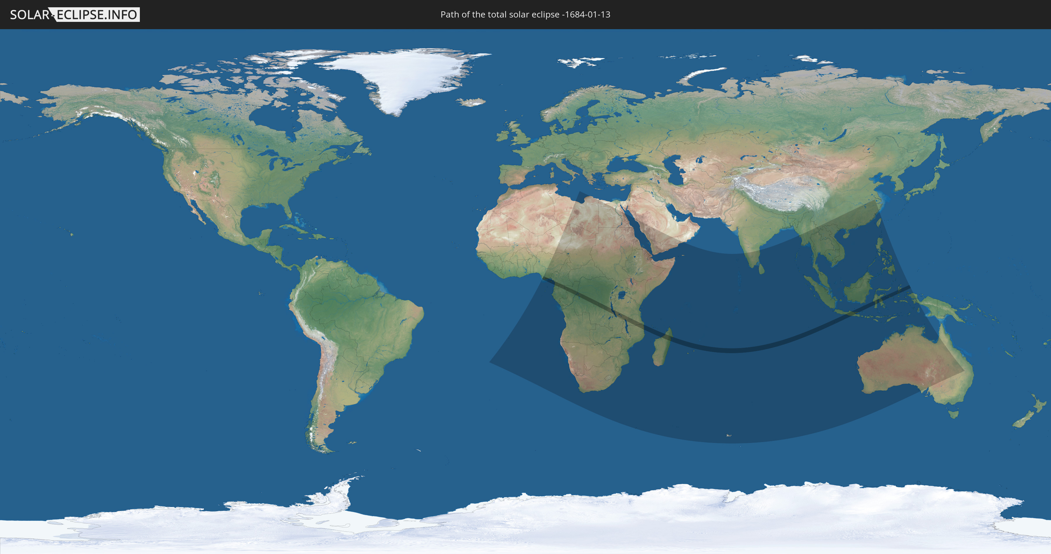
Die Sonnenfinsternis am 01/13/-1684 kann man in 65 Ländern als partielle Sonnenfinsternis beobachten.
Der Finsternispfad verläuft durch 13 Länder. Nur in diesen Ländern ist sie als total Sonnenfinsternis zu sehen.
In den folgenden Ländern ist die Sonnenfinsternis total zu sehen
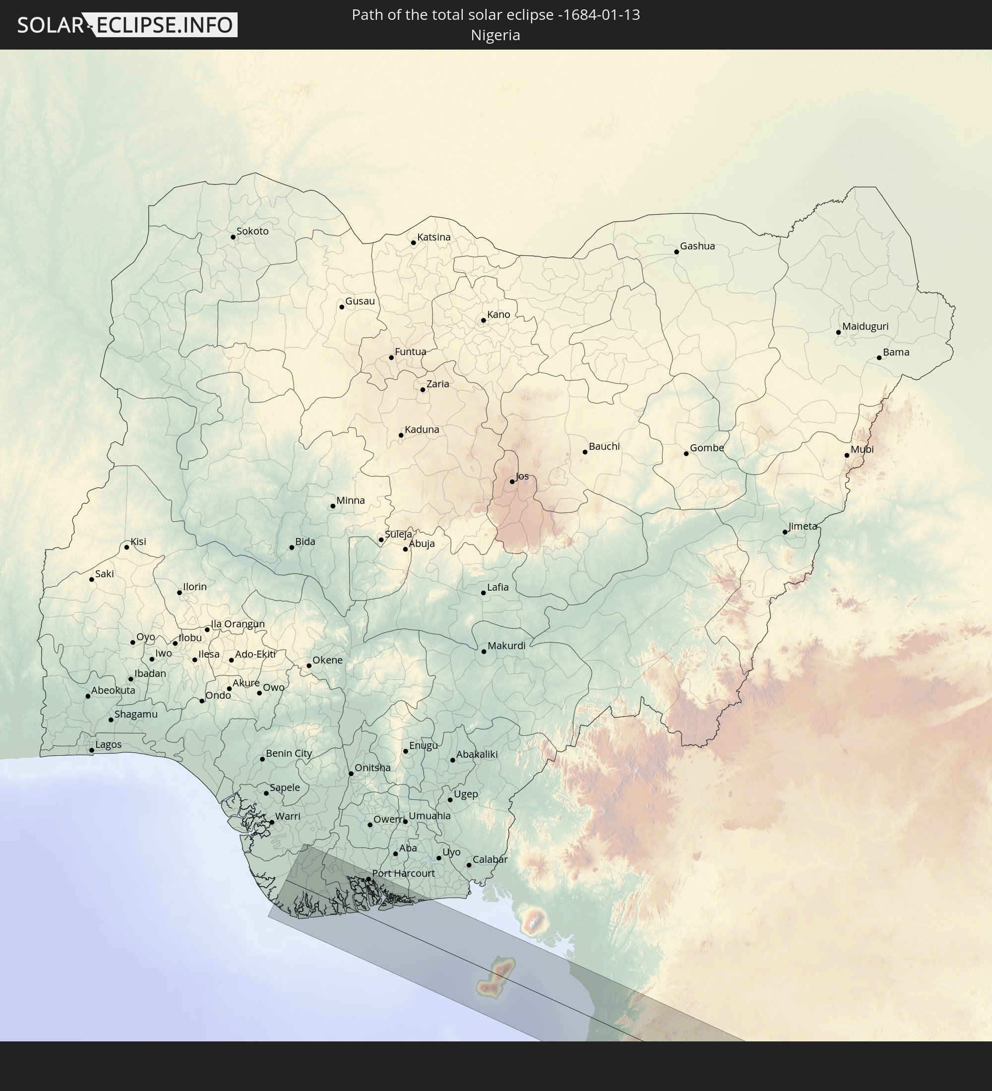 Nigeria
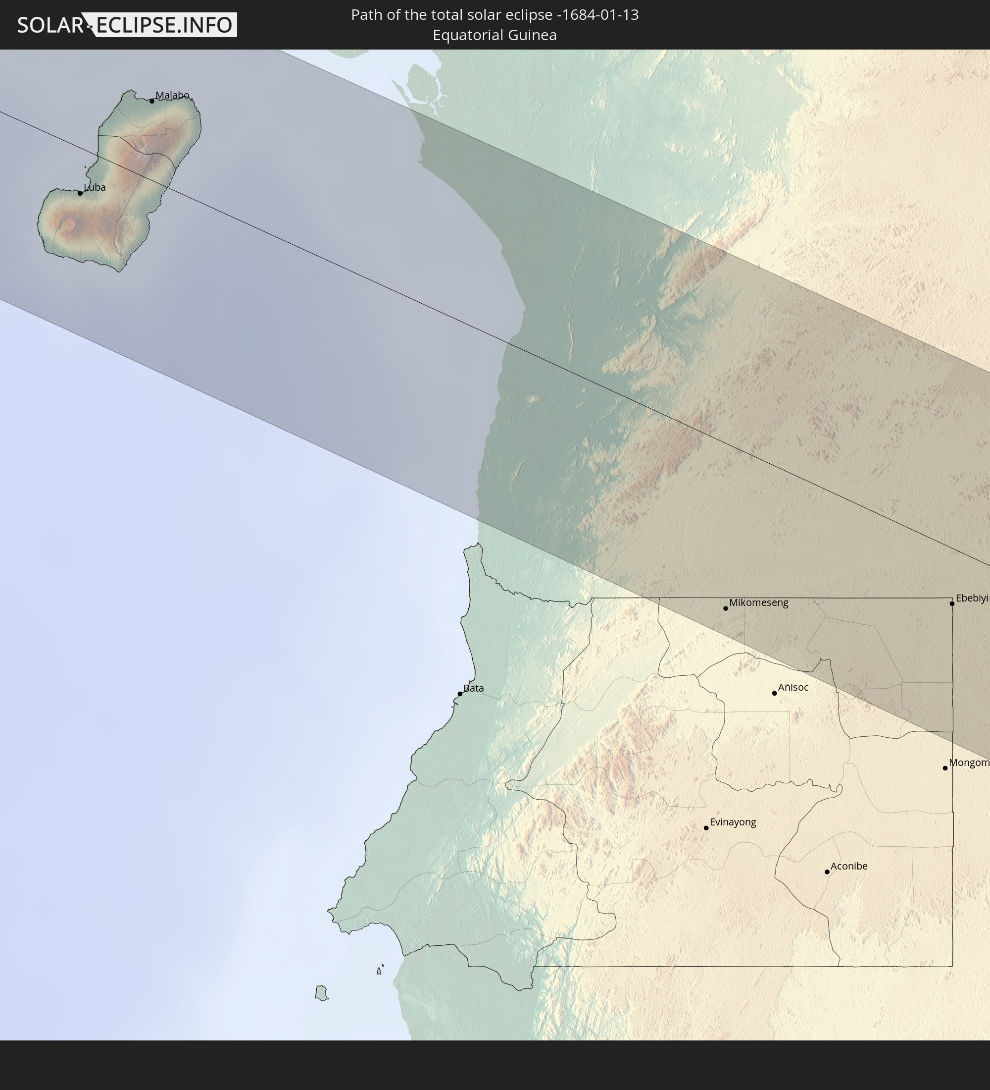 Equatorial Guinea
 Cameroon
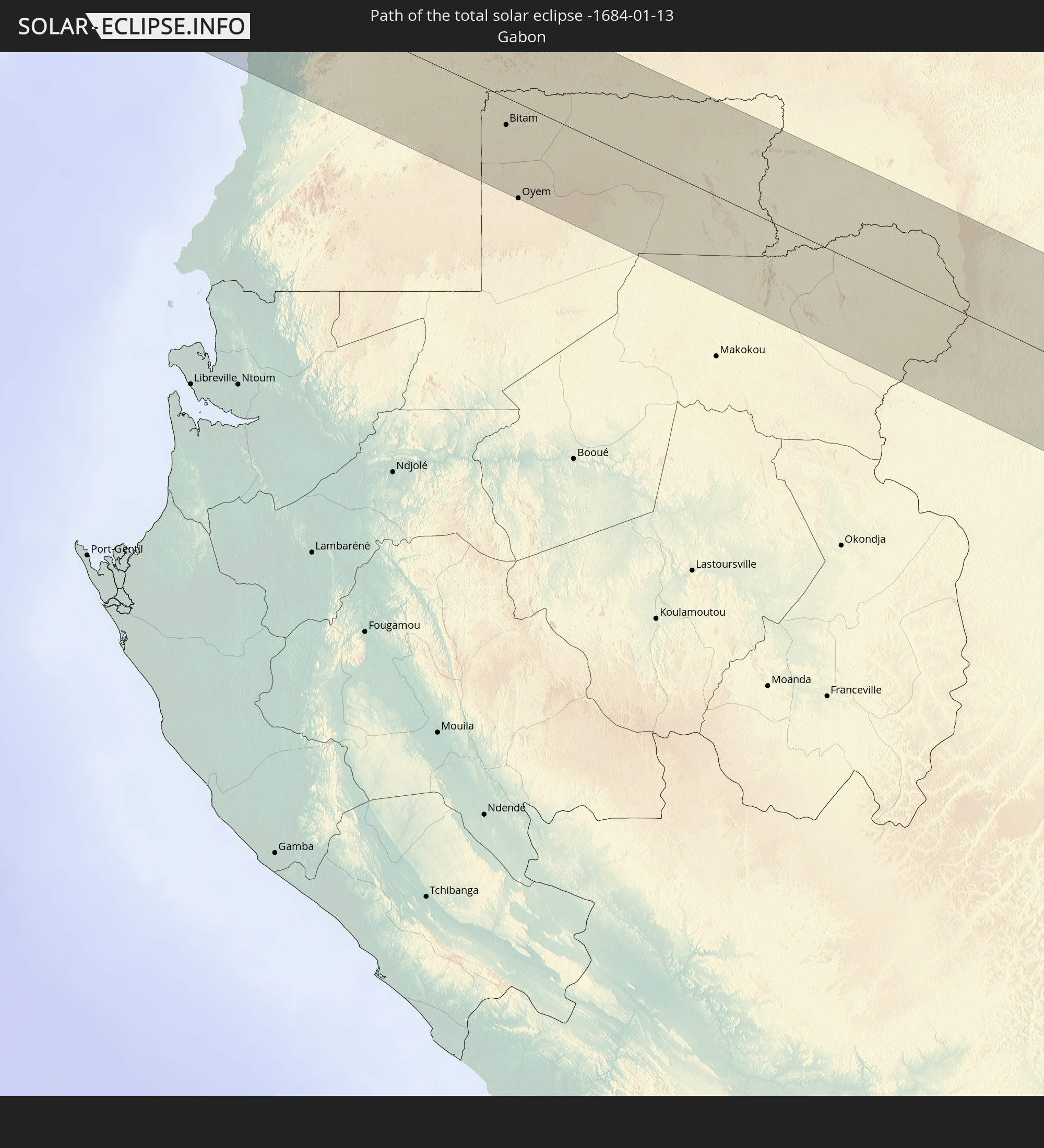 Gabon
Gabon
 Republic of the Congo
 Democratic Republic of the Congo
 Tanzania
 Mozambique
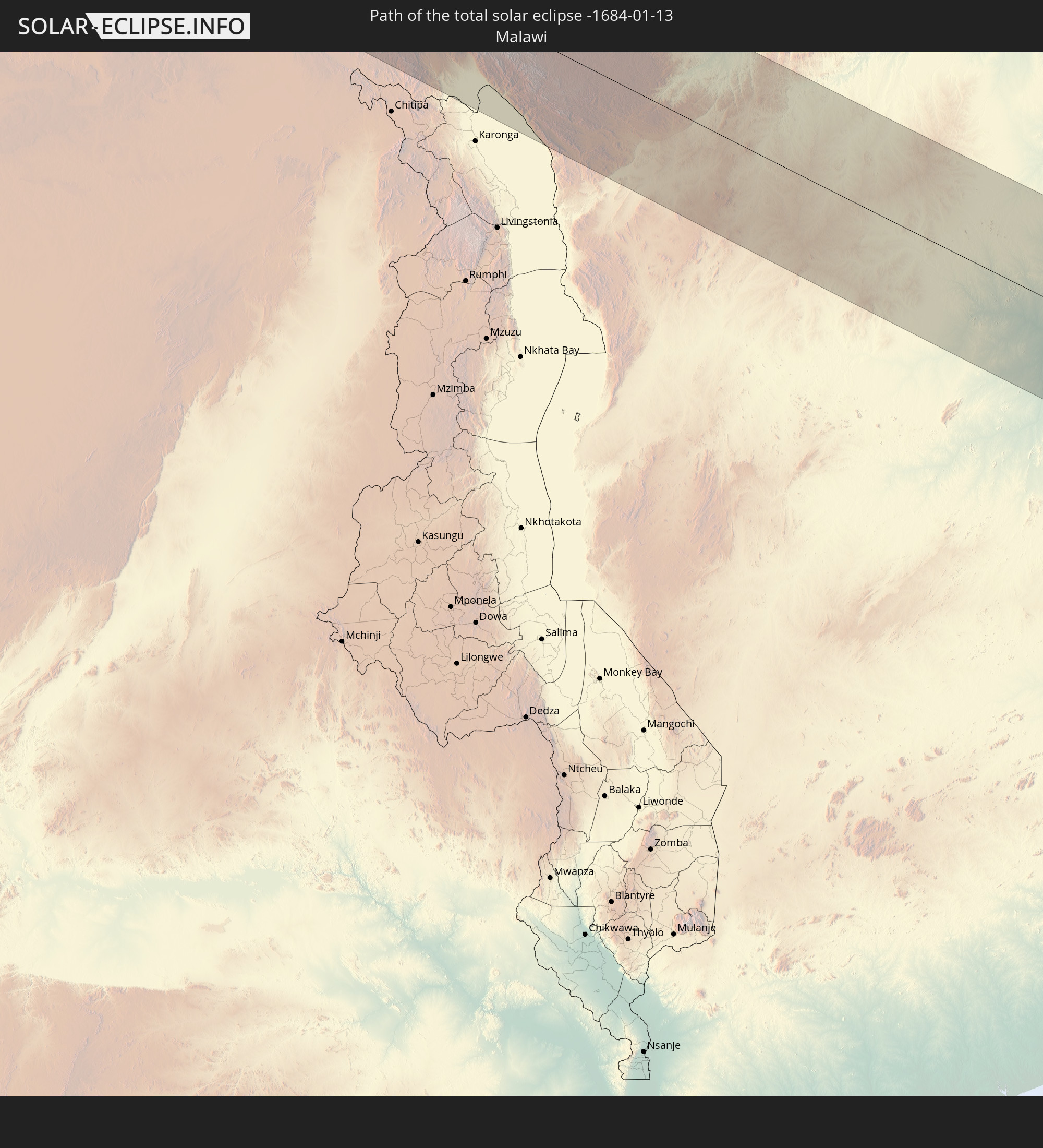 Malawi
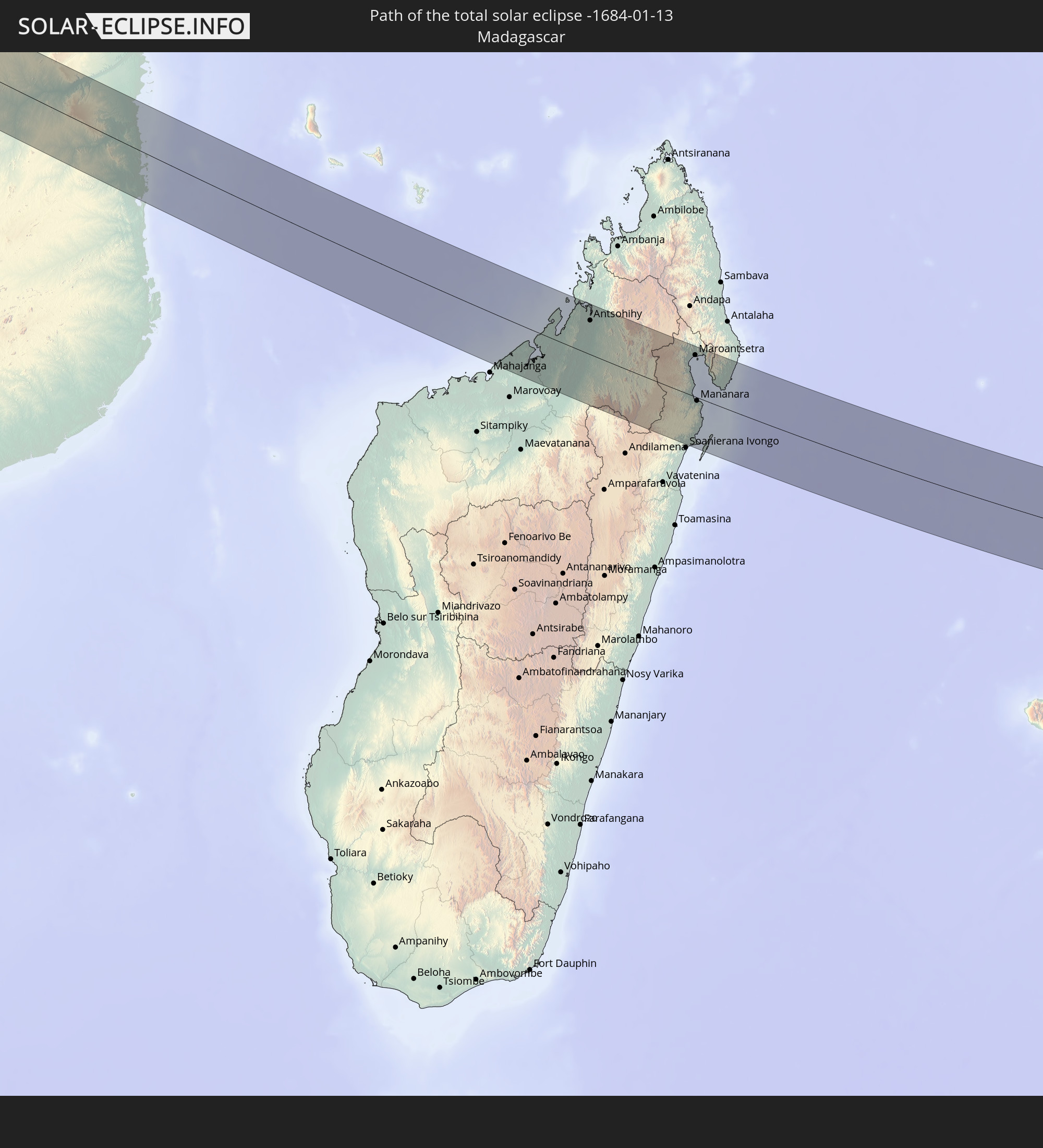 Madagascar
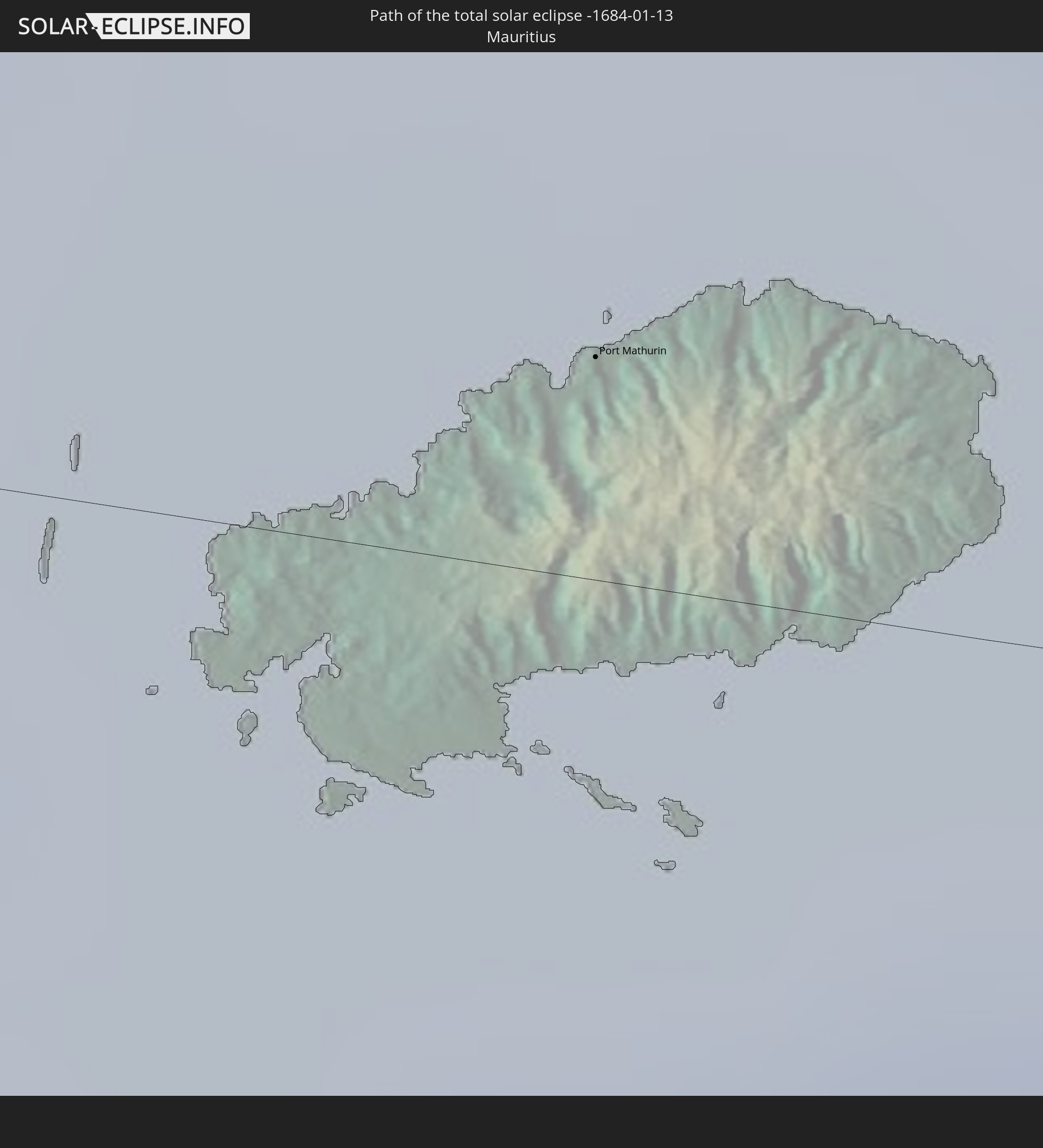 Mauritius
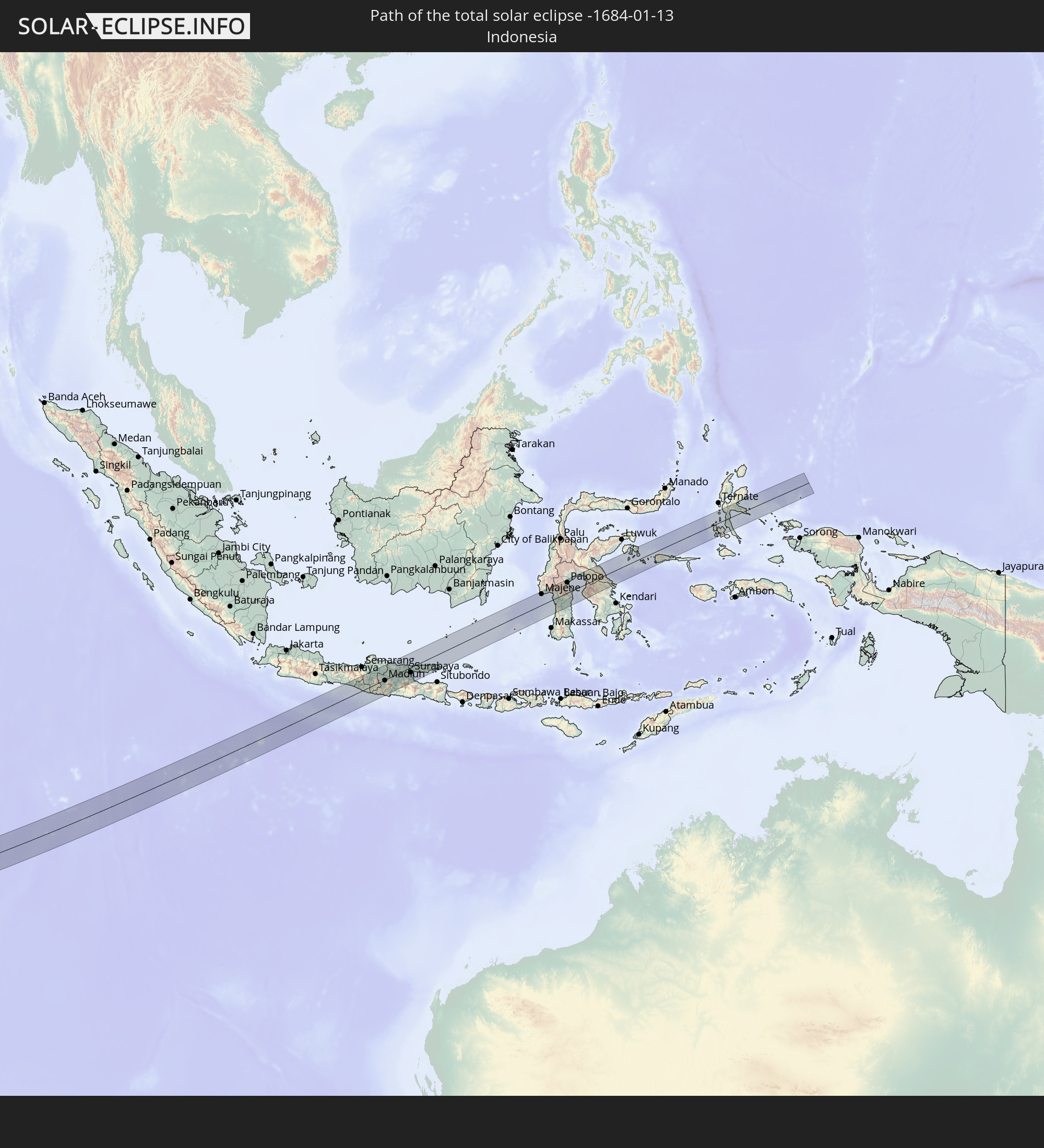 Indonesia
 Christmas Island
In den folgenden Ländern ist die Sonnenfinsternis partiell zu sehen
 Saint Helena, Ascension and Tristan da Cunha
 Niger
Niger
 Nigeria
 Equatorial Guinea
 São Tomé and Príncipe
 Cameroon
 Gabon
Gabon
 Libya
Libya
 Republic of the Congo
 Angola
 Namibia
 Democratic Republic of the Congo
 Chad
Chad
 Central African Republic
 South Africa
 Botswana
 Sudan
Sudan
 Zambia
 Egypt
Egypt
 Zimbabwe
 Lesotho
 Rwanda
 Burundi
 Tanzania
 Uganda
 Mozambique
 Swaziland
 Malawi
 Ethiopia
 Kenya
Kenya
 Saudi Arabia
 Eritrea
 French Southern and Antarctic Lands
 Somalia
 Djibouti
 Yemen
Yemen
 Madagascar
 Comoros
 Mayotte
 Seychelles
 Oman
Oman
 Réunion
 Mauritius
 India
India
 British Indian Ocean Territory
 Maldives
 China
China
 Sri Lanka
 Myanmar
 Indonesia
 Cocos Islands
 Thailand
 Malaysia
 Laos
Laos
 Vietnam
 Cambodia
 Singapore
 Christmas Island
 Australia
 Macau
Macau
 Hong Kong
 Brunei
 Taiwan
 Philippines
 East Timor
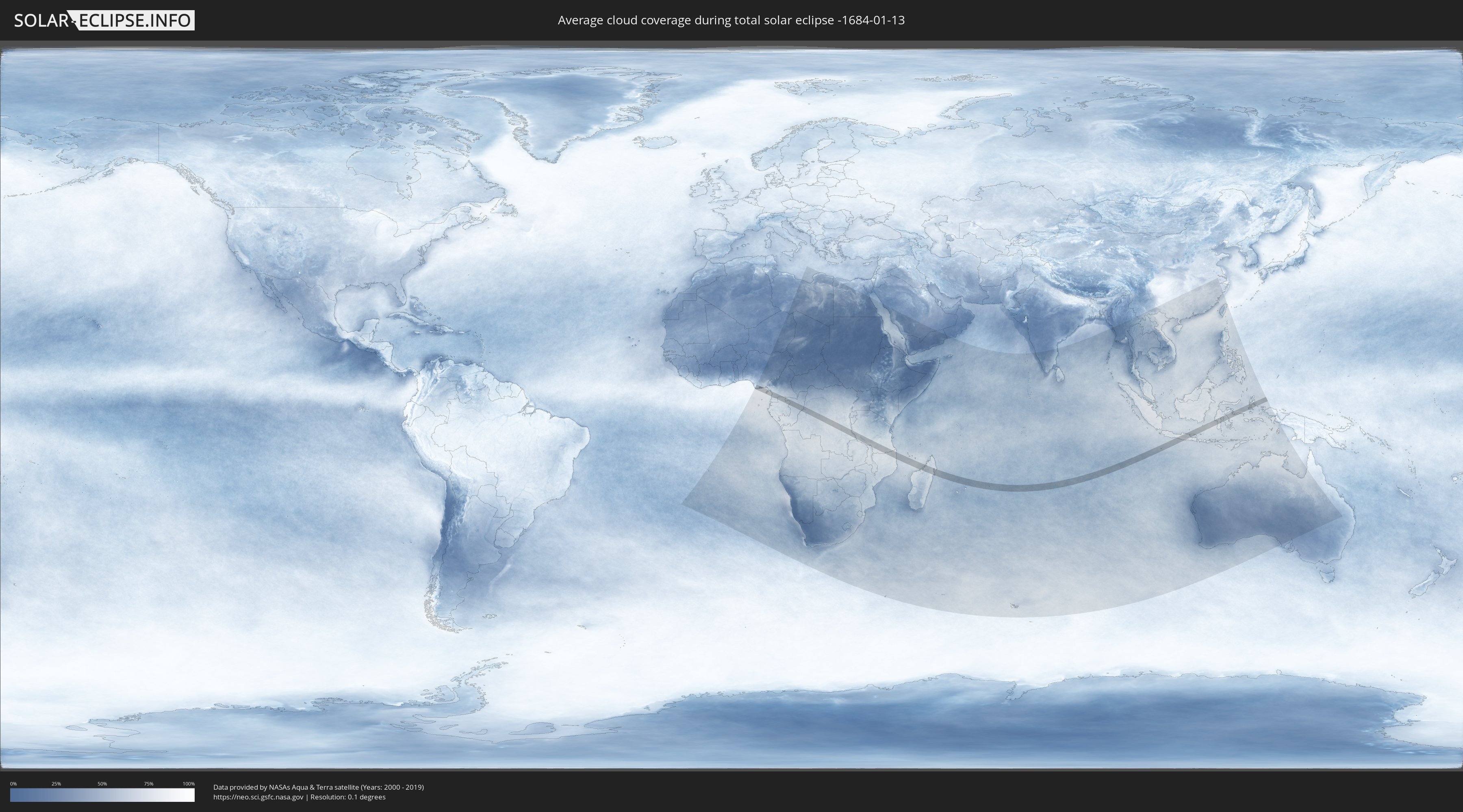
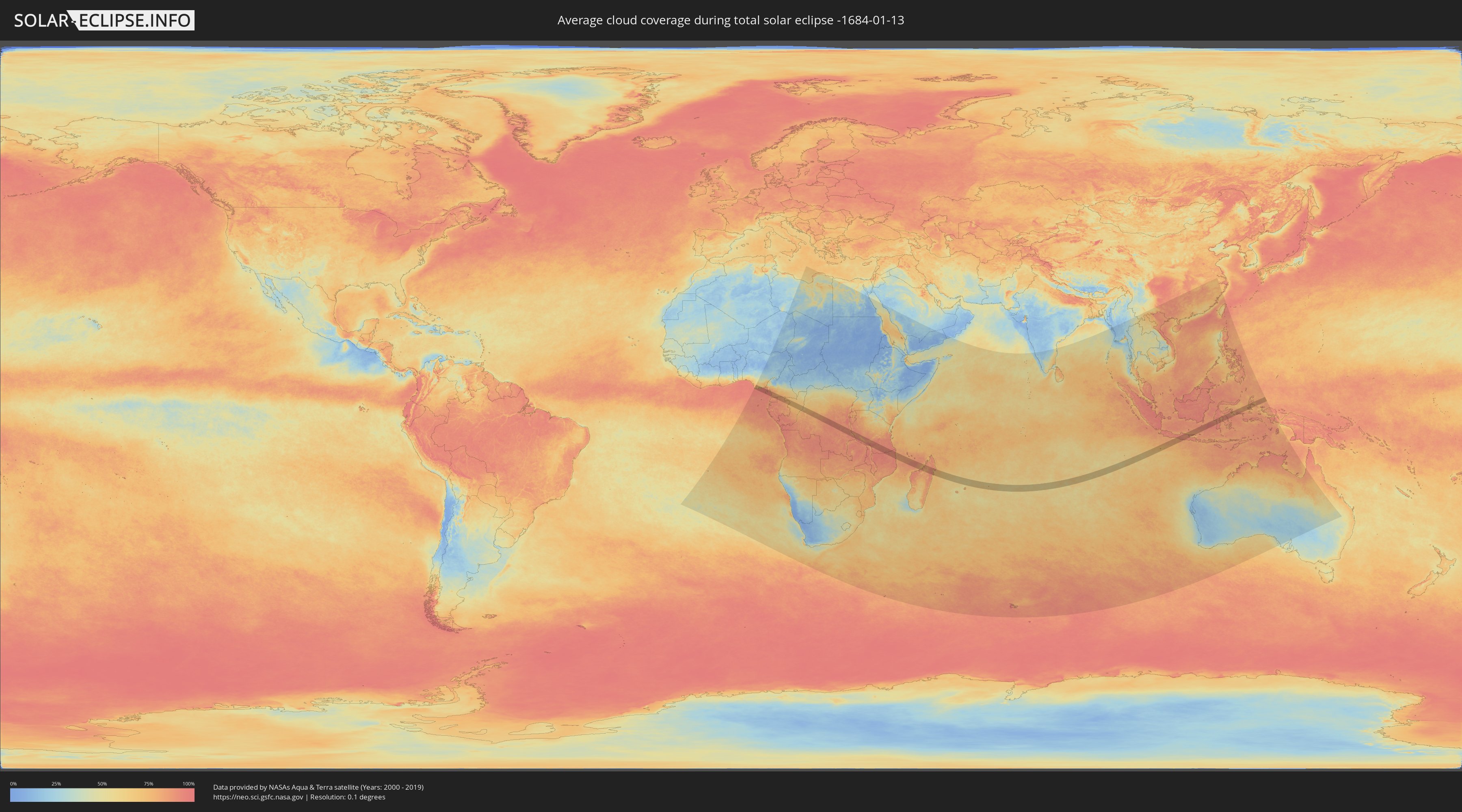
How will be the weather during the total solar eclipse on 01/13/-1684?
Where is the best place to see the total solar eclipse of 01/13/-1684?
The following maps show the average cloud coverage for the day of the total solar eclipse.
With the help of these maps, it is possible to find the place along the eclipse path, which has the best
chance of a cloudless sky.
Nevertheless, you should consider local circumstances and inform about the weather of your chosen
observation site.
The data is provided by NASAs satellites
AQUA and TERRA.
The cloud maps are averaged over a period of 19 years (2000 - 2019).
Detailed country maps
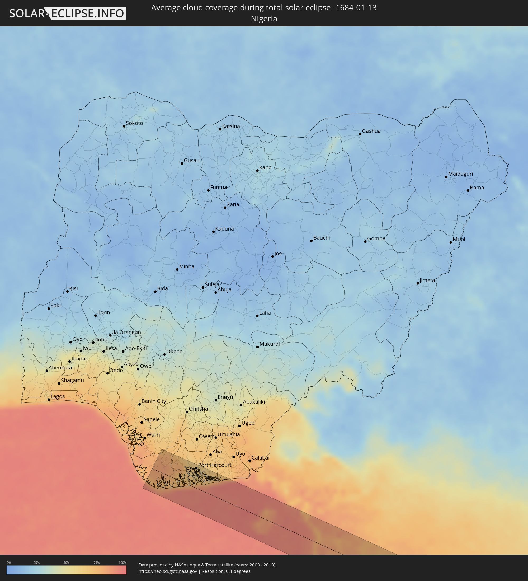 Nigeria
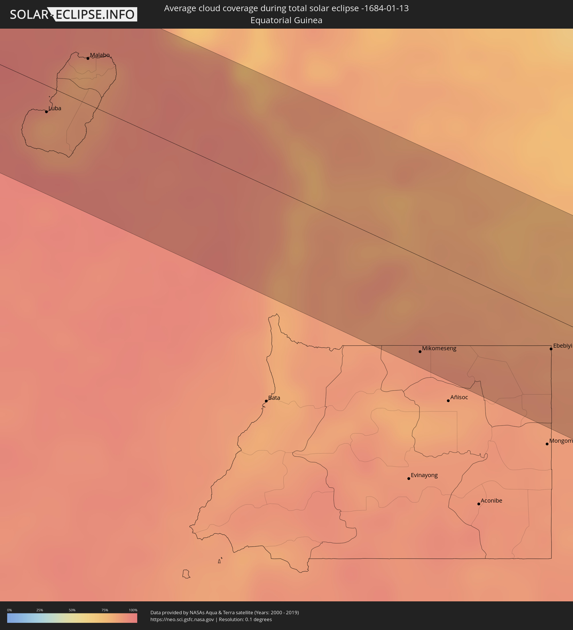 Equatorial Guinea
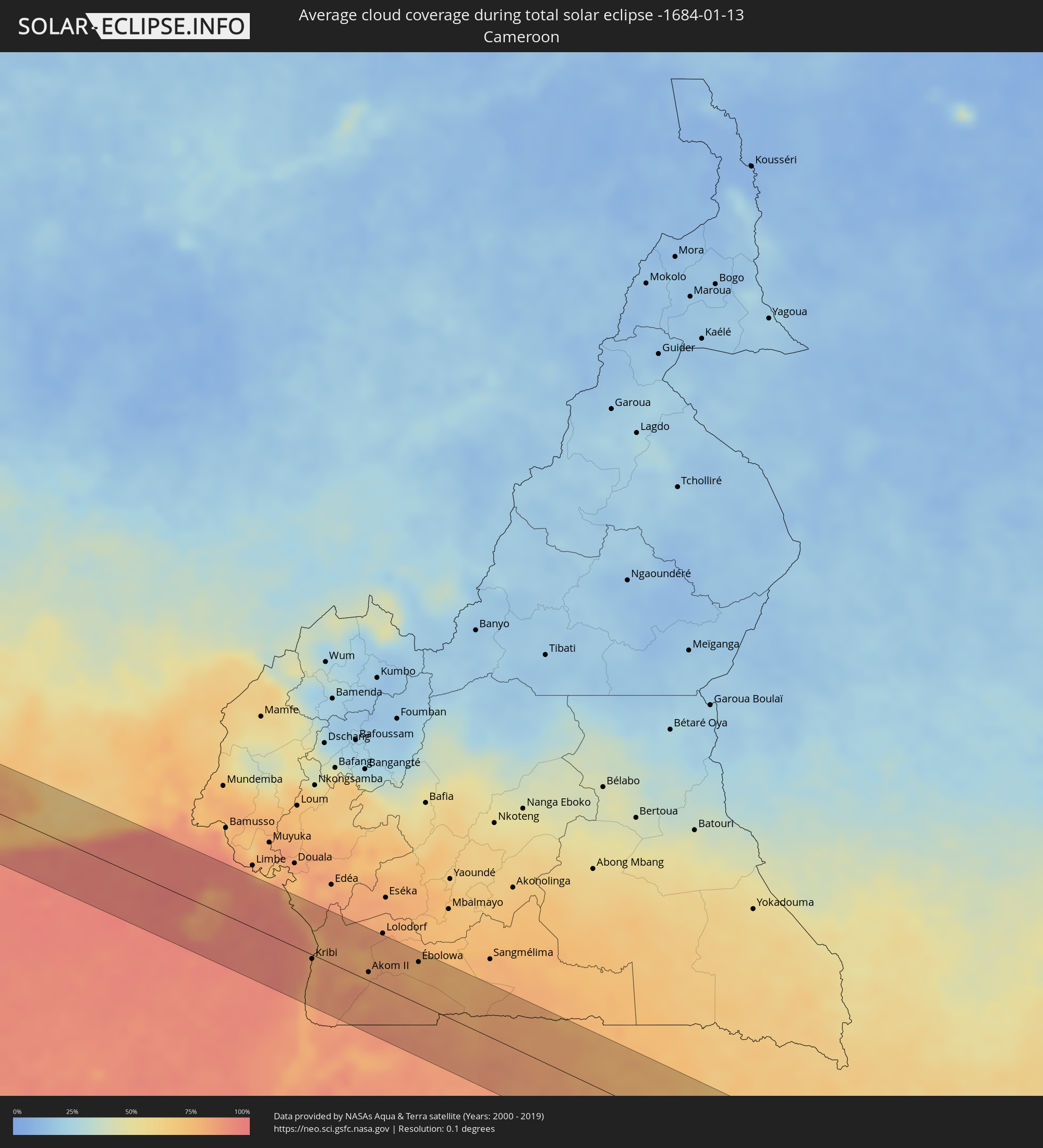 Cameroon
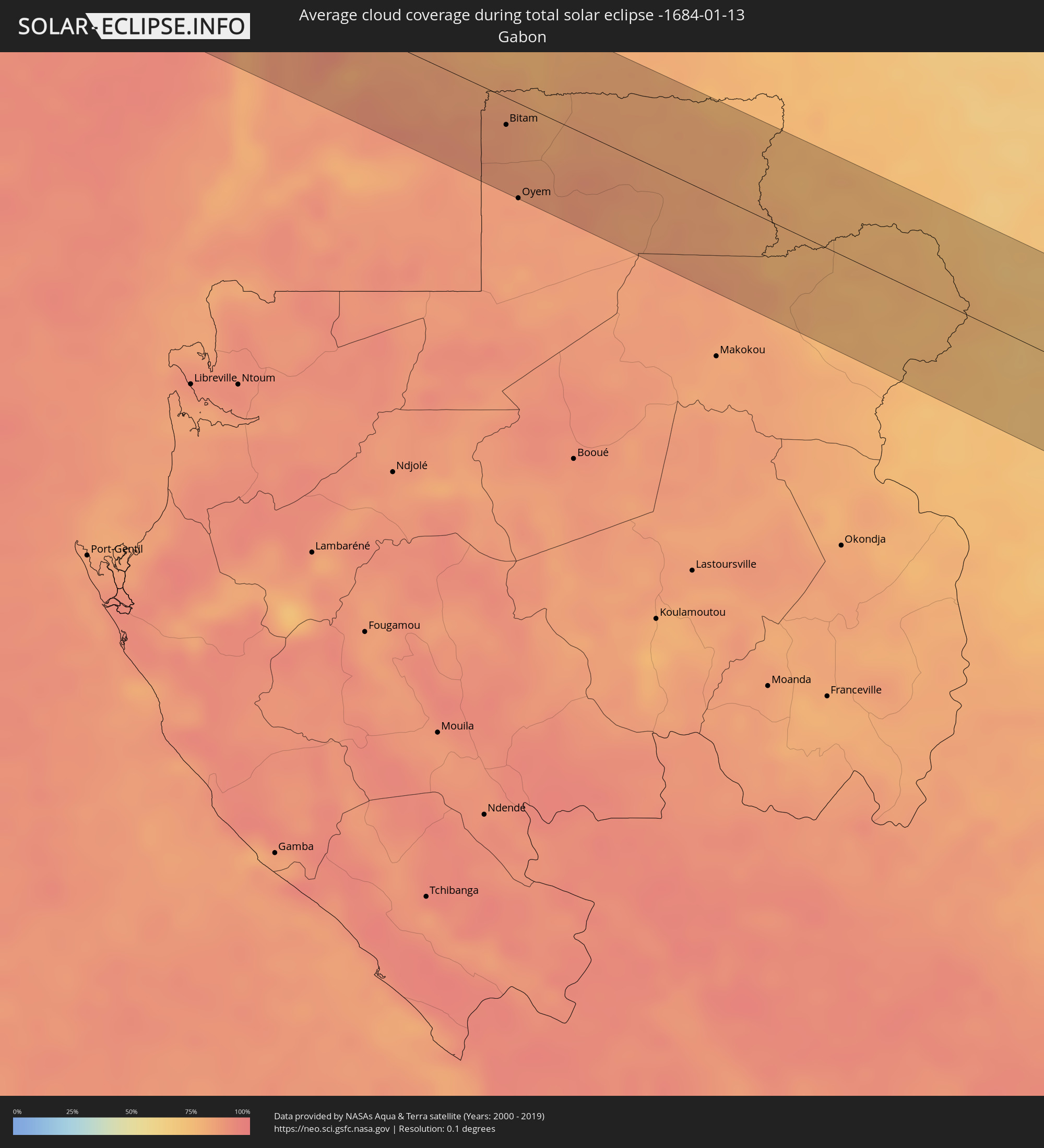 Gabon
Gabon
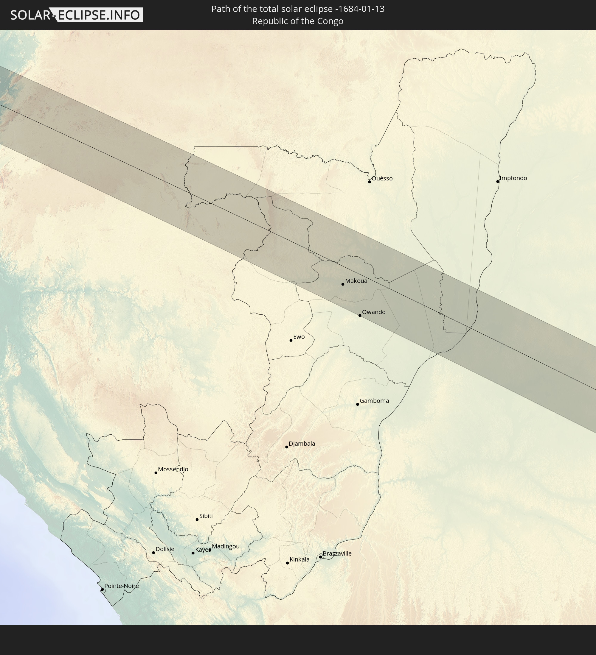
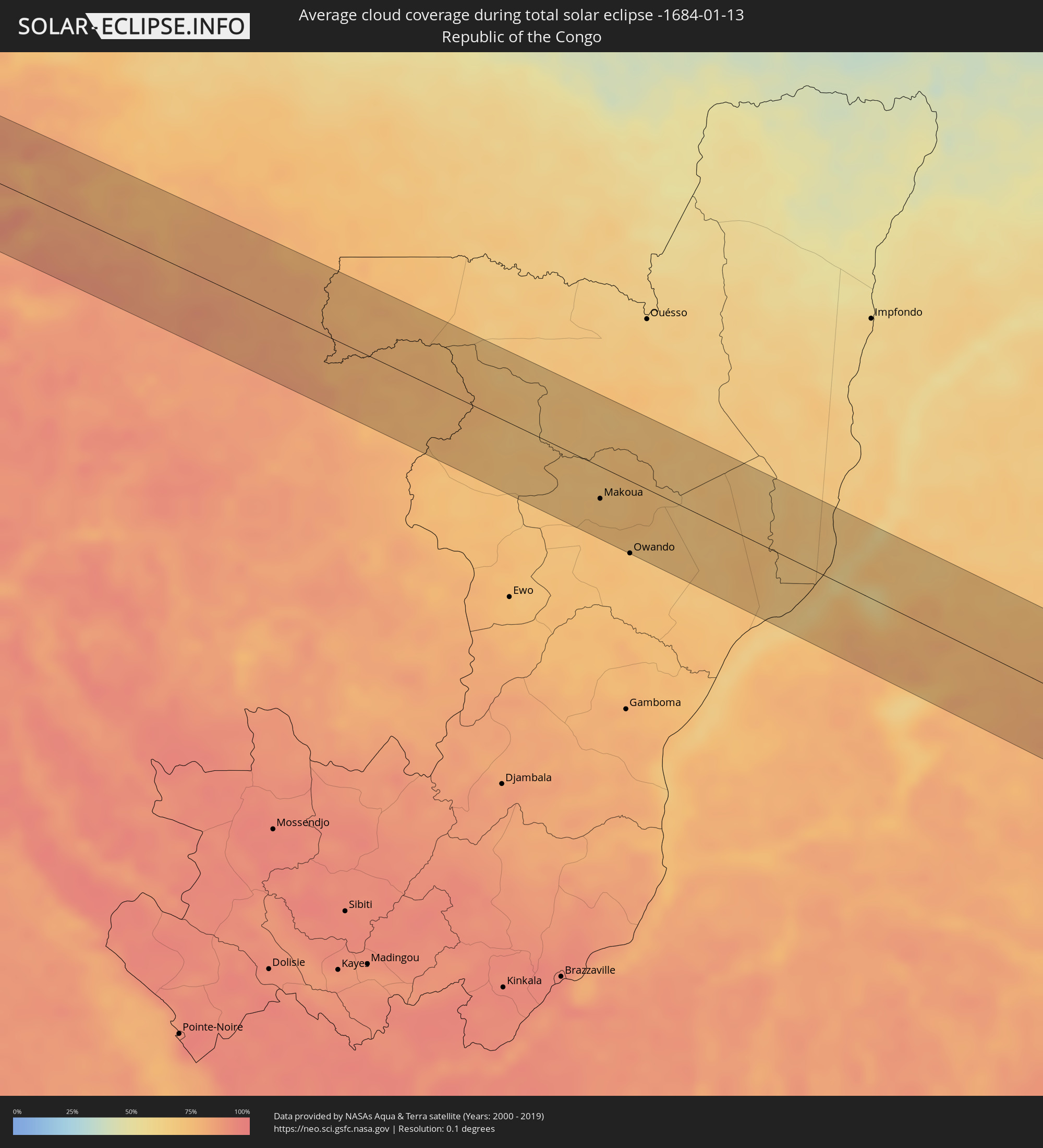 Republic of the Congo
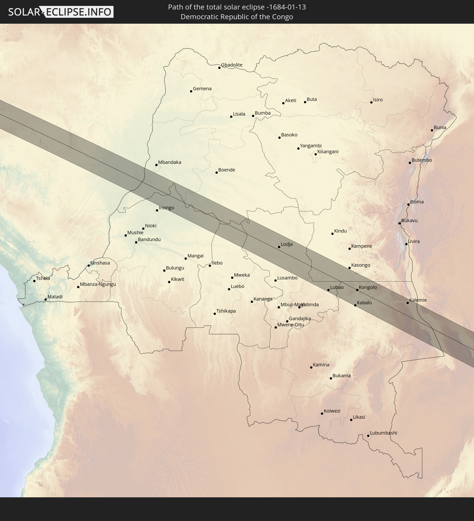
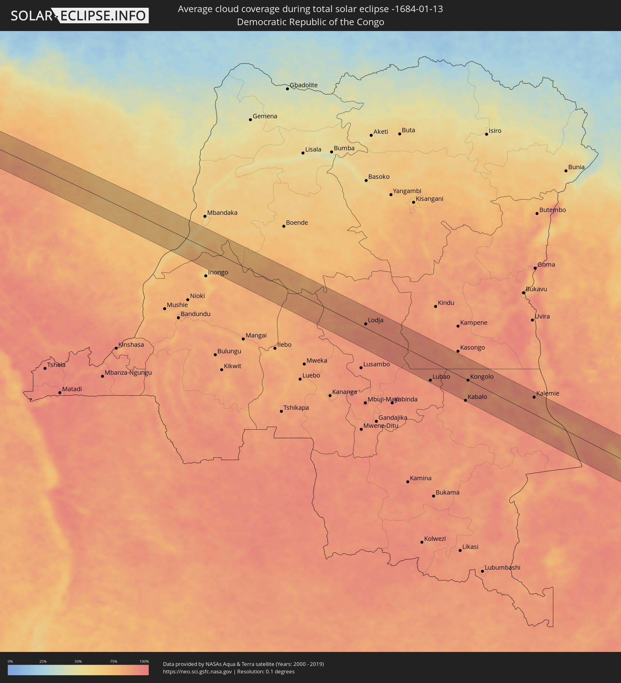 Democratic Republic of the Congo
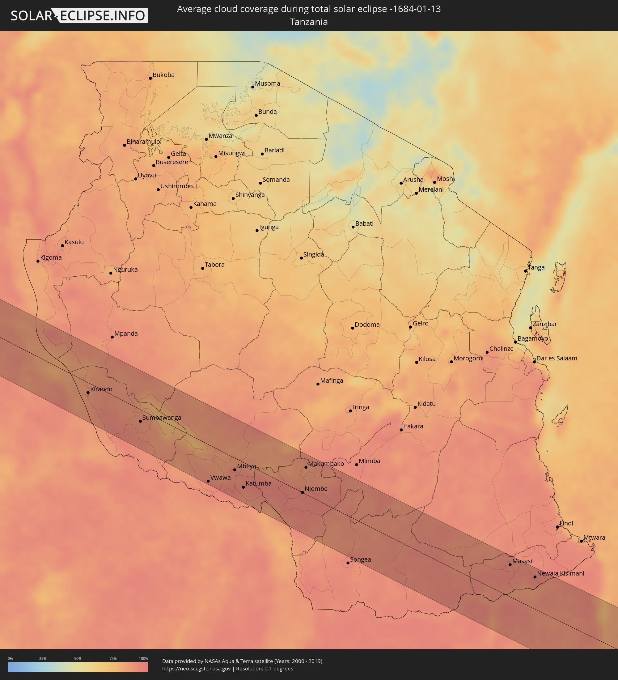 Tanzania
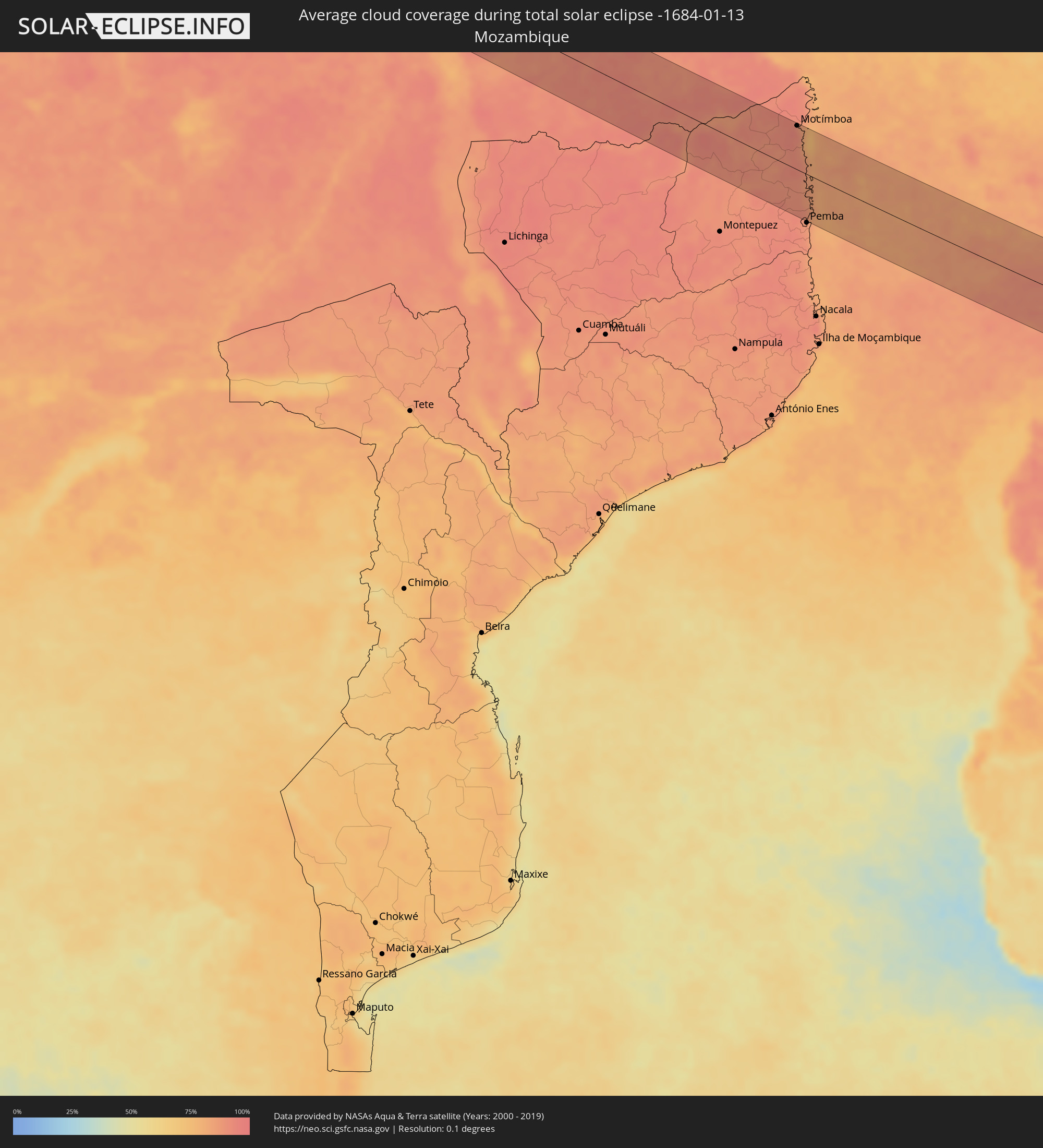 Mozambique
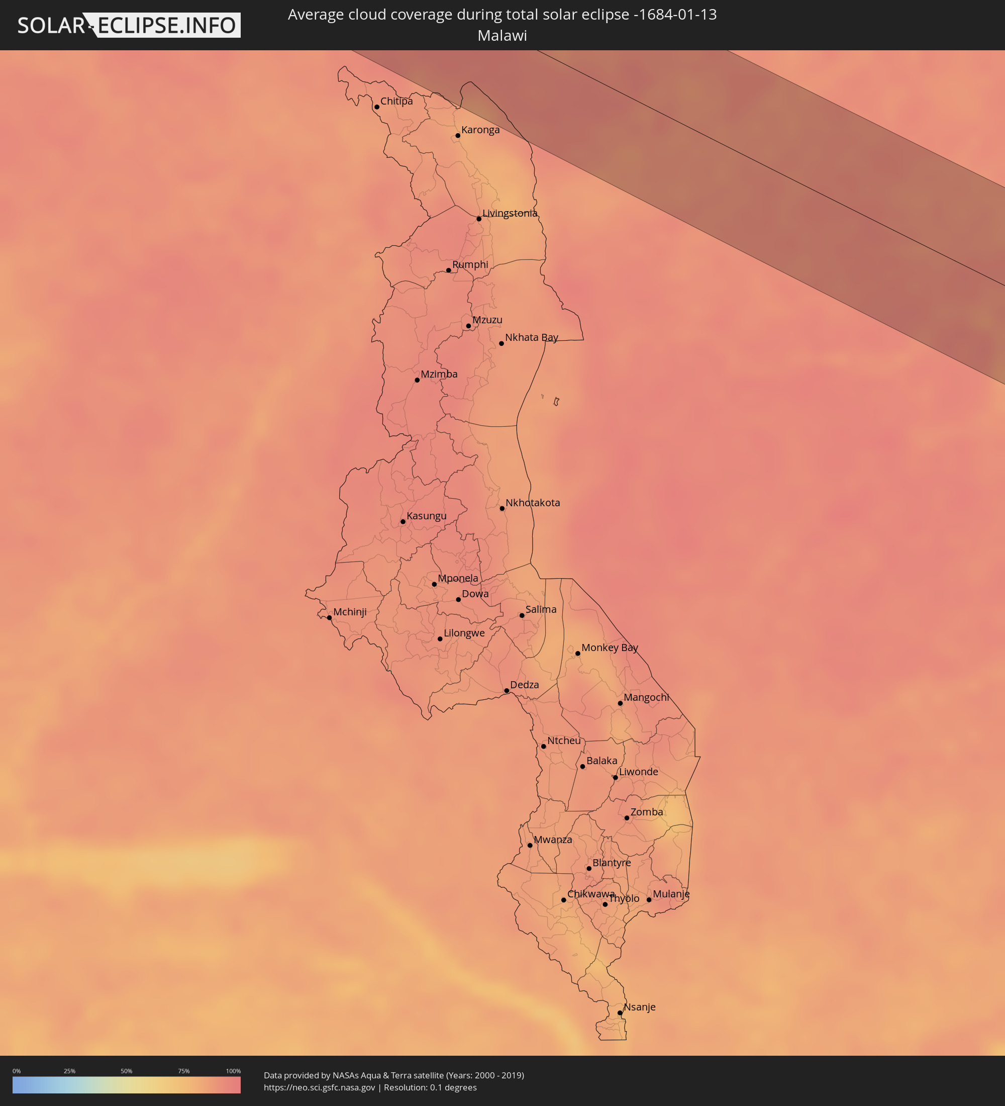 Malawi
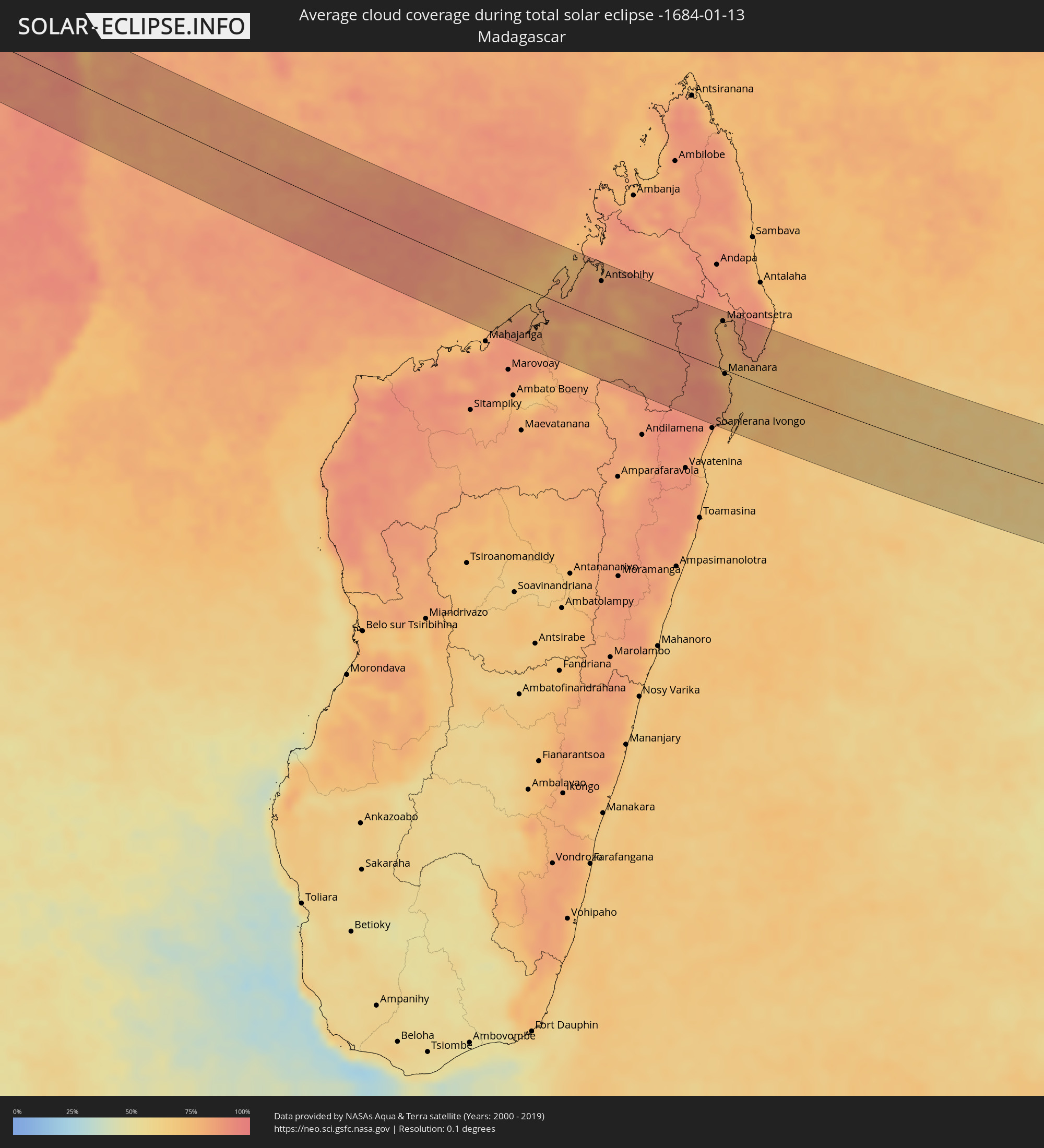 Madagascar
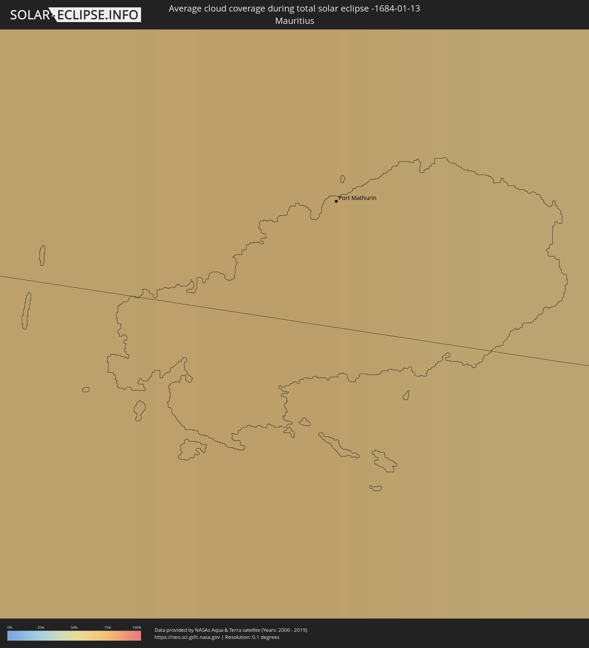 Mauritius
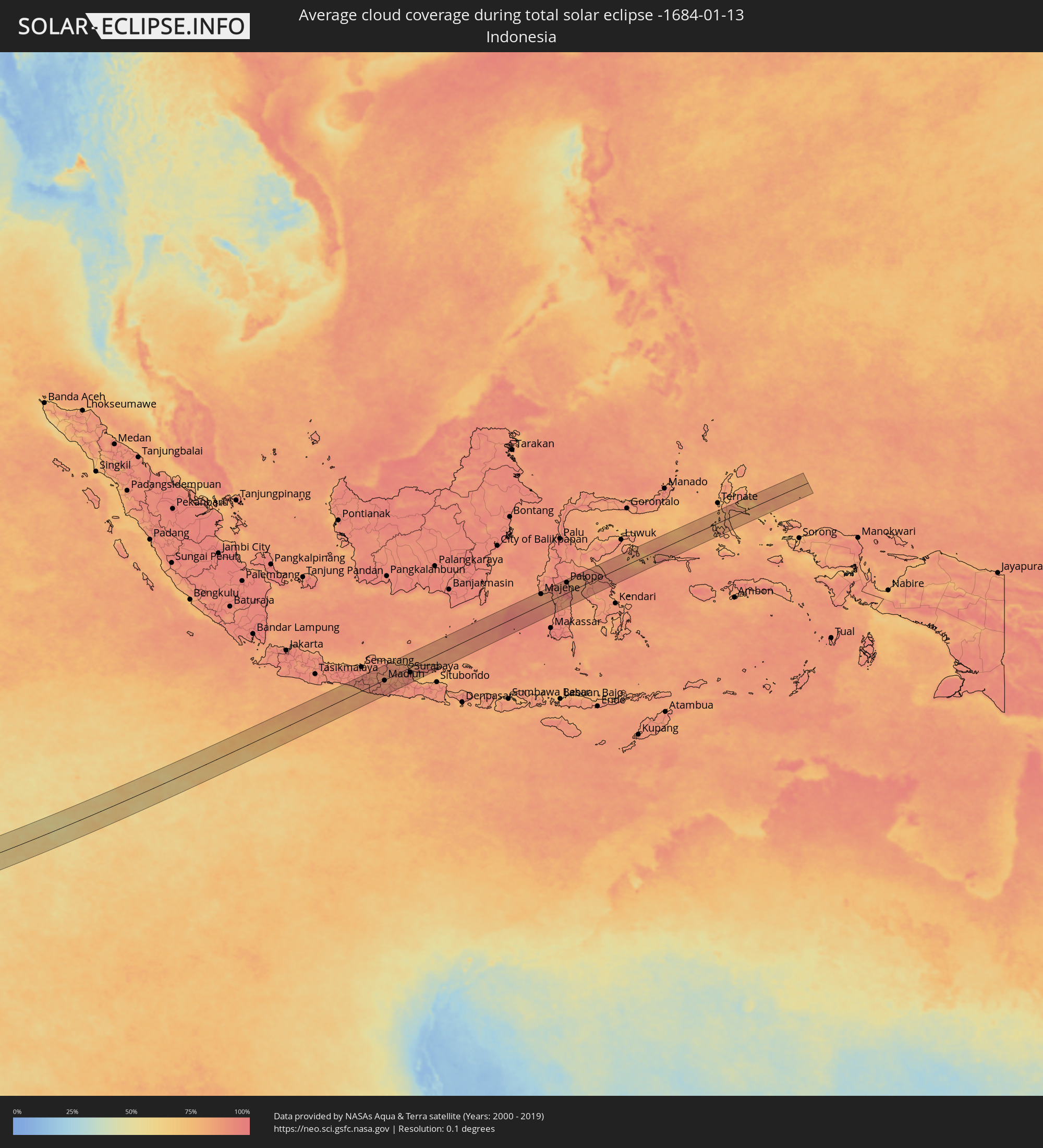 Indonesia
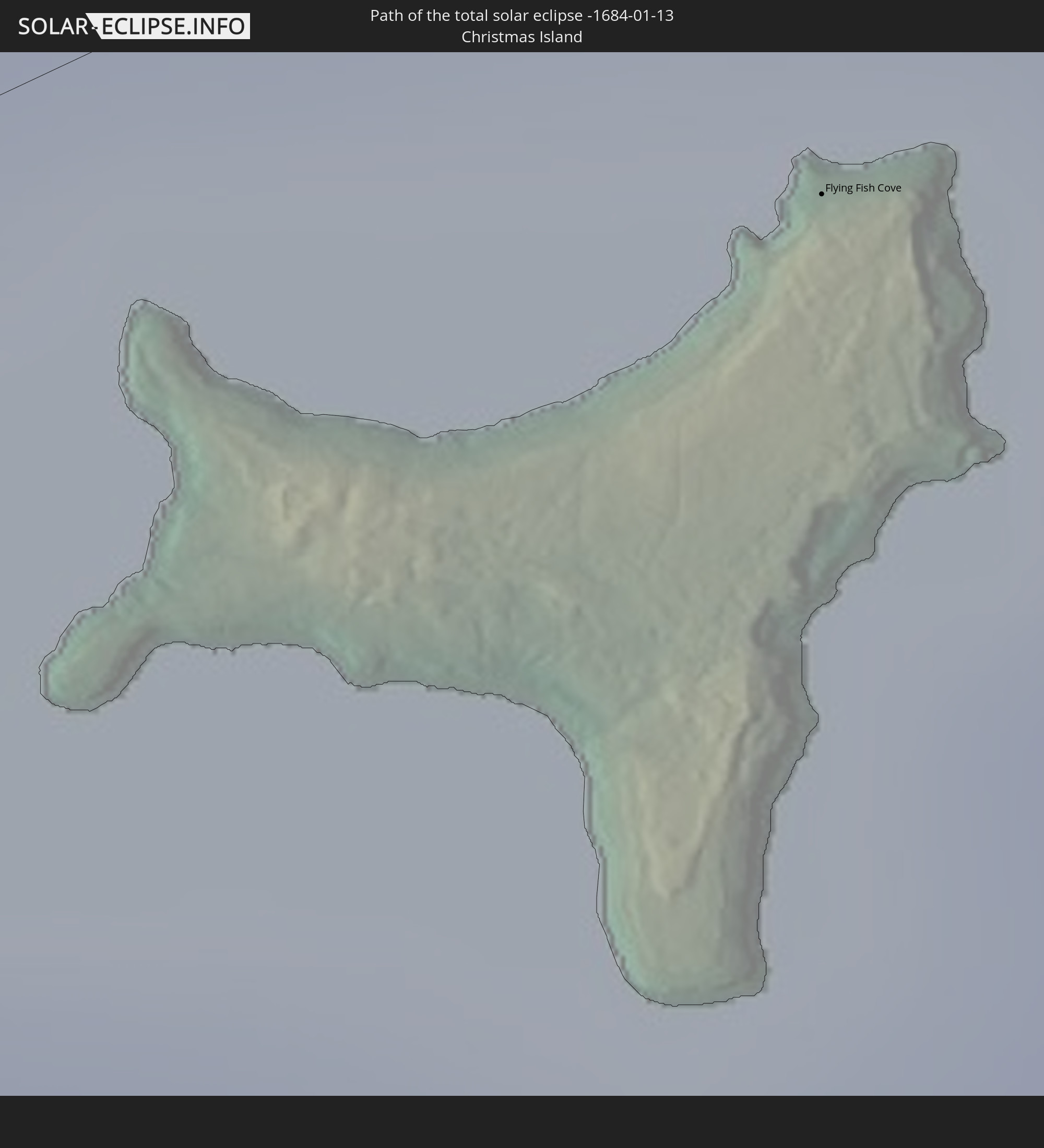
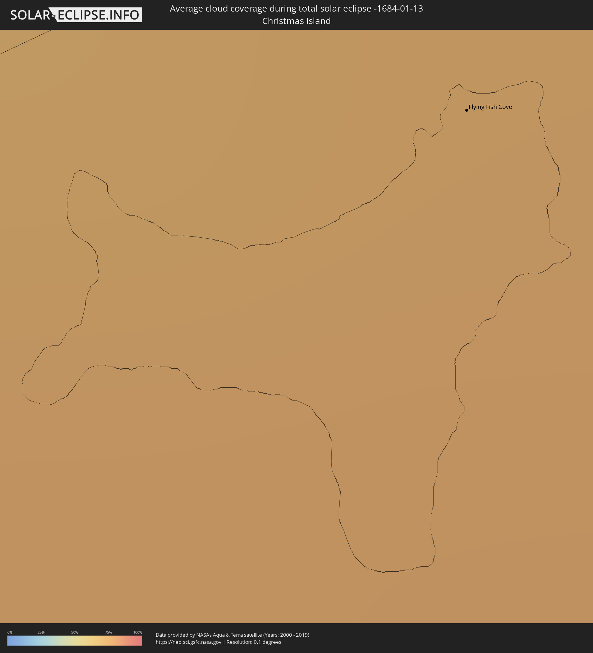 Christmas Island
Cities inside the path of the eclipse
The following table shows all locations with a population of more than 5,000 inside the eclipse path. Cities which have more than 100,000 inhabitants are marked bold. A click at the locations opens a detailed map.
| City | Type | Eclipse duration | Local time of max. eclipse | Distance to central line | Ø Cloud coverage |
|
Amassoma, Bayelsa
|
total | - | 06:09:53 UTC+00:13 | 28 km | 81% |
|
Patani, Delta
|
total | - | 06:09:50 UTC+00:13 | 58 km | 77% |
|
Twon-Brass, Bayelsa
|
total | - | 06:10:00 UTC+00:13 | 33 km | 85% |
|
Yenagoa, Bayelsa
|
total | - | 06:09:53 UTC+00:13 | 36 km | 82% |
|
Degema Hulk, Rivers
|
total | - | 06:09:53 UTC+00:13 | 36 km | 74% |
|
Obonoma, Rivers
|
total | - | 06:09:53 UTC+00:13 | 32 km | 68% |
|
Buguma, Rivers
|
total | - | 06:09:53 UTC+00:13 | 38 km | 63% |
|
Port Harcourt, Rivers
|
total | - | 06:09:52 UTC+00:13 | 49 km | 63% |
|
Okrika, Rivers
|
total | - | 06:09:52 UTC+00:13 | 49 km | 64% |
|
Bonny, Rivers
|
total | - | 06:09:55 UTC+00:13 | 23 km | 69% |
|
Bori, Rivers
|
total | - | 06:09:52 UTC+00:13 | 55 km | 68% |
|
Luba, Bioko Sur
|
total | - | 06:10:07 UTC+00:13 | 15 km | 84% |
|
Malabo, Bioko Norte
|
total | - | 06:10:02 UTC+00:13 | 25 km | 83% |
|
Rebola, Bioko Norte
|
total | - | 06:10:03 UTC+00:13 | 24 km | 84% |
|
Kribi, South
|
total | - | 06:10:16 UTC+00:13 | 5 km | 80% |
|
Akom II, South
|
total | - | 06:10:20 UTC+00:13 | 10 km | 81% |
|
Mikomeseng, Kié-Ntem
|
total | - | 06:10:31 UTC+00:13 | 53 km | 89% |
|
Ébolowa, South
|
total | - | 06:10:20 UTC+00:13 | 49 km | 77% |
|
Ambam, South
|
total | - | 06:10:30 UTC+00:13 | 3 km | 82% |
|
Ebebiyin, Kié-Ntem
|
total | - | 06:10:34 UTC+00:13 | 18 km | 86% |
|
Bitam, Woleu-Ntem
|
total | - | 06:10:36 UTC+00:13 | 18 km | 85% |
|
Oyem, Woleu-Ntem
|
total | - | 06:10:46 UTC+00:13 | 62 km | 87% |
|
Makoua, Cuvette
|
total | - | 06:11:59 UTC+00:13 | 29 km | 72% |
|
Owando, Cuvette
|
total | - | 06:12:15 UTC+00:13 | 65 km | 72% |
|
Lukolela, Équateur
|
total | - | 06:12:51 UTC+00:13 | 60 km | 70% |
|
Lodja, Kasaï-Oriental
|
total | - | 08:13:34 UTC+02:10 | 13 km | 90% |
|
Lubao, Kasaï-Oriental
|
total | - | 08:16:00 UTC+02:10 | 64 km | 90% |
|
Kabalo, Katanga
|
total | - | 08:17:15 UTC+02:10 | 71 km | 89% |
|
Kongolo, Katanga
|
total | - | 08:16:53 UTC+02:10 | 1 km | 85% |
|
Kalemie, Katanga
|
total | - | 08:18:59 UTC+02:10 | 55 km | 85% |
|
Kirando, Rukwa
|
total | - | 08:38:11 UTC+02:27 | 20 km | 86% |
|
Namanyere, Rukwa
|
total | - | 08:38:41 UTC+02:27 | 7 km | 89% |
|
Matai, Rukwa
|
total | - | 08:39:43 UTC+02:27 | 61 km | 91% |
|
Sumbawanga, Rukwa
|
total | - | 08:39:34 UTC+02:27 | 23 km | 90% |
|
Vwawa, Mbeya
|
total | - | 08:41:48 UTC+02:27 | 70 km | 92% |
|
Mbeya, Mbeya
|
total | - | 08:42:11 UTC+02:27 | 23 km | 92% |
|
Katumba, Mbeya
|
total | - | 08:42:38 UTC+02:27 | 48 km | 91% |
|
Kyela, Mbeya
|
total | - | 08:43:10 UTC+02:27 | 71 km | 85% |
|
Igurusi, Mbeya
|
total | - | 08:42:35 UTC+02:27 | 2 km | 92% |
|
Chimala, Mbeya
|
total | - | 08:42:47 UTC+02:27 | 10 km | 90% |
|
Rujewa, Mbeya
|
total | - | 08:43:04 UTC+02:27 | 44 km | 84% |
|
Njombe, Njombe
|
total | - | 08:44:01 UTC+02:27 | 0 km | 94% |
|
Makumbako, Njombe
|
total | - | 08:43:42 UTC+02:27 | 51 km | 88% |
|
Nangomba, Mtwara
|
total | - | 08:50:07 UTC+02:27 | 28 km | 93% |
|
Lukuledi, Mtwara
|
total | - | 08:50:15 UTC+02:27 | 76 km | 93% |
|
Masasi, Mtwara
|
total | - | 08:50:23 UTC+02:27 | 61 km | 93% |
|
Newala Kisimani, Mtwara
|
total | - | 08:51:16 UTC+02:27 | 61 km | 92% |
|
Mocímboa, Cabo Delgado
|
total | - | 08:36:15 UTC+02:10 | 75 km | 87% |
|
Antsohihy, Sofia
|
total | - | 09:10:01 UTC+02:27 | 56 km | 84% |
|
Antsirabe Afovoany, Sofia
|
total | - | 09:13:02 UTC+02:27 | 14 km | 88% |
|
Maroantsetra, Analanjirofo
|
total | - | 09:14:13 UTC+02:27 | 69 km | 76% |
|
Mananara, Analanjirofo
|
total | - | 09:14:56 UTC+02:27 | 6 km | 78% |
|
Antakotako, Analanjirofo
|
total | - | 09:14:15 UTC+02:27 | 84 km | 80% |
|
Port Mathurin, Rodrigues
|
total | - | 11:15:05 UTC+03:50 | 5 km | 65% |
|
Flying Fish Cove
|
total | - | 16:06:08 UTC+07:00 | 9 km | 76% |
|
Yogyakarta, Yogyakarta
|
total | - | 16:19:09 UTC+07:07 | 34 km | 92% |
|
Klaten, Central Java
|
total | - | 16:19:24 UTC+07:07 | 32 km | 89% |
|
Surakarta, Central Java
|
total | - | 16:19:39 UTC+07:07 | 36 km | 91% |
|
Ponorogo, East Java
|
total | - | 16:19:55 UTC+07:07 | 25 km | 89% |
|
Madiun, East Java
|
total | - | 16:20:06 UTC+07:07 | 4 km | 88% |
|
Bojonegoro, East Java
|
total | - | 16:20:37 UTC+07:07 | 27 km | 88% |
|
Kedungwaru, East Java
|
total | - | 16:20:07 UTC+07:07 | 67 km | 91% |
|
Kediri, East Java
|
total | - | 16:20:20 UTC+07:07 | 46 km | 91% |
|
Jombang, East Java
|
total | - | 16:20:38 UTC+07:07 | 29 km | 87% |
|
Mojokerto, East Java
|
total | - | 16:20:49 UTC+07:07 | 31 km | 89% |
|
Sidoarjo, East Java
|
total | - | 16:21:01 UTC+07:07 | 43 km | 92% |
|
Surabaya, East Java
|
total | - | 16:21:09 UTC+07:07 | 24 km | 87% |
|
Bangil, East Java
|
total | - | 16:20:59 UTC+07:07 | 63 km | 92% |
|
Pamekasan, East Java
|
total | - | 16:21:39 UTC+07:07 | 50 km | 85% |
|
Sumenep, East Java
|
total | - | 16:21:58 UTC+07:07 | 54 km | 90% |
|
Parepare, South Sulawesi
|
total | - | 17:16:28 UTC+07:57 | 27 km | 87% |
|
Palopo, South Sulawesi
|
total | - | 17:17:04 UTC+07:57 | 49 km | 88% |