Total solar eclipse of 07/03/-1963
| Day of week: | Wednesday |
| Maximum duration of eclipse: | 06m12s |
| Maximum width of eclipse path: | 231 km |
| Saros cycle: | 5 |
| Coverage: | 100% |
| Magnitude: | 1.0646 |
| Gamma: | -0.4077 |
Wo kann man die Sonnenfinsternis vom 07/03/-1963 sehen?
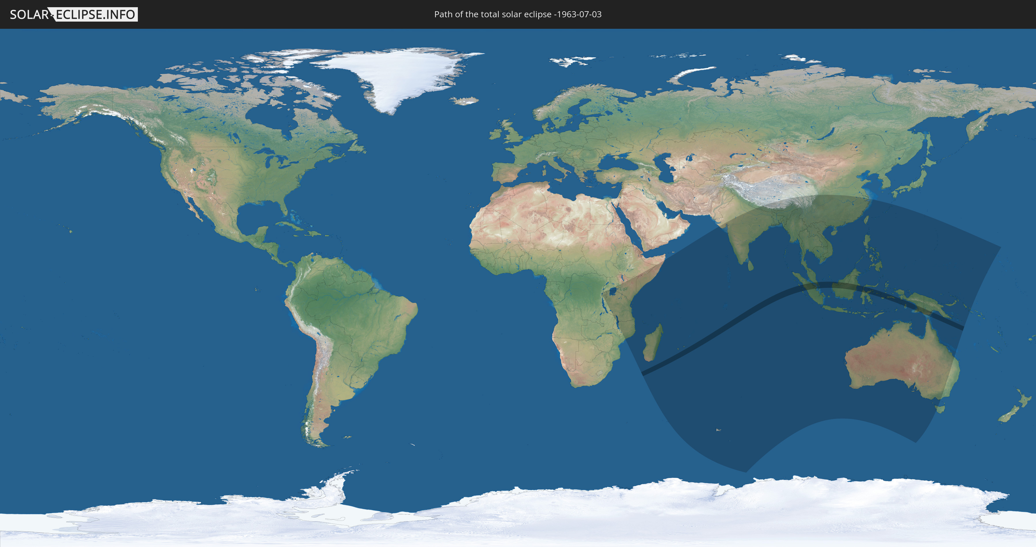
Die Sonnenfinsternis am 07/03/-1963 kann man in 52 Ländern als partielle Sonnenfinsternis beobachten.
Der Finsternispfad verläuft durch 6 Länder. Nur in diesen Ländern ist sie als total Sonnenfinsternis zu sehen.
In den folgenden Ländern ist die Sonnenfinsternis total zu sehen
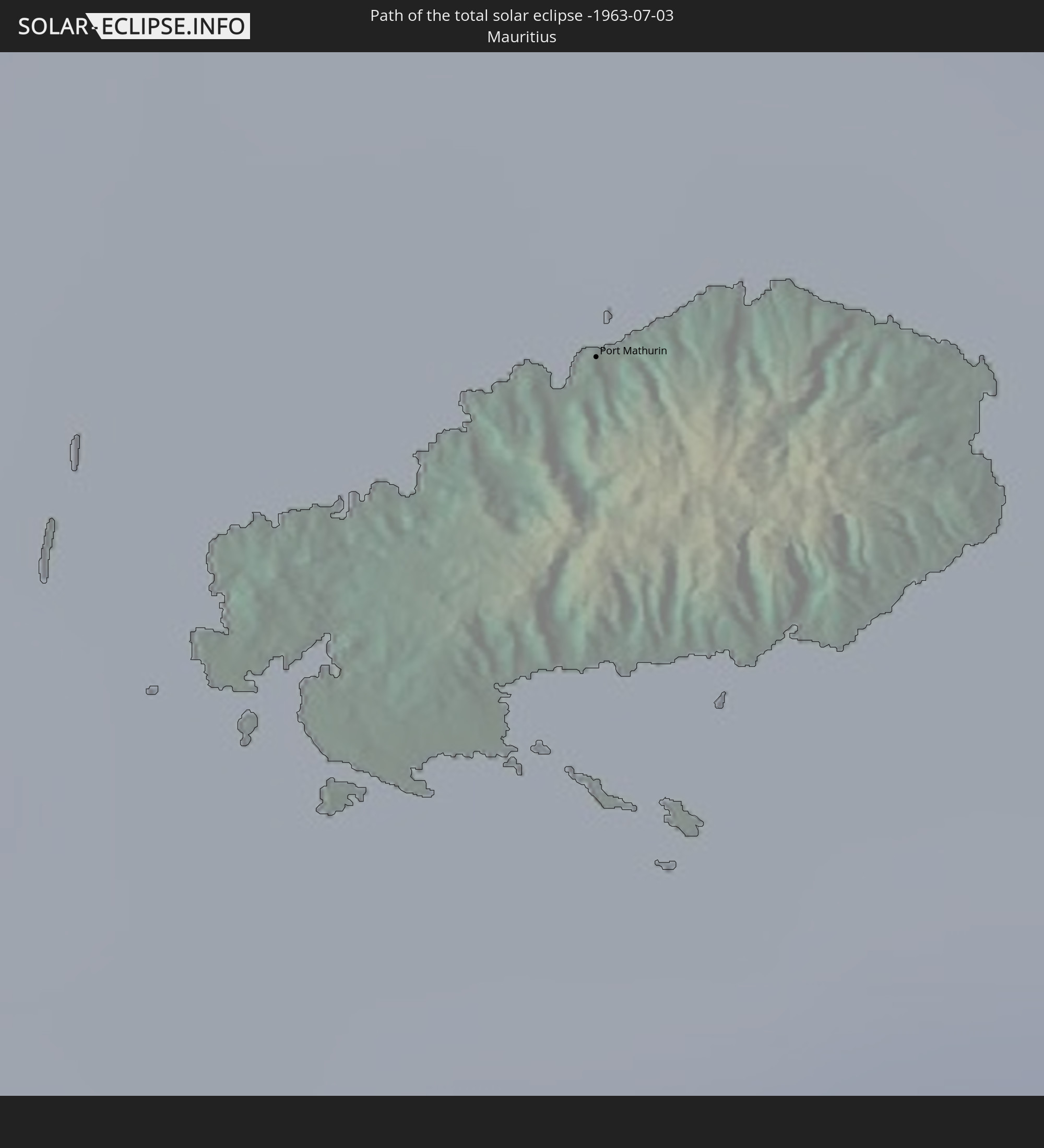 Mauritius
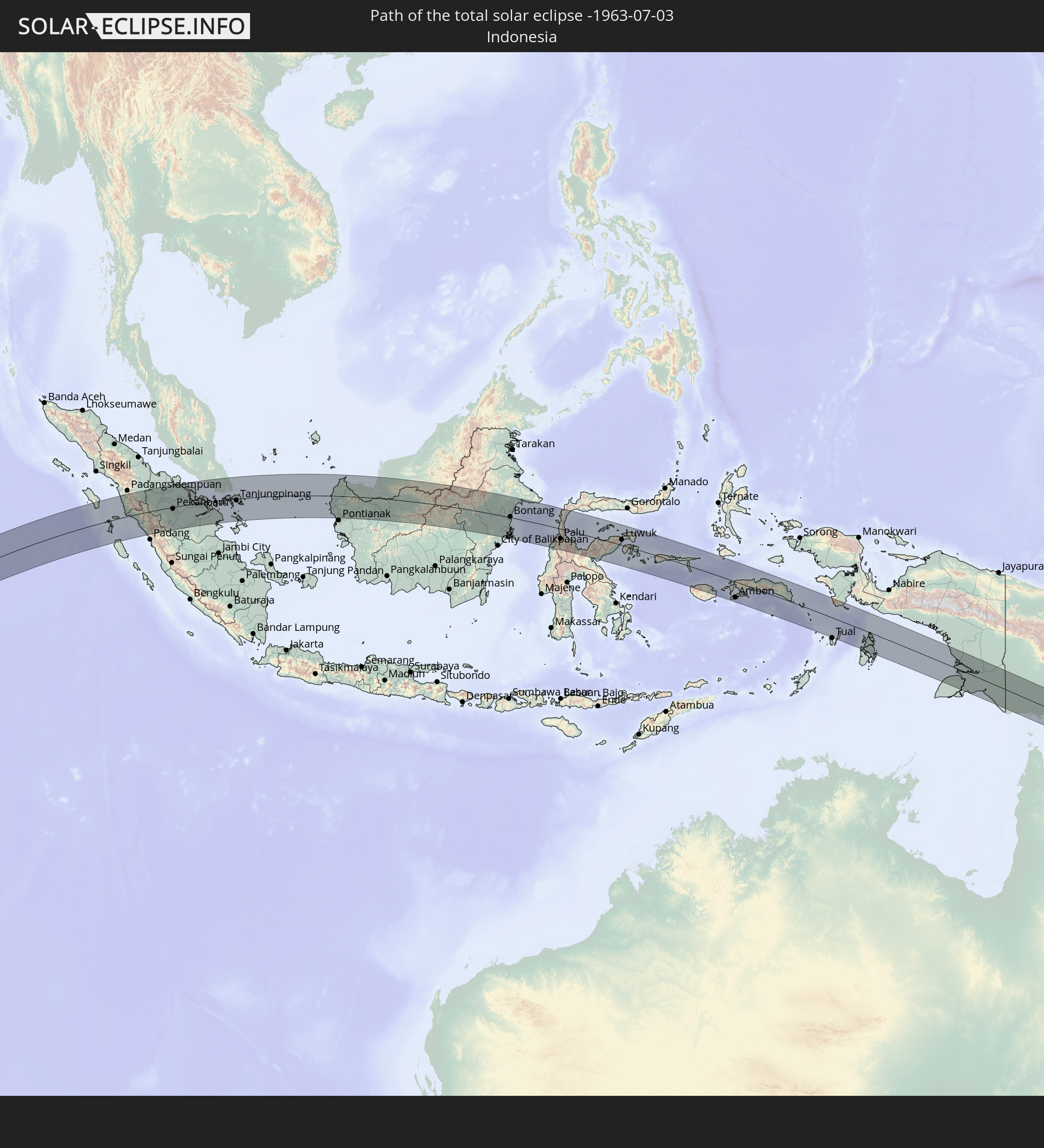 Indonesia
 Malaysia
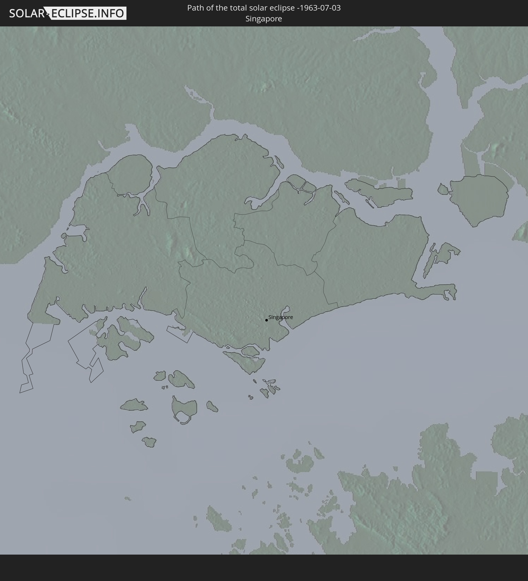 Singapore
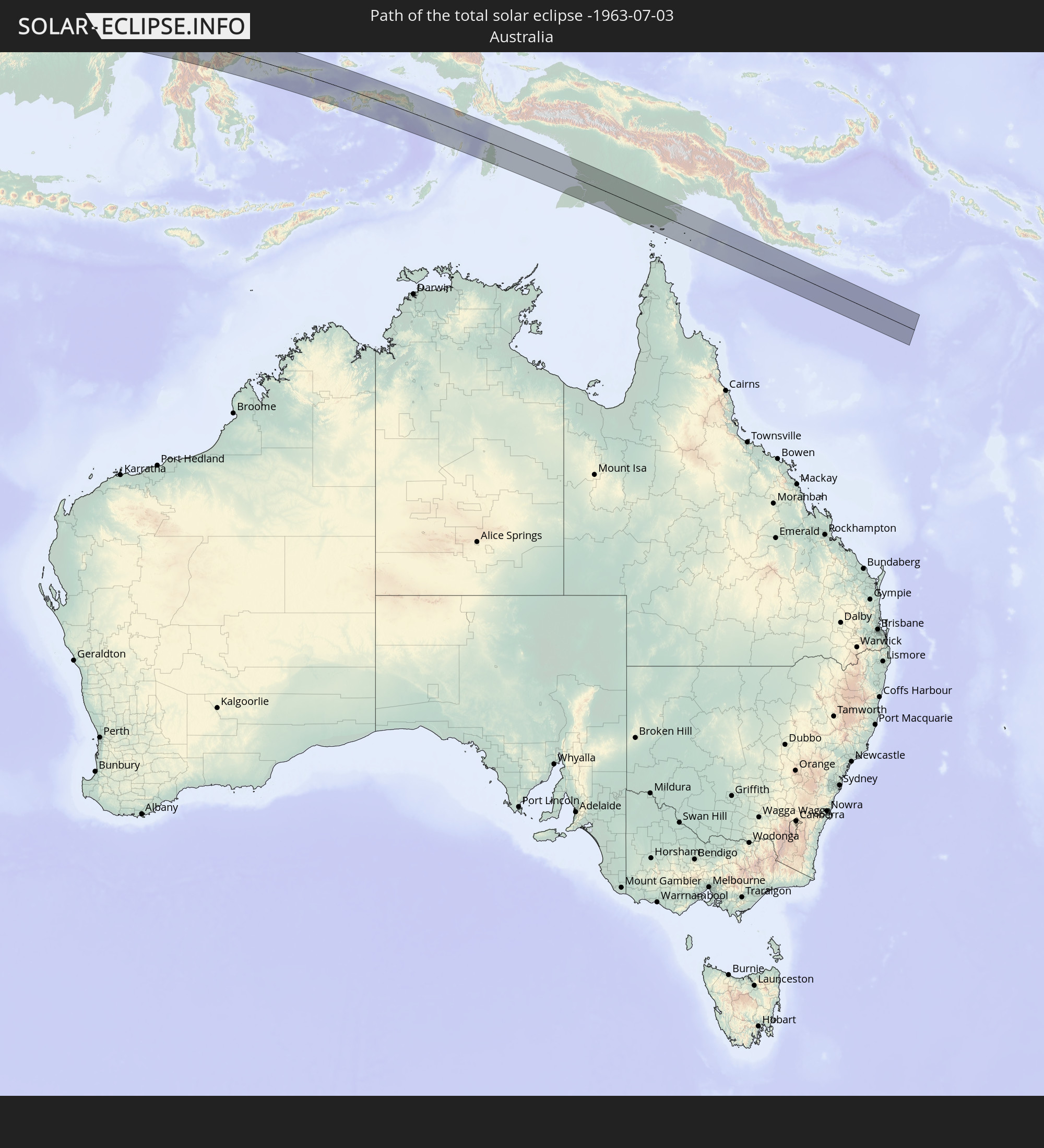 Australia
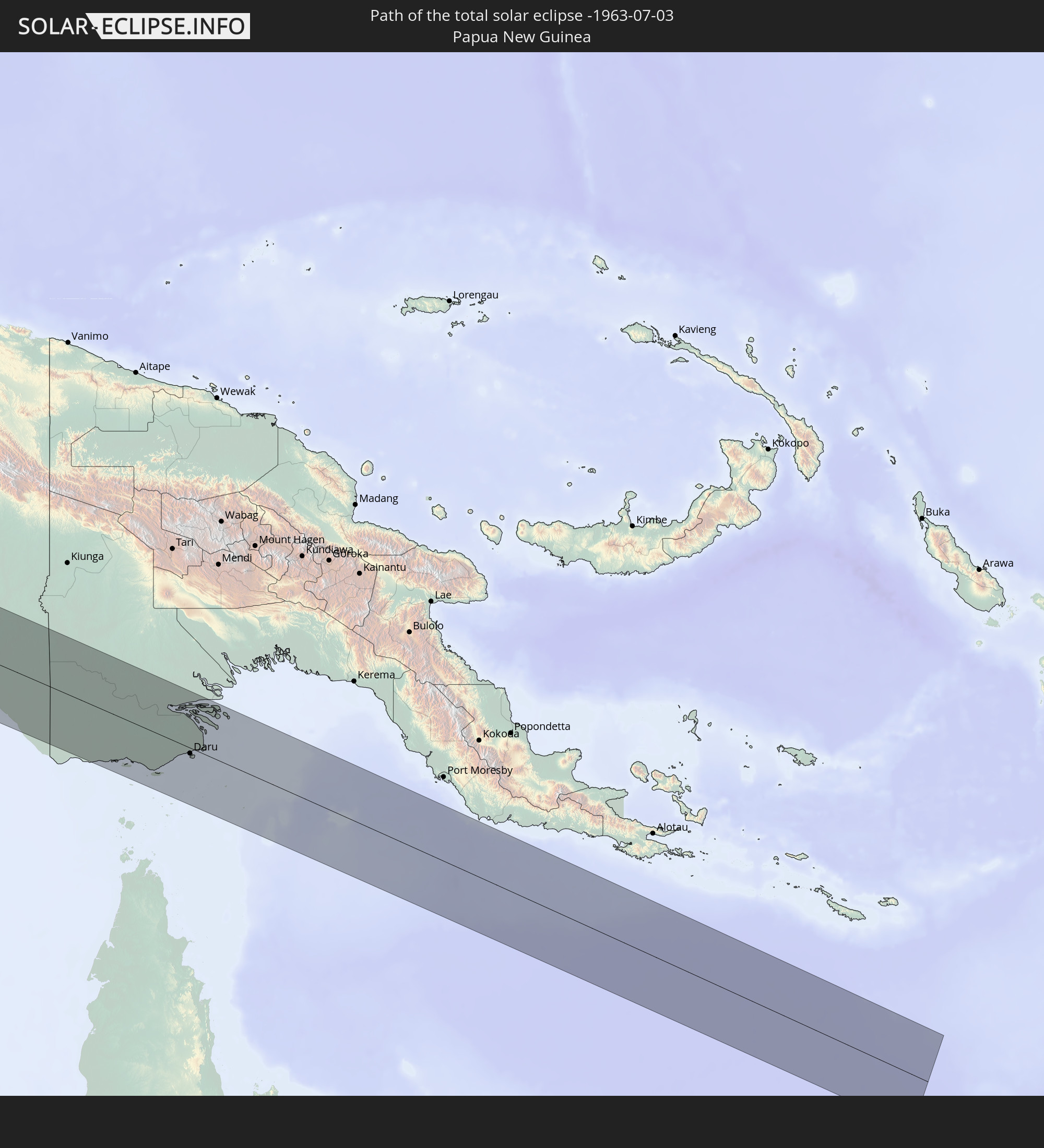 Papua New Guinea
In den folgenden Ländern ist die Sonnenfinsternis partiell zu sehen
 Democratic Republic of the Congo
 Zambia
 Rwanda
 Burundi
 Tanzania
 Uganda
 Mozambique
 Malawi
 Ethiopia
 Kenya
Kenya
 French Southern and Antarctic Lands
 Somalia
 Madagascar
 Comoros
 Mayotte
 Seychelles
 Réunion
 Mauritius
 India
India
 British Indian Ocean Territory
 Heard Island and McDonald Islands
 Maldives
 China
China
 Sri Lanka
 Nepal
Nepal
 Bangladesh
 Bhutan
 Myanmar
 Indonesia
 Cocos Islands
 Thailand
 Malaysia
 Laos
Laos
 Vietnam
 Cambodia
 Singapore
 Christmas Island
 Australia
 Macau
Macau
 Hong Kong
 Brunei
 Taiwan
 Philippines
 Japan
Japan
 East Timor
 Palau
Palau
 Federated States of Micronesia
 Papua New Guinea
 Guam
Guam
 Northern Mariana Islands
 Solomon Islands
 Marshall Islands
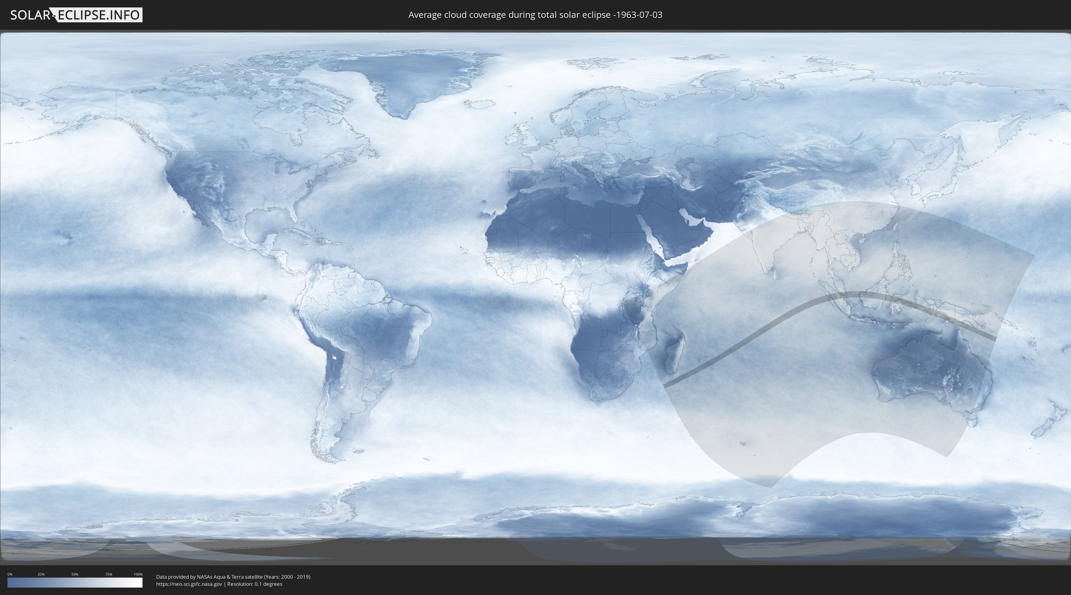
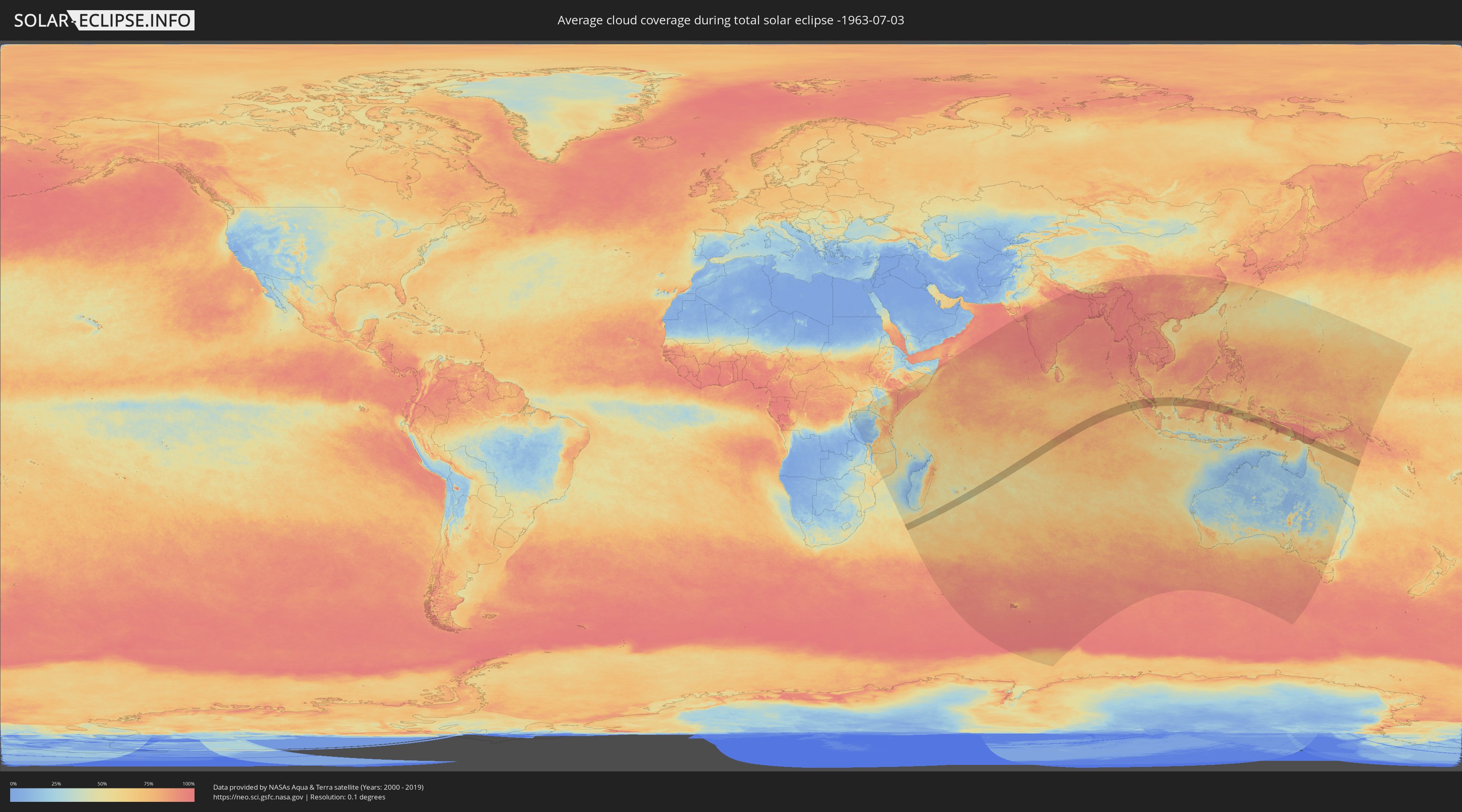
How will be the weather during the total solar eclipse on 07/03/-1963?
Where is the best place to see the total solar eclipse of 07/03/-1963?
The following maps show the average cloud coverage for the day of the total solar eclipse.
With the help of these maps, it is possible to find the place along the eclipse path, which has the best
chance of a cloudless sky.
Nevertheless, you should consider local circumstances and inform about the weather of your chosen
observation site.
The data is provided by NASAs satellites
AQUA and TERRA.
The cloud maps are averaged over a period of 19 years (2000 - 2019).
Detailed country maps
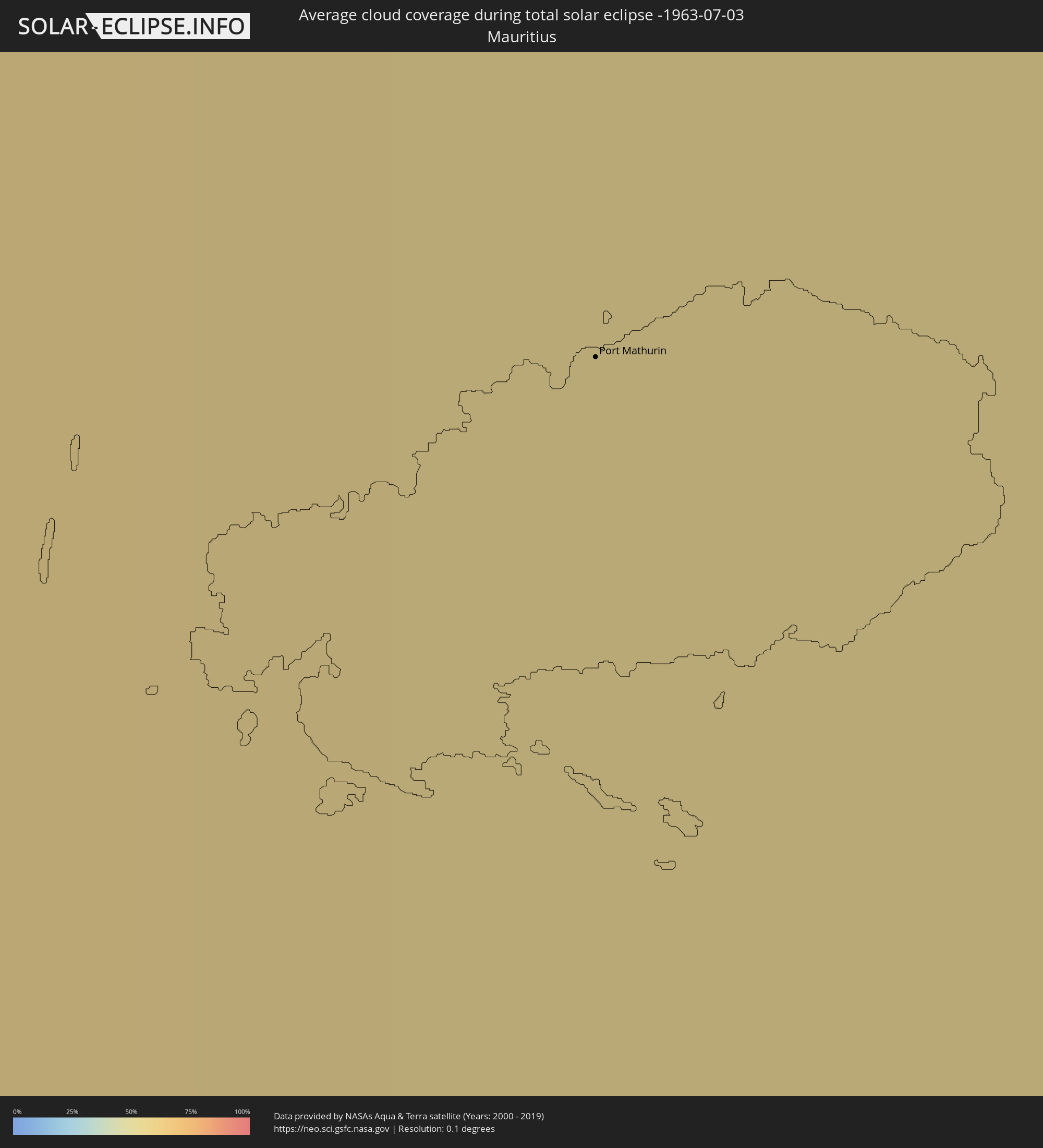 Mauritius
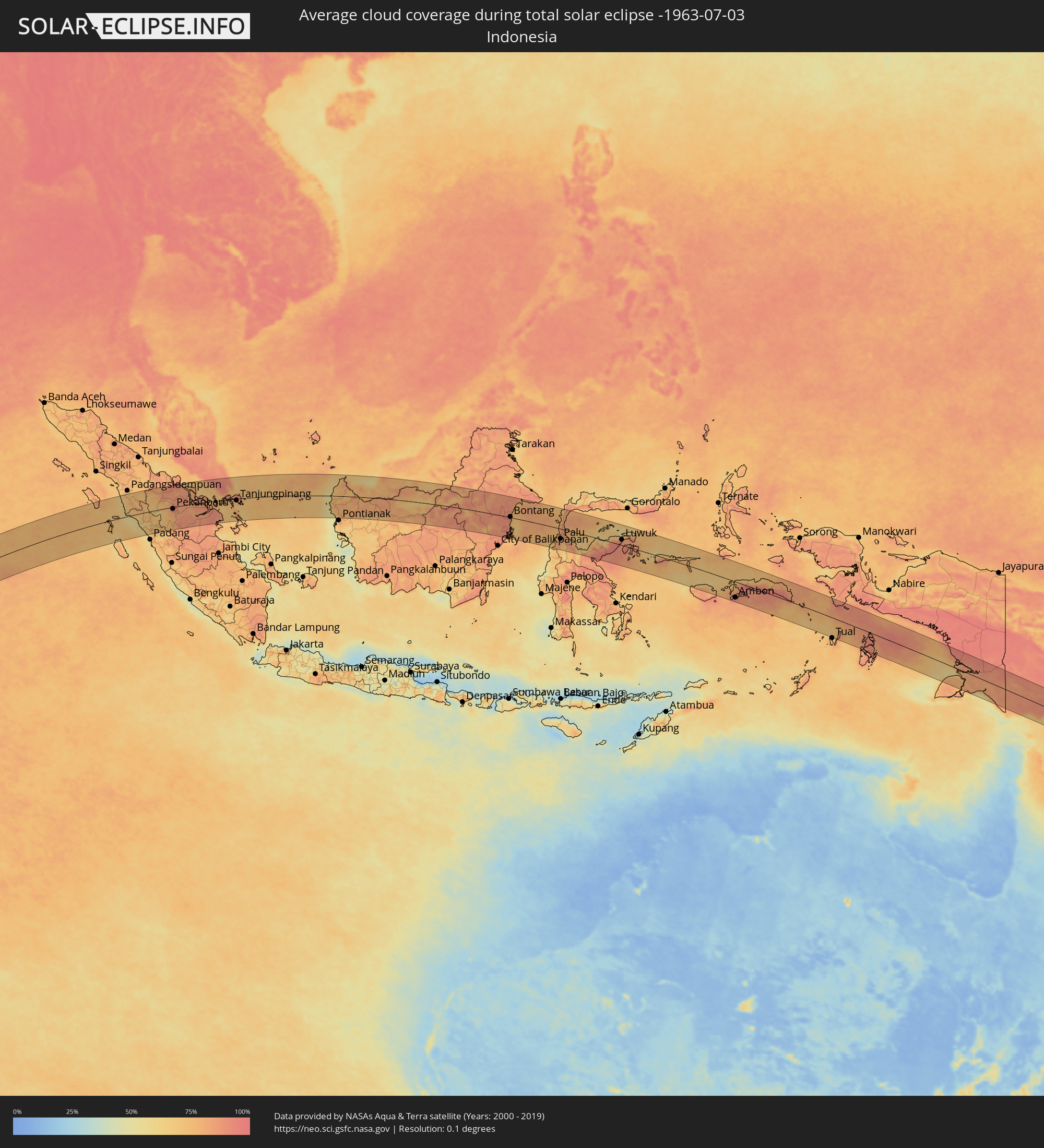 Indonesia
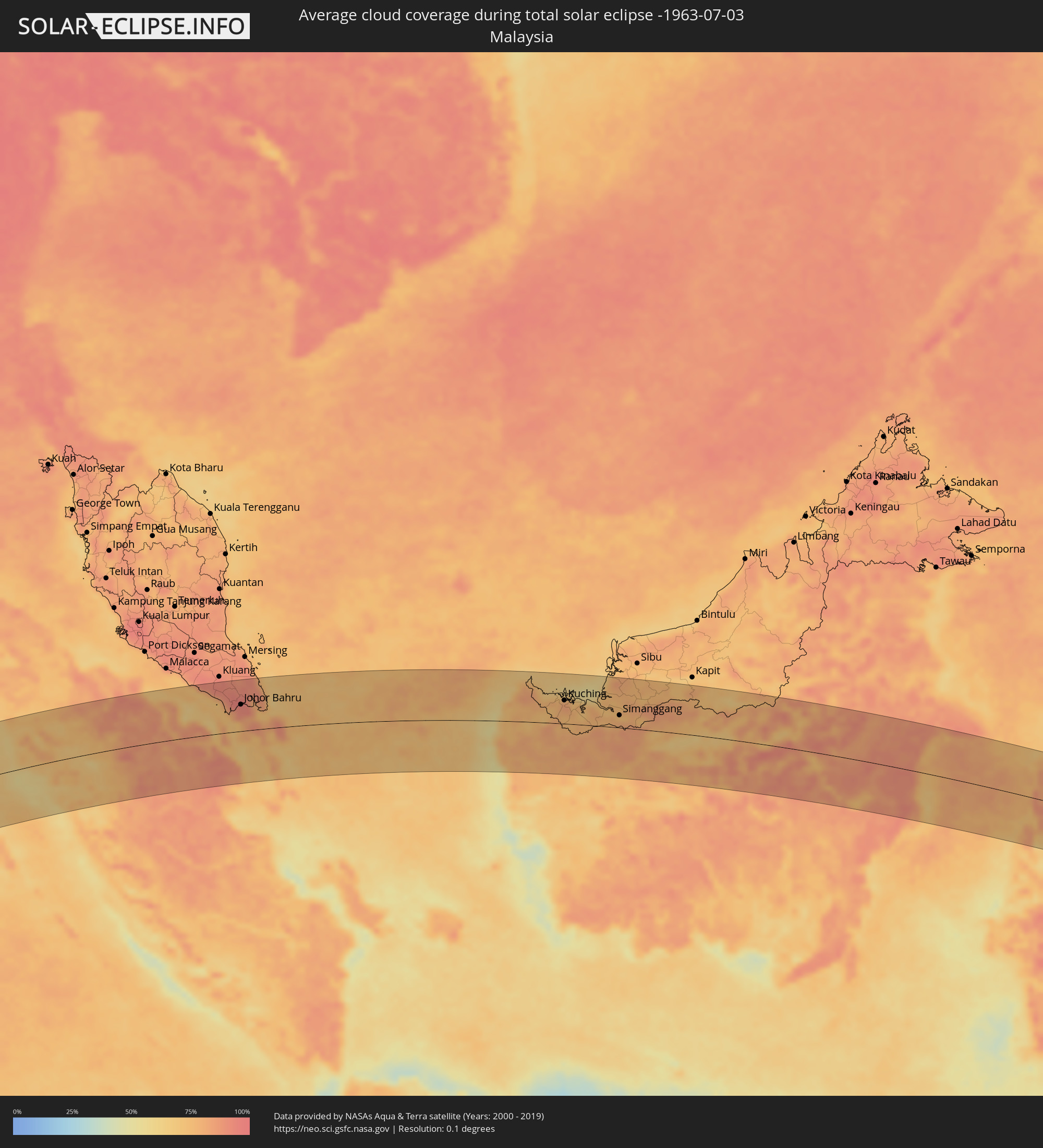 Malaysia
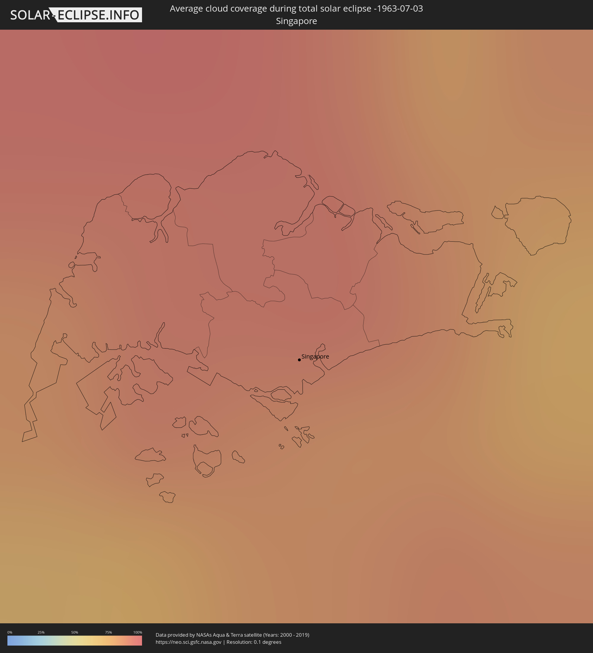 Singapore
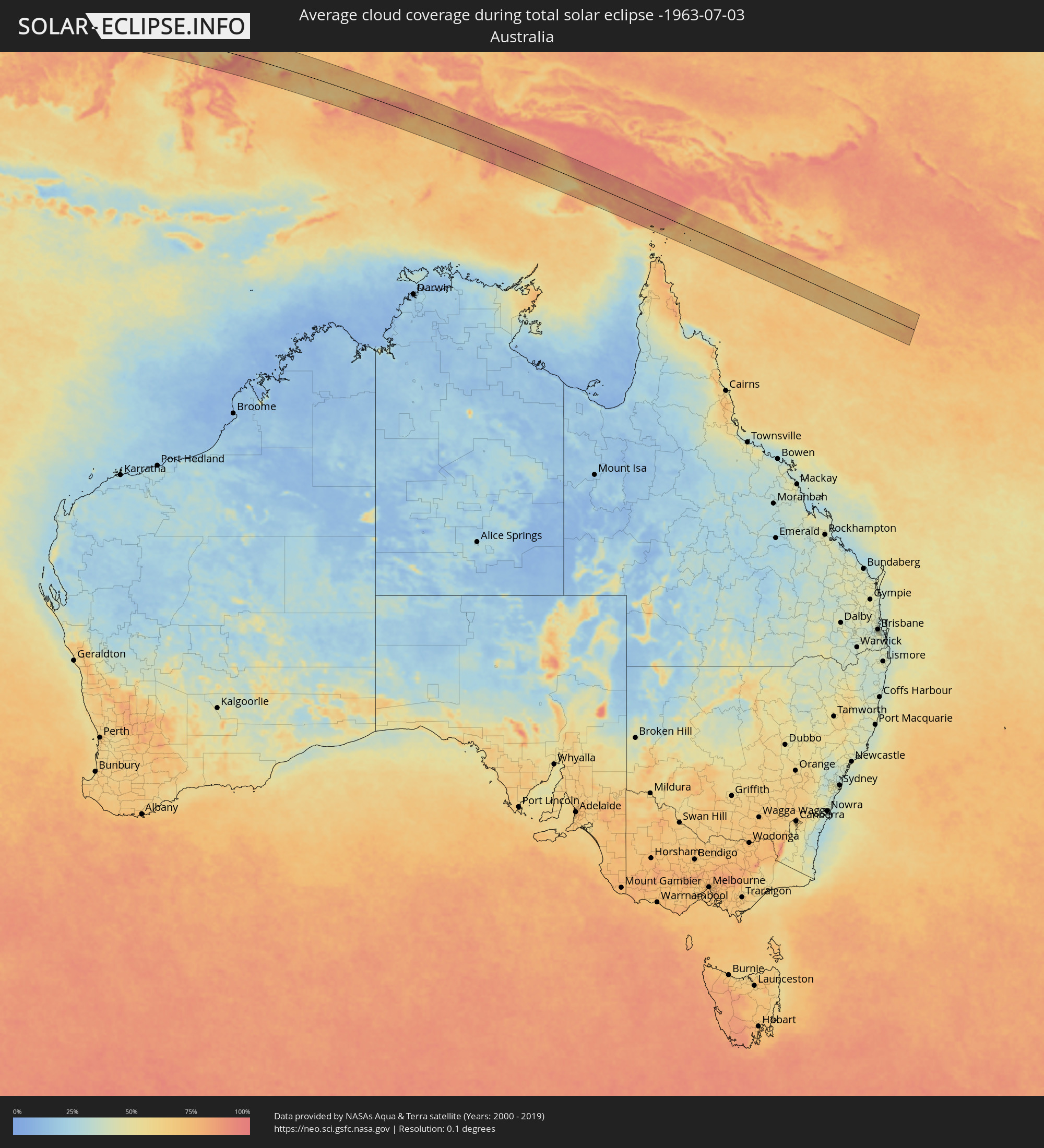 Australia
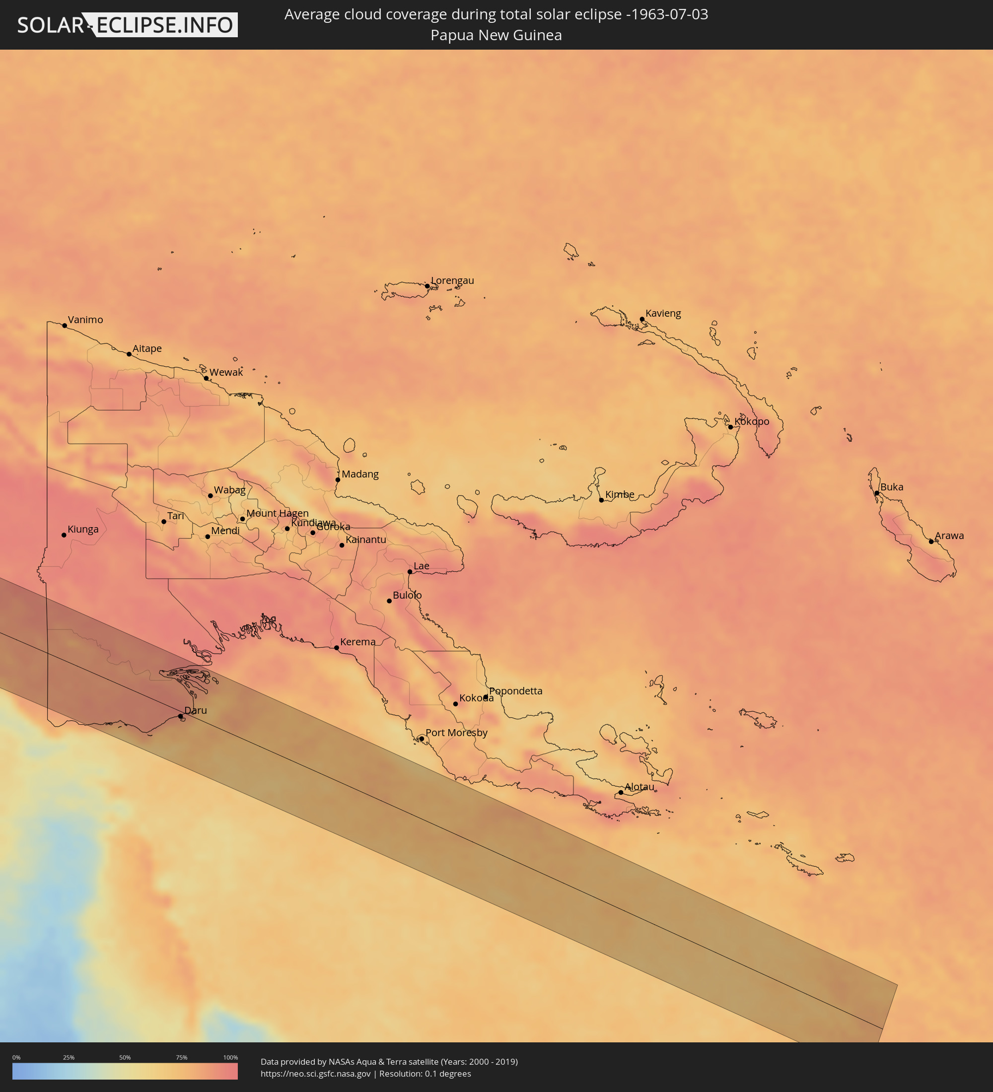 Papua New Guinea
Cities inside the path of the eclipse
The following table shows all locations with a population of more than 5,000 inside the eclipse path. Cities which have more than 100,000 inhabitants are marked bold. A click at the locations opens a detailed map.
| City | Type | Eclipse duration | Local time of max. eclipse | Distance to central line | Ø Cloud coverage |
|
Port Mathurin, Rodrigues
|
total | - | 07:58:01 UTC+03:50 | 53 km | 54% |
|
Pariaman, West Sumatra
|
total | - | 12:46:06 UTC+07:07 | 105 km | 58% |
|
Bukittinggi, West Sumatra
|
total | - | 12:47:08 UTC+07:07 | 77 km | 75% |
|
Payakumbuh, West Sumatra
|
total | - | 12:48:02 UTC+07:07 | 73 km | 70% |
|
Balaipungut, Riau
|
total | - | 12:50:59 UTC+07:07 | 53 km | 85% |
|
Pekanbaru, Riau
|
total | - | 12:51:07 UTC+07:07 | 9 km | 91% |
|
Batu Pahat, Johor
|
total | - | 12:44:53 UTC+06:55 | 114 km | 86% |
|
Parit Raja, Johor
|
total | - | 12:45:27 UTC+06:55 | 113 km | 90% |
|
Kampung Simpang Renggam, Johor
|
total | - | 12:46:01 UTC+06:55 | 106 km | 91% |
|
Pontian Kechil, Johor
|
total | - | 12:46:06 UTC+06:55 | 67 km | 77% |
|
Pekan Nenas, Johor
|
total | - | 12:46:30 UTC+06:55 | 68 km | 87% |
|
Kelapa Sawit, Johor
|
total | - | 12:46:39 UTC+06:55 | 85 km | 92% |
|
Kulai, Johor
|
total | - | 12:46:52 UTC+06:55 | 83 km | 94% |
|
Taman Senai, Johor
|
total | - | 12:46:57 UTC+06:55 | 76 km | 95% |
|
Skudai, Johor
|
total | - | 12:46:58 UTC+06:55 | 69 km | 92% |
|
Johor Bahru, Johor
|
total | - | 12:47:14 UTC+06:55 | 60 km | 93% |
|
Ulu Tiram, Johor
|
total | - | 12:47:30 UTC+06:55 | 74 km | 95% |
|
Singapore, Central Singapore
|
total | - | 12:47:26 UTC+06:55 | 39 km | 82% |
|
Kampung Pasir Gudang Baru, Johor
|
total | - | 12:47:37 UTC+06:55 | 59 km | 92% |
|
Kota Tinggi, Johor
|
total | - | 12:47:50 UTC+06:55 | 88 km | 90% |
|
Tanjungpinang, Riau Islands
|
total | - | 13:00:55 UTC+07:07 | 9 km | 82% |
|
Kijang, Riau Islands
|
total | - | 13:01:27 UTC+07:07 | 12 km | 85% |
|
Sungai Raya, West Kalimantan
|
total | - | 13:14:23 UTC+07:07 | 49 km | 60% |
|
Pemangkat, West Kalimantan
|
total | - | 13:14:46 UTC+07:07 | 3 km | 67% |
|
Singkawang, West Kalimantan
|
total | - | 13:14:43 UTC+07:07 | 25 km | 75% |
|
Kuching, Sarawak
|
total | - | 13:32:59 UTC+07:21 | 53 km | 81% |
|
Simanggang, Sarawak
|
total | - | 13:36:02 UTC+07:21 | 28 km | 79% |
|
Loa Janan, East Kalimantan
|
total | - | 14:26:31 UTC+07:57 | 84 km | 90% |
|
Samarinda, East Kalimantan
|
total | - | 14:26:40 UTC+07:57 | 73 km | 88% |
|
Bontang, East Kalimantan
|
total | - | 14:27:35 UTC+07:57 | 3 km | 82% |
|
Palu, Central Sulawesi
|
total | - | 14:32:49 UTC+07:57 | 51 km | 79% |
|
Poso, Central Sulawesi
|
total | - | 14:34:38 UTC+07:57 | 80 km | 65% |
|
Luwuk, Central Sulawesi
|
total | - | 14:38:49 UTC+07:57 | 28 km | 83% |
|
Ambon, Maluku
|
total | - | 16:13:05 UTC+09:22 | 79 km | 90% |
|
Amahai, Maluku
|
total | - | 16:14:15 UTC+09:22 | 14 km | 87% |
|
Daru, Western Province
|
total | - | 17:05:20 UTC+10:00 | 9 km | 79% |