Total solar eclipse of 07/22/0027
| Day of week: | Thursday |
| Maximum duration of eclipse: | 06m31s |
| Maximum width of eclipse path: | 241 km |
| Saros cycle: | 75 |
| Coverage: | 100% |
| Magnitude: | 1.0741 |
| Gamma: | 0.0603 |
Wo kann man die Sonnenfinsternis vom 07/22/0027 sehen?
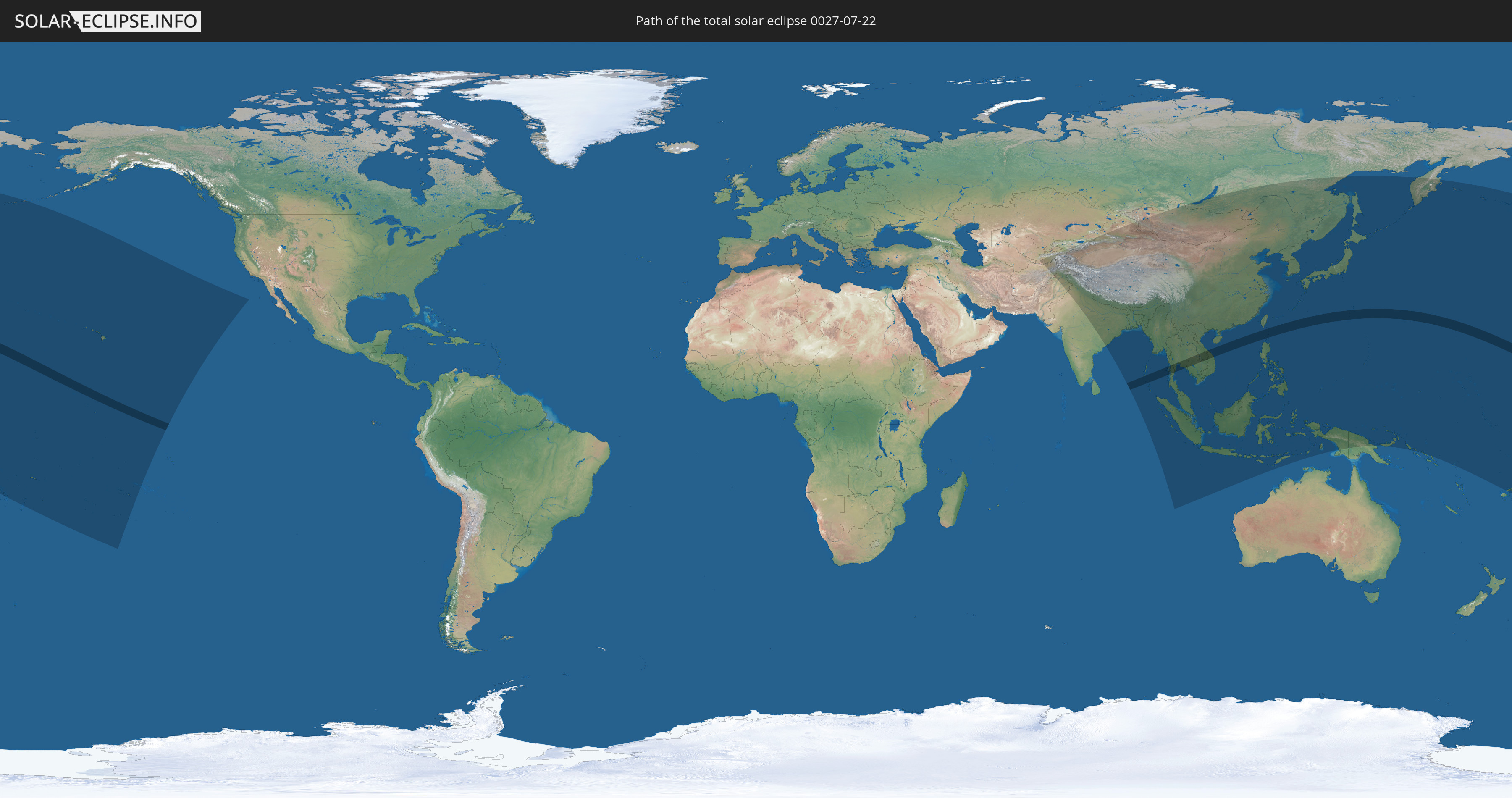
Die Sonnenfinsternis am 07/22/0027 kann man in 53 Ländern als partielle Sonnenfinsternis beobachten.
Der Finsternispfad verläuft durch 8 Länder. Nur in diesen Ländern ist sie als total Sonnenfinsternis zu sehen.
In den folgenden Ländern ist die Sonnenfinsternis total zu sehen
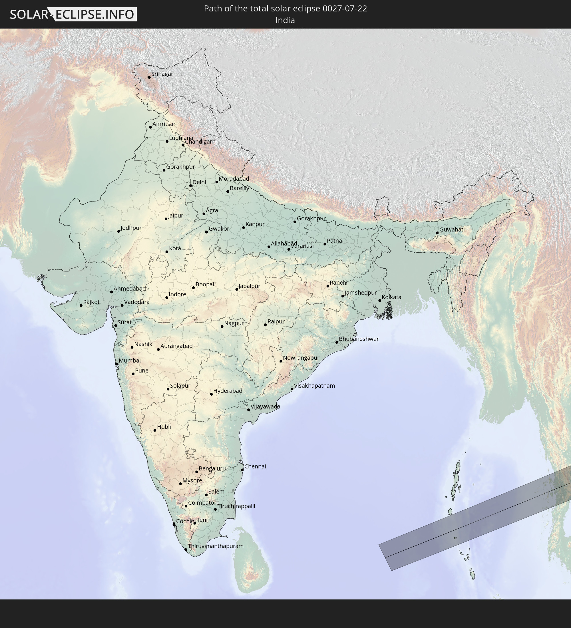 India
India
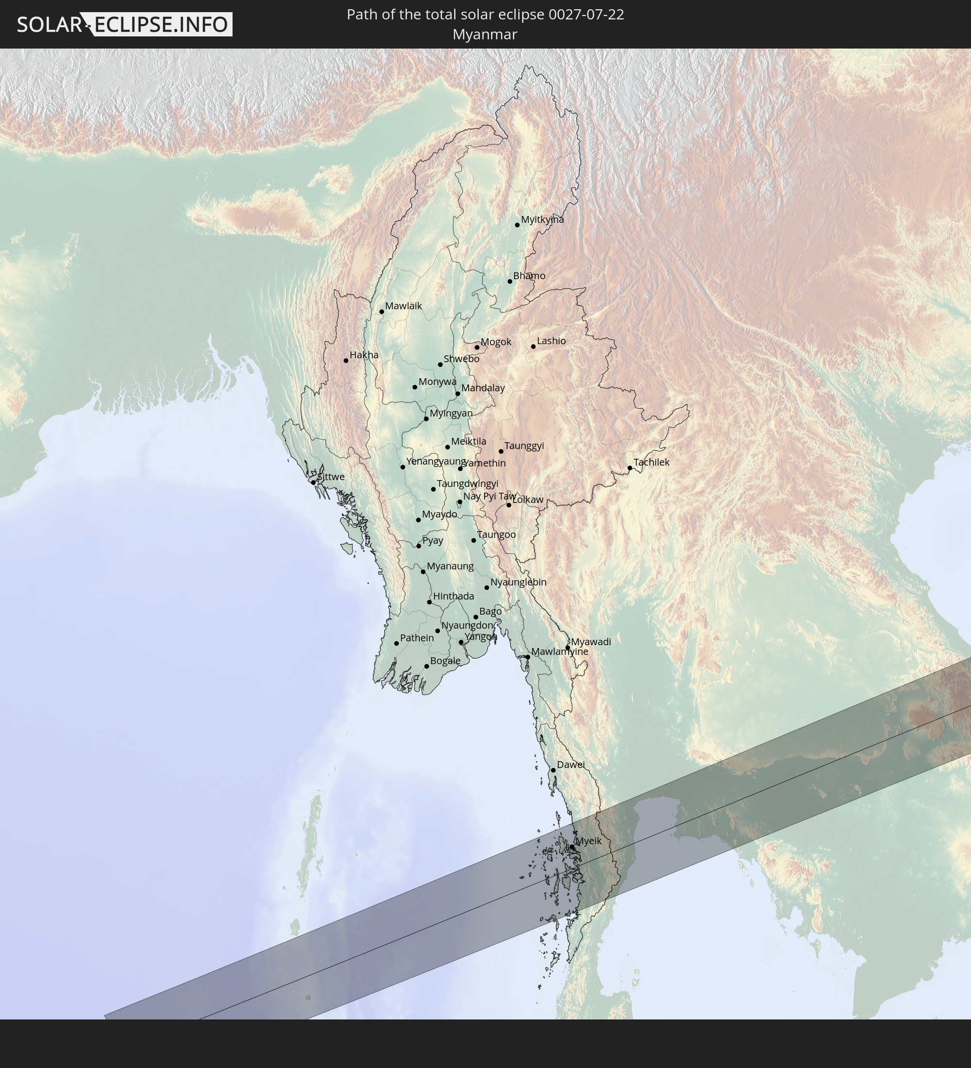 Myanmar
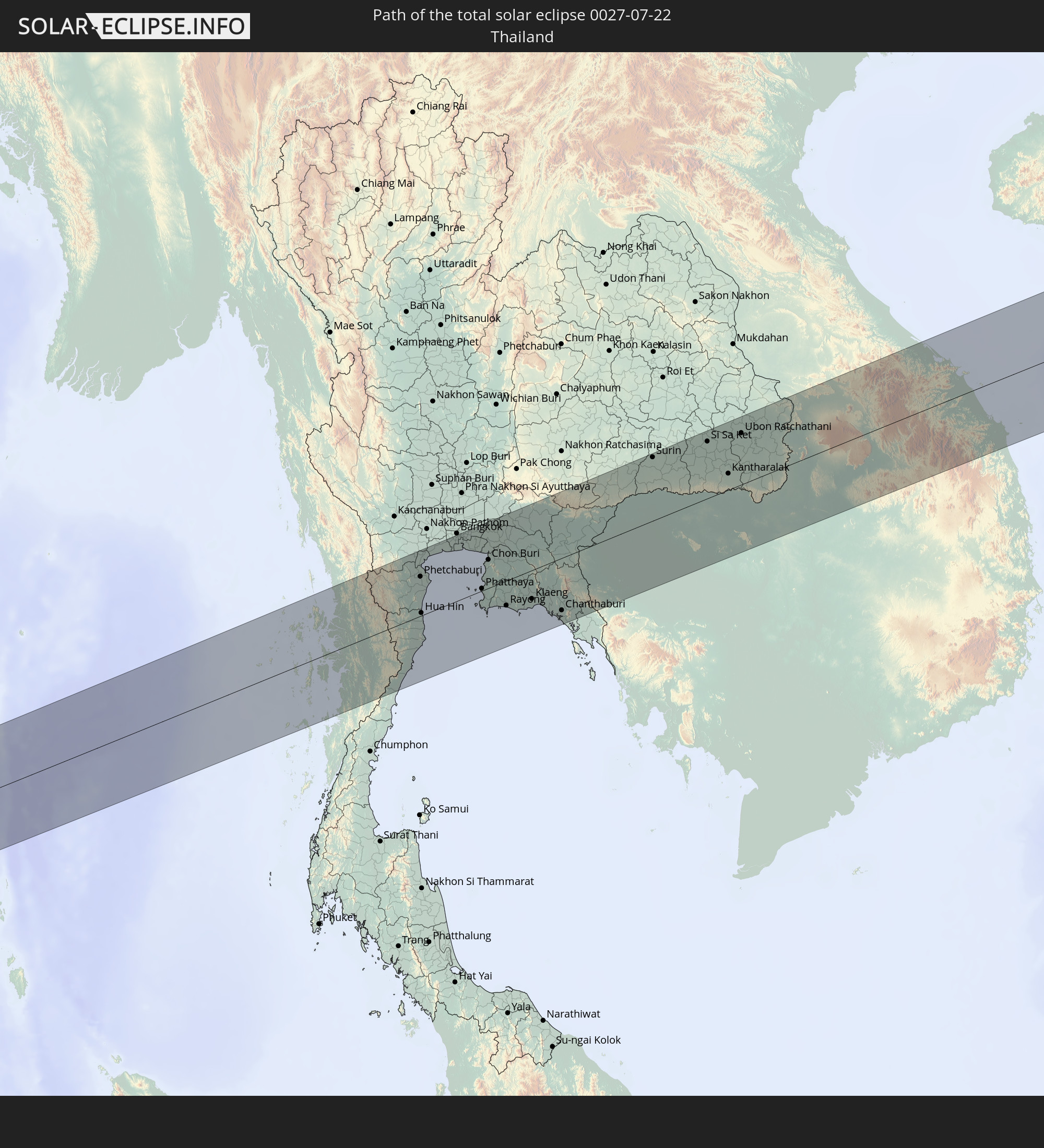 Thailand
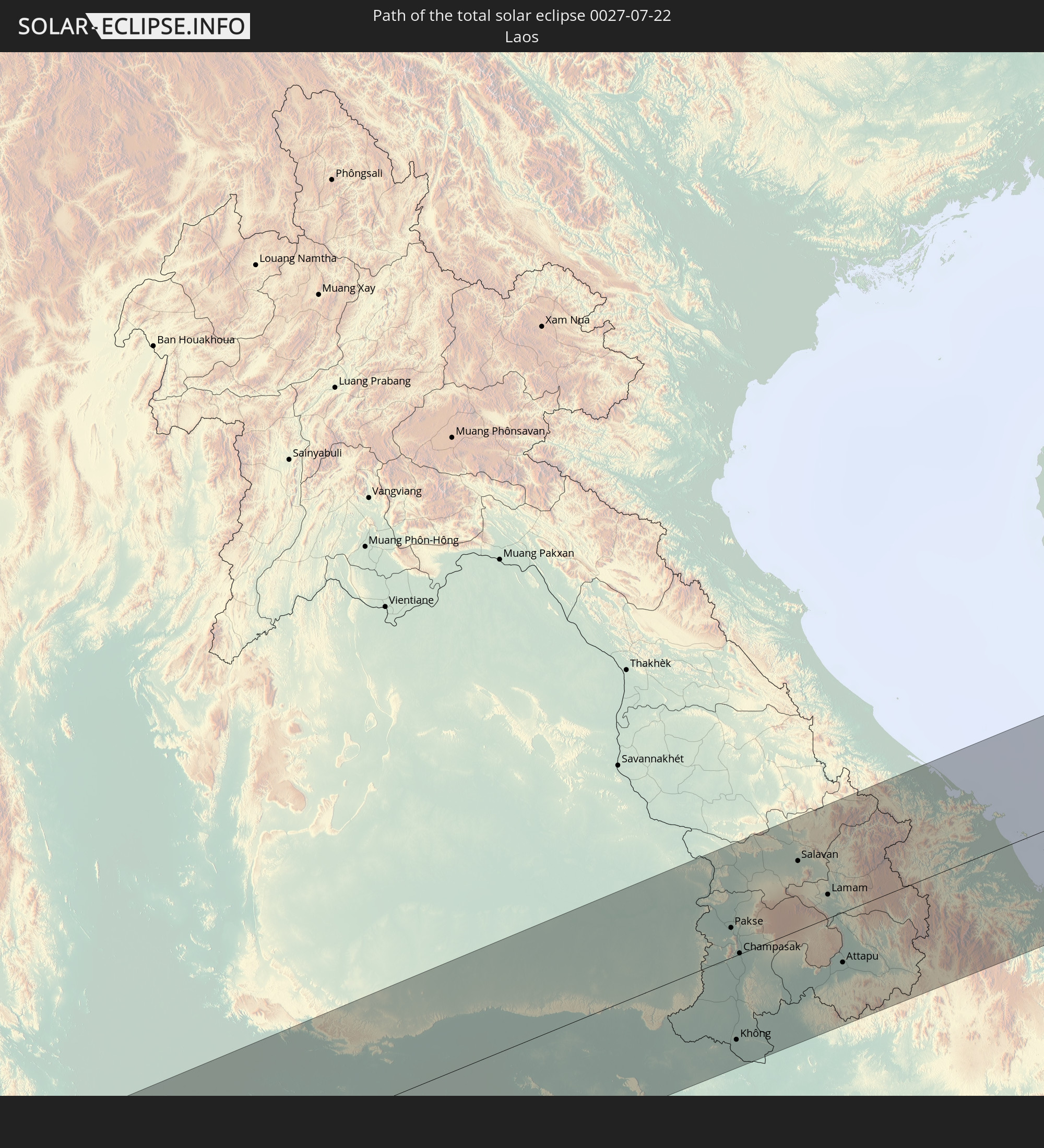 Laos
Laos
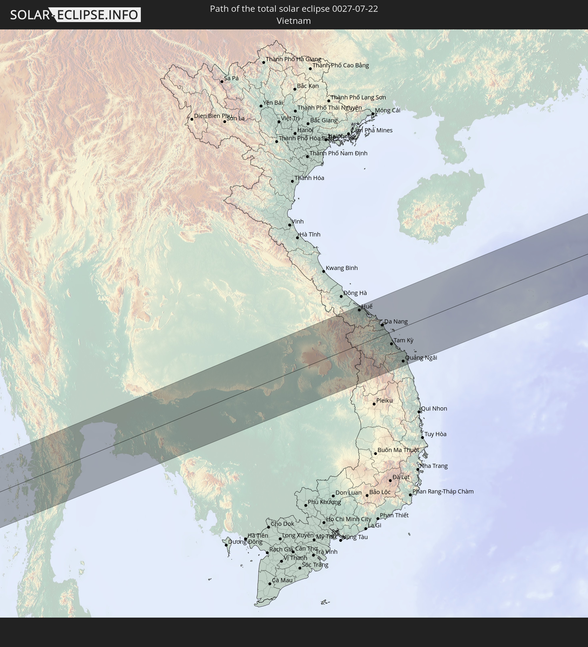 Vietnam
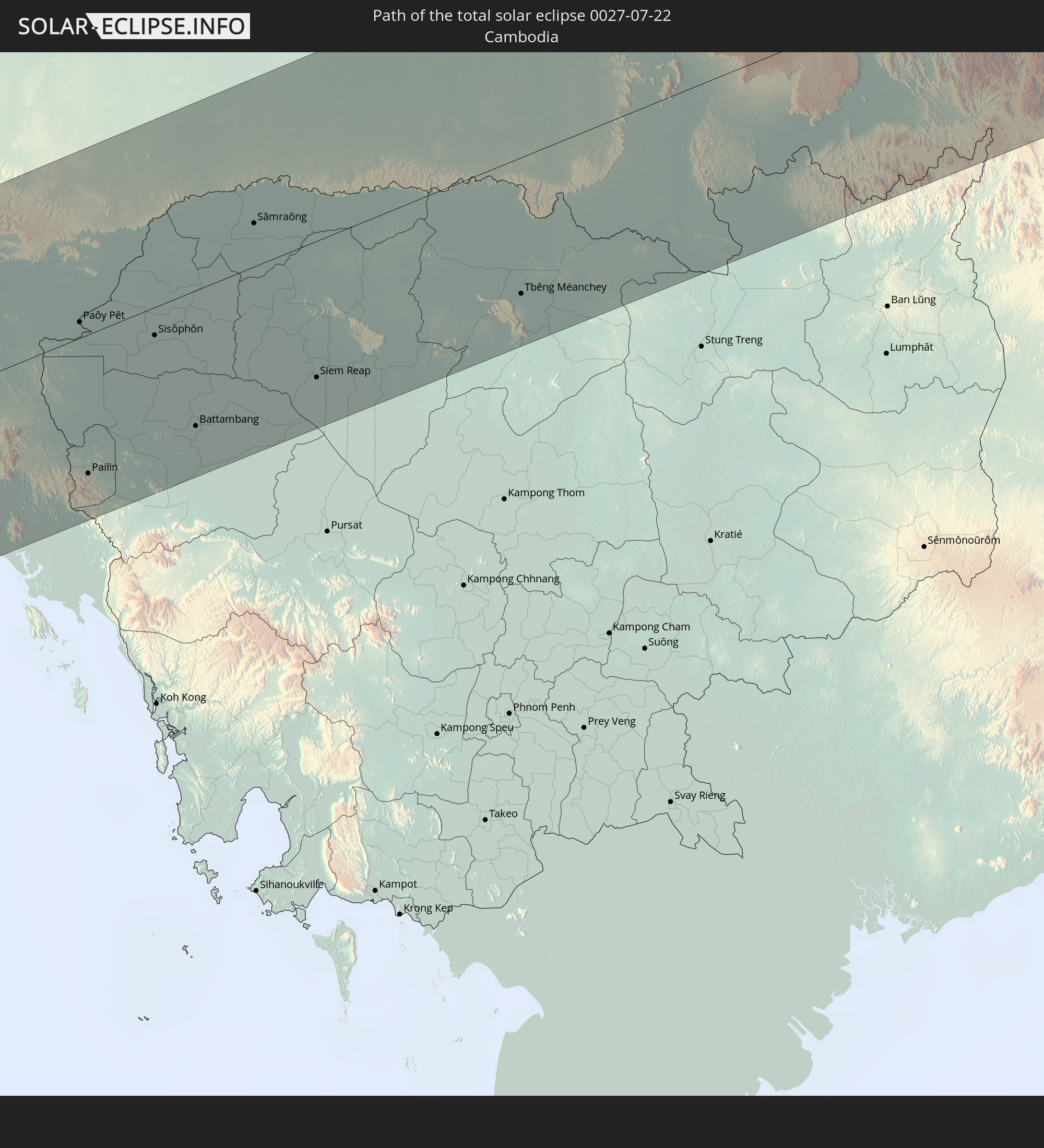 Cambodia
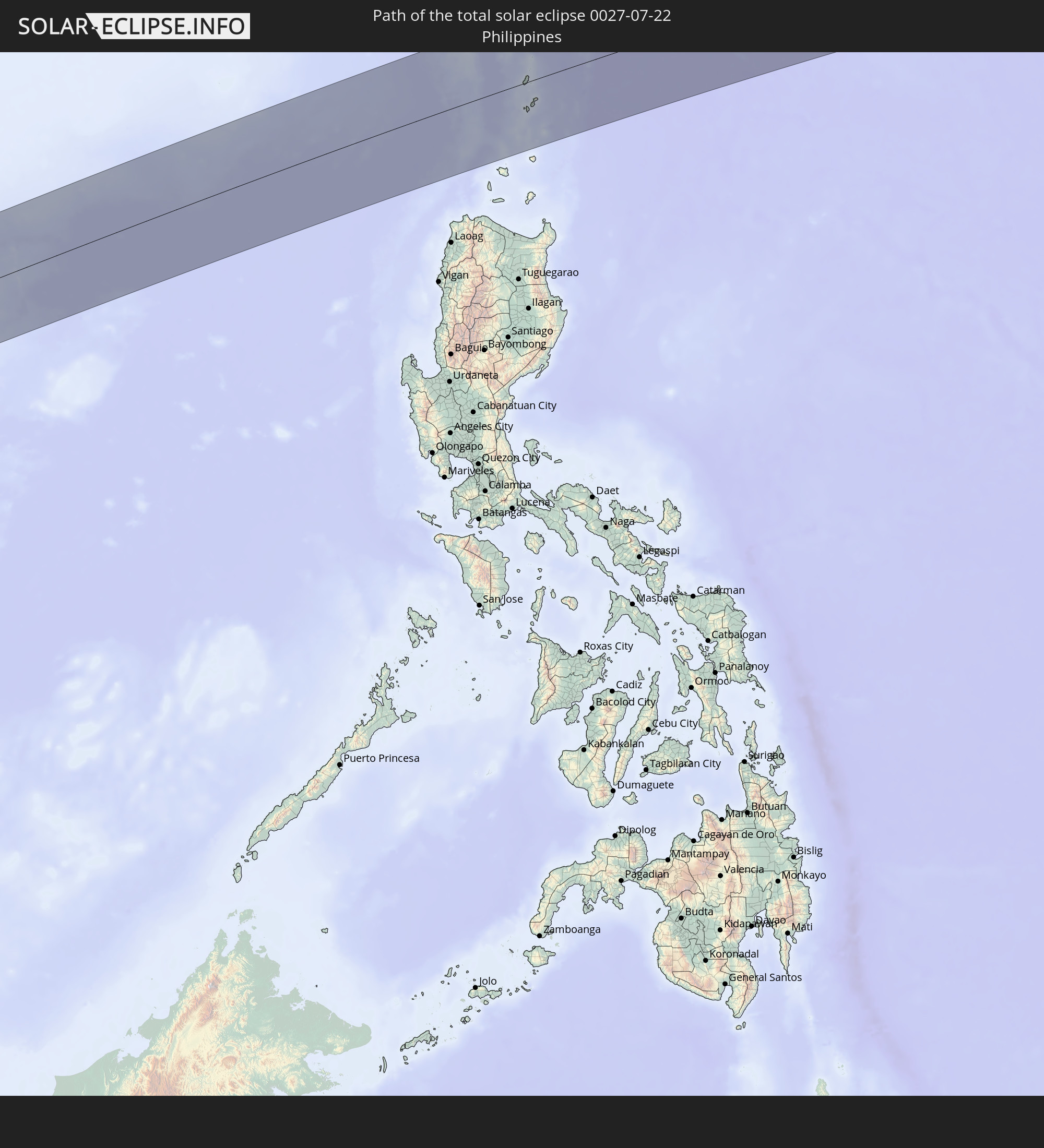 Philippines
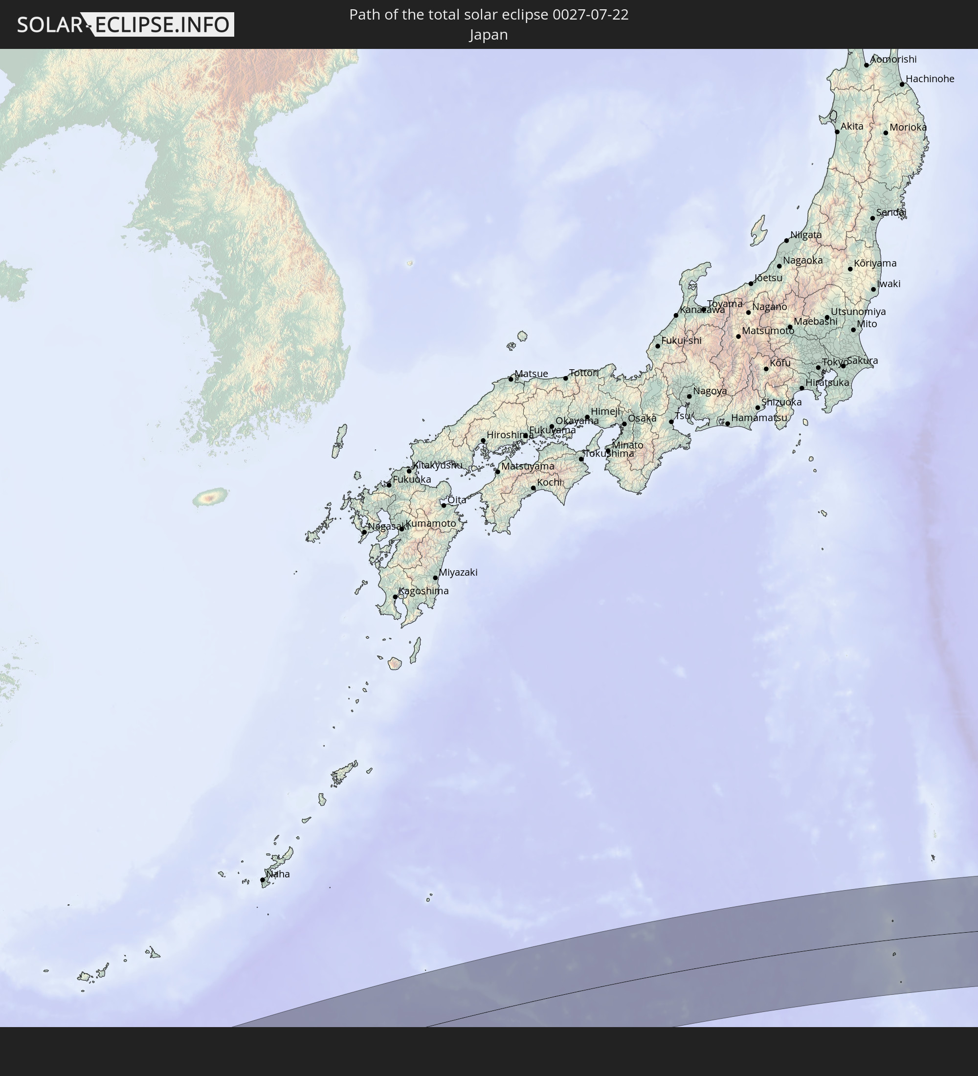 Japan
Japan
In den folgenden Ländern ist die Sonnenfinsternis partiell zu sehen
 Russia
 Fiji
Fiji
 United States
 United States Minor Outlying Islands
 Wallis and Futuna
 Tonga
Tonga
 Kiribati
 Samoa
Samoa
 Tokelau
 American Samoa
 Niue
Niue
 Cook Islands
 French Polynesia
 Kazakhstan
 Uzbekistan
 Afghanistan
 Pakistan
 Tajikistan
 India
India
 Kyrgyzstan
 China
China
 Nepal
Nepal
 Mongolia
 Bangladesh
 Bhutan
 Myanmar
 Indonesia
 Cocos Islands
 Thailand
 Malaysia
 Laos
Laos
 Vietnam
 Cambodia
 Singapore
 Christmas Island
 Macau
Macau
 Hong Kong
 Brunei
 Taiwan
 Philippines
 Japan
Japan
 East Timor
 North Korea
 South Korea
 Palau
Palau
 Federated States of Micronesia
 Papua New Guinea
 Guam
Guam
 Northern Mariana Islands
 Solomon Islands
 Marshall Islands
 Nauru
Nauru
 Tuvalu
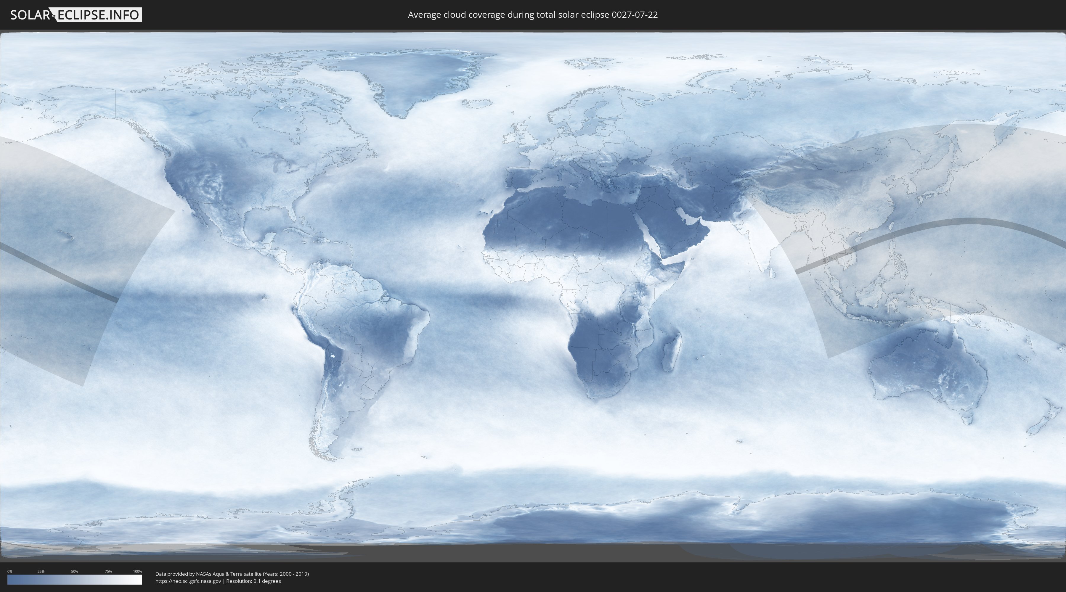
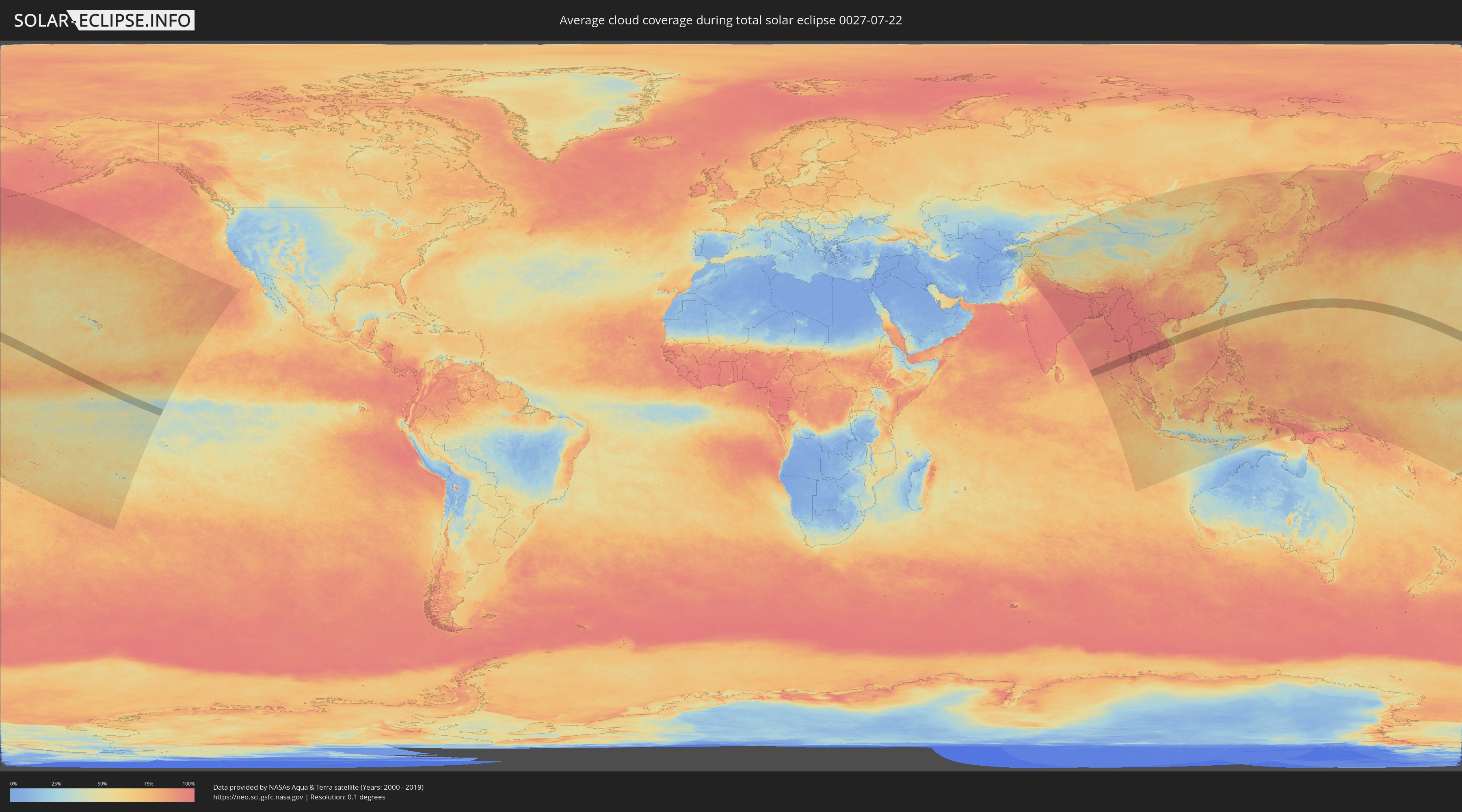
How will be the weather during the total solar eclipse on 07/22/0027?
Where is the best place to see the total solar eclipse of 07/22/0027?
The following maps show the average cloud coverage for the day of the total solar eclipse.
With the help of these maps, it is possible to find the place along the eclipse path, which has the best
chance of a cloudless sky.
Nevertheless, you should consider local circumstances and inform about the weather of your chosen
observation site.
The data is provided by NASAs satellites
AQUA and TERRA.
The cloud maps are averaged over a period of 19 years (2000 - 2019).
Detailed country maps
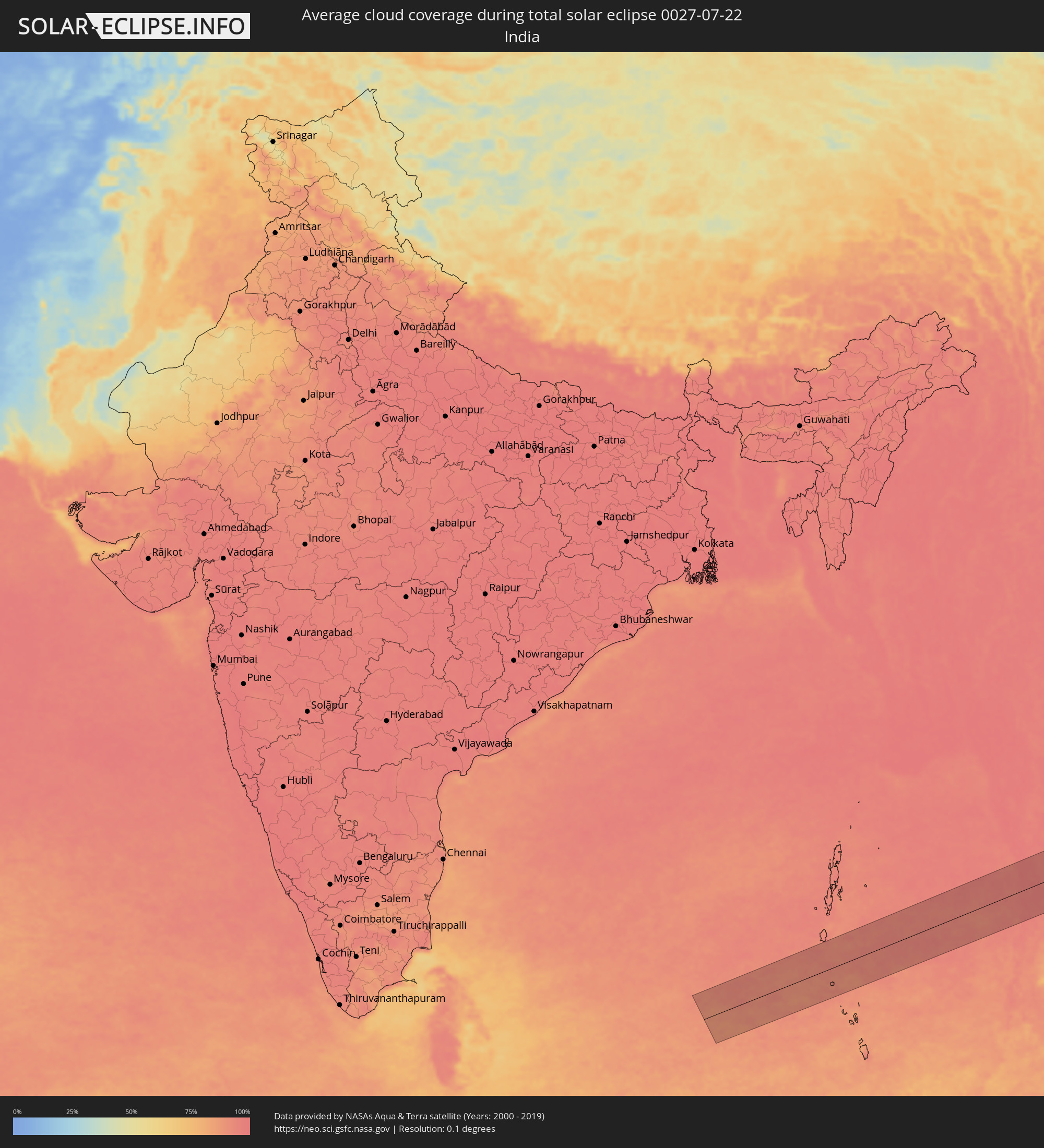 India
India
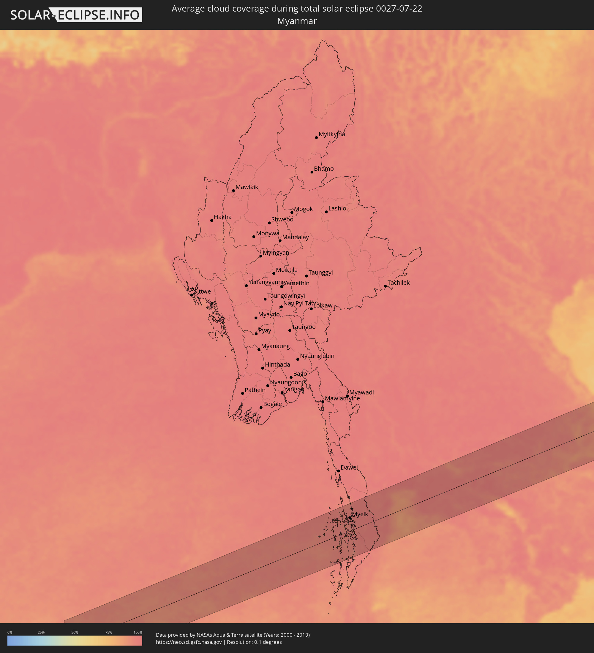 Myanmar
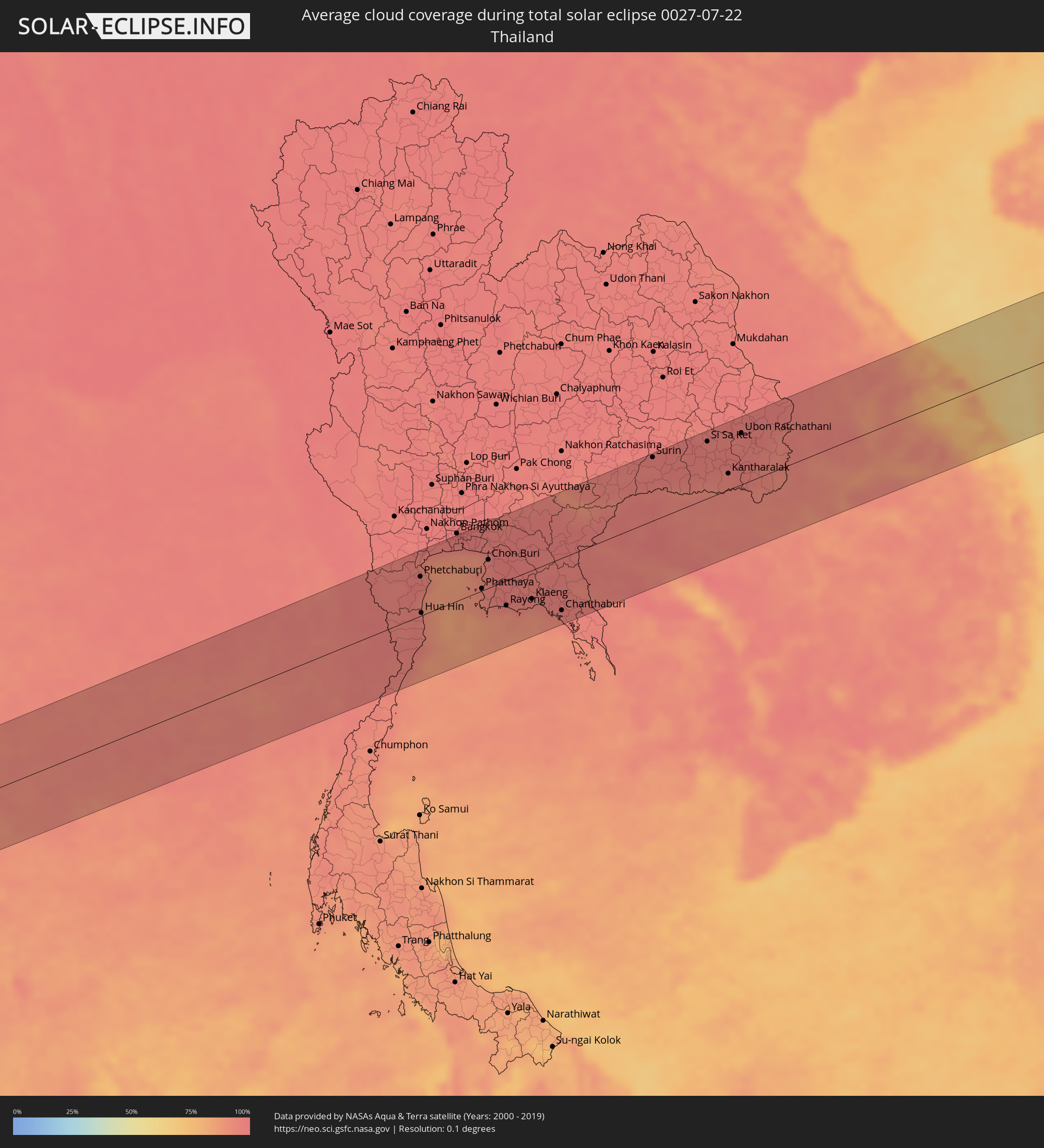 Thailand
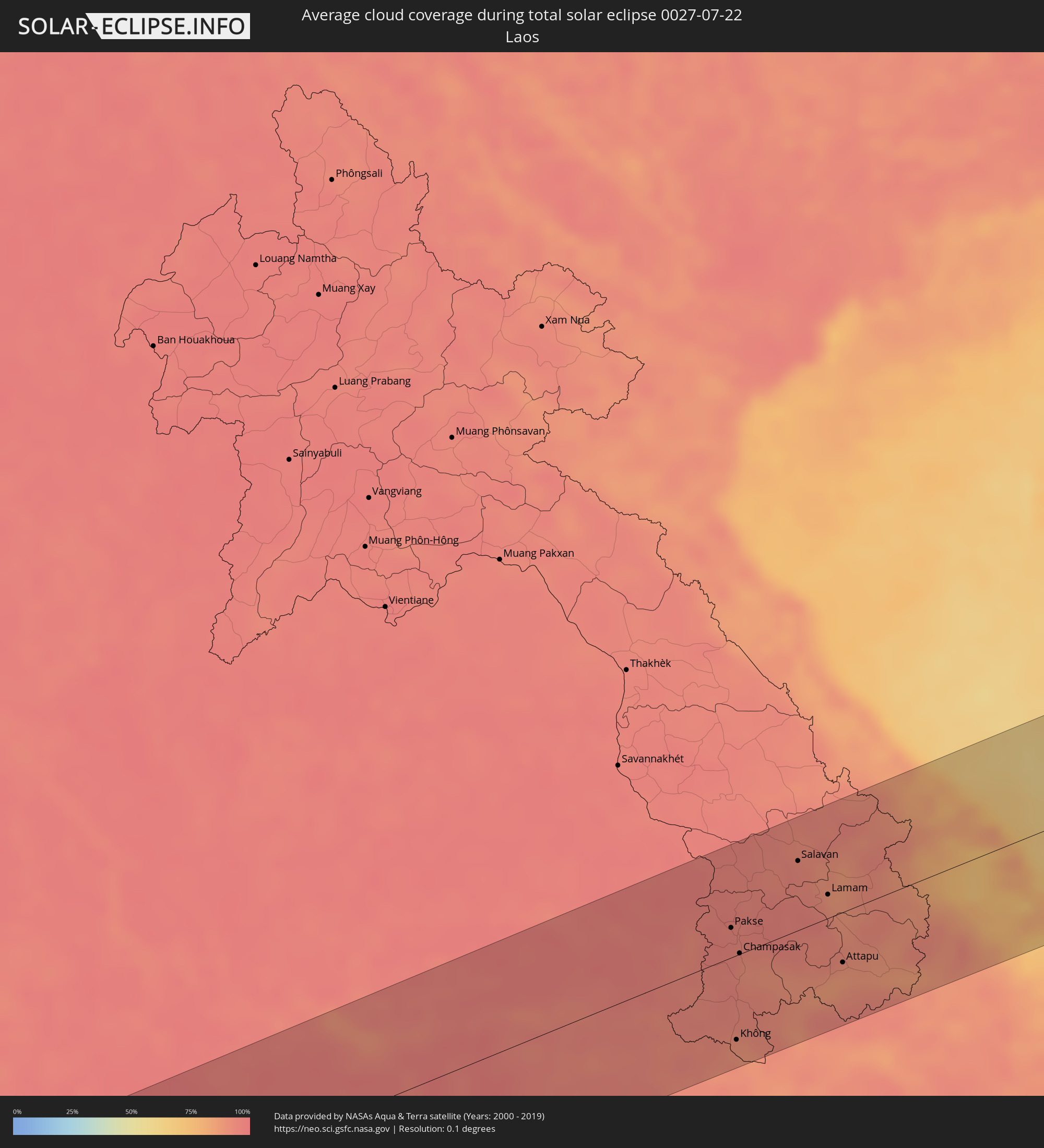 Laos
Laos
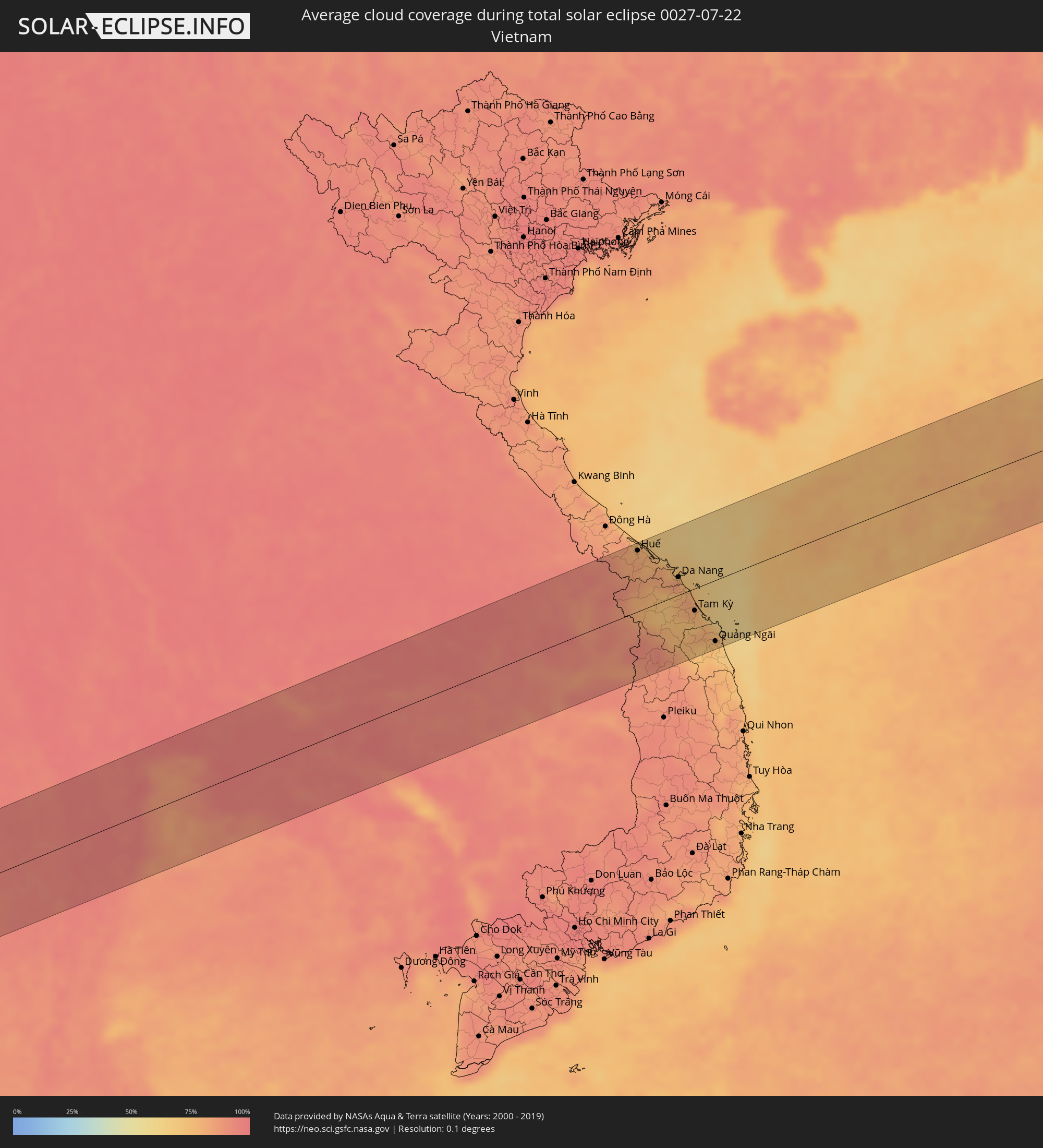 Vietnam
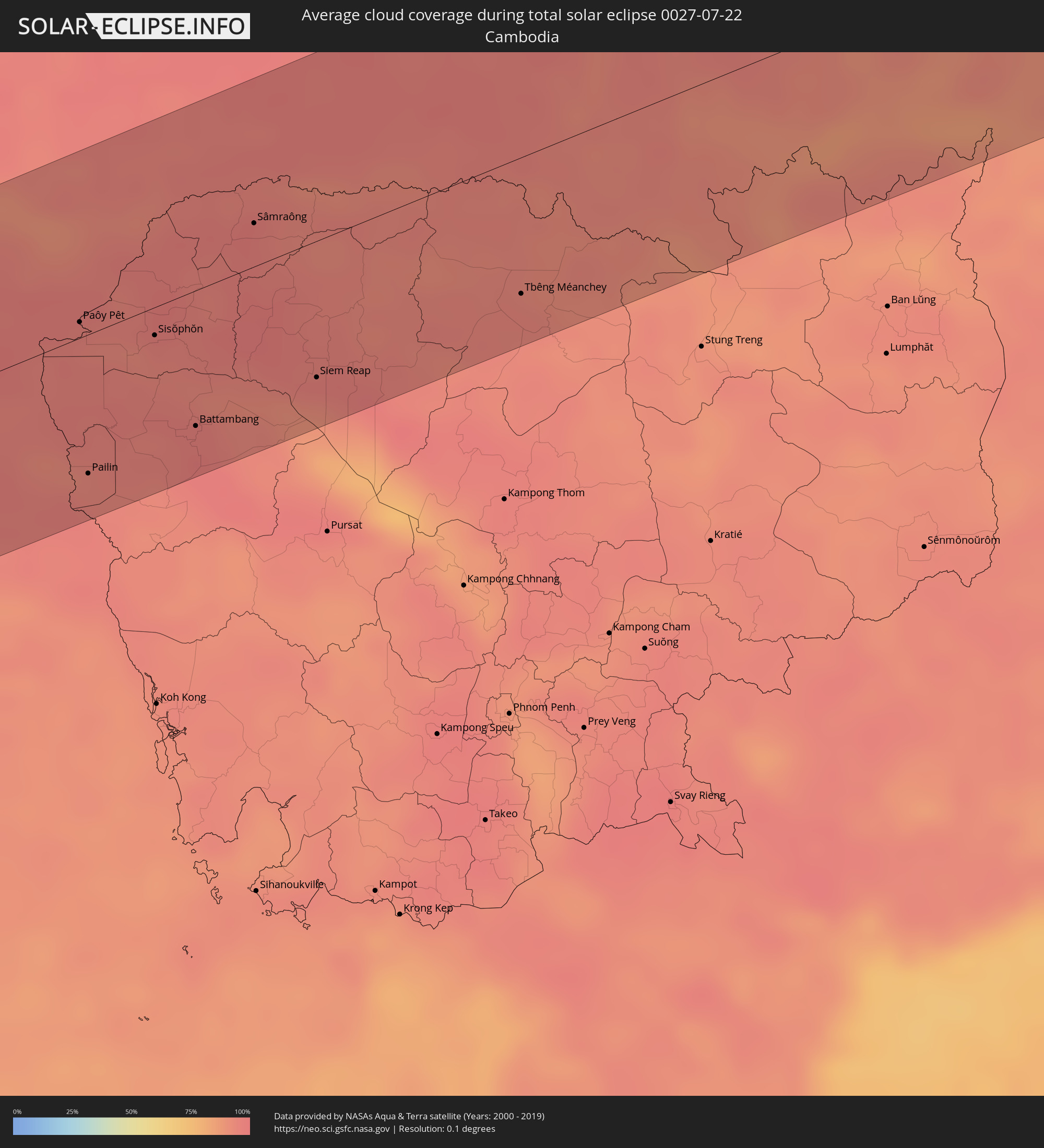 Cambodia
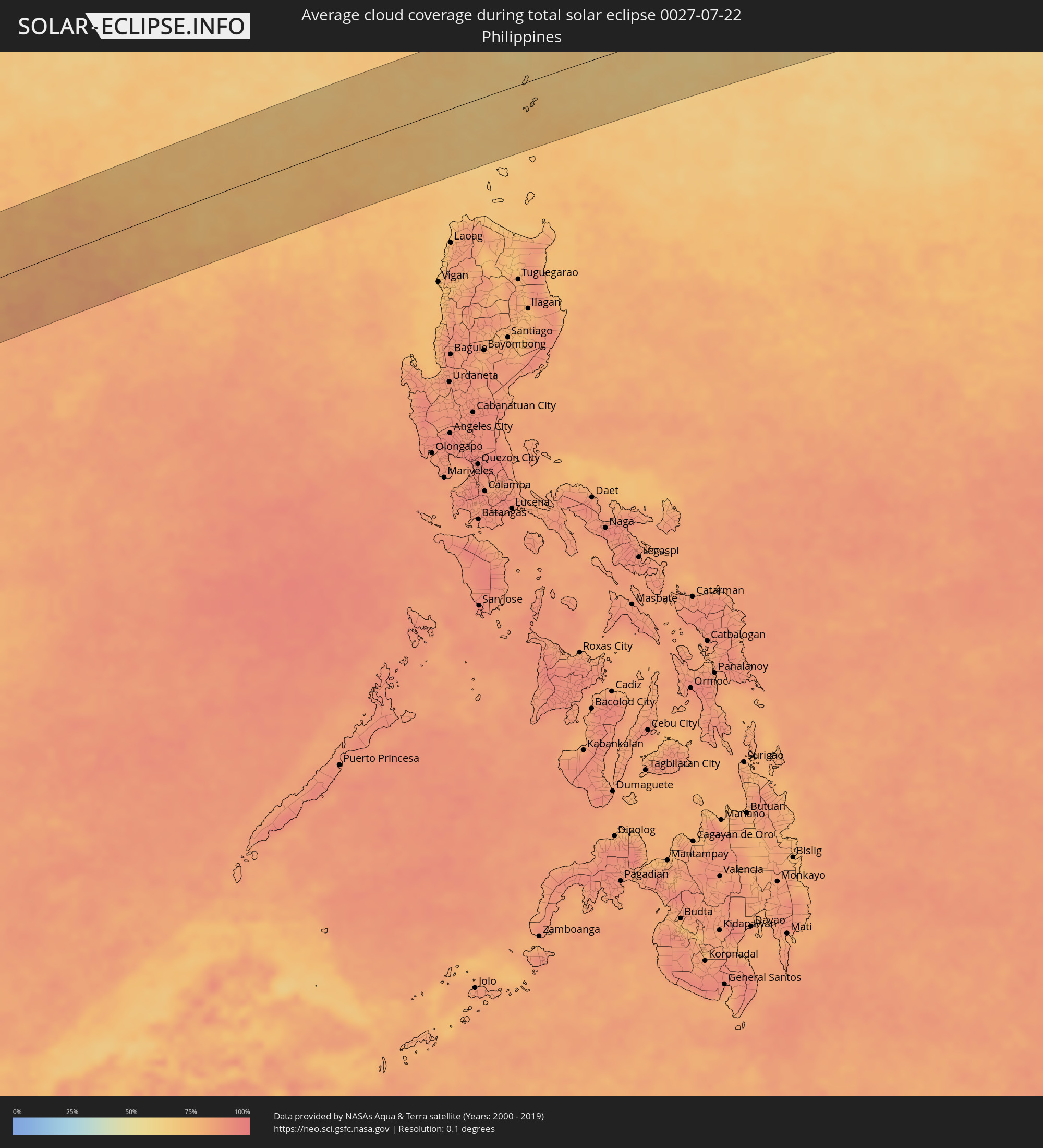 Philippines
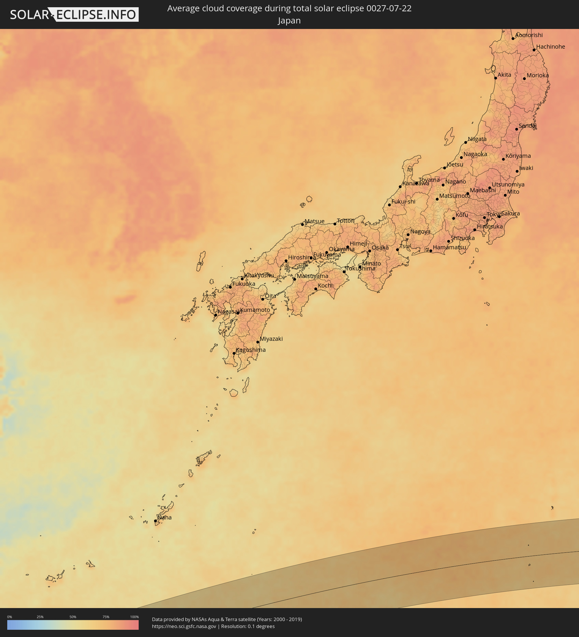 Japan
Japan
Cities inside the path of the eclipse
The following table shows all locations with a population of more than 5,000 inside the eclipse path. Cities which have more than 100,000 inhabitants are marked bold. A click at the locations opens a detailed map.
| City | Type | Eclipse duration | Local time of max. eclipse | Distance to central line | Ø Cloud coverage |
|
Myeik, Tanintharyi
|
total | - | 06:22:18 UTC+06:24 | 46 km | 95% |
|
Prachuap Khiri Khan, Prachuap Khiri Khan
|
total | - | 06:39:30 UTC+06:42 | 66 km | 94% |
|
Pran Buri, Prachuap Khiri Khan
|
total | - | 06:39:50 UTC+06:42 | 13 km | 97% |
|
Tha Yang, Phetchaburi
|
total | - | 06:40:08 UTC+06:42 | 46 km | 98% |
|
Phetchaburi, Phetchaburi
|
total | - | 06:40:14 UTC+06:42 | 60 km | 98% |
|
Hua Hin, Prachuap Khiri Khan
|
total | - | 06:39:56 UTC+06:42 | 4 km | 93% |
|
Cha-am, Phetchaburi
|
total | - | 06:40:04 UTC+06:42 | 27 km | 91% |
|
Samut Songkhram, Samut Songkhram
|
total | - | 06:40:25 UTC+06:42 | 89 km | 93% |
|
Samut Sakhon, Samut Sakhon
|
total | - | 06:40:34 UTC+06:42 | 92 km | 92% |
|
Samut Prakan, Samut Prakan
|
total | - | 06:40:40 UTC+06:42 | 84 km | 95% |
|
Bang Bo District, Samut Prakan
|
total | - | 06:40:43 UTC+06:42 | 73 km | 96% |
|
Ban Khlong Bang Sao Thong, Samut Prakan
|
total | - | 06:40:46 UTC+06:42 | 78 km | 96% |
|
Phatthaya, Chon Buri
|
total | - | 06:40:22 UTC+06:42 | 3 km | 93% |
|
Sattahip, Chon Buri
|
total | - | 06:40:14 UTC+06:42 | 25 km | 91% |
|
Si Racha, Chon Buri
|
total | - | 06:40:31 UTC+06:42 | 26 km | 94% |
|
Chon Buri, Chon Buri
|
total | - | 06:40:39 UTC+06:42 | 43 km | 96% |
|
Bang Pakong, Chachoengsao
|
total | - | 06:40:45 UTC+06:42 | 62 km | 95% |
|
Ban Talat Bueng, Chon Buri
|
total | - | 06:40:29 UTC+06:42 | 13 km | 96% |
|
Ban Chang, Rayong
|
total | - | 06:40:18 UTC+06:42 | 25 km | 93% |
|
Chachoengsao, Chachoengsao
|
total | - | 06:40:51 UTC+06:42 | 73 km | 97% |
|
Ban Bueng, Chon Buri
|
total | - | 06:40:39 UTC+06:42 | 33 km | 96% |
|
Phanat Nikhom, Chon Buri
|
total | - | 06:40:45 UTC+06:42 | 44 km | 98% |
|
Rayong, Rayong
|
total | - | 06:40:20 UTC+06:42 | 38 km | 95% |
|
Prachin Buri, Prachin Buri
|
total | - | 06:41:09 UTC+06:42 | 98 km | 96% |
|
Klaeng, Rayong
|
total | - | 06:40:30 UTC+06:42 | 44 km | 96% |
|
Tha Mai, Chanthaburi
|
total | - | 06:40:32 UTC+06:42 | 75 km | 94% |
|
Sa Kaeo, Sa Kaeo
|
total | - | 06:41:14 UTC+06:42 | 45 km | 97% |
|
Chanthaburi, Chanthaburi
|
total | - | 06:40:33 UTC+06:42 | 80 km | 96% |
|
Aranyaprathet, Sa Kaeo
|
total | - | 06:41:18 UTC+06:42 | 15 km | 97% |
|
Paôy Pêt, Banteay Meanchey
|
total | - | 06:41:18 UTC+06:42 | 9 km | 96% |
|
Pailin, Pailin
|
total | - | 06:40:51 UTC+06:42 | 76 km | 95% |
|
Nang Rong, Buriram
|
total | - | 06:41:58 UTC+06:42 | 100 km | 95% |
|
Sisŏphŏn, Banteay Meanchey
|
total | - | 06:41:24 UTC+06:42 | 15 km | 96% |
|
Battambang, Battambang
|
total | - | 06:41:12 UTC+06:42 | 74 km | 97% |
|
Surin, Surin
|
total | - | 06:42:22 UTC+06:42 | 97 km | 96% |
|
Sâmraông, Ŏtâr Méanchey
|
total | - | 06:41:57 UTC+06:42 | 24 km | 98% |
|
Siem Reap, Siem Reap
|
total | - | 06:41:36 UTC+06:42 | 75 km | 97% |
|
Si Sa Ket, Sisaket
|
total | - | 06:42:51 UTC+06:42 | 87 km | 96% |
|
Kantharalak, Sisaket
|
total | - | 06:42:41 UTC+06:42 | 25 km | 94% |
|
Ubon Ratchathani, Changwat Ubon Ratchathani
|
total | - | 06:43:09 UTC+06:42 | 78 km | 95% |
|
Tbêng Méanchey, Preah Vihear
|
total | - | 06:42:20 UTC+06:42 | 75 km | 94% |
|
Det Udom, Changwat Ubon Ratchathani
|
total | - | 06:43:03 UTC+06:42 | 35 km | 96% |
|
Pakse, Champasak
|
total | - | 06:43:31 UTC+06:42 | 27 km | 94% |
|
Không, Champasak
|
total | - | 06:42:55 UTC+06:42 | 78 km | 89% |
|
Champasak, Champasak
|
total | - | 06:43:24 UTC+06:42 | 1 km | 91% |
|
Salavan, Salavan
|
total | - | 06:44:12 UTC+06:42 | 64 km | 93% |
|
Lamam, Xékong
|
total | - | 06:44:09 UTC+06:42 | 22 km | 90% |
|
Attapu, Attapu
|
total | - | 06:43:50 UTC+06:42 | 46 km | 87% |
|
Huế, Thừa Thiên-Huế
|
total | - | 07:09:56 UTC+07:06 | 93 km | 79% |
|
Da Nang, Đà Nẵng
|
total | - | 07:10:01 UTC+07:06 | 27 km | 83% |
|
Hội An, Quảng Nam
|
total | - | 07:09:57 UTC+07:06 | 3 km | 78% |
|
Tam Kỳ, Quảng Nam
|
total | - | 07:09:50 UTC+07:06 | 34 km | 77% |
|
Quảng Ngãi, Quảng Ngãi
|
total | - | 07:09:44 UTC+07:06 | 93 km | 72% |
|
Basco, Cagayan Valley
|
total | - | 08:19:20 UTC+08:00 | 33 km | 72% |