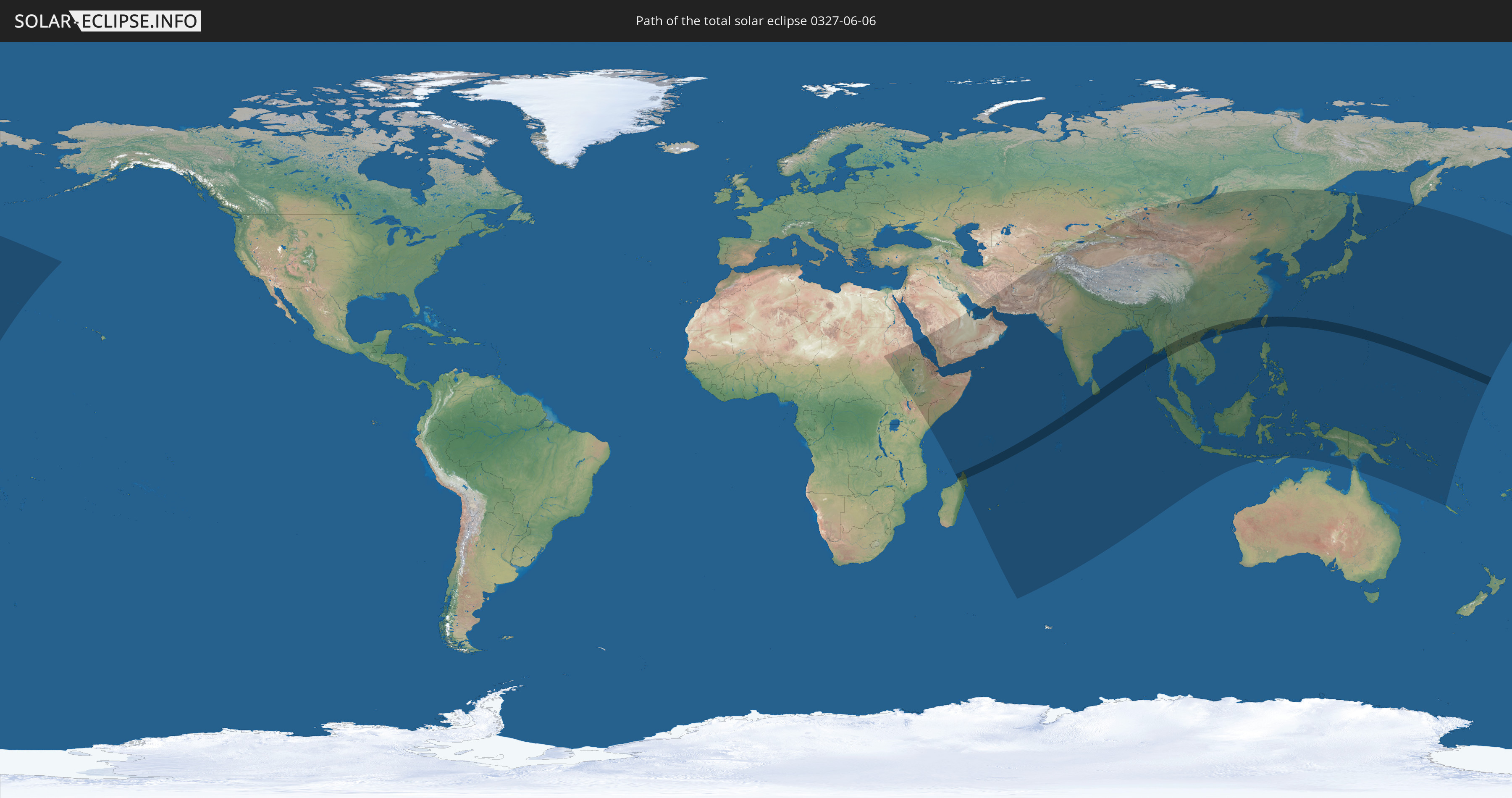
Total solar eclipse of 06/06/0327
| Day of week: | Monday |
| Maximum duration of eclipse: | 07m03s |
| Maximum width of eclipse path: | 261 km |
| Saros cycle: | 81 |
| Coverage: | 100% |
| Magnitude: | 1.081 |
| Gamma: | -0.0413 |
Wo kann man die Sonnenfinsternis vom 06/06/0327 sehen?
Die Sonnenfinsternis am 06/06/0327 kann man in 65 Ländern als partielle Sonnenfinsternis beobachten.
Der Finsternispfad verläuft durch 16 Länder. Nur in diesen Ländern ist sie als total Sonnenfinsternis zu sehen.
In den folgenden Ländern ist die Sonnenfinsternis total zu sehen
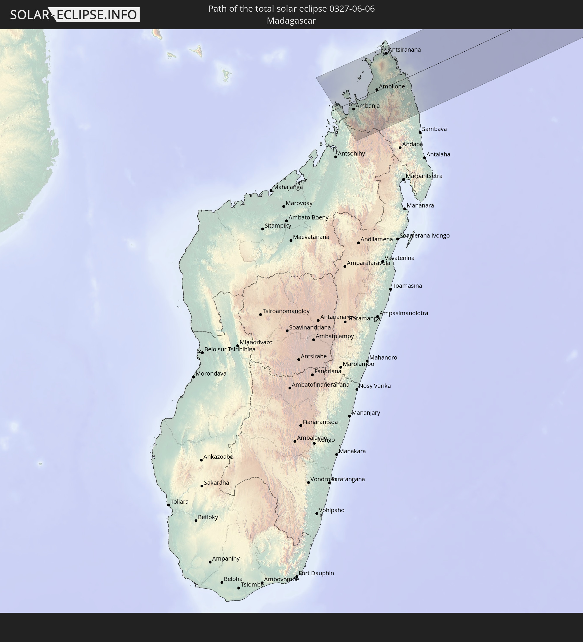 Madagascar
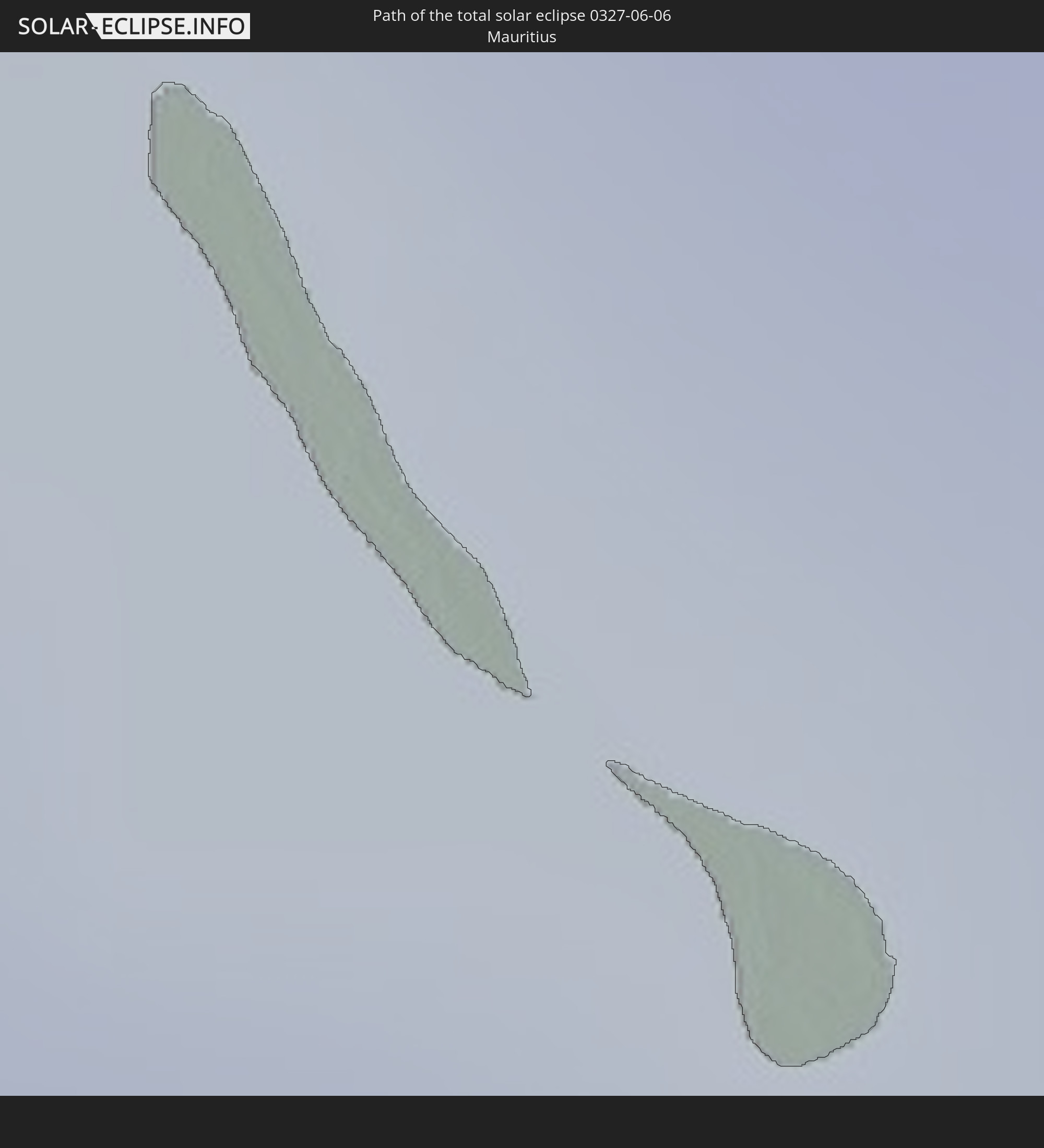 Mauritius
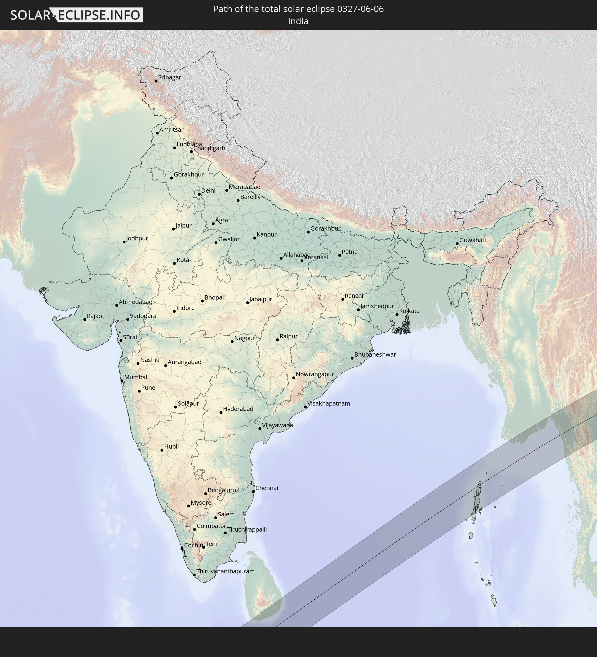 India
India
 Maldives
 China
China
 Sri Lanka
 Myanmar
 Thailand
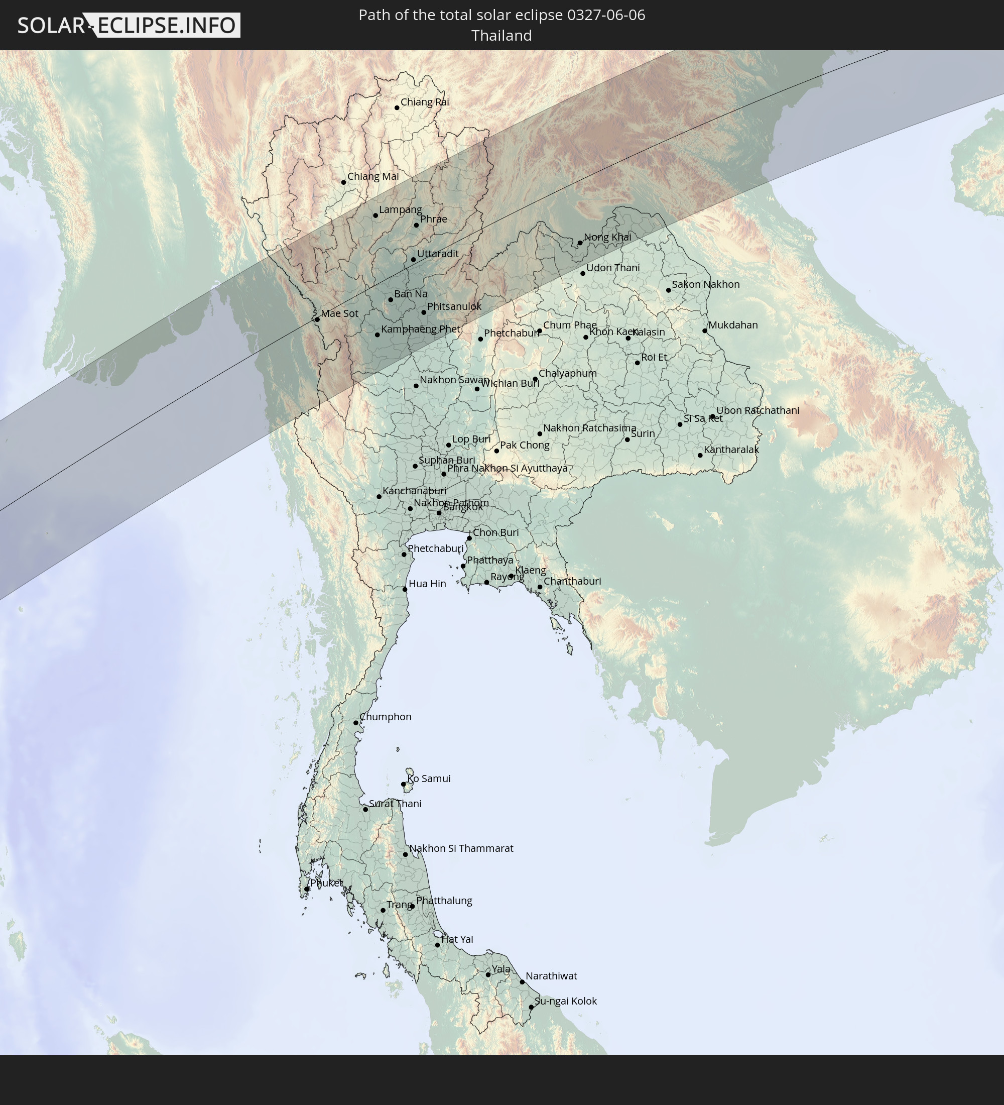
 Laos
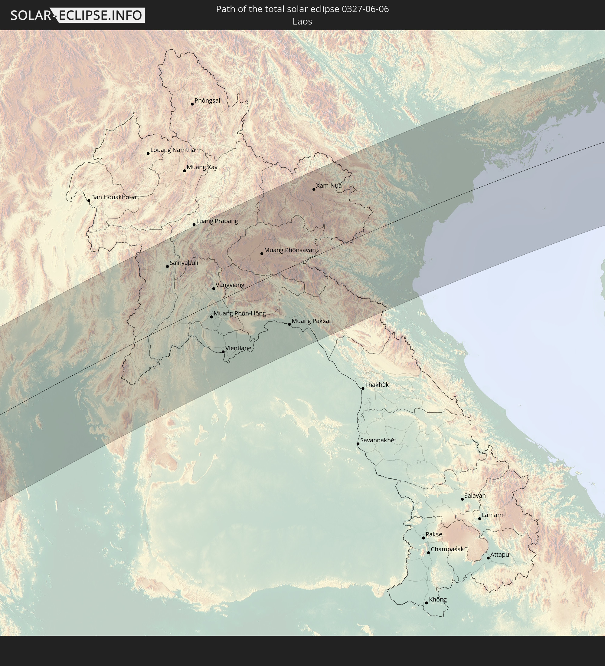
Laos
 Vietnam
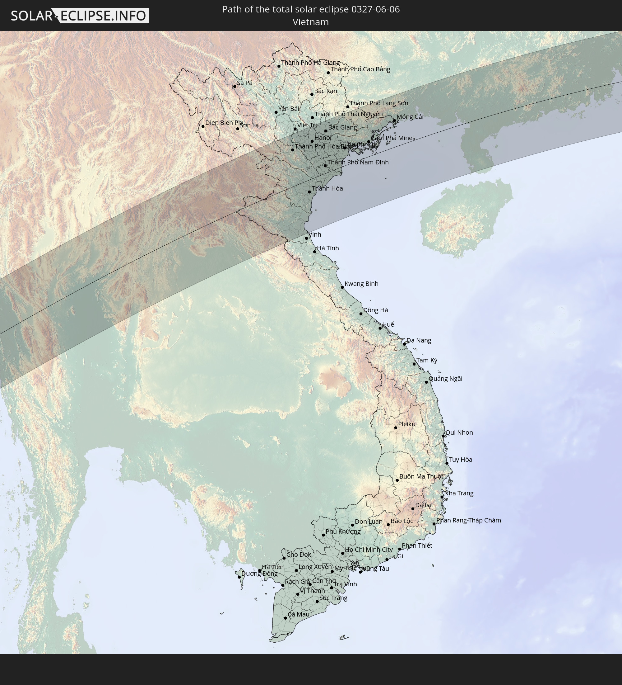
 Macau
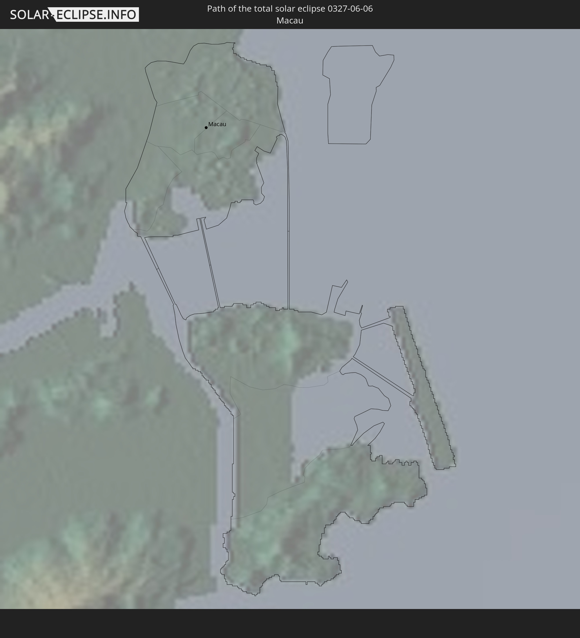
Macau
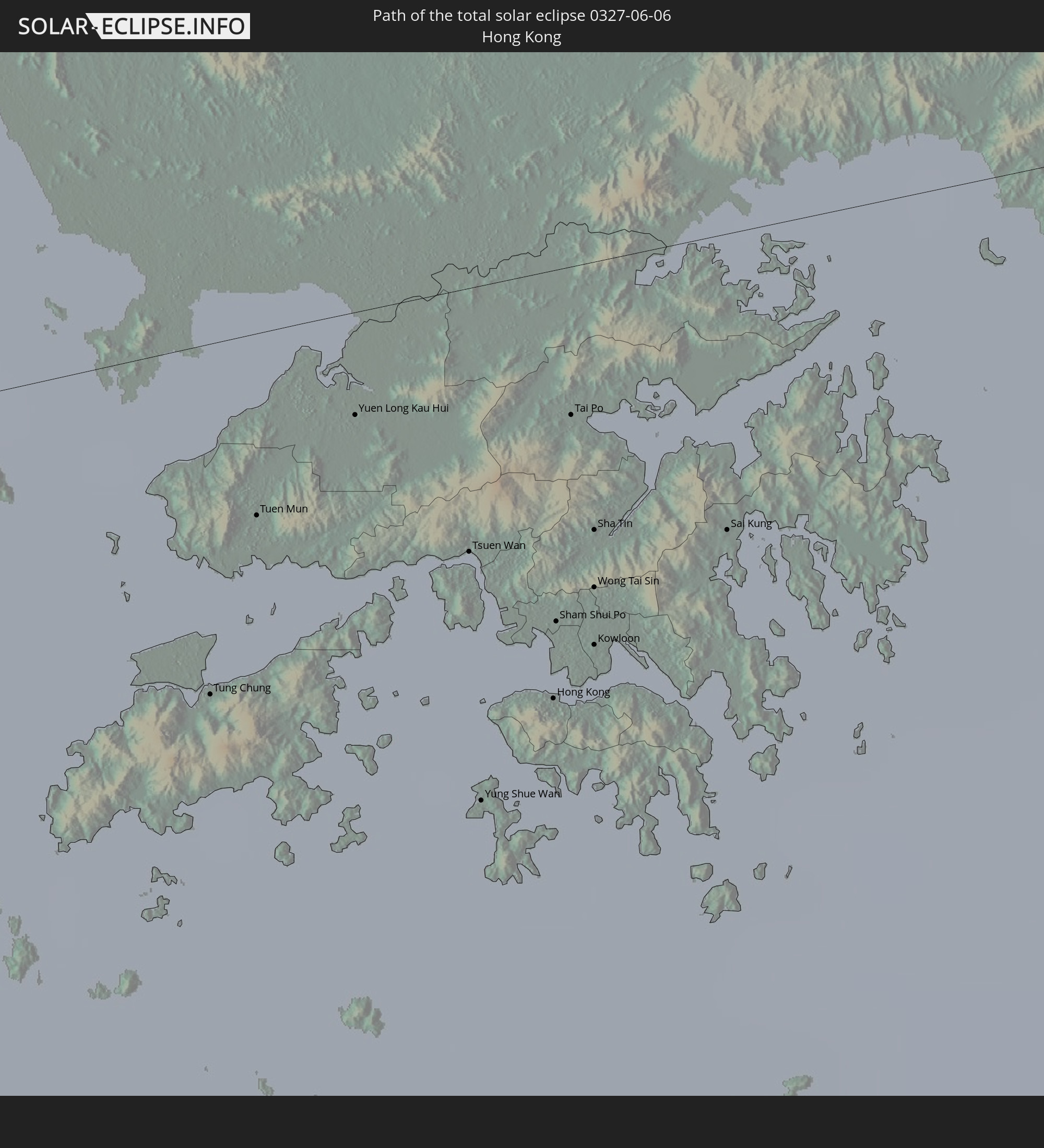 Hong Kong
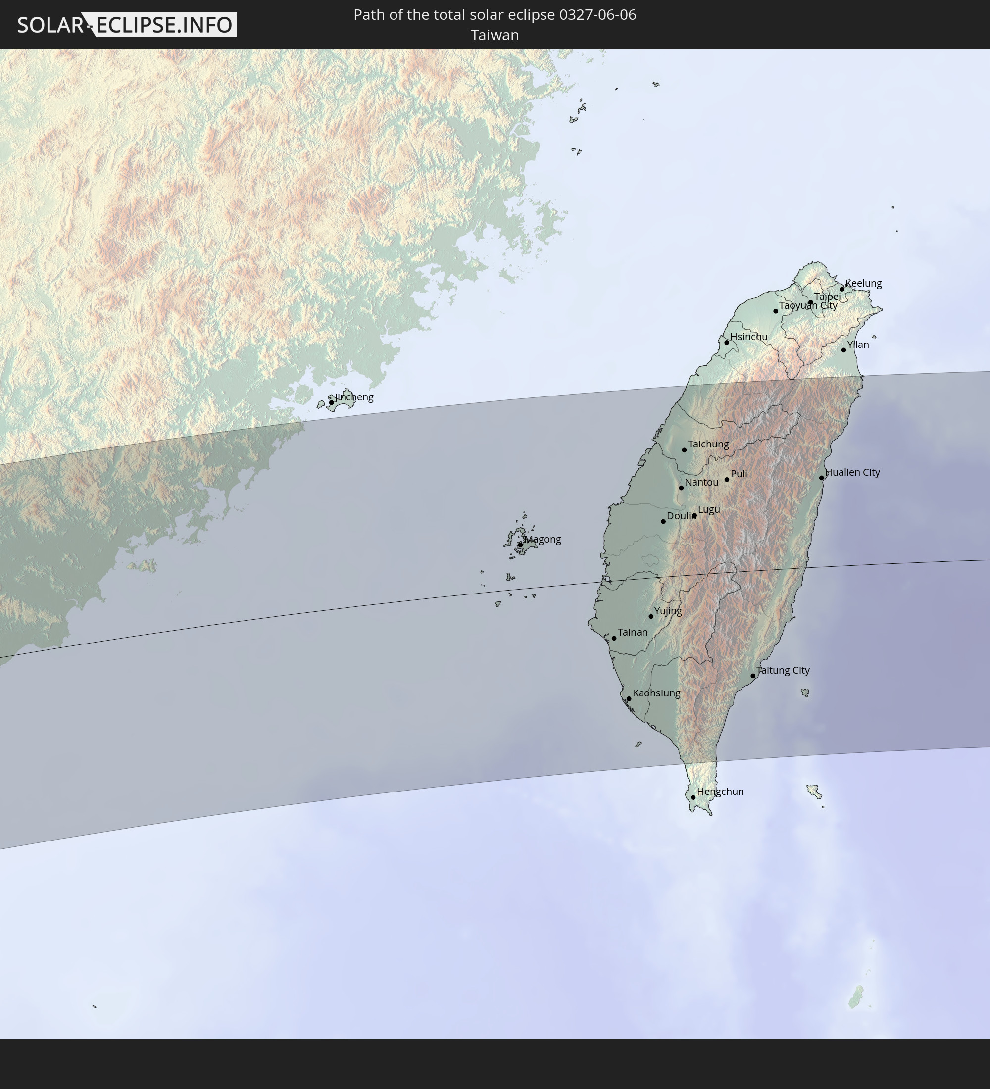 Taiwan
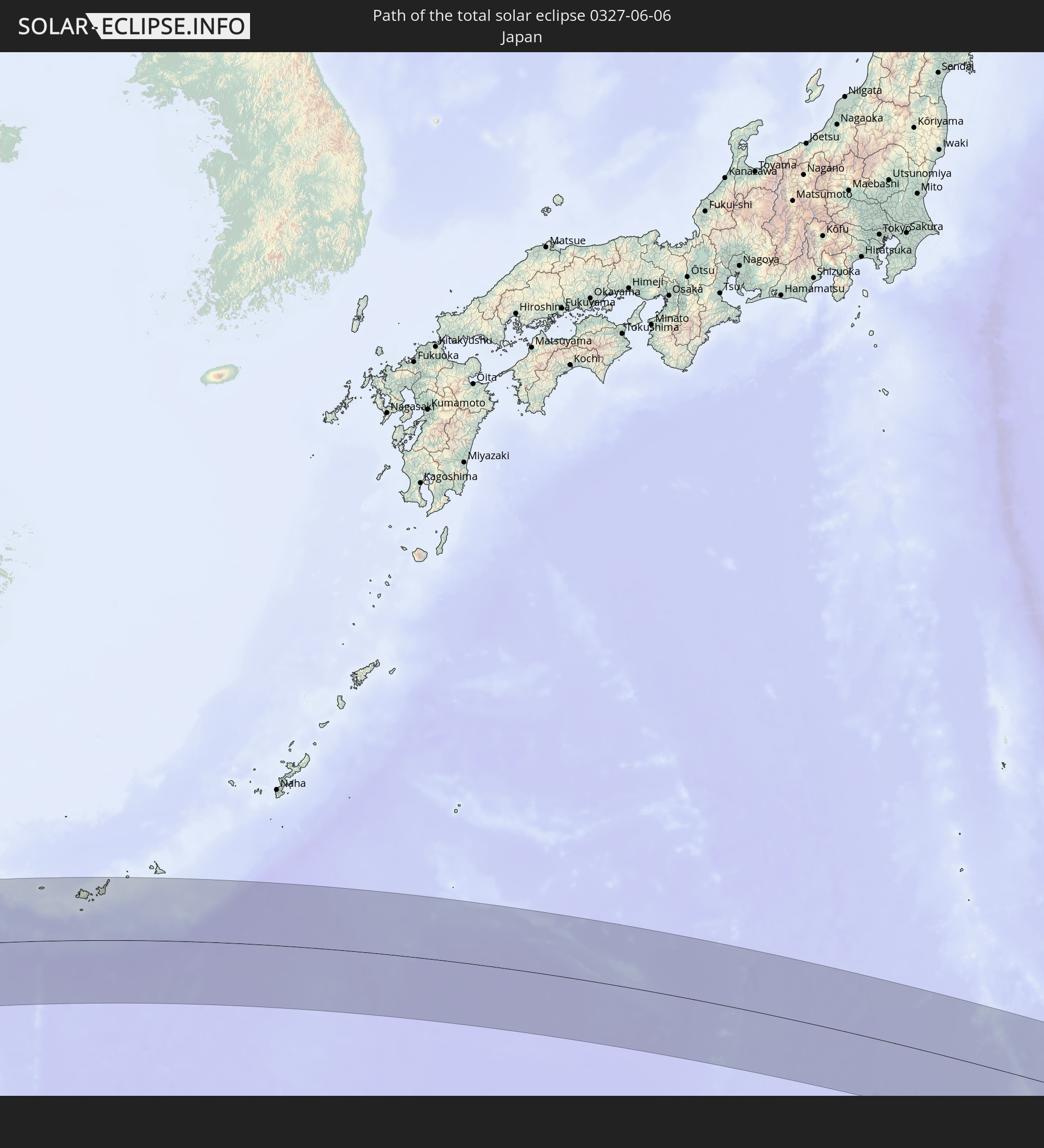 Japan
Japan
 Northern Mariana Islands
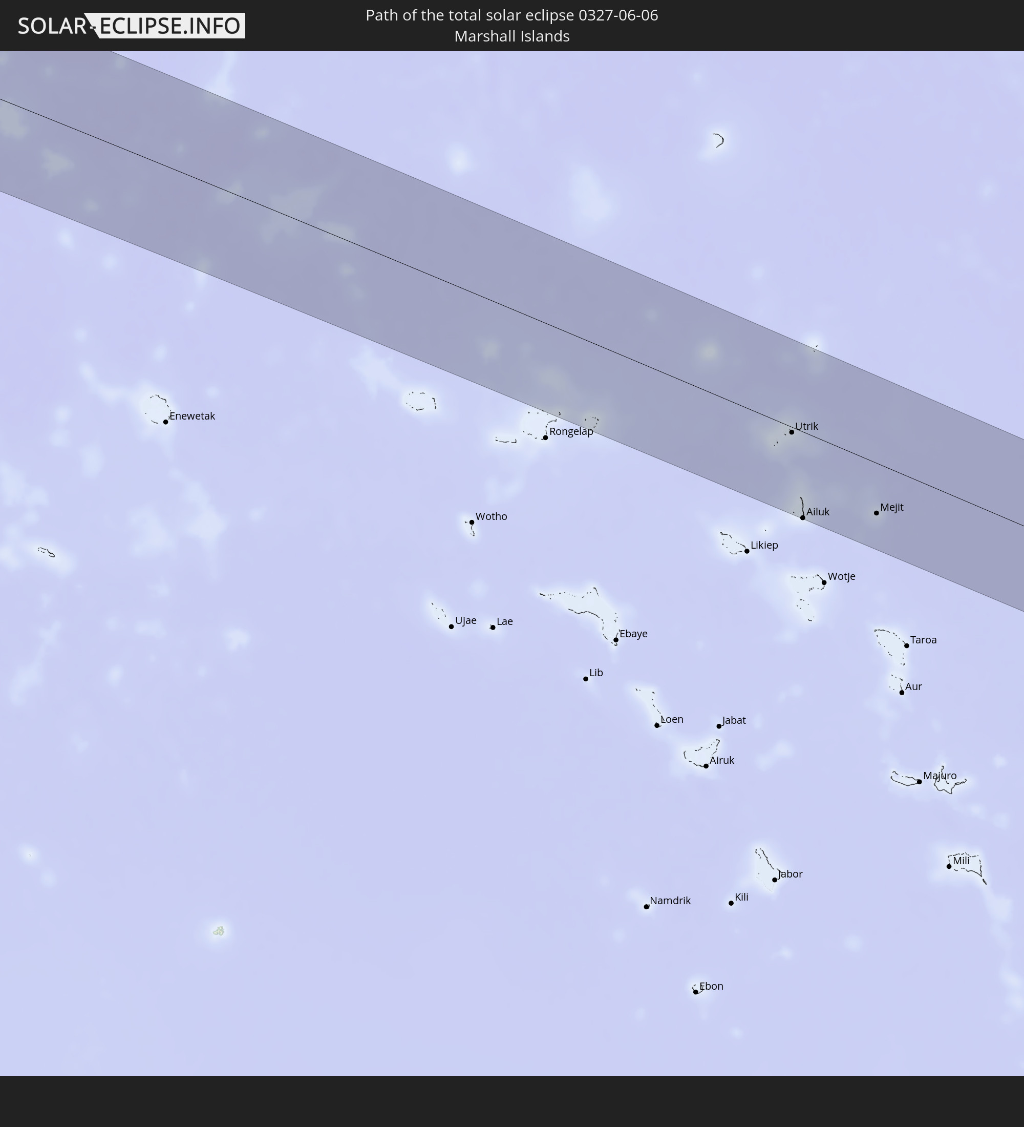 Marshall Islands
In den folgenden Ländern ist die Sonnenfinsternis partiell zu sehen
 Russia
 United States Minor Outlying Islands
 Kiribati
 Sudan
Sudan
 Ethiopia
 Kenya
Kenya
 Saudi Arabia
 Eritrea
 French Southern and Antarctic Lands
 Somalia
 Djibouti
 Yemen
Yemen
 Madagascar
 Iran
Iran
 Seychelles
 Kazakhstan
 Bahrain
 Qatar
Qatar
 United Arab Emirates
 Oman
Oman
 Réunion
 Uzbekistan
 Mauritius
 Afghanistan
 Pakistan
 Tajikistan
 India
India
 Kyrgyzstan
 British Indian Ocean Territory
 Maldives
 China
China
 Sri Lanka
 Nepal
Nepal
 Mongolia
 Bangladesh
 Bhutan
 Myanmar
 Indonesia
 Cocos Islands
 Thailand
 Malaysia
 Laos
Laos
 Vietnam
 Cambodia
 Singapore
 Christmas Island
 Australia
 Macau
Macau
 Hong Kong
 Brunei
 Taiwan
 Philippines
 Japan
Japan
 East Timor
 North Korea
 South Korea
 Palau
Palau
 Federated States of Micronesia
 Papua New Guinea
 Guam
Guam
 Northern Mariana Islands
 Solomon Islands
 New Caledonia
 Marshall Islands
 Nauru
Nauru
How will be the weather during the total solar eclipse on 06/06/0327?
Where is the best place to see the total solar eclipse of 06/06/0327?
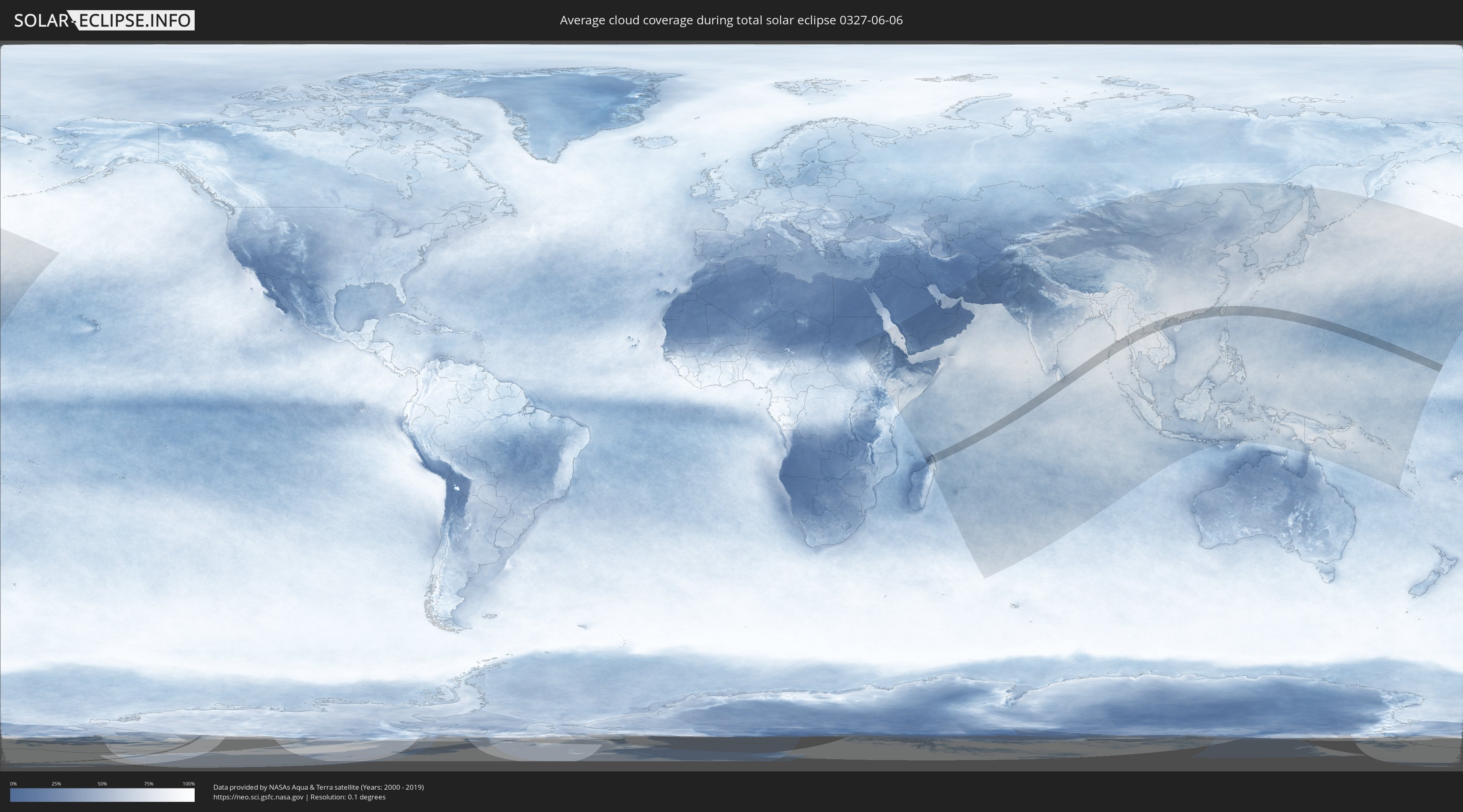
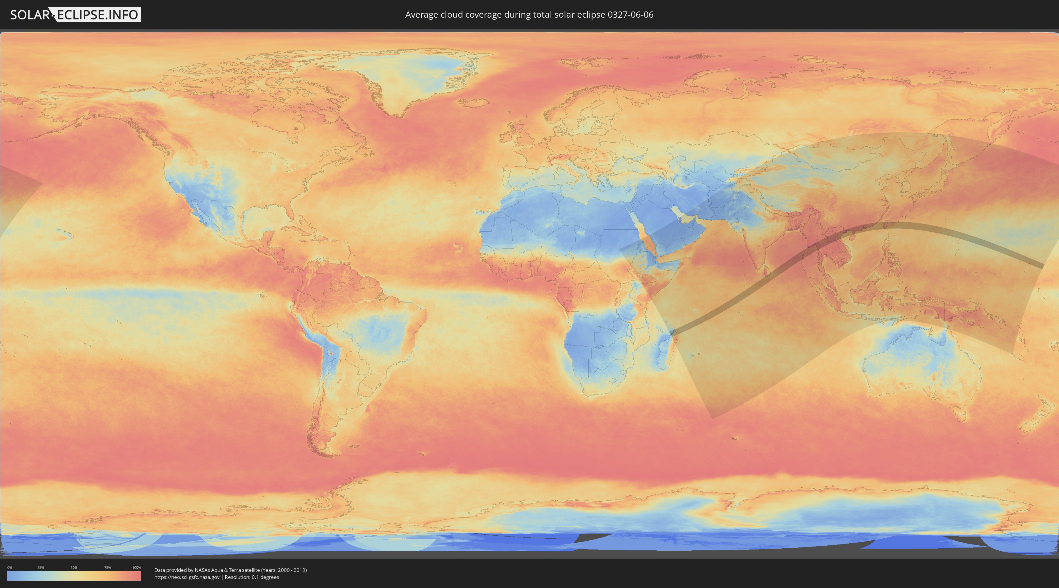
The following maps show the average cloud coverage for the day of the total solar eclipse.
With the help of these maps, it is possible to find the place along the eclipse path, which has the best
chance of a cloudless sky.
Nevertheless, you should consider local circumstances and inform about the weather of your chosen
observation site.
The data is provided by NASAs satellites
AQUA and TERRA.
The cloud maps are averaged over a period of 19 years (2000 - 2019).
Detailed country maps
 Madagascar
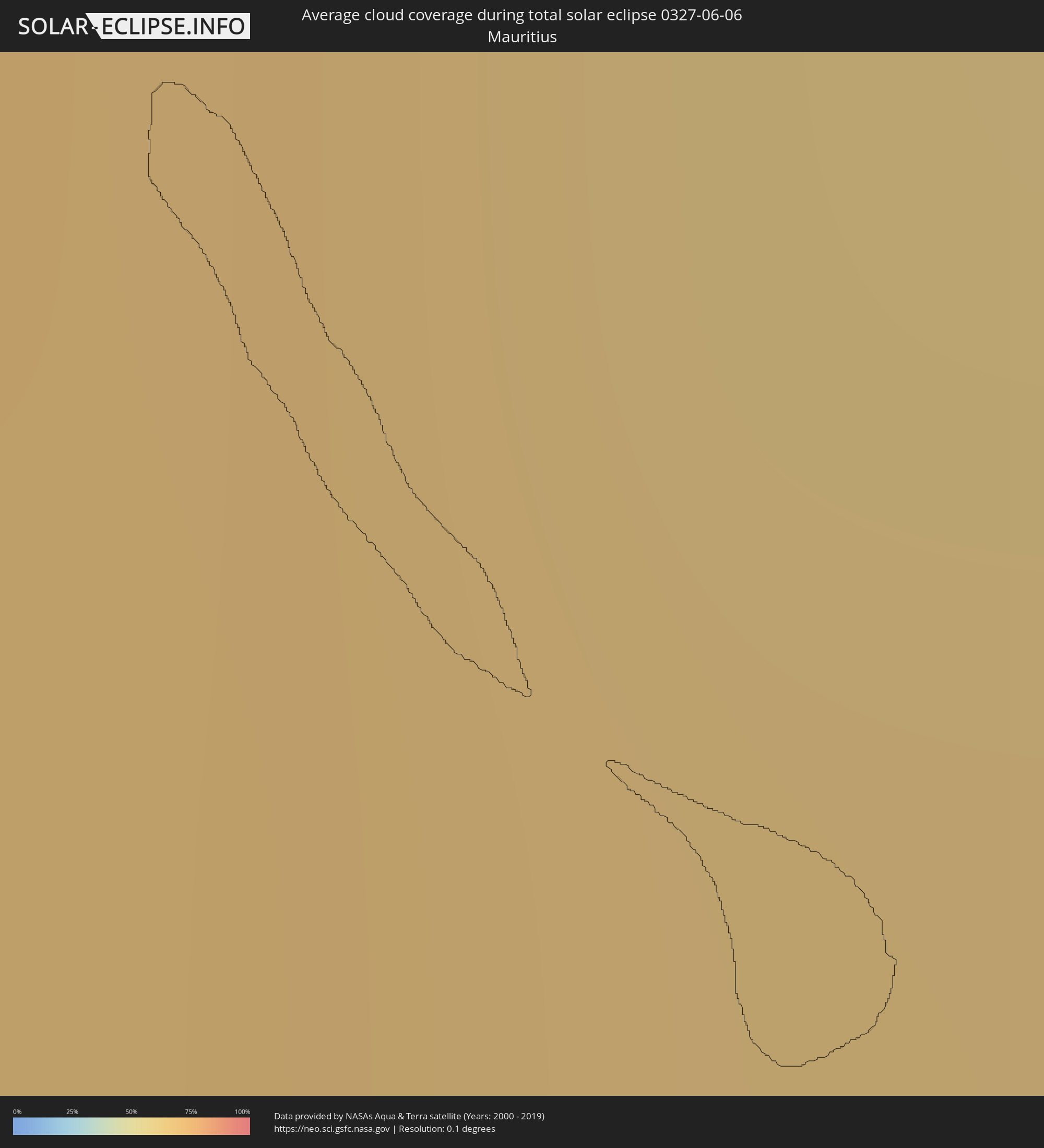 Mauritius
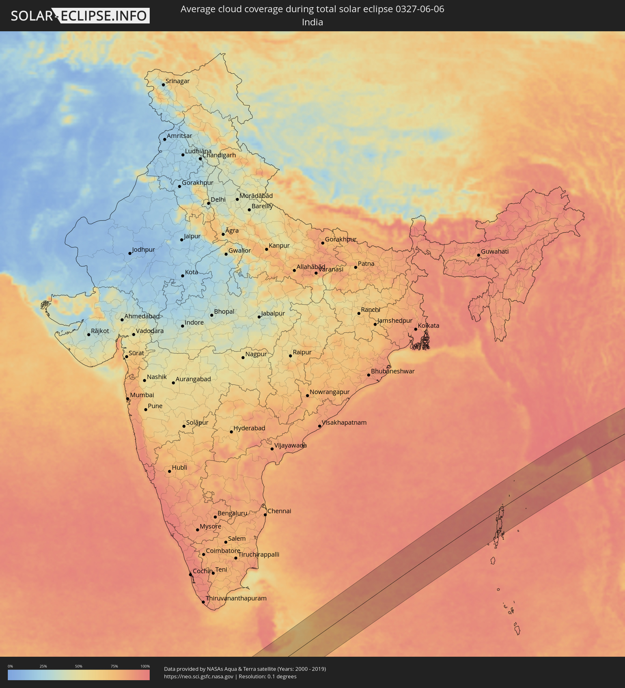 India
India
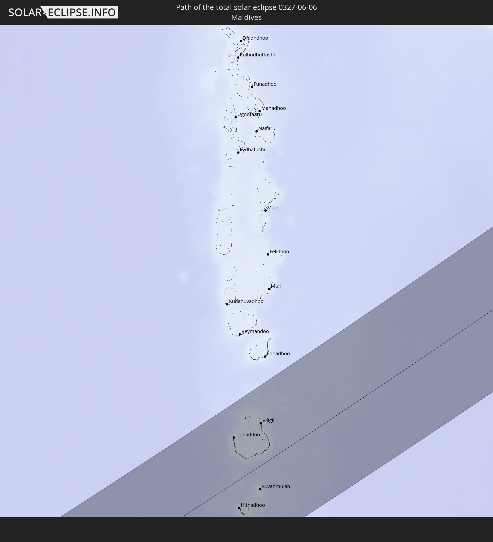
 Maldives
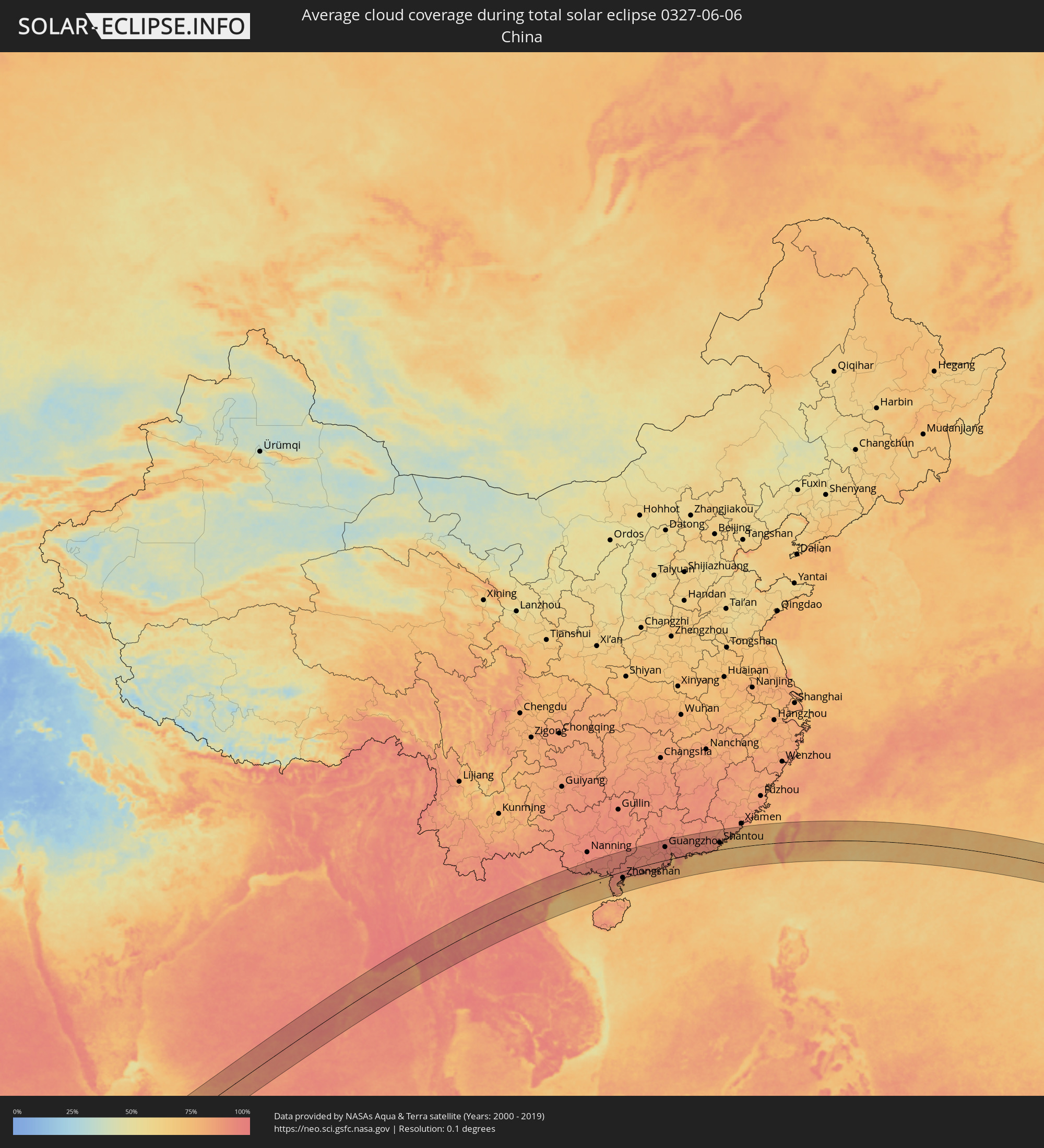 China
China
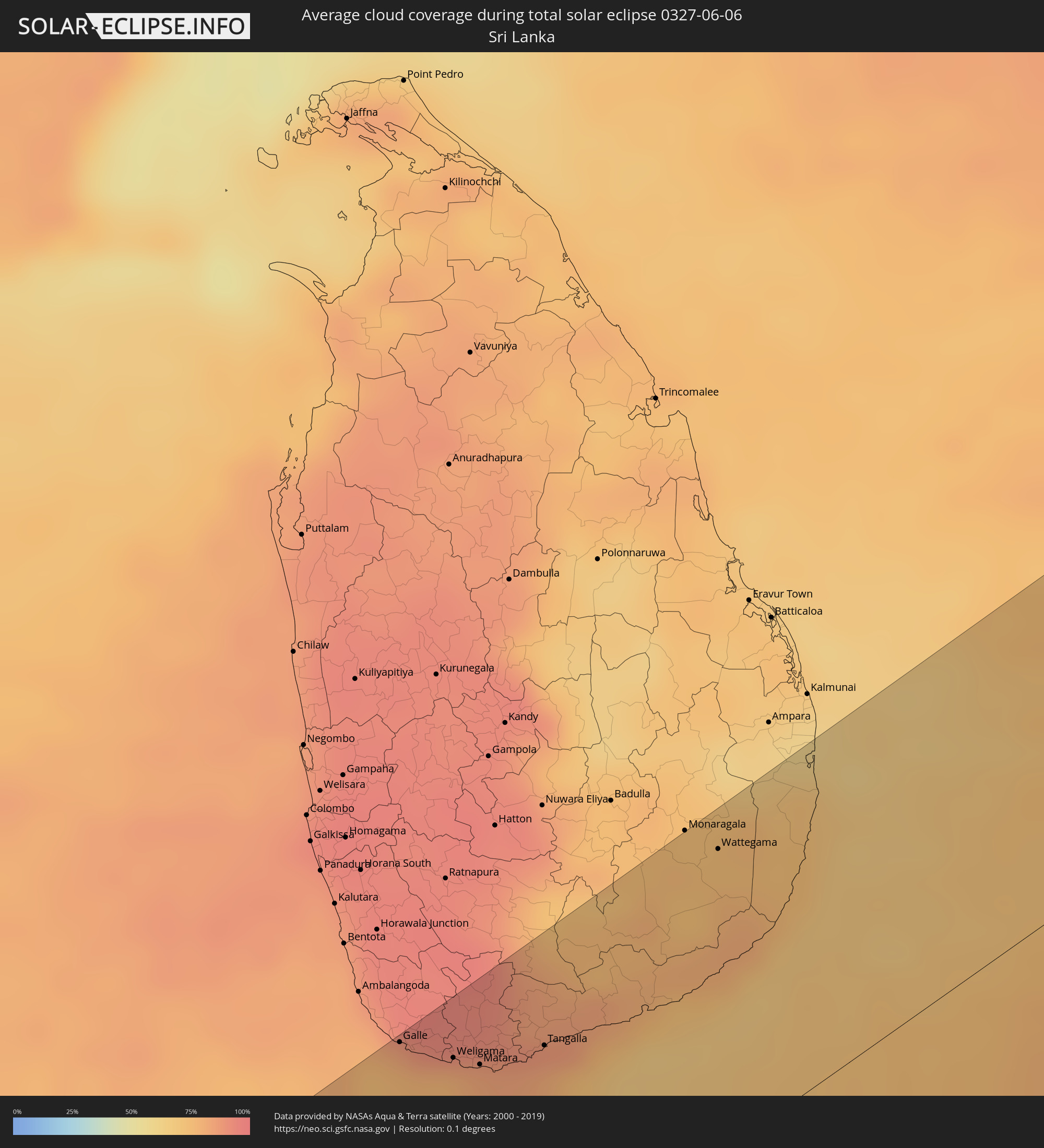 Sri Lanka
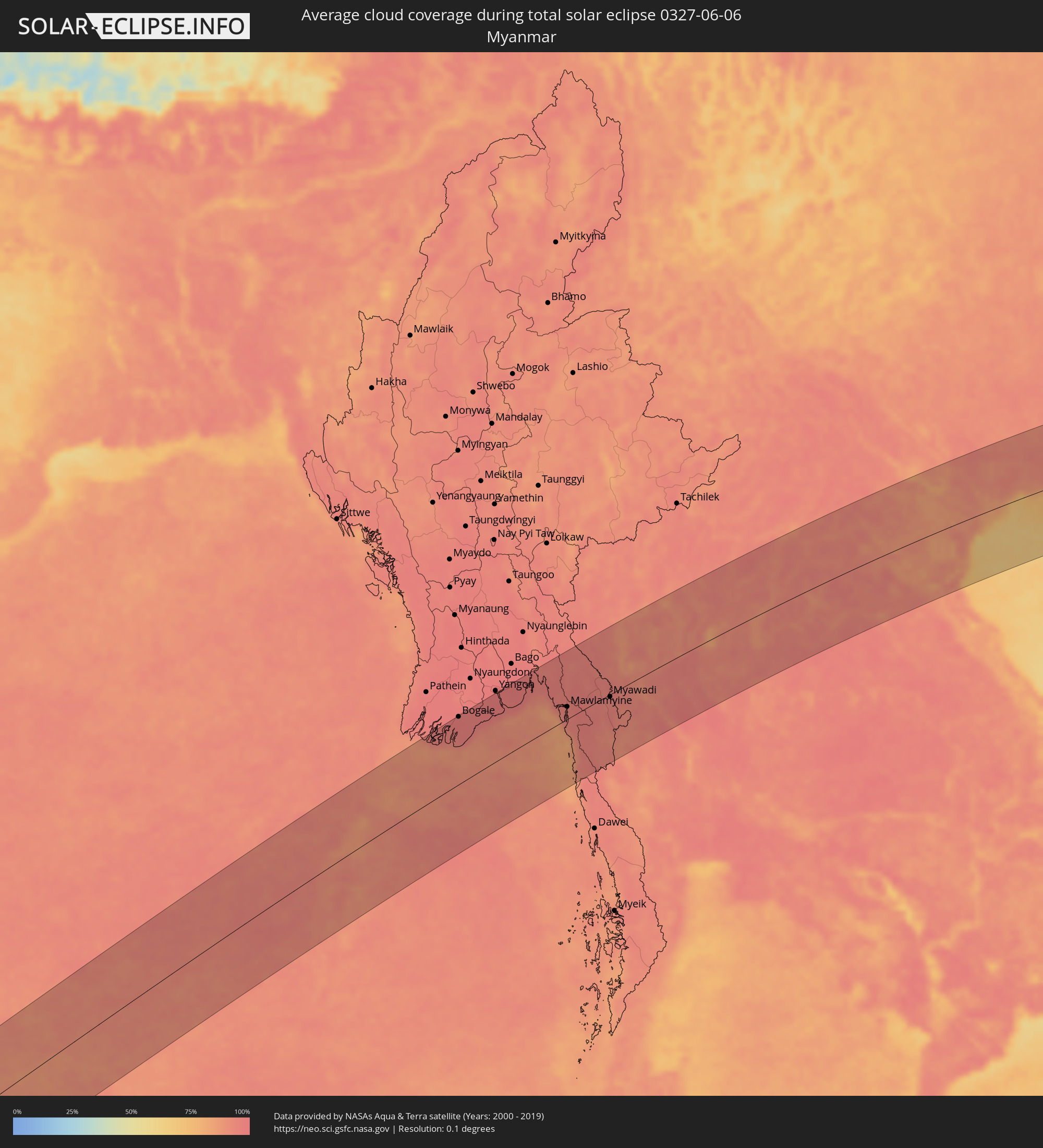 Myanmar
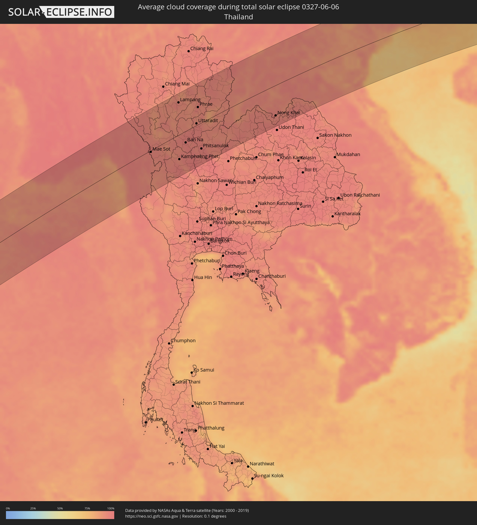 Thailand
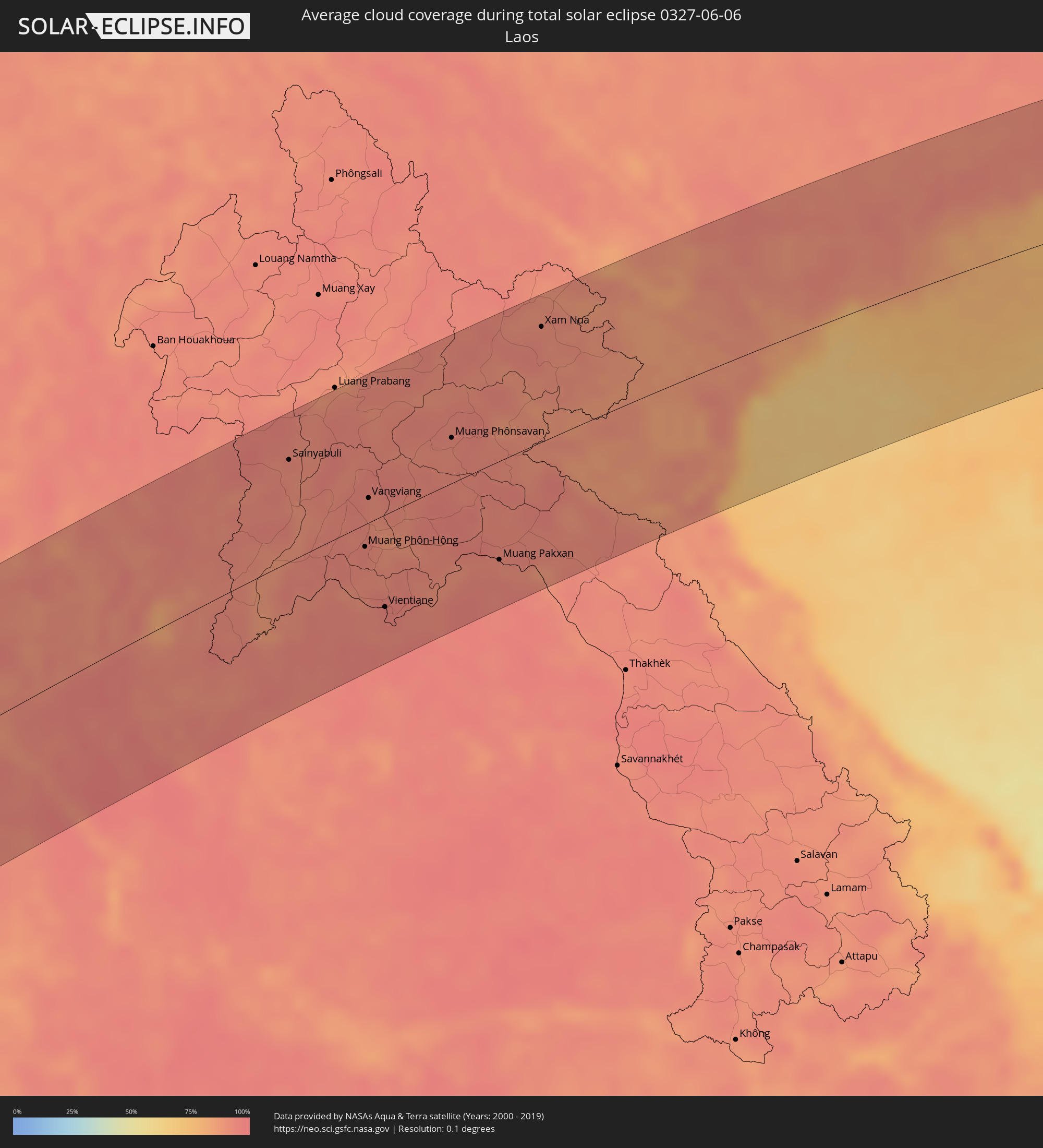 Laos
Laos
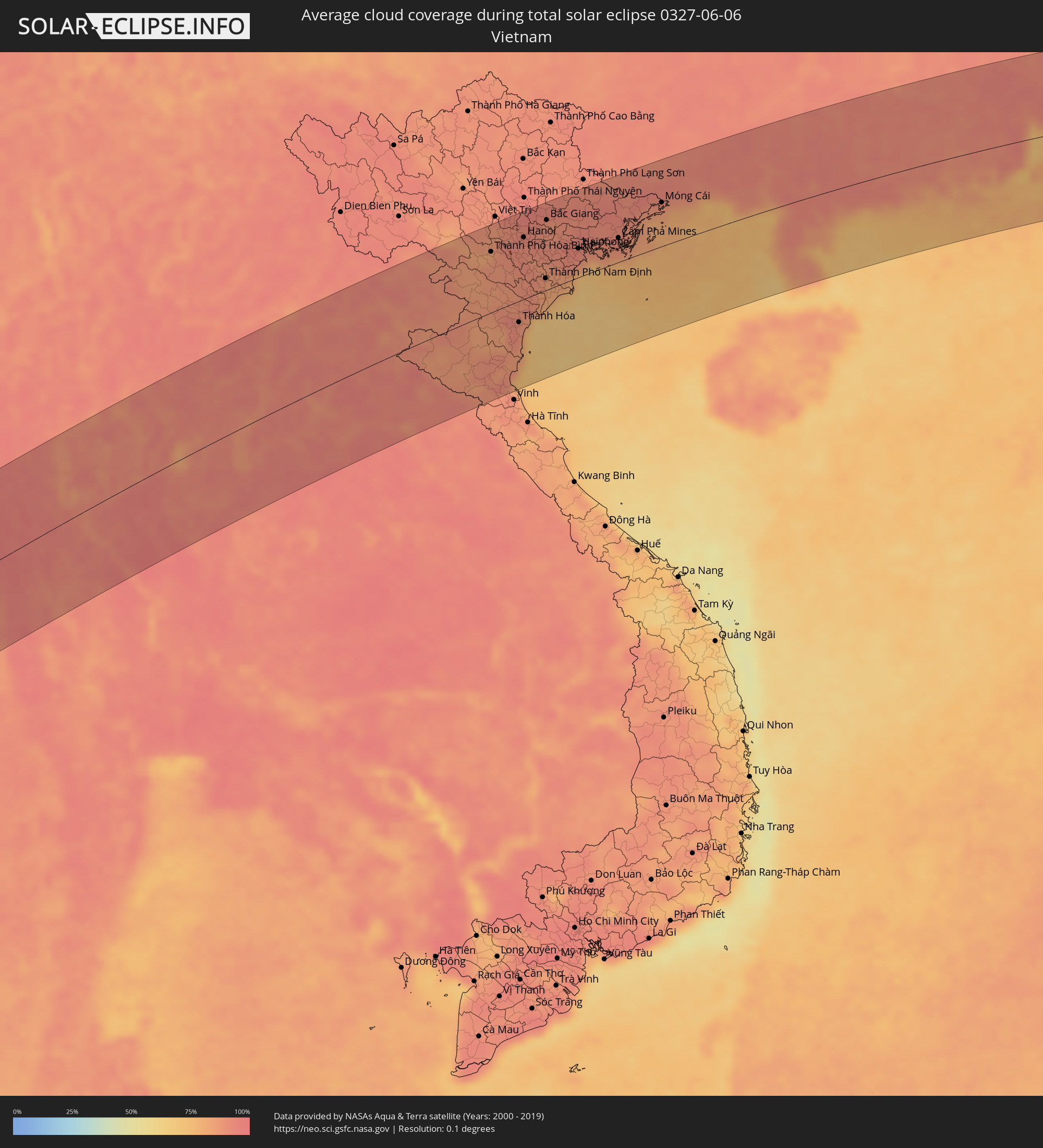 Vietnam
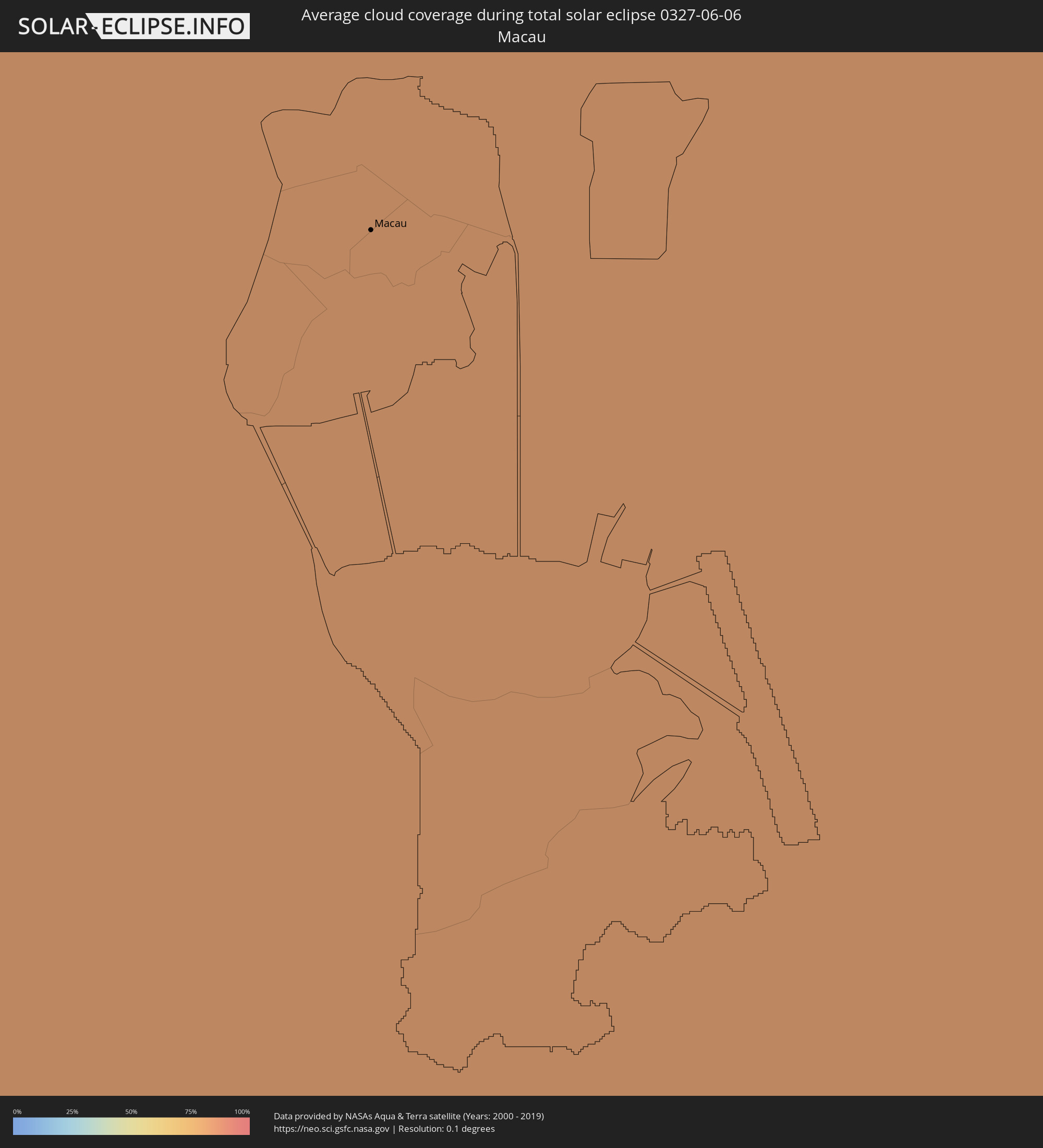 Macau
Macau
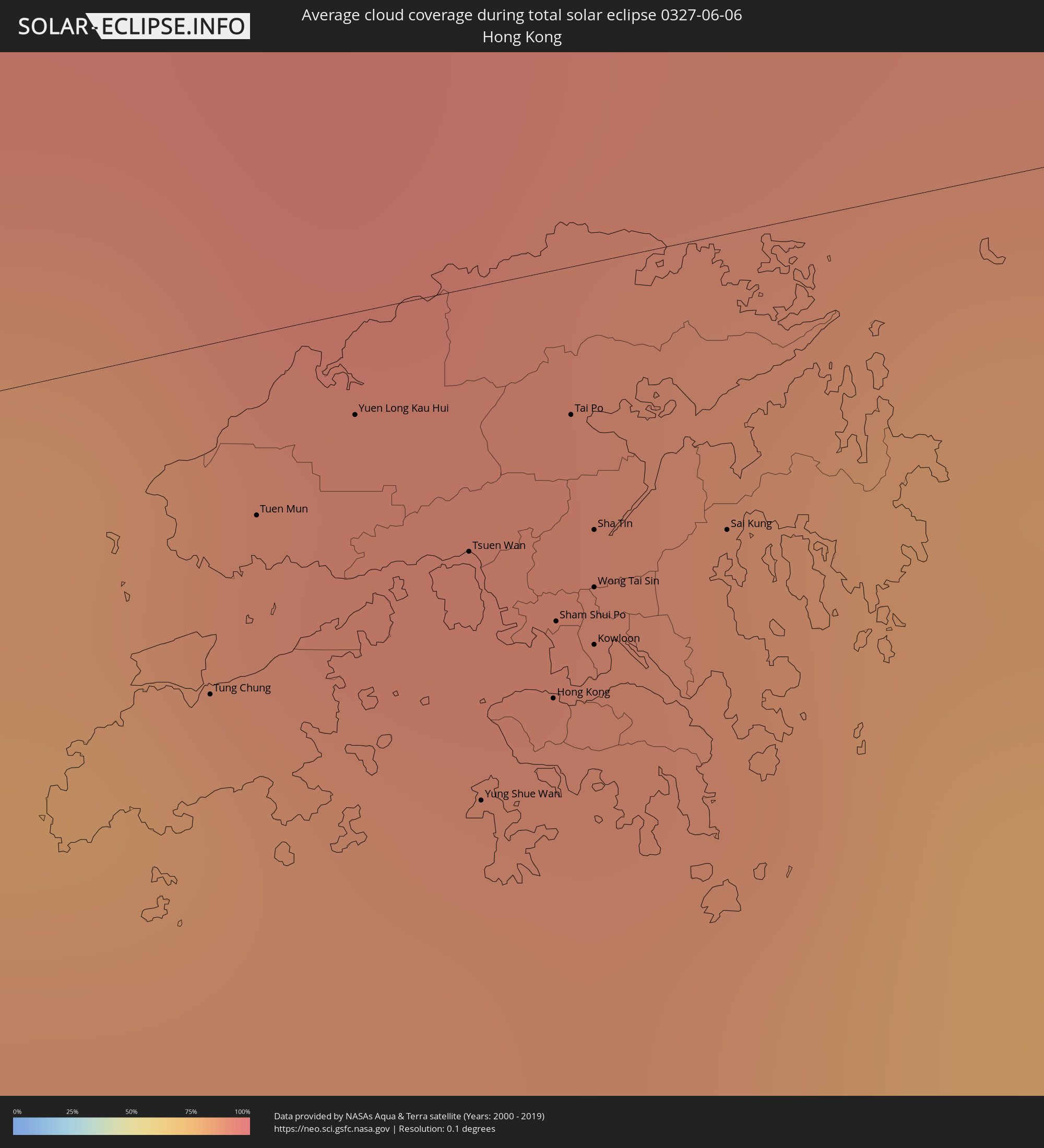 Hong Kong
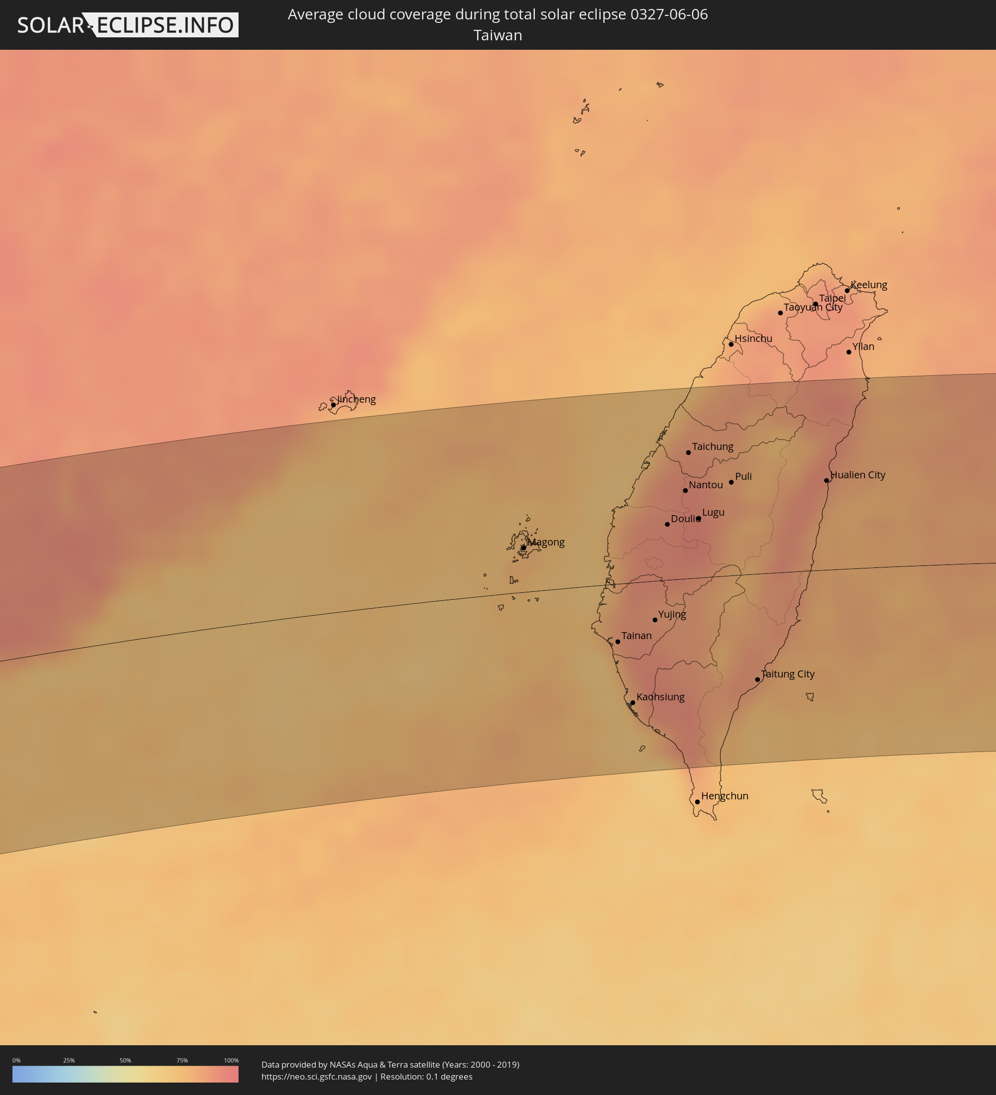 Taiwan
 Japan
Japan
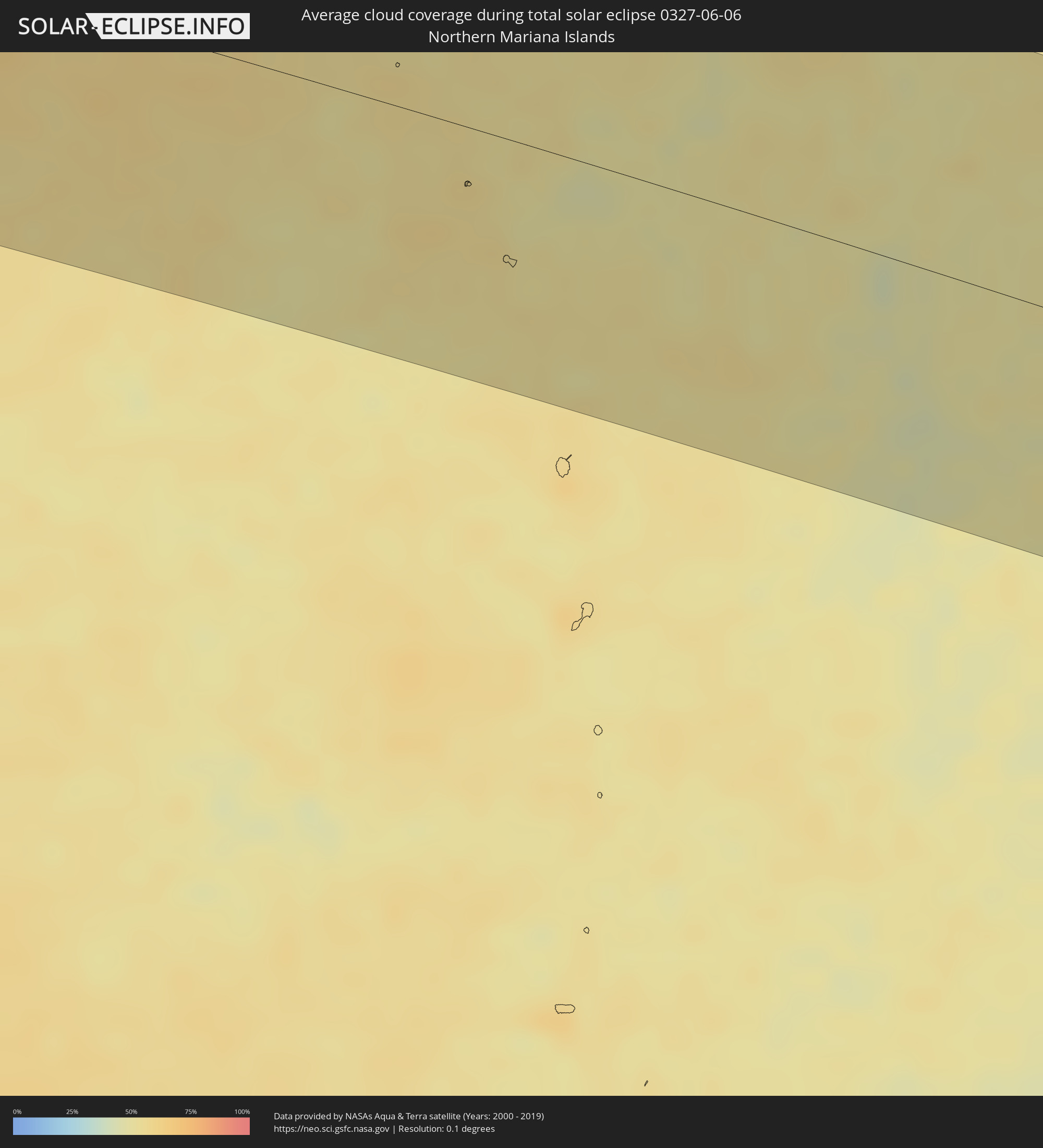 Northern Mariana Islands
 Marshall Islands
Cities inside the path of the eclipse
The following table shows all locations with a population of more than 5,000 inside the eclipse path. Cities which have more than 100,000 inhabitants are marked bold. A click at the locations opens a detailed map.
| City | Type | Eclipse duration | Local time of max. eclipse | Distance to central line | Ø Cloud coverage |
|
Hell-Ville, Diana
|
total | - | 05:33:59 UTC+02:27 | 16 km | 23% |
|
Ambanja, Diana
|
total | - | 05:33:55 UTC+02:27 | 21 km | 28% |
|
Antsohimbondrona, Diana
|
total | - | 05:34:01 UTC+02:27 | 23 km | 36% |
|
Ambarakaraka, Diana
|
total | - | 05:33:55 UTC+02:27 | 20 km | 36% |
|
Ambilobe, Diana
|
total | - | 05:33:59 UTC+02:27 | 2 km | 39% |
|
Antsiranana, Diana
|
total | - | 05:34:12 UTC+02:27 | 85 km | 39% |
|
Sadjoavato, Diana
|
total | - | 05:34:06 UTC+02:27 | 48 km | 56% |
|
Thinadhoo, Gaafu Dhaalu Atholhu
|
total | - | 08:16:39 UTC+04:54 | 68 km | 73% |
|
Hithadhoo
|
total | - | 08:15:42 UTC+04:54 | 43 km | 77% |
|
Fuvahmulah, Gnyaviyani Atoll
|
total | - | 08:16:15 UTC+04:54 | 35 km | 74% |
|
Viligili, Gaafu Alifu Atholhu
|
total | - | 08:17:14 UTC+04:54 | 62 km | 70% |
|
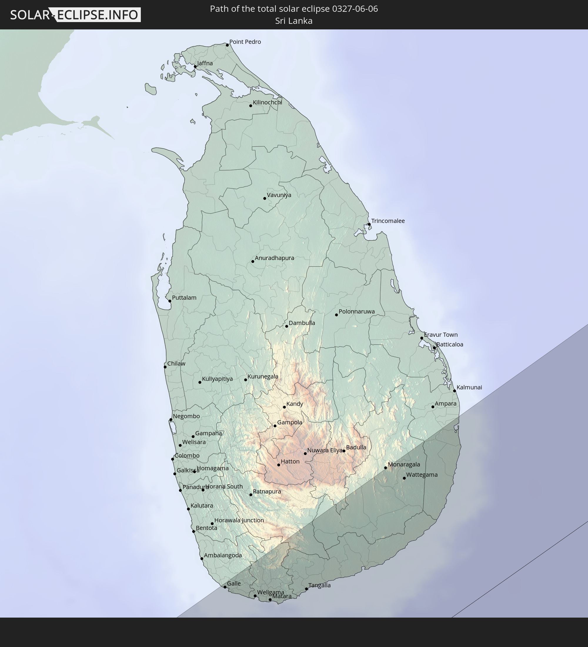
Galle, Southern
|
total | - | 08:55:29 UTC+05:19 | 121 km | 76% |
|
Weligama, Southern
|
total | - | 08:55:41 UTC+05:19 | 102 km | 78% |
|
Matara, Southern
|
total | - | 08:55:47 UTC+05:19 | 93 km | 76% |
|
Tangalla, Southern
|
total | - | 08:56:12 UTC+05:19 | 83 km | 80% |
|
Wattegama, Uva
|
total | - | 08:58:02 UTC+05:19 | 110 km | 74% |
|
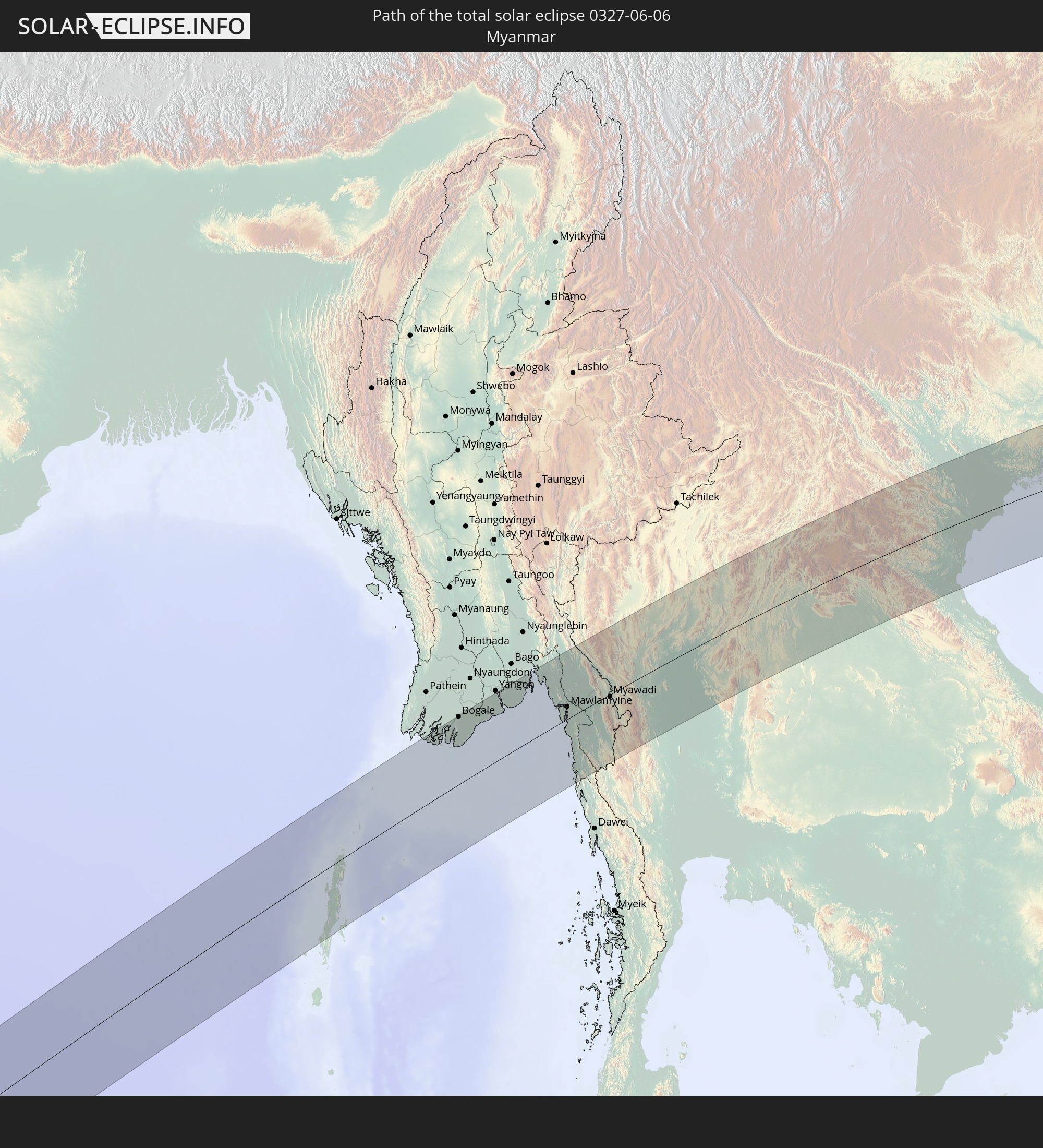
Bogale, Ayeyarwady
|
total | - | 10:40:37 UTC+06:24 | 127 km | 98% |
|
Pyapon, Ayeyarwady
|
total | - | 10:41:13 UTC+06:24 | 110 km | 97% |
|
Kyaiklat, Ayeyarwady
|
total | - | 10:41:33 UTC+06:24 | 123 km | 97% |
|
Syriam, Yangon
|
total | - | 10:43:09 UTC+06:24 | 125 km | 98% |
|
Thongwa, Yangon
|
total | - | 10:43:46 UTC+06:24 | 109 km | 98% |
|
Kayan, Yangon
|
total | - | 10:44:03 UTC+06:24 | 121 km | 98% |
|
Thaton, Mon
|
total | - | 10:45:53 UTC+06:24 | 78 km | 96% |
|
Kyaikkami, Mon
|
total | - | 10:45:09 UTC+06:24 | 13 km | 90% |
|
Martaban, Mon
|
total | - | 10:45:54 UTC+06:24 | 28 km | 95% |
|
Mawlamyine, Mon
|
total | - | 10:45:53 UTC+06:24 | 23 km | 95% |
|
Hpa-an, Kayin
|
total | - | 10:46:27 UTC+06:24 | 61 km | 96% |
|
Mudon, Mon
|
total | - | 10:45:46 UTC+06:24 | 5 km | 95% |
|
Myawadi, Kayin
|
total | - | 10:48:12 UTC+06:24 | 4 km | 95% |
|
Mae Sot, Tak
|
total | - | 11:05:39 UTC+06:42 | 5 km | 94% |
|
Tak, Tak
|
total | - | 11:07:12 UTC+06:42 | 19 km | 89% |
|
Lampang, Lampang
|
total | - | 11:10:00 UTC+06:42 | 101 km | 94% |
|
Kamphaeng Phet, Kamphaeng Phet
|
total | - | 11:07:37 UTC+06:42 | 77 km | 92% |
|
Ban Na, Sukhothai
|
total | - | 11:08:51 UTC+06:42 | 36 km | 95% |
|
Si Satchanalai, Sukhothai
|
total | - | 11:09:35 UTC+06:42 | 12 km | 95% |
|
Sawankhalok, Sukhothai
|
total | - | 11:09:29 UTC+06:42 | 11 km | 96% |
|
Uttaradit, Uttaradit
|
total | - | 11:10:32 UTC+06:42 | 6 km | 96% |
|
Phrae, Phrae
|
total | - | 11:11:21 UTC+06:42 | 55 km | 94% |
|
Phitsanulok, Phitsanulok
|
total | - | 11:09:52 UTC+06:42 | 81 km | 96% |
|
Phichit, Phichit
|
total | - | 11:09:34 UTC+06:42 | 123 km | 96% |
|
Nan, Nan
|
total | - | 11:13:44 UTC+06:42 | 86 km | 93% |
|
Sainyabuli, Xiagnabouli
|
total | - | 11:16:38 UTC+06:42 | 89 km | 92% |
|
Loei, Loei
|
total | - | 11:14:23 UTC+06:42 | 88 km | 94% |
|
Na Klang, Changwat Nong Bua Lamphu
|
total | - | 11:15:19 UTC+06:42 | 128 km | 95% |
|
Muang Phôn-Hông, Vientiane Province
|
total | - | 11:17:25 UTC+06:42 | 20 km | 94% |
|
Vangviang, Vientiane Province
|
total | - | 11:18:02 UTC+06:42 | 22 km | 93% |
|
Tha Bo, Nong Khai
|
total | - | 11:17:01 UTC+06:42 | 92 km | 93% |
|
Vientiane, Vientiane
|
total | - | 11:17:13 UTC+06:42 | 81 km | 95% |
|
Nong Khai, Nong Khai
|
total | - | 11:17:28 UTC+06:42 | 97 km | 93% |
|
Muang Phônsavan, Xiangkhoang
|
total | - | 11:20:38 UTC+06:42 | 40 km | 91% |
|
Muang Pakxan, Bolikhamsai Province
|
total | - | 11:20:27 UTC+06:42 | 87 km | 91% |
|
Xam Nua, Houaphan
|
total | - | 11:23:54 UTC+06:42 | 102 km | 93% |
|
Thành Phố Hòa Bình, Hòa Bình
|
total | - | 11:52:15 UTC+07:06 | 90 km | 85% |
|
Sơn Tây, Ha Nội
|
total | - | 11:53:03 UTC+07:06 | 117 km | 90% |
|
Thanh Hóa, Thanh Hóa
|
total | - | 11:52:13 UTC+07:06 | 32 km | 88% |
|
Hà Đông, Ha Nội
|
total | - | 11:53:33 UTC+07:06 | 89 km | 91% |
|
Hanoi, Ha Nội
|
total | - | 11:53:46 UTC+07:06 | 92 km | 91% |
|
Bỉm Sơn, Thanh Hóa
|
total | - | 11:52:47 UTC+07:06 | 7 km | 90% |
|
Bắc Ninh, Bắc Ninh
|
total | - | 11:54:33 UTC+07:06 | 99 km | 90% |
|
Thành Phố Nam Định, Nam Định
|
total | - | 11:54:00 UTC+07:06 | 18 km | 83% |
|
Bắc Giang, Bắc Giang
|
total | - | 11:54:57 UTC+07:06 | 104 km | 90% |
|
Thành Phố Hải Dương, Hải Dương
|
total | - | 11:54:57 UTC+07:06 | 64 km | 91% |
|
Thành Phố Thái Bình, Thái Bình
|
total | - | 11:54:27 UTC+07:06 | 13 km | 85% |
|
Haiphong, Hải Phòng
|
total | - | 11:55:47 UTC+07:06 | 43 km | 91% |
|
Thành Phố Uông Bí, Quảng Ninh
|
total | - | 11:56:12 UTC+07:06 | 58 km | 90% |
|
Thành Phố Hạ Long, Quảng Ninh
|
total | - | 11:56:54 UTC+07:06 | 38 km | 89% |
|
Cẩm Phả Mines, Quảng Ninh
|
total | - | 11:57:34 UTC+07:06 | 36 km | 90% |
|
Móng Cái, Quảng Ninh
|
total | - | 11:59:49 UTC+07:06 | 66 km | 86% |
|
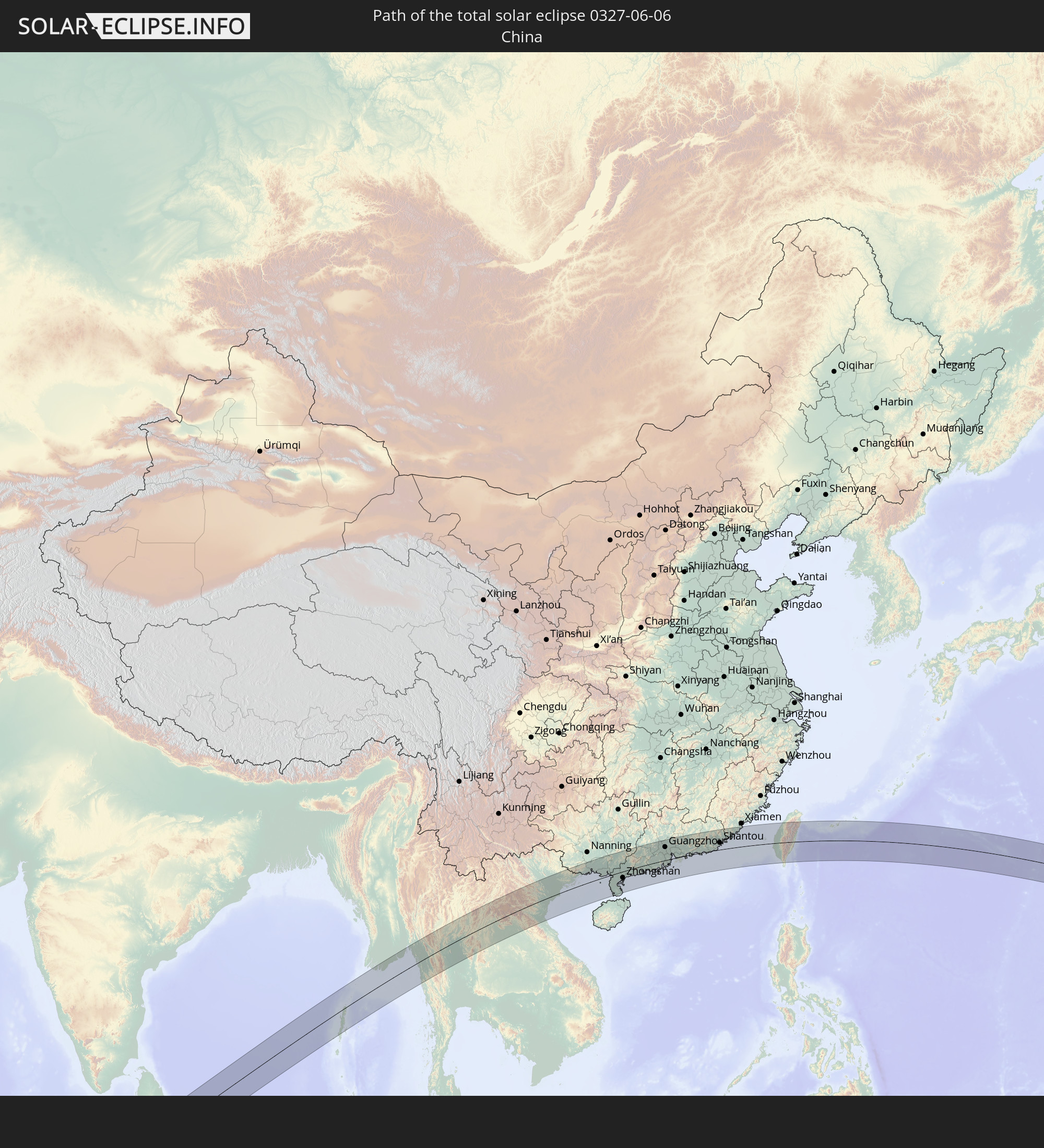
Beihai, Guangxi Zhuang Autonomous Region
|
total | - | 12:56:06 UTC+08:00 | 24 km | 81% |
|
Zhanjiang, Guangdong
|
total | - | 12:59:14 UTC+08:00 | 37 km | 92% |
|
Zhongshan, Guangdong
|
total | - | 12:59:53 UTC+08:00 | 39 km | 85% |
|
Yangjiang, Guangdong
|
total | - | 13:04:03 UTC+08:00 | 21 km | 87% |
|
Yunfu, Guangdong
|
total | - | 13:05:05 UTC+08:00 | 93 km | 92% |
|
Zhaoqing, Guangdong
|
total | - | 13:06:16 UTC+08:00 | 95 km | 92% |
|
Jiangmen, Guangdong
|
total | - | 13:07:34 UTC+08:00 | 30 km | 93% |
|
Foshan, Guangdong
|
total | - | 13:08:00 UTC+08:00 | 77 km | 92% |
|
Guangzhou, Guangdong
|
total | - | 13:08:22 UTC+08:00 | 84 km | 94% |
|
Shiqi, Guangdong
|
total | - | 13:08:19 UTC+08:00 | 15 km | 94% |
|
Macau, Macau
|
total | - | 12:42:42 UTC+07:34 | 23 km | 89% |
|
Zhuhai, Guangdong
|
total | - | 13:08:39 UTC+08:00 | 15 km | 81% |
|
Dongguan, Guangdong
|
total | - | 13:09:37 UTC+08:00 | 62 km | 93% |
|
Tung Chung, Islands
|
total | - | 12:46:21 UTC+07:36 | 22 km | 84% |
|
Tuen Mun, Tuen Mun
|
total | - | 12:46:29 UTC+07:36 | 11 km | 84% |
|
Yuen Long Kau Hui, Yuen Long
|
total | - | 12:46:41 UTC+07:36 | 6 km | 88% |
|
Shenzhen, Guangdong
|
total | - | 13:10:09 UTC+08:00 | 3 km | 91% |
|
Tsuen Wan, Tsuen Wan
|
total | - | 12:46:50 UTC+07:36 | 17 km | 88% |
|
Yung Shue Wan
|
total | - | 12:46:45 UTC+07:36 | 33 km | 75% |
|
Hong Kong, Central and Western
|
total | - | 12:46:55 UTC+07:36 | 27 km | 86% |
|
Central, Central and Western
|
total | - | 12:46:55 UTC+07:36 | 27 km | 86% |
|
Sham Shui Po, Sham Shui Po
|
total | - | 12:46:57 UTC+07:36 | 22 km | 86% |
|
Tai Po, Tai Po
|
total | - | 12:47:03 UTC+07:36 | 9 km | 89% |
|
Wan Chai, Wanchai
|
total | - | 12:46:57 UTC+07:36 | 28 km | 86% |
|
Kowloon, Kowloon City
|
total | - | 12:47:00 UTC+07:36 | 24 km | 86% |
|
Wong Tai Sin, Wong Tai Sin
|
total | - | 12:47:01 UTC+07:36 | 21 km | 88% |
|
Sha Tin, Sha Tin
|
total | - | 12:47:03 UTC+07:36 | 17 km | 88% |
|
Sai Kung, Sai Kung
|
total | - | 12:47:16 UTC+07:36 | 19 km | 86% |
|
Jieyang, Guangdong
|
total | - | 13:16:41 UTC+08:00 | 69 km | 91% |
|
Chaozhou, Guangdong
|
total | - | 13:17:24 UTC+08:00 | 77 km | 92% |
|
Shantou, Guangdong
|
total | - | 13:17:30 UTC+08:00 | 44 km | 86% |
|
Magong, Taiwan
|
total | - | 13:24:50 UTC+08:00 | 30 km | 76% |
|
Tainan, Taiwan
|
total | - | 13:26:14 UTC+08:00 | 40 km | 78% |
|
Kaohsiung, Takao
|
total | - | 13:26:23 UTC+08:00 | 82 km | 73% |
|
Yujing, Taiwan
|
total | - | 13:26:53 UTC+08:00 | 27 km | 87% |
|
Douliu, Taiwan
|
total | - | 13:27:14 UTC+08:00 | 37 km | 90% |
|
Nantou, Taiwan
|
total | - | 13:27:35 UTC+08:00 | 59 km | 91% |
|
Taichung, Taiwan
|
total | - | 13:27:41 UTC+08:00 | 85 km | 90% |
|
Zhongxing New Village, Taiwan
|
total | - | 13:27:39 UTC+08:00 | 64 km | 91% |
|
Lugu, Taiwan
|
total | - | 13:27:45 UTC+08:00 | 40 km | 91% |
|
Puli, Taiwan
|
total | - | 13:28:20 UTC+08:00 | 63 km | 82% |
|
Taitung City, Taiwan
|
total | - | 13:28:30 UTC+08:00 | 72 km | 85% |
|
Hualien City, Taiwan
|
total | - | 13:29:52 UTC+08:00 | 60 km | 86% |
|
Ishigaki, Okinawa
|
total | - | 14:35:52 UTC+09:00 | 94 km | 82% |
|
Utrik, Utrik Atoll
|
total | - | 17:31:37 UTC+11:00 | 7 km | 68% |
|
Ailuk, Ailuk Atoll
|
total | - | 17:31:54 UTC+11:00 | 104 km | 73% |
|
Mejit, Mejit Island
|
total | - | 17:31:55 UTC+11:00 | 61 km | 72% |