Total solar eclipse of 07/17/0353
| Day of week: | Friday |
| Maximum duration of eclipse: | 03m27s |
| Maximum width of eclipse path: | 124 km |
| Saros cycle: | 90 |
| Coverage: | 100% |
| Magnitude: | 1.0341 |
| Gamma: | -0.389 |
Wo kann man die Sonnenfinsternis vom 07/17/0353 sehen?
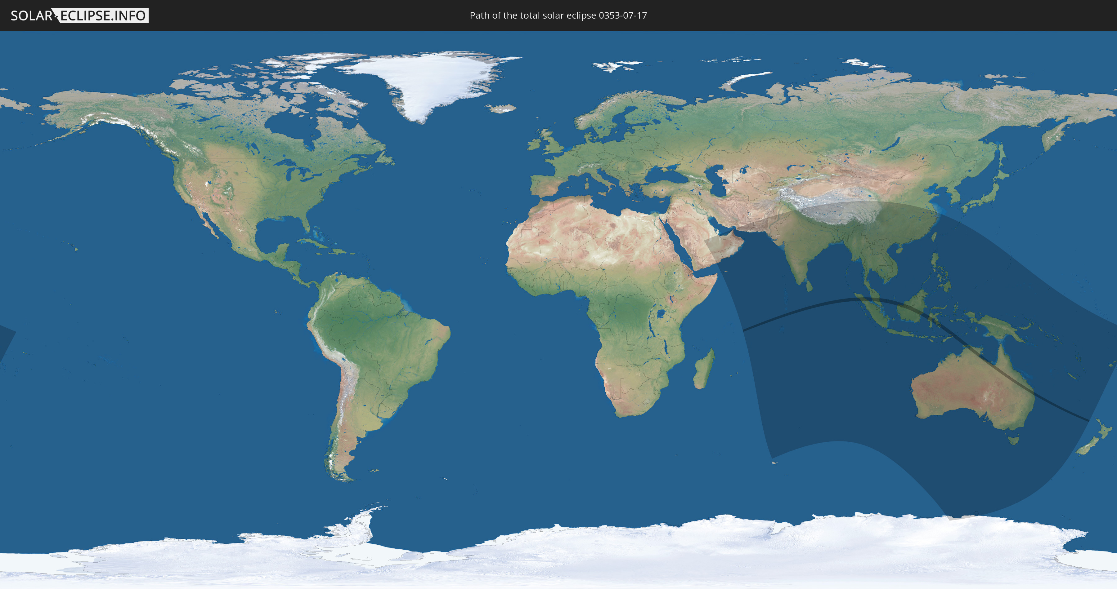
Die Sonnenfinsternis am 07/17/0353 kann man in 48 Ländern als partielle Sonnenfinsternis beobachten.
Der Finsternispfad verläuft durch 4 Länder. Nur in diesen Ländern ist sie als total Sonnenfinsternis zu sehen.
In den folgenden Ländern ist die Sonnenfinsternis total zu sehen
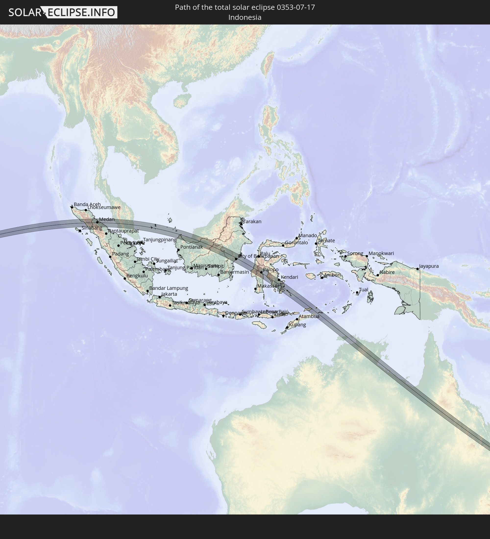 Indonesia
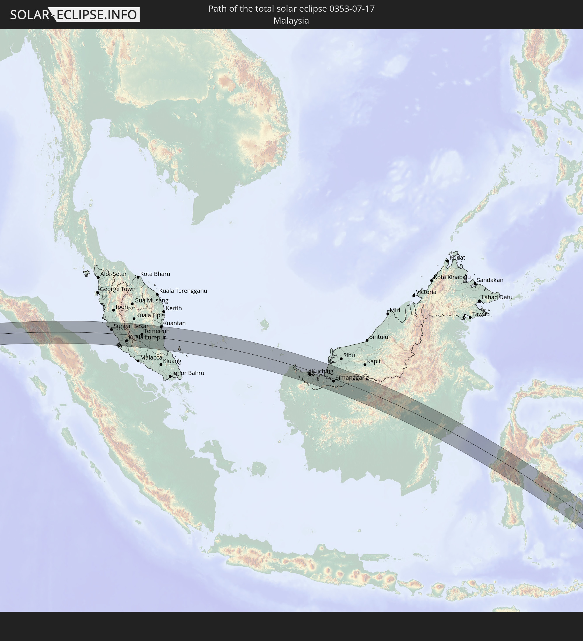 Malaysia
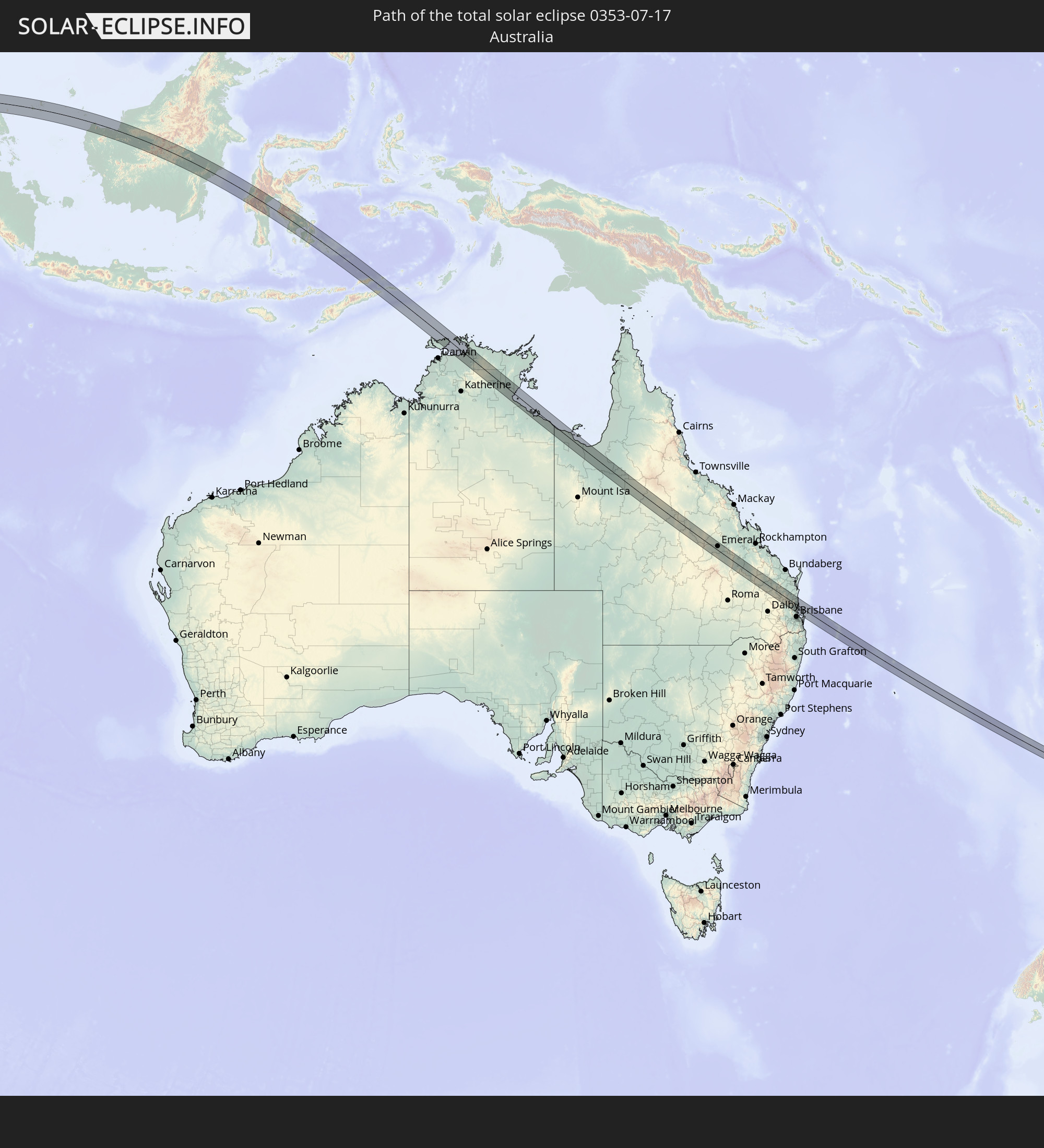 Australia
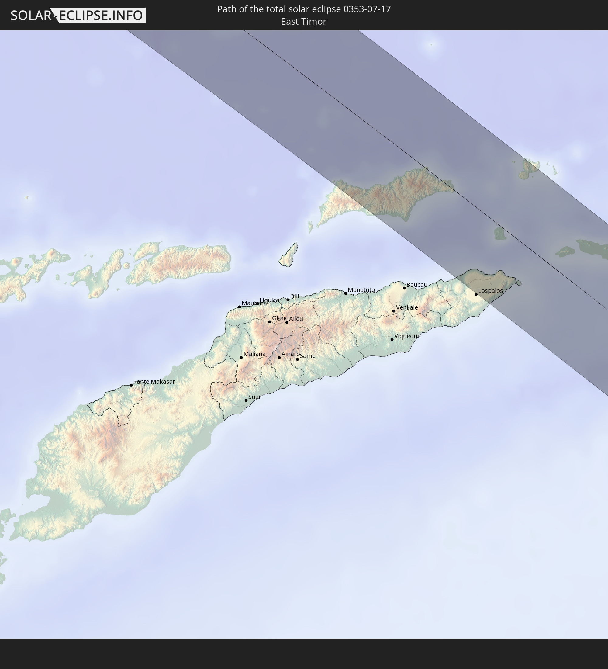 East Timor
In den folgenden Ländern ist die Sonnenfinsternis partiell zu sehen
 Antarctica
 Fiji
Fiji
 Kiribati
 Saudi Arabia
 French Southern and Antarctic Lands
 Yemen
Yemen
 Iran
Iran
 United Arab Emirates
 Oman
Oman
 Mauritius
 Pakistan
 India
India
 British Indian Ocean Territory
 Maldives
 China
China
 Sri Lanka
 Nepal
Nepal
 Bangladesh
 Bhutan
 Myanmar
 Indonesia
 Cocos Islands
 Thailand
 Malaysia
 Laos
Laos
 Vietnam
 Cambodia
 Singapore
 Christmas Island
 Australia
 Macau
Macau
 Hong Kong
 Brunei
 Taiwan
 Philippines
 Japan
Japan
 East Timor
 Palau
Palau
 Federated States of Micronesia
 Papua New Guinea
 Guam
Guam
 Northern Mariana Islands
 Solomon Islands
 New Caledonia
 Vanuatu
 Nauru
Nauru
 Norfolk Island
 Tuvalu
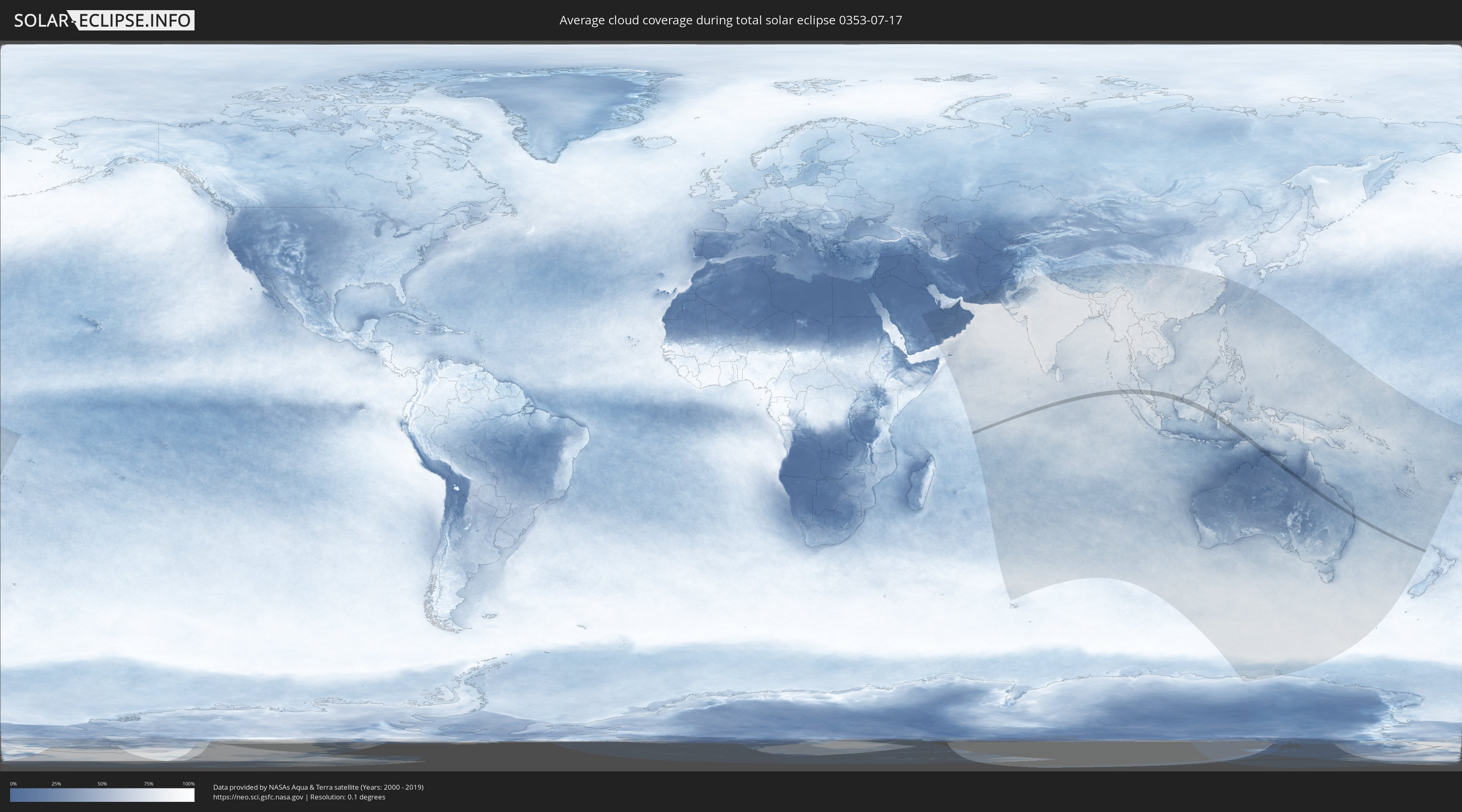
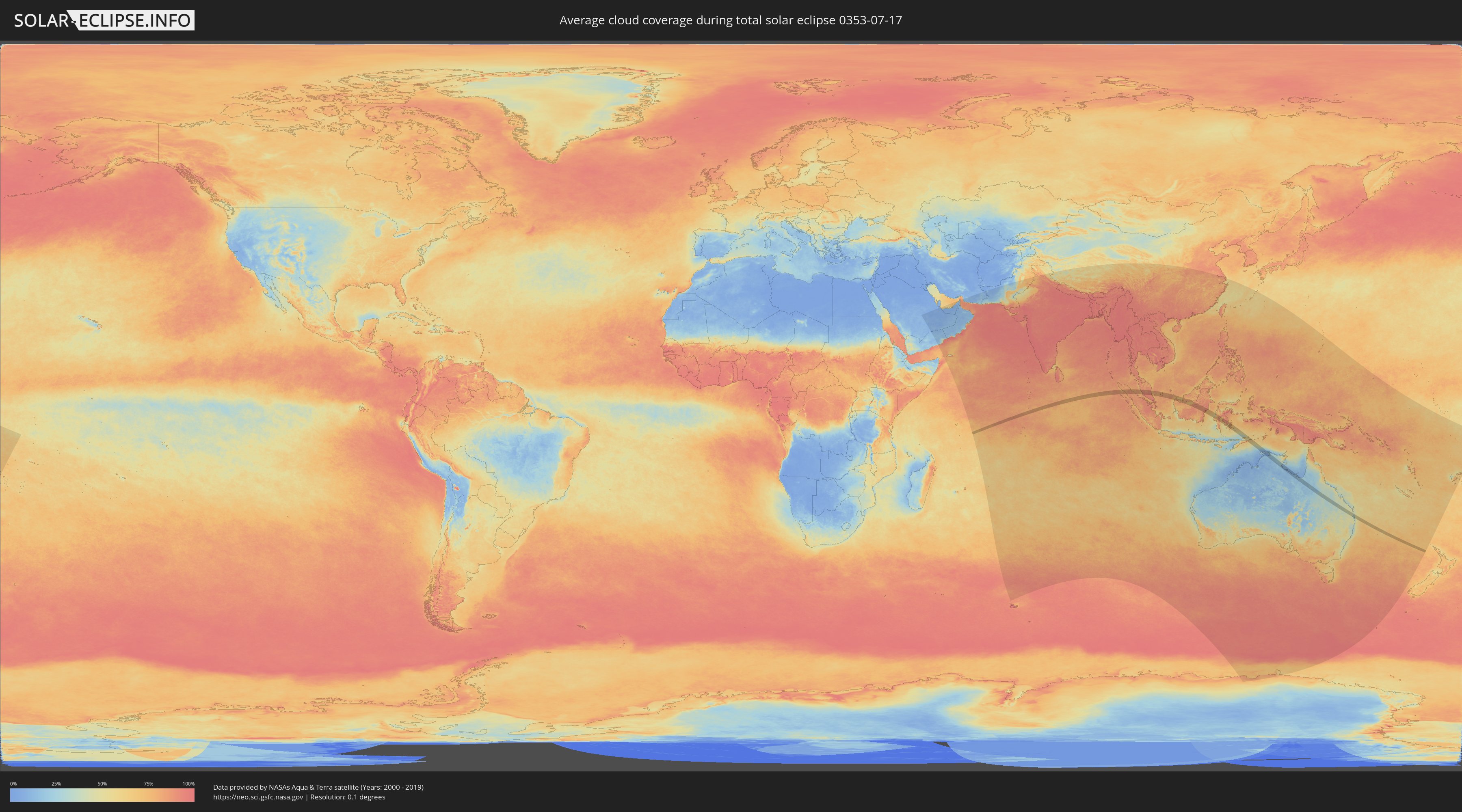
How will be the weather during the total solar eclipse on 07/17/0353?
Where is the best place to see the total solar eclipse of 07/17/0353?
The following maps show the average cloud coverage for the day of the total solar eclipse.
With the help of these maps, it is possible to find the place along the eclipse path, which has the best
chance of a cloudless sky.
Nevertheless, you should consider local circumstances and inform about the weather of your chosen
observation site.
The data is provided by NASAs satellites
AQUA and TERRA.
The cloud maps are averaged over a period of 19 years (2000 - 2019).
Detailed country maps
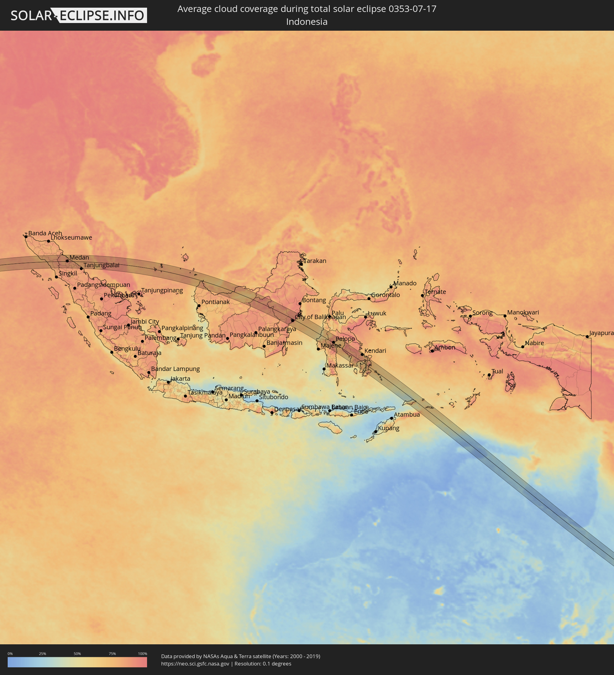 Indonesia
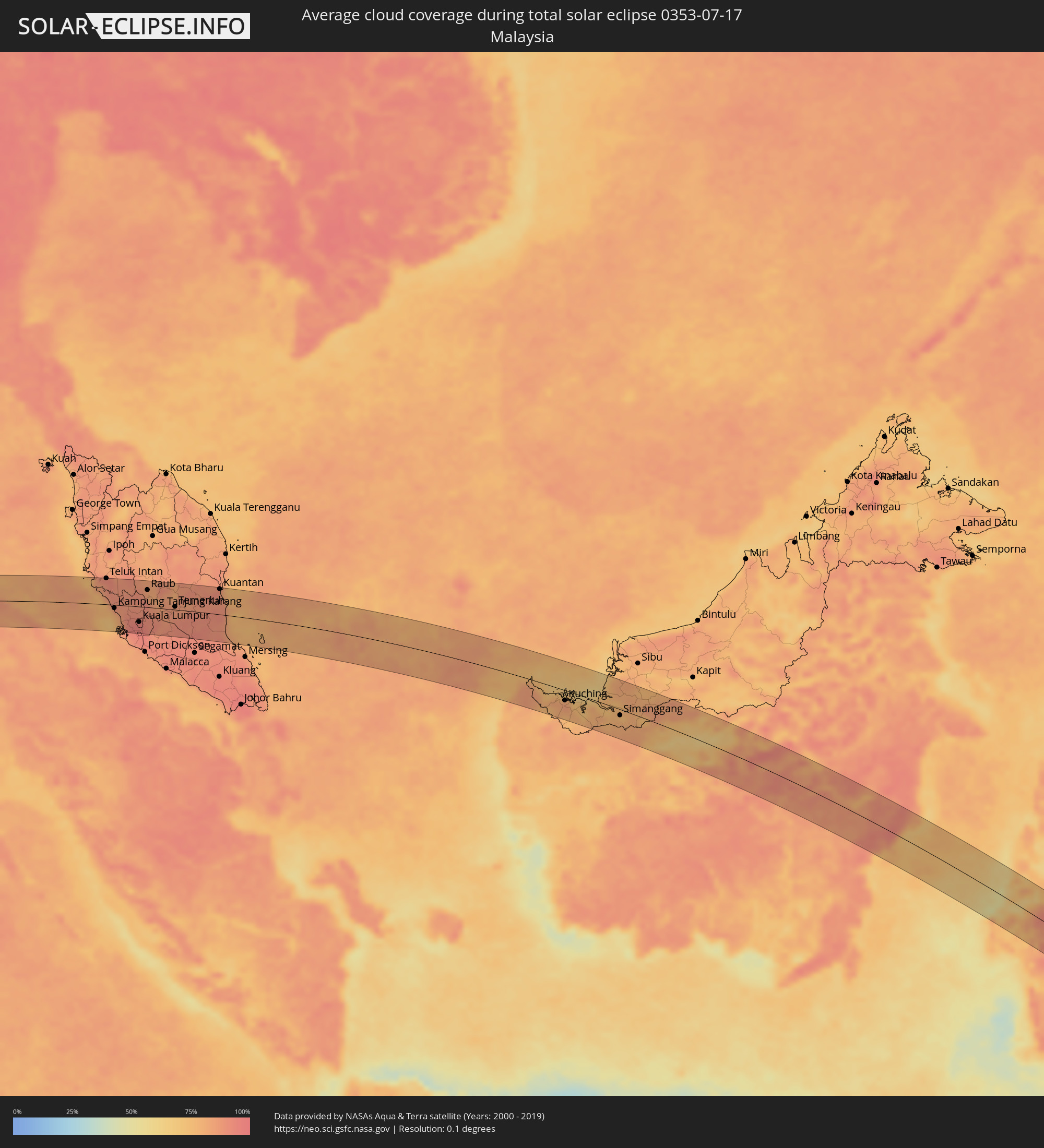 Malaysia
 Australia
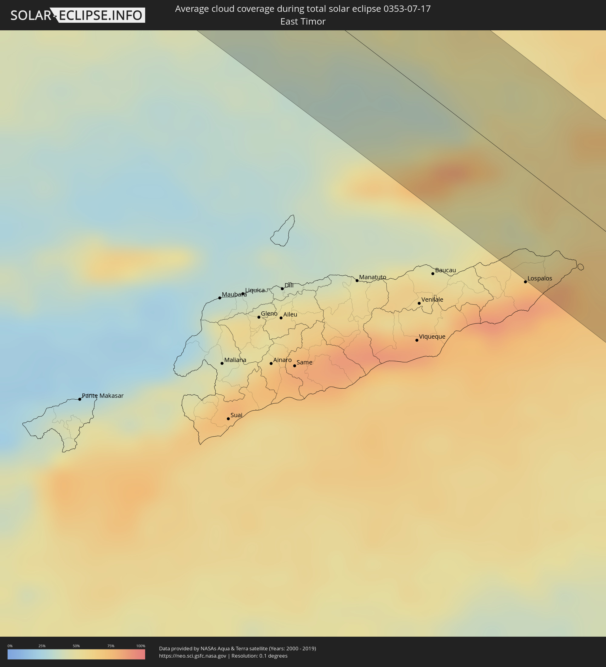 East Timor
Cities inside the path of the eclipse
The following table shows all locations with a population of more than 5,000 inside the eclipse path. Cities which have more than 100,000 inhabitants are marked bold. A click at the locations opens a detailed map.
| City | Type | Eclipse duration | Local time of max. eclipse | Distance to central line | Ø Cloud coverage |
|
Pangkalan Brandan, North Sumatra
|
total | - | 10:04:46 UTC+07:07 | 50 km | 85% |
|
Tanjungtiram, North Sumatra
|
total | - | 10:04:58 UTC+07:07 | 54 km | 77% |
|
Stabat, North Sumatra
|
total | - | 10:05:23 UTC+07:07 | 18 km | 88% |
|
Binjai, North Sumatra
|
total | - | 10:05:34 UTC+07:07 | 3 km | 87% |
|
Kabanjahe, North Sumatra
|
total | - | 10:05:55 UTC+07:07 | 53 km | 85% |
|
Berastagi, North Sumatra
|
total | - | 10:05:53 UTC+07:07 | 42 km | 86% |
|
Sunggal, North Sumatra
|
total | - | 10:05:54 UTC+07:07 | 1 km | 90% |
|
Medan, North Sumatra
|
total | - | 10:06:01 UTC+07:07 | 1 km | 91% |
|
Labuhan Deli, North Sumatra
|
total | - | 10:05:57 UTC+07:07 | 17 km | 91% |
|
Belawan, North Sumatra
|
total | - | 10:05:56 UTC+07:07 | 23 km | 84% |
|
Deli Tua, North Sumatra
|
total | - | 10:06:07 UTC+07:07 | 7 km | 87% |
|
Percut, North Sumatra
|
total | - | 10:06:30 UTC+07:07 | 6 km | 87% |
|
Perbaungan, North Sumatra
|
total | - | 10:06:46 UTC+07:07 | 1 km | 85% |
|
Tebingtinggi, North Sumatra
|
total | - | 10:07:27 UTC+07:07 | 27 km | 82% |
|
Pekan Bahapal, North Sumatra
|
total | - | 10:07:38 UTC+07:07 | 51 km | 83% |
|
Sungai Besar, Selangor
|
total | - | 10:00:10 UTC+06:55 | 19 km | 83% |
|
Sabak Bernam, Selangor
|
total | - | 10:00:06 UTC+06:55 | 30 km | 87% |
|
Teluk Intan, Perak
|
total | - | 10:00:00 UTC+06:55 | 59 km | 89% |
|
Kampung Tanjung Karang, Selangor
|
total | - | 10:00:54 UTC+06:55 | 7 km | 80% |
|
Kuala Selangor, Selangor
|
total | - | 10:01:08 UTC+06:55 | 15 km | 87% |
|
Kampong Dungun, Perak
|
total | - | 10:01:25 UTC+06:55 | 29 km | 82% |
|
Batang Berjuntai, Selangor
|
total | - | 10:01:33 UTC+06:55 | 10 km | 89% |
|
Klang, Selangor
|
total | - | 10:01:55 UTC+06:55 | 49 km | 93% |
|
Batu Arang, Selangor
|
total | - | 10:01:44 UTC+06:55 | 17 km | 92% |
|
Ladang Seri Kundang, Selangor
|
total | - | 10:01:54 UTC+06:55 | 20 km | 92% |
|
Shah Alam, Selangor
|
total | - | 10:02:06 UTC+06:55 | 42 km | 95% |
|
Kampung Baru Subang, Selangor
|
total | - | 10:02:03 UTC+06:55 | 35 km | 94% |
|
Kuang, Selangor
|
total | - | 10:02:01 UTC+06:55 | 23 km | 92% |
|
Putra Heights, Selangor
|
total | - | 10:02:17 UTC+06:55 | 52 km | 94% |
|
Rawang, Selangor
|
total | - | 10:02:02 UTC+06:55 | 16 km | 92% |
|
Subang Jaya, Selangor
|
total | - | 10:02:16 UTC+06:55 | 46 km | 94% |
|
Serendah, Selangor
|
total | - | 10:02:04 UTC+06:55 | 11 km | 90% |
|
Petaling Jaya, Selangor
|
total | - | 10:02:17 UTC+06:55 | 39 km | 95% |
|
Kuala Lumpur, Kuala Lumpur
|
total | - | 10:02:29 UTC+06:55 | 35 km | 95% |
|
Putrajaya, Putrajaya
|
total | - | 10:02:39 UTC+06:55 | 57 km | 94% |
|
Kampong Baharu Balakong, Selangor
|
total | - | 10:02:44 UTC+06:55 | 46 km | 94% |
|
Kampung Bukit Tinggi, Bentong, Pahang
|
total | - | 10:02:41 UTC+06:55 | 10 km | 91% |
|
Semenyih, Selangor
|
total | - | 10:03:04 UTC+06:55 | 54 km | 94% |
|
Raub, Pahang
|
total | - | 10:02:25 UTC+06:55 | 39 km | 81% |
|
Bentong Town, Pahang
|
total | - | 10:02:46 UTC+06:55 | 10 km | 88% |
|
Mentekab, Pahang
|
total | - | 10:04:00 UTC+06:55 | 10 km | 88% |
|
Jerantut, Pahang
|
total | - | 10:03:41 UTC+06:55 | 60 km | 82% |
|
Temerluh, Pahang
|
total | - | 10:04:14 UTC+06:55 | 7 km | 86% |
|
Kuantan, Pahang
|
total | - | 10:06:26 UTC+06:55 | 57 km | 90% |
|
Pekan, Pahang
|
total | - | 10:06:56 UTC+06:55 | 22 km | 89% |
|
Kuching, Sarawak
|
total | - | 10:55:28 UTC+07:21 | 22 km | 83% |
|
Simanggang, Sarawak
|
total | - | 10:59:18 UTC+07:21 | 13 km | 78% |
|
Balikpapan, East Kalimantan
|
total | - | 11:55:27 UTC+07:57 | 21 km | 76% |
|
City of Balikpapan, East Kalimantan
|
total | - | 11:55:37 UTC+07:57 | 15 km | 85% |
|
Loa Janan, East Kalimantan
|
total | - | 11:55:16 UTC+07:57 | 60 km | 92% |
|
Mamuju, West Sulawesi
|
total | - | 12:03:35 UTC+07:57 | 44 km | 72% |
|
Rantepao, South Sulawesi
|
total | - | 12:06:55 UTC+07:57 | 12 km | 81% |
|
Palopo, South Sulawesi
|
total | - | 12:07:48 UTC+07:57 | 3 km | 79% |
|
Kendari, Southeast Sulawesi
|
total | - | 12:15:40 UTC+07:57 | 54 km | 85% |
|
Katabu, Southeast Sulawesi
|
total | - | 12:17:02 UTC+07:57 | 33 km | 79% |
|
Emerald, Queensland
|
total | - | 15:22:02 UTC+10:00 | 20 km | 35% |
|
Gympie, Queensland
|
total | - | 15:26:31 UTC+10:00 | 36 km | 46% |
|
Morayfield, Queensland
|
total | - | 15:26:49 UTC+10:00 | 34 km | 42% |
|
Caboolture, Queensland
|
total | - | 15:26:49 UTC+10:00 | 31 km | 39% |
|
Burpengary, Queensland
|
total | - | 15:26:49 UTC+10:00 | 38 km | 42% |
|
Nambour, Queensland
|
total | - | 15:26:47 UTC+10:00 | 12 km | 46% |
|
Deception Bay, Queensland
|
total | - | 15:26:53 UTC+10:00 | 37 km | 42% |
|
Tewantin, Queensland
|
total | - | 15:26:49 UTC+10:00 | 38 km | 42% |
|
Buderim, Queensland
|
total | - | 15:26:52 UTC+10:00 | 12 km | 41% |
|
Noosaville, Queensland
|
total | - | 15:26:51 UTC+10:00 | 39 km | 39% |
|
Coolum Beach, Queensland
|
total | - | 15:26:52 UTC+10:00 | 28 km | 40% |
|
Little Mountain, Queensland
|
total | - | 15:26:54 UTC+10:00 | 4 km | 39% |
|
Margate, Queensland
|
total | - | 15:26:56 UTC+10:00 | 38 km | 35% |
|
Scarborough, Queensland
|
total | - | 15:26:56 UTC+10:00 | 33 km | 35% |
|
Mooloolaba, Queensland
|
total | - | 15:26:55 UTC+10:00 | 15 km | 41% |
|
Caloundra, Queensland
|
total | - | 15:26:55 UTC+10:00 | 4 km | 39% |
|
Bongaree, Queensland
|
total | - | 15:26:58 UTC+10:00 | 20 km | 32% |