Annular solar eclipse of 09/11/0527
| Day of week: | Thursday |
| Maximum duration of eclipse: | 04m05s |
| Maximum width of eclipse path: | 290 km |
| Saros cycle: | 101 |
| Coverage: | 95.3% |
| Magnitude: | 0.9532 |
| Gamma: | 0.8106 |
Wo kann man die Sonnenfinsternis vom 09/11/0527 sehen?
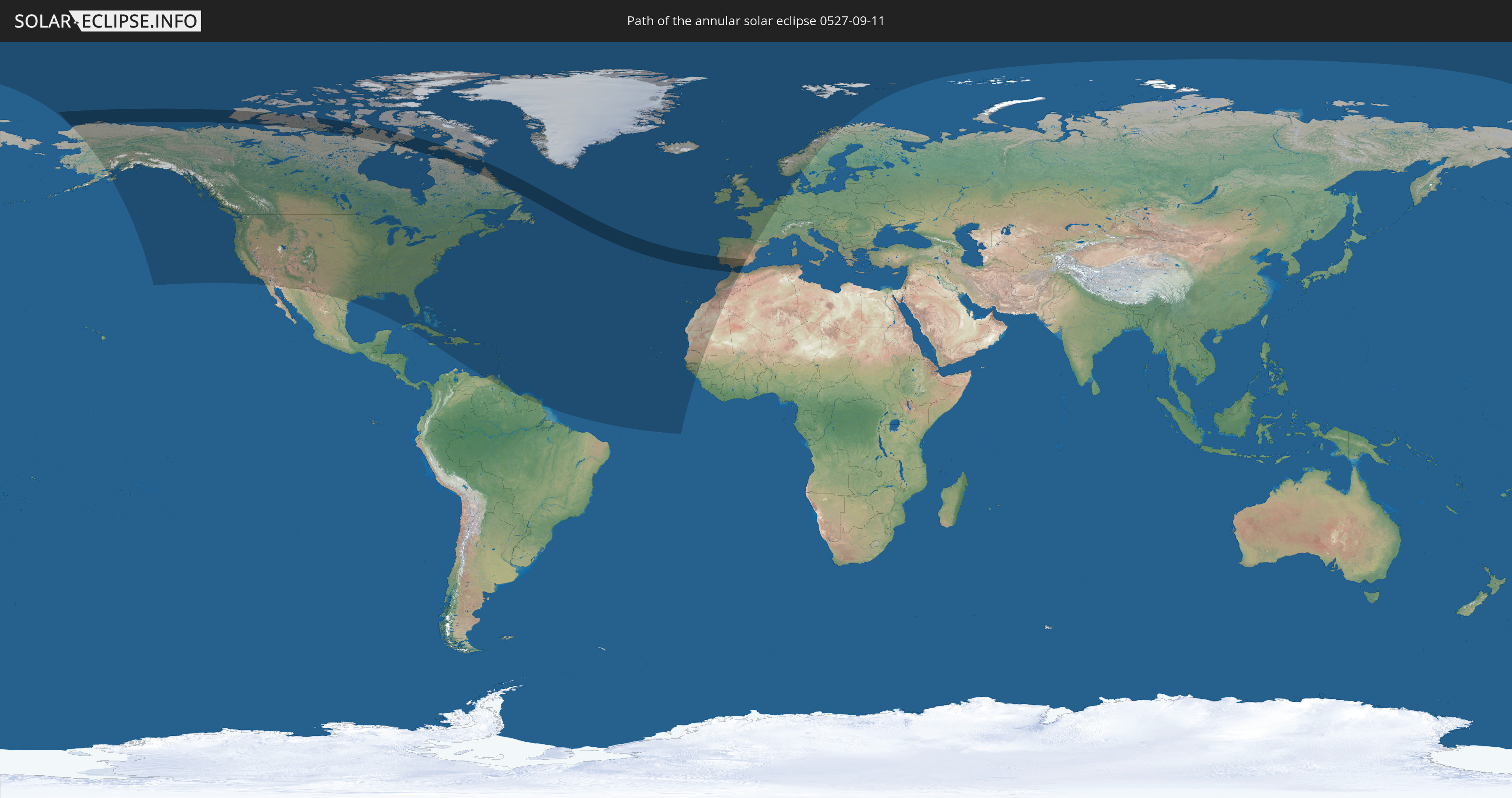
Die Sonnenfinsternis am 09/11/0527 kann man in 61 Ländern als partielle Sonnenfinsternis beobachten.
Der Finsternispfad verläuft durch 6 Länder. Nur in diesen Ländern ist sie als annular Sonnenfinsternis zu sehen.
In den folgenden Ländern ist die Sonnenfinsternis annular zu sehen
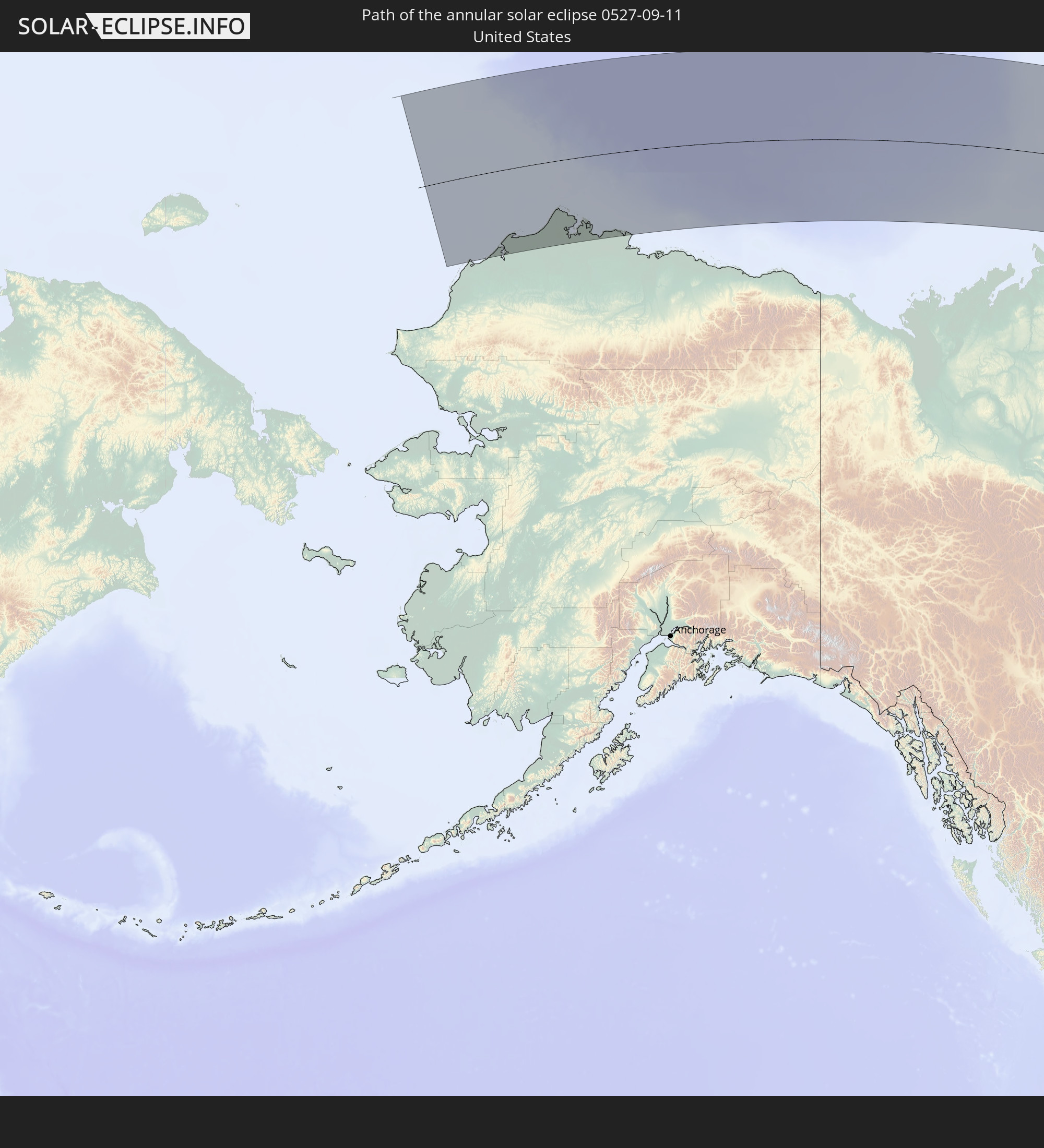 United States
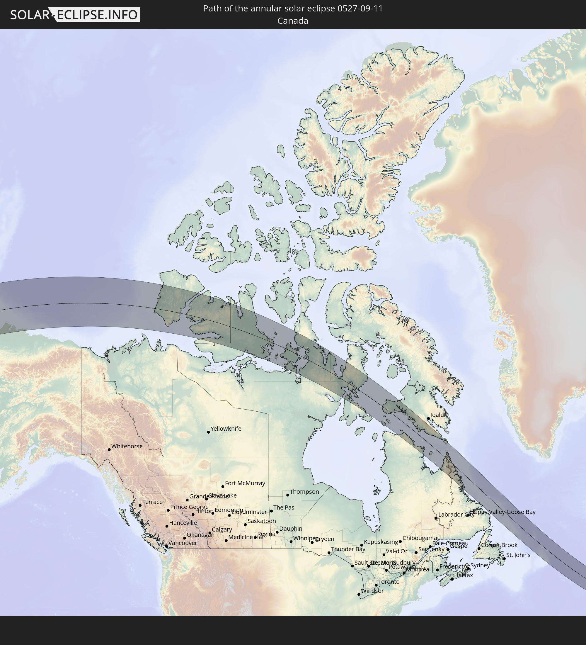 Canada
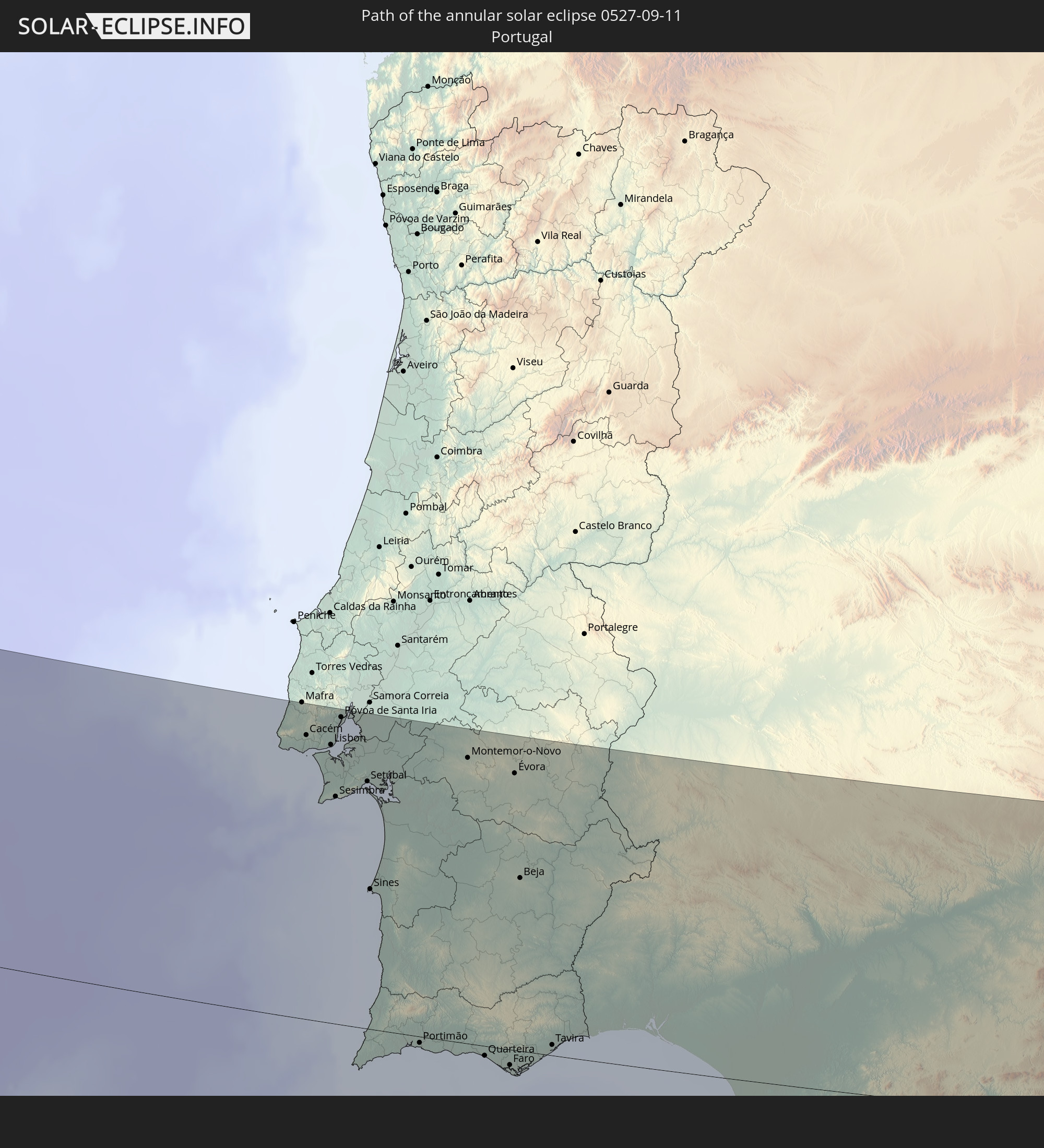 Portugal
 Spain
Spain
 Morocco
 Gibraltar
In den folgenden Ländern ist die Sonnenfinsternis partiell zu sehen
 United States
 United States Minor Outlying Islands
 Canada
 Mexico
 Greenland
 Cuba
Cuba
 The Bahamas
 Jamaica
 Haiti
Haiti
 Brazil
 Venezuela
 Turks and Caicos Islands
 Dominican Republic
 Puerto Rico
 United States Virgin Islands
 Bermuda
 British Virgin Islands
 Anguilla
 Collectivity of Saint Martin
 Saint Barthélemy
 Saint Kitts and Nevis
 Antigua and Barbuda
 Montserrat
 Trinidad and Tobago
 Guadeloupe
 Grenada
 Dominica
 Saint Vincent and the Grenadines
 Guyana
 Martinique
 Saint Lucia
 Barbados
 Suriname
 Saint Pierre and Miquelon
 French Guiana
 Portugal
 Cabo Verde
 Iceland
 Spain
Spain
 Senegal
 Mauritania
 The Gambia
 Guinea-Bissau
 Guinea
 Morocco
 Republic of Ireland
 Svalbard and Jan Mayen
 Algeria
 United Kingdom
 Faroe Islands
 Gibraltar
 France
 Isle of Man
 Guernsey
 Jersey
 Belgium
 Netherlands
 Norway
 Germany
 Denmark
 Sweden
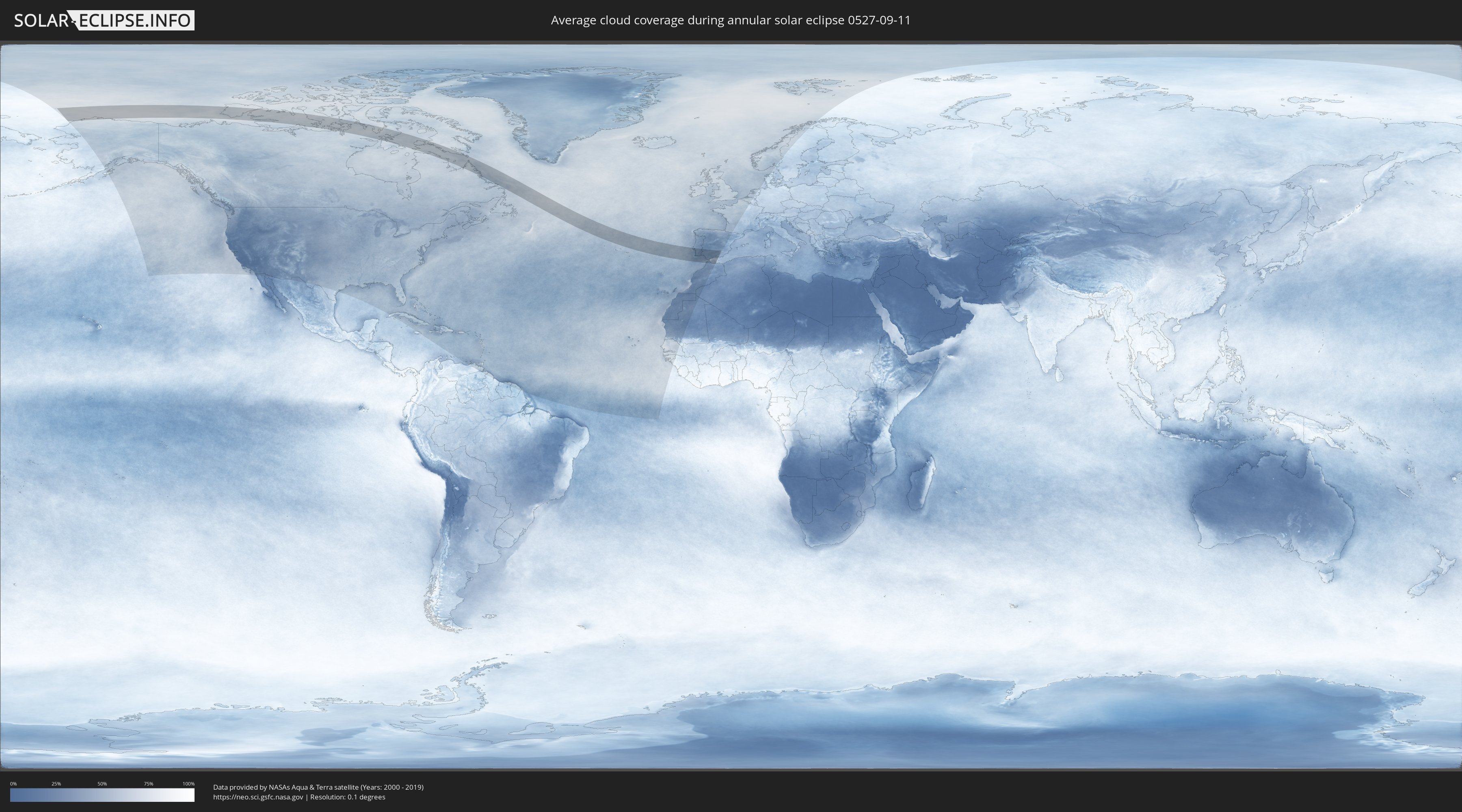
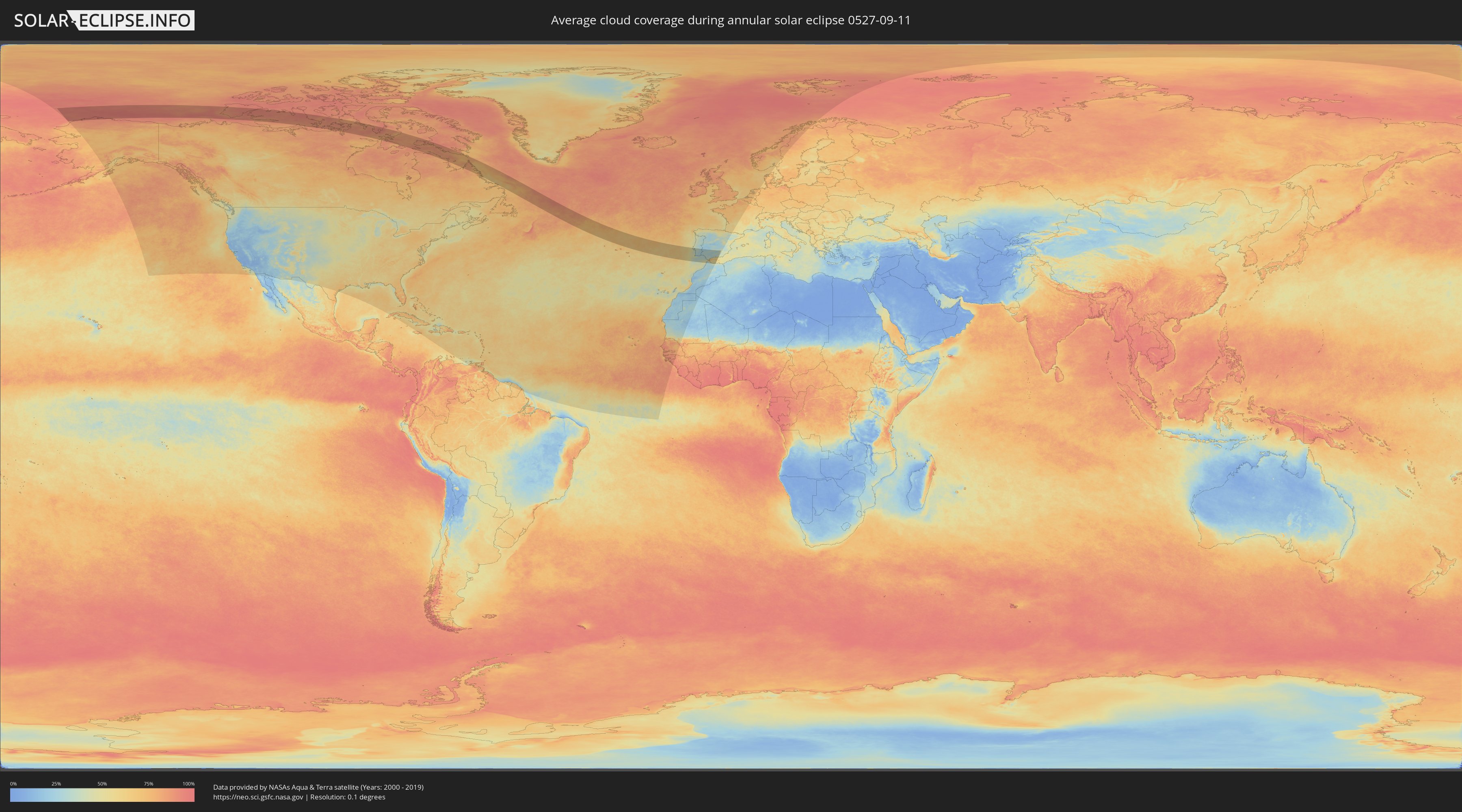
How will be the weather during the annular solar eclipse on 09/11/0527?
Where is the best place to see the annular solar eclipse of 09/11/0527?
The following maps show the average cloud coverage for the day of the annular solar eclipse.
With the help of these maps, it is possible to find the place along the eclipse path, which has the best
chance of a cloudless sky.
Nevertheless, you should consider local circumstances and inform about the weather of your chosen
observation site.
The data is provided by NASAs satellites
AQUA and TERRA.
The cloud maps are averaged over a period of 19 years (2000 - 2019).
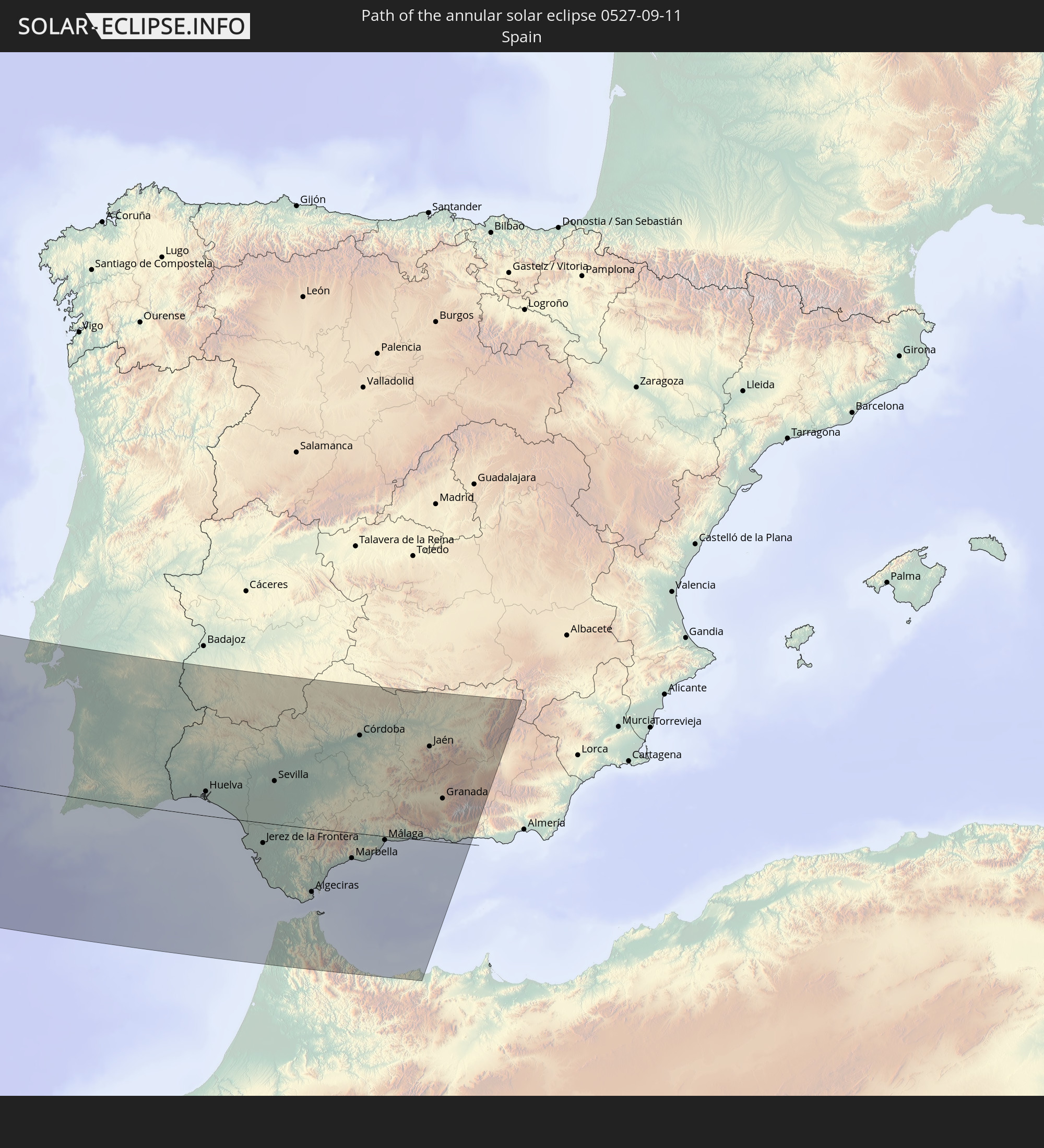
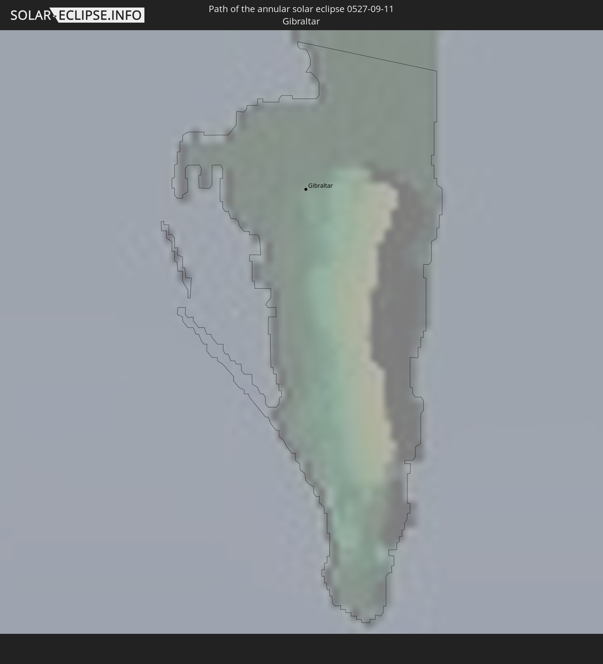
Detailed country maps
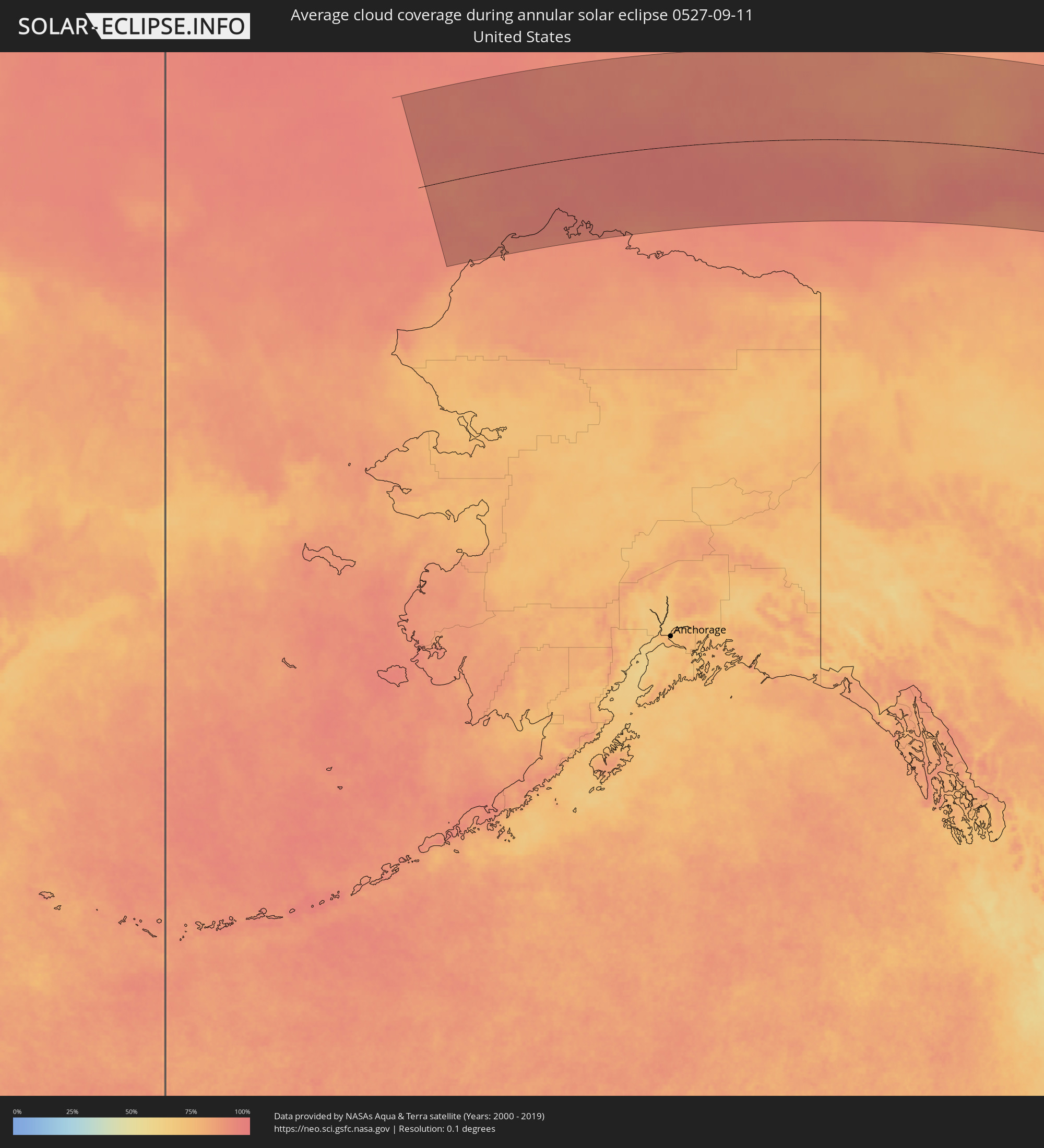 United States
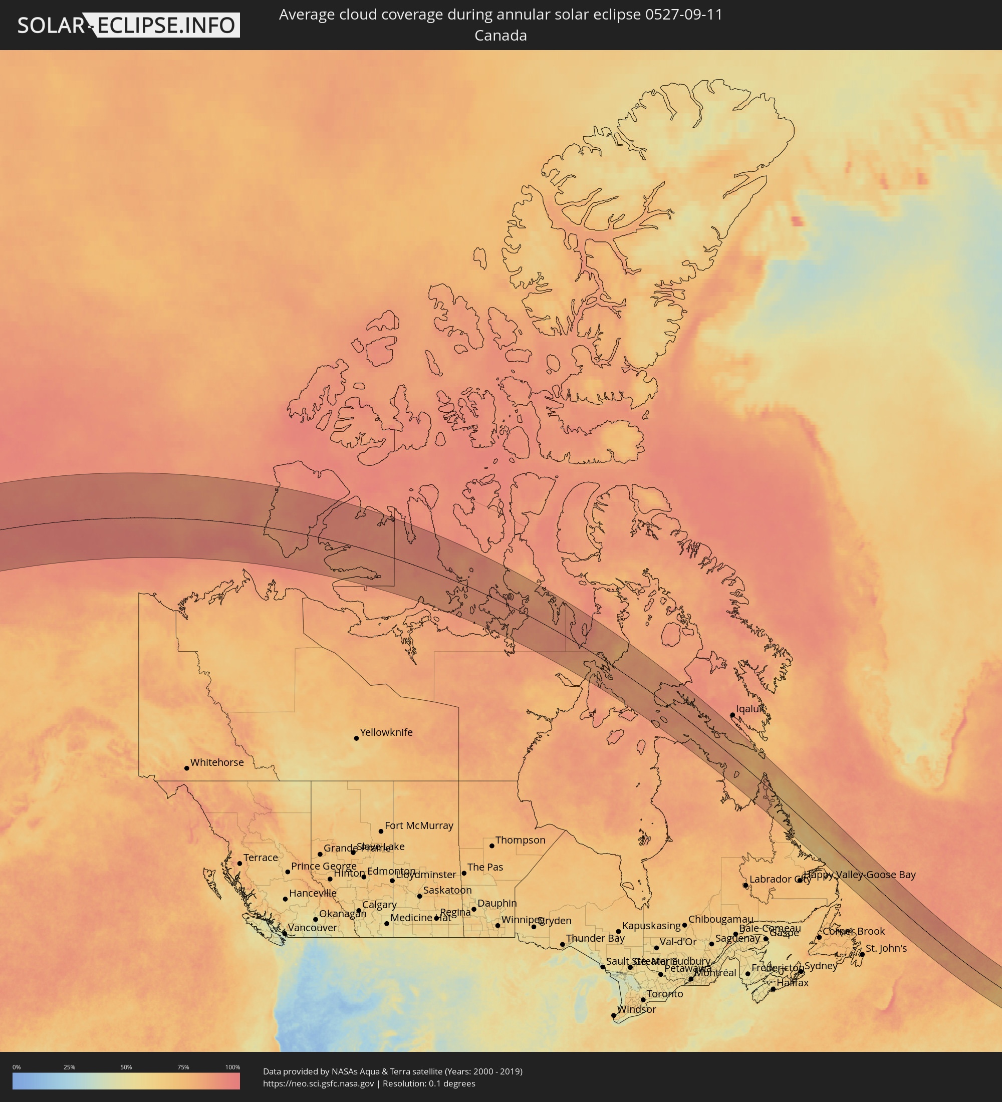 Canada
 Portugal
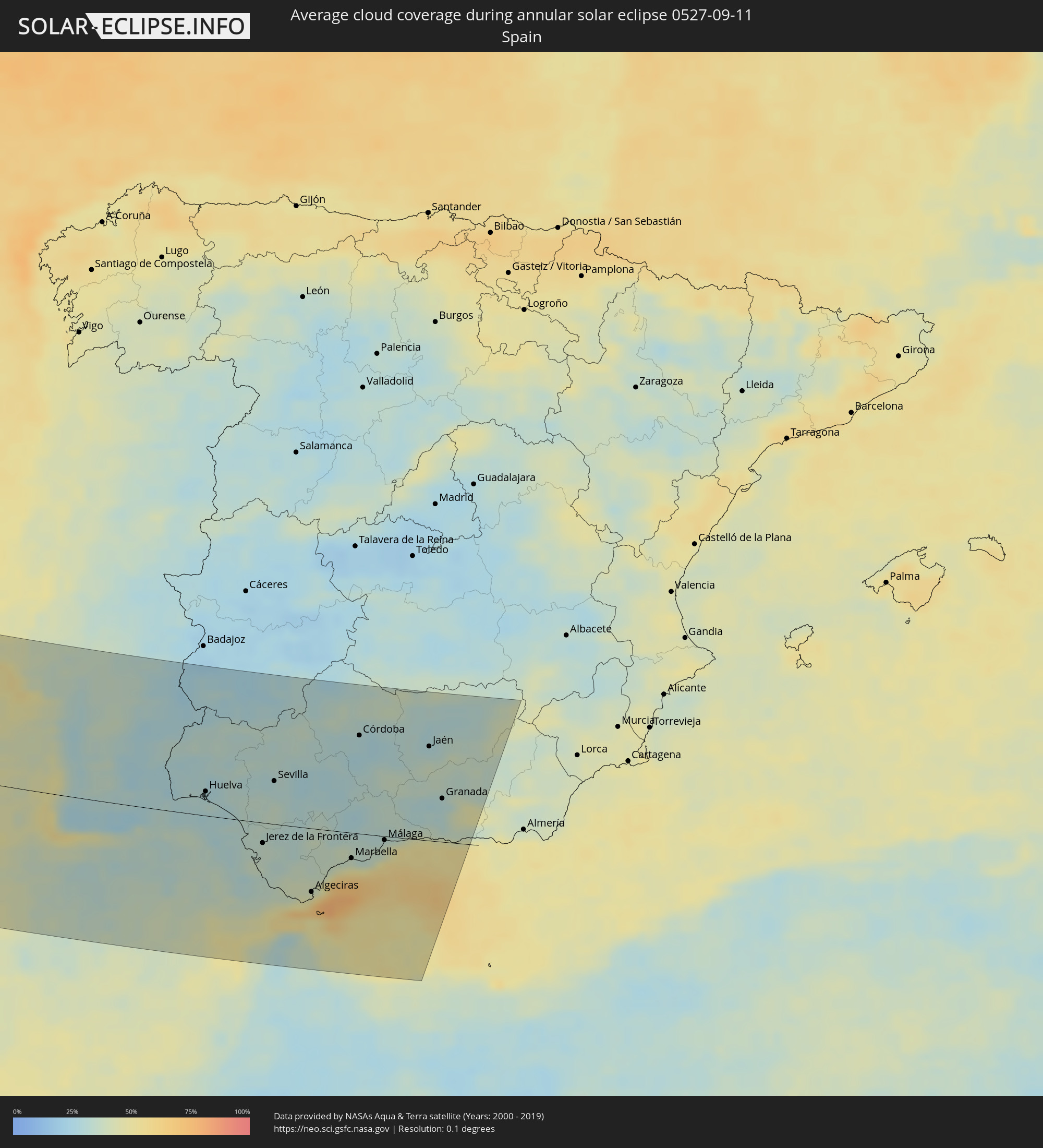 Spain
Spain
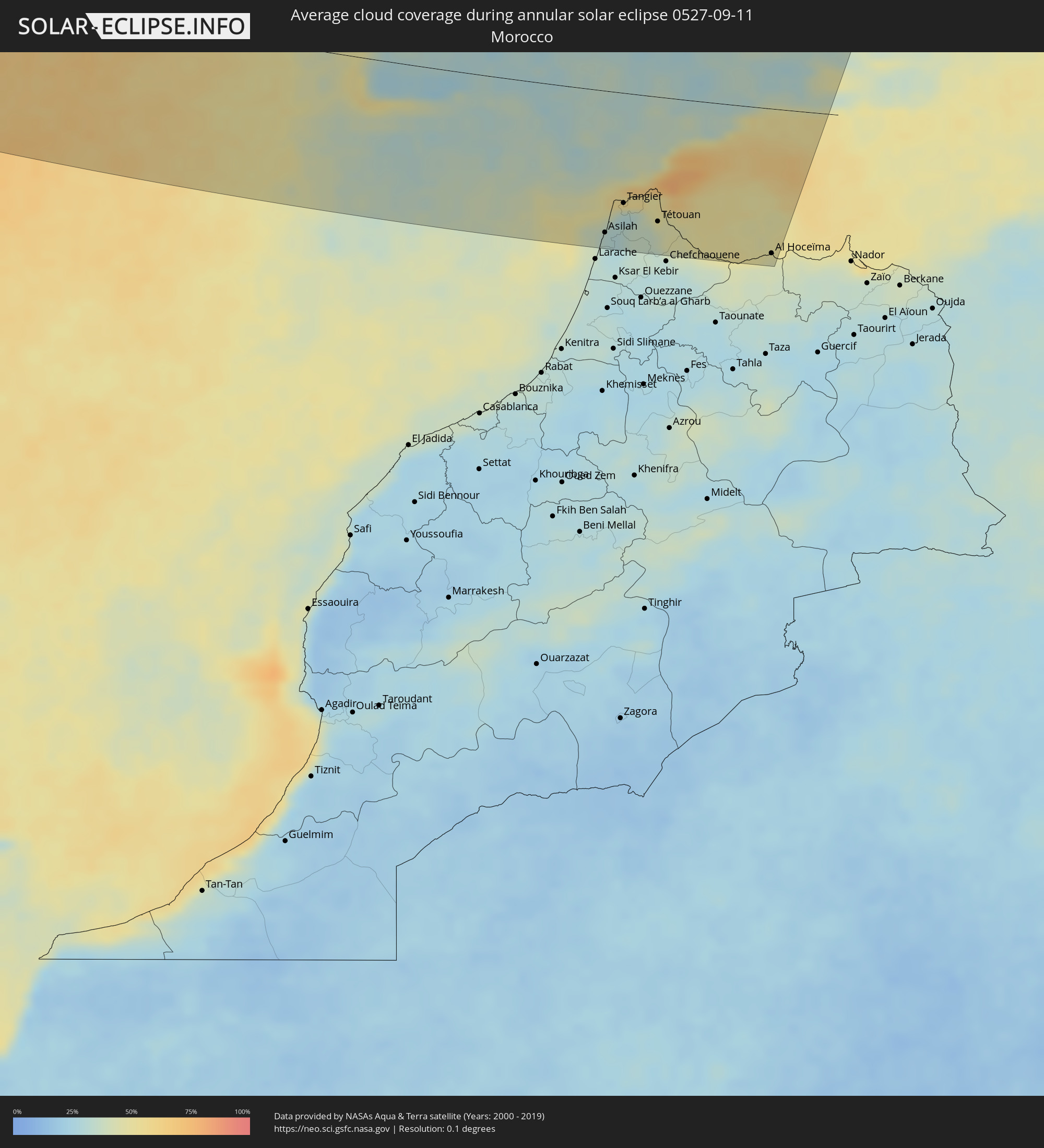 Morocco
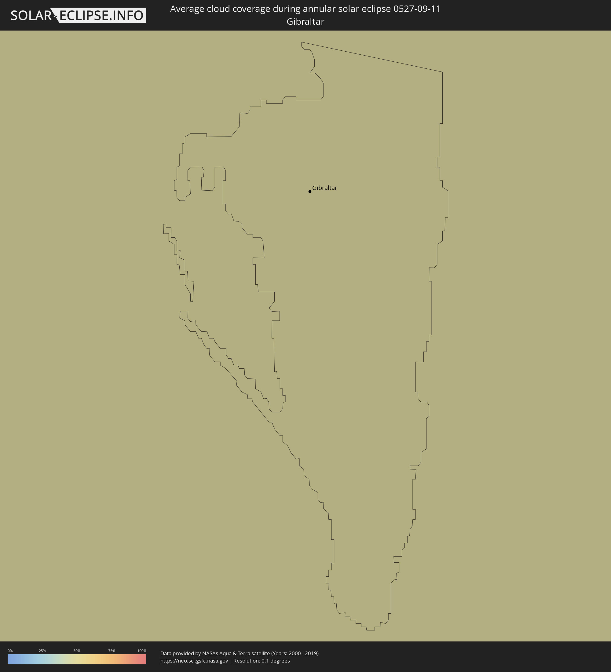 Gibraltar
Cities inside the path of the eclipse
The following table shows all locations with a population of more than 5,000 inside the eclipse path. Cities which have more than 100,000 inhabitants are marked bold. A click at the locations opens a detailed map.
| City | Type | Eclipse duration | Local time of max. eclipse | Distance to central line | Ø Cloud coverage |
|
Colares, Lisbon
|
annular | - | 17:39:45 UTC-00:36 | 168 km | 40% |
|
São João das Lampas, Lisbon
|
annular | - | 17:39:37 UTC-00:36 | 177 km | 40% |
|
Porto Salvo, Lisbon
|
annular | - | 17:39:54 UTC-00:36 | 160 km | 38% |
|
Cacém, Lisbon
|
annular | - | 17:39:49 UTC-00:36 | 165 km | 39% |
|
Barcarena, Lisbon
|
annular | - | 17:39:53 UTC-00:36 | 162 km | 38% |
|
Almargem, Lisbon
|
annular | - | 17:39:41 UTC-00:36 | 174 km | 39% |
|
Quejas, Lisbon
|
annular | - | 17:39:54 UTC-00:36 | 161 km | 38% |
|
Costa de Caparica, Setúbal
|
annular | - | 17:40:02 UTC-00:36 | 153 km | 36% |
|
Caneças, Lisbon
|
annular | - | 17:39:44 UTC-00:36 | 171 km | 38% |
|
Famões, Lisbon
|
annular | - | 17:39:47 UTC-00:36 | 169 km | 38% |
|
Sobreda, Setúbal
|
annular | - | 17:40:02 UTC-00:36 | 154 km | 36% |
|
Pragal, Setúbal
|
annular | - | 17:39:59 UTC-00:36 | 157 km | 37% |
|
Cacilhas, Setúbal
|
annular | - | 17:39:58 UTC-00:36 | 159 km | 36% |
|
Lisbon, Lisbon
|
annular | - | 17:39:55 UTC-00:36 | 162 km | 36% |
|
Apelação, Lisbon
|
annular | - | 17:39:45 UTC-00:36 | 173 km | 35% |
|
Unhos, Lisbon
|
annular | - | 17:39:44 UTC-00:36 | 174 km | 35% |
|
Moscavide, Lisbon
|
annular | - | 17:39:48 UTC-00:36 | 169 km | 35% |
|
Sesimbra, Setúbal
|
annular | - | 17:40:23 UTC-00:36 | 133 km | 42% |
|
Bobadela, Lisbon
|
annular | - | 17:39:45 UTC-00:36 | 173 km | 35% |
|
Aldeia de Paio Pires, Setúbal
|
annular | - | 17:40:05 UTC-00:36 | 152 km | 36% |
|
Póvoa de Santa Iria, Lisbon
|
annular | - | 17:39:40 UTC-00:36 | 179 km | 38% |
|
Santo António da Charneca, Setúbal
|
annular | - | 17:40:05 UTC-00:36 | 154 km | 36% |
|
Alhos Vedros, Setúbal
|
annular | - | 17:40:02 UTC-00:36 | 158 km | 37% |
|
Alcochete, Setúbal
|
annular | - | 17:39:51 UTC-00:36 | 170 km | 37% |
|
Quinta do Anjo, Setúbal
|
annular | - | 17:40:11 UTC-00:36 | 149 km | 36% |
|
Setúbal, Setúbal
|
annular | - | 17:40:16 UTC-00:36 | 145 km | 35% |
|
Sines, Setúbal
|
annular | - | 17:41:14 UTC-00:36 | 82 km | 30% |
|
Santo André, Setúbal
|
annular | - | 17:41:05 UTC-00:36 | 95 km | 28% |
|
Santiago do Cacém, Setúbal
|
annular | - | 17:41:09 UTC-00:36 | 92 km | 30% |
|
Grândola, Setúbal
|
annular | - | 17:40:52 UTC-00:36 | 112 km | 32% |
|
Portimão, Faro
|
annular | - | 17:42:38 UTC-00:36 | 5 km | 27% |
|
Alcácer do Sal, Setúbal
|
annular | - | 17:40:32 UTC-00:36 | 134 km | 35% |
|
Estômbar, Faro
|
annular | - | 17:42:38 UTC-00:36 | 3 km | 27% |
|
Vendas Novas, Évora
|
annular | - | 17:40:01 UTC-00:36 | 168 km | 35% |
|
Silves, Faro
|
annular | - | 17:42:33 UTC-00:36 | 6 km | 30% |
|
São Bartolomeu de Messines, Faro
|
annular | - | 17:42:26 UTC-00:36 | 22 km | 31% |
|
Albufeira, Faro
|
annular | - | 17:42:44 UTC-00:36 | 22 km | 26% |
|
Montemor-o-Novo, Évora
|
annular | - | 17:40:05 UTC-00:36 | 167 km | 35% |
|
Almancil, Faro
|
annular | - | 17:42:44 UTC-00:36 | 4 km | 25% |
|
Loulé, Faro
|
annular | - | 17:42:39 UTC-00:36 | 4 km | 25% |
|
Faro, Faro
|
annular | - | 17:42:51 UTC-00:36 | 12 km | 37% |
|
Évora, Évora
|
annular | - | 17:40:14 UTC-00:36 | 162 km | 34% |
|
São Brás de Alportel, Faro
|
annular | - | 17:42:38 UTC-00:36 | 11 km | 28% |
|
Beja, Beja
|
annular | - | 17:41:11 UTC-00:36 | 102 km | 26% |
|
Moncarapacho, Faro
|
annular | - | 17:42:44 UTC-00:36 | 19 km | 28% |
|
Tavira, Faro
|
annular | - | 17:42:41 UTC-00:36 | 16 km | 32% |
|
Serpa, Beja
|
annular | - | 17:41:18 UTC-00:36 | 100 km | 31% |
|
Reguengos de Monsaraz, Évora
|
annular | - | 17:40:29 UTC-00:36 | 152 km | 29% |
|
Moura, Beja
|
annular | - | 17:40:58 UTC-00:36 | 121 km | 28% |
|
Vila Real de Santo António, Faro
|
annular | - | 17:42:34 UTC-00:36 | 17 km | 29% |
|
Ayamonte, Andalusia
|
annular | - | 18:19:17 UTC+00:00 | 19 km | 29% |
|
Lepe, Andalusia
|
annular | - | 18:19:13 UTC+00:00 | 34 km | 30% |
|
Huelva, Andalusia
|
annular | - | 18:19:12 UTC+00:00 | 30 km | 28% |
|
Almonte, Andalusia
|
annular | - | 18:19:11 UTC+00:00 | 35 km | 33% |
|
Sanlúcar de Barrameda, Andalusia
|
annular | - | 18:19:59 UTC+00:00 | 23 km | 33% |
|
Cadiz, Andalusia
|
annular | - | 18:20:24 UTC+00:00 | 49 km | 37% |
|
Chiclana de la Frontera, Andalusia
|
annular | - | 18:20:34 UTC+00:00 | 55 km | 33% |
|
Jerez de la Frontera, Andalusia
|
annular | - | 18:20:08 UTC+00:00 | 27 km | 35% |
|
Conil de la Frontera, Andalusia
|
annular | - | 18:20:48 UTC+00:00 | 70 km | 34% |
|
Lebrija, Andalusia
|
annular | - | 18:19:45 UTC+00:00 | 7 km | 32% |
|
Asilah, Tanger-Tétouan
|
annular | - | 17:51:47 UTC-00:30 | 160 km | 30% |
|
Sevilla, Andalusia
|
annular | - | 18:18:59 UTC+00:00 | 54 km | 31% |
|
Barbate de Franco, Andalusia
|
annular | - | 18:20:56 UTC+00:00 | 79 km | 38% |
|
Arcos de la Frontera, Andalusia
|
annular | - | 18:20:01 UTC+00:00 | 24 km | 32% |
|
Tangier, Tanger-Tétouan
|
annular | - | 17:51:17 UTC-00:30 | 124 km | 33% |
|
Utrera, Andalusia
|
annular | - | 18:19:18 UTC+00:00 | 37 km | 31% |
|
Carmona, Andalusia
|
annular | - | 18:18:49 UTC+00:00 | 70 km | 26% |
|
Tarifa, Andalusia
|
annular | - | 18:21:12 UTC+00:00 | 94 km | 65% |
|
Lora del Río, Andalusia
|
annular | - | 18:18:30 UTC+00:00 | 89 km | 31% |
|
Morón de la Frontera, Andalusia
|
annular | - | 18:19:23 UTC+00:00 | 30 km | 31% |
|
Algeciras, Andalusia
|
annular | - | 18:21:00 UTC+00:00 | 81 km | 56% |
|
Marchena, Andalusia
|
annular | - | 18:19:03 UTC+00:00 | 53 km | 28% |
|
Tétouan, Tanger-Tétouan
|
annular | - | 17:51:33 UTC-00:30 | 141 km | 43% |
|
Gibraltar
|
annular | - | 18:20:59 UTC+00:00 | 80 km | 69% |
|
Ceuta, Ceuta
|
annular | - | 18:21:23 UTC+00:00 | 107 km | 56% |
|
Palma del Río, Andalusia
|
annular | - | 18:18:26 UTC+00:00 | 96 km | 30% |
|
Martil, Tanger-Tétouan
|
annular | - | 17:51:29 UTC-00:30 | 135 km | 45% |
|
Ronda, Andalusia
|
annular | - | 18:20:00 UTC+00:00 | 17 km | 36% |
|
Estepona, Andalusia
|
annular | - | 18:20:30 UTC+00:00 | 45 km | 59% |
|
Osuna, Andalusia
|
annular | - | 18:19:11 UTC+00:00 | 48 km | 30% |
|
Écija, Andalusia
|
annular | - | 18:18:41 UTC+00:00 | 82 km | 29% |
|
Marbella, Andalusia
|
annular | - | 18:20:21 UTC+00:00 | 34 km | 49% |
|
Córdoba, Andalusia
|
annular | - | 18:18:05 UTC+00:00 | 122 km | 28% |
|
Puente-Genil, Andalusia
|
annular | - | 18:18:55 UTC+00:00 | 68 km | 32% |
|
Montilla, Andalusia
|
annular | - | 18:18:35 UTC+00:00 | 92 km | 32% |
|
Mijas, Andalusia
|
annular | - | 18:20:12 UTC+00:00 | 23 km | 39% |
|
Antequera, Andalusia
|
annular | - | 18:19:30 UTC+00:00 | 28 km | 32% |
|
Lucena, Andalusia
|
annular | - | 18:18:52 UTC+00:00 | 71 km | 32% |
|
Málaga, Andalusia
|
annular | - | 18:19:59 UTC+00:00 | 9 km | 42% |
|
Baena, Andalusia
|
annular | - | 18:18:31 UTC+00:00 | 96 km | 34% |
|
Priego de Córdoba, Andalusia
|
annular | - | 18:18:48 UTC+00:00 | 79 km | 36% |
|
Loja, Andalusia
|
annular | - | 18:19:14 UTC+00:00 | 51 km | 32% |
|
Vélez-Málaga, Andalusia
|
annular | - | 18:19:51 UTC+00:00 | 11 km | 44% |
|
Andújar, Andalusia
|
annular | - | 18:17:48 UTC+00:00 | 146 km | 32% |
|
Martos, Andalusia
|
annular | - | 18:18:19 UTC+00:00 | 110 km | 34% |
|
Tirhanimîne, Taza-Al Hoceima-Taounate
|
annular | - | 17:51:58 UTC-00:30 | 166 km | 40% |
|
Al Hoceïma, Taza-Al Hoceima-Taounate
|
annular | - | 17:51:56 UTC-00:30 | 165 km | 44% |
|
Alcalá la Real, Andalusia
|
annular | - | 18:18:44 UTC+00:00 | 82 km | 34% |
|
Nerja, Andalusia
|
annular | - | 18:19:53 UTC+00:00 | 12 km | 48% |
|
Jaén, Andalusia
|
annular | - | 18:18:13 UTC+00:00 | 117 km | 32% |
|
Almuñécar, Andalusia
|
annular | - | 18:19:53 UTC+00:00 | 18 km | 51% |
|
Linares, Andalusia
|
annular | - | 18:17:40 UTC+00:00 | 155 km | 29% |
|
Granada, Andalusia
|
annular | - | 18:19:09 UTC+00:00 | 56 km | 30% |
|
Motril, Andalusia
|
annular | - | 18:19:51 UTC+00:00 | 7 km | 44% |
|
Úbeda, Andalusia
|
annular | - | 18:17:47 UTC+00:00 | 148 km | 32% |
|
Guadix, Andalusia
|
annular | - | 18:18:55 UTC+00:00 | 70 km | 35% |
|
Campiña, Andalusia
|
annular | - | 18:17:25 UTC+00:00 | 173 km | 34% |