Total solar eclipse of 02/19/0695
| Day of week: | Tuesday |
| Maximum duration of eclipse: | 01m05s |
| Maximum width of eclipse path: | 70 km |
| Saros cycle: | 80 |
| Coverage: | 100% |
| Magnitude: | 1.0126 |
| Gamma: | 0.7865 |
Wo kann man die Sonnenfinsternis vom 02/19/0695 sehen?
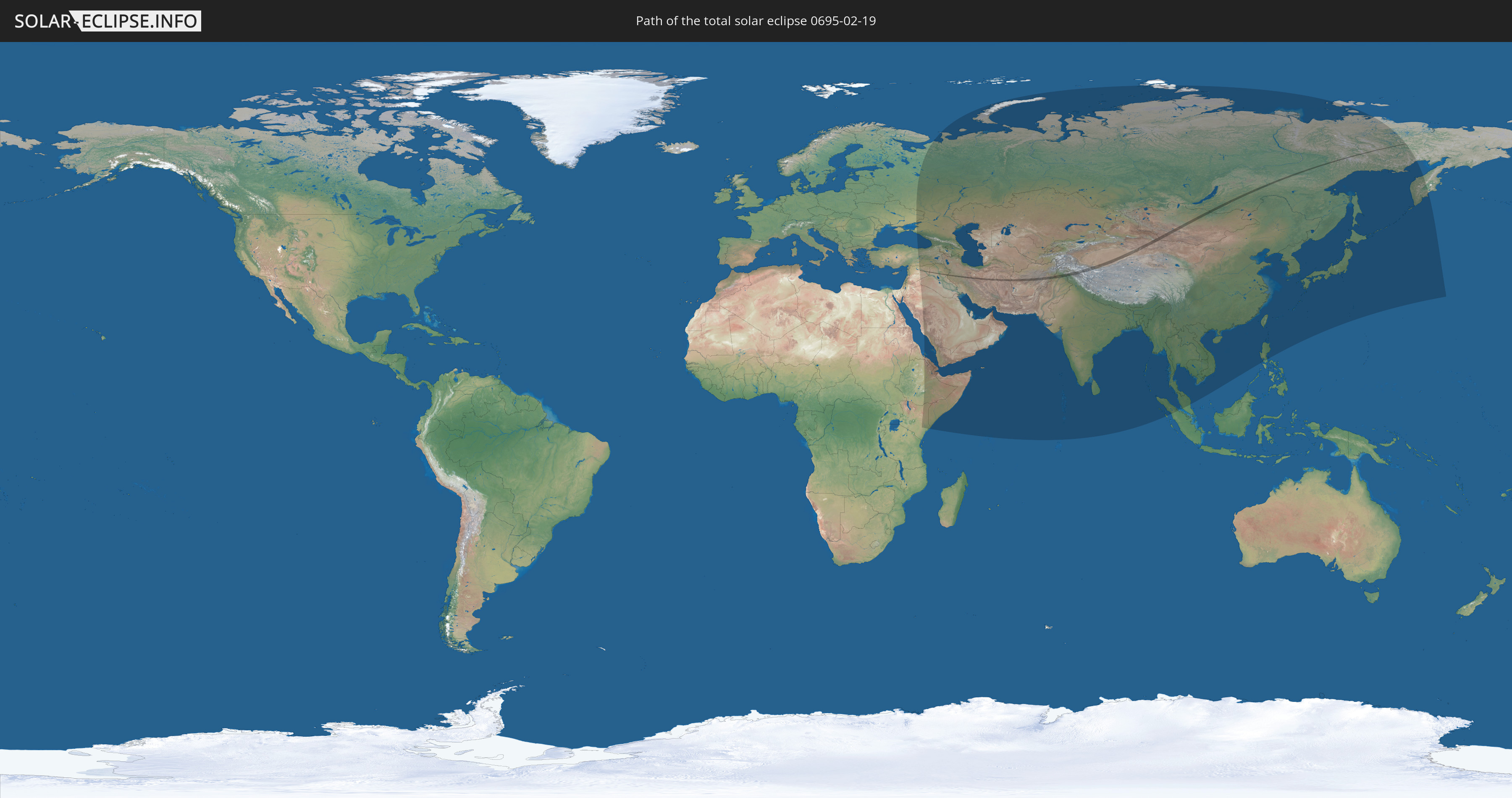
Die Sonnenfinsternis am 02/19/0695 kann man in 52 Ländern als partielle Sonnenfinsternis beobachten.
Der Finsternispfad verläuft durch 9 Länder. Nur in diesen Ländern ist sie als total Sonnenfinsternis zu sehen.
In den folgenden Ländern ist die Sonnenfinsternis total zu sehen
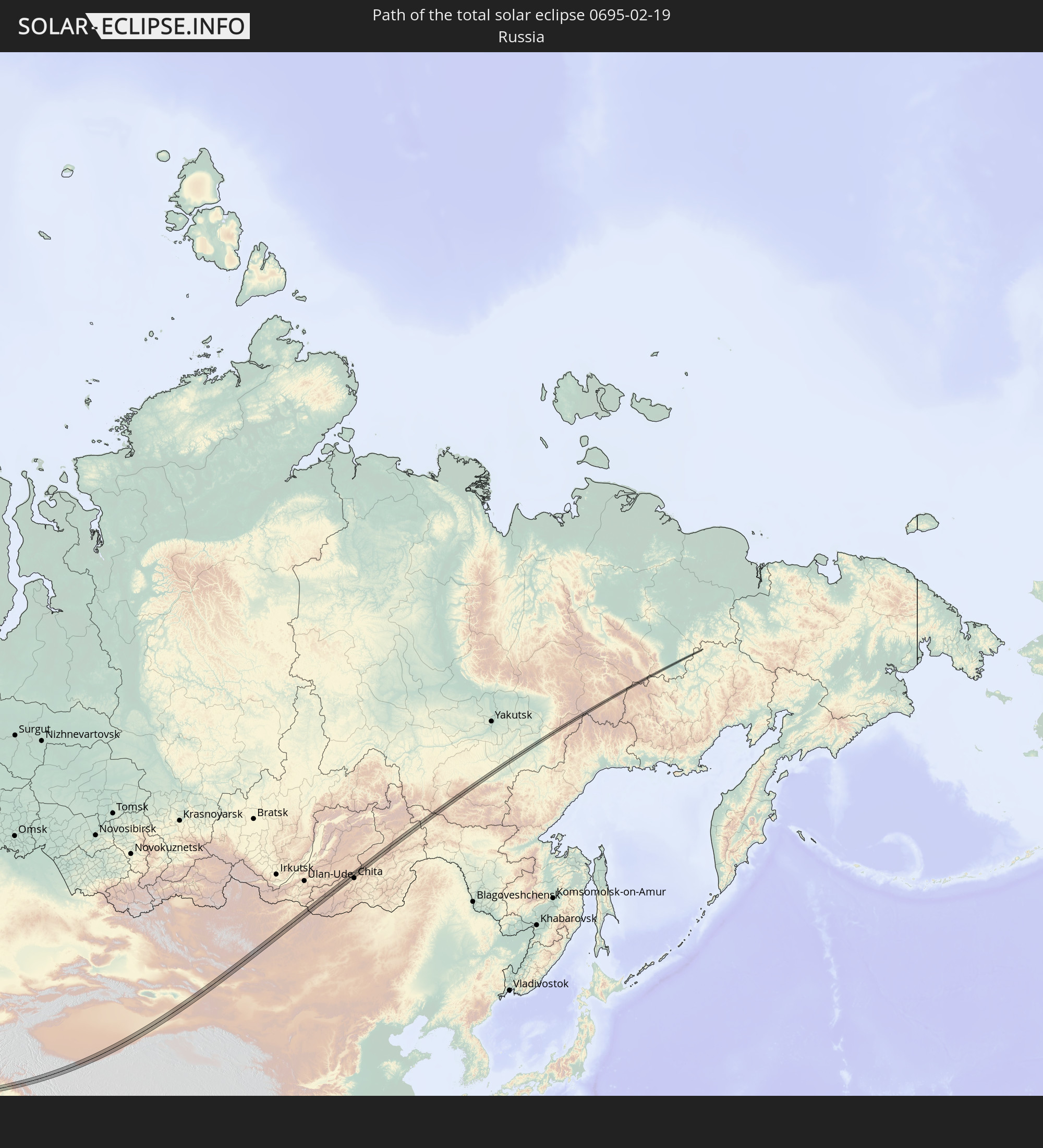 Russia
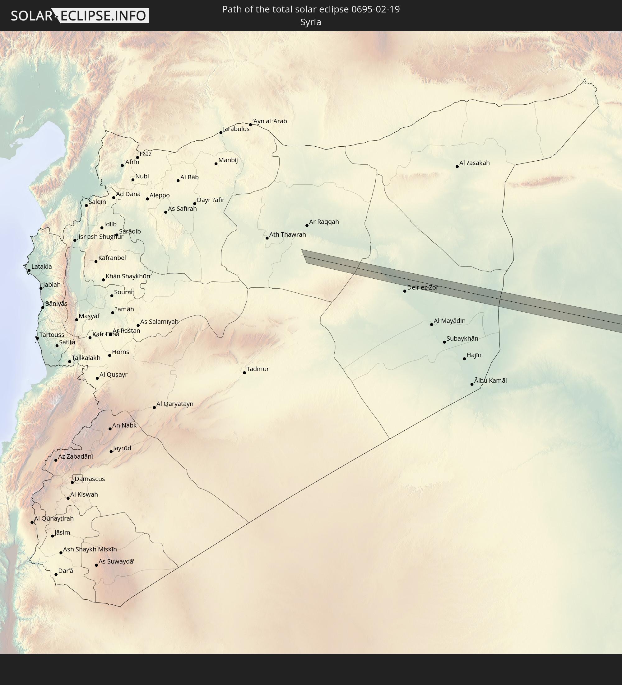 Syria
Syria
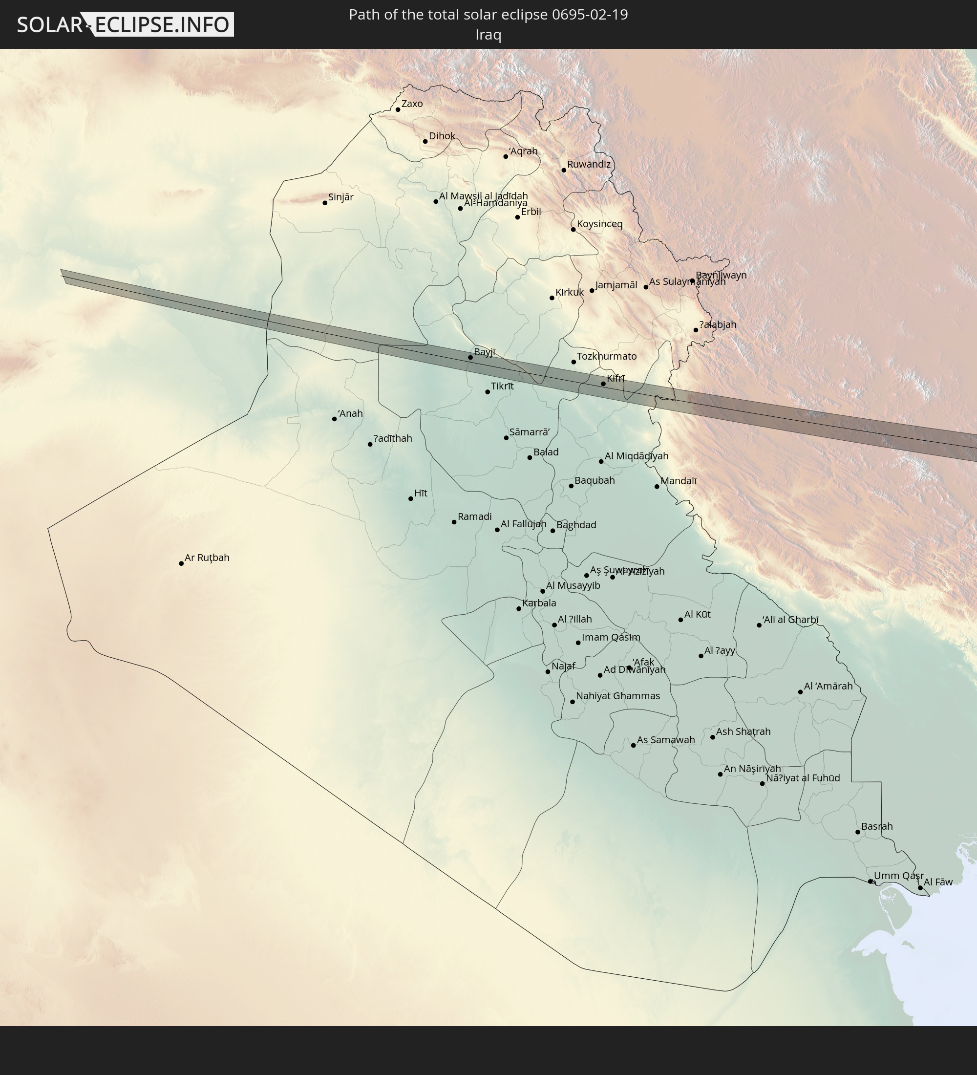 Iraq
Iraq
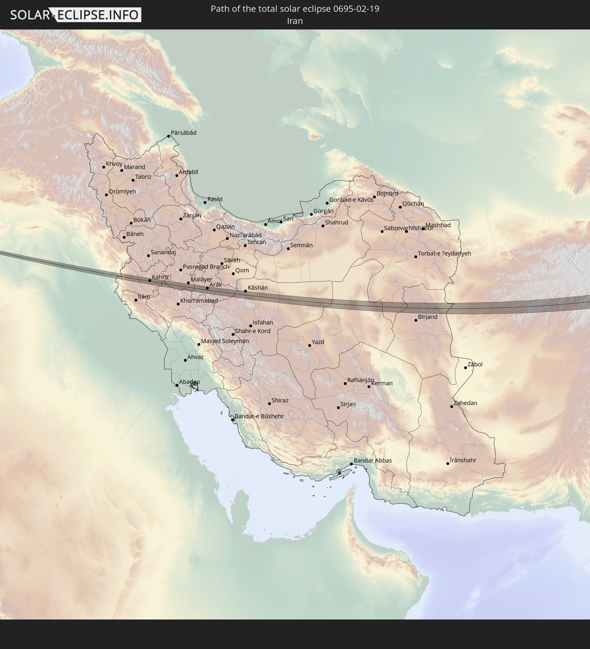 Iran
Iran
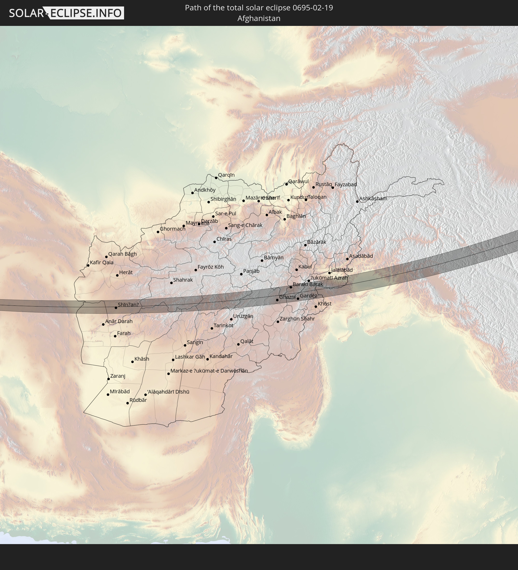 Afghanistan
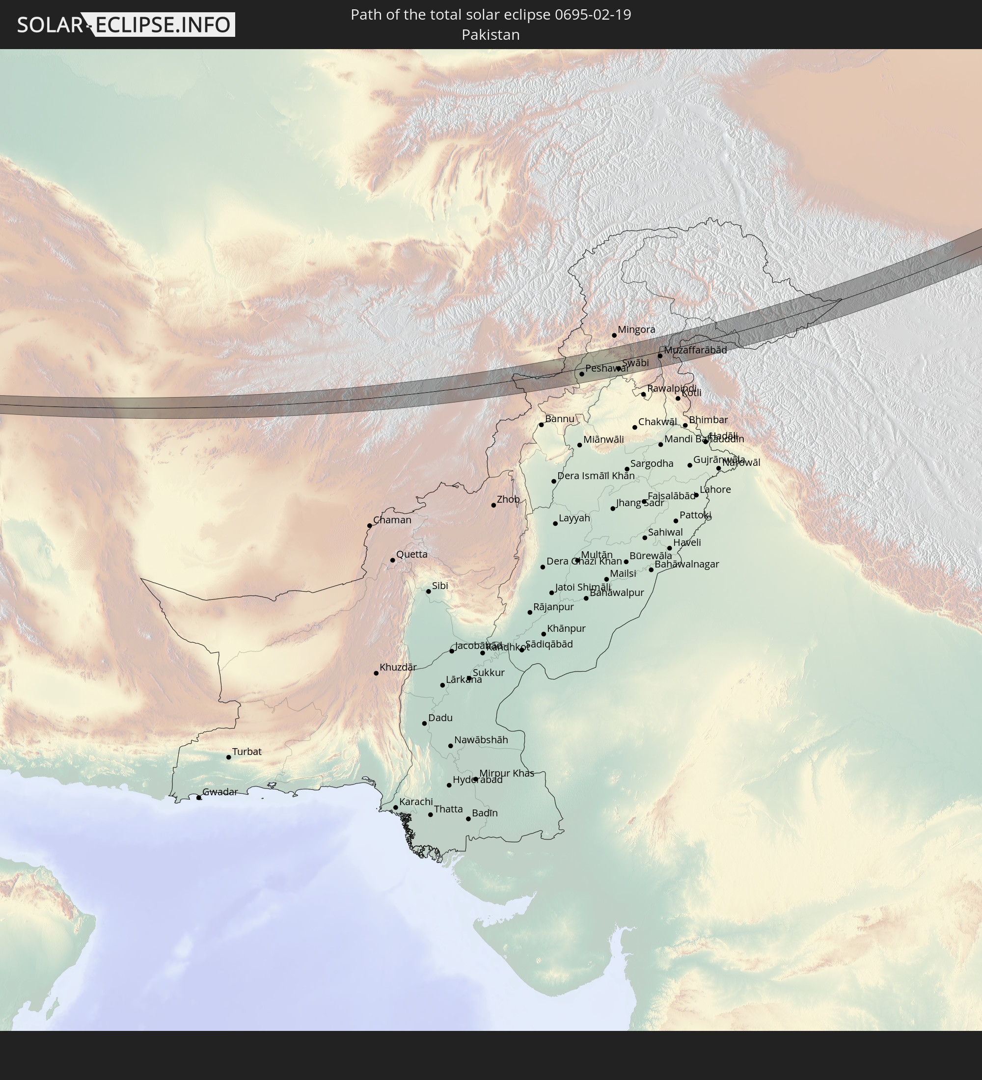 Pakistan
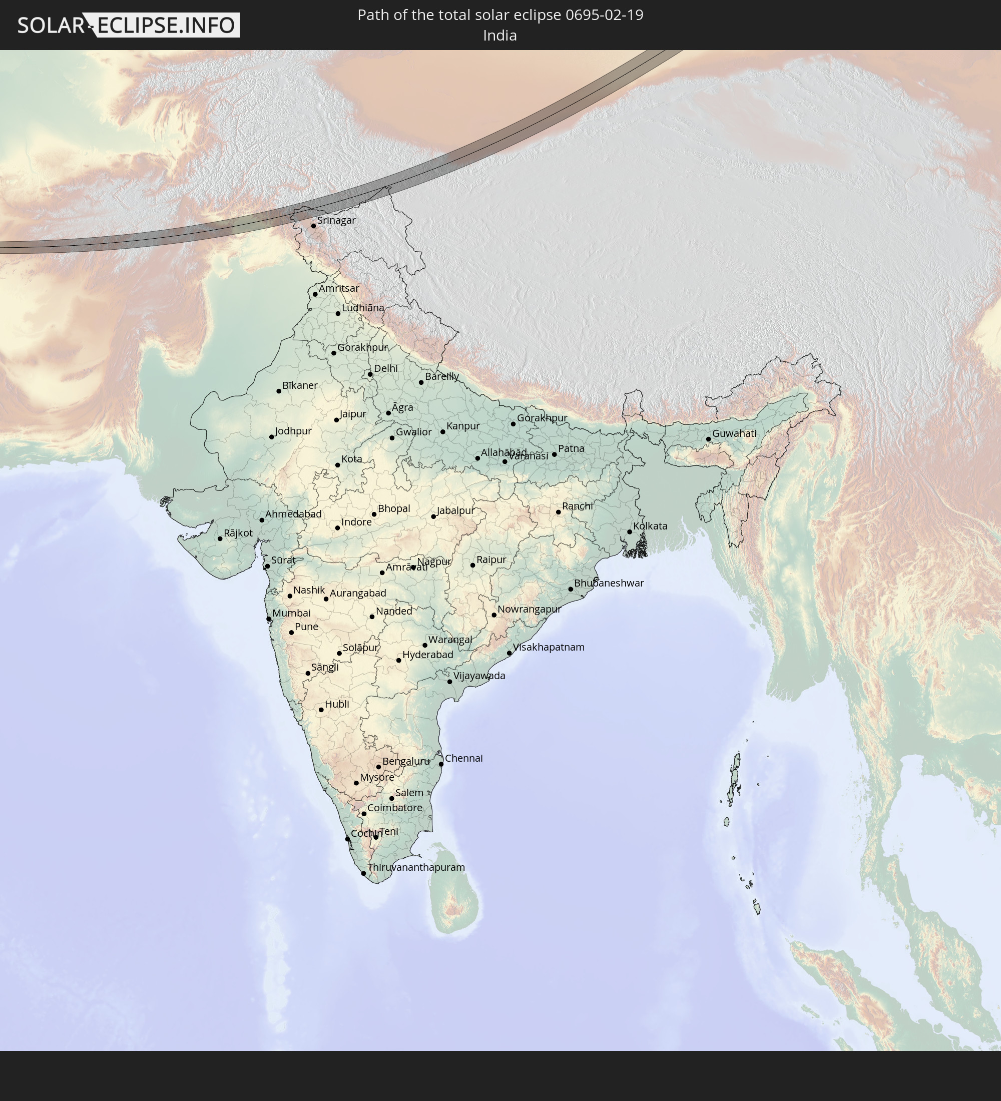 India
India
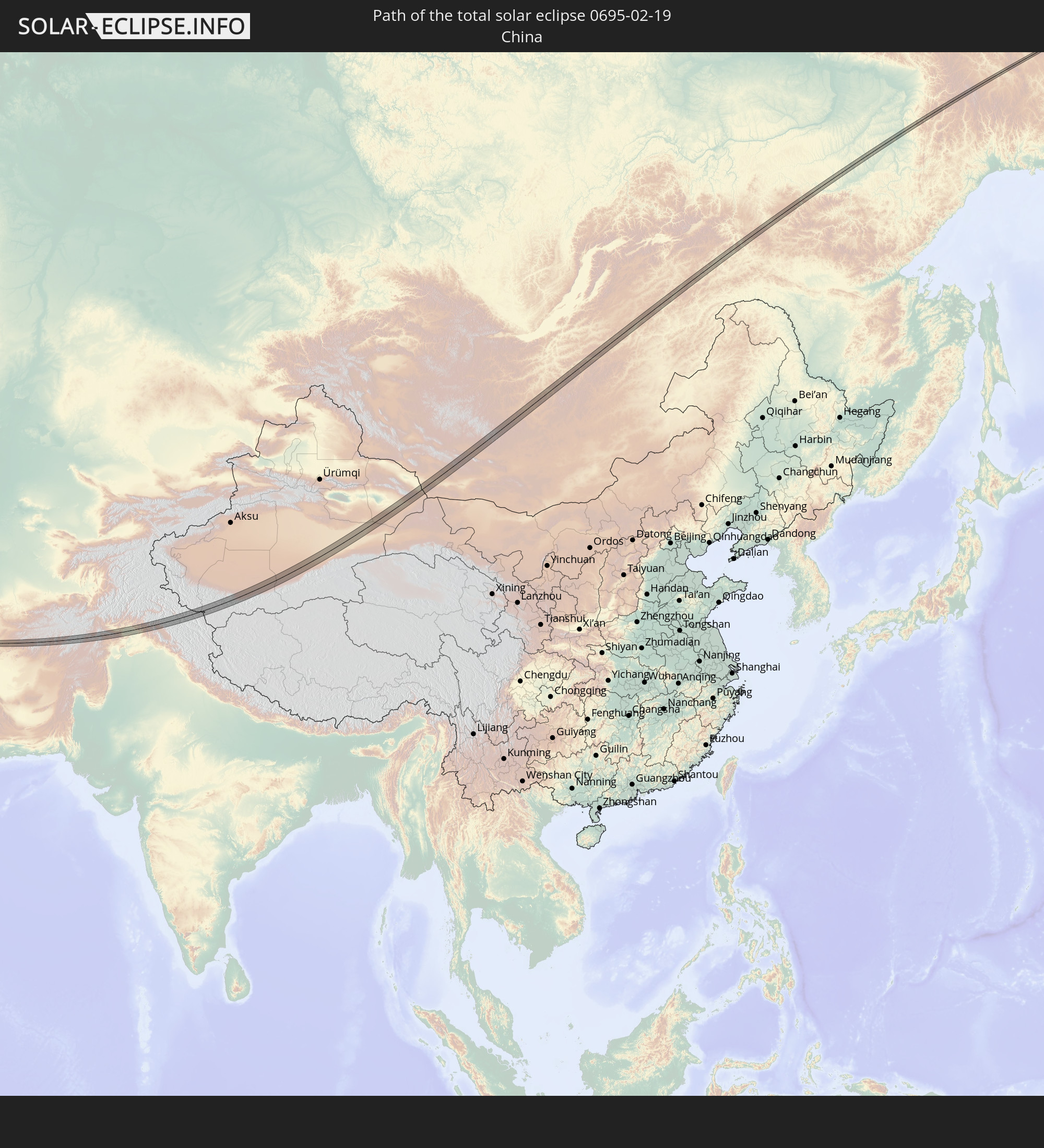 China
China
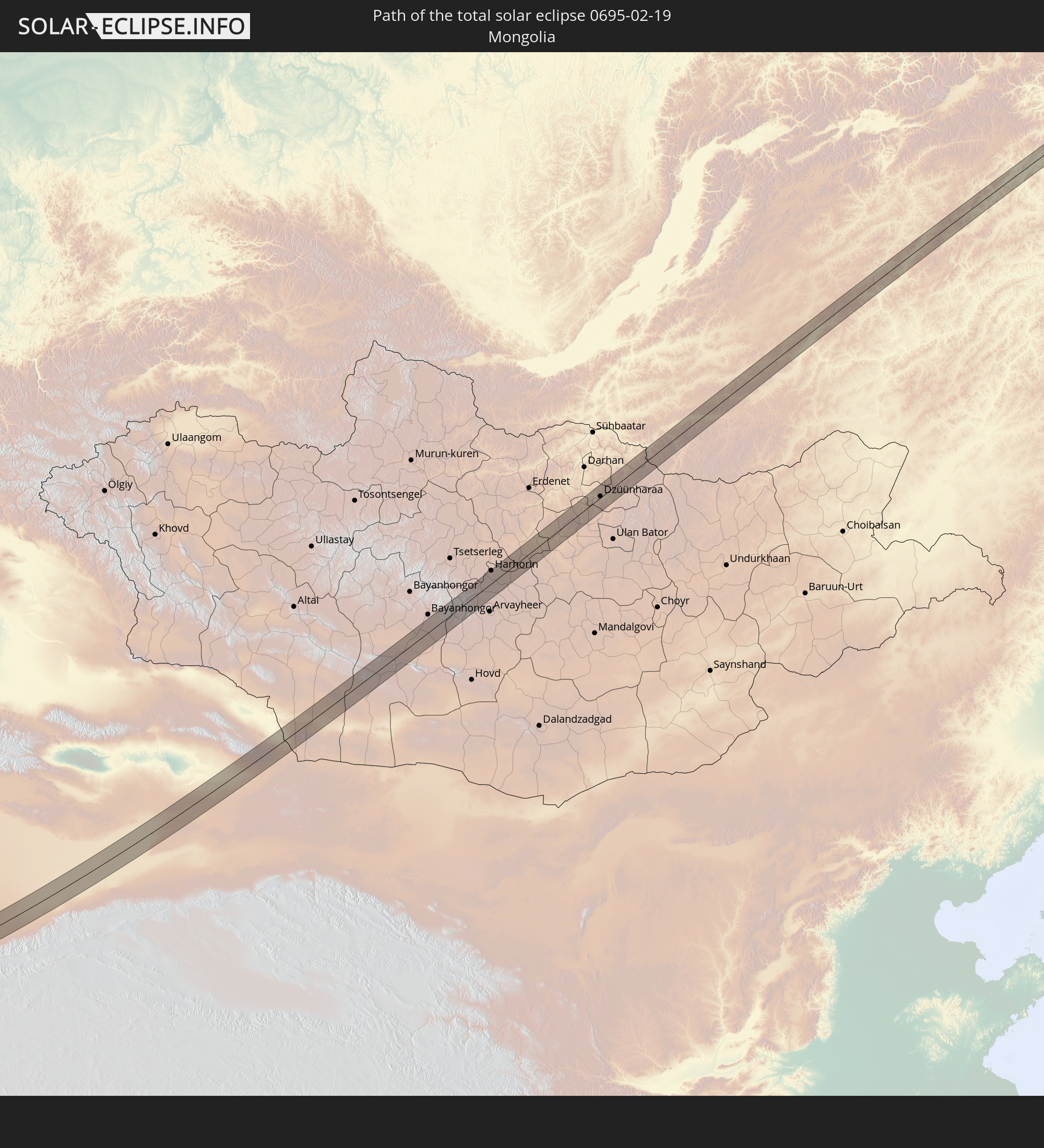 Mongolia
In den folgenden Ländern ist die Sonnenfinsternis partiell zu sehen
 Russia
 Ukraine
 Turkey
 Ethiopia
 Kenya
Kenya
 Saudi Arabia
 Jordan
 Syria
Syria
 Eritrea
 Iraq
Iraq
 Georgia
 Somalia
 Djibouti
 Yemen
Yemen
 Armenia
 Iran
Iran
 Azerbaijan
 Seychelles
 Kazakhstan
 Kuwait
 Bahrain
 Qatar
Qatar
 United Arab Emirates
 Oman
Oman
 Turkmenistan
 Uzbekistan
 Afghanistan
 Pakistan
 Tajikistan
 India
India
 Kyrgyzstan
 Maldives
 China
China
 Sri Lanka
 Nepal
Nepal
 Mongolia
 Bangladesh
 Bhutan
 Myanmar
 Indonesia
 Thailand
 Malaysia
 Laos
Laos
 Vietnam
 Cambodia
 Macau
Macau
 Hong Kong
 Taiwan
 Philippines
 Japan
Japan
 North Korea
 South Korea
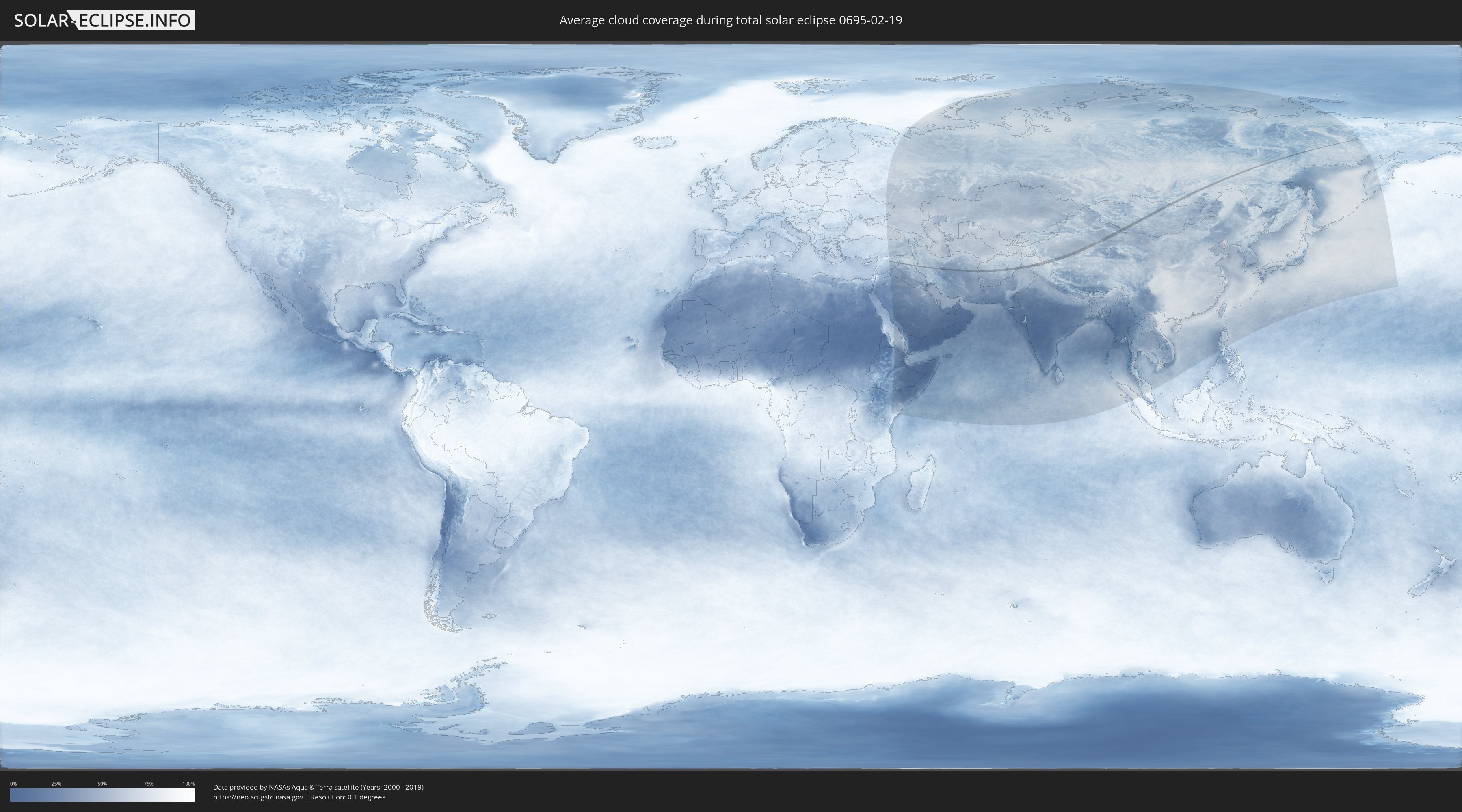
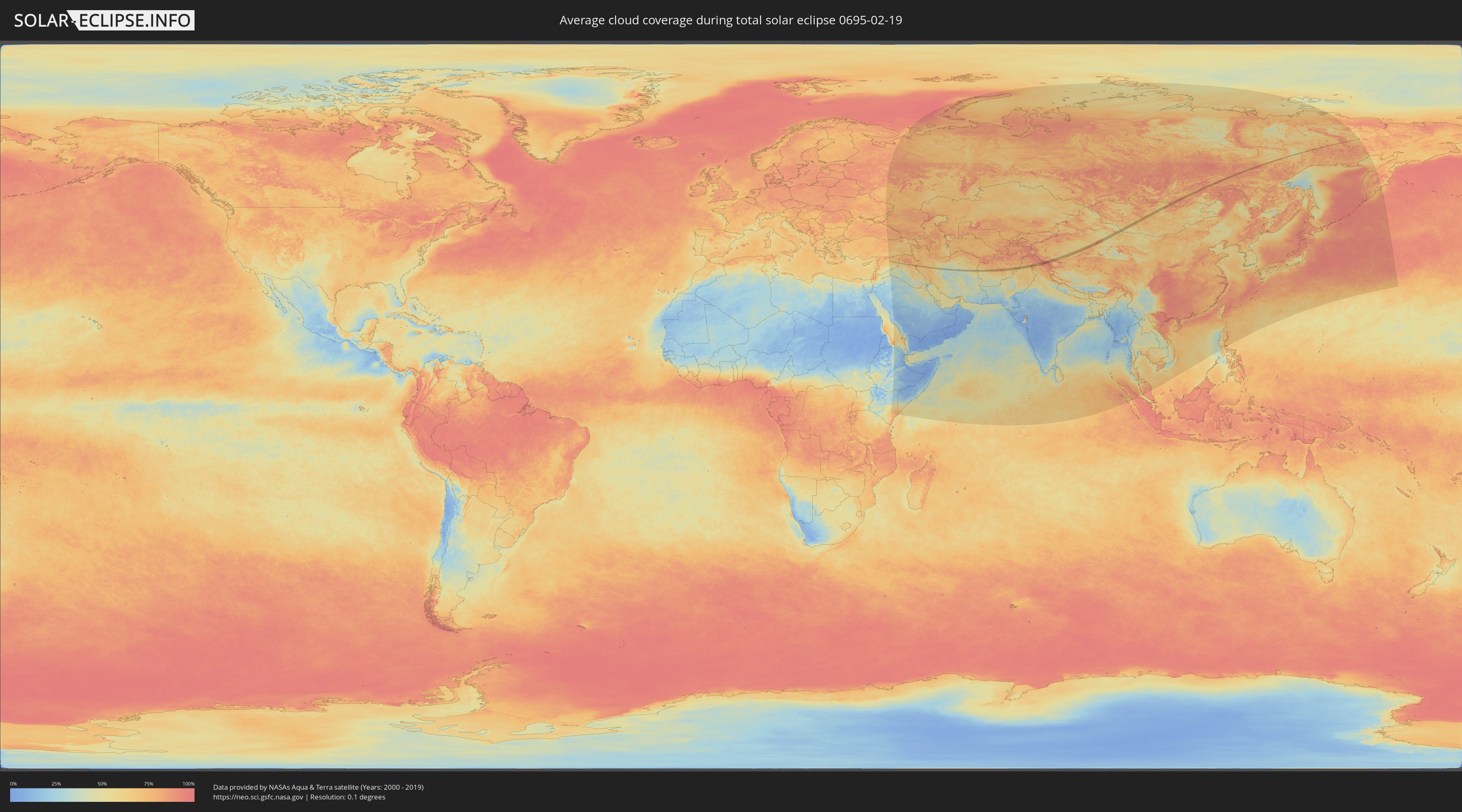
How will be the weather during the total solar eclipse on 02/19/0695?
Where is the best place to see the total solar eclipse of 02/19/0695?
The following maps show the average cloud coverage for the day of the total solar eclipse.
With the help of these maps, it is possible to find the place along the eclipse path, which has the best
chance of a cloudless sky.
Nevertheless, you should consider local circumstances and inform about the weather of your chosen
observation site.
The data is provided by NASAs satellites
AQUA and TERRA.
The cloud maps are averaged over a period of 19 years (2000 - 2019).
Detailed country maps
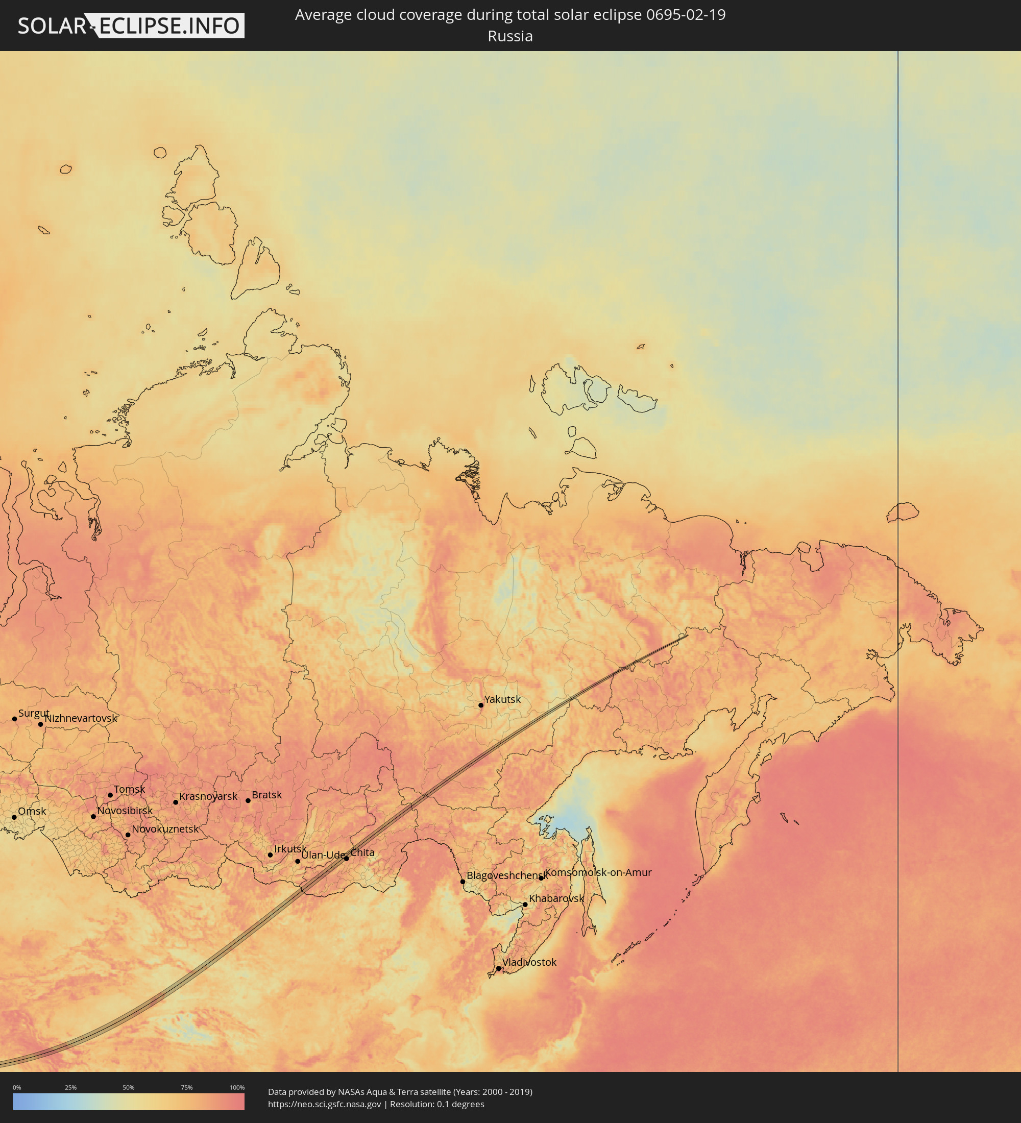 Russia
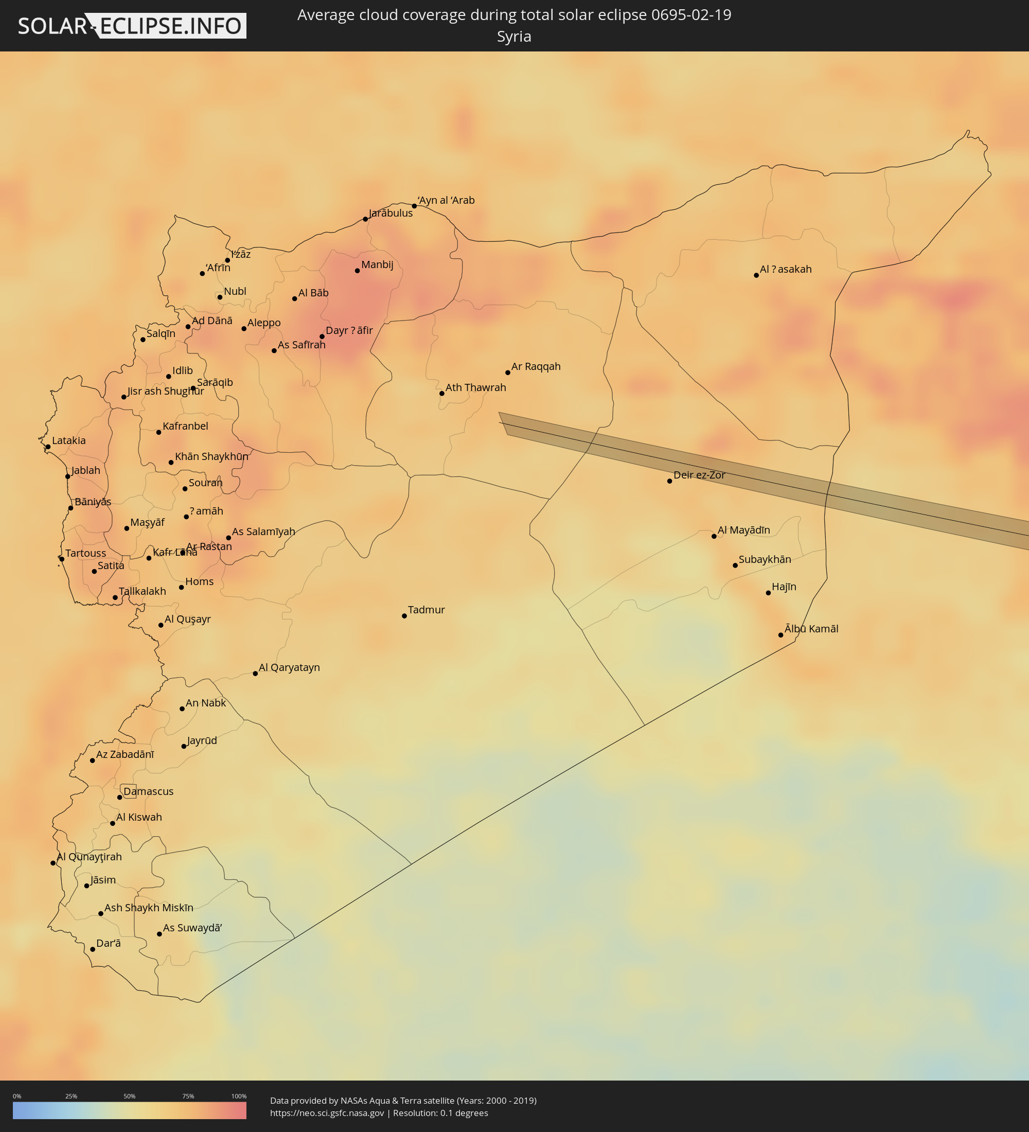 Syria
Syria
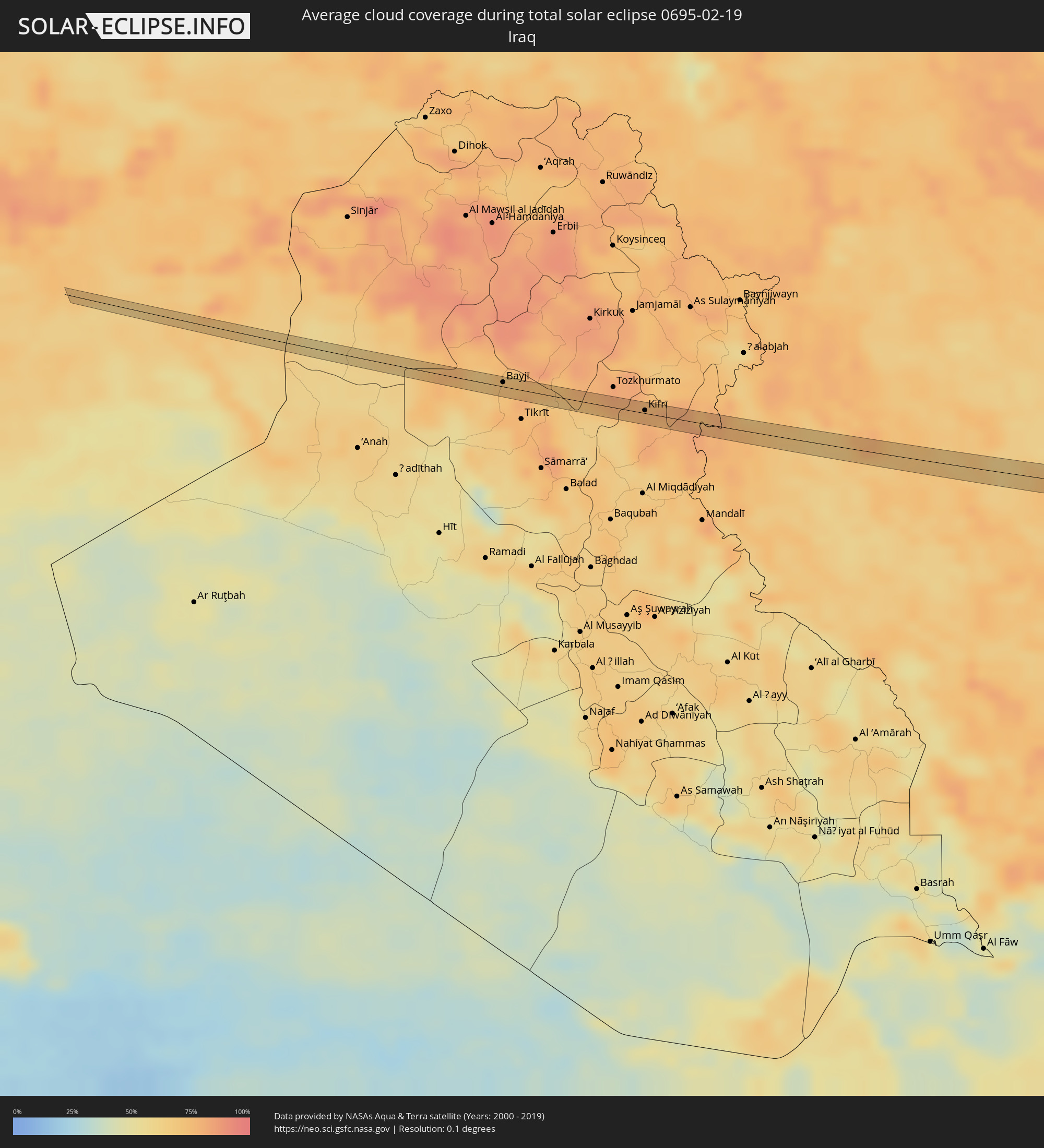 Iraq
Iraq
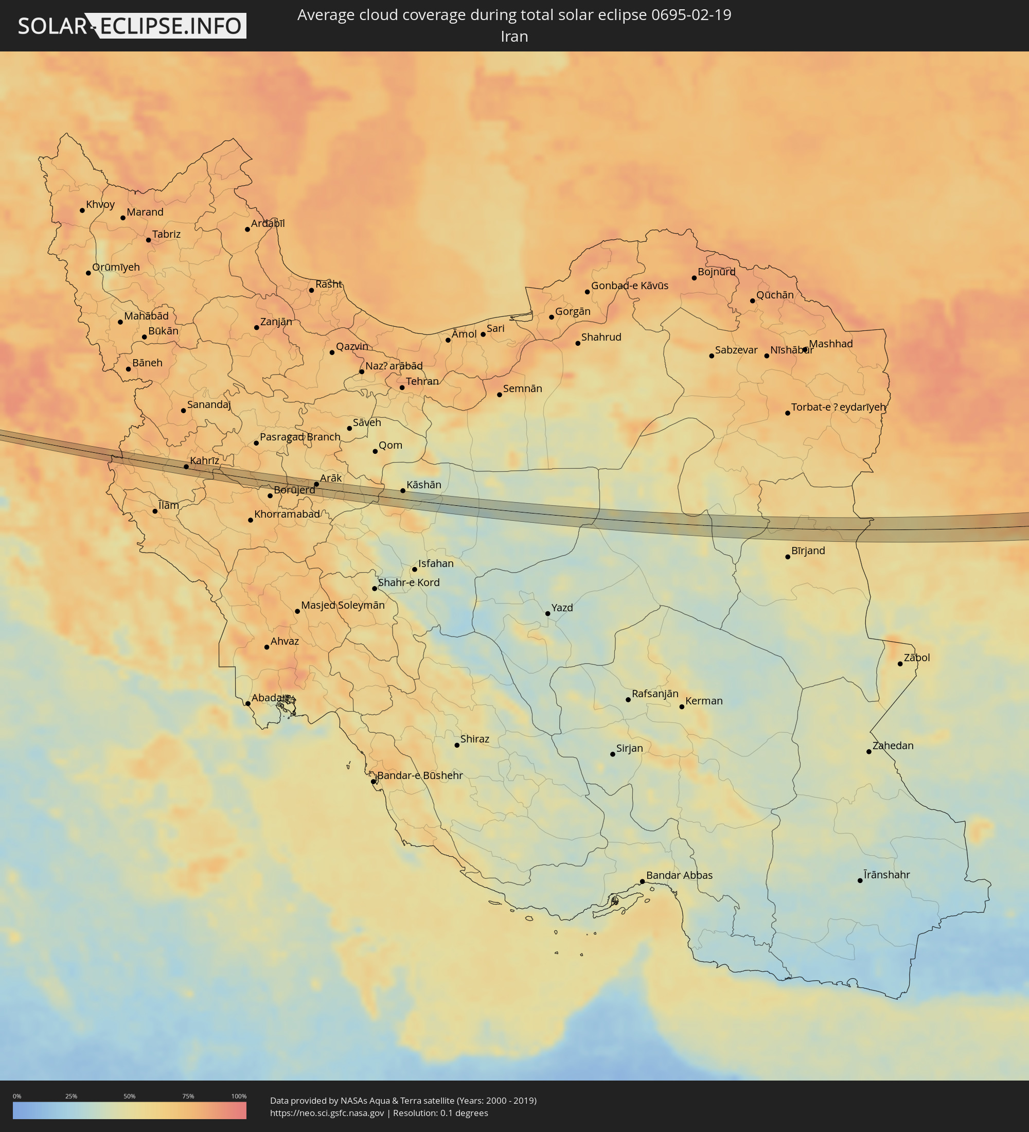 Iran
Iran
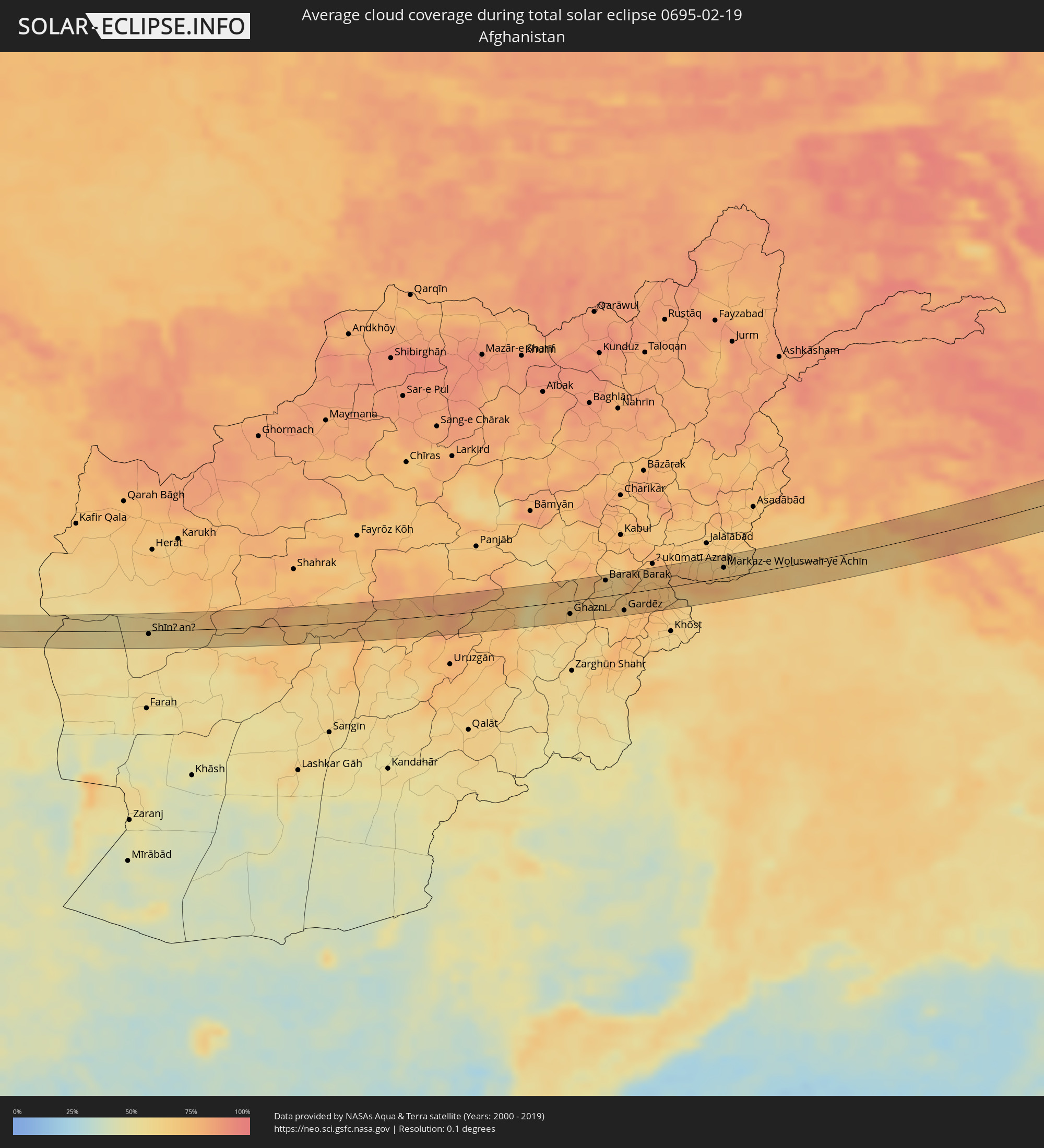 Afghanistan
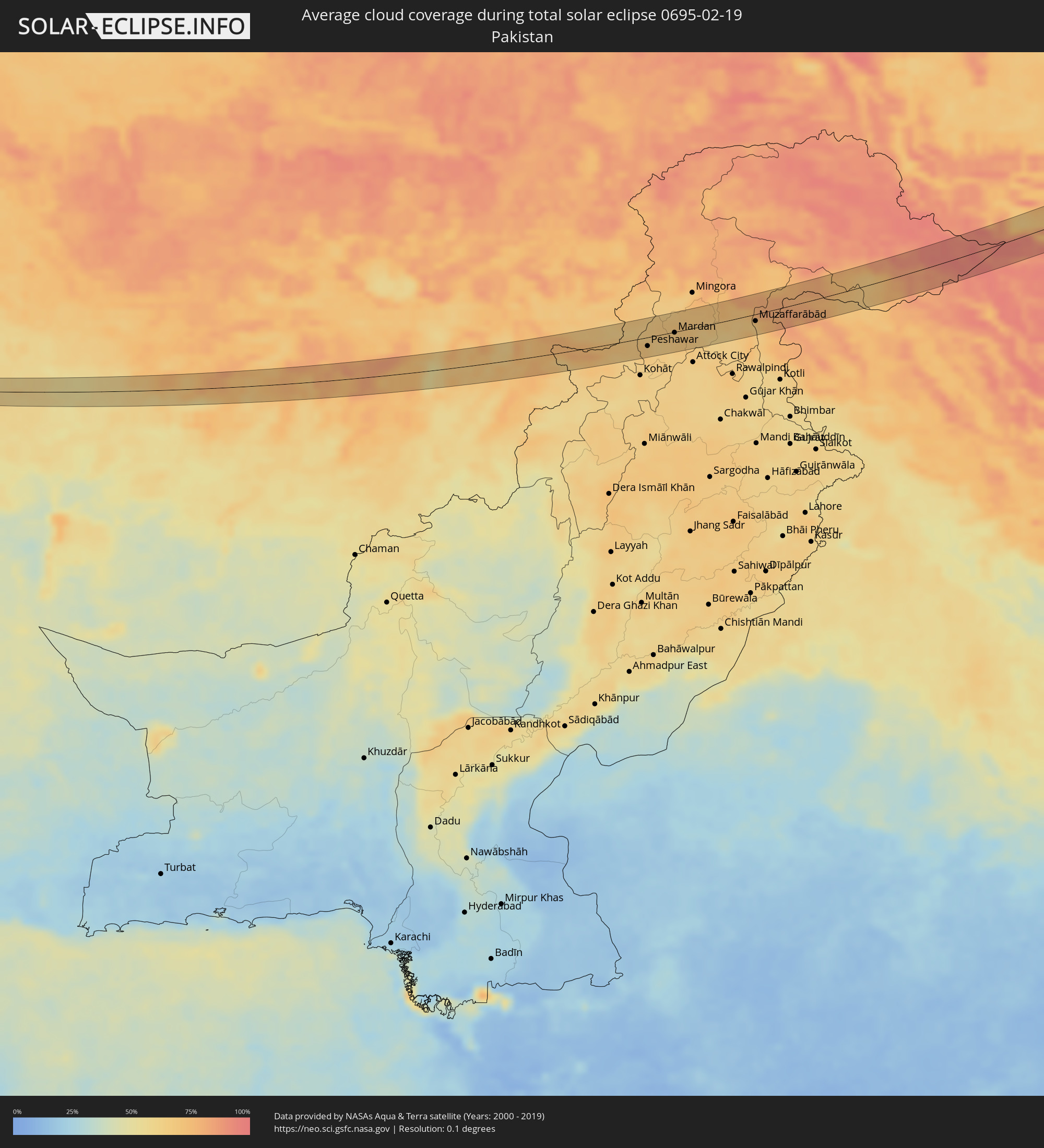 Pakistan
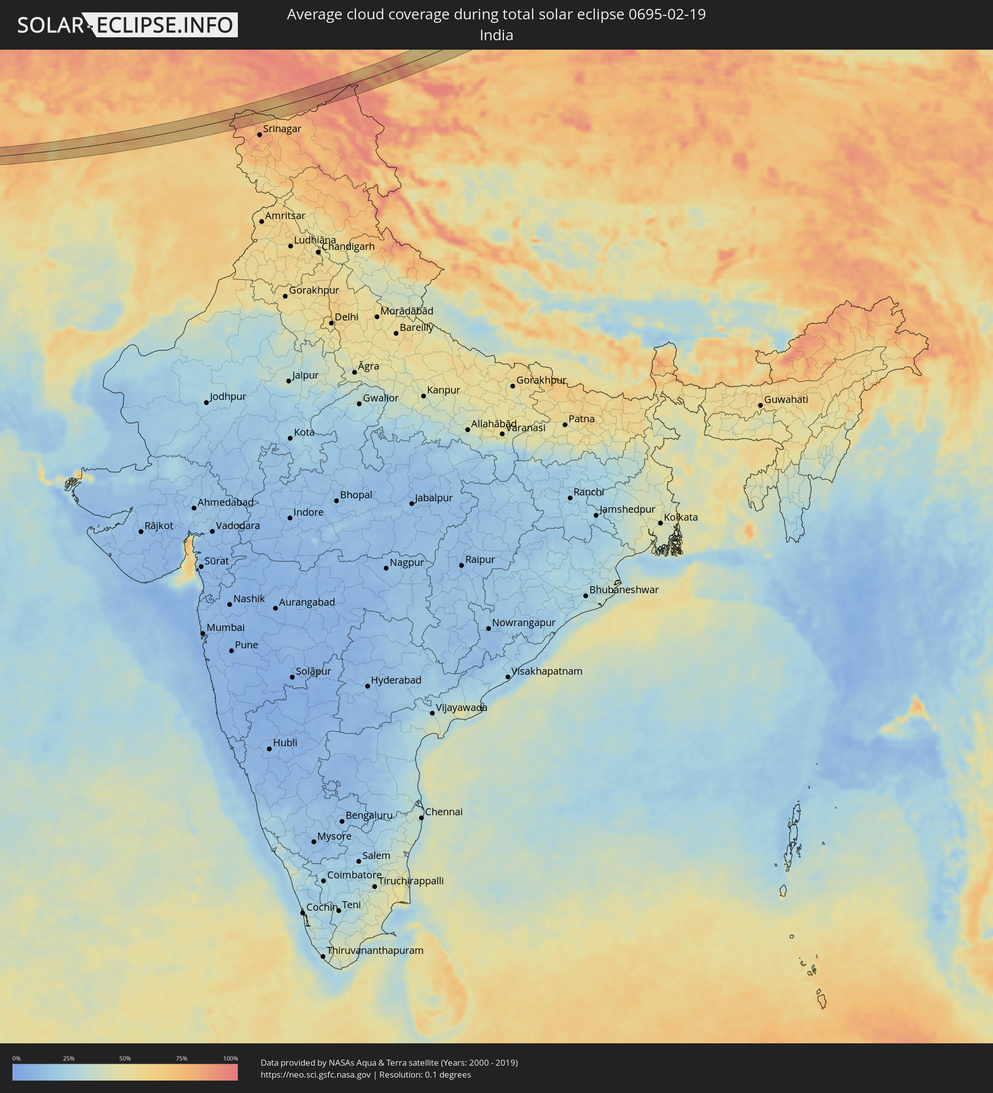 India
India
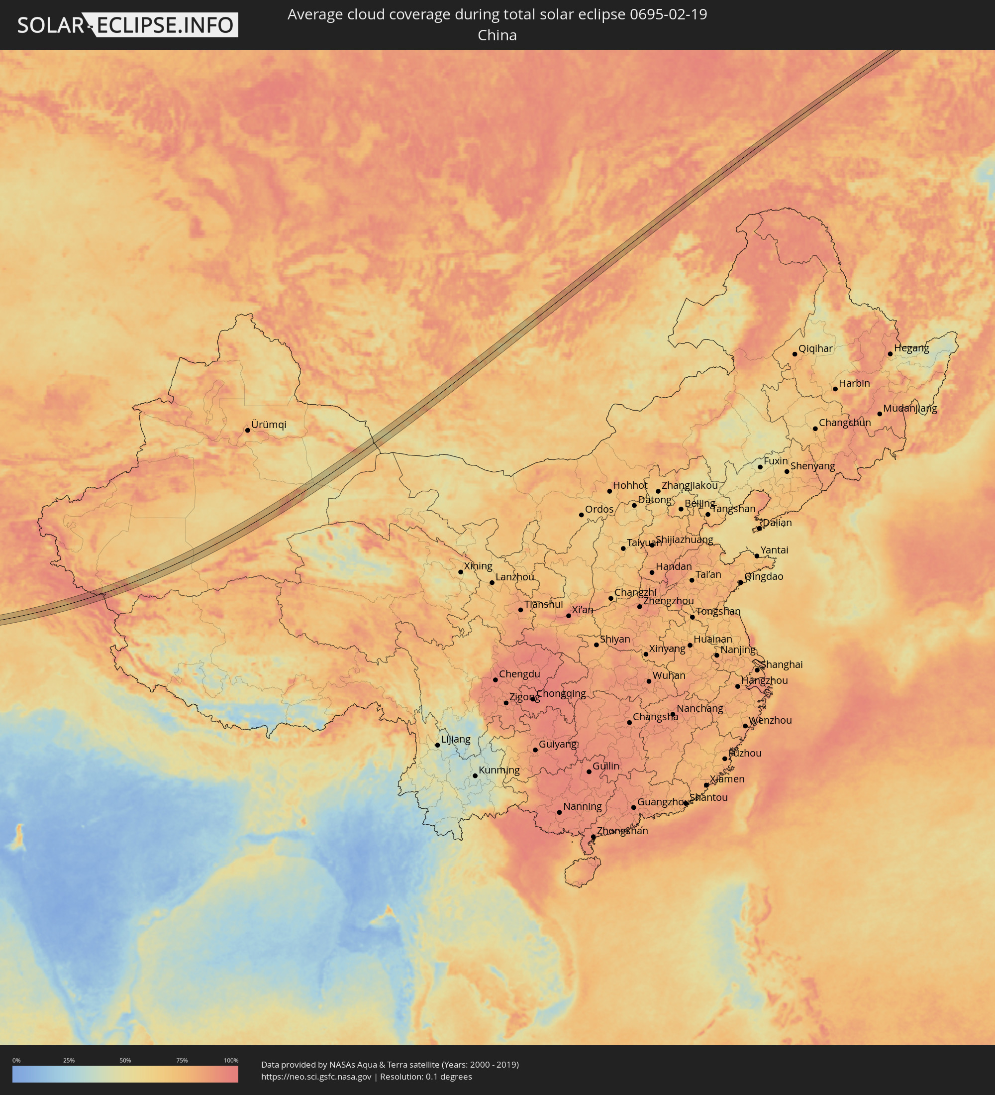 China
China
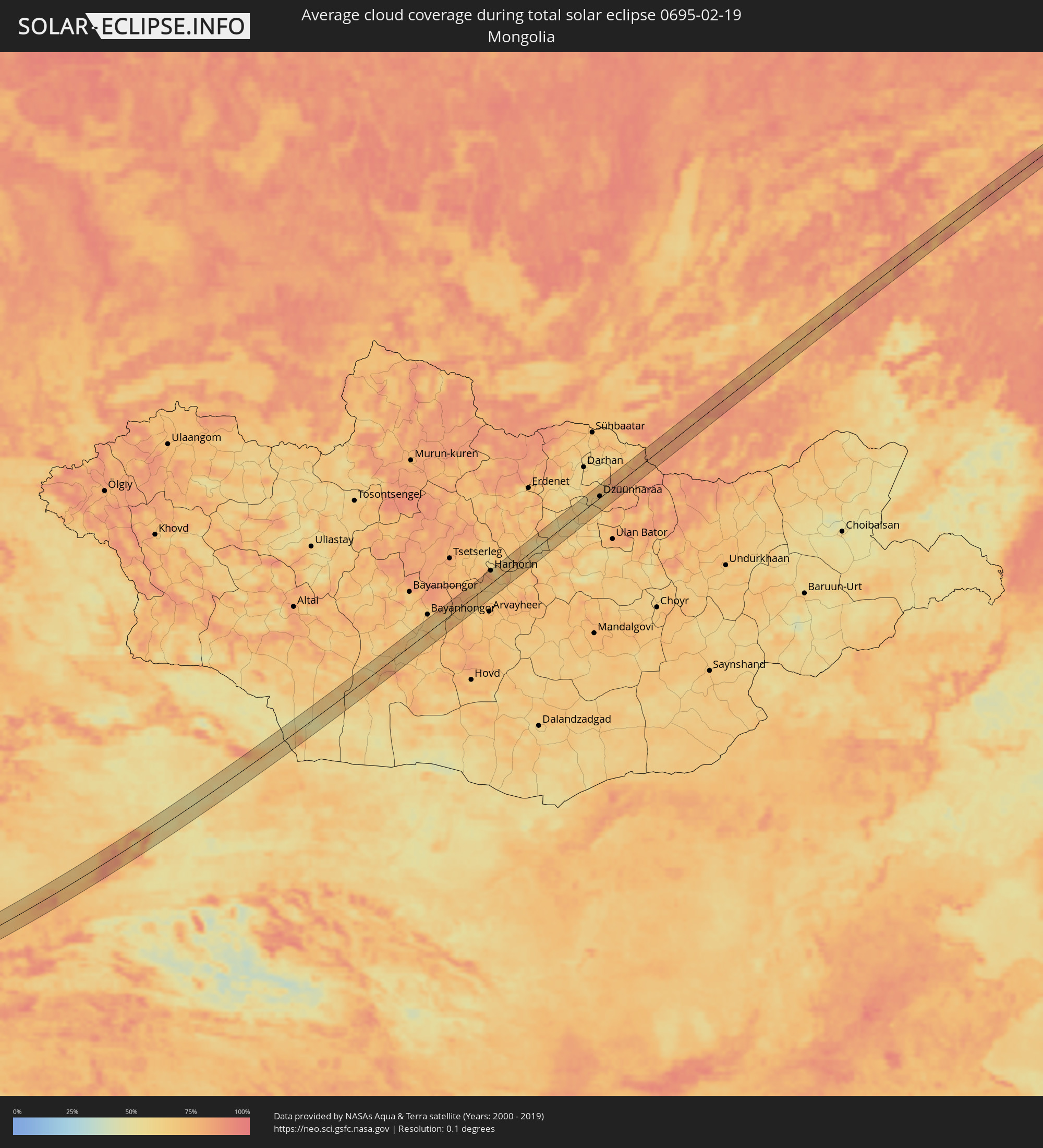 Mongolia
Cities inside the path of the eclipse
The following table shows all locations with a population of more than 5,000 inside the eclipse path. Cities which have more than 100,000 inhabitants are marked bold. A click at the locations opens a detailed map.
| City | Type | Eclipse duration | Local time of max. eclipse | Distance to central line | Ø Cloud coverage |
|
Bayjī, Salah ad Din Governorate
|
total | - | 07:07:47 UTC+02:57 | 4 km | 71% |
|
Kifrī, Diyālá
|
total | - | 07:08:04 UTC+02:57 | 3 km | 77% |
|
Sarpol-e Z̄ahāb, Kermānshāh
|
total | - | 07:36:18 UTC+03:25 | 8 km | 75% |
|
Kahrīz, Kermānshāh
|
total | - | 07:36:48 UTC+03:25 | 2 km | 70% |
|
Kermānshāh, Kermānshāh
|
total | - | 07:36:42 UTC+03:25 | 6 km | 67% |
|
Harsīn, Kermānshāh
|
total | - | 07:36:55 UTC+03:25 | 3 km | 71% |
|
Nahāvand, Hamadān
|
total | - | 07:37:15 UTC+03:25 | 1 km | 68% |
|
Arāk, Markazi
|
total | - | 07:37:54 UTC+03:25 | 6 km | 68% |
|
Delījān, Markazi
|
total | - | 07:38:24 UTC+03:25 | 7 km | 52% |
|
Kāshān, Isfahan
|
total | - | 07:38:55 UTC+03:25 | 15 km | 54% |
|
Tabas, Yazd
|
total | - | 07:42:49 UTC+03:25 | 17 km | 54% |
|
Kushk, Herat
|
total | - | 08:21:51 UTC+04:00 | 5 km | 55% |
|
Shīnḏanḏ, Herat
|
total | - | 08:22:05 UTC+04:00 | 5 km | 55% |
|
Nīlī, Daykundi
|
total | - | 08:27:44 UTC+04:00 | 23 km | 78% |
|
Ghazni, Ghazni
|
total | - | 08:30:40 UTC+04:00 | 18 km | 67% |
|
Barakī Barak, Logar
|
total | - | 08:32:05 UTC+04:00 | 21 km | 63% |
|
Pul-e ‘Alam, Logar
|
total | - | 08:32:14 UTC+04:00 | 23 km | 64% |
|
Gardēz, Paktia
|
total | - | 08:31:55 UTC+04:00 | 23 km | 71% |
|
Parachinar, Federally Administered Tribal Areas
|
total | - | 09:01:54 UTC+04:28 | 2 km | 63% |
|
Markaz-e Woluswalī-ye Āchīn, Nangarhar
|
total | - | 08:34:59 UTC+04:00 | 14 km | 71% |
|
Bāsawul, Nangarhar
|
total | - | 08:35:26 UTC+04:00 | 24 km | 65% |
|
Shabqadar, Khyber Pakhtunkhwa
|
total | - | 09:04:39 UTC+04:28 | 9 km | 65% |
|
Peshawar, Khyber Pakhtunkhwa
|
total | - | 09:04:22 UTC+04:28 | 14 km | 68% |
|
Tangi, Khyber Pakhtunkhwa
|
total | - | 09:04:56 UTC+04:28 | 17 km | 66% |
|
Chārsadda, Khyber Pakhtunkhwa
|
total | - | 09:04:50 UTC+04:28 | 1 km | 65% |
|
Utmānzai, Khyber Pakhtunkhwa
|
total | - | 09:04:56 UTC+04:28 | 3 km | 66% |
|
Pabbi, Khyber Pakhtunkhwa
|
total | - | 09:04:42 UTC+04:28 | 17 km | 65% |
|
Amān Garh, Khyber Pakhtunkhwa
|
total | - | 09:04:55 UTC+04:28 | 20 km | 66% |
|
Risalpur Cantonment, Khyber Pakhtunkhwa
|
total | - | 09:05:06 UTC+04:28 | 15 km | 65% |
|
Nowshera Cantonment, Khyber Pakhtunkhwa
|
total | - | 09:05:01 UTC+04:28 | 22 km | 63% |
|
Mardan, Khyber Pakhtunkhwa
|
total | - | 09:05:25 UTC+04:28 | 1 km | 68% |
|
Akora, Khyber Pakhtunkhwa
|
total | - | 09:05:14 UTC+04:28 | 24 km | 65% |
|
Zaida, Khyber Pakhtunkhwa
|
total | - | 09:05:52 UTC+04:28 | 24 km | 65% |
|
Swābi, Khyber Pakhtunkhwa
|
total | - | 09:05:58 UTC+04:28 | 18 km | 65% |
|
Topi, Khyber Pakhtunkhwa
|
total | - | 09:06:08 UTC+04:28 | 26 km | 65% |
|
Mānsehra, Khyber Pakhtunkhwa
|
total | - | 09:07:29 UTC+04:28 | 9 km | 66% |
|
Abbottābād, Khyber Pakhtunkhwa
|
total | - | 09:07:13 UTC+04:28 | 30 km | 65% |
|
Baffa, Khyber Pakhtunkhwa
|
total | - | 09:07:41 UTC+04:28 | 2 km | 65% |
|
Muzaffarābād, Azad Kashmir
|
total | - | 09:07:59 UTC+04:28 | 11 km | 66% |
|
Bandipura, Kashmir
|
total | - | 10:03:00 UTC+05:21 | 31 km | 76% |
|
Kharkhorin, Övörhangay
|
total | - | 12:54:46 UTC+07:07 | 26 km | 83% |
|
Harhorin, Övörhangay
|
total | - | 12:54:48 UTC+07:07 | 26 km | 83% |
|
Dzüünharaa, Selenge
|
total | - | 13:01:02 UTC+07:07 | 2 km | 66% |