Total solar eclipse of 03/06/0927
| Day of week: | Thursday |
| Maximum duration of eclipse: | 04m50s |
| Maximum width of eclipse path: | 214 km |
| Saros cycle: | 93 |
| Coverage: | 100% |
| Magnitude: | 1.0617 |
| Gamma: | -0.3456 |
Wo kann man die Sonnenfinsternis vom 03/06/0927 sehen?
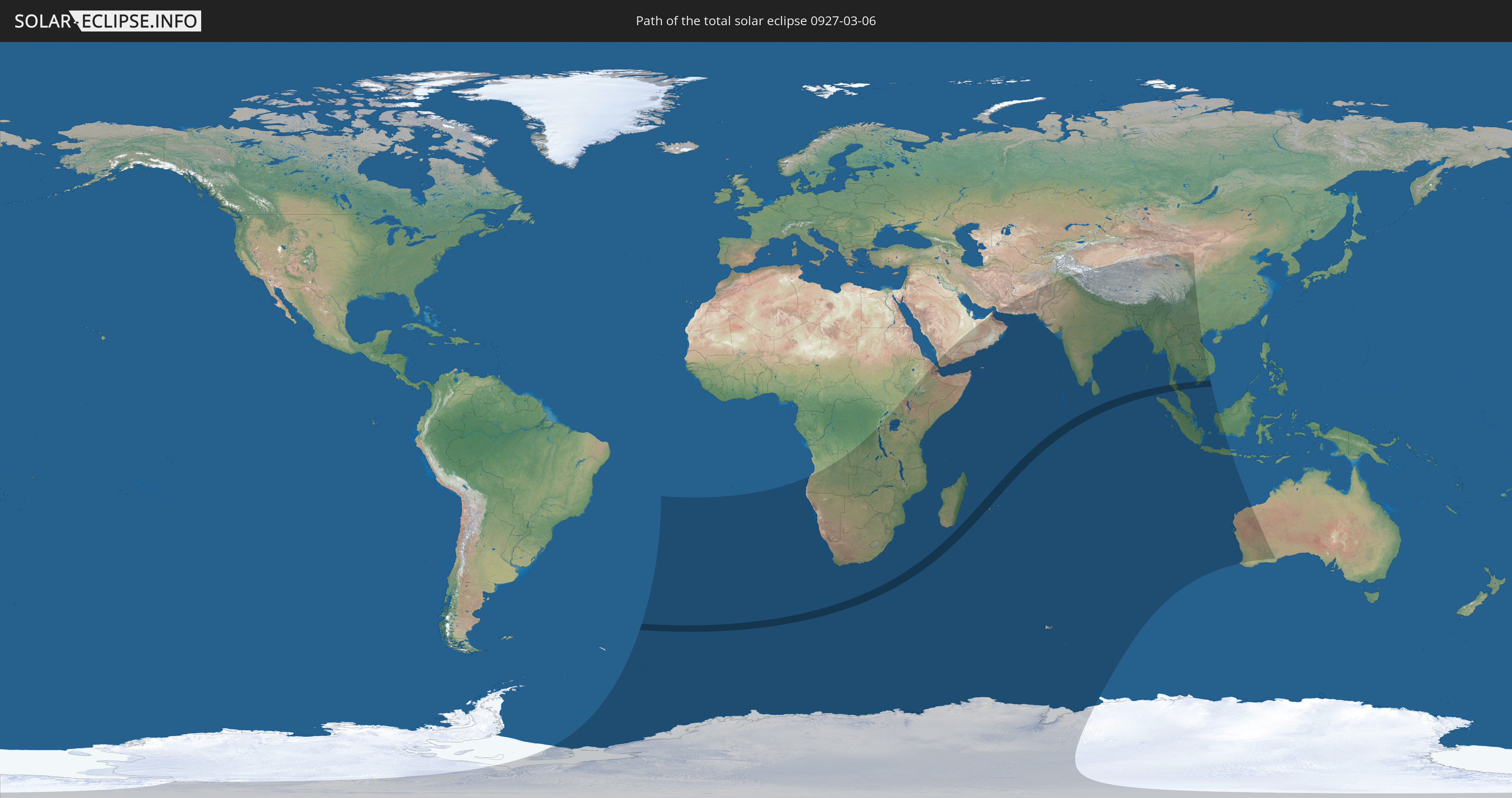
Die Sonnenfinsternis am 03/06/0927 kann man in 58 Ländern als partielle Sonnenfinsternis beobachten.
Der Finsternispfad verläuft durch 4 Länder. Nur in diesen Ländern ist sie als total Sonnenfinsternis zu sehen.
In den folgenden Ländern ist die Sonnenfinsternis total zu sehen
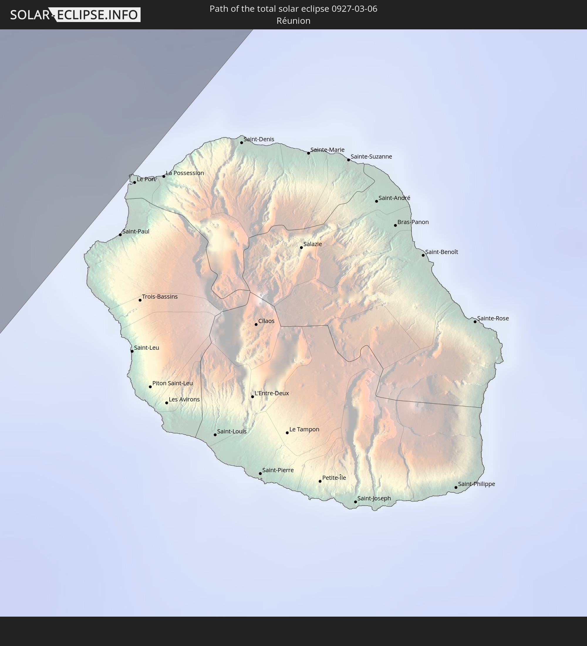 Réunion
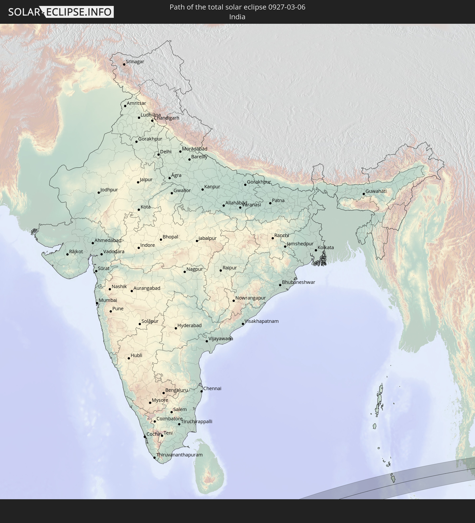 India
India
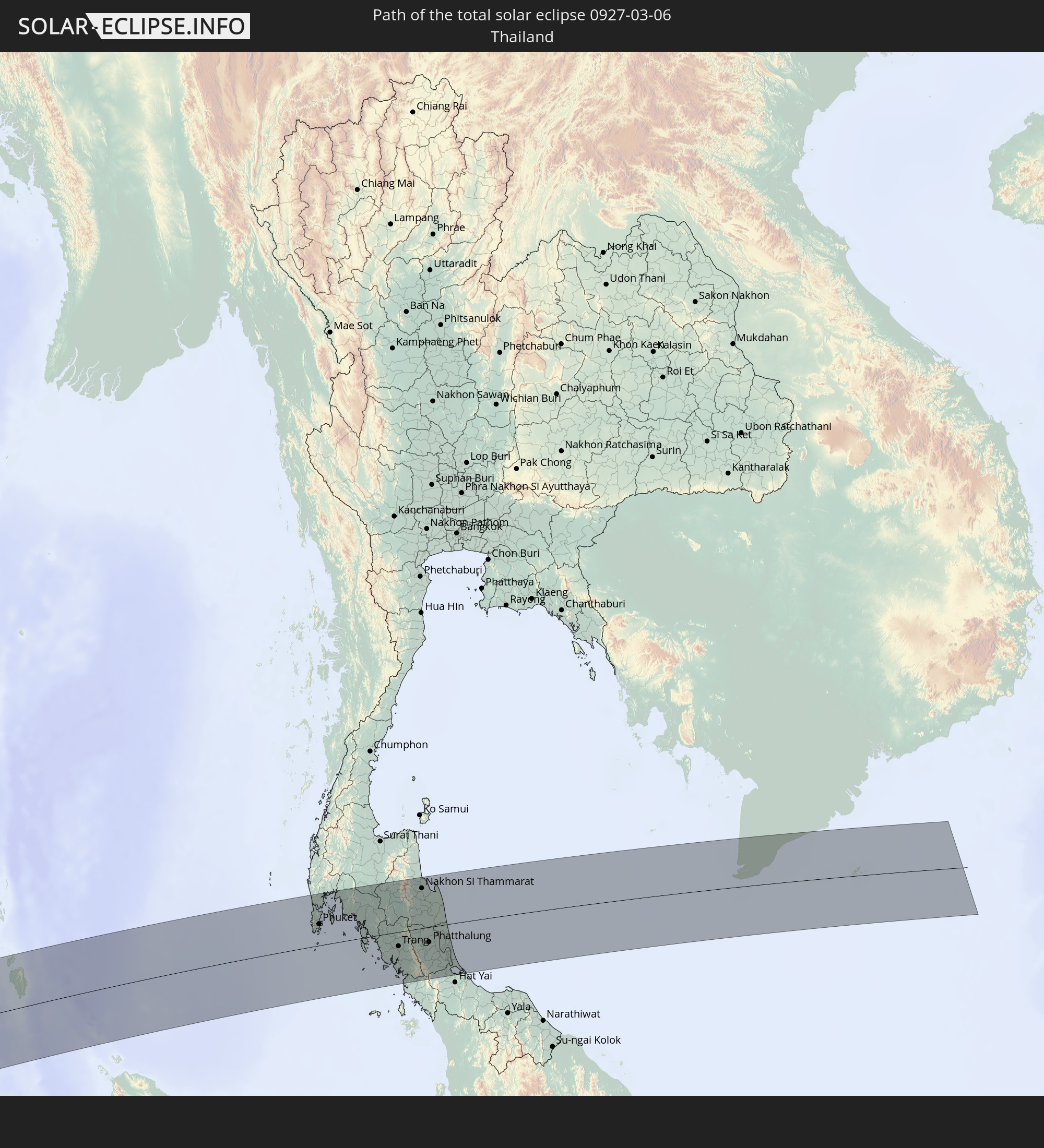 Thailand
 Vietnam
In den folgenden Ländern ist die Sonnenfinsternis partiell zu sehen
 Antarctica
 South Georgia and the South Sandwich Islands
 Saint Helena, Ascension and Tristan da Cunha
 Bouvet Island
 Angola
 Namibia
 Democratic Republic of the Congo
 South Africa
 Botswana
 Zambia
 Zimbabwe
 Lesotho
 Rwanda
 Burundi
 Tanzania
 Uganda
 Mozambique
 Swaziland
 Malawi
 Ethiopia
 Kenya
Kenya
 Saudi Arabia
 Eritrea
 French Southern and Antarctic Lands
 Somalia
 Djibouti
 Yemen
Yemen
 Madagascar
 Comoros
 Iran
Iran
 Mayotte
 Seychelles
 United Arab Emirates
 Oman
Oman
 Réunion
 Mauritius
 Afghanistan
 Pakistan
 India
India
 British Indian Ocean Territory
 Heard Island and McDonald Islands
 Maldives
 China
China
 Sri Lanka
 Nepal
Nepal
 Bangladesh
 Bhutan
 Myanmar
 Indonesia
 Cocos Islands
 Thailand
 Malaysia
 Laos
Laos
 Vietnam
 Cambodia
 Singapore
 Christmas Island
 Australia
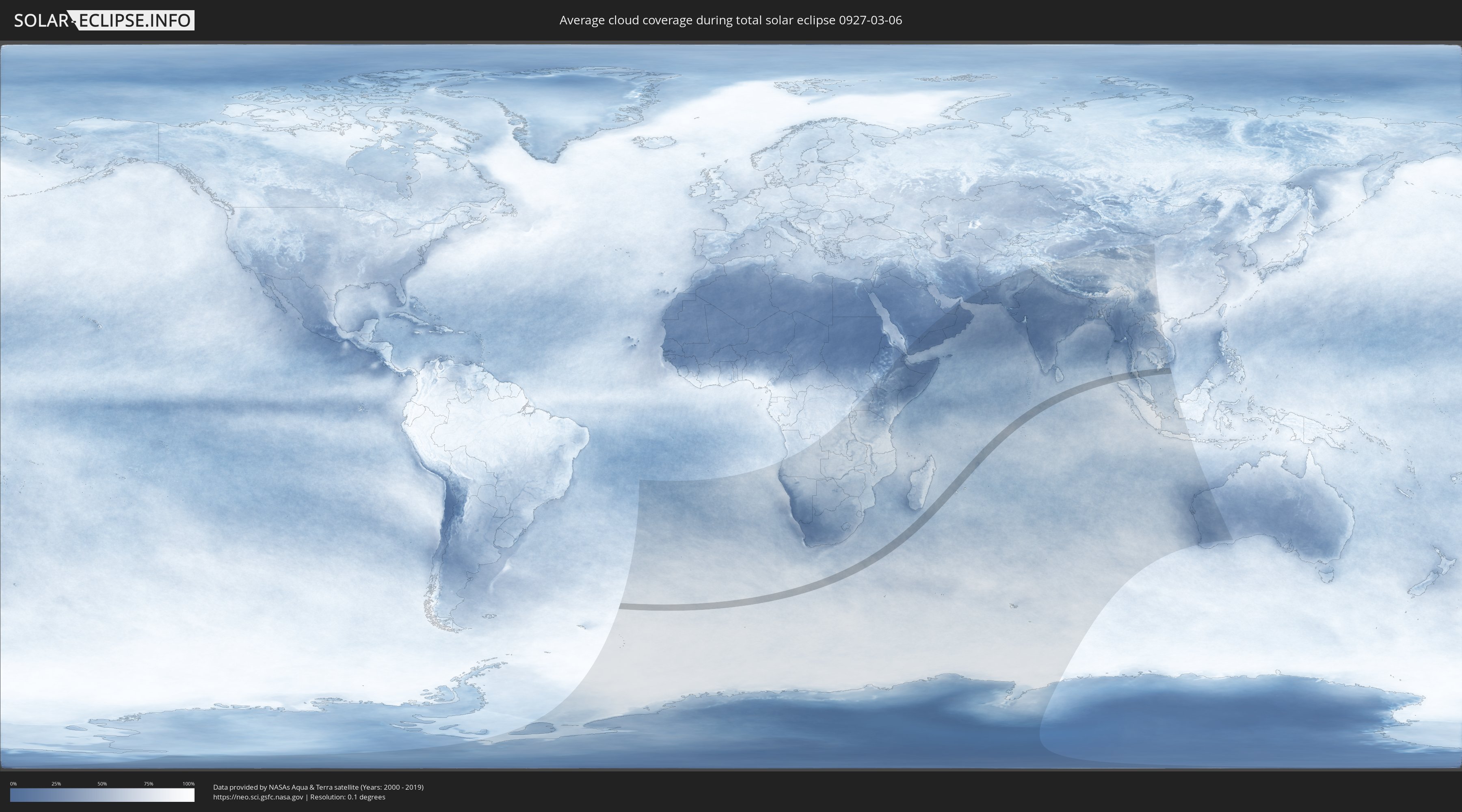
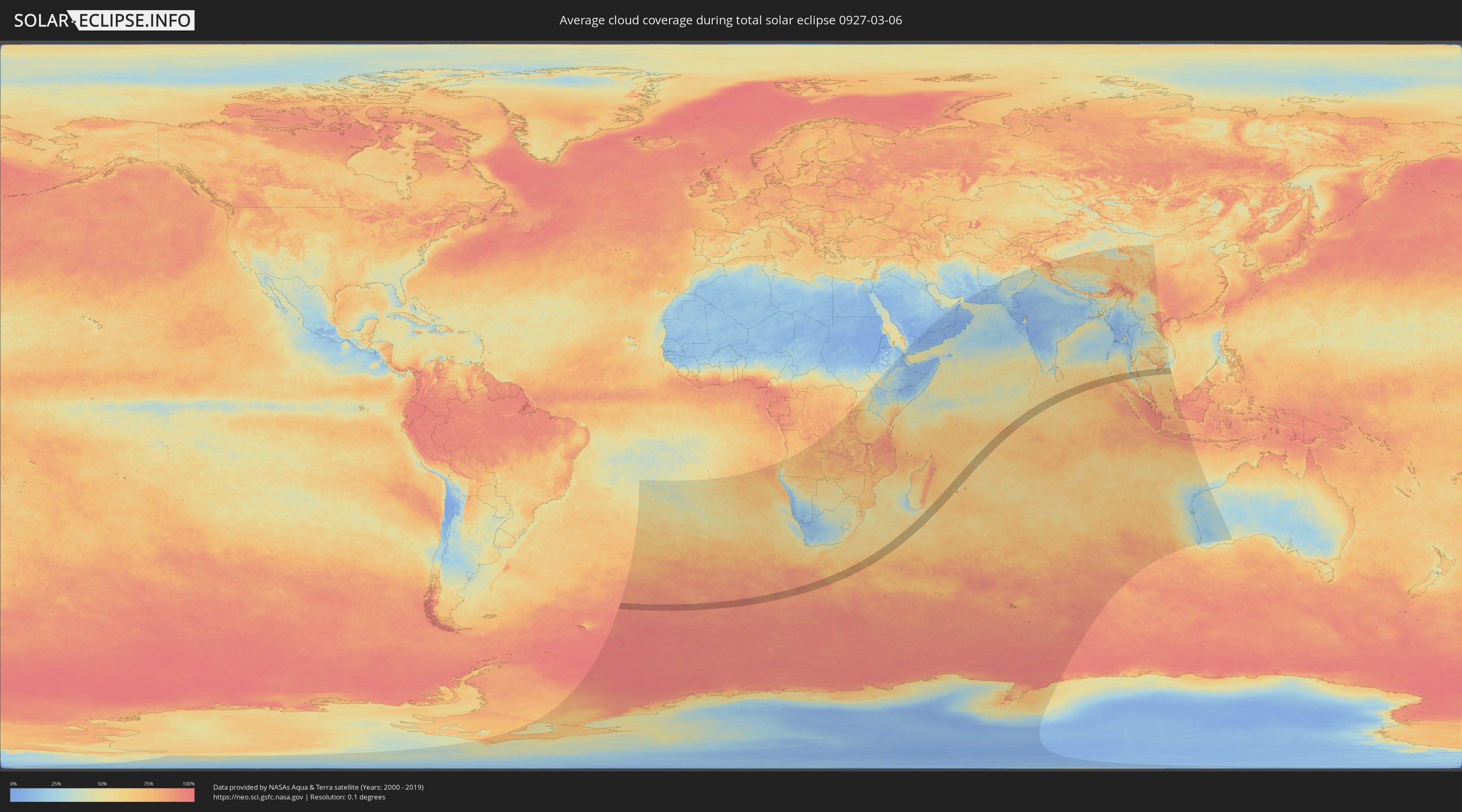
How will be the weather during the total solar eclipse on 03/06/0927?
Where is the best place to see the total solar eclipse of 03/06/0927?
The following maps show the average cloud coverage for the day of the total solar eclipse.
With the help of these maps, it is possible to find the place along the eclipse path, which has the best
chance of a cloudless sky.
Nevertheless, you should consider local circumstances and inform about the weather of your chosen
observation site.
The data is provided by NASAs satellites
AQUA and TERRA.
The cloud maps are averaged over a period of 19 years (2000 - 2019).
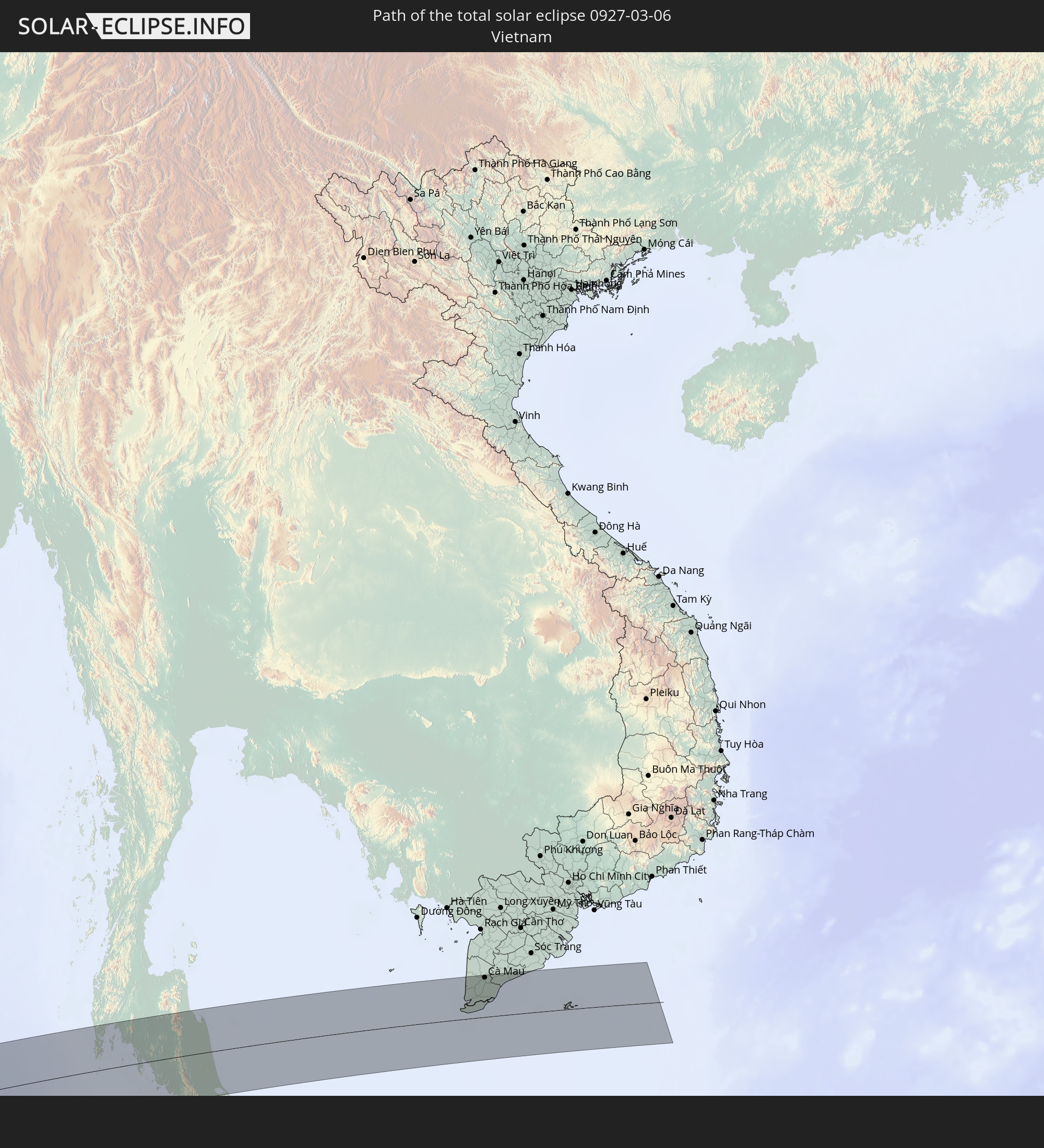
Detailed country maps
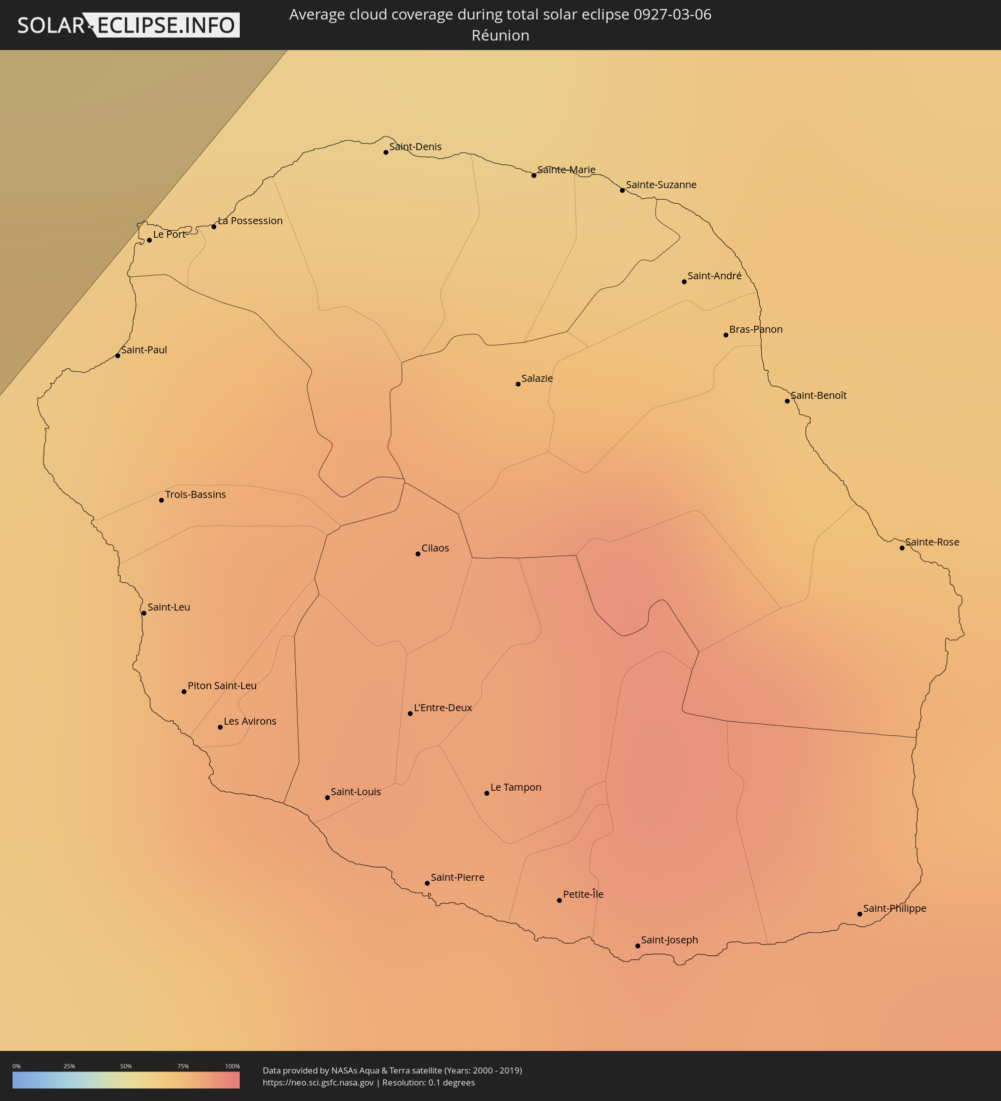 Réunion
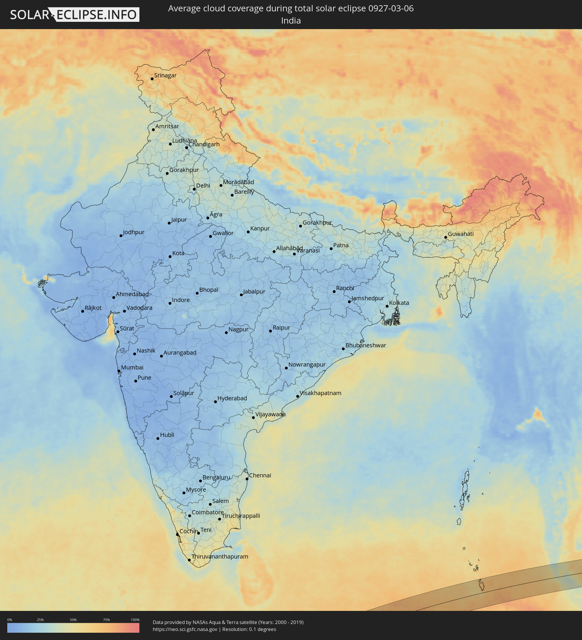 India
India
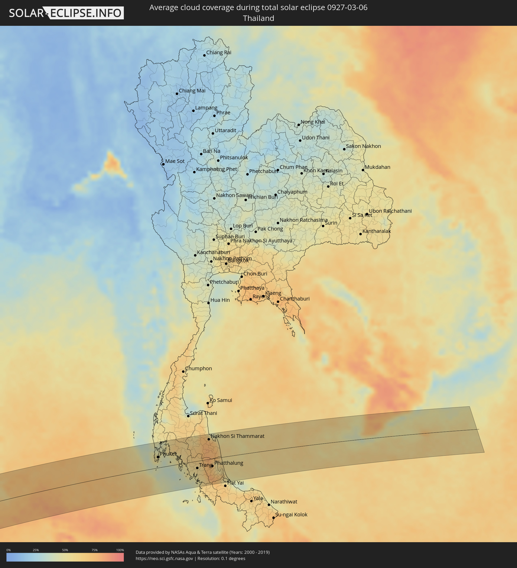 Thailand
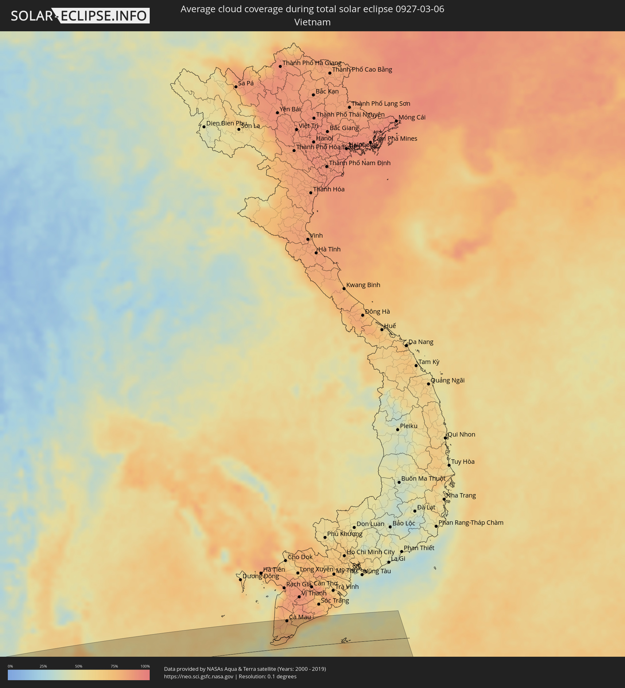 Vietnam
Cities inside the path of the eclipse
The following table shows all locations with a population of more than 5,000 inside the eclipse path. Cities which have more than 100,000 inhabitants are marked bold. A click at the locations opens a detailed map.
| City | Type | Eclipse duration | Local time of max. eclipse | Distance to central line | Ø Cloud coverage |
|
Patong, Phuket
|
total | - | 17:36:04 UTC+06:42 | 38 km | 54% |
|
Ban Karon, Phuket
|
total | - | 17:36:02 UTC+06:42 | 33 km | 51% |
|
Rawai, Phuket
|
total | - | 17:35:59 UTC+06:42 | 25 km | 51% |
|
Kathu, Phuket
|
total | - | 17:36:05 UTC+06:42 | 40 km | 54% |
|
Ban Chalong, Phuket
|
total | - | 17:36:02 UTC+06:42 | 31 km | 51% |
|
Wichit, Phuket
|
total | - | 17:36:05 UTC+06:42 | 35 km | 52% |
|
Ban Talat Nua, Phuket
|
total | - | 17:36:05 UTC+06:42 | 35 km | 52% |
|
Ban Ko Kaeo, Phuket
|
total | - | 17:36:07 UTC+06:42 | 40 km | 52% |
|
Phuket, Phuket
|
total | - | 17:36:05 UTC+06:42 | 35 km | 52% |
|
Ban Talat Yai, Phuket
|
total | - | 17:36:05 UTC+06:42 | 35 km | 52% |
|
Ban Ratsada, Phuket
|
total | - | 17:36:06 UTC+06:42 | 37 km | 52% |
|
Ban Phru Nai, Phangnga
|
total | - | 17:36:11 UTC+06:42 | 39 km | 44% |
|
Ao Luek, Krabi
|
total | - | 17:36:32 UTC+06:42 | 83 km | 49% |
|
Ban Ao Nang, Phangnga
|
total | - | 17:36:18 UTC+06:42 | 45 km | 50% |
|
Krabi, Krabi
|
total | - | 17:36:20 UTC+06:42 | 46 km | 56% |
|
Nuea Khlong, Krabi
|
total | - | 17:36:22 UTC+06:42 | 44 km | 56% |
|
Saladan, Krabi
|
total | - | 17:36:00 UTC+06:42 | 7 km | 43% |
|
Chai Buri, Surat Thani
|
total | - | 17:36:41 UTC+06:42 | 85 km | 62% |
|
Ko Lanta, Krabi
|
total | - | 17:35:57 UTC+06:42 | 17 km | 43% |
|
Tham Phannara, Nakhon Si Thammarat
|
total | - | 17:36:43 UTC+06:42 | 75 km | 59% |
|
Chawang, Nakhon Si Thammarat
|
total | - | 17:36:44 UTC+06:42 | 74 km | 57% |
|
Kantang, Trang
|
total | - | 17:35:56 UTC+06:42 | 39 km | 49% |
|
Trang, Trang
|
total | - | 17:36:05 UTC+06:42 | 24 km | 57% |
|
Huai Yot, Trang
|
total | - | 17:36:16 UTC+06:42 | 1 km | 63% |
|
Thung Song, Nakhon Si Thammarat
|
total | - | 17:36:34 UTC+06:42 | 42 km | 70% |
|
Ron Phibun, Nakhon Si Thammarat
|
total | - | 17:36:37 UTC+06:42 | 40 km | 78% |
|
Nakhon Si Thammarat, Nakhon Si Thammarat
|
total | - | 17:36:50 UTC+06:42 | 66 km | 76% |
|
Phatthalung, Phatthalung
|
total | - | 17:36:13 UTC+06:42 | 25 km | 68% |
|
Pak Phanang, Nakhon Si Thammarat
|
total | - | 17:36:48 UTC+06:42 | 53 km | 65% |
|
Ranot, Songkhla
|
total | - | 17:36:23 UTC+06:42 | 12 km | 58% |
|
Ban Mai, Songkhla
|
total | - | 17:35:58 UTC+06:42 | 79 km | 52% |
|
Songkhla, Songkhla
|
total | - | 17:35:59 UTC+06:42 | 80 km | 48% |
|
Cà Mau, Cà Mau
|
total | - | 18:02:30 UTC+07:06 | 76 km | 76% |