Total solar eclipse of 05/08/1008
| Day of week: | Sunday |
| Maximum duration of eclipse: | 06m22s |
| Maximum width of eclipse path: | 330 km |
| Saros cycle: | 112 |
| Coverage: | 100% |
| Magnitude: | 1.0734 |
| Gamma: | -0.694 |
Wo kann man die Sonnenfinsternis vom 05/08/1008 sehen?
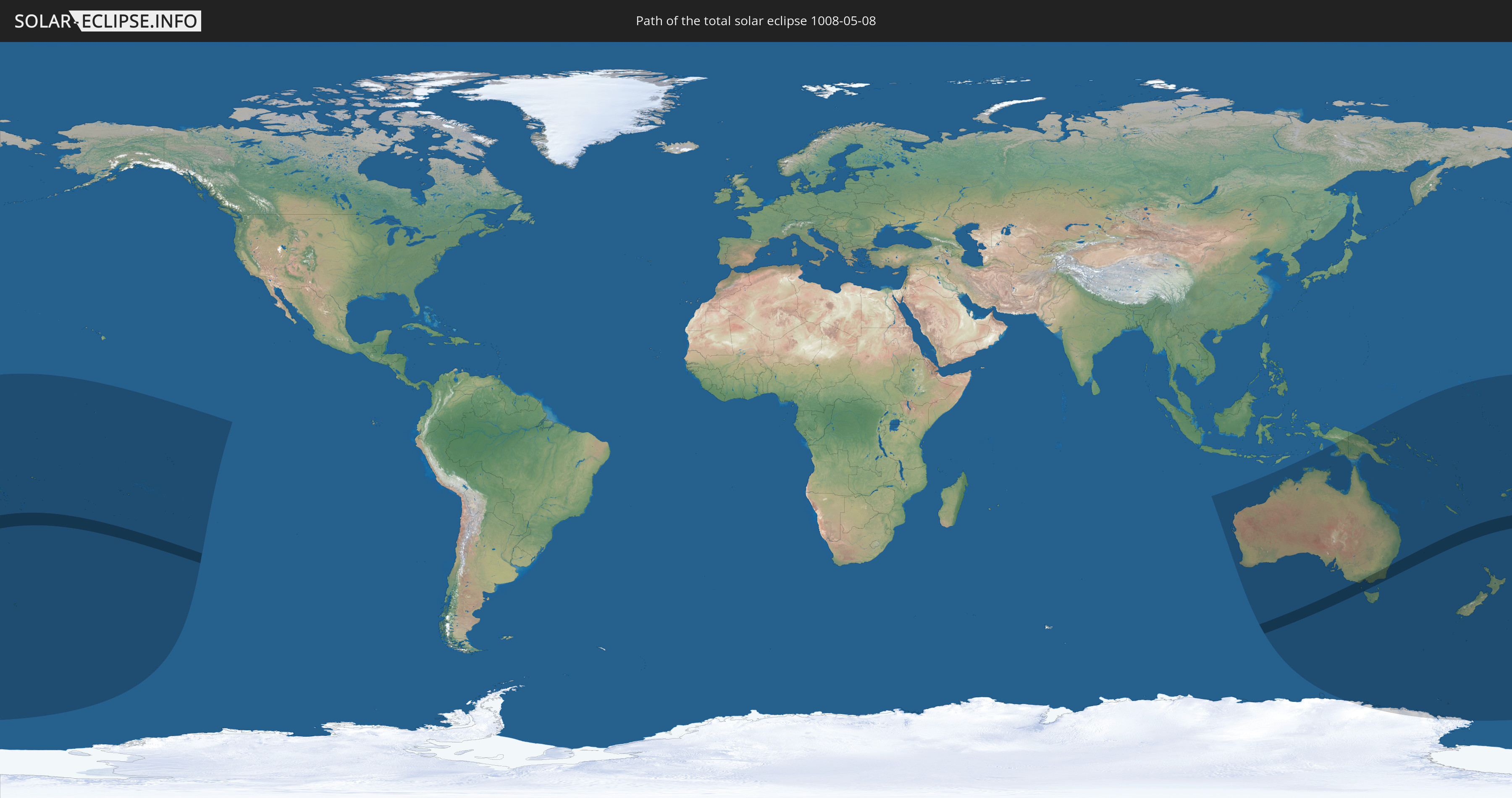
Die Sonnenfinsternis am 05/08/1008 kann man in 25 Ländern als partielle Sonnenfinsternis beobachten.
Der Finsternispfad verläuft durch 4 Länder. Nur in diesen Ländern ist sie als total Sonnenfinsternis zu sehen.
In den folgenden Ländern ist die Sonnenfinsternis total zu sehen
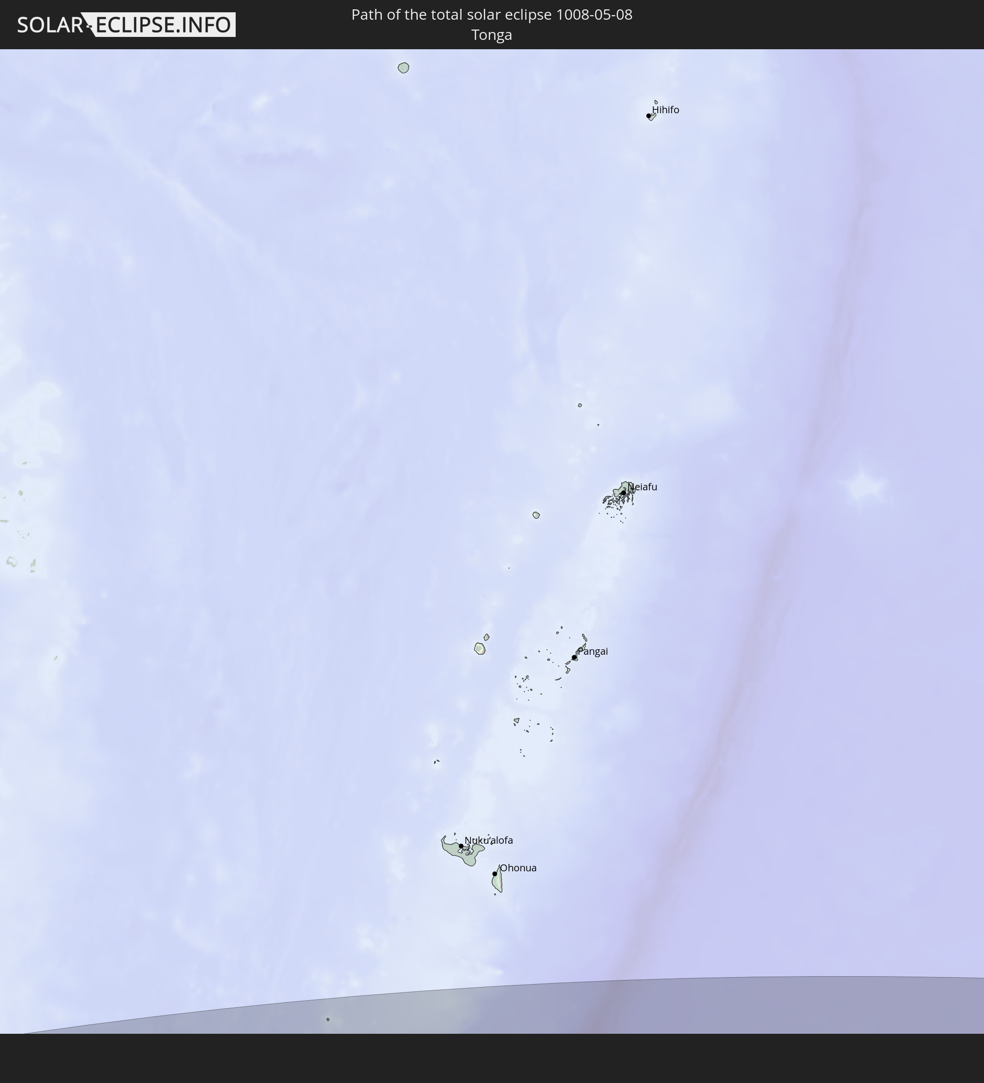 Tonga
Tonga
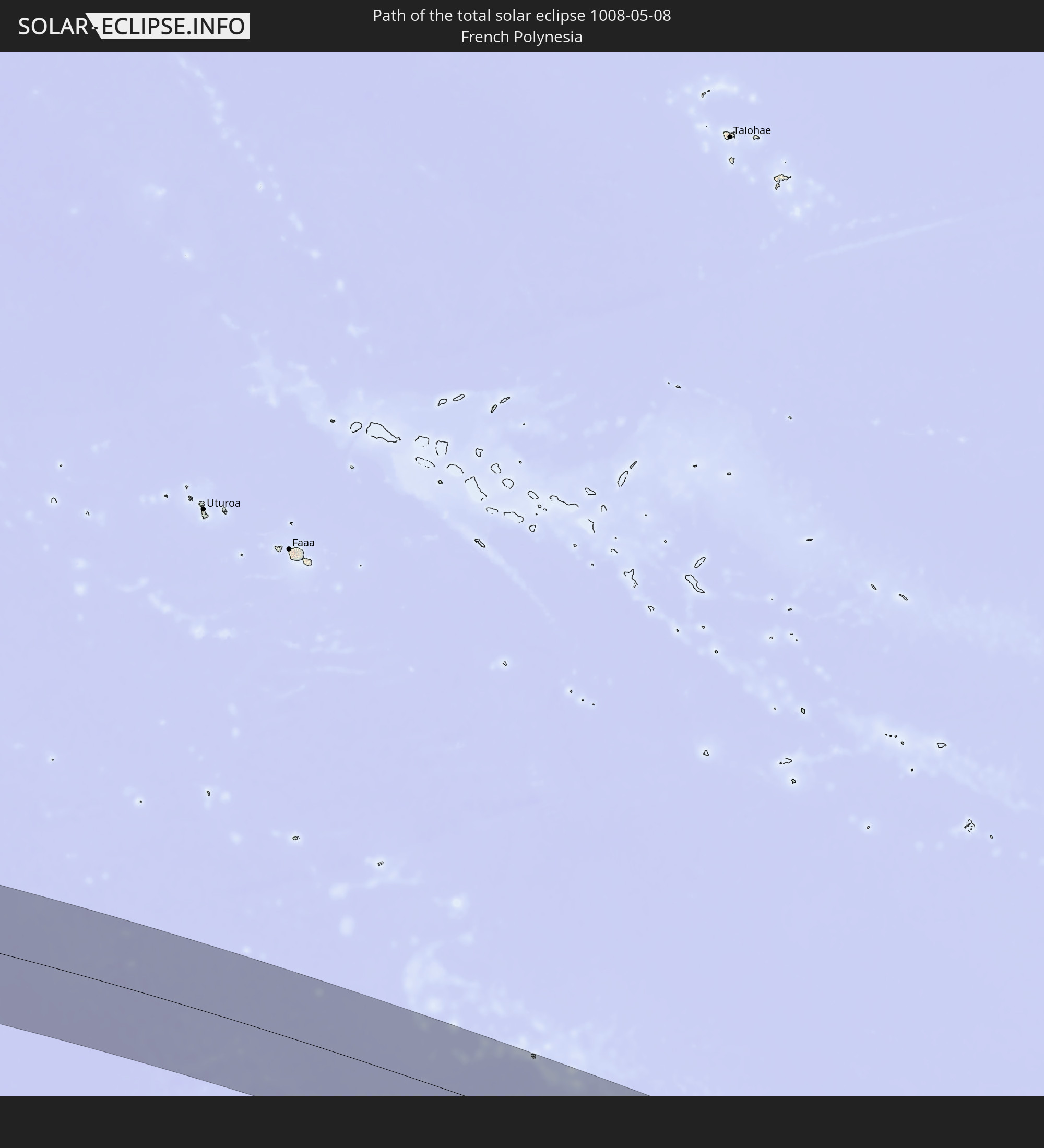 French Polynesia
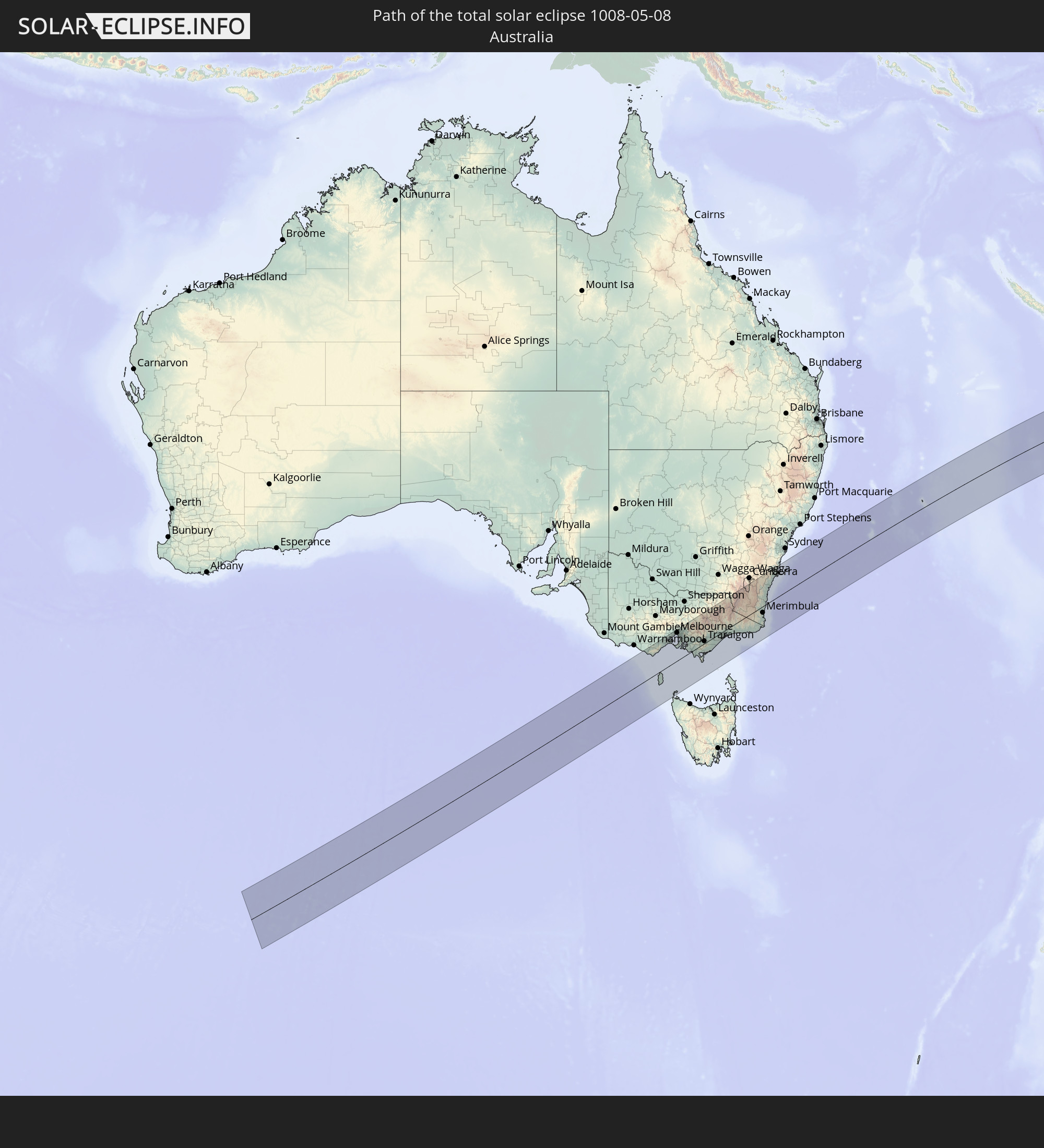 Australia
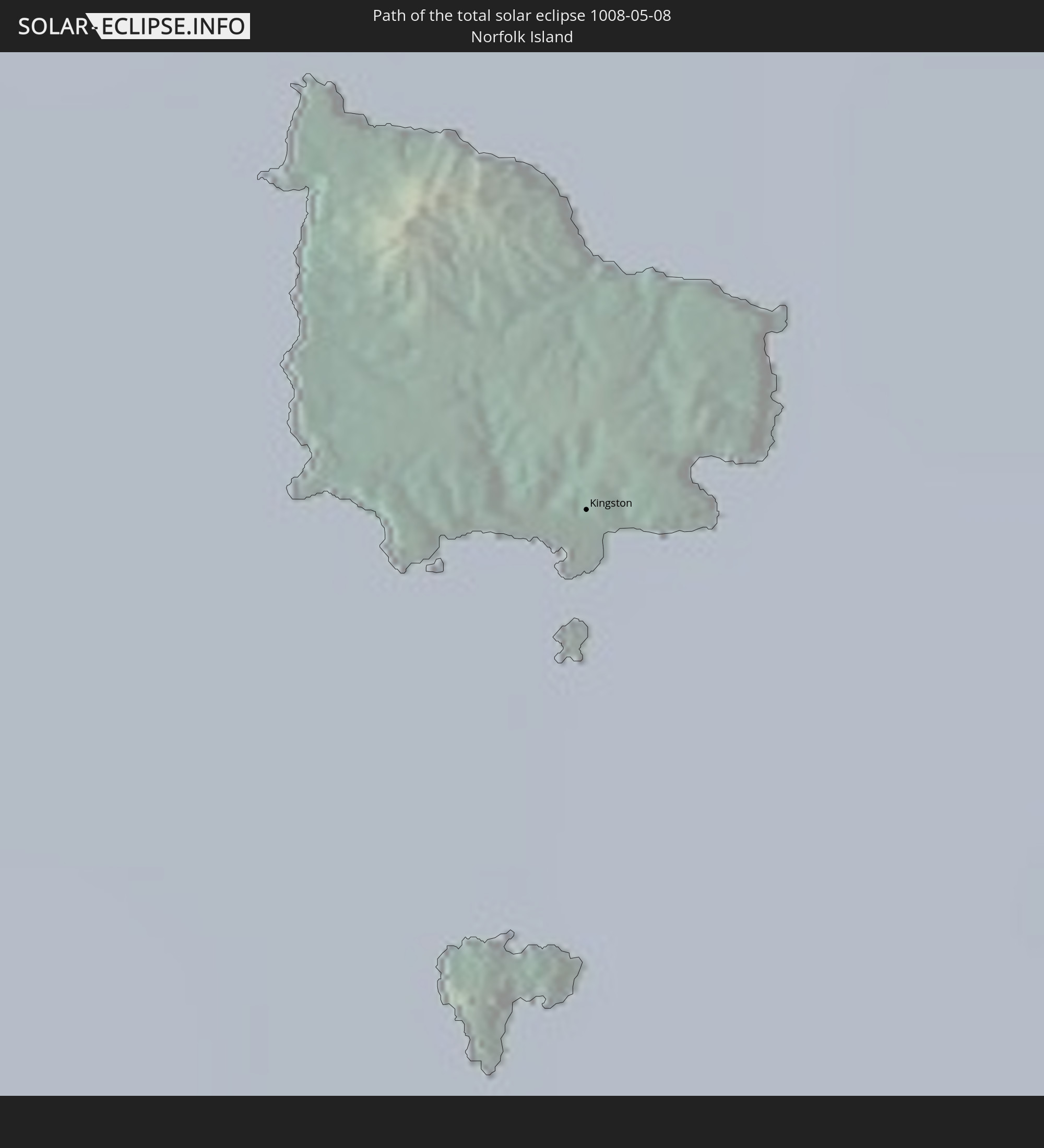 Norfolk Island
In den folgenden Ländern ist die Sonnenfinsternis partiell zu sehen
 Antarctica
 Fiji
Fiji
 New Zealand
 United States Minor Outlying Islands
 Wallis and Futuna
 Tonga
Tonga
 Kiribati
 Samoa
Samoa
 Tokelau
 American Samoa
 Niue
Niue
 Cook Islands
 French Polynesia
 Pitcairn Islands
 Indonesia
 Australia
 Federated States of Micronesia
 Papua New Guinea
 Solomon Islands
 New Caledonia
 Marshall Islands
 Vanuatu
 Nauru
Nauru
 Norfolk Island
 Tuvalu
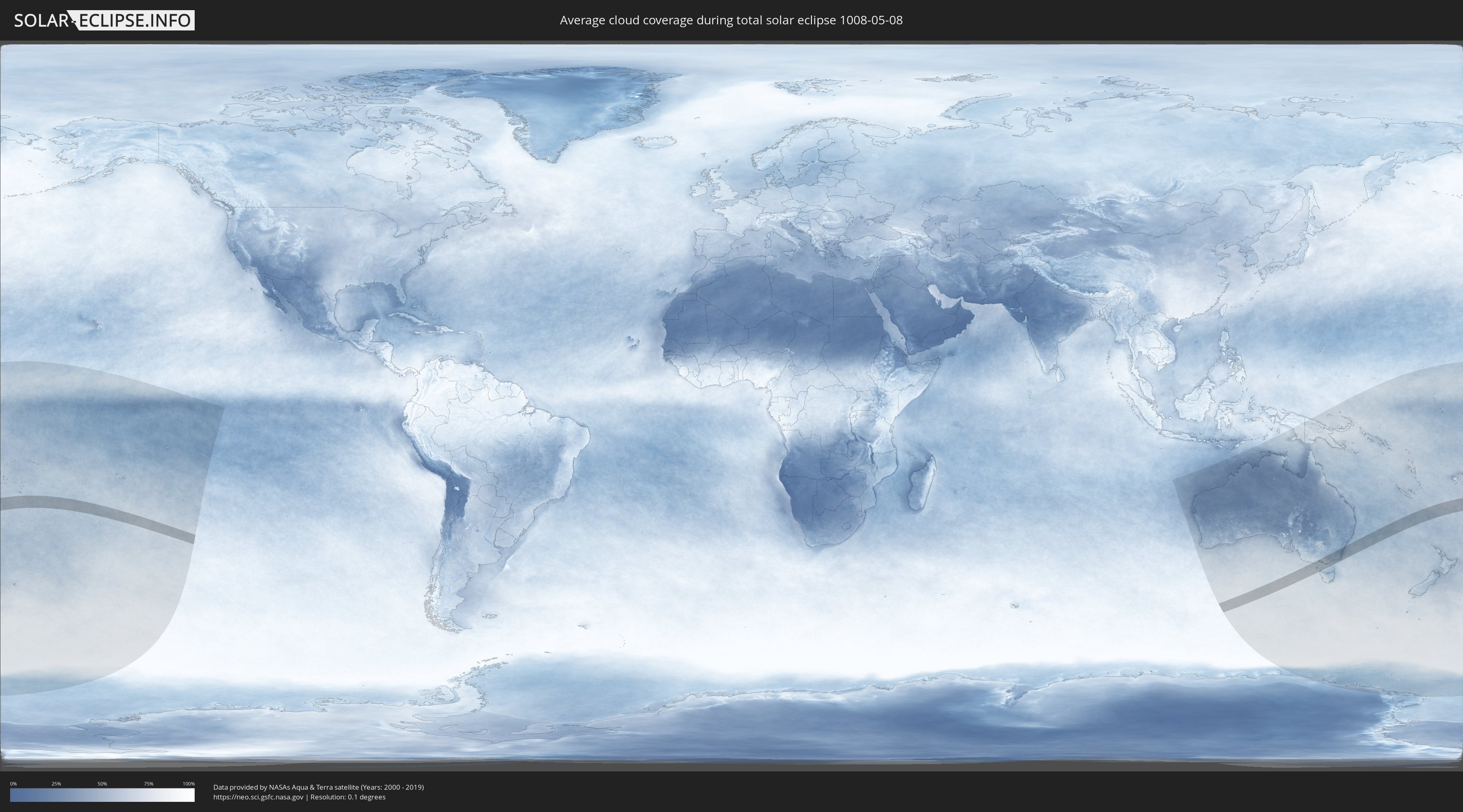
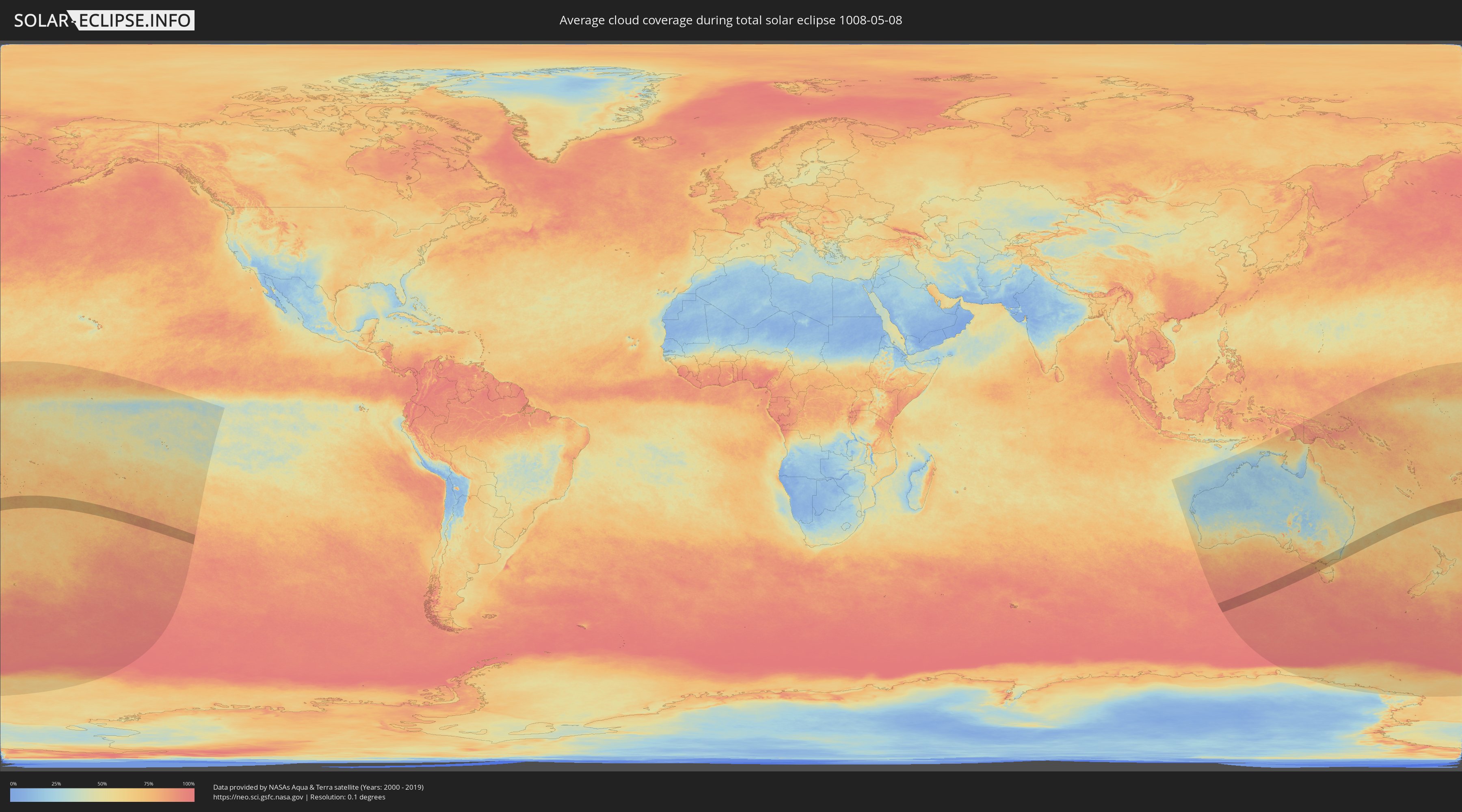
How will be the weather during the total solar eclipse on 05/08/1008?
Where is the best place to see the total solar eclipse of 05/08/1008?
The following maps show the average cloud coverage for the day of the total solar eclipse.
With the help of these maps, it is possible to find the place along the eclipse path, which has the best
chance of a cloudless sky.
Nevertheless, you should consider local circumstances and inform about the weather of your chosen
observation site.
The data is provided by NASAs satellites
AQUA and TERRA.
The cloud maps are averaged over a period of 19 years (2000 - 2019).
Detailed country maps
 Tonga
Tonga
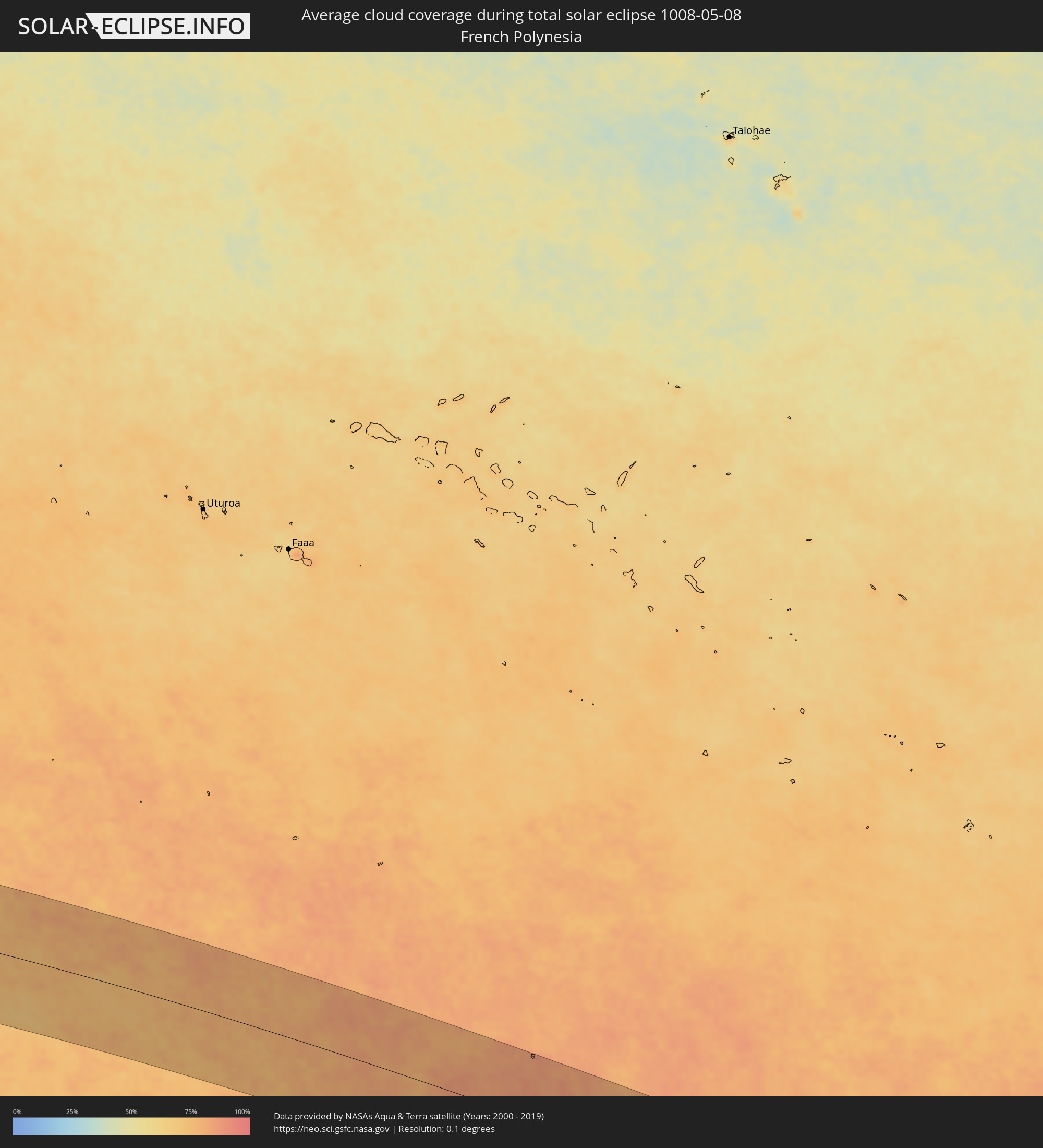 French Polynesia
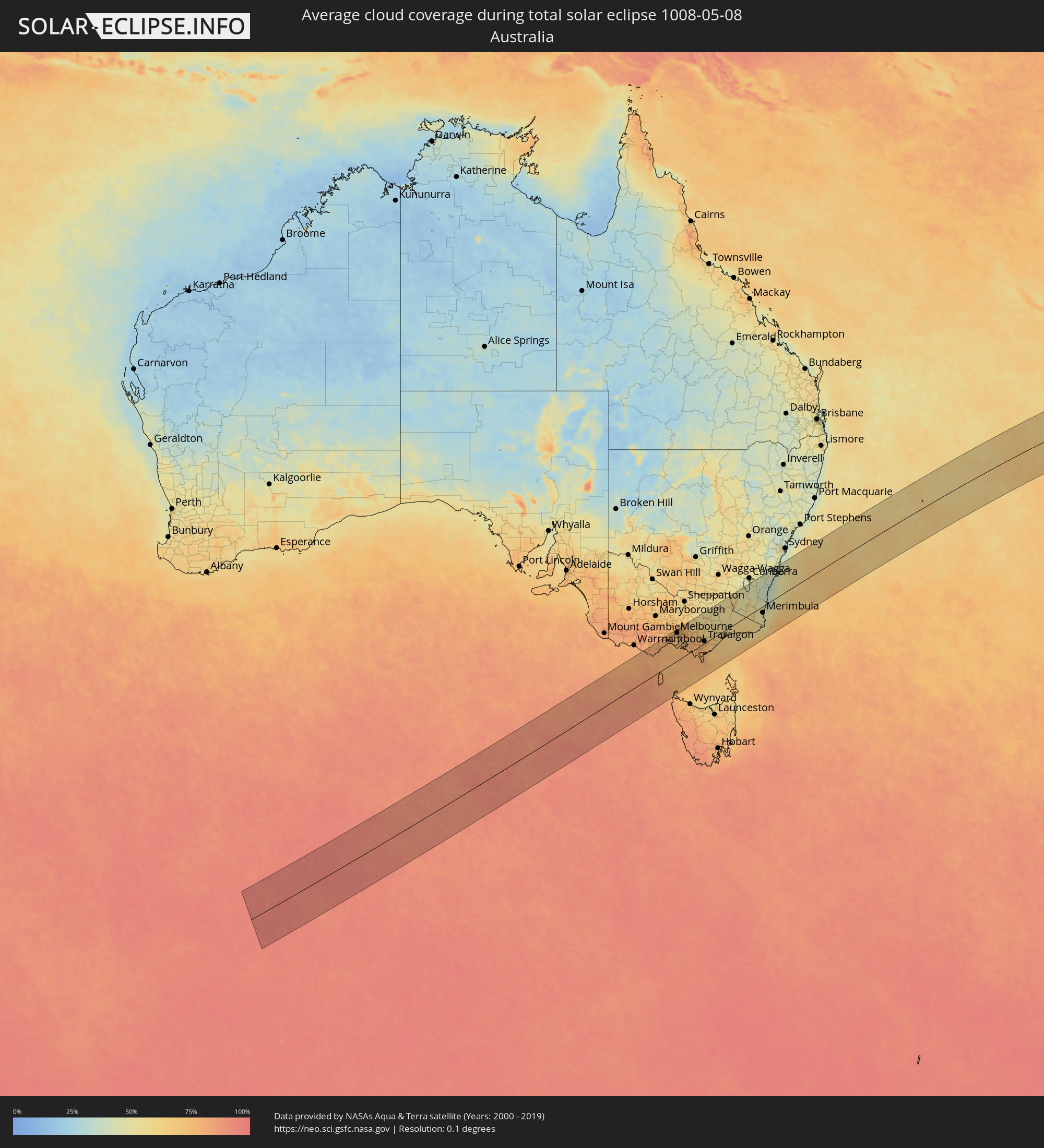 Australia
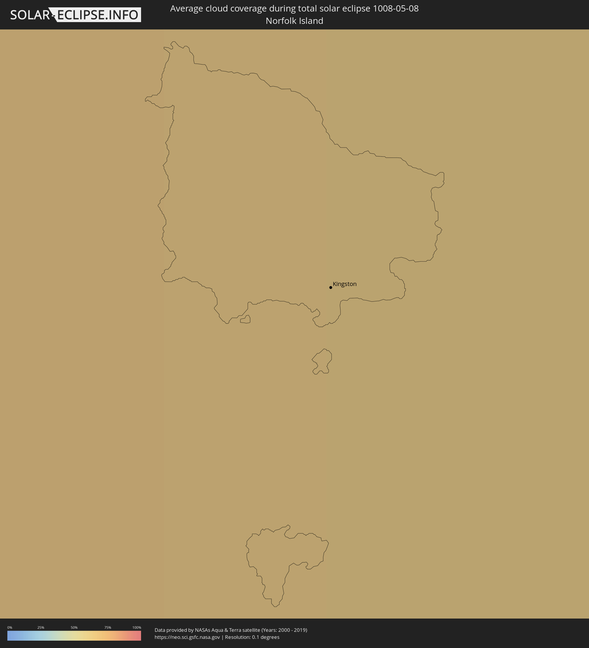 Norfolk Island
Cities inside the path of the eclipse
The following table shows all locations with a population of more than 5,000 inside the eclipse path. Cities which have more than 100,000 inhabitants are marked bold. A click at the locations opens a detailed map.
| City | Type | Eclipse duration | Local time of max. eclipse | Distance to central line | Ø Cloud coverage |
|
Colac, Victoria
|
total | - | 09:34:15 UTC+10:00 | 133 km | 78% |
|
Hamlyn Heights, Victoria
|
total | - | 09:35:03 UTC+10:00 | 119 km | 79% |
|
Geelong, Victoria
|
total | - | 09:35:06 UTC+10:00 | 115 km | 77% |
|
Leopold, Victoria
|
total | - | 09:35:15 UTC+10:00 | 106 km | 74% |
|
Clifton Springs, Victoria
|
total | - | 09:35:20 UTC+10:00 | 105 km | 74% |
|
Hoppers Crossing, Victoria
|
total | - | 09:35:24 UTC+10:00 | 125 km | 71% |
|
Truganina, Victoria
|
total | - | 09:35:26 UTC+10:00 | 129 km | 73% |
|
Derrimut, Victoria
|
total | - | 09:35:27 UTC+10:00 | 130 km | 73% |
|
Cairnlea, Victoria
|
total | - | 09:35:27 UTC+10:00 | 132 km | 73% |
|
Saint Albans, Victoria
|
total | - | 09:35:27 UTC+10:00 | 134 km | 78% |
|
Rye, Victoria
|
total | - | 09:35:46 UTC+10:00 | 74 km | 73% |
|
Braybrook, Victoria
|
total | - | 09:35:33 UTC+10:00 | 126 km | 72% |
|
Maidstone, Victoria
|
total | - | 09:35:34 UTC+10:00 | 126 km | 72% |
|
Tullamarine, Victoria
|
total | - | 09:35:33 UTC+10:00 | 133 km | 76% |
|
Airport West, Victoria
|
total | - | 09:35:33 UTC+10:00 | 131 km | 76% |
|
Gladstone Park, Victoria
|
total | - | 09:35:33 UTC+10:00 | 134 km | 76% |
|
Flemington, Victoria
|
total | - | 09:35:39 UTC+10:00 | 123 km | 72% |
|
Parkville, Victoria
|
total | - | 09:35:40 UTC+10:00 | 122 km | 72% |
|
Docklands, Victoria
|
total | - | 09:35:41 UTC+10:00 | 119 km | 72% |
|
Coburg North, Victoria
|
total | - | 09:35:39 UTC+10:00 | 127 km | 75% |
|
Melbourne, Victoria
|
total | - | 09:35:42 UTC+10:00 | 119 km | 72% |
|
Southbank, Victoria
|
total | - | 09:35:42 UTC+10:00 | 118 km | 72% |
|
Carlton North, Victoria
|
total | - | 09:35:41 UTC+10:00 | 122 km | 72% |
|
South Melbourne, Victoria
|
total | - | 09:35:43 UTC+10:00 | 117 km | 72% |
|
Brunswick East, Victoria
|
total | - | 09:35:41 UTC+10:00 | 122 km | 72% |
|
Fitzroy, Victoria
|
total | - | 09:35:43 UTC+10:00 | 120 km | 72% |
|
Windsor, Victoria
|
total | - | 09:35:45 UTC+10:00 | 114 km | 70% |
|
Clifton Hill, Victoria
|
total | - | 09:35:44 UTC+10:00 | 119 km | 72% |
|
Albert Park, Victoria
|
total | - | 09:35:45 UTC+10:00 | 115 km | 72% |
|
Elsternwick, Victoria
|
total | - | 09:35:47 UTC+10:00 | 110 km | 70% |
|
Black Rock, Victoria
|
total | - | 09:35:50 UTC+10:00 | 101 km | 71% |
|
Mount Martha, Victoria
|
total | - | 09:35:58 UTC+10:00 | 74 km | 74% |
|
Fairfield, Victoria
|
total | - | 09:35:45 UTC+10:00 | 120 km | 72% |
|
Ormond, Victoria
|
total | - | 09:35:49 UTC+10:00 | 107 km | 70% |
|
Epping, Victoria
|
total | - | 09:35:43 UTC+10:00 | 131 km | 75% |
|
Cheltenham, Victoria
|
total | - | 09:35:52 UTC+10:00 | 100 km | 71% |
|
Kew East, Victoria
|
total | - | 09:35:48 UTC+10:00 | 116 km | 74% |
|
Heidelberg Heights, Victoria
|
total | - | 09:35:47 UTC+10:00 | 121 km | 74% |
|
Rosanna, Victoria
|
total | - | 09:35:48 UTC+10:00 | 120 km | 74% |
|
Murrumbeena, Victoria
|
total | - | 09:35:52 UTC+10:00 | 106 km | 74% |
|
Ashburton, Victoria
|
total | - | 09:35:52 UTC+10:00 | 108 km | 74% |
|
Hughesdale, Victoria
|
total | - | 09:35:53 UTC+10:00 | 105 km | 74% |
|
Mordialloc, Victoria
|
total | - | 09:35:56 UTC+10:00 | 96 km | 72% |
|
Canterbury, Victoria
|
total | - | 09:35:51 UTC+10:00 | 112 km | 74% |
|
Oakleigh South, Victoria
|
total | - | 09:35:54 UTC+10:00 | 102 km | 74% |
|
Viewbank, Victoria
|
total | - | 09:35:50 UTC+10:00 | 120 km | 74% |
|
Mernda, Victoria
|
total | - | 09:35:46 UTC+10:00 | 133 km | 74% |
|
Aspendale, Victoria
|
total | - | 09:35:58 UTC+10:00 | 92 km | 72% |
|
Montmorency, Victoria
|
total | - | 09:35:51 UTC+10:00 | 121 km | 74% |
|
Clarinda, Victoria
|
total | - | 09:35:57 UTC+10:00 | 100 km | 74% |
|
Chelsea, Victoria
|
total | - | 09:36:00 UTC+10:00 | 89 km | 73% |
|
Aspendale Gardens, Victoria
|
total | - | 09:35:59 UTC+10:00 | 92 km | 72% |
|
Box Hill South, Victoria
|
total | - | 09:35:54 UTC+10:00 | 110 km | 74% |
|
Bonbeach, Victoria
|
total | - | 09:36:01 UTC+10:00 | 88 km | 73% |
|
Frankston, Victoria
|
total | - | 09:36:03 UTC+10:00 | 80 km | 73% |
|
Box Hill, Victoria
|
total | - | 09:35:54 UTC+10:00 | 111 km | 74% |
|
Patterson Lakes, Victoria
|
total | - | 09:36:02 UTC+10:00 | 86 km | 73% |
|
Doncaster East, Victoria
|
total | - | 09:35:55 UTC+10:00 | 113 km | 74% |
|
Eltham North, Victoria
|
total | - | 09:35:53 UTC+10:00 | 121 km | 75% |
|
Blackburn North, Victoria
|
total | - | 09:35:56 UTC+10:00 | 110 km | 75% |
|
Somerville, Victoria
|
total | - | 09:36:08 UTC+10:00 | 71 km | 72% |
|
Hastings, Victoria
|
total | - | 09:36:11 UTC+10:00 | 63 km | 73% |
|
Noble Park North, Victoria
|
total | - | 09:36:03 UTC+10:00 | 95 km | 76% |
|
Skye, Victoria
|
total | - | 09:36:09 UTC+10:00 | 80 km | 75% |
|
Phillip Island, Victoria
|
total | - | 09:36:20 UTC+10:00 | 43 km | 77% |
|
Scoresby, Victoria
|
total | - | 09:36:05 UTC+10:00 | 98 km | 76% |
|
Rowville, Victoria
|
total | - | 09:36:05 UTC+10:00 | 95 km | 76% |
|
Doveton, Victoria
|
total | - | 09:36:07 UTC+10:00 | 89 km | 76% |
|
Knoxfield, Victoria
|
total | - | 09:36:06 UTC+10:00 | 98 km | 76% |
|
Heathmont, Victoria
|
total | - | 09:36:04 UTC+10:00 | 104 km | 77% |
|
Lynbrook, Victoria
|
total | - | 09:36:10 UTC+10:00 | 82 km | 75% |
|
Cranbourne West, Victoria
|
total | - | 09:36:12 UTC+10:00 | 78 km | 75% |
|
Cranbourne East, Victoria
|
total | - | 09:36:15 UTC+10:00 | 75 km | 75% |
|
Bayswater North, Victoria
|
total | - | 09:36:08 UTC+10:00 | 102 km | 77% |
|
Croydon North, Victoria
|
total | - | 09:36:07 UTC+10:00 | 106 km | 77% |
|
Lysterfield, Victoria
|
total | - | 09:36:11 UTC+10:00 | 92 km | 75% |
|
Chirnside Park, Victoria
|
total | - | 09:36:07 UTC+10:00 | 110 km | 76% |
|
Narre Warren North, Victoria
|
total | - | 09:36:13 UTC+10:00 | 86 km | 77% |
|
Upwey, Victoria
|
total | - | 09:36:12 UTC+10:00 | 93 km | 75% |
|
Lilydale, Victoria
|
total | - | 09:36:10 UTC+10:00 | 107 km | 75% |
|
Berwick, Victoria
|
total | - | 09:36:17 UTC+10:00 | 80 km | 75% |
|
Montrose, Victoria
|
total | - | 09:36:11 UTC+10:00 | 101 km | 75% |
|
Mount Evelyn, Victoria
|
total | - | 09:36:13 UTC+10:00 | 102 km | 75% |
|
Emerald, Victoria
|
total | - | 09:36:21 UTC+10:00 | 85 km | 75% |
|
Pakenham South, Victoria
|
total | - | 09:36:32 UTC+10:00 | 63 km | 76% |
|
Healesville, Victoria
|
total | - | 09:36:20 UTC+10:00 | 108 km | 76% |
|
North Wonthaggi, Victoria
|
total | - | 09:36:51 UTC+10:00 | 15 km | 74% |
|
Warragul, Victoria
|
total | - | 09:37:05 UTC+10:00 | 41 km | 77% |
|
Moe, Victoria
|
total | - | 09:37:31 UTC+10:00 | 24 km | 73% |
|
Traralgon, Victoria
|
total | - | 09:37:54 UTC+10:00 | 9 km | 73% |
|
Sale, Victoria
|
total | - | 09:38:33 UTC+10:00 | 8 km | 67% |
|
Bairnsdale, Victoria
|
total | - | 09:39:10 UTC+10:00 | 6 km | 64% |
|
Lakes Entrance, Victoria
|
total | - | 09:39:42 UTC+10:00 | 29 km | 60% |
|
Cooma, New South Wales
|
total | - | 09:40:45 UTC+10:00 | 71 km | 51% |
|
Merimbula, New South Wales
|
total | - | 09:42:06 UTC+10:00 | 28 km | 46% |
|
Batemans Bay, New South Wales
|
total | - | 09:42:09 UTC+10:00 | 71 km | 33% |
|
Ulladulla, New South Wales
|
total | - | 09:42:31 UTC+10:00 | 90 km | 38% |
|
Nowra, New South Wales
|
total | - | 09:42:36 UTC+10:00 | 128 km | 43% |
|
Bomaderry, New South Wales
|
total | - | 09:42:36 UTC+10:00 | 131 km | 42% |
|
Kiama, New South Wales
|
total | - | 09:42:56 UTC+10:00 | 137 km | 38% |
|
Kingston
|
total | - | 11:29:24 UTC+11:12 | 124 km | 65% |