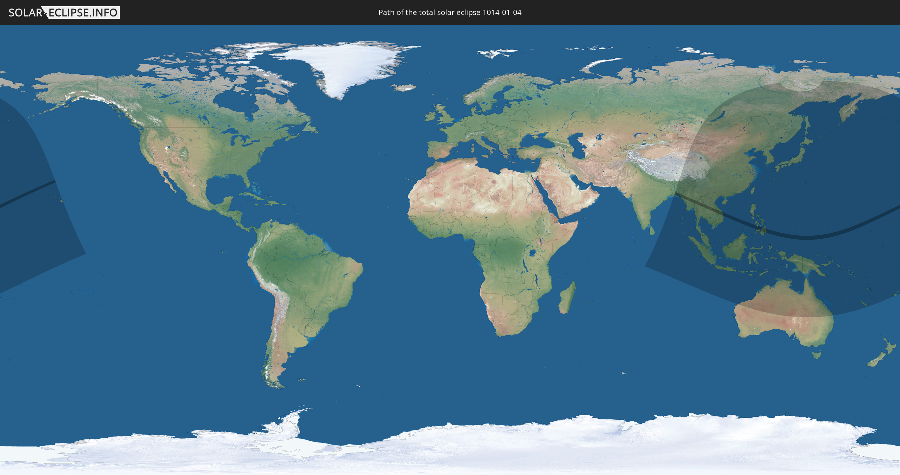
Total solar eclipse of 01/04/1014
| Day of week: | Tuesday |
| Maximum duration of eclipse: | 04m29s |
| Maximum width of eclipse path: | 173 km |
| Saros cycle: | 96 |
| Coverage: | 100% |
| Magnitude: | 1.0462 |
| Gamma: | 0.4565 |
Wo kann man die Sonnenfinsternis vom 01/04/1014 sehen?
Die Sonnenfinsternis am 01/04/1014 kann man in 45 Ländern als partielle Sonnenfinsternis beobachten.
Der Finsternispfad verläuft durch 11 Länder. Nur in diesen Ländern ist sie als total Sonnenfinsternis zu sehen.
In den folgenden Ländern ist die Sonnenfinsternis total zu sehen
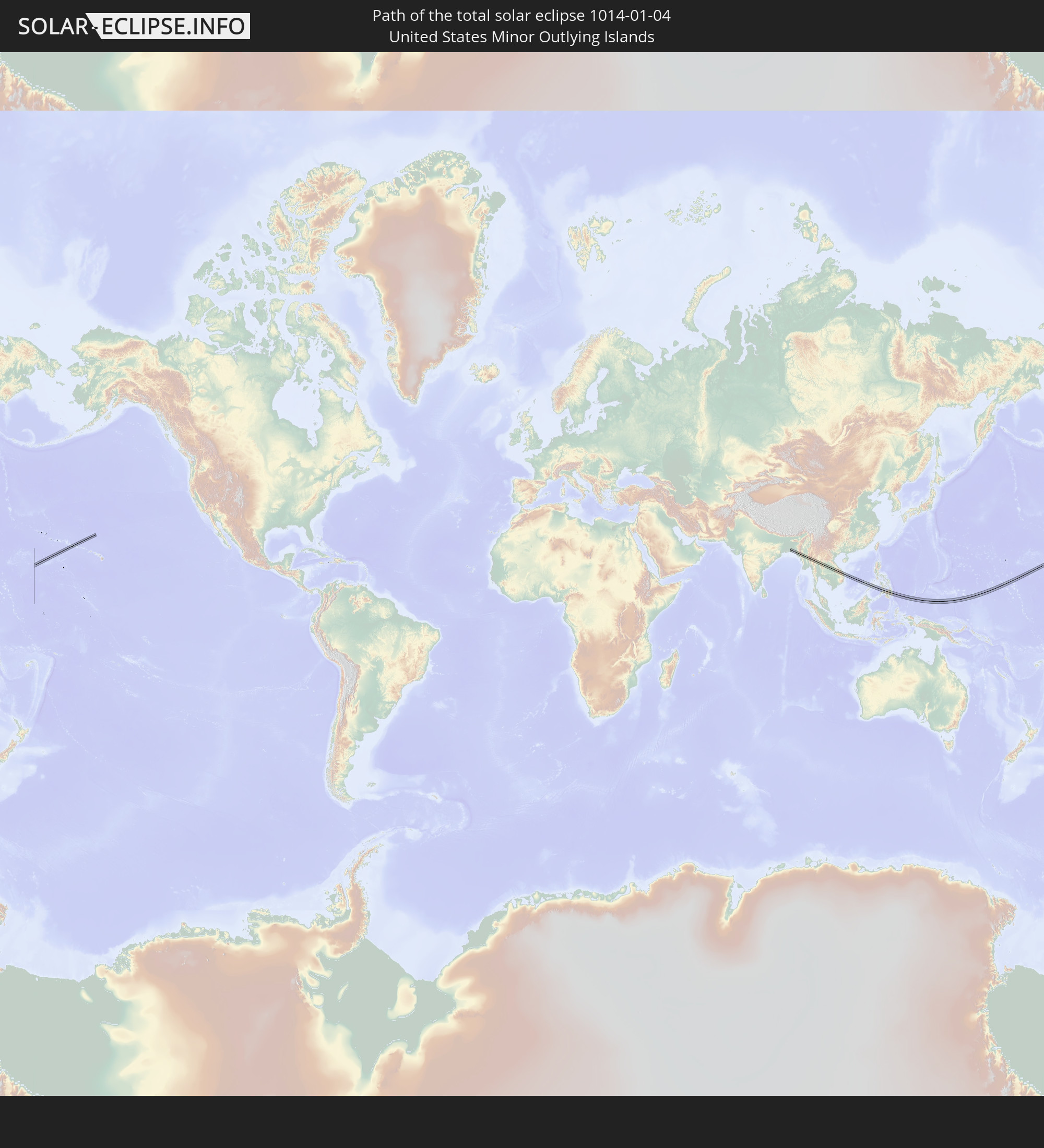 United States Minor Outlying Islands
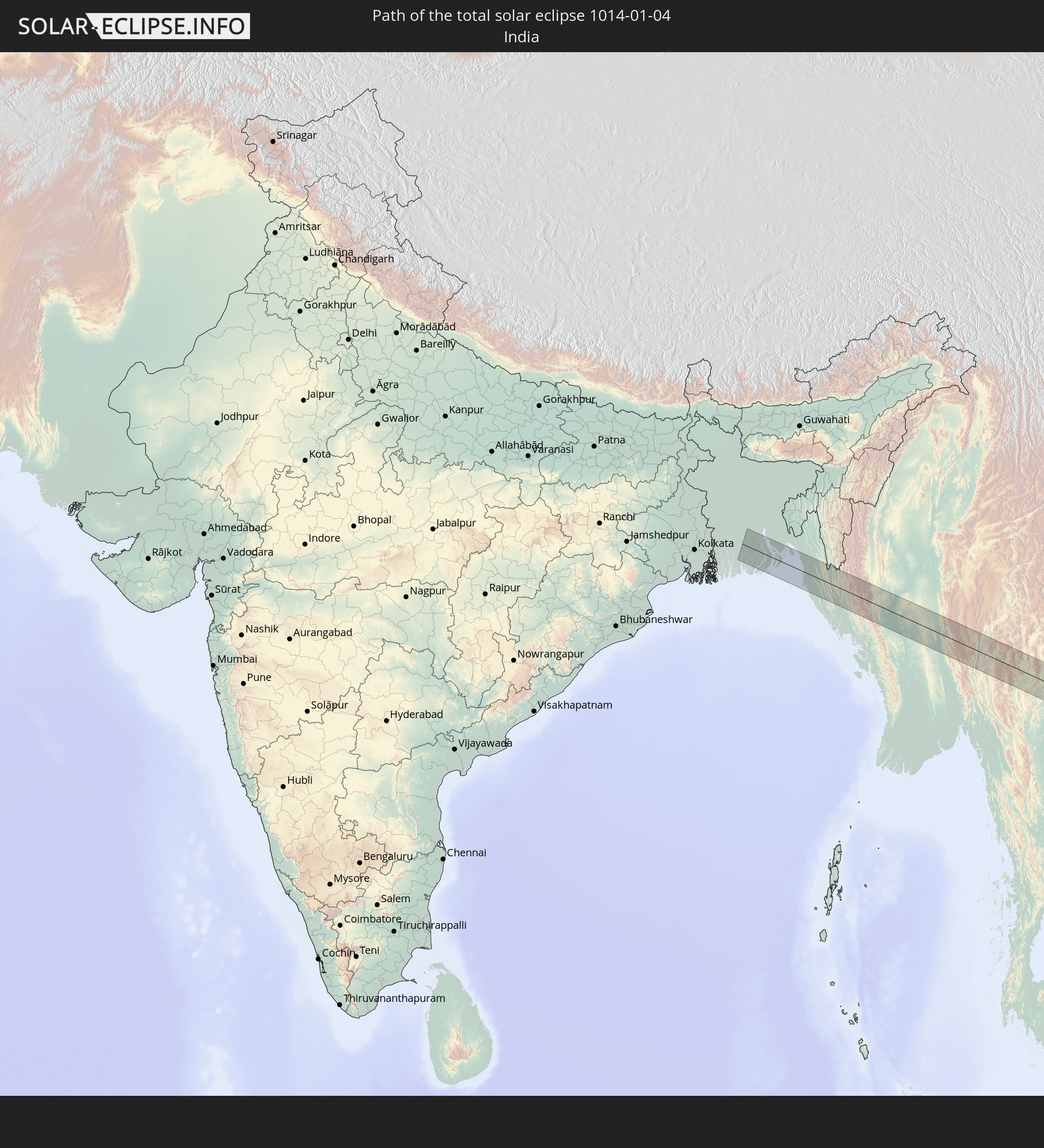 India
India
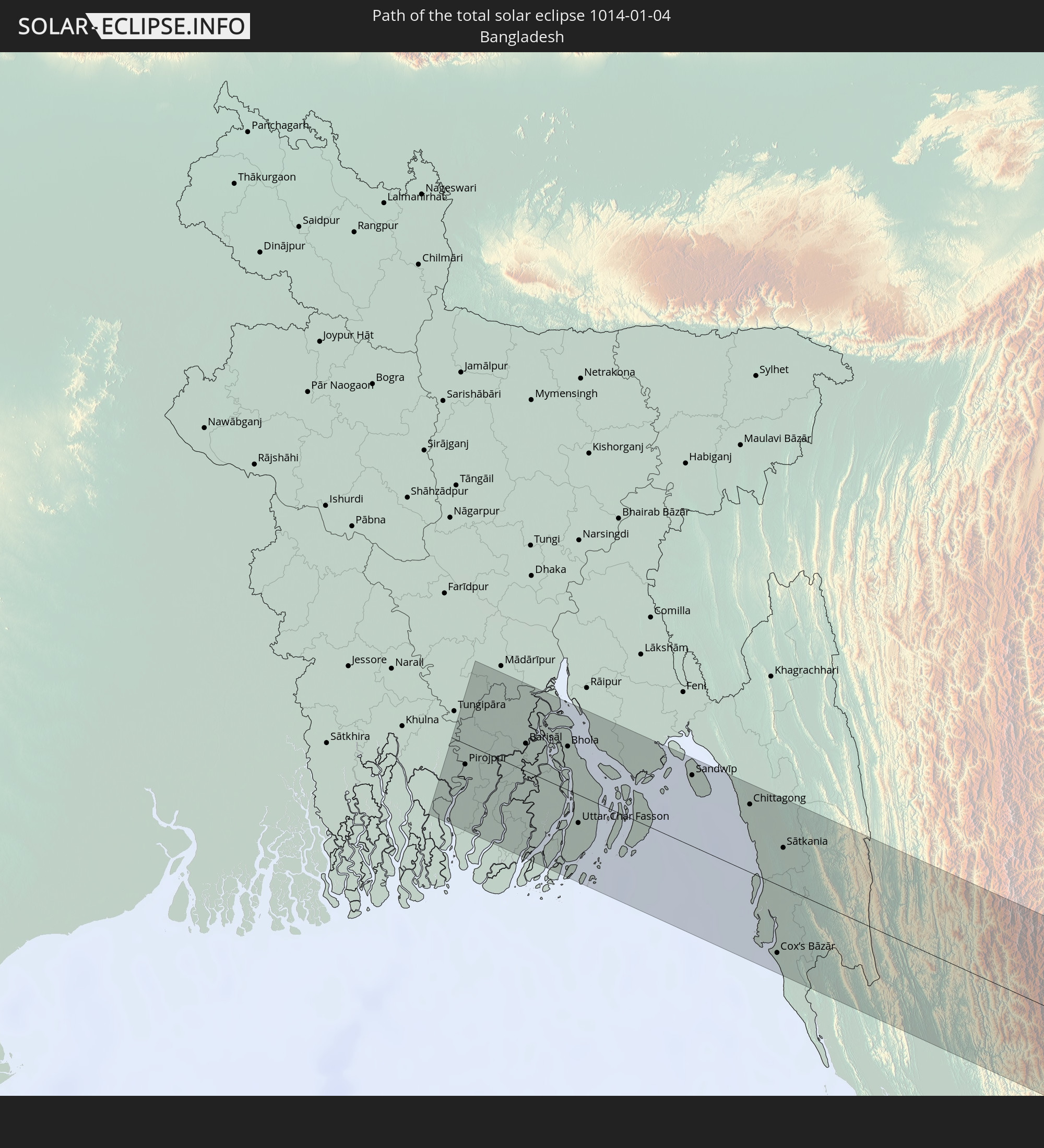 Bangladesh
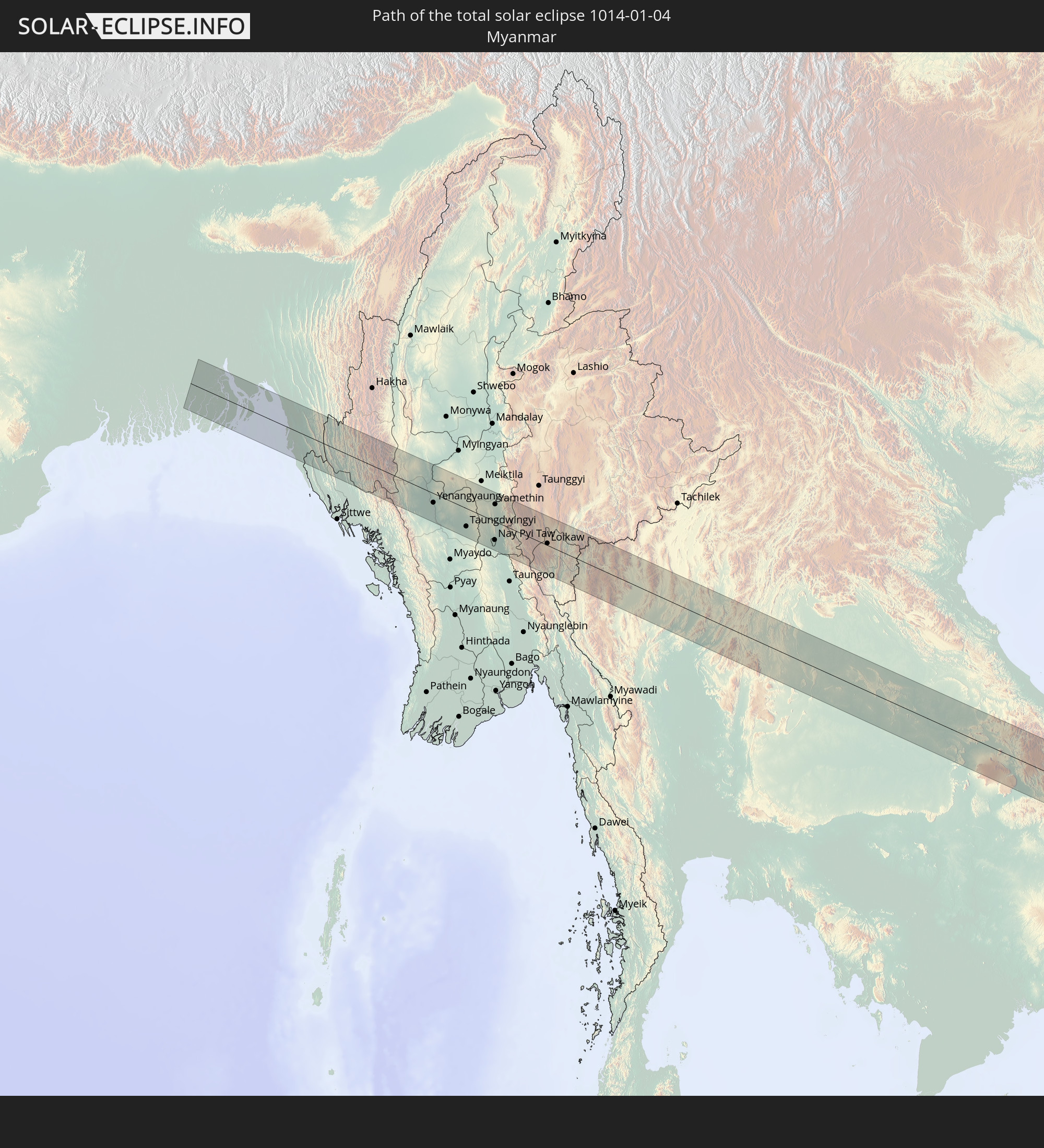 Myanmar
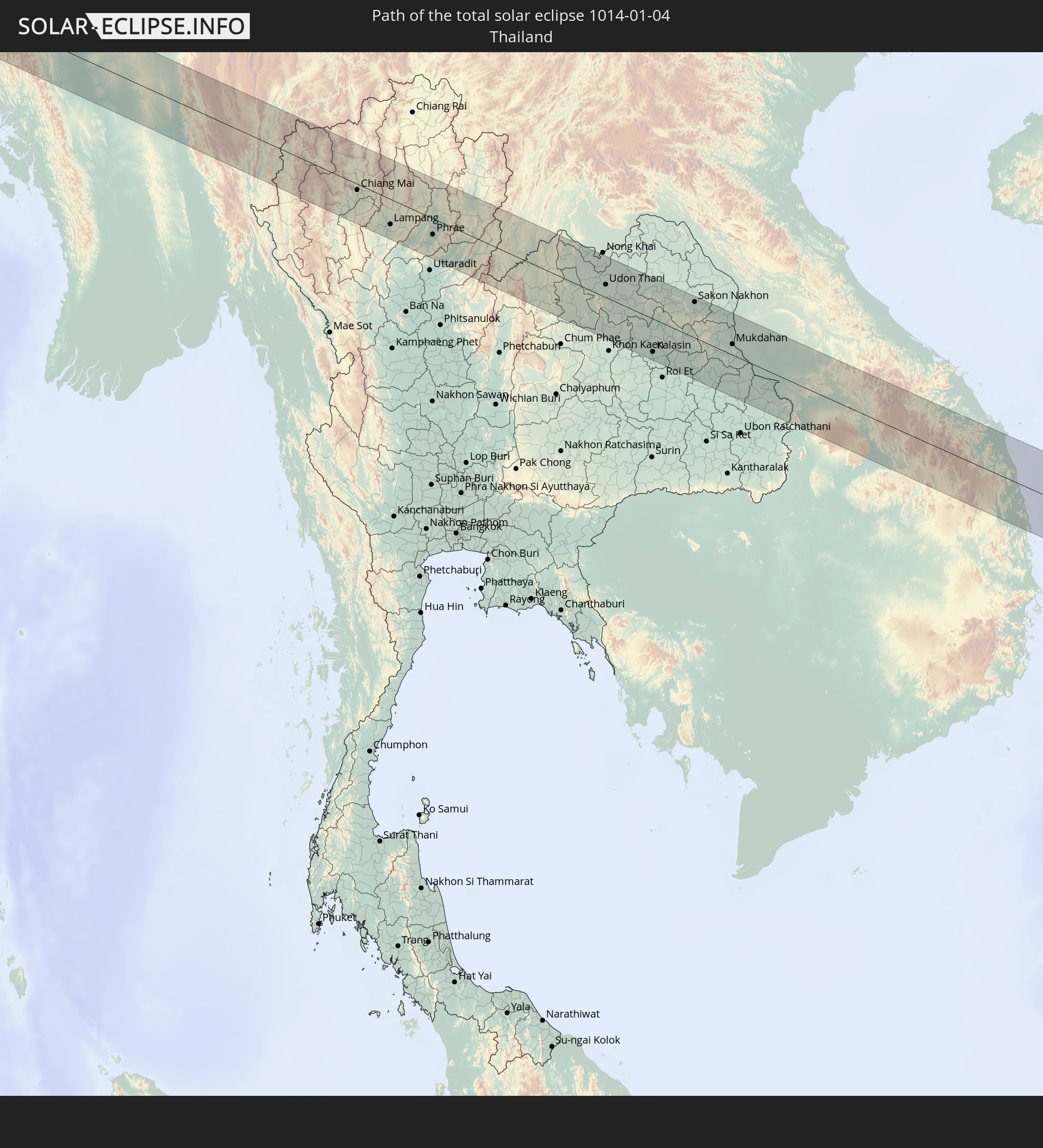 Thailand
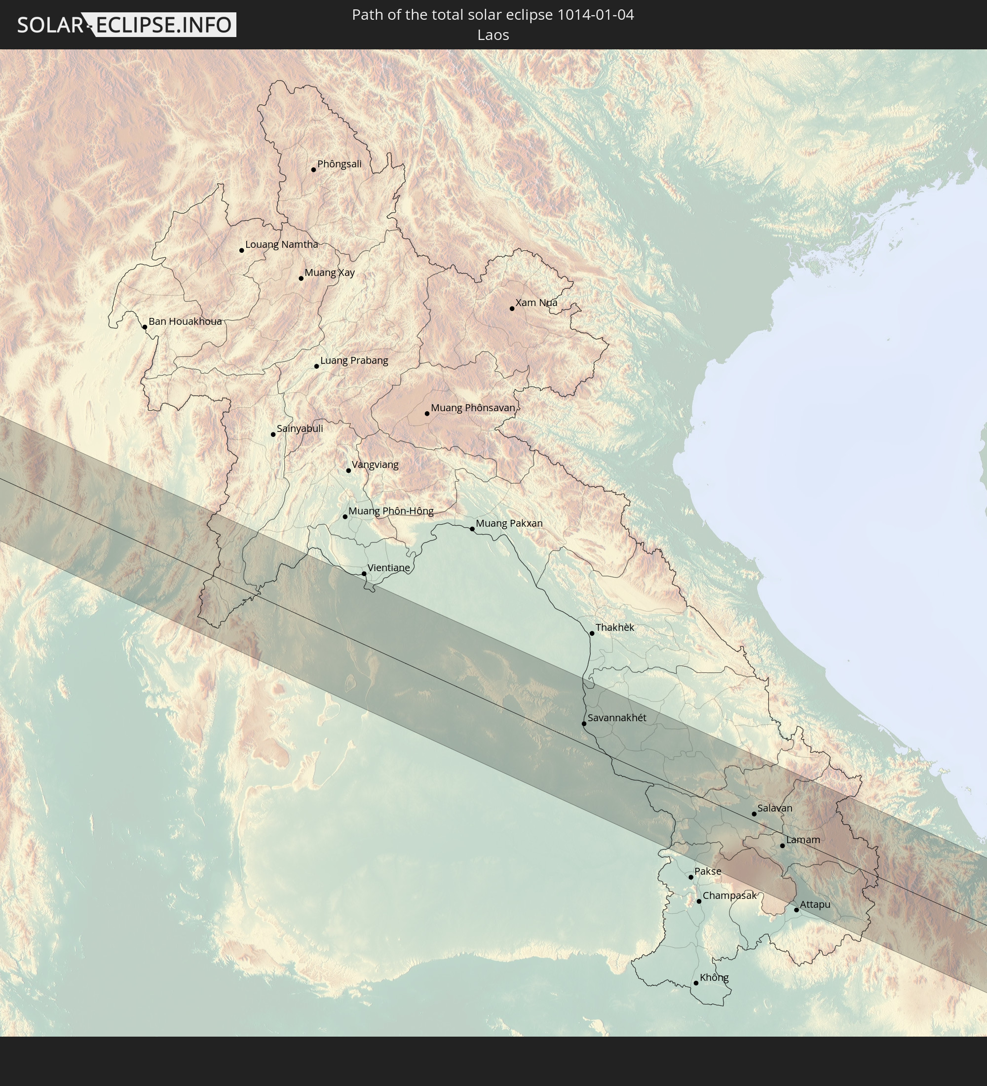 Laos
Laos
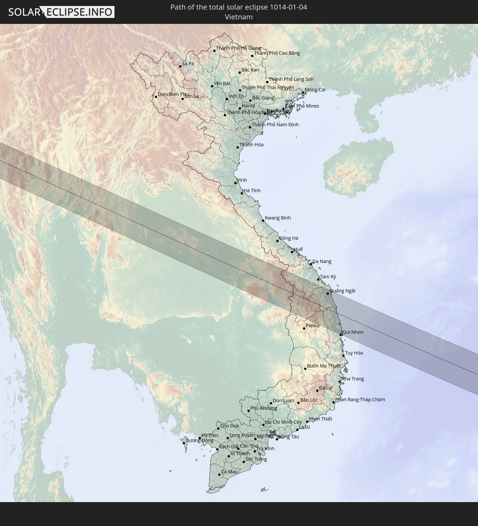 Vietnam
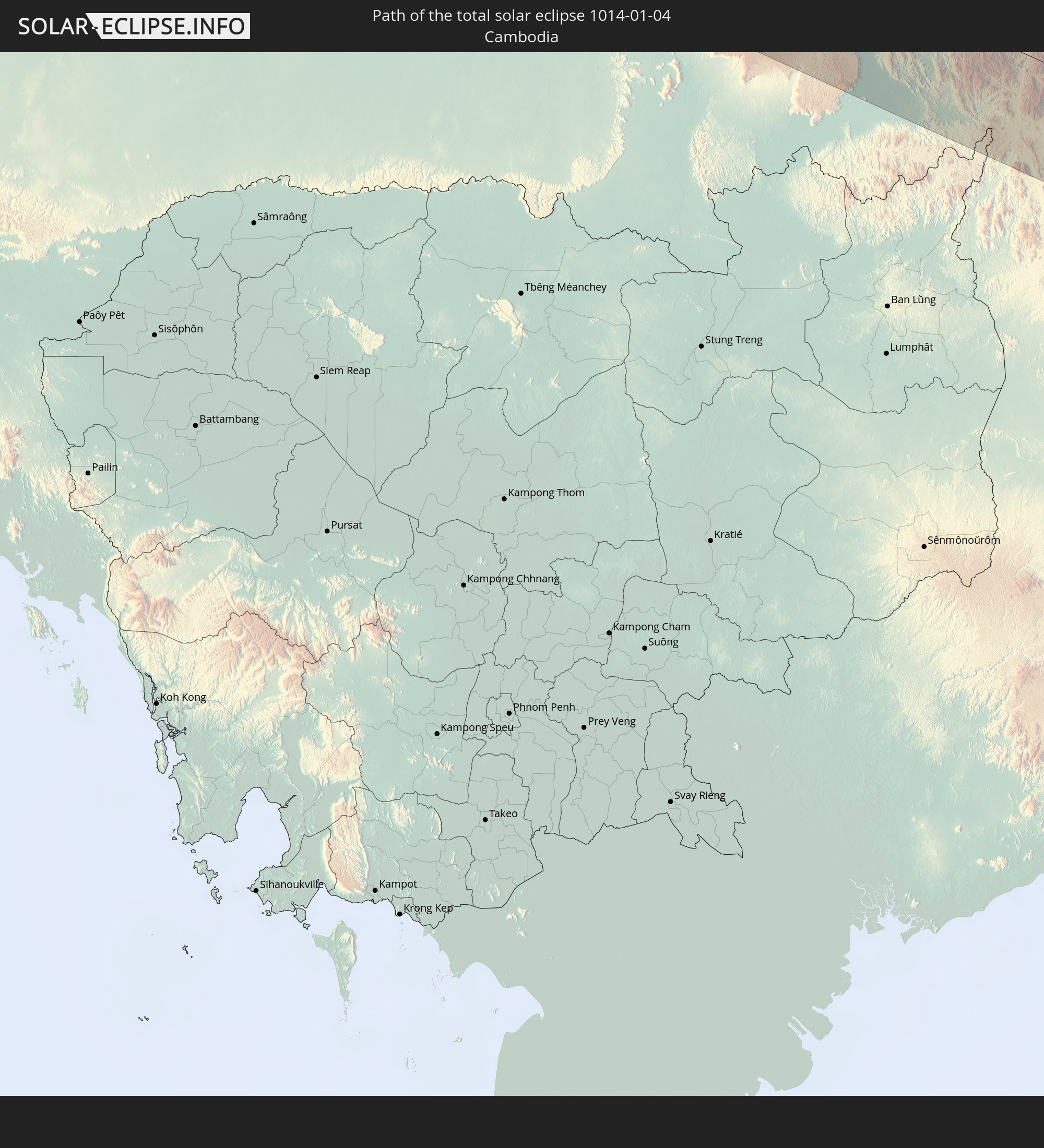 Cambodia
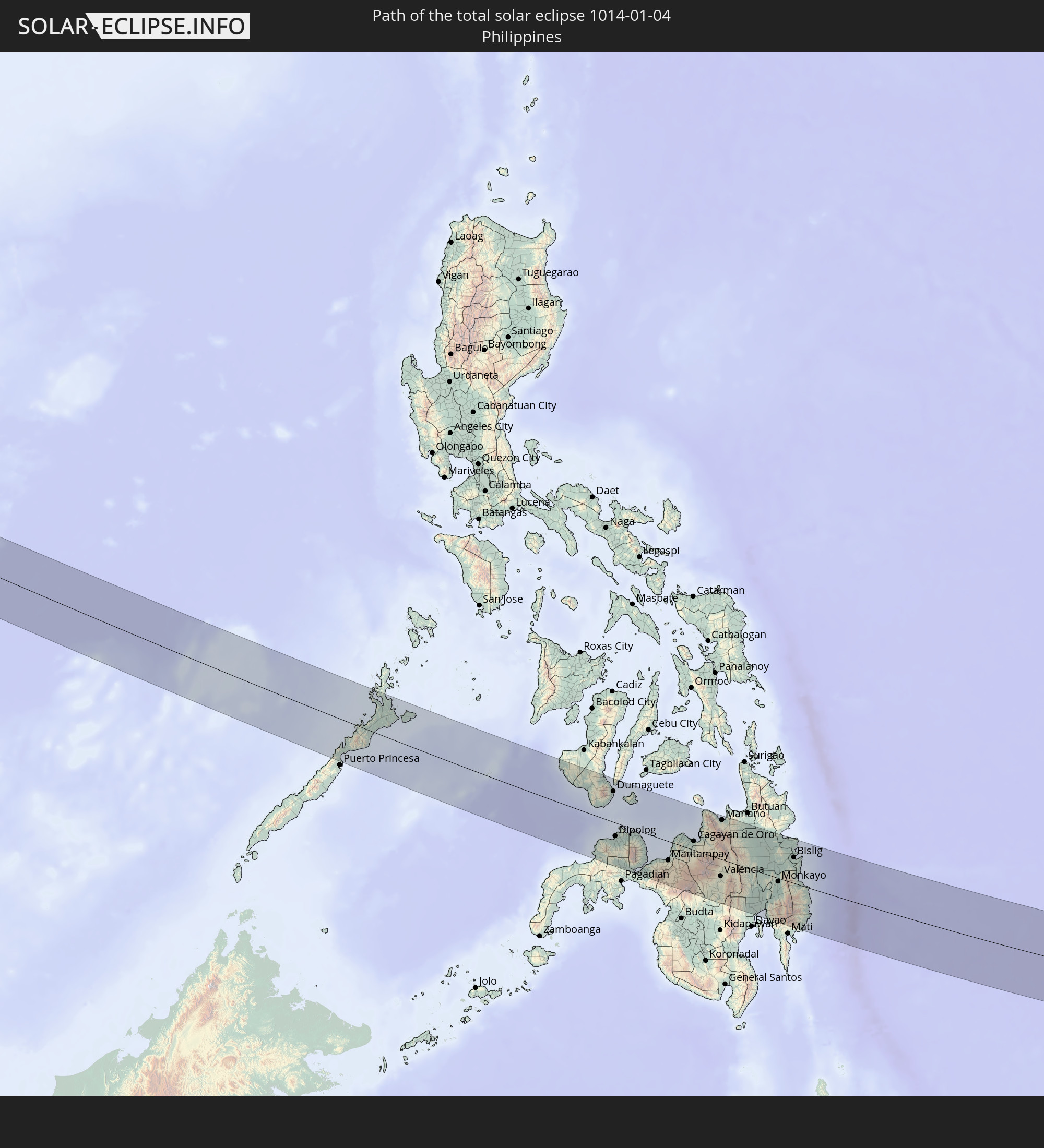 Philippines
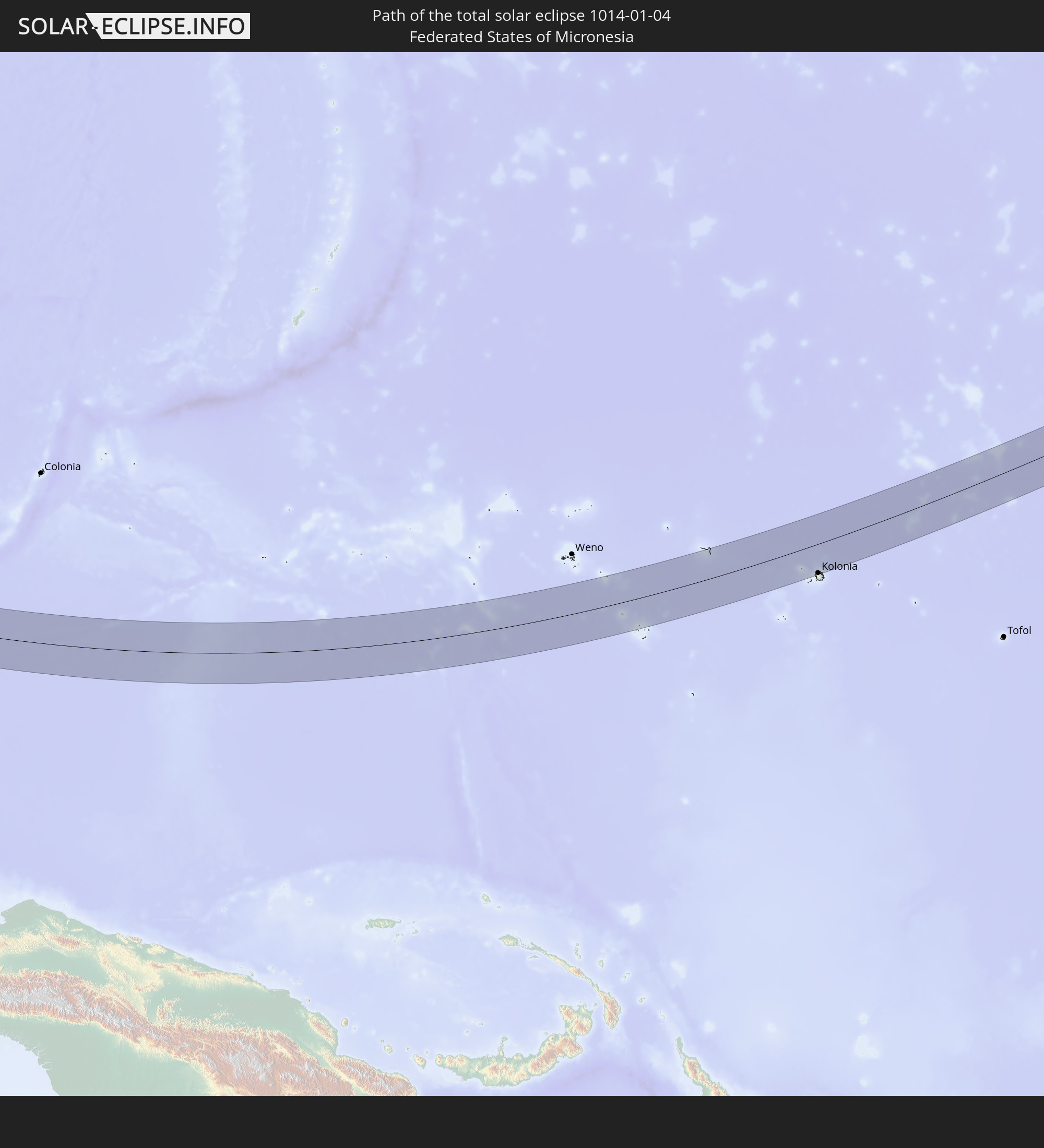 Federated States of Micronesia
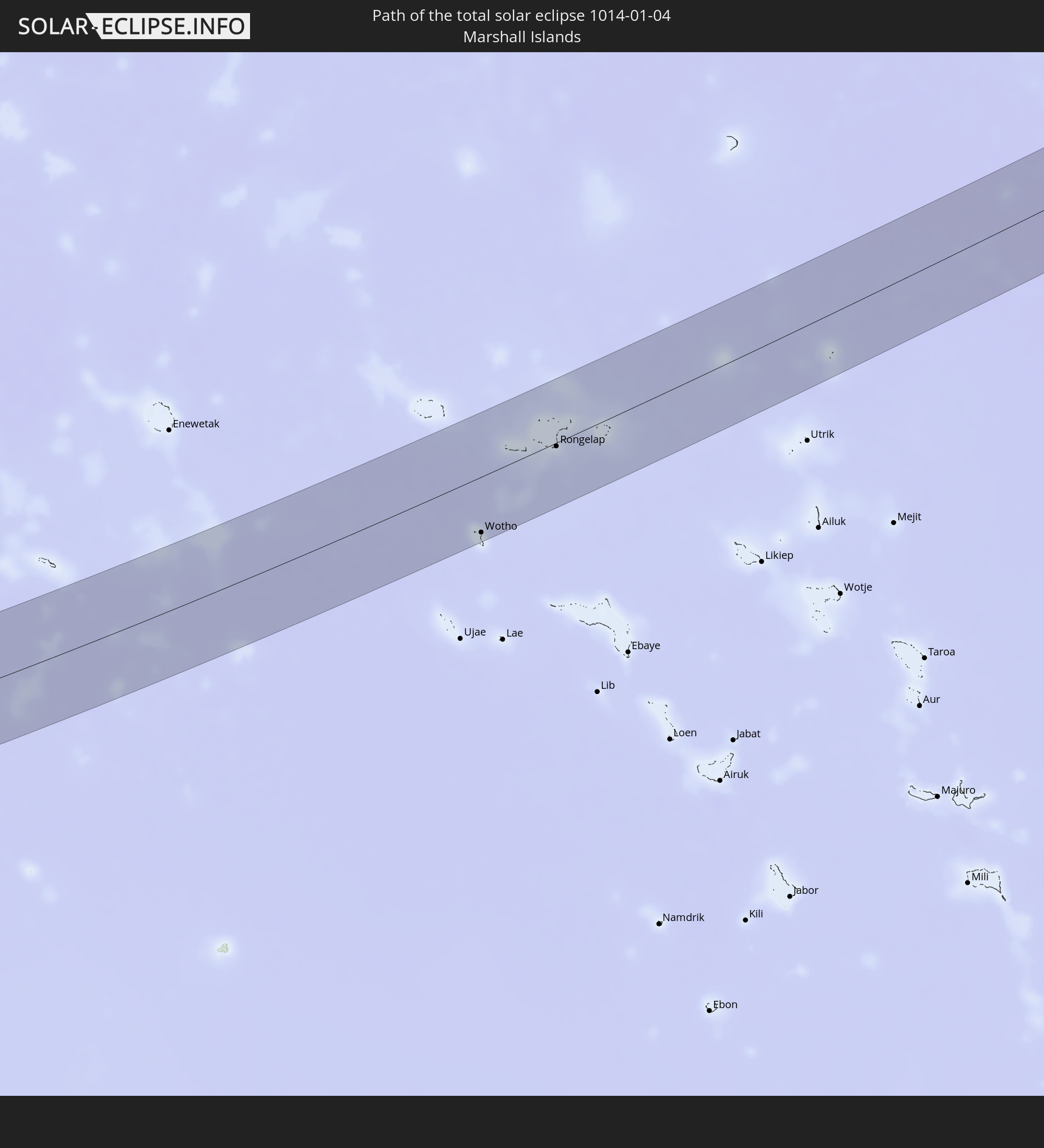 Marshall Islands
In den folgenden Ländern ist die Sonnenfinsternis partiell zu sehen
 Fiji
Fiji
 Russia
 United States
 United States Minor Outlying Islands
 Wallis and Futuna
 Kiribati
 Samoa
Samoa
 Tokelau
 American Samoa
 India
India
 China
China
 Mongolia
 Bangladesh
 Bhutan
 Myanmar
 Indonesia
 Cocos Islands
 Thailand
 Malaysia
 Laos
Laos
 Vietnam
 Cambodia
 Singapore
 Christmas Island
 Australia
 Macau
Macau
 Hong Kong
 Brunei
 Taiwan
 Philippines
 Japan
Japan
 East Timor
 North Korea
 South Korea
 Palau
Palau
 Federated States of Micronesia
 Papua New Guinea
 Guam
Guam
 Northern Mariana Islands
 Solomon Islands
 New Caledonia
 Marshall Islands
 Vanuatu
 Nauru
Nauru
 Tuvalu
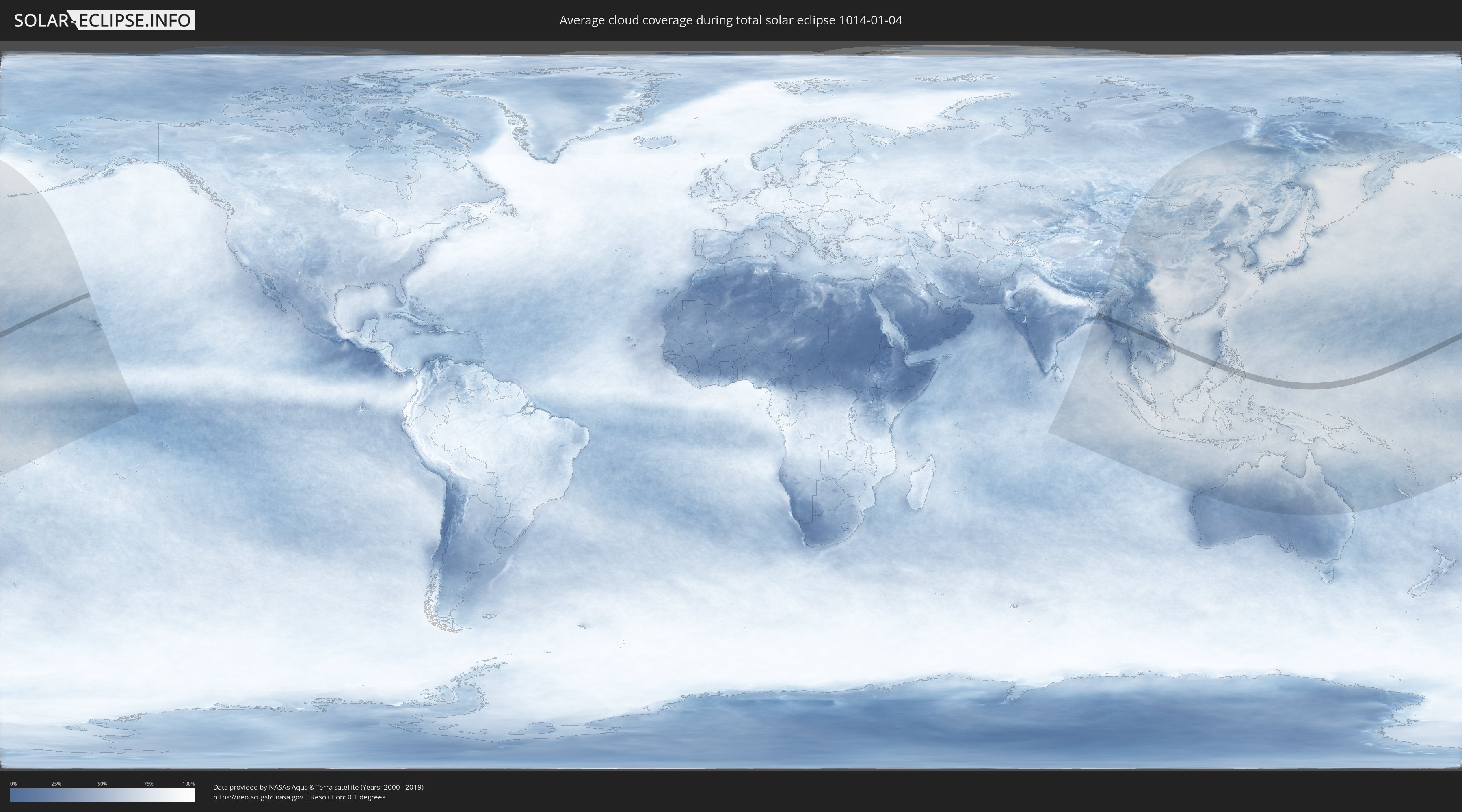
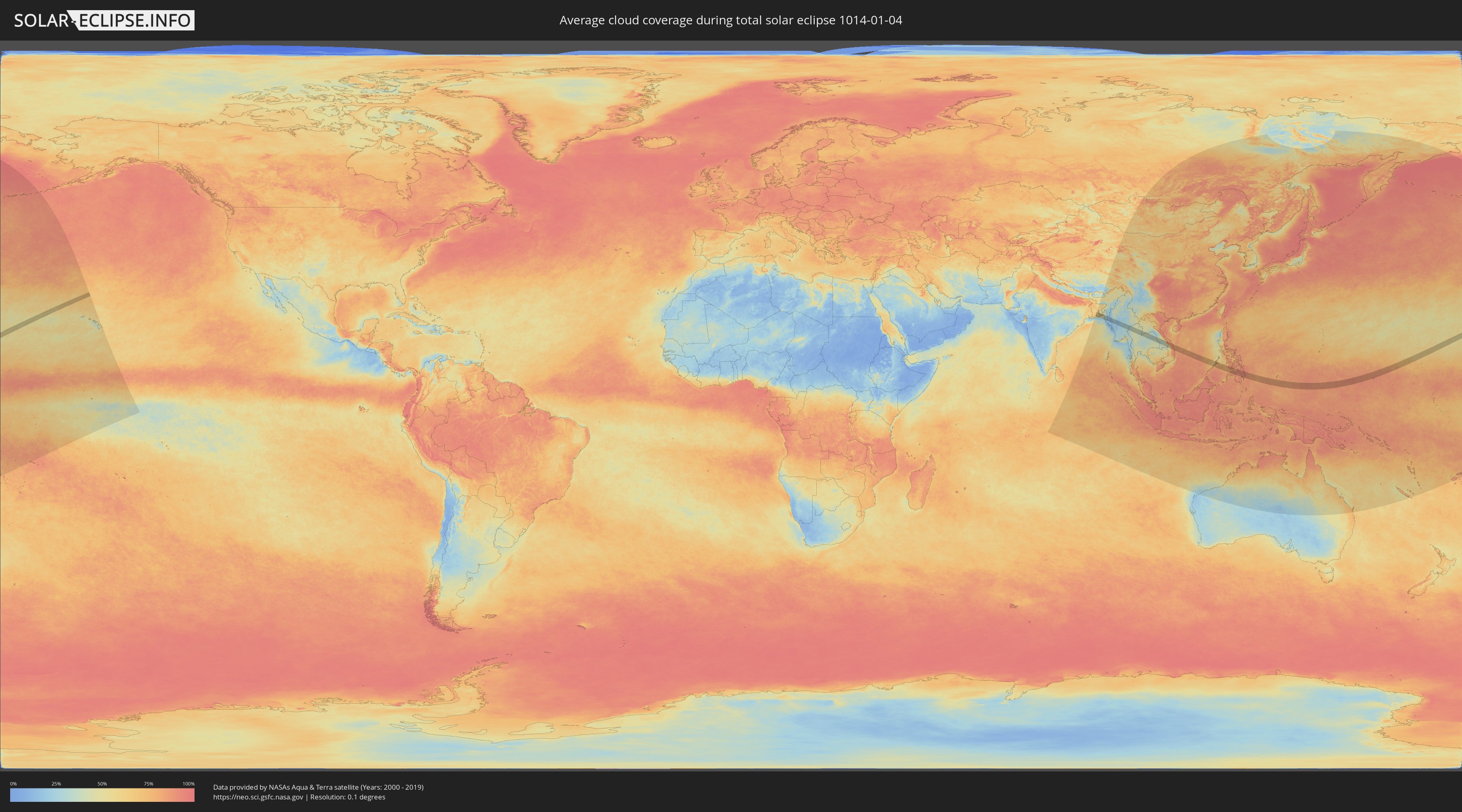
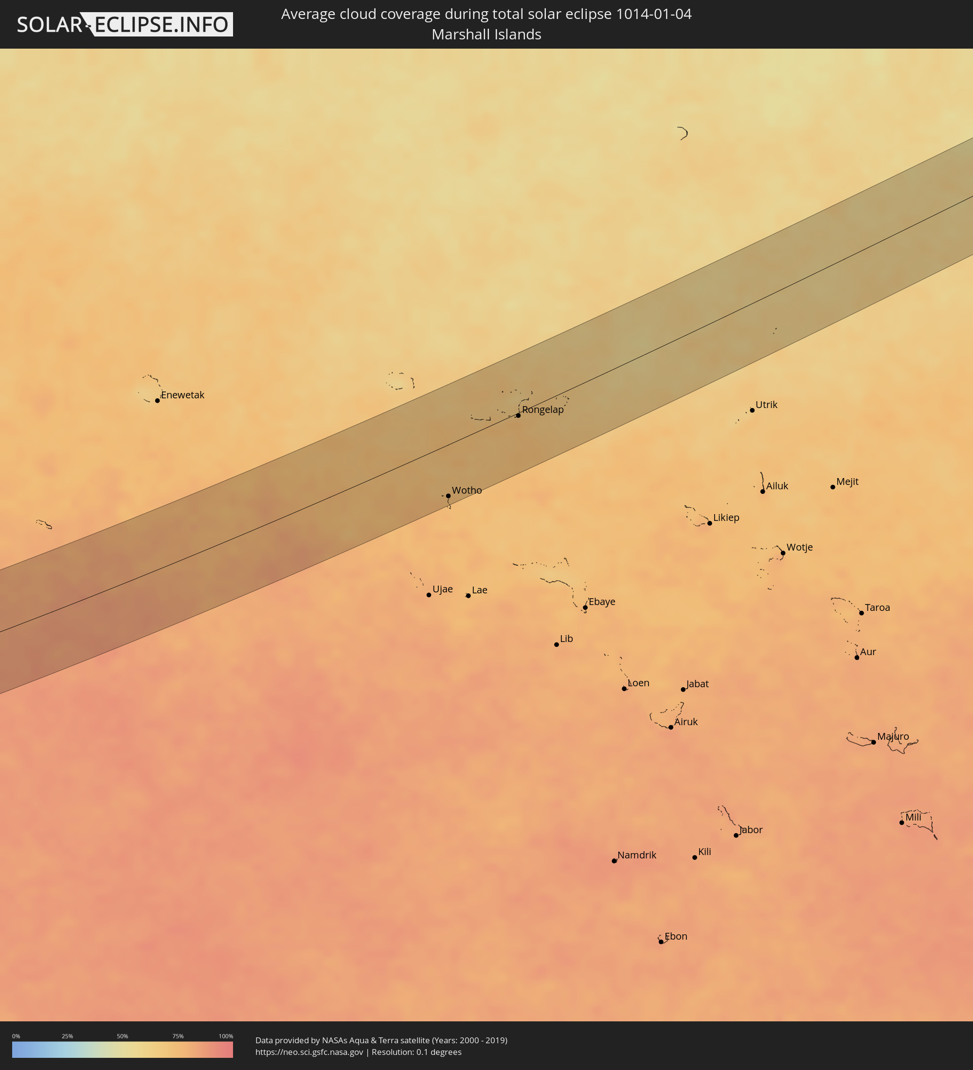
How will be the weather during the total solar eclipse on 01/04/1014?
Where is the best place to see the total solar eclipse of 01/04/1014?
The following maps show the average cloud coverage for the day of the total solar eclipse.
With the help of these maps, it is possible to find the place along the eclipse path, which has the best
chance of a cloudless sky.
Nevertheless, you should consider local circumstances and inform about the weather of your chosen
observation site.
The data is provided by NASAs satellites
AQUA and TERRA.
The cloud maps are averaged over a period of 19 years (2000 - 2019).
Detailed country maps
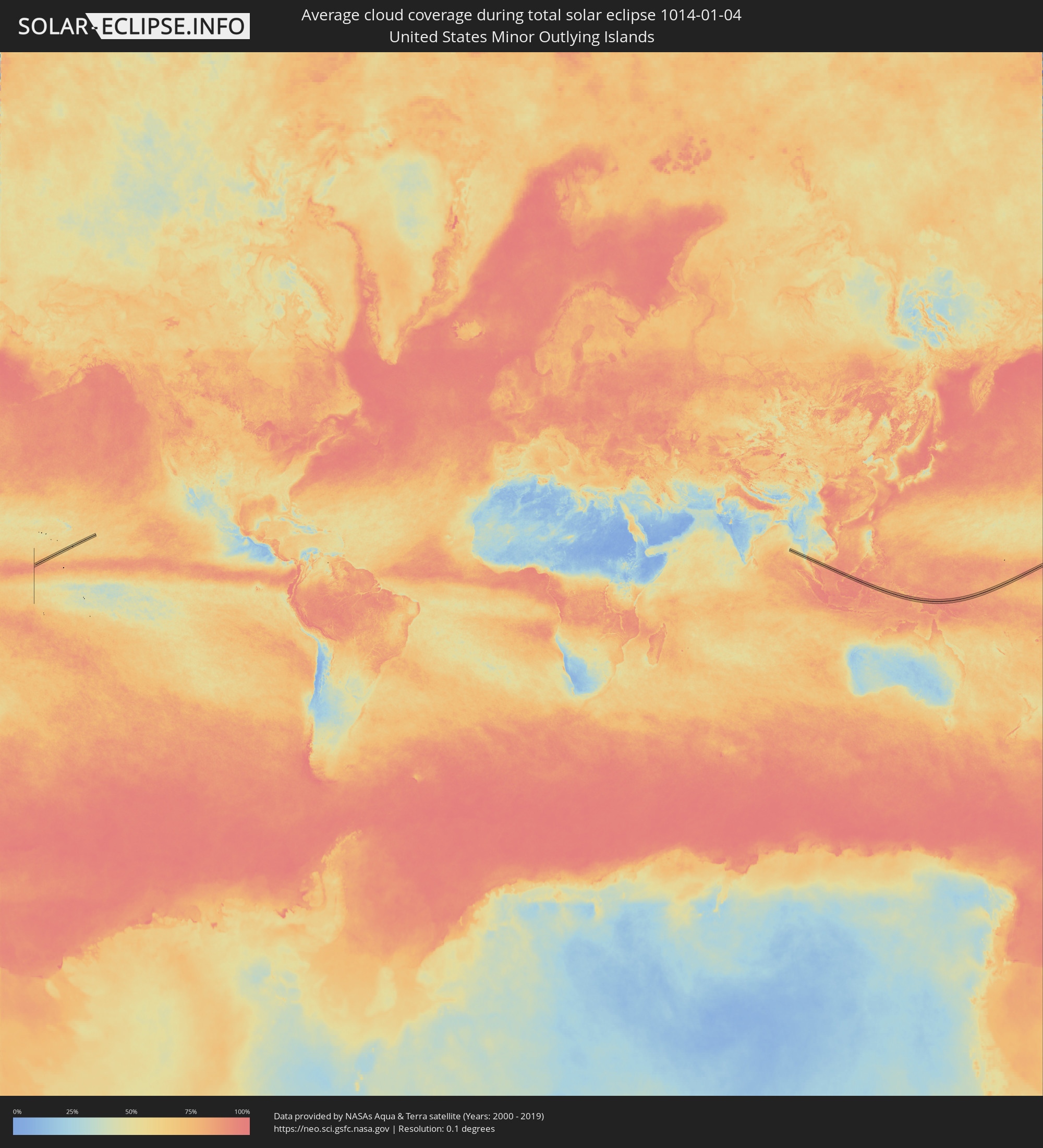 United States Minor Outlying Islands
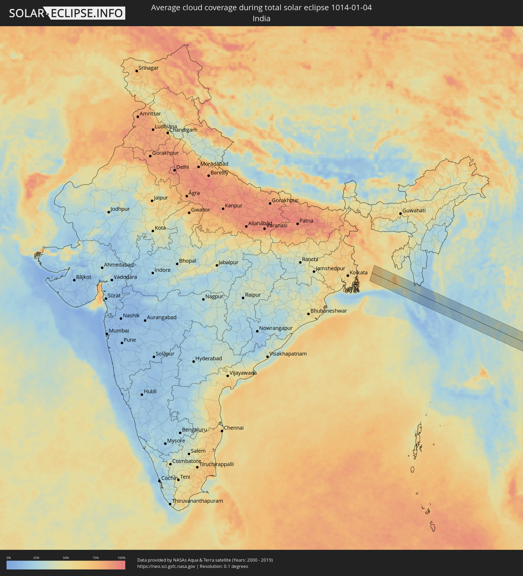 India
India
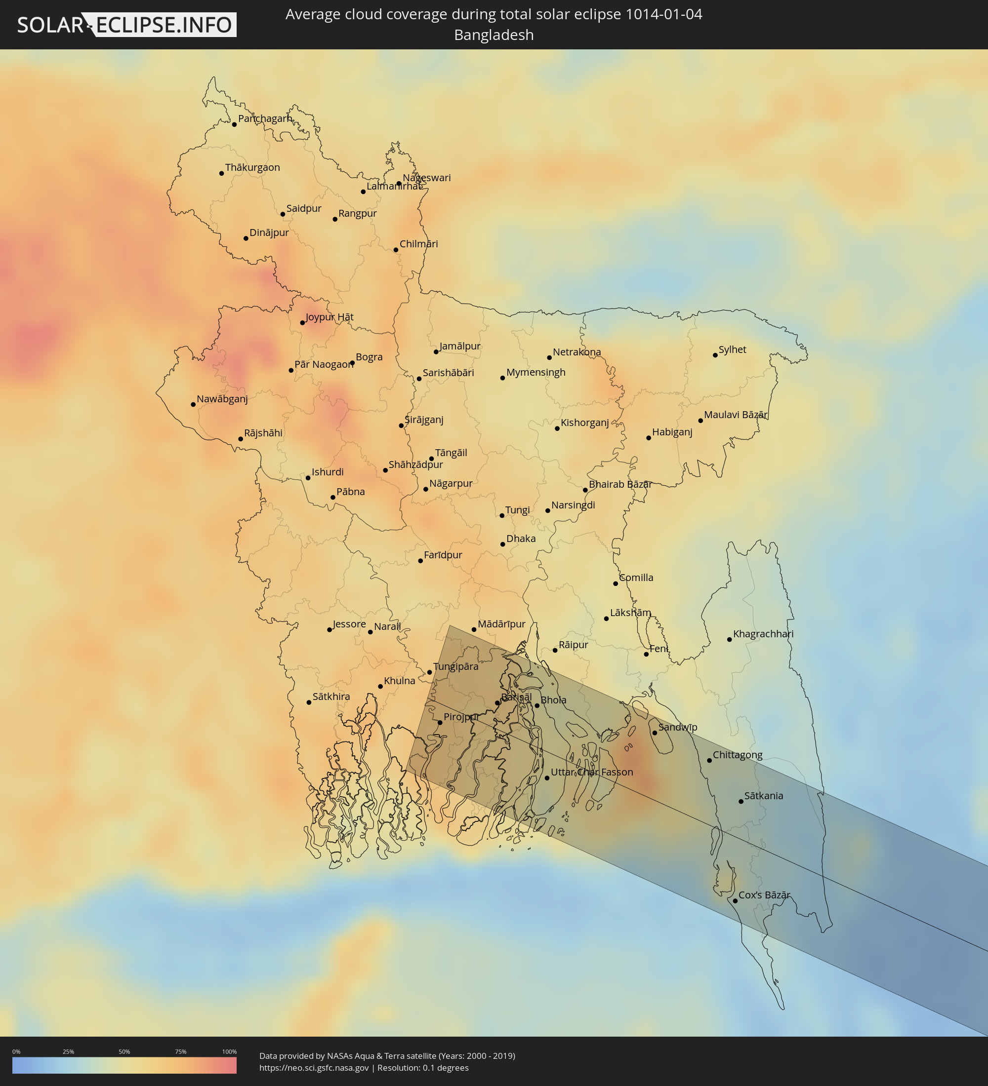 Bangladesh
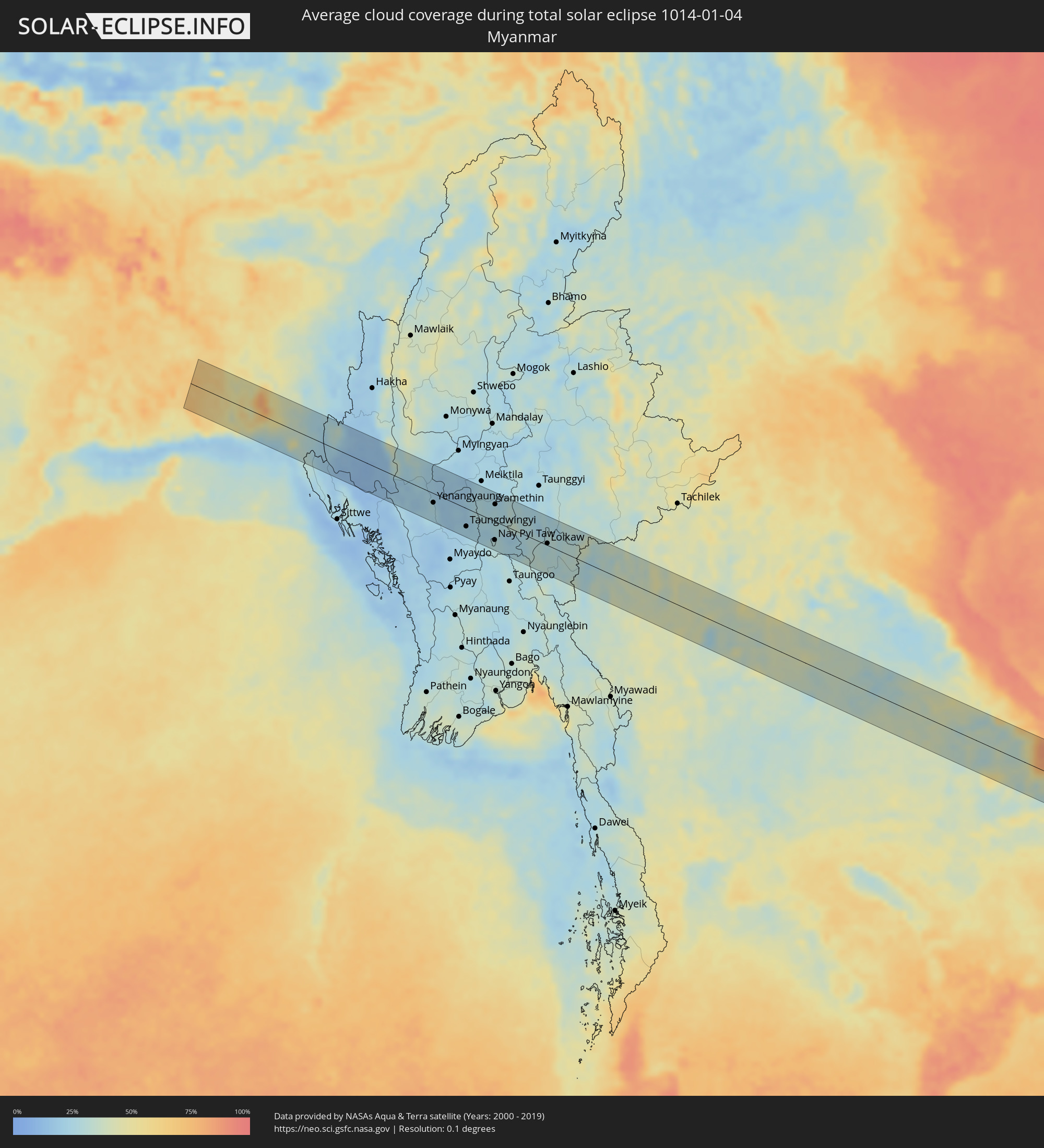 Myanmar
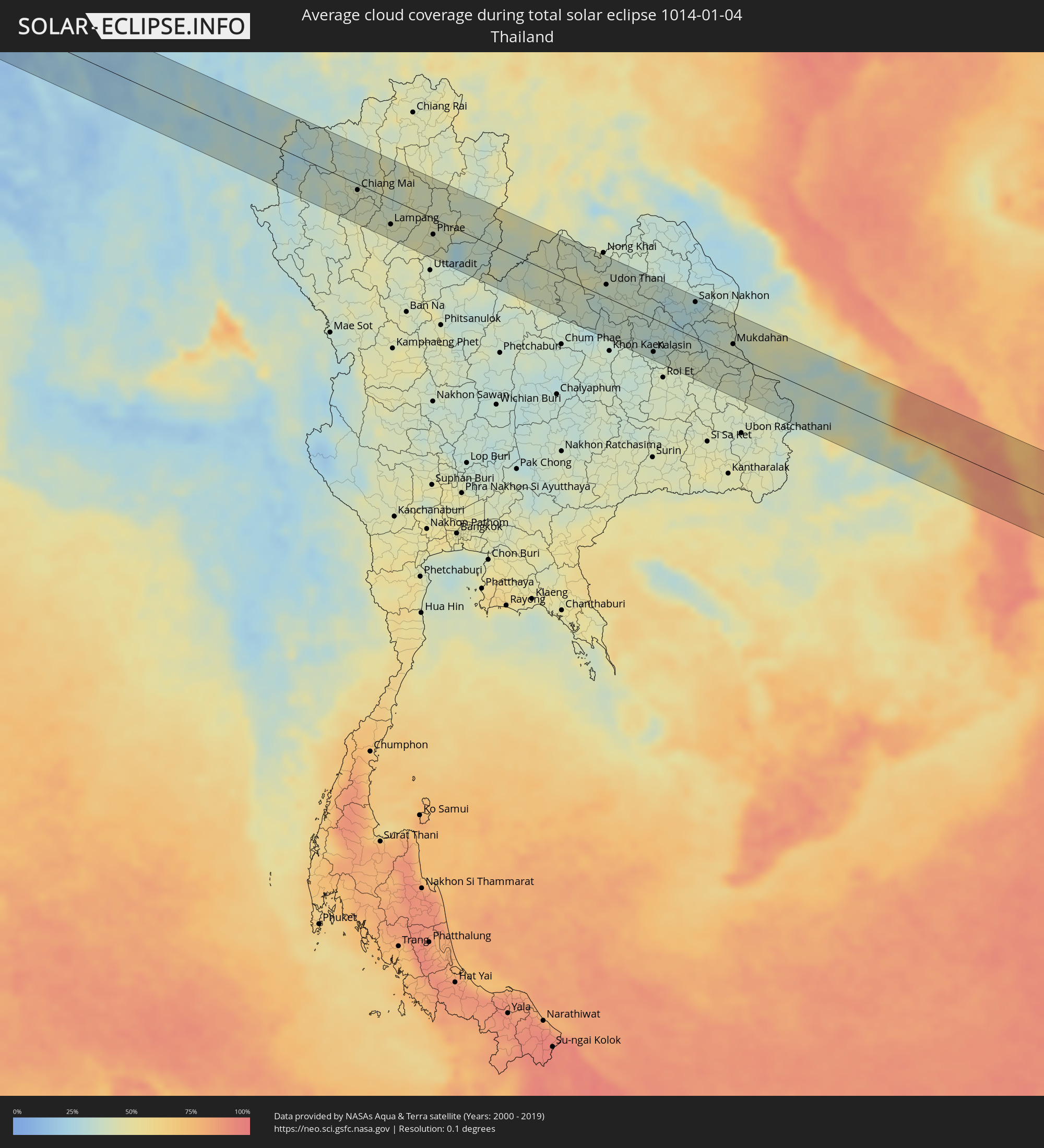 Thailand
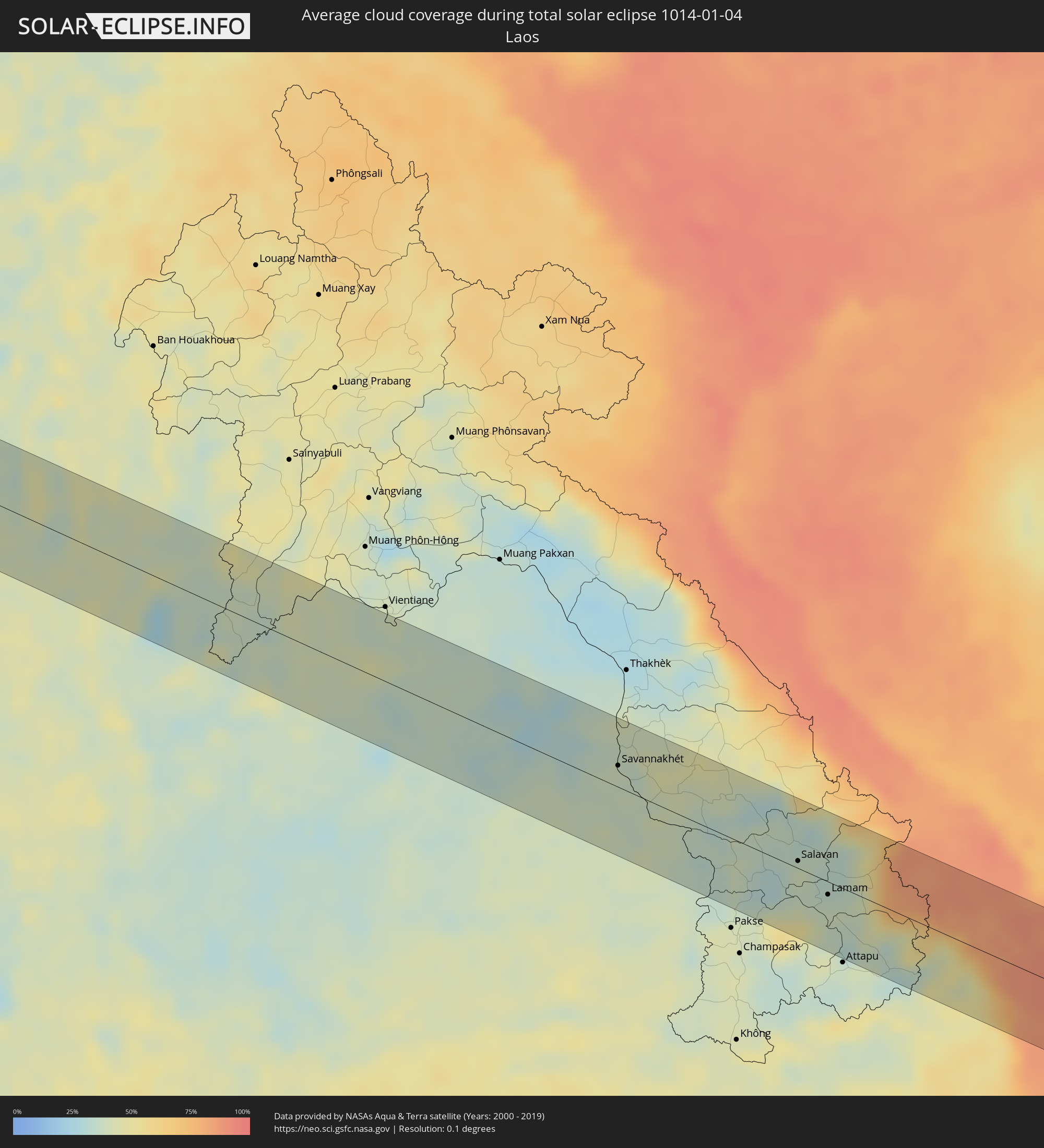 Laos
Laos
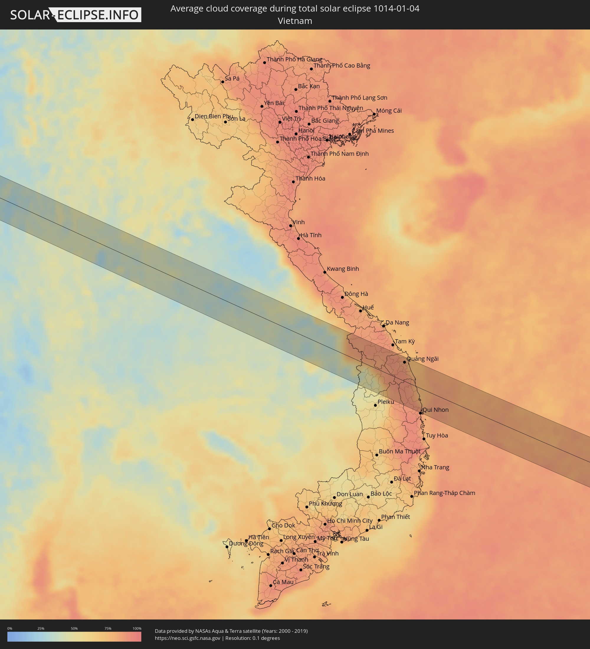 Vietnam
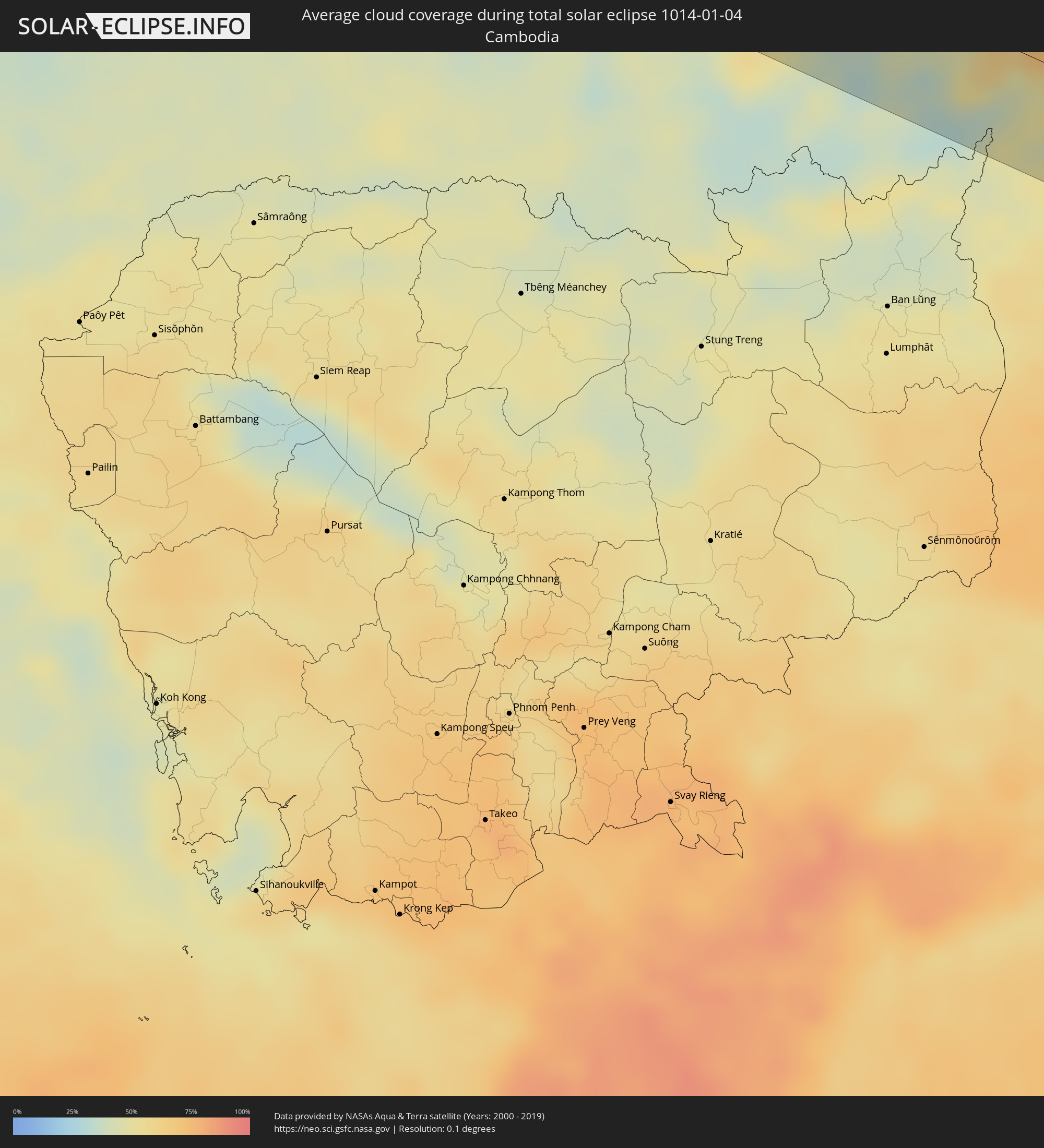 Cambodia
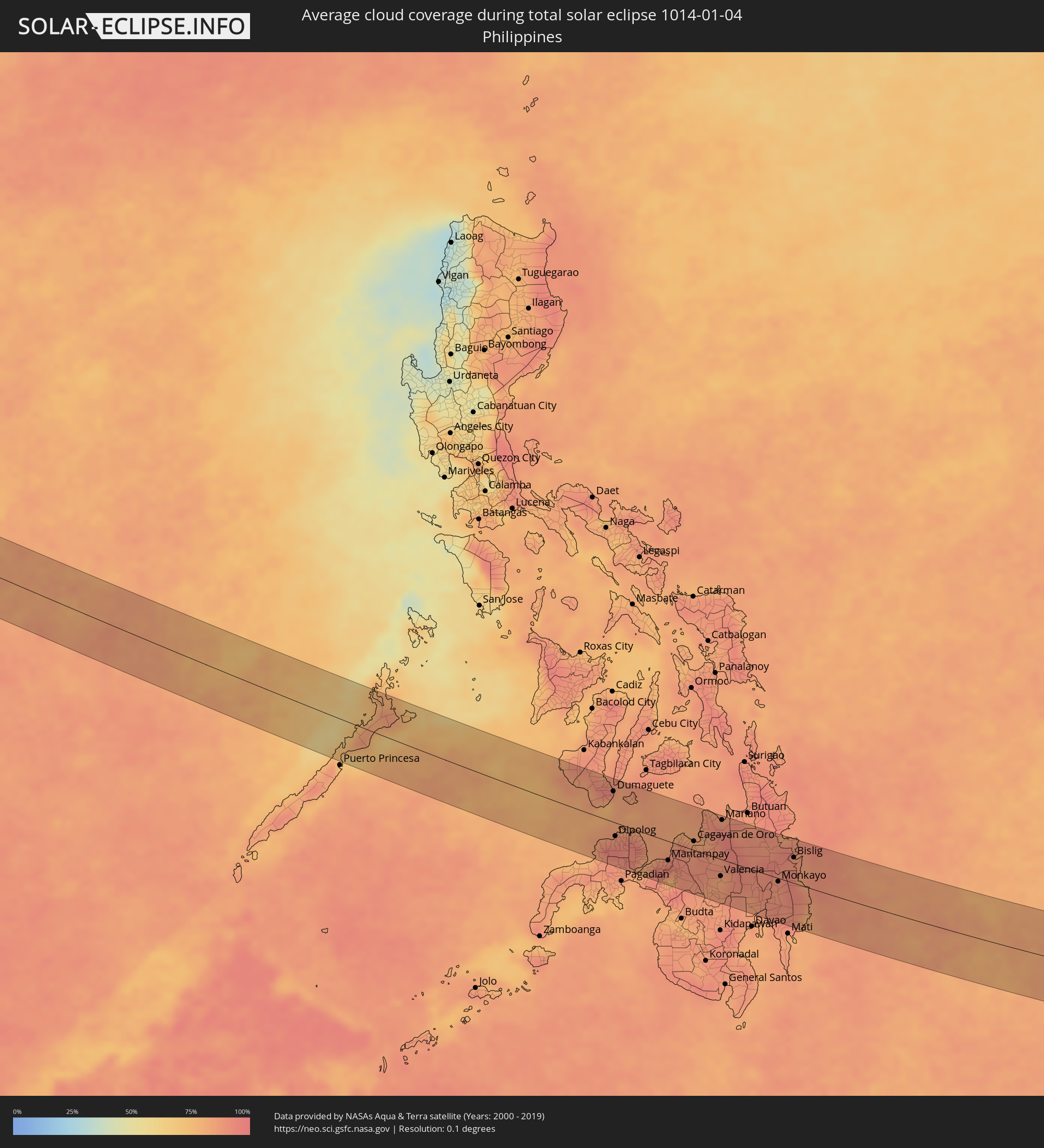 Philippines
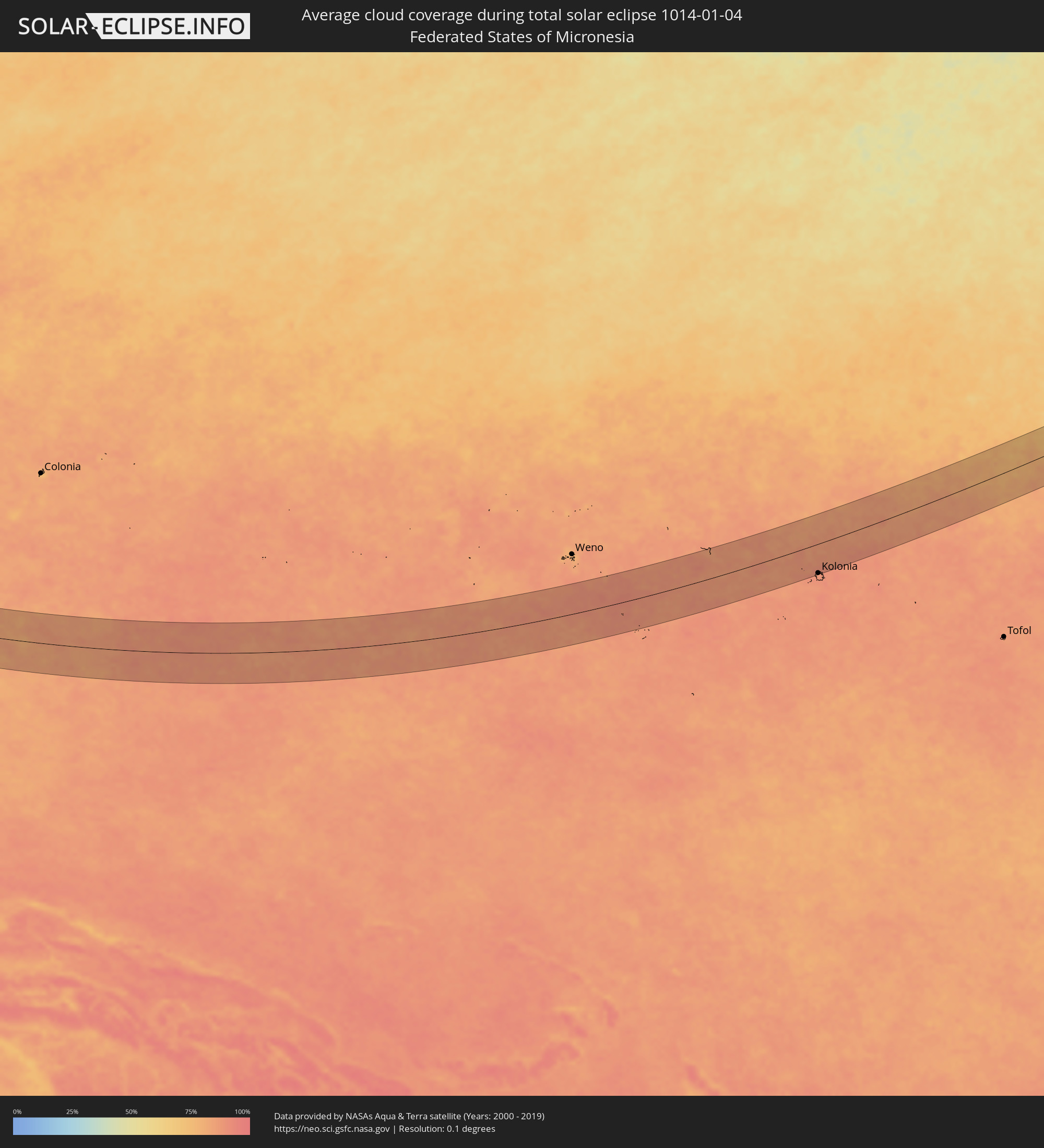 Federated States of Micronesia
 Marshall Islands
Cities inside the path of the eclipse
The following table shows all locations with a population of more than 5,000 inside the eclipse path. Cities which have more than 100,000 inhabitants are marked bold. A click at the locations opens a detailed map.
| City | Type | Eclipse duration | Local time of max. eclipse | Distance to central line | Ø Cloud coverage |
|
Sarankhola, Khulna
|
total | - | 06:42:27 UTC+05:53 | 48 km | 61% |
|
Morrelgonj, Khulna
|
total | - | 06:42:33 UTC+05:53 | 30 km | 69% |
|
Mathba, Barisāl
|
total | - | 06:42:29 UTC+05:53 | 46 km | 66% |
|
Pirojpur, Barisāl
|
total | - | 06:42:38 UTC+05:53 | 13 km | 65% |
|
Bhāndāria, Barisāl
|
total | - | 06:42:36 UTC+05:53 | 24 km | 63% |
|
Gaurnadi, Barisāl
|
total | - | 06:42:54 UTC+05:53 | 39 km | 64% |
|
Nālchiti, Barisāl
|
total | - | 06:42:44 UTC+05:53 | 6 km | 59% |
|
Barisāl, Barisāl
|
total | - | 06:42:48 UTC+05:53 | 17 km | 60% |
|
Mehendiganj, Barisāl
|
total | - | 06:42:54 UTC+05:53 | 35 km | 61% |
|
Bhola, Barisāl
|
total | - | 06:42:51 UTC+05:53 | 27 km | 52% |
|
Uttar Char Fasson, Khulna
|
total | - | 06:42:38 UTC+05:53 | 17 km | 42% |
|
Burhānuddin, Barisāl
|
total | - | 06:42:46 UTC+05:53 | 10 km | 50% |
|
Lālmohan, Barisāl
|
total | - | 06:42:41 UTC+05:53 | 5 km | 43% |
|
Sandwīp, Chittagong
|
total | - | 06:42:58 UTC+05:53 | 43 km | 52% |
|
Chittagong, Chittagong
|
total | - | 06:42:59 UTC+05:53 | 42 km | 40% |
|
Patiya, Chittagong
|
total | - | 06:43:00 UTC+05:53 | 43 km | 35% |
|
Cox’s Bāzār, Chittagong
|
total | - | 06:42:35 UTC+05:53 | 42 km | 24% |
|
Sātkania, Chittagong
|
total | - | 06:42:55 UTC+05:53 | 24 km | 37% |
|
Bāndarban, Chittagong
|
total | - | 06:43:02 UTC+05:53 | 44 km | 30% |
|
Chauk, Magway
|
total | - | 07:14:44 UTC+06:24 | 24 km | 21% |
|
Yenangyaung, Magway
|
total | - | 07:14:33 UTC+06:24 | 18 km | 22% |
|
Minbu, Magway
|
total | - | 07:14:25 UTC+06:24 | 47 km | 24% |
|
Magway, Magway
|
total | - | 07:14:25 UTC+06:24 | 47 km | 22% |
|
Taungdwingyi, Magway
|
total | - | 07:14:36 UTC+06:24 | 35 km | 23% |
|
Nay Pyi Taw, Nay Pyi Taw
|
total | - | 07:14:45 UTC+06:24 | 37 km | 29% |
|
Yamethin, Mandalay
|
total | - | 07:15:04 UTC+06:24 | 33 km | 27% |
|
Pyinmana, Nay Pyi Taw
|
total | - | 07:14:47 UTC+06:24 | 34 km | 28% |
|
Loikaw, Kayah
|
total | - | 07:15:13 UTC+06:24 | 4 km | 28% |
|
San Pa Tong, Chiang Mai
|
total | - | 07:32:56 UTC+06:42 | 29 km | 40% |
|
Hang Dong, Chiang Mai
|
total | - | 07:32:58 UTC+06:42 | 22 km | 38% |
|
Chiang Mai, Chiang Mai
|
total | - | 07:33:03 UTC+06:42 | 9 km | 41% |
|
Lamphun, Lamphun
|
total | - | 07:32:59 UTC+06:42 | 29 km | 41% |
|
San Kamphaeng, Chiang Mai
|
total | - | 07:33:07 UTC+06:42 | 8 km | 41% |
|
Lampang, Lampang
|
total | - | 07:33:09 UTC+06:42 | 37 km | 41% |
|
Den Chai, Phrae
|
total | - | 07:33:21 UTC+06:42 | 44 km | 41% |
|
Phrae, Phrae
|
total | - | 07:33:28 UTC+06:42 | 23 km | 41% |
|
Loei, Loei
|
total | - | 07:34:15 UTC+06:42 | 20 km | 39% |
|
Wang Saphung, Loei
|
total | - | 07:34:13 UTC+06:42 | 38 km | 41% |
|
Na Klang, Changwat Nong Bua Lamphu
|
total | - | 07:34:30 UTC+06:42 | 18 km | 39% |
|
Nam Som, Changwat Udon Thani
|
total | - | 07:34:40 UTC+06:42 | 29 km | 41% |
|
Nong Bua Lamphu, Changwat Nong Bua Lamphu
|
total | - | 07:34:39 UTC+06:42 | 18 km | 38% |
|
Kut Chap, Changwat Udon Thani
|
total | - | 07:34:49 UTC+06:42 | 10 km | 35% |
|
Tha Bo, Nong Khai
|
total | - | 07:34:59 UTC+06:42 | 54 km | 37% |
|
Udon Thani, Changwat Udon Thani
|
total | - | 07:34:58 UTC+06:42 | 19 km | 37% |
|
Ban Phan Don, Changwat Udon Thani
|
total | - | 07:35:01 UTC+06:42 | 1 km | 37% |
|
Ban Nong Wua So, Changwat Udon Thani
|
total | - | 07:35:14 UTC+06:42 | 23 km | 37% |
|
Nong Kung Si, Kalasin
|
total | - | 07:35:05 UTC+06:42 | 36 km | 34% |
|
Sawang Daen Din, Sakon Nakhon
|
total | - | 07:35:30 UTC+06:42 | 54 km | 36% |
|
Kalasin, Kalasin
|
total | - | 07:35:10 UTC+06:42 | 49 km | 36% |
|
Kuchinarai, Kalasin
|
total | - | 07:35:38 UTC+06:42 | 14 km | 39% |
|
Sakon Nakhon, Sakon Nakhon
|
total | - | 07:35:55 UTC+06:42 | 53 km | 28% |
|
Amnat Charoen, Amnat Charoen
|
total | - | 07:35:53 UTC+06:42 | 58 km | 40% |
|
Mukdahan, Mukdahan
|
total | - | 07:36:10 UTC+06:42 | 16 km | 38% |
|
Savannakhét, Savannahkhét
|
total | - | 07:36:12 UTC+06:42 | 19 km | 38% |
|
Salavan, Salavan
|
total | - | 07:37:23 UTC+06:42 | 7 km | 40% |
|
Lamam, Xékong
|
total | - | 07:37:33 UTC+06:42 | 12 km | 40% |
|
Kon Tum, Kon Tum
|
total | - | 08:03:08 UTC+07:06 | 62 km | 48% |
|
Quảng Ngãi, Quảng Ngãi
|
total | - | 08:04:07 UTC+07:06 | 50 km | 85% |
|
Sipalay, Western Visayas
|
total | - | 09:16:31 UTC+08:00 | 66 km | 82% |
|
Asia, Western Visayas
|
total | - | 09:16:43 UTC+08:00 | 49 km | 85% |
|
Bayawan, Central Visayas
|
total | - | 09:17:16 UTC+08:00 | 41 km | 83% |
|
Tanjay, Central Visayas
|
total | - | 09:17:59 UTC+08:00 | 70 km | 90% |
|
Dumaguete, Central Visayas
|
total | - | 09:18:15 UTC+08:00 | 53 km | 84% |
|
Dipolog, Zamboanga Peninsula
|
total | - | 09:18:17 UTC+08:00 | 23 km | 87% |
|
Molave, Zamboanga Peninsula
|
total | - | 09:18:35 UTC+08:00 | 68 km | 87% |
|
Lala, Northern Mindanao
|
total | - | 09:19:06 UTC+08:00 | 70 km | 80% |
|
Oroquieta, Northern Mindanao
|
total | - | 09:19:14 UTC+08:00 | 15 km | 85% |
|
Ozamiz City, Northern Mindanao
|
total | - | 09:19:18 UTC+08:00 | 49 km | 80% |
|
Mantampay, Northern Mindanao
|
total | - | 09:20:04 UTC+08:00 | 33 km | 90% |
|
Marawi City, Autonomous Region in Muslim Mindanao
|
total | - | 09:20:12 UTC+08:00 | 48 km | 84% |
|
Iligan City, Soccsksargen
|
total | - | 09:20:27 UTC+08:00 | 18 km | 91% |
|
Cagayan de Oro, Northern Mindanao
|
total | - | 09:20:59 UTC+08:00 | 15 km | 85% |
|
Manolo Fortich, Northern Mindanao
|
total | - | 09:21:26 UTC+08:00 | 11 km | 88% |
|
Maramag, Northern Mindanao
|
total | - | 09:21:43 UTC+08:00 | 48 km | 83% |
|
Valencia, Northern Mindanao
|
total | - | 09:21:55 UTC+08:00 | 30 km | 82% |
|
Mariano, Northern Mindanao
|
total | - | 09:22:00 UTC+08:00 | 69 km | 89% |
|
Malaybalay, Northern Mindanao
|
total | - | 09:22:00 UTC+08:00 | 2 km | 88% |
|
Panabo, Davao
|
total | - | 09:23:11 UTC+08:00 | 72 km | 84% |
|
Tagum, Davao
|
total | - | 09:23:28 UTC+08:00 | 53 km | 88% |
|
Bah-Bah, Caraga
|
total | - | 09:23:44 UTC+08:00 | 73 km | 90% |
|
Monkayo, Davao
|
total | - | 09:24:01 UTC+08:00 | 6 km | 90% |
|
Compostela, Davao
|
total | - | 09:24:05 UTC+08:00 | 20 km | 89% |
|
Bislig, Caraga
|
total | - | 09:24:36 UTC+08:00 | 45 km | 89% |
|
Palikir - National Government Center, Pohnpei
|
total | - | 13:58:31 UTC+11:00 | 81 km | 89% |
|
Kolonia Town, Pohnpei
|
total | - | 13:58:39 UTC+11:00 | 79 km | 87% |
|
Kolonia, Pohnpei
|
total | - | 13:58:39 UTC+11:00 | 79 km | 87% |
|
Wotho, Wotho Atoll
|
total | - | 14:18:28 UTC+11:00 | 66 km | 73% |
|
Rongelap, Rongelap Atoll
|
total | - | 14:20:32 UTC+11:00 | 4 km | 74% |