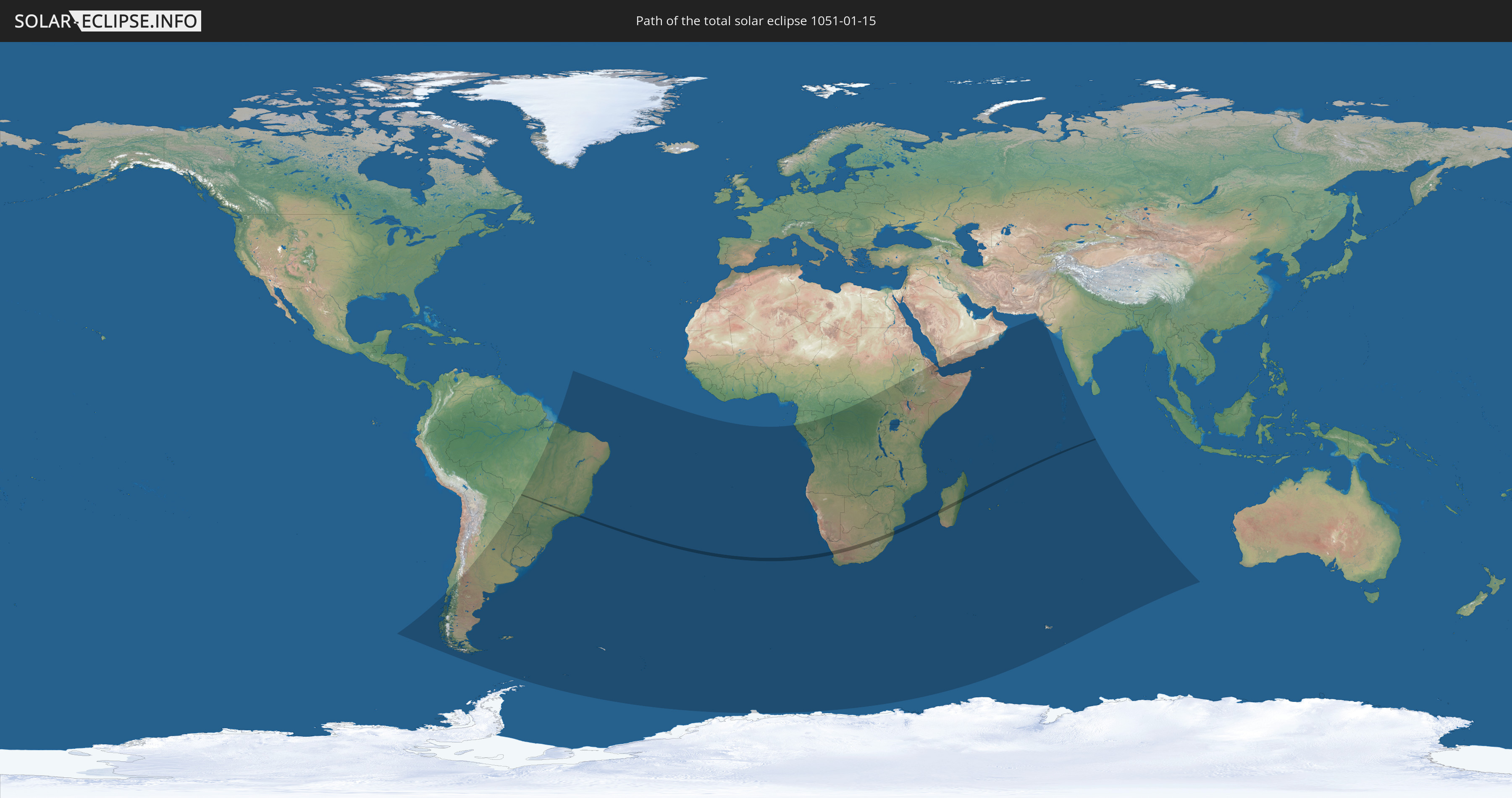
Total solar eclipse of 01/15/1051
| Day of week: | Wednesday |
| Maximum duration of eclipse: | 02m18s |
| Maximum width of eclipse path: | 88 km |
| Saros cycle: | 106 |
| Coverage: | 100% |
| Magnitude: | 1.0252 |
| Gamma: | -0.2049 |
Wo kann man die Sonnenfinsternis vom 01/15/1051 sehen?
Die Sonnenfinsternis am 01/15/1051 kann man in 47 Ländern als partielle Sonnenfinsternis beobachten.
Der Finsternispfad verläuft durch 7 Länder. Nur in diesen Ländern ist sie als total Sonnenfinsternis zu sehen.
In den folgenden Ländern ist die Sonnenfinsternis total zu sehen
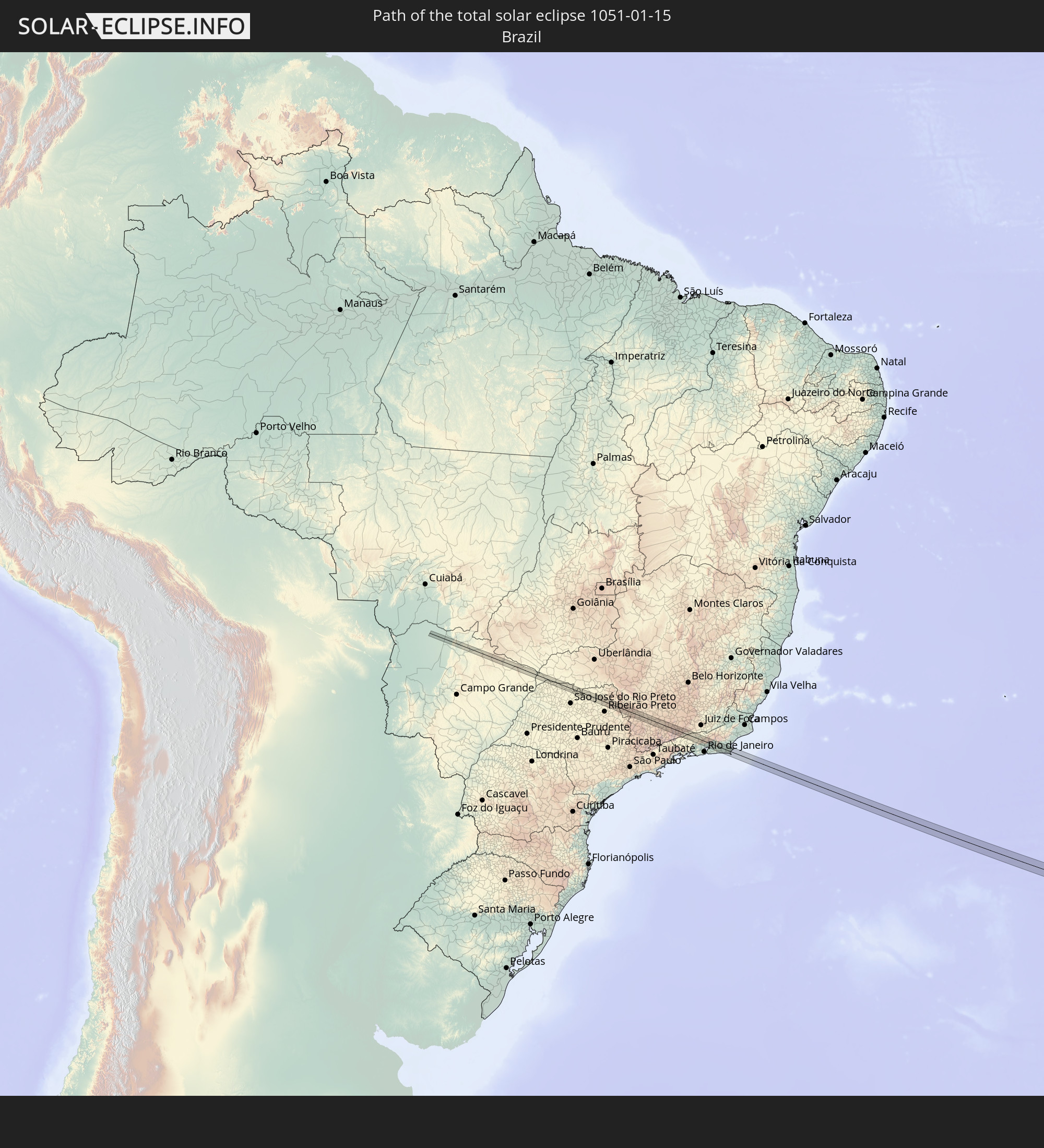 Brazil
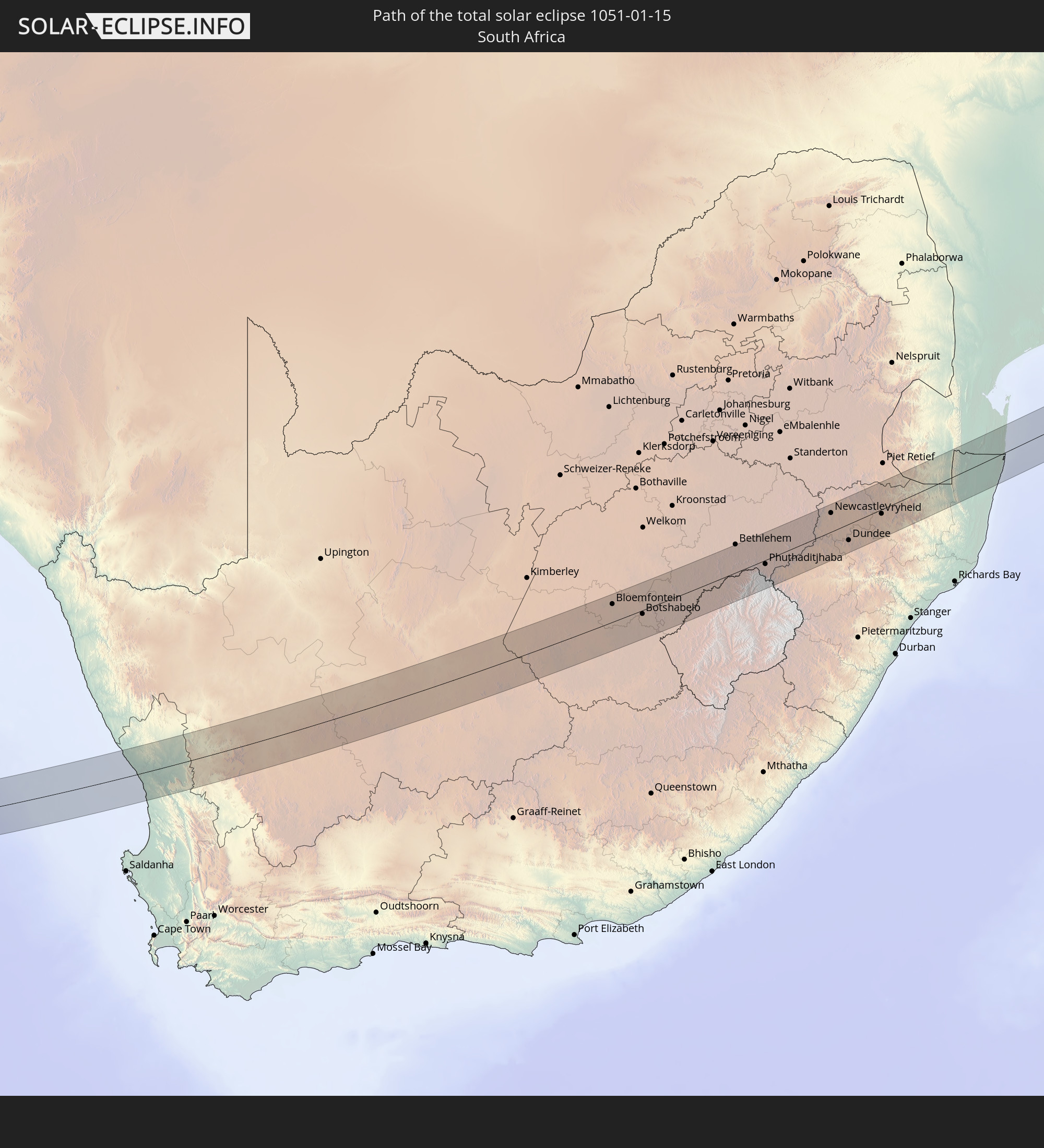 South Africa
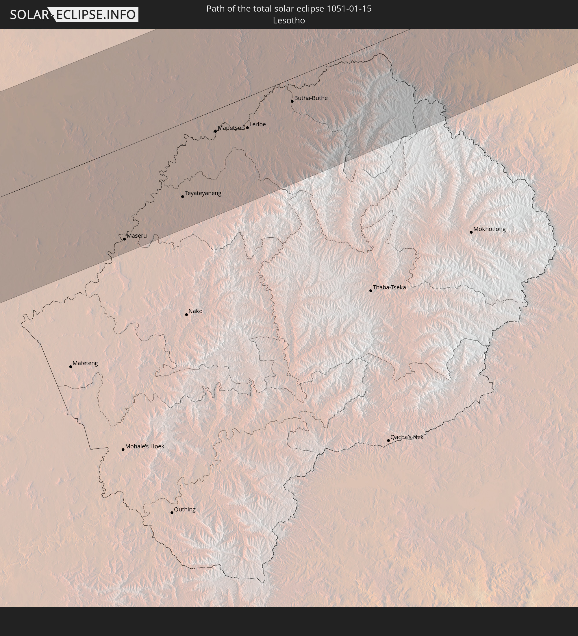 Lesotho
 Mozambique
 Swaziland
 French Southern and Antarctic Lands
 Madagascar
In den folgenden Ländern ist die Sonnenfinsternis partiell zu sehen
 Antarctica
 Chile
Chile
 Brazil
 Argentina
 Paraguay
 Falkland Islands
 Uruguay
 South Georgia and the South Sandwich Islands
 Saint Helena, Ascension and Tristan da Cunha
 Bouvet Island
 Gabon
Gabon
 Republic of the Congo
 Angola
 Namibia
 Democratic Republic of the Congo
 Central African Republic
 South Africa
 Botswana
 Zambia
 Zimbabwe
 Lesotho
 Rwanda
 Burundi
 Tanzania
 Uganda
 Mozambique
 Swaziland
 Malawi
 Ethiopia
 Kenya
Kenya
 Eritrea
 French Southern and Antarctic Lands
 Somalia
 Djibouti
 Yemen
Yemen
 Madagascar
 Comoros
 Mayotte
 Seychelles
 Oman
Oman
 Réunion
 Mauritius
 Pakistan
 India
India
 British Indian Ocean Territory
 Heard Island and McDonald Islands
 Maldives
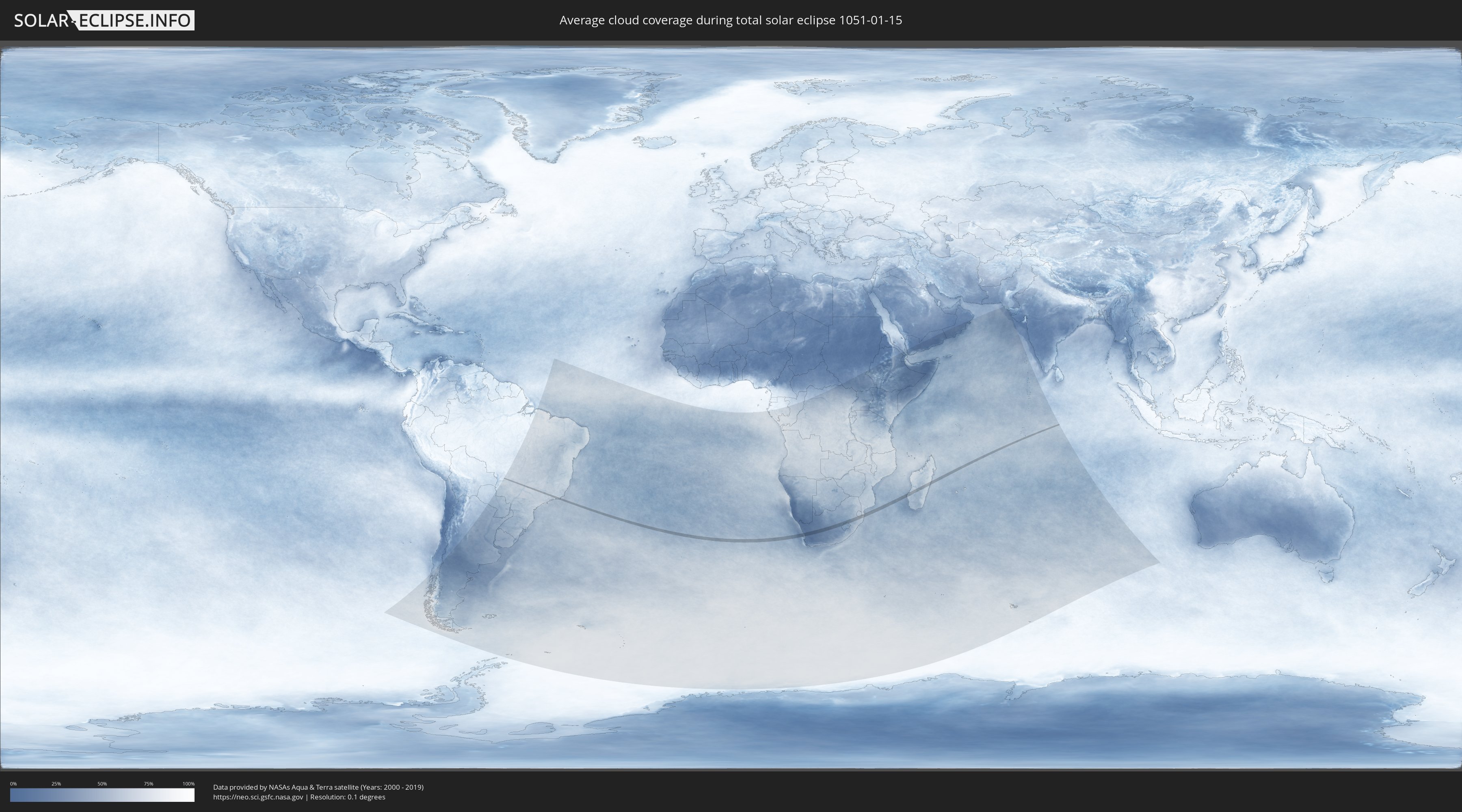
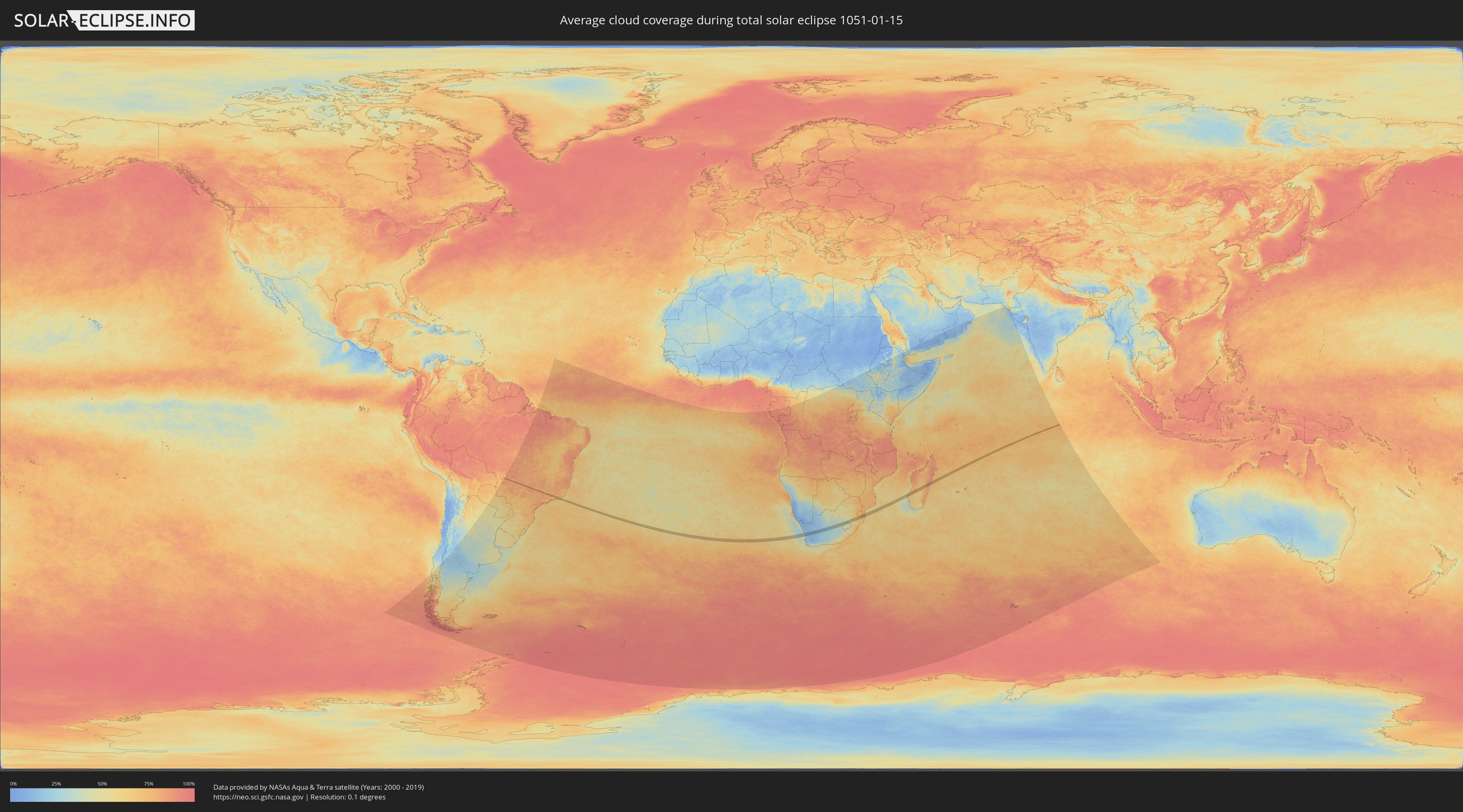
How will be the weather during the total solar eclipse on 01/15/1051?
Where is the best place to see the total solar eclipse of 01/15/1051?
The following maps show the average cloud coverage for the day of the total solar eclipse.
With the help of these maps, it is possible to find the place along the eclipse path, which has the best
chance of a cloudless sky.
Nevertheless, you should consider local circumstances and inform about the weather of your chosen
observation site.
The data is provided by NASAs satellites
AQUA and TERRA.
The cloud maps are averaged over a period of 19 years (2000 - 2019).
Detailed country maps
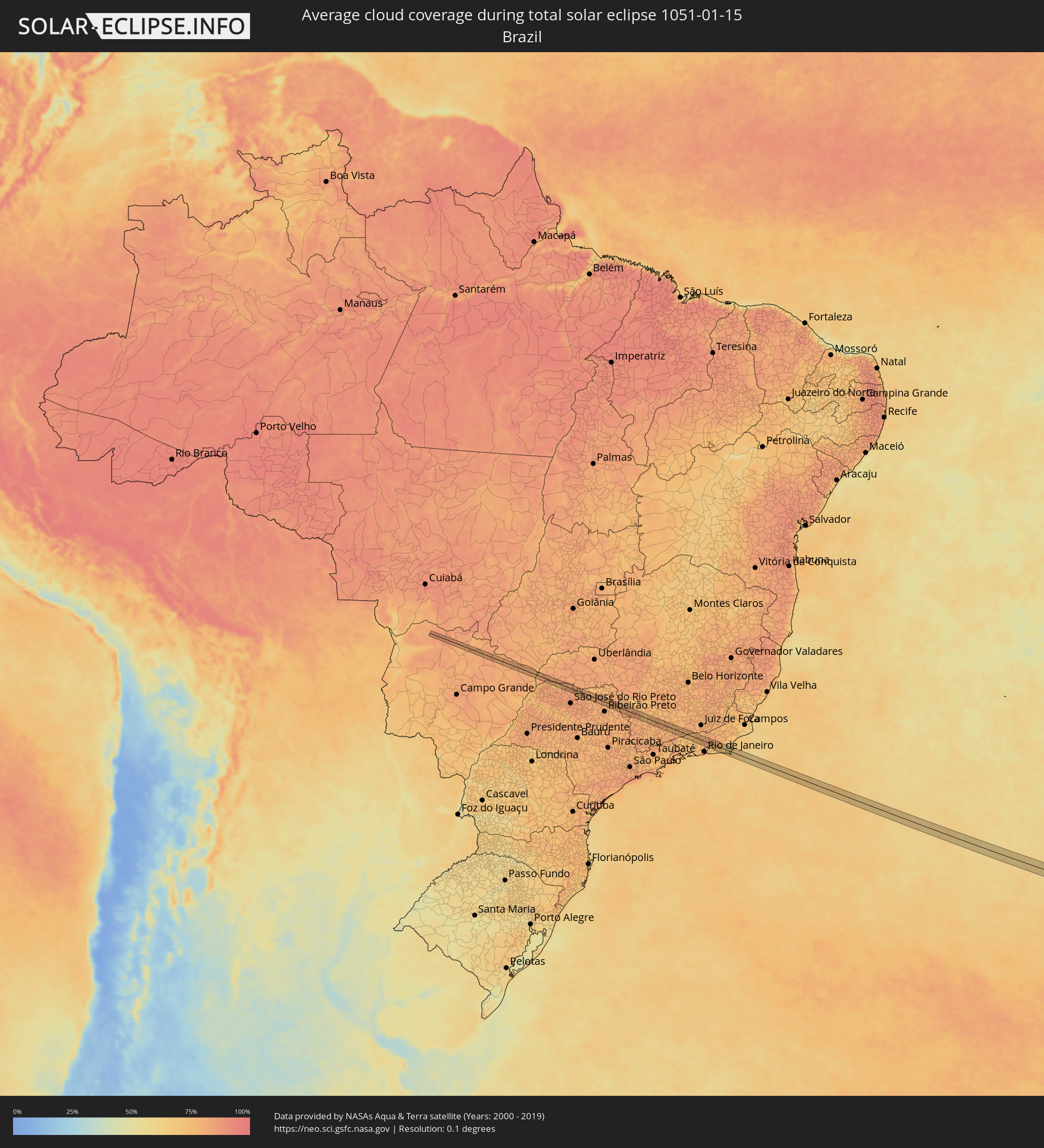 Brazil
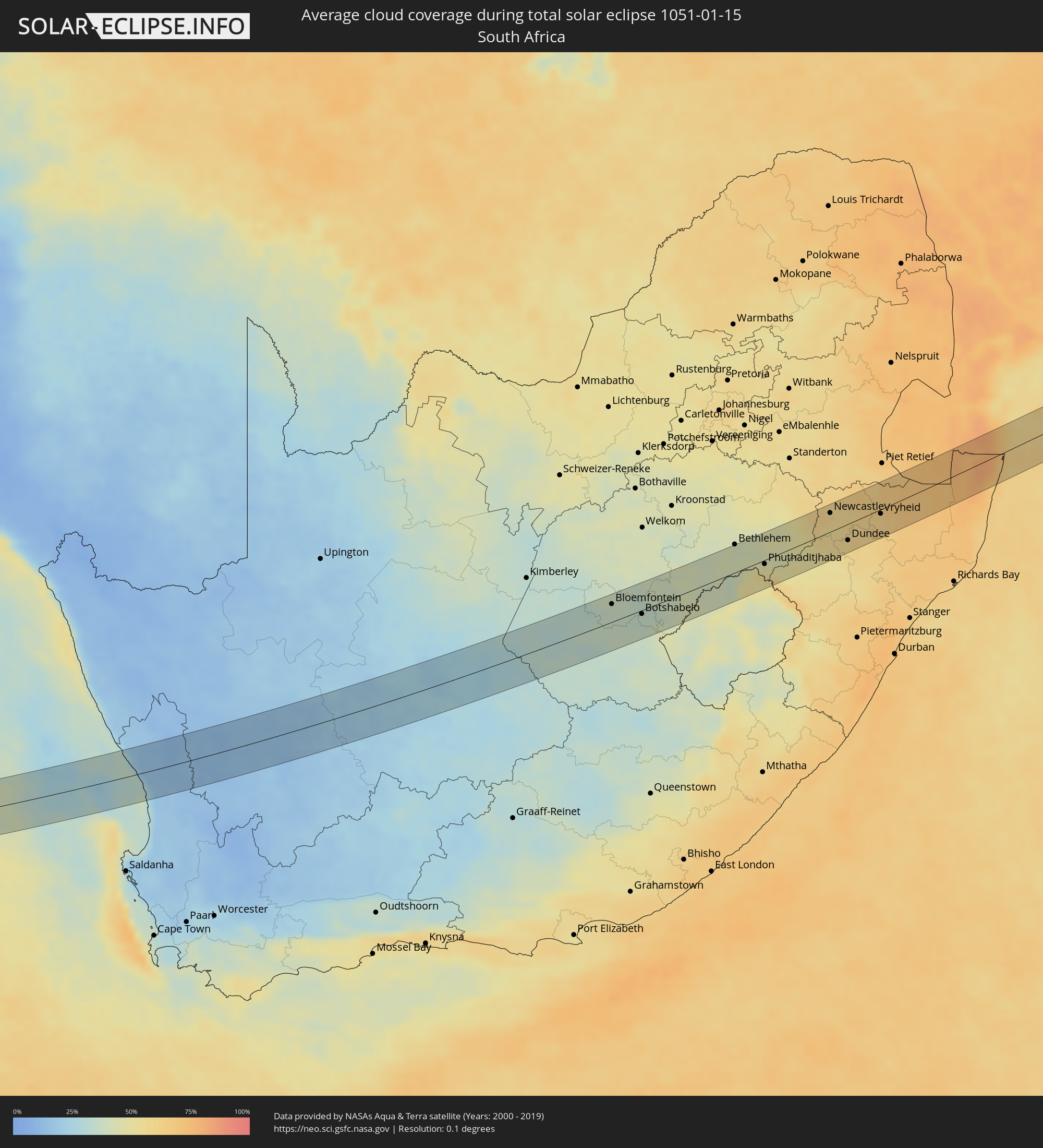 South Africa
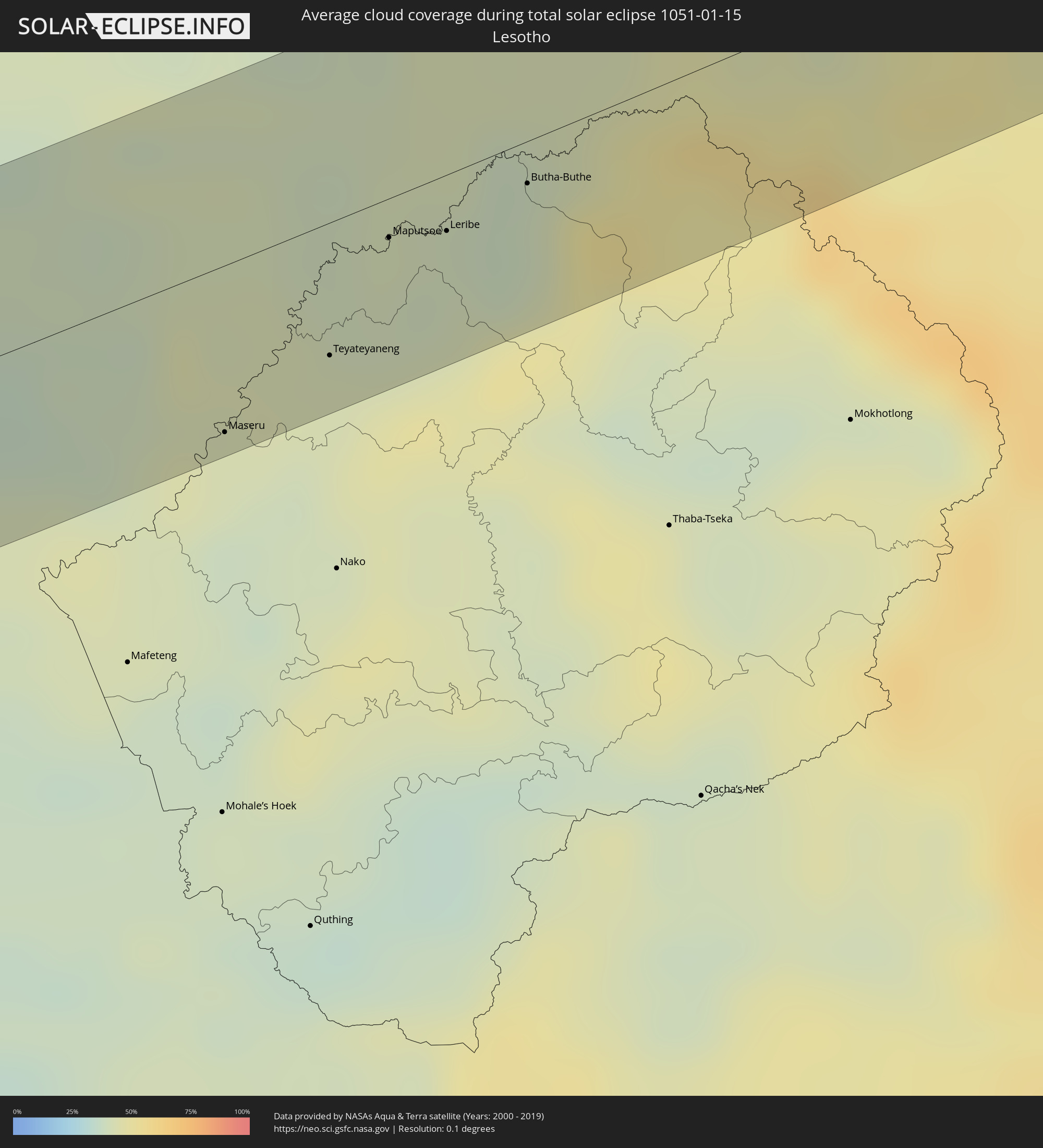 Lesotho
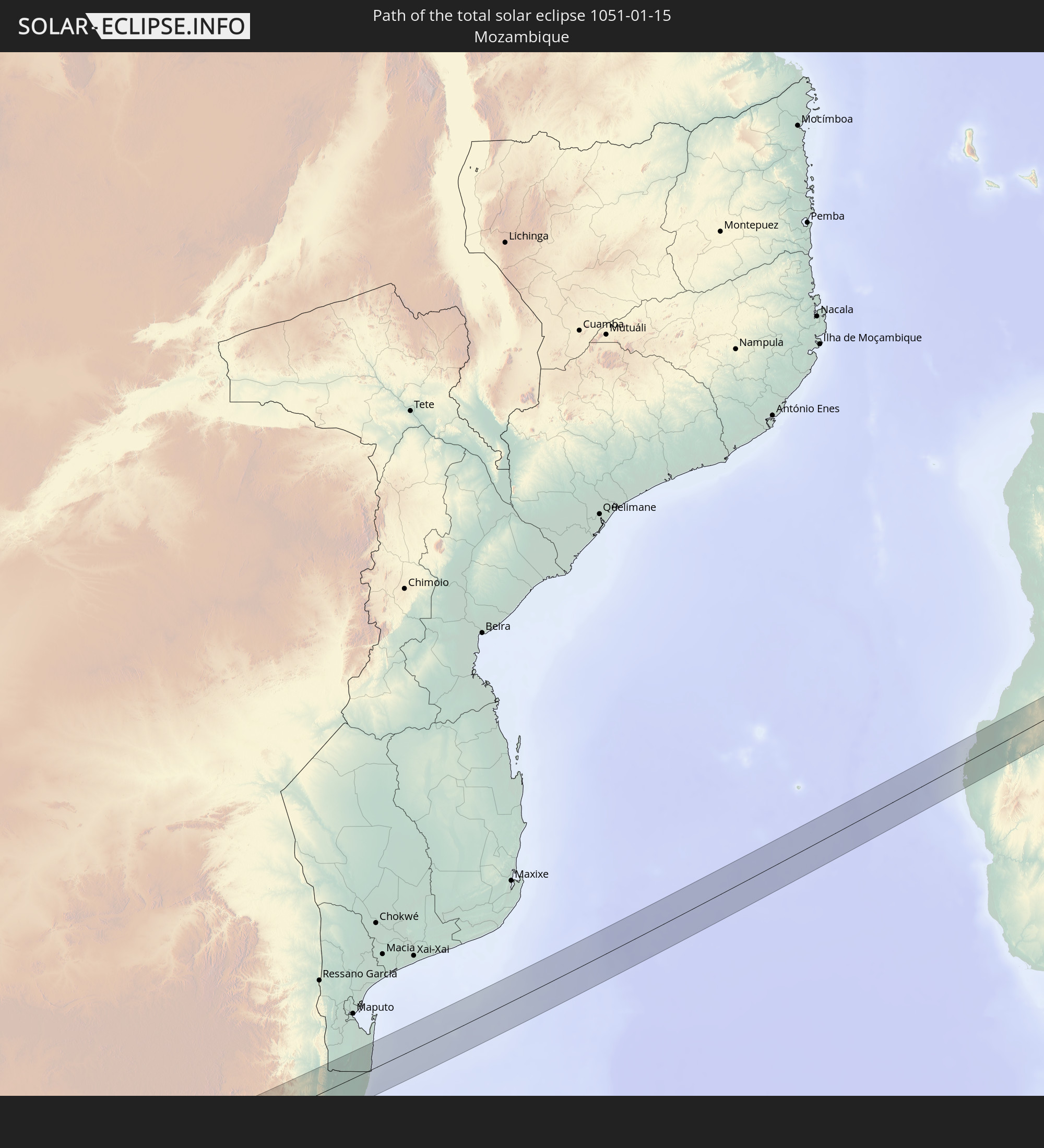
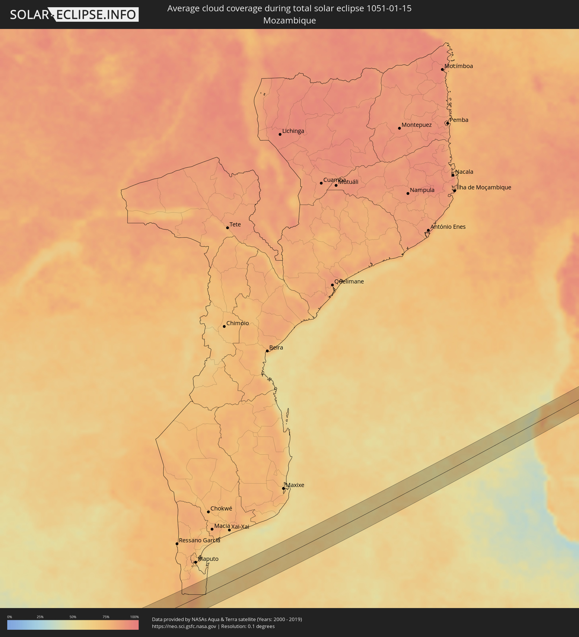 Mozambique
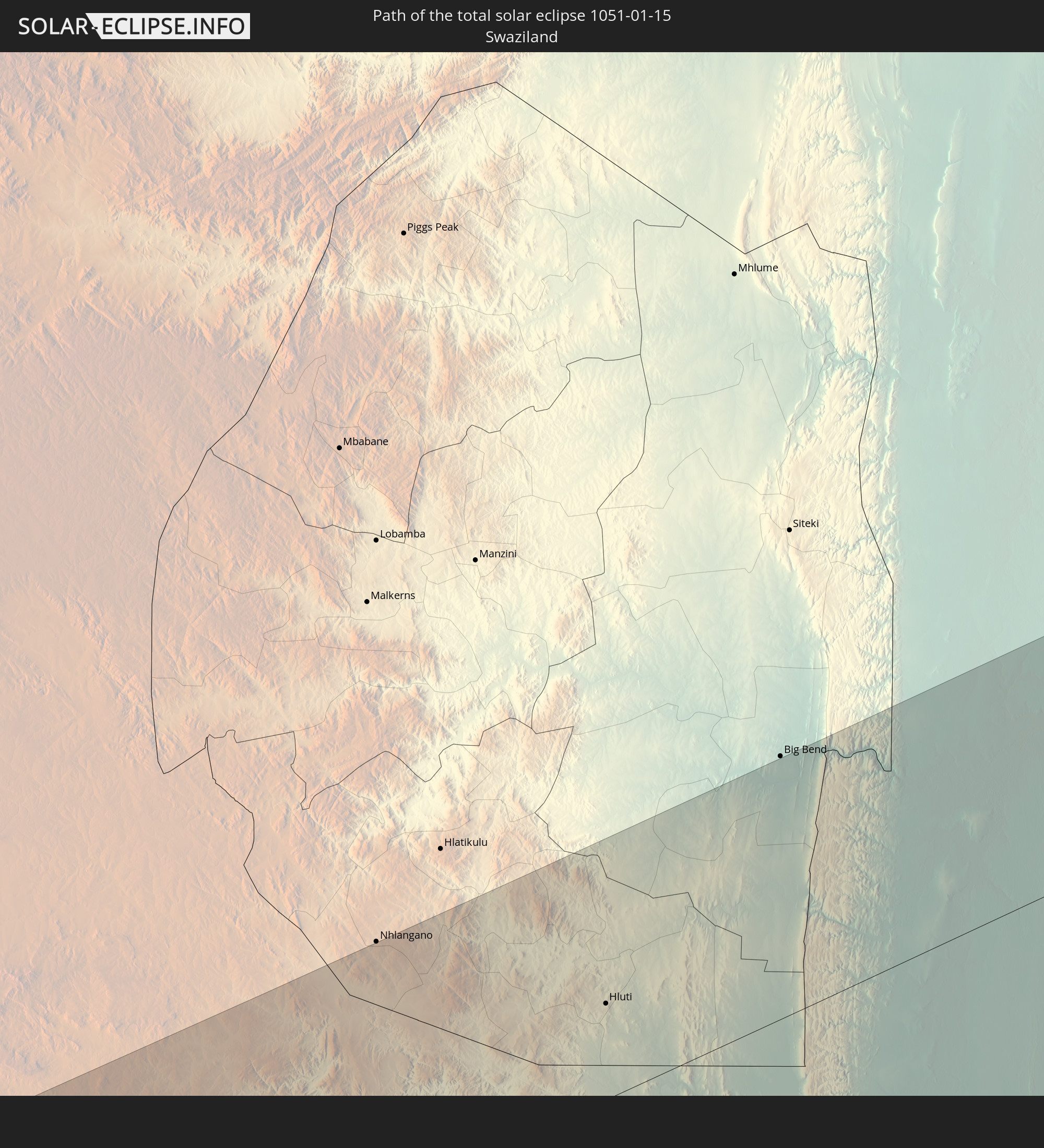
 Swaziland
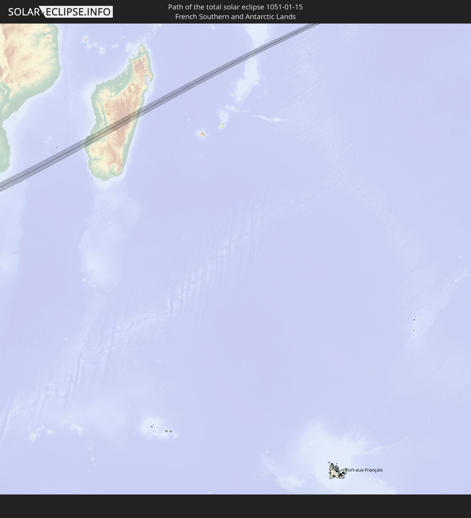
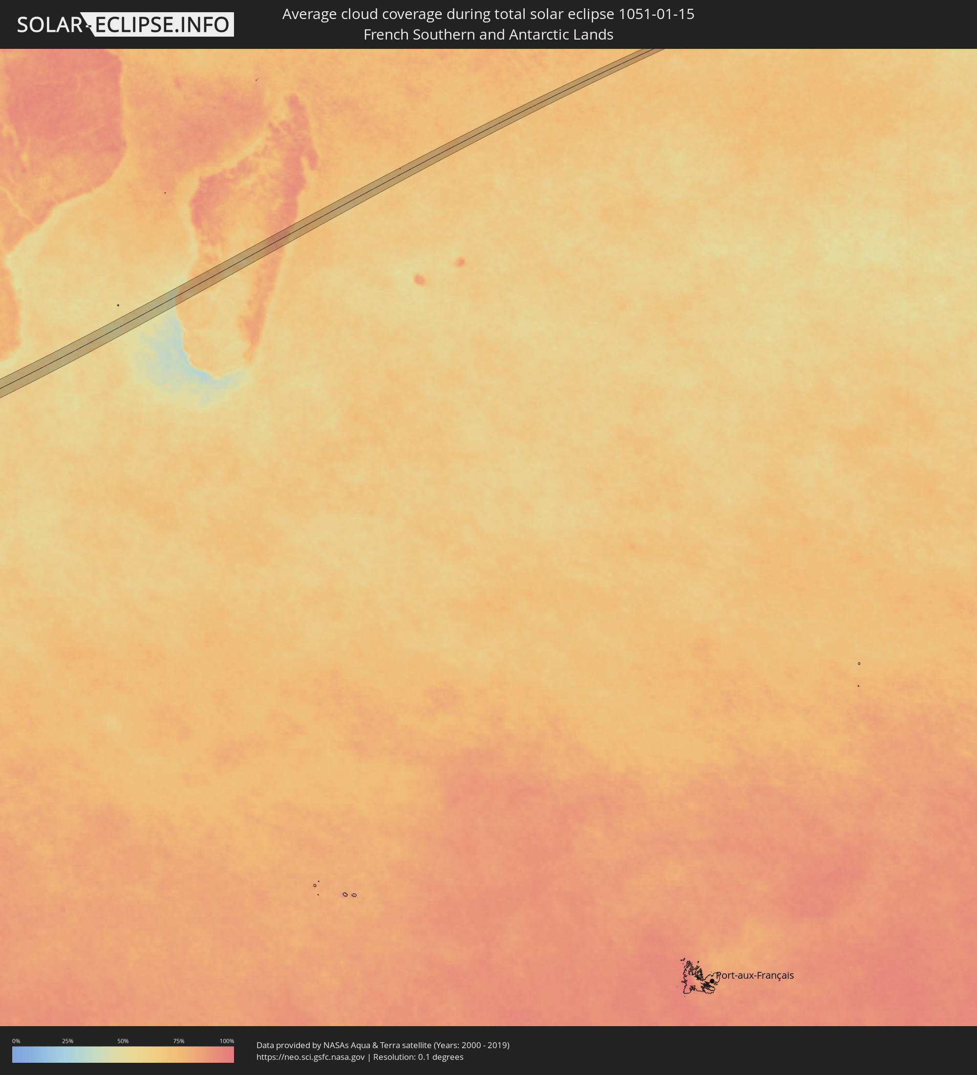 French Southern and Antarctic Lands
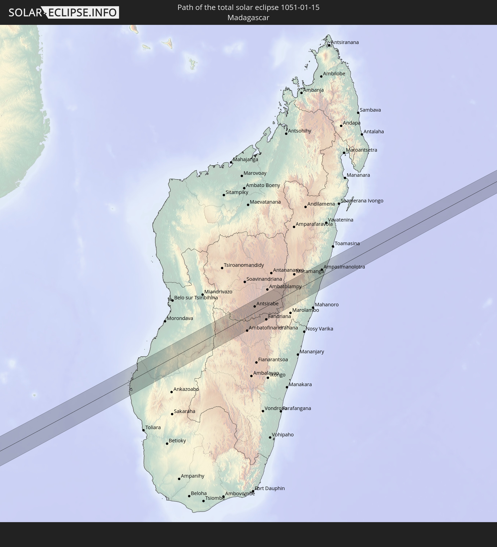
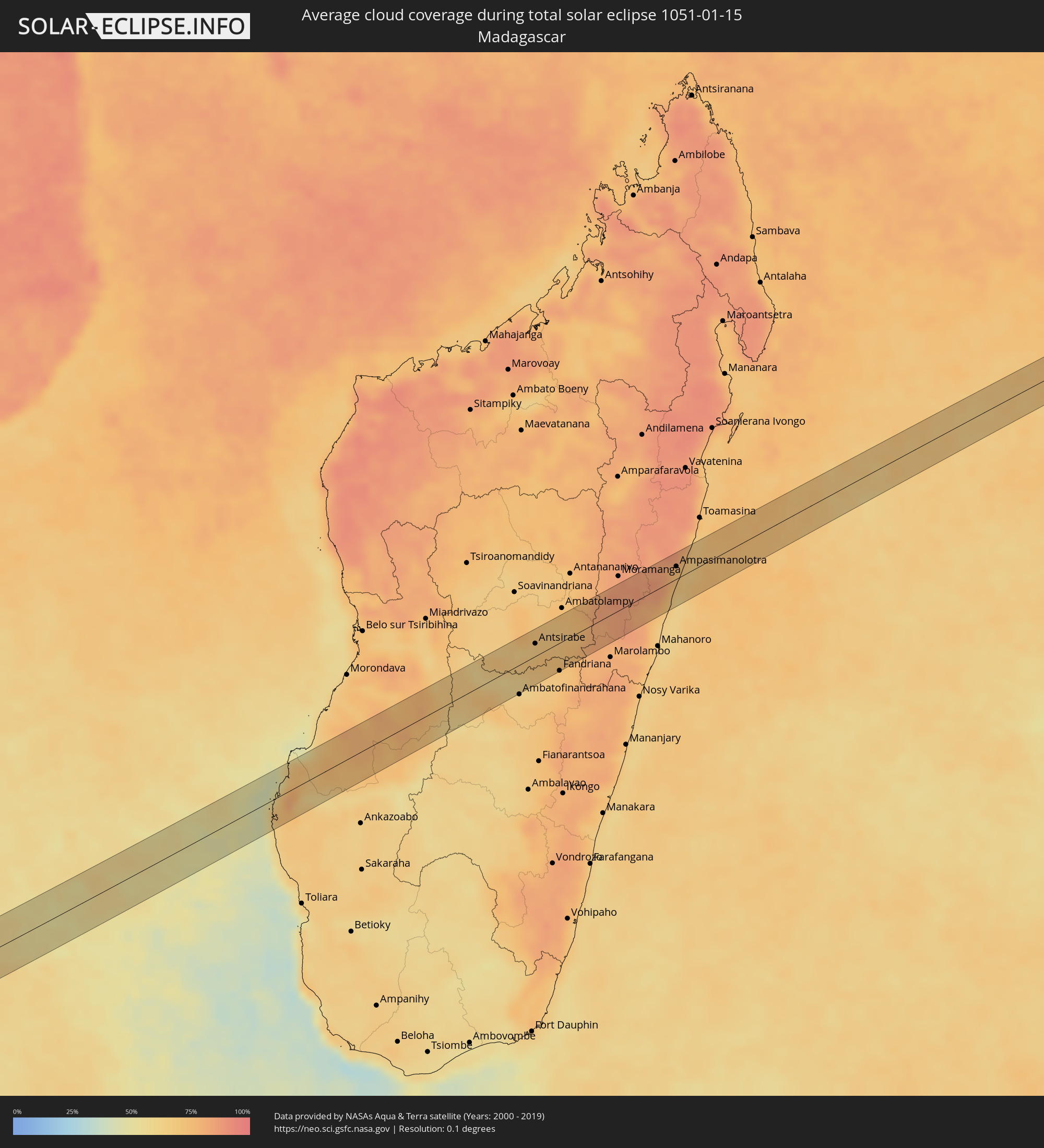 Madagascar
Cities inside the path of the eclipse
The following table shows all locations with a population of more than 5,000 inside the eclipse path. Cities which have more than 100,000 inhabitants are marked bold. A click at the locations opens a detailed map.
| City | Type | Eclipse duration | Local time of max. eclipse | Distance to central line | Ø Cloud coverage |
|
Iturama, Minas Gerais
|
total | - | 06:24:18 UTC-03:06 | 14 km | 80% |
|
Barretos, São Paulo
|
total | - | 06:24:50 UTC-03:06 | 9 km | 81% |
|
Morro Agudo, São Paulo
|
total | - | 06:24:58 UTC-03:06 | 8 km | 81% |
|
Orlândia, São Paulo
|
total | - | 06:24:58 UTC-03:06 | 0 km | 80% |
|
São Joaquim da Barra, São Paulo
|
total | - | 06:24:52 UTC-03:06 | 15 km | 80% |
|
Batatais, São Paulo
|
total | - | 06:25:06 UTC-03:06 | 6 km | 80% |
|
Altinópolis, São Paulo
|
total | - | 06:25:12 UTC-03:06 | 12 km | 78% |
|
São Sebastião do Paraíso, Minas Gerais
|
total | - | 06:25:09 UTC-03:06 | 14 km | 78% |
|
Monte Santo de Minas, Minas Gerais
|
total | - | 06:25:21 UTC-03:06 | 14 km | 80% |
|
Guaranésia, Minas Gerais
|
total | - | 06:25:26 UTC-03:06 | 19 km | 79% |
|
Guaxupé, Minas Gerais
|
total | - | 06:25:27 UTC-03:06 | 16 km | 81% |
|
Muzambinho, Minas Gerais
|
total | - | 06:25:31 UTC-03:06 | 16 km | 81% |
|
Areado, Minas Gerais
|
total | - | 06:25:32 UTC-03:06 | 1 km | 74% |
|
Alfenas, Minas Gerais
|
total | - | 06:25:36 UTC-03:06 | 1 km | 74% |
|
Paraguaçu, Minas Gerais
|
total | - | 06:25:43 UTC-03:06 | 4 km | 78% |
|
Elói Mendes, Minas Gerais
|
total | - | 06:25:47 UTC-03:06 | 4 km | 79% |
|
Varginha, Minas Gerais
|
total | - | 06:25:45 UTC-03:06 | 8 km | 81% |
|
Três Corações, Minas Gerais
|
total | - | 06:25:53 UTC-03:06 | 1 km | 79% |
|
Conceição do Rio Verde, Minas Gerais
|
total | - | 06:26:02 UTC-03:06 | 13 km | 77% |
|
Caxambu, Minas Gerais
|
total | - | 06:26:08 UTC-03:06 | 17 km | 77% |
|
Baependi, Minas Gerais
|
total | - | 06:26:07 UTC-03:06 | 14 km | 77% |
|
Cruzília, Minas Gerais
|
total | - | 06:26:03 UTC-03:06 | 2 km | 77% |
|
Valença, Rio de Janeiro
|
total | - | 06:26:32 UTC-03:06 | 2 km | 75% |
|
Vassouras, Rio de Janeiro
|
total | - | 06:26:40 UTC-03:06 | 14 km | 71% |
|
Miguel Pereira, Rio de Janeiro
|
total | - | 06:26:44 UTC-03:06 | 11 km | 75% |
|
Paty do Alferes, Rio de Janeiro
|
total | - | 06:26:43 UTC-03:06 | 7 km | 76% |
|
Petrópolis, Rio de Janeiro
|
total | - | 06:26:50 UTC-03:06 | 6 km | 77% |
|
Guapimirim, Rio de Janeiro
|
total | - | 06:26:54 UTC-03:06 | 2 km | 77% |
|
Teresópolis, Rio de Janeiro
|
total | - | 06:26:48 UTC-03:06 | 11 km | 83% |
|
Itaboraí, Rio de Janeiro
|
total | - | 06:27:05 UTC-03:06 | 18 km | 72% |
|
Tanguá, Rio de Janeiro
|
total | - | 06:27:06 UTC-03:06 | 12 km | 69% |
|
Cachoeiras de Macacu, Rio de Janeiro
|
total | - | 06:26:54 UTC-03:06 | 19 km | 71% |
|
Rio Bonito, Rio de Janeiro
|
total | - | 06:27:07 UTC-03:06 | 5 km | 69% |
|
Silva Jardim, Rio de Janeiro
|
total | - | 06:27:07 UTC-03:06 | 9 km | 68% |
|
Araruama, Rio de Janeiro
|
total | - | 06:27:18 UTC-03:06 | 12 km | 71% |
|
Iguaba Grande, Rio de Janeiro
|
total | - | 06:27:18 UTC-03:06 | 5 km | 68% |
|
São Pedro da Aldeia, Rio de Janeiro
|
total | - | 06:27:20 UTC-03:06 | 0 km | 67% |
|
Arraial do Cabo, Rio de Janeiro
|
total | - | 06:27:27 UTC-03:06 | 10 km | 69% |
|
Cabo Frio, Rio de Janeiro
|
total | - | 06:27:23 UTC-03:06 | 2 km | 71% |
|
Armação de Búzios, Rio de Janeiro
|
total | - | 06:27:19 UTC-03:06 | 18 km | 66% |
|
Vredendal, Western Cape
|
total | - | 12:48:16 UTC+01:30 | 14 km | 15% |
|
Calvinia, Northern Cape
|
total | - | 12:51:33 UTC+01:30 | 24 km | 14% |
|
Carnarvon, Northern Cape
|
total | - | 12:57:41 UTC+01:30 | 35 km | 20% |
|
Bloemfontein, Orange Free State
|
total | - | 13:09:11 UTC+01:30 | 27 km | 37% |
|
Botshabelo, Orange Free State
|
total | - | 13:10:10 UTC+01:30 | 6 km | 35% |
|
Thaba Nchu, Orange Free State
|
total | - | 13:10:30 UTC+01:30 | 4 km | 36% |
|
Marquard, Orange Free State
|
total | - | 13:12:28 UTC+01:30 | 31 km | 42% |
|
Ladybrand, Orange Free State
|
total | - | 13:11:54 UTC+01:30 | 25 km | 42% |
|
Maseru, Maseru
|
total | - | 13:11:48 UTC+01:30 | 38 km | 42% |
|
Clocolan, Orange Free State
|
total | - | 13:12:28 UTC+01:30 | 1 km | 43% |
|
Teyateyaneng, Berea
|
total | - | 13:12:36 UTC+01:30 | 30 km | 42% |
|
Maputsoe, Leribe
|
total | - | 13:13:14 UTC+01:30 | 9 km | 41% |
|
Leribe, Leribe
|
total | - | 13:13:35 UTC+01:30 | 13 km | 39% |
|
Butha-Buthe, Butha-Buthe
|
total | - | 13:14:09 UTC+01:30 | 10 km | 38% |
|
Bethlehem, Orange Free State
|
total | - | 13:14:57 UTC+01:30 | 43 km | 40% |
|
Phuthaditjhaba, Orange Free State
|
total | - | 13:15:42 UTC+01:30 | 6 km | 47% |
|
Harrismith, Orange Free State
|
total | - | 13:16:41 UTC+01:30 | 8 km | 45% |
|
Newcastle, KwaZulu-Natal
|
total | - | 13:19:04 UTC+01:30 | 29 km | 57% |
|
Glencoe, KwaZulu-Natal
|
total | - | 13:18:59 UTC+01:30 | 22 km | 55% |
|
Dundee, KwaZulu-Natal
|
total | - | 13:19:10 UTC+01:30 | 25 km | 57% |
|
Mondlo, KwaZulu-Natal
|
total | - | 13:20:25 UTC+01:30 | 25 km | 63% |
|
Vryheid, KwaZulu-Natal
|
total | - | 13:20:51 UTC+01:30 | 7 km | 61% |
|
Hluti, Shiselweni
|
total | - | 13:23:17 UTC+01:30 | 16 km | 69% |
|
Betafo, Vakinankaratra
|
total | - | 14:55:33 UTC+02:27 | 29 km | 64% |
|
Antsirabe, Vakinankaratra
|
total | - | 14:55:44 UTC+02:27 | 17 km | 68% |
|
Soanindrariny, Vakinankaratra
|
total | - | 14:55:55 UTC+02:27 | 3 km | 73% |
|
Antanifotsy, Vakinankaratra
|
total | - | 14:56:21 UTC+02:27 | 23 km | 69% |
|
Fandriana, Amoron'i Mania
|
total | - | 14:55:39 UTC+02:27 | 37 km | 68% |
|
Ampasimanolotra, Atsinanana
|
total | - | 14:59:24 UTC+02:27 | 17 km | 71% |
|
Andovoranto, Atsinanana
|
total | - | 14:59:16 UTC+02:27 | 1 km | 67% |