Total solar eclipse of 02/27/1104
| Day of week: | Saturday |
| Maximum duration of eclipse: | 04m49s |
| Maximum width of eclipse path: | 221 km |
| Saros cycle: | 96 |
| Coverage: | 100% |
| Magnitude: | 1.0568 |
| Gamma: | 0.539 |
Wo kann man die Sonnenfinsternis vom 02/27/1104 sehen?
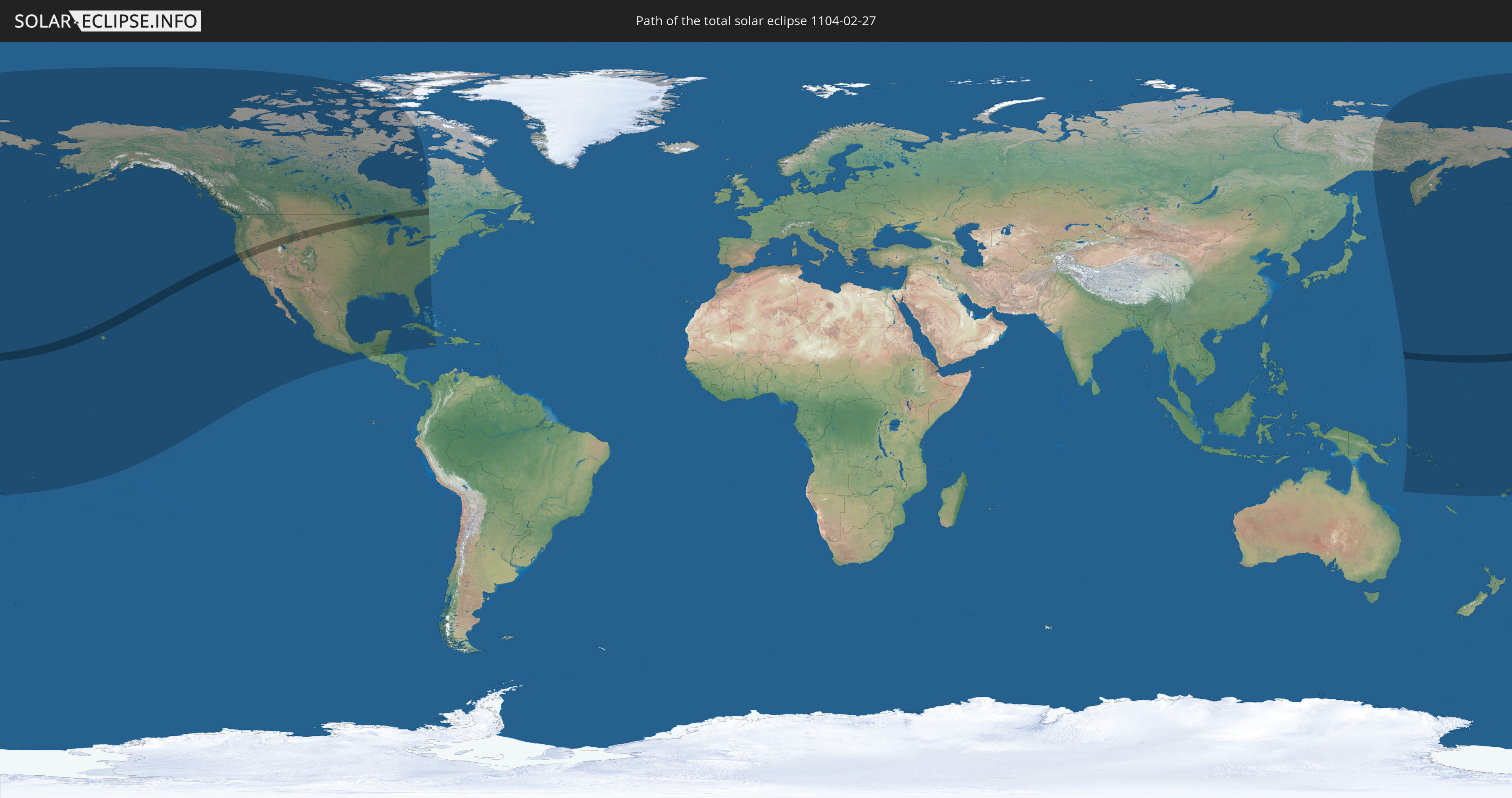
Die Sonnenfinsternis am 02/27/1104 kann man in 29 Ländern als partielle Sonnenfinsternis beobachten.
Der Finsternispfad verläuft durch 4 Länder. Nur in diesen Ländern ist sie als total Sonnenfinsternis zu sehen.
In den folgenden Ländern ist die Sonnenfinsternis total zu sehen
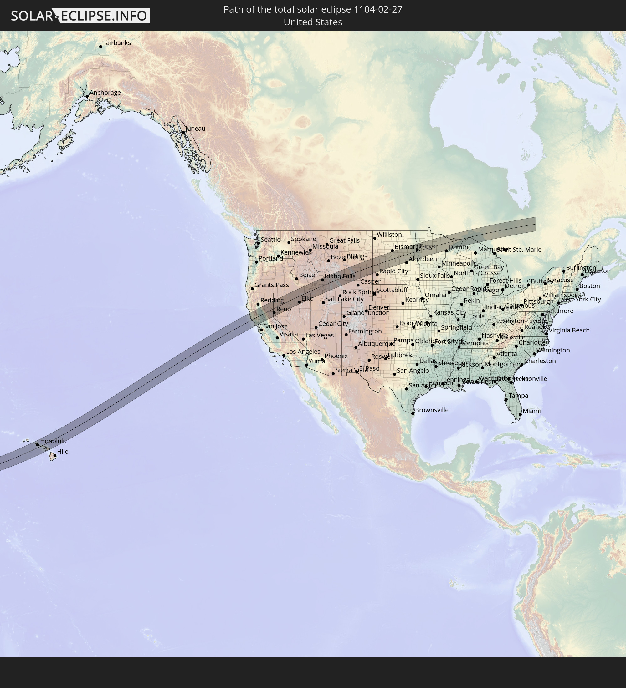 United States
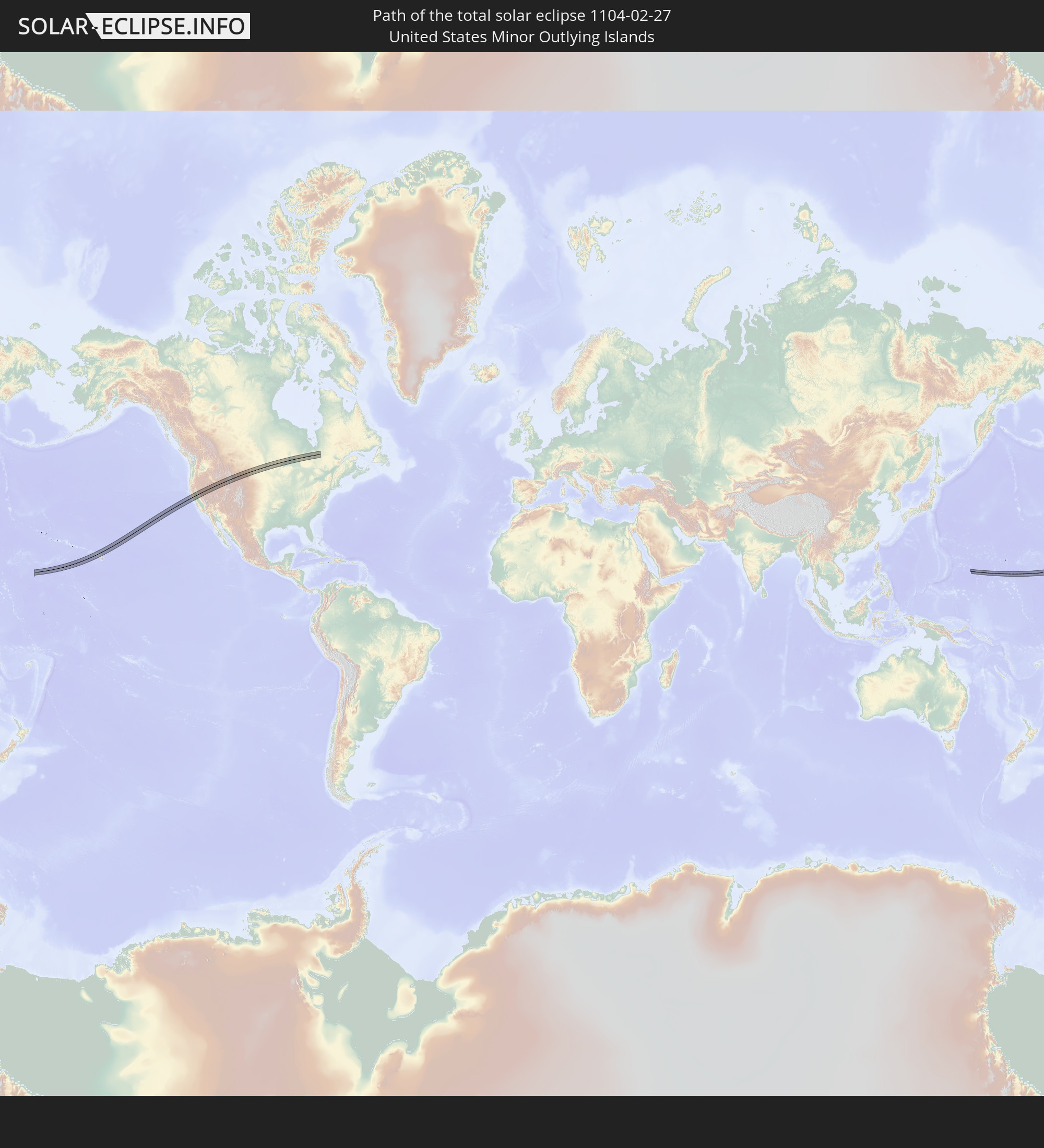 United States Minor Outlying Islands
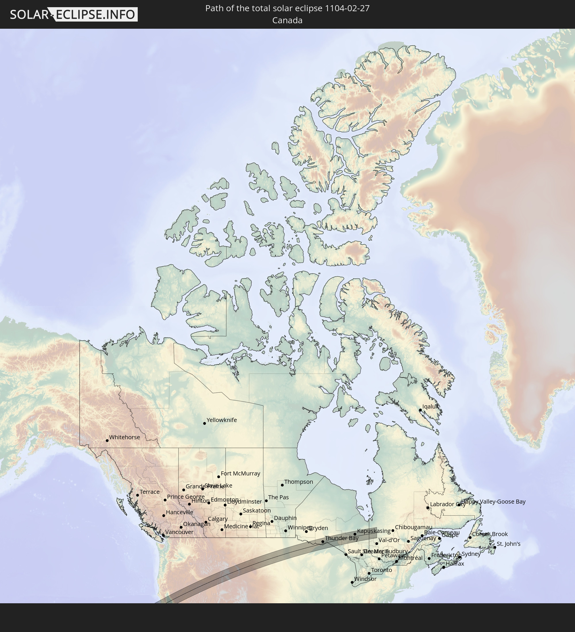 Canada
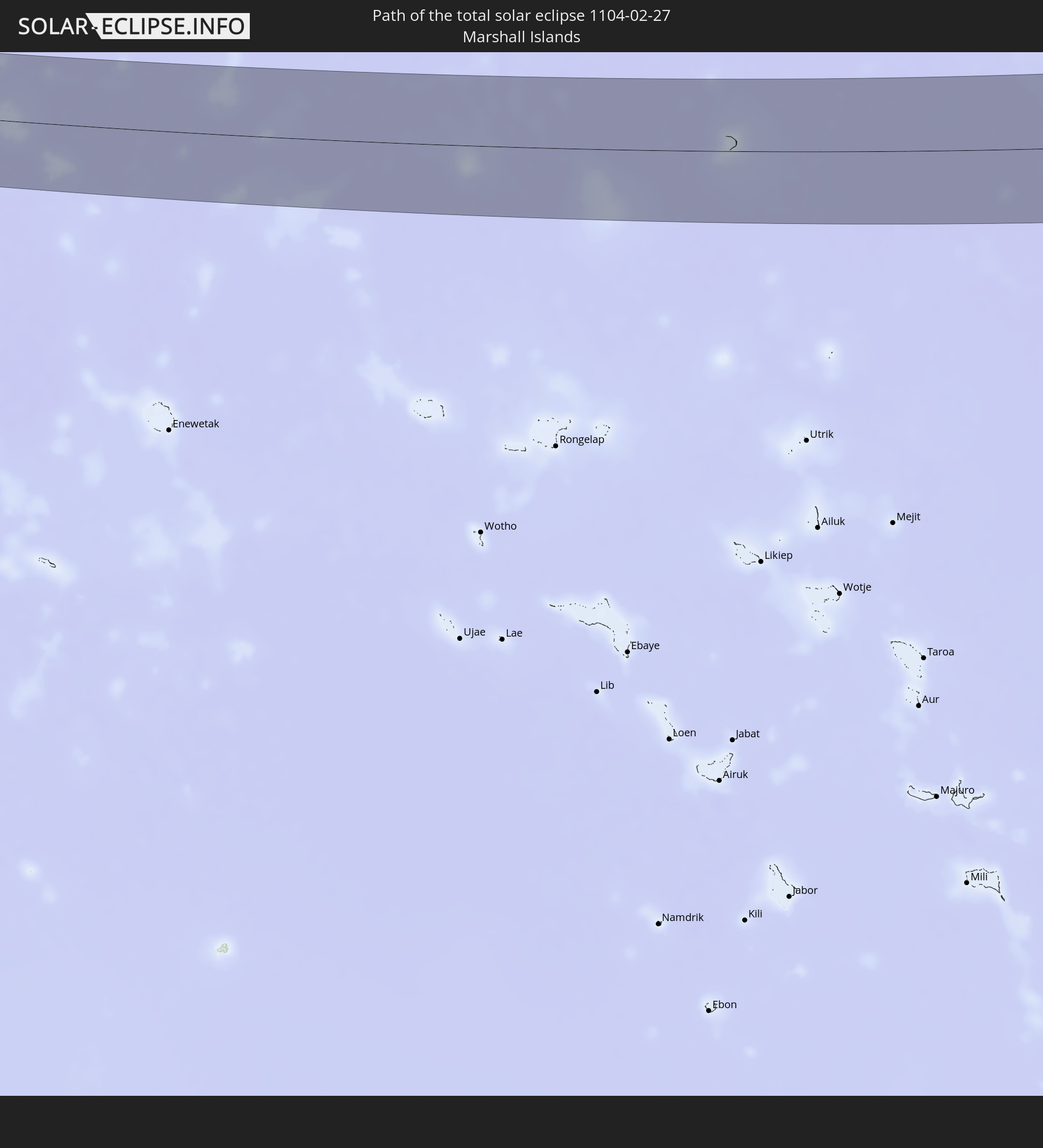 Marshall Islands
In den folgenden Ländern ist die Sonnenfinsternis partiell zu sehen
 Fiji
Fiji
 Russia
 United States
 United States Minor Outlying Islands
 Wallis and Futuna
 Tonga
Tonga
 Kiribati
 Samoa
Samoa
 Tokelau
 American Samoa
 Cook Islands
 Canada
 Mexico
 Greenland
 Guatemala
 Honduras
 Belize
 Cuba
Cuba
 Cayman Islands
 The Bahamas
 Jamaica
 Japan
Japan
 Federated States of Micronesia
 Papua New Guinea
 Solomon Islands
 Marshall Islands
 Vanuatu
 Nauru
Nauru
 Tuvalu
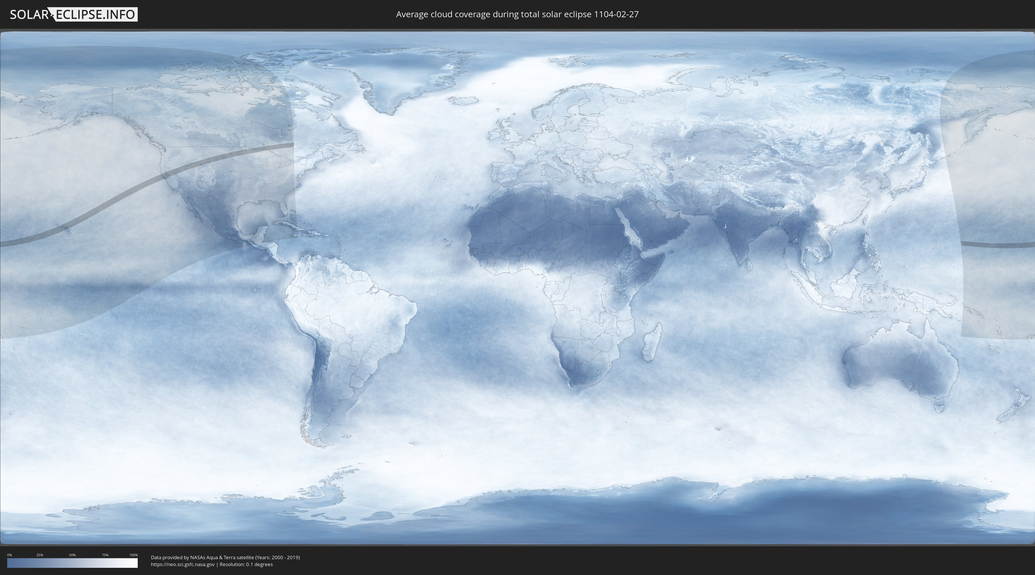
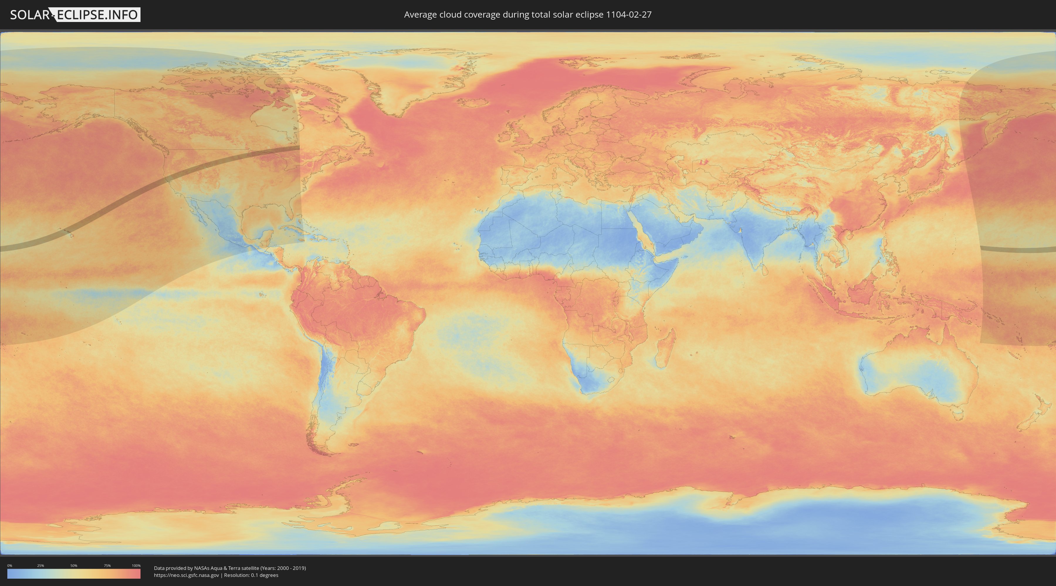
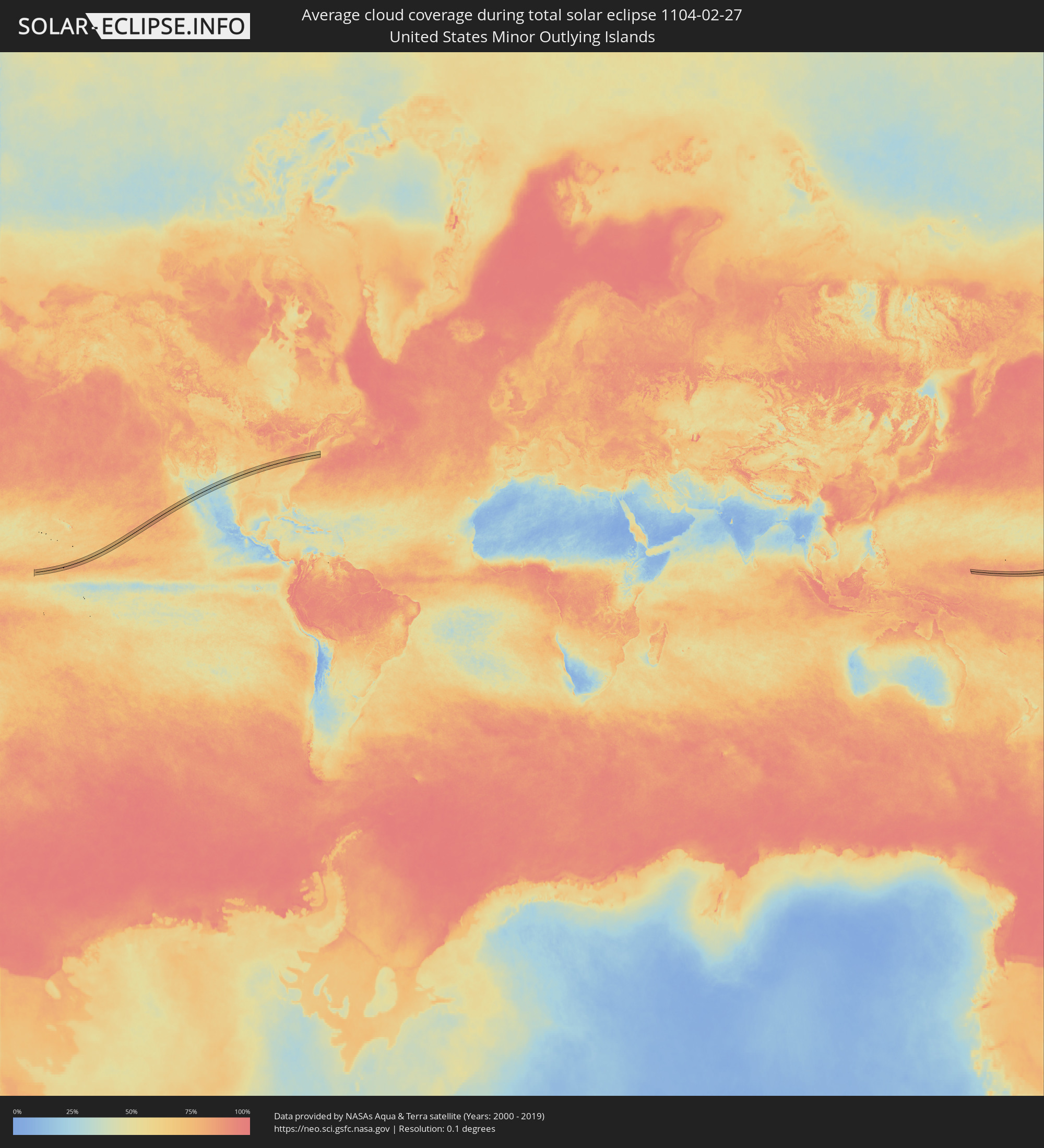
How will be the weather during the total solar eclipse on 02/27/1104?
Where is the best place to see the total solar eclipse of 02/27/1104?
The following maps show the average cloud coverage for the day of the total solar eclipse.
With the help of these maps, it is possible to find the place along the eclipse path, which has the best
chance of a cloudless sky.
Nevertheless, you should consider local circumstances and inform about the weather of your chosen
observation site.
The data is provided by NASAs satellites
AQUA and TERRA.
The cloud maps are averaged over a period of 19 years (2000 - 2019).
Detailed country maps
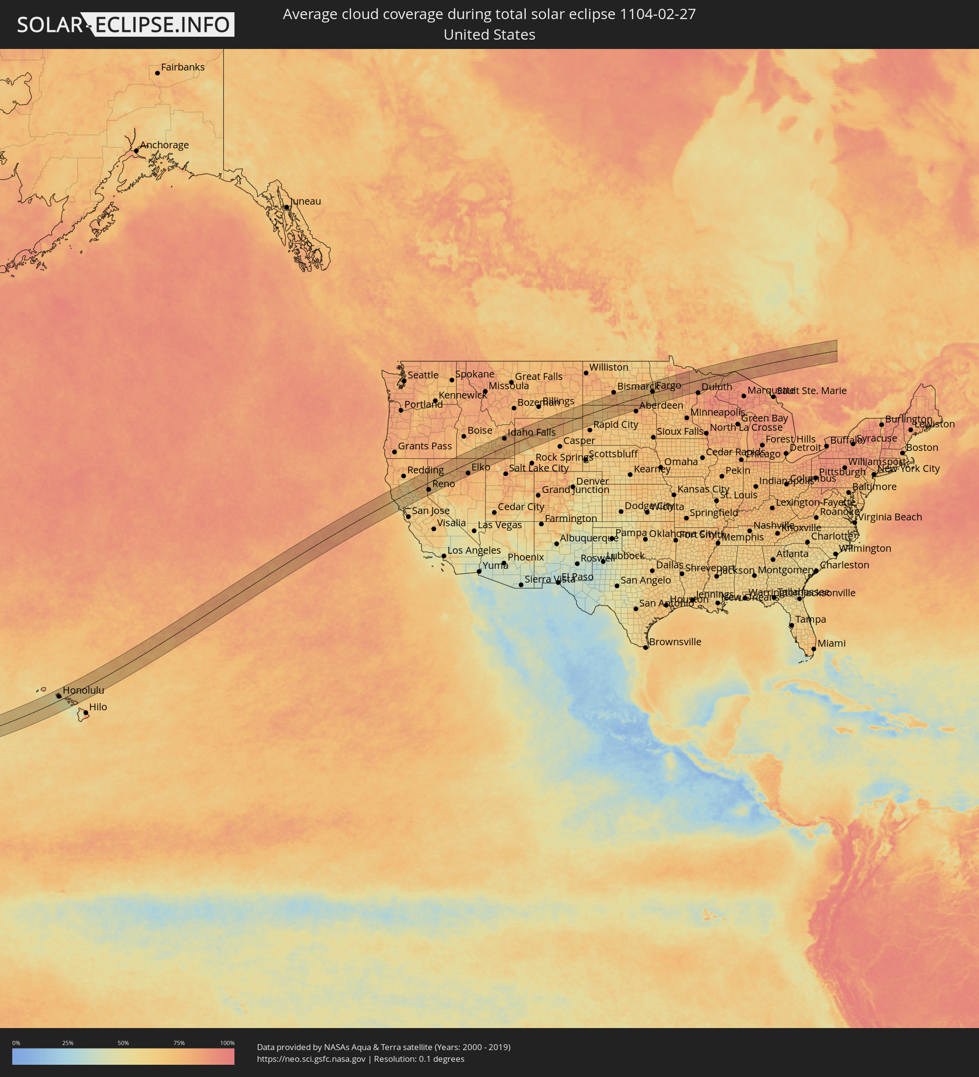 United States
 United States Minor Outlying Islands
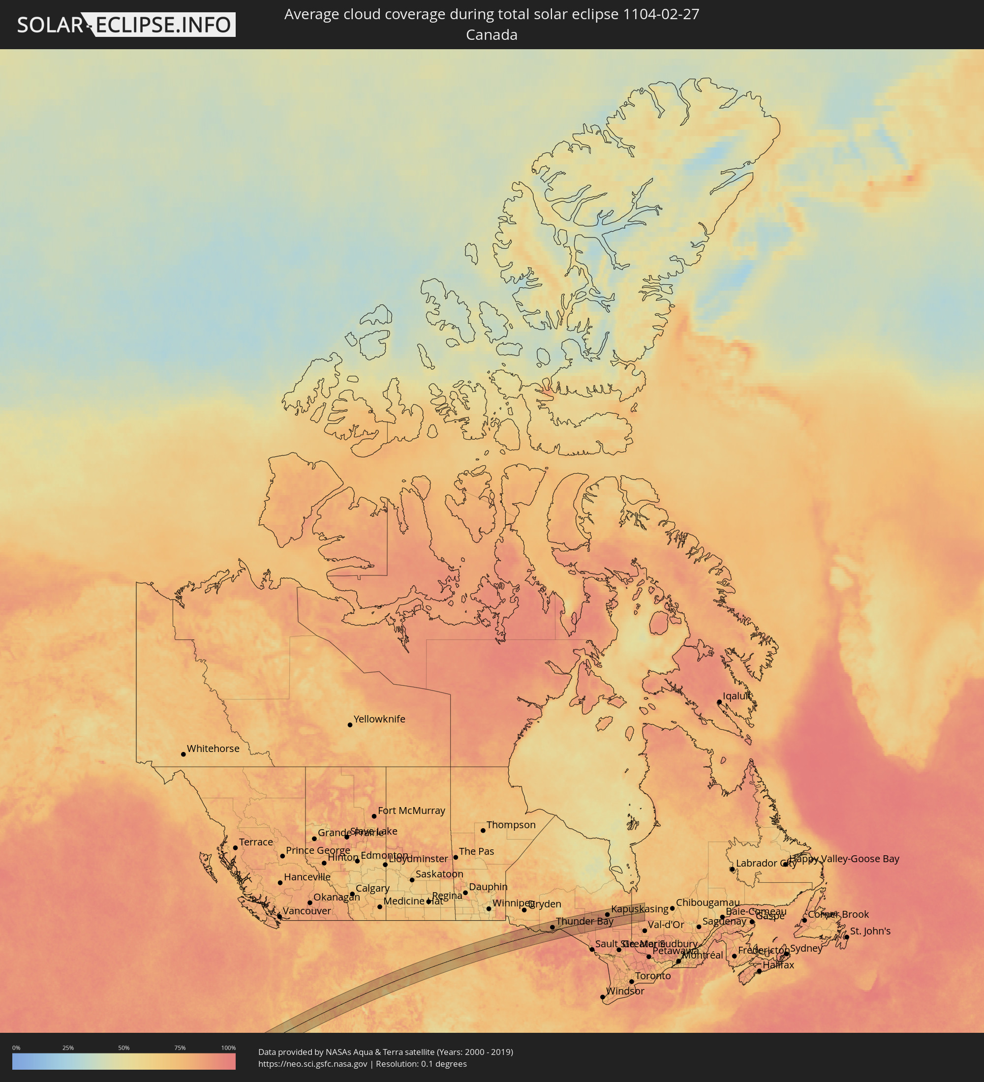 Canada
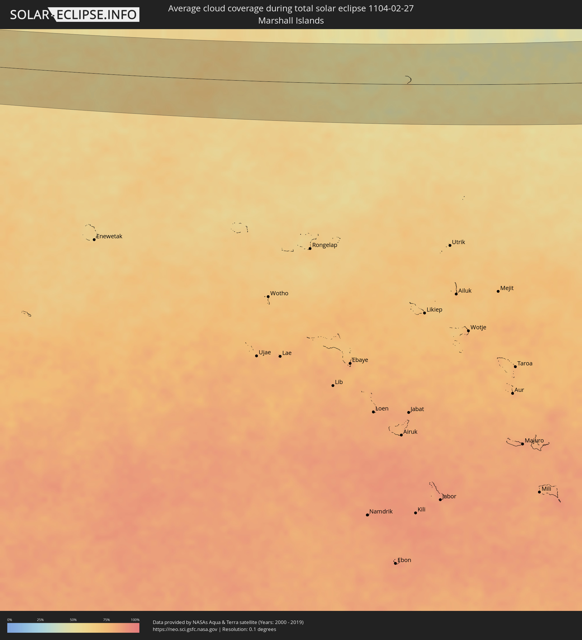 Marshall Islands
Cities inside the path of the eclipse
The following table shows all locations with a population of more than 5,000 inside the eclipse path. Cities which have more than 100,000 inhabitants are marked bold. A click at the locations opens a detailed map.
| City | Type | Eclipse duration | Local time of max. eclipse | Distance to central line | Ø Cloud coverage |
|
Mākaha, Hawaii
|
total | - | 10:33:47 UTC-10:30 | 65 km | 67% |
|
Waianae, Hawaii
|
total | - | 10:33:48 UTC-10:30 | 61 km | 63% |
|
Mā‘ili, Hawaii
|
total | - | 10:33:48 UTC-10:30 | 59 km | 63% |
|
Nānākuli, Hawaii
|
total | - | 10:33:48 UTC-10:30 | 56 km | 63% |
|
Makakilo City, Hawaii
|
total | - | 10:33:53 UTC-10:30 | 48 km | 55% |
|
Schofield Barracks, Hawaii
|
total | - | 10:34:09 UTC-10:30 | 62 km | 79% |
|
Village Park, Hawaii
|
total | - | 10:34:05 UTC-10:30 | 51 km | 71% |
|
Royal Kunia, Hawaii
|
total | - | 10:34:05 UTC-10:30 | 50 km | 71% |
|
‘Ewa Beach, Hawaii
|
total | - | 10:34:01 UTC-10:30 | 41 km | 59% |
|
Waipio, Hawaii
|
total | - | 10:34:11 UTC-10:30 | 51 km | 71% |
|
Pearl City, Hawaii
|
total | - | 10:34:12 UTC-10:30 | 48 km | 71% |
|
Hickam Field, Hawaii
|
total | - | 10:34:09 UTC-10:30 | 42 km | 59% |
|
Waimalu, Hawaii
|
total | - | 10:34:17 UTC-10:30 | 47 km | 73% |
|
‘Aiea, Hawaii
|
total | - | 10:34:16 UTC-10:30 | 45 km | 73% |
|
Hālawa, Hawaii
|
total | - | 10:34:18 UTC-10:30 | 44 km | 73% |
|
Hālawa Heights, Hawaii
|
total | - | 10:34:19 UTC-10:30 | 43 km | 73% |
|
Honolulu, Hawaii
|
total | - | 10:34:20 UTC-10:30 | 34 km | 63% |
|
‘Āhuimanu, Hawaii
|
total | - | 10:34:34 UTC-10:30 | 47 km | 81% |
|
Marine Corps Base Hawaii - MCBH, Hawaii
|
total | - | 10:34:46 UTC-10:30 | 42 km | 73% |
|
Kailua, Hawaii
|
total | - | 10:34:43 UTC-10:30 | 38 km | 73% |
|
Napili-Honokowai, Hawaii
|
total | - | 10:36:27 UTC-10:30 | 53 km | 62% |
|
Lahaina, Hawaii
|
total | - | 10:36:18 UTC-10:30 | 64 km | 51% |
|
Wailuku, Hawaii
|
total | - | 10:36:43 UTC-10:30 | 70 km | 71% |
|
Waihee-Waiehu, Hawaii
|
total | - | 10:36:46 UTC-10:30 | 66 km | 71% |
|
Kahului, Hawaii
|
total | - | 10:36:47 UTC-10:30 | 71 km | 71% |
|
Pukalani, Hawaii
|
total | - | 10:37:00 UTC-10:30 | 83 km | 71% |
|
Makawao, Hawaii
|
total | - | 10:37:05 UTC-10:30 | 82 km | 74% |
|
Haiku-Pauwela, Hawaii
|
total | - | 10:37:12 UTC-10:30 | 76 km | 74% |
|
Fort Bragg, California
|
total | - | 14:29:02 UTC-08:00 | 90 km | 69% |
|
Ukiah, California
|
total | - | 14:29:53 UTC-08:00 | 36 km | 69% |
|
Cloverdale, California
|
total | - | 14:30:09 UTC-08:00 | 5 km | 61% |
|
Healdsburg, California
|
total | - | 14:30:21 UTC-08:00 | 31 km | 64% |
|
Sebastopol, California
|
total | - | 14:30:24 UTC-08:00 | 53 km | 62% |
|
Larkfield-Wikiup, California
|
total | - | 14:30:31 UTC-08:00 | 45 km | 60% |
|
Santa Rosa, California
|
total | - | 14:30:34 UTC-08:00 | 54 km | 60% |
|
Cotati, California
|
total | - | 14:30:34 UTC-08:00 | 65 km | 59% |
|
Petaluma, California
|
total | - | 14:30:40 UTC-08:00 | 77 km | 58% |
|
Clearlake, California
|
total | - | 14:30:42 UTC-08:00 | 6 km | 59% |
|
Novato, California
|
total | - | 14:30:45 UTC-08:00 | 92 km | 60% |
|
Sonoma, California
|
total | - | 14:30:55 UTC-08:00 | 79 km | 60% |
|
Napa, California
|
total | - | 14:31:10 UTC-08:00 | 85 km | 58% |
|
Orland, California
|
total | - | 14:31:19 UTC-08:00 | 54 km | 68% |
|
Corning, California
|
total | - | 14:31:20 UTC-08:00 | 71 km | 64% |
|
Vacaville, California
|
total | - | 14:31:36 UTC-08:00 | 91 km | 62% |
|
Chico, California
|
total | - | 14:31:48 UTC-08:00 | 38 km | 63% |
|
Woodland, California
|
total | - | 14:31:54 UTC-08:00 | 68 km | 67% |
|
Davis, California
|
total | - | 14:31:57 UTC-08:00 | 83 km | 62% |
|
Live Oak, California
|
total | - | 14:32:04 UTC-08:00 | 14 km | 64% |
|
South Yuba City, California
|
total | - | 14:32:06 UTC-08:00 | 30 km | 65% |
|
Paradise, California
|
total | - | 14:32:06 UTC-08:00 | 33 km | 65% |
|
Yuba City, California
|
total | - | 14:32:07 UTC-08:00 | 29 km | 65% |
|
Marysville, California
|
total | - | 14:32:10 UTC-08:00 | 29 km | 65% |
|
Magalia, California
|
total | - | 14:32:10 UTC-08:00 | 36 km | 65% |
|
Oroville, California
|
total | - | 14:32:12 UTC-08:00 | 6 km | 57% |
|
Olivehurst, California
|
total | - | 14:32:13 UTC-08:00 | 36 km | 65% |
|
Sacramento, California
|
total | - | 14:32:18 UTC-08:00 | 89 km | 63% |
|
Oroville East, California
|
total | - | 14:32:19 UTC-08:00 | 2 km | 58% |
|
Rio Linda, California
|
total | - | 14:32:22 UTC-08:00 | 80 km | 67% |
|
La Riviera, California
|
total | - | 14:32:29 UTC-08:00 | 96 km | 63% |
|
Rancho Cordova, California
|
total | - | 14:32:34 UTC-08:00 | 96 km | 62% |
|
Lincoln, California
|
total | - | 14:32:35 UTC-08:00 | 66 km | 63% |
|
Roseville, California
|
total | - | 14:32:35 UTC-08:00 | 80 km | 62% |
|
Gold River, California
|
total | - | 14:32:38 UTC-08:00 | 94 km | 60% |
|
El Dorado Hills, California
|
total | - | 14:32:52 UTC-08:00 | 95 km | 58% |
|
North Auburn, California
|
total | - | 14:32:52 UTC-08:00 | 71 km | 59% |
|
Auburn, California
|
total | - | 14:32:52 UTC-08:00 | 74 km | 59% |
|
Grass Valley, California
|
total | - | 14:32:53 UTC-08:00 | 43 km | 63% |
|
Alta Sierra, California
|
total | - | 14:32:54 UTC-08:00 | 51 km | 62% |
|
Susanville, California
|
total | - | 14:33:22 UTC-08:00 | 60 km | 77% |
|
Truckee, California
|
total | - | 14:34:04 UTC-08:00 | 66 km | 72% |
|
Cold Springs, Nevada
|
total | - | 14:34:19 UTC-08:00 | 39 km | 74% |
|
Incline Village, Nevada
|
total | - | 14:34:21 UTC-08:00 | 82 km | 71% |
|
Reno, Nevada
|
total | - | 14:34:33 UTC-08:00 | 61 km | 72% |
|
Spanish Springs, Nevada
|
total | - | 14:34:41 UTC-08:00 | 53 km | 72% |
|
Fernley, Nevada
|
total | - | 14:35:17 UTC-08:00 | 74 km | 68% |
|
Winnemucca, Nevada
|
total | - | 14:37:01 UTC-08:00 | 6 km | 75% |
|
Elko, Nevada
|
total | - | 14:39:24 UTC-08:00 | 79 km | 80% |
|
Jerome, Idaho
|
total | - | 15:40:17 UTC-07:00 | 69 km | 70% |
|
Twin Falls, Idaho
|
total | - | 15:40:24 UTC-07:00 | 51 km | 72% |
|
Burley, Idaho
|
total | - | 15:41:08 UTC-07:00 | 26 km | 68% |
|
Chubbuck, Idaho
|
total | - | 15:42:23 UTC-07:00 | 21 km | 82% |
|
Pocatello, Idaho
|
total | - | 15:42:26 UTC-07:00 | 15 km | 84% |
|
Blackfoot, Idaho
|
total | - | 15:42:25 UTC-07:00 | 45 km | 78% |
|
Idaho Falls, Idaho
|
total | - | 15:42:37 UTC-07:00 | 63 km | 82% |
|
Ammon, Idaho
|
total | - | 15:42:41 UTC-07:00 | 61 km | 82% |
|
Rexburg, Idaho
|
total | - | 15:42:43 UTC-07:00 | 92 km | 79% |
|
Jackson, Wyoming
|
total | - | 15:43:52 UTC-07:00 | 24 km | 77% |
|
Cody, Wyoming
|
total | - | 15:44:58 UTC-07:00 | 80 km | 77% |
|
Sheridan, Wyoming
|
total | - | 15:46:39 UTC-07:00 | 46 km | 76% |
|
Gillette, Wyoming
|
total | - | 15:48:07 UTC-07:00 | 47 km | 73% |
|
Spearfish, South Dakota
|
total | - | 15:49:17 UTC-07:00 | 71 km | 73% |
|
Jamestown, North Dakota
|
total | - | 16:51:08 UTC-06:00 | 56 km | 78% |
|
Fargo, North Dakota
|
total | - | 16:52:15 UTC-06:00 | 9 km | 77% |
|
Wahpeton, North Dakota
|
total | - | 16:52:48 UTC-06:00 | 60 km | 69% |
|
Fergus Falls, Minnesota
|
total | - | 16:53:04 UTC-06:00 | 70 km | 72% |
|
Detroit Lakes, Minnesota
|
total | - | 16:52:47 UTC-06:00 | 18 km | 79% |
|
Bemidji, Minnesota
|
total | - | 16:52:46 UTC-06:00 | 32 km | 73% |
|
Grand Rapids, Minnesota
|
total | - | 16:53:35 UTC-06:00 | 21 km | 82% |
|
Hibbing, Minnesota
|
total | - | 16:53:42 UTC-06:00 | 12 km | 83% |
|
Virginia, Minnesota
|
total | - | 16:53:48 UTC-06:00 | 10 km | 82% |
|
Thunder Bay, Ontario
|
total | - | 17:54:22 UTC-05:00 | 22 km | 76% |
|
Kapuskasing, Ontario
|
total | - | 17:55:16 UTC-05:00 | 28 km | 80% |