Annular solar eclipse of 12/08/1238
| Day of week: | Wednesday |
| Maximum duration of eclipse: | 11m23s |
| Maximum width of eclipse path: | 315 km |
| Saros cycle: | 110 |
| Coverage: | 91.8% |
| Magnitude: | 0.9175 |
| Gamma: | 0.0988 |
Wo kann man die Sonnenfinsternis vom 12/08/1238 sehen?
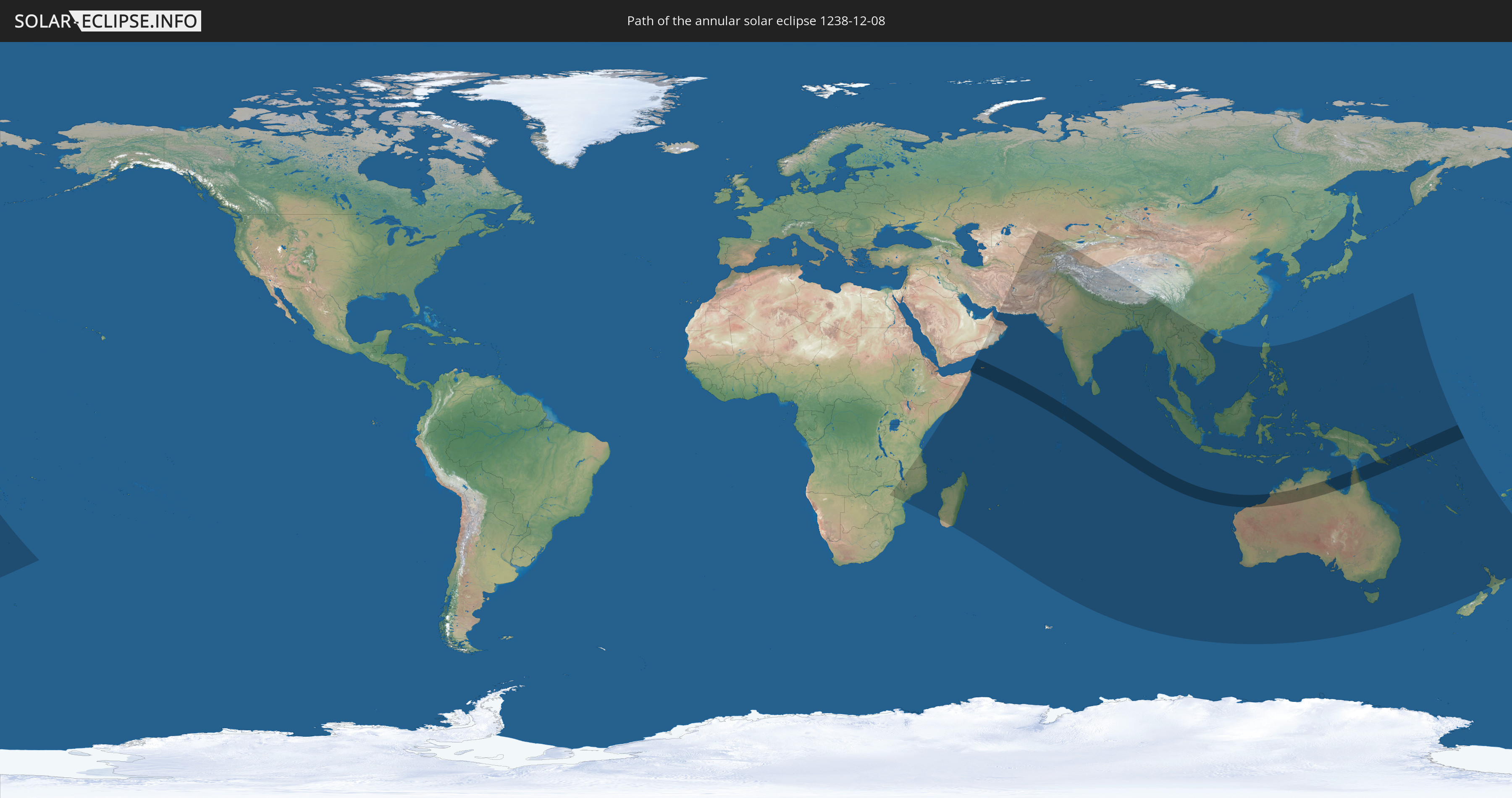
Die Sonnenfinsternis am 12/08/1238 kann man in 56 Ländern als partielle Sonnenfinsternis beobachten.
Der Finsternispfad verläuft durch 7 Länder. Nur in diesen Ländern ist sie als annular Sonnenfinsternis zu sehen.
In den folgenden Ländern ist die Sonnenfinsternis annular zu sehen
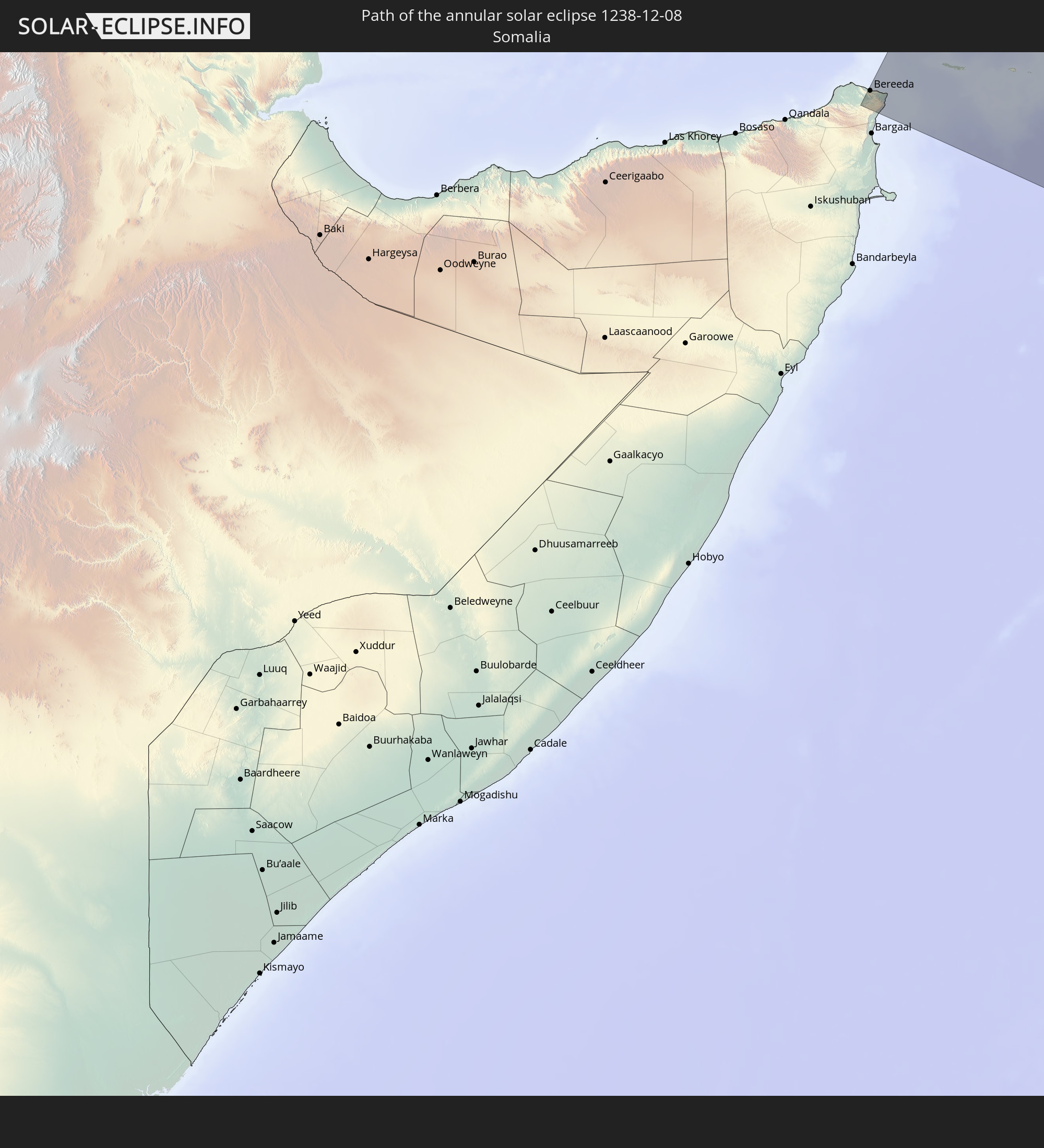 Somalia
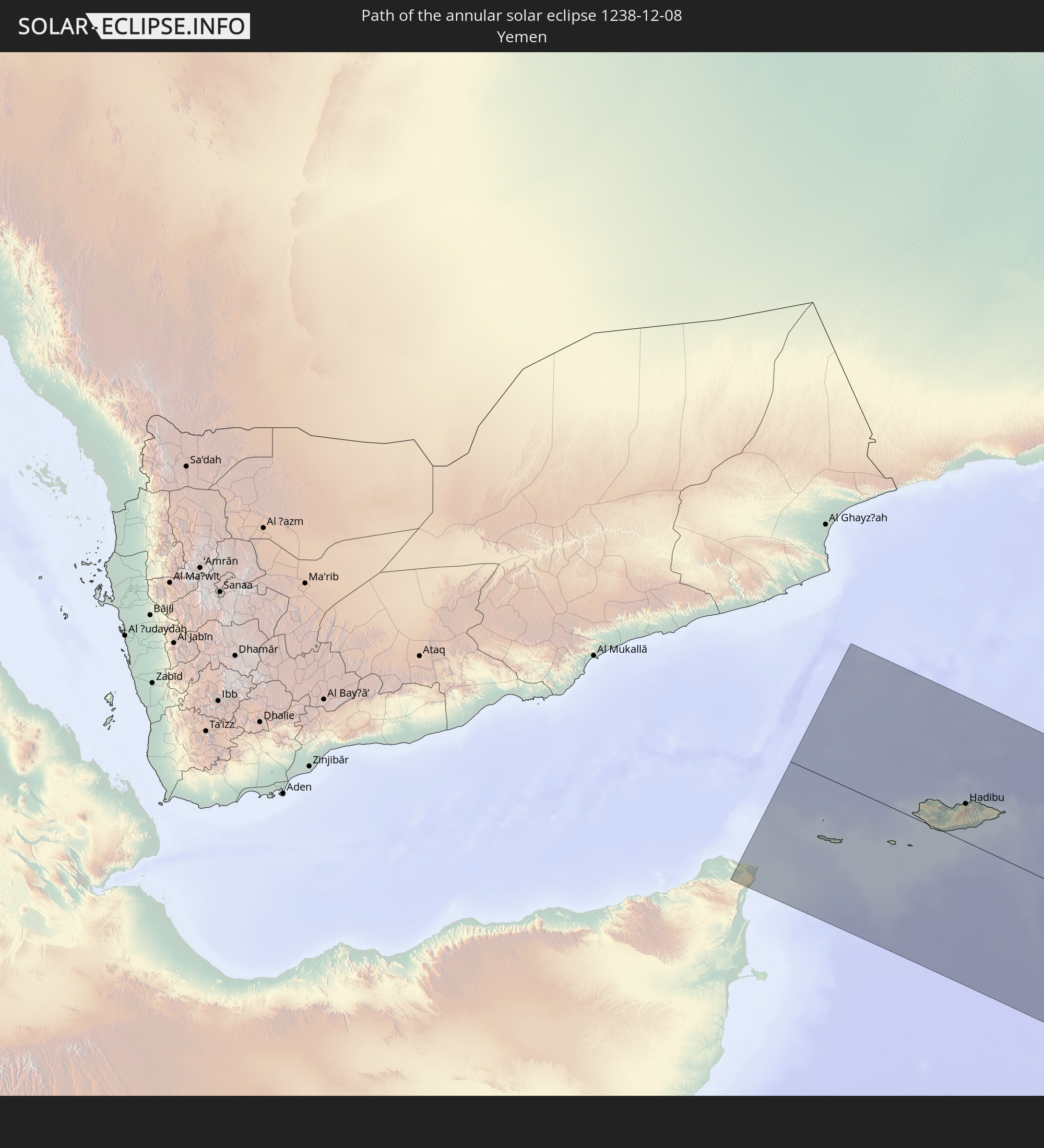 Yemen
Yemen
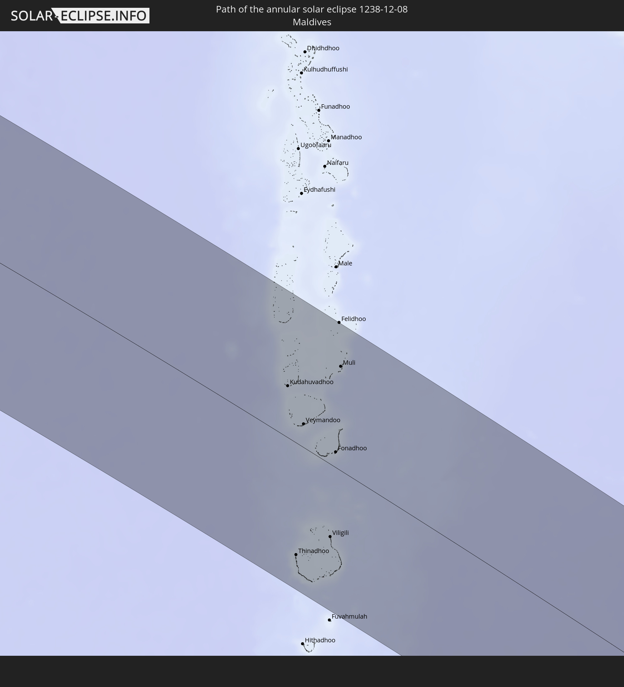 Maldives
 Cocos Islands
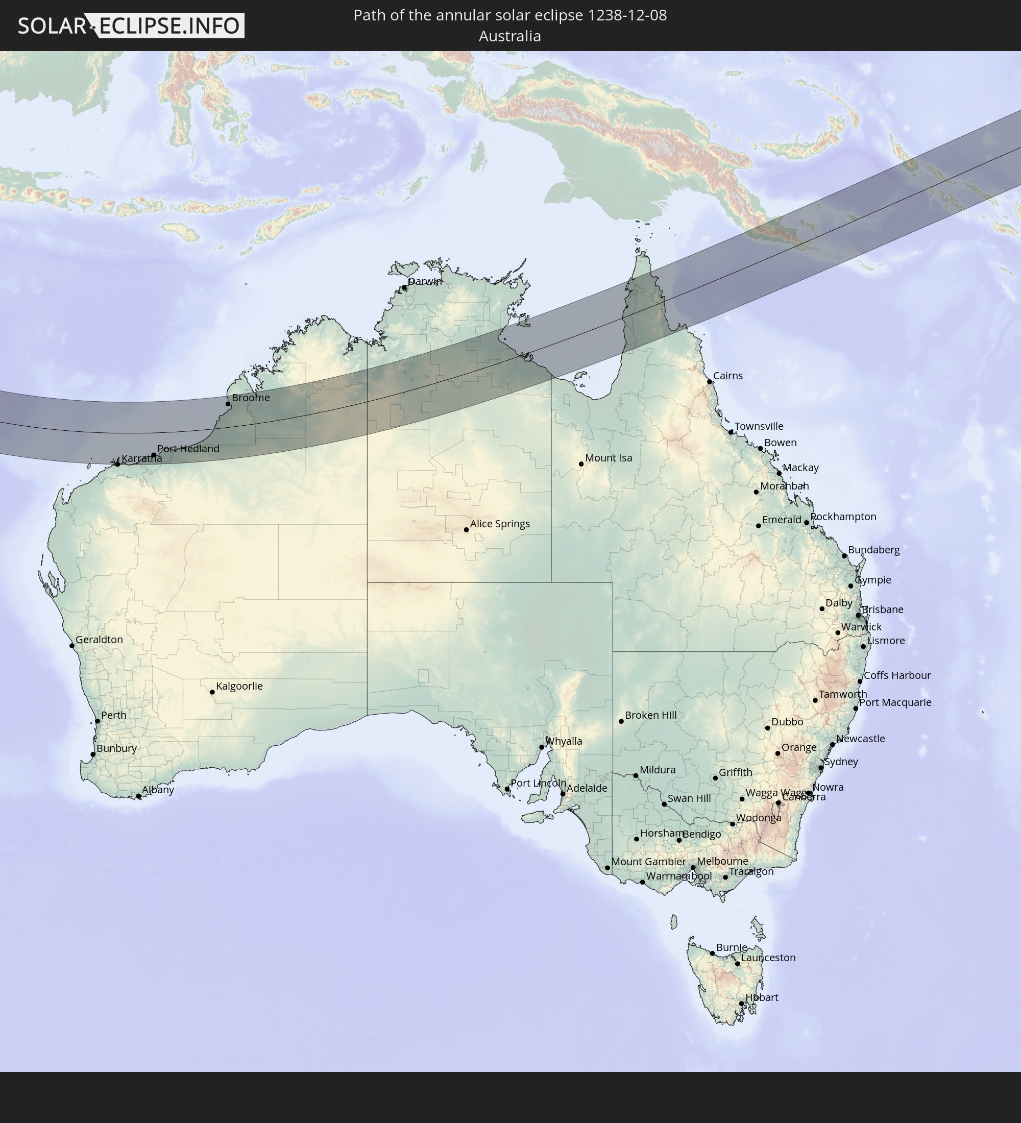 Australia
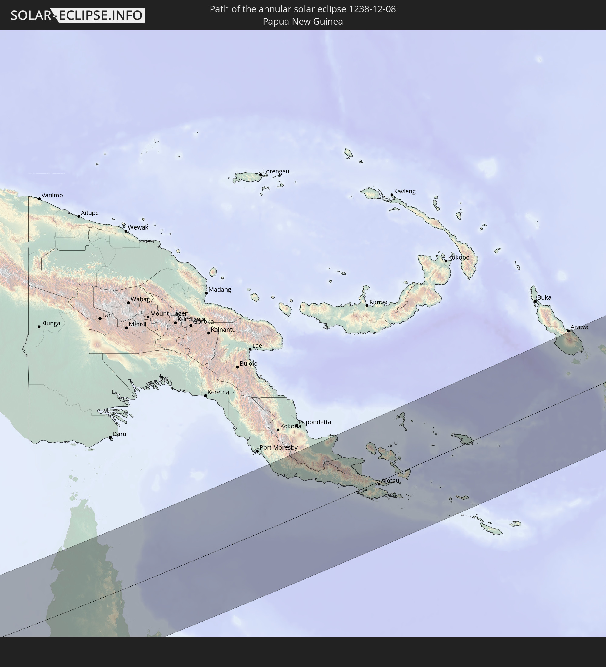 Papua New Guinea
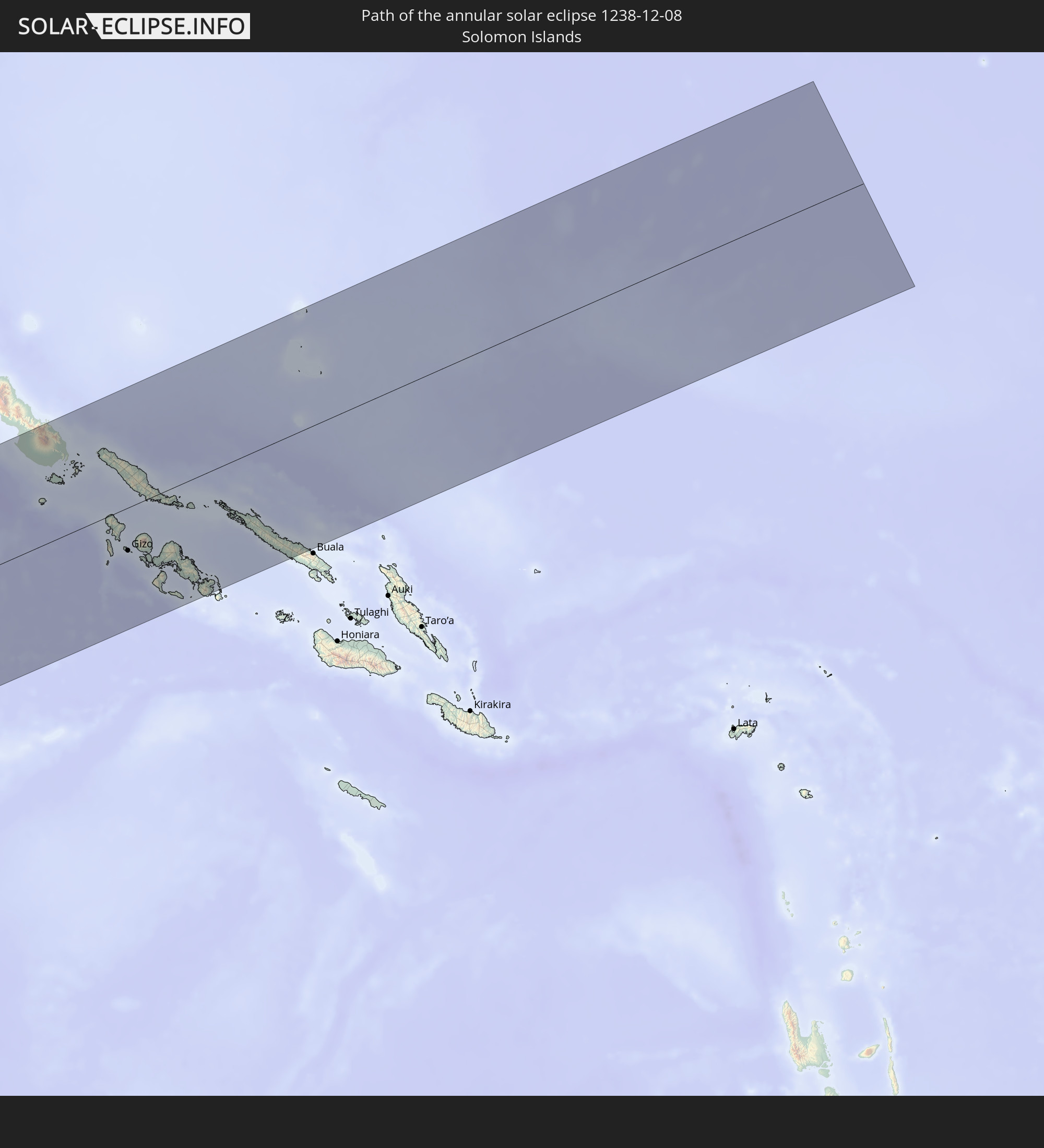 Solomon Islands
In den folgenden Ländern ist die Sonnenfinsternis partiell zu sehen
 New Zealand
 Zimbabwe
 Tanzania
 Mozambique
 Malawi
 French Southern and Antarctic Lands
 Somalia
 Yemen
Yemen
 Madagascar
 Comoros
 Iran
Iran
 Mayotte
 Seychelles
 Kazakhstan
 Oman
Oman
 Turkmenistan
 Réunion
 Uzbekistan
 Mauritius
 Afghanistan
 Pakistan
 Tajikistan
 India
India
 Kyrgyzstan
 British Indian Ocean Territory
 Maldives
 China
China
 Sri Lanka
 Nepal
Nepal
 Bangladesh
 Bhutan
 Myanmar
 Indonesia
 Cocos Islands
 Thailand
 Malaysia
 Laos
Laos
 Vietnam
 Cambodia
 Singapore
 Christmas Island
 Australia
 Brunei
 Philippines
 Japan
Japan
 East Timor
 Palau
Palau
 Federated States of Micronesia
 Papua New Guinea
 Guam
Guam
 Northern Mariana Islands
 Solomon Islands
 New Caledonia
 Marshall Islands
 Vanuatu
 Norfolk Island
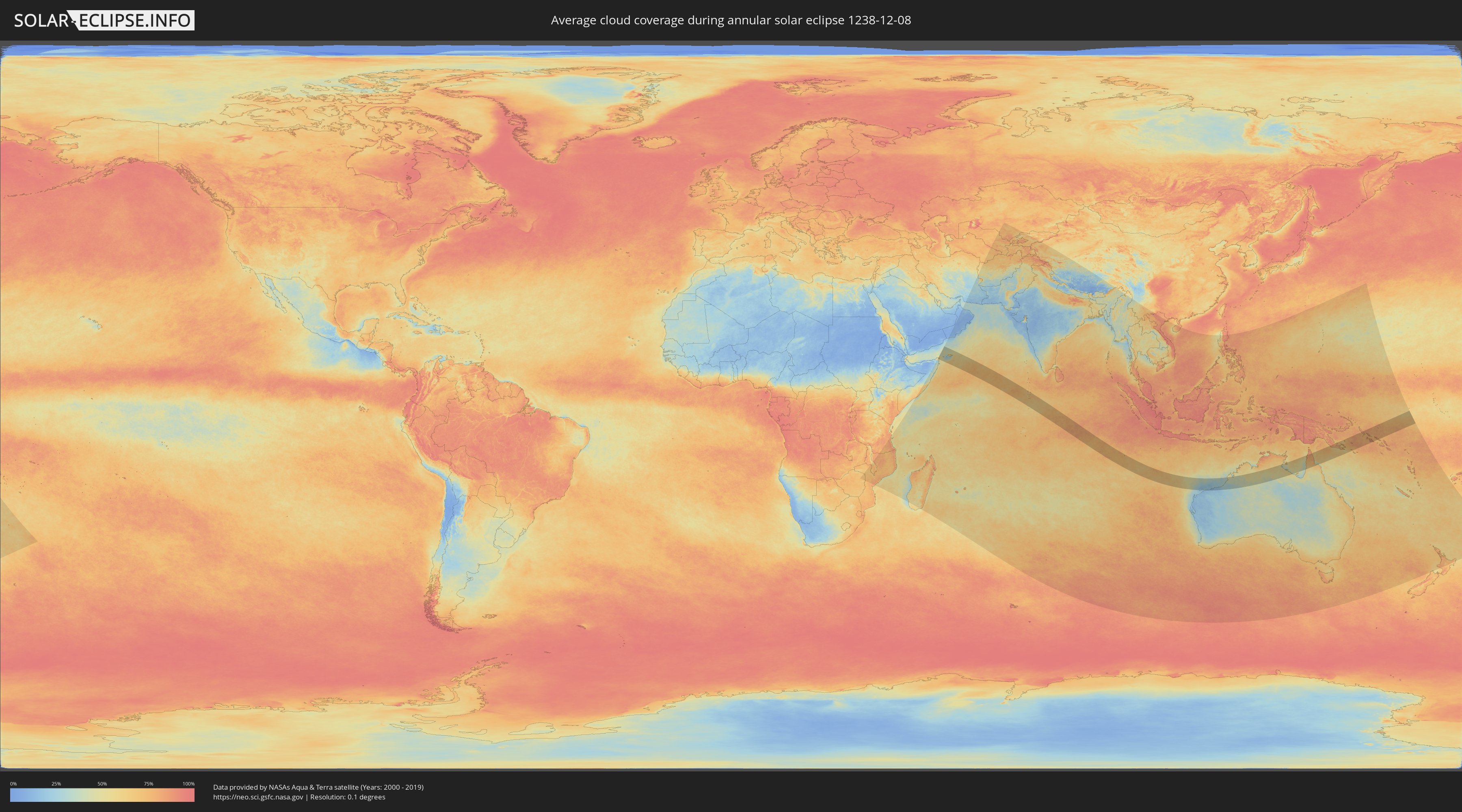
How will be the weather during the annular solar eclipse on 12/08/1238?
Where is the best place to see the annular solar eclipse of 12/08/1238?
The following maps show the average cloud coverage for the day of the annular solar eclipse.
With the help of these maps, it is possible to find the place along the eclipse path, which has the best
chance of a cloudless sky.
Nevertheless, you should consider local circumstances and inform about the weather of your chosen
observation site.
The data is provided by NASAs satellites
AQUA and TERRA.
The cloud maps are averaged over a period of 19 years (2000 - 2019).

Detailed country maps
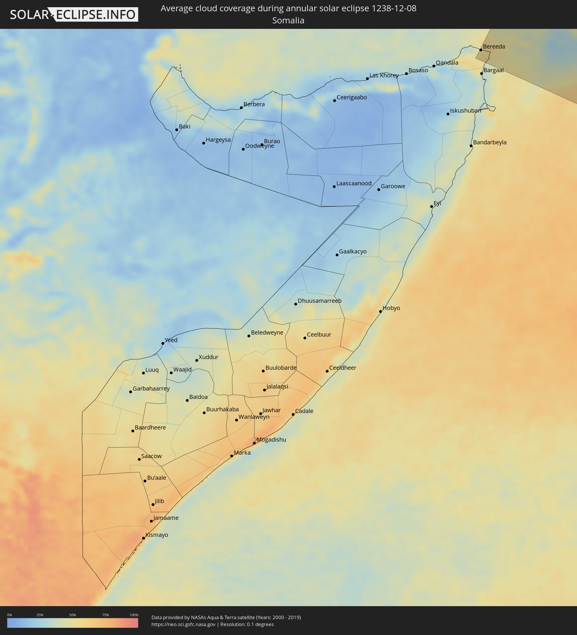 Somalia
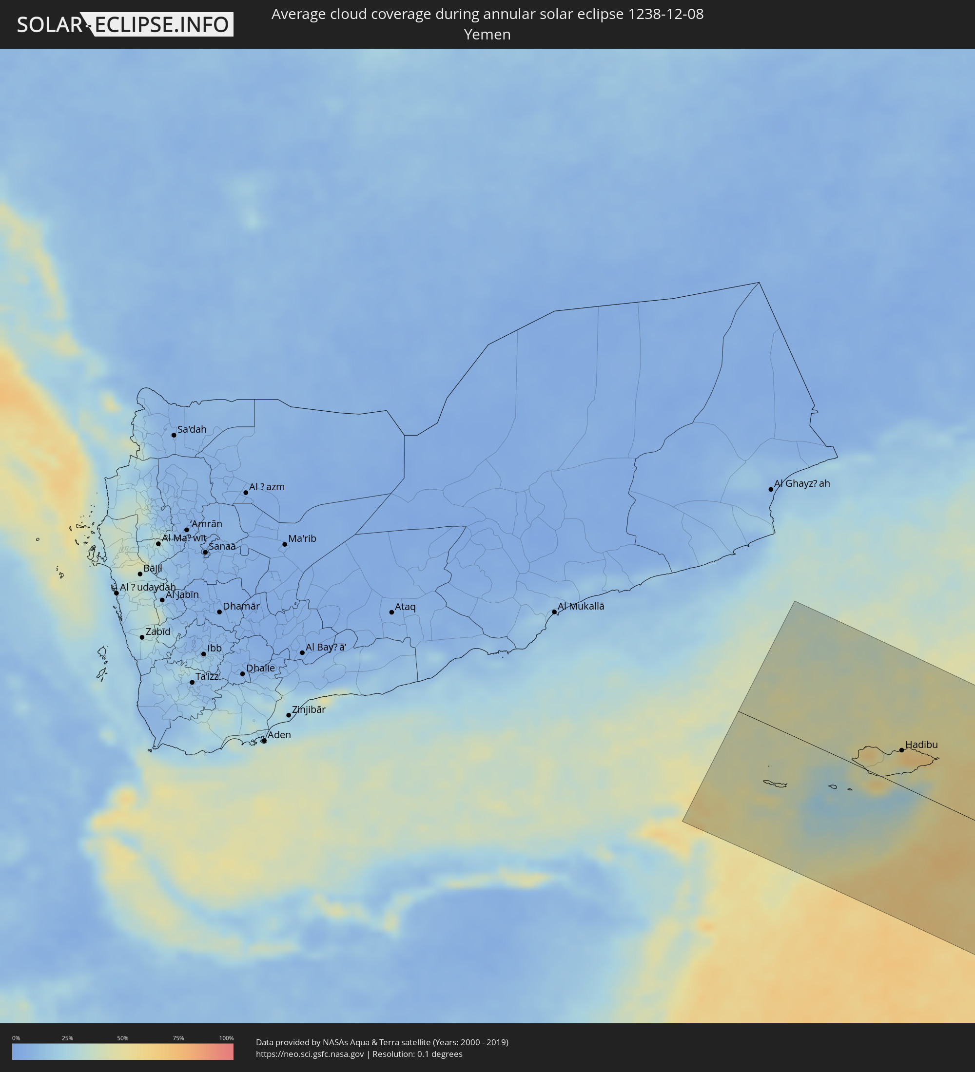 Yemen
Yemen
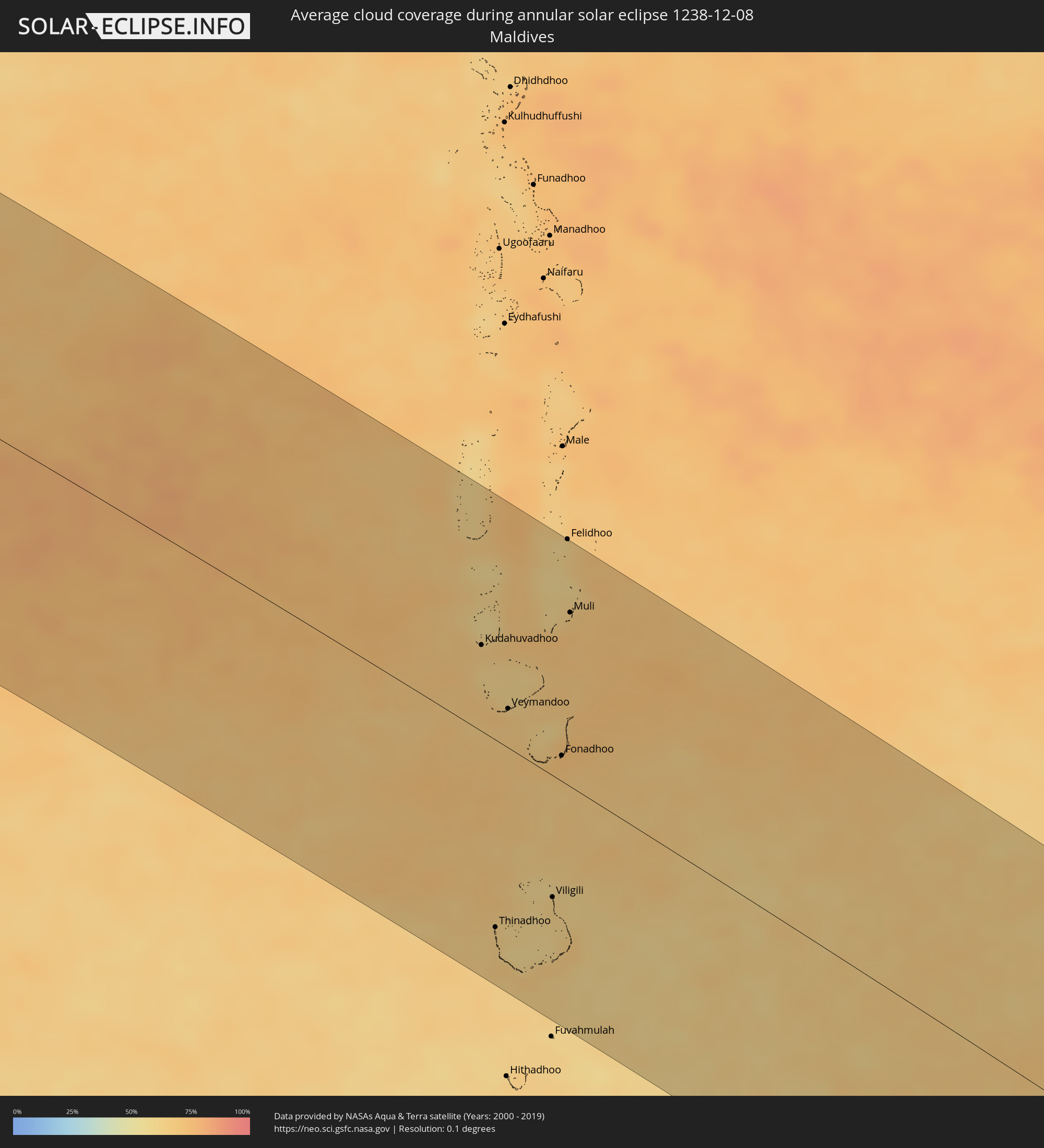 Maldives
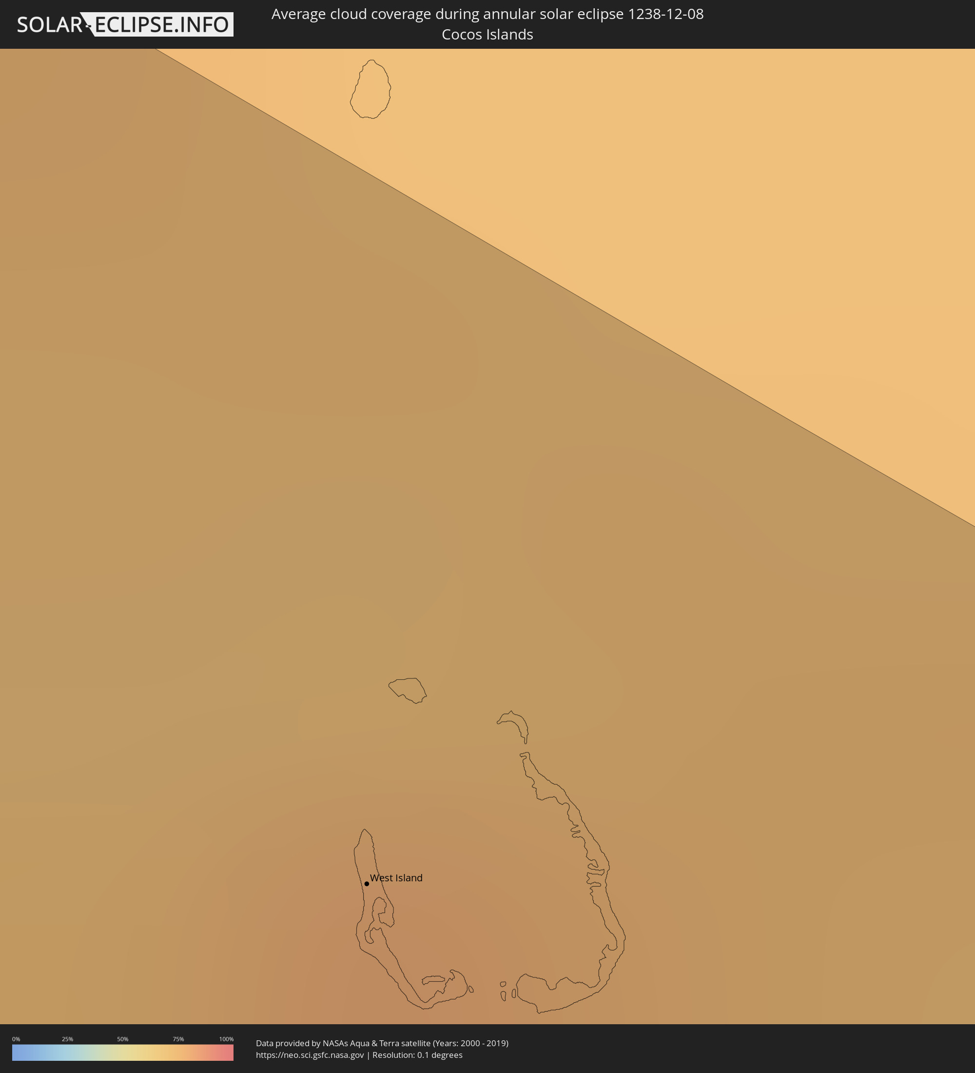 Cocos Islands
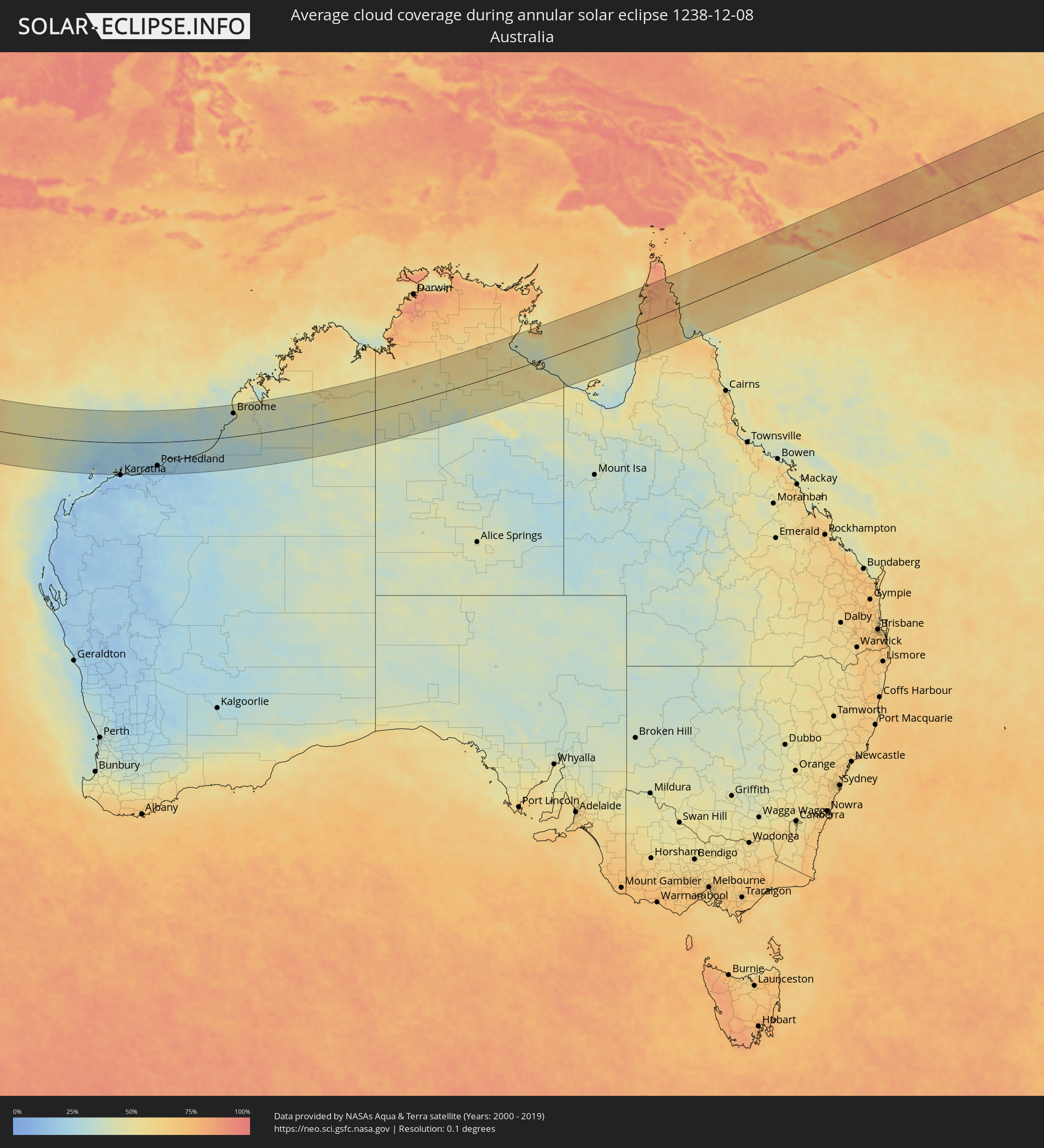 Australia
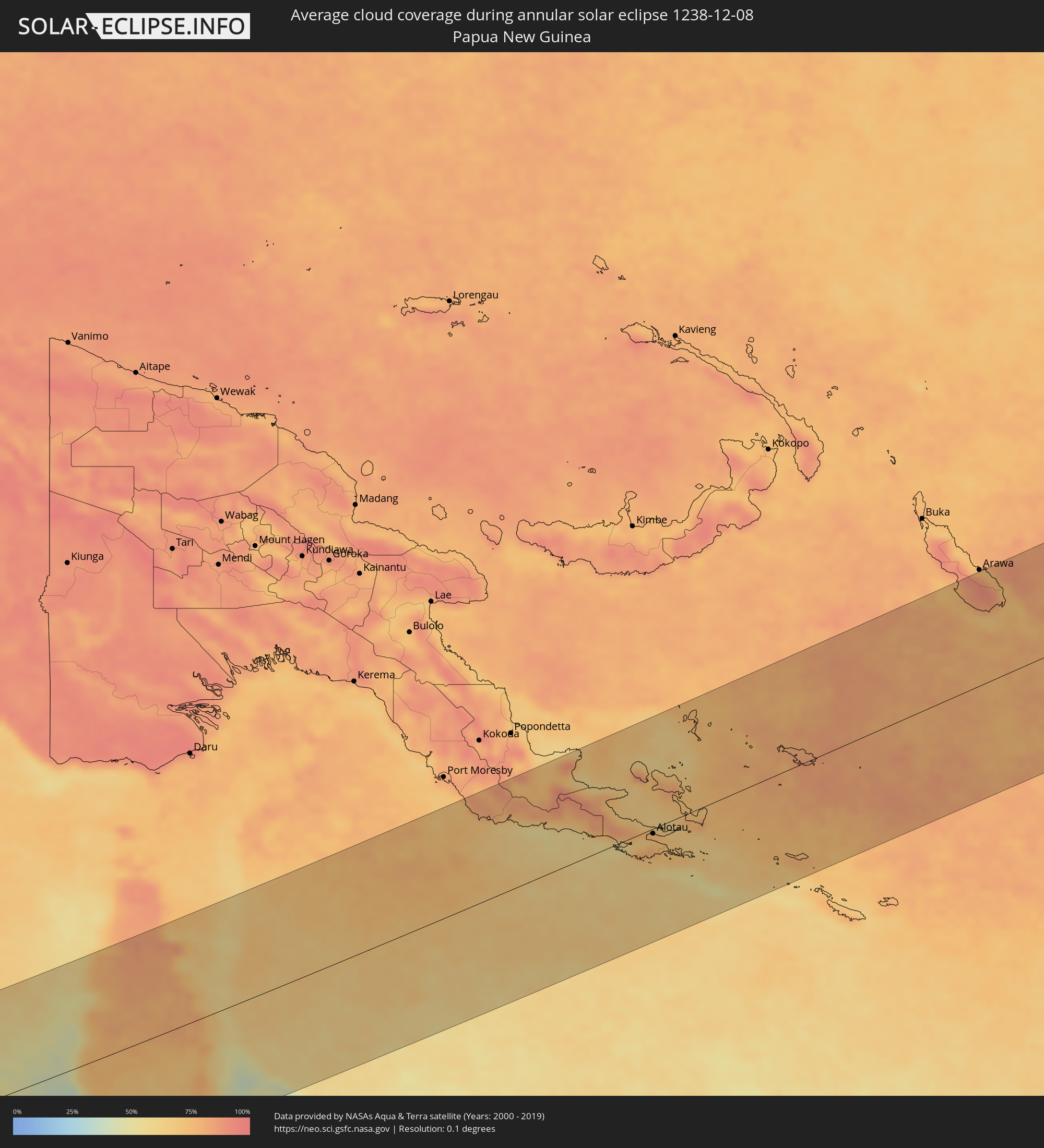 Papua New Guinea
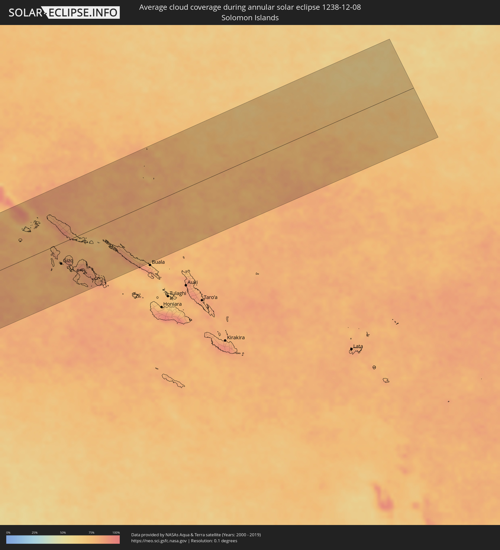 Solomon Islands
Cities inside the path of the eclipse
The following table shows all locations with a population of more than 5,000 inside the eclipse path. Cities which have more than 100,000 inhabitants are marked bold. A click at the locations opens a detailed map.
| City | Type | Eclipse duration | Local time of max. eclipse | Distance to central line | Ø Cloud coverage |
|
Bereeda, Bari
|
annular | - | 05:20:50 UTC+02:27 | 163 km | 57% |
|
Hadibu, Soqatra Governorate
|
annular | - | 06:00:04 UTC+03:06 | 49 km | 57% |
|
Kudahuvadhoo, Dhaalu Atholhu
|
annular | - | 07:59:16 UTC+04:54 | 62 km | 67% |
|
Thinadhoo, Gaafu Dhaalu Atholhu
|
annular | - | 08:01:19 UTC+04:54 | 134 km | 65% |
|
Veymandoo, Thaa Atholhu
|
annular | - | 07:59:51 UTC+04:54 | 28 km | 67% |
|
Viligili, Gaafu Alifu Atholhu
|
annular | - | 08:01:28 UTC+04:54 | 87 km | 63% |
|
Fonadhoo, Laamu
|
annular | - | 08:00:31 UTC+04:54 | 18 km | 71% |
|
Muli, Meemu Atholhu
|
annular | - | 07:59:36 UTC+04:54 | 125 km | 69% |
|
West Island
|
annular | - | 10:38:03 UTC+06:30 | 132 km | 76% |
|
Port Hedland, Western Australia
|
annular | - | 13:34:45 UTC+08:00 | 117 km | 16% |
|
Broome, Western Australia
|
annular | - | 13:46:47 UTC+08:00 | 116 km | 34% |
|
Alotau, Milne Bay
|
annular | - | 16:42:55 UTC+10:00 | 8 km | 71% |
|
Gizo, Western Province
|
annular | - | 17:27:13 UTC+10:39 | 64 km | 75% |