Hybrid solar eclipse of 01/19/1246
| Day of week: | Friday |
| Maximum duration of eclipse: | 01m34s |
| Maximum width of eclipse path: | 57 km |
| Saros cycle: | 109 |
| Coverage: | 100% |
| Magnitude: | 1.0166 |
| Gamma: | -0.015 |
Wo kann man die Sonnenfinsternis vom 01/19/1246 sehen?
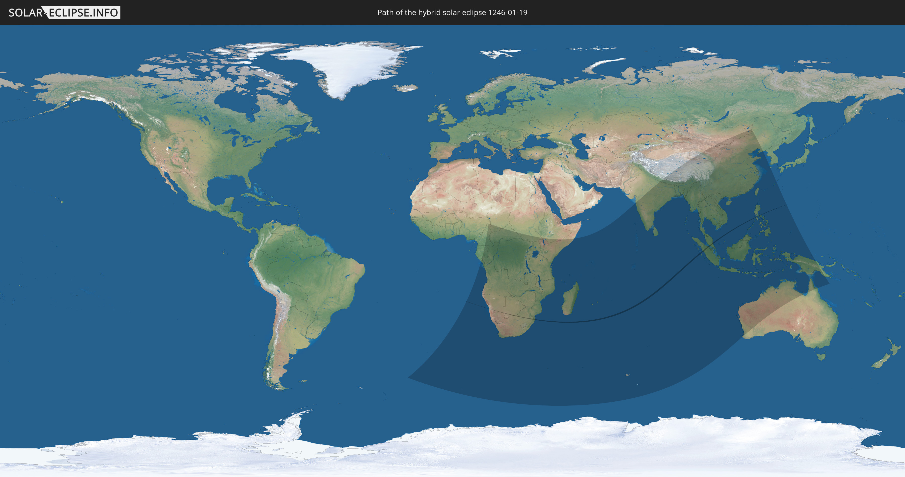
Die Sonnenfinsternis am 01/19/1246 kann man in 62 Ländern als partielle Sonnenfinsternis beobachten.
Der Finsternispfad verläuft durch 7 Länder. Nur in diesen Ländern ist sie als hybrid Sonnenfinsternis zu sehen.
In den folgenden Ländern ist die Sonnenfinsternis hybrid zu sehen
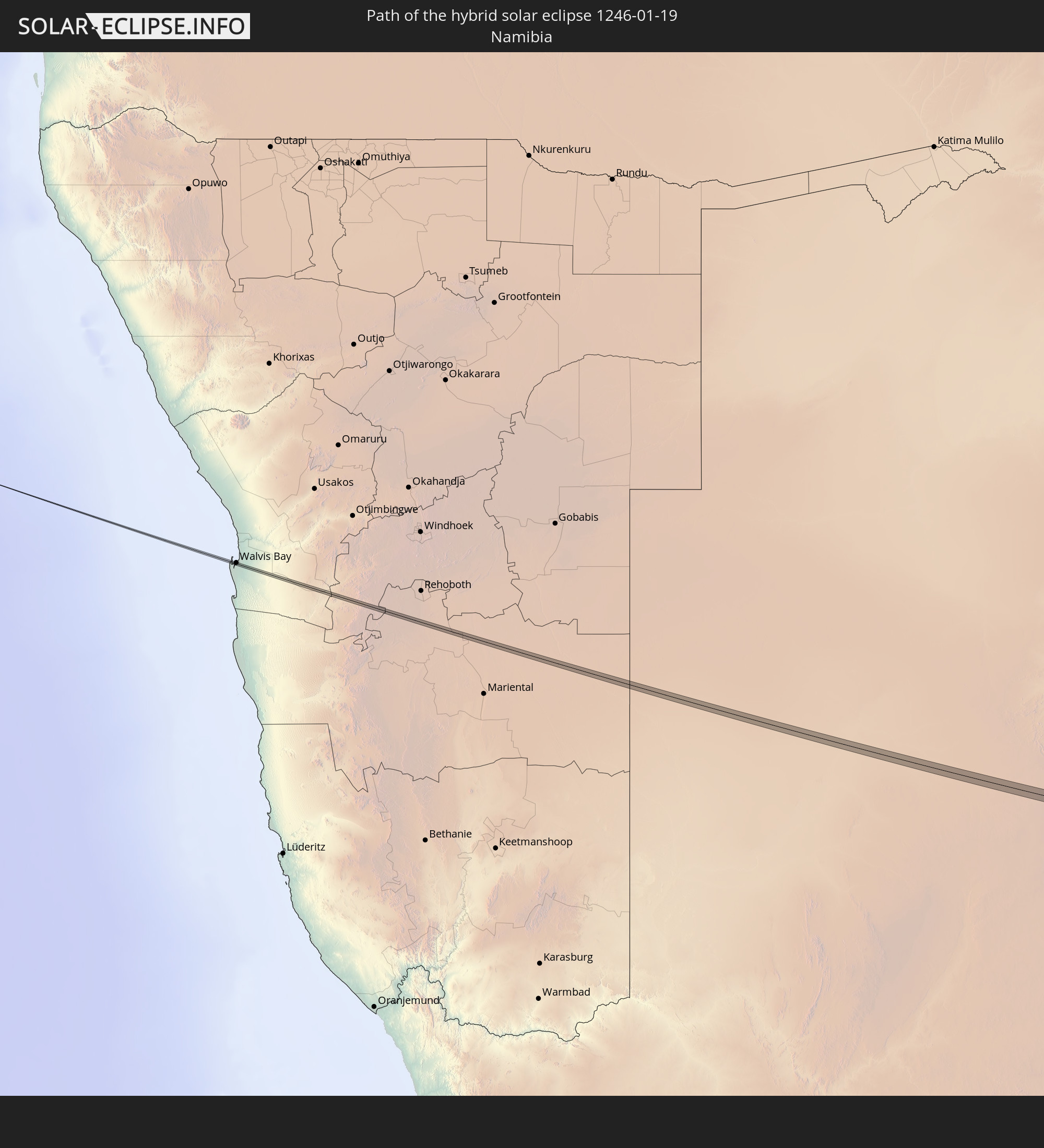 Namibia
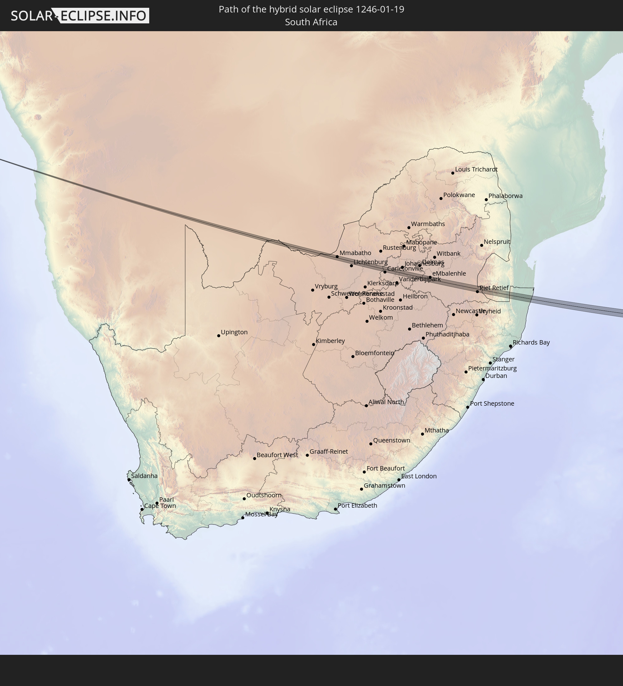 South Africa
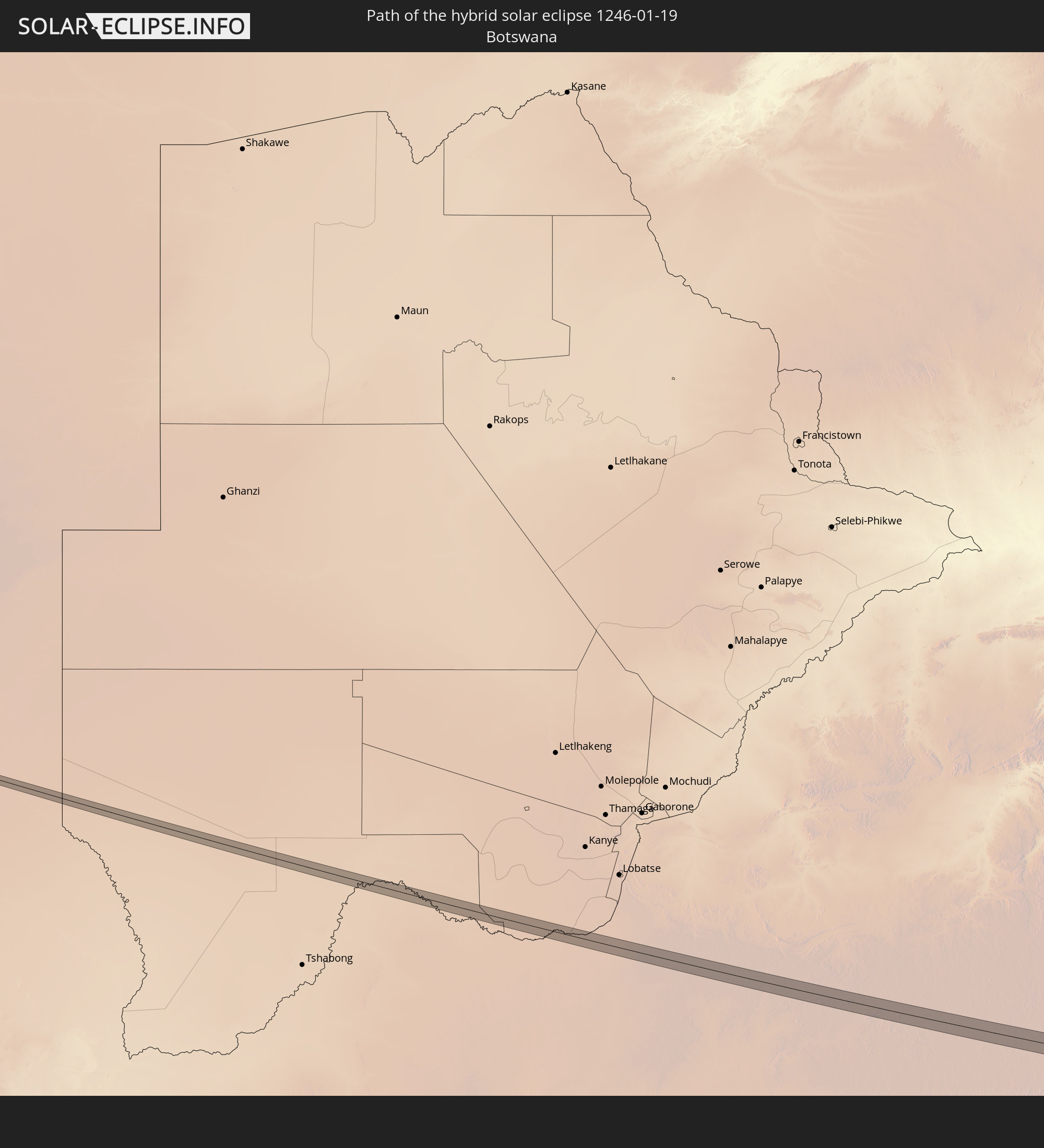 Botswana
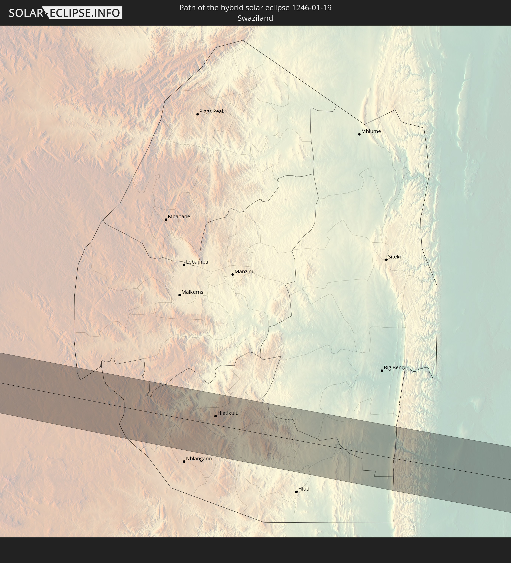 Swaziland
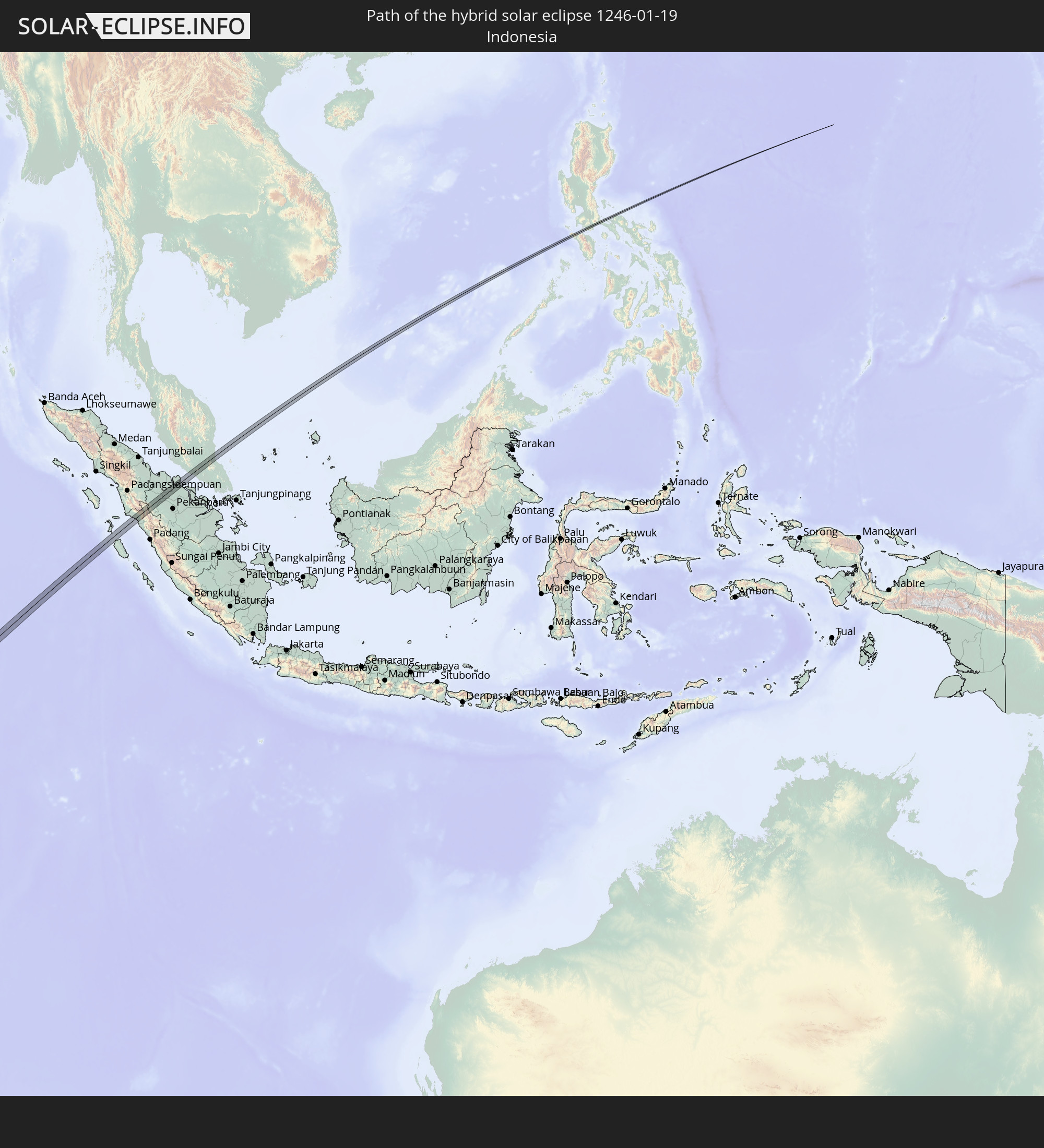 Indonesia
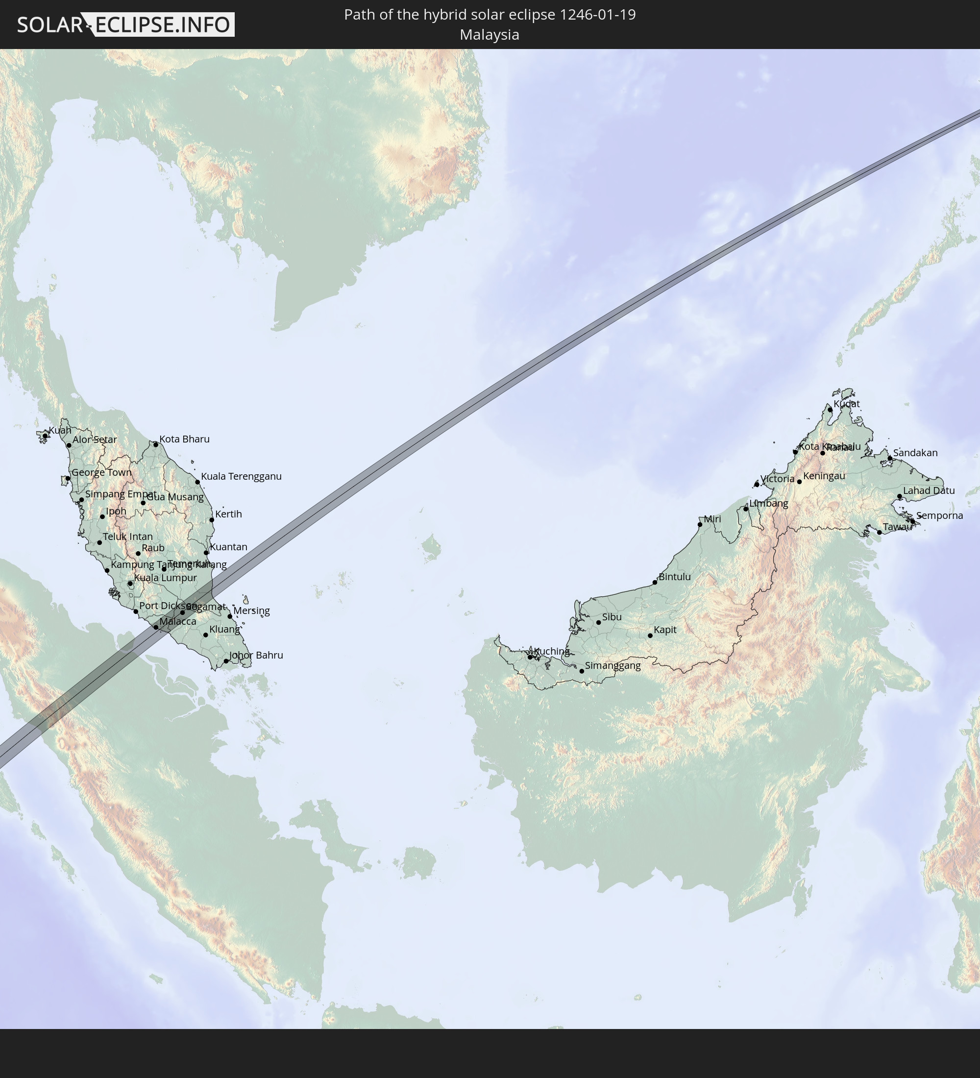 Malaysia
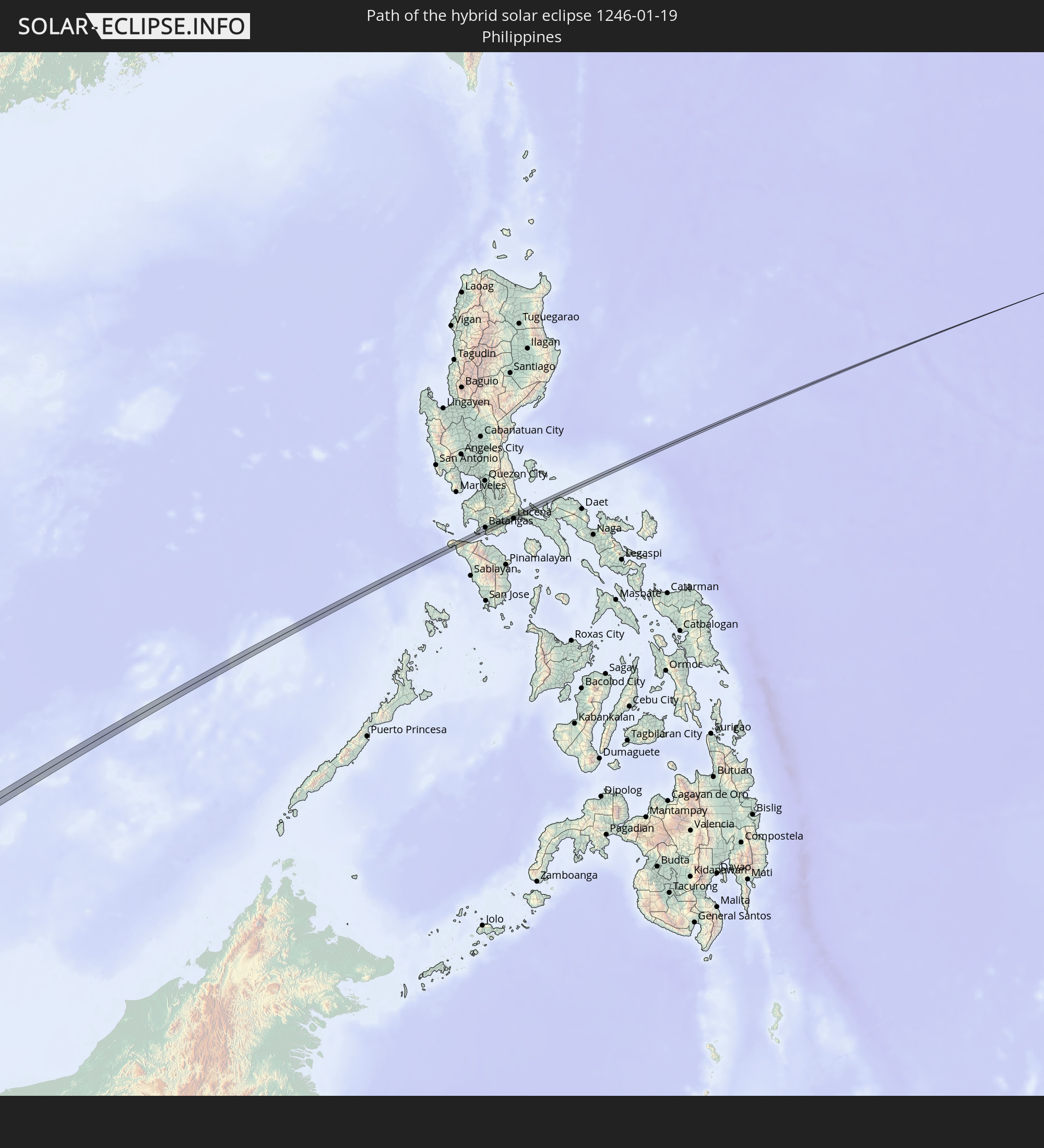 Philippines
In den folgenden Ländern ist die Sonnenfinsternis partiell zu sehen
 Bouvet Island
 Cameroon
 Gabon
Gabon
 Republic of the Congo
 Angola
 Namibia
 Democratic Republic of the Congo
 Chad
Chad
 Central African Republic
 South Africa
 Botswana
 Zambia
 Zimbabwe
 Lesotho
 Rwanda
 Burundi
 Tanzania
 Uganda
 Mozambique
 Swaziland
 Malawi
 Ethiopia
 Kenya
Kenya
 French Southern and Antarctic Lands
 Somalia
 Madagascar
 Comoros
 Mayotte
 Seychelles
 Réunion
 Mauritius
 India
India
 British Indian Ocean Territory
 Heard Island and McDonald Islands
 Maldives
 China
China
 Sri Lanka
 Nepal
Nepal
 Mongolia
 Bangladesh
 Bhutan
 Myanmar
 Indonesia
 Cocos Islands
 Thailand
 Malaysia
 Laos
Laos
 Vietnam
 Cambodia
 Singapore
 Christmas Island
 Australia
 Macau
Macau
 Hong Kong
 Brunei
 Taiwan
 Philippines
 Japan
Japan
 East Timor
 South Korea
 Palau
Palau
 Papua New Guinea
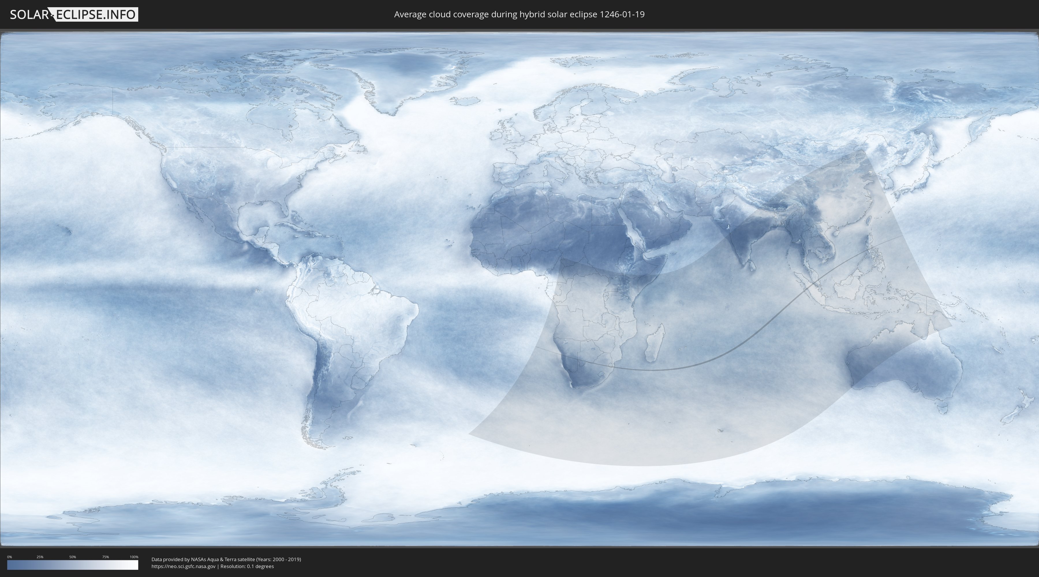
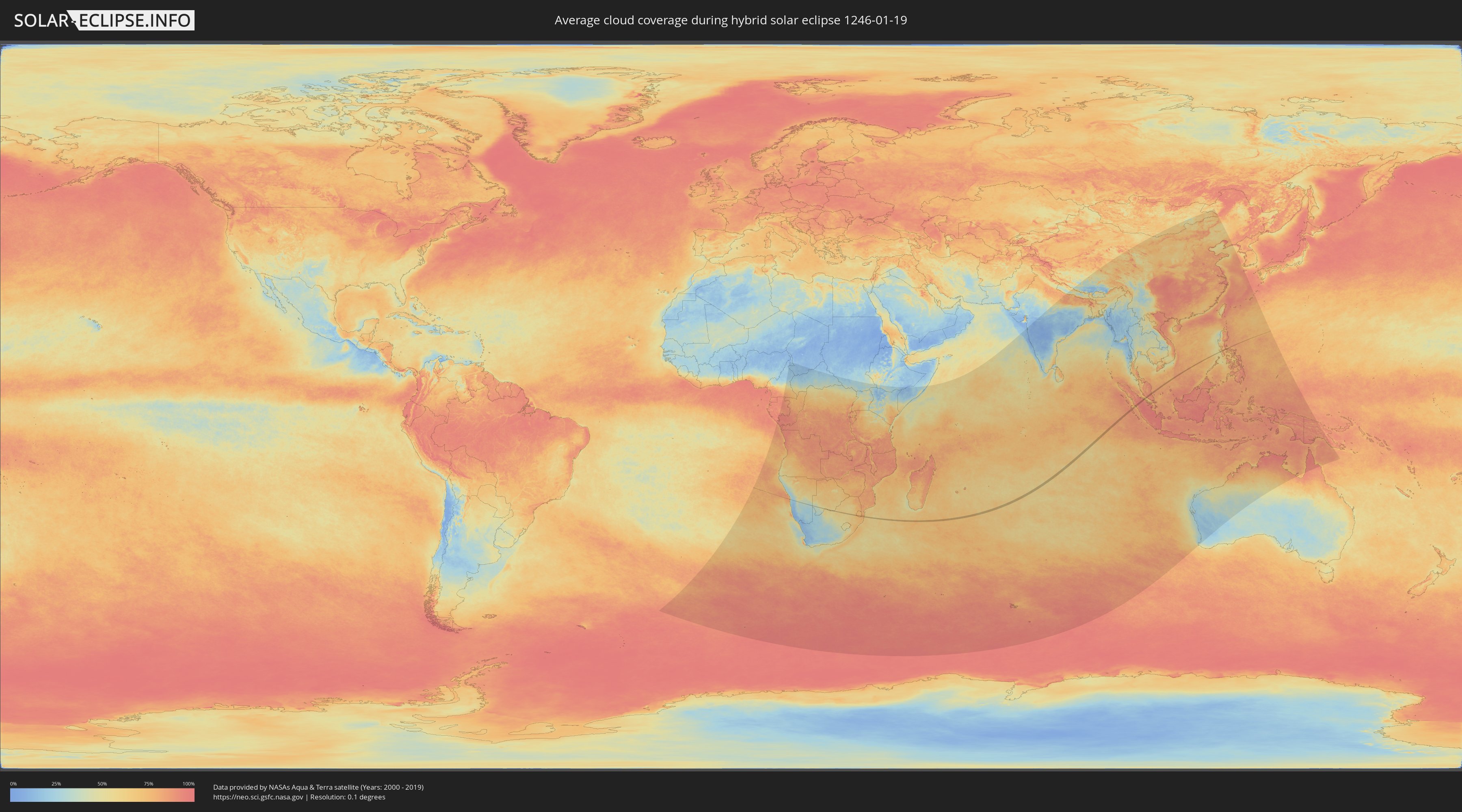
How will be the weather during the hybrid solar eclipse on 01/19/1246?
Where is the best place to see the hybrid solar eclipse of 01/19/1246?
The following maps show the average cloud coverage for the day of the hybrid solar eclipse.
With the help of these maps, it is possible to find the place along the eclipse path, which has the best
chance of a cloudless sky.
Nevertheless, you should consider local circumstances and inform about the weather of your chosen
observation site.
The data is provided by NASAs satellites
AQUA and TERRA.
The cloud maps are averaged over a period of 19 years (2000 - 2019).
Detailed country maps
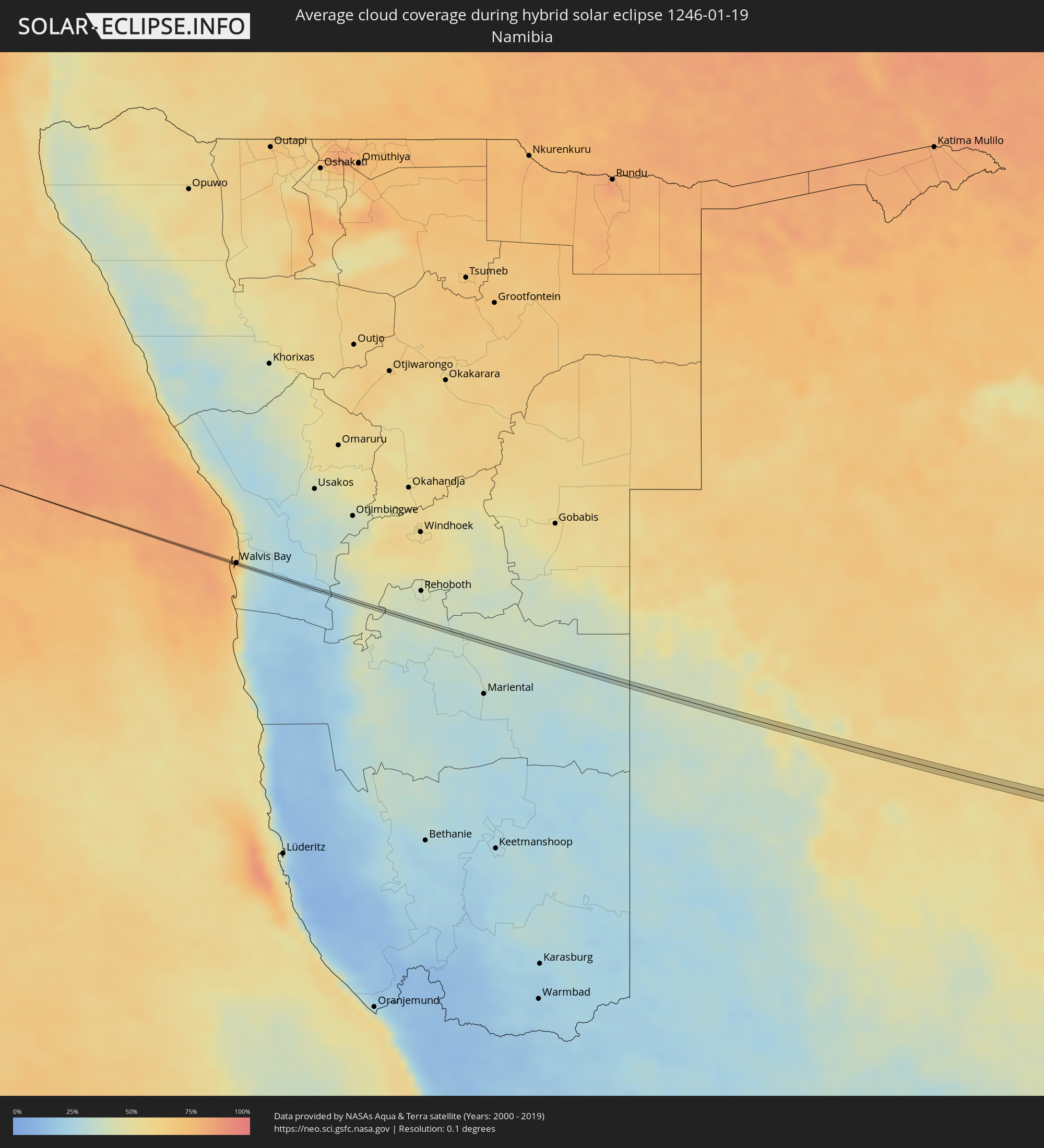 Namibia
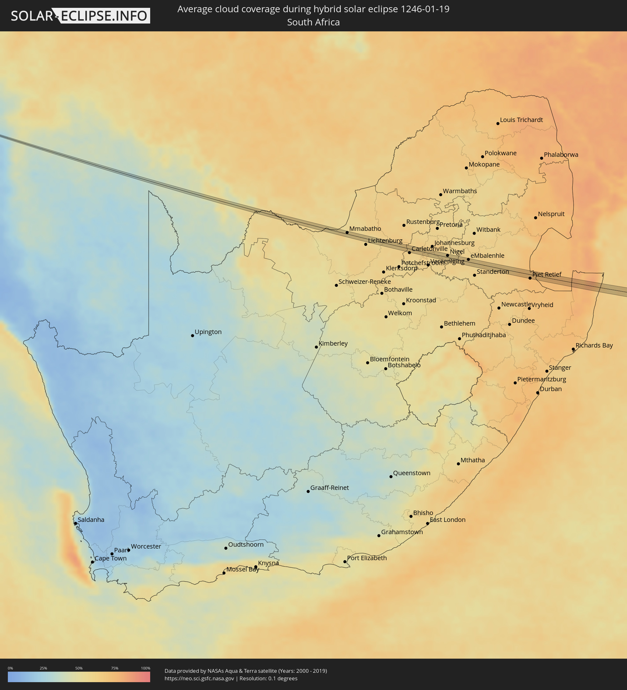 South Africa
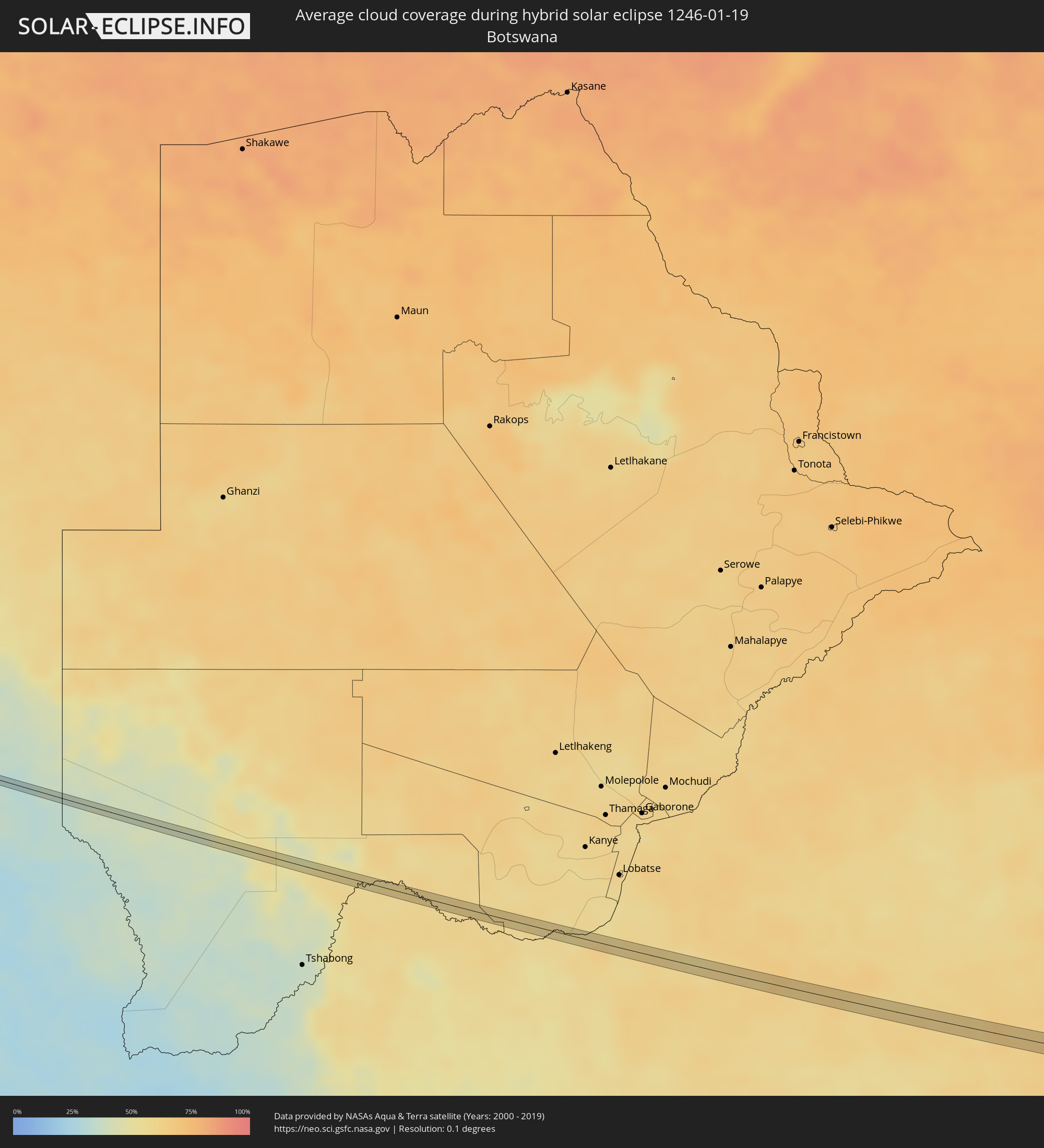 Botswana
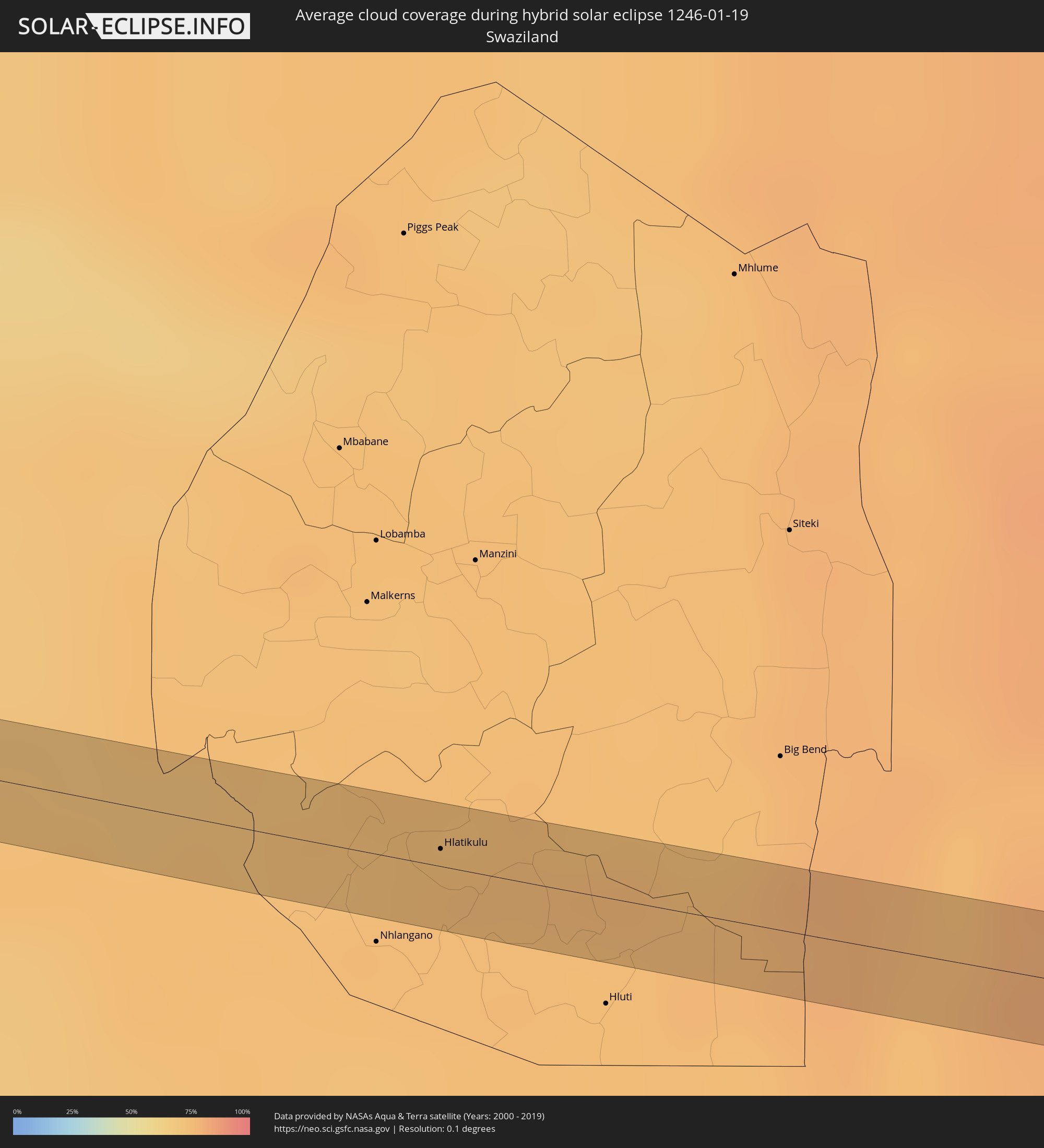 Swaziland
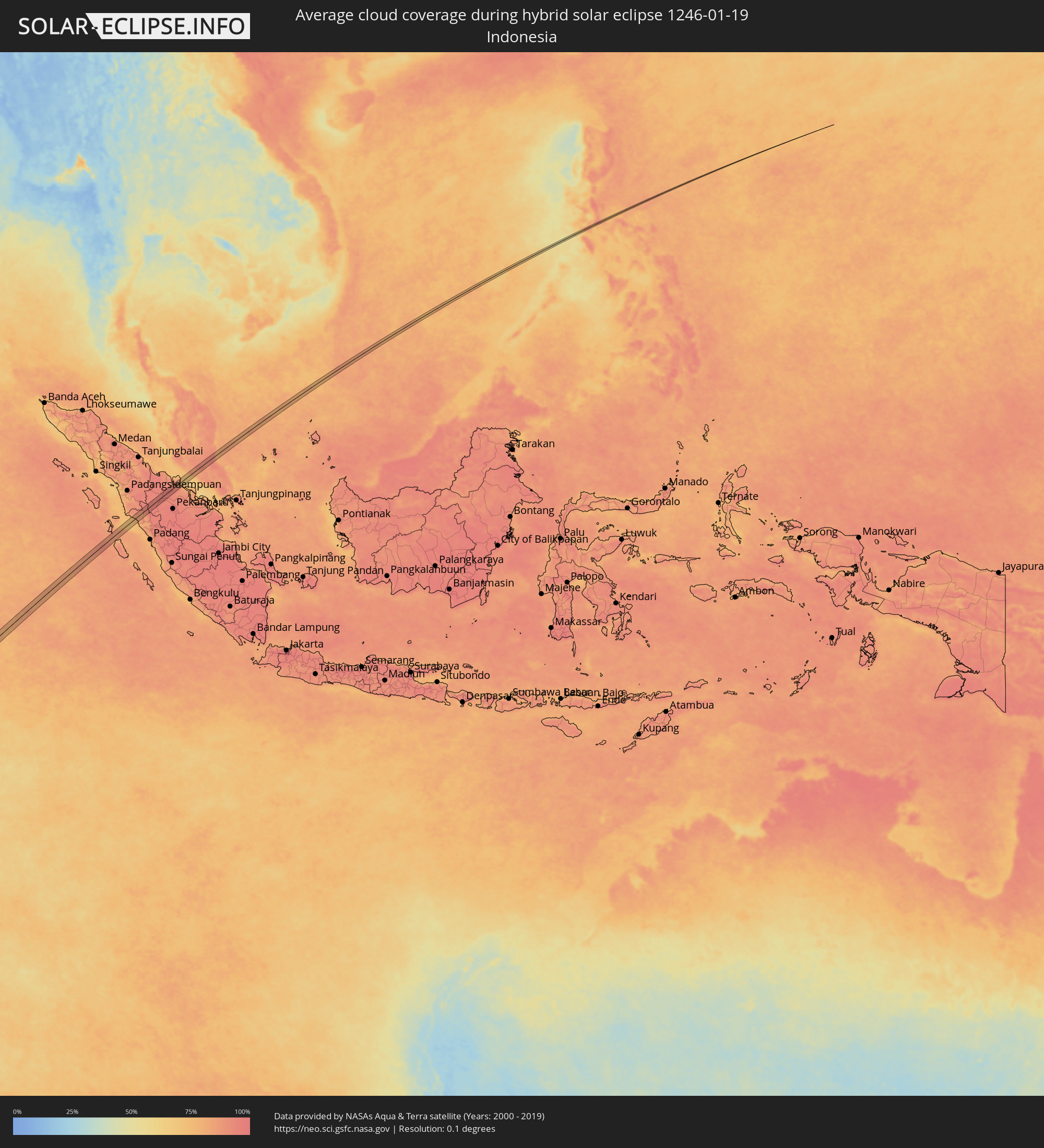 Indonesia
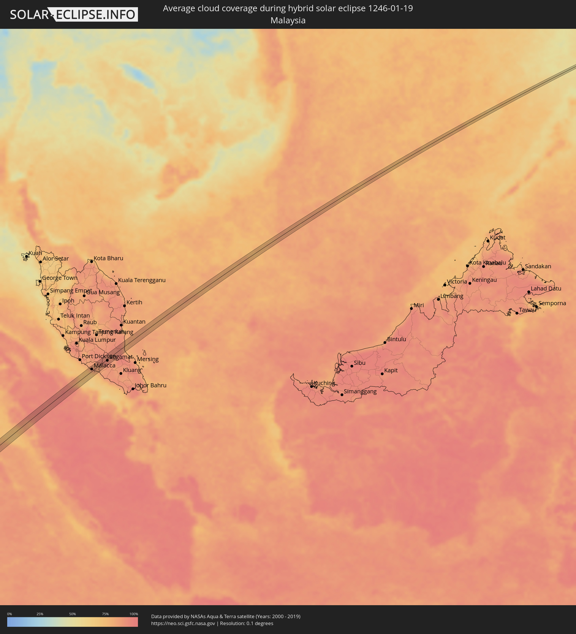 Malaysia
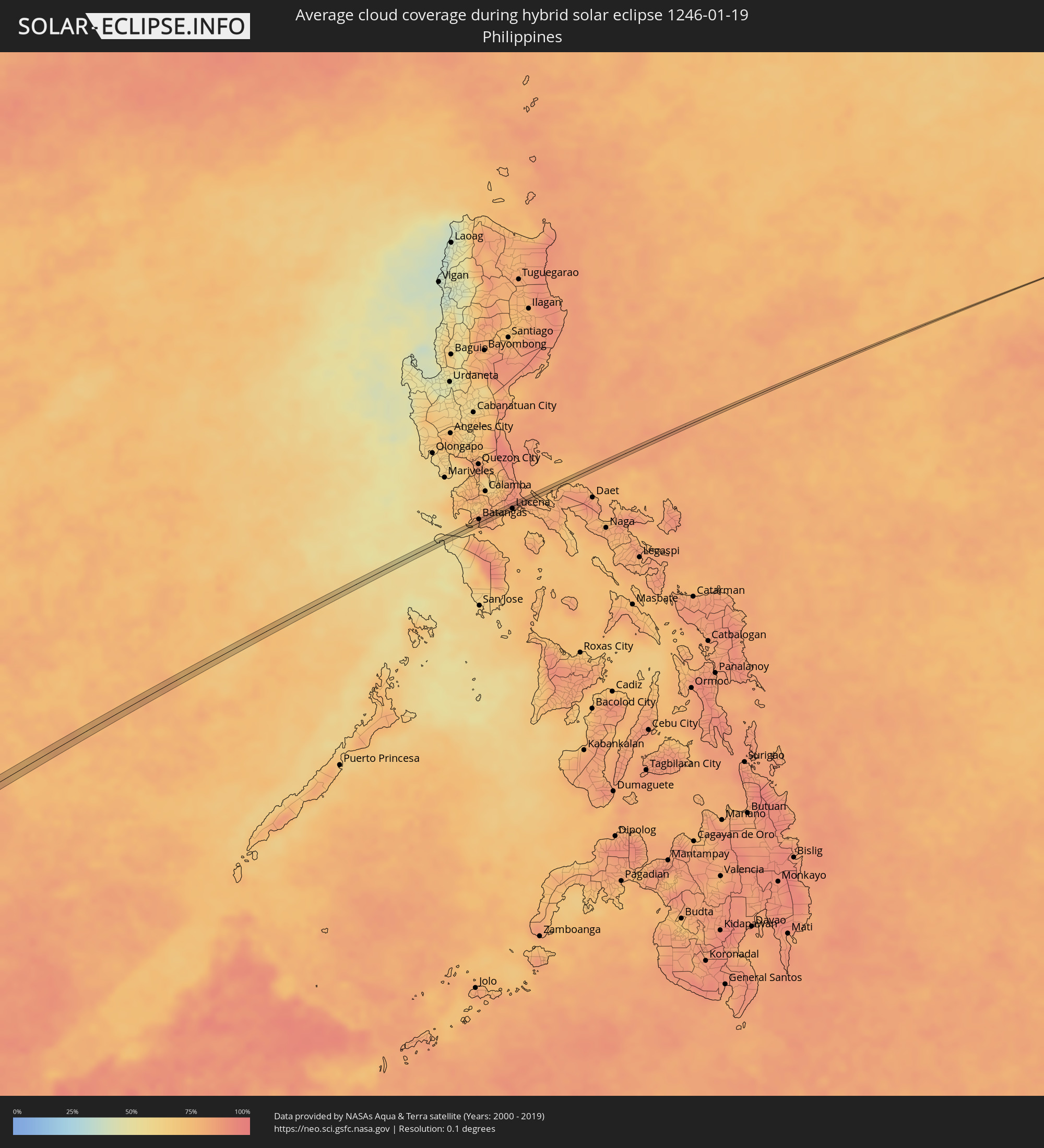 Philippines
Cities inside the path of the eclipse
The following table shows all locations with a population of more than 5,000 inside the eclipse path. Cities which have more than 100,000 inhabitants are marked bold. A click at the locations opens a detailed map.
| City | Type | Eclipse duration | Local time of max. eclipse | Distance to central line | Ø Cloud coverage |
|
Walvis Bay, Erongo
|
total | - | 06:55:16 UTC+01:30 | 1 km | 52% |
|
Mmabatho, North-West
|
total | - | 07:00:57 UTC+01:30 | 3 km | 56% |
|
Mahikeng, North-West
|
total | - | 07:00:58 UTC+01:30 | 2 km | 56% |
|
Westonaria, Gauteng
|
total | - | 07:02:30 UTC+01:30 | 1 km | 60% |
|
Soweto, Gauteng
|
total | - | 07:02:38 UTC+01:30 | 9 km | 61% |
|
Heidelberg, Gauteng
|
total | - | 07:03:06 UTC+01:30 | 6 km | 61% |
|
Nigel, Gauteng
|
total | - | 07:03:10 UTC+01:30 | 5 km | 58% |
|
eMbalenhle, Mpumalanga
|
total | - | 07:03:39 UTC+01:30 | 6 km | 60% |
|
Secunda, Mpumalanga
|
total | - | 07:03:45 UTC+01:30 | 6 km | 58% |
|
Piet Retief, Mpumalanga
|
total | - | 07:05:17 UTC+01:30 | 11 km | 74% |
|
Hlatikulu, Shiselweni
|
total | - | 07:05:42 UTC+01:30 | 3 km | 74% |
|
Dumai, Riau
|
total | - | 15:38:30 UTC+07:07 | 15 km | 91% |
|
Bukit Rambai, Melaka
|
total | - | 15:28:14 UTC+06:55 | 16 km | 87% |
|
Klebang Besar, Melaka
|
total | - | 15:28:12 UTC+06:55 | 11 km | 78% |
|
Malacca, Melaka
|
total | - | 15:28:13 UTC+06:55 | 7 km | 78% |
|
Batu Berendam, Melaka
|
total | - | 15:28:17 UTC+06:55 | 11 km | 78% |
|
Kampung Ayer Keroh, Melaka
|
total | - | 15:28:21 UTC+06:55 | 10 km | 88% |
|
Kampung Bukit Baharu, Melaka
|
total | - | 15:28:17 UTC+06:55 | 5 km | 82% |
|
Kampung Ayer Molek, Melaka
|
total | - | 15:28:19 UTC+06:55 | 2 km | 82% |
|
Bemban, Melaka
|
total | - | 15:28:26 UTC+06:55 | 4 km | 84% |
|
Tangkak, Johor
|
total | - | 15:28:36 UTC+06:55 | 8 km | 83% |
|
Buloh Kasap, Johor
|
total | - | 15:29:11 UTC+06:55 | 3 km | 91% |
|
Segamat, Johor
|
total | - | 15:29:11 UTC+06:55 | 4 km | 91% |
|
Batangas, Calabarzon
|
total | - | 16:54:20 UTC+08:00 | 5 km | 82% |
|
Santa Catalina Norte, Calabarzon
|
total | - | 16:54:28 UTC+08:00 | 2 km | 76% |
|
Candelaria, Calabarzon
|
total | - | 16:54:31 UTC+08:00 | 5 km | 76% |
|
Malabanban Norte, Calabarzon
|
total | - | 16:54:31 UTC+08:00 | 6 km | 76% |
|
Santa Catalina Sur, Calabarzon
|
total | - | 16:54:29 UTC+08:00 | 1 km | 76% |
|
Concepcion Ibaba, Calabarzon
|
total | - | 16:54:31 UTC+08:00 | 3 km | 76% |
|
Bignay Uno, Calabarzon
|
total | - | 16:54:29 UTC+08:00 | 5 km | 76% |
|
Janagdong, Calabarzon
|
total | - | 16:54:31 UTC+08:00 | 2 km | 76% |
|
Guisguis, Calabarzon
|
total | - | 16:54:30 UTC+08:00 | 5 km | 76% |
|
Sariaya, Calabarzon
|
total | - | 16:54:33 UTC+08:00 | 3 km | 79% |
|
Lucena, Calabarzon
|
total | - | 16:54:33 UTC+08:00 | 4 km | 78% |
|
Pagbilao, Calabarzon
|
total | - | 16:54:35 UTC+08:00 | 4 km | 78% |
|
Alabat, Calabarzon
|
total | - | 16:54:43 UTC+08:00 | 5 km | 82% |